Application of IMAPP at East China Normal University
|
|
|
- Roger Rich
- 6 years ago
- Views:
Transcription


1 CSPP / IMAPP Users Group Meeting Application of IMAPP at East China Normal University Yan an Liu 1, 2, Wei Gao 1, Runhe Shi 1, Allen Huang 2, Kathy Strabala 2, Liam Gumley 2, Yunzhu Chen 1, Xiaoyun Zhuang 1 1. East China Normal University, Shanghai, China 2. CIMSS/SSEC, University of Wisconsin- Madison, WI, USA 5/23/2013
2 Outline 1 Installation & Training 2 Localization of profile retrieval 3 Data fusion of AOD 4 Evaluation of DBCRAS


3 Installation and Training Site Location 85m Science Building A at ECNU


4 Installation and Training Onsite installation Lifting of positioner Lifting of reflector


5 Installation and Training Onsite installation Outdoor installation Indoor installation EOF-FES DBPS Archive System Dehydrator


6 Installation and Training Hardware onsite training Software training


7 Installation and Training Remote control UI


8 First ECNU EOS-FES/DBPS Terra MODIS Images(0235 UTC, 25 May, 2010) Infrared Visible True color True Color


9 First ECNU EOS-FES/DBPS Terra MODIS Image in Google Earth


10 First DB Products Terra/MODIS Retrieval products Sea Surface Temperature Aerosol Optical Thickness Water Vapor


11 Localization of Temperature Profile Retrieval Distribution of testing samples in global and China. Comparison between the two algorithms: 1. Dual-Regression algorithm based on global regression coefficients; 2. AIRS/MODIS retrieval algorithm that uses both AIRS L1B data and MODIS product. To get a better atmospheric temperature profile, proposed a regional algorithm: 3. Dual-Regression algorithm based on Chinese regression coefficients.
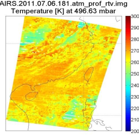


12 Localization of Temperature Profile Retrieval Dual-regression AIRS/MODIS retrieval Chinese coefficient
13 Localization of Temperature Profile Retrieval
14 Localization of Temperature Profile Retrieval
15 Localization of Temperature Profile Retrieval Averaged absolute error and relative error compared with radiosonde observations: 1.Dual-regression algorithm: 1.71K, 0.84% 2.AIRS/MODIS Retrieval algorithm: 2.68K, 1.32% 3. Chinese coefficients: 1.59K, 0.78%
16 Data Fusion of Aerosol Optical Depth Satellite retrieved aerosol product has the low spatial coverage because of the limitation of cloud coverage and dark target algorithm. Horizontal meteorological visibility (HMV) is another very important parameter in describing aerosol optical characteristics. It is observed fixed times and published per day by widely distributed meteorological sites. It can be a good supplement of satellite retrieved AOD. Thus, a fast fusion algorithm was developed. Terra and Aqua satellite MODIS AOD and ground-based HMV data were fused in order to obtain AOD product with high spatial resolution and complete spatial coverage in real time. Step 1 : Linear fusion Step 2 : Model conversion fusion Step 3 : Interpolation
17 Data Fusion of Aerosol Optical Depth (a) Terra (b) Aqua Distribution of AOD at east of China

18 Data Fusion of Aerosol Optical Depth Spatial coverage after linear fusion Source of AOD data
19 Data Fusion of Aerosol Optical Depth HMV Peterson Model AOD Distribution of HMV data from observation sites (stars) Model conversion fusion
20 Data Fusion of Aerosol Optical Depth Without HMV After model conversion Thin plate splines interpolation
21 Data Fusion of Aerosol Optical Depth Using cross-validation method to validate the fusion steps separately Fusion step RMSE Step1: Linear fusion 0.11 Step2: Model conversion fusion 0.31 Step3: Interpolation 0.35

22 Application of IDEA-I Infusing satellite Data into Environmental Application - International
: 12-hr spin-up with 5-7 MODIS inserts 3 hourly, grib2 format 00/12 UTC Initial conditions: 1/2 degree GFS, 6 hr Forecast Boundaries: Inputs: 6")
23 Evaluation of DBCRAS Direct Broadcast CIMSS Regional Assimilation System Resolution: Sigma levels: 38 Grid Size: Time-step: 48 km;16 km 210 x140; 207x seconds Forecast length: 72 hours; 48 hours Initialization: Output: Initial times (UTC): 12-hr spin-up with 5-7 MODIS inserts 3 hourly, grib2 format 00/12 UTC Initial conditions: 1/2 degree GFS, 6 hr Forecast Boundaries: Inputs: 6 hourly, one degree GFS Forecasts Surface, RAOBs, Re-locate (31 N, 121 E) MODIS: Total precipitable water, cloud-top pressure

24 Evaluation of DBCRAS 72h forecast at 500hPa, 12UTC 27/10/2010
25 Evaluation of DBCRAS Methods Qualitative and quantitative analysis Time 00UTC, heavy rain case at Yangtze river delta in June 2011 Data CRAS output (format: grib2); Projection: Polar stereographic Resolution: ECMWF: ERA-Interim (format: netcdf) Projection: Cylindrical equidistant Resolution: Other data: Radiosonde; TRMM precipitation product
 300hPa (b) 500hPa (c) 700hPa (d)")
26 Evaluation of DBCRAS 24h forecast temperature bias (a) 300hPa (b) 500hPa (c) 700hPa (d) 850hPa
 300hPa (b) 500hPa (c) 700hPa (d)")
27 Evaluation of DBCRAS 24h forecast relativity humidity bias (a) 300hPa (b) 500hPa (c) 700hPa (d) 850hPa
28 Evaluation of DBCRAS
29 Evaluation of DBCRAS


30 Evaluation of DBCRAS Forecast of 24h accumulated precipitation compared with TRMM precipitation
31 Researches supported by IMAPP Xiaoyun Zhuang : Localization of temperature profile retrieval Yunzhu Chen : Data fusion of aerosol optical depth Cong Zhou : Research on CO2 Yuanyuan Chen : PM 10 forecast Yan an Liu : Assimilation of CrIS in regional model
32
Performance and Application of CSPP/IMAPP in East China
 Performance and Application of CSPP/IMAPP in East China Yan-An Liu 1, Wei Gao 1, Runhe Shi 1, Allen Huang 2, Kathy Strabala 2, Liam Gumley 2 1. East China Normal University 2. University of Wisconsin-Madison
Monitoring vegetation activity in Hungary using Direct Broadcast MODIS data
 Monitoring vegetation activity in Hungary using Direct Broadcast MODIS data Anikó Kern1 Contributors: Szilárd Pásztor1, Péter Bognár1, Zoltán Barcza2, Gábor Timár1, János Lichtenberger1, Péter Steinbach3,
EOS Direct Broadcast Real-Time Products for the US National Weather Service
 EOS Direct Broadcast Real-Time Products for the US National Weather Service Liam E. Gumley,, K. Strabala, J. Gerth,, S. Bachmeier, R. Dengel,, S. Dutcher, and J. Robaidek Liam.Gumley@ssec.wisc.edu University
Updates to the IMAPP AIRS Utility Software
 SPACE SCIENCE AND ENGINEERING CENTER Updates to the IMAPP AIRS Utility Software Elisabeth Weisz, Hung-Lung Huang and Kathy Strabala Cooperative Institute for Meteorological Satellite Studies Space Science
Satellite-derived Wind, Cloud, and Surface Products at Direct Broadcast Sites in the Antarctic and Arctic
 Satellite-derived Wind, Cloud, and Surface Products at Direct Broadcast Sites in the Antarctic and Arctic William Straka III +, Jeff Key*, Dave Santek +, Matthew Lazzara #, Liam Gumley +, Kathy Strabala
The use of Direct Broadcast Processing System in Poland
 The use of Direct Broadcast Processing System in Poland B.Łapeta, P.Struzik Satellite Remote Sensing Department, Institute of Meteortology and Water Management National Reasearch Institute About IMWM-NRI
Applications of future GEO advanced IR sounder for high impact weather forecasting demonstration with regional OSSE
 Applications of future GEO advanced IR sounder for high impact weather forecasting demonstration with regional OSSE Jun Li @, Tim Schmit &, Zhenglong Li @, Feng Zhu @*, Pei Wang @*, Agnes Lim @, and Robert
GIFTS SOUNDING RETRIEVAL ALGORITHM DEVELOPMENT
 P2.32 GIFTS SOUNDING RETRIEVAL ALGORITHM DEVELOPMENT Jun Li, Fengying Sun, Suzanne Seemann, Elisabeth Weisz, and Hung-Lung Huang Cooperative Institute for Meteorological Satellite Studies (CIMSS) University
DERIVING ATMOSPHERIC MOTION VECTORS FROM AIRS MOISTURE RETRIEVAL DATA
 DERIVING ATMOSPHERIC MOTION VECTORS FROM AIRS MOISTURE RETRIEVAL DATA David Santek 1, Sharon Nebuda 1, Christopher Velden 1, Jeff Key 2, Dave Stettner 1 1 Cooperative Institute for Meteorological Satellite
CIMSS Hyperspectral IR Sounding Retrieval (CHISR) Processing & Applications
 Processing & Applications") CIMSS Hyperspectral IR Sounding Retrieval (CHISR) Processing & Applications Jun Li @, Elisabeth Weisz @, Jinlong Li @, Hui Liu #, Timothy J. Schmit &, Jason Otkin @ and many other CIMSS collaborators @Cooperative
CIMSS Hyperspectral IR Sounding Retrieval (CHISR) Processing & Applications Jun Li @, Elisabeth Weisz @, Jinlong Li @, Hui Liu #, Timothy J. Schmit &, Jason Otkin @ and many other CIMSS collaborators @Cooperative
Single footprint sounding, surface emissivity and cloud property retrievals from hyperspectral infrared radiances under all sky conditions
 Single footprint sounding, surface emissivity and cloud property retrievals from hyperspectral infrared radiances under all sky conditions Jun Li @, Elisabeth Weisz @, Jinlong Li @, Allen Huang @, Chian-Yi
From ITPP, IAPP, IMAPP to CSPP Supporting Direct Broadcast Users Over Three Decades
 From ITPP, IAPP, IMAPP to CSPP Supporting Direct Broadcast Users Over Three Decades Allen Huang PI of IMAPP & CSPP-LEO allenh@ssec.wisc.edu Space Science & Engineering Center (SSEC) University of Wisconsin-Madison
Impact of assimilating the VIIRS-based CrIS cloudcleared radiances on hurricane forecasts
 Impact of assimilating the VIIRS-based CrIS cloudcleared radiances on hurricane forecasts Jun Li @, Pei Wang @, Jinlong Li @, Zhenglong Li @, Jung-Rim Lee &, Agnes Lim @, Timothy J. Schmit #, and Mitch
Synergistic use of AIRS and MODIS radiance measurements for atmospheric profiling
 Click Here for Full Article GEOPHYSICAL RESEARCH LETTERS, VOL. 35, L21802, doi:10.1029/2008gl035859, 2008 Synergistic use of AIRS and MODIS radiance measurements for atmospheric profiling Chian-Yi Liu,
Dual-Regression Surface and Atmospheric Sounding Algorithm for Initializing Physical Retrievals and Direct Radiance Assimilation
 SPACE SCIENCE AND ENGINEERING CENTER Dual-Regression Surface and Atmospheric Sounding Algorithm for Initializing Physical Retrievals and Direct Radiance Assimilation W. L. Smith Sr. 1,2,3, E. Weisz 1,
Combining Polar Hyper-spectral and Geostationary Multi-spectral Sounding Data A Method to Optimize Sounding Spatial and Temporal Resolution
 Combining Polar Hyper-spectral and Geostationary Multi-spectral Sounding Data A Method to Optimize Sounding Spatial and Temporal Resolution W. L. Smith 1,2, E. Weisz 1, and J. McNabb 2 1 University of
A New Numerical Weather Prediction Approach to the NDFD's Sky Cover Grid
 A New Numerical Weather Prediction Approach to the NDFD's Sky Cover Grid Jordan Gerth Graduate Research Assistant Cooperative Institute for Meteorological Satellite Studies (CIMSS) and Department of Atmospheric
CORRELATION BETWEEN ATMOSPHERIC COMPOSITION AND VERTICAL STRUCTURE AS MEASURED BY THREE GENERATIONS OF HYPERSPECTRAL SOUNDERS IN SPACE
 CORRELATION BETWEEN ATMOSPHERIC COMPOSITION AND VERTICAL STRUCTURE AS MEASURED BY THREE GENERATIONS OF HYPERSPECTRAL SOUNDERS IN SPACE Nadia Smith 1, Elisabeth Weisz 1, and Allen Huang 1 1 Space Science
IDEA. from research to routine
 IDEA. from research to routine A collaboration between NASA, EPA, NOAA and CIMSS Cooperative Institute for Meteorological Satellite Studies Infusing satellite Data in Environmental Applications (IDEA)
NOAA Direct Broadcast Real-Time Network Status
 NOAA Direct Broadcast Real-Time Network Status Liam Gumley (CIMSS/SSEC/UW-Madison) Mitch Goldberg (JPSS/NOAA) WMO DBNET Operators Meeting Sept 2016 Overview NOAA antennas for Honolulu, Madison, Miami,
Fine atmospheric structure retrieved from IASI and AIRS under all weather conditions
 Fine atmospheric structure retrieved from IASI and AIRS under all weather conditions Daniel K. Zhou 1, William L. Smith 2,3, Allen M. Larar 1, Xu Liu 1, Jonathan P. Taylor 4, Peter Schlüssel 5, L. Larrabee
Sensitivity Study of the MODIS Cloud Top Property
 Sensitivity Study of the MODIS Cloud Top Property Algorithm to CO 2 Spectral Response Functions Hong Zhang a*, Richard Frey a and Paul Menzel b a Cooperative Institute for Meteorological Satellite Studies,
Synergistic Cloud Clearing Using Aqua Sounding and Imaging Infrared Measurements
 Synergistic Cloud Clearing Using Aqua Sounding and Imaging Infrared Measurements H-L Allen Huang, et al. CIMSS/SSEC Univ. of Wisconsin-Madison and William L. Smith, LaRC, NASA Cloud Clearing/Cloud Detection
Performance of sounding retrievals from AIRS, GOES10, MODIS and HIRS Radiances during Mini-Barca campaign June 2008
 Performance of sounding retrievals from AIRS, GOES10, MODIS and HIRS Radiances during Mini-Barca campaign June 2008 Simone Sievert da Costa 1 Jurandir Ventura Rodrigues 1 Weber Andrade Gonçalves 1 Rodrigo
An Overview of the UW Hyperspectral Retrieval System for AIRS, IASI and CrIS
 An Overview of the UW Hyperspectral Retrieval System for AIRS, IASI and CrIS Nadia Smith a, Elisabeth Weisz b and William L. Smith Cooperative Institute for Meteorological Satellite Studies (CIMSS) Space
Rela%ve Merit of MODIS AOD and Surface PM2.5 for Aerosol Analysis and Forecast
 Rela%ve Merit of MODIS AOD and Surface PM2.5 for Aerosol Analysis and Forecast Zhiquan Liu (liuz@ucar.edu) NCAR/NESL/MMM NCAR/MMM: Craig S. Schwartz, Hui- Chuan Lin NOAA/ESRL: Stuart A. McKeen ITSC- 18,
Feature-tracked 3D Winds from Satellite Sounders: Derivation and Impact in Global Models
 Feature-tracked 3D Winds from Satellite Sounders: Derivation and Impact in Global Models David Santek, Anne-Sophie Daloz 1, Samantha Tushaus 1, Marek Rogal 1, Will McCarty 2 1 Space Science and Engineering
Atmospheric Soundings of Temperature, Moisture and Ozone from AIRS
 Atmospheric Soundings of Temperature, Moisture and Ozone from AIRS M.D. Goldberg, W. Wolf, L. Zhou, M. Divakarla,, C.D. Barnet, L. McMillin, NOAA/NESDIS/ORA Oct 31, 2003 Presented at ITSC-13 Risk Reduction
AN OVERVIEW OF THE UW HYPERSPECTRAL RETRIEVAL SYSTEM FOR AIRS, IASI AND CrIS
 AN OVERVIEW OF THE UW HYPERSPECTRAL RETRIEVAL SYSTEM FOR AIRS, IASI AND CrIS Nadia Smith 1a, Elisabeth Weisz 1, William L. Smith, Sr. 1 and Allen H.-L. Huang 1 1 Cooperative Institute for Meteorological
VALIDATION OF CROSS-TRACK INFRARED SOUNDER (CRIS) PROFILES OVER EASTERN VIRGINIA. Author: Jonathan Geasey, Hampton University
 PROFILES OVER EASTERN VIRGINIA. Author: Jonathan Geasey, Hampton University") VALIDATION OF CROSS-TRACK INFRARED SOUNDER (CRIS) PROFILES OVER EASTERN VIRGINIA Author: Jonathan Geasey, Hampton University Advisor: Dr. William L. Smith, Hampton University Abstract The Cross-Track Infrared
VALIDATION OF CROSS-TRACK INFRARED SOUNDER (CRIS) PROFILES OVER EASTERN VIRGINIA Author: Jonathan Geasey, Hampton University Advisor: Dr. William L. Smith, Hampton University Abstract The Cross-Track Infrared
Forecast of hurricane track and intensity with advanced IR soundings
 Forecast of hurricane track and intensity with advanced IR soundings Jun Li @, Hui Liu #, Jinlong Li @, and Tim Schmit & @CIMSS/SSEC, University of Wisconsin-Madison #National Center for Atmospheric Research
1. INTRODUCTION 2. CASE STUDIES DESCRIPTION
 27 Communicating Timely Information on Convective Available Potential Energy () using Geostationary and Polar Orbiting Satellite Sounders: Application to El Reno Event Jessie Gartzke 1,3, Steve Ackerman
IMAPP: Software to Transform EOS Direct Broadcast Data into Science Products. Kathleen Strabala, Liam Gumley, Allen Huang, Elisabeth Weisz, Jun Huang
 IMAPP: Software to Transform EOS Direct Broadcast Data into Science Products Kathleen Strabala, Liam Gumley, Allen Huang, Elisabeth Weisz, Jun Huang Overview of Wisconsin DB Activities Real time data processing
Source, transport and impacts of a heavy dust event in the Yangtze River Delta, China in 2011
 Source, transport and impacts of a heavy dust event in the Yangtze River Delta, China in 211 Xiao Fu a,*, Shuxiao Wang a, b,*, Zhen Cheng a, Jia Xing a, c, David Wang c, Bin Zhao a, Jiandong Wang a, Jiming
REVISION OF THE STATEMENT OF GUIDANCE FOR GLOBAL NUMERICAL WEATHER PREDICTION. (Submitted by Dr. J. Eyre)
") WORLD METEOROLOGICAL ORGANIZATION Distr.: RESTRICTED CBS/OPAG-IOS (ODRRGOS-5)/Doc.5, Add.5 (11.VI.2002) COMMISSION FOR BASIC SYSTEMS OPEN PROGRAMME AREA GROUP ON INTEGRATED OBSERVING SYSTEMS ITEM: 4 EXPERT
WORLD METEOROLOGICAL ORGANIZATION Distr.: RESTRICTED CBS/OPAG-IOS (ODRRGOS-5)/Doc.5, Add.5 (11.VI.2002) COMMISSION FOR BASIC SYSTEMS OPEN PROGRAMME AREA GROUP ON INTEGRATED OBSERVING SYSTEMS ITEM: 4 EXPERT
NASA Flood Monitoring and Mapping Tools
 National Aeronautics and Space Administration ARSET Applied Remote Sensing Training http://arset.gsfc.nasa.gov @NASAARSET NASA Flood Monitoring and Mapping Tools www.nasa.gov Outline Overview of Flood
Lecture 4b: Meteorological Satellites and Instruments. Acknowledgement: Dr. S. Kidder at Colorado State Univ.
 Lecture 4b: Meteorological Satellites and Instruments Acknowledgement: Dr. S. Kidder at Colorado State Univ. US Geostationary satellites - GOES (Geostationary Operational Environmental Satellites) US
MODIS ATMOSPHERIC PROFILES PRODUCT IN FINLAND A FEASIBILITY STUDY
 MODIS ATMOSPHERIC PROFILES PRODUCT IN FINLAND A FEASIBILITY STUDY Sauli Joro Finnish Meteorological Institute P.O.Box 503, FIN-00101 Helsinki, FINLAND sauli.joro@fmi.fi ABSTRACT The prediction of convection
ICON. Limited-area mode (ICON-LAM) and updated verification results. Günther Zängl, on behalf of the ICON development team
 and updated verification results. Günther Zängl, on behalf of the ICON development team") ICON Limited-area mode (ICON-LAM) and updated verification results Günther Zängl, on behalf of the ICON development team COSMO General Meeting, Offenbach, 07.09.2016 Outline Status of limited-area-mode
ICON Limited-area mode (ICON-LAM) and updated verification results Günther Zängl, on behalf of the ICON development team COSMO General Meeting, Offenbach, 07.09.2016 Outline Status of limited-area-mode
CLOUD CLASSIFICATION AND CLOUD PROPERTY RETRIEVAL FROM MODIS AND AIRS
 6.4 CLOUD CLASSIFICATION AND CLOUD PROPERTY RETRIEVAL FROM MODIS AND AIRS Jun Li *, W. Paul Menzel @, Timothy, J. Schmit @, Zhenglong Li *, and James Gurka # *Cooperative Institute for Meteorological Satellite
Utilization of Forecast Models in High Temporal GOES Sounding Retrievals
 Utilization of Forecast Models in High Temporal GOES Sounding Retrievals Zhenglong Li, Jun Li, W. Paul Menzel, Steve Ackerman CIMSS/UW The CoRP Symposium Aug 12-13, 2008 Corvallis, OR Introduction: GOES
Feature-tracked 3D Winds from Satellite Sounders: Derivation and Impact in Global Models
 Feature-tracked 3D Winds from Satellite Sounders: Derivation and Impact in Global Models David Santek 1, A.-S. Daloz 1, S. Tushaus 1, M. Rogal 1, W. McCarty 2 1 Space Science and Engineering Center/University
1.2 UTILIZING MODIS SATELLITE OBSERVATIONS IN NEAR-REAL-TIME TO IMPROVE AIRNow NEXT DAY FORECAST OF FINE PARTICULATE MATTER, PM2.5
 1.2 UTILIZING MODIS SATELLITE OBSERVATIONS IN NEAR-REAL-TIME TO IMPROVE AIRNow NEXT DAY FORECAST OF FINE PARTICULATE MATTER, PM2.5 James Szykman*, John White US EPA, Office of Air Quality Planning and
Evaluation of Satellite and Reanalysis Products of Downward Surface Solar Radiation over East Asia
 International Workshop on Land Use/Cover Changes and Air Pollution in Asia August 4-7th, 2015, Bogor, Indonesia Evaluation of Satellite and Reanalysis Products of Downward Surface Solar Radiation over
Recent updates of the UW/CIMSS high spectral resolution global land surface infrared emissivity database
 Recent updates of the UW/CIMSS high spectral resolution global land surface infrared emissivity database Eva E. Borbas, Suzanne Wetzel Seemann, Robert O. Knuteson, Elisabeth Weisz, and Allen Huang Space
Introducing VIIRS Aerosol Products
 1 Introducing VIIRS Aerosol Products Shobha Kondragunta NOAA/NESDIS Center for Satellite Applications and Research VIIRS Aerosol Cal/Val Team 2 Name Organization Major Task Kurt F. Brueske IIS/Raytheon
The May 2013 SNPP Cal/Val Campaign Validation of Satellite Soundings W. L. Smith Sr., A. M. Larar, H. E. Revercomb, M. Yesalusky, and E.
 The May 2013 SNPP Cal/Val Campaign Validation of Satellite Soundings W. L. Smith Sr., A. M. Larar, H. E. Revercomb, M. Yesalusky, and E. Weisz May 2013 Suomi NPP Aircraft Campaign SHIS, NAST I, NAST M,MASTER/AVIRIS
Jun Mitch Goldberg %, Pei Timothy J. Schmit &, Jinlong Zhenglong and Agnes
 Progress on the assimilation of advanced IR sounder radiances in cloudy skies Jun Li @, Mitch Goldberg %, Pei Wang @#, Timothy J. Schmit &, Jinlong Li @, Zhenglong Li @, and Agnes Lim @ @CIMSS, University
Global reanalysis: Some lessons learned and future plans
 Global reanalysis: Some lessons learned and future plans Adrian Simmons and Sakari Uppala European Centre for Medium-Range Weather Forecasts With thanks to Per Kållberg and many other colleagues from ECMWF
Recent Data Assimilation Activities at Environment Canada
 Recent Data Assimilation Activities at Environment Canada Major upgrade to global and regional deterministic prediction systems (now in parallel run) Sea ice data assimilation Mark Buehner Data Assimilation
On the assimilation of hyperspectral infrared sounder radiances in cloudy skies
 On the assimilation of hyperspectral infrared sounder radiances in cloudy skies Jun Li 1, Pei Wang 1, Zhenglong Li 1, Jinlong Li 1 and Mitchell D. Goldberg 2 1 Cooperative Institute for Meteorological
Improving Tropical Cyclone Forecasts by Assimilating Microwave Sounder Cloud-Screened Radiances and GPM precipitation measurements
 Improving Tropical Cyclone Forecasts by Assimilating Microwave Sounder Cloud-Screened Radiances and GPM precipitation measurements Hyojin Han a, Jun Li a, Mitch Goldberg b, Pei Wang a,c, Jinlong Li a,
Performance of the AIRS/AMSU And MODIS Soundings over Natal/Brazil Using Collocated Sondes: Shadoz Campaign
 Performance of the AIRS/AMSU And MODIS Soundings over Natal/Brazil Using Collocated Sondes: Shadoz Campaign 2004-2005 Rodrigo Augusto Ferreira de Souza, Jurandir Rodrigues Ventura, Juan Carlos Ceballos
JMA s atmospheric motion vectors
 Prepared by JMA Agenda Item: WG II/6 Discussed in WG II JMA s atmospheric motion vectors This paper reports on the recent status of JMA's Atmospheric Motion Vectors (AMVs) from MTSAT-2 and MTSAT-1R, and
Preparation for Himawari 8
 Preparation for Himawari 8 Japan Meteorological Agency Meteorological Satellite Center Hidehiko MURATA ET SUP 8, WMO HQ, Geneva, 14 17 April 2014 1/18 Introduction Background The Japan Meteorological Agency
The impact of assimilation of microwave radiance in HWRF on the forecast over the western Pacific Ocean
 The impact of assimilation of microwave radiance in HWRF on the forecast over the western Pacific Ocean Chun-Chieh Chao, 1 Chien-Ben Chou 2 and Huei-Ping Huang 3 1Meteorological Informatics Business Division,
Prediction Center (Hart, J. A., J. Whistler, R. Lindsay 1999).
.") 3.2 TEN YEAR CLIMATOLOGY OF CAPE OBSERVATIONS EAST OF THE ROCKY MOUNTAINS FROM HYPERSPECTRAL IR SOUNDERS Jessica Gartzke and R. Knuteson, S. A. Ackerman, W. Feltz, and G. Przybyl CIMSS/Univ. of Wisconsin,
3.2 TEN YEAR CLIMATOLOGY OF CAPE OBSERVATIONS EAST OF THE ROCKY MOUNTAINS FROM HYPERSPECTRAL IR SOUNDERS Jessica Gartzke and R. Knuteson, S. A. Ackerman, W. Feltz, and G. Przybyl CIMSS/Univ. of Wisconsin,
P4.23 INTRODUCING THE GOES IMAGER CLEAR-SKY BRIGHTNESS TEMPERATURE (CSBT) PRODUCT
 PRODUCT") P4.23 INTRODUCING THE GOES IMAGER CLEAR-SKY BRIGHTNESS TEMPERATURE (CSBT) PRODUCT Anthony J. Schreiner Cooperative Institute for Meteorological Satellite Studies (CIMSS) University of Wisconsin-Madison
P4.23 INTRODUCING THE GOES IMAGER CLEAR-SKY BRIGHTNESS TEMPERATURE (CSBT) PRODUCT Anthony J. Schreiner Cooperative Institute for Meteorological Satellite Studies (CIMSS) University of Wisconsin-Madison
Development of 3D Variational Assimilation System for ATOVS Data in China
 Development of 3D Variational Assimilation System for ATOVS Data in China Xue Jishan, Zhang Hua, Zhu Guofu, Zhuang Shiyu 1) Zhang Wenjian, Liu Zhiquan, Wu Xuebao, Zhang Fenyin. 2) 1) Chinese Academy of
Development of physical retrieval algorithm for clear sky atmospheric profiles from SEVIRI, GOES Sounder and ABI infrared radiances
 Development of physical retrieval algorithm for clear sky atmospheric profiles from SEVIRI, GOES Sounder and ABI infrared radiances Jun Li Cooperative Institute for Meteorological Satellite Studies University
PRECONVECTIVE SOUNDING ANALYSIS USING IASI AND MSG- SEVIRI
 PRECONVECTIVE SOUNDING ANALYSIS USING IASI AND MSG- SEVIRI Marianne König, Dieter Klaes EUMETSAT, Eumetsat-Allee 1, 64295 Darmstadt, Germany Abstract EUMETSAT operationally generates the Global Instability
Evaluation of Regressive Analysis Based Sea Surface Temperature Estimation Accuracy with NCEP/GDAS Data
 Evaluation of Regressive Analysis Based Sea Surface Temperature Estimation Accuracy with NCEP/GDAS Data Kohei Arai 1 Graduate School of Science and Engineering Saga University Saga City, Japan Abstract
The Use of ATOVS Microwave Data in the Grapes-3Dvar System
 The Use of ATOVS Microwave Data in the Grapes-3Dvar System Peiming Dong 1 Zhiquan Liu 2 Jishan Xue 1 Guofu Zhu 1 Shiyu Zhuang 1 Yan Liu 1 1 Chinese Academy of Meteorological Sciences, Beijing, China 2
The Use of Hyperspectral Infrared Radiances In Numerical Weather Prediction
 The Use of Hyperspectral Infrared Radiances In Numerical Weather Prediction J. Le Marshall 1, J. Jung 1, J. Derber 1, T. Zapotocny 2, W. L. Smith 3, D. Zhou 4, R. Treadon 1, S. Lord 1, M. Goldberg 1 and
RTTOV 10 Theory & Exercise
 RTTOV 10 Theory & Exercise Ø Overview of RTTOVS Radiative Transfer Model q Gases Absorption (water Vapor & other trace gases) q Aerosol/Clouds Scattering and Absorption q Surface Emissivity/Reflectivity
Synergistic use of high spatial resolution imager and high spectral resolution sounder for cloud retrieval
 Synergistic use of high spatial resolution imager and high spectral resolution sounder for cloud retrieval Jun Li*, Timothy, J. Schmit@, Fengying Sun*, W. Paul Menzel@ *Cooperative Institute for Meteorological
Introduction of the Hyperspectral Environmental Suite (HES) on GOES-R and beyond
 on GOES-R and beyond") Introduction of the Hyperspectral Environmental Suite (HES) on GOES-R and beyond 1 Timothy J. Schmit, 2 Jun Li, 3 James Gurka 1 NOAA/NESDIS, Office of Research and Applications, Advanced Satellite Products
Introduction of the Hyperspectral Environmental Suite (HES) on GOES-R and beyond 1 Timothy J. Schmit, 2 Jun Li, 3 James Gurka 1 NOAA/NESDIS, Office of Research and Applications, Advanced Satellite Products
Introduction of the Hyperspectral Environmental Suite (HES) on GOES-R and beyond
 on GOES-R and beyond") Introduction of the Hyperspectral Environmental Suite (HES) on GOES-R and beyond Timothy J. Schmit SaTellite Applications and Research (STAR) Advanced Satellite Products Team (ASPT) Presented by Jun Li
Introduction of the Hyperspectral Environmental Suite (HES) on GOES-R and beyond Timothy J. Schmit SaTellite Applications and Research (STAR) Advanced Satellite Products Team (ASPT) Presented by Jun Li
Upgraded usage of MODIS-derived polar winds in the JMA operational global 4D-Var assimilation system
 1 Upgraded usage of MODIS-derived polar winds in the JMA operational global 4D-Var assimilation system Koji Yamashita Japan Meteorological Agency Kobo.yamashita@met.kishou.go.jp Background Objectives 2
ECMWF global reanalyses: Resources for the wind energy community
 ECMWF global reanalyses: Resources for the wind energy community (and a few myth-busters) Paul Poli European Centre for Medium-range Weather Forecasts (ECMWF) Shinfield Park, RG2 9AX, Reading, UK paul.poli
DEVELOPMENT OF THE ECMWF FORECASTING SYSTEM
 DEVELOPMENT OF THE ECMWF FORECASTING SYSTEM Jean-Noël Thépaut European Centre for Medium Range Weather Forecasts ECMWF Acknowledgements: Lars Isaksen, Mike Fisher, Yannick Trémolet, Peter Bauer, Adrian
Procedures to Characterize Sounding Profiles using Conventional and Reference/Dedicated Observations --- NPROVS & NPROVS+
 Procedures to Characterize Sounding Profiles using Conventional and Reference/Dedicated Observations --- NPROVS & NPROVS+ Tony Reale 1 and Bomin Sun 2 and many others 1 STAR/NESDIS/NOAA 2 IMSG at STAR/NESDIS/NOAA
Satellite observation of atmospheric dust
 Satellite observation of atmospheric dust Taichu Y. Tanaka Meteorological Research Institute, Japan Meteorological Agency 11 April 2017, SDS WAS: Dust observation and modeling @WMO, Geneva Dust observations
Ensemble aerosol forecasts and assimila1on at ECMWF
 Ensemble aerosol forecasts and assimila1on at ECMWF Angela Benede*, Miha Razinger, Luke Jones & Jean- Jacques Morcre
Application of FY-2C Cloud Drift Winds in a Mesoscale Numerical Model
 740 ACTA METEOROLOGICA SINICA VOL.24 Application of FY-2C Cloud Drift Winds in a Mesoscale Numerical Model LI Huahong 1,2 ( ), WANG Man 3 ( ), XUE Jishan 4 ( ), and QI Minghui 2 ( ) 1 Department of Atmospheric
2.2 USE OF EOS DATA IN AWIPS FOR WEATHER FORECASTING
 2.2 USE OF EOS DATA IN AWIPS FOR WEATHER FORECASTING Gary Jedlovec 1, Stephanie Haines 2, Ron Suggs 1, Tom Bradshaw 3, Chris Darden 3, Jason Burks 3 1 Earth Science Department, NASA/MSFC, Huntsville, AL
Application of Atmosphere Precipitation Resources Distribution Remote Sensed by Ground-based GPS in the West of Taiwan Strait.
 4th International Conference on Mechatronics, Materials, Chemistry and Computer Engineering (ICMMCCE 2015) Application of Atmosphere Precipitation Resources Distribution Remote Sensed by Ground-based GPS
HIGH RESOLUTION RAPID REFRESH COUPLED WITH SMOKE (HRRR- SMOKE): REAL-TIME AIR QUALITY MODELING SYSTEM AND ITS APPLICATION TO CASE STUDIES
: REAL-TIME AIR QUALITY MODELING SYSTEM AND ITS APPLICATION TO CASE STUDIES") HIGH RESOLUTION RAPID REFRESH COUPLED WITH SMOKE (HRRR- SMOKE): REAL-TIME AIR QUALITY MODELING SYSTEM AND ITS APPLICATION TO CASE STUDIES Ravan Ahmadov 1,2 (ravan.ahmadov@noaa.gov) Acknowledgement: G.
HIGH RESOLUTION RAPID REFRESH COUPLED WITH SMOKE (HRRR- SMOKE): REAL-TIME AIR QUALITY MODELING SYSTEM AND ITS APPLICATION TO CASE STUDIES Ravan Ahmadov 1,2 (ravan.ahmadov@noaa.gov) Acknowledgement: G.
THE INTERNATIONAL MODIS/AIRS PROCESSING PACKAGE (IMAPP): TERRA AND AQUA DIRECT BROADCAST PROCESSING AND APPLICATIONS 2.
: TERRA AND AQUA DIRECT BROADCAST PROCESSING AND APPLICATIONS 2.") JP1.17 THE INTERNATIONAL MODIS/AIRS PROCESSING PACKAGE (IMAPP): TERRA AND AQUA DIRECT BROADCAST PROCESSING AND APPLICATIONS Kathleen I. Strabala* a, Liam E. Gumley a, Thomas Rink a, Hung-Lung Huang a,
JP1.17 THE INTERNATIONAL MODIS/AIRS PROCESSING PACKAGE (IMAPP): TERRA AND AQUA DIRECT BROADCAST PROCESSING AND APPLICATIONS Kathleen I. Strabala* a, Liam E. Gumley a, Thomas Rink a, Hung-Lung Huang a,
A new perspective on aerosol direct radiative effects in South Atlantic and Southern Africa
 A new perspective on aerosol direct radiative effects in South Atlantic and Southern Africa Ian Chang and Sundar A. Christopher Department of Atmospheric Science University of Alabama in Huntsville, U.S.A.
Application and verification of ECMWF products 2015
 Application and verification of ECMWF products 2015 METEO- J. Stein, L. Aouf, N. Girardot, S. Guidotti, O. Mestre, M. Plu, F. Pouponneau and I. Sanchez 1. Summary of major highlights The major event is
Impact of GPS and TMI Precipitable Water Data on Mesoscale Numerical Weather Prediction Model Forecasts
 Journal of the Meteorological Society of Japan, Vol. 82, No. 1B, pp. 453--457, 2004 453 Impact of GPS and TMI Precipitable Water Data on Mesoscale Numerical Weather Prediction Model Forecasts Ko KOIZUMI
Retrieval of Cloud Microphysical Properties from MODIS and AIRS
 1526 J O U R N A L O F A P P L I E D M E T E O R O L O G Y VOLUME 44 Retrieval of Cloud Microphysical Properties from MODIS and AIRS JUN LI,* HUNG-LUNG HUANG,* CHIAN-YI LIU,* PING YANG, TIMOTHY J. SCHMIT,
A WRF-based rapid updating cycling forecast system of. BMB and its performance during the summer and Olympic. Games 2008
 A WRF-based rapid updating cycling forecast system of BMB and its performance during the summer and Olympic Games 2008 Min Chen 1, Shui-yong Fan 1, Jiqin Zhong 1, Xiang-yu Huang 2, Yong-Run Guo 2, Wei
On the Satellite Determination of Multilayered Multiphase Cloud Properties. Science Systems and Applications, Inc., Hampton, Virginia 2
 JP1.10 On the Satellite Determination of Multilayered Multiphase Cloud Properties Fu-Lung Chang 1 *, Patrick Minnis 2, Sunny Sun-Mack 1, Louis Nguyen 1, Yan Chen 2 1 Science Systems and Applications, Inc.,
FIRST RESULTS FROM THE USE OF THE AQUA SOUNDING SYSTEM IN THE CPTEC GLOBAL DATA ASSIMILATION/FORECAST SYSTEM
 FIRST RESULTS FROM THE USE OF THE AQUA SOUNDING SYSTEM IN THE CPTEC GLOBAL DATA ASSIMILATION/FORECAST SYSTEM Rita Valéria Andreoli de Souza, Rodrigo Augusto Ferreira de Souza, Sérgio Henrique S. Ferreira,
Current verification practices with a particular focus on dust
 Current verification practices with a particular focus on dust Marion Mittermaier and Ric Crocker Outline 1. Guide to developing verification studies 2. Observations at the root of it all 3. Grid-to-point,
Application of the UW/CIMSS high spectral resolution global IR land surface emissivity database into the RTTOV model
 Application of the UW/CIMSS high spectral resolution global IR land surface emissivity database into the RTTOV model Eva Borbas 1, Ben Ruston 2, Roger Saunders 3, Andrew Collard 3, Robert Knuteson 1, James
Validation approaches for satellite-based PM2.5 estimation: Assessment and a new approach
 Validation approaches for satellite-based PM2.5 estimation: Assessment and a new approach Tongwen Li a, Huanfeng Shen a,b,c*, Qiangqiang Yuan d,b, Liangpei Zhang e,b a School of Resource and Environmental
McIDAS-X Software Development and Demonstration. PDA Animated Weather (PAW) Status by Russ Dengel. Dave Santek and Jay Heinzelman.
 Status by Russ Dengel. Dave Santek and Jay Heinzelman.") McIDAS-X Software Development and Demonstration Dave Santek and Jay Heinzelman 2 June 2009 PDA Animated Weather (PAW) Status by Russ Dengel Overview McIDAS-X 2008, 2009.1 McIDAS-XRD 2008, 2009.1 Software
McIDAS-X Software Development and Demonstration Dave Santek and Jay Heinzelman 2 June 2009 PDA Animated Weather (PAW) Status by Russ Dengel Overview McIDAS-X 2008, 2009.1 McIDAS-XRD 2008, 2009.1 Software
Recent Update on MODIS C6 and VIIRS Deep Blue Aerosol Products
 Recent Update on MODIS C6 and VIIRS Deep Blue Aerosol Products N. Christina Hsu, Photo taken from Space Shuttle: Fierce dust front over Libya Corey Bettenhausen, Andrew M. Sayer, and Rick Hansell Laboratory
Instrumentation planned for MetOp-SG
 Instrumentation planned for MetOp-SG Bill Bell Satellite Radiance Assimilation Group Met Office Crown copyright Met Office Outline Background - the MetOp-SG programme The MetOp-SG instruments Summary Acknowledgements:
APPENDIX 2 OVERVIEW OF THE GLOBAL PRECIPITATION MEASUREMENT (GPM) AND THE TROPICAL RAINFALL MEASURING MISSION (TRMM) 2-1
 AND THE TROPICAL RAINFALL MEASURING MISSION (TRMM) 2-1") APPENDIX 2 OVERVIEW OF THE GLOBAL PRECIPITATION MEASUREMENT (GPM) AND THE TROPICAL RAINFALL MEASURING MISSION (TRMM) 2-1 1. Introduction Precipitation is one of most important environmental parameters.
APPENDIX 2 OVERVIEW OF THE GLOBAL PRECIPITATION MEASUREMENT (GPM) AND THE TROPICAL RAINFALL MEASURING MISSION (TRMM) 2-1 1. Introduction Precipitation is one of most important environmental parameters.
Remote Sensing Observations AOSC 200 Tim Canty
 Remote Sensing Observations AOSC 200 Tim Canty Class Web Site: http://www.atmos.umd.edu/~tcanty/aosc200 Topics for today: Maps Radar Satellite Observations Lecture 04 Feb 7 2019 1 Today s Weather Map http://www.wpc.ncep.noaa.gov/sfc/namussfcwbg.gif
Next Generation LEO Hyperspectral Sensor IFOV Size Impact on the High-Resolution NWP Model Forecast Performance An OSSE Study
 Next Generation LEO Hyperspectral Sensor IFOV Size Impact on the High-Resolution NWP Model Forecast Performance An OSSE Study Agnes Lim 1, Allen Huang 1, Zhenglong Li 1, James Jung 1, Jack Woollen 2, FW
ABSTRACT 3 RADIAL VELOCITY ASSIMILATION IN BJRUC 3.1 ASSIMILATION STRATEGY OF RADIAL
 REAL-TIME RADAR RADIAL VELOCITY ASSIMILATION EXPERIMENTS IN A PRE-OPERATIONAL FRAMEWORK IN NORTH CHINA Min Chen 1 Ming-xuan Chen 1 Shui-yong Fan 1 Hong-li Wang 2 Jenny Sun 2 1 Institute of Urban Meteorology,
CALIBRATION INFRASTRUCTURE AND TYPICAL APPLICATIONS OF CHINA LAND OBSERVATION SATELLITES. Li Liu. Executive summary (corresponding to ca ½ a page)
") Prepared by CNSA Agenda Item: WG.3 CALIBRATION INFRASTRUCTURE AND TYPICAL APPLICATIONS OF CHINA LAND OBSERVATION SATELLITES Li Liu Executive summary (corresponding to ca ½ a page) This report introduces
Prepared by CNSA Agenda Item: WG.3 CALIBRATION INFRASTRUCTURE AND TYPICAL APPLICATIONS OF CHINA LAND OBSERVATION SATELLITES Li Liu Executive summary (corresponding to ca ½ a page) This report introduces
Nonlinear Bias Correction for Satellite Data Assimilation using A Taylor Series Polynomial Expansion of the Observation Departures
 Nonlinear Bias Correction for Satellite Data Assimilation using A Taylor Series Polynomial Expansion of the Observation Departures Jason Otkin University of Wisconsin-Madison, Cooperative Institute for
Hampton University 2. University of Wisconsin-Madison 3. NASA Langley Research Center
 Ultra High Spectral Resolution Satellite Remote Sounding - Results from Aircraft and Satellite Measurements W. L. Smith Sr. 1,2, D.K. Zhou 3, A. M. Larar 3, and H. E. Revercomb 2 1 Hampton University 2
Aerosol impact and correction on temperature profile retrieval from MODIS
 GEOPHYSICAL RESEARCH LETTERS, VOL. 35, L13818, doi:10.1029/2008gl034419, 2008 Aerosol impact and correction on temperature profile retrieval from MODIS Jie Zhang 1,2 and Qiang Zhang 1,2 Received 24 April