Greening of Arctic: Knowledge and Uncertainties
|
|
|
- Lester Perry
- 5 years ago
- Views:
Transcription

1 Greening of Arctic: Knowledge and Uncertainties Jiong Jia, Hesong Wang Chinese Academy of Science Howie Epstein Skip Walker Moscow, January 28, 2008
2 Global Warming and Its Impact IMPACTS FOR HIGH WARMING SCENARIO OBSERVED Some increase in extreme climate events Small positive or negative net monetary impacts (most people adversely affected) Net negative for some regions Risks to some systems Risks of large scale discontinuities Net negative monetary impacts Net negative for many regions Risks to many systems Extreme and irreversible effects Aggregate impacts Distribution of impacts Unique and threatened systems Temperature anomaly ( o C) Global mean annual temperature change relative to preindustrial IPCC High IPCC Low OBSERVED Some increase in extreme climate events Small positive or negative net monetary impacts (most people adversely affected) Net negative for some regions Risks to some systems IMPACTS FOR LOW WARMING SCENARIO Extreme and irreversible effects Aggregate impacts Distribution of impacts Unique and threatened systems
3 Available Data NASA GIMMS bi-monthly 8km Recent update for (September 2007) NASA PAL monthly 4km (Piao( Piao,, Zhou, et al.) Long-term data record (LTDR( LTDR), daily ~2000 (Missing data over 70 degree north) MODIS , collection 5, 4 (ORNL subsets) Landsat MSS, TM, ETM+ over many locations since early 1970s with 5-20 yr interval (Bruce, Jiong) Near future: NPOESS-VIIRS
4 Knowledge Base What are the Consequences of Land Cover & Land Use Change for the Sustainability of Ecosystems & Economic Productivity? NASA Joint Unfunded Landsats-4,5 &7 Landsat-7 Landsat-7/ASTER IKONOS Data buy Aqua/MODIS Terra/MODIS, MISR & ASTER NOAA AVHRR Aqua/MODIS AVHRR global 1 km land cover; Local to regional scale inventories of land cover & land use change using Landsat 5 data. Terra/ MODIS Spatially explicit socio-economic & ecological models of land cover/ land use change working synergistically NPP-VIIRS Landsat Data Continuity Mission NPOESS- VIIRS Land Use & Integrated Assessment Models Ecological, biogeochemical, and land use model simulation results incorporating actual land cover observations Quantitative inventory of global forest cover Understanding the physical and socio-economic impacts of land use changes Global and regional land cover change products detailing loss of biodiversity, habitat degradation and fragmentation, changes in water resources and changes in the forestry and agriculture sectors; changes in urban areas, wetlands and coastal zones Global estimation of above-ground biomass carbon storage and sources Land cover and land use change effects on atmospheric, surface radiation and hydrological processes Environmental & Climate Data Records at moderate spatial resolution Continuous high-resolution global seasonally-refreshed land cover and land use data Continued improvement in algorithms for land cover classification, direct parameterizations and change detection Evaluate consequences of observed and predicted changes and further understanding of their impact on environmental goods and services, the carbon and water cycles and the management of natural resources Forecast the extent & impacts of land use change at local, national, and regional scales with models integrating imagery across scales (e.g., MODIS to IKONOS) with socioeconomic & climate data
5 AVHRR Data Corrections Compared to newer sensors (e.g. MODIS, MISR), AVHRR lacks of onboard calibration; Low SNR due to cloud contamination and water vapor (Mostly corrected with MVC); Geometric registration errors (Mostly corrected); Volcanic aerosol effects for and (partly corrected); Residual sensor degradation and viewing angle effects due to satellite drift (partly corrected, problem over recent years)

6 Use of EMD technique and the removal of SZAcorrelated trends Top: Before draft correction, Middle: trend removed Bottom: resulting series.
7 What we have done Unmix the signal of vegetation and select areas with relatively homogeneous vegetation with MODIS and Landsat ETM+ for each subzone and boreal forest; Mask pixels of water and ice/snow in analysis; Temporal-spatial analysis of peak and time-integrated NDVI by continents and subzones Analysis of vegetation phenology Examining the uncertainties in interpreting trends of greenness


8 Observations Remotely sensed In situ measurements Meta analysis Scaling up

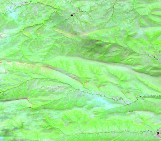
9 Modeled Landscape
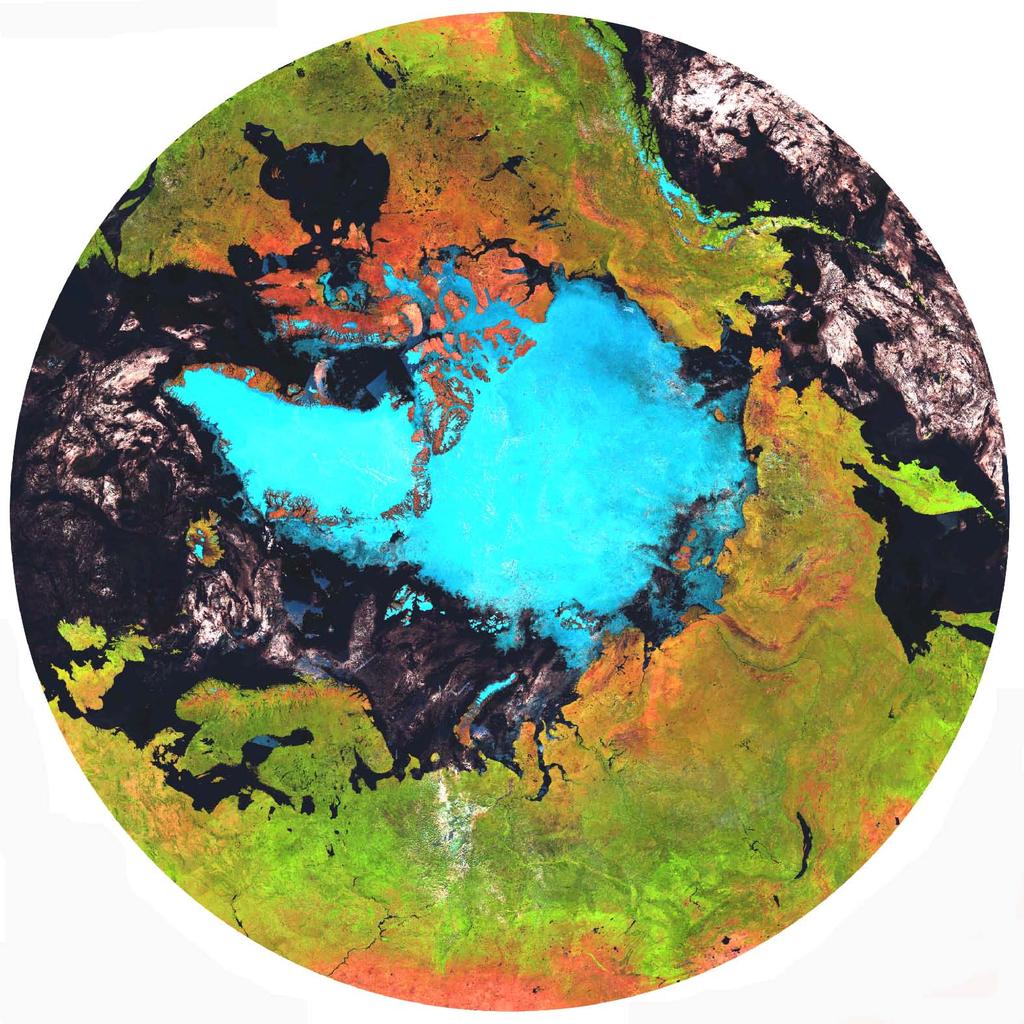
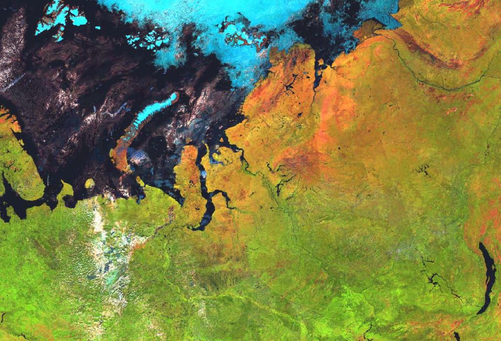
10 Circumpolar Greenness
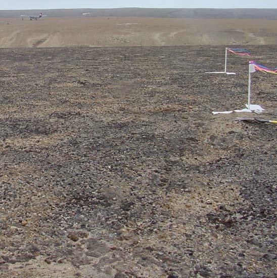
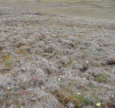
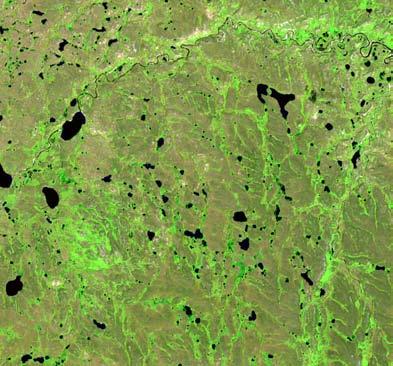
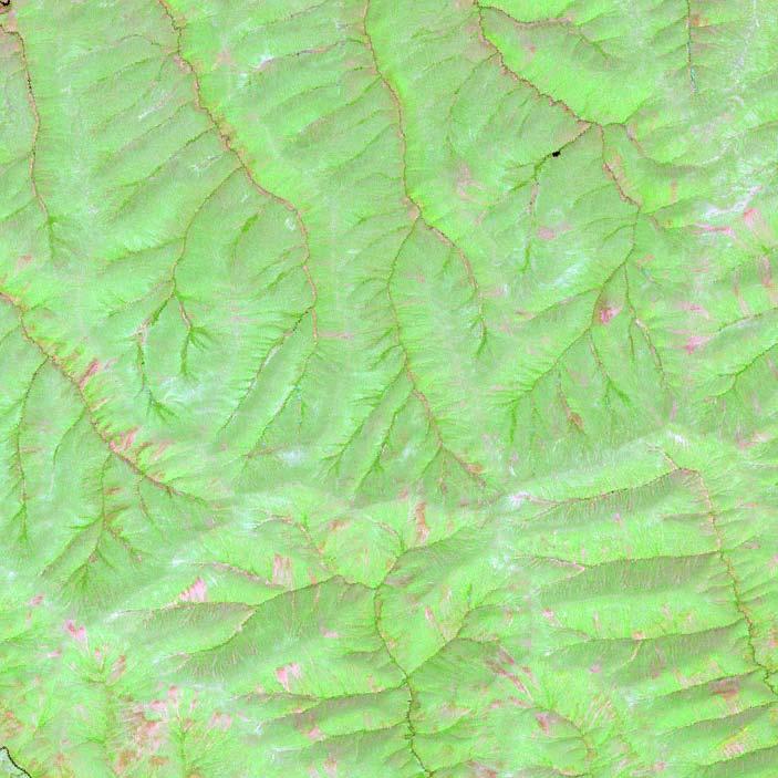
11 Vegetation in Yamal
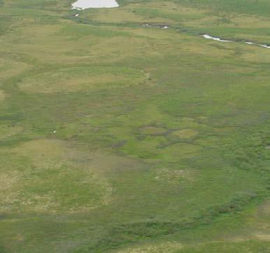
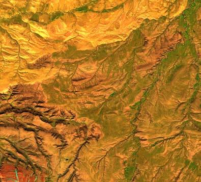
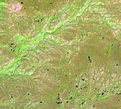
12 Vegetation shown on photos and Landsat ETM+ images Subzone A Subzone B Subzone C
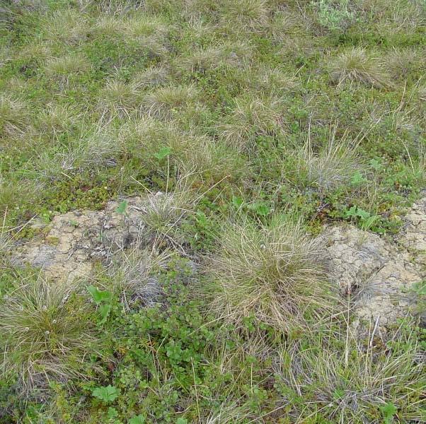
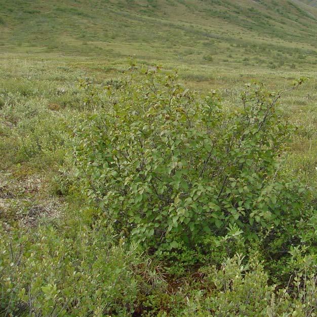
13 Vegetation shown on photos and Landsat ETM+ images Subzone D Subzone E
14 Circumpolar Peak Vegetation Greenness


15 Semi-decadal comparison of peak NDVI over circumpolar region
16 Annual peak NDVI Yamal Arctic tundra +0.44%/yr, R2=0.61, p< Years ! 0.75 Yamal Arctic south of 70 degree north +0.34%/yr, r2=0.36, p<0.01 Changes of annual peak vegetation greenness (NDVI) over tundra biome from (top) and below 70 degree north from (bottom) in Yamal Arctic, Russia as detected by NOAA AVHRR time series data. Annual peak NDVI Years
17 0.60 Annual peak NDVI North American Arctic 0.64%/yr, r2=0.71, p< Years 0.8 Changes of annual peak vegetation greenness (NDVI) over tundra biome from (top) and below 70 degree north from (bottom) in North American Arctic (Alaska and Canada) as detected by NOAA AVHRR time series data. Annual peak NDVI North American Arctic south of 70 degree 0.58%/yr, r2=0.70, p< Years
18 Canadian High Arctic Peak NDVI Subzone A: 0.492%/yr Subzone B: 0.55%/yr Subzone C: 0.806%/yr Year
19 Canadian Low Arctic Peak NDVI Subzone D: 0.672%/yr Subzone E: 0.354%/yr Taiga: %/yr Year
20 Russia High Arctic Peak NDVI Subzone A: 0.556%/yr Subzone B: 0.537%/yr Subzone C: 0.407%/yr Year
21 Russia Low Arctic and Taiga Peak NDVI Subzone D: 0.371%/yr Subzone E: 0.283%/yr Taiga: %/yr Year

22 Seasonal Pattern of Vegetation Greenness
23 NDVI Subzone A Subzone A A Arctic Subzone A a 5b 6a 6b 7a 7b 8a 8b 9a 9b Subzone B Subzone B B 0.18 NDVI 0.16 Arctic Subzone B a 5b 6a 6b 7a 7b 8a 8b 9a 9b
24 Subzone C Subzone C C NDVI Arctic Subzone C a 5b 6a 6b 7a 7b 8a 8b 9a 9b Subzone D Subzone D D Arctic Subzone D NDVI a 5b 6a 6b 7a 7b 8a 8b 9a 9b
25 Subzone E Subzone E E NDVI Arctic Subzone E a 5b 6a 6b 7a 7b 8a 8b 9a 9b Bimonthly periods
26 What s s Behind the Greening General trend of global and regional warming Stronger warming signals Get closer to Canadian Arctic (1km ~2005) Revisit Arctic Alaska (1km, weekly, ~2006) Spatial patterns of NDVI changes Impact of surface temperature and sea-ice on vegetation greenness

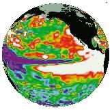
27 MODIS + AVHRR over Siberia (Graversen et al, 2008, Nature)
28 Temperature anomalies (Graversen et al, 2008, Nature)
29 Fire and NPP anomalies (Bond-Lamberty, 2007, Nature)
30 Accumulative effect on biomass and NPP Standing biomass Cumulative NPP Time Time Exclosure Low/Moderate intensity grazing High intensity grazing
31 Uncertainties Major uncertainties came from data calibrations; Draft of AVHRR sensors and differences in spectra and algorisms between AVHRR and MODIS; Confused from pixels contain mixture of land cover types respond to warming in different ways; Time periods considered in analysis; Geographic extents in analysis; Reluctance in facing the inconvenient truth

32 MODIS vs. AVHRR NDVI

33 AVHRR over Siberia

34 MODIS + AVHRR over Siberia
35 0.5 Peak NDVI Year 0.7 Peak NDVI Year How trend of greening is affected by the length and period of time series
36 3.0! TI-NDVI TI-NDVI Year! Year In case of time-integrated NDVI
37 Goetz et al. (2005)
38 :966 8: %,%-./.012%3% %,%6/6780 GAC Peak NDVI NA boreal GAC summer NDVI NA boreal *%+%,-.,/01%2%3434/ 5 / %+%-.6,63 6,0-- 6, /--- /--0 /-6-
39 7<000 7/000 7;000 7: &.&/012345&6&70/ &.&0173:7 GAC Peak NDVI NA Subzone D ; ; ; :: 37::: 322:: GAC Peak NDVI NA Subzone E 32::: 3<2:: 3<::: -(.(/012345(6(24/ (.(:1304; 3/2:: 34;: 34;2 344: ::: 9::2 9:3:
40 Plans for 2008 Revise JGR paper; Submit Alaska revisit paper; Prepare and submit global trends and uncertainty paper; Resubmit Arctic vegetation RS proposal to NSFC, with Howie and Skip int l l collaborators; Continue support a student on GOA work
41 Thanks! Questions?

42 Bunn et al, 2007, EOS
Data Fusion and Multi-Resolution Data
 Data Fusion and Multi-Resolution Data Nature.com www.museevirtuel-virtualmuseum.ca www.srs.fs.usda.gov Meredith Gartner 3/7/14 Data fusion and multi-resolution data Dark and Bram MAUP and raster data Hilker
Arctic Tundra land cover and biomass change on the Central Yamal peninsula, Russia
 Arctic Tundra land cover and biomass change on the Central Yamal peninsula, Russia ArcticBiomass Workshop, 20-23 Ocrobertember 2015, Svalbard Kumpula, T.*, Verdonen, M*., Macias-Fauria, M***, Skarin A.****
Weather and climate outlooks for crop estimates
 Weather and climate outlooks for crop estimates CELC meeting 2016-04-21 ARC ISCW Observed weather data Modeled weather data Short-range forecasts Seasonal forecasts Climate change scenario data Introduction
Overview on Land Cover and Land Use Monitoring in Russia
 Russian Academy of Sciences Space Research Institute Overview on Land Cover and Land Use Monitoring in Russia Sergey Bartalev Joint NASA LCLUC Science Team Meeting and GOFC-GOLD/NERIN, NEESPI Workshop
Recent temporal dynamics of arctic tundra vegetation within the context of spatial biomass-temperature relationships Howard E. Epstein and Leah M.
 Recent temporal dynamics of arctic tundra vegetation within the context of spatial biomass-temperature relationships Howard E. Epstein and Leah M. Reichle - Department of Environmental Science, University
Validation of satellite derived snow cover data records with surface networks and m ulti-dataset inter-comparisons
 Validation of satellite derived snow cover data records with surface networks and m ulti-dataset inter-comparisons Chris Derksen Climate Research Division Environment Canada Thanks to our data providers:
Cross-Sensor Continuity Science Algorithm
 Cross-Sensor Continuity Science Algorithm - Long Term Vegetation Index and Phenology Workshop - Javzan Tsend-Ayush and Tomoaki Miura Department of Natural Resources and Environmental Management University
Lecture Topics. 1. Vegetation Indices 2. Global NDVI data sets 3. Analysis of temporal NDVI trends
 Lecture Topics 1. Vegetation Indices 2. Global NDVI data sets 3. Analysis of temporal NDVI trends Why use NDVI? Normalize external effects of sun angle, viewing angle, and atmospheric effects Normalize
Land cover research, applications and development needs in Slovakia
 Land cover research, applications and development needs in Slovakia Andrej Halabuk Institute of Landscape Ecology Slovak Academy of Sciences (ILE SAS) Štefánikova 3, 814 99 Bratislava, Slovakia Institute
Circumpolar Arctic greening:
 Circumpolar Arctic greening: Relationships to summer sea-ice concentrations, land temperatures and disturbance regimes D.A. Walker, U.S. Bhatt, H.E. Epstein, M.K. Raynolds, G.V. Frost, M.O. Liebman, A.V.
A Facility for Producing Consistent Remotely Sensed Biophysical Data Products of Australia
 TERRESTRIAL ECOSYSTEM RESEARCH NETWORK - AusCover - A Facility for Producing Consistent Remotely Sensed Biophysical Data Products of Australia June, 2011 Mervyn Lynch Professor of Remote Sensing Curtin
VISUALIZATION URBAN SPATIAL GROWTH OF DESERT CITIES FROM SATELLITE IMAGERY: A PRELIMINARY STUDY
 CO-439 VISUALIZATION URBAN SPATIAL GROWTH OF DESERT CITIES FROM SATELLITE IMAGERY: A PRELIMINARY STUDY YANG X. Florida State University, TALLAHASSEE, FLORIDA, UNITED STATES ABSTRACT Desert cities, particularly
NSF Expeditions in Computing. Understanding Climate Change: A Data Driven Approach. Vipin Kumar University of Minnesota
 NSF Expeditions in Computing Understanding Climate Change: A Data Driven Approach Vipin Kumar University of Minnesota kumar@cs.umn.edu www.cs.umn.edu/~kumar Vipin Kumar UCC Aug 15, 2011 Climate Change:
Remote sensing of the terrestrial ecosystem for climate change studies
 Frontier of Earth System Science Seminar No.1 Fall 2013 Remote sensing of the terrestrial ecosystem for climate change studies Jun Yang Center for Earth System Science Tsinghua University Outline 1 Introduction
Comparison of NASA AIRS and MODIS Land Surface Temperature and Infrared Emissivity Measurements from the EOS AQUA platform
 Comparison of NASA AIRS and MODIS Land Surface Temperature and Infrared Emissivity Measurements from the EOS AQUA platform Robert Knuteson, Steve Ackerman, Hank Revercomb, Dave Tobin University of Wisconsin-Madison
Assessing Drought in Agricultural Area of central U.S. with the MODIS sensor
 Assessing Drought in Agricultural Area of central U.S. with the MODIS sensor Di Wu George Mason University Oct 17 th, 2012 Introduction: Drought is one of the major natural hazards which has devastating
Impact of NASA EOS data on the scientific literature: 16 years of published research results from Terra, Aqua, Aura, and Aquarius
 Impact of NASA EOS data on the scientific literature: 16 years of published research results from Terra, Aqua, Aura, and Aquarius Gene R. Major NASA Goddard Library Nebulous Connections April 4, 2017 RESACs/RA
Land Surface Temperature Measurements From the Split Window Channels of the NOAA 7 Advanced Very High Resolution Radiometer John C.
 Land Surface Temperature Measurements From the Split Window Channels of the NOAA 7 Advanced Very High Resolution Radiometer John C. Price Published in the Journal of Geophysical Research, 1984 Presented
Preparation of LULC map from GE images for GIS based Urban Hydrological Modeling
 International Conference on Modeling Tools for Sustainable Water Resources Management Department of Civil Engineering, Indian Institute of Technology Hyderabad: 28-29 December 2014 Abstract Preparation
ANALYSIS AND VALIDATION OF A METHODOLOGY TO EVALUATE LAND COVER CHANGE IN THE MEDITERRANEAN BASIN USING MULTITEMPORAL MODIS DATA
 PRESENT ENVIRONMENT AND SUSTAINABLE DEVELOPMENT, NR. 4, 2010 ANALYSIS AND VALIDATION OF A METHODOLOGY TO EVALUATE LAND COVER CHANGE IN THE MEDITERRANEAN BASIN USING MULTITEMPORAL MODIS DATA Mara Pilloni
Applications of GIS and Remote Sensing for Analysis of Urban Heat Island
 Chuanxin Zhu Professor Peter V. August Professor Yeqiao Wang NRS 509 December 15, 2016 Applications of GIS and Remote Sensing for Analysis of Urban Heat Island Since the last century, the global mean surface
Spatial Variability of Aerosol - Cloud Interactions over Indo - Gangetic Basin (IGB)
") Spatial Variability of Aerosol - Cloud Interactions over Indo - Gangetic Basin (IGB) Shani Tiwari Graduate School of Environmental Studies Nagoya University, Nagoya, Japan Email: pshanitiwari@gmail.com
Spatial Variability of Aerosol - Cloud Interactions over Indo - Gangetic Basin (IGB) Shani Tiwari Graduate School of Environmental Studies Nagoya University, Nagoya, Japan Email: pshanitiwari@gmail.com
Physical Geography: Patterns, Processes, and Interactions, Grade 11, University/College Expectations
 Geographic Foundations: Space and Systems SSV.01 explain major theories of the origin and internal structure of the earth; Page 1 SSV.02 demonstrate an understanding of the principal features of the earth
Terrestrial Snow Cover: Properties, Trends, and Feedbacks. Chris Derksen Climate Research Division, ECCC
 Terrestrial Snow Cover: Properties, Trends, and Feedbacks Chris Derksen Climate Research Division, ECCC Outline Three Snow Lectures: 1. Why you should care about snow: Snow and the cryosphere Classes of
Land Surface Remote Sensing II
 PROCEEDINGS OFSPIE Land Surface Remote Sensing II Thomas J. Jackson Jing Ming Chen Peng Gong Shunlin Liang Editors 13-16 October 2014 Beijing, China Sponsored by SPIE Cosponsored by State Key Laboratory
Remote Sensing of SWE in Canada
 Remote Sensing of SWE in Canada Anne Walker Climate Research Division, Environment Canada Polar Snowfall Hydrology Mission Workshop, June 26-28, 2007 Satellite Remote Sensing Snow Cover Optical -- Snow
APPENDIX. Normalized Difference Vegetation Index (NDVI) from MODIS data
 from MODIS data") APPENDIX Land-use/land-cover composition of Apulia region Overall, more than 82% of Apulia contains agro-ecosystems (Figure ). The northern and somewhat the central part of the region include arable lands
APPENDIX Land-use/land-cover composition of Apulia region Overall, more than 82% of Apulia contains agro-ecosystems (Figure ). The northern and somewhat the central part of the region include arable lands
Remote Sensing products and global datasets. Joint Research Centre, European Commission
 Remote Sensing products and global datasets Joint Research Centre, European Commission Setting the stage. Needs and requirements for integrated approach(es) for land degradation assessment. in Special
Remote Sensing Based Inversion of Gap Fraction for Determination of Leaf Area Index. Alemu Gonsamo 1 and Petri Pellikka 1
 Remote Sensing Based Inversion of Gap Fraction for Determination of Leaf Area Index Alemu Gonsamo and Petri Pellikka Department of Geography, University of Helsinki, P.O. Box, FIN- Helsinki, Finland; +-()--;
Inter- Annual Land Surface Variation NAGS 9329
 Annual Report on NASA Grant 1 Inter- Annual Land Surface Variation NAGS 9329 PI Stephen D. Prince Co-I Yongkang Xue April 2001 Introduction This first period of operations has concentrated on establishing
Estimation of Wavelet Based Spatially Enhanced Evapotranspiration Using Energy Balance Approach
 Estimation of Wavelet Based Spatially Enhanced Evapotranspiration Using Energy Balance Approach Dr.Gowri 1 Dr.Thirumalaivasan 2 1 Associate Professor, Jerusalem College of Engineering, Department of Civil
Spanish national plan for land observation: new collaborative production system in Europe
 ADVANCE UNEDITED VERSION UNITED NATIONS E/CONF.103/5/Add.1 Economic and Social Affairs 9 July 2013 Tenth United Nations Regional Cartographic Conference for the Americas New York, 19-23, August 2013 Item
An Overview of NOAA s Satellite, Data, and Information Stewardship Program
 An Overview of NOAA s Satellite, Data, and Information Stewardship Program John J. Bates and Mitch Goldberg National Oceanic and Atmospheric Administration National Environmental Satellite Data and Information
VIIRS Radiometric Calibration for Reflective Solar Bands: Antarctic Dome C Site and Simultaneous Nadir Overpass Observations
 VIIRS Radiometric Calibration for Reflective Solar Bands: Antarctic Dome C Site and Simultaneous Nadir Overpass Observations Slawomir Blonski, * Changyong Cao, Sirish Uprety, ** and Xi Shao * NOAA NESDIS
Overview of Remote Sensing in Natural Resources Mapping
 Overview of Remote Sensing in Natural Resources Mapping What is remote sensing? Why remote sensing? Examples of remote sensing in natural resources mapping Class goals What is Remote Sensing A remote sensing
Challenges for the operational assimilation of satellite image data in agrometeorological models
 Challenges for the operational assimilation of satellite image data in agrometeorological models Mark Danson Centre for Environmental Systems Research, University of Salford, UK 0 Objectives The main objective
ESM 186 Environmental Remote Sensing and ESM 186 Lab Syllabus Winter 2012
 ESM 186 Environmental Remote Sensing and ESM 186 Lab Syllabus Winter 2012 Instructor: Susan Ustin (slustin@ucdavis.edu) Phone: 752-0621 Office: 233 Veihmeyer Hall and 115A, the Barn Office Hours: Tuesday
OSS MISSION.
 GEO-CRADLE COORDINATING AND INTEGRATING STATE-OF-THE-ART EARTH OBSERVATION ACTIVITIES IN THE REGION OF NORTH OF AFRICA, MIDDLE EAST, AND BALKANS AND DEVELOPING LINKS WITH GEO RELATED INITIATIVES TOWARD
Permafrost: Earth Observation Applications: Introduction
 Polar Meeting 3 Permafrost: Earth Observation Applications: Introduction Mark Drinkwater CNES, Paris, 22 23 May, 2013 Remote Sensing of Permafrost which Remote Sensing products? applicability to Permafrost
Earth Science Flight Mission Overview
 Earth Science Flight Mission Overview Nand Topiwala Science Mission Directorate NASA Headquarters April 25, 2007 Earth Science Missions Afternoon Constellation, or A-Train, Multi-Satellite Observatory
METRIC tm. Mapping Evapotranspiration at high Resolution with Internalized Calibration. Shifa Dinesh
 METRIC tm Mapping Evapotranspiration at high Resolution with Internalized Calibration Shifa Dinesh Outline Introduction Background of METRIC tm Surface Energy Balance Image Processing Estimation of Energy
Remote sensing of sealed surfaces and its potential for monitoring and modeling of urban dynamics
 Remote sensing of sealed surfaces and its potential for monitoring and modeling of urban dynamics Frank Canters CGIS Research Group, Department of Geography Vrije Universiteit Brussel Herhaling titel van
Comparison of NASA AIRS and MODIS Land Surface Temperature and Infrared Emissivity Measurements from the EOS AQUA platform
 Comparison of NASA AIRS and MODIS Land Surface Temperature and Infrared Emissivity Measurements from the EOS AQUA platform Robert Knuteson, Hank Revercomb, Dave Tobin University of Wisconsin-Madison 16
Deforestation and Degradation in Central and Southern Africa. Project Title: "Deforestation and Degradation in Central and Southern Africa"
 Deforestation and Degradation in Central and Southern Africa Project Title: "Deforestation and Degradation in Central and Southern Africa" Description: An integrated land degradation and deforestation
Cumulative effects of resource development, reindeer herding, and climate change on the Yamal Peninsula, Russia
 Cumulative effects of resource development, reindeer herding, and climate change on the Yamal Peninsula, Russia Photo: Bryan and Cherry Alexander D. A. (Skip) Walker, University of Alaska Fairbanks, and
Circumpolar AVHRR Surface Temperature and its Relationship Bioclimate Zones and NDVI
 Circumpolar AVHRR Surface Temperature and its Relationship Bioclimate Zones and NDVI Martha Raynolds, Donald A. Walker, University of Alaska Fairbanks Overview of Presentation Two data sets: Circumpolar
GMES: calibration of remote sensing datasets
 GMES: calibration of remote sensing datasets Jeremy Morley Dept. Geomatic Engineering jmorley@ge.ucl.ac.uk December 2006 Outline Role of calibration & validation in remote sensing Types of calibration
Moderate Resolution Imaging Spectroradiometer (MODIS) Products and Potential Applications For Environmental and Climatic Monitoring in China
 Products and Potential Applications For Environmental and Climatic Monitoring in China") Moderate Resolution Imaging Spectroradiometer (MODIS) Products and Potential Applications For Environmental and Climatic Monitoring in China Jianhe (John) Qu Center for Earth Observing and Space Research
Moderate Resolution Imaging Spectroradiometer (MODIS) Products and Potential Applications For Environmental and Climatic Monitoring in China Jianhe (John) Qu Center for Earth Observing and Space Research
European Space Agency
 Guidelines - Guidelines how/when to interact during the WebEx session: - Due to the number of attendees, please keep always your webcam and microphone switched-off - You can use anytime the chat to all
Long-term global time series of MODIS and VIIRS SSTs
 Long-term global time series of MODIS and VIIRS SSTs Peter J. Minnett, Katherine Kilpatrick, Guillermo Podestá, Yang Liu, Elizabeth Williams, Susan Walsh, Goshka Szczodrak, and Miguel Angel Izaguirre Ocean
Chapter 7 Part III: Biomes
 Chapter 7 Part III: Biomes Biomes Biome: the major types of terrestrial ecosystems determined primarily by climate 2 main factors: Temperature and precipitation Depends on latitude or altitude; proximity
CHAPTER 2 REMOTE SENSING IN URBAN SPRAWL ANALYSIS
 9 CHAPTER 2 REMOTE SENSING IN URBAN SPRAWL ANALYSIS 2.1. REMOTE SENSING Remote sensing is the science of acquiring information about the Earth's surface without actually being in contact with it. This
Recent Update on MODIS C6 and VIIRS Deep Blue Aerosol Products
 Recent Update on MODIS C6 and VIIRS Deep Blue Aerosol Products N. Christina Hsu, Photo taken from Space Shuttle: Fierce dust front over Libya Corey Bettenhausen, Andrew M. Sayer, and Rick Hansell Laboratory
«Desertification and Drought Monitoring in Arid Tunisia based on Remote Sensing Imagery» Research Undertaken & Case-Studies.
 «Desertification and Drought Monitoring in Arid Tunisia based on Remote Sensing Imagery» Research Undertaken & Case-Studies EU COST Action September 2015, Antalya Turkey Bouajila ESSIFI INSTITUT DES REGIONS
USGS/EROS Accomplishments and Year 3 Plans. Enhancement of the U.S. Drought Monit Through the Integration of NASA Vegetation Index Imagery
 USGS/EROS Accomplishments and Year 3 Plans Enhancement of the U.S. Drought Monit Through the Integration of NASA Vegetation Index Imagery Jesslyn Brown Team Meeting, Austin, TX, 10/6/09 U.S. Department
Variability of the Seasonally Integrated Normalized Difference Vegetation Index Across the North Slope of Alaska in the 1990s
 INT. J. REMOTE SENSING, 2003, VOL. 24, NO. 5, 1111 1117 Variability of the Seasonally Integrated Normalized Difference Vegetation Index Across the North Slope of Alaska in the 1990s D. STOW*, S. DAESCHNER,
The Landsat Program and its Products: Global Land Surveys. Garik Gutman LCLUC Program Manager NASA Headquarters Washington, DC
 The Landsat Program and its Products: Global Land Surveys Garik Gutman LCLUC Program Manager NASA Headquarters Washington, DC 1 Land-Cover/Land-Use Change Program LCLUC is an interdisciplinary scientific
Estimation of ocean contribution at the MODIS near-infrared wavelengths along the east coast of the U.S.: Two case studies
 GEOPHYSICAL RESEARCH LETTERS, VOL. 32, L13606, doi:10.1029/2005gl022917, 2005 Estimation of ocean contribution at the MODIS near-infrared wavelengths along the east coast of the U.S.: Two case studies
SPATIAL AND TEMPORAL MODELLING OF ECOSYSTEM SERVICES
 SPATIAL AND TEMPORAL MODELLING OF ECOSYSTEM SERVICES Solen Le Clec h, T.Decaëns, S. Dufour, M. Grimaldi, N. Jégou and J. Oszwald ACES Conference 2016 Jacksonville, Florida (USA). December, 5-9th : issues
GCOS High Resolution Land Cover ECV. Slide 11
 GCOS High Resolution Land Cover ECV Slide 11 Detailed Land Cover and Climate Land cover and its changes modify the goods and services provided to human society force climate by altering water and energy
REMOTE SENSING OF PERMAFROST IN NORTHERN ENVIRONMENTS
 REMOTE SENSING OF PERMAFROST IN NORTHERN ENVIRONMENTS What is permafrost? What can we monitor with satellite data? Permafrost is an Essential Climate Variable About 25 % of the land surface is underlain
AGOG 485/585 /APLN 533 Spring Lecture 5: MODIS land cover product (MCD12Q1). Additional sources of MODIS data
. Additional sources of MODIS data") AGOG 485/585 /APLN 533 Spring 2019 Lecture 5: MODIS land cover product (MCD12Q1). Additional sources of MODIS data Outline Current status of land cover products Overview of the MCD12Q1 algorithm Mapping
AGOG 485/585 /APLN 533 Spring 2019 Lecture 5: MODIS land cover product (MCD12Q1). Additional sources of MODIS data Outline Current status of land cover products Overview of the MCD12Q1 algorithm Mapping
ZRCSAZU. Remote sensing and Earth observation data at ZRC SAZU. dr. Tatjana Veljanovski Atrij ZRC Ljubljana
 ZRCSAZU Remote sensing and Earth observation data at ZRC SAZU dr. Tatjana Veljanovski 2016-06-08 Atrij ZRC Ljubljana Remote Sensing Department Remote Sensing Department 20 years of experience application,
Pattern to Process: Research and Applications for Understanding Multiple Interactions and Feedbacks on Land Cover Change (NAG ).
.") Pattern to Process: Research and Applications for Understanding Multiple Interactions and Feedbacks on Land Cover Change (NAG 5 9232). Robert Walker, Principle Investigator Department of Geography 315
Pattern to Process: Research and Applications for Understanding Multiple Interactions and Feedbacks on Land Cover Change (NAG 5 9232). Robert Walker, Principle Investigator Department of Geography 315
Using MERIS and MODIS for Land Cover Mapping in the Netherlands
 Using MERIS and for Land Cover Mapping in the Netherlands Raul Zurita Milla, Michael Schaepman and Jan Clevers Wageningen University, Centre for Geo-Information, NL Introduction Actual and reliable information
West meets East: Monitoring and modeling urbanization in China Land Cover-Land Use Change Program Science Team Meeting April 3, 2012
 West meets East: Monitoring and modeling urbanization in China Land Cover-Land Use Change Program Science Team Meeting April 3, 2012 Annemarie Schneider Center for Sustainability and the Global Environment,
Comparison of MSG-SEVIRI and SPOT-VEGETATION data for vegetation monitoring over Africa
 Comparison of MSG-SEVIRI and SPOT-VEGETATION data for vegetation monitoring over Africa Bernard LACAZE CNRS UMR 8586 PRODIG Pôle Image et Campus Spatial, Université Paris Diderot Paris 7 Objectives Comparison
Global SoilMappingin a Changing World
 Global SoilMappingin a Changing World Sabine Grunwald Acknowledgements: GIS-Pedometrics Team, UF Soil Story My soil story. Your soil story Digital Soil Mapping in a Changing World Global climate change,
Application and impacts of the GlobeLand30 land cover dataset on the Beijing Climate Center Climate Model
 IOP Conference Series: Earth and Environmental Science PAPER OPEN ACCESS Application and impacts of the GlobeLand30 land cover dataset on the Beijing Climate Center Climate Model To cite this article:
Satellite-based Lake Surface Temperature (LST) Homa Kheyrollah Pour Claude Duguay
 Homa Kheyrollah Pour Claude Duguay") Satellite-based Lake Surface Temperature (LST) Homa Kheyrollah Pour Claude Duguay Lakes in NWP models Interaction of the atmosphere and underlying layer is the most important issue in climate modeling
Satellite-based Lake Surface Temperature (LST) Homa Kheyrollah Pour Claude Duguay Lakes in NWP models Interaction of the atmosphere and underlying layer is the most important issue in climate modeling
Land Monitoring Core Service Implementation Group (LMCS IG) - Results and Outlook
 - Results and Outlook") Land Monitoring Core Service Implementation Group (LMCS IG) - Results and Outlook Pr. Dietmar Grünreich, President of BKG, Germany Chairman of the GMES LMCS IG Outline 1 Introduction 2 Preparatory Projects
Land Monitoring Core Service Implementation Group (LMCS IG) - Results and Outlook Pr. Dietmar Grünreich, President of BKG, Germany Chairman of the GMES LMCS IG Outline 1 Introduction 2 Preparatory Projects
International Arctic Research Center
 International Arctic Research Center IARC Project Reducing Uncertainty in Arctic Climate Change Prediction Distinguishing Natural and Anthropogenic Changes Testing Carbon Cycle Hydrologic Cycle Integration
Canadian Prairie Snow Cover Variability
 Canadian Prairie Snow Cover Variability Chris Derksen, Ross Brown, Murray MacKay, Anne Walker Climate Research Division Environment Canada Ongoing Activities: Snow Cover Variability and Links to Atmospheric
Sea Level Rise in Connecticut A Risk-Informed Approach
 GZA GeoEnvironmental, Inc. CAFM Conference October 25, 2017 Proactive By Design. Our Company Commitment Proactive By Design. Our Company Commitment Sea Level Rise in Connecticut A Risk-Informed Approach
Evaluation of estimated satellite images for filling data gaps in an intra-annual high spatial resolution time-series
 Evaluation of estimated satellite images for filling data gaps in an intra-annual high spatial resolution time-series Tobias Schmidt, Michael Förster, Birgit Kleinschmit Technical University Berlin, Geoinformation
Sentinel 2 Pre-processing Requirements for coastal and inland waters
 Sentinel 2 Pre-processing Requirements for coastal and inland waters K A I S Ø R E NSEN NIVA CARSTEN B R O CKMANN Ecological and chemical classification of water bodies in Norway Water quality - products
Snow processes and their drivers in Sierra Nevada (Spain), and implications for modelling.
, and implications for modelling.") Snow processes and their drivers in Sierra Nevada (Spain), and implications for modelling. M.J. Polo, M.J. Pérez-Palazón, R. Pimentel, J. Herrero Granada,02 de November 2016 SECTIONS 1. 2. 3. 4. 5. Introduction
Snow processes and their drivers in Sierra Nevada (Spain), and implications for modelling. M.J. Polo, M.J. Pérez-Palazón, R. Pimentel, J. Herrero Granada,02 de November 2016 SECTIONS 1. 2. 3. 4. 5. Introduction
Interpretation of Polar-orbiting Satellite Observations. Atmospheric Instrumentation
 Interpretation of Polar-orbiting Satellite Observations Outline Polar-Orbiting Observations: Review of Polar-Orbiting Satellite Systems Overview of Currently Active Satellites / Sensors Overview of Sensor
Satellite Constraints on Arctic-region Airborne Particles Ralph Kahn NASA Goddard Space Flight Center
 Satellite Constraints on Arctic-region Airborne Particles Ralph Kahn NASA Goddard Space Flight Center Sea of Okhotsk, MODIS image Feb. 6, 2007, NASA Earth Observatory Arctic Aerosol Remote Sensing Overview
NES: Weather and Climate: Satellite Meteorology
 LIVE INTERACTIVE LEARNING @ YOUR DESKTOP NES: Weather and Climate: Satellite Meteorology Presented by: Rudo Kashiri January 23, 2012 Weather and Climate: Satellite Meteorology Presented by Rudo Kashiri
Land Accounts - The Canadian Experience
 Land Accounts - The Canadian Experience Development of a Geospatial database to measure the effect of human activity on the environment Who is doing Land Accounts Statistics Canada (national) Component
3rd LCLUC Science Team Meeting Airlie House, Warrenton, Va May
 3rd LCLUC Science Team Meeting Airlie House, Warrenton, Va May 18-21 1999 May 18 th Day 1, 9.00 am Plenary Session - The Jefferson Room Welcome and Objectives of the Meeting C. Justice / J. Ranson Programmatic
CCI achievements atmosphere / surface
 CCI achievements atmosphere / surface aerosol CCI SST CCI cloud CCI ozone CCI + a bonus discussion : can these CCI provide insights / explanations to the surface T hiatus? aerosol CCI at the start there
UNSD SEEA-EEA revision 2020
 UNSD SEEA-EEA revision 2020 Area 1: Spatial units; introduction Sjoerd Schenau, Patrick Bogaart, Edwin Horlings London group meeting, October 2018 Overview Spatial units in SEEA EEA Main revision issues
Progress Report Year 2, NAG5-6003: The Dynamics of a Semi-Arid Region in Response to Climate and Water-Use Policy
 Progress Report Year 2, NAG5-6003: The Dynamics of a Semi-Arid Region in Response to Climate and Water-Use Policy Principal Investigator: Dr. John F. Mustard Department of Geological Sciences Brown University
QUALITY INFORMATION DOCUMENT For OSI TAC SST products , 007, 008
 QUALITY INFORMATION DOCUMENT For OSI TAC SST products 010-003, 007, 008 Issue: 1.5 Contributors: Jacob L. HOYER (DMI), Hanne HEIBERG (met.no), Jean-Francois PIOLLÉ (IFREMER), Bruce Hackett (MET Norway)
Accuracy and Precision Requirements for Climate-Level Data Sets
 Accuracy and Precision Requirements for Climate-Level Data Sets K. Thome NASA/GSFC Libya-4 Workshop Paris, France October 4-5, 2012 Accuracy requirements Commercial imagers Precision and SNR drive calibration
Validating a Satellite Microwave Remote Sensing Based Global Record of Daily Landscape Freeze- Thaw Dynamics
 University of Montana ScholarWorks at University of Montana Numerical Terradynamic Simulation Group Publications Numerical Terradynamic Simulation Group 2012 Validating a Satellite Microwave Remote Sensing
REMOTELY SENSED INFORMATION FOR CROP MONITORING AND FOOD SECURITY
 LEARNING OBJECTIVES Lesson 4 Methods and Analysis 2: Rainfall and NDVI Seasonal Graphs At the end of the lesson, you will be able to: understand seasonal graphs for rainfall and NDVI; describe the concept
EU collaborations with NASA LCLUC Program & Current Priorities
 & Current Priorities ioannis Manakos, Dr. Centre for Research and Technology Hellas Information Technologies Institute Visual Analytics, Virtual & Augmented Reality Laboratory European Association of Remote
NASA NNG06GC42G A Global, 1-km Vegetation Modeling System for NEWS February 1, January 31, Final Report
 NASA NNG06GC42G A Global, 1-km Vegetation Modeling System for NEWS February 1, 2006- January 31, 2009 Final Report Scott Denning, Reto Stockli, Lixin Lu Department of Atmospheric Science, Colorado State
DROUGHT ASSESSMENT USING SATELLITE DERIVED METEOROLOGICAL PARAMETERS AND NDVI IN POTOHAR REGION
 DROUGHT ASSESSMENT USING SATELLITE DERIVED METEOROLOGICAL PARAMETERS AND NDVI IN POTOHAR REGION Researcher: Saad-ul-Haque Supervisor: Dr. Badar Ghauri Department of RS & GISc Institute of Space Technology
A Time Series of Photo-synthetically Available Radiation at the Ocean Surface from SeaWiFS and MODIS Data
 A Time Series of Photo-synthetically Available Radiation at the Ocean Surface from SeaWiFS and MODIS Data Robert Frouin* a, John McPherson a, Kyozo Ueyoshi a, Bryan A. Franz b a Scripps Institution of
Changing Marine Access in the Arctic Ocean: The Arctic Climate Impact Assessment Panama Canal Authority 11 January 2005
 Changing Marine Access in the Arctic Ocean: The Arctic Climate Impact Assessment Panama Canal Authority 11 January 2005 Lawson Brigham Deputy Director, U.S. Arctic Research Commission ACIA Contributing
Title. Author(s)Radiarta, I Nyoman; Saitoh, Sei-Ichi. Issue Date Doc URL. Type. Note. File Information
Radiarta, I Nyoman; Saitoh, Sei-Ichi. Issue Date Doc URL. Type. Note. File Information") Title Spatial information systems approach toward sustaina Author(s)Radiarta, I Nyoman; Saitoh, Sei-Ichi International Symposium on "Sustainability Science o Citation2009. Hakodate, Japan. Issue Date 2009-11-07
Title Spatial information systems approach toward sustaina Author(s)Radiarta, I Nyoman; Saitoh, Sei-Ichi International Symposium on "Sustainability Science o Citation2009. Hakodate, Japan. Issue Date 2009-11-07
Research Proposal Global Change in Photosynthesis Moumita Dutta Gupta ~ GGR 904 May 5 th 2009
 Research Proposal Global Change in Photosynthesis 1982 2008 Moumita Dutta Gupta ~ GGR 904 May 5 th 2009 ?? -The Question - How and where is Global Photosynthesis changing as captured by the SPOT VEGETATION
Observed Climate Variability and Change: Evidence and Issues Related to Uncertainty
 Observed Climate Variability and Change: Evidence and Issues Related to Uncertainty David R. Easterling National Climatic Data Center Asheville, North Carolina Overview Some examples of observed climate
Assimilating terrestrial remote sensing data into carbon models: Some issues
 University of Oklahoma Oct. 22-24, 2007 Assimilating terrestrial remote sensing data into carbon models: Some issues Shunlin Liang Department of Geography University of Maryland at College Park, USA Sliang@geog.umd.edu,
Vegetation greening in the canadian arctic related to decadal warming
 PAPER www.rsc.org/jem Journal of Environmental Monitoring Vegetation greening in the canadian arctic related to decadal warming Gensuo J. Jia,* a Howard E. Epstein b and Donald A. Walker c Received 15th
Pan-Arctic, Regional and Local Land Cover Products
 Pan-Arctic, Regional and Local Land Cover Products Marcel Urban (1), Stefan Pöcking (1), Sören Hese (1) & Christiane Schmullius (1) (1) Friedrich-Schiller University Jena, Department of Earth Observation,