Comparison of NASA AIRS and MODIS Land Surface Temperature and Infrared Emissivity Measurements from the EOS AQUA platform
|
|
|
- Laurel McGee
- 6 years ago
- Views:
Transcription
1 Comparison of NASA AIRS and MODIS Land Surface Temperature and Infrared Emissivity Measurements from the EOS AQUA platform Robert Knuteson, Hank Revercomb, Dave Tobin University of Wisconsin-Madison 16 Sept 2008
2 Imager/Sounder Synergy Imager Contiguous spatial coverage. IR Sounder - Vertical profile at lower spatial res MW Sounder - All weather at lower spatial res. Ideally a single algorithm would combine these data optimally. But at a minimum, comparison of products from imager and sounder data should be used as a quality check on potential CDRs (climate data records). This presentation is a preliminary imager/sounder assessment using EOS MODIS and AIRS products as a prelude to the operational sensors on NPP/NPOESS.
3 Goals The goal of this effort is to evaluate the following: What are the natural spatial and temporal scales of the natural variability of the relevant quantities? To what degree can we identify BIASES in the LST product? When product algorithm changes are made (i.e. version changes), do we have a way of deciding if the intended improvements actually improve or degrade the product accuracy?
4
5 AIRS- MODIS Brightness Temperature Comparison (Tobin et al, 2006) Window Channels < 0.2 K Tobin, D. C., H. E. Revercomb, C. C. Moeller, and T. S. Pagano (2006), Use of Atmospheric Infrared Sounder high spectral resolution spectra to assess the calibration of Moderate resolution Imaging Spectroradiometer on EOS Aqua, J. Geophys. Res., 111, D09S05,
6 MODIS and AIRS LST Product Characteristics Aqua MODIS Aqua AIRS Sensor Calibration < 0.2 K (windows) < 0.2 K Atmospheric Attenuation Column Retrieved Profile Retrieved Cloud Contamination Cloud Detection Cloud Clearing Surface Type Multi-spectral (004) Multi-spectral Land Cover Class (005) Temporal Sampling Clear only; 1:30 AM, PM Partly Cloudy; 1:30 AM, PM and Resolution (0.333 msec per sample) (30 msec per sample) Spatial Sampling 1 km Clear Only Samples 45 km CC (< 60% CF) and Resolution (1 km 5 km > 1 deg) (15 km 45 km > 1 deg)

7 AIRS Tskin Night

8 Mean 1 deg LST MODIS NIGHT
9 Use Land Classes (IGBP) to group the global data by land type for statistical analysis. IGBP CLASS ID IGBP CLASS Description 0 Water Bodies 1 Evergreen Needleleaf Forest 2 Evergreen Broadleaf Forest 3 Deciduous Needleleaf Forest 4 Deciduous Broadleaf Forest 5 Mixed Forest 6 Closed Shrublands 7 Open Shrublands 8 Woody Savannas 9 Savannas 10 Grasslands 11 Permanent Wetlands 12 Croplands 13 Urban and Built-Up 14 Cropland/Natural Vegetation Mosaic 15 Snow and Ice 16 Barren or Sparsely Vegetated 17 Missing Data

10 Forests NIGHT Barren/Savanna MODIS 004 Grassland/cropland Ice/Snow

11 MODIS 004 NIGHT Snow/Ice Covered Land Warm clouds over cold snow/ice contaminate the AIRS LST monthly product.
 agree to within 0.")
12 MODIS 004 NIGHT AIRS and MODIS (collection 004) agree to within 0.5 K at night!!!
13 MODIS 004 DAY AIRS and MODIS (collection 004) agree to between 0 and -1.5 K in the Day.

14 MODIS Collection 004 (red) Note: AIRS day/night emissivity bias will be addressed In next version update.

15 MODIS 004 NIGHT AIRS 12 μm B32 11 μm B31 Single Month MODIS MODIS AIRS 8.5 μm B μm B20 MODIS MODIS
16 Summary: AIRS vs MODIS LST 1. Observed window brightness temperatures between AIRS and MODIS agree to < 0.2 K indicating good absolute calibration. 2. For Land Surface Skin Temperature the MODIS collection 004 Clear Day/Night algorithm and AIRS (version 5) cloud-cleared multi-channel regression retrieval agree to within 0.5 K at night (!!!) [excluding snow/ice covered land] and between 0 and -1.5 K during the day. I think is this is quite good agreement considering the difficulty of the problem although there are improvements that can be made. 3. The fact that biases can be assessed through a comparison of AIRS and MODIS suggests that a continuous comparison of imager and sounder LST products will be a useful quality check on future operational algorithms.
17 Validation of AIRS & IASI Total Precipitable Water Vapor at the ARM Southern Great Plains Site Robert Knuteson, Sarah Bedka, Hank Revercomb, Dave Tobin, Dave Turner University of Wisconsin-Madison 15 September 2008
18 Topics What are the current biases for AIRS and IASI L2 products? Are AIRS and/or IASI L2 products of climate quality or do we need to do better? If so then how? Water vapor is the primary greenhouse gas, we look at the total column water vapor as a metric for the water vapor absolute accuracy.
19 AIRS EOS AQUA Water Vapor PWV Day This is monthly average but AIRS provides nearly complete daily coverage.
20 AIRS PWV Night

21 AIRS PWV Day - Night Are Day/Night Total Water Vapor Retrievals impacted by surface?
22 AIRS PWV Day - Night
23 AIRS PWV Day - Night
24 AIRS PWV Day - Night

25 AIRS PWV Day - Night

26 AIRS PWV Day - Night
27 AIRS PWV Day - Night
28 AIRS PWV Day - Night
29 AIRS PWV Day - Night
30 AIRS PWV Day - Night
31 AIRS PWV Day - Night
32 AIRS PWV Day - Night
33 AIRS PWV Day - Night
34 AIRS PWV Day - Night
35 AIRS PWV Day - Night
36 AIRS PWV Day - Night
37 AIRS PWV Day - Night
38 AIRS PWV Day - Night
39 AIRS PWV Day - Night
40 AIRS PWV Day - Night
41 AIRS PWV Day - Night
42 AIRS PWV Day - Night
43 AIRS PWV Day - Night
44 AIRS PWV Day - Night
 Radiometrics, Inc MWR stated calibration accuracy about 1%. TPW best estimate retrieval method used to analyze ARM time series by Dave Turner (Turner et al.")
45 22 GHz MWR Retrieval of TPW (built by Radiometrics, Inc.) 22 GHz spectroscopy known to better than 1% (Clough et al.,1973 Stark Effect paper) Radiometrics, Inc MWR stated calibration accuracy about 1%. TPW best estimate retrieval method used to analyze ARM time series by Dave Turner (Turner et al., 2007) Water Vapor Intensive Periods connected Chilled Mirror (better than 1%) to MWR column using Raman Lidar (Revercomb et al., 2003) Conclusion is that DOE ARM MWR TPW has absolute accuracy of 1% - 3%

46 AIRS at SGP
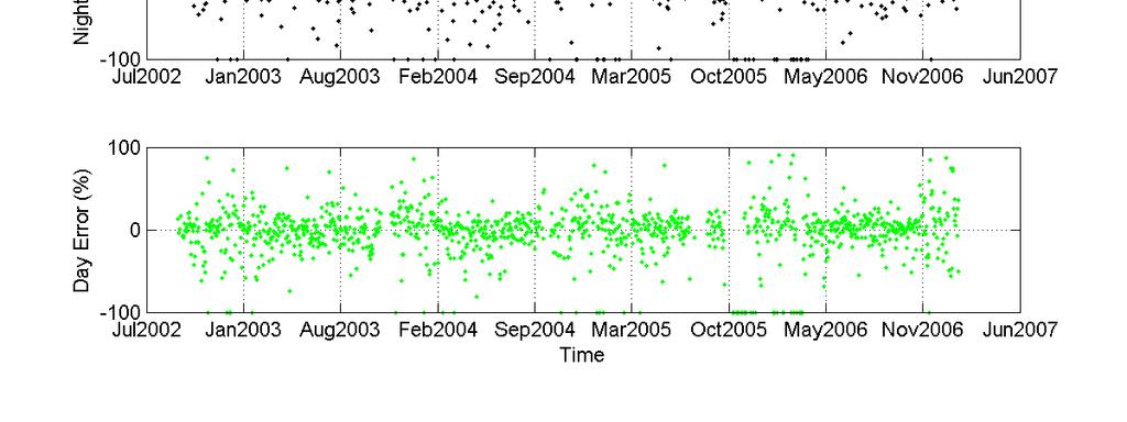
47
48
49
50
51 AIRS Over- Estimates Diurnal TPW Signal
52 IASI at SGP
53
54
55
56 Summary: AIRS & IASI TPW at SGP 1. AIRS Daytime TPW agrees with MWR ground truth to within 1%. 2. AIRS Nighttime TPW is 5-10 % too dry at night in summer (high humidity). About 5-10% too wet in winter (low humidity) 3. AIRS Day minus Night diurnal signal is real but larger in summer than MWR would indicate. 4. Preliminary IASI L2 comparison to MWR at SGP site suggests IASI is about 50% too wet in winter (low humidity) but without much skill (wide variance). IASI L2 is consistently 20% too dry in summer (high humidity) but with better skill (narrower distribution). Conclusions: AIRS water vapor biases are small but should be improved In order to use the data for climate studies. Peter Schussel indicated that an IASI L2 error has been corrected. This change should be re-evaluated against ARM SGP MWR data.
57
Comparison of NASA AIRS and MODIS Land Surface Temperature and Infrared Emissivity Measurements from the EOS AQUA platform
 Comparison of NASA AIRS and MODIS Land Surface Temperature and Infrared Emissivity Measurements from the EOS AQUA platform Robert Knuteson, Steve Ackerman, Hank Revercomb, Dave Tobin University of Wisconsin-Madison
AIRS and IASI Precipitable Water Vapor (PWV) Absolute Accuracy at Tropical, Mid-Latitude, and Arctic Ground-Truth Sites
 Absolute Accuracy at Tropical, Mid-Latitude, and Arctic Ground-Truth Sites") AIRS and IASI Precipitable Water Vapor (PWV) Absolute Accuracy at Tropical, Mid-Latitude, and Arctic Ground-Truth Sites Robert Knuteson, Sarah Bedka, Jacola Roman, Dave Tobin, Dave Turner, Hank Revercomb
AIRS and IASI Precipitable Water Vapor (PWV) Absolute Accuracy at Tropical, Mid-Latitude, and Arctic Ground-Truth Sites Robert Knuteson, Sarah Bedka, Jacola Roman, Dave Tobin, Dave Turner, Hank Revercomb
Cross-Sensor Continuity Science Algorithm
 Cross-Sensor Continuity Science Algorithm - Long Term Vegetation Index and Phenology Workshop - Javzan Tsend-Ayush and Tomoaki Miura Department of Natural Resources and Environmental Management University
Patrick Leinenkugel. German Aerospace Center (DLR) Vortrag > Autor > Dokumentname > Datum
 Vortrag > Autor > Dokumentname > Datum") Characterisation of land surface phenology and land cover for the Mekong Basin on the basis of multitemporal and multispectral satellite data from the MODIS Sensor Patrick Leinenkugel German Aerospace
Characterisation of land surface phenology and land cover for the Mekong Basin on the basis of multitemporal and multispectral satellite data from the MODIS Sensor Patrick Leinenkugel German Aerospace
Sensitivity Study of the MODIS Cloud Top Property
 Sensitivity Study of the MODIS Cloud Top Property Algorithm to CO 2 Spectral Response Functions Hong Zhang a*, Richard Frey a and Paul Menzel b a Cooperative Institute for Meteorological Satellite Studies,
Recent updates of the UW/CIMSS high spectral resolution global land surface infrared emissivity database
 Recent updates of the UW/CIMSS high spectral resolution global land surface infrared emissivity database Eva E. Borbas, Suzanne Wetzel Seemann, Robert O. Knuteson, Elisabeth Weisz, and Allen Huang Space
Using VIIRS Land Surface Temperature to Evaluate NCEP North American Mesoscale Model (NAM) Forecast
 Forecast") Using VIIRS Land Surface Temperature to Evaluate NCEP North American Mesoscale Model (NAM) Forecast Zhuo Wang (University of Maryland) Yunyue Yu (NOAA/NESDIS/STAR) Peng Yu (University of Maryland) Yuling
Using VIIRS Land Surface Temperature to Evaluate NCEP North American Mesoscale Model (NAM) Forecast Zhuo Wang (University of Maryland) Yunyue Yu (NOAA/NESDIS/STAR) Peng Yu (University of Maryland) Yuling
Comparison of Land Surface Infrared Spectral Emissivity Derived from MetOp IASI and Aqua AIRS
 Comparison of Land Surface Infrared Spectral Emissivity Derived from MetOp IASI and Aqua AIRS Robert Knuteson, Eva Borbas, Szu Chia Moeller, Henry Revercomb, Suzanne Seeman, and David Tobin CIMSS/SSEC,
Aircraft Validation of Infrared Emissivity derived from Advanced InfraRed Sounder Satellite Observations
 Aircraft Validation of Infrared Emissivity derived from Advanced InfraRed Sounder Satellite Observations Robert Knuteson, Fred Best, Steve Dutcher, Ray Garcia, Chris Moeller, Szu Chia Moeller, Henry Revercomb,
GIFTS SOUNDING RETRIEVAL ALGORITHM DEVELOPMENT
 P2.32 GIFTS SOUNDING RETRIEVAL ALGORITHM DEVELOPMENT Jun Li, Fengying Sun, Suzanne Seemann, Elisabeth Weisz, and Hung-Lung Huang Cooperative Institute for Meteorological Satellite Studies (CIMSS) University
C. Jimenez, C. Prigent, F. Aires, S. Ermida. Estellus, Paris, France Observatoire de Paris, France IPMA, Lisbon, Portugal
 All-weather land surface temperature estimates from microwave satellite observations, over several decades and real time: methodology and comparison with infrared estimates C. Jimenez, C. Prigent, F. Aires,
A high spectral resolution global land surface infrared emissivity database
 A high spectral resolution global land surface infrared emissivity database Eva E. Borbas, Robert O. Knuteson, Suzanne W. Seemann, Elisabeth Weisz, Leslie Moy, and Hung-Lung Huang Space Science and Engineering
Implementation of the NCEP operational GLDAS for the CFS land initialization
 Implementation of the NCEP operational GLDAS for the CFS land initialization Jesse Meng, Mickael Ek, Rongqian Yang NOAA/NCEP/EMC July 2012 1 Improving the Global Land Surface Climatology via improved Global
First steps toward a comparison of modelled thermal comfort during a heatwave in Melbourne, Australia
 First steps toward a comparison of modelled thermal comfort during a heatwave in Melbourne, Australia Stephanie Jacobs PhD supervisors: Ailie Gallant and Nigel Tapper Outline of talk Motivation for research
Single footprint sounding, surface emissivity and cloud property retrievals from hyperspectral infrared radiances under all sky conditions
 Single footprint sounding, surface emissivity and cloud property retrievals from hyperspectral infrared radiances under all sky conditions Jun Li @, Elisabeth Weisz @, Jinlong Li @, Allen Huang @, Chian-Yi
An Overview of the UW Hyperspectral Retrieval System for AIRS, IASI and CrIS
 An Overview of the UW Hyperspectral Retrieval System for AIRS, IASI and CrIS Nadia Smith a, Elisabeth Weisz b and William L. Smith Cooperative Institute for Meteorological Satellite Studies (CIMSS) Space
Sensitivity of Convective Indices to Humidity Adjustments
 Sensitivity of Convective Indices to Humidity Adjustments M. E. Splitt University of Utah Salt Lake City, Utah R. A. Peppler Cooperative Institute for Mesoscale Meteorological Studies University of Oklahoma
Methane Sensing Flight of Scanning HIS over Hutchinson, KS, 31 March 2001
 Methane Sensing Flight of Scanning HIS over Hutchinson, KS, 31 March 2001 Hank Revercomb, Chris Moeller, Bob Knuteson, Dave Tobin, Ben Howell University of Wisconsin, Space Science and Engineering Center
Status of Land Surface Temperature Product Development for JPSS Mission
 Status of Land Surface Temperature Product Development for JPSS Mission Yuling Liu 1,2, Yunyue Yu 2, Peng Yu 1,2 and Heshun Wang 1,2 1 ESSIC at University of Maryland, College Park, MD USA 2 Center for
AGOG 485/585 /APLN 533 Spring Lecture 5: MODIS land cover product (MCD12Q1). Additional sources of MODIS data
. Additional sources of MODIS data") AGOG 485/585 /APLN 533 Spring 2019 Lecture 5: MODIS land cover product (MCD12Q1). Additional sources of MODIS data Outline Current status of land cover products Overview of the MCD12Q1 algorithm Mapping
AGOG 485/585 /APLN 533 Spring 2019 Lecture 5: MODIS land cover product (MCD12Q1). Additional sources of MODIS data Outline Current status of land cover products Overview of the MCD12Q1 algorithm Mapping
remote sensing ISSN
 Remote Sens. 2014, 6, 8594-8616; doi:10.3390/rs6098594 Article OPEN ACCESS remote sensing ISSN 2072-4292 www.mdpi.com/journal/remotesensing Inter-Calibration of Satellite Passive Microwave Land Observations
Retrieval Algorithm Using Super channels
 Retrieval Algorithm Using Super channels Xu Liu NASA Langley Research Center, Hampton VA 23662 D. K. Zhou, A. M. Larar (NASA LaRC) W. L. Smith (HU and UW) P. Schluessel (EUMETSAT) Hank Revercomb (UW) Jonathan
CIMSS Hyperspectral IR Sounding Retrieval (CHISR) Processing & Applications
 Processing & Applications") CIMSS Hyperspectral IR Sounding Retrieval (CHISR) Processing & Applications Jun Li @, Elisabeth Weisz @, Jinlong Li @, Hui Liu #, Timothy J. Schmit &, Jason Otkin @ and many other CIMSS collaborators @Cooperative
CIMSS Hyperspectral IR Sounding Retrieval (CHISR) Processing & Applications Jun Li @, Elisabeth Weisz @, Jinlong Li @, Hui Liu #, Timothy J. Schmit &, Jason Otkin @ and many other CIMSS collaborators @Cooperative
Satellite-based Lake Surface Temperature (LST) Homa Kheyrollah Pour Claude Duguay
 Homa Kheyrollah Pour Claude Duguay") Satellite-based Lake Surface Temperature (LST) Homa Kheyrollah Pour Claude Duguay Lakes in NWP models Interaction of the atmosphere and underlying layer is the most important issue in climate modeling
Satellite-based Lake Surface Temperature (LST) Homa Kheyrollah Pour Claude Duguay Lakes in NWP models Interaction of the atmosphere and underlying layer is the most important issue in climate modeling
Synergistic Cloud Clearing Using Aqua Sounding and Imaging Infrared Measurements
 Synergistic Cloud Clearing Using Aqua Sounding and Imaging Infrared Measurements H-L Allen Huang, et al. CIMSS/SSEC Univ. of Wisconsin-Madison and William L. Smith, LaRC, NASA Cloud Clearing/Cloud Detection
Satellite data assimilation for Numerical Weather Prediction II
 Satellite data assimilation for Numerical Weather Prediction II Niels Bormann European Centre for Medium-range Weather Forecasts (ECMWF) (with contributions from Tony McNally, Jean-Noël Thépaut, Slide
Land biosphere atmosphere interactions over the Tibetan plateau from MODIS observations
 Environmental Research Letters LETTER Land biosphere atmosphere interactions over the Tibetan plateau from MODIS observations To cite this article: Menglin S Jin and Terrence J Mullens 2012 Environ. Res.
DEVELOPMENT OF GPS PHOTOS DATABASE FOR LAND USE AND LAND COVER APPLICATIONS
 DEVELOPMENT OF GPS PHOTOS DATABASE FOR LAND USE AND LAND COVER APPLICATIONS An Ngoc VAN and Wataru TAKEUCHI Institute of Industrial Science University of Tokyo 4-6-1 Komaba, Meguro-ku, Tokyo 153-8505 Japan
1. INTRODUCTION 2. CASE STUDIES DESCRIPTION
 27 Communicating Timely Information on Convective Available Potential Energy () using Geostationary and Polar Orbiting Satellite Sounders: Application to El Reno Event Jessie Gartzke 1,3, Steve Ackerman
Meteorological Satellite Image Interpretations, Part III. Acknowledgement: Dr. S. Kidder at Colorado State Univ.
 Meteorological Satellite Image Interpretations, Part III Acknowledgement: Dr. S. Kidder at Colorado State Univ. Dates EAS417 Topics Jan 30 Introduction & Matlab tutorial Feb 1 Satellite orbits & navigation
A Longwave Broadband QME Based on ARM Pyrgeometer and AERI Measurements
 A Longwave Broadband QME Based on ARM Pyrgeometer and AERI Measurements Introduction S. A. Clough, A. D. Brown, C. Andronache, and E. J. Mlawer Atmospheric and Environmental Research, Inc. Cambridge, Massachusetts
Clear-Air Forward Microwave and Millimeterwave Radiative Transfer Models for Arctic Conditions
 Clear-Air Forward Microwave and Millimeterwave Radiative Transfer Models for Arctic Conditions E. R. Westwater 1, D. Cimini 2, V. Mattioli 3, M. Klein 1, V. Leuski 1, A. J. Gasiewski 1 1 Center for Environmental
Global Broadband IR Surface Emissivity Computed from Combined ASTER and MODIS Emissivity over Land (CAMEL)
") P76 Global Broadband IR Surface Emissivity Computed from Combined ASTER and MODIS Emissivity over Land (CAMEL) Michelle Feltz, Eva Borbas, Robert Knuteson, Glynn Hulley*, Simon Hook* University of Wisconsin-Madison
P76 Global Broadband IR Surface Emissivity Computed from Combined ASTER and MODIS Emissivity over Land (CAMEL) Michelle Feltz, Eva Borbas, Robert Knuteson, Glynn Hulley*, Simon Hook* University of Wisconsin-Madison
Observations of Integrated Water Vapor and Cloud Liquid Water at SHEBA. James Liljegren
 Observations of Integrated Water Vapor and Cloud Liquid Water at SHEBA James Liljegren Ames Laboratory Ames, IA 515.294.8428 liljegren@ameslab.gov Introduction In the Arctic water vapor and clouds influence
Data assimilation of IASI radiances over land.
 Data assimilation of IASI radiances over land. PhD supervised by Nadia Fourrié, Florence Rabier and Vincent Guidard. 18th International TOVS Study Conference 21-27 March 2012, Toulouse Contents 1. IASI
Spectral surface emissivity for use in assimilation of IR radiance data over land
 Spectral surface emissivity for use in assimilation of IR radiance data over land 1 2 Małgorzata Szczech-Gajewska, Florence Rabier 1 Institute of Meteorology and Water Management ul. P. Borowego 14, Kraków,
Lecture 4b: Meteorological Satellites and Instruments. Acknowledgement: Dr. S. Kidder at Colorado State Univ.
 Lecture 4b: Meteorological Satellites and Instruments Acknowledgement: Dr. S. Kidder at Colorado State Univ. US Geostationary satellites - GOES (Geostationary Operational Environmental Satellites) US
THE VALIDATION OF GOES-LI AND AIRS TOTAL PRECIPITABLE WATER RETRIEVALS USING GROUND-BASED MEASUREMENTS
 THE VALIDATION OF GOES-LI AND AIRS TOTAL PRECIPITABLE WATER RETRIEVALS USING GROUND-BASED MEASUREMENTS Richard Dworak and Ralph A. Petersen Cooperative Institute for Meteorological Satellite Studies, University
AIRS observations of Dome Concordia in Antarctica and comparison with Automated Weather Stations during 2005
 AIRS observations of Dome Concordia in Antarctica and comparison with Automated Weather Stations during 2005, Dave Gregorich and Steve Broberg Jet Propulsion Laboratory California Institute of Technology
An Annual Cycle of Arctic Cloud Microphysics
 An Annual Cycle of Arctic Cloud Microphysics M. D. Shupe Science and Technology Corporation National Oceanic and Atmospheric Administration Environmental Technology Laboratory Boulder, Colorado T. Uttal
Yan Chen, Sunny Sun-Mack, and Robert F. Arduini Science Application International Corporation, Hampton, VA USA 23666
 5.6 CLEAR-SKY AND SURFACE NARROWBAND ALBEDO VARIATIONS DERIVED FROM VIRS AND MODIS DATA Yan Chen, Sunny Sun-Mack, and Robert F. Arduini Science Application International Corporation, Hampton, VA USA 23666
Lecture 19: Operational Remote Sensing in Visible, IR, and Microwave Channels
 MET 4994 Remote Sensing: Radar and Satellite Meteorology MET 5994 Remote Sensing in Meteorology Lecture 19: Operational Remote Sensing in Visible, IR, and Microwave Channels Before you use data from any
P2.7 A GLOBAL INFRARED LAND SURFACE EMISSIVITY DATABASE AND ITS VALIDATION
 P2.7 A GLOBAL INFRARED LAND SURFACE EMISSIVITY DATABASE AND ITS VALIDATION Eva E. Borbas*, Leslie Moy, Suzanne W. Seemann, Robert O. Knuteson, Paolo Antonelli, Jun Li, Hung-Lung Huang, Space Science and
Satellite data assimilation for NWP: II
 Satellite data assimilation for NWP: II Jean-Noël Thépaut European Centre for Medium-range Weather Forecasts (ECMWF) with contributions from many ECMWF colleagues Slide 1 Special thanks to: Tony McNally,
Quality Assessment of S-NPP VIIRS Land Surface Temperature Product
 Remote Sens. 2015, 7, 12215-12241; doi:10.3390/rs70912215 Article OPEN ACCESS remote sensing ISSN 2072-4292 www.mdpi.com/journal/remotesensing Quality Assessment of S-NPP VIIRS Land Surface Temperature
Lessons Learned with the AIRS Hyperspectral Sensor. L.Larrabee Strow
 AS and Lessons Learned with the AS Sensor L.Larrabee Strow Atmospheric Spectroscopy Laboratory (ASL) UMBC Physics Department and the Joint Center for Earth Systems Technology April 26, 2006 Thanks to:
Average Weather In March For Fukuoka, Japan
 Average Weather In March For Fukuoka, Japan Location This report describes the typical weather at the Fukuoka Airport (Fukuoka, Japan) weather station over the course of an average March. It is based on
Prediction Center (Hart, J. A., J. Whistler, R. Lindsay 1999).
.") 3.2 TEN YEAR CLIMATOLOGY OF CAPE OBSERVATIONS EAST OF THE ROCKY MOUNTAINS FROM HYPERSPECTRAL IR SOUNDERS Jessica Gartzke and R. Knuteson, S. A. Ackerman, W. Feltz, and G. Przybyl CIMSS/Univ. of Wisconsin,
3.2 TEN YEAR CLIMATOLOGY OF CAPE OBSERVATIONS EAST OF THE ROCKY MOUNTAINS FROM HYPERSPECTRAL IR SOUNDERS Jessica Gartzke and R. Knuteson, S. A. Ackerman, W. Feltz, and G. Przybyl CIMSS/Univ. of Wisconsin,
forest tropical jungle swamp marsh prairie savanna pampas Different Ecosystems (rainforest)
") Different Ecosystems forest A region of land that is covered with many trees and shrubs. tropical jungle (rainforest) swamp A region with dense trees and a variety of plant life. It has a tropical climate.
Different Ecosystems forest A region of land that is covered with many trees and shrubs. tropical jungle (rainforest) swamp A region with dense trees and a variety of plant life. It has a tropical climate.
Improvement and Sensitivity Analysis of the Atmospheric Chemistry Module for Modeling TICs in SCIPUFF
 Improvement and Sensitivity Analysis of the Atmospheric Chemistry Module for Modeling TICs in SCIPUFF Douglas S Burns, Veeradej Chynwat, William Moore, Jeffrey J Piotrowski, and Floyd Wiseman ENSCO, Inc.
P1.20 MICROWAVE LAND EMISSIVITY OVER COMPLEX TERRAIN: APPLIED TO TEMPERATURE PROFILING WITH NOGAPS ABSTRACT
 P1.0 MICROWAVE LAND EMISSIVITY OVER COMPLEX TERRAIN: APPLIED TO TEMPERATURE PROFILING WITH NOGAPS Benjamin Ruston *1, Thomas Vonder Haar 1, Andrew Jones 1, and Nancy Baker 1 Cooperative Institute for Research
STRATOSPHERIC TEMPERATURE MONITORING USING A COLLOCATED IR/ GPSRO DATASET
 STRATOSPHERIC TEMPERATURE MONITORING USING A COLLOCATED IR/ GPSRO DATASET Robert Knuteson, Michelle Feltz, Dave Tobin, Dan DeSlover, Hank Revercomb, and Steve Ackerman Uni. of Wisconsin- Madison Space
Hyperspectral IR clear and cloudy sounding retrieval study
 Hyperspectral IR clear and cloudy sounding retrieval study Jun Li @, Timothy J. Schmit #, Chian-Yi Liu @, Elisabeth Weisz @, Li Guan @, and Allen Huang @ @Cooperative Institute for Meteorological Satellite
Genera&on of the Daily OLR Climate Data Record
 Genera&on of the Daily OLR Climate Data Record Hai- Tien Lee 1, Carl J. Schreck 2,3, Kenneth R. Knapp 3 1 University of Maryland, College Park, Maryland, USA 2 North Carolina State University, Raleigh,
Calculating Drive-time Buffers and Territories with Sparse Road Network
 Calculating Drive-time Buffers and Territories with Sparse Road Network Ran Tao 1, Jean-Claude Thill 1, James Walsh 1 Daniel Strandow 2, Michael Findley 3 1 University of North Carolina at Charlotte 2
REVISION OF THE STATEMENT OF GUIDANCE FOR GLOBAL NUMERICAL WEATHER PREDICTION. (Submitted by Dr. J. Eyre)
") WORLD METEOROLOGICAL ORGANIZATION Distr.: RESTRICTED CBS/OPAG-IOS (ODRRGOS-5)/Doc.5, Add.5 (11.VI.2002) COMMISSION FOR BASIC SYSTEMS OPEN PROGRAMME AREA GROUP ON INTEGRATED OBSERVING SYSTEMS ITEM: 4 EXPERT
WORLD METEOROLOGICAL ORGANIZATION Distr.: RESTRICTED CBS/OPAG-IOS (ODRRGOS-5)/Doc.5, Add.5 (11.VI.2002) COMMISSION FOR BASIC SYSTEMS OPEN PROGRAMME AREA GROUP ON INTEGRATED OBSERVING SYSTEMS ITEM: 4 EXPERT
CORRELATION BETWEEN ATMOSPHERIC COMPOSITION AND VERTICAL STRUCTURE AS MEASURED BY THREE GENERATIONS OF HYPERSPECTRAL SOUNDERS IN SPACE
 CORRELATION BETWEEN ATMOSPHERIC COMPOSITION AND VERTICAL STRUCTURE AS MEASURED BY THREE GENERATIONS OF HYPERSPECTRAL SOUNDERS IN SPACE Nadia Smith 1, Elisabeth Weisz 1, and Allen Huang 1 1 Space Science
A Comparison of Clear-Sky Emission Models with Data Taken During the 1999 Millimeter-Wave Radiometric Arctic Winter Water Vapor Experiment
 A Comparison of Clear-Sky Emission Models with Data Taken During the 1999 Millimeter-Wave Radiometric Arctic Winter Water Vapor Experiment E. R. Westwater, Y. Han, A. Gasiewski, and M. Klein Cooperative
Feature-tracked 3D Winds from Satellite Sounders: Derivation and Impact in Global Models
 Feature-tracked 3D Winds from Satellite Sounders: Derivation and Impact in Global Models David Santek, Anne-Sophie Daloz 1, Samantha Tushaus 1, Marek Rogal 1, Will McCarty 2 1 Space Science and Engineering
P2.7 CHARACTERIZATION OF AIRS TEMPERATURE AND WATER VAPOR MEASUREMENT CAPABILITY USING CORRELATIVE OBSERVATIONS
 P2.7 CHARACTERIZATION OF AIRS TEMPERATURE AND WATER VAPOR MEASUREMENT CAPABILITY USING CORRELATIVE OBSERVATIONS Eric J. Fetzer, Annmarie Eldering and Sung -Yung Lee Jet Propulsion Laboratory, California
Study of the Influence of Thin Cirrus Clouds on Satellite Radiances Using Raman Lidar and GOES Data
 Study of the Influence of Thin Cirrus Clouds on Satellite Radiances Using Raman Lidar and GOES Data D. N. Whiteman, D. O C. Starr, and G. Schwemmer National Aeronautics and Space Administration Goddard
CH. 3: Climate and Vegetation
 CH. 3: Climate and Vegetation GROUP WORK RUBRIC Score of 50 (5): Superior - 100% A 5 is superior work, and has completed all requirements of the assignments, it is in order and its presentation is almost
Mario Flores, Graduate Student Department of Applied Mathematics, UTSA. EES 5053: Remote Sensing
 Mario Flores, Graduate Student Department of Applied Mathematics, UTSA Miguel Balderas, E.I.T., Graduate Student Department of Civil/Environmental Engineering, UTSA EES 5053: Remote Sensing REMOTE SENSING
Ice Surface temperatures, status and utility. Jacob Høyer, Gorm Dybkjær, Rasmus Tonboe and Eva Howe Center for Ocean and Ice, DMI
 Ice Surface temperatures, status and utility Jacob Høyer, Gorm Dybkjær, Rasmus Tonboe and Eva Howe Center for Ocean and Ice, DMI Outline Motivation for IST data production IST from satellite Infrared Passive
Introduction of the Hyperspectral Environmental Suite (HES) on GOES-R and beyond
 on GOES-R and beyond") Introduction of the Hyperspectral Environmental Suite (HES) on GOES-R and beyond Timothy J. Schmit SaTellite Applications and Research (STAR) Advanced Satellite Products Team (ASPT) Presented by Jun Li
Introduction of the Hyperspectral Environmental Suite (HES) on GOES-R and beyond Timothy J. Schmit SaTellite Applications and Research (STAR) Advanced Satellite Products Team (ASPT) Presented by Jun Li
METEOSAT SECOND GENERATION DATA FOR ASSESSMENT OF SURFACE MOISTURE STATUS
 METEOSAT SECOND GENERATION DATA FOR ASSESSMENT OF SURFACE MOISTURE STATUS Simon Stisen (1), Inge Sandholt (1), Rasmus Fensholt (1) (1) Institute of Geography, University of Copenhagen, Oestervoldgade 10,
Changes in Seasonal Albedo with Land Cover Class
 Name: Date: Changes in Seasonal Albedo with Land Cover Class Guiding question: How does albedo change over the seasons in different land cover classes? Introduction. Now that you have completed the Introduction
Application of the UW/CIMSS high spectral resolution global IR land surface emissivity database into the RTTOV model
 Application of the UW/CIMSS high spectral resolution global IR land surface emissivity database into the RTTOV model Eva Borbas 1, Ben Ruston 2, Roger Saunders 3, Andrew Collard 3, Robert Knuteson 1, James
x = x a +(K T S e -1 K+S a -1 ) -1 K T S e -1 *[R-F(x)+K*(x-x a )]
![x = x a +(K T S e -1 K+S a -1 ) -1 K T S e -1 *[R-F(x)+K*(x-x a )]](/thumbs/86/93497200.jpg "x = x a +(K T S e -1 K+S a -1 ) -1 K T S e -1 *[R-F(x)+K*(x-x a )]") P2.7 RETRIEVALS OF ATMOSPHERIC THERMODYNAMIC STRUCTURE FROM UNIVERSITY OF WISCONSIN SCANNING-HIGH-RESOLUTION INTERFEROMETER SOUNDER (S-HIS) UPWELLING RADIANCE OBSERVATIONS USING A BAYESIAN MAXIMUM A POSTERIORI
P2.7 RETRIEVALS OF ATMOSPHERIC THERMODYNAMIC STRUCTURE FROM UNIVERSITY OF WISCONSIN SCANNING-HIGH-RESOLUTION INTERFEROMETER SOUNDER (S-HIS) UPWELLING RADIANCE OBSERVATIONS USING A BAYESIAN MAXIMUM A POSTERIORI
An Atmospheric Chemistry Module for Modeling Toxic Industrial Chemicals (TICs) in SCIPUFF
 in SCIPUFF") An Atmospheric Chemistry Module for Modeling Toxic Industrial Chemicals (TICs) in SCIPUFF Douglas S Burns, Veeradej Chynwat, Jeffrey J Piotrowski, Kia Tavares, and Floyd Wiseman ENSCO, Inc. Science and
An Atmospheric Chemistry Module for Modeling Toxic Industrial Chemicals (TICs) in SCIPUFF Douglas S Burns, Veeradej Chynwat, Jeffrey J Piotrowski, Kia Tavares, and Floyd Wiseman ENSCO, Inc. Science and
Lectures 7 and 8: 14, 16 Oct Sea Surface Temperature
 Lectures 7 and 8: 14, 16 Oct 2008 Sea Surface Temperature References: Martin, S., 2004, An Introduction to Ocean Remote Sensing, Cambridge University Press, 454 pp. Chapter 7. Robinson, I. S., 2004, Measuring
Dynamic Infrared Land Surface Emissivity Atlas based on IASI Retrievals
 Dynamic Infrared Land Surface Emissivity Atlas based on IASI Retrievals EUMETSAT Fellowship 2015-2018 Rory Gray rory.gray@metoffice.gov.uk Thanks to: Ed Pavelin, Bill Bell, Chawn Harlow www.metoffice.gov.uk
Atmospheric Soundings of Temperature, Moisture and Ozone from AIRS
 Atmospheric Soundings of Temperature, Moisture and Ozone from AIRS M.D. Goldberg, W. Wolf, L. Zhou, M. Divakarla,, C.D. Barnet, L. McMillin, NOAA/NESDIS/ORA Oct 31, 2003 Presented at ITSC-13 Risk Reduction
Microphysical Properties of Single and Mixed-Phase Arctic Clouds Derived From Ground-Based AERI Observations
 Microphysical Properties of Single and Mixed-Phase Arctic Clouds Derived From Ground-Based AERI Observations Dave Turner University of Wisconsin-Madison Pacific Northwest National Laboratory 8 May 2003
RTTOV 10 Theory & Exercise
 RTTOV 10 Theory & Exercise Ø Overview of RTTOVS Radiative Transfer Model q Gases Absorption (water Vapor & other trace gases) q Aerosol/Clouds Scattering and Absorption q Surface Emissivity/Reflectivity
Towards a better use of AMSU over land at ECMWF
 Towards a better use of AMSU over land at ECMWF Blazej Krzeminski 1), Niels Bormann 1), Fatima Karbou 2) and Peter Bauer 1) 1) European Centre for Medium-range Weather Forecasts (ECMWF), Shinfield Park,
Comparisons of IR Sounder and COSMIC Radio Occultation Temperatures: Guidance for CrIS NUCAPS Validation
 Comparisons of IR Sounder and COSMIC Radio Occultation Temperatures: Guidance for CrIS NUCAPS Validation Michelle Feltz, Robert Knuteson, Lori Borg, Steve Ackerman, Dave Tobin UW Madison SSEC / CIMSS 02Nov2015
The QME AERI LBLRTM: A Closure Experiment for Downwelling High Spectral Resolution Infrared Radiance
 VOL. 61, NO. 22 JOURNAL OF THE ATMOSPHERIC SCIENCES 15 NOVEMBER 2004 The QME AERI LBLRTM: A Closure Experiment for Downwelling High Spectral Resolution Infrared Radiance D. D. TURNER,* D. C. TOBIN, S.
Michelle Feltz, Robert Knuteson, Dave Tobin, Tony Reale*, Steve Ackerman, Henry Revercomb
 P1 METHODOLOGY FOR THE VALIDATION OF TEMPERATURE PROFILE ENVIRONMENTAL DATA RECORDS (EDRS) FROM THE CROSS-TRACK INFRARED MICROWAVE SOUNDING SUITE (CRIMSS): EXPERIENCE WITH RADIO OCCULTATION FROM COSMIC
Joint Airborne IASI Validation Experiment (JAIVEx) - An Overview
 - An Overview") Joint Airborne IASI Validation Experiment (JAIVEx) - An Overview W. Smith 1,2, A. Larar 3, J.Taylor 4, H. Revercomb 2, S. Kireev 1, D. Zhou 3, X. Liu 3, D. Tobin 2, S. Newman 4, P. Schluessel 5, X. Calbet
Joint Airborne IASI Validation Experiment (JAIVEx) - An Overview W. Smith 1,2, A. Larar 3, J.Taylor 4, H. Revercomb 2, S. Kireev 1, D. Zhou 3, X. Liu 3, D. Tobin 2, S. Newman 4, P. Schluessel 5, X. Calbet
Coupling Climate to Clouds, Precipitation and Snow
 Coupling Climate to Clouds, Precipitation and Snow Alan K. Betts akbetts@aol.com http://alanbetts.com Co-authors: Ray Desjardins, Devon Worth Agriculture and Agri-Food Canada Shusen Wang and Junhua Li
Retrieval Hyperspectrally-Resolved Surface IR Emissivity
 Retrieval Hyperspectrally-Resolved Surface IR Emissivity Daniel K. Zhou, Allen M. Larar, Xu Liu, William L. Smith, L. Larrabee Strow, P. Yang, and Peter Schlüsse OUTLINE: Motivation & Goal Ret. Algorithms
Fine atmospheric structure retrieved from IASI and AIRS under all weather conditions
 Fine atmospheric structure retrieved from IASI and AIRS under all weather conditions Daniel K. Zhou 1, William L. Smith 2,3, Allen M. Larar 1, Xu Liu 1, Jonathan P. Taylor 4, Peter Schlüssel 5, L. Larrabee
School on Modelling Tools and Capacity Building in Climate and Public Health April Remote Sensing
 2453-5 School on Modelling Tools and Capacity Building in Climate and Public Health 15-26 April 2013 Remote Sensing CECCATO Pietro International Research Institute for Climate and Society, IRI The Earth
Steve Ackerman, R. Holz, R Frey, S. Platnick, A. Heidinger, and a bunch of others.
 Steve Ackerman, R. Holz, R Frey, S. Platnick, A. Heidinger, and a bunch of others. Outline Using CALIOP to Validate MODIS Cloud Detection, Cloud Height Assignment, Optical Properties Clouds and Surface
16 Global Climate. Learning Goals. Summary. After studying this chapter, students should be able to:
 16 Global Climate Learning Goals After studying this chapter, students should be able to: 1. associate the world s six major vegetation biomes to climate (pp. 406 408); 2. describe methods for classifying
The MODIS Cloud Data Record
 The MODIS Cloud Data Record Brent C. Maddux 1,2 Steve Platnick 3, Steven A. Ackerman 1 Paul Menzel 1, Kathy Strabala 1, Richard Frey 1, 1 Cooperative Institute for Meteorological Satellite Studies, 2 Department
Climate Applications from High Spectral Resolution Infrared Sounders
 Climate Applications from High Spectral Resolution Infrared Sounders Mitchell D. Goldberg, Lihang Zhou, and Xingpin Liu National Oceanic and Atmospheric Administration, National Environmental Satellite,
GUEDJ Stephanie KARBOU Fatima RABIER Florence LSA-SAF User Workshop 2010, Toulouse
 CNRM/GAME GUEDJ Stephanie KARBOU Fatima RABIER Florence LSA-SAF User Workshop 2010, Toulouse INTRODUCTION (1/3) SEVIRI instrument Radiometer onboard METEOSAT-8/-9 (geostationnary) Measures «top-of-atmosphere»
Working Together on the Stratosphere: Comparisons of RO and Hyperspectral IR Data in Temperature and Radiance Space
 Working Together on the Stratosphere: Comparisons of RO and Hyperspectral IR Data in Temperature and Radiance Space Michelle Feltz, Robert Knuteson, Johannes Nielsen 1, Lori Borg, Thomas August 2, Tim
Comparison of MSG-SEVIRI and SPOT-VEGETATION data for vegetation monitoring over Africa
 Comparison of MSG-SEVIRI and SPOT-VEGETATION data for vegetation monitoring over Africa Bernard LACAZE CNRS UMR 8586 PRODIG Pôle Image et Campus Spatial, Université Paris Diderot Paris 7 Objectives Comparison
Extending the use of surface-sensitive microwave channels in the ECMWF system
 Extending the use of surface-sensitive microwave channels in the ECMWF system Enza Di Tomaso and Niels Bormann European Centre for Medium-range Weather Forecasts Shinfield Park, Reading, RG2 9AX, United
Performance of the AIRS/AMSU And MODIS Soundings over Natal/Brazil Using Collocated Sondes: Shadoz Campaign
 Performance of the AIRS/AMSU And MODIS Soundings over Natal/Brazil Using Collocated Sondes: Shadoz Campaign 2004-2005 Rodrigo Augusto Ferreira de Souza, Jurandir Rodrigues Ventura, Juan Carlos Ceballos
Long-Term Time Series of Water Vapour Total Columns from GOME, SCIAMACHY and GOME-2
 Graphics: ESA Graphics: ESA Graphics: ESA Long-Term Time Series of Water Vapour Total Columns from GOME, SCIAMACHY and GOME-2 S. Noël, S. Mieruch, H. Bovensmann, J. P. Burrows Institute of Environmental
Characterizing the Impact of Hyperspectral Infrared Radiances near Clouds on Global Atmospheric Analyses
 Characterizing the Impact of Hyperspectral Infrared Radiances near Clouds on Global Atmospheric Analyses Will McCarty NASA Session 9a: Assimilation Studies Clouds ITSC-XIX Jeju Island, South Korea 28 March
The Use of Hyperspectral Infrared Radiances In Numerical Weather Prediction
 The Use of Hyperspectral Infrared Radiances In Numerical Weather Prediction J. Le Marshall 1, J. Jung 1, J. Derber 1, T. Zapotocny 2, W. L. Smith 3, D. Zhou 4, R. Treadon 1, S. Lord 1, M. Goldberg 1 and
Variability in Global Top-of-Atmosphere Shortwave Radiation Between 2000 And 2005
 Variability in Global Top-of-Atmosphere Shortwave Radiation Between 2000 And 2005 Norman G. Loeb NASA Langley Research Center Hampton, VA Collaborators: B.A. Wielicki, F.G. Rose, D.R. Doelling February
Energy Systems, Structures and Processes Essential Standard: Analyze patterns of global climate change over time Learning Objective: Differentiate
 Energy Systems, Structures and Processes Essential Standard: Analyze patterns of global climate change over time Learning Objective: Differentiate between weather and climate Global Climate Focus Question
Retrieval of atmospheric profiles and surface parameters from METEOR - 3M IR- and MW- sounders data
 The 19th International TOVS Study Conference (ITSC-19) Retrieval of atmospheric profiles and surface parameters from METEOR - 3M IR- and MW- sounders data Polyakov, Alexander 1, Kostsov, Vladimir 1, Timofeyev,
The Retrieval of Infrared Cooling Rate Profiles from Thermal Infrared Remote Sounder Radiance Measurements
 The Retrieval of Infrared Cooling Rate Profiles from Thermal Infrared Remote Sounder Radiance Measurements Daniel Feldman Candidacy Presentation May 13, 2005 Outline 1. Background 2. Motivation 3. Cooling