A Facility for Producing Consistent Remotely Sensed Biophysical Data Products of Australia
|
|
|
- Christine McKenzie
- 5 years ago
- Views:
Transcription

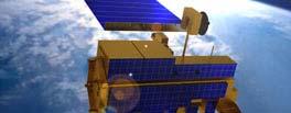
1 TERRESTRIAL ECOSYSTEM RESEARCH NETWORK - AusCover - A Facility for Producing Consistent Remotely Sensed Biophysical Data Products of Australia June, 2011 Mervyn Lynch Professor of Remote Sensing Curtin University Leader of the Perth AusCover Node m.lynch@curtin.edu.au 1
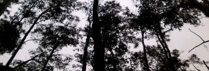
2 The Scope of AusCover Outline of Presentation Moderate to Low Resolution Remote Sensing Data Sets Delivered via Portal Field Data Collection Program NIST referenced optical calibration lab at Curtin Validation of Products /attach uncertainty High Spatial Resolution Remote Sensing Products via the Portal 2
3 AusCover Scope AusCover remote sensing data archive and access capability (DAAC) launched in the first half of 2010 One of several TERN facilities Current funding till mid-2014 [incl EIF funding] Delivery of consistent national time-series of remotely sensed biophysical parameters To support ecosystem research and natural resource management communities in Australia LANDSAT, MODIS, AVHRR among others Consistently formatted and detailed metadata Publically accessible and retrievable through the online AusCover data portal 3
4 AusCover Portal eg for NDVI 4
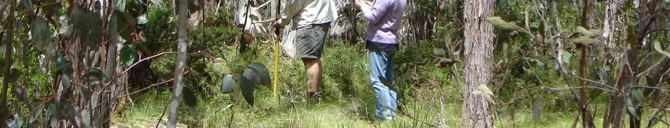
5 Moderate-Low Resolution Data Sets Delivered by AusCover Products Ecosystem dynamics Land Cover Green Land Cover Leaf Area Index FPAR Foliage Projected Cover Ground cover fraction Forest cover National ecosystems map Water bodies Vegetation height Land cover moisture Above ground Vegetation Biomass Additional Products Fire National MODIS mosaics Atmospheric products Climatologic products Site focussed 5
6 Metadata Considered equally important to image data AVHRR NDVI Normalised Difference Vegetation Index (NDVI) derived from AVHRR Vegetation greenness time series Synopsis NDVI is an index of the amount and greenness of live green vegetation. AVHRR NDVI gives a long time series overview of the dynamics of vegetation. Spatial resolution: 0.01, 0.05 Spatial coverage: Australia, land only Temporal resolution: 3 per month, monthly Temporal coverage: April 1992 present Custodian: Bureau of Meteorology Sensor & platform: AVHRR on NOAA-11 to -18 Algorithm date: 2008 Production date: 2008, then near real time Use limitation: Some licence description Algorithm: Data up to June 2008 is stitched passes from CSIRO. Subsequent data is unstitched near real time passes from Bureau of Meteorology. CAPS navigation, cloud masking, regridding. Calibration drift detrended and locked to NOAA-14 by invariant semi-arid IBRA regions. No atmospheric or angular corrections. Compositing by maximum value NDVI. Datasets AVHRR NDVI, 0.01, 3 per Month: Available September 2011 AVHRR NDVI, 0.05, 3 per Month: Available September 2011 AVHRR NDVI, 0.01, Monthly: AVHRR NDVI, 0.05 Monthly: Overview The Normalised Difference Vegetation Index (NDVI) grids and maps are derived from satellite data. The data provides an overview of the status and dynamics of vegetation across Australia, providing a measure the amount of live green vegetation. The satellite data comes from the Advanced Very High Resolution Radiometer (AVHRR) instruments on board the National 6


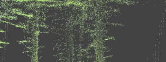
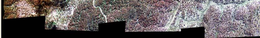
7 Linking Data Sets Scaling Up High-Resolution, Field-based Measurements Medium/Low-Resolution, Space-based Measurements Canopy Lidar Point-Clouds Continental Dynamics in Green Cover 7

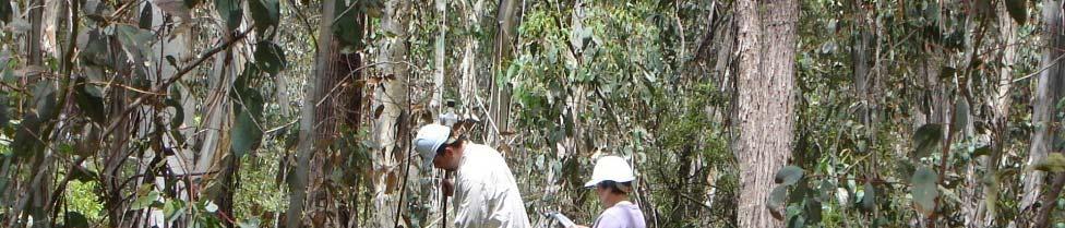
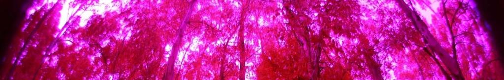
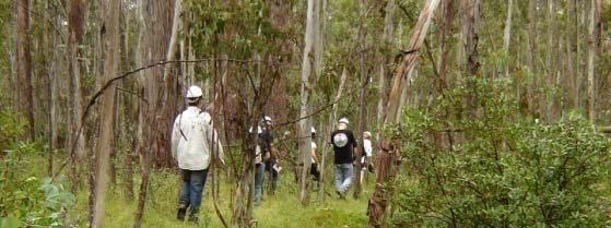
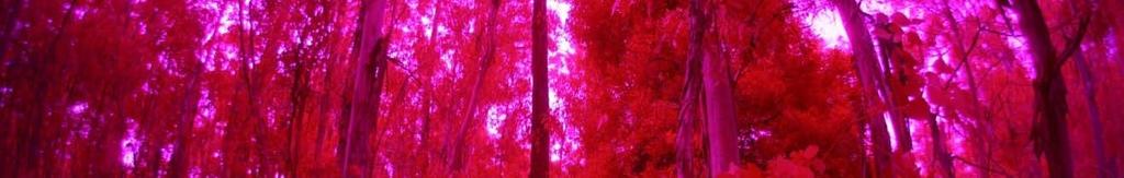
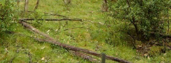
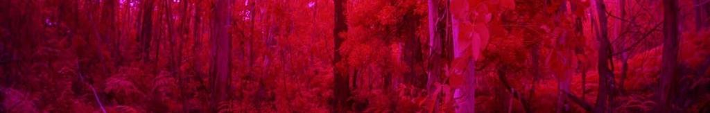
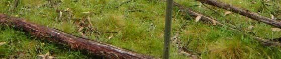
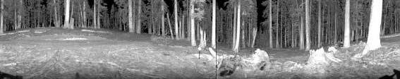
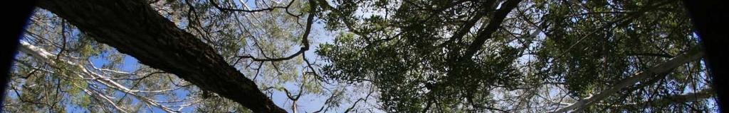
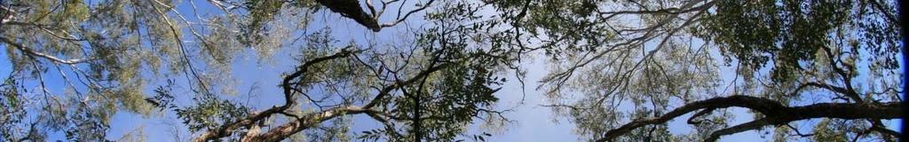
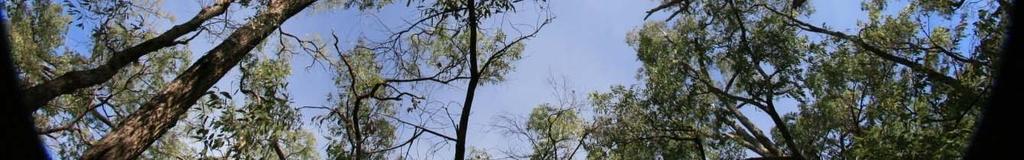
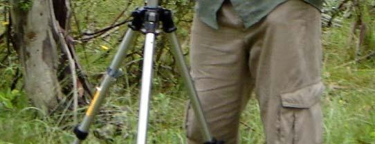
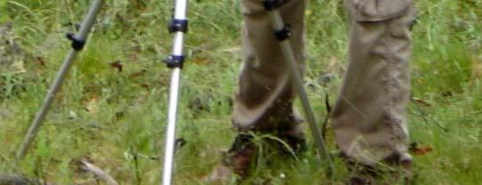
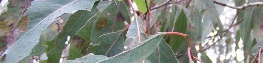
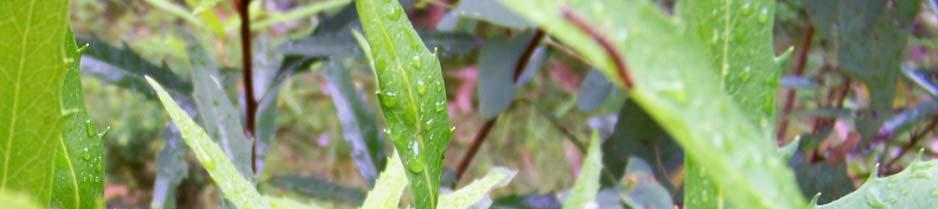
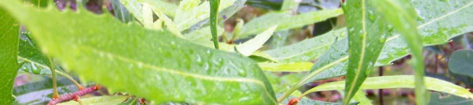
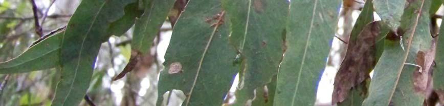
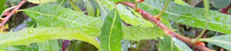
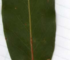
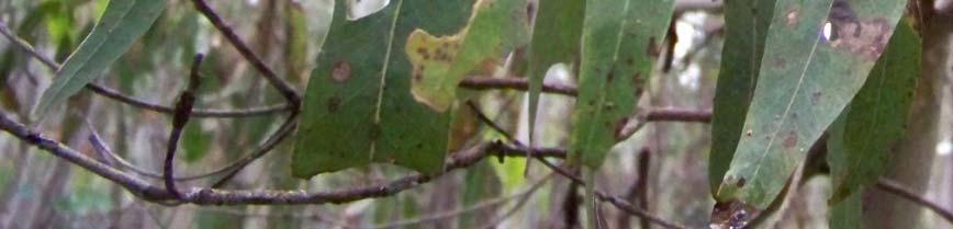
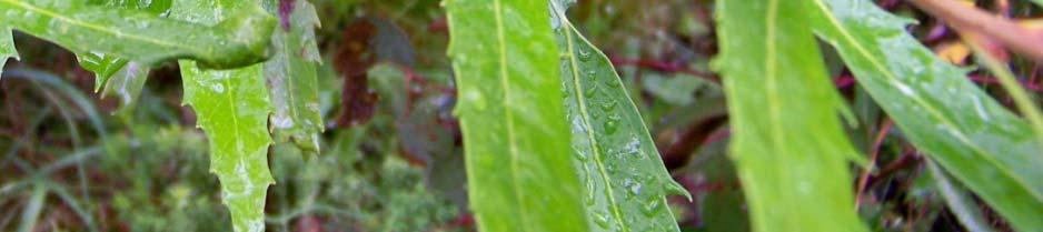
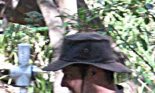
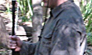
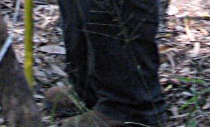
8 Field Photos - Tumbarumba 8
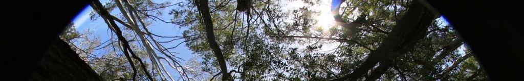
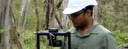

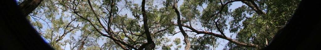
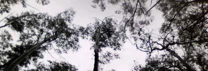
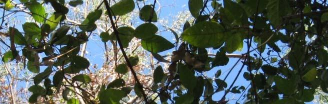
9 Hemispherical Photography 9
10 Spectroradiometric Measurements Reflectance Wavelength (nm) Leaf 1 Leaf 2 Leaf 3 Leaf 4 Leaf 5 10

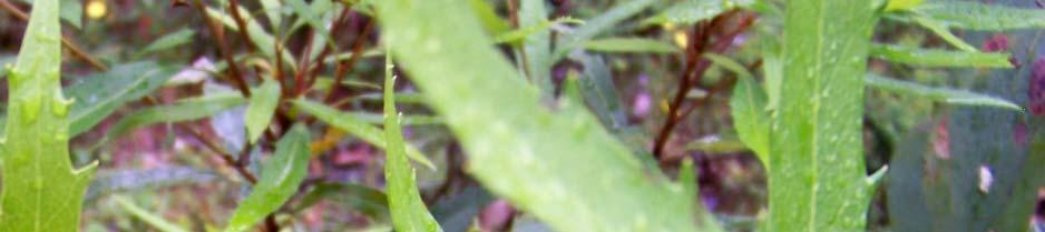
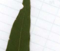
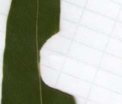

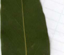

11 Leaf Samples and Their Properties 11
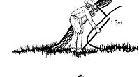
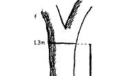
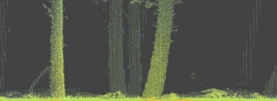
12 Basic Structural Measurements 12
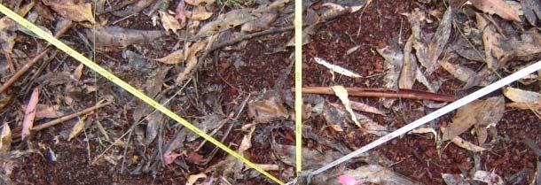
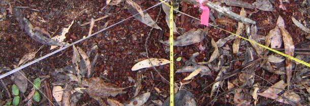
13 Foliage Projective Cover & Fractional Ground Cover 13

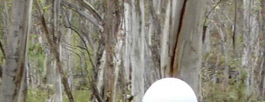
14 AusPlots LAI Eg LAI2200 instrument t 14
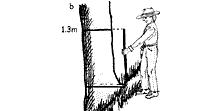
15 Validation Dominant biomes Homogenous 5 x 5 km sites (CEOS Bigfoot) Flux tower TLS FPC / Structure Hemi / LAI
16 WorldView-2 WorldView 2 - Tumbarumba 16
17 WorldView-2 - Tumbarumba 17

18 Hymap - Tumbarumba 18
19 CW LIDAR - Tumbarumba 19


20 AusCover MODIS Cloud Products MODIS Cloud Mask Cloud Detection MODISCloud Top Properties Bulk Cloud Properties MODISCloud Optical Properties Cloud Microphysics Applications: Hydrodynamic cycle thin cloud detection and screening


21 AusCover MODIS Atmosphere Products MODIS Atmospheric Profiles Vertical Temperature Vertical Water Vapor MODIS Water Vapor Precipitable Water Vapor Applications: Hydrodynamic cycle Model assimilation Atmospheric Dynamics


22 AusCover MODIS Surface Products MODIS Daily Dil Land dsurface Temperature MODIS Atmospheric and BRDF Corrected Reflectance Optimized for Australian land surface conditions Numerous applications VIIRS extension
23 Status of RS Data Delivery by Perth AusCover Node # of Products Coding of Status of Products Shipping to Data Fabric / AusCover Server In production / testing for shipping Tested for production Under development Preliminary Total = 89 products of which 57 [64%] currently are being delivered and another 19 products [21%] close to delivery which will bring the tally to 85%.
24 LIDAR DEM, DTM Canopy height Foliage Projective Cover Vertical Profiles Tree density LAI Hyper-Spectral data Proposed High Resolution Data Products At-Surface Reflectance Leaf / Canopy properties: N, H 2 O, chlorophyll content Unmixing: i Photsynthetic th ti vegetation ti NV, NPV and bare ground WorldView-2 Imagery Land cover / Structural category classification Visual image interpretation for cal/val airborne data products 24
25 Product Deliveries via Portal LIDAR data: Las format, ascii All derived products Metadata, including processing steps and validation results Hyperspectral data: Reflectance All derived products Metadata, including processing steps and validation results WorldView-2 data: All derived products Metadata, including processing steps and validation results 25
26 Engaging g g with End Users AusCover User Reference Group Ensuring use of final products Ensuring suitable data formats Ensuring suitable accuracies are achieved Involving state and federal government agencies and NGO s Building on existing approaches Integrating existing field and image data International remote sensing community 26


27 Future Outlooks Focus areas suitable for long-term ecosystem monitoring Consistent data sets Consistent processing Consistent validation Consistent products and metadata t All data available via online portal 27
28 Products Ecosystem dynamics Land Cover (DLCM) Time series Green Land Cover Leaf Area Index Time series FPAR Foliage Projected Cover (FPC, Landsat) Ground cover fraction Forest cover (>20%) Sparse forest cover (<20%) National ecosystems map Water bodies Vegetation height Land cover moisture Ancillary Solar radiation/par Rainfall Air temperature Humidity Wind run NWP wind Albedo Soil moisture (Satellite?, Modelled) Continental shape files AWAP outputs Soil Moisture (Upper, Lower) Total Evaporation Aboveground Vegetation Biomass Cover Dynamics Transpiration Fire, LST Soil Evaporation Burnt area Potential Evaporation Fire frequency Local Discharge Fire radiative energy Surface Runoff Grassland curing LST National MODIS mosaics MOD09 Surface Reflectance M*D11 MD11 LST and emissivity MCD12 Land cover type & dynamics MOD13 Vegetation Indices (NDVI, EVI) MOD14 Thermal anomalies / Fire MOD15 LAI and fpar MOD17 Gross Primary Productivity MCD43 BRDF and Albedo (NBAR) MOD44 Vegetation Continuous Fields MCD45 Burned area Inputs to satellite processing Mean sea level pressure (NWP) Total column water vapour (NWP) Total column ozone Aerosol optical depth Deep Drainage Sensible Heat Latent Heat Base satellite Land surface reflectance (Landsat, MODIS, AVHRR) Brightness temperatures (AVHRR, GEO) AVHRR (stitched passes, composites, PAL) ATSR1,2/AATSR/MERIS Hyperion Site focused Land surface reflectance (100+ bands, air/in-situ) Lidar (air, ground) MODIS atmosphere Cloud top properties Cloud optical properties Aerosol, smoke, dust Atmospheric profiles Column water vapour
Inter- Annual Land Surface Variation NAGS 9329
 Annual Report on NASA Grant 1 Inter- Annual Land Surface Variation NAGS 9329 PI Stephen D. Prince Co-I Yongkang Xue April 2001 Introduction This first period of operations has concentrated on establishing
Dynamic Land Cover Dataset Product Description
 Dynamic Land Cover Dataset Product Description V1.0 27 May 2014 D2014-40362 Unclassified Table of Contents Document History... 3 A Summary Description... 4 Sheet A.1 Definition and Usage... 4 Sheet A.2
Geoscience Australia Report on Cal/Val Activities
 Medhavy Thankappan Geoscience Australia Agency Report I Berlin May 6-8, 2015 Outline 1. Calibration / validation at Geoscience Australia Corner reflector infrastructure for SAR calibration (for information)
Recent Update on MODIS C6 and VIIRS Deep Blue Aerosol Products
 Recent Update on MODIS C6 and VIIRS Deep Blue Aerosol Products N. Christina Hsu, Photo taken from Space Shuttle: Fierce dust front over Libya Corey Bettenhausen, Andrew M. Sayer, and Rick Hansell Laboratory
Greening of Arctic: Knowledge and Uncertainties
 Greening of Arctic: Knowledge and Uncertainties Jiong Jia, Hesong Wang Chinese Academy of Science jiong@tea.ac.cn Howie Epstein Skip Walker Moscow, January 28, 2008 Global Warming and Its Impact IMPACTS
Assimilating terrestrial remote sensing data into carbon models: Some issues
 University of Oklahoma Oct. 22-24, 2007 Assimilating terrestrial remote sensing data into carbon models: Some issues Shunlin Liang Department of Geography University of Maryland at College Park, USA Sliang@geog.umd.edu,
Assimilation of satellite derived soil moisture for weather forecasting
 Assimilation of satellite derived soil moisture for weather forecasting www.cawcr.gov.au Imtiaz Dharssi and Peter Steinle February 2011 SMOS/SMAP workshop, Monash University Summary In preparation of the
Evaluation of a MODIS Triangle-based Algorithm for Improving ET Estimates in the Northern Sierra Nevada Mountain Range
 Evaluation of a MODIS Triangle-based Algorithm for Improving ET Estimates in the Northern Sierra Nevada Mountain Range Kyle R. Knipper 1, Alicia M. Kinoshita 2, and Terri S. Hogue 1 January 5 th, 2015
Moderate Resolution Imaging Spectroradiometer (MODIS) Products and Potential Applications For Environmental and Climatic Monitoring in China
 Products and Potential Applications For Environmental and Climatic Monitoring in China") Moderate Resolution Imaging Spectroradiometer (MODIS) Products and Potential Applications For Environmental and Climatic Monitoring in China Jianhe (John) Qu Center for Earth Observing and Space Research
Moderate Resolution Imaging Spectroradiometer (MODIS) Products and Potential Applications For Environmental and Climatic Monitoring in China Jianhe (John) Qu Center for Earth Observing and Space Research
McIDAS support of Suomi-NPP /JPSS and GOES-R L2
 McIDAS support of Suomi-NPP /JPSS and GOES-R L2 William Straka III 1 Tommy Jasmin 1, Bob Carp 1 1 Cooperative Institute for Meteorological Satellite Studies, Space Science and Engineering Center, University
THE LAND-SAF SURFACE ALBEDO AND DOWNWELLING SHORTWAVE RADIATION FLUX PRODUCTS
 THE LAND-SAF SURFACE ALBEDO AND DOWNWELLING SHORTWAVE RADIATION FLUX PRODUCTS Bernhard Geiger, Dulce Lajas, Laurent Franchistéguy, Dominique Carrer, Jean-Louis Roujean, Siham Lanjeri, and Catherine Meurey
Advanced Geostationary Observations for the OzEWEX Community. Leon Majewski Bureau of Meteorology
 Advanced Geostationary Observations for the OzEWEX Community Leon Majewski Bureau of Meteorology Overview Geostationary satellite missions & sensors Meteorological applications Access for OzEWEX researchers
Evaporative Fraction and Bulk Transfer Coefficients Estimate through Radiometric Surface Temperature Assimilation
 Evaporative Fraction and Bulk Transfer Coefficients Estimate through Radiometric Surface Temperature Assimilation Francesca Sini, Giorgio Boni CIMA Centro di ricerca Interuniversitario in Monitoraggio
GMES: calibration of remote sensing datasets
 GMES: calibration of remote sensing datasets Jeremy Morley Dept. Geomatic Engineering jmorley@ge.ucl.ac.uk December 2006 Outline Role of calibration & validation in remote sensing Types of calibration
VALIDATION OF INSAT-3D DERIVED RAINFALL. (Submitted by Suman Goyal, IMD) Summary and Purpose of Document
 Summary and Purpose of Document") WORLD METEOROLOGICAL ORGANIZATION COMMISSION FOR BASIC SYSTEMS OPEN PROGRAMME AREA GROUP ON INTEGRATED OBSERVING SYSTEMS INTER-PROGRAMME EXPERT TEAM ON SATELLITE UTILIZATION AND PRODUCTS SECOND SESSION
WORLD METEOROLOGICAL ORGANIZATION COMMISSION FOR BASIC SYSTEMS OPEN PROGRAMME AREA GROUP ON INTEGRATED OBSERVING SYSTEMS INTER-PROGRAMME EXPERT TEAM ON SATELLITE UTILIZATION AND PRODUCTS SECOND SESSION
Experiences of using ECV datasets in ECMWF reanalyses including CCI applications. David Tan and colleagues ECMWF, Reading, UK
 Experiences of using ECV datasets in ECMWF reanalyses including CCI applications David Tan and colleagues ECMWF, Reading, UK Slide 1 Main points Experience shows benefit of integrated & iterative approach
Estimation of Wavelet Based Spatially Enhanced Evapotranspiration Using Energy Balance Approach
 Estimation of Wavelet Based Spatially Enhanced Evapotranspiration Using Energy Balance Approach Dr.Gowri 1 Dr.Thirumalaivasan 2 1 Associate Professor, Jerusalem College of Engineering, Department of Civil
Himawari-8/9 and GCOM-C Non-Meteorological Application Opportunities
 Himawari-8/9 and GCOM-C Non-Meteorological Application Opportunities Alex Held Centre for Australian Weather and Climate Research CAWCR December 2013 Selected materials from C. Down BoM) Non-Meteorological
Weather and climate outlooks for crop estimates
 Weather and climate outlooks for crop estimates CELC meeting 2016-04-21 ARC ISCW Observed weather data Modeled weather data Short-range forecasts Seasonal forecasts Climate change scenario data Introduction
METRIC tm. Mapping Evapotranspiration at high Resolution with Internalized Calibration. Shifa Dinesh
 METRIC tm Mapping Evapotranspiration at high Resolution with Internalized Calibration Shifa Dinesh Outline Introduction Background of METRIC tm Surface Energy Balance Image Processing Estimation of Energy
Flux Tower Data Quality Analysis in the North American Monsoon Region
 Flux Tower Data Quality Analysis in the North American Monsoon Region 1. Motivation The area of focus in this study is mainly Arizona, due to data richness and availability. Monsoon rains in Arizona usually
Snow Cover Applications: Major Gaps in Current EO Measurement Capabilities
 Snow Cover Applications: Major Gaps in Current EO Measurement Capabilities Thomas NAGLER ENVEO Environmental Earth Observation IT GmbH INNSBRUCK, AUSTRIA Polar and Snow Cover Applications User Requirements
Deforestation and Degradation in Central and Southern Africa. Project Title: "Deforestation and Degradation in Central and Southern Africa"
 Deforestation and Degradation in Central and Southern Africa Project Title: "Deforestation and Degradation in Central and Southern Africa" Description: An integrated land degradation and deforestation
Once a specific data set is selected, NEO will list related data sets in the panel titled Matching Datasets, which is to the right of the image.
 NASA Earth Observations (NEO): A Brief Introduction NEO is a data visualization tool that allows users to explore a wealth of environmental data collected by NASA satellites. The satellites use an array
Capabilities and Limitations of Land Cover and Satellite Data for Biomass Estimation in African Ecosystems Valerio Avitabile
 Capabilities and Limitations of Land Cover and Satellite Data for Biomass Estimation in African Ecosystems Valerio Avitabile Kaniyo Pabidi - Budongo Forest Reserve November 13th, 2008 Outline of the presentation
ASSESSMENT OF DIFFERENT WATER STRESS INDICATORS BASED ON EUMETSAT LSA SAF PRODUCTS FOR DROUGHT MONITORING IN EUROPE
 ASSESSMENT OF DIFFERENT WATER STRESS INDICATORS BASED ON EUMETSAT LSA SAF PRODUCTS FOR DROUGHT MONITORING IN EUROPE G. Sepulcre Canto, A. Singleton, J. Vogt European Commission, DG Joint Research Centre,
GCOM-W1 now on the A-Train
 GCOM-W1 now on the A-Train GCOM-W1 Global Change Observation Mission-Water Taikan Oki, K. Imaoka, and M. Kachi JAXA/EORC (& IIS/The University of Tokyo) Mini-Workshop on A-Train Science, March 8 th, 2013
ISO MODIS NDVI Weekly Composites for Canada South of 60 N Data Product Specification
 ISO 19131 MODIS NDVI Weekly Composites for South of 60 N Data Product Specification Revision: A Data specification: MODIS NDVI Composites for South of 60 N - Table of Contents - 1. OVERVIEW... 3 1.1. Informal
The role of soil moisture in influencing climate and terrestrial ecosystem processes
 1of 18 The role of soil moisture in influencing climate and terrestrial ecosystem processes Vivek Arora Canadian Centre for Climate Modelling and Analysis Meteorological Service of Canada Outline 2of 18
EUMETSAT LSA-SAF EVAPOTRANSPIRATION PRODUCTS STATUS AND PERSPECTIVES
 EUMETSAT LSA-SAF EVAPOTRANSPIRATION PRODUCTS STATUS AND PERSPECTIVES Arboleda, N. Ghilain, F. Gellens-Meulenberghs Royal Meteorological Institute, Avenue Circulaire, 3, B-1180 Bruxelles, BELGIUM Corresponding
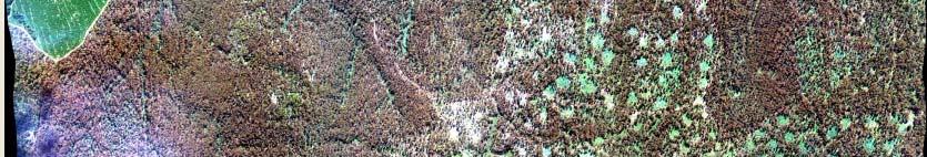
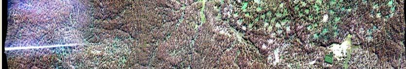
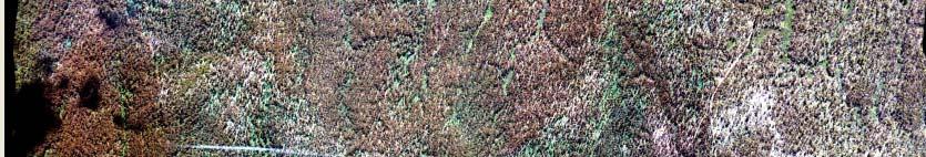
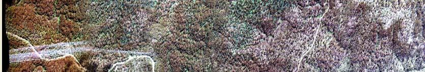
EO-1 SVT Site: TUMBARUMBA, AUSTRALIA
 EO-1 SVT Site: TUMBARUMBA, AUSTRALIA Background Tumbarumba Tumbarumba Study Area is located in Southern NSW, Australia. (E 148º 15' S 35º 45') and covers 5, hectares of publicly owned Forest Gently undulating
Lectures 7 and 8: 14, 16 Oct Sea Surface Temperature
 Lectures 7 and 8: 14, 16 Oct 2008 Sea Surface Temperature References: Martin, S., 2004, An Introduction to Ocean Remote Sensing, Cambridge University Press, 454 pp. Chapter 7. Robinson, I. S., 2004, Measuring
Remote Sensing Based Inversion of Gap Fraction for Determination of Leaf Area Index. Alemu Gonsamo 1 and Petri Pellikka 1
 Remote Sensing Based Inversion of Gap Fraction for Determination of Leaf Area Index Alemu Gonsamo and Petri Pellikka Department of Geography, University of Helsinki, P.O. Box, FIN- Helsinki, Finland; +-()--;
Near Real-time Evapotranspiration Estimation Using Remote Sensing Data
 Near Real-time Evapotranspiration Estimation Using Remote Sensing Data by Qiuhong Tang 08 Aug 2007 Land surface hydrology group of UW Land Surface Hydrology Research Group ❶ ❷ ❸ ❹ Outline Introduction
REVISION OF THE STATEMENT OF GUIDANCE FOR GLOBAL NUMERICAL WEATHER PREDICTION. (Submitted by Dr. J. Eyre)
") WORLD METEOROLOGICAL ORGANIZATION Distr.: RESTRICTED CBS/OPAG-IOS (ODRRGOS-5)/Doc.5, Add.5 (11.VI.2002) COMMISSION FOR BASIC SYSTEMS OPEN PROGRAMME AREA GROUP ON INTEGRATED OBSERVING SYSTEMS ITEM: 4 EXPERT
WORLD METEOROLOGICAL ORGANIZATION Distr.: RESTRICTED CBS/OPAG-IOS (ODRRGOS-5)/Doc.5, Add.5 (11.VI.2002) COMMISSION FOR BASIC SYSTEMS OPEN PROGRAMME AREA GROUP ON INTEGRATED OBSERVING SYSTEMS ITEM: 4 EXPERT
Environmental Remote Sensing GEOG 2021
 Environmental Remote Sensing GEOG 2021 Lecture 3 Spectral information in remote sensing Spectral Information 2 Outline Mechanisms of variations in reflectance Optical Microwave Visualisation/analysis Enhancements/transforms
Monitoring daily evapotranspiration in the Alps exploiting Sentinel-2 and meteorological data
 Monitoring daily evapotranspiration in the Alps exploiting Sentinel-2 and meteorological data M. Castelli, S. Asam, A. Jacob, M. Zebisch, and C. Notarnicola Institute for Earth Observation, Eurac Research,
A high spectral resolution global land surface infrared emissivity database
 A high spectral resolution global land surface infrared emissivity database Eva E. Borbas, Robert O. Knuteson, Suzanne W. Seemann, Elisabeth Weisz, Leslie Moy, and Hung-Lung Huang Space Science and Engineering
APPLICATIONS WITH METEOROLOGICAL SATELLITES. W. Paul Menzel. Office of Research and Applications NOAA/NESDIS University of Wisconsin Madison, WI
 APPLICATIONS WITH METEOROLOGICAL SATELLITES by W. Paul Menzel Office of Research and Applications NOAA/NESDIS University of Wisconsin Madison, WI July 2004 Unpublished Work Copyright Pending TABLE OF CONTENTS
Status of VIIRS Reflective Solar Bands On-orbit Calibration and Performance
 EOS Status of VIIRS Reflective Solar Bands On-orbit Calibration and Performance X. Xiong 1, J. Fulbright 2, N. Lei 2, J. Sun 2, Z. Wang 2, and J. McIntire 2 1. NASA/GSFC, Greenbelt, MD 20771, USA 2. Sigma
Land Surface Temperature in the EUMETSAT LSA SAF: Current Service and Perspectives. Isabel Trigo
 Land Surface Temperature in the EUMETSAT LSA SAF: Current Service and Perspectives Isabel Trigo Outline EUMETSAT Land-SAF: Land Surface Temperature Geostationary Service SEVIRI Polar-Orbiter AVHRR/Metop
Surface temperature what does this data tell us about micro-meteorological processes?
 Surface temperature what does this data tell us about micro-meteorological processes? Prof. Dr. Eberhard Parlow Meteorology, Climatology and Remote Sensing (MCR Lab) Department of Environmental Sciences
TEMPO Aerosols. Need for TEMPO-ABI Synergy
 TEMPO Aerosols Need for TEMPO-ABI Synergy Omar Torres, Hiren Jethva, Changwoo Ahn CEOS - 2018 NOAA-College Park May 04, 2018 Use of near UV Satellite Observations for retrieving aerosol properties over
AGOG 485/585 /APLN 533 Spring Lecture 5: MODIS land cover product (MCD12Q1). Additional sources of MODIS data
. Additional sources of MODIS data") AGOG 485/585 /APLN 533 Spring 2019 Lecture 5: MODIS land cover product (MCD12Q1). Additional sources of MODIS data Outline Current status of land cover products Overview of the MCD12Q1 algorithm Mapping
AGOG 485/585 /APLN 533 Spring 2019 Lecture 5: MODIS land cover product (MCD12Q1). Additional sources of MODIS data Outline Current status of land cover products Overview of the MCD12Q1 algorithm Mapping
RESEARCH METHODOLOGY
 III. RESEARCH METHODOLOGY 3.1 Time and Location This research has been conducted in period March until October 2010. Location of research is over Sumatra terrain. Figure 3.1 show the area of interest of
The CEOS Atmospheric Composition Constellation (ACC) An Example of an Integrated Earth Observing System for GEOSS
 An Example of an Integrated Earth Observing System for GEOSS") The CEOS Atmospheric Composition Constellation (ACC) An Example of an Integrated Earth Observing System for GEOSS Presentation Authors: E. Hilsenrath NASA, C. Zehner ESA, J. Langen ESA, J. Fishman NASA
The CEOS Atmospheric Composition Constellation (ACC) An Example of an Integrated Earth Observing System for GEOSS Presentation Authors: E. Hilsenrath NASA, C. Zehner ESA, J. Langen ESA, J. Fishman NASA
Climate Roles of Land Surface
 Lecture 5: Land Surface and Cryosphere (Outline) Climate Roles Surface Energy Balance Surface Water Balance Sea Ice Land Ice (from Our Changing Planet) Surface Albedo Climate Roles of Land Surface greenhouse
Interpretation of Polar-orbiting Satellite Observations. Atmospheric Instrumentation
 Interpretation of Polar-orbiting Satellite Observations Outline Polar-Orbiting Observations: Review of Polar-Orbiting Satellite Systems Overview of Currently Active Satellites / Sensors Overview of Sensor
Snow processes and their drivers in Sierra Nevada (Spain), and implications for modelling.
, and implications for modelling.") Snow processes and their drivers in Sierra Nevada (Spain), and implications for modelling. M.J. Polo, M.J. Pérez-Palazón, R. Pimentel, J. Herrero Granada,02 de November 2016 SECTIONS 1. 2. 3. 4. 5. Introduction
Snow processes and their drivers in Sierra Nevada (Spain), and implications for modelling. M.J. Polo, M.J. Pérez-Palazón, R. Pimentel, J. Herrero Granada,02 de November 2016 SECTIONS 1. 2. 3. 4. 5. Introduction
Assessing Drought in Agricultural Area of central U.S. with the MODIS sensor
 Assessing Drought in Agricultural Area of central U.S. with the MODIS sensor Di Wu George Mason University Oct 17 th, 2012 Introduction: Drought is one of the major natural hazards which has devastating
ESTIMATION OF ATMOSPHERIC COLUMN AND NEAR SURFACE WATER VAPOR CONTENT USING THE RADIANCE VALUES OF MODIS
 ESTIMATION OF ATMOSPHERIC COLUMN AND NEAR SURFACE WATER VAPOR CONTENT USIN THE RADIANCE VALUES OF MODIS M. Moradizadeh a,, M. Momeni b, M.R. Saradjian a a Remote Sensing Division, Centre of Excellence
Seasonal and interannual relations between precipitation, soil moisture and vegetation in the North American monsoon region
 Seasonal and interannual relations between precipitation, soil moisture and vegetation in the North American monsoon region Luis A. Mendez-Barroso 1, Enrique R. Vivoni 1, Christopher J. Watts 2 and Julio
Integration of remotely sensed data into a GIS of soil resources
 UN / Austria / ESA Symposium Space Tools and Solutions for Monitoring the Atmosphere and Land Cover Integration of remotely sensed data into a GIS of soil resources Diana Hanganu,, Roxana Vintila ICPA
Module 2.1 Monitoring activity data for forests using remote sensing
 Module 2.1 Monitoring activity data for forests using remote sensing Module developers: Frédéric Achard, European Commission (EC) Joint Research Centre (JRC) Jukka Miettinen, EC JRC Brice Mora, Wageningen
Challenges for the operational assimilation of satellite image data in agrometeorological models
 Challenges for the operational assimilation of satellite image data in agrometeorological models Mark Danson Centre for Environmental Systems Research, University of Salford, UK 0 Objectives The main objective
USE OF SATELLITE REMOTE SENSING IN HYDROLOGICAL PREDICTIONS IN UNGAGED BASINS
 USE OF SATELLITE REMOTE SENSING IN HYDROLOGICAL PREDICTIONS IN UNGAGED BASINS Venkat Lakshmi, PhD, P.E. Department of Geological Sciences, University of South Carolina, Columbia SC 29208 (803)-777-3552;
Instrumentation planned for MetOp-SG
 Instrumentation planned for MetOp-SG Bill Bell Satellite Radiance Assimilation Group Met Office Crown copyright Met Office Outline Background - the MetOp-SG programme The MetOp-SG instruments Summary Acknowledgements:
John R. Mecikalski #1, Martha C. Anderson*, Ryan D. Torn #, John M. Norman*, George R. Diak #
 P4.22 THE ATMOSPHERE-LAND EXCHANGE INVERSE (ALEXI) MODEL: REGIONAL- SCALE FLUX VALIDATIONS, CLIMATOLOGIES AND AVAILABLE SOIL WATER DERIVED FROM REMOTE SENSING INPUTS John R. Mecikalski #1, Martha C. Anderson*,
Joint International Surface Working Group and Satellite Applications Facility on Land Surface Analysis Workshop, IPMA, Lisboa, June 2018
 Joint International Surface Working Group and Satellite Applications Facility on Land Surface Analysis Workshop, IPMA, Lisboa, 26-28 June 2018 Introduction Soil moisture Evapotranspiration Future plan
What other observations are needed in addition to Fs for a robust GPP estimate?
 What other observations are needed in addition to Fs for a robust GPP estimate? Luis Guanter Free University of Berlin, Germany With contributions from Joanna Joiner & Betsy Middleton NASA Goddard Space
Land Management and Natural Hazards Unit --- DESERT Action 1. Land Management and Natural Hazards Unit Institute for Environment and Sustainability
 Land Management and Natural Hazards Unit --- DESERT Action 1 Monitoring Drought with Meteorological and Remote Sensing Data A case study on the Horn of Africa Paulo Barbosa and Gustavo Naumann Land Management
Status of Land Surface Temperature Product Development for JPSS Mission
 Status of Land Surface Temperature Product Development for JPSS Mission Yuling Liu 1,2, Yunyue Yu 2, Peng Yu 1,2 and Heshun Wang 1,2 1 ESSIC at University of Maryland, College Park, MD USA 2 Center for
The current status of FY-3D
 The current status of FY-3D Xiang Fang National Satellite Meteorological Center, China Meteorological Administration (NSMC/CMA) OUTLINE Overview Key instruments onboard FY-3D Products and data service
EUMETSAT s Support to Climate Services and User Support. Joachim Saalmüller
 EUMETSAT s Support to Climate Services and User Support Joachim Saalmüller 1 User Forum in Africa September 2016 Outline of my talk EUMETSAT in support of climate services Exploring our data and subscribing
Introducing VIIRS Aerosol Products
 1 Introducing VIIRS Aerosol Products Shobha Kondragunta NOAA/NESDIS Center for Satellite Applications and Research VIIRS Aerosol Cal/Val Team 2 Name Organization Major Task Kurt F. Brueske IIS/Raytheon
Operational Uses of Bands on the GOES-R Advanced Baseline Imager (ABI) Presented by: Kaba Bah
 Presented by: Kaba Bah") Operational Uses of Bands on the GOES-R Advanced Baseline Imager (ABI) Presented by: Kaba Bah Topics: Introduction to GOES-R & ABI ABI individual bands Use of band differences ABI derived products Conclusions
Operational Uses of Bands on the GOES-R Advanced Baseline Imager (ABI) Presented by: Kaba Bah Topics: Introduction to GOES-R & ABI ABI individual bands Use of band differences ABI derived products Conclusions
Mapping Evapotranspiration and Drought at Local to Continental Scales Using Thermal Remote Sensing
 Mapping Evapotranspiration and Drought at Local to Continental Scales Using Thermal Remote Sensing M.C. Anderson, W.P. Kustas USDA-ARS, Hydrology and Remote Sensing Laboratory J.M Norman University of
Climate Change Service
 Service Metadata for the Data Store Dick Dee, ECMWF C3S: data + expertise + operational Open and free access to climate data (observations, reanalyses, model predictions) Tools and best scientific practices
Infrared continental surface emissivity spectra and skin temperature retrieved from IASI observation
 Infrared continental surface emissivity spectra and skin temperature retrieved from IASI observation Capelle V., Chédin A., Péquignot E., N. A Scott Schlüssel P., Newman S. IASI Conference 2013 Introduction
Remote Sensing of Snow GEOG 454 / 654
 Remote Sensing of Snow GEOG 454 / 654 What crysopheric questions can RS help to answer? 2 o Where is snow lying? (Snow-covered area or extent) o How much is there? o How rapidly is it melting? (Area, depth,
Satellite analysis of aerosol indirect effect on stratocumulus clouds over South-East Atlantic
 1/23 Remote sensing of atmospheric aerosol, clouds and aerosol-cloud interactions. Bremen, 16-19 December 2013 Satellite analysis of aerosol indirect effect on stratocumulus clouds over South-East Atlantic
Preparation for Himawari 8
 Preparation for Himawari 8 Japan Meteorological Agency Meteorological Satellite Center Hidehiko MURATA ET SUP 8, WMO HQ, Geneva, 14 17 April 2014 1/18 Introduction Background The Japan Meteorological Agency
Indian National (Weather) SATellites for Agrometeorological Applications
 SATellites for Agrometeorological Applications") Indian National (Weather) SATellites for Agrometeorological Applications Bimal K. Bhattacharya Agriculture-Terrestrial Biosphere- Hydrology Group Space Applications Centre (ISRO) Ahmedabad 380015, India
Indian National (Weather) SATellites for Agrometeorological Applications Bimal K. Bhattacharya Agriculture-Terrestrial Biosphere- Hydrology Group Space Applications Centre (ISRO) Ahmedabad 380015, India
DROUGHT ASSESSMENT USING SATELLITE DERIVED METEOROLOGICAL PARAMETERS AND NDVI IN POTOHAR REGION
 DROUGHT ASSESSMENT USING SATELLITE DERIVED METEOROLOGICAL PARAMETERS AND NDVI IN POTOHAR REGION Researcher: Saad-ul-Haque Supervisor: Dr. Badar Ghauri Department of RS & GISc Institute of Space Technology
NASA s Airborne Visible/Infrared Imaging Spectrometer (AVIRIS) AVIRIS: PEARL HARBOR, HAWAII
 AVIRIS: PEARL HARBOR, HAWAII") AVIRIS: PEARL HARBOR, HAWAII 000412 NASA s Airborne Visible/Infrared Imaging Spectrometer (AVIRIS) LCLUC Update Robert O. Green (Tom Chrien, presenting) Jet Propulsion Laboratory Overview Objective & Approach
AVIRIS: PEARL HARBOR, HAWAII 000412 NASA s Airborne Visible/Infrared Imaging Spectrometer (AVIRIS) LCLUC Update Robert O. Green (Tom Chrien, presenting) Jet Propulsion Laboratory Overview Objective & Approach
Remote sensing with FAAM to evaluate model performance
 Remote sensing with FAAM to evaluate model performance YOPP-UK Workshop Chawn Harlow, Exeter 10 November 2015 Contents This presentation covers the following areas Introduce myself Focus of radiation research
Lesson 4b Remote Sensing and geospatial analysis to integrate observations over larger scales
 Lesson 4b Remote Sensing and geospatial analysis to integrate observations over larger scales We have discussed static sensors, human-based (participatory) sensing, and mobile sensing Remote sensing: Satellite
Land Surface Remote Sensing II
 PROCEEDINGS OFSPIE Land Surface Remote Sensing II Thomas J. Jackson Jing Ming Chen Peng Gong Shunlin Liang Editors 13-16 October 2014 Beijing, China Sponsored by SPIE Cosponsored by State Key Laboratory
Remote sensing of the terrestrial ecosystem for climate change studies
 Frontier of Earth System Science Seminar No.1 Fall 2013 Remote sensing of the terrestrial ecosystem for climate change studies Jun Yang Center for Earth System Science Tsinghua University Outline 1 Introduction
Estimation of evapotranspiration using satellite TOA radiances Jian Peng
 Estimation of evapotranspiration using satellite TOA radiances Jian Peng Max Planck Institute for Meteorology Hamburg, Germany Satellite top of atmosphere radiances Slide: 2 / 31 Surface temperature/vegetation
A Method for MERIS Aerosol Correction : Principles and validation. David Béal, Frédéric Baret, Cédric Bacour, Kathy Pavageau
 A Method for MERIS Aerosol Correction : Principles and validation David Béal, Frédéric Baret, Cédric Bacour, Kathy Pavageau Outlook Objectives Principles Training neural networks Validation Comparison
DRARS Coordination Meeting Contribution from IMD
 DRARS Coordination Meeting Contribution from IMD Dr. Ashim Kumar Mitra Ministry of Earth Sciences India Meteorological Department New Delhi-INDIA 11-13 March 2015 The Processing System of NOAA/METOP/MODIS
What are Aerosols? Suspension of very small solid particles or liquid droplets Radii typically in the range of 10nm to
 What are Aerosols? Suspension of very small solid particles or liquid droplets Radii typically in the range of 10nm to 10µm Concentrations decrease exponentially with height N(z) = N(0)exp(-z/H) Long-lived
Report. Northern Africa. RAIDEG-8, 1-2 Nov 2017
 Report Northern Africa RAIDEG-8, 1-2 Nov 2017 Report Northern Africa RAIDEG-8, 1-2 Nov 2017 Important Note: Formal letters have been sent from the PR of Morocco with WMO to PRs of Algeria, Tunisia, Libya
LAND SURFACE ALBEDO AND DOWNWELLING SHORTWAVE RADIATION FROM MSG GEOSTATIONARY SATELLITE (METHOD FOR RETRIEVAL, VALIDATION, AND APPLICATION)
") LAND SURFACE ALBEDO AND DOWNWELLING SHORTWAVE RADIATION FROM MSG GEOSTATIONARY SATELLITE (METHOD FOR RETRIEVAL, VALIDATION, AND APPLICATION) Dominique Carrer, Jean-Louis Roujean, Olivier Hautecoeur, Jean-Christophe
LAND SURFACE ALBEDO AND DOWNWELLING SHORTWAVE RADIATION FROM MSG GEOSTATIONARY SATELLITE (METHOD FOR RETRIEVAL, VALIDATION, AND APPLICATION) Dominique Carrer, Jean-Louis Roujean, Olivier Hautecoeur, Jean-Christophe
Course outline, objectives, workload, projects, expectations
 Course outline, objectives, workload, projects, expectations Introductions Remote Sensing Overview Elements of a remote sensing observing system 1. platform (satellite, surface, etc) 2. experimental design
Satellite observation of atmospheric dust
 Satellite observation of atmospheric dust Taichu Y. Tanaka Meteorological Research Institute, Japan Meteorological Agency 11 April 2017, SDS WAS: Dust observation and modeling @WMO, Geneva Dust observations
Comparison of MSG-SEVIRI and SPOT-VEGETATION data for vegetation monitoring over Africa
 Comparison of MSG-SEVIRI and SPOT-VEGETATION data for vegetation monitoring over Africa Bernard LACAZE CNRS UMR 8586 PRODIG Pôle Image et Campus Spatial, Université Paris Diderot Paris 7 Objectives Comparison
Data Fusion and Multi-Resolution Data
 Data Fusion and Multi-Resolution Data Nature.com www.museevirtuel-virtualmuseum.ca www.srs.fs.usda.gov Meredith Gartner 3/7/14 Data fusion and multi-resolution data Dark and Bram MAUP and raster data Hilker
The Delaware Environmental Monitoring & Analysis Center
 The Delaware Environmental Monitoring & Analysis Center Tina Callahan Delaware Estuary Science & Environmental Summit 2013 January 27-30, 2013 What is DEMAC? Delaware Environmental Monitoring & Analysis
Regional offline land surface simulations over eastern Canada using CLASS. Diana Verseghy Climate Research Division Environment Canada
 Regional offline land surface simulations over eastern Canada using CLASS Diana Verseghy Climate Research Division Environment Canada The Canadian Land Surface Scheme (CLASS) Originally developed for the
5. General Circulation Models
 5. General Circulation Models I. 3-D Climate Models (General Circulation Models) To include the full three-dimensional aspect of climate, including the calculation of the dynamical transports, requires
GLOBAL/CONTINENTAL LAND COVER MAPPING AND MONITORING
 GLOBAL/CONTINENTAL LAND COVER MAPPING AND MONITORING Ryutaro Tateishi, Cheng Gang Wen, and Jong-Geol Park Center for Environmental Remote Sensing (CEReS), Chiba University 1-33 Yayoi-cho Inage-ku Chiba
Land Monitoring Core Service Implementation Group (LMCS IG) - Results and Outlook
 - Results and Outlook") Land Monitoring Core Service Implementation Group (LMCS IG) - Results and Outlook Pr. Dietmar Grünreich, President of BKG, Germany Chairman of the GMES LMCS IG Outline 1 Introduction 2 Preparatory Projects
Land Monitoring Core Service Implementation Group (LMCS IG) - Results and Outlook Pr. Dietmar Grünreich, President of BKG, Germany Chairman of the GMES LMCS IG Outline 1 Introduction 2 Preparatory Projects
Satellite ASTER Global Geoscience Maps
 Satellite ASTER Global Geoscience Maps Michael Abrams Jet Propulsion Laboratory, California Institute of Technology, Pasadena USA (c) 2017 California Institute of Technology. Government sponsorship acknowledged.
Application of a Land Surface Temperature Validation Protocol to AATSR data. Dar ren Ghent1, Fr ank Göttsche2, Folke Olesen2 & John Remedios1
 Application of a Land Surface Temperature Validation Protocol to AATSR data Dar ren Ghent1, Fr ank Göttsche, Folke Olesen & John Remedios1 1 E a r t h O b s e r v a t i o n S c i e n c e, D e p a r t m
An update on CMIP(6), obs4mips and the WGCM/WGNE Diagnostics and Metrics Panel
, obs4mips and the WGCM/WGNE Diagnostics and Metrics Panel") An update on CMIP(6), obs4mips and the WGCM/WGNE Diagnostics and Metrics Panel Peter J. Gleckler WGNE 31, Pretoria, South Africa, April 27, 2016 REMOTE PRESENTATION Talk outline 2 CMIP6 status obs4mips
An update on CMIP(6), obs4mips and the WGCM/WGNE Diagnostics and Metrics Panel Peter J. Gleckler WGNE 31, Pretoria, South Africa, April 27, 2016 REMOTE PRESENTATION Talk outline 2 CMIP6 status obs4mips
Cross-Sensor Continuity Science Algorithm
 Cross-Sensor Continuity Science Algorithm - Long Term Vegetation Index and Phenology Workshop - Javzan Tsend-Ayush and Tomoaki Miura Department of Natural Resources and Environmental Management University
Non-meteorological Applications for Next Generation Geostationary Satellites: A 2016 CEOS Chair Initiative
 Committee on Earth Observation Satellites Non-meteorological Applications for Next Generation Geostationary Satellites: A 2016 CEOS Chair Initiative Ian Grant, Australian Bureau of Meteorology (Adapted
Amita Mehta and Ana Prados
 Building Capacity in Utilizing NASA Remote Sensing Observations in SWAT for Water Resources and Agricultural Management Applications Amita Mehta and Ana Prados NASA - University of Maryland Baltimore County