Environmental Remote Sensing GEOG 2021
|
|
|
- Della McCormick
- 5 years ago
- Views:
Transcription
1 Environmental Remote Sensing GEOG 2021 Lecture 3 Spectral information in remote sensing

2 Spectral Information 2
3 Outline Mechanisms of variations in reflectance Optical Microwave Visualisation/analysis Enhancements/transforms Getting info. from multispectral data 3
4 Reflectance Reflectance = output / input (radiance) measurement of surface complicated by atmosphere input solar radiation for passive optical input from spacecraft for active systems RADAR Strictly NOT reflectance - use related term backscatter 4


5 RADAR Mechanisms RADAR = RAdio Detection and Ranging Backscatter Transmit Receive See: 5
 means rougher 6")
6 RADAR Mechanisms Rule-of-thumb: higher backscatter (brighter) means rougher 6
7 RADAR Mechanisms 7


8 Passive RS Mechanisms 8

9 Mechanisms Atmospheric windows transmission high so can see through atmosphere Particularly microwave 9
10 Reflectance Causes of spectral (with wavelength) variation in reflectance? (bio)chemical & structural properties chlorophyll concentration in vegetation soil - minerals/ water/ organic matter 10
11 Optical Mechanisms: vegetation 11
12 Optical Mechanisms: soil 12
 A=Bare soil B=Full cover")
13 consider Vegetation amount change in canopy cover over time (dynamics) varying proportions of soil / vegetation (canopy cover) A=Bare soil B=Full cover C=Senescence 13


14 Vegetation amount & dynamics Change detection Rondonia 1975 Rondonia 1986 Rondonia 1992 fishbone pattern? Landsat Multispectral Scanner :


15 Vegetation amount & dynamics Change detection 15
16 Uses of (spectral) information consider properties as continuous e.g. mapping leaf area index (LAI) or canopy cover or discrete variable e.g. spectrum representative of cover type (classification) Vegetation reflectance LOW in visible, HIGH in nearinfrared (NIR) 16

17 Leaf Area Index (LAI) The total one-sided green leaf area per unit ground surface area. 17
18 Leaf Area Index (LAI) 18

19 Leaf Area Index (LAI) Multi-year average MODIS LAI: 19

20 20

21 Leaf Area Index (LAI) MODIS LAI over Africa: September 2000 (left), December 2000 (right) See: & 21

22 See: Forest cover

23 Forest cover
24 visualisation/analysis spectral curves spectral features, e.g., 'red edge scatter plot two (/three) channels of information colour composites three channels of information enhancements e.g. NDVI 24
25 visualisation/analysis spectral curves reflectance (absorptance) features information on type and concentration of absorbing materials (minerals, pigments) e.g., 'red edge': increase Chlorophyll concentration leads to increase in spectral location of 'feature' e.g., tracking of red edge through model fitting or differentiation 25
26 visualisation/analysis Colour Composites choose three channels of information not limited to RGB use standard composites e.g. false colour composite (FCC) learn interpretation Vegetation refl. high in NIR, display on red channel, so more veg == more red, soil blue 26
27 visualisation/analysis Std FCC - Rondonia 27
28 Enhancements Vegetation Indices reexamine red/nir space features NDVI =? 28
29 Enhancements Vegetation Index (VI) approach define function of the two channels to enhance response to vegetation & minimise response to extraneous factors (soil) maintain (linear?) relationship with desired quantity (e.g., canopy coverage, LAI) Main categories: ratio indices (angular measure) perpendicular indices (parallel lines) 29
30 RATIO Enhancements INDICES Vegetation Indices 30
31 RATIO Enhancements INDICES Vegetation Indices Ratio Vegetation Index RVI = NIR/Red Normalised Difference Vegetation Index NDVI = (NIR-Red)/(NIR+Red) 31

 NDVI")
32 Enhancements Vegetation Indices RATIO INDICES FCC (veg is red) NDVI (veg is bright) 32

33 Global NDVI from MODIS in 2000 RATIO INDICES See: 33
34 Enhancements Vegetation Indices PERPENDICULAR INDICES 34
35 Enhancements Vegetation Indices PERPENDICULAR INDICES Perpendicular Vegetation Index PVI Soil Adjusted Vegetation Index SAVI 35

36 PERPENDICULAR INDICES And others... SARVI2, now called EVI (Enhanced Vegetation Index) 36
37 Summary Scattering/reflectance mechanisms monitoring vegetation amount visualisation/analysis spectral plots, scatter plots enhancement Vis 37
38 Readings Jensen s Chapter on Veg. Indexes Verstraete and Pinty (1996) Designing Optimal Spectral Indexes for Remote Sensing Applications Both available as pdfs on Moodle 38
INTRODUCTION TO MICROWAVE REMOTE SENSING. Dr. A. Bhattacharya
 1 INTRODUCTION TO MICROWAVE REMOTE SENSING Dr. A. Bhattacharya Why Microwaves? More difficult than with optical imaging because the technology is more complicated and the image data recorded is more varied.
GNR401 Principles of Satellite Image Processing
 Principles of Satellite Image Processing Instructor: Prof. CSRE, IIT Bombay bkmohan@csre.iitb.ac.in Slot 5 Guest Lecture PCT and Band Arithmetic November 07, 2012 9.30 AM 10.55 AM IIT Bombay Slide 1 November
Introduction to Satellite Derived Vegetation Indices
 Introduction to the Use of Geospatial Information Technology for Drought Risk Management 13-17 November, 2017 Tonle Bassac II Restaurant, Phnom Penh, Cambodia Introduction to Satellite Derived Vegetation
Hyperspectral Remote Sensing --an indirect trait measuring method
 Hyperspectral Remote Sensing --an indirect trait measuring method Jin Wu 05/02/2012 Outline Part 1: Terminologies & Tools of RS Techniques Part 2: RS Approaches to Estimating Leaf/Canopy Traits Part 3:
Learning Objectives. Thermal Remote Sensing. Thermal = Emitted Infrared
 November 2014 lava flow on Kilauea (USGS Volcano Observatory) (http://hvo.wr.usgs.gov) Landsat-based thermal change of Nisyros Island (volcanic) Thermal Remote Sensing Distinguishing materials on the ground
Many of remote sensing techniques are generic in nature and may be applied to a variety of vegetated landscapes, including
 Remote Sensing of Vegetation Many of remote sensing techniques are generic in nature and may be applied to a variety of vegetated landscapes, including 1. Agriculture 2. Forest 3. Rangeland 4. Wetland,
Introduction to RS Lecture 2. NR401 Dr. Avik Bhattacharya 1
 Introduction to RS Lecture 2 NR401 Dr. Avik Bhattacharya 1 This course is about electromagnetic energy sensors other types of remote sensing such as geophysical will be disregarded. For proper analysis
Vegetation Remote Sensing
 Vegetation Remote Sensing Huade Guan Prepared for Remote Sensing class Earth & Environmental Science University of Texas at San Antonio November 2, 2005 Outline Why do we study vegetation remote sensing?
9/12/2011. Training Course Remote Sensing - Basic Theory & Image Processing Methods September 2011
 Training Course Remote Sensing - Basic Theory & Image Processing Methods 19 23 September 2011 Introduction to Remote Sensing Michiel Damen (September 2011) damen@itc.nl 1 Overview Electro Magnetic (EM)
GEOG Lecture 8. Orbits, scale and trade-offs
 Environmental Remote Sensing GEOG 2021 Lecture 8 Orbits, scale and trade-offs Orbits revisit Orbits geostationary (36 000 km altitude) polar orbiting (200-1000 km altitude) Orbits revisit Orbits geostationary
School on Modelling Tools and Capacity Building in Climate and Public Health April Remote Sensing
 2453-5 School on Modelling Tools and Capacity Building in Climate and Public Health 15-26 April 2013 Remote Sensing CECCATO Pietro International Research Institute for Climate and Society, IRI The Earth
Remote Sensing in Meteorology: Satellites and Radar. AT 351 Lab 10 April 2, Remote Sensing
 Remote Sensing in Meteorology: Satellites and Radar AT 351 Lab 10 April 2, 2008 Remote Sensing Remote sensing is gathering information about something without being in physical contact with it typically
What is a vegetation index?
 Vegetation indexes What is a vegetation index? A tool: a vegetation index is a mathematical formula used to estimate the likelihood of vegetation presence in remotely sensed data A product: the result
F O U N D A T I O N A L C O U R S E
 F O U N D A T I O N A L C O U R S E December 6, 2018 Satellite Foundational Course for JPSS (SatFC-J) F O U N D A T I O N A L C O U R S E Introduction to Microwave Remote Sensing (with a focus on passive
Spectral reflectance: When the solar radiation is incident upon the earth s surface, it is either
 Spectral reflectance: When the solar radiation is incident upon the earth s surface, it is either reflected by the surface, transmitted into the surface or absorbed and emitted by the surface. Remote sensing
Response of Crops to a Heat Wave Detected by using Airborne Reflectance and Chlorophyll Fluorescence Measurements
 Response of Crops to a Heat Wave Detected by using Airborne Reflectance and Chlorophyll Fluorescence Measurements Peiqi Yang, Christiaan van der Tol, Wouter Verhoef, Alexander Damm, Anke Schickling and
Fundamentals of Remote Sensing
 Division of Spatial Information Science Graduate School Life and Environment Sciences University of Tsukuba Fundamentals of Remote Sensing Prof. Dr. Yuji Murayama Surantha Dassanayake 10/6/2010 1 Fundamentals
HYPERSPECTRAL IMAGING
 1 HYPERSPECTRAL IMAGING Lecture 9 Multispectral Vs. Hyperspectral 2 The term hyperspectral usually refers to an instrument whose spectral bands are constrained to the region of solar illumination, i.e.,
Integration of remotely sensed data into a GIS of soil resources
 UN / Austria / ESA Symposium Space Tools and Solutions for Monitoring the Atmosphere and Land Cover Integration of remotely sensed data into a GIS of soil resources Diana Hanganu,, Roxana Vintila ICPA
Introduction to Electromagnetic Radiation and Radiative Transfer
 Introduction to Electromagnetic Radiation and Radiative Transfer Temperature Dice Results Visible light, infrared (IR), ultraviolet (UV), X-rays, γ-rays, microwaves, and radio are all forms of electromagnetic
Once a specific data set is selected, NEO will list related data sets in the panel titled Matching Datasets, which is to the right of the image.
 NASA Earth Observations (NEO): A Brief Introduction NEO is a data visualization tool that allows users to explore a wealth of environmental data collected by NASA satellites. The satellites use an array
Remote Sensing of Snow GEOG 454 / 654
 Remote Sensing of Snow GEOG 454 / 654 What crysopheric questions can RS help to answer? 2 o Where is snow lying? (Snow-covered area or extent) o How much is there? o How rapidly is it melting? (Area, depth,
Hot Spot Signature Dynamics in Vegetation Canopies with varying LAI. F. Camacho-de Coca, M. A. Gilabert and J. Meliá
 Hot Spot Signature Dynamics in Vegetation Canopies with varying LAI F. Camacho-de Coca, M. A. Gilabert and J. Meliá Departamento de Termodinàmica. Facultat de Física. Universitat de València Dr. Moliner,
Fundamental Interactions with Earth Surface
 Fundamental Interactions with Earth Surface 1 / 96 http://speclab.cr.usgs.gov/papers/tetracorder/ GEO 827 - Digital Image Processing and Analysis 2 / 96 http://www.markelowitz.com/hyperspectral.html 3
UNIT I EMR AND ITS INTERACTION WITH ATMOSPHERE & EARTH MATERIAL
 Date deliverance : UNIT I EMR AND ITS INTERACTION WITH ATMOSPHERE & EARTH MATERIAL Definition remote sensing and its components Electromagnetic spectrum wavelength regions important to remote sensing Wave
Space Applications Institute Characterization of the Impact of Forest Architecture on AVHRR Bands 1 and 2 Observations
 Space Applications Institute Characterization of the Impact of Forest Architecture on AVHRR Bands 1 and 2 Observations by Yves M. Govaerts EC Joint Research Centre January 1997 i Table of Contents Overview
GMES: calibration of remote sensing datasets
 GMES: calibration of remote sensing datasets Jeremy Morley Dept. Geomatic Engineering jmorley@ge.ucl.ac.uk December 2006 Outline Role of calibration & validation in remote sensing Types of calibration
Meteorological Satellite Image Interpretations, Part III. Acknowledgement: Dr. S. Kidder at Colorado State Univ.
 Meteorological Satellite Image Interpretations, Part III Acknowledgement: Dr. S. Kidder at Colorado State Univ. Dates EAS417 Topics Jan 30 Introduction & Matlab tutorial Feb 1 Satellite orbits & navigation
Remote Sensing. 1. Basics and Applications. Rangnath R Navalgund
 Remote Sensing 1. Basics and Applications Rangnath R Navalgund Rangnath R Navalgund, after working for more than two decades at the Space Applications Centre (ISRO), Ahmedabad has moved over to the National
FUNDAMENTALS OF REMOTE SENSING FOR RISKS ASSESSMENT. 1. Introduction
 FUNDAMENTALS OF REMOTE SENSING FOR RISKS ASSESSMENT FRANÇOIS BECKER International Space University and University Louis Pasteur, Strasbourg, France; E-mail: becker@isu.isunet.edu Abstract. Remote sensing
Electromagnetic Radiation. Physical Principles of Remote Sensing
 Electromagnetic Radiation Physical Principles of Remote Sensing Outline for 4/3/2003 Properties of electromagnetic radiation The electromagnetic spectrum Spectral emissivity Radiant temperature vs. kinematic
A Facility for Producing Consistent Remotely Sensed Biophysical Data Products of Australia
 TERRESTRIAL ECOSYSTEM RESEARCH NETWORK - AusCover - A Facility for Producing Consistent Remotely Sensed Biophysical Data Products of Australia June, 2011 Mervyn Lynch Professor of Remote Sensing Curtin
Remote Sensing I: Basics
 Remote Sensing I: Basics Kelly M. Brunt Earth System Science Interdisciplinary Center, University of Maryland Cryospheric Science Laboratory, Goddard Space Flight Center kelly.m.brunt@nasa.gov (Based on
(Refer Slide Time: 3:48)
") Introduction to Remote Sensing Dr. Arun K Saraf Department of Earth Sciences Indian Institute of Technology Roorkee Lecture 01 What is Satellite based Remote Sensing Hello, hello everyone this is Arun
Introduction to Remote Sensing Dr. Arun K Saraf Department of Earth Sciences Indian Institute of Technology Roorkee Lecture 01 What is Satellite based Remote Sensing Hello, hello everyone this is Arun
Introduction to radiation theory HELENA ERIKSSON
 Introduction to radiation theory HELENA ERIKSSON 2015-08-15 Property, symbol and unit A. Terms/laws/relationships that are new to me? B. Terms/laws/relationships I know all about (property, common symbol
PRINCIPLES OF REMOTE SENSING. Electromagnetic Energy and Spectral Signatures
 PRINCIPLES OF REMOTE SENSING Electromagnetic Energy and Spectral Signatures Remote sensing is the science and art of acquiring and analyzing information about objects or phenomena from a distance. As humans,
MULTICHANNEL NADIR SPECTROMETER FOR THEMATICALLY ORIENTED REMOTE SENSING INVESTIGATIONS
 S E S 2 5 Scientific Conference SPACE, ECOLOGY, SAFETY with International Participation 1 13 June 25, Varna, Bulgaria MULTICHANNEL NADIR SPECTROMETER FOR THEMATICALLY ORIENTED REMOTE SENSING INVESTIGATIONS
Topics: Visible & Infrared Measurement Principal Radiation and the Planck Function Infrared Radiative Transfer Equation
 Review of Remote Sensing Fundamentals Allen Huang Cooperative Institute for Meteorological Satellite Studies Space Science & Engineering Center University of Wisconsin-Madison, USA Topics: Visible & Infrared
AATSR atmospheric correction
 AATSR atmospheric correction Objective: Retrieval of aerosol opacity and bidirectional reflectance over land surface Talk structure Science background and objectives Dual-angle method Validation and satellite
Chapter 1: Introduction
 Chapter 1: Introduction Photogrammetry: Definition & applications What are we trying to do? Data acquisition systems 3-D viewing of 2-D imagery Automation (matching problem) Necessary tools: Image formation
PASSIVE MICROWAVE IMAGING. Dr. A. Bhattacharya
 1 PASSIVE MICROWAVE IMAGING Dr. A. Bhattacharya 2 Basic Principles of Passive Microwave Imaging Imaging with passive microwave is a complementary technology that needs an introduction to identify its role
Electromagnetic Waves
 ELECTROMAGNETIC RADIATION AND THE ELECTROMAGNETIC SPECTRUM Electromagnetic Radiation (EMR) THE ELECTROMAGNETIC SPECTRUM Electromagnetic Waves A wave is characterized by: Wavelength (λ - lambda) is the
INTRODUCTION TO MICROWAVE REMOTE SENSING - II. Dr. A. Bhattacharya
 1 INTRODUCTION TO MICROWAVE REMOTE SENSING - II Dr. A. Bhattacharya The Radiation Framework The information about features on the Earth s surface using RS depends on measuring energy emanating from the
The Spectral Radiative Effects of Inhomogeneous Clouds and Aerosols
 The Spectral Radiative Effects of Inhomogeneous Clouds and Aerosols S. Schmidt, B. Kindel, & P. Pilewskie Laboratory for Atmospheric and Space Physics University of Colorado SORCE Science Meeting, 13-16
Light is an electromagnetic wave (EM)
") What is light? Light is a form of energy. Light travels in a straight line Light speed is 3.0 x 10 8 m/s Light is carried by photons Light can travel through a vacuum Light is a transverse wave Light is
What is light? Light is a form of energy. Light travels in a straight line Light speed is 3.0 x 10 8 m/s Light is carried by photons Light can travel through a vacuum Light is a transverse wave Light is
Lecture 2: principles of electromagnetic radiation
 Remote sensing for agricultural applications: principles and methods Lecture 2: principles of electromagnetic radiation Instructed by Prof. Tao Cheng Nanjing Agricultural University March Crop 11, Circles
Examination Questions & Model Answers (2009/2010) PLEASE PREPARE YOUR QUESTIONS AND ANSWERS BY USING THE FOLLOWING GUIDELINES;
 PLEASE PREPARE YOUR QUESTIONS AND ANSWERS BY USING THE FOLLOWING GUIDELINES;") Examination s & Model Answers (2009/2010) PLEASE PREPARE YOUR QUESTIONS AND ANSWERS BY USING THE FOLLOWING GUIDELINES; 1. If using option 2 or 3 use template provided 2. Use Times New Roman 12 3. Enter
Examination s & Model Answers (2009/2010) PLEASE PREPARE YOUR QUESTIONS AND ANSWERS BY USING THE FOLLOWING GUIDELINES; 1. If using option 2 or 3 use template provided 2. Use Times New Roman 12 3. Enter
Remote Sensing of Precipitation
 Lecture Notes Prepared by Prof. J. Francis Spring 2003 Remote Sensing of Precipitation Primary reference: Chapter 9 of KVH I. Motivation -- why do we need to measure precipitation with remote sensing instruments?
Vegetation Index Calculator
 Vegetation Index Calculator Janki M.Adhvaryu 1, Mayank Singh Sakla 2 1 Student, CEPT University 2 Student, CEPT University K.L.Campus university road Navrangpura Ahmedabad Gujarat, India Word Limit of
Atmospheric Measurements from Space
 Atmospheric Measurements from Space MPI Mainz Germany Thomas Wagner Satellite Group MPI Mainz Part 1: Basics Break Part 2: Applications Part 1: Basics of satellite remote sensing Why atmospheric satellite
ESM 186 Environmental Remote Sensing and ESM 186 Lab Syllabus Winter 2012
 ESM 186 Environmental Remote Sensing and ESM 186 Lab Syllabus Winter 2012 Instructor: Susan Ustin (slustin@ucdavis.edu) Phone: 752-0621 Office: 233 Veihmeyer Hall and 115A, the Barn Office Hours: Tuesday
SUPPORTING INFORMATION. Ecological restoration and its effects on the
 SUPPORTING INFORMATION Ecological restoration and its effects on the regional climate: the case in the source region of the Yellow River, China Zhouyuan Li, Xuehua Liu,* Tianlin Niu, De Kejia, Qingping
Satellite remote sensing of aerosols & clouds: An introduction
 Satellite remote sensing of aerosols & clouds: An introduction Jun Wang & Kelly Chance April 27, 2006 junwang@fas.harvard.edu Outline Principals in retrieval of aerosols Principals in retrieval of water
Assimilating terrestrial remote sensing data into carbon models: Some issues
 University of Oklahoma Oct. 22-24, 2007 Assimilating terrestrial remote sensing data into carbon models: Some issues Shunlin Liang Department of Geography University of Maryland at College Park, USA Sliang@geog.umd.edu,
Lecture 19: Operational Remote Sensing in Visible, IR, and Microwave Channels
 MET 4994 Remote Sensing: Radar and Satellite Meteorology MET 5994 Remote Sensing in Meteorology Lecture 19: Operational Remote Sensing in Visible, IR, and Microwave Channels Before you use data from any
Hyperspectral Atmospheric Correction
 Hyperspectral Atmospheric Correction Bo-Cai Gao June 2015 Remote Sensing Division Naval Research Laboratory, Washington, DC USA BACKGROUND The concept of imaging spectroscopy, or hyperspectral imaging,
An Algorithm for Retrieving Land Surface Temperatures Using VIIRS Data in Combination with Multi-Sensors
 Sensors 2014, 14, 21385-21408; doi:10.3390/s141121385 Article OPEN ACCESS sensors ISSN 1424-8220 www.mdpi.com/journal/sensors An Algorithm for Retrieving Land Surface Temperatures Using VIIRS Data in Combination
Assessing Drought in Agricultural Area of central U.S. with the MODIS sensor
 Assessing Drought in Agricultural Area of central U.S. with the MODIS sensor Di Wu George Mason University Oct 17 th, 2012 Introduction: Drought is one of the major natural hazards which has devastating
ElectroMagnetic Radiation (EMR) Lecture 2-3 August 29 and 31, 2005
 Lecture 2-3 August 29 and 31, 2005") ElectroMagnetic Radiation (EMR) Lecture 2-3 August 29 and 31, 2005 Jensen, Jensen, Ways of of Energy Transfer Energy is is the the ability to to do do work. In In the the process of of doing work, energy
ElectroMagnetic Radiation (EMR) Lecture 2-3 August 29 and 31, 2005 Jensen, Jensen, Ways of of Energy Transfer Energy is is the the ability to to do do work. In In the the process of of doing work, energy
Developing a protocol to use remote sensing as a cost effective tool to monitor contamination of mangrove wetlands
 Developing a protocol to use remote sensing as a cost effective tool to monitor contamination of mangrove wetlands Johannes H. Schellekens, Fernando Gilbes-Santaella, Augustine Rodriguez-Roman, and Belyneth
Preface to the Second Edition. Preface to the First Edition
 Contents Preface to the Second Edition Preface to the First Edition iii v 1 Introduction 1 1.1 Relevance for Climate and Weather........... 1 1.1.1 Solar Radiation.................. 2 1.1.2 Thermal Infrared
Reminder: All answers MUST GO ON ANSWER SHEET! Answers recorded in the exam booklet will not count.
 Reminder: All answers MUST GO ON ANSWER SHEET! Answers recorded in the exam booklet will not count. 1. Identify the following acronyms; compare these platform types; provide situations where one platform
We are IntechOpen, the world s leading publisher of Open Access books Built by scientists, for scientists. International authors and editors
 We are IntechOpen, the world s leading publisher of Open Access books Built by scientists, for scientists 3,500 108,000 1.7 M Open access books available International authors and editors Downloads Our
SAIL thermique, a model to simulate land surface emissivity (LSE) spectra
 spectra") SAIL thermique, a model to simulate land surface emissivity (LSE) spectra Albert Olioso, INRA, UMR EMMAH (INRA UAPV), Avignon, France Frédéric Jacob, Audrey Lesaignoux IRD, UMR LISAH, Montpellier, France
SAIL thermique, a model to simulate land surface emissivity (LSE) spectra Albert Olioso, INRA, UMR EMMAH (INRA UAPV), Avignon, France Frédéric Jacob, Audrey Lesaignoux IRD, UMR LISAH, Montpellier, France
Monday, Oct. 2: Clear-sky radiation; solar attenuation, Thermal. nomenclature
 Monday, Oct. 2: Clear-sky radiation; solar attenuation, Thermal nomenclature Sun Earth Y-axis: Spectral radiance, aka monochromatic intensity units: watts/(m^2*ster*wavelength) Blackbody curves provide
Blackbody radiation. Main Laws. Brightness temperature. 1. Concepts of a blackbody and thermodynamical equilibrium.
 Lecture 4 lackbody radiation. Main Laws. rightness temperature. Objectives: 1. Concepts of a blackbody, thermodynamical equilibrium, and local thermodynamical equilibrium.. Main laws: lackbody emission:
Astronomical Observations: Distance & Light 7/2/09. Astronomy 101
 Astronomical Observations: Distance & Light 7/2/09 Astronomy 101 Astronomy Picture of the Day Astronomy 101 Something Cool: Lasers on the Moon Astronomy 101 Outline for Today Astronomy Picture of the Day
Cloud optical thickness and effective particle radius derived from transmitted solar radiation measurements: Comparison with cloud radar observations
 P-1 Cloud optical thickness and effective particle radius derived from transmitted solar radiation measurements: Comparison with cloud radar observations Nobuhiro Kikuchi, Hiroshi Kumagai and Hiroshi Kuroiwa
Inaugural University of Michigan Science Olympiad Tournament
 Inaugural University of Michigan Science Olympiad Tournament The test may be taken apart. Ties will be broken based on predetermined questions and quality of response. Remote Sensing Test length: 50 Minutes
Examination Questions & Model Answers. (Academic year ) PLEASE PREPARE YOUR QUESTIONS AND ANSWERS BY USING THE FOLLOWING GUIDELINES;
 PLEASE PREPARE YOUR QUESTIONS AND ANSWERS BY USING THE FOLLOWING GUIDELINES;") Examination Questions & Model Answers (Academic year 2015-2016) PLEASE PREPARE YOUR QUESTIONS AND ANSWERS BY USING THE FOLLOWING GUIDELINES; 1. Use Times New Roman 12 2. Enter the Module Code and Title
Examination Questions & Model Answers (Academic year 2015-2016) PLEASE PREPARE YOUR QUESTIONS AND ANSWERS BY USING THE FOLLOWING GUIDELINES; 1. Use Times New Roman 12 2. Enter the Module Code and Title
APPLICATIONS WITH METEOROLOGICAL SATELLITES. W. Paul Menzel. Office of Research and Applications NOAA/NESDIS University of Wisconsin Madison, WI
 APPLICATIONS WITH METEOROLOGICAL SATELLITES by W. Paul Menzel Office of Research and Applications NOAA/NESDIS University of Wisconsin Madison, WI July 2004 Unpublished Work Copyright Pending TABLE OF CONTENTS
A Method for MERIS Aerosol Correction : Principles and validation. David Béal, Frédéric Baret, Cédric Bacour, Kathy Pavageau
 A Method for MERIS Aerosol Correction : Principles and validation David Béal, Frédéric Baret, Cédric Bacour, Kathy Pavageau Outlook Objectives Principles Training neural networks Validation Comparison
REMOTE SENSING TEST!!
 REMOTE SENSING TEST!! This is a really ugly cover page I m sorry. Name. Score / 100 Directions: (idk if I need to put this???) You have 50 minutes to take this test. You may use a cheatsheet (2 pages),
REMOTE SENSING KEY!!
 REMOTE SENSING KEY!! This is a really ugly cover page I m sorry. Name Key. Score / 100 Directions: You have 50 minutes to take this test. You may use a cheatsheet (2 pages), a non-graphing calculator,
Electromagnetic Radiation
 Electromagnetic Radiation aka Light Properties of Light are simultaneously wave-like AND particle-like Sometimes it behaves like ripples on a pond (waves). Sometimes it behaves like billiard balls (particles).
ECNU WORKSHOP LAB ONE 2011/05/25)
") ECNU WORKSHOP LAB ONE (Liam.Gumley@ssec.wisc.edu 2011/05/25) The objective of this laboratory exercise is to become familiar with the characteristics of MODIS Level 1B 1000 meter resolution data. After
ECNU WORKSHOP LAB ONE (Liam.Gumley@ssec.wisc.edu 2011/05/25) The objective of this laboratory exercise is to become familiar with the characteristics of MODIS Level 1B 1000 meter resolution data. After
Satellite Remote Sensing SIO 135/SIO 236. Electromagnetic Radiation and Polarization
 Satellite Remote Sensing SIO 135/SIO 236 Electromagnetic Radiation and Polarization 1 Electromagnetic Radiation The first requirement for remote sensing is to have an energy source to illuminate the target.
Imaging Spectrometry on Mangrove Species Identification and Mapping in Malaysia
 Imaging Spectrometry on Mangrove Species Identification and Mapping in Malaysia KAMARUZAMAN, J and KASAWANI, I Forest Geospatial Information & Survey Lab, Lebuh Silikon Faculty of Forestry Universiti Putra
Applications of GIS and Remote Sensing for Analysis of Urban Heat Island
 Chuanxin Zhu Professor Peter V. August Professor Yeqiao Wang NRS 509 December 15, 2016 Applications of GIS and Remote Sensing for Analysis of Urban Heat Island Since the last century, the global mean surface
Physical Basics of Remote-Sensing with Satellites
 - Physical Basics of Remote-Sensing with Satellites Dr. K. Dieter Klaes EUMETSAT Meteorological Division Am Kavalleriesand 31 D-64295 Darmstadt dieter.klaes@eumetsat.int Slide: 1 EUM/MET/VWG/09/0162 MET/DK
Principles of Radiative Transfer Principles of Remote Sensing. Marianne König EUMETSAT
 - Principles of Radiative Transfer Principles of Remote Sensing Marianne König EUMETSAT marianne.koenig@eumetsat.int Remote Sensing All measurement processes which perform observations/measurements of
What are Aerosols? Suspension of very small solid particles or liquid droplets Radii typically in the range of 10nm to
 What are Aerosols? Suspension of very small solid particles or liquid droplets Radii typically in the range of 10nm to 10µm Concentrations decrease exponentially with height N(z) = N(0)exp(-z/H) Long-lived
ATMOS 5140 Lecture 7 Chapter 6
 ATMOS 5140 Lecture 7 Chapter 6 Thermal Emission Blackbody Radiation Planck s Function Wien s Displacement Law Stefan-Bolzmann Law Emissivity Greybody Approximation Kirchhoff s Law Brightness Temperature
Satellite-Based Detection of Fog and Very Low Stratus
 Satellite-Based Detection of Fog and Very Low Stratus A High-Latitude Case Study Centred on the Helsinki Testbed Experiment J. Cermak 1, J. Kotro 2, O. Hyvärinen 2, V. Nietosvaara 2, J. Bendix 1 1: Laboratory
Remote Sensing How we know what we know A Brief Tour
 Remote Sensing How we know what we know A Brief Tour Dr. Erik Richard Dr. Jerald Harder LASP Richard 1 Remote Sensing The measurement of physical variables (usually light or sound) from outside of a medium
Analysis of Land Use Zoning Regulations and Green Coverage Ratio
 Analysis of Land Use Zoning Regulations and Green Coverage Ratio Masahiro Sotoma* 1, Hiroshi Miyazaki 2, Takashi Kyakuno 3 and Masakazu Moriyama 4 1 Graduate Student, Graduate School of Science and Technology,
Summary. Week 7: 10/5 & 10/ Learning from Light. What are the three basic types of spectra? Three Types of Spectra
 Week 7: 10/5 & 10/7 Capturing that radiation Chapter 6 (Telescopes & Sensors) Optical to Radio Summary What are we sensing? Matter! Matter is made of atoms (nucleus w/ protons, neutrons & cloud of electrons
New capabilities with high resolution cloud micro-structure facilitated by MTG 2.3 um channel
 Slide 19 November 2016, V1.0 New capabilities with high resolution cloud micro-structure facilitated by MTG 2.3 um channel Author: Daniel Rosenfeld The Hebrew University of Jerusalem (HUJ) daniel.rosenfeld@huji.ac.il
Lectures 7 and 8: 14, 16 Oct Sea Surface Temperature
 Lectures 7 and 8: 14, 16 Oct 2008 Sea Surface Temperature References: Martin, S., 2004, An Introduction to Ocean Remote Sensing, Cambridge University Press, 454 pp. Chapter 7. Robinson, I. S., 2004, Measuring
Projects in the Remote Sensing of Aerosols with focus on Air Quality
 Projects in the Remote Sensing of Aerosols with focus on Air Quality Faculty Leads Barry Gross (Satellite Remote Sensing), Fred Moshary (Lidar) Direct Supervision Post-Doc Yonghua Wu (Lidar) PhD Student
Introduction to Remote Sensing
 Introduction to Remote Sensing J. M. Veal, Ph. D. version 13.08.13 Contents 1 Basics of Electromagnetic Radiaton 2 1.1 Introduction...................... 2 1.2 Elementary Concepts of E.-M. Radiation......
EXTRACTION OF REMOTE SENSING INFORMATION OF BANANA UNDER SUPPORT OF 3S TECHNOLOGY IN GUANGXI PROVINCE
 EXTRACTION OF REMOTE SENSING INFORMATION OF BANANA UNDER SUPPORT OF 3S TECHNOLOGY IN GUANGXI PROVINCE Xin Yang 1,2,*, Han Sun 1, 2, Zongkun Tan 1, 2, Meihua Ding 1, 2 1 Remote Sensing Application and Test
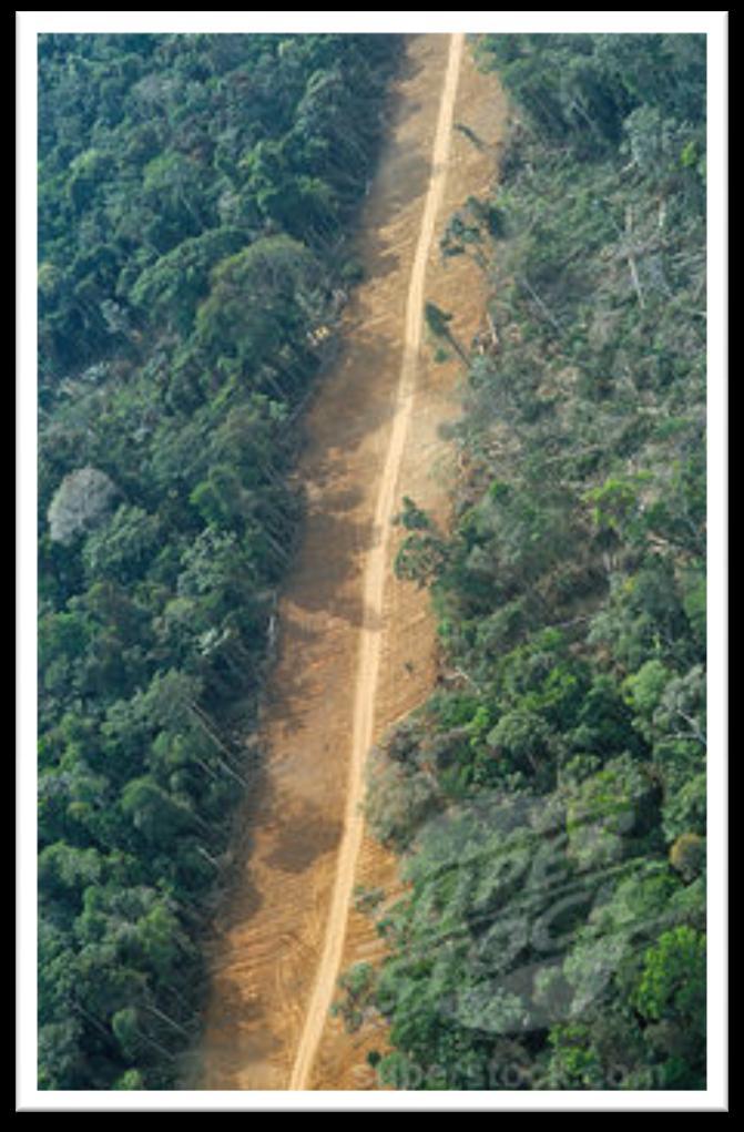
 1971 Radar used to map Brazil s Amazon Basin Entire ~ 5M km 2 Discovered major Amazon tributary Found fertile soil Until 1993 estimates of area and rate of deforestation ranged widely (21K 2 80K 2 /yr)
Vegetation Change Detection of Central part of Nepal using Landsat TM
 Vegetation Change Detection of Central part of Nepal using Landsat TM Kalpana G. Bastakoti Department of Geography, University of Calgary, kalpanagb@gmail.com Abstract This paper presents a study of detecting
Validation of a leaf reflectance and transmittance model for three agricultural crop species
 Validation of a leaf reflectance and transmittance model for three agricultural crop species Application Note Author G. J. Newnham* and T. Burt** *Remote Sensing and Satellite Research Group, Curtin University
The Main Point. How do light and matter interact? Lecture #7: Radiation and Spectra II. How is light absorbed and emitted?
 Lecture #7: Radiation and Spectra II How is light absorbed and emitted? Models of Atomic Structure. Formation of Spectral Lines. Doppler Shift. Applications in Solar System Studies Detecting gaseous phases
Stars, Galaxies & the Universe Announcements. Stars, Galaxies & the Universe Observing Highlights. Stars, Galaxies & the Universe Lecture Outline
 Stars, Galaxies & the Universe Announcements Lab Observing Trip Next week: Tues (9/28) & Thurs (9/30) let me know ASAP if you have an official conflict (class, work) - website: http://astro.physics.uiowa.edu/~clang/sgu_fall10/observing_trip.html
THE LAND-SAF SURFACE ALBEDO AND DOWNWELLING SHORTWAVE RADIATION FLUX PRODUCTS
 THE LAND-SAF SURFACE ALBEDO AND DOWNWELLING SHORTWAVE RADIATION FLUX PRODUCTS Bernhard Geiger, Dulce Lajas, Laurent Franchistéguy, Dominique Carrer, Jean-Louis Roujean, Siham Lanjeri, and Catherine Meurey
PRINCIPLES OF REMOTE SENSING. Shefali Aggarwal Photogrammetry and Remote Sensing Division Indian Institute of Remote Sensing, Dehra Dun
 PRINCIPLES OF REMOTE SENSING Shefali Aggarwal Photogrammetry and Remote Sensing Division Indian Institute of Remote Sensing, Dehra Dun Abstract : Remote sensing is a technique to observe the earth surface
Menzel/Matarrese/Puca/Cimini/De Pasquale/Antonelli Lab 2 Ocean Properties inferred from MODIS data June 2006
 Menzel/Matarrese/Puca/Cimini/De Pasquale/Antonelli Lab 2 Ocean Properties inferred from MODIS data June 2006 Table: MODIS Channel Number, Wavelength (µm), and Primary Application Reflective Bands Emissive