USGS/EROS Accomplishments and Year 3 Plans. Enhancement of the U.S. Drought Monit Through the Integration of NASA Vegetation Index Imagery
|
|
|
- Shannon Simmons
- 6 years ago
- Views:
Transcription
1 USGS/EROS Accomplishments and Year 3 Plans Enhancement of the U.S. Drought Monit Through the Integration of NASA Vegetation Index Imagery Jesslyn Brown Team Meeting, Austin, TX, 10/6/09 U.S. Department of the Interior U.S. Geological Survey
2 Objective Integration of MODIS VI and derivative products into the U.S. Drought Monitor Decision Support System, and the emerging National Integrated Drought Information System (NIDIS) EROS Staff Jesslyn Brown,Yingxin Gu, Brian Davis, Danny Howard
3 Topics FY 2009 Progress Drought Data Production System Data Continuity (AVHRR to MODIS) Product Validation Presentations/Publications FY 2010 Plans Data Continuity (AVHRR to MODIS) Validation Transition to Operational Status Product Delivery Presentations/Publications
4 FY 2009 Progress emodis System/Drought System Development 2009 emodis expedited data stream, latency Historical data for data translation (Terra and Aqua NDVI time series processed for CONUS) System integration for seamless drought data production (from satellite to decision-maker) Integration into Vegetation Drought Response Index models System testing
5 Comparison of alternate satellite data sources for drought products AVHRR (CONUS composite) 1. NDVI composite produced weekly (set interval: Tues Mon) 2. AVHRR delivery ~10:00 am (T+24h after NOAA-17 overpass) 3. Manual process (requires personnel) 4. Average VegDRI processing time: 5h 55m emodis (CONUS composite) 1. NDVI composite produced daily (rolling interval) 2. emodis delivery ~11:30 pm (T+13h after Terra overpass) 3. Automated system 4. Average VegDRI processing time: 7h 16m 5. Average delivery time (Aug/Sep): 3:30 p.m. Tue (T+29h after NOAA- 17 overpass) 5. Average delivery time (Aug/Sep): 7:45 a.m. Mon (T+21h after Terra overpass) 6. Data redundancy: NOAA-19 AVHRR 6. Data redundancy: Aqua MODIS
 can be gained using server with faster CPU speeds.")


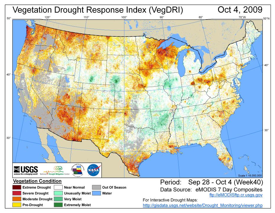
6 Water Management: National Drought Monitoring System Terra & Aqua More efficiencies (2-3 x) can be gained using server with faster CPU speeds. USGS Drought Monitoring Drought_Monitoring/viewer.php T+10hrs T+11hrs EDOS MODIS L0 Data T+2-5hrs emodis System USGS/EROS USGS/EROS Vegetation Dynamics and VegDRI System NIDIS Drought Portal Drought DSS NOAA U.S. Department of the Interior U.S. Geological Survey Drought DSS: Desired/required 24 hour or less data delivery schedule NDMC Vegetation Drought Response Index vegdri/vegdri_main.htm Data Deadline: Monday 12:00 p.m. March 2005
7 FY 2009 Progress Tif and image output Achieved automated ingest into interactive web map viewer, only available internally to date [ ring/viewer.php] Web site release to public planned for October, 2009 Graphical maps staged to FTP
8 FY 2009 Progress: Drought System Production Delivery Monday Date week Delivery TOD Notes 6/1/ :26:19 Test mode 6/8/ :22:23 Next day, test mode 6/15/ :27:36 Test mode 6/22/ :56:48 6/29/ :18:22 7/6/ :06:46 7/13/ :08:12 7/20/ :31:59 Next day 7/27/ :01:09 M. Svoboda used in USDM DSS 8/3/ :46:02 M. Svoboda used in USDM DSS 8/10/ :46:00 8/17/ :07:16 Graphic products delivered to ftp 8/24/ :10:22 Graphic products delivered to ftp 8/31/ :45:42 Graphic products delivered to ftp
9 FY 2009 Progress: Drought System Production Delivery Monday Date week Delivery TOD Notes 9/7/ :56:22 Graphic products delivered to ftp 9/14/ :16:04 Graphic products delivered to ftp 9/21/ :48:03 Graphic products delivered to ftp, Sat data input 9/28/ :59:59 Graphic products delivered to ftp 10/5/ :16:22 Graphic products delivered to ftp 10/12/
10
11 FY 2009 Progress Data validation evaluation (EROS and NDMC) Performed historical comparisons between emodis and AVHRR-based drought products (apparent differences because of historical coverage, further evaluation and report in FY2010)
12 FY 2009 Accomplishments Data Continuity Methodology* Translation Equation B (delivered 9/1/09) Based on cloud-screened NOAA-17 AVHRR/3 and emodis Terra NDVI, Two regression methods Conventional maximum likelihood regression Geometric mean regression *Collaboration with T. Miura, Univ. of Hawaii
13 FY2009 Accomplishments: Presentations Gu, Y., Brown, J.F., van Leewen, W., Reed, B.C., and Miura, T., Phenologic classification of the United States: a framework for extending a multisensor time series for vegetation drought monitoring, In Proceedings of the Annual Meeting of the Association of American Geographers, March, 2009, Las Vegas, Nevada. [Presentation]. Brown, J.F., Miura, T., Gu, Y., Jenkerson, C., and Wardlow, B., Utilizing a multi-sensor satellite time series in real-time drought monitoring across the United States, In Proceedings of the 2009 Joint Assembly of the American Geophysical Union, May, 2009, Toronto, Canada. [Presentation].
14 FY2010 Work Plan Complete and integrate code for greenness ranking products Test greenness ranking product in USDM DSS Continue regular weekly production (VegDRI, BPASG, NDVIrank) Assure accurate ingest of weekly products into USGS and NIDIS viewers
15 FY2010 Work Plan Complete plan for operational under USGS/EROS Full evaluation of data translation (Eq. B) and products
16 FY2010 Work Plans: Publications and Presentations Gu, Y., Brown, J.F., Miura, T., van Leewen, W., and Reed, B.C., Phenological classification of the United States: a geographic framework for extending multisensor time series data, manuscript in preparation AGU presentations Remote sensing techniques for monitoring drought hazards: an intercomparison Cross-calibration of AVHRR and MODIS NDVI conterminous United States datasets

17 A Drought product intercomparison USDM USDM ESI emodis AVHRR Palmer Z Anomalies Anomalies VegDRI VHI Anomalies M J J


18 Water Management: National Drought Monitoring System Earth System Models Land Surface Models: Vegetation Drought Response Index Predictions/Forecasts Information products Vegetation Indices MODIS NDVI MODIS NDWI AVHRR NDVI Phenological Metrics Start of Season Start of Season Anomaly Seasonal Greenness Decision Support Systems, Assessments, Management Actions National Integrated Drought Information System US Drought Monitor Weekly map and narrative NIDIS web portal Value & Benefits to Society Quantitative and qualitative benefits from improved decisions Wider dissemination of drought information Improved understanding of drought effects at sub-county scale Earth Observations Land Surface Vegetation: MODIS and AVHRR Precipitation: Weather Station networks, RADAR observations Land Use/Land Cover: Landsat, MODIS Percent of Average SG Gridded Rainfall Products Calibrated RADAR Standardized Precipitation Index Observations, Parameters & Products Analyses Early Drought Detection Drought Spatial Extent Drought State/Drought Severity Decisions / Actions Drought Plans Activated Urban Water Restrictions Drought Assistance Programs Agricultural Choices for Water Conservation Quicker response for State Drought Task Forces and State Governors Increased spatial precision in drought emergency designations Better informed state and local decision making leading to more effective use of available water and drought relief program resources
Enhancement of the U.S. Drought Monitor Through the Integration of NASA Vegetation Index Imagery
 Enhancement of the U.S. Drought Monitor Through the Integration of NASA Vegetation Index Imagery Project and Related Activities at USGS/EROS Jim Verdin, Jesslyn Brown, Yingxin Gu, Gail Schmidt, Troy McVay
U.S. Land Surface Phenology: Methods, Data, and Applications. U.S. Department of the Interior U.S. Geological Survey
 U.S. Land Surface Phenology: Methods, Data, and Applications U.S. Department of the Interior U.S. Geological Survey Jesslyn Brown 23 January 2013 What and why Identify, track, and understand climaterelated
NIDIS Remote Sensing Workshop: Showcase of Products & Technologies
 Feature Article From Intermountain West Climate Summary, April 2008 NIDIS Remote Sensing Workshop: Showcase of Products & Technologies By Christina Alvord of WWA Three knowledge assessment workshops are
Assessing Drought in Agricultural Area of central U.S. with the MODIS sensor
 Assessing Drought in Agricultural Area of central U.S. with the MODIS sensor Di Wu George Mason University Oct 17 th, 2012 Introduction: Drought is one of the major natural hazards which has devastating
The Delaware Environmental Monitoring & Analysis Center
 The Delaware Environmental Monitoring & Analysis Center Tina Callahan Delaware Estuary Science & Environmental Summit 2013 January 27-30, 2013 What is DEMAC? Delaware Environmental Monitoring & Analysis
Drought Estimation Maps by Means of Multidate Landsat Fused Images
 Remote Sensing for Science, Education, Rainer Reuter (Editor) and Natural and Cultural Heritage EARSeL, 2010 Drought Estimation Maps by Means of Multidate Landsat Fused Images Diego RENZA, Estíbaliz MARTINEZ,
The National Integrated Drought Information System (NIDIS) Moving the Nation from Reactive to Proactive Drought Risk Management
 Moving the Nation from Reactive to Proactive Drought Risk Management") The National Integrated Drought Information System (NIDIS) Moving the Nation from Reactive to Proactive Drought Risk Management CSG-West Annual Meeting Agriculture & Water Committee Snowbird, UT September
The National Integrated Drought Information System (NIDIS) Moving the Nation from Reactive to Proactive Drought Risk Management CSG-West Annual Meeting Agriculture & Water Committee Snowbird, UT September
Regional Drought Decision Support System (RDDSS) Project Update and Product Concepts
 Project Update and Product Concepts") Regional Drought Decision Support System (RDDSS) Project Update and Product Concepts Part of the Red River Basin Decision Information Network (RRBDIN) NEXT-GEN RRBDIN Decision Support for the Red River
Regional Drought Decision Support System (RDDSS) Project Update and Product Concepts Part of the Red River Basin Decision Information Network (RRBDIN) NEXT-GEN RRBDIN Decision Support for the Red River
Drought and Climate Extremes Indices for the North American Drought Monitor and North America Climate Extremes Monitoring System. Richard R. Heim Jr.
 Drought and Climate Extremes Indices for the North American Drought Monitor and North America Climate Extremes Monitoring System Richard R. Heim Jr. NOAA/NESDIS/National Climatic Data Center Asheville,
The United States Drought Monitor How is it Made?
 The United States Drought Monitor How is it Made? Brian Fuchs, Climatologist National Drought Mitigation Center School of Natural Resources University of Nebraska-Lincoln September 14-17, 2009 Bamako,
An Overview of Operations at the West Gulf River Forecast Center Gregory Waller Service Coordination Hydrologist NWS - West Gulf River Forecast Center
 National Weather Service West Gulf River Forecast Center An Overview of Operations at the West Gulf River Forecast Center Gregory Waller Service Coordination Hydrologist NWS - West Gulf River Forecast
NADM, NACEM, and Opportunities for Future Collaboration
 NADM, NACEM, and Opportunities for Future Collaboration Richard R. Heim Jr. NOAA/NESDIS/National Climatic Data Center Asheville, North Carolina, U.S.A. 4th Annual DRI Workshop 26-28 January 2009, Regina,
International Desks: African Training Desk and Projects
 The Climate Prediction Center International Desks: African Training Desk and Projects Wassila M. Thiaw Team Leader Climate Prediction Center National Centers for Environmental Predictions 1 African Desk
USGS Water Census Guidelines and Specifications for ET Remote Sensing
 USGS Water Census Guidelines and Specifications for ET Remote Sensing U.S. Department of the Interior U.S. Geological Survey Guidelines and specifications Many prior and ongoing crop ET remote sensing
The U.S. Drought Monitor: A Composite Indicator Approach
 The U.S. Drought Monitor: A Composite Indicator Approach Mark Svoboda, Climatologist Monitoring Program Area Leader National Drought Mitigation Center School of Natural Resources University of Nebraska-Lincoln
Sources of Imagery and GIS Data Layers (Last updated October 2005)
") Sources of Imagery and GIS Data Layers (Last updated October 2005) The question of where to find data is one often asked by beginners in precision agriculture and other geospatial projects. The following
Sources of Imagery and GIS Data Layers (Last updated October 2005) The question of where to find data is one often asked by beginners in precision agriculture and other geospatial projects. The following
The U.S. Drought Monitor and tools from the National Drought Mitigation Center
 The U.S. Drought Monitor and tools from the National Drought Mitigation Center Brian Fuchs, Climatologist National Drought Mitigation Center School of Natural Resources University of Nebraska-Lincoln Winter
The Vegetation Outlook (VegOut): A New Tool for Providing Outlooks of General Vegetation Conditions Using Data Mining Techniques
: A New Tool for Providing Outlooks of General Vegetation Conditions Using Data Mining Techniques") University of Nebraska - Lincoln DigitalCommons@University of Nebraska - Lincoln Drought Mitigation Center Faculty Publications Drought -- National Drought Mitigation Center 2007 The Vegetation Outlook
University of Nebraska - Lincoln DigitalCommons@University of Nebraska - Lincoln Drought Mitigation Center Faculty Publications Drought -- National Drought Mitigation Center 2007 The Vegetation Outlook
The North American Drought Monitor - The Canadian Perspective -
 The North American Drought Monitor - The Canadian Perspective - Trevor Hadwen National Agroclimate Information Service AAFC-PFRA, Regina Canmore, Alberta March 16-18, 2008 Background The NADM is a cooperative
GIS Tools, Data, & Methods in the Weekly US Drought Monitor
 GIS Tools, Data, & Methods in the Weekly US Drought Monitor International Workshop on Agromet and GIS Applications for Agricultural Decision Making Jeju, South Korea December 5, 2016 Eric Luebehusen USDA/OCE/WAOB
The U.S. Drought Monitor: Parameters, People, Process, Policy
 The U.S. Drought Monitor: Parameters, People, Process, Policy Mark Svoboda, Climatologist Monitoring Program Area Leader National Drought Mitigation Center School of Natural Resources University of Nebraska-Lincoln
Climate Prediction Center National Centers for Environmental Prediction
 NOAA s Climate Prediction Center Climate Monitoring Tool Wassila M. Thiaw and CPC International Team Climate Prediction Center National Centers for Environmental Prediction CPC International Team Vadlamani
REMOTELY SENSED INFORMATION FOR CROP MONITORING AND FOOD SECURITY
 LEARNING OBJECTIVES Lesson 4 Methods and Analysis 2: Rainfall and NDVI Seasonal Graphs At the end of the lesson, you will be able to: understand seasonal graphs for rainfall and NDVI; describe the concept
The U.S. Drought Monitor: A Composite Indicator Approach
 The U.S. Drought Monitor: A Composite Indicator Approach Mark Svoboda, Climatologist Monitoring Program Area Leader National Drought Mitigation Center University of Nebraska-Lincoln NWS IN Climate Services
Drought and its effect on vegetation, comparison of NDVI for drought and non-drought years related to Land use classifications
 Drought and its effect on vegetation, comparison of NDVI for drought and non-drought years related to Land use classifications Jabbari *, S., Khajeddin, S. J. Jafari, R, Soltani, S and Riahi, F s.jabbari_62@yahoo.com
Weather and climate outlooks for crop estimates
 Weather and climate outlooks for crop estimates CELC meeting 2016-04-21 ARC ISCW Observed weather data Modeled weather data Short-range forecasts Seasonal forecasts Climate change scenario data Introduction
NESDIS Global Automated Satellite Snow Product: Current Status and Planned Upgrades Peter Romanov
 NESDIS Global Automated Satellite Snow Product: Current Status and Planned Upgrades Peter Romanov NOAA-CREST, City University of New York (CUNY) Center for Satellite Applications and Research (STAR), NOAA/NESDIS
Cross-Sensor Continuity Science Algorithm
 Cross-Sensor Continuity Science Algorithm - Long Term Vegetation Index and Phenology Workshop - Javzan Tsend-Ayush and Tomoaki Miura Department of Natural Resources and Environmental Management University
Greening of Arctic: Knowledge and Uncertainties
 Greening of Arctic: Knowledge and Uncertainties Jiong Jia, Hesong Wang Chinese Academy of Science jiong@tea.ac.cn Howie Epstein Skip Walker Moscow, January 28, 2008 Global Warming and Its Impact IMPACTS
Land Surface Temperature Measurements From the Split Window Channels of the NOAA 7 Advanced Very High Resolution Radiometer John C.
 Land Surface Temperature Measurements From the Split Window Channels of the NOAA 7 Advanced Very High Resolution Radiometer John C. Price Published in the Journal of Geophysical Research, 1984 Presented
Customizable Drought Climate Service for supporting different end users needs
 1 Customizable Drought Climate Service for supporting different end users needs Ramona MAGNO, T. De Filippis, E. Di Giuseppe, M. Pasqui, E. Rapisardi, L. Rocchi (IBIMET-CNR; LaMMA Consortium) 1 Congresso
NESDIS Global Automated Satellite Snow Product: Current Status and Recent Results Peter Romanov
 NESDIS Global Automated Satellite Snow Product: Current Status and Recent Results Peter Romanov NOAA-CREST, City University of New York (CUNY) Center for Satellite Applications and Research (STAR), NOAA/NESDIS
TAMSAT: LONG-TERM RAINFALL MONITORING ACROSS AFRICA
 TAMSAT: LONG-TERM RAINFALL MONITORING ACROSS AFRICA Ross Maidment, Emily Black, Matthew Young and Dagmawi Asfaw TAMSAT, University of Reading Helen Greatrex IRI, Columbia University 13 th EUMETSAT User
Canadian Urban Environmental Health Research Consortium
 DATA SET INFORMATION Data Set Title: Normalized Difference Vegetation Index (NDVI) MODIS Time Series Description: Theme Keywords: Place Keywords: Data preparation date: File Names File Type: Beginning
Effective Utilization of Synthetic Aperture Radar (SAR) Imagery in Rapid Damage Assessment
 Imagery in Rapid Damage Assessment") Effective Utilization of Synthetic Aperture Radar (SAR) Imagery in Rapid Damage Assessment Case Study Pakistan Floods SUPARCO M. Maisam Raza, Ahmad H. Rabbani SEQUENCE Flood Monitoring using Satellite
Effective Utilization of Synthetic Aperture Radar (SAR) Imagery in Rapid Damage Assessment Case Study Pakistan Floods SUPARCO M. Maisam Raza, Ahmad H. Rabbani SEQUENCE Flood Monitoring using Satellite
Kimberly J. Mueller Risk Management Solutions, Newark, CA. Dr. Auguste Boissonade Risk Management Solutions, Newark, CA
 1.3 The Utility of Surface Roughness Datasets in the Modeling of United States Hurricane Property Losses Kimberly J. Mueller Risk Management Solutions, Newark, CA Dr. Auguste Boissonade Risk Management
NIDIS Intermountain West Drought Early Warning System October 17, 2017
 NIDIS Drought and Water Assessment NIDIS Intermountain West Drought Early Warning System October 17, 2017 Precipitation The images above use daily precipitation statistics from NWS COOP, CoCoRaHS, and
Precipitation. Standardized Precipitation Index. NIDIS Intermountain West Drought Early Warning System September 5, 2017
 9/6/2017 NIDIS Drought and Water Assessment NIDIS Intermountain West Drought Early Warning System September 5, 2017 Precipitation The images above use daily precipitation statistics from NWS COOP, CoCoRaHS,
Introduction to Satellite Derived Vegetation Indices
 Introduction to the Use of Geospatial Information Technology for Drought Risk Management 13-17 November, 2017 Tonle Bassac II Restaurant, Phnom Penh, Cambodia Introduction to Satellite Derived Vegetation
Applications of yield monitoring systems and agricultural statistics in agricultural (re)insurance
insurance") Image: used under license from shutterstock.com Applications of yield monitoring systems and agricultural statistics in agricultural (re)insurance 18 October 2018 Ernst Bedacht Agenda Introduction 1. Munich
Image: used under license from shutterstock.com Applications of yield monitoring systems and agricultural statistics in agricultural (re)insurance 18 October 2018 Ernst Bedacht Agenda Introduction 1. Munich
NIDIS Intermountain West Drought Early Warning System November 21, 2017
 NIDIS Drought and Water Assessment NIDIS Intermountain West Drought Early Warning System November 21, 2017 Precipitation The images above use daily precipitation statistics from NWS COOP, CoCoRaHS, and
AN INSIDE LOOK AT THE U.S. DROUGHT MONITOR
 AN INSIDE LOOK AT THE U.S. DROUGHT MONITOR Great Basin Climate Forum Desert Research Institute Reno, Nevada December 6, 2018 David B. Simeral U.S. Drought Monitor Author Associate Research Scientist -
GLOBAL/CONTINENTAL LAND COVER MAPPING AND MONITORING
 GLOBAL/CONTINENTAL LAND COVER MAPPING AND MONITORING Ryutaro Tateishi, Cheng Gang Wen, and Jong-Geol Park Center for Environmental Remote Sensing (CEReS), Chiba University 1-33 Yayoi-cho Inage-ku Chiba
Global Satellite Products & Services for Agricultural and Vegetation Health
 Global Satellite Products & Services for Agricultural and Vegetation Health Presented at the WMO Expert Meeting on National Early Warning System for Agricultural Weather Management George Mason University
NIDIS Intermountain West Drought Early Warning System August 8, 2017
 NIDIS Drought and Water Assessment 8/8/17, 4:43 PM NIDIS Intermountain West Drought Early Warning System August 8, 2017 Precipitation The images above use daily precipitation statistics from NWS COOP,
NIDIS Intermountain West Drought Early Warning System December 11, 2018
 NIDIS Drought and Water Assessment NIDIS Intermountain West Drought Early Warning System December 11, 2018 Precipitation The images above use daily precipitation statistics from NWS COOP, CoCoRaHS, and
The use of satellite images to forecast agricultural production
 The use of satellite images to forecast agricultural production Artur Łączyński Central Statistical Office, Agriculture Department Niepodległości 208 Warsaw, Poland E-mail a.laczynski@stat.gov.pl DOI:
Precipitation. Standardized Precipitation Index. NIDIS Intermountain West Regional Drought Early Warning System January 3, 2017
 1/3/2017 NIDIS Drought and Water Assessment NIDIS Intermountain West Regional Drought Early Warning System January 3, 2017 Precipitation The images above use daily precipitation statistics from NWS COOP,
The History and Making of the U.S. Drought Monitor
 The History and Making of the U.S. Drought Monitor Mike Hayes, Director Mark Svoboda, Climatologist/Monitoring Program Area Leader Kelly Smith, Communications Specialist National Drought Mitigation Center
High Resolution Indicators for Local Drought Monitoring
 High Resolution Indicators for Local Drought Monitoring REBECCA CUMBIE, STATE CLIMATE OFFICE OF NC, NCSU Monitoring Drought Multiple indicators, multiple sources Local detail important 1 Point-Based Climate-Division
Utility of National Spatial Data for Conservation Design Projects
 Utility of National Spatial Data for Conservation Design Projects Steve Williams Biodiversity and Spatial Information Center North Carolina State University PIF CDW St. Louis, MO April 11, 2006 Types of
StreamStats: Delivering Streamflow Information to the Public. By Kernell Ries
 StreamStats: Delivering Streamflow Information to the Public By Kernell Ries U.S. Department of the Interior U.S. Geological Survey MD-DE-DC District 410-238-4317 kries@usgs.gov StreamStats Web Application
GI Technology for Disaster Management
 GI Technology for Disaster Management 17 th ICC on the Regional Space Applications Programme for Sustainable Development (RESAP) 26 th Nov 2013 Bangkok Thailand Period and time of seasonal in thailand
Droughts are normal recurring climatic phenomena that vary in space, time, and intensity. They may affect people and agriculture at local scales for
 I. INTRODUCTION 1.1. Background Droughts are normal recurring climatic phenomena that vary in space, time, and intensity. They may affect people and agriculture at local scales for short periods or cover
CARIWIN Regional Seminar January 14-15, 2010, Georgetown, Guyana
 Creating the North American Drought Monitor Angel (Bennett) McCoy Angel.M.Bennett@noaa.gov NOAA/Climate Prediction Center Camp Springs, Maryland, U.S.A. Doug LeComte NOAA/Climate Prediction Center Richard
RESEARCH METHODOLOGY
 III. RESEARCH METHODOLOGY 3.1 Time and Location This research has been conducted in period March until October 2010. Location of research is over Sumatra terrain. Figure 3.1 show the area of interest of
RHOAPS. Real-time Hydrology Ocean Atmosphere Prediction System. Pronunciation: Ropes Motto: More than just THREDDS
 RHOAPS Real-time Hydrology Ocean Atmosphere Prediction System Pronunciation: Ropes Motto: More than just THREDDS Key Aspects Integrated real-time data systems Atmospheric Hydrologic Coastal oceans Societal
Transboundary water management with Remote Sensing. Oluf Jessen DHI Head of Projects, Water Resources Technical overview
 Transboundary water management with Remote Sensing Oluf Jessen DHI Head of Projects, Water Resources Technical overview ozj@dhigroup.com Transboundary water management Water management across national
Real-Time Meteorological Gridded Data: What s New With HEC-RAS
 Real-Time Meteorological Gridded Data: What s New With HEC-RAS Acquisition and Application of Gridded Meteorological Data in Support of the USACE s Real-Time Water Management Mission Fauwaz Hanbali, Tom
1.6 TRENDS AND VARIABILITY OF SNOWFALL AND SNOW COVER ACROSS NORTH AMERICA AND EURASIA. PART 2: WHAT THE DATA SAY
 1.6 TRENDS AND VARIABILITY OF SNOWFALL AND SNOW COVER ACROSS NORTH AMERICA AND EURASIA. PART 2: WHAT THE DATA SAY David A. Robinson* Rutgers University, Department of Geography, Piscataway, New Jersey
Existing NWS Flash Flood Guidance
 Introduction The Flash Flood Potential Index (FFPI) incorporates physiographic characteristics of an individual drainage basin to determine its hydrologic response. In flash flood situations, the hydrologic
Analyzing Long-Term Drought Effects on Land Surface Temperature and Vegetation Using National Oceanic Atmospheric Administration Satellite s Data
 Analyzing Long-Term Drought Effects on Land Surface Temperature and Vegetation Using National Oceanic Atmospheric Administration Satellite s Data Cornelius Holmes, Derek Morris Jr. S Abstract Analyzing
NIDIS Intermountain West Drought Early Warning System April 18, 2017
 1 of 11 4/18/2017 3:42 PM Precipitation NIDIS Intermountain West Drought Early Warning System April 18, 2017 The images above use daily precipitation statistics from NWS COOP, CoCoRaHS, and CoAgMet stations.
TO PRODUCE VEGETATION OUTLOOK MAPS AND MONITOR DROUGHT
 6.2 IDENTIFYING TIME-LAG RELATIONSHIPS BETWEEN VEGETATION CONDITION AND CLIMATE TO PRODUCE VEGETATION OUTLOOK MAPS AND MONITOR DROUGHT Tsegaye Tadesse*, Brian D. Wardlow, and Jae H. Ryu National Drought
CHAPTER 1 THE UNITED STATES 2001 NATIONAL LAND COVER DATABASE
 CHAPTER 1 THE UNITED STATES 2001 NATIONAL LAND COVER DATABASE Collin Homer*, Jon Dewitz, Joyce Fry, and Nazmul Hossain *U.S. Geological Survey (USGS) Center for Earth Resources Observation and Science
NIDIS Intermountain West Drought Early Warning System April 16, 2019
 NIDIS Intermountain West Drought Early Warning System April 16, 2019 Precipitation The images above use daily precipitation statistics from NWS COOP, CoCoRaHS, and CoAgMet stations. From top to bottom,
An Overview of USAID / FEWS-NET Activities at CPC
 An Overview of USAID / FEWS-NET Activities at CPC Nick Novella 12, Wassila Thiaw 2, Tom Di Liberto 12, Vadlamani Kumar 12 Nicholas.Novella@noaa.gov 1 Wyle Information Systems, CPC/NCEP/NWS/NOAA 1 Climate
Development of the Canadian Precipitation Analysis (CaPA) and the Canadian Land Data Assimilation System (CaLDAS)
 and the Canadian Land Data Assimilation System (CaLDAS)") Development of the Canadian Precipitation Analysis (CaPA) and the Canadian Land Data Assimilation System (CaLDAS) Marco L. Carrera, Vincent Fortin and Stéphane Bélair Meteorological Research Division Environment
Development of the Canadian Precipitation Analysis (CaPA) and the Canadian Land Data Assimilation System (CaLDAS) Marco L. Carrera, Vincent Fortin and Stéphane Bélair Meteorological Research Division Environment
Climate Prediction Center Research Interests/Needs
 Climate Prediction Center Research Interests/Needs 1 Outline Operational Prediction Branch research needs Operational Monitoring Branch research needs New experimental products at CPC Background on CPC
NIDIS Intermountain West Drought Early Warning System November 14, 2017
 NIDIS Intermountain West Drought Early Warning System November 14, 2017 Precipitation The images above use daily precipitation statistics from NWS COOP, CoCoRaHS, and CoAgMet stations. From top to bottom,
Monitoring vegetation activity in Hungary using Direct Broadcast MODIS data
 Monitoring vegetation activity in Hungary using Direct Broadcast MODIS data Anikó Kern1 Contributors: Szilárd Pásztor1, Péter Bognár1, Zoltán Barcza2, Gábor Timár1, János Lichtenberger1, Péter Steinbach3,
DROUGHT ASSESSMENT USING SATELLITE DERIVED METEOROLOGICAL PARAMETERS AND NDVI IN POTOHAR REGION
 DROUGHT ASSESSMENT USING SATELLITE DERIVED METEOROLOGICAL PARAMETERS AND NDVI IN POTOHAR REGION Researcher: Saad-ul-Haque Supervisor: Dr. Badar Ghauri Department of RS & GISc Institute of Space Technology
Activities of NOAA s NWS Climate Prediction Center (CPC)
") Activities of NOAA s NWS Climate Prediction Center (CPC) Jon Gottschalck and Dave DeWitt Improving Sub-Seasonal and Seasonal Precipitation Forecasting for Drought Preparedness May 27-29, 2015 San Diego,
Activities of NOAA s NWS Climate Prediction Center (CPC) Jon Gottschalck and Dave DeWitt Improving Sub-Seasonal and Seasonal Precipitation Forecasting for Drought Preparedness May 27-29, 2015 San Diego,
Regional Centre for Mapping of Resources for Development (RCMRD), Nairobi, Kenya
, Nairobi, Kenya") Regional Centre for Mapping of Resources for Development (RCMRD), Nairobi, Kenya Introduction to GIS (2 weeks: 10 days) Intakes: 8 th January, 6 th February, 5th March, 3 rd. April 9 th, May 7 th, June
Regional Centre for Mapping of Resources for Development (RCMRD), Nairobi, Kenya Introduction to GIS (2 weeks: 10 days) Intakes: 8 th January, 6 th February, 5th March, 3 rd. April 9 th, May 7 th, June
Comparison of MSG-SEVIRI and SPOT-VEGETATION data for vegetation monitoring over Africa
 Comparison of MSG-SEVIRI and SPOT-VEGETATION data for vegetation monitoring over Africa Bernard LACAZE CNRS UMR 8586 PRODIG Pôle Image et Campus Spatial, Université Paris Diderot Paris 7 Objectives Comparison
Remote Sensing products and global datasets. Joint Research Centre, European Commission
 Remote Sensing products and global datasets Joint Research Centre, European Commission Setting the stage. Needs and requirements for integrated approach(es) for land degradation assessment. in Special
Regional Centre for Mapping of Resources for Development (RCMRD), Nairobi, Kenya
, Nairobi, Kenya") Regional Centre for Mapping of Resources for Development (RCMRD), Nairobi, Kenya Introduction GIS ( 2 weeks: 10 days) Intakes: 7 th Jan, 4 th Feb,4 th March, 1 st April 6 th May, 3 rd June, 1 st July,
Regional Centre for Mapping of Resources for Development (RCMRD), Nairobi, Kenya Introduction GIS ( 2 weeks: 10 days) Intakes: 7 th Jan, 4 th Feb,4 th March, 1 st April 6 th May, 3 rd June, 1 st July,
Land Management and Natural Hazards Unit --- DESERT Action 1. Land Management and Natural Hazards Unit Institute for Environment and Sustainability
 Land Management and Natural Hazards Unit --- DESERT Action 1 Monitoring Drought with Meteorological and Remote Sensing Data A case study on the Horn of Africa Paulo Barbosa and Gustavo Naumann Land Management
The Global Land Cover Facility
 The Global Land Cover Facility REASoN Activities John Townshend, Principal Investigator Joseph JaJa, Co-Principal Investigator Paul Davis, Science Manager University of Maryland January 2004 The GLCF The
AGOG 485/585 /APLN 533 Spring Lecture 5: MODIS land cover product (MCD12Q1). Additional sources of MODIS data
. Additional sources of MODIS data") AGOG 485/585 /APLN 533 Spring 2019 Lecture 5: MODIS land cover product (MCD12Q1). Additional sources of MODIS data Outline Current status of land cover products Overview of the MCD12Q1 algorithm Mapping
AGOG 485/585 /APLN 533 Spring 2019 Lecture 5: MODIS land cover product (MCD12Q1). Additional sources of MODIS data Outline Current status of land cover products Overview of the MCD12Q1 algorithm Mapping
The contribution of VEGETATION
 The contribution of VEGETATION /SPOT4 products to remote sensing applications for food security, early warning and environmental monitoring in the IGAD sub region G. Pierre, C. Crépeau, P. Bicheron, T.
NIDIS Intermountain West Drought Early Warning System October 30, 2018
 10/30/2018 NIDIS Drought and Water Assessment NIDIS Intermountain West Drought Early Warning System October 30, 2018 Precipitation The images above use daily precipitation statistics from NWS COOP, CoCoRaHS,
LCMAP Workshop Welcome. Jesslyn F. Brown USGS/EROS Nov 6, 2018
 LCMAP Workshop Welcome Jesslyn F. Brown USGS/EROS Nov 6, 2018 LCMAP: Workshop Goals Land Change Monitoring, Analysis, and Projection (LCMAP) Provide an update on current status (Version 1) Algorithm approaches
BSYSE 456/556 Surface Hydrologic Processes and Modeling
 BSYSE 456/556 Surface Hydrologic Processes and Modeling Lab 9 (Prepared by Erin Brooks and Jan Boll, UI, and Joan Wu, WSU) P Introduction One of the most difficult tasks in watershed assessment and management
National Drought Mitigation Center. Drought Services: Collaborative Efforts Towards Drought Early Warning and Information Systems
 National Drought Mitigation Center Drought Services: Collaborative Efforts Towards Drought Early Warning and Information Systems Mark Svoboda, Climatologist Monitoring Program Area Leader National Drought
NIDIS Intermountain West Drought Early Warning System May 23, 2017
 NIDIS Drought and Water Assessment NIDIS Intermountain West Drought Early Warning System May 23, 2017 Precipitation The images above use daily precipitation statistics from NWS COOP, CoCoRaHS, and CoAgMet
Regional Centre for Mapping of Resources for Development (RCMRD), Nairobi, Kenya. Introduction GIS ( 2 weeks: 10 days)
, Nairobi, Kenya. Introduction GIS ( 2 weeks: 10 days)") Regional Centre for Mapping of Resources for Development (RCMRD), Nairobi, Kenya Introduction GIS ( 2 weeks: 10 days) Intakes: 8 th Jan, 6 th Feb,5 th March, 3 rd April 9 th, May 7 th, June 4 th, July
Regional Centre for Mapping of Resources for Development (RCMRD), Nairobi, Kenya Introduction GIS ( 2 weeks: 10 days) Intakes: 8 th Jan, 6 th Feb,5 th March, 3 rd April 9 th, May 7 th, June 4 th, July
Chapter 2 Drought Hazard in Bihar
 Chapter 2 Drought Hazard in Bihar 2.1 Introduction Drought occurs when a region faces a deficiency in its water supply either surface or underground for an extended period of months or years, due to consistent
European Drought Observatory Progress on Drought Monitoring
 European Drought Observatory Progress on Drought Monitoring Alfred de Jager Diego Magni European Commission Joint Research Centre (JRC) Disaster Risk Management Unit Outline 1. Introduction Philosophy
NOAA Direct Broadcast Real-Time Network Status
 NOAA Direct Broadcast Real-Time Network Status Liam Gumley (CIMSS/SSEC/UW-Madison) Mitch Goldberg (JPSS/NOAA) WMO DBNET Operators Meeting Sept 2016 Overview NOAA antennas for Honolulu, Madison, Miami,
Multi Radar Multi Sensor NextGen Weather Program. Presentation materials sourced from: Ken Howard HydroMet Research Group NSSL Warning R&D Division
 Multi Radar Multi Sensor NextGen Weather Program Presentation materials sourced from: Ken Howard HydroMet Research Group NSSL Warning R&D Division What is Multiple Radar Multi Sensor System () is the world
NIDIS Intermountain West Drought Early Warning System July 18, 2017
 NIDIS Drought and Water Assessment NIDIS Intermountain West Drought Early Warning System July 18, 2017 Precipitation The images above use daily precipitation statistics from NWS COOP, CoCoRaHS, and CoAgMet
NIDIS Intermountain West Drought Early Warning System December 30, 2018
 1/2/2019 NIDIS Drought and Water Assessment NIDIS Intermountain West Drought Early Warning System December 30, 2018 Precipitation The images above use daily precipitation statistics from NWS COOP, CoCoRaHS,
Summary of SARP Kickoff Workshop 10/1/ /2/2012
 Summary of SARP Kickoff Workshop 10/1/2012-10/2/2012 On October 1 st a kickoff meeting for the Integrating Climate Forecasts and Reforecasts into Decision Making SARP project was held in Salt Lake City
NIDIS Intermountain West Drought Early Warning System November 13, 2018
 NIDIS Intermountain West Drought Early Warning System November 13, 2018 Precipitation The images above use daily precipitation statistics from NWS COOP, CoCoRaHS, and CoAgMet stations. From top to bottom,
NIDIS Intermountain West Drought Early Warning System February 19, 2019
 NIDIS Intermountain West Drought Early Warning System February 19, 2019 Precipitation The images above use daily precipitation statistics from NWS COOP, CoCoRaHS, and CoAgMet stations. From top to bottom,
Geoprocessing Hydrometeorological Datasets to Assess National Weather Service (NWS) Forecasts
 Forecasts") Geoprocessing Hydrometeorological Datasets to Assess National Weather Service (NWS) Forecasts Jack Settelmaier National Weather Service Southern Region HQ Fort Worth, Texas ABSTRACT The National Weather
Geoprocessing Hydrometeorological Datasets to Assess National Weather Service (NWS) Forecasts Jack Settelmaier National Weather Service Southern Region HQ Fort Worth, Texas ABSTRACT The National Weather
Great Lakes Information Network GIS (Queryable by topic, geography, organization, and upload date 73 layers as of October, 2009)
") Google Earth Files for the Great Lakes and Beyond GLOS Mapping Workshop Alpena, Michigan November 9, 2009 David Hart GIS Specialist University of Wisconsin Sea Grant Institute GREAT LAKES Great Lakes Information
Google Earth Files for the Great Lakes and Beyond GLOS Mapping Workshop Alpena, Michigan November 9, 2009 David Hart GIS Specialist University of Wisconsin Sea Grant Institute GREAT LAKES Great Lakes Information
Research applications with Click to edit Master title style NOAA s Climate Data Record Program
 Research applications with Click to edit Master title style NOAA s Climate Data Record Program Click to edit Master subtitle style Jessica Matthews November 29, 2016 1 NOAA s CDR Program Mission: To develop
GMES: calibration of remote sensing datasets
 GMES: calibration of remote sensing datasets Jeremy Morley Dept. Geomatic Engineering jmorley@ge.ucl.ac.uk December 2006 Outline Role of calibration & validation in remote sensing Types of calibration