Monitoring Sea Ice with Space-borne Synthetic Aperture Radar
|
|
|
- Job Pitts
- 5 years ago
- Views:
Transcription

1 Monitoring Sea Ice with Space-borne Synthetic Aperture Radar Torbjørn Eltoft UiT- the Arctic University of Norway CIRFA A Centre for Research-based Innovation cirfa.uit.no
2 Sea ice & climate Some basic facts Sea ice covers the polar oceans in the Arctic and the Antarctic The area covered by ice varies seasonally; the Arctic sea ice extent in winter is about 3 x larger than in summer (in 2012: factor 4...) Sea ice is from a few cm to several meters thick Ridging and rafting due to dynamics can lead to very thick ice Two main classes: First-year ice and multiyear ice The ice gets covered by snow, which when melting forms melt ponds
 Sea Ice")
3 (R.G.Onsott & R. Schuchman) Sea Ice Types

4 Courtesy A. Renner
5 What do we want to know about sea ice - Sea ice segmentation - Sea ice type classification - Physical characterization of sea ice - Retrieval of geophysical parameters Concentration, thickness Roughness Ice floe size distribution Lead & ridge fraction Melt pond fraction Sea ice drift estimation


6 Sea Ice and Arctic Operations Oil & gas Shipping Tourism


7 Challenges related to Arctic industrial activities Low temperatures Icing Remoteness Sea Ice Darkness Low visibility Polar lows and arctic storms

8 Arctic surveillance: Requirements Independent of weather and light conditions Image at multiple scales High spatial resolution Frequent imaging of Areas of Interest Provide large information contents Combine sensors! Combine platforms! Synthtic Aperture Radar!


9 Some current & future radar Satellites Current Radarsat 2 TerraSAR X ALOS Palsar 2 Sentinel 1 COSMO SkyMed Radarsat Constallation Sentinel family


10 New opportunities Multiple polarizations Multiple frequencies Combined Radar/optical
11 Penetration of microwave signals in vegetation, soils and ice (after NASA, 1987)

12 ALOS 2 Scenes from the N-ICE campaign

13 Radarsat 2 Scenes from the N-ICE campaign


14 Pauli-decomposition RS2: C band 26. mai, 2015 ALOS 2: L band 26. mai, 2015 Copyright raw data MDA, Processed by KSAT Copyright raw data JAXA, 2015


15 NNED decomposition Copyright raw data MDA, Processed by KSAT Copyright raw data JAXA, 2015


16 Polarimetric Entropy


17 Sea ice classification Copyright raw data MDA, Processed by KSAT Moen, M. A.N., A.P. Doulgeris, S.N. Anfinsen, A.H.H. Renner, N. Hughes, S. Gerland and T. Eltoft: Comparison of automatic segmentation of full polarimetric SAR sea ice images with manually drawn ice charts, The Cryosphere, vol. 7, no. 6, pp , November, 2013.


18 Sea ice velocity estimation from image time series Correlation methods: Estimate accuracy with drifting buoys Copyright raw data MDA, Processed by KSAT


19 ALOS-2: Example of sea ice segmentation Copyright raw data JAXA, 2015
20 ALOS problems? Copyright raw data JAXA, 2015


21 ALOS problems? Meyer, F.J., J. Nicoll and A.P. Doulgeris: Characterization and correction of residual RFI signatures in operationally processed ALOS PALSAR imagery, Proc. EUSAR 2012, Nuremberg, Germany, pp , April, 2012 (Best Paper Award).


22 Centre for Integrated Remote Sensing and Forecasting for Arctic Operations (CIRFA) Objectives: Long term research on integrated remote sensing from satellites and airborne platforms for Arctic operations Requests for ALOS data: Satellite data is needed in algorithm development and in dedicated validation campaigns related to the various work packages


23 Work packages WP1: Ocean Remote Sensing PI: Norut 1.1 Retrieval of ocean winds 1.2 Retrieval of ocean surface currents 1.3 Detection and tracking of polar lows WP2: Sea Ice, Iceberg and Growler Remote Sensing PI: UiT 2.1 Classification & characterization of sea ice 2.2 Estimation of sea ice drift velocity field 2.3 Iceberg detection & characterization in open waters 2.4 Iceberg detection & characterization in sea ice 2.5 Tracking methodologies WP5: Drift Modelling and Prediction PI: Met.no 5.1: Data assimilation 5.2 Sea ice drift modelling and prediction 5.3: Oils spill drift modelling and prediction 5.4 Iceberg drift and deterioration WP6: Field Work PI: NPI 6.1 Yearly cruises to collect in situ data 6.2 Yearly helicopter flights with EM sounder 6.3 Freeze in of Lance winter 2015 WP3: Oil Spill Remote Sensing PI: UiT 3.1: Detection & characterization in open water 3.2: Detection & characterization in sea ice WP4: RPAS Technology PI: Norut 4.1: Technology for RPAS operation 4.2: Sensors for sea ice and iceberg mapping 4.3: Sensors for oil spill mapping 4.3: Technology for geo tagging of icebergs WP7: Pilot Service Demonstration PI: KSAT & Met.no 7.1 Arctic surveillance services design 7.2: System and data integration 7.3: Pilot service demonstration Iceberg services Sea ice services Oil spill services Polar Lows services


24 Thank you for your attention cirfa.uit.no
EXTRACTION OF LATE SUMMER SEA ICE PROPERTIES FROM POLARIMETRIC SAR FEATURES IN C- AND X- BAND
 EXTRACTION OF LATE SUMMER SEA ICE PROPERTIES FROM POLARIMETRIC SAR FEATURES IN C- AND X- BAND Ane S. Fors 1, Camilla Brekke 1, Sebastian Gerland 2, Anthony P. Doulgeris 1, and Torbjørn Eltoft 1 1 Department
Wave processes in Arctic Seas, observed from TerraSAR-X
 DISTRIBUTION STATEMENT A. Approved for public release; distribution is unlimited. Wave processes in Arctic Seas, observed from TerraSAR-X Susanne Lehner DLR German Air and Space Research Center Earth Observation
Fjernmåling og modellering av oljesøl - på åpen sjø og i is
 Fjernmåling og modellering av oljesøl - på åpen sjø og i is Associate Professor, Camilla Brekke CIRFA (SFI) WP3 leader - Oil Spill Remote Sensing cirfa.uit.no What we are aiming for Detection & characterization
DLR s TerraSAR-X contributes to international fleet of radar satellites to map the Arctic and Antarctica
 DLR s TerraSAR-X contributes to international fleet of radar satellites to map the Arctic and Antarctica The polar regions play an important role in the Earth system. The snow and ice covered ocean and
Ice surveys, meteorological and oceanographic data What is available and up-to-date?
 Ice surveys, meteorological and oceanographic data What is available and up-to-date? Leader of the Norwegian Ice Service +47 77 62 13 15 - nick.hughes@met.no Norwegian Meteorological Institute met.no 1
Paper 1: Late summer sea ice segmentation with multi-polarisation SAR features in C- and X-band
 Chapter 7 Paper 1: Late summer sea ice segmentation with multi-polarisation SAR features in C- and X-band Ane S. Fors, Camilla Brekke, Anthony P. Doulgeris, Torbjørn Eltoft, Angelika H. H. Renner and Sebastian
Evaluating the Discrete Element Method as a Tool for Predicting the Seasonal Evolution of the MIZ
 DISTRIBUTION STATEMENT A. Approved for public release; distribution is unlimited. Evaluating the Discrete Element Method as a Tool for Predicting the Seasonal Evolution of the MIZ Arnold J. Song Cold Regions
The Importance of Microwave Remote Sensing for Operational Sea Ice Services And Challenges
 The Importance of Microwave Remote Sensing for Operational Sea Ice Services And Challenges Wolfgang Dierking January 2015 (1) Why is microwave remote sensing important (=useful) for sea ice mapping? Problems
Arctic Regional Ocean Observing System Arctic ROOS Report from 2012
 Arctic Regional Ocean Observing System Arctic ROOS Report from 2012 By Stein Sandven Nansen Environmental and Remote Sensing Center (www.arctic-roos.org) Focus in 2012 1. Arctic Marine Forecasting Center
Monitoring of Arctic Conditions from a Virtual Constellation of Synthetic Aperture Radar Satellites
 DISTRIBUTION STATEMENT A. Approved for public release; distribution is unlimited. Monitoring of Arctic Conditions from a Virtual Constellation of Synthetic Aperture Radar Satellites Hans C. Graber RSMAS
Floating Ice: Progress in Addressing Science Goals
 Polar Floating Ice: Progress in Addressing Science Goals Stephen Howell 1, Leif Toudal Pedersen 2 and Roberto Saldo 3 1 Environment Canada, Climate Research Division, Toronto, Canada 2 Danish Meteorological
Remote sensing of sea ice
 Remote sensing of sea ice Ice concentration/extent Age/type Drift Melting Thickness Christian Haas Remote Sensing Methods Passive: senses shortwave (visible), thermal (infrared) or microwave radiation
VIDEO/LASER HELICOPTER SENSOR TO COLLECT PACK ICE PROPERTIES FOR VALIDATION OF RADARSAT SAR BACKSCATTER VALUES
 VIDEO/LASER HELICOPTER SENSOR TO COLLECT PACK ICE PROPERTIES FOR VALIDATION OF RADARSAT SAR BACKSCATTER VALUES S.J. Prinsenberg 1, I.K. Peterson 1 and L. Lalumiere 2 1 Bedford Institute of Oceanography,
Wave processes in Arctic Seas, observed from TerraSAR-X
 DISTRIBUTION STATEMENT A. Approved for public release; distribution is unlimited. Wave processes in Arctic Seas, observed from TerraSAR-X Susanne Lehner DLR German Air and Space Research Center Earth Observation
Application Status and Prospect of Microwave Remote Sensing
 2017 International Conference on Computing, Communications and Automation(I3CA 2017) Application Status and Prospect of Microwave Remote Sensing Cheng Lele, Yan Xinsui, Zhou Mengqiu, Zhou Yongqin, Wang
Marine Situational Awareness and Environmental Monitoring using Satellites
 1 The Ny-ålesund Symposium 2013 The Changing Arctic Opportunity or Threat Marine Situational Awareness and Environmental Monitoring using Satellites Rolf Skatteboe President, Kongsberg Satellite Services
Regional Sea Ice Outlook for Greenland Sea and Barents Sea - based on data until the end of May 2013
 Regional Sea Ice Outlook for Greenland Sea and Barents Sea - based on data until the end of May 2013 Sebastian Gerland 1*, Max König 1, Angelika H.H. Renner 1, Gunnar Spreen 1, Nick Hughes 2, and Olga
Spectral Albedos. a: dry snow. b: wet new snow. c: melting old snow. a: cold MY ice. b: melting MY ice. d: frozen pond. c: melting FY white ice
 Spectral Albedos a: dry snow b: wet new snow a: cold MY ice c: melting old snow b: melting MY ice d: frozen pond c: melting FY white ice d: melting FY blue ice e: early MY pond e: ageing ponds Extinction
Knowledge-based sea ice classification by polarimetric SAR
 Downloaded from orbit.dtu.dk on: Dec 17, 217 Knowledge-based sea ice classification by polarimetric SAR Skriver, Henning; Dierking, Wolfgang Published in: IEEE International Geoscience Remote Sensing Symposium,
Sentinel-1 Mission Status
 Sentinel-1 Mission Status Pierre Potin, Sentinel-1 Mission Manager, ESA Luca Martino, Technical Support Engineer, ESA... and the Sentinel-1 operations team PSTG SAR Coordination Working Group 14 December
Annual Report. CIRFA Centre for Integrated Remote Sensing and Forecasting for Arctic Operations
 2016 Annual Report CIRFA Centre for Integrated Remote Sensing and Forecasting for Arctic Operations 2016 IN REVIEW 2016 was the first year of full operation in CIRFA - Centre for Integrated Remote Sensing
Making a case for full-polarimetric radar remote sensing
 Making a case for full-polarimetric radar remote sensing Jeremy Nicoll Alaska Satellite Facility, University of Alaska Fairbanks 1 Polarization States of a Coherent Plane Wave electric field vector vertically
Infrastructure monitoring using SAR interferometry
 Infrastructure monitoring using SAR interferometry Hossein Nahavandchi Roghayeh Shamshiri Norwegian University of Science and Technology (NTNU), Department of Civil and Environmental Engineering Geodesy
Operational ice charting in mid-latitudes using Near-Real-Time SAR imagery
 Operational ice charting in mid-latitudes using Near-Real-Time SAR imagery Sergey Vernyayev Ice Engineer ICEMAN.KZ Carles Debart Project Manager Energy, Environment and Security Yevgeniy Kadranov Ice charting
On the potential of hand-held GPS tracking of fjord ice features for remote-sensing validation
 Annals of Glaciology 59(76pt2) 2018 doi: 10.1017/aog.2017.35 173 The Author(s) 2017. This is an Open Access article, distributed under the terms of the Creative Commons Attribution-NonCommercial-ShareAlike
AIRBORNE EM SEA-ICE THICHNESS PROFILING OVER BRACKISH BALTIC SEA WATER
 17th International Symposium on Ice Saint Petersburg, Russia, 21-25 June 2004 International Association of Hydraulic Engineering and Research AIRBORNE EM SEA-ICE THICHNESS PROFILING OVER BRACKISH BALTIC
Remote Sensing I: Basics
 Remote Sensing I: Basics Kelly M. Brunt Earth System Science Interdisciplinary Center, University of Maryland Cryospheric Science Laboratory, Goddard Space Flight Center kelly.m.brunt@nasa.gov (Based on
K&C Phase 4 Status report. Ice Sheet Monitoring using ALOS-2. University of California, Irvine 2 JPL
 K&C Phase 4 Status report Ice Sheet Monitoring using ALOS-2 Bernd Scheuchl 1, Jeremie Mouginot 1, Eric Rignot 1,2 1 University of California, Irvine 2 JPL Science Team meeting #24 Tokyo, Japan, January
EONav Satellite data in support of maritime route optimization
 EONav Satellite data in support of maritime route optimization Leif Eriksson Department of Space, Earth and Environment Chalmers University of Technology Outline Why is maritime navigation support needed?
EO-Based Ice and Iceberg Monitoring in Support of Offshore Engineering Design and Tactical Operations
 EO-Based Ice and Iceberg Monitoring in Support of Offshore Engineering Design and Tactical Operations Desmond Power, C-CORE ESA Industry Workshop on Satellite EO for the Oil and Gas Sector Overview Operations
Snow property extraction based on polarimetry and differential SAR interferometry
 Snow property extraction based on polarimetry and differential SAR interferometry S. Leinß, I. Hajnsek Earth Observation and Remote Sensing, Institute of Enviromental Science, ETH Zürich TerraSAR X and
New Era of Global Monitoring by ALOS-2: Advanced Land Observing Satellite-2 DAICHI-2 Yuko Suzuki
 New Era of Global Monitoring by ALOS-2: Advanced Land Observing Satellite-2 DAICHI-2 Yuko Suzuki International Relations and Research Department Japan Aerospace Exploration Agency (JAXA) 1 Dawning Era
We greatly appreciate the thoughtful comments from the reviewers. According to the reviewer s comments, we revised the original manuscript.
 Response to the reviews of TC-2018-108 The potential of sea ice leads as a predictor for seasonal Arctic sea ice extent prediction by Yuanyuan Zhang, Xiao Cheng, Jiping Liu, and Fengming Hui We greatly
CGMS Baseline. Sustained contributions to the Global Observing System. Endorsed by CGMS-46 in Bengaluru, June 2018
 CGMS Baseline Sustained contributions to the Global Observing System Best Practices for Achieving User Readiness for New Meteorological Satellites Endorsed by CGMS-46 in Bengaluru, June 2018 CGMS/DOC/18/1028862,
Assimilation of Snow and Ice Data (Incomplete list)
") Assimilation of Snow and Ice Data (Incomplete list) Snow/ice Sea ice motion (sat): experimental, climate model Sea ice extent (sat): operational, U.S. Navy PIPs model; Canada; others? Sea ice concentration
Assimilation of Snow and Ice Data (Incomplete list) Snow/ice Sea ice motion (sat): experimental, climate model Sea ice extent (sat): operational, U.S. Navy PIPs model; Canada; others? Sea ice concentration
Observations of Arctic snow and sea ice thickness from satellite and airborne surveys. Nathan Kurtz NASA Goddard Space Flight Center
 Observations of Arctic snow and sea ice thickness from satellite and airborne surveys Nathan Kurtz NASA Goddard Space Flight Center Decline in Arctic sea ice thickness and volume Kwok et al. (2009) Submarine
Opportunities for advanced Remote Sensing; an outsider s perspective
 Opportunities for advanced Remote Sensing; an outsider s perspective Ramon Hanssen Delft University of Technology 1 Starting questions Can we do more with the data we are already acquire? What s in stock
Sea Ice Motion: Physics and Observations Ron Kwok Jet Propulsion Laboratory California Institute of Technology, Pasadena, CA
 Sea Ice Motion: Physics and Observations Ron Kwok Jet Propulsion Laboratory California Institute of Technology, Pasadena, CA 7 th ESA Earth Observation Summer School ESRIN, Frascati, Italy 4-14 August
The Seasonal Evolution of Sea Ice Floe Size Distribution
 DISTRIBUTION STATEMENT A. Approved for public release; distribution is unlimited. The Seasonal Evolution of Sea Ice Floe Size Distribution Jacqueline A. Richter-Menge and Donald K. Perovich CRREL 72 Lyme
ICE DRIFT IN THE FRAM STRAIT FROM ENVISAT ASAR DATA
 ICE DRIFT IN THE FRAM STRAIT FROM ENVISAT ASAR DATA Stein Sandven (1), Kjell Kloster (1), and Knut F. Dagestad (1) (1) Nansen Environmental and Remote Sensing Center (NERSC), Thormøhlensgte 47, N-5006
SAWS: Met-Ocean Data & Infrastructure in Support of Industry, Research & Public Good. South Africa-Norway Science Week, 2016
 SAWS: Met-Ocean Data & Infrastructure in Support of Industry, Research & Public Good South Africa-Norway Science Week, 2016 Marc de Vos, November 2016 South Africa: Context http://learn.mindset.co.za/sites/default/files/resourcelib/e
Soil frost from microwave data. Kimmo Rautiainen, Jouni Pulliainen, Juha Lemmetyinen, Jaakko Ikonen, Mika Aurela
 Soil frost from microwave data Kimmo Rautiainen, Jouni Pulliainen, Juha Lemmetyinen, Jaakko Ikonen, Mika Aurela Why landscape freeze/thaw? Latitudinal variation in mean correlations (r) between annual
Distribution and Thickness of Different Sea Ice Types and Extreme Ice Features in the Beaufort Sea: 2012 Field Report
 Distribution and Thickness of Different Sea Ice Types and Extreme Ice Features in the Beaufort Sea: 2012 Field Report July 2012 NCR#5859681 - v1 DISTRIBUTION AND THICKNESS OF DIFFERENT SEA ICE TYPES AND
C-BAND MULTIPLE POLARIZATION SAR FOR ICE MONITORING WHAT CAN IT DO FOR THE CANADIAN ICE SERVICE
 C-BAND MULTIPLE POLARIZATION SAR FOR ICE MONITORING WHAT CAN IT DO FOR THE CANADIAN ICE SERVICE Matt Arkett, Dean Flett, and Roger De Abreu Canadian Ice Service, Meteorological Service of Canada, Environment
ICEBERGS IN THE BARENTS SEA
 ICEBERGS IN THE BARENTS SEA Mapping ice and snow conditions in the Barents Sea, part-report 1 Icebergs Leif J Dalsgaard, Petroleum Safety Authority Norway Tore Syversen, Sintef Mars Goals Achieve better
Application of Wavelet Spectrum Analysis to Oil Spill Detection by Using Satellite Observation Data
 PAJ Oil Spill Symposium 2008 Application of Wavelet Spectrum Analysis to Oil Spill Detection by Using Satellite Observation Data February 21, 2008 Tokyo, Japan Masanao Hara Dr., VisionTech Inc. 1. Background
CGMS Baseline In response to CGMS action/recommendation A45.01 HLPP reference: 1.1.8
 Prepared by WGIII Agenda Item: 7.1 Discussed in WGIII CGMS Baseline In response to CGMS action/recommendation A45.01 HLPP reference: 1.1.8 In CGMS-45, Working Group III agreed to hold a review of the CGMS
Dual-Frequency Ku- Band Radar Mission Concept for Snow Mass
 Dual-Frequency Ku- Band Radar Mission Concept for Snow Mass Chris Derksen Environment and Climate Change Canada Study Team: Climate Research Division/Meteorological Research Division, ECCC Canadian Space
Currents and Objects
 SAR Marine Applications Currents and Objects Martin Gade Uni Hamburg, Institut für Meereskunde martin.gade@uni-hamburg.de SAR Maritime Applications Friday, 9 Sep, Morning: 1 - History & Basics Introduction
How thick can Baltic sea ice get? Mikko Lensu Finnish Meteorological Institute
 How thick can Baltic sea ice get? Mikko Lensu Finnish Meteorological Institute In the Baltic ice research is closely related to winter navigation there are about 25 000 port calls to Finnish ports during
Improved sea-ice monitoring for the Baltic Sea Project summary
 Improved sea-ice monitoring for the Baltic Sea Project summary Leif E.B. Eriksson (1), Karin Borenäs (2), Wolfgang Dierking (3), Anders Berg (1) and Per Pemberton (2) (1) Chalmers University of Technology,
Permafrost: Earth Observation Applications: Introduction
 Polar Meeting 3 Permafrost: Earth Observation Applications: Introduction Mark Drinkwater CNES, Paris, 22 23 May, 2013 Remote Sensing of Permafrost which Remote Sensing products? applicability to Permafrost
PREDICTION AND MONITORING OF OCEANIC DISASTERS USING MICROWAVE REMOTE SENSING TECHNIQUES
 PREDICTION AND MONITORING OF OCEANIC DISASTERS USING MICROWAVE REMOTE SENSING TECHNIQUES O P N Calla International Centre for Radio Science, OM NIWAS A-23, Shastri Nagar, Jodhpur-342 003 Abstract The disasters
Use of Satellite Earth Observations, in situ data and numerical model capabilities for oil spill contingency. Page 1
 Use of Satellite Earth Observations, in situ data and numerical model capabilities for oil spill contingency Page 1 Oil spill service Page 2 Interest of Earth-Observation (EO) data for oil and gas companies
REVISION OF THE STATEMENT OF GUIDANCE FOR GLOBAL NUMERICAL WEATHER PREDICTION. (Submitted by Dr. J. Eyre)
") WORLD METEOROLOGICAL ORGANIZATION Distr.: RESTRICTED CBS/OPAG-IOS (ODRRGOS-5)/Doc.5, Add.5 (11.VI.2002) COMMISSION FOR BASIC SYSTEMS OPEN PROGRAMME AREA GROUP ON INTEGRATED OBSERVING SYSTEMS ITEM: 4 EXPERT
WORLD METEOROLOGICAL ORGANIZATION Distr.: RESTRICTED CBS/OPAG-IOS (ODRRGOS-5)/Doc.5, Add.5 (11.VI.2002) COMMISSION FOR BASIC SYSTEMS OPEN PROGRAMME AREA GROUP ON INTEGRATED OBSERVING SYSTEMS ITEM: 4 EXPERT
Small-scale horizontal variability of snow, sea-ice thickness and freeboard in the first-year ice region north of Svalbard
 Annals of Glaciology 54(62) 2013 doi:10.3189/2013aog62a157 261 Small-scale horizontal variability of snow, sea-ice thickness and freeboard in the first-year ice region north of Svalbard Jari HAAPALA, 1
Earth Observation + Artificial Intelligence = Smart Society 2.0
 Earth Observation + Artificial Intelligence = Smart Society 2.0 Dag Anders Moldestad Norwegian Space Centre Dag.anders.moldestad@spacecentre.no 22 51 18 09 Automatic sea ice analysis based on AMSR2 & Sentinel-1
Validation of sea ice concentration in the myocean Arctic Monitoring and Forecasting Centre 1
 Note No. 12/2010 oceanography, remote sensing Oslo, August 9, 2010 Validation of sea ice concentration in the myocean Arctic Monitoring and Forecasting Centre 1 Arne Melsom 1 This document contains hyperlinks
The Polar Ice Sheets Monitoring Project A Coordinated Response from Space Agencies
 The Polar Ice Sheets Monitoring Project A Coordinated Response from Space Agencies Yves Crevier / Members of the PSTG SAR Coordination WG Canadian Space Agency CEOS SIT-28 Meeting Hampton, Virginia, USA
Investigating Coastal Polynya Thin Sea Ice State in the Laptev Sea Using TerraSAR-X Dual-Pol Stripmap Data
 Investigating Coastal Polynya Thin Sea Ice State in the Laptev Sea Using TerraSAR-X Dual-Pol Stripmap Data Thomas Busche (1), Irena Hajnsek (1), Thomas Krumpen (2), Lasse Rabenstein (2), Jens Hoelemann
Coastal Ocean Applications Demonstrations of ALOS PALSAR Imagery for NOAA CoastWatch
 Coastal Ocean Applications Demonstrations of ALOS PALSAR Imagery for NOAA CoastWatch William Pichel Center for Satellite Applications and Research Frank Monaldo The Johns Hopkins University Applied Physics
Using Remote-sensed Sea Ice Thickness, Extent and Speed Observations to Optimise a Sea Ice Model
 Using Remote-sensed Sea Ice Thickness, Extent and Speed Observations to Optimise a Sea Ice Model Paul Miller, Seymour Laxon, Daniel Feltham, Douglas Cresswell Centre for Polar Observation and Modelling
Long term performance monitoring of ASCAT-A
 Long term performance monitoring of ASCAT-A Craig Anderson and Julia Figa-Saldaña EUMETSAT, Eumetsat Allee 1, 64295 Darmstadt, Germany. Abstract The Advanced Scatterometer (ASCAT) on the METOP series of
SST in Climate Research
 SST in Climate Research Roger Saunders, Met Office with inputs from Nick Rayner, John Kennedy, Rob Smith, Karsten Fennig, Sarah Millington, Owen Embury. This work is supported by the Joint DECC and Defra
J2.6 SONAR MEASUREMENTS IN THE GULF STREAM FRONT ON THE SOUTHEAST FLORIDA SHELF COORDINATED WITH TERRASAR-X SATELLITE OVERPASSES
 J2.6 SONAR MEASUREMENTS IN THE GULF STREAM FRONT ON THE SOUTHEAST FLORIDA SHELF COORDINATED WITH TERRASAR-X SATELLITE OVERPASSES Chris Maingot 1, Alexander Soloviev 1, Silvia Matt 1, Mikhail Gilman 1,
The Seasonal Evolution of Sea Ice Floe Size Distribution
 DISTRIBUTION STATEMENT A. Approved for public release; distribution is unlimited. The Seasonal Evolution of Sea Ice Floe Size Distribution Jacqueline A. Richter-Menge and Donald K. Perovich CRREL, 72 Lyme
Integrated Space Applications in Transport, Energy & Safety Oil & Gas Exploration
 Exploration & Production Technology delivering breakthrough solutions Integrated Space Applications in Transport, Energy & Safety Oil & Gas Exploration Dr Colin Grant Engineering Technical Authority, Metocean
TerraSAR-X and TanDEM-X Applications for Maritime Domain Awereness
 TerraSAR-X and TanDEM-X Applications for Maritime Domain Awereness Dr. Stephan Brusch German Aerospace Center DLR Remote Sensing Technology Institute DLR Oberpfaffenhofen (Germany) Dr. Jürgen Drescher
Recent Improvements in the U.S. Navy s Ice Modeling Efforts Using CryoSat-2 Ice Thickness for Model Initialization
 Recent Improvements in the U.S. Navy s Ice Modeling Efforts Using CryoSat-2 Ice Thickness for Model Initialization Richard Allard 1, David Hebert 1, Pamela Posey 1, Alan Wallcraft 1, Li Li 2, William Johnston
OCEAN SURFACE DRIFT BY WAVELET TRACKING USING ERS-2 AND ENVISAT SAR IMAGES
 OCEAN SURFACE DRIFT BY WAVELET TRACKING USING ERS-2 AND ENVISAT SAR IMAGES Antony K. Liu, Yunhe Zhao Ocean Sciences Branch, NASA Goddard Space Flight Center, Greenbelt, Maryland, USA Ming-Kuang Hsu Northern
Observing Arctic Sea Ice Change. Christian Haas
 Observing Arctic Sea Ice Change Christian Haas Decreasing Arctic sea ice extent in September Ice extent is decreasing, but regional patterns are very different every year The Cryosphere Today, http://arctic.atmos.uiuc.edu;
Office of Naval Research Update and Status of Arctic Environmental Programs
 Office of Naval Research Update and Status of Arctic Environmental Programs October 2017 CDR Blake McBride Deputy, Ocean, Atmosphere and Space Research Division Office of Naval Research marvin.mcbride@navy.mil
SMOSIce L-Band Radiometry for Sea Ice Applications
 Institute of Environmental Physics University of Bremen SMOSIce L-Band Radiometry for Sea Ice Applications Georg Heygster 1), Christian Haas 2), Lars Kaleschke 3), Helge Rebhan 5), Detlef Stammer 3), Rasmus
Methods of Evaluating Arctic Sea-Ice Distribution and Thickness for Arctic Shipping
 Faculty of Engineering Science and Technology Department of Marine Technology Sustainable Arctic Sea Transport Group SAST ntnu.edu/sast Methods of Evaluating Arctic Sea-Ice Distribution and Thickness for
Arctic Observing Systems Challenges, New opportunities and Integration
 Arctic Observing Systems Challenges, New opportunities and Integration Japan Norway Arctic Science Week 03 June 2016 By Stein Sandven, NERSC Building an integrated Arctic Observing System Need to collect,
H2020-EO New ideas for Earth-relevant space applications
 Ref. Ares(2017)3630944-18/07/2017 H2020-EO-1-2014 New ideas for Earth-relevant space applications Space-borne observations for detecting and forecasting sea ice cover extremes Deliverable: D2.2 Novel sea
The known requirements for Arctic climate services
 The known requirements for Arctic climate services based on findings described in STT White paper 8/2015 Johanna Ekman / EC PHORS STT Regional drivers The Arctic region is home to almost four million people
Floating Ice. Susanne Lehner DLR EOC
 Floating Ice Susanne Lehner DLR EOC DLR Research Lab Maritime Safety and Security in Bremen Team SAR Oceanography Relocated from Oberpfaffenhofen to Bremen Cooperation with NRT Services (Neustrelitz) and
Large-scale ice thickness distribution of first-year sea ice in spring and summer north of Svalbard
 Annals of Glaciology 54(62) 2013 doi: 10.3189/2013AoG62A146 13 Large-scale ice thickness distribution of first-year sea ice in spring and summer north of Svalbard Angelika H. H. RENNER, 1 Stefan HENDRICKS,
National Satellite Data Centre and Finnish Sentinel Collaborative Ground Segment. Jyri Heilimo Finnish Meteorological Instute
 National Satellite Data Centre and Finnish Sentinel Collaborative Ground Segment Jyri Heilimo Finnish Meteorological Instute Sodankylä National Satellite Data Centre National satellite data centre providing
Satellite microwave observations and investigations of extreme events (polar lows) in the Arctic
 in the Arctic") Satellite microwave observations and investigations of extreme events (polar lows) in the Arctic Elizaveta Zabolotskikh, Vladimir Kudryavtsev, Pavel Golubkin, Olga Aniskina, and Bertrand Chapron Outline
Satellite microwave observations and investigations of extreme events (polar lows) in the Arctic Elizaveta Zabolotskikh, Vladimir Kudryavtsev, Pavel Golubkin, Olga Aniskina, and Bertrand Chapron Outline
Sea ice charts and SAR for sea ice classification. Patrick Eriksson Juha Karvonen Jouni Vainio
 Sea ice charts and SAR for sea ice classification Patrick Eriksson Juha Karvonen Jouni Vainio ECMWF Ocean Workshop, 22-25 January 2018 Ice service from past to present Finland has long experience in ice
Linking Different Spatial Scales For Retrieval Of Sea Ice Conditions From SAR Images
 Linking Different Spatial Scales For Retrieval Of Sea Ice Conditions From SAR Images Matt Arkett 2, Wolfgang Dierking 1, Jakob Griebel 1, Thomas Hollands 1, Stefanie Linow 1, Eero Rinne 3, Markku Similä
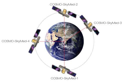
MARINE AND MARITIME SAR APPLICATIONS: COSMO-SKYMED FROM 1 ST TO 2 ND GENERATION
 MARINE AND MARITIME SAR APPLICATIONS: COSMO-SKYMED FROM 1 ST TO 2 ND GENERATION Maurizio Migliaccio, Ferdinando Nunziata, Andrea Buono Dipartimento di Ingegneria, Università degli Studi di Napoli Parthenope
Norway leading the way in observing the new Arctic system
 Norway leading the way in observing the new Arctic system Gathering time series from the high Arctic The challenge of moving ice 1890s Fram 1990s SHEBA Upcoming large international ship-based drift Great
GLOBAL SATELLITE OBSERVATION REQUIREMENTS FOR FLOATING ICE
 GLOBAL SATELLITE OBSERVATION REQUIREMENTS FOR FLOATING ICE FOCUSING ON SYNTHETIC APERTURE RADAR MARCH 2014 JOHN C. FALKINGHAM Contact: John.Falkingham@rogers.com (Contract report for Environment Canada:
Propagation and Directional Scattering of Ocean Waves in the Marginal Ice Zone and Neighboring Seas
 DISTRIBUTION STATEMENT A. Approved for public release; distribution is unlimited. Propagation and Directional Scattering of Ocean Waves in the Marginal Ice Zone and Neighboring Seas William Perrie Bedford
SAR Data Help Improving the Monitoring of Intertidal Flats on the German North Sea Coast
 SAR Data Help Improving the Monitoring of Intertidal Flats on the German North Sea Coast Martin Gade (1), Kerstin Stelzer (2), and Jörn Kohlus (3) (1) Institut für Meereskunde, Universität Hamburg, Hamburg,
Radar Remote Sensing of Ice and Sea State and Air-Sea Interaction in the Marginal Ice Zone
 DISTRIBUTION STATEMENT A. Approved for public release; distribution is unlimited. Radar Remote Sensing of Ice and Sea State and Air-Sea Interaction in the Marginal Ice Zone Hans C. Graber RSMAS Department
2 nd Asia CryoNet Workshop Current methods of measurement of the cryosphere in Asia consistency and issues
 2 nd Asia CryoNet Workshop Current methods of measurement of the cryosphere in Asia consistency and issues Dongqi Zhang, Cunde Xiao, Vladimir Aizen and Wolfgang Schöner Feb.5, 2016, Salekhard, Russia 1.
HY-2A Satellite User s Guide
 National Satellite Ocean Application Service 2013-5-16 Document Change Record Revision Date Changed Pages/Paragraphs Edit Description i Contents 1 Introduction to HY-2 Satellite... 1 2 HY-2 satellite data
Contribution to global Earth observation from satellites
 Contribution to global Earth observation from satellites - JAXA s Earth Observation strategy - April 16, 2008 Makoto Kajii Japan Aerospace Exploration Agency Earth Observation Summits and GEOSS 1 st EO
DUAL-POLARIZED COSMO SKYMED SAR DATA TO OBSERVE METALLIC TARGETS AT SEA
 DUAL-POLARIZED COSMO SKYMED SAR DATA TO OBSERVE METALLIC TARGETS AT SEA F. Nunziata, M. Montuori and M. Migliaccio Università degli Studi di Napoli Parthenope Dipartimento per le Tecnologie Centro Direzionale,
SAR Coordination Working Group
 SAR Coordination Working Group Update for 2015 and Plans for 2016-18 The Polar Space Task Group (PSTG) was established under the auspices of the World Meteorological Organization. The PSTG provides coordination
NOAA and National Ice Center (NIC) Activities and Future Synthetic Aperture Radar (SAR) Applications and Operational Needs
 Activities and Future Synthetic Aperture Radar (SAR) Applications and Operational Needs") NOAA and National Ice Center (NIC) Activities and Future Synthetic Aperture Radar (SAR) Applications and Operational Needs PSTG 4th Session GSFC, Greenbelt, MD September 30, 2014 Pablo Clemente-Colón U.S.
NOAA and National Ice Center (NIC) Activities and Future Synthetic Aperture Radar (SAR) Applications and Operational Needs PSTG 4th Session GSFC, Greenbelt, MD September 30, 2014 Pablo Clemente-Colón U.S.
MAPPING OF LAKE ICE IN NORTHERN EUROPE USING DUAL-POLARIZATION RADARSAT-2 DATA
 MAPPING OF LAKE ICE IN NORTHERN EUROPE USING DUAL-POLARIZATION RADARSAT-2 DATA Hindberg, Heidi and Malnes, Eirik Northern Research Institute (Norut), PO Box 6434 Tromsø Science Park, N9291 Tromsø, Email:
ESA Business Applications SPACE IS OPEN FOR BUSINESS
 ESA Business Applications SPACE IS OPEN FOR BUSINESS Tony Sephton @esa_artes business.esa.int ESA UNCLASSIFIED - For Official Use Slide 1 Agenda Norwegian Space opportunities within ESA's ARTES Applications
Kenneth Lee. Fisheries and Oceans Canada
 Oil Spill Scenario: Broken Ice Kenneth Lee Offshore Oil Centre for, Gas and Energy Research (COOGER) Fisheries and Oceans Canada Broken Ice Spill Scenario Similar to the open water scenario but occurs
Weather and ice information as a tool for arctic marine and offshore services
 Weather and ice information as a tool for arctic marine and offshore services World Meteorological Organization Executive Council Panel of Experts on Polar Observations, Research and Services President
EC-PORS III Research. Sodankylä, February Developing a Polar Prediction System
 EC-PORS III Research Sodankylä, February 2012 Developing a Polar Prediction System Polar Prediction System - Status 1. EC-PORS I (Oct. 2009) -> initial discussions 2. WWRP/THORPEX Polar Prediction Workshop,