Use of Satellite Earth Observations, in situ data and numerical model capabilities for oil spill contingency. Page 1
|
|
|
- Mary Paul
- 5 years ago
- Views:
Transcription
1 Use of Satellite Earth Observations, in situ data and numerical model capabilities for oil spill contingency Page 1
2 Oil spill service Page 2 Interest of Earth-Observation (EO) data for oil and gas companies => one example: oil spill service Based on EO data and satellite technologies, CLS offers a fully integrated service for: Oil spill detection Oil spill tracking Oil spill monitoring and forecasting
3 Combined approach Page 3 Satellite radar imagery to detect oil spills to assess their extents Drifting buoys (moored in the spill) to collect its location in real time to assess their locations Wind/current data and numerical models to describe metocean conditions to predict spills drift


4 Oil Spill Response Services Page 4 CLS expertise
5 Oil Spill Response Services Page 5 Detection service RADAR technology


6 Radar imaging (Synthetic Aperture Radar) Page 6 1. Emission of radio pulses and Reception of their echoes 2. Signal downlinked to a ground station 3. Signal processed to synthetise an image of the terrain reflectivity Day / Night Vision All-weather Vision Swath


7 Oil spill in the Gulf Of Mexico 2 May 2010 Strong S-SE wind is pushing oil towards the shore. Oil spill still remains North of the Loop Current. S-SE wind 12 m/s


 Oil spill")

8 Oil Spill detection report Contains results of the analysis of SAR image Analysis report is structured as follows Synthetic presentation of all detected slicks Detailed description of each reported slicks Information on the local meteooceanic conditions Other information (Ship detection) Oil spill detection report is posted on the Web and may be consulted using any browser End-users notification is done by , Fax, etc
9 Oil Spill Response Services Page 9 technology Tracking service Argos


10 Argos + GPS Location Page 10 Localisation & Data Collection 4 NOAA satellites 1 MetOp satellite 54 regional antenas 2 main processing centers (CLS Toulouse & CLS Washington)


11 Oil Spill Trackers Page 11 Basic Argos Argos+ GPS Air Deployable


12 Tracking Oil Slick Page 12 Small trackers to be deployed in oil slick GPS positions relayed by Satellite

13 Argos: locate and monitor oil spill Buoy tracks displayed on a web site Page 13 Web interface with buoys locations may be consulted using any browser
14 Oil Spill Response Services Page 14 Forecast service ocean & weather data + drift modelling


15 Metocean Services Page 15 Easy Access Operational Services & Support


16 Hybrid surface current Page 16


17 Forecast Page 17 Composite data combined to compute high resolution (space & time) forecast sea surface currents (hybrid currents) Hybrid currents Resolution: ~2min + hourly forecast ~72h

 Drift Model (forecast) scenario")
18 Initial location of the oil spill Drift model structure DRIFT Page 18 Temperature Hybrid sea surface current Wind field (model or Radar observation) Bathymetry Observation (buoys / radar / in situ) Drift Model (forecast) scenario Results


19 Oil Spill Response Services Page 19 CLS expertise Deploying CLS Response
20 Operational service: 2 modes Page 20 Surveillance (routine): Detection service only, based on radar imagery acquisition Low rate delivery (e.g. every week): of oil-spill reports over a specific area report is sent in near-real-time, i.e. couple of hours or less (depending on the area) after image acquisition Crisis (triggered in case of emergency): Combination of detection, tracking and forecast services High rate delivery (e.g. every day) of bulletins describing the oil spill situation and forecast
21 End of crisis CRISIS scenario OK Feedback from client CLS feedback and hotline Not OK Page 21 CLS synthesis Argos data interpretation Argos data acquisition/processing Drifting model (ocean & weather) Ocean/weather data acquisition/processing RADAR data interpretation RADAR acquisition/processing Mooring of Argos buoys Information from client RADAR programmation Begin of crisis
Dr Marc Lucas CLS Toulouse, France.
 Dr Marc Lucas CLS Toulouse, France. Oceanology International 15th March 2012 Slide 1 Ocean depiction In the past: Information mainly comes from in situ measurements (ADCP) Now: The role of satellite data
TOSCA RESULTS OVERVIEW
 TOSCA RESULTS OVERVIEW Almost 3 years after the project started, TOSCA has proved capable of improving oil spill tracking systems. TOSCA has brought updated knowledge on surface currents and noticeable
Can buoys predict hurricanes? Objectives Students will be able to: track drifter buoys determine the course of the gulf stream current
 Drifters Can buoys predict hurricanes? Objectives Students will be able to: track drifter buoys determine the course of the gulf stream current Materials computers with Internet access Student Worksheet
HY-2A Satellite User s Guide
 National Satellite Ocean Application Service 2013-5-16 Document Change Record Revision Date Changed Pages/Paragraphs Edit Description i Contents 1 Introduction to HY-2 Satellite... 1 2 HY-2 satellite data
Mersea Oil Spill Drift Forecast Demonstrations in TOP2
 Mersea Oil Spill Drift Forecast Demonstrations in TOP2 Bruce Hackett (met.no), George Zodiatis (UCY), Pierre Daniel (MeteoFrance), Francois Parthiot (Cedre) Presented at 3rd Mersea Plenary Meeting, CNR,
What is CERA? Coastal Emergency Risks Assessment
 What is CERA? Coastal Emergency Risks Assessment Visualization tool using OGC standards Displays the outputs from the ADCIRC storm surge model or other coastal models Represents the maps on interactive
Earth Observation in coastal zone MetOcean design criteria
 ESA Oil & Gas Workshop 2010 Earth Observation in coastal zone MetOcean design criteria Cees de Valk BMT ARGOSS Wind, wave and current design criteria geophysical process uncertainty modelling assumptions
Oceanology International, London, March 2012 Ocean Observation & Forecasting programme. An African Network of Offshore Real-Time Metocean Stations
 Oceanology International, London, March 2012 Ocean Observation & Forecasting programme An African Network of Offshore Real-Time Metocean Stations Valérie QUINIOU-RAMUS, Rémi ESTIVAL (TOTAL S.A., EP/DEV/TEC/GEO)
National Satellite Data Centre and Finnish Sentinel Collaborative Ground Segment. Jyri Heilimo Finnish Meteorological Instute
 National Satellite Data Centre and Finnish Sentinel Collaborative Ground Segment Jyri Heilimo Finnish Meteorological Instute Sodankylä National Satellite Data Centre National satellite data centre providing
EONav Satellite data in support of maritime route optimization
 EONav Satellite data in support of maritime route optimization Leif Eriksson Department of Space, Earth and Environment Chalmers University of Technology Outline Why is maritime navigation support needed?
SAWS: Met-Ocean Data & Infrastructure in Support of Industry, Research & Public Good. South Africa-Norway Science Week, 2016
 SAWS: Met-Ocean Data & Infrastructure in Support of Industry, Research & Public Good South Africa-Norway Science Week, 2016 Marc de Vos, November 2016 South Africa: Context http://learn.mindset.co.za/sites/default/files/resourcelib/e
Operational ice charting in mid-latitudes using Near-Real-Time SAR imagery
 Operational ice charting in mid-latitudes using Near-Real-Time SAR imagery Sergey Vernyayev Ice Engineer ICEMAN.KZ Carles Debart Project Manager Energy, Environment and Security Yevgeniy Kadranov Ice charting
EO-Based Ice and Iceberg Monitoring in Support of Offshore Engineering Design and Tactical Operations
 EO-Based Ice and Iceberg Monitoring in Support of Offshore Engineering Design and Tactical Operations Desmond Power, C-CORE ESA Industry Workshop on Satellite EO for the Oil and Gas Sector Overview Operations
REVISION OF THE STATEMENT OF GUIDANCE FOR GLOBAL NUMERICAL WEATHER PREDICTION. (Submitted by Dr. J. Eyre)
") WORLD METEOROLOGICAL ORGANIZATION Distr.: RESTRICTED CBS/OPAG-IOS (ODRRGOS-5)/Doc.5, Add.5 (11.VI.2002) COMMISSION FOR BASIC SYSTEMS OPEN PROGRAMME AREA GROUP ON INTEGRATED OBSERVING SYSTEMS ITEM: 4 EXPERT
WORLD METEOROLOGICAL ORGANIZATION Distr.: RESTRICTED CBS/OPAG-IOS (ODRRGOS-5)/Doc.5, Add.5 (11.VI.2002) COMMISSION FOR BASIC SYSTEMS OPEN PROGRAMME AREA GROUP ON INTEGRATED OBSERVING SYSTEMS ITEM: 4 EXPERT
The MSC Beaufort Wind and Wave Reanalysis
 The MSC Beaufort Wind and Wave Reanalysis Val Swail Environment Canada Vincent Cardone, Brian Callahan, Mike Ferguson, Dan Gummer and Andrew Cox Oceanweather Inc. Cos Cob, CT, USA Introduction: History
Monitoring Sea Ice with Space-borne Synthetic Aperture Radar
 Monitoring Sea Ice with Space-borne Synthetic Aperture Radar Torbjørn Eltoft UiT- the Arctic University of Norway CIRFA A Centre for Research-based Innovation cirfa.uit.no Sea ice & climate Some basic
Understanding oceans in change: Engineering science and technological tools for distributed real-time sensing Kristin Guldbrandsen Frøysa, CMR and
 Understanding oceans in change: Engineering science and technological tools for distributed real-time sensing Kristin Guldbrandsen Frøysa, CMR and University of Bergen Anne A Hageberg, CMR Christian Michelsen
DUAL-POLARIZED COSMO SKYMED SAR DATA TO OBSERVE METALLIC TARGETS AT SEA
 DUAL-POLARIZED COSMO SKYMED SAR DATA TO OBSERVE METALLIC TARGETS AT SEA F. Nunziata, M. Montuori and M. Migliaccio Università degli Studi di Napoli Parthenope Dipartimento per le Tecnologie Centro Direzionale,
Direct Readout at the Meteorological Service of Canada
 Direct Readout at the Meteorological Service of Canada CSPP Users Meeting 2015 Darmstadt, Germany April 14-16, 2015 David Bradley Manager, Earth Observation and Geomatics Meteorological Service of Canada
MERSEA Marine Environment and Security for the European Area
 MERSEA Marine Environment and Security for the European Area Development of a European system for operational monitoring and forecasting of the ocean physics, biogeochemistry, and ecosystems, on global
PREDICTION OF OIL SPILL TRAJECTORY WITH THE MMD-JMA OIL SPILL MODEL
 PREDICTION OF OIL SPILL TRAJECTORY WITH THE MMD-JMA OIL SPILL MODEL Project Background Information MUHAMMAD HELMI ABDULLAH MALAYSIAN METEOROLOGICAL DEPARTMENT(MMD) MINISTRY OF SCIENCE, TECHNOLOGY AND INNOVATION
IMPORTANCE OF SATELLITE DATA (FOR REANALYSIS AND BEYOND) Jörg Schulz EUMETSAT
 Jörg Schulz EUMETSAT") IMPORTANCE OF SATELLITE DATA (FOR REANALYSIS AND BEYOND) Jörg Schulz EUMETSAT Why satellite data for climate monitoring? Global coverage Global consistency, sometimes also temporal consistency High spatial
IMPORTANCE OF SATELLITE DATA (FOR REANALYSIS AND BEYOND) Jörg Schulz EUMETSAT Why satellite data for climate monitoring? Global coverage Global consistency, sometimes also temporal consistency High spatial
West Florida Shelf and Tampa Bay Responses to Hurricane Irma: What Happened and Why
 West Florida Shelf and Tampa Bay Responses to Hurricane Irma: What Happened and Why R.H. Weisberg Y. Liu J. Chen College of Marine Science University of South Florida St. Petersburg, FL SECOORA Webinar
Hurricane Season 2010 & NOAA s Deepwater Response
 Hurricane Season 2010 & NOAA s Deepwater Response What s Happened? What Will 2010 Bring? Possible Shoreline Effects Darin Figurskey Meteorologist-in-Charge NOAA s NWS Raleigh, NC NOAA s National Weather
Environmental Data In Support of Search & Rescue Operations in the Central Mediterranean Sea
 Environmental Data In Support of Search & Rescue Operations in the Central Mediterranean Sea Dr. Eric Comerma (RPS ASA) eric.comerma@rpsgroup.com Cathleen Turner (RPS ASA) Prof. Aldo Drago (Univ. of Malta)
The Mediterranean Operational Oceanography Network (MOON): Products and Services
: Products and Services") The Mediterranean Operational Oceanography Network (MOON): Products and Services The MOON consortia And Nadia Pinardi Co-chair of MOON Istituto Nazionale di Geofisica e Vulcanologia Department of Environmental
The Mediterranean Operational Oceanography Network (MOON): Products and Services The MOON consortia And Nadia Pinardi Co-chair of MOON Istituto Nazionale di Geofisica e Vulcanologia Department of Environmental
Towards a Web MetOcean Model Map Service (WM3S) profile of WMS
 profile of WMS") Towards a Web MetOcean Model Map Service (WM3S) profile of WMS This is great...... but we are still confused What a mess... WMS? The MetOcean Spatial Data Infrastructure Why WMS? Current system works Production
Towards a Web MetOcean Model Map Service (WM3S) profile of WMS This is great...... but we are still confused What a mess... WMS? The MetOcean Spatial Data Infrastructure Why WMS? Current system works Production
Development and deployment plan of ARGO type buoy in the Arctic Ocean
 1/16 Development and deployment plan of ARGO type buoy in the Arctic Ocean by T.Kikuchi, N.Shikama (JAMSTEC), D.Langevin, T.Monk, and O.Lebreton (MetOcean) 2/16 Ice-drifting buoy observation J-CAD ( JAMSTEC
NOAA Unmanned Aircraft Systems (UAS) Program Overview
 Program Overview") NOAA Unmanned Aircraft Systems (UAS) Program Overview AUVSI Pathfinder Symposium March 2015 Presented by: John Walker Cherokee Nation Technologies in support of NOAA UAS Program Office NOAA UAS Program
NOAA Unmanned Aircraft Systems (UAS) Program Overview AUVSI Pathfinder Symposium March 2015 Presented by: John Walker Cherokee Nation Technologies in support of NOAA UAS Program Office NOAA UAS Program
Session 1 Presentation - Use of Offshore Energy Facilities as Deepwater Ocean Observing Platforms
 University of New Orleans ScholarWorks@UNO Ocean Waves Workshop Ocean Waves Workshop 2017 Dec 7th, 9:00 AM - 9:45 AM Session 1 Presentation - Use of Offshore Energy Facilities as Deepwater Ocean Observing
CGMS Baseline. Sustained contributions to the Global Observing System. Endorsed by CGMS-46 in Bengaluru, June 2018
 CGMS Baseline Sustained contributions to the Global Observing System Best Practices for Achieving User Readiness for New Meteorological Satellites Endorsed by CGMS-46 in Bengaluru, June 2018 CGMS/DOC/18/1028862,
Australian National Report to DBCP. DBCP October, 2014 Weihai, China
 Australian National Report to DBCP DBCP-30 27-31 October, 2014 Weihai, China Outline Australian Bureau of Meteorology (ABOM) Drifting Buoys Background & Planning 2013/14 Deployments & Current Status 2014/15
Davida Streett NOAA/NESDIS. NESDIS Satellite Analysis Branch Hazard Mitigation Programs
 ESA 2010 Oil Davida Streett NOAA/NESDIS NESDIS Satellite Analysis Branch Hazard Mitigation Programs Operational 24 x 7 x 365 Fire and Smoke Precipitation Tropical Storms/Hurricanes Oil/Marine Pollution
Toward Environmental Predictions MFSTEP. Executive summary
 Research Project co-funded by the European Commission Research Directorate-General 5 th Framework Programme Energy, Environment and Sustainable Development Contract No. EVK3-CT-2002-00075 Project home
Validation of sea ice concentration in the myocean Arctic Monitoring and Forecasting Centre 1
 Note No. 12/2010 oceanography, remote sensing Oslo, August 9, 2010 Validation of sea ice concentration in the myocean Arctic Monitoring and Forecasting Centre 1 Arne Melsom 1 This document contains hyperlinks
New NASA Ocean Observations and Coastal Applications
 New NASA Ocean Observations and Coastal Applications Duane Armstrong Chief, Applied Science & Technology Project Office August 20, 2014 1 Outline NASA s new Earth Science Ocean Science Missions for 2014
Understanding Weather and Climate Risk. Matthew Perry Sharing an Uncertain World Conference The Geological Society, 13 July 2017
 Understanding Weather and Climate Risk Matthew Perry Sharing an Uncertain World Conference The Geological Society, 13 July 2017 What is risk in a weather and climate context? Hazard: something with the
PREDICTION AND MONITORING OF OCEANIC DISASTERS USING MICROWAVE REMOTE SENSING TECHNIQUES
 PREDICTION AND MONITORING OF OCEANIC DISASTERS USING MICROWAVE REMOTE SENSING TECHNIQUES O P N Calla International Centre for Radio Science, OM NIWAS A-23, Shastri Nagar, Jodhpur-342 003 Abstract The disasters
Importance of Technology as part of the NWS New Orleans/Baton Rouge Impact- Based Decision Support Pilot Project
 Importance of Technology as part of the NWS New Orleans/Baton Rouge Impact- Based Decision Support Pilot Project NWS New Orleans Meteorologist-In-Charge: Ken Graham Emergency Response Specialist Team:
Iceberg monitoring service by joint use of drift model, SAR and altimeter data
 Iceberg monitoring service by joint use of drift model, SAR and altimeter data N. Longépé, F. Mercier, J.Y Lebras, M. Sutton, G. Hajduch Collecte Localisation Satellites (CLS) SeaSAR, Tromso, June 21,
Evolution of NOAA s Observing System Integrated Analysis (NOSIA)
") Evolution of NOAA s Observing System Integrated Analysis (NOSIA) Presented to the 13th Symposium on Societal Applications: Policy, Research and Practice (paper 9.1) Louis Cantrell Jr., and D. Helms, R.
Evolution of NOAA s Observing System Integrated Analysis (NOSIA) Presented to the 13th Symposium on Societal Applications: Policy, Research and Practice (paper 9.1) Louis Cantrell Jr., and D. Helms, R.
Remote Sensing for Sea Surface Monitoring. Cristina Bentz PETROBRAS R&D Center Environment Assessment and Monitoring
 Remote Sensing for Sea Surface Monitoring Cristina Bentz PETROBRAS R&D Center Environment Assessment and Monitoring cris@petrobras.com.br Overview Introduction Orbital sea surface monitoring: Scope and
NOAA Great Lakes CoastWatch Program
 Great Lakes Workshop Series on Remote Sensing of Water Quality May 7-8, 2014 NOAA GLERL, 4840 South State Rd, Ann Arbor, MI NOAA Great Lakes CoastWatch Program CoastWatch is a nationwide National Oceanic
The ITSU System in the Pacific Region and Future Upgrades
 The ITSU System in the Pacific Region and Future Upgrades Eddie Bernard Director, Pacific Marine Environmental Laboratory (PMEL) NOAA/USA Pacific Tsunami Warning Center OPERATIONAL ACTIVITIES SEISMIC DATA
J2.6 SONAR MEASUREMENTS IN THE GULF STREAM FRONT ON THE SOUTHEAST FLORIDA SHELF COORDINATED WITH TERRASAR-X SATELLITE OVERPASSES
 J2.6 SONAR MEASUREMENTS IN THE GULF STREAM FRONT ON THE SOUTHEAST FLORIDA SHELF COORDINATED WITH TERRASAR-X SATELLITE OVERPASSES Chris Maingot 1, Alexander Soloviev 1, Silvia Matt 1, Mikhail Gilman 1,
OCEAN SURFACE DRIFT BY WAVELET TRACKING USING ERS-2 AND ENVISAT SAR IMAGES
 OCEAN SURFACE DRIFT BY WAVELET TRACKING USING ERS-2 AND ENVISAT SAR IMAGES Antony K. Liu, Yunhe Zhao Ocean Sciences Branch, NASA Goddard Space Flight Center, Greenbelt, Maryland, USA Ming-Kuang Hsu Northern
5. TRACKING AND SURVEILLANCE
 5. Knowledge of the present position of spilled oil and an ability to predict its motion are essential components of any oil spill response. This function is known as surveillance and tracking and has
European Space Agency
 Guidelines - Guidelines how/when to interact during the WebEx session: - Due to the number of attendees, please keep always your webcam and microphone switched-off - You can use anytime the chat to all
Integrated Space Applications in Transport, Energy & Safety Oil & Gas Exploration
 Exploration & Production Technology delivering breakthrough solutions Integrated Space Applications in Transport, Energy & Safety Oil & Gas Exploration Dr Colin Grant Engineering Technical Authority, Metocean
Satellite ALTimetry. SALT applications and use of data base for SE-Asia region. SEAMERGES kick-off meeting, Bangkok, Thailand.
 Satellite ALTimetry SALT applications and use of data base for SE-Asia region SEAMERGES kick-off meeting, Bangkok, Thailand Marc Naeije 4 March 2004 1 Faculty of Aerospace Engineering DEOS/AS SEAMERGES
SCOTIA WEATHER SERVICES INC.
 SCOTIA WEATHER SERVICES INC. Mission To provide high quality, reliable valued-added environmental information services based on measured and modeled atmospheric, land and/or oceanographic physical parameters
Enhancing The Delivery Of Weather & Climate Information To End-Users. by Meteorological Services Division, NEA, Singapore
 Enhancing The Delivery Of Weather & Climate Information To End-Users by Meteorological Services Division, NEA, Singapore WMO RA V Seminar on Enhancing Service Delivery Kuala Lumpur, Malaysia, 2-6 April
Applications of Data Assimilation in Earth System Science. Alan O Neill Data Assimilation Research Centre University of Reading
 Applications of Data Assimilation in Earth System Science Alan O Neill Data Assimilation Research Centre University of Reading DARC Current & Future Satellite Coverage Formation Flying - Afternoon Constellation
WMO Coordination Group on Satellite Data Requirements for Region III and IV Sept 5-8, 2016 Willemstad, Curaçao
 WMO Coordination Group on Satellite Data Requirements for Region III and IV Sept 5-8, 2016 Willemstad, Curaçao 1. Current Satellite Reception 2. Preparation for Next-Gen GOES-R JPSS 3. Satellite Data Applications
Access to IOOS Data Relevant to OOI. Kathleen Bailey NOAA/NOS/IOOS January 6, 2016
 Access to IOOS Data Relevant to OOI Kathleen Bailey NOAA/NOS/IOOS January 6, 2016 The U.S. Integrated Ocean Observing System (IOOS) Federal Regional Satellites 600+: Buoys, Water Level stations, Coastal
Applications of High Frequency Geostationary Satellite Data in Hurricane Surveillance and Research
 Applications of High Frequency Geostationary Satellite Data in Hurricane Surveillance and Research by Nan Walker Director, Earth Scan Laboratory Coastal Studies Institute Associate Professor, Dept. of
CGMS Baseline In response to CGMS action/recommendation A45.01 HLPP reference: 1.1.8
 Prepared by WGIII Agenda Item: 7.1 Discussed in WGIII CGMS Baseline In response to CGMS action/recommendation A45.01 HLPP reference: 1.1.8 In CGMS-45, Working Group III agreed to hold a review of the CGMS
ESA s Earth Observation Programmes
 ESA s Earth Observation Programmes 2015 DRAGON Symposium Interlaken, 23 June 2015 Maurice Borgeaud Head of the Department Science, Applications, and Future Technologies ESA Earth Observation Programmes
Coastal Ocean Applications Demonstrations of ALOS PALSAR Imagery for NOAA CoastWatch
 Coastal Ocean Applications Demonstrations of ALOS PALSAR Imagery for NOAA CoastWatch William Pichel Center for Satellite Applications and Research Frank Monaldo The Johns Hopkins University Applied Physics
Ocean Currents Student Activity Book
 Ocean Currents Student Activity Book I. Introduction Ocean currents influence the weather in coastal areas. They also influence sailing vessels. Though they visibly affect many people's lives, they are
Marine Situational Awareness and Environmental Monitoring using Satellites
 1 The Ny-ålesund Symposium 2013 The Changing Arctic Opportunity or Threat Marine Situational Awareness and Environmental Monitoring using Satellites Rolf Skatteboe President, Kongsberg Satellite Services
TerraSAR-X and TanDEM-X Applications for Maritime Domain Awereness
 TerraSAR-X and TanDEM-X Applications for Maritime Domain Awereness Dr. Stephan Brusch German Aerospace Center DLR Remote Sensing Technology Institute DLR Oberpfaffenhofen (Germany) Dr. Jürgen Drescher
Status of EUMETSAT Current and Future Programmes
 Status of EUMETSAT Current and Future Programmes Ernst Koenemann Director Programme Development Spanish Industry Day 15 th Slide: 1 Brief Status of MSG and EPS All operational Missions are performing as
Observing System Requirements for the Harmful Algal Bloom Forecast System in the Gulf of Mexico
 Observing System Requirements for the Harmful Algal Bloom Forecast System in the Gulf of Mexico July 2007 Background The Harmful Algal Bloom (HAB) Forecast System provides nowcasts and forecasts of Karenia
Hindcast Arabian Gulf
 Hindcast Arabian Gulf Image of isobars of atmospheric pressure and hindcast wind- and wave field over the Arabian Gulf during a storm in January 1993. Detailed wave studies are supported by nesting of
Overview of the Tropical Cyclone Guidance Project
 Overview of the Tropical Cyclone Guidance Project Dr. Jonathan L. Vigh With thanks to Mahsa Mirzargar (Univ. of Miami) Shanghai Typhoon Institute 09 July 2018 NCAR is sponsored by the National Science
RHOAPS. Real-time Hydrology Ocean Atmosphere Prediction System. Pronunciation: Ropes Motto: More than just THREDDS
 RHOAPS Real-time Hydrology Ocean Atmosphere Prediction System Pronunciation: Ropes Motto: More than just THREDDS Key Aspects Integrated real-time data systems Atmospheric Hydrologic Coastal oceans Societal
Complete Weather Intelligence for Public Safety from DTN
 Complete Weather Intelligence for Public Safety from DTN September 2017 White Paper www.dtn.com / 1.800.610.0777 From flooding to tornados to severe winter storms, the threats to public safety from weather-related
Opportunities for advanced Remote Sensing; an outsider s perspective
 Opportunities for advanced Remote Sensing; an outsider s perspective Ramon Hanssen Delft University of Technology 1 Starting questions Can we do more with the data we are already acquire? What s in stock
Sentinel-1 Mission Status
 Sentinel-1 Mission Status Pierre Potin, Sentinel-1 Mission Manager, ESA Luca Martino, Technical Support Engineer, ESA... and the Sentinel-1 operations team PSTG SAR Coordination Working Group 14 December
BRINGING MARINE DATA ASSETS TO THE FUTURE INTERNET
 ENVIROfying the Future Internet BRINGING MARINE DATA ASSETS TO THE FUTURE INTERNET Leveraging the Future Internet for the Marine Usage Area Dr.Conor Delaney Galway Bay Smart Bay - Ireland MARINE SCENARIOS
OSE/OSSEs at NOAA. Eric Bayler NOAA/NESDIS/STAR
 OSE/OSSEs at NOAA Eric Bayler NOAA/NESDIS/STAR OSE/OSSEs at NOAA NOAA Leadership view: Relatively inexpensive way to: Assess the impact of potential new observations Refine and redirect current observing
Unit 5 Lesson 3 How is Weather Predicted? Copyright Houghton Mifflin Harcourt Publishing Company
 Tracking the Weather Warm up 1 Why is it important to watch the weather forecast before traveling to another country? Tracking the Weather A meteorologist is a scientist who studies weather. Meteorologists
Sea Ice Motion: Physics and Observations Ron Kwok Jet Propulsion Laboratory California Institute of Technology, Pasadena, CA
 Sea Ice Motion: Physics and Observations Ron Kwok Jet Propulsion Laboratory California Institute of Technology, Pasadena, CA 7 th ESA Earth Observation Summer School ESRIN, Frascati, Italy 4-14 August
Wave-DDS and Pilot Wave Forecast Verification Scheme Extension
 Wave-DDS and Pilot Wave Forecast Verification Scheme Extension David Poulter, National Oceanography Centre GlobWave 2010. All rights reserved The Globwave Wave-DDS and PS-WFVS The GlobWave Diagnostic Systems
Seatrack Web Developments
 Seatrack Web Seatrack Web Developments HELCOM RESPONSE 16/2012, 21 November 2012 Johan Mattsson, DCOO Seatrack Web Contents Short overview Recent developments Online demonstration (experimental) Questions
Fjernmåling og modellering av oljesøl - på åpen sjø og i is
 Fjernmåling og modellering av oljesøl - på åpen sjø og i is Associate Professor, Camilla Brekke CIRFA (SFI) WP3 leader - Oil Spill Remote Sensing cirfa.uit.no What we are aiming for Detection & characterization
Ocean Observatories Initiative. Oscar Schofield Rutgers University. Ocean Leadership October 2010
 Ocean Observatories Initiative Oscar Schofield Rutgers University Ocean Leadership October 2010 What is OOI? THE VISION To launch an era of scientific discovery across and within the ocean basins, utilizing
Monitoring of Arctic Conditions from a Virtual Constellation of Synthetic Aperture Radar Satellites
 DISTRIBUTION STATEMENT A. Approved for public release; distribution is unlimited. Monitoring of Arctic Conditions from a Virtual Constellation of Synthetic Aperture Radar Satellites Hans C. Graber RSMAS
Application of Wavelet Spectrum Analysis to Oil Spill Detection by Using Satellite Observation Data
 PAJ Oil Spill Symposium 2008 Application of Wavelet Spectrum Analysis to Oil Spill Detection by Using Satellite Observation Data February 21, 2008 Tokyo, Japan Masanao Hara Dr., VisionTech Inc. 1. Background
Sources of Hourly Surface Data and Weather Maps for the U.S.
 Sources of Hourly Surface Data and Weather Maps for the U.S. Weather Underground Weather Underground http://www.wunderground.com/history/ maintains a deep archive of hourly reports for around the world.
The known requirements for Arctic climate services
 The known requirements for Arctic climate services based on findings described in STT White paper 8/2015 Johanna Ekman / EC PHORS STT Regional drivers The Arctic region is home to almost four million people
METOC at Defence Center for Operational Oceanography (FCOO)
") METOC at Defence Center for Operational Oceanography (FCOO) Forsvarets Center for Operativ Oceanografi Dr. Johan Söderqvist Oceanographer jos@fcoo.dk FCOO Staff (13 pos.) Geophysical expertise: oceanography,
METOC at Defence Center for Operational Oceanography (FCOO) Forsvarets Center for Operativ Oceanografi Dr. Johan Söderqvist Oceanographer jos@fcoo.dk FCOO Staff (13 pos.) Geophysical expertise: oceanography,
NOAA Observing System Integrated Analysis (NOSIA) Applications
 Applications") NOAA Observing System Integrated Analysis (NOSIA) Applications Aaron Pratt 1,2, PhD, David Helms 2, Louis Cantrell 2,4, PhD, Vincent Ries 4 1 Science and Technology Corporation 2 NOAA/NESDIS/OSD/TPIO 3
NOAA Observing System Integrated Analysis (NOSIA) Applications Aaron Pratt 1,2, PhD, David Helms 2, Louis Cantrell 2,4, PhD, Vincent Ries 4 1 Science and Technology Corporation 2 NOAA/NESDIS/OSD/TPIO 3
Meteorological instruments and observations methods: a key component of the Global Earth Observing System of Systems (GEOSS)
") GLOBAL OBSERVING SYSTEMS Instruments and Methods of Observation Programme Meteorological instruments and observations methods: a key component of the Global Earth Observing System of Systems (GEOSS) Dr.
GLOBAL OBSERVING SYSTEMS Instruments and Methods of Observation Programme Meteorological instruments and observations methods: a key component of the Global Earth Observing System of Systems (GEOSS) Dr.
Wave processes in Arctic Seas, observed from TerraSAR-X
 DISTRIBUTION STATEMENT A. Approved for public release; distribution is unlimited. Wave processes in Arctic Seas, observed from TerraSAR-X Susanne Lehner DLR German Air and Space Research Center Earth Observation
Identifying Drifter Deployment Values
 Identifying Drifter Deployment Values Presented by: Shaun Dolk Produced in Collaboration with: Dr. Rick Lumpkin NOAA/AOML/GDP Miami, Florida DBCP-29 - September 23-27, 2013 Paris, France Objectives & Direction
Sharafat GADIMOVA Azerbaijan National Aerospace Agency (ANASA), Azerbaijan
, Azerbaijan") TOWARDS THE DEVELOPMENT OF AN OPERATIONAL STRATEGY FOR OIL SPILL DETECTION AND MONITORING IN THE CASPIAN SEA BASED UPON A TECHNICAL EVALUATION OF SATELLITE SAR OBSERVATIONS IN SOUTHEAST ASIA Sharafat GADIMOVA
TOWARDS THE DEVELOPMENT OF AN OPERATIONAL STRATEGY FOR OIL SPILL DETECTION AND MONITORING IN THE CASPIAN SEA BASED UPON A TECHNICAL EVALUATION OF SATELLITE SAR OBSERVATIONS IN SOUTHEAST ASIA Sharafat GADIMOVA
Near Real Time Applications for Maritime Situational Awareness
 Near Real Time Applications for Maritime Situational Awareness Egbert Schwarz Maritime Security Lab Neustrelitz (DFD) ATLAS MEETS SCIENCE Bremen, 12.-13. October 2016 Presentation Outline Background Earth
Impact of frontal eddy dynamics on the Loop Current variability during free and data assimilative HYCOM simulations
 Impact of frontal eddy dynamics on the Loop Current variability during free and data assimilative HYCOM simulations Matthieu Le Hénaff (1) Villy H. Kourafalou (1) Ashwanth Srinivasan (1) George R. Halliwell
Marine Monitoring. The Copernicus Marine Service
 Marine The Copernicus Marine Service Why is the marine sector so important? Marine Blue Economy, 5 million jobs, gross added value almost 500bn/year 90% of international trade is maritime Half of the world's
Unmanned Aerial Systems
 Unmanned Aerial Systems Gulf Region Stakeholder Workshop July 17-18, 2007 Mississippi State University Starkville, Mississippi List of Measurement Requirements Fill gaps in measurements of surface and
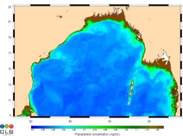
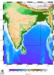
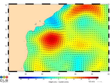
Indian Ocean Forecast System (INDOFOS) Abhisek Chatterjee
 Abhisek Chatterjee") Indian Ocean Forecast System (INDOFOS) Abhisek Chatterjee Earth System Sciences Organisation (ESSO) Indian National Centre for Ocean Information Services (INCOIS) Ministry of Earth Sciences, Government
Indian Ocean Forecast System (INDOFOS) Abhisek Chatterjee Earth System Sciences Organisation (ESSO) Indian National Centre for Ocean Information Services (INCOIS) Ministry of Earth Sciences, Government
CHAPTER 27 AN EVALUATION OF TWO WAVE FORECAST MODELS FOR THE SOUTH AFRICAN REGION. by M. Rossouw 1, D. Phelp 1
 CHAPTER 27 AN EVALUATION OF TWO WAVE FORECAST MODELS FOR THE SOUTH AFRICAN REGION by M. Rossouw 1, D. Phelp 1 ABSTRACT The forecasting of wave conditions in the oceans off Southern Africa is important
The ESA Earth observation programmes overview and outlook
 The ESA Earth observation programmes overview and outlook Dr. Volker Liebig Director, ESA EO Programmes ILA 2008, Berlin ENVISAT mission: 6 years! Bam earthquake Tectonic uplift (Andaman) Arctic 2007 First
PETROLEUM HAZARDS MANAGEMENT BY GEOMATIC SYSTEMS
 PETROLEUM HAZARDS MANAGEMENT BY GEOMATIC SYSTEMS H. ASSILZADEH Spatial Information Technology & Engineering (SITE) Research Center Faculty of Engineering, Universiti Putra Malaysia, 43400 UPM, Serdang
Exploitation of Ocean Predictions by the Oil and Gas Industry. GODAE OceanView Symposium 2013
 Exploitation of Ocean Predictions by the Oil and Gas Industry GODAE OceanView Symposium 2013 Introduction Information needs Challenges Acknowledgements IMarEST/SUT Metocean Awareness Course Colleagues
Ice surveys, meteorological and oceanographic data What is available and up-to-date?
 Ice surveys, meteorological and oceanographic data What is available and up-to-date? Leader of the Norwegian Ice Service +47 77 62 13 15 - nick.hughes@met.no Norwegian Meteorological Institute met.no 1
Mapping Surface Oil Extent from the Deepwater Horizon Oil Spill Using ASCAT Backscatter
 Mapping Surface Oil Extent from the Deepwater Horizon Oil Spill Using ASCAT Backscatter Richard D. Lindsley and David G. Long Microwave Earth Remote Sensing Laboratory Brigham Young University Provo, UT
A 32-Year Run of 1/12 o HYCOM in the Gulf of Mexico
 A 32-Year Run of 1/12 o HYCOM in the Gulf of Mexico W. Wang ExxonMobil Company 3319 Mercer St., URC-GW3-752A Houston, TX 77027 Tel: 713 431 7439 Fax: 713 431 7272 Email: wensu.wang@exxonmobil.com 1 4/30/2007