METOC at Defence Center for Operational Oceanography (FCOO)
|
|
|
- Theresa Golden
- 5 years ago
- Views:
Transcription
1 METOC at Defence Center for Operational Oceanography (FCOO) Forsvarets Center for Operativ Oceanografi Dr. Johan Söderqvist Oceanographer
2 FCOO Staff (13 pos.) Geophysical expertise: oceanography, meteorology, geodesy, hydrography IT specialists: Linux, supercomputing (clusters), automation, optimal data processing Oceanographic modelling, forecasting, and validation Scientific computing and high performance computing (HPC) Data handling for I/O data, quality control, database technologies Software development for dissemination, communication and presentation for users
3 FCOO METOC tasks Contribute to defence: - planning - operations - exercises Support Danish Navy s Coast Guard assignments Single POC for the Danish defence in national/international cooperation Datacenter: Data and Products for special use by the Danish defence
4 FCOO Cooperation Civilian national institutions: Greenland Institute of Natural Resources Geological Survey of Denmark and Greenland (GEUS) The Danish National Space Institute (DTU-Space) Danish Meteorological Institute (DMI) Arctic Research Center: Copenhagen University & Aarhus University Faroe Marine Research Institute International: NAVOCEANO & NRL
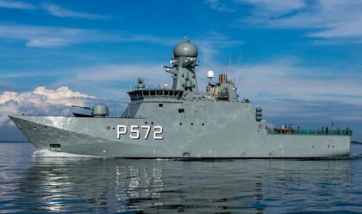
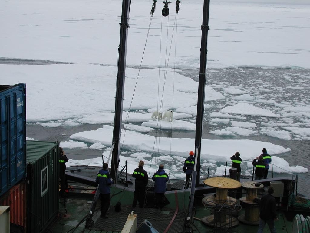
5 Danish Defence in the Arctic Vessels: 3 Knud Class, including the Research Vessel Lauge Koch 3 Thetis class 1 Frigate (from 2019) Aircraft: Challenger C-130 Dog sledge patrol (Sirius patrol)

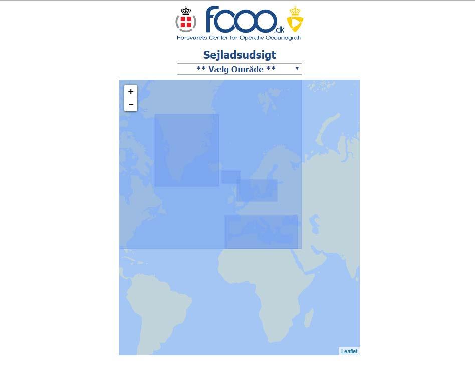
6 FCOO forecast areas
7 FCOO forecast areas, Arctic Only waves: WW3-Arctic We need help!
8 External METOC forecasts and observations: Arctic Ocean-Ice forecasts NAVOCEANO NOAA: also N. Atlantic & Mediterranean Wave and Meteorological forecasts ECMWF: Global (including Arctic) Meteorological forecasts Danish Meteorological Institute (DMI) Ice charts & Satellite images Danish Meteorological Institute (DMI)


9 Danish perspectives Danish Resources Lauge Koch FCOO Products & Dissemination End users Lauge Koch
10 Dissemination & Products Information For Mariners Maps (IFM Maps) - Impact Maps - Seatrack Web: Oil spill simulations for Greenland and Danish waters Search And Rescue (SAR) for Greenland and Danish waters
11 IFM Maps

12 IFM Maps - Greenland

13 Impact Maps - Greenland

14 Impact Maps - Europe


15 NAVOCEANO forecast (1) Sirius Patrol support


16 NAVOCEANO forecast (2) Exercise, East Greenland

17 Oil spill monitoring and prediction system
18 New tasks Disseminate Satellite images on IFM Maps Climate maps (like IFM Maps, but for Environmental Briefing Doc.) Impact Maps: Include ocean forecasts (currents, sea-ice, temperature) Deployed NOAA/NASA buoys in Arctic Ocean (IABP) Deliver products for ASW
19 Gaps - Modelling Regional ocean/sea-ice model for Greenland waters, where coastal effects comes into play Disseminate profile data: (speed of sound, salt, temp., dens.) Visibility: Best practice for monitoring and validation of forecasts
20 Gaps - Observations In-situ: Met.-Ocean buoys, ADCP, Waveriders, Gliders, Drifters, Autonomous submarine vehicles HF-radar: Ocean currents Airborne remote sensing: Lidars for measuring waves and the sea floor Sea level monitoring: outside the Greenland archipelagoes and fjords (existing Greenland tide gauges are inshore)
21 Summary: Danish perspectives Danish Resources Lauge Koch FCOO Products & Dissemination End users Lauge Koch
22 Questions?
23
24 Knud Class Offshore patrol vessel Displacement: 1720 tons Length: 71.8m (235 ft.) Draft 4.9m (16ft.) Range: 3000 nm. 18 crew members Accommodation in total: 43 Fishery inspections Environment protection Search And Rescue Sovereign enforcement Icebreaker assignments
25 Thetis Class Ocean patrol vessel Displacement: 3500 tons Length: 112m (388 ft.) Draft 6m (19ft.) Range: 8700 nm. Accommodation: Can break through 0.8m ice Fishery inspections Environment protection Search And Rescue Sovereign enforcement Icebreaker assignments Support local authorities
26 Impact Maps Client-server architecture Client based on web technologies Server is a standard Web Map Service (WMS) with minor extensions Advantages Server extremely cheap to implement Can be standardised as an extension to the WMS standard Interoperability between clients and servers from different vendors Takes advantage of existing high performing WMS servers Flexible; users can adjust impact parameters Server can be used to plot risk assessment maps as well
27 Impact Maps future work Collaboration on standardisation of WMS extension and convention for impact color representation Foundation for efficient operational impact maps New server version Flexible grids Flexible scheduling WMS compliant (plus extensions) Performance New client version Multi map view

28 Search And Rescue (SAR)
MERSEA Marine Environment and Security for the European Area
 MERSEA Marine Environment and Security for the European Area Development of a European system for operational monitoring and forecasting of the ocean physics, biogeochemistry, and ecosystems, on global
Monitoring the coastal ocean: from local to regional
 Monitoring the coastal ocean: from local to regional Luísa Bastos University of Porto / CIIMAR RAIA partners Ocean monitoring To answer key societal and scientific challenges navigation safety, fisheries,
The IHPT Marine Spatial Data infrastructure and its contribution to the INSPIRE Directive
 The IHPT Marine Spatial Data infrastructure and its contribution to the INSPIRE Directive INSPIRE - GWF 2015 - Coastal & Marine session Lisbon Congress Center, Portugal - Thursday, 28 May 2015 Summary
Environmental Data In Support of Search & Rescue Operations in the Central Mediterranean Sea
 Environmental Data In Support of Search & Rescue Operations in the Central Mediterranean Sea Dr. Eric Comerma (RPS ASA) eric.comerma@rpsgroup.com Cathleen Turner (RPS ASA) Prof. Aldo Drago (Univ. of Malta)
Understanding oceans in change: Engineering science and technological tools for distributed real-time sensing Kristin Guldbrandsen Frøysa, CMR and
 Understanding oceans in change: Engineering science and technological tools for distributed real-time sensing Kristin Guldbrandsen Frøysa, CMR and University of Bergen Anne A Hageberg, CMR Christian Michelsen
Evaluation of the sea ice forecast at DMI
 DMI Evaluation of the sea ice forecast at DMI Till A. S. Rasmussen 1 Kristine S. Madsen 1, Mads H. Ribergaard 1, Leif T.Pedersen 1, Jacob L Høyer 1, Gorm Dybkjær 1, Mads Bruun Poulsen 2 and Sofie Abildgaard
FOURTH INTERNATIONAL PORT METEOROLOGICAL OFFICERS WORKSHOP AND SUPPORT TO GLOBAL OCEAN OBSERVATIONS USING SHIP LOGISTICS
 FOURTH INTERNATIONAL PORT METEOROLOGICAL OFFICERS WORKSHOP AND SUPPORT TO GLOBAL OCEAN OBSERVATIONS USING SHIP LOGISTICS PMO-IV 8-10 DEC 2010, ORLANDO, FLORIDA, USA 1 This presentation is generally for
24/02/2014. Where do forecasts come from? Presentation of teacher. Lesson outline. Dr. Kristine Madsen Danish Meteorological Institute
 Where do forecasts come from? Boundary: tides surge T & S Atmosphere: wind pressure temperature Observations: tide gauge (satellites) Storm surge x model Forecaster Authorities Media General public Dr.
CANADIAN HYDROGRAPHIC SERVICE & OCEANOGRAPHIC SERVICES
 CANADIAN HYDROGRAPHIC SERVICE & OCEANOGRAPHIC SERVICES Presentation to Warming of the North Conference Ottawa, March 2 nd, 2015 Denis Hains, Director General & Hydrographer General of Canada TIP OF THE
Ocean and sea ice modeling for Arctic shipping
 Ocean and sea ice modeling for Arctic shipping Mads H. Ribergaard, Till A. S. Rasmussen, Kristine S. Madsen, Ida M. Ringgaard Danish Meteorological Institute Lyngbyvej 100, Copenhagen, Denmark Ocean modelling
Baltic Sea Hydrographic Commission 22nd meeting
 Agenda item B3.1 Baltic Sea Hydrographic Commission 22nd meeting Rostock, Germany, 19 21 September 2017 National Report of Denmark August 2017 Executive summary This report gives a summary of the main
Office of Naval Research Update and Status of Arctic Environmental Programs
 Office of Naval Research Update and Status of Arctic Environmental Programs October 2017 CDR Blake McBride Deputy, Ocean, Atmosphere and Space Research Division Office of Naval Research marvin.mcbride@navy.mil
The Mediterranean Operational Oceanography Network (MOON): Products and Services
: Products and Services") The Mediterranean Operational Oceanography Network (MOON): Products and Services The MOON consortia And Nadia Pinardi Co-chair of MOON Istituto Nazionale di Geofisica e Vulcanologia Department of Environmental
The Mediterranean Operational Oceanography Network (MOON): Products and Services The MOON consortia And Nadia Pinardi Co-chair of MOON Istituto Nazionale di Geofisica e Vulcanologia Department of Environmental
Validation of sea ice concentration in the myocean Arctic Monitoring and Forecasting Centre 1
 Note No. 12/2010 oceanography, remote sensing Oslo, August 9, 2010 Validation of sea ice concentration in the myocean Arctic Monitoring and Forecasting Centre 1 Arne Melsom 1 This document contains hyperlinks
NOAA S Arctic Program in 2017
 NOAA S Arctic Program in 2017 NOAA s Arctic Mission To determine how the Arctic system is changing on time scales of weeks to decades, particularly with respect to the consequences that the loss of sea
Weather and ice information as a tool for arctic marine and offshore services
 Weather and ice information as a tool for arctic marine and offshore services World Meteorological Organization Executive Council Panel of Experts on Polar Observations, Research and Services President
ALASKA DEEP-DRAFT ARCTIC PORT EVALUATION
 ALASKA DEEP-DRAFT ARCTIC PORT EVALUATION Joint Study of Federal and State June 20, 2012 Opportunity and Constraint Warming of Arctic region is leading to new maritime opportunities. Thawing of permafrost
R E P U B L I C O F C Y P R U S. NATIONAL REPORT OF CYPRUS TO THE 19 th MEDITERRANEAN AND BLACK SEAS HYDROGRAPHIC COMMISSION (MBSHC)
") R E P U B L I C O F C Y P R U S NATIONAL REPORT OF CYPRUS TO THE 19 th MEDITERRANEAN AND BLACK SEAS HYDROGRAPHIC COMMISSION (MBSHC) BATUMI MEETING 30 JUNE TO 02 JULY 2015 NATIONAL REPORT OF CYPRUS TO THE
R E P U B L I C O F C Y P R U S NATIONAL REPORT OF CYPRUS TO THE 19 th MEDITERRANEAN AND BLACK SEAS HYDROGRAPHIC COMMISSION (MBSHC) BATUMI MEETING 30 JUNE TO 02 JULY 2015 NATIONAL REPORT OF CYPRUS TO THE
The role of the Italian Navy Hydrographic Institute in the Arctic activities
 The role of the Italian Navy Hydrographic Institute in the Arctic activities Luigi Sinapi Director of the Italian Hydrographic Institute Early Arctic hydrographic surveys ICE ICE Arctic hydrographic monitoring
12/2/15. Providing observa.ons, data and informa.on products to meet agency and stakeholder needs
 12/2/15 Providing observa.ons, data and informa.on products to meet agency and stakeholder needs 1 Part of the Integrated Ocean Observing System (IOOS) Governed through a Memorandum of Agreement Fiscal
E x a m p l e s o f t o o l s f o r s e a s i t u a t i o n a l a w a r e n e s s u s i n g C M E M S d a t a. Copernicus EU
 E x a m p l e s o f t o o l s f o r s e a s i t u a t i o n a l a w a r e n e s s u s i n g C M E M S d a t a Copernicus EU Copernicus EU Copernicus EU www.copernicus.eu S e a S i t u a t i o n a l A w
National / Naval Ice Center (NIC) Operations Brief This brief is UNCLASSIFIED
 Operations Brief This brief is UNCLASSIFIED") National / Naval Ice Center (NIC) Operations Brief This brief is UNCLASSIFIED Christopher Szorc, Senior Ice Analyst/Forecaster USCG USN NOAA Outline NIC s mission is to provide timely, accurate and relevant
National / Naval Ice Center (NIC) Operations Brief This brief is UNCLASSIFIED Christopher Szorc, Senior Ice Analyst/Forecaster USCG USN NOAA Outline NIC s mission is to provide timely, accurate and relevant
Appendix E: Oceanographic Databases
 Appendix E: Oceanographic Databases Many of the principal U.S. and international database depositories for worldwide ocean observations are listed below, as are a few technical reports with descriptions
Arctic. Ocean Observing Build Out Plan. alaska ocean observing system. March 1, 2013 draft. Tom Van Pelt
 Arctic Ocean Observing Build Out Plan March 1, 2013 draft Tom Van Pelt alaska ocean observing system Tom Van Pelt Why a coastal observing system in the Arctic? The Arctic is booming with increased activity
Ice surveys, meteorological and oceanographic data What is available and up-to-date?
 Ice surveys, meteorological and oceanographic data What is available and up-to-date? Leader of the Norwegian Ice Service +47 77 62 13 15 - nick.hughes@met.no Norwegian Meteorological Institute met.no 1
CANADIAN HYDROGRAPHIC SERVICE
 CANADIAN HYDROGRAPHIC SERVICE Surveying and Charting Canada s Waters Since 1883 Ilulisat Maritime Workshop 2017 The Importance and Need for Hydrography Denis Hains, Hydrographer General of Canada & Director
TOSCA RESULTS OVERVIEW
 TOSCA RESULTS OVERVIEW Almost 3 years after the project started, TOSCA has proved capable of improving oil spill tracking systems. TOSCA has brought updated knowledge on surface currents and noticeable
Oceanology International, London, March 2012 Ocean Observation & Forecasting programme. An African Network of Offshore Real-Time Metocean Stations
 Oceanology International, London, March 2012 Ocean Observation & Forecasting programme An African Network of Offshore Real-Time Metocean Stations Valérie QUINIOU-RAMUS, Rémi ESTIVAL (TOTAL S.A., EP/DEV/TEC/GEO)
Mersea Oil Spill Drift Forecast Demonstrations in TOP2
 Mersea Oil Spill Drift Forecast Demonstrations in TOP2 Bruce Hackett (met.no), George Zodiatis (UCY), Pierre Daniel (MeteoFrance), Francois Parthiot (Cedre) Presented at 3rd Mersea Plenary Meeting, CNR,
Sustaining Arctic Observing Networks SAON
 Sustaining Arctic Observing Networks SAON Atmosphere Breakout Group Stockholm, Sweden November 12 14, 2007 Lisa Darby (NOAA) & Jussi Paatero (FMI) What role does the atmosphere play in the reduction of
National Polish services using regional products
 Oceanographic services for the European regions - session organized by EuroGOOS European Maritime Day, Gdańsk, 20th May 2011 Polish Baltic Frédéric Chopin Philharmonic, Chamber Green Hall National Polish
Roger Revelle Memorial lectures, 2008
 INTERGOVERNMENTAL OCEANOGRAPHIC COMMISSION (of UNESCO) Forty-first Session of the Executive Council UNESCO, Paris, 24 June 1 st July 2008 Roger Revelle Memorial lectures, 2008 Thursday 26 June 2008, UNESCO
"Outcomes of the storm surge and waves workshop in Dominican Republic and the questionnaire"
 "Outcomes of the storm surge and waves workshop in Dominican Republic and the questionnaire" Strengthening Regional Cooperation to Support Forecasting with Multi Hazard Approach in RA IV Ritz Carlton Grand
Overview of NOS Coastal Ocean Operational Forecast Systems
 Overview of NOS Coastal Ocean Operational Forecast Systems Aijun Zhang NOAA/NOS Center for Operational Oceanographic Products and Services (CO-OPS) Frank Aikman III NOAA/NOS/OCS Coast Survey Development
SAWS: Met-Ocean Data & Infrastructure in Support of Industry, Research & Public Good. South Africa-Norway Science Week, 2016
 SAWS: Met-Ocean Data & Infrastructure in Support of Industry, Research & Public Good South Africa-Norway Science Week, 2016 Marc de Vos, November 2016 South Africa: Context http://learn.mindset.co.za/sites/default/files/resourcelib/e
EO-Based Ice and Iceberg Monitoring in Support of Offshore Engineering Design and Tactical Operations
 EO-Based Ice and Iceberg Monitoring in Support of Offshore Engineering Design and Tactical Operations Desmond Power, C-CORE ESA Industry Workshop on Satellite EO for the Oil and Gas Sector Overview Operations
Yi Chao Jet Propulsion Laboratory California Institute of Technology & Joint Institute for Regional Earth System Science and Engineering (JIFRESSE)
") Strategy to Develop a 3D Ocean Circulation Forecasting System for Cook Inlet Yi Chao Jet Propulsion Laboratory California Institute of Technology & Joint Institute for Regional Earth System Science and
Strategy to Develop a 3D Ocean Circulation Forecasting System for Cook Inlet Yi Chao Jet Propulsion Laboratory California Institute of Technology & Joint Institute for Regional Earth System Science and
E x a m p l e s o f t o o l s f o r s e a s i t u a t i o n a l a w a r e n e s s u s i n g C M E M S d a t a. Copernicus EU
 E x a m p l e s o f t o o l s f o r s e a s i t u a t i o n a l a w a r e n e s s u s i n g C M E M S d a t a Copernicus EU Copernicus EU Copernicus EU www.copernicus.eu S e a S i t u a t i o n a l A w
Alaska Ocean Observing System 101 Anchorage, Alaska
 Alaska Ocean Observing System 101 Anchorage, Alaska Molly McCammon, Director Alaska Ocean Observing System (AOOS) A Regional Observing System within the Integrated Ocean Observing System www.aoos.org IOOS
Sea ice charts and SAR for sea ice classification. Patrick Eriksson Juha Karvonen Jouni Vainio
 Sea ice charts and SAR for sea ice classification Patrick Eriksson Juha Karvonen Jouni Vainio ECMWF Ocean Workshop, 22-25 January 2018 Ice service from past to present Finland has long experience in ice
PORTUGAL NATIONAL REPORT
 PORTUGAL NATIONAL REPORT 14 TH MEETING OF THE EASTERN ATLANTIC HYDROGRAPHIC COMMISSION Cadiz, Spain 18 th 20 th October 2016 INSTITUTO HIDROGRÁFICO Miguel Arenga IHPT Head of the Hydrography Division 2016-10-18
Molly McCammon Alaska Ocean Observing System October 15, 2012
 Molly McCammon Alaska Ocean Observing System October 15, 2012 Marine Operations Safe a& efficient shipping & recreational boating, search & rescue, spill response & offshore energy development Weather
Ocean Monitoring and Forecasting core services,
 MY OCEAN Marine Core Service Ocean Monitoring and Forecasting core services, the MyOcean example Pierre BAHUREL MyOcean coordinator Mercator Ocean, France Session 5B "The way forward: delivering societal
Introduction to EMODnet
 Introduction to EMODnet Antonio Novellino Torino, 14-15 Ottobre 2015 What is EMODnet? Initiated by the European Commission in response to the EU Future Maritime Policy and Blue Growth, launched in June
Seatrack Web Developments
 Seatrack Web Seatrack Web Developments HELCOM RESPONSE 16/2012, 21 November 2012 Johan Mattsson, DCOO Seatrack Web Contents Short overview Recent developments Online demonstration (experimental) Questions
Delivering Met to the Military User
 Delivering Met to the Military User Andy Kirkman Met Office Defence Business Manager ECMWF MOS Workshop - November 2007 Crown copyright 2006 Page 1 Delivering Met to the Military User This Presentation
EONav Satellite data in support of maritime route optimization
 EONav Satellite data in support of maritime route optimization Leif Eriksson Department of Space, Earth and Environment Chalmers University of Technology Outline Why is maritime navigation support needed?
Arctic Regional Hydrographic Commission (ARHC) Portsmouth, New Hampshire, United States, January 29-30, Hydrographic National Report of Denmark
 Portsmouth, New Hampshire, United States, January 29-30, Hydrographic National Report of Denmark") ARHC4-2.2 Arctic Regional Hydrographic Commission (ARHC) Portsmouth, New Hampshire, United States, January 29-30, 2014 Hydrographic National Report of Denmark January 2014 1. Hydrographic Office January
ARHC4-2.2 Arctic Regional Hydrographic Commission (ARHC) Portsmouth, New Hampshire, United States, January 29-30, 2014 Hydrographic National Report of Denmark January 2014 1. Hydrographic Office January
OSI SAF Sea Ice products
 OSI SAF Sea Ice products Lars-Anders Brevik, Gorm Dybkjær, Steinar Eastwood, Øystein Godøy, Mari Anne Killie, Thomas Lavergne, Rasmus Tonboe, Signe Aaboe Norwegian Meteorological Institute Danish Meteorological
Determining the Impact of Sea Ice Thickness on the
 US NAVAL RESEARCH LABORATORY FIVE YEAR RESEARCH OPTION Determining the Impact of Sea Ice Thickness on the Arctic s Naturally Changing Environment (DISTANCE) Co-PI s for NRL John Brozena, Joan Gardner (Marine
Access to IOOS Data Relevant to OOI. Kathleen Bailey NOAA/NOS/IOOS January 6, 2016
 Access to IOOS Data Relevant to OOI Kathleen Bailey NOAA/NOS/IOOS January 6, 2016 The U.S. Integrated Ocean Observing System (IOOS) Federal Regional Satellites 600+: Buoys, Water Level stations, Coastal
Floating Ice: Progress in Addressing Science Goals
 Polar Floating Ice: Progress in Addressing Science Goals Stephen Howell 1, Leif Toudal Pedersen 2 and Roberto Saldo 3 1 Environment Canada, Climate Research Division, Toronto, Canada 2 Danish Meteorological
HFR Surface Currents Observing System in Lower Chesapeake Bay and Virginia Coast
 HFR Surface Currents Observing System in Lower Chesapeake Bay and Virginia Coast Larry P. Atkinson, Teresa Garner, and Jose Blanco Center for Coastal Physical Oceanography Old Dominion University Norfolk,
C o a s t a l p o l l u t i o n
 C o a s t a l p o l l u t i o n Copernicus for Coastal Zone Management and Marine Environment Monitoring Service Copernicus EU Copernicus EU Copernicus EU www.copernicus.eu I N T R O D U C T I O N Main
PREDICTION OF OIL SPILL TRAJECTORY WITH THE MMD-JMA OIL SPILL MODEL
 PREDICTION OF OIL SPILL TRAJECTORY WITH THE MMD-JMA OIL SPILL MODEL Project Background Information MUHAMMAD HELMI ABDULLAH MALAYSIAN METEOROLOGICAL DEPARTMENT(MMD) MINISTRY OF SCIENCE, TECHNOLOGY AND INNOVATION
Hydrographic National Report of Denmark
 18th Conference Agenda item B.2 Tallinn, Estonia National report 16-18 September 2013 Denmark Hydrographic National Report of Denmark Marts 2013 1. Hydrographic Office January 1, 2013 Kort & Matrikelstyrelsen
3.7 MYWXMAP: A NEW APPRAOCH TO WEB-BASED METEOROLOGICAL AND OCEANOGRAPHIC (METOC) CHART DISPLAY
 CHART DISPLAY") 3.7 MYWXMAP: A NEW APPRAOCH TO WEB-BASED METEOROLOGICAL AND OCEANOGRAPHIC (METOC) CHART DISPLAY Carl D. Thormeyer* and Earl V. Ravid Fleet Numerical Meteorology and Oceanography Center (FNMOC) Monterey,
3.7 MYWXMAP: A NEW APPRAOCH TO WEB-BASED METEOROLOGICAL AND OCEANOGRAPHIC (METOC) CHART DISPLAY Carl D. Thormeyer* and Earl V. Ravid Fleet Numerical Meteorology and Oceanography Center (FNMOC) Monterey,
Ocean currents from altimetry
 Ocean currents from altimetry Pierre-Yves LE TRAON - CLS - Space Oceanography Division Gamble Workshop - Stavanger,, May 2003 Introduction Today: information mainly comes from in situ measurements ocean
Development of spatial intercomparison within the operational wave forecast verification exchange
 Development of spatial intercomparison within the operational wave forecast verification exchange Adrian Hines, Met Office / JCOMM Jean-Michel Lefèvre, Météo-France / JCOMM Dave Poulter, National Oceanography
Evolution of NOAA s Observing System Integrated Analysis (NOSIA)
") Evolution of NOAA s Observing System Integrated Analysis (NOSIA) Presented to the 13th Symposium on Societal Applications: Policy, Research and Practice (paper 9.1) Louis Cantrell Jr., and D. Helms, R.
Evolution of NOAA s Observing System Integrated Analysis (NOSIA) Presented to the 13th Symposium on Societal Applications: Policy, Research and Practice (paper 9.1) Louis Cantrell Jr., and D. Helms, R.
Options in Capacity Building. Underpinning the Blue Economy. Slide 1/78. Derrick R. Peyton. 14 th MACHC Meeting. IIC Technologies. December 9-13, 2013
 Options in Capacity Building Underpinning the Blue Economy Derrick R. Peyton IIC Technologies 14 th MACHC Meeting December 9-13, 2013 Slide 1/78 Overview Blue Economy Defined Challenges (SDI, MSDI, Standards)
The route towards a new GEBCO grid
 The route towards a new GEBCO grid Pauline Weatherall, GEBCO Digital Atlas Manager British Oceanographic Data Centre (BODC) GEBCO TSCOM/SCRUM meeting, Monaco, October 2012 The route towards a new GEBCO
Sea Ice Model for Marginal Ice Zone
 Sea Ice Model for Marginal Ice Zone Max D. Coon Northwest Research Associates, Inc. 14508 N.E. 20 th Street Bellevue, WA 98007-3713 Phone: (425) 644-9660 ext. 332 Fax: (425) 644-8422 E-mail: max@nwra.com
CGMS Baseline In response to CGMS action/recommendation A45.01 HLPP reference: 1.1.8
 Prepared by WGIII Agenda Item: 7.1 Discussed in WGIII CGMS Baseline In response to CGMS action/recommendation A45.01 HLPP reference: 1.1.8 In CGMS-45, Working Group III agreed to hold a review of the CGMS
Polar. Thematic Exploitation Platform. Andrew Fleming, BAS/Polar View ESRIN, 14 th October 2015
 Polar Thematic Exploitation Platform Andrew Fleming, BAS/Polar View ESRIN, 14 th October 2015 Why a Polar TEP? Polar regions play an important role in regulating and driving the global climate & experiencing
West Florida Shelf and Tampa Bay Responses to Hurricane Irma: What Happened and Why
 West Florida Shelf and Tampa Bay Responses to Hurricane Irma: What Happened and Why R.H. Weisberg Y. Liu J. Chen College of Marine Science University of South Florida St. Petersburg, FL SECOORA Webinar
MetConsole AWOS. (Automated Weather Observation System) Make the most of your energy SM
 Make the most of your energy SM") MetConsole AWOS (Automated Weather Observation System) Meets your aviation weather needs with inherent flexibility, proven reliability Make the most of your energy SM Automated Weather Observation System
MetConsole AWOS (Automated Weather Observation System) Meets your aviation weather needs with inherent flexibility, proven reliability Make the most of your energy SM Automated Weather Observation System
Arctic Observing Systems Challenges, New opportunities and Integration
 Arctic Observing Systems Challenges, New opportunities and Integration Japan Norway Arctic Science Week 03 June 2016 By Stein Sandven, NERSC Building an integrated Arctic Observing System Need to collect,
Use of Satellite Earth Observations, in situ data and numerical model capabilities for oil spill contingency. Page 1
 Use of Satellite Earth Observations, in situ data and numerical model capabilities for oil spill contingency Page 1 Oil spill service Page 2 Interest of Earth-Observation (EO) data for oil and gas companies
CopernicusEU. the EU's Earth Observation Programme. Sara Zennaro Atre Delegation of the European Union to Japan
 Copernicus the EU's Earth Observation Programme Sara Zennaro Atre Delegation of the European Union to Japan Status Overview, Sept 2016 & Ocean Policies Seminar 4 October 2016 ollow us on: Copernicus EU
Vision: The National Oceanography Centre will, by 2015, be recognised as the world-leading Centre for integrated ocean sciences and technology".
 National Oceanography Centre from coast to deep ocean Waterfront Campus, Southampton Vision: Joseph Proudman Building, Liverpool The National Oceanography Centre will, by 2015, be recognised as the world-leading
Importance of Technology as part of the NWS New Orleans/Baton Rouge Impact- Based Decision Support Pilot Project
 Importance of Technology as part of the NWS New Orleans/Baton Rouge Impact- Based Decision Support Pilot Project NWS New Orleans Meteorologist-In-Charge: Ken Graham Emergency Response Specialist Team:
An Arctic Perspective NCEI's Prototype Arctic Data Viewer
 An Arctic Perspective NCEI's Prototype Arctic Data Viewer NCEI Arctic Action Team Kate Rose NOAA National Environmental Satellite, Data, and Information Service National Centers for Environmental Information
Infrastructure monitoring using SAR interferometry
 Infrastructure monitoring using SAR interferometry Hossein Nahavandchi Roghayeh Shamshiri Norwegian University of Science and Technology (NTNU), Department of Civil and Environmental Engineering Geodesy
HF radarcontribution to South Africa Blue Economy
 HF radarcontribution to South Africa Blue Economy Anton G Kjelaas1, Andres Alonso- Martirena2, Chad Whelan3 South Africa- Norway Science Week 2016 Oct 31- Nov 4 2016 1 2 3 BLUE ECONOMY Sustainable use
ICE STRENGTH INFORMATION IN THE CANADIAN ARCTIC: FROM SCIENCE TO OPERATIONS
 Ice in the Environment: Proceedings of the 16th IAHR International Symposium on Ice Dunedin, New Zealand, 2nd 6th December 2002 International Association of Hydraulic Engineering and Research ICE STRENGTH
ADVANTAGES OF GIS-INTEGRATED MARITIME DATA IN THE BLACK SEA REGION FOR MULTIPURPOSE USE
 INTERAGENCY INTERACTION IN CRISIS MANAGEMENT AND DISASTER RESPONSE 2017 ADVANTAGES OF GIS-INTEGRATED MARITIME DATA IN THE BLACK SEA REGION FOR MULTIPURPOSE USE Lyubka Pashova 1, Anna Kortcheva 2, Vasko
PS4a: Real-time modelling platforms during SOP/EOP
 PS4a: Real-time modelling platforms during SOP/EOP Mistral Tramontane Bora Etesian Major sites of dense water formation Major sites of deep water formation influence of coastal waters Chairs: G. Boni,
Support of METOC Sabbatical Research and Training
 Support of METOC Sabbatical Research and Training Carlyle H. Wash Code MR/Wx Naval Postgraduate School 589 Dyer Rd., Rm. 254 Monterey, CA 93943 phone: (831) 656-2516 fax: (831) 656-3061 email: wash@nps.navy.mil
a national geological survey perspective François ROBIDA BRGM (French Geological Survey)
") a national geological survey perspective François ROBIDA BRGM (French Geological Survey) Pre-Conference Seminar on Socio-Economic Value of Geospatial for National and Regional Development 21 August 2017,
a national geological survey perspective François ROBIDA BRGM (French Geological Survey) Pre-Conference Seminar on Socio-Economic Value of Geospatial for National and Regional Development 21 August 2017,
New COST Action: Towards a European Network on Chemical Weather Forecasting and Information Systems
 New COST Action: Towards a European Network on Chemical Weather Forecasting and Information Systems Proposer: Mikhail Sofiev Finnish Meteorological Institute Historical background EUMETNET Workshop on
Ocean Observation from Haiyang Satellites:
 SPACE SCIENCE ACTIVITIES IN CHINA Ocean Observation from Haiyang Satellites: 2012 2014 AUTHORS JIANG Xingwei LIN Mingsen National Satellite Ocean Application Service, Beijing 100081 ABSTRACT During 2012
The Delaware Environmental Monitoring & Analysis Center
 The Delaware Environmental Monitoring & Analysis Center Tina Callahan Delaware Estuary Science & Environmental Summit 2013 January 27-30, 2013 What is DEMAC? Delaware Environmental Monitoring & Analysis
R E P U B L I C O F C Y P R U S NATIONAL REPORT OF CYPRUS TO THE MEDITERRANEAN AND BLACK SEAS HYDROGRAPHIC COMMISSION (MBSHC)
") R E P U B L I C O F C Y P R U S NATIONAL REPORT OF CYPRUS TO THE MEDITERRANEAN AND BLACK SEAS HYDROGRAPHIC COMMISSION (MBSHC) ISTANBUL MEETING 25-27 SEPTEMBER 2013 NATIONAL REPORT OF CYPRUS TO THE MEDITERRANEAN
R E P U B L I C O F C Y P R U S NATIONAL REPORT OF CYPRUS TO THE MEDITERRANEAN AND BLACK SEAS HYDROGRAPHIC COMMISSION (MBSHC) ISTANBUL MEETING 25-27 SEPTEMBER 2013 NATIONAL REPORT OF CYPRUS TO THE MEDITERRANEAN
Current status and plans for developing sea ice forecast services and products for the WMO Arctic Regional Climate Centre Sea Ice Outlook
 Current status and plans for developing sea ice forecast services and products for the WMO Arctic Regional Climate Centre 2018 Sea Ice Outlook 13 WMO Global Producing Centres providing seasonal forecasts
Tsunami detection component: discussion about the existing network and real-time data processing. Begoña Pérez Gómez, Puertos del Estado, Spain
 Tsunami detection component: discussion about the existing network and real-time data processing Begoña Pérez Gómez, Puertos del Estado, Spain Outline Marine network: role within TWS s NEAMTWS overview
Indian Ocean Forecast System (INDOFOS) Abhisek Chatterjee
 Abhisek Chatterjee") Indian Ocean Forecast System (INDOFOS) Abhisek Chatterjee Earth System Sciences Organisation (ESSO) Indian National Centre for Ocean Information Services (INCOIS) Ministry of Earth Sciences, Government
Indian Ocean Forecast System (INDOFOS) Abhisek Chatterjee Earth System Sciences Organisation (ESSO) Indian National Centre for Ocean Information Services (INCOIS) Ministry of Earth Sciences, Government
Bathymetry. EMODnet Stakeholder Conference & Sea-basin Workshops February Bathymetry
 EMODnet Stakeholder Conference & Sea-basin Workshops 14-15 February 2017 Arctic checkpoint Belinda Kater On behalf of all Checkpoints http://www.emodnet.eu 1 ? is the study of the "beds" or "floors" of
SCOTIA WEATHER SERVICES INC.
 SCOTIA WEATHER SERVICES INC. Mission To provide high quality, reliable valued-added environmental information services based on measured and modeled atmospheric, land and/or oceanographic physical parameters
Automation of Ocean Model Performance Metrics
 Automation of Ocean Model Performance Metrics James D. Dykes 1, Jay F. Shriver 1 and Sean Ziegeler 2 1 Naval Research Laboratory Code 7320 Bldg 1009 Stennis Space Center, MS 39529 USA 2 High Performance
Andy Mahoney, Hajo Eicken, Josh Jones
 First Annual Partners Meeting Presentation Integrated Framework to Identify, Track and Communicate Sea-Ice Hazards Arctic Domain Awareness Center (ADAC) A DHS Center of Excellence Andy Mahoney, Hajo Eicken,
New Directions in Catastrophe Risk Models
 New Directions in Catastrophe Risk Models World Bank Brown-Bag Lunch Presentation October 9, 2007 Richard J. Murnane Baseline Management Company, Inc. Overview! Background on reinsurance and cat models!
Research and data infrastructure obtained at NIB-Marine Biology Station Piran
 Research and data infrastructure obtained at NIB-Marine Biology Station Piran Branko Čermelj, National Institute of Biology, Marine Biology Station, Piran 9 th May 2008 and maritime sectors of Slovenia
DBCP National Report Germany. 28 th DBCP Fremantle, 6 st of October 2012 Kai Herklotz (BSH)
") DBCP National Report Germany 28 th DBCP Fremantle, 6 st of October 2012 Kai Herklotz (BSH) Outline BSH and its relation to the DBCP ARGO-Program Other activities MARNET Perspectives 06.10.2012 28th DBCP,
DBCP National Report Germany 28 th DBCP Fremantle, 6 st of October 2012 Kai Herklotz (BSH) Outline BSH and its relation to the DBCP ARGO-Program Other activities MARNET Perspectives 06.10.2012 28th DBCP,
THE PORTUGUESE INSTITUTE FOR THE OCEAN AND ATMOSPHERE. Pedro Viterbo
 THE PORTUGUESE INSTITUTE FOR THE OCEAN AND ATMOSPHERE Pedro Viterbo pedro.viterbo@ipma.pt 2012 IPMA CREATION Before Now IM INRB/IPIMAR LNEG IPMA SOME NUMBERS: 506 Staff: Personnel 426 Budget 2014 11% 26%
IABP Deployment Plans for 2004
 IABP Buoy Positions IABP Deployment Plans for 2004 SPRING NPEO (Multiple buoys provided by NOAA/PMEL, JAMSTEC, & CRREL) EC/NIC- CES (80N 120W, & 80N 130W) SUMMER IARC/NABOS Cruise 2 NOAA-PSC IMB (North
JCOMM Overview. Val Swail Environment and Climate Change Canada JCOMM representative to IOGP Metocean Committee
 JCOMM Overview Val Swail Environment and Climate Change Canada JCOMM representative to IOGP Metocean Committee IOGP/JCOMM/WCRP Workshop Our Future Climate Understanding the spread of physical risk for
ALASKA OCEAN OBSERVING SYSTEM 2016 ANNUAL IMPACT REPORT
 ALASKA OCEAN OBSERVING SYSTEM 2016 ANNUAL IMPACT REPORT 1 ALASKA OCEAN OBSERVING SYSTEM 2016 ANNUAL IMPACT REPORT 2 ALASKA OCEAN OBSERVING SYSTEM 2016 ANNUAL IMPACT REPORT Letter from Executive Director
FINDINGS OF THE ARCTIC METEOROLOGY SUMMIT
 FINDINGS OF THE ARCTIC METEOROLOGY SUMMIT 2018 WWW.FMI.FI CHAIR S SUMMARY: 1 2 3 We need to be curious to explore the known unknowns. Meteorology is an elemental part of international collaboration in
Earth Observation in coastal zone MetOcean design criteria
 ESA Oil & Gas Workshop 2010 Earth Observation in coastal zone MetOcean design criteria Cees de Valk BMT ARGOSS Wind, wave and current design criteria geophysical process uncertainty modelling assumptions