Vision: The National Oceanography Centre will, by 2015, be recognised as the world-leading Centre for integrated ocean sciences and technology".
|
|
|
- Ruth McCoy
- 5 years ago
- Views:
Transcription


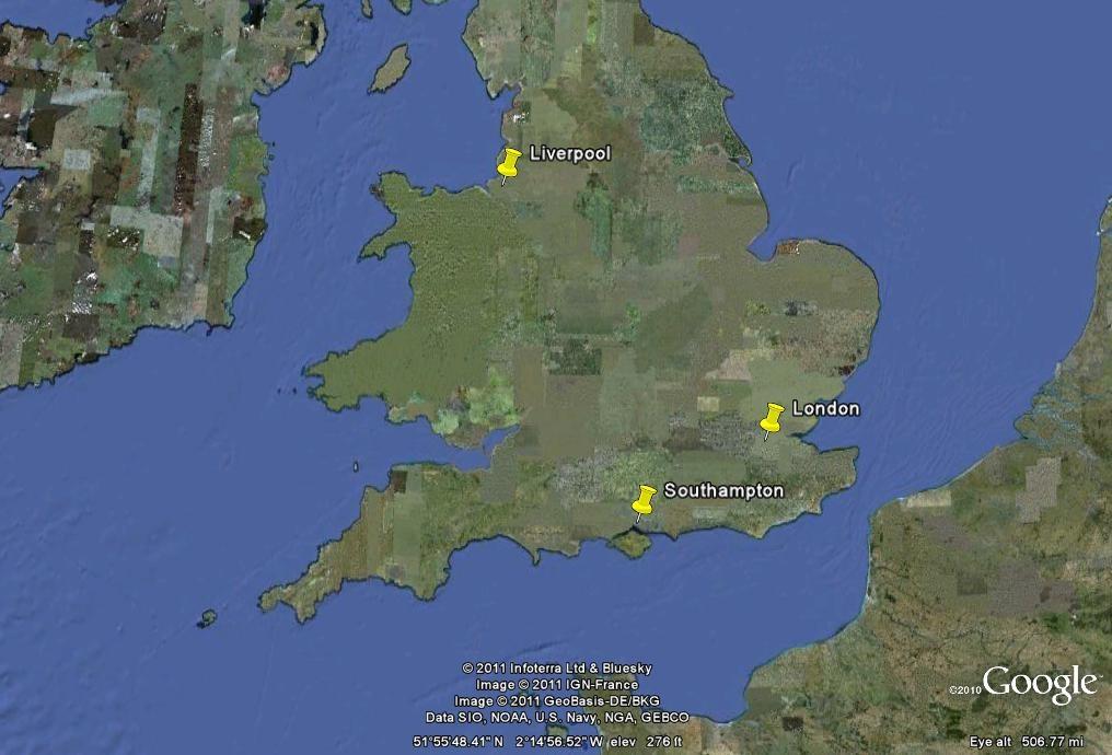
1 National Oceanography Centre from coast to deep ocean Waterfront Campus, Southampton Vision: Joseph Proudman Building, Liverpool The National Oceanography Centre will, by 2015, be recognised as the world-leading Centre for integrated ocean sciences and technology".
2


3 The six NERC Sector Centres Grant funding to Universities and Research Institutions Research Centres Polar Earth Terrestrial & Freshwater Marine Atmosphere Earth Observation
4 Some key facts NOC is owned by the Natural Environment Research Council (NERC) Coast to deep sea Based in two sites at Southampton (headquarters) and Liverpool since April 2010 Hosting Partners - University of Southampton, University of Liverpool 560 NERC staff (>200 scientists and technologists) 52 million annual budget (including capital) Funded by NERC, EU, Industry, Government Departments and Agencies Delivery Partners in Plymouth, Scotland Building a wider association of Universities and Research Centres Facilities directly managed by NOC for NERC Royal Research Ships, James Cook and Discovery National Marine Equipment Pool British Oceanographic Data Centre Permanent Service for Mean Sea-level British Ocean Sediment Core Research Facility


5 Facilities National Marine Equipment Pool and seagoing technical support Global-class Research Vessels British Ocean Sediment Core Research Facility National Oceanographic Library Permanent Service for Mean Sea Level British Oceanographic Data Centre National Tidal and Sea-level Independent scientific advice


6 Research Expertise Marine Physics & Marine Climate Marine Systems Modelling Marine Biosciences Marine Geo-sciences Technology development
7 Some key facts NOC research can be divided into two parts National Capability Research linked to activities which are considered to be of fundamental (and probably long term) national and international importance Blue Skies Research funded by means of science proposals to research council committees In principle this research can be on any topic PhD Research Can be undertaken in either NC (block allocations) or BS (with studentships written into proposals) for UK students.


8 National Capability Programmes Long-term ocean observing for decadal and rapid change Technology development to measure the ocean in new ways Modelling to simulate the oceans in the earth system Mapping to chart the oceans, sea floor and habitats for science and users
9 National Oceanography Centre Liverpool (former Proudman Oceanographic Laboratory) Located alongside the Liverpool University School of Environmental Sciences which includes Oceanography, Geology, Geophysics, Geography and Marine Biology. Prof. George Wolff will explain more about Liverpool University School of Environmental Sciences. Southampton (former National Oceanography Centre Southampton) Located alongside the University of Southampton School of Ocean and Earth Science. More information from its web site.


10 School of Ocean and Earth Science, University of Southampton
11 NOC Liverpool Marine Physics and Ocean Climate About 120 staff Most research is in Physical Oceanography, Sea Level Science, Geodesy/Geophysics, Coastal Processes, Climate Change etc. A large modelling group involved in various kinds of physical oceanographic modelling and coupling to ecosystem modelling. PhD students could be visitors i.e. registered at USP in which case financial arrangements would have to be formalised with NOC Director. (This may change in the future, see below). Or registered at the University of Liverpool, or both L pool and USP jointly. The student may then have 3 co-supervisors: one at NOC, one at LU and one at USP. Marine Biology, Chemistry and Geophysics Can be undertaken at Liverpool University itself the student would then have to be registered as above. Professor Wolff can provide more details.


 studies;")
12 Sea and Land Level Science Global and regional mean sea level; GPS, land movements and geodesy; Geophysics (GIA) studies; Drake Passage flows;


13 Ocean and Shelf Sea Science RAPID programme at 26 N observing; RAPID wave monitoring off the US coast; Shelf-edge mixing - effects on primary production; Irish Sea observatory; Ocean turbulence.


14 Ocean Modelling Shelf and coastal modelling - shelf seas & processes; Integrated physical and ecosystem modelling; Advanced model development; Near coastal process. Wind Stress Irradiation Sed River Inputs


")

15 Technology at NOC Liverpool Tide Gauges Telemetry Bottom pressure Drake Passage and Atlantic Wave (20 and 5 years) Gliders Coastal radars and other shelf instrumentation
16 Sea Level Monitoring at NOC Liverpool: Around the UK South Atlantic and Antarctica Gibraltar Contributions to African and Indian Ocean networks


17 NOC (UK) Sea Level Stations in the South Atlantic, Antarctica and Gibraltar 9 Sea Level Stations Real time telemetry: Ascension Island Saint Helena Port Stanley Tristan Vernadsky (Faraday) Rothera Gibraltar Delayed mode data: Signy St.Helena and Tristan recently re-built after storm damage late 2010


18 Autosub6000 Autosub Long Range 6000m depth 6000km range January 2011 trials First science use: pinpointing world s deepest hydrothermal vent sites known to date, mid-


19 Data Management at NOC Liverpool Permanent Service for Mean Sea Level British Oceanographic Data Centre
20 NOC Liverpool Survey of Interest in Cooperation with USP There have been many years of collaboration between Liverpool and USP (especially Profs. Mesquita and Harari), primarily on topics such as tides, sea level change etc. The problem is that there is now a completely new generation of scientists in Liverpool with a much wider range of research interests. Therefore NOC Liverpool science staff were surveyed as to their interest in collaboration with IOUSP and their responses are included in a report which is available. This report consists primarily in ideas for possible PhD projects. We were very pleased with the level of response. Nevertheless knowledge by NOCL staff of staff at IOUSP (and vice versa) is limited and it will take more work to spin up many of these ideas. Perhaps the findings of the report can be discussed and further discussions can take place with video conferences?
21
22
23
24 NOC Southampton Southampton Responses to the Survey NOC scientists at Southampton were also asked to contribute to the survey but responses were far fewer and they have not been included in the report. However I can pass on to anyone interested in the identified areas (e.g. sea bed mapping). Research at Southampton So far as I know, Southampton does not have the visitor option (except for short collaborative visits) but all students must be registered with the University of Southampton. Because of the formation of NOC, it is possible that NOCL may adopt this NOCS practice at some point.
 Check out the NOC and LU web sites We would be happy to put you in touch with possible supervisors www.noc.")
25 National Oceanography Centre If you are interested in studying at Liverpool (either NOC or LU): e Talk to George and me while we are here, you can us afterwards Check out the NOC-USP survey (although that is not exclusive) Check out the NOC and LU web sites We would be happy to put you in touch with possible supervisors
The Global Sea Level Observing System (GLOSS) Andrew Willmott
 Andrew Willmott") The Global Sea Level Observing System (GLOSS) Andrew Willmott A Big Scientific Issue Sea Level Rise The rate of global mean sea level rise increased between the 19 th and 20 th century MSL rose by 1-2
The Global Sea Level Observing System (GLOSS) Andrew Willmott A Big Scientific Issue Sea Level Rise The rate of global mean sea level rise increased between the 19 th and 20 th century MSL rose by 1-2
UK Argo. AST#16, Brest, France, March Crown copyright Met Office
 UK Argo AST#16, Brest, France, March 2015 UK Argo the beginning The original commitment made by Government CSA in 1999 was that the UK would contribute to Argo to at least a GNP-level based share at full
POLCOMS Metadata for the ARCoES project Keywords: POLCOMS, WAM, residual circulation, waves, Liverpool Bay, UK shelf
 POLCOMS Metadata for the ARCoES project Keywords: POLCOMS, WAM, residual circulation, waves, Liverpool Bay, UK shelf POLCOMS is the Proudman Oceanographic Laboratory Coastal Ocean Modelling System. It
National Oceanography Centre. Research & Consultancy Report No. 36
 National Oceanography Centre Research & Consultancy Report No. 36 State of the eastern North Atlantic subpolar gyre: The Extended Ellett Line Programme Annual Report No. 1 N P Holliday 1, S Cunningham
Sea Level Monitoring and the GLOSS Programme
 Sea Level Monitoring and the GLOSS Programme Philip L. Woodworth Permanent Service for Mean Sea Level Proudman Oceanographic Laboratory, UK Port Meteorological Officers Meeting, IMO, 25 July 2003 www.pol.ac.uk
Sea Level Space Watch: Service Offering
 Space for Smarter Government Programme Sea Level Space Watch: Service Offering General Sea Level Space Watch : Operational service developed to support national flood defence planning. Systematically updated
Missions from MARS: Marine Autonomous and Robotic Systems - current and future science applications
 Missions from MARS: Marine Autonomous and Robotic Systems - current and future science applications Dr Russell B Wynn (MARS Chief Scientist, Head of NOC Marine Geoscience) Marine Autonomous and Robotic
Landscape Systems: Coasts 3 days
 AS Level Geography Edexcel Landscape Systems: Coasts 3 days Deliver two days of fieldwork within an inspiring physical environment covering all the recommended themes in depth. Prepare AS level students
Adapting NEMO for use as the UK operational storm surge forecasting model
 Adapting NEMO for use as the UK operational storm surge forecasting model Rachel Furner 1, Jane Williams 2, Kevin Horsburgh 2, Andy Saulter 1 1; Met Office 2; NOC Table of Contents Existing CS3 model Developments
Coastal Systems and Landscapes 3 days
 AS Level Geography WJEC Coastal Systems and Landscapes 3 days This course is for Welsh schools. This in-depth course prepares students for the physical fieldwork focusing on the Coastal option, for Section
REPORT ON SEA LEVEL MEASUREMENT FOR GHANA
 20TH SEPTEMBER 2006 REPORT ON SEA LEVEL MEASUREMENT FOR GHANA Emmanuel K. Nkebi 1 1 Survey Department of Ghana, P. O. Box CT903, Accra Tel: 233 21 777 334 Fax : 233 21 765687 E-mail: survey@ghana.com E-mail:eknkebi@yahoo.com
Table of Contents. Introduction 4. Chapter 1 Research and the Deep Oceans 6. Chapter 2 Physical Characteristics of the Ocean 10
 Table of Contents Introduction 4 Chapter 1 Research and the Deep Oceans 6 Chapter 2 Physical Characteristics of the Ocean 10 Chapter 3 Composition of the Oceans Waters 16 Chapter 4 Tides, Waves, and Currents
Storm surge forecasting and other Met Office ocean modelling
 Storm surge forecasting and other Met Office ocean modelling EMODnet stakeholder meeting Clare O Neill + many others Outline Ocean modelling at the Met Office Storm surge forecasting Current operational
The Field Research Facility, Duck, NC Warming Ocean Observations and Forecast of Effects
 The Field Research Facility, Duck, NC Warming Ocean Observations and Forecast of Effects A potential consequence of a warming ocean is more frequent and more intense wind events (Hurricanes & Typhoons)
Marine Ecology Pacing Guide
 Marine Ecology Pacing Guide Course Description: The focus of the course is the interrelationships among marine organisms and the physical, chemical, geological and biological factors. North Carolina coastal
National Perspectives - Portugal. Margarida Almodovar
 National Perspectives - Portugal Margarida Almodovar margarida.almodovar@mam.gov.pt from base line to the external limit of the continental shelf behind 200 miles and according to UNCLOS definitions Economic
UNIVERSITY OF NAIROBI
 UNIVERSITY OF NAIROBI SPEECH DELIVERED BY THE VICE-CHANCELLOR PROF. G.A.O. MAGOHA DURING THE KENYA JAPAN EXCHANGE SEMINAR ON OCEAN SCIENCE COOPERATING TOWARDS A BETTER PLANET EARTH ON 16 TH JANUARY 2006
MSc(Res) Polar and Alpine Change.
 Polar and Alpine Change.") Department Of Geography. MSc(Res) Polar and Alpine Change. MSc(Res) Polar and Alpine Change Our MSc(Res) Polar and Alpine Change programme provides a unique research experience that seeks to embed our
Department Of Geography. MSc(Res) Polar and Alpine Change. MSc(Res) Polar and Alpine Change Our MSc(Res) Polar and Alpine Change programme provides a unique research experience that seeks to embed our
Climate Change: Understanding Recent Changes in Sea Level and the Ocean. Sea Level Rise
 Climate Change: Understanding Recent Changes in Sea Level and the Ocean Sea Level Rise Philip L. Woodworth Proudman Oceanographic Laboratory, Liverpool ASE/BA/City of Culture Evening 18 October 2007 Long
Benjamin Franklin ( )
") MARITIME HISTORY Benjamin Franklin (1706-1790) Published the 1 st map of the Gulf Stream To increase postal speed To gain advantage in war time Franklin s Gulf Stream Map 1761 John Harrison Working class
MARITIME HISTORY Benjamin Franklin (1706-1790) Published the 1 st map of the Gulf Stream To increase postal speed To gain advantage in war time Franklin s Gulf Stream Map 1761 John Harrison Working class
Mapping of marine habitats in shallow coastal areas in Denmark
 6 th Workshop Seabed Acoustics, Rostock, November 14/15, 2013 P11-1 Mapping of marine habitats in shallow coastal areas in Denmark Dr. Zyad Al-Hamdani Geological Survey of Denmark and Greenland - GEUS
Physical Oceanography OEAS 405/505 Fall 2013
 Physical Oceanography OEAS 405/505 Fall 2013 Instructor: Prof. Tal Ezer http://www.ccpo.odu.edu/facstaff/faculty/tezer/ezer.html Office: CCPO, Innovation Research Park Bldg. #1 4111 Monarch Way, Room 3217
Climate Services in Practice UK Perspective
 Climate Services in Practice UK Perspective Chris Hewitt ICCS, Columbia University, October 2011 Overview Perspectives on: Why have a climate service? What is a climate service? UK activities Examples
14 th NIOHC, Myanmar National Report MYANMAR NAVAL HYDROGRAPHIC CENTRE (MNHC) NATIONAL REPORT HYDROGRAPHIC DEPARTMENT, ROYAL THAI NAVY-HDRTN
 NATIONAL REPORT HYDROGRAPHIC DEPARTMENT, ROYAL THAI NAVY-HDRTN") 14 th NIOHC, Myanmar National Report MYANMAR NAVAL HYDROGRAPHIC CENTRE (MNHC) NATIONAL REPORT 14 th NORTH INDIAN OCEAN HYDROGRAPHIC COMMISSION CONFERENCE HYDROGRAPHIC DEPARTMENT, ROYAL THAI NAVY-HDRTN
14 th NIOHC, Myanmar National Report MYANMAR NAVAL HYDROGRAPHIC CENTRE (MNHC) NATIONAL REPORT 14 th NORTH INDIAN OCEAN HYDROGRAPHIC COMMISSION CONFERENCE HYDROGRAPHIC DEPARTMENT, ROYAL THAI NAVY-HDRTN
Coastal Zones & Ocean Science
 4 th International Conference on Coastal Zones & Ocean Science Theme: Discovering the Innovative methods for the betterment of Coastal and Ocean science Dates: May 15-16, 2019 Venue: https://coastalzonemanagement.conferenceseries.com/
National Marine Sanctuary Program
 National Marine Sanctuary Program NMSP/USGS Joint Seabed Mapping Initiative: September 2004 AA National Ocean Service National Marine Sanctuaries Interim Report September 2004 Background: Since 2002,
National Oceanography Centre. Research & Consultancy Report No. 38
 National Oceanography Centre Research & Consultancy Report No. 38 Evaluation and comparison of the operational Bristol Channel Model storm surge suite J A Williams & K J Horsburgh 2013 Revised September
For the multiple-choice questions, completely fill in the circle alongside the appropriate answer.
 DRAFT SPECIMEN MATERIAL A-level GEOGRAPHY Paper 1 Physical geography Specimen Question Paper Time allowed: 2 hours 30 minutes Materials For this paper you must have: a pencil a rubber a ruler. You may
R E P U B L I C O F C Y P R U S. NATIONAL REPORT OF CYPRUS TO THE 19 th MEDITERRANEAN AND BLACK SEAS HYDROGRAPHIC COMMISSION (MBSHC)
") R E P U B L I C O F C Y P R U S NATIONAL REPORT OF CYPRUS TO THE 19 th MEDITERRANEAN AND BLACK SEAS HYDROGRAPHIC COMMISSION (MBSHC) BATUMI MEETING 30 JUNE TO 02 JULY 2015 NATIONAL REPORT OF CYPRUS TO THE
R E P U B L I C O F C Y P R U S NATIONAL REPORT OF CYPRUS TO THE 19 th MEDITERRANEAN AND BLACK SEAS HYDROGRAPHIC COMMISSION (MBSHC) BATUMI MEETING 30 JUNE TO 02 JULY 2015 NATIONAL REPORT OF CYPRUS TO THE
Coastal Systems and Landscapes 3 days
 AS Level Geography Eduqas Coastal Systems and Landscapes 3 days Deliver two days of fieldwork within an inspiring physical environment. Prepare AS level students for Paper 1 Section B: Fieldwork Investigation
Current and future climate of Vanuatu. Pacific-Australia Climate Change Science and Adaptation Planning Program
 Pacific-Australia Climate Change Science and Adaptation Planning Program Hiu Torres Islands Vanua Lava Gaua Banks Islands Espiritu Santo Malekula Ambae Épi Maéwo Pentecost Ambrym Shepherd Islands Éfate
Research Background: Researcher Sam Bond taking Sediment Elevation Table (SET) measurements in the marsh. A view of salt marsh hay growing in a marsh
 measurements in the marsh. A view of salt marsh hay growing in a marsh") Name Keeping up with the sea level Featured scientist: Anne Giblin from the Marine Biological Laboratory and the Plum Island Ecosystems Long-Term Ecological Research site Research Background: Salt marshes
Name Keeping up with the sea level Featured scientist: Anne Giblin from the Marine Biological Laboratory and the Plum Island Ecosystems Long-Term Ecological Research site Research Background: Salt marshes
FINDINGS OF THE ARCTIC METEOROLOGY SUMMIT
 FINDINGS OF THE ARCTIC METEOROLOGY SUMMIT 2018 WWW.FMI.FI CHAIR S SUMMARY: 1 2 3 We need to be curious to explore the known unknowns. Meteorology is an elemental part of international collaboration in
Current and future climate of the Cook Islands. Pacific-Australia Climate Change Science and Adaptation Planning Program
 Pacific-Australia Climate Change Science and Adaptation Planning Program Penrhyn Pukapuka Nassau Suwarrow Rakahanga Manihiki N o r t h e r n C o o k I s l a nds S o u t h e Palmerston r n C o o k I s l
If you have any comments or questions regarding the IMOS Bulletin please contact IMOS Communications,
 IMOS Bulletin Issue #55 June 2016 Welcome to the IMOS Bulletin. Please feel free to distribute this email bulletin to others. The Bulletin is also available for download from the website at http://imos.org.au/bulletin.html.
Forcing ocean model with atmospheric model outputs to simulate storm surge in the Bangladesh coast
 Forcing ocean model with atmospheric model outputs to simulate storm surge in the Bangladesh coast Nabir Mamnun 1, 2, Lucy Brechino 3, Md. Rashed-Un-Nabi 2 1. Nansen-Bangladesh International Centre for
NOAA/OAR Observing Systems
 NOAA/OAR Observing Systems Dr. Christopher L. Sabine Director NOAA s Pacific Marine Environmental Laboratory Workshop on Hydroclimate Monitoring Systems and Measurement Needs June, 2014 Global Ocean Observing
SEMESTER AT SEA COURSE SYLLABUS. Introduction to Oceanography
 COURSE DESCRIPTION SEMESTER AT SEA COURSE SYLLABUS Introduction to Oceanography More of an exploration of the seas than a class, this course engages students in direct observation, reflection, and analysis.
1. Introduction 2. Organization of the meeting 3. Project aims, hypothesis and structure 4. AWAKE phases 5. Project prolongation? 6.
 Second meeting 1. Introduction 2. Organization of the meeting 3. Project aims, hypothesis and structure 4. AWAKE phases 5. Project prolongation? 6. Additional measurements? 7. Papers!!!!! 8. EGU 2015 9.
Applied Geoscience and Technology Division SOPAC. Joy Papao, Risk Information Systems Officer
 Joy Papao, Risk Information Systems Officer Secretariat of the Pacific Community SPC 22 Pacific Island States Head office in Noumea, New Caledonia 2 Regional offices (Pohnpei and Honiara) 600 staff 9 Technical
Carbon pathways in the South Atlantic
 Carbon pathways in the South Atlantic Olga T. Sato, Ph.D. Paulo Polito, Ph.D. olga.sato@usp.br - polito@usp.br Oceanographic Institute University of São Paulo Olga Sato and Paulo Polito (IOUSP) Carbon
The Index to Marine and Lacustrine Geological Samples
 The Index to Marine and Lacustrine Geological Samples Community access to common information on sample collections Kelly J. Stroker 1, Jennifer Jencks 2 1 Cooperative Institute for Research in Environmental
WIND TRENDS IN THE HIGHLANDS AND ISLANDS OF SCOTLAND AND THEIR RELATION TO THE NORTH ATLANTIC OSCILLATION. European Way, Southampton, SO14 3ZH, UK
 J 4A.11A WIND TRENDS IN THE HIGHLANDS AND ISLANDS OF SCOTLAND AND THEIR RELATION TO THE NORTH ATLANTIC OSCILLATION Gwenna G. Corbel a, *, John T. Allen b, Stuart W. Gibb a and David Woolf a a Environmental
TASMANIAN SEAGRASS COMMUNITIES
 TASMANIAN SEAGRASS COMMUNITIES by Christopher Grant Rees, B.Ed (}Ions.) Submitted in partial fulfilment of the requirement for the degree of Master of Environmental Studies (By Coursework) Centre for Environmental
IODP drilling and core storage facilities
 4 IODP drilling and core storage facilities Neville Exon As the knowledge obtainable from ocean drilling is various and extensive, its end-users are similarly various and extensive. Scientific ocean drilling
Long Term Monitoring of the Mediterranean and Red Sea Levels in Israel
 Long Term Monitoring of the Mediterranean and Red Sea Levels in Israel Boris SHIRMAN and Yossi MELZER, Israel Key words: tide-gauge station, mean sea level, geoid, meteorological factors. SUMMARY The Survey
2 nd Tidal and Water Level Working Group Meeting
 2 nd Tidal and Water Level Working Group Meeting Norwegian Hydrographic Service, Stavanger, Norway 27 29 April 2010 Vertical Offshore Reference Framework (VORF) Chris Jones United Kingdom Hydrographic
OCEANOGRAPHY CURRICULUM. Unit 1: Introduction to Oceanography
 Chariho Regional School District - Science Curriculum September, 2016 OCEANOGRAPHY CURRICULUM Unit 1: Introduction to Oceanography OVERVIEW Summary In this unit students will be introduced to the field
BLAST Harmonising spatial information across the North Sea region
 b r i n g i n g l a n d a n d s e a t o g e t h e r BLAST Content: Harmonising spatial information across the North Sea region 3 BLAST Harmonising spatial information across the North Sea region 4 6 8
R E P U B L I C O F C Y P R U S NATIONAL REPORT OF CYPRUS TO THE MEDITERRANEAN AND BLACK SEAS HYDROGRAPHIC COMMISSION (MBSHC)
") R E P U B L I C O F C Y P R U S NATIONAL REPORT OF CYPRUS TO THE MEDITERRANEAN AND BLACK SEAS HYDROGRAPHIC COMMISSION (MBSHC) ISTANBUL MEETING 25-27 SEPTEMBER 2013 NATIONAL REPORT OF CYPRUS TO THE MEDITERRANEAN
R E P U B L I C O F C Y P R U S NATIONAL REPORT OF CYPRUS TO THE MEDITERRANEAN AND BLACK SEAS HYDROGRAPHIC COMMISSION (MBSHC) ISTANBUL MEETING 25-27 SEPTEMBER 2013 NATIONAL REPORT OF CYPRUS TO THE MEDITERRANEAN
Marine Spatial Planning: A Tool for Implementing Ecosystem-Based Management
 Marine Spatial Planning: A Tool for Implementing Ecosystem-Based Management Steven Murawski, Ph.D., Ecosystem Goal Team Lead National Oceanic and Atmospheric Administration NOAA November 16, 2009 1 To
Spatial Data Availability Energizes Florida s Citizens
 NASCIO 2016 Recognition Awards Nomination Spatial Data Availability Energizes Florida s Citizens State of Florida Agency for State Technology & Department of Environmental Protection Category: ICT Innovations
EDUCATION PROGRAMS GUIDE
 EDUCATION PROGRAMS GUIDE Inner Space Center University of Rhode Island Graduate School of Oceanography innerspacecenter.org ABOUT THE ISC The Inner Space Center (ISC) is an international leader in ocean
INFORMATION RESOURCES FOR MARINE AND AQUATIC SCIENCES RESEARCH IN TRINIDAD AND TOBAGO
 INFORMATION RESOURCES FOR MARINE AND AQUATIC SCIENCES RESEARCH IN TRINIDAD AND TOBAGO Introduction Sharida Hosein The University of the West Indies Campus Libraries St Augustine, Trinidad and Tobago. West
Robotic Systems and Technologies: New tools for ocean exploration
 Robotic Systems and Technologies: New tools for ocean exploration Elgar Desa National Institute of Oceanography, Goa, India Antonio Pascoal Institute for Systems and Robotics / IST, Lisbon, Portugal Ricardo
NOAA s National Ocean Service. Center for Operational Oceanographic Products and Services
 NOAA s National Ocean Service Center for Operational Oceanographic Products and Services Richard Edwing, CO-OPS Acting Director January 27, 2010 Outline CO-OPS Overview Programs Observing Systems PORTS
Marine Spatial Planning (MSP): A practical approach to ecosystembased
: A practical approach to ecosystembased") Marine Spatial Planning (MSP): A practical approach to ecosystembased management Erik Olsen, Institute of Marine Research, Norway Fanny Douvere, International Oceanographic Commission Overview Why we need
Marine Spatial Planning (MSP): A practical approach to ecosystembased management Erik Olsen, Institute of Marine Research, Norway Fanny Douvere, International Oceanographic Commission Overview Why we need
ADVANTAGES OF GIS-INTEGRATED MARITIME DATA IN THE BLACK SEA REGION FOR MULTIPURPOSE USE
 INTERAGENCY INTERACTION IN CRISIS MANAGEMENT AND DISASTER RESPONSE 2017 ADVANTAGES OF GIS-INTEGRATED MARITIME DATA IN THE BLACK SEA REGION FOR MULTIPURPOSE USE Lyubka Pashova 1, Anna Kortcheva 2, Vasko
Proper Data Management Responsibilities to Meet the Global Ocean Observing System (GOOS) Requirements
 Requirements") Data Buoy Cooperation Panel XXVI Oban, Scotland, UK 27 September 2010 Proper Data Management Responsibilities to Meet the Global Ocean Observing System (GOOS) Requirements William Burnett Data Management
Data Buoy Cooperation Panel XXVI Oban, Scotland, UK 27 September 2010 Proper Data Management Responsibilities to Meet the Global Ocean Observing System (GOOS) Requirements William Burnett Data Management
ACTIVITIES OF THE HEADQUARTERS FOR EARTHQUAKE RESEARCH PROMOTION
 Journal of Japan Association for Earthquake Engineering, Vol.4, No.3 (Special Issue), 2004 ACTIVITIES OF THE HEADQUARTERS FOR EARTHQUAKE RESEARCH PROMOTION Sadanori HIGASHI 1 1 Member of JAEE, Earthquake
A Level Geography Cambridge International Content Programme For teaching from September 2016
 A Level Geography Cambridge International Content Programme For teaching from September 2016 is located on the Start Bay coast in South Devon and is surrounded by Slapton Ley National Nature Reserve. The
St. James C of E Primary School
 St. James C of E Primary School Geography Policy St. James C of E Primary School Geography Policy Written by: Lisa Harford Written: April 2016 Reviewed: April 2018 1. Introduction Geography is concerned
NSF Geosciences Budget for FY2005 Would Increase But Not by Much
 Eos,Vol. 85, No. 8, 24 February 2004 NSF Geosciences Budget for FY2005 Would Increase But Not by Much PAGE 77 The Geosciences Directorate of the National Science Foundation would receive $728.5 million
Marine Science and Oceanography
 Marine Science and Oceanography Marine geology- study of the ocean floor Physical oceanography- study of waves, currents, and tides Marine biology study of nature and distribution of marine organisms Chemical
THAILAND NATIONAL REPORT
 NIOHC18 TH National Report THAILAND NATIONAL REPORT 18 th NORTH INDIAN OCEAN HYDROGRAPHIC COMMISSION (NIOHC) CONFERENCE Goa, India 9 th 12 th April 2018-1 - CONTENTS 1. Hydrographic Office / Service 3
METOC at Defence Center for Operational Oceanography (FCOO)
") METOC at Defence Center for Operational Oceanography (FCOO) Forsvarets Center for Operativ Oceanografi Dr. Johan Söderqvist Oceanographer jos@fcoo.dk FCOO Staff (13 pos.) Geophysical expertise: oceanography,
METOC at Defence Center for Operational Oceanography (FCOO) Forsvarets Center for Operativ Oceanografi Dr. Johan Söderqvist Oceanographer jos@fcoo.dk FCOO Staff (13 pos.) Geophysical expertise: oceanography,
NSF Grants Conference Denver June 23-24, 2014
 NSF Grants Conference Denver June 23-24, 2014 NSF Directorate for Geosciences Sarah Ruth, DPhil Division of Atmospheric and Geospace Sciences sruth@nsf.gov 1 Directorate for Geosciences: Our Mission Support
Updating the GEBCO Grid
 Updating the GEBCO Grid PAULINE WEATHERALL, GEBCO DIGITAL ATLAS MANAGER, BRITISH OCEANOGRAPHIC DATA CENTRE (BODC), NATIONAL OCEANOGRAPHY CENTRE (NOC), LIVERPOOL, UK. GEBCO TSCOM and SCRUM meeting, Kuala
Creating a WeatherSMART nation: SAWS drought related research, services and products
 Creating a WeatherSMART nation: SAWS drought related research, services and products Drought Dialogue 23-24 June 2016 Western Cape Government Hannes Rautenbach South African Weather Service SAWS mandate
HAMILTON DECLARATION ON COLLABORATION FOR THE CONSERVATION OF THE SARGASSO SEA
 HAMILTON DECLARATION ON COLLABORATION FOR THE CONSERVATION OF THE SARGASSO SEA Hamilton, Bermuda 11 March, 2014 WE, THE SIGNATORIES LISTED BELOW: Recognising that the islands of Bermuda are the only land
7.34 Spartina (Spartina anglica)
") 7.34 Spartina (Spartina anglica) Why is it a threat? Spartina is a sward forming grass that originates from the United Kingdom. It grows from underground rhizomes. The rhizomes break off and establish
7.34 Spartina (Spartina anglica) Why is it a threat? Spartina is a sward forming grass that originates from the United Kingdom. It grows from underground rhizomes. The rhizomes break off and establish
Current and future climate of Vanuatu
 Hiu Torres Islands Vanua Lava Gaua Banks Islands Espiritu Santo Malekula Ambae Épi Maéwo Pentecost Ambrym Shepherd Islands Éfate PORT VILA South Pacific Ocean Erromango Tanna Aneityum Current and future
SUSTAINABLE OCEANS GOVERNANCE:: NEW APPROACHES. Oceans Governance: Shaping our Future Workshop USP, 1-2 December 2016
 SUSTAINABLE OCEANS GOVERNANCE:: NEW APPROACHES Oceans Governance: Shaping our Future Workshop USP, 1-2 December 2016 WHAT IS SUSTAINABLE OCEAN GOVERNANCE? O C E A N G O V E R N A N C E I S T H E C O N
PORTUGAL NATIONAL REPORT
 PORTUGAL NATIONAL REPORT 14 TH MEETING OF THE EASTERN ATLANTIC HYDROGRAPHIC COMMISSION Cadiz, Spain 18 th 20 th October 2016 INSTITUTO HIDROGRÁFICO Miguel Arenga IHPT Head of the Hydrography Division 2016-10-18
Sea Level Variability in the East Coast of Male, Maldives
 Sea Level Variability in the East Coast of Male, Maldives K.W. Indika 1 *, E.M.S. Wijerathne 2, G. W. A. R. Fernando 3, S.S.L.Hettiarachchi 4 1 National Aquatics Resources Research and Development Agency,
The Nansen-Zhu International Research Centre: Beijing, China
 The Nansen-Zhu International Research Centre: Beijing, China Vision To become an internationally acknowledged climate research and training centre with emphasis on tropical and highlatitude regions, and
THE OPEN UNIVERSITY OF SRI LANKA
 THE OPEN UNIVERSITY OF SRI LANKA Extended Abstracts Open University Research Sessions (OURS 2017) 16 th & 17 th November, 2017 The Open University of Sri Lanka - 2017 All rights reserved. No part of this
Charles Magori. Status Report of GLOSS Tide Gauges in Kenya
 GLOSS Group of Experts Meeting February 2005 Charles Magori Introduction Status Report of GLOSS Tide Gauges in Kenya There is growing concern about the rise in mean sea level around the globe. To address
Research Programme Polar, Marine and Coastal Systems. Current and future Arctic research priorities of Germany Nicole Biebow, AWI
 Research Programme Polar, Marine and Coastal Systems Current and future Arctic research priorities of Germany Nicole Biebow, AWI Arctic Science and Technology (S&T) Collaboration and Engagement Workshop,
Improving global coastal inundation forecasting WMO Panel, UR2014, London, 2 July 2014
 Improving global coastal inundation forecasting WMO Panel, UR2014, London, 2 July 2014 Cyclone Sidr, November 2007 Hurricane Katrina, 2005 Prof. Kevin Horsburgh Head of marine physics, UK National Oceanography
NOAA/University of New Hampshire Joint Hydrographic Center & Center for Coastal and Ocean Mapping. MAPPS Summer Conference July 23, 2013
 NOAA/University of New Hampshire Joint Hydrographic Center & Center for Coastal and Ocean Mapping MAPPS Summer Conference July 23, 2013 07/23/2013 2 07/23/2013 3 Center Goals To be a world leader in the
Does the SDCP need inputs from geology?
 The British Geological Survey s Experience and Expertise in Supporting Projects such as the Sirte Depression Connection Project David Ovadia Director of International Kingsley Dunham Centre Keyworth Nottingham
Marine environment monitoring : The basic requirements to support Marine Renewable Energies
 Marine environment monitoring : The basic requirements to support Marine Renewable Energies SHOM in brief SHOM is the French Government agency in charge of Hydrography and Oceanography SHOM s vocation
IHO Input to the Report of the UN Secretary General on Oceans and Law of the Sea Executive Summary General
 IHO Input to the Report of the UN Secretary General on Oceans and Law of the Sea The following notes provide information on activities of the International Hydrographic Organization that are relevant to
The International Indian Ocean Expedition. Mika ODIDO IOC Sub Commission for Africa and the Adjacent Island States
 The International Indian Ocean Expedition Mika ODIDO IOC Sub Commission for Africa and the Adjacent Island States INDIAN OCEAN Facts and Figures 3rd largest ocean (after Pacific and Atlantic) Extent from
Research and data infrastructure obtained at NIB-Marine Biology Station Piran
 Research and data infrastructure obtained at NIB-Marine Biology Station Piran Branko Čermelj, National Institute of Biology, Marine Biology Station, Piran 9 th May 2008 and maritime sectors of Slovenia
Changes in Marine Extremes. Professor Mikis Tsimplis. The LRET Research Collegium Southampton, 11 July 2 September 2011
 Changes in Marine Extremes by Professor Mikis Tsimplis The LRET Research Collegium Southampton, 11 July 2 September 2011 1 Changes in marine extremes Mikis Tsimplis, School of Law and National Oceanography
Objectives: Describe the structure of the ocean floor. Describe light intensity and temperature characteristics at different ocean depths.
 Ocean Structure Virtual Lab What are some characteristics of the ocean and the ocean floor? Earths highest mountains, deepest valleys, and flattest plains are found not on land but under the ocean. Beyond
JCOMM-CHy Coastal Inundation Forecasting Demonstration Project (CIFDP)
") WMO World Meteorological Organization Working together in weather, climate and water JCOMM-CHy Coastal Inundation Forecasting Demonstration Project (CIFDP) Coastal Flooding & Vulnerable Populations Coastal
WMO World Meteorological Organization Working together in weather, climate and water JCOMM-CHy Coastal Inundation Forecasting Demonstration Project (CIFDP) Coastal Flooding & Vulnerable Populations Coastal
Oceanography Page 1 of 6 Marine Biology: Ocean Zonation M.Sewell rm #70. Oceanographers divide the ocean into zones both vertically and horizontally.
 Oceanography Page 1 of 6 Ocean Zones There's a trench in the bottom of the sea. Would you like to visit it? In 1960, two men in a specially designed submarine called the Trieste descended into a submarine
South Bay Coastal Ocean Observing System California Clean Beaches Initiative
 South Bay Coastal Ocean Observing System California Clean Beaches Initiative Third Quarterly Report April, 2003 to City of Imperial Beach Eric Terrill 1 1 Scripps Institution of Oceanography, University
Coastal Impacts of Climate Change in the Northwest: A Summary of the Findings of the upcoming National Climate Assessment
 Western Washington University Western CEDAR Salish Sea Ecosystem Conference 2014 Salish Sea Ecosystem Conference (Seattle, Wash.) May 1st, 3:30 PM - 5:00 PM Coastal Impacts of Climate Change in the Northwest:
PROCESSES CONTRIBUTING TO THE GLOBAL SEA LEVEL CHANGE
 Second Split Workshop in Atmospheric Physics and Oceanography PROCESSES CONTRIBUTING TO THE GLOBAL SEA LEVEL CHANGE Student: Maristella Berta Mentor: Prof. Stjepan Marcelja Split, 24 May 2010 INTRODUCTION
Unit 1: Water Systems on Earth Chapter 2
 Unit 1: Water Systems on Earth Chapter 2 Create a mind map with the driving question, Why are Oceans Important? Remember: Why are oceans so important? Why are oceans so important? Primary water source
IMA s ROLE IN COASTAL AND OCEAN GOVERNANCE IN TRINIDAD AND TOBAGO
 IMA s ROLE IN COASTAL AND OCEAN GOVERNANCE IN TRINIDAD AND TOBAGO Presented by Rahanna Juman, Deputy Director (Ag.) About the Institute of Marine Affairs Institute of Marine Affairs (IMA) was established,
Monitoring the coastal ocean: from local to regional
 Monitoring the coastal ocean: from local to regional Luísa Bastos University of Porto / CIIMAR RAIA partners Ocean monitoring To answer key societal and scientific challenges navigation safety, fisheries,
Australian Mean Sea Level Survey 2009 National Tidal Centre Bureau of Meteorology
 Australian Mean Sea Level Survey 2009 National Tidal Centre Bureau of Meteorology Summary There are 39 Australian locations where relative sea levels have been measured for at least 25 years. The average
Belfast Sea Level Rise A Briefing for Policy Makers
 Belfast Sea Level Rise A Briefing for Policy Makers Version 3, issued 16/02/17 This paper briefly sets out the relative current rate of sea level rise in Belfast, and how this increases the risk of coastal
Professors Dean and Dalrymple are also authors of the well-known Water Wave Mechanics for Engineers and Scientists.
 COASTAL PROCESSES The world s coastlines, dividing land from sea, are geological environments unique in their composition and the physical processes affecting them. Humans have been building structures
Dynamics of Boundary Currents and Marginal Seas
 Dynamics of Boundary Currents and Marginal Seas W. E. Johns University of Miami, RSMAS/MPO 4600 Rickenbacker Causeway, Miami, Florida 33149-1098 Phone (305)361-4054; fax: (305)361-4696; email: wjohns@rsmas.miami.edu