Investigating Coastal Polynya Thin Sea Ice State in the Laptev Sea Using TerraSAR-X Dual-Pol Stripmap Data
|
|
|
- Irene Brooks
- 6 years ago
- Views:
Transcription
, Irena Hajnsek (1), Thomas")
 (1) German Aerospace Center (DLR) e.")
, Canada (5) University of Trier, Trier, Germany")
1 Investigating Coastal Polynya Thin Sea Ice State in the Laptev Sea Using TerraSAR-X Dual-Pol Stripmap Data Thomas Busche (1), Irena Hajnsek (1), Thomas Krumpen (2), Lasse Rabenstein (2), Jens Hoelemann (2), Christian Haas (4), Sascha Willmes (5) (1) German Aerospace Center (DLR) e.v, Germany (2) Alfred Wegener Institute, Bremerhaven, Germany (4) University of Alberta, Edmonton (Alberta), Canada (5) University of Trier, Trier, Germany 28-Jan-2009

: Oceanography WP 2 (AWI): Polynya dynamics + Remote Sensing WP 3 (Trier): Meteorology Support by: : ESA Proposal AO500 & TerraSAR-X X COA0388 WP3:")
2 Project Framework Russian/German project: Laptev Sea System Focus on year-round round integrated system studies of sea ice cover, water column and sea floor across and along the Laptev Sea polynya system. Project duration: Funding: Minobrnauki Russia, BMBF Germany Project leader: H. Kassens,, Kiel Expeditions: 5 expeditions organized by Arctic & Antarctic Research Institute (AARI), St.Petersburg & IFM-GEOMAR, Kiel WP 1 & 4 (Inst. of Marine Science-GEOMAR: Kiel): Oceanography WP 2 (AWI): Polynya dynamics + Remote Sensing WP 3 (Trier): Meteorology Support by: : ESA Proposal AO500 & TerraSAR-X X COA0388 WP3: Atmospheric dataset WP2: Polynya dynamics WP1/4: Ocean model + Isotope Role of polynya for AO water mass modification 2
3 Objectives Polynyas are regions of open water surrounded by sea ice, which remain unfrozen for much of the year. Polynyas are regions of high ice production and sensible to climate change. Are the polarimetric parameters extracted from TerraSAR-X dual-pol data sensitive to thin sea ice thickness? Can those parameters been used for thin sea ice inversion?
4 Transdrift XIII Expedition Activities Satellite Observations: Envisat ASAR Wide Swath Mode (WSM) data in Near Real Time (NRT), C- band, single polarisation (2-3 h after data take available, fully automatic by ), swath width 400km, large scale study, field work & flight planning TerraSAR-X StripMap Mode, dual-pol (HH-VV), 15km swath width Optical data: MODIS, AVHRR Helicopter-Observations: Electromagnetic EM-Bird sea ice thickness measurements (profile flights) Nadir-Looking Digital Camera (GPS connection) Ground Based Methods Sea Floor Mounted Mooring (Acoustic Doppler Current Profiler ADCP, continuously) Ship observations and ground based measurements (oceanography)


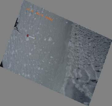
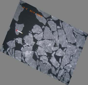
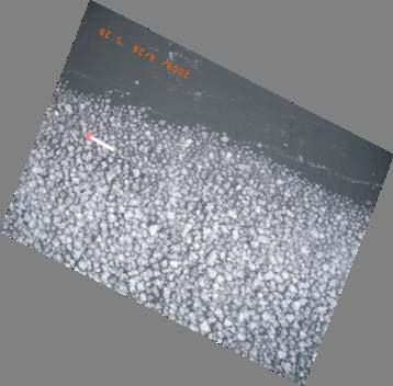
5 Polynyas and water mass modification Fast Ice Lena Delta Thin ice Pack ice 5


6 EM induction sea ice thickness sounding

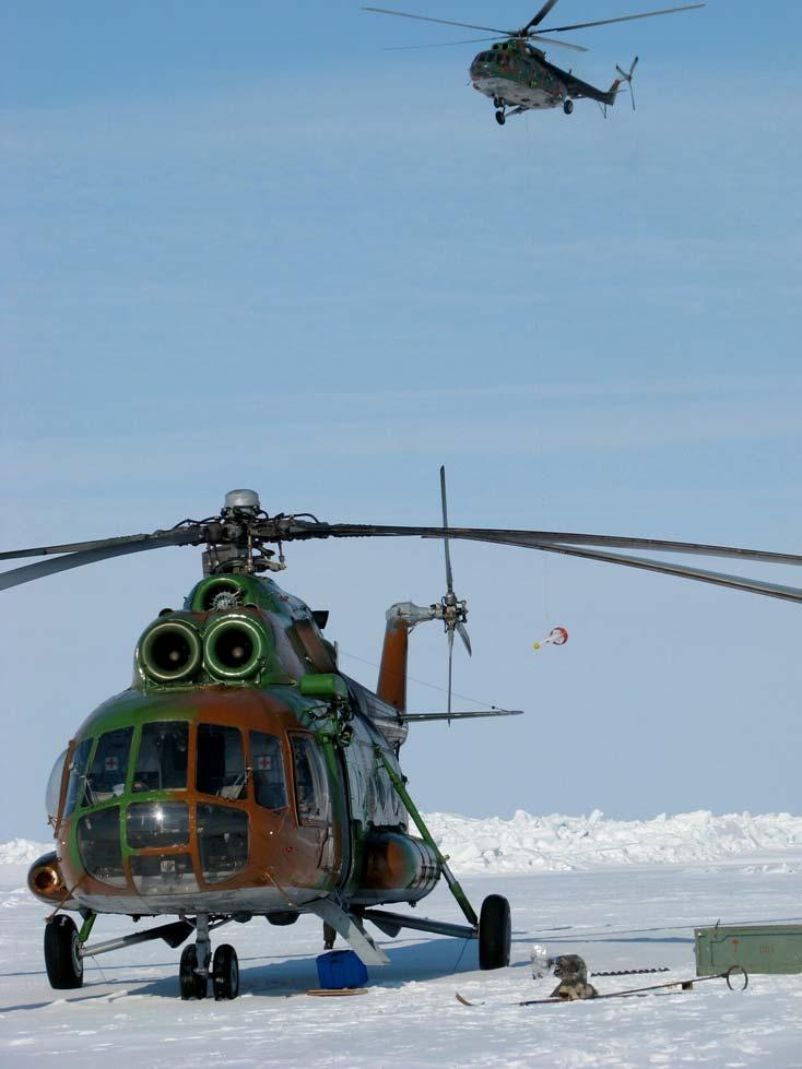
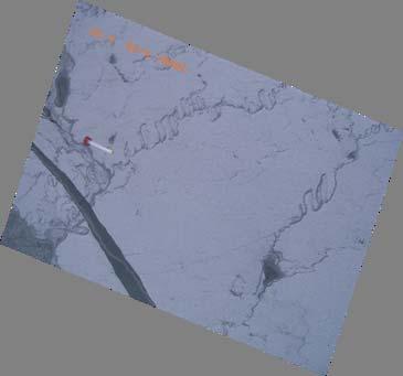
7 EM Bird AWI s EM Bird


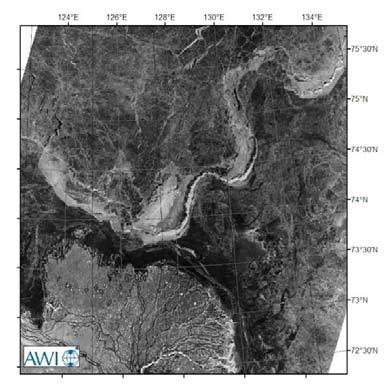
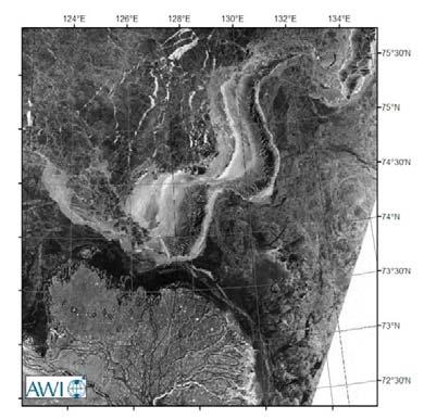
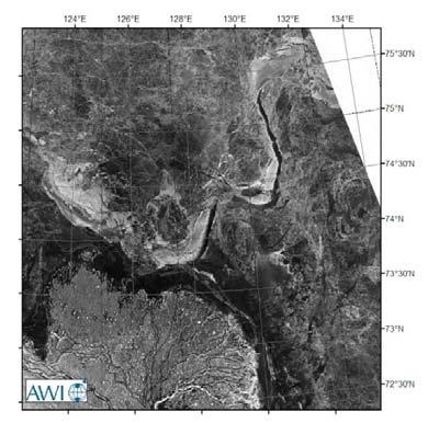
8 ENVISAT ASAR WSM time series observations 08/04/ /04/ /04/ /04/ /04/ /04/2008

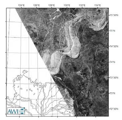
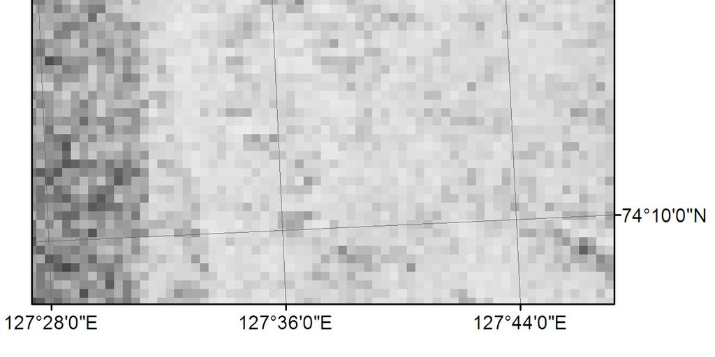
9 TerraSAR-X Dual Pol HHVV 16 TerraSAR-X X Strip map mode data takes, Dual-Pol HH/VV, between April and May 2008 ENVISAT ASAR WSM Magenta:Overlay of TerraSAR-X Footprints Red: Fast Ice Border
")


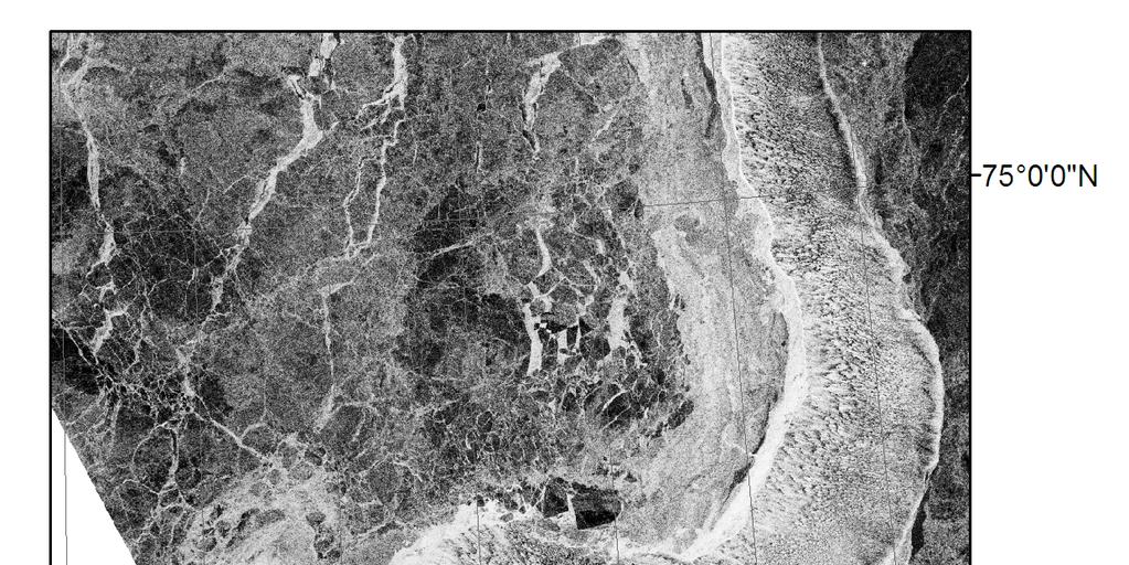
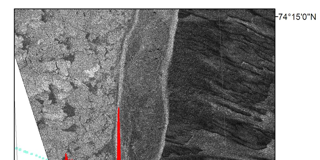
10 Coincident data takes of EM-Bird & TerraSAR-X Profile (3 dates) TerraSAR-X : TerraSAR-X : TerraSAR -X: Blue: TerraSAR-X footprints; Red thickness profiles, overlay on ENVISAT ASAR WSM

11
12 Processing Steps Data Processing (TerraSAR-X and EM Bird, ): Correction of sea ice drift for the EM bird thickness profile, due to time difference of 3.5 h between data takes: Initial estimate of drift by feature tracking of 2 TerraSAR-X scene Reconstruction of drift trajectory by means of climatological data (wind direction and speed) First order residual motion compensation for thickness profile (correction of correlation of thickness with flight altitude) Polarimetric processing of TerraSAR-X SLC data (dual-pol HHVV) Polarimetric coherence 2D eigenvector analysis (Entropy, Anisotropy, Alpha Angle etc.) Copol ratio Signature extraction and plot vs. sea ice thickness
13 EM Bird Sea Ice Thickness Profile & Histogram Negative Thickness Values: Only relative thickness values available at the moment! Thicker Sea Ice
14 First Polarimetric Analysis Results: HHVV Coherence HHVV coherence [mean] mean sea ice thickness
15 First Polarimetric Analysis Results: HHVV Coherence Phase HHVV coherence phase [mean] 20 degree mean sea ice thickness
16 First Polarimetric Analysis Results: Polarimetric 2D Entropy 2D Entropy [mean] mean sea ice thickness
17 Summary: Some of the polarimetric parameters seem to be sensitive to thin sea thickness change, Polarimetric TerraSAR-X data may be a useful tool Dual pol X-band data provides informations for thin ice classification of sea ice surfaces Inversion of thin sea ice thickness may be feasible: A combination of several polarimetric parameters is suggested to increase the information content
18 Open Question: Dependency of polarimetric parameters to incidence angle change and upper limit of sea ice thickness sensitivity: Additional experiments are planned Connection to scattering theory (Winebrenner et al. 1995, Radio Science, Vol. 30, No 2) Future work: Fine-tuning of drift correction algorithm Enhanced motion compensation by means of DGPS processing for the thickness profiles to come to absolute thickness values Development of an EM model based inversion algorithm
19 Thank you for your attention! Questions, recommendations?
Improved sea-ice monitoring for the Baltic Sea Project summary
 Improved sea-ice monitoring for the Baltic Sea Project summary Leif E.B. Eriksson (1), Karin Borenäs (2), Wolfgang Dierking (3), Anders Berg (1) and Per Pemberton (2) (1) Chalmers University of Technology,
Linking Different Spatial Scales For Retrieval Of Sea Ice Conditions From SAR Images
 Linking Different Spatial Scales For Retrieval Of Sea Ice Conditions From SAR Images Matt Arkett 2, Wolfgang Dierking 1, Jakob Griebel 1, Thomas Hollands 1, Stefanie Linow 1, Eero Rinne 3, Markku Similä
Airborne sea ice thickness sounding
 Airborne sea ice thickness sounding 1, Christian Haas 2, Lasse Rabenstein 1, John Lobach 3 1. Alfred Wegener Institute for Polar and Marine Research, Germany 2. University of Alberta, Canada 3. Ferra Dynamics
EM ice thickness measurements during GreenICE 2004 field campaign
 EM ice thickness measurements during GreenICE field campaign Latitude ( N).... Ice thickness (m).. Longitude ( E) GreenICE Deliverable D Christian Haas October Executive summary This report summarizes
DLR/TerraSAR-X: development of IPY portofolio since the SAR coordination workshop (CSA, March 2008) Dana Floricioiu
 Dana Floricioiu") DLR/TerraSAR-X: development of IPY portofolio since the SAR coordination workshop (CSA, March 2008) Dana Floricioiu STG-3 Meeting, ESRIN Frascati 5/6 May 2008 Acquisitions themes adopted at the SAR coordination
DLR/TerraSAR-X: development of IPY portofolio since the SAR coordination workshop (CSA, March 2008) Dana Floricioiu STG-3 Meeting, ESRIN Frascati 5/6 May 2008 Acquisitions themes adopted at the SAR coordination
German Arctic Expeditions
 German Arctic Expeditions 2015-2016 FARO/ASSW, 2016, Fairbanks Dirk Mengedoht (Alfred Wegener Institute, Germany) Dirk Mengedoht, AWI Logistics 2015 Polarstern Arctic Expeditions 2015 Leg Start End Mission
Status DLR (TerraSAR X / TanDEM X)
") SAR Coordination Working Meeting 5 Status DLR (TerraSAR X / TanDEM X) Dana Floricioiu, Achim Roth Imaging Requirements for TerraSAR X & TanDEM X Missions Ice Sheets: TSX supports Greenland outlet glaciers,
SAR Coordination Working Meeting 5 Status DLR (TerraSAR X / TanDEM X) Dana Floricioiu, Achim Roth Imaging Requirements for TerraSAR X & TanDEM X Missions Ice Sheets: TSX supports Greenland outlet glaciers,
DLR-EOC Contributions to Spaceborne Polar Observing Systems
 DLR-EOC Contributions to Spaceborne Polar Observing Systems M. Gottwald DLR-IMF Polar Space Task Group, GSFC, 29 September 1 October 2014 Slide 2 Slide 3 Slide 4 Polar Activities status GARS O Higgins
Remote sensing of sea ice
 Remote sensing of sea ice Ice concentration/extent Age/type Drift Melting Thickness Christian Haas Remote Sensing Methods Passive: senses shortwave (visible), thermal (infrared) or microwave radiation
DLR s TerraSAR-X contributes to international fleet of radar satellites to map the Arctic and Antarctica
 DLR s TerraSAR-X contributes to international fleet of radar satellites to map the Arctic and Antarctica The polar regions play an important role in the Earth system. The snow and ice covered ocean and
Floating Ice: Progress in Addressing Science Goals
 Polar Floating Ice: Progress in Addressing Science Goals Stephen Howell 1, Leif Toudal Pedersen 2 and Roberto Saldo 3 1 Environment Canada, Climate Research Division, Toronto, Canada 2 Danish Meteorological
Monitoring Sea Ice with Space-borne Synthetic Aperture Radar
 Monitoring Sea Ice with Space-borne Synthetic Aperture Radar Torbjørn Eltoft UiT- the Arctic University of Norway CIRFA A Centre for Research-based Innovation cirfa.uit.no Sea ice & climate Some basic
Wave processes in Arctic Seas, observed from TerraSAR-X
 DISTRIBUTION STATEMENT A. Approved for public release; distribution is unlimited. Wave processes in Arctic Seas, observed from TerraSAR-X Susanne Lehner DLR German Air and Space Research Center Earth Observation
Making a case for full-polarimetric radar remote sensing
 Making a case for full-polarimetric radar remote sensing Jeremy Nicoll Alaska Satellite Facility, University of Alaska Fairbanks 1 Polarization States of a Coherent Plane Wave electric field vector vertically
SMOSIce L-Band Radiometry for Sea Ice Applications
 Institute of Environmental Physics University of Bremen SMOSIce L-Band Radiometry for Sea Ice Applications Georg Heygster 1), Christian Haas 2), Lars Kaleschke 3), Helge Rebhan 5), Detlef Stammer 3), Rasmus
AIRBORNE EM SEA-ICE THICHNESS PROFILING OVER BRACKISH BALTIC SEA WATER
 17th International Symposium on Ice Saint Petersburg, Russia, 21-25 June 2004 International Association of Hydraulic Engineering and Research AIRBORNE EM SEA-ICE THICHNESS PROFILING OVER BRACKISH BALTIC
VIDEO/LASER HELICOPTER SENSOR TO COLLECT PACK ICE PROPERTIES FOR VALIDATION OF RADARSAT SAR BACKSCATTER VALUES
 VIDEO/LASER HELICOPTER SENSOR TO COLLECT PACK ICE PROPERTIES FOR VALIDATION OF RADARSAT SAR BACKSCATTER VALUES S.J. Prinsenberg 1, I.K. Peterson 1 and L. Lalumiere 2 1 Bedford Institute of Oceanography,
Monitoring dynamics and sea-ice export of the Southern West New Siberian polynya, using model and remote sensing data
 MASTER OF SCIENCE PROGRAM IN EARTH OBSERVATION Monitoring dynamics and sea-ice export of the Southern West New Siberian polynya, using model and remote sensing data T. Krumpen Promoter Dr. C. Haas 1, Dr.
Anfang. German Arctic expeditions ASSW, March 27 April 1, 2011, Seoul, Korea. Foto: L. Tadday
 Anfang German Arctic expeditions 2010-2011 ASSW, March 27 April 1, 2011, Seoul, Korea Foto: L. Tadday Overview: Research facilities around the globe Arctic Science Summit Week, March 27 April 1, 2011,
DEMOSS. Title: Development of Marine Oil Spills/slicks Satellite monitoring System elements for the Black Sea, Caspian Sea and /Kara/Barents Seas
 DEMOSS Title: Development of Marine Oil Spills/slicks Satellite monitoring System elements for the Black Sea, Caspian Sea and /Kara/Barents Seas INTAS Thematic Call on Earth Sciences and Environment in
Currents and Objects
 SAR Marine Applications Currents and Objects Martin Gade Uni Hamburg, Institut für Meereskunde martin.gade@uni-hamburg.de SAR Maritime Applications Friday, 9 Sep, Morning: 1 - History & Basics Introduction
Ice surveys, meteorological and oceanographic data What is available and up-to-date?
 Ice surveys, meteorological and oceanographic data What is available and up-to-date? Leader of the Norwegian Ice Service +47 77 62 13 15 - nick.hughes@met.no Norwegian Meteorological Institute met.no 1
Opportunities for advanced Remote Sensing; an outsider s perspective
 Opportunities for advanced Remote Sensing; an outsider s perspective Ramon Hanssen Delft University of Technology 1 Starting questions Can we do more with the data we are already acquire? What s in stock
Distribution and Thickness of Different Sea Ice Types and Extreme Ice Features in the Beaufort Sea: 2012 Field Report
 Distribution and Thickness of Different Sea Ice Types and Extreme Ice Features in the Beaufort Sea: 2012 Field Report July 2012 NCR#5859681 - v1 DISTRIBUTION AND THICKNESS OF DIFFERENT SEA ICE TYPES AND
Knowledge-based sea ice classification by polarimetric SAR
 Downloaded from orbit.dtu.dk on: Dec 17, 217 Knowledge-based sea ice classification by polarimetric SAR Skriver, Henning; Dierking, Wolfgang Published in: IEEE International Geoscience Remote Sensing Symposium,
DUAL-POLARIZED COSMO SKYMED SAR DATA TO OBSERVE METALLIC TARGETS AT SEA
 DUAL-POLARIZED COSMO SKYMED SAR DATA TO OBSERVE METALLIC TARGETS AT SEA F. Nunziata, M. Montuori and M. Migliaccio Università degli Studi di Napoli Parthenope Dipartimento per le Tecnologie Centro Direzionale,
Ice Station POLarstern (ISPOL 1)
") Ice Station POLarstern (ISPOL 1) ANT XXI/2: 18.12003-8.2004 (51 days) (N.B.: Earlier start and extension of 10 days is highly desirable (70 days duration)) Overall Objective The main goal of this project
Ice Station POLarstern (ISPOL 1) ANT XXI/2: 18.12003-8.2004 (51 days) (N.B.: Earlier start and extension of 10 days is highly desirable (70 days duration)) Overall Objective The main goal of this project
Floating Ice. Susanne Lehner DLR EOC
 Floating Ice Susanne Lehner DLR EOC DLR Research Lab Maritime Safety and Security in Bremen Team SAR Oceanography Relocated from Oberpfaffenhofen to Bremen Cooperation with NRT Services (Neustrelitz) and
J2.6 SONAR MEASUREMENTS IN THE GULF STREAM FRONT ON THE SOUTHEAST FLORIDA SHELF COORDINATED WITH TERRASAR-X SATELLITE OVERPASSES
 J2.6 SONAR MEASUREMENTS IN THE GULF STREAM FRONT ON THE SOUTHEAST FLORIDA SHELF COORDINATED WITH TERRASAR-X SATELLITE OVERPASSES Chris Maingot 1, Alexander Soloviev 1, Silvia Matt 1, Mikhail Gilman 1,
WaMaPro a user friendly tool for water surface derivation from SAR data and further products derived from optical data
 WaMaPro a user friendly tool for water surface derivation from SAR data and further products derived from optical data J. Huth a, M. Ahrens a, I. Klein a, U. Gessner a, J. Hoffmann b, C. Kuenzer a a German
EXTRACTION OF LATE SUMMER SEA ICE PROPERTIES FROM POLARIMETRIC SAR FEATURES IN C- AND X- BAND
 EXTRACTION OF LATE SUMMER SEA ICE PROPERTIES FROM POLARIMETRIC SAR FEATURES IN C- AND X- BAND Ane S. Fors 1, Camilla Brekke 1, Sebastian Gerland 2, Anthony P. Doulgeris 1, and Torbjørn Eltoft 1 1 Department
Evaluation of a polynya flux model by means of thermal infrared satellite estimates
 Annals of Glaciology 52(57) 2011 1 Evaluation of a polynya flux model by means of thermal infrared satellite estimates Thomas KRUMPEN, 1 Sascha WILLMES, 2 Miguel Angel MORALES MAQUEDA, 3 Christian HAAS,
1. Regarding the availability of two co-polarized (HH and VV) channels.
 channels.") Dear Anonymous Referee #2, Thank you for your insightful and stimulating review comments. Modifications based on these comments will significantly improve the quality of this research paper. General Comments:
Dear Anonymous Referee #2, Thank you for your insightful and stimulating review comments. Modifications based on these comments will significantly improve the quality of this research paper. General Comments:
Snow property extraction based on polarimetry and differential SAR interferometry
 Snow property extraction based on polarimetry and differential SAR interferometry S. Leinß, I. Hajnsek Earth Observation and Remote Sensing, Institute of Enviromental Science, ETH Zürich TerraSAR X and
Wave processes in Arctic Seas, observed from TerraSAR-X
 DISTRIBUTION STATEMENT A. Approved for public release; distribution is unlimited. Wave processes in Arctic Seas, observed from TerraSAR-X Susanne Lehner DLR German Air and Space Research Center Earth Observation
CHARACTERISTICS OF SNOW AND ICE MORPHOLOGICAL FEATURES DERIVED FROM MULTI-POLARIZATION TERRASAR-X DATA
 CHARACTERISTICS OF SNOW AND ICE MORPHOLOGICAL FEATURES DERIVED FROM MULTI-POLARIZATION TERRASAR-X DATA Dana Floricioiu 1, Helmut Rott 2, Thomas Nagler 2, Markus Heidinger 2 and Michael Eineder 1 1 DLR,
1. Greenland Flow Distortion experiment (GFDex)
") 1. Greenland Flow Distortion experiment (GFDex) (GFDex) is an international fieldwork and modelling-based project to investigate the role that Greenland plays in distorting atmospheric flow over and around
1. Greenland Flow Distortion experiment (GFDex) (GFDex) is an international fieldwork and modelling-based project to investigate the role that Greenland plays in distorting atmospheric flow over and around
FRontiers in Arctic marine Monitoring: The FRAM Ocean Observing System
 FRontiers in Arctic marine Monitoring: The FRAM Ocean Observing System Thomas Soltwedel Alfred-Wegener-Institute Helmholtz-Center for Polar and Marine Research Arctic Frontiers 2017 Svalbard Symposium
Large-scale ice thickness distribution of first-year sea ice in spring and summer north of Svalbard
 Annals of Glaciology 54(62) 2013 doi: 10.3189/2013AoG62A146 13 Large-scale ice thickness distribution of first-year sea ice in spring and summer north of Svalbard Angelika H. H. RENNER, 1 Stefan HENDRICKS,
MARINE AND MARITIME SAR APPLICATIONS: COSMO-SKYMED FROM 1 ST TO 2 ND GENERATION
 MARINE AND MARITIME SAR APPLICATIONS: COSMO-SKYMED FROM 1 ST TO 2 ND GENERATION Maurizio Migliaccio, Ferdinando Nunziata, Andrea Buono Dipartimento di Ingegneria, Università degli Studi di Napoli Parthenope
Earth Exploration-Satellite Service (EESS)- Active Spaceborne Remote Sensing and Operations
- Active Spaceborne Remote Sensing and Operations") Earth Exploration-Satellite Service (EESS)- Active Spaceborne Remote Sensing and Operations SRTM Radarsat JASON Seawinds TRMM Cloudsat Bryan Huneycutt (USA) Charles Wende (USA) WMO, Geneva, Switzerland
Earth Exploration-Satellite Service (EESS)- Active Spaceborne Remote Sensing and Operations SRTM Radarsat JASON Seawinds TRMM Cloudsat Bryan Huneycutt (USA) Charles Wende (USA) WMO, Geneva, Switzerland
EUMETSAT STATUS AND PLANS
 1 EUM/TSS/VWG/15/826793 07/10/2015 EUMETSAT STATUS AND PLANS François Montagner, Marine Applications Manager, EUMETSAT WMO Polar Space Task Group 5 5-7 October 2015, DLR, Oberpfaffenhofen PSTG Strategic
EC-PORS III Research. Sodankylä, February Developing a Polar Prediction System
 EC-PORS III Research Sodankylä, February 2012 Developing a Polar Prediction System Polar Prediction System - Status 1. EC-PORS I (Oct. 2009) -> initial discussions 2. WWRP/THORPEX Polar Prediction Workshop,
Arctic Observing Systems Challenges, New opportunities and Integration
 Arctic Observing Systems Challenges, New opportunities and Integration Japan Norway Arctic Science Week 03 June 2016 By Stein Sandven, NERSC Building an integrated Arctic Observing System Need to collect,
Observations of supercooling and frazil ice formation in the Laptev Sea coastal polynya
 Click Here for Full Article JOURNAL OF GEOPHYSICAL RESEARCH, VOL. 115,, doi:10.1029/2009jc005798, 2010 Observations of supercooling and frazil ice formation in the Laptev Sea coastal polynya Igor A. Dmitrenko,
K&C Phase 4 Status report. Ice Sheet Monitoring using ALOS-2. University of California, Irvine 2 JPL
 K&C Phase 4 Status report Ice Sheet Monitoring using ALOS-2 Bernd Scheuchl 1, Jeremie Mouginot 1, Eric Rignot 1,2 1 University of California, Irvine 2 JPL Science Team meeting #24 Tokyo, Japan, January
Overview of data assimilation in oceanography or how best to initialize the ocean?
 Overview of data assimilation in oceanography or how best to initialize the ocean? T. Janjic Alfred Wegener Institute for Polar and Marine Research Bremerhaven, Germany Outline Ocean observing system Ocean
FINNISH INSTITUTE OF MARINE RESEARCH CRUISE REPORT. R/V Aranda. Cruise 2 / February - 22 April 2002
 FINNISH INSTITUTE OF MARINE RESEARCH CRUISE REPORT R/V Aranda Cruise 2 / 2002 11 February - 22 April 2002 The report is based on preliminary data and is subject to changes. Finnish Institute of Marine
MAPPING OF LAKE ICE IN NORTHERN EUROPE USING DUAL-POLARIZATION RADARSAT-2 DATA
 MAPPING OF LAKE ICE IN NORTHERN EUROPE USING DUAL-POLARIZATION RADARSAT-2 DATA Hindberg, Heidi and Malnes, Eirik Northern Research Institute (Norut), PO Box 6434 Tromsø Science Park, N9291 Tromsø, Email:
Reduced ice thickness in Arctic Transpolar Drift favors rapid ice retreat
 Reduced ice thickness in Arctic Transpolar Drift favors rapid ice retreat Christian Haas 1,a,*, Andreas Pfaffling 1,b, Stefan Hendricks 1, Lasse Rabenstein 1, Jean- Louis Etienne 2, Ignatius Rigor 3 1
Long-Term Time Series of Water Vapour Total Columns from GOME, SCIAMACHY and GOME-2
 Graphics: ESA Graphics: ESA Graphics: ESA Long-Term Time Series of Water Vapour Total Columns from GOME, SCIAMACHY and GOME-2 S. Noël, S. Mieruch, H. Bovensmann, J. P. Burrows Institute of Environmental
In-situ and airborne sea ice observations for better sea ice prediction and climate analysis. Christian Haas
 In-situ and airborne sea ice observations for better sea ice prediction and climate analysis Christian Haas Data assimilation improves sea ice forecasts Most important parameters are: Concentration (SIC),
Recent developments in multi-beam echo-sounder processing at the Delft
 Recent developments in multi-beam echo-sounder processing at the Delft University of Technology Prof. Dr. Dick G. Simons Acoustic Remote Sensing Group, Faculty of Aerospace Engineering, Delft University
Multisensor monitoring of Peter the Great Bay
 Multisensor monitoring of Peter the Great Bay Leonid Mitnik, Vyacheslav Dubina, Oleg Konstantinov and Vitaly Fischenko V.I. Il'ichev Pacific Oceanological Institute FEB RAS 43 Baltiyskaya St. 690041 Vladivostok,
Arctic Regional Ocean Observing System Arctic ROOS Report from 2012
 Arctic Regional Ocean Observing System Arctic ROOS Report from 2012 By Stein Sandven Nansen Environmental and Remote Sensing Center (www.arctic-roos.org) Focus in 2012 1. Arctic Marine Forecasting Center
EO-Based Ice and Iceberg Monitoring in Support of Offshore Engineering Design and Tactical Operations
 EO-Based Ice and Iceberg Monitoring in Support of Offshore Engineering Design and Tactical Operations Desmond Power, C-CORE ESA Industry Workshop on Satellite EO for the Oil and Gas Sector Overview Operations
Mass balance of sea ice in both hemispheres Airborne validation and the AWI CryoSat-2 sea ice data product
 Mass balance of sea ice in both hemispheres Airborne validation and the AWI CryoSat-2 sea ice data product Stefan Hendricks Robert Ricker Veit Helm Sandra Schwegmann Christian Haas Andreas Herber Airborne
HY-2A Satellite User s Guide
 National Satellite Ocean Application Service 2013-5-16 Document Change Record Revision Date Changed Pages/Paragraphs Edit Description i Contents 1 Introduction to HY-2 Satellite... 1 2 HY-2 satellite data
Radio occultation at GFZ Potsdam: Current status and future prospects
 Radio occultation at GFZ Potsdam: Current status and future prospects J. Wickert, T. Schmidt, G. Beyerle, S. Heise, R. Stosius GFZ German Research Centre for Geosciences, Potsdam, Germany The CHAMP, GRACE,
DBCP National Report Germany. 28 th DBCP Fremantle, 6 st of October 2012 Kai Herklotz (BSH)
") DBCP National Report Germany 28 th DBCP Fremantle, 6 st of October 2012 Kai Herklotz (BSH) Outline BSH and its relation to the DBCP ARGO-Program Other activities MARNET Perspectives 06.10.2012 28th DBCP,
DBCP National Report Germany 28 th DBCP Fremantle, 6 st of October 2012 Kai Herklotz (BSH) Outline BSH and its relation to the DBCP ARGO-Program Other activities MARNET Perspectives 06.10.2012 28th DBCP,
ATMOSPHERIC ERROR, PHASE TREND AND DECORRELATION NOISE IN TERRASAR-X DIFFERENTIAL INTERFEROGRAMS
 ATMOSPHERIC ERROR, PHASE TREND AND DECORRELATION NOISE IN TERRASAR-X DIFFERENTIAL INTERFEROGRAMS Steffen Knospe () () Institute of Geotechnical Engineering and Mine Surveying, Clausthal University of Technology,
TerraSAR-X and TanDEM-X Applications for Maritime Domain Awereness
 TerraSAR-X and TanDEM-X Applications for Maritime Domain Awereness Dr. Stephan Brusch German Aerospace Center DLR Remote Sensing Technology Institute DLR Oberpfaffenhofen (Germany) Dr. Jürgen Drescher
90 N. exploring the arctic and the perspectives on climate change
 . 90 N POLE TRACK exploring the arctic and the perspectives on climate change 2 0 0 5 The drive to return to the North Pole once more for a scientific expedition is fueled by my desire to contribute to
Figure 1: Two schematic views of the global overturning circulation. The Southern Ocean plays two key roles in the global overturning: (1) the
 the") Figure 1: Two schematic views of the global overturning circulation. The Southern Ocean plays two key roles in the global overturning: (1) the Antarctic Circumpolar Current connects the ocean basins, establishing
Figure 1: Two schematic views of the global overturning circulation. The Southern Ocean plays two key roles in the global overturning: (1) the Antarctic Circumpolar Current connects the ocean basins, establishing
Applications of ice profiling sonar technology to scientific, engineering and operational issues in Polar and sub-polar waters
 Applications of ice profiling sonar technology to scientific, engineering and operational issues in Polar and sub-polar waters J.R. Marko, ASL Environmental Sciences Inc., Sidney, B.C., Canada And H. Melling,
Fjernmåling og modellering av oljesøl - på åpen sjø og i is
 Fjernmåling og modellering av oljesøl - på åpen sjø og i is Associate Professor, Camilla Brekke CIRFA (SFI) WP3 leader - Oil Spill Remote Sensing cirfa.uit.no What we are aiming for Detection & characterization
Better ice information onboard ships ECDIS S-411
 Better ice information onboard ships ECDIS S411 DeMarine User Workshop Dr. Jürgen Holfort Head of German ice service at the Bundesamt für Seeschifffahrt und Hydrographie Vicechair of the JCOMM Expert team
Hydrometeorological support of the safety of marine activity in the Arctic
 International Conference "Through the Northern Sea Route to strategic stability in the Arctic" Hydrometeorological support of the safety of marine activity in the Arctic Alexander Frolov Head of Roshydromet
The Importance of Microwave Remote Sensing for Operational Sea Ice Services And Challenges
 The Importance of Microwave Remote Sensing for Operational Sea Ice Services And Challenges Wolfgang Dierking January 2015 (1) Why is microwave remote sensing important (=useful) for sea ice mapping? Problems
COLD REGIONS SCIENCE AND MARINE TECHNOLOGY - Polar Ice By Satellite Remote Sensing - Antony Liu
 POLAR ICE BY SATELLITE REMOTE SENSING Antony Liu Ocean Sciences Branch, NASA Goddard Space Flight Center, Greenbelt MD USA Keywords: Satellite remote sensing, Sea ice drift, Ice extent, Ice concentration,
Geodetics measurements within the scope of current and future perspectives of GNSS-Reflectometry and GNSS-Radio Occultation
 Geodetics measurements within the scope of current and future perspectives of GNSS-Reflectometry and GNSS-Radio Occultation Introduction The aim of this presentation is to provide an overview of the GNSS-R
WERA Ocean Radar Capability of Real-Time Tsunami Detection
 WERA Ocean Radar Capability of Real-Time Tsunami Detection Dr. Anna Dzvonkovskaya Helzel Messtechnik GmbH Kaltenkirchen, GERMANY e-mail: dzvonkovskaya@helzel.com member of and Worldwide WERA HF Ocean Radar
Training Course on Radar & Optical RS, IES, Cēsis, Latvia, 5-9 September SAR Marine Applications. Wind and Waves
 SAR Marine Applications Wind and Waves Martin Gade Uni Hamburg, Institut für Meereskunde martin.gade@uni-hamburg.de SAR Marine Applications Friday, 9 Sep, Morning: 1 - History & Basics Introduction Radar/SAR
ICE DRIFT IN THE FRAM STRAIT FROM ENVISAT ASAR DATA
 ICE DRIFT IN THE FRAM STRAIT FROM ENVISAT ASAR DATA Stein Sandven (1), Kjell Kloster (1), and Knut F. Dagestad (1) (1) Nansen Environmental and Remote Sensing Center (NERSC), Thormøhlensgte 47, N-5006
Research Programme Polar, Marine and Coastal Systems. Current and future Arctic research priorities of Germany Nicole Biebow, AWI
 Research Programme Polar, Marine and Coastal Systems Current and future Arctic research priorities of Germany Nicole Biebow, AWI Arctic Science and Technology (S&T) Collaboration and Engagement Workshop,
Observations of Arctic snow and sea ice thickness from satellite and airborne surveys. Nathan Kurtz NASA Goddard Space Flight Center
 Observations of Arctic snow and sea ice thickness from satellite and airborne surveys Nathan Kurtz NASA Goddard Space Flight Center Decline in Arctic sea ice thickness and volume Kwok et al. (2009) Submarine
SAR Coordination for Snow Products
 Polar SAR Coordination Working Meeting 5 SAR Coordination for Snow Products David Small 1, Thomas Nagler 2, David Jäger 1, Christoph Rohner 1, Adrian Schubert 1 1: University of Zurich, Switzerland 2:
OSE/OSSEs at NOAA. Eric Bayler NOAA/NESDIS/STAR
 OSE/OSSEs at NOAA Eric Bayler NOAA/NESDIS/STAR OSE/OSSEs at NOAA NOAA Leadership view: Relatively inexpensive way to: Assess the impact of potential new observations Refine and redirect current observing
MULTI-POLARISATION MEASUREMENTS OF SNOW SIGNATURES WITH AIR- AND SATELLITEBORNE SAR
 EARSeL eproceedings 5, 1/2006 111 MULTI-POLARISATION MEASUREMENTS OF SNOW SIGNATURES WITH AIR- AND SATELLITEBORNE SAR Eirik Malnes 1, Rune Storvold 1, Inge Lauknes 1 and Simone Pettinato 2 1. Norut IT,
ATOC 5051 INTRODUCTION TO PHYSICAL OCEANOGRAPHY
 ATOC 5051 INTRODUCTION TO PHYSICAL OCEANOGRAPHY Lecture 4 Learning objective: understand how the ocean properties are measured & how the methods have been improved Observational methods: a) Depth; b) Temperature;
SAR data Sensords and examples
 SAR data Sensords and examples Sar Technical Training for Forest Mapping 2014/2015 Cédric Lardeux Jean-Paul Rudant Pierre-Louis Frison cedric.lardeux@onfinternational.com rudant@univ-mlv.fr frison@univ-mlv.fr
An Overview. Jeff Key (NOAA) PSTG Vice-Chair. on behalf of Polar Space Task Group. Polar Space Task Group
 PSTG Vice-Chair. on behalf of Polar Space Task Group. Polar Space Task Group") An Overview Jeff Key (NOAA) PSTG Vice-Chair on behalf of Asia CryoNet Meeting 4 December 2013, Beijing Cryosphere Satellite Missions International Year (IPY) The IPY provided an international framework
An Overview Jeff Key (NOAA) PSTG Vice-Chair on behalf of Asia CryoNet Meeting 4 December 2013, Beijing Cryosphere Satellite Missions International Year (IPY) The IPY provided an international framework
Monitoring of Arctic Conditions from a Virtual Constellation of Synthetic Aperture Radar Satellites
 DISTRIBUTION STATEMENT A. Approved for public release; distribution is unlimited. Monitoring of Arctic Conditions from a Virtual Constellation of Synthetic Aperture Radar Satellites Hans C. Graber RSMAS
SST in Climate Research
 SST in Climate Research Roger Saunders, Met Office with inputs from Nick Rayner, John Kennedy, Rob Smith, Karsten Fennig, Sarah Millington, Owen Embury. This work is supported by the Joint DECC and Defra
North pole drifting stations A presentation for the GCW CryoNet Implementation Meeting, First Session
 North pole drifting stations A presentation for the GCW CryoNet Implementation Meeting, First Session Vienna, Austria, 20-22 November 2012 Vasily Smolyanitsky Arctic and Antarctic Research Institute (AARI)
Observing Arctic Sea Ice Change. Christian Haas
 Observing Arctic Sea Ice Change Christian Haas Decreasing Arctic sea ice extent in September Ice extent is decreasing, but regional patterns are very different every year The Cryosphere Today, http://arctic.atmos.uiuc.edu;
EVALUATION OF CLASSIFICATION METHODS WITH POLARIMETRIC ALOS/PALSAR DATA
 EVALUATION OF CLASSIFICATION METHODS WITH POLARIMETRIC ALOS/PALSAR DATA Anne LÖNNQVIST a, Yrjö RAUSTE a, Heikki AHOLA a, Matthieu MOLINIER a, and Tuomas HÄME a a VTT Technical Research Centre of Finland,
Natural Sciences Expedition to the Volcanoes of the Arctic Seafloor
 Natural Sciences Expedition to the Volcanoes of the Arctic Seafloor The AMORE Expedition headed for the so-called Gakkel Ridge where, on the floor of the Arctic Ocean, there is hot work afoot for this
Analysis of the Temporal Behavior of Coherent Scatterers (CSs) in ALOS PalSAR Data
 in ALOS PalSAR Data") Analysis of the Temporal Behavior of Coherent Scatterers (CSs) in ALOS PalSAR Data L. Marotti, R. Zandona-Schneider & K.P. Papathanassiou German Aerospace Center (DLR) Microwaves and Radar Institute0 PO.BOX
Analysis of the Temporal Behavior of Coherent Scatterers (CSs) in ALOS PalSAR Data L. Marotti, R. Zandona-Schneider & K.P. Papathanassiou German Aerospace Center (DLR) Microwaves and Radar Institute0 PO.BOX
Observations of sea ice thickness, surface roughness and ice motion in Amundsen Gulf
 Click Here for Full Article JOURNAL OF GEOPHYSICAL RESEARCH, VOL. 113,, doi:10.1029/2007jc004456, 2008 Observations of sea ice thickness, surface roughness and ice motion in Amundsen Gulf I. K. Peterson,
IceBird 2018 Summer Campaign
 Campaign report August 2018 IceBird 2018 Summer Campaign Sea ice thickness measurements with Polar 6 from Station Nord and Alert Authors Thomas Krumpen Helge Goessling Manuel Sellmann Alfred Wegener Institute
ANALYSIS OF ASAR POLARISATION SIGNATURES FROM URBAN AREAS (AO-434)
") ANALYSIS OF ASAR POLARISATION SIGNATURES FROM URBAN AREAS (AO-434) Dan Johan Weydahl and Richard Olsen Norwegian Defence Research Establishment (FFI), P.O. Box 25, NO-2027 Kjeller, NORWAY, Email: dan-johan.weydahl@ffi.no
ANALYSIS OF ASAR POLARISATION SIGNATURES FROM URBAN AREAS (AO-434) Dan Johan Weydahl and Richard Olsen Norwegian Defence Research Establishment (FFI), P.O. Box 25, NO-2027 Kjeller, NORWAY, Email: dan-johan.weydahl@ffi.no
SAWS: Met-Ocean Data & Infrastructure in Support of Industry, Research & Public Good. South Africa-Norway Science Week, 2016
 SAWS: Met-Ocean Data & Infrastructure in Support of Industry, Research & Public Good South Africa-Norway Science Week, 2016 Marc de Vos, November 2016 South Africa: Context http://learn.mindset.co.za/sites/default/files/resourcelib/e
Shashi Kumar. Indian Institute of Remote Sensing. (Indian Space Research Organisation)
") Practical-1 SAR Image Interpretation Shashi Kumar Indian Institute of Remote Sensing (Indian Space Research Organisation) Department of Space, Government of India 04 Kalidas Road, Dehradun - 248 001, U.K.
Practical-1 SAR Image Interpretation Shashi Kumar Indian Institute of Remote Sensing (Indian Space Research Organisation) Department of Space, Government of India 04 Kalidas Road, Dehradun - 248 001, U.K.
Detection, tracking and study of polar lows from satellites Leonid P. Bobylev
 Detection, tracking and study of polar lows from satellites Leonid P. Bobylev Nansen Centre, St. Petersburg, Russia Nansen Centre, Bergen, Norway Polar lows and their general characteristics International
ALOS-2 Basic Observation Scenario (First Edition) January 10, 2014 JAXA/ALOS-2 Project
 January 10, 2014 JAXA/ALOS-2 Project") ALOS-2 Basic Observation Scenario (First Edition) January 10, 2014 JAXA/ALOS-2 Project 1 1.First edition 2.Purpose and Background 3.Approach of the Basic Observation Scenario 4.Basic Observation
ALOS-2 Basic Observation Scenario (First Edition) January 10, 2014 JAXA/ALOS-2 Project 1 1.First edition 2.Purpose and Background 3.Approach of the Basic Observation Scenario 4.Basic Observation
Analysis of Antarctic Sea Ice Extent based on NIC and AMSR-E data Burcu Cicek and Penelope Wagner
 Analysis of Antarctic Sea Ice Extent based on NIC and AMSR-E data Burcu Cicek and Penelope Wagner 1. Abstract The extent of the Antarctica sea ice is not accurately defined only using low resolution microwave
Atmospheric Measurements from Space
 Atmospheric Measurements from Space MPI Mainz Germany Thomas Wagner Satellite Group MPI Mainz Part 1: Basics Break Part 2: Applications Part 1: Basics of satellite remote sensing Why atmospheric satellite
Merged sea-ice thickness product from complementary L-band and altimetry information
 Merged sea-ice thickness product from complementary L-band and altimetry information Contributors AWI Team Stefan Hendricks Robert Ricker Stephan Paul University Hamburg Team Lars Kaleschke Xiangshan Tian-Kunze
PROGRESS IN ADDRESSING SCIENCE GOALS FOR SNOW MONITORING BY MEANS OF SAR
 Polar Space Task Group PROGRESS IN ADDRESSING SCIENCE GOALS FOR SNOW MONITORING BY MEANS OF SAR Thomas Nagler, Helmut Rott, ENVEO IT GmbH, Innsbruck, Austria SNOW: Observational Requirements and SAR Products