WaMaPro a user friendly tool for water surface derivation from SAR data and further products derived from optical data
|
|
|
- Gwendoline Cole
- 5 years ago
- Views:
Transcription

, Land Surface Department, Oberpfaffenhofen, 82234 Wessling, Germany.")
1 WaMaPro a user friendly tool for water surface derivation from SAR data and further products derived from optical data J. Huth a, M. Ahrens a, I. Klein a, U. Gessner a, J. Hoffmann b, C. Kuenzer a a German Aerospace Center (DLR), Earth Observation Center (EOC), German Remote Sensing Data Center (DFD), Land Surface Department, Oberpfaffenhofen, Wessling, Germany. b German Aerospace Center (DLR), Space Agency, Bonn, Germany.
2 Overview WaMaPro introduction Implementation as a tool WaMaPro application in environmental research projects Further products related to water body mapping activities
3 Introduction -Slide 3
4 WaMaPro Aims and Goals WaMaPro = Water Mask Processor Original Ideas: Data analyses over time with a focus on thematic analyses Create a simple image processing tool possible to hand over to project partners and people working in developing countries (access to software) Target user group: environmental scientists, remote sensing beginners, etc. Data we process with WaMaPro: TerraSAR-X Envisat-ASAR Sentinel-1A other SAR data possible
5 WaMaPro Principles and Techniques B1 (water) Image Dilation (sesize) Input data (DN) Medianfilter (3x3) Threshold Definition (water and land threshold) Convert to binary images B2 (land) Comparison (B3 && B2) B1 Watermask Remove islands and lakes (island size, lake size) B5 Morphological Closing (fix value) B4 DN values 3x3 Median Filter (speckle effect) Threshold definition (water and land) B1 confident water: image dilation (growing with sesize) = B3 B2 confident land Comparison of B2 and B3 (buffer area of unconfident land/water e.g. more soils) = B4 Morphological Closing (grow+shrink) for edge smoothing with fixed value (as if sesize is1) Removing of lakes and islands with user given size B3
6 WaMaPro Principles and Techniques B1 - confident water B2 - confident land B3 - dilate B1 B4 water after buffer comparison

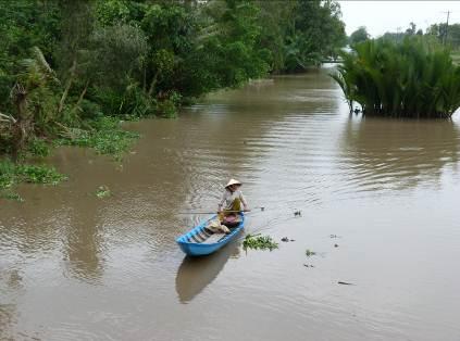
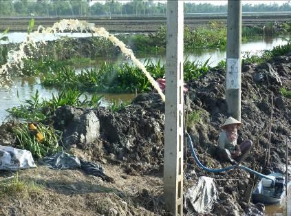
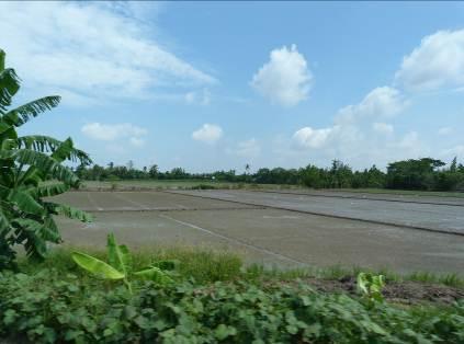
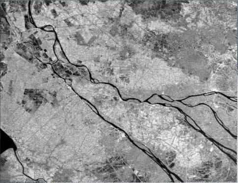
7 WaMaPro test cases Mekong Delta, Vietnam TSX WaMaPro - watermask Overlay


8 WaMaPro test cases Yellow River Delta, China TSX WaMaPro - watermask Overlay

9 WaMaPro test cases Mali, Africa TSX WaMaPro - watermask Overlay


10 MARTINIS, S., KUENZER, C., WENDLEDER, A., HUTH, J., TWELE, A., ROTH, A., DECH, S.: Comparing four different approaches for operational SAR-based water and flood detection. Submitted to International Journal of Remote Sensing WaMaPro test cases North sea coast - Watt, Netherlands Challenges: Wind artefacts on open ocean water; inland water shows good result TSX WaMaPro - watermask Overlay
 Flood season Dry season Validation data of Jan.")
11 Accuracy Assessment (e.g. Vietnam flood vs. dry season) Flood season Dry season Validation data of Jan Blue water 20 km

12 Accuracy Assessment percentage of val.points [%] Watermask Validation for m 1-2m 2-5m 5-8m >8m distance between measured and calculated land-water boundary [m] GPS points at the land-water boundary with simultaneuosly acquired TerraSAR-X data 25% of points located at the land-water boundary 55% within 1-8m distance of watermask to land-water boundary GPS accuracy 2-10m (DGPS not possible) Geometric accuracy of TSX data approx. 1 pixels 20% outliers (> 8m) source: WISDOM project Huth et al. (2009): Automated inundation monitoring using TerraSAR-X multi-temporal imagery. European Geosciences Union, EGU, General Assembly 2009, Apr. 2009, Vienna, Austria.
13 Implementation as a tool -Slide 13

14 WaMaPro open-source based tool implementation


15 WaMaPro open-source based tool implementation GUI

16 WaMaPro open-source based tool implementation result
17 -Slide 17 Application in environmental research projects


18 Slide 18

19 -Slide 19


20 KUENZER, C., GUO, H., LEINENKUGEL, L, HUTH, J., LI, X., and S. DECH, 2013: Flood mapping and flood dynamics of the Mekong Delta: An ENVISAT-ASAR-WSM based Time Series Analyses, Remote Sensing 5 (doi: /rs ), Slide 20

, 687-715 Slide 21 2007-2011: 51 observations 10 per year in")
21 KUENZER, C., GUO, H., LEINENKUGEL, L, HUTH, J., LI, X., and S. DECH, 2013: Flood mapping and flood dynamics of the Mekong Delta: An ENVISAT-ASAR-WSM based Time Series Analyses, Remote Sensing 5 (doi: /rs ), Slide : 51 observations 10 per year in rainy season, ASAR, 150m


22 Mekong Delta - Rainy Season 2007 b a c b Gulf of c Thailand South China Sea N 45 km 0 15 Largest common coverage Coastline


23 Inundation mapping with TerraSAR-X vs. ASAR Kuenzer et al., (2013): Varying Scale and Capability of Envisat ASAR-WSM, TerraSAR-X Scansar and TerraSAR-X Stripmap Data to Assess Urban Flood Situations: A Case Study of the Mekong Delta in Can Tho Province. In: Remote Sensing


24 Zeitreihenuntersuchung Überflutung Coastal analyses Inundation frequency ASAR WSM data 150 m resolution -Slide 24
 brine ponds TSX stripmap data 3 m resolution")


25 canal oil field Yellow River aquaculture wetland (reed) brine ponds TSX stripmap data 3 m resolution KUENZER, C., HUTH, J., MARTINIS, S., LU, L., DECH, S., 2015: SAR Time Series for the Analysis of Inundation Patterns in the Yellow River Delta, China. In: Kuenzer, C., Dech, S., Wagner, W. (eds.), 2015: Remote Sensing Time Series Analyses revealing Land Surface Dynamics. In print, will be published in April, Springer, The Netherlands


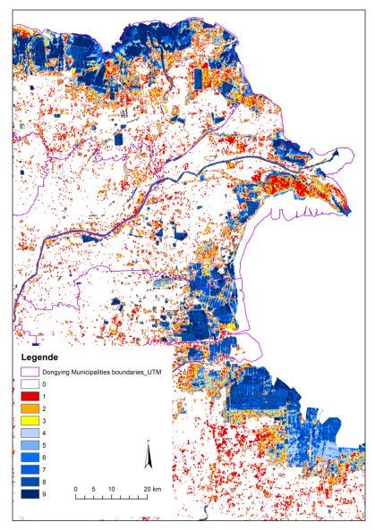
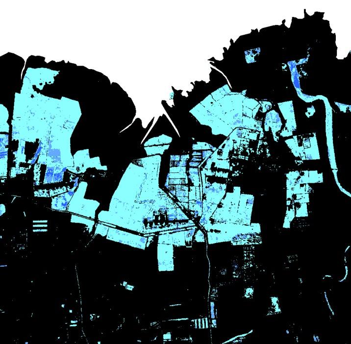
26 Inundation Frequency at East Dongting Lake Datasets: TSX stripmap 3m resolution scenes (Jan Dec) scenes (Jan Mar) - Yellow to orange flood prone - Blue permanent water bodies


27 Flood Mapping of Northern Namibia with Sentinel-1A
28 Publications related to WaMaPro - GSTAIGER, V., GEBHARDT, S., HUTH, J., WEHRMANN; T. and C. KUENZER, 2012: Multi-sensoral derivation of inundated areas using TerraSAR-X and ENVISAT ASAR data. International Journal of Remote Sensing, Vol. 33, 22, , DOI: / KUENZER, C., GUO, H., LEINENKUGEL, L, HUTH, J., LI, X., and S. DECH, 2013: Flood mapping and flood dynamics of the Mekong Delta: An ENVISAT-ASAR-WSM based Time Series Analyses, Remote Sensing 5 (doi: /rs ), KUENZER, C., GUO, H., SCHLEGEL, I., VO, Q.T., LI, X., DECH, S., 2013: Scale and the Capability of Envisat ASAR-WSM, TerraSAR-X Scansar, and TerraSAR-X Stripmap Data to assess urban Flood Situations: A Case Study in Can Tho Province of the Mekong Delta, Remote Sensing, 5, ; doi: /rs KUENZER, C., HUTH, J., MARTINIS, S., LU, L., DECH, S., 2015: SAR Time Series for the Analysis of Inundation Patterns in the Yellow River Delta, China. In: Kuenzer, C., Dech, S., Wagner, W. (eds.), 2015: Remote Sensing Time Series Analyses revealing Land Surface Dynamics. In print, will be published in April, Springer, The Netherlands - MARTINIS, S., KUENZER, C., WENDLEDER, A., HUTH, J., TWELE, A., ROTH, A., DECH, S., 2015: Comparing four different approaches for operational SAR-based water and flood detection. Submitted to International Journal of Remote Sensing - HUTH, et al., 2015: Deriving Water Surfaces with WaMaPro Observations of Water Surface Dynamics of the Yellow River Delta, China. Accepted oral presentation at ISRSE36, Berlin


29 Ausbreitung von Aquakulturflächen
30 Global WaterPack -Slide 30

31 Processed Data for 2013
32 Used Data for Classification Ancillary Data Filter to remove misclassification Input MODIS daily data (09GQ) Terra + Aqua MODIS daily data (10A1) Terra + Aqua MODIS Water (MOD44W) DTM Workflow: water detection 1. Preprocessing 2. Water detection Intermediate result 3. Temporal scan and remove of clouds and no data NIR Thematic info: cloud, lake ice, ocean Static Water Mask (training areas) Calculates the NIR mean for individual tile within training areas (excluding NIR > 20%, cloud covered or no data pixel) Dynamic upper threshold for individual tile: mean + 2std DT classification Thematic product for each tile of Terra and Aqua: water, land, cloud*, lake ice* -----> combination of both for each day (*from 10A1 product) 1. Temporal filter to remove cloud shadows (logical scan of pixel within the temporal stack) 2. Temporal filter to remove clouds/no data and replace by values before/after the cloud Mosaiking, resampling and tiling to MODIS extent and 250-m resolution -> Slope calculation Slope to remove misclassification due to relief End result Cloud free product (water, land) for each day Water Cover Duration Confidence layer with amount of cloud per pixel Min & Max extent

33 Global WaterPack 2013


34 High intra-annual variability Lake Poyang (China) Lake Dongting (China)

35 Hydropower dams and water reservoirs Koksaray Reservoir American Falls Reservoir Shardara Reservoir DOY
36 Publications related to Global WaterPack - Klein, I., Dietz, A.J., Gessner, U., Galayeva, A., Myrzakhmetov, A., Kuenzer, C., Evaluation of seasonal water body extents in Central Asia over the past 27 years derived from mediumresolution remote sensing data. Int. J. Appl. Earth Obs. Geoinf. 26, Klein, I., Dietz, A., Gessner, U., Dech, S., Kuenzer, C Results of the Global WaterPack: a novel product to assess inland water body dynamics on a daily basis. In: Remote Sensing Letters (6), 78-87


37 Software to share: WaMaPro Tool contact:

38 Thank you very much for your attention!
Patrick Leinenkugel. German Aerospace Center (DLR) Vortrag > Autor > Dokumentname > Datum
 Vortrag > Autor > Dokumentname > Datum") Characterisation of land surface phenology and land cover for the Mekong Basin on the basis of multitemporal and multispectral satellite data from the MODIS Sensor Patrick Leinenkugel German Aerospace
Characterisation of land surface phenology and land cover for the Mekong Basin on the basis of multitemporal and multispectral satellite data from the MODIS Sensor Patrick Leinenkugel German Aerospace
Urban Mapping & Change Detection. Sebastian van der Linden Humboldt-Universität zu Berlin, Germany
 Urban Mapping & Change Detection Sebastian van der Linden Humboldt-Universität zu Berlin, Germany Introduction - The urban millennium Source: United Nations Introduction Text Source: Google Earth Introduction
Leveraging Sentinel-1 time-series data for mapping agricultural land cover and land use in the tropics
 Leveraging Sentinel-1 time-series data for mapping agricultural land cover and land use in the tropics Caitlin Kontgis caitlin@descarteslabs.com @caitlinkontgis Descartes Labs Overview What is Descartes
Landcover Dynamics in the Niger Inland Delta (Mali)
") Fakultät Forst-, Geo- Hydrowissenschaften Institut f. Photogrammetrie & Fernerkundung, Professur Fernerkundung Landcover Dynamics in the Niger Inland Delta (Mali) A Classification Approach for MERIS Data
Fakultät Forst-, Geo- Hydrowissenschaften Institut f. Photogrammetrie & Fernerkundung, Professur Fernerkundung Landcover Dynamics in the Niger Inland Delta (Mali) A Classification Approach for MERIS Data
Linking Different Spatial Scales For Retrieval Of Sea Ice Conditions From SAR Images
 Linking Different Spatial Scales For Retrieval Of Sea Ice Conditions From SAR Images Matt Arkett 2, Wolfgang Dierking 1, Jakob Griebel 1, Thomas Hollands 1, Stefanie Linow 1, Eero Rinne 3, Markku Similä
DAMAGE DETECTION OF THE 2008 SICHUAN, CHINA EARTHQUAKE FROM ALOS OPTICAL IMAGES
 DAMAGE DETECTION OF THE 2008 SICHUAN, CHINA EARTHQUAKE FROM ALOS OPTICAL IMAGES Wen Liu, Fumio Yamazaki Department of Urban Environment Systems, Graduate School of Engineering, Chiba University, 1-33,
Investigating Coastal Polynya Thin Sea Ice State in the Laptev Sea Using TerraSAR-X Dual-Pol Stripmap Data
 Investigating Coastal Polynya Thin Sea Ice State in the Laptev Sea Using TerraSAR-X Dual-Pol Stripmap Data Thomas Busche (1), Irena Hajnsek (1), Thomas Krumpen (2), Lasse Rabenstein (2), Jens Hoelemann
Amina Rangoonwala and Elijah Ramsey III Wetland and Aquatic Research Center. U.S. Geological Survey. Lafayette, LA
 First I will show examples of radar mapping of hurricane surge extent and duration and optical mapping of the resultant marsh dieback along the Louisiana coast Next we extend these works to hurricane Sandy
DLR-EOC Contributions to Spaceborne Polar Observing Systems
 DLR-EOC Contributions to Spaceborne Polar Observing Systems M. Gottwald DLR-IMF Polar Space Task Group, GSFC, 29 September 1 October 2014 Slide 2 Slide 3 Slide 4 Polar Activities status GARS O Higgins
NASA Flood Monitoring and Mapping Tools
 National Aeronautics and Space Administration ARSET Applied Remote Sensing Training http://arset.gsfc.nasa.gov @NASAARSET NASA Flood Monitoring and Mapping Tools www.nasa.gov Outline Overview of Flood
Long-Term Time Series of Water Vapour Total Columns from GOME, SCIAMACHY and GOME-2
 Graphics: ESA Graphics: ESA Graphics: ESA Long-Term Time Series of Water Vapour Total Columns from GOME, SCIAMACHY and GOME-2 S. Noël, S. Mieruch, H. Bovensmann, J. P. Burrows Institute of Environmental
Sentinel-1 Mission Status
 Sentinel-1 Mission Status Pierre Potin, Sentinel-1 Mission Manager, ESA Luca Martino, Technical Support Engineer, ESA... and the Sentinel-1 operations team PSTG SAR Coordination Working Group 14 December
Using MERIS and MODIS for Land Cover Mapping in the Netherlands
 Using MERIS and for Land Cover Mapping in the Netherlands Raul Zurita Milla, Michael Schaepman and Jan Clevers Wageningen University, Centre for Geo-Information, NL Introduction Actual and reliable information
URBAN MAPPING AND CHANGE DETECTION
 URBAN MAPPING AND CHANGE DETECTION Sebastian van der Linden with contributions from Akpona Okujeni Humboldt-Unveristät zu Berlin, Germany Introduction Introduction The urban millennium Source: United Nations,
Identifying Changing Snow Cover Characteristics in Central Asia between 1986 and 2014 from Remote Sensing Data
 Remote Sens. 2014, 6, 12752-12775; doi:10.3390/rs61212752 Article OPEN ACCESS remote sensing ISSN 2072-4292 www.mdpi.com/journal/remotesensing Identifying Changing Snow Cover Characteristics in Central
Time Series Analysis with SAR & Optical Satellite Data
 Time Series Analysis with SAR & Optical Satellite Data Thomas Bahr ESRI European User Conference Thursday October 2015 harris.com Motivation Changes in land surface characteristics mirror a multitude of
Effective Utilization of Synthetic Aperture Radar (SAR) Imagery in Rapid Damage Assessment
 Imagery in Rapid Damage Assessment") Effective Utilization of Synthetic Aperture Radar (SAR) Imagery in Rapid Damage Assessment Case Study Pakistan Floods SUPARCO M. Maisam Raza, Ahmad H. Rabbani SEQUENCE Flood Monitoring using Satellite
Effective Utilization of Synthetic Aperture Radar (SAR) Imagery in Rapid Damage Assessment Case Study Pakistan Floods SUPARCO M. Maisam Raza, Ahmad H. Rabbani SEQUENCE Flood Monitoring using Satellite
SAR Coordination for Snow Products
 Polar SAR Coordination Working Meeting 5 SAR Coordination for Snow Products David Small 1, Thomas Nagler 2, David Jäger 1, Christoph Rohner 1, Adrian Schubert 1 1: University of Zurich, Switzerland 2:
Pan-Arctic, Regional and Local Land Cover Products
 Pan-Arctic, Regional and Local Land Cover Products Marcel Urban (1), Stefan Pöcking (1), Sören Hese (1) & Christiane Schmullius (1) (1) Friedrich-Schiller University Jena, Department of Earth Observation,
Modeling CO 2 sinks and sources of European land vegetation using remote sensing data
 Modeling CO 2 sinks and sources of European land vegetation using remote sensing data K. Wißkirchen, K. Günther German Aerospace Center (DLR), German Remote Sensing Data Center (DFD), Climate and Atmospheric
Floating Ice: Progress in Addressing Science Goals
 Polar Floating Ice: Progress in Addressing Science Goals Stephen Howell 1, Leif Toudal Pedersen 2 and Roberto Saldo 3 1 Environment Canada, Climate Research Division, Toronto, Canada 2 Danish Meteorological
Urban remote sensing: from local to global and back
 Urban remote sensing: from local to global and back Paolo Gamba University of Pavia, Italy A few words about Pavia Historical University (1361) in a nice town slide 3 Geoscience and Remote Sensing Society
Urban Mapping. Sebastian van der Linden, Akpona Okujeni, Franz Schug 11/09/2018
 Urban Mapping Sebastian van der Linden, Akpona Okujeni, Franz Schug 11/09/2018 Introduction to urban remote sensing Introduction The urban millennium Source: United Nations, 2014 Urban areas mark extremes
EasyChair Preprint. Height Accuracy and Data Coverage for the Final Global TanDEM-X DEM Data
 EasyChair Preprint 123 Height Accuracy and Data Coverage for the Final Global TanDEM-X DEM Data Christopher Wecklich, Carolina Gonzalez and Paola Rizzoli EasyChair preprints are intended for rapid dissemination
The Potential of High Resolution Satellite Interferometry for Monitoring Enhanced Oil Recovery
 The Potential of High Resolution Satellite Interferometry for Monitoring Enhanced Oil Recovery Urs Wegmüller a Lutz Petrat b Karsten Zimmermann c Issa al Quseimi d 1 Introduction Over the last years land
SWOS (The Satellite-based Wetland Observation Service) Satellite images for peatland monitoring and management Kathrin Weise, Jena-Optronik GmbH
 Satellite images for peatland monitoring and management Kathrin Weise, Jena-Optronik GmbH") This project has received funding from the European Union s Horizon 2020 research and innovation programme under grant agreement No 642088 SWOS (The Satellite-based Wetland Observation Service) Satellite
This project has received funding from the European Union s Horizon 2020 research and innovation programme under grant agreement No 642088 SWOS (The Satellite-based Wetland Observation Service) Satellite
Luyi Sun & Jan-Peter Muller, Imaging Group, Mullard Space Science Laboratory, University College London
 Evaluation of the use of the sub-pixel Offset Tracking method with conventional dinsar techniques to monitor landslides in densely vegetated terrain in the Three Gorges Region, China Luyi Sun & Jan-Peter
Development of a Regional Land Cover Monitoring System In the Lower Mekong Region a Joint Effort Between SERVIR-Mekong and Partners -
 Mekong Development of a Regional Land Cover Monitoring System In the Lower Mekong Region a Joint Effort Between SERVIR-Mekong and Partners - Aekkapol Aekakkararungroj SERVIR-Mekong Asian Disaster Preparedness
SPATIAL AND TEMPORAL PATTERN OF FOREST/PLANTATION FIRES IN RIAU, SUMATRA FROM 1998 TO 2000
 SPATIAL AND TEMPORAL PATTERN OF FOREST/PLANTATION FIRES IN RIAU, SUMATRA FROM 1998 TO 2000 SHEN Chaomin, LIEW Soo Chin, KWOH Leong Keong Centre for Remote Imaging, Sensing and Processing (CRISP) Faculty
SAR Data Help Improving the Monitoring of Intertidal Flats on the German North Sea Coast
 SAR Data Help Improving the Monitoring of Intertidal Flats on the German North Sea Coast Martin Gade (1), Kerstin Stelzer (2), and Jörn Kohlus (3) (1) Institut für Meereskunde, Universität Hamburg, Hamburg,
Interannual variation of MODIS NDVI in Lake Taihu and its relation to climate in submerged macrophyte region
 Yale-NUIST Center on Atmospheric Environment Interannual variation of MODIS NDVI in Lake Taihu and its relation to climate in submerged macrophyte region ZhangZhen 2015.07.10 1 Outline Introduction Data
Estimation of ocean contribution at the MODIS near-infrared wavelengths along the east coast of the U.S.: Two case studies
 GEOPHYSICAL RESEARCH LETTERS, VOL. 32, L13606, doi:10.1029/2005gl022917, 2005 Estimation of ocean contribution at the MODIS near-infrared wavelengths along the east coast of the U.S.: Two case studies
Earth Observation & GeoSpatial Information for Monitoring Urban SDG Indicators. Global Urbanization Trend
 Earth Observation & GeoSpatial Information for Monitoring Urban SDG Indicators Yifang Ban, Professor Director, Division of Geoinformatics Vice Chair, Department for Urban Planning and Environment KTH Royal
We greatly appreciate the thoughtful comments from the reviewers. According to the reviewer s comments, we revised the original manuscript.
 Response to the reviews of TC-2018-108 The potential of sea ice leads as a predictor for seasonal Arctic sea ice extent prediction by Yuanyuan Zhang, Xiao Cheng, Jiping Liu, and Fengming Hui We greatly
CONTRAILS FROM (A)ATSR(2) DATA
ATSR(2) DATA") CONTRAILS FROM (A)ATSR(2) DATA Hermann Mannstein and Rüdiger Büll Deutsches Zentrum für Luft- und Raumfahrt, Oberpfaffenhofen, 82230 Wessling, Germany ABSTRACT/RESUME The DLR contrail detection algorithm
CONTRAILS FROM (A)ATSR(2) DATA Hermann Mannstein and Rüdiger Büll Deutsches Zentrum für Luft- und Raumfahrt, Oberpfaffenhofen, 82230 Wessling, Germany ABSTRACT/RESUME The DLR contrail detection algorithm
Land Cover Project ESA Climate Change Initiative. Processing chain for land cover maps dedicated to climate modellers.
 Land Cover Project ESA Climate Change Initiative Processing chain for land cover maps dedicated to climate modellers land_cover_cci S. Bontemps 1, P. Defourny 1, V. Kalogirou 2, F.M. Seifert 2 and O. Arino
The Importance of Microwave Remote Sensing for Operational Sea Ice Services And Challenges
 The Importance of Microwave Remote Sensing for Operational Sea Ice Services And Challenges Wolfgang Dierking January 2015 (1) Why is microwave remote sensing important (=useful) for sea ice mapping? Problems
Surface WAter Microwave Product Series [SWAMPS]
![Surface WAter Microwave Product Series [SWAMPS]](/thumbs/87/97403550.jpg "Surface WAter Microwave Product Series [SWAMPS]") Surface WAter Microwave Product Series [SWAMPS] Version 3.2 Release Date: May 01 2018 Contact Information: Kyle McDonald, Principal Investigator: kmcdonald2@ccny.cuny.edu Kat Jensen: kjensen@ccny.cuny.edu
Surface WAter Microwave Product Series [SWAMPS] Version 3.2 Release Date: May 01 2018 Contact Information: Kyle McDonald, Principal Investigator: kmcdonald2@ccny.cuny.edu Kat Jensen: kjensen@ccny.cuny.edu
Defining microclimates on Long Island using interannual surface temperature records from satellite imagery
 Defining microclimates on Long Island using interannual surface temperature records from satellite imagery Deanne Rogers*, Katherine Schwarting, and Gilbert Hanson Dept. of Geosciences, Stony Brook University,
Dr. Simon Plank. German Remote Sensing Data Center (DFD), German Aerospace Center (DLR)
, German Aerospace Center (DLR)") Pre-survey suitability analysis of the differential and persistent scatterer synthetic ti aperture radar interferometry t method for deformation monitoring of landslides Dr. Simon Plank German Remote Sensing
Pre-survey suitability analysis of the differential and persistent scatterer synthetic ti aperture radar interferometry t method for deformation monitoring of landslides Dr. Simon Plank German Remote Sensing
Product Guide: TerraSAR-X derived Cliff Top Retreat
 Product Guide: TerraSAR-X derived Cliff Top Retreat Stettner, Samuel 1), Bartsch, Annett 2),3), Widhalm, Barbara 2,3), Heim, Birgit 1), Günther, Frank 1), Morgenstern, Anne 1) 1) Alfred-Wegener-Institut,
GTZ Partner for the Future. Worldwide.
 GTZ Partner for the Future. Worldwide. Multidisciplinary approach of information system for integrated water resources management and biodiversity data gathering: an example for benefits from cross-linking
Infrastructure monitoring using SAR interferometry
 Infrastructure monitoring using SAR interferometry Hossein Nahavandchi Roghayeh Shamshiri Norwegian University of Science and Technology (NTNU), Department of Civil and Environmental Engineering Geodesy
FLOOD DAMAGE ASSESSMENT INTEGRATING GEOSPATIAL TECHNOLOGIES. A CASE STUDY IN HUE, VIET NAM
 Paper 5-4-2 FLOOD DAMAGE ASSESSMENT INTEGRATING GEOSPATIAL TECHNOLOGIES. A CASE STUDY IN HUE, VIET NAM DINH NGOC DAT, J. S. M. FOWZE, NGUYEN DUONG ANH, MANZUL K. HAZARIKA AND LAL SAMARAKOON GeoInformatics
Flood mapping for index-based disaster risk transfer and insurance mechanisms
 Flood mapping for index-based disaster risk transfer and insurance mechanisms Atmospheric and Environmental Research (AER) African Risk Capacity (ARC) Contributors: AER: John Galantowicz, Jeff Picton,
REMOTE SENSING OF PERMAFROST IN NORTHERN ENVIRONMENTS
 REMOTE SENSING OF PERMAFROST IN NORTHERN ENVIRONMENTS What is permafrost? What can we monitor with satellite data? Permafrost is an Essential Climate Variable About 25 % of the land surface is underlain
Remote sensing data uses and supply in Vietnam. Dr. Chu Hải Tùng National Remote Sensing Department, Ministry of Natural Resource and Environment
 Remote sensing data uses and supply in Vietnam Dr. Chu Hải Tùng National Remote Sensing Department, Ministry of Natural Resource and Environment Content Uses of remote sensing data in Vietnam Roles of
Evaluation of estimated satellite images for filling data gaps in an intra-annual high spatial resolution time-series
 Evaluation of estimated satellite images for filling data gaps in an intra-annual high spatial resolution time-series Tobias Schmidt, Michael Förster, Birgit Kleinschmit Technical University Berlin, Geoinformation
A new land cover map for the Mekong: Southeast Asia s largest transboundary river basin
 A new land cover map for the Mekong: Southeast Asia s largest transboundary river basin Patrick Leinenkugel 1, Natascha Oppelt 2, Claudia Kuenzer 1 German Aerospace Center (DLR), German Remote Sensing
CHAPTER-7 INTERFEROMETRIC ANALYSIS OF SPACEBORNE ENVISAT-ASAR DATA FOR VEGETATION CLASSIFICATION
 147 CHAPTER-7 INTERFEROMETRIC ANALYSIS OF SPACEBORNE ENVISAT-ASAR DATA FOR VEGETATION CLASSIFICATION 7.1 INTRODUCTION: Interferometric synthetic aperture radar (InSAR) is a rapidly evolving SAR remote
Monitoring Land Cover and Land Use in Central Asia Remote Sensing Contributions from selected German projects
 Monitoring Land Cover and Land Use in Central Asia Remote Sensing Contributions from selected German projects NASA LCLUC Meeting, Tashkent, 11.-13.11.2013 Christopher Conrad University of Würzburg, Institute
A HIGH RESOLUTION EUROPEAN CLOUD CLIMATOLOGY FROM 15 YEARS OF NOAA/AVHRR DATA
 A HIGH RESOLUTION EUROPEAN CLOUD CLIMATOLOGY FROM 15 YEARS OF NOAA/AVHRR DATA R. Meerkötter 1, G. Gesell 2, V. Grewe 1, C. König 1, S. Lohmann 1, H. Mannstein 1 Deutsches Zentrum für Luft- und Raumfahrt
DLR s TerraSAR-X contributes to international fleet of radar satellites to map the Arctic and Antarctica
 DLR s TerraSAR-X contributes to international fleet of radar satellites to map the Arctic and Antarctica The polar regions play an important role in the Earth system. The snow and ice covered ocean and
Mapping Water Resources and Reservoirs for Climate Resilience in Zambezi River Basin
 Mapping Water Resources and Reservoirs for Climate Resilience in Zambezi River Basin Corné van der Sande, NEO BV Senior Advisor Earth Observation Services for Monitoring Drought and Water Resources in
Undergraduate Research Final Report: Estimation of suspended sediments using MODIS 250 m bands in Mayagüez Bay, Puerto Rico
 Undergraduate Research Final Report: Estimation of suspended sediments using MODIS 250 m bands in Mayagüez Bay, Puerto Rico Abstract: José F. Martínez Colón Undergraduate Research 2007 802-03-4097 Advisor:
Land cover/land use mapping and cha Mongolian plateau using remote sens. Title. Author(s) Bagan, Hasi; Yamagata, Yoshiki. Citation Japan.
 Bagan, Hasi; Yamagata, Yoshiki. Citation Japan.") Title Land cover/land use mapping and cha Mongolian plateau using remote sens Author(s) Bagan, Hasi; Yamagata, Yoshiki International Symposium on "The Imp Citation Region Specific Systems". 6 Nove Japan.
Title Land cover/land use mapping and cha Mongolian plateau using remote sens Author(s) Bagan, Hasi; Yamagata, Yoshiki International Symposium on "The Imp Citation Region Specific Systems". 6 Nove Japan.
Wave processes in Arctic Seas, observed from TerraSAR-X
 DISTRIBUTION STATEMENT A. Approved for public release; distribution is unlimited. Wave processes in Arctic Seas, observed from TerraSAR-X Susanne Lehner DLR German Air and Space Research Center Earth Observation
A MODEL FOR RISES AND DOWNS OF THE GREATEST LAKE ON EARTH
 A MODEL FOR RISES AND DOWNS OF THE GREATEST LAKE ON EARTH Parviz Tarikhi Iranian Remote Sensing Center, Iran May 2005 1 Figure 1: West of Novshahr in the Iranian coast of Caspian; the dam constructed to
Towards a Global High-Resolution Inundation Map: African continent application
 Towards a Global HighResolution Inundation Map: African continent application Étienne FluetChouinard, Bernhard Lehner M.Sc Student, McGill University Presentation Outline Intro: Objective Methods: Results:
OCEAN SURFACE DRIFT BY WAVELET TRACKING USING ERS-2 AND ENVISAT SAR IMAGES
 OCEAN SURFACE DRIFT BY WAVELET TRACKING USING ERS-2 AND ENVISAT SAR IMAGES Antony K. Liu, Yunhe Zhao Ocean Sciences Branch, NASA Goddard Space Flight Center, Greenbelt, Maryland, USA Ming-Kuang Hsu Northern
Aerosol Optical Depth Variation over European Region during the Last Fourteen Years
 Aerosol Optical Depth Variation over European Region during the Last Fourteen Years Shefali Singh M.Tech. Student in Computer Science and Engineering at Meerut Institute of Engineering and Technology,
Detection of ship NO 2 emissions over Europe from satellite observations
 Detection of ship NO 2 emissions over Europe from satellite observations Huan Yu DOAS seminar 24 April 2015 Ship Emissions to Atmosphere Reporting Service (SEARS project) Outline Introduction Shipping
TOWARDS A TRACKING OF SMALL SCALE EDDIES USING HIGH- RESOLUTION RADARSAT-2 AND TERRASAR-X IMAGERY
 1 st EARSeL Workshop on Temporal Analysis of Satellite Images 1 TOWARDS A TRACKING OF SMALL SCALE EDDIES USING HIGH- RESOLUTION RADARSAT-2 AND TERRASAR-X IMAGERY Benjamin Seppke 1, Prof. Dr. Leonie Dreschler-Fischer
Seasonal variability in the vertical attenuation coefficient at 490 nm (K490) in waters around Puerto Rico and US Virgin Islands.
 in waters around Puerto Rico and US Virgin Islands.") Seasonal variability in the vertical attenuation coefficient at 490 nm (K490) in waters around Puerto Rico and US Virgin Islands. William J. Hernandez 1 and Fernando Gilbes 2 1 Department of Marine Science,
Seasonal variability in the vertical attenuation coefficient at 490 nm (K490) in waters around Puerto Rico and US Virgin Islands. William J. Hernandez 1 and Fernando Gilbes 2 1 Department of Marine Science,
Diversity of Settlement Categories in Very High Resolution SAR Images
 Diversity of Settlement Categories in Very High Resolution SAR Images Corneliu Octavian Dumitru Remote Sensing Technology Institute (IMF) German Aerospace Center (DLR) Oberpfaffenhofen Wessling, Germany
Explain the impact of location, climate, natural resources, and population distribution on Europe. a. Compare how the location, climate, and natural
 SS6G10 Explain the impact of location, climate, natural resources, and population distribution on Europe. a. Compare how the location, climate, and natural resources of Germany, the United Kingdom and
Satellite data for hydrological forecasting
 Satellite data for hydrological forecasting Current use at ECMWF and perspective Shopping list! Our current tools does not allow direct use, but could be modified Christel Prudhomme Christel.prudhomme@ecmwf.int
WETLAND-RADAR Wetland vegetation mapping using X- and C- band SAR time series data
 Funded by DLR within the joint C/X Band Initiative of CSA & DLR (FKZ 50EE1511, FKZ 50EE1512) WETLAND-RADAR Wetland vegetation mapping using X- and C- band SAR time series data Symposium Neue Perspektiven
AND THE COOPERATION WITH SENTINEL ASIA FOR DISASTER MANAGEMENT
 Ministry of Natural resources and Environment National Remote Sensing DEpartment NATIONAL REMOTE SENSING DEPARTMENT (NRSD) AND THE COOPERATION WITH SENTINEL ASIA FOR DISASTER MANAGEMENT By: Dr. Chu Hai
Potential and Accuracy of Digital Landscape Analysis based on high resolution remote sensing data
 'Spatial Information for Sustainable Management of Urban Areas' Mainz, 2-4 February 2009, Germany Potential and Accuracy of Digital Landscape Analysis based on high resolution remote sensing data Dr. Matthias
Remote Sensing of Snow and Ice. Lecture 21 Nov. 9, 2005
 Remote Sensing of Snow and Ice Lecture 21 Nov. 9, 2005 Topics Remote sensing snow depth: passive microwave (covered in Lecture 14) Remote sensing sea ice and ice sheet elevation change: Lidar - ICESat
Validation of sea ice concentration in the myocean Arctic Monitoring and Forecasting Centre 1
 Note No. 12/2010 oceanography, remote sensing Oslo, August 9, 2010 Validation of sea ice concentration in the myocean Arctic Monitoring and Forecasting Centre 1 Arne Melsom 1 This document contains hyperlinks
The Impact of Geography in South and East Asia
 The Impact of Geography in South and East Asia Gobi desert, Mongolia Essential Question: How does geography impact the distribution of population throughout South and East Asia? I CAN Explain how geography
REMOTELY SENSED INFORMATION FOR CROP MONITORING AND FOOD SECURITY
 LEARNING OBJECTIVES Lesson 4 Methods and Analysis 2: Rainfall and NDVI Seasonal Graphs At the end of the lesson, you will be able to: understand seasonal graphs for rainfall and NDVI; describe the concept
Status DLR (TerraSAR X / TanDEM X)
") SAR Coordination Working Meeting 5 Status DLR (TerraSAR X / TanDEM X) Dana Floricioiu, Achim Roth Imaging Requirements for TerraSAR X & TanDEM X Missions Ice Sheets: TSX supports Greenland outlet glaciers,
SAR Coordination Working Meeting 5 Status DLR (TerraSAR X / TanDEM X) Dana Floricioiu, Achim Roth Imaging Requirements for TerraSAR X & TanDEM X Missions Ice Sheets: TSX supports Greenland outlet glaciers,
Joint Research Centre Global Surface Water - Data Users Guide (v2)
") Joint Research Centre Global Surface Water - Data Users Guide (v2) Background This document provides a detailed technical description of the datasets that are being made available as part of the Joint
Joint Research Centre Global Surface Water - Data Users Guide (v2) Background This document provides a detailed technical description of the datasets that are being made available as part of the Joint
Aniekan Eyoh 1* Department of Geoinformatics & Surveying, Faculty of Environmental Studies, University of Uyo, Nigeria
 Available online at http://euroasiapub.org/journals.php, pp. 53~62 Thomson Reuters Researcher ID: L-5236-2015 TEMPORAL APPRAISAL OF LAND SURFACE TEMPERATURE DYNAMICS ACROSS THE NINE STATES OF NIGER DELTA
FFGS Additional Functionalities and Products. Konstantine P. Georgakakos, Sc.D. HYDROLOGIC RESEARCH CENTER 23 May 2018
 FFGS Additional Functionalities and Products Konstantine P. Georgakakos, Sc.D. HYDROLOGIC RESEARCH CENTER 23 May 2018 Advanced Functionalities 0. Multi-Model QPF A. Urban Flash Flood Warning B. Riverine
Improved PSI Performance for Landslide Monitoring Applications. J. Duro, R. Iglesias, P. Blanco-Sánchez, F. Sánchez and D. Albiol
 Improved PSI Performance for Landslide Monitoring Applications J. Duro, R. Iglesias, P. Blanco-Sánchez, F. Sánchez and D. Albiol Outline Area of Study Previous PSI (and others) studies Main conclusions
Data Quality and Uncertainty
 Data Quality and Uncertainty The power of GIS analysis is based on the assembly of layers of data, but as data layers increase, errors multiply - quality decreases. Garbage in, garbage out. High quality
Preparation of LULC map from GE images for GIS based Urban Hydrological Modeling
 International Conference on Modeling Tools for Sustainable Water Resources Management Department of Civil Engineering, Indian Institute of Technology Hyderabad: 28-29 December 2014 Abstract Preparation
Geoscience Australia Report on Cal/Val Activities
 Medhavy Thankappan Geoscience Australia Agency Report I Berlin May 6-8, 2015 Outline 1. Calibration / validation at Geoscience Australia Corner reflector infrastructure for SAR calibration (for information)
SEDIMENT DATA FOR THE LOWER MEKONG
 SEDIMENT DATA FOR THE LOWER MEKONG A review of past monitoring activity and what it tells us about past and recent sediment fluxes and what lessons can be learnt for future monitoring DES WALLING DEPARTMENT
Sub-pixel regional land cover mapping. with MERIS imagery
 Sub-pixel regional land cover mapping with MERIS imagery R. Zurita Milla, J.G.P.W. Clevers and M. E. Schaepman Centre for Geo-information Wageningen University 29th September 2005 Overview Land Cover MERIS
Urban Growth Analysis: Calculating Metrics to Quantify Urban Sprawl
 Urban Growth Analysis: Calculating Metrics to Quantify Urban Sprawl Jason Parent jason.parent@uconn.edu Academic Assistant GIS Analyst Daniel Civco Professor of Geomatics Center for Land Use Education
The MODIS Cloud Data Record
 The MODIS Cloud Data Record Brent C. Maddux 1,2 Steve Platnick 3, Steven A. Ackerman 1 Paul Menzel 1, Kathy Strabala 1, Richard Frey 1, 1 Cooperative Institute for Meteorological Satellite Studies, 2 Department
The CAWa Project. CA High Elevation Research
 The CAWa Project A New Potential for Cooperation in CA High Elevation Research Katy Unger-Shayesteh & Gerd Rücker CAWa Project Coordination Outline CAWa Project Overview Selected Activities Hydrometeorological
Chapter 21 Southwest Asia: Harsh & Arid Lands
 Name Hour Chapter 21 Southwest Asia: Harsh & Arid Lands Essential Question: How has the physical geography of Asia influenced the development of these regions (i.e. history, population distribution, &
National Satellite Data Centre and Finnish Sentinel Collaborative Ground Segment. Jyri Heilimo Finnish Meteorological Instute
 National Satellite Data Centre and Finnish Sentinel Collaborative Ground Segment Jyri Heilimo Finnish Meteorological Instute Sodankylä National Satellite Data Centre National satellite data centre providing
AN OBJECT-BASED CLASSIFICATION PROCEDURE FOR THE DERIVATION OF BROAD LAND COVER CLASSES USING OPTICAL AND SAR DATA
 AN OBJECT-BASED CLASSIFICATION PROCEDURE FOR THE DERIVATION OF BROAD LAND COVER CLASSES USING OPTICAL AND SAR DATA T. RIEDEL, C. THIEL, C. SCHMULLIUS Friedrich-Schiller-University Jena, Earth Observation,
EXTRACTION OF FLOODED AREAS DUE THE 2015 KANTO-TOHOKU HEAVY RAINFALL IN JAPAN USING PALSAR-2 IMAGES
 EXTRACTION OF FLOODED AREAS DUE THE 2015 KANTO-TOHOKU HEAVY RAINFALL IN JAPAN USING PALSAR-2 IMAGES F. Yamazaki a, *, W. Liu a a Chiba University, Graduate School of Engineering, Chiba 263-8522, Japan
CadasterENV Sweden Time series in support of a multi-purpose land cover mapping system at national scale
 CadasterENV Sweden Time series in support of a multi-purpose land cover mapping system at national scale Mats Rosengren, Camilla Jönsson ; Metria AB Marc Paganini ; ESA ESRIN Background CadasterENV Sweden
Data Fusion and Multi-Resolution Data
 Data Fusion and Multi-Resolution Data Nature.com www.museevirtuel-virtualmuseum.ca www.srs.fs.usda.gov Meredith Gartner 3/7/14 Data fusion and multi-resolution data Dark and Bram MAUP and raster data Hilker
Ice Observations on the Churchill River using Satellite Imagery
 CGU HS Committee on River Ice Processes and the Environment 15 th Workshop on River Ice St. John s, Newfoundland and Labrador, June 15-17, 2009 Ice Observations on the Churchill River using Satellite Imagery
ERS-ENVISAT Cross-interferometry for Coastal DEM Construction
 ERS-ENVISAT Cross-interferometry for Coastal DEM Construction Sang-Hoon Hong and Joong-Sun Won Department of Earth System Sciences, Yonsei University, 134 Shinchon-dong, Seodaemun-gu, 120-749, Seoul, Korea
Using COSMO-SkyMed images to improve river flood monitoring and forecasting.
 Using COSMO-SkyMed images to improve river flood monitoring and forecasting. D.C. Mason 1, S.L. Dance 23, J. Garcia-Pintado 24, S. Vetra-Carvalho 2, H.L. Cloke 125, P.D. Bates 6 1 Department of Geography
Quick Response Report #126 Hurricane Floyd Flood Mapping Integrating Landsat 7 TM Satellite Imagery and DEM Data
 Quick Response Report #126 Hurricane Floyd Flood Mapping Integrating Landsat 7 TM Satellite Imagery and DEM Data Jeffrey D. Colby Yong Wang Karen Mulcahy Department of Geography East Carolina University
AUTOMATISIERTE ZEITREIHENANALYSE VON FERNERKUNDUNGSDATEN FÜR DAS MONITORING VON OBERFLÄCHENGEWÄSSERN
 Place image here (10 x 3.5 ) AUTOMATISIERTE ZEITREIHENANALYSE VON FERNERKUNDUNGSDATEN FÜR DAS MONITORING VON OBERFLÄCHENGEWÄSSERN THOMAS BAHR & NICOLAI HOLZER 23. Workshop Arbeitskreis Umweltinformationssysteme
Capabilities and Limitations of Land Cover and Satellite Data for Biomass Estimation in African Ecosystems Valerio Avitabile
 Capabilities and Limitations of Land Cover and Satellite Data for Biomass Estimation in African Ecosystems Valerio Avitabile Kaniyo Pabidi - Budongo Forest Reserve November 13th, 2008 Outline of the presentation
Annex VI-1. Draft National Report on Ocean Remote Sensing in China. (Reviewed by the Second Meeting of NOWPAP WG4)
") UNEP/NOWPAP/CEARAC/WG4 2/9 Page1 Draft National Report on Ocean Remote Sensing in China (Reviewed by the Second Meeting of NOWPAP WG4) UNEP/NOWPAP/CEARAC/WG4 2/9 Page1 1. Status of RS utilization in marine
UNEP/NOWPAP/CEARAC/WG4 2/9 Page1 Draft National Report on Ocean Remote Sensing in China (Reviewed by the Second Meeting of NOWPAP WG4) UNEP/NOWPAP/CEARAC/WG4 2/9 Page1 1. Status of RS utilization in marine