Radio occultation at GFZ Potsdam: Current status and future prospects
|
|
|
- Clare Chambers
- 6 years ago
- Views:
Transcription
1 Radio occultation at GFZ Potsdam: Current status and future prospects J. Wickert, T. Schmidt, G. Beyerle, S. Heise, R. Stosius GFZ German Research Centre for Geosciences, Potsdam, Germany The CHAMP, GRACE, TerraSAR X team
2 Overview Status of current RO missions at GFZ Potsdam: CHAMP, GRACE and TerraSAR X Upcoming missions: Tandem X Future prospects: MicroGEM, ACES, HALO Summary


3 GPS radio occultation experiments CHAMP since 2006 since 2006 COSMIC/FORMOSAT 3 GRACE since 2008 MetOp since 2006 TerraSAR X
4 Current missions i at GFZ


5 Post processing at GFZ Post processing CHAMP: GRACE: DDIFF Version 5 reactivation? ZDIFF Version 6 TerraSAR X: SDIFF experimental Reprocessing project started


6 NRT processing at GFZ NRT processing Experimental start with CHAMP in 2006 Operational since mid 2007 with CHAMP and GRACE Bufr feeding to GTS via German Weather Service TerraSAR X raw data available, test data set for NWP centers provided

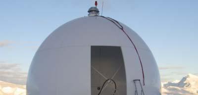
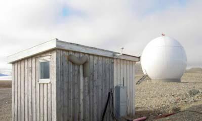
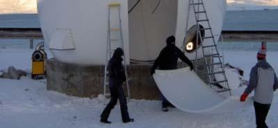
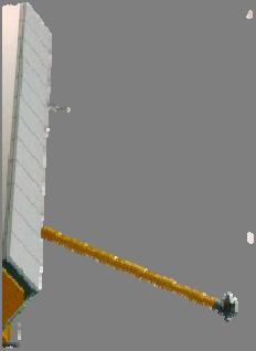
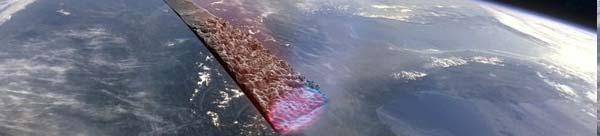
7 Data receiving for NRT processing 2 GFZ antennas in Ny Alesund, Spitsbergen
8 Impact of RO data: CHAMP vs. ECMWF DJF MAM JJA SON (a) (b) (c) (d) 2005 (e) (f) (g) (h) 2006 (i) (j) (k) (l) 2007 (from Schmidt et al., Ann. Geophysicae, 2008)


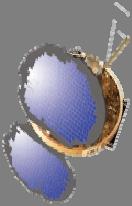
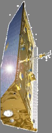
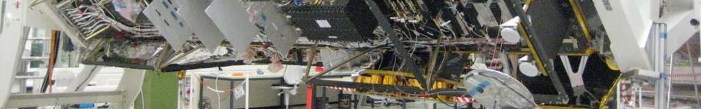
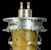
9 TerraSAR X technical data Technical data launch date 15 June 2007 launch site Baikonur, Kasakhstan orbit altitude 514 km orbit inclination 97.4 o dimension so 4.9 m x 2.4 m (diam.) mass 1230 kg design life time 5 years Instrumentation X band synthetic aperture radar (SAR) laser communication terminal TOR (retroreflector array and GPS receiver IGOR )


,")


")
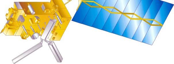
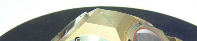
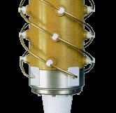
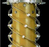
10 TerraSAR X technical data 48 channel GPS receiver IGOR GPS receiver IGOR 4 element antenna array 2 occultation antennas (forward and aft looking), tilted by 20 o towards horizon Improvements over CHAMP / GRACE : antenna array (4 elements) firmware modifications open loop tracking
11 TerraSAR X data processing and statistics (I) Experimental processing system (POCS X) precise GPS and TerraSAR X orbits from GFZ corrections: antenna phase center offsets, relativity, carrier phase wind up, clock biases demodulation of navigation data using independent observations extracted from NavBit data base bending angle initialization above 35 km using MSIS climatology wave optics (Full Spectrum Inversion / Canonical Transform) Statistics (24 July 17 November 2008) (rising occultations forward looking antenna not yet activated) number of events 26, % missing NavBit data % gaps in 0.1 Hz data % range incomplete ( 10 to +60 km SLTA) % ref. GPS below 10 o elevation % other % processed events 18,647 70%
12 TerraSAR X data processing and statistics (II) TerraSAR SAR(POCS X) single differencing, setting occultations, open loop tracking below 6 7 km 50% altitude: 980 m CHAMP (POCS) double differencing, setting occultations, fly wheeling tracking 50% altitude: 3.4 km Doubling of the data a rate aein the lower troposphere e GRACE A (POCS) zero differencing, setting occultations, fly wheeling tracking 50% altitude: 3.3 km
13 Upcoming mission i


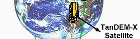
14 TanDEM X Occ. antenna Start in December 2009 IGOR


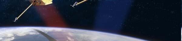

15 TerraSAR X and TanDEM X Two identical German radar satellites, stereo view of the Earth Source: DLR and EADS
16 Future prospects


17 MicroGEM: Microsatellite for GNSS Earth Monitoring Phase A feasibility study: Minisatellite for Galileo POD: GNSS POD: SLR POD: VLBI Topside Ionosphere Tomography Reflectometry Ocean/Ice with Galileo/GPS Occultation Atmosphere/Ionosphere
18 MicroGEM: Microsatellite for GNSS Earth Monitoring 18 Sep 2009: Final presentation of Phase A study with Technical University Berlin, GFZ and regional industry.
19 Precise orbit determination GPS/Galileo, VLBI, SLR MicroGEM: Scientific goals Atmosphere/ionosphere sounding radio occultation and tomography Coherent reflectometry over water and ice proof of concept, initial demonstration Focus on initial application of Galileo signals for space based GNSS remote sensing Near polar orbit (~700 km altitude), piggy back pggy launch ~2012/13 planned Cost effective mission realisation


20 MicroGEM: Scientific payload GPS/Galileo SLR (Pyxis) (Satellite Laser Ranging) g) 3 geodetic POD methods on one satellite VLBI (Very Long Baseline Interferometry) transmitter


 First demonstration of a tsunami early warning concept from the LEO orbit First demonstration of digital")
21 ACES: Atomic Clock Ensemble in Space Proposalto ESA: GALILEO on board theiss by Volume: 1172x867x1246 mm 3 Total mass: 227 kg Power: 450 W D. Svehla D, M. Rothacher, C. Salomon, G. Beyerle, J. Wickert, A. Helm, M. Ziebart, J. Dow, L. Cacciapuoti, T. Börner, A. Rius, E. Cardellach, O. Montenbruck, R. Rivas,T. Gruber, C. K. Shum Scientific Objectives - Geodesy Precise orbit determination for the ISS GPS/GALILEO time and frequency transfer combined with ACES MW link First demonstration of relativistic geodesy GPS/GALILEO coherent reflectometry/radio occultation (GNSS R/RO) GPS/GALILEO incoherent reflectometry/scatterometry (GNSS R) First demonstration of a tsunami early warning concept from the LEO orbit First demonstration of digital beamforming for wide swath GNSS R from the LEO orbit Combination of GNSS altimetry and conventional nadir altimetry


22 HALO The High Altitude and LOng Range Research Aircraft Reflectometry/Scatterometry Occultations Planned for 2011, GEOHALO (+ airborne gravimetry) For further questions contact Georg Beyerle:
23 Summary Status information: CHAMP (reactivation of ROs?), GRACE (NRT and PP), TerraSAR X, Tandem X (start very soon) Reprocessing of all CHAMP/GRACE data from Level 0 Future missions: MicroGEM (Jens Wickert, wickert@gfz potsdam.de) de) ACES (ESA proposal: GALILEO on board the ISS ) HALO (Georg Beyerle,,gbeyerle@gfz potsdam.de)
Geodesy Part of the ACES Mission: GALILEO on Board the International Space Station
 Geodesy Part of the ACES Mission: GALILEO on Board the International Space Station 1 Svehla D, 2 Rothacher M, 3 Salomon C, 2 Wickert J, 2 Helm A, 2 Beyerle, G, 4 Ziebart M, 5 Dow J 1 Institute of Astronomical
Tsunami Detection from Space using GNSS Reflections
 Tsunami Detection from Space using GNSS Reflections R. Stosius, G. Beyerle, A. Helm, A. Hoechner, and J. Wickert Nat. Hazards Earth Syst. Sci., 10, 1359 1372, 2010 1 Tsunami Detection from Space Global
GNSS reflectometry aboard the International Space Station GEROS-ISS: Numerical simulation of expected observation coverage
 GNSS reflectometry aboard the International Space Station GEROS-ISS: Numerical simulation of expected observation coverage V. Leister 1,2, M. Semmling 2, J. Wickert 2, G. Beyerle 2, H. Schuh 1,2 1. Technische
GPS RADIO OCCULTATION WITH CHAMP AND GRACE: OVERVIEW, RECENT RESULTS AND OUTLOOK TO METOP
 GPS RADIO OCCULTATION WITH CHAMP AND GRACE: OVERVIEW, RECENT RESULTS AND OUTLOOK TO METOP J. Wickert 1, G. Beyerle 1, S. Heise 1, T. Schmidt 1, G. Michalak 1, R. König 1, A. Helm 1, M. Rothacher 1, N.
Processing of GPS radio occultation data from TerraSAR-X and TanDEM-X: Current status & future plans
 Processing of GPS radio occultation data from TerraSAR-X and TanDEM-X: Current status & future plans Florian Zus, Georg Beyerle, Ludwig Grunwaldt, Stefan Heise, Grzegorz Michalak,Torsten Schmidt and Jens
Satellite Geodesy and Navigation Present and Future
 Satellite Geodesy and Navigation Present and Future Drazen Svehla Institute of Astronomical and Physical Geodesy Technical University of Munich, Germany Content Clocks for navigation Relativistic geodesy
Satellite baseline determination with phase cycle slip fixing over long data gaps
 Satellite baseline determination with phase cycle slip fixing over long data gaps Grzegorz Michalak and Rolf König Overview The cycle slip fixing methode 3 solutions Float ambiguities Ambiguities fixed
Geodetics measurements within the scope of current and future perspectives of GNSS-Reflectometry and GNSS-Radio Occultation
 Geodetics measurements within the scope of current and future perspectives of GNSS-Reflectometry and GNSS-Radio Occultation Introduction The aim of this presentation is to provide an overview of the GNSS-R
EUMETSAT's possible contributions to the future radio occultation constellation. COSMIC Workshop 2009 Boulder, USA
 EUMETSAT's possible contributions to the future radio occultation constellation A. von Engeln, C. Marquardt, C. Accadia Introduction: Radio Occultation Instruments 97 98 99 00 01 02 03 03 04 05 06 07 08
GG S. Internal Vision of GGOS. Markus Rothacher. GFZ Potsdam
 Internal Vision of GGOS Markus Rothacher GFZ Potsdam GGOS Retreat DGFI in Munich February 15-16, 2006 Contents Motivation Four Levels of Products of the IAG Services: First Level: Raw Data Collection Second
Originally published as:
 Originally published as: Heise, S., Wickert, J., Beyerle, G., Schmidt, T., Smit, H., Cammas, J. P., Rothacher, M. (2008): Comparison of Water Vapour and Temperature Results From GPS Radio Occultation Aboard
VELOX-CI: Advanced Application of GPS for Radio Occultation and Satellite Attitude Determination
 VELOX-CI: Advanced Application of GPS for Radio Occultation and Satellite Attitude Determination Yung-Fu Tsai, Guo Xiong Lee and Kay Soon Low Satellite Research Centre (SaRC) School of Electrical and Electronic
Co-location of VLBI with other techniques in space: a simulation study
 Co-location of VLBI with other techniques in space: a simulation study B. Männel, M. Rothacher ETH Zürich, Geodesy and Geodynamics Lab 7 th IGS General Meeting, Madrid 212 1 Reference frame and local ties
Preparation of a Science Plan for the Radio Occultation Instrument on EPS-SG/MetOp-SG
 Preparation of a Science Plan for the Radio Occultation Instrument on EPS-SG/MetOp-SG Michael Kern, Axel von Engeln, Alberto Garcia Rodriguez, Josep Rosello, Salvatore D Addio, Andre Hauschild, Sean Healy,
The ACES Mission. Fundamental Physics Tests with Cold Atom Clocks in Space. L. Cacciapuoti European Space Agency
 The ACES Mission Fundamental Physics Tests with Cold Atom Clocks in Space L. Cacciapuoti European Space Agency La Thuile, 20-27 March 2011 Gravitational Waves and Experimental Gravity 1 ACES Mission Concept
Review of GNSS as sources of opportunity for Earth Observation
 NOAA UK-MetOffice Joofix Review of GNSS as sources of opportunity for Earth Observation Dr. Estel Cardellach (ICE-CSIC/IEEC, Spain) HISDESAT ESA Overview Motivation: contribution to a sustained and efficient
GPS radio occultation with TerraSAR-X and TanDEM-X: sensitivity of lower troposphere sounding to the Open-Loop Doppler model
 Atmos. Meas. Tech. Discuss., 7, 12719 12733, 14 www.atmos-meas-tech-discuss.net/7/12719/14/ doi:.194/amtd-7-12719-14 Author(s) 14. CC Attribution 3. License. This discussion paper is/has been under review
GPS radio occultation with CHAMP and GRACE: A first look at a new and promising satellite configuration for global atmospheric sounding
 Annales Geophysicae, 23, 653 658, 2005 SRef-ID: 1432-0576/ag/2005-23-653 European Geosciences Union 2005 Annales Geophysicae GPS radio occultation with CHAMP and GRACE: A first look at a new and promising
esa ACE+ An Atmosphere and Climate Explorer based on GPS, GALILEO, and LEO-LEO Occultation Per Høeg (AIR/DMI) Gottfried Kirchengast (IGAM/UG)
 Gottfried Kirchengast (IGAM/UG)") ACE+ An Atmosphere and Climate Explorer based on GPS, GALILEO, and LEO-LEO Occultation Per Høeg (AIR/DMI) Gottfried Kirchengast (IGAM/UG) OPAC-1, September, 2002 1 Objectives Climate Monitoring global
ACE+ An Atmosphere and Climate Explorer based on GPS, GALILEO, and LEO-LEO Occultation Per Høeg (AIR/DMI) Gottfried Kirchengast (IGAM/UG) OPAC-1, September, 2002 1 Objectives Climate Monitoring global
Assimilation of GPS radio occultation measurements at Météo-France
 Assimilation of GPS radio occultation measurements at Météo-France P. Poli Centre National de Recherches Météorologiques CNRS-GAME, 42 av. Coriolis, 31057 Toulouse, France paul.poli@meteo.fr G. Beyerle,
Combined forecast impact of GRACE-A and CHAMP GPS radio occultation bending angle profiles
 ATMOSPHERIC SCIENCE LETTERS Atmos. Sci. Let. 8: 43 50 (2007) Published online in Wiley InterScience (www.interscience.wiley.com).149 Combined forecast impact of GRACE-A and CHAMP GPS radio occultation
Test Computations
 158 7. Test Computations.3.2.1 -.1 -.2 Fourier index 2.8.4 -.4 -.8 Fourier index 2.2.1 -.1 -.2 Fourier index 3.8.4 -.4 -.8 Fourier index 3.2.1 -.1 -.2 -.3 Fourier index 4.8.4 -.4 -.8 Fourier index 4.2.1
GG S Global Geodetic Observing System (GGOS): Status and Future. Markus Rothacher, Ruth Neilan, Hans-Peter Plag
: Status and Future. Markus Rothacher, Ruth Neilan, Hans-Peter Plag") 2020 Global Geodetic Observing System (GGOS): Status and Future Markus Rothacher, Ruth Neilan, Hans-Peter Plag GeoForschungsZentrum Potsdam (GFZ) Jet Propulsion Laboratory (JPL) University of Nevada, Reno
2020 Global Geodetic Observing System (GGOS): Status and Future Markus Rothacher, Ruth Neilan, Hans-Peter Plag GeoForschungsZentrum Potsdam (GFZ) Jet Propulsion Laboratory (JPL) University of Nevada, Reno
We have processed RO data for climate research and for validation of weather data since 1995 as illustrated in Figure 1.
 Real-time Analysis of COSMIC Data Christian Rocken, Doug Hunt, Bill Schreiner University Corporation for Atmospheric Research (UCAR) COSMIC Project Office Boulder, CO Abstract UCAR has analyzed GPS radio
Operational Support by ESOC s GRAS Ground Support Network - Status and Outlook
 ESA UNCLASSIFIED Releasable to the public Operational Support by ESOC s GRAS Ground Support Network - Status and Outlook R. Zandbergen, F.Wollenweber, C.Marquardt, W. Enderle and the ESOC and EUMETSAT
Reduced GEROS-ISS Mission
 educed GEOS-ISS Mission M. Martín-Neira 1, J. Hatton 1, M. Kern 1, J. Benito 2, A. Andrés-Beivide 2, S. Moreno 2,. Vilaseca 3, H. Fragner 4, A. Dielacher 4, J. Wickert 5, E. Cardellach 6 1 European Space
Interacciones en la Red Iberica
 2a Reunion Red Iberica MM5 Grupo 12: interacciones, modelo mm5 y proyectos actuales Lidia Cucurull UCAR - NOAA/NCEP Washington DC, USA http://www.cosmic.ucar.edu Lidia.Cucurull@noaa.gov cucurull@ucar.edu
Radio Occultation Data Processing at the COSMIC Data Analysis and Archival Center (CDAAC)
") Radio Occultation Data Processing at the COSMIC Data Analysis and Archival Center (CDAAC) Bill Schreiner, Doug Hunt, Chris Rocken, Sergey Sokolovskiy University Corporation for Atmospheric Research (UCAR),
Radio Occultation Data Processing at the COSMIC Data Analysis and Archival Center (CDAAC) Bill Schreiner, Doug Hunt, Chris Rocken, Sergey Sokolovskiy University Corporation for Atmospheric Research (UCAR),
Precise Orbit Determination and Radio Occultation Retrieval Processing at the UCAR CDAAC: Overview and Results
 Precise Orbit Determination and Radio Occultation Retrieval Processing at the UCAR CDAAC: Overview and Results Bill Schreiner B. Kuo, C. Rocken, S. Sokolovskiy, D. Hunt, X. Yue, K. Hudnut, M. Sleziak,
onboard of Metop-A COSMIC Workshop 2009 Boulder, USA
 GRAS Radio Occultation Measurements onboard of Metop-A A. von Engeln 1, Y. Andres 1, C. Cardinali 2, S. Healy 2,3, K. Lauritsen 3, C. Marquardt 1, F. Sancho 1, S. Syndergaard 3 1 2 3 EUMETSAT, ECMWF, GRAS
Assimilation of GNSS Radio Occultation Data at JMA. Hiromi Owada, Yoichi Hirahara and Masami Moriya Japan Meteorological Agency
 Assimilation of GNSS Radio Occultation Data at JMA Hiromi Owada, Yoichi Hirahara and Masami Moriya Japan Meteorological Agency COSMIC-IROWG 2017, 21-27 September 2017 1 Outline Current RO data utilization
Real-Time Estimation of GPS Satellite Clocks Based on Global NTRIP-Streams. André Hauschild
 Real-Time Estimation of GPS Satellite Clocks Based on Global NTRIP-Streams André Hauschild Agenda Motivation Overview of the real-time clock estimation system Assessment of clock product quality a) SISRE
INTEGRATED OPERATIONAL PRECISE ORBIT DETERMINATION FOR LEO
 INTEGRATED OPERATIONAL PRECISE ORBIT DETERMINATION FOR LEO J. Fernández Sánchez, F. M. Martínez Fadrique, A. Águeda Maté, D. Escobar Antón GMV S.A., Isaac Newton, 8760 Tres Cantos, Spain, Email: jfernandez@gmv.com,
A simulated Radio Occultation Data Set for Processor and Instrument Testing
 A simulated Radio Occultation Data Set for Processor and Instrument Testing A. von Engeln (1), R. Notarpietro (1), Y. Andres (1), C. Marquardt (1), M. Hernandez-Pajares (2), M. Garcia-Fernandez (2), A.
Danish Meteorological Institute Ministry of Transport and Energy
 Ministry of Transport and Energy GRAS SAF Open Loop Workshop 6-8 June 2005, Helsingør, Denmark K. B. Lauritsen and F. Rubek (editors) Copenhagen 2005 page 1 Colophon Serial title: Title: GRAS SAF Open
N E S D I S C D A A C. COSMIC Operations JCSDA TACC NCEP ECMWF CWB GTS UKMO
 CDAAC Activities Bill Schreiner B. Kuo, C. Rocken, S. Sokolovskiy, D. Hunt, X. Yue, J. Zeng, K. Hudnut, M. Sleziak, T.-K. Wee, T. Vanhove, J. Lin UCAR / COSMIC Program Office - Boulder CO COSMIC IWG Meeting
IN ORBIT VERIFICATION RESULTS FROM GRAS RECEIVER ON METOP-A SATELLITE
 IN ORBIT VERIFICATION RESULTS FROM GRAS RECEIVER ON METOP-A SATELLITE Marc Loiselet (1), Nico Stricker (1), Jacob Christensen (2), Carmelo Carrascosa (3) (1) ESA/ESTEC, Keplerlaan 1, 22 AG Noordwijk, The
Comparison of DMI Retrieval of CHAMP Occultation Data with ECMWF
 Comparison of DMI Retrieval of CHAMP Occultation Data with ECMWF Jakob Grove-Rasmussen Danish Meteorological Institute, Lyngbyvej 100, DK-2100 Copenhagen, Denmark jgr@dmi.dk Summary. At DMI a processing
Julia Figa-Saldaña & Klaus Scipal
 Julia Figa-Saldaña & Klaus Scipal julia.figa@eumetsat.int klaus.scipal@esa.int C. Anderson, F. Fois, C. Lin, M. Loiselet, F. Ticconi, J.J.W. Wilson Meeting, Outline Overview and objectives of European
ATOMIC CLOCK ENSEMBLE IN SPACE Mission status
 ATOMIC CLOCK ENSEMBLE IN SPACE Mission status Luigi Cacciapuoti on behalf of the ACES team 30/03/2017 Rencontres de Moriond 2017 - Gravitation, La Thuile ACES Luigi Cacciapuoti 30/03/2017 Slide 2 The Columbus
Goal and context a new electron density extrapolation technique (VCET) for impact parameters of 500km up to the EPS-SG orbital height.
 for impact parameters of 500km up to the EPS-SG orbital height.") Improved Abel Inversion and additional modeling of electron density fields: application to EUMETSAT Polar System Second Generation Miquel Garcia-Fernàndez(1,2), Manuel Hernandez- Pajares(1), Antonio Rius(3),
Improved Abel Inversion and additional modeling of electron density fields: application to EUMETSAT Polar System Second Generation Miquel Garcia-Fernàndez(1,2), Manuel Hernandez- Pajares(1), Antonio Rius(3),
Remote Sensing I: Basics
 Remote Sensing I: Basics Kelly M. Brunt Earth System Science Interdisciplinary Center, University of Maryland Cryospheric Science Laboratory, Goddard Space Flight Center kelly.m.brunt@nasa.gov (Based on
Contributions of geodesy to monitoring natural hazards and global change
 Contributions of geodesy to monitoring natural hazards and global change Prof. Dr. Harald Schuh Director Dept. 1: Geodesy and Remote Sensing Helmholtz Centre Potsdam, GFZ German Research Centre for Geosciences
New satellite mission for improving the Terrestrial Reference Frame: means and impacts
 Fourth Swarm science meeting and geodetic missions workshop ESA, 20-24 March 2017, Banff, Alberta, Canada New satellite mission for improving the Terrestrial Reference Frame: means and impacts Richard
Use of FY-3C/GNOS Data for Assessing the on-orbit Performance of Microwave Sounding Instruments
 Use of FY-3C/GNOS Data for Assessing the on-orbit Performance of Microwave Sounding Instruments Xiuqing Hu 1 Xueyan Hou 2, and Mi Liao 1 1 National Satellite Meteorological Center (NSMC), CMA 2 Chinese
EPOS-RT: Software for Real-time GNSS Data Processing
 EGU 2009,Session G4,21 April,2009 1 EPOS-RT: Software for Real-time GNSS Data Processing Maorong Ge, Junping Chen, Gerd Gendt Department of Geodesy and Remote Sensing, Deutsches GeoForschungsZentrum Contact:
Global & National Geodesy, GNSS Surveying & CORS Infrastructure
 Global & National Geodesy, GNSS Surveying & CORS Infrastructure Chris Rizos School of Surveying & Spatial Information Systems University of New South Wales, Sydney, Australia President-elect, International
The Global Geodetic Observing System (GGOS) of the International Association of Geodesy, IAG
 of the International Association of Geodesy, IAG") The Global Geodetic Observing System (GGOS) of the International Association of Geodesy, IAG Hans-Peter Plag (1), Markus Rothacher (2), Richard Gross (3), Srinivas Bettadpur (4) (1) Nevada Bureau of Mines
The Global Geodetic Observing System (GGOS) of the International Association of Geodesy, IAG Hans-Peter Plag (1), Markus Rothacher (2), Richard Gross (3), Srinivas Bettadpur (4) (1) Nevada Bureau of Mines
The TerraSAR-X / TanDEM-X Formation Flight: Challenges to Flight Dynamics and First Results. Wessling, Germany,
 The TerraSAR-X / TanDEM-X Formation Flight: Challenges to Flight Dynamics and First Results R. Kahle 1, M. Wermuth 1, B. Schlepp 1, S. Aida 1 1 German Aerospace Center / German Space Operations Center
Development of the Next Generation GRAS Instrument
 Development of the Next Generation GRAS Instrument Jacob Christensen Magnus Bonnedal, Anders Carlström, Thomas Lindgren Sean Healy (ECMWF), Hans-Henrik Benzon (DMI) RUAG Space Gothenburg Sweden D-I-HO-00022-RSE,
GRAS SAF Workshop on Applications of GPS Radio Occultation Measurements. ECMWF Reading, UK; June 2008
 GRAS SAF Workshop on Applications of GPS Radio Occultation Measurements ECMWF Reading, UK; 16-18 June 08 Climate Signal Detection with GPS Radio Occultation Measurements (focus trend signal detection,
ADM-Aeolus ESA s Wind Lidar Mission and its spin-off aerosol profile products
 ADM-Aeolus ESA s Wind Lidar Mission and its spin-off aerosol profile products A. Dehn, A.G. Straume, A. Elfving, F. de Bruin, T. Kanitz, D. Wernham, D. Schuettemeyer, F. Buscaglione, W. Lengert European
CGMS Baseline. Sustained contributions to the Global Observing System. Endorsed by CGMS-46 in Bengaluru, June 2018
 CGMS Baseline Sustained contributions to the Global Observing System Best Practices for Achieving User Readiness for New Meteorological Satellites Endorsed by CGMS-46 in Bengaluru, June 2018 CGMS/DOC/18/1028862,
Assessing attitude error of FORMOSAT-3/COSMIC satellites and its impact on orbit determination
 Available online at www.sciencedirect.com Advances in Space Research 49 (2012) 1301 1312 www.elsevier.com/locate/asr Assessing attitude error of FORMOSAT-3/COSMC satellites and its impact on orbit determination
GPS radio occultation on-board the OCEANSAT-2 mission: An Indian (ISRO) Italian (ASI) collaboration
 Italian (ASI) collaboration") Indian Journal of Radio Space Physics Vol. 36, October, 2007, pp. 386-393 GPS radio occultation on-board the OCEANSAT-2 mission: An Indian (ISRO) Italian (ASI) collaboration Giovanni Perona, Riccardo Notarpietro
Indian Journal of Radio Space Physics Vol. 36, October, 2007, pp. 386-393 GPS radio occultation on-board the OCEANSAT-2 mission: An Indian (ISRO) Italian (ASI) collaboration Giovanni Perona, Riccardo Notarpietro
Precise Orbit Determination and prediction of the ISS in the frame of the ACES Mission
 Precise Orbit Determination and prediction of the ISS in the frame of the ACES Mission Wermuth Martin, Montenbruck Oliver German Space Operations Center (GSOC) German Aerospace Center (DLR) Oberpfaffenhofen,
Germany s Option for a Moon Satellite
 Germany s Option for a Moon Satellite 38th COSPAR B01-0016-10 Quantius, D. (1), Päsler, H. (2), Gülzow, P. (2), Braukhane, A. (1), Vollhardt, A. (2), Bauer, W. (1), Romberg, O. (1), Scheibe, K. (1), Hoffmann,
1
 Daniel.Schuetze@aei.mpg.de 1 Satellite gravimetry Mapping the global gravity field Static and dynamic components Many applications in geosciences Techniques Orbit determination and tracking Satellite-to-satellite
COSMIC-2: Next Generation Atmospheric Remote Sensing System using Radio Occultation Technique
 COSMIC-2: Next Generation Atmospheric Remote Sensing System using Radio Occultation Technique Bill Kuo, Bill Schreiner, Doug Hunt, Sergey Sokolovskiy UCAR COSMIC Program Office www.cosmic.ucar.edu GPS
EUMETSAT STATUS AND PLANS
 1 EUM/TSS/VWG/15/826793 07/10/2015 EUMETSAT STATUS AND PLANS François Montagner, Marine Applications Manager, EUMETSAT WMO Polar Space Task Group 5 5-7 October 2015, DLR, Oberpfaffenhofen PSTG Strategic
The Copernicus Sentinel-5 Mission: Daily Global Data for Air Quality, Climate and Stratospheric Ozone Applications
 SENTINEL-5 The Copernicus Sentinel-5 Mission: Daily Global Data for Air Quality, Climate and Stratospheric Ozone Applications Yasjka Meijer RHEA for ESA, Noordwijk, NL 15/04/2016 Co-Authors: Jörg Langen,
The Green-OAWL (GrOAWL) Airborne Demonstrator for the ATHENA-OAWL Mission Concept: System Progress and Flight Plans
 Airborne Demonstrator for the ATHENA-OAWL Mission Concept: System Progress and Flight Plans") The Green-OAWL (GrOAWL) Airborne Demonstrator for the ATHENA-OAWL Mission Concept: System Progress and Flight Plans International Winds Working Group Workshop 27 June 1 July 2016 Monterey, CA Sara Tucker
The Green-OAWL (GrOAWL) Airborne Demonstrator for the ATHENA-OAWL Mission Concept: System Progress and Flight Plans International Winds Working Group Workshop 27 June 1 July 2016 Monterey, CA Sara Tucker
Vicky Chu, Jer Ling, Tom Lin, Joe Fong, Feng-Tai Huang, Guey-Shin Chang. April 15, 2011
 FORMOSAT-7/COSMIC-2 Overview Vicky Chu, Jer Ling, Tom Lin, Joe Fong, Feng-Tai Huang, Guey-Shin Chang April 15, 2011 Program Status AIT-TECRO Agreement on FORMOSAT-7/COSMIC-2 joint program has been signed
IOVWST Meeting, Sapporo/Japan, May 2016
 IOVWST Meeting, Sapporo/Japan, May 2016 The Design and Performance of the SCA Radar carried by the METOP Second Generation Satellites J. J. W. Wilson, C. Anderson EUMETSAT, Darmstadt, Germany. A. Ostergaard,
Emerging Needs and Opportunities in Ocean Remote Sensing
 Emerging Needs and Opportunities in Ocean Remote Sensing Christine Gommenginger National Oceanography Centre, Southampton With thanks to: Chris Banks, Val Byfield, Paolo Cipollini, Nadim Dayoub, Giuseppe
OVERVIEW OF EUMETSAT RADIO OCCULTATION ACTIVITIES
 1 Eighth FORMOSAT-3/COSMIC Data Users' Workshop, Sep/Oct 2014, Boulder OVERVIEW OF EUMETSAT RADIO OCCULTATION ACTIVITIES Axel von Engeln, Christian Marquardt, Yago Andres Overview EUMETSAT Mission Overview
Latest new EUMETSAT Products: - A 15 year Reprocessed RO Data Set - GRAS Occultation Prediction
 Latest new EUMETSAT Products: - A 15 year Reprocessed RO Data Set - GRAS Occultation Prediction A. von Engeln, C. Marquardt, Y. Andres, R. Notarpietro, C. Garcia-Serrano, L. Butenko @ EUMETSAT With Inputs
Information in Radio Waves
 Teacher Notes for the Geodesy Presentation: Possible discussion questions before presentation: - If you didn t know the size and shape of the Earth, how would you go about figuring it out? Slide 1: Geodesy
Satellite communications and the environment of space. V 1.1 Swiss Space Summer Camp 2016 Images: NASA 1
 Satellite communications and the environment of space Swiss Space Summer Camp 2016 Images: NASA 1 Can you name these satellites? Sputnik The first man made satellite Launched in 1957 by The USSR Mass 84kg,
High resolution geoid from altimetry & bathymetry: requirements for a future mission
 High resolution geoid from altimetry & bathymetry: requirements for a future mission The GRAL team: J-Y Royer 1,2, M-F Lalancette 3, G Louis 1,2, M Maia 1,2, D Rouxel 3 & L Géli 4 Project funded by 1 2
- an Operational Radio Occultation System
 - an Operational Radio Occultation System Frans Rubek, Georg Bergeton Larsen, Hans-Henrik Benzon, Kent Bækgaard Lauritsen, Martin Bjært Sørensen Danmarks Meteorologiske Institut (Denmark) Josep M. Aparicio,
Inventory & Evaluation of Space-based Instruments: Using OSCAR for space weather
 WMO OMM World Meteorological Organization Working together in weather, climate and water Inventory & Evaluation of Space-based Instruments: Using OSCAR for space weather Jérôme Lafeuille (WMO) Alain Hilgers
STE-QUEST (Space-Time Explorer and Quantum Test of the Equivalence Principle): the mission concept test of gravitational time dilation
: the mission concept test of gravitational time dilation") 13th ICATPP Conference on Astroparticle, Particle, Space Physics and Detectors for Physics Applications Como, 3. -7. 10. 2011 STE-QUEST (Space-Time Explorer and Quantum Test of the Equivalence Principle):
13th ICATPP Conference on Astroparticle, Particle, Space Physics and Detectors for Physics Applications Como, 3. -7. 10. 2011 STE-QUEST (Space-Time Explorer and Quantum Test of the Equivalence Principle):
The GRAS SAF Radio Occultation Processing Intercomparison Project ROPIC
 The GRAS SAF Radio Occultation Processing Intercomparison Project ROPIC A. Löscher 1, K. B. Lauritsen 2, and M. Sørensen 2 1 European Space Agency (ESA), P.O. Box 299, 2200 AG Noordwijk, The Netherlands
COSMIC Program Office
 Algorithm Theoretical Basis Document (ATBD) GPS RO Temperature Climatology A controlled copy of this document is maintained in the COSMIC Library. Approved for public release, distribution is unlimited.
A Mission to Planet Mars Gravity Field Determination
 A Mission to Planet Mars Gravity Field Determination Department for Theoretical Geodesy Graz University of Technology and Space Research Institute Austrian Academy of Sciences Gravity field CHAMP GRACE
Application of Accelerometer Data in Precise Orbit Determination of GRACE -A and -B
 Chin. J. Astron. Astrophys. Vol. 8 (28), No., 63 61 (http://www.chjaa.org) Chinese Journal of Astronomy and Astrophysics Application of Accelerometer Data in Precise Orbit Determination of GRACE -A and
DATA AND PRODUCT EXCHANGE ISSUES Formats and standards: FY-3C GNOS Data Formats. (Submitted by Xiaoxin Zhang) Summary and Purpose of Document
 Summary and Purpose of Document") WORLD METEOROLOGICAL ORGANIZATION COMMISSION FOR BASIC SYSTEMS COMMISSION FOR AERONAUTICAL METEOROLOGY INTER-PROGRAMME COORDINATION TEAM ON SPACE WEATHER ICTSW-4/Doc. 8.2(4) (25.XI. 2013) ITEM: 8.2 FOURTH
WORLD METEOROLOGICAL ORGANIZATION COMMISSION FOR BASIC SYSTEMS COMMISSION FOR AERONAUTICAL METEOROLOGY INTER-PROGRAMME COORDINATION TEAM ON SPACE WEATHER ICTSW-4/Doc. 8.2(4) (25.XI. 2013) ITEM: 8.2 FOURTH
Summary of IROWG Activities
 Summary of IROWG Activities Co-Chairs: Ulrich Foelsche (University of Graz), Sean Healy (ECMWF) Rapporteur: Tony Mannucci (NASA/JPL) CGMS-45 COSMIC-IROWG, Korea, June Estes 2017 Park, Sept 2017 Slide:
Carrier-phase Ambiguity Success Rates for Integrated GPS-Galileo Satellite Navigation
 Proceedings Space, Aeronautical and Navigational Electronics Symposium SANE2, The Institute of Electronics, Information and Communication Engineers (IEICE), Japan, Vol., No. 2, pp. 3- Carrier-phase Ambiguity
Precise Orbit Determinatibn for CHAMP'using GPS Data from BlackJack Receiver
 Precise Orbit Determinatibn for CHAMP'using GPS Data from BlackJack Receiver Da Kuang, Yoaz Bar-Sever, Willy Bertiger, Shailen Desai, Bruce Haines, Byron Iijima, Gerhard Kruizinga, Thomas'Meehan, Larry
UCGE Reports Number 20271
 UCGE Reports Number 20271 Department of Geomatics Engineering Use of the Global Environmental Multiscale Model for Atmospheric Retrieval from Radio Occultation for Canadian Events (URL: http://www.geomatics.ucalgary.ca/research/publications/gradtheses.html)
Sentinels and Waves. GMES Sentinel-1 SAR GMES Sentinel-3 Altimeter
 Sentinels and Waves GMES Sentinel-1 SAR GMES Sentinel-3 Altimeter Simon Pinnock, ESA-ESRIN, Frascati, Italy with help from Craig Donlon (ESTEC) & Nuno Miranda (ESRIN) et al. GMES Space Component: dedicated
Satellite Position Determination of LEO Spacecraft
 Satellite Position Determination of LEO Spacecraft S.C.Rathnakara ISRO Satellite Centre 5 th September, 2007 International Committee on Global Navigation Satellite Systems(ICG) Things to follow Brief background
Gravimetry: Theory and Applications
 Satellite Altimetry and Gravimetry Gravimetry: Theory and Applications C.K. Shum 1,2, Alexander Bruan 2,1 1,2 Laboratory for Space Geodesy & Remote Sensing 2,1 Byrd Polar Research Center The Ohio State
Errors in GNSS radio occultation data: relevance of the measurement geometry and obliquity of profiles
 doi:1.194/amt-4-189-211 Author(s) 211. CC Attribution 3. License. Atmospheric Measurement Techniques Errors in GNSS radio occultation data: relevance of the measurement geometry and obliquity of profiles
IMPORTANCE OF SATELLITE DATA (FOR REANALYSIS AND BEYOND) Jörg Schulz EUMETSAT
 Jörg Schulz EUMETSAT") IMPORTANCE OF SATELLITE DATA (FOR REANALYSIS AND BEYOND) Jörg Schulz EUMETSAT Why satellite data for climate monitoring? Global coverage Global consistency, sometimes also temporal consistency High spatial
IMPORTANCE OF SATELLITE DATA (FOR REANALYSIS AND BEYOND) Jörg Schulz EUMETSAT Why satellite data for climate monitoring? Global coverage Global consistency, sometimes also temporal consistency High spatial
Investigating Coastal Polynya Thin Sea Ice State in the Laptev Sea Using TerraSAR-X Dual-Pol Stripmap Data
 Investigating Coastal Polynya Thin Sea Ice State in the Laptev Sea Using TerraSAR-X Dual-Pol Stripmap Data Thomas Busche (1), Irena Hajnsek (1), Thomas Krumpen (2), Lasse Rabenstein (2), Jens Hoelemann
Towards eenvironment Prague, March GMES Space Component. Josef Aschbacher Head, ESA GMES Space Office
 Towards eenvironment Prague, 25-27 March 2009 GMES Space Component Josef Aschbacher Head, ESA GMES Space Office Prague from Space Segment 2 05 Nov 2003 CNES 2003 GISAT 2007 ESA GSELAND GMES is an EU led
GPS Radio Occultation A New Data Source for Improvement of Antarctic Pressure Field
 GPS Radio Occultation A New Data Source for Improvement of Antarctic Pressure Field Ge Shengjie, Shum C. K. Laboratory for Space Geodesy and Remote Sensing Research, The Ohio State University, 47 Hitchcock
GNSS radio occultation measurements: Current status and future perspectives
 GNSS radio occultation measurements: Current status and future perspectives Sean Healy, Florian Harnisch Peter Bauer, Steve English, Jean-Nöel Thépaut, Paul Poli, Carla Cardinali, Outline GNSS radio occultation
Aeolus ESA s Wind Lidar Mission: Objectives, Design & Status
 Aeolus ESA s Wind Lidar Mission: Objectives, Design & Status Anne Grete Straume on behalf of Anders Elfving European Space Agency/ESTEC Working Group on Space-based Lidar Winds Boulder, 28/04/2015 Atmospheric
Global Models. Franz Barthelmes
 Global Models Franz Barthelmes Helmholtz Centre Potsdam GFZ German Research Centre for Geosciences Department 1: Geodesy Section 1.2: Global Geomonitoring and Gravity Field Telegrafenberg, 14473 Potsdam,
ERA5 and the use of ERA data
 ERA5 and the use of ERA data Hans Hersbach, and many colleagues European Centre for Medium-Range Weather Forecasts Overview Overview of Reanalysis products at ECMWF ERA5, the follow up of ERA-Interim,
Satellite data assimilation for Numerical Weather Prediction (NWP)
") Satellite data assimilation for Numerical Weather Prediction (NWP Niels Bormann European Centre for Medium-range Weather Forecasts (ECMWF (with contributions from Tony McNally, Slide 1 Jean-Noël Thépaut,
Satellite data assimilation for Numerical Weather Prediction (NWP Niels Bormann European Centre for Medium-range Weather Forecasts (ECMWF (with contributions from Tony McNally, Slide 1 Jean-Noël Thépaut,
ROCSAT-3 Constellation Mission
 ROCSAT-3 Constellation Mission, An-Ming Wu, Paul Chen National Space Program Office 8F, 9 Prosperity 1st Road, Science Based Industrial Park, Hsin-Chu, Taiwan vicky@nspo.org.tw, amwu@nspo.org.tw, paulchen@nspo.org.tw
Lecture 2 Measurement Systems. GEOS 655 Tectonic Geodesy
 Lecture 2 Measurement Systems GEOS 655 Tectonic Geodesy VLBI and SLR VLBI Very Long Baseline Interferometry SLR Satellite Laser Ranging Very Long Baseline Interferometry VLBI Geometric Delay δg S Baseline
Long-Term Time Series of Water Vapour Total Columns from GOME, SCIAMACHY and GOME-2
 Graphics: ESA Graphics: ESA Graphics: ESA Long-Term Time Series of Water Vapour Total Columns from GOME, SCIAMACHY and GOME-2 S. Noël, S. Mieruch, H. Bovensmann, J. P. Burrows Institute of Environmental
Analysis of long-term temporal variations in atmospheric water vapor time series
 Analysis of long-term temporal variations in atmospheric water vapor time series F. Alshawaf, G. Dick, S. Heise, T. Simeonov, S. Vey, T. Schmidt, and J. Wickert German Research Center for Geosciences GFZ
Chart 1 Changing the Perspective: Atmospheric Research on the ISS Prof. Dr. Hansjörg Dittus German Aerospace Center (DLR)
") www.dlr.de Chart 1 Changing the Perspective: Atmospheric Research on the ISS Prof. Dr. Hansjörg Dittus German Aerospace Center (DLR) www.dlr.de Chart 2 DLR German Aerospace Center Research Institution
www.dlr.de Chart 1 Changing the Perspective: Atmospheric Research on the ISS Prof. Dr. Hansjörg Dittus German Aerospace Center (DLR) www.dlr.de Chart 2 DLR German Aerospace Center Research Institution