GG S Global Geodetic Observing System (GGOS): Status and Future. Markus Rothacher, Ruth Neilan, Hans-Peter Plag
|
|
|
- Collin Norton
- 5 years ago
- Views:
Transcription
1 2020 Global Geodetic Observing System (GGOS): Status and Future Markus Rothacher, Ruth Neilan, Hans-Peter Plag GeoForschungsZentrum Potsdam (GFZ) Jet Propulsion Laboratory (JPL) University of Nevada, Reno (UNR) AOGS 5th Annual Meeting 2008 June 16-20, 2008 Busan, Korea
2 Contents Motivation Monitoring and Modeling the Earth System Structure of GGOS GGOS Instrumentation / Infrastructure GGOS Data Flow and Portal Processing, Analysis, Combination Modeling and Interpretation Conclusions
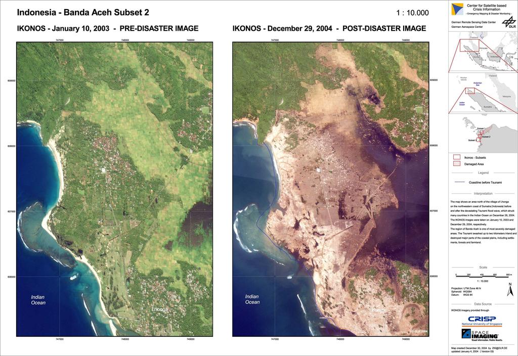
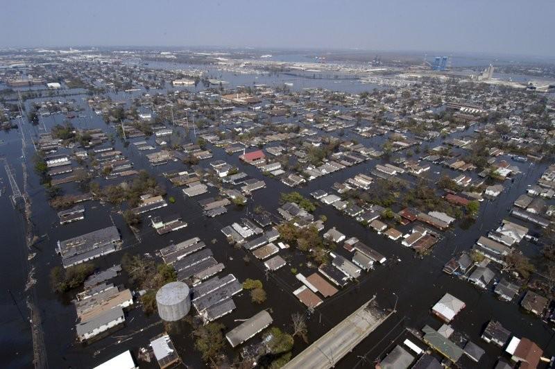
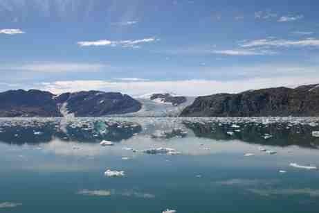
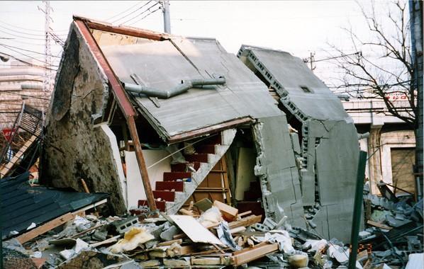
3 Motivation: Missing Understanding of Key Processes
4 GGOS: Monitoring and Modelling the Earth s System Reference frames: highest accuracy and long-term stability Global Monitoring Space Techniques VLBI C SLR/LLR O GNSS M DORIS B Altimetry I InSAR N Gravity/Magnet. Missions A T Terrestrial I Techniques O Levelling N S Gravimetry Tide Gauges Information about Earth System Geometry Earth System Station Position/Motion, Sea Level Change, Deformation Sun/Moon I N (Planets) T Atmosphere E Ocean R Hydrosphere A C Cryosphere T I Crust O Mantle N Core S Earth Rotation Precession/Nutation, Polar Motion, UT1, LOD Gravity Geocenter Gravity Field, Temporal Variations Innovative Technologies Interpretation
5 GGOS Chronology July 2003: Decision of the International Association of Geodesy (IAG) to establish a Global Geodetic Observing System (GGOS) April 2004: IAG/GGOS becomes participating organization of GEO (Group on Earth Observation) for the realization of GEOSS (Global Earth Observing System of Systems) May 2006: GGOS becomes official member of IGOS-P (Integrated Global Observation Strategy Partnership) July 2007: GGOS becomes an official component of the IAG, the observing system of the IAG GGOS2020 reference document is almost complete, is in the review process (~ 200 pages)
6 Std Ocean Gravimetry Geometry IAG Services: Backbone of GGOS IERS: International Earth Rotation and Reference Systems Service IGS: International GNSS Service IVS: International VLBI Service ILRS: International Laser Ranging Service IDS: International DORIS Service IGFS: International Gravity Field Service BGI: Bureau Gravimetrique International IGeS: International Geoid Service ICET: International Center for Earth Tides ICGEM: International Center for Global Earth Models IDEMS: International Digital Elevation Models Service PSMSL: Permanent Service for Mean Sea Level IAS: International Altimetry Service (in preparation) BIPM: Bureau International des Poids et Mesures IBS: IAG Bibliographic Service


7 Structure of the Future GGOS Bureau for Networks and Communication Global Networks of Observing Stations Regional and Global Data and Product Centers Data Analysis Centers Bureau for Conventions and Standards Coordination Office Archiving and Dissemination Earth Observation Satellites / Planetary Missions GGOS Portal Combination Centers Missionspecific Data and Product Centers Archiving and Dissemination Bureau for Satellite and Space Missions Modeling Centers Access to all information, data, products Users, Science & Society Meta data; information Real data; information
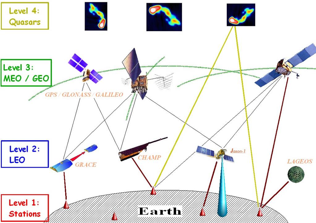
8 GGOS Instrumentation: 5 Levels of Objects 5: Level 4: Moon,Planets Planets Moon
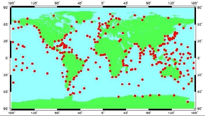
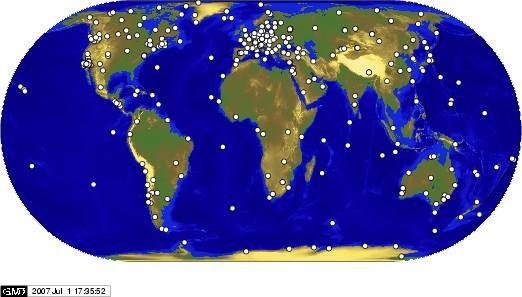
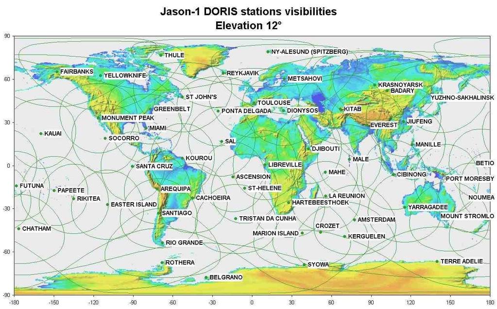
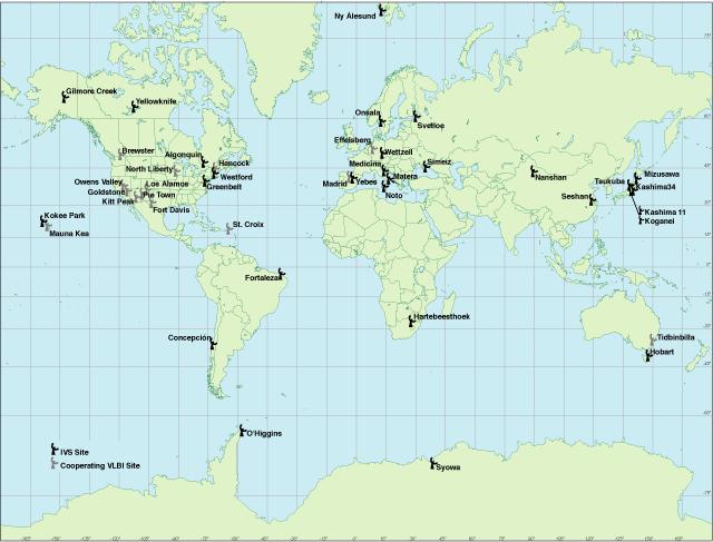
9 Level 1: Ground-Based Component GPS VLBI Sup.Grav. Abs.Grav. SLR/LLR DORIS Tide Gauges
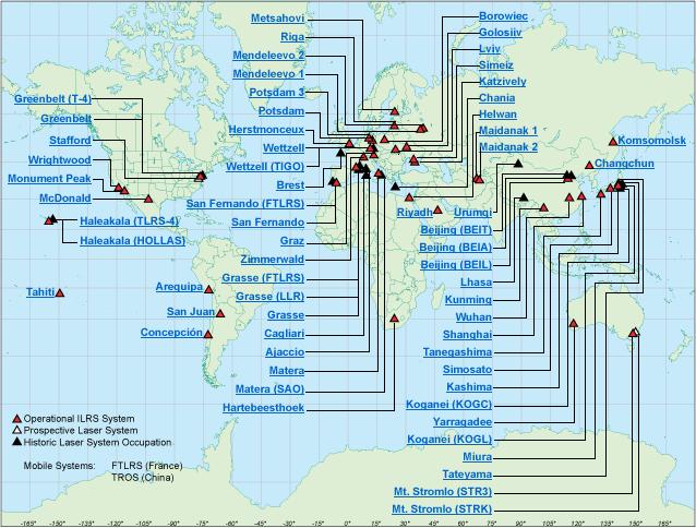
10 Future Core Ground-Based Infrastructure Core Network (~ 40 Stations): 2-3 VLBI telescopes for continuous observations SLR/LLR telescope for tracking of all major satellites At least 3 GNSS antennas and receivers (controlled equipment changes) DORIS beacon of the most recent generation Ultra-stable oscillator for time and frequency keeping and transfer Terrestrial survey instruments for permanent/automated local tie monitoring Superconducting and absolute gravimeter (gravity missions, geocenter) Meteorological sensors (pressure, temperature, humidity) Seismometer for combination with deformation from space geodesy and GNSS seismology Additional sensors: water vapor radiometer, tilt-meters, gyroscopes, ground water sensors, General Characteristics: highly automated, 24-hour/365 days, latest technologies
 VLBI")
 DORIS: 3rd")

11 Ground-Based Infrastructure: Innovation VLBI: High slew rates (> 5 deg/s) 1-3 small telescopes at a site Continuous frequency range (2-18 GHz) VLBI Twin Telescope (Wettzell) SLR: khz laser technology 2 frequency systems Higher quantum efficiency khz Laser: Lageos Spin (Graz) DORIS: 3rd generation DORIS systems Galileo Experimental Sensor Station (GESS) GNSS: GPS, Glonass, Galileo, Compass, Sampling > 10 Hz Real-time 3 antennas/receivers DORIS Beacon (Thule)


12 Level 2: Satellite Mission Component v a r G GRACE CHAMP Oce Topex/Pos. d l e i F y t i ry t e m i t l A n a JASON-1 IceSat-1 COSMIC ry t e m i t l A e Ic Cryosat-2 th r a E e c a f Sur MetOp e n g a M CHAMP TanDEM-X TerraSAR-X JASON-2 e r e h p s o m t A CHAMP GRACE Follow-on? GOCE d l e i t ic F SWARM and new mission concepts IceSat-2

13 New Mission Concepts: Constellations and Formations Formation flying, swarms Satellite Constellations


14 New Mission Concepts: GNSS Reflectometry Future satellite constellation as a component of a Multi-Hazard Early Warning System? AOGS 5 Annual Meeting 2008, June 16-20, 2008, Busan, Korea th

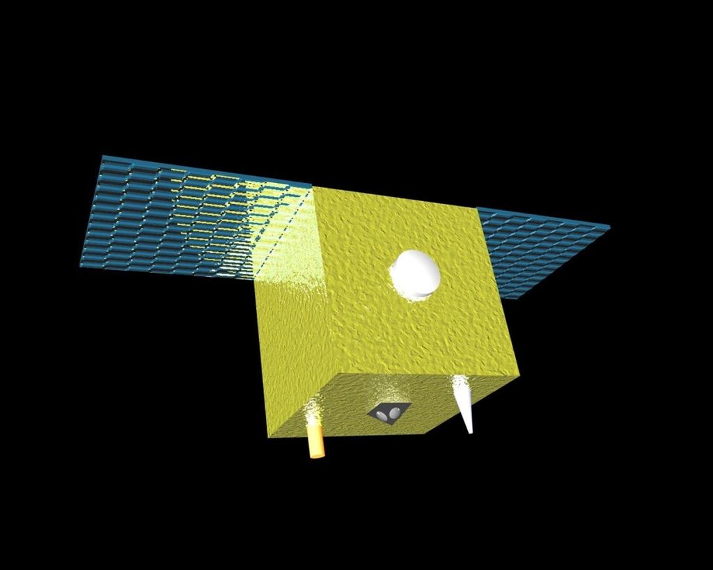
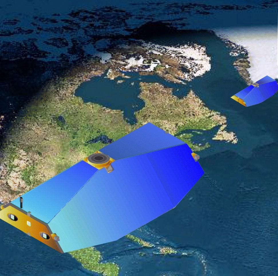
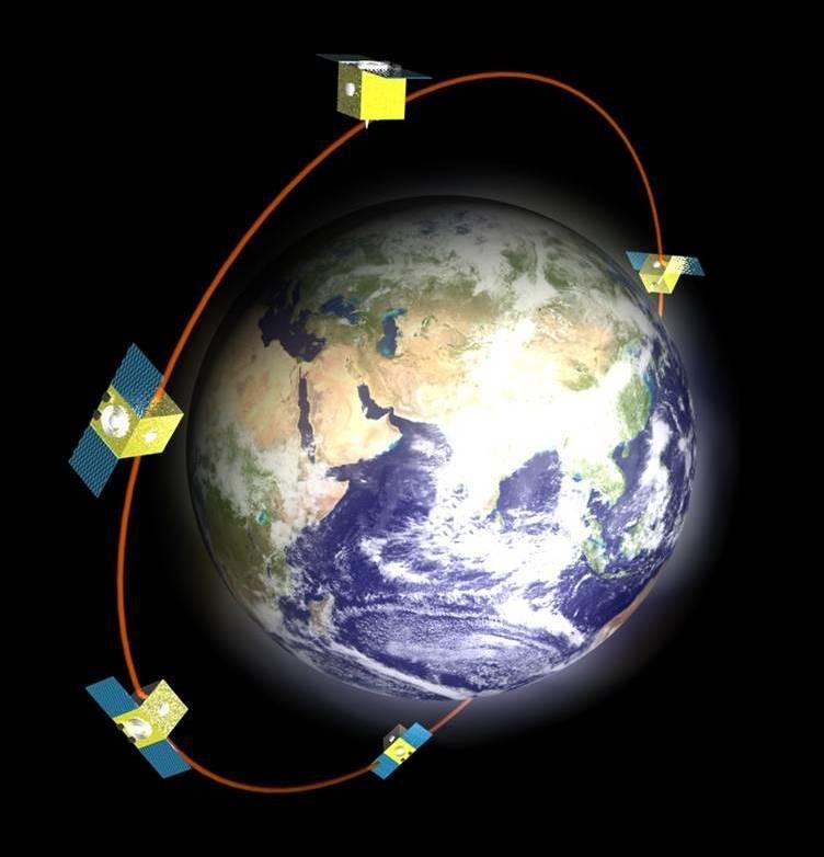
15 New Mission Concepts: Co-location Micro-Satellite(s) RO Antenna POD Antenna Star Sensors SLR Retro-Reflector VLBI Sender MicroSatellite 3 GPS Receiver Board (Redundancy)
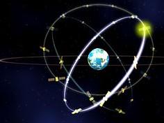
16 Level 3, 4, 5: GNSS + Extraterrestrial GNSS and SLR Satellites: More than 100 GNSS satellites in 2020: GPS (24/32), GLONASS (24/19), GALILEO (30/1), QZSS (3/0), COMPASS (30/4), Cheap LAGEOS-type satellites with laser retro-reflectors and with GNSS receivers forming a network in space with internally 1 mm accuracy (distances up to km) Geodetic Planetary Missions: Bepi Colombo, Mars missions, lunar exploration (GRAIL, LEO), Stars (observed with CCD cameras or in future with GAIA) Quasars


17 GGOS Data Flow and Portal Network Synergies: Common data communication and infrastructure for all techniques (archiving, ) Real-time data transfer New communication technologies for remote areas
18 Processing, Analysis, Combination Processing and Analysis: Fully automated processing in near real-time or even in real-time (early warning systems, GNSS seismology, atmosphere sounding, ) Full reprocessing capabilities for all data available, long consistent time series for long-term trends Combination of all data types on the observation level Combination with LEO data (co-location, gravity, geocenter, atmosphere, ) Combination with satellite altimetry data (and with InSAR?) Combination with terrestrial data (e.g. gravity field, ) Combination of different analysis centers (redundancy, reliability, accuracy, ) Improvements in modeling, parameterization, conventions Supercomputers, visualization

19 Combination: Tsunami Early Warning System GNSS receivers
![Combination of GNSS / Seismology Height [m] East [m] North](/docs-images/82/87014106/images/20-3.jpg "[m] Sumatra Earthquake of September 12, 2007 Earth`s motion")

20 Combination of GNSS / Seismology Height [m] East [m] North [m] Sumatra Earthquake of September 12, 2007 Earth`s motion during the earthquake combination with seismometers Deformation due to the earthquake (magnitude determination, rupture process)

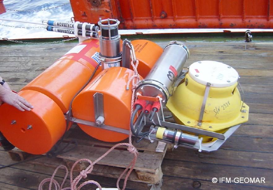
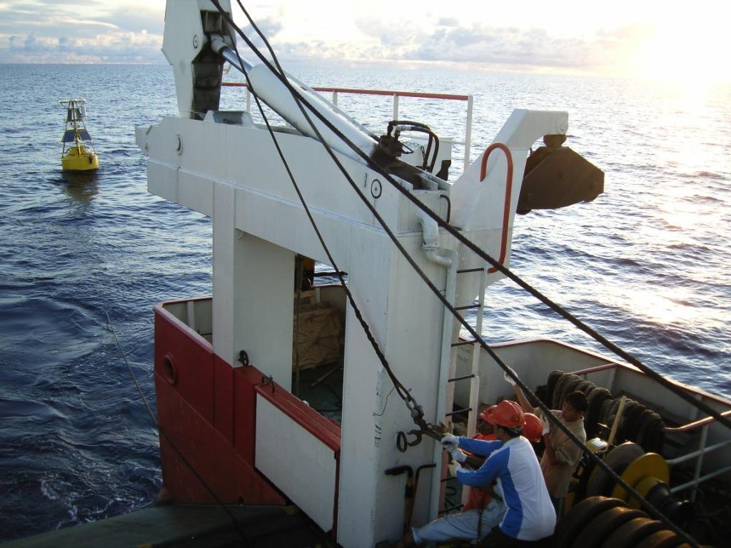
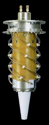
21 Tsunami Buoy: GPS / OBPU / Seismometer
:")
22 GPS Tsunami Buoy: Motion Horizontal Position (Days): Height: Waves:
23 Tsunami Buoy: Sea Level Height RMS: ~ 2-3 cm Tsunami: ~ 50 cm Filtered GPS Heights Ocean Bottom Pressure Ocean Tidal Model (GOTT)
24 Combination of Geometry and Gravity (IERS/IGFS) GEOMETRY IERS Ellipsoidal heights GPS, Altimetry, INSAR Remote Sensing Leveling Sea Level IGFS REFERENCE SYSTEMS VLBI, SLR, LLR, GPS, DORIS Physical heights, geoid EARTH ROTATION GRAVITY FIELD VLBI, SLR, LLR, GPS, DORIS Classical: Astronomy New: Ringlasers, Gyros Orbit Analysis Satellite Gradiometry Ship-& Airborne Gravimetry Absolute Gravimetry Gravity Field Determination
25 Earth System Modelling Tides of the solid Earth Lunisolar Gravitational acceleration Oceanic tides Atmospheric tides Angular torques Density variations in the atmosphere Atmospheric loading Angular momentum variation of the atmosphere Effects from Earth interior Ocean circulation Global ground water Snow Ocean loading Angular momentum variation of the oceans Deformation of the Earth Precession,Nutation Polar motion Length of day Postglacial land uplift Tectonic plate motion Volcanism Earthquakes Pole tides Orientation of the Earth Global vegetation Gravity Field of the Earth


26 Example: Sea-Level Change & Ice-Mass Balances Data processing Altimetry missions Envisat ICESat Gravimetry missions Jason-1 CryoSat II GRACE Geodynamic modeling Ocean modeling Terrestrial networks Sea-level change (mm/a) Tide gauge Glacial-isostatic adjustment GPS Geoid change (mm/a)
27 Conclusions Geodesy can contribute significantly to the monitoring and understanding of the Earth system Integration of a multitude of different and innovative sensors on the ground and in space into a GGOS Complete and consistent data processing chains ranging from the acquisition to the processing of vast amounts of observational data Combination and assimilation of the geodetic/geophyiscal parameters into complex numerical models of the Earth system This will finally allow the understanding and prediction of the processes in the Earth system for the benefit of human society.

28 Thank you for your attention!
GG S. Internal Vision of GGOS. Markus Rothacher. GFZ Potsdam
 Internal Vision of GGOS Markus Rothacher GFZ Potsdam GGOS Retreat DGFI in Munich February 15-16, 2006 Contents Motivation Four Levels of Products of the IAG Services: First Level: Raw Data Collection Second
The Global Geodetic Observing System (GGOS) of the International Association of Geodesy, IAG
 of the International Association of Geodesy, IAG") The Global Geodetic Observing System (GGOS) of the International Association of Geodesy, IAG Hans-Peter Plag (1), Markus Rothacher (2), Richard Gross (3), Srinivas Bettadpur (4) (1) Nevada Bureau of Mines
The Global Geodetic Observing System (GGOS) of the International Association of Geodesy, IAG Hans-Peter Plag (1), Markus Rothacher (2), Richard Gross (3), Srinivas Bettadpur (4) (1) Nevada Bureau of Mines
Global & National Geodesy, GNSS Surveying & CORS Infrastructure
 Global & National Geodesy, GNSS Surveying & CORS Infrastructure Chris Rizos School of Surveying & Spatial Information Systems University of New South Wales, Sydney, Australia President-elect, International
The Interactions between IGS and GGOS
 The Interactions between IGS and GGOS Markus Rothacher Institute of Geodesy and Photogrammetry (IGP) ETH Zurich, Switzerland 2012 IGS Workshop July 23-27, 2012, Olsztyn, Poland Overview GGOS Vision, Mission
Fundamental Station Wettzell - geodetic observatory -
 Fundamental Station Wettzell - geodetic observatory - Wolfgang Schlüter Bundesamt für Kartographie und Geodäsie, Fundamental Station Wettzell Germany Radiometer Workshop, Wettzell, 10.10.06 Evolvement
New satellite mission for improving the Terrestrial Reference Frame: means and impacts
 Fourth Swarm science meeting and geodetic missions workshop ESA, 20-24 March 2017, Banff, Alberta, Canada New satellite mission for improving the Terrestrial Reference Frame: means and impacts Richard
GGOS The Global Geodetic Observing System of the International Association of Geodesy (IAG)
") GGOS The Global Geodetic Observing System of the International Association of Geodesy (IAG) Hansjörg KUTTERER, Germany Key words: Geodetic Reference Frames, Global Geodetic Observing System, International
GGOS The Global Geodetic Observing System of the International Association of Geodesy (IAG) Hansjörg KUTTERER, Germany Key words: Geodetic Reference Frames, Global Geodetic Observing System, International
The Global Geodetic Observing System (GGOS) of the International Association of Geodesy (IAG)
 of the International Association of Geodesy (IAG)") The Global Geodetic Observing System (GGOS) of the International Association of Geodesy (IAG) Hermann Drewes Representative of the International Union of Geodesy and Geophysics (IUGG) to the Cartographic
The Global Geodetic Observing System (GGOS) of the International Association of Geodesy (IAG) Hermann Drewes Representative of the International Union of Geodesy and Geophysics (IUGG) to the Cartographic
Towards a Rigorous Combination of Space Geodetic Techniques
 Towards a Rigorous Combination of Space Geodetic Techniques Markus Rothacher Forschungseinrichtung Satellitengeodäsie, TU Munich, Germany Abstract: The with all its different components and products, ranging
GGOS The Global Geodetic Observing System of the International Association of Geodesy
 GGOS The Global Geodetic Observing System of the International Association of Geodesy Presented at the FIG Working Week 2017, May 29 - June 2, 2017 in Helsinki, Finland Hansjörg Kutterer BKG, Germany Content
Torsten Mayer-Gürr Institute of Geodesy, NAWI Graz Technische Universität Graz
 GGOS and Reference Systems Introduction 2015-10-12 Torsten Mayer-Gürr Institute of Geodesy, NAWI Graz Technische Universität Graz Torsten Mayer-Gürr 1 Course and exam Lecture Monday 14:00 16:00, A111 (ST01044)
GGOS Bureau for Standards and Conventions
 GGOS D. Angermann (1), T. Gruber (2), J. Bouman (1), M. Gerstl (1), R. Heinkelmann (1), U. Hugentobler (2), L. Sánchez (1), P. Steigenberger (2) (1) Deutsches Geodätisches Forschungsinstitut (DGFI), München
GGOS, ECGN and NGOS: Global and regional geodetic observing systems. Markku Poutanen Finish Geodetic Institute
 GGOS, ECGN and NGOS: Global and regional geodetic observing systems Markku Poutanen Finish Geodetic Institute Contents GGOS, ECGN, NGOS Why? How? Future? (geodesy) GGOS Structure GGOS Structure European
A Unique Reference Frame: Basis of the Global Geodetic Observing System (GGOS) for Geodynamics and Global Change
 for Geodynamics and Global Change") SRTM (InSAR) A Unique Reference Frame: Basis of the Global Geodetic Observing System (GGOS) for Geodynamics and Global Change Hermann Drewes President IAG Commission 1 Reference Frames Deutsches Geodätisches
SRTM (InSAR) A Unique Reference Frame: Basis of the Global Geodetic Observing System (GGOS) for Geodynamics and Global Change Hermann Drewes President IAG Commission 1 Reference Frames Deutsches Geodätisches
Geodetic Observing Systems: tools in observing the Glacial Isostatic Adjustment. Markku Poutanen Finnish Geodetic Institute
 Geodetic Observing Systems: tools in observing the Glacial Isostatic Adjustment Markku Poutanen Finnish Geodetic Institute Glacial Isostatic Adjustment Land uplift is just one consequence of the physical
El proyecto Sistema de Observación Geodésico Global [Global Geodetic Observing System (GGOS)] de la Asociación Internacional de Geodesia (IAG)
![El proyecto Sistema de Observación Geodésico Global [Global Geodetic Observing System (GGOS)] de la Asociación Internacional de Geodesia (IAG)](/thumbs/79/79010389.jpg "El proyecto Sistema de Observación Geodésico Global [Global Geodetic Observing System (GGOS)] de la Asociación Internacional de Geodesia (IAG)") El proyecto Sistema de Observación Geodésico Global [Global Geodetic Observing System (GGOS)] de la Asociación Internacional de Geodesia (IAG) Hermann Drewes Deutsches Geodätisches Forschungsinstitut (DGFI)
El proyecto Sistema de Observación Geodésico Global [Global Geodetic Observing System (GGOS)] de la Asociación Internacional de Geodesia (IAG) Hermann Drewes Deutsches Geodätisches Forschungsinstitut (DGFI)
Co-location of VLBI with other techniques in space: a simulation study
 Co-location of VLBI with other techniques in space: a simulation study B. Männel, M. Rothacher ETH Zürich, Geodesy and Geodynamics Lab 7 th IGS General Meeting, Madrid 212 1 Reference frame and local ties
Linking the Global Geodetic Observing System (GGOS) (IGOS-P) through the Theme Earth System Dynamics. with the Integrated Global Observing Strategy
 (IGOS-P) through the Theme Earth System Dynamics. with the Integrated Global Observing Strategy") Linking the Global Geodetic Observing System (GGOS) to the Integrated Global Observing Strategy Partnership (IGOS-P) through the Theme Earth System Dynamics H.-P. Plag, Nevada Bureau of Mines and Geology
Linking the Global Geodetic Observing System (GGOS) to the Integrated Global Observing Strategy Partnership (IGOS-P) through the Theme Earth System Dynamics H.-P. Plag, Nevada Bureau of Mines and Geology
GGOS. Global Geodetic Observing System. Carey Noll NASA GSFC (on behalf of GGOS) WDS Forum September 11, 2016
 WDS Forum September 11, 2016") https://ntrs.nasa.gov/search.jsp?r=20160011397 2018-12-07T18:04:29+00:00Z GGOS Global Geodetic Observing System Carey Noll NASA GSFC (on behalf of GGOS) WDS Forum September 11, 2016 Global Geodetic Observing
https://ntrs.nasa.gov/search.jsp?r=20160011397 2018-12-07T18:04:29+00:00Z GGOS Global Geodetic Observing System Carey Noll NASA GSFC (on behalf of GGOS) WDS Forum September 11, 2016 Global Geodetic Observing
Lecture 2 Measurement Systems. GEOS 655 Tectonic Geodesy
 Lecture 2 Measurement Systems GEOS 655 Tectonic Geodesy VLBI and SLR VLBI Very Long Baseline Interferometry SLR Satellite Laser Ranging Very Long Baseline Interferometry VLBI Geometric Delay δg S Baseline
Status. EUREF TWG Meeting November 8 9, 2004, Praha
 ECGN was initiated by IAG Sub-Commission for Europe EUREF (SC1.3a) and IAG Sub-Commission for Europe of the International Gravity and Geoid Commission (IGGC) with relationship to Joint Research Centre
Dependences in the pillar Earth s gravity field of
 Reports on Geodesy, vol. 92, no. 1, 2012 Dependences in the pillar Earth s gravity field of GGOS - description using UML notation Małgorzata Paśnicka 1, Karolina Szafranek 2, Agnieszka Zwirowicz Rutkowska
3.4.2 International Laser Ranging Service (ILRS)
") 3 Reports of IERS components 3.4 Technique Centres 3.4.2 International Laser Ranging Service (ILRS) Introduction Network The International Laser Ranging Service (ILRS), established in 1998, is responsible
3 Reports of IERS components 3.4 Technique Centres 3.4.2 International Laser Ranging Service (ILRS) Introduction Network The International Laser Ranging Service (ILRS), established in 1998, is responsible
Call for space geodetic solutions corrected for non-tidal atmospheric loading (NT-ATML) at the observation level
 at the observation level") Call for space geodetic solutions corrected for non-tidal atmospheric loading (NT-ATML) at the observation level Xavier Collilieux, Tonie van Dam, Zuheir Altamimi Outline: Context Why correcting for non-tidal
Call for space geodetic solutions corrected for non-tidal atmospheric loading (NT-ATML) at the observation level Xavier Collilieux, Tonie van Dam, Zuheir Altamimi Outline: Context Why correcting for non-tidal
REGIONAL REFERENCE FRAMES: THE IAG PERSPECTIVE
 REGIONAL REFERENCE FRAMES: THE IAG PERSPECTIVE João Agria Torres SPUIAGG IAG Sub-commission 1.3: Regional Reference Frames jatorres@iol.pt 1. About the IAG CONTENT 2. Objectives and organization of SC
GGOS INFORMATION MODELS: ANALYSIS OF INTERRELATIONS BETWEEN OBSERVATION TECHNIQUES AND THE EARTH GRAVITY FIELD
 GGOS INFORMATION MODELS: ANALYSIS OF INTERRELATIONS BETWEEN OBSERVATION TECHNIQUES AND THE EARTH GRAVITY FIELD Wojciech Pachelski 1) Małgorzata Paśnicka-Pawłowska 2) Karolina Szafranek 3) Agnieszka Zwirowicz
Contributions of Geodesy to Oceanography
 Contributions of Geodesy to Oceanography B. Tapley and J. Ries Center for Space Research, The University of Texas at Austin Dynamic Planet 2005 Cairns, Australia August 22-26, 2005 August 22-26, 2005 Dynam
Establishment of a Global Absolute Gravity Network
 Establishment of a Global Absolute Gravity Network H. Wilmes 1), H. Wziontek 1), R. Falk 1), J. Ihde 1), S. Bonvalot 2), R. Forsberg 3), S. Kenyon 4), L. Vitushkin 5) 1) Federal Agency for Cartography
Contributions of geodesy to monitoring natural hazards and global change
 Contributions of geodesy to monitoring natural hazards and global change Prof. Dr. Harald Schuh Director Dept. 1: Geodesy and Remote Sensing Helmholtz Centre Potsdam, GFZ German Research Centre for Geosciences
GRACE impact in geodesy and geophysics. R. Biancale (GRGS-CNES Toulouse), M. Diament (IPG Paris)
, M. Diament (IPG Paris)") GRACE impact in geodesy and geophysics R. Biancale (GRGS-CNES Toulouse), M. Diament (IPG Paris) Improvement of gravity models Since 2002 the GRACE mission has changed some goals in geodesy. It has become
GRACE impact in geodesy and geophysics R. Biancale (GRGS-CNES Toulouse), M. Diament (IPG Paris) Improvement of gravity models Since 2002 the GRACE mission has changed some goals in geodesy. It has become
Atmospheric Effects in Space Geodesy
 Atmospheric Effects in Space Geodesy Johannes Böhm 18 November 2011 @ UNESP, Presidente Prudente, Brazil The atmosphere.. is not only causing troubles in space geodesy.. but it opens up a wide field of
Radio occultation at GFZ Potsdam: Current status and future prospects
 Radio occultation at GFZ Potsdam: Current status and future prospects J. Wickert, T. Schmidt, G. Beyerle, S. Heise, R. Stosius GFZ German Research Centre for Geosciences, Potsdam, Germany The CHAMP, GRACE,
Report for 15th PCGIAP Meeting at 18th UNRCC-AP Working Group 1 Regional Geodesy
 Report for 15th PCGIAP Meeting at 18th UNRCC-AP Working Group 1 Regional Geodesy Chairman Shigeru Matsuzaka, Japan - shigeru@gsi.go.jp Vice Chairman Prof. Pengfei Cheng, China - chengpf@casm.ac.cn John
Earth-Oriented Space Research at TU-Delft
 Earth-Oriented Space Research at TU-Delft The contribution of DEOS to the South-East Asia: Mastering Environmental Research with Geodetic Space Techniques (SEAMERGES) project Kick-off meeting, Chulalongkorn
SLR Graz: khz Satellite Laser Ranging & Co
 Graz in Space 2014 KFU Graz 4. 5. September 2014 SLR Graz: khz Satellite Laser Ranging & Co Georg Kirchner, Franz Koidl, Oliver Baur Space Research Institute Austrian Academy of Sciences Outline What is
Strategy for the Realization of the International Height Reference System (IHRS)
") Deutsches Geodätisches Forschungsinstitut (DGFI-TUM) Technische Universität München Strategy for the Realization of the International Height Reference System (IHRS) Laura Sánchez 1, Johannes Ihde 2, Roland
Deutsches Geodätisches Forschungsinstitut (DGFI-TUM) Technische Universität München Strategy for the Realization of the International Height Reference System (IHRS) Laura Sánchez 1, Johannes Ihde 2, Roland
Physical Dynamics of the Coastal Zone in the Mediterranean on Annual to Decadal Scales
 Physical Dynamics of the Coastal Zone in the Mediterranean on Annual to Decadal Scales Hans-Peter Plag Nevada Bureau of Mines and Geology and Seismological Laboratory University of Nevada, Reno, Nevada,
IGS Services & Other Initiatives. Chris Rizos UNSW, Australia President IAG
 IGS Services & Other Initiatives Chris Rizos UNSW, Australia President IAG The IAG & FIG promote the adoption of the ITRF by all nations & users as the basis for fundamental national or regional datums,
A Mission to Planet Mars Gravity Field Determination
 A Mission to Planet Mars Gravity Field Determination Department for Theoretical Geodesy Graz University of Technology and Space Research Institute Austrian Academy of Sciences Gravity field CHAMP GRACE
Geodetic Observations and Global Reference Frame Contributions to Understanding Sea - Level Rise and Variability
 9 Geodetic Observations and Global Reference Frame Contributions to Understanding Sea - Level Rise and Variability Geoff Blewitt, Zuheir Altamimi, James Davis, Richard Gross, Chung-Yen Kuo, Frank G. Lemoine,
Graz in Space Graz SLR System. Daniel Kucharski. IWF / SatGeo
 Graz in Space 2008 Graz SLR System Daniel Kucharski IWF / SatGeo Satellite Laser Ranging Range measurements to the satellites - time of flight of the ultrashort laser pulses - mm precision station-satellite
SIRGAS: Basis for Geosciences, Geodata, and Navigation in Latin America
 SIRGAS: Basis for Geosciences, Geodata, and Navigation in Latin America Claudio Brunini President of SIRGAS Universidad Nacional de La Plata, Argentina María Virginia Mackern President of SIRGAS/WG-I:
INTERNATIONAL SLR SERVICE
 ARTIFICIAL SATELLITES, Vol. 46, No. 4 2011 DOI: 10.2478/v10018-012-0004-z INTERNATIONAL SLR SERVICE Stanisław Schillak Space Research Centre, Polish Academy of Sciences Astrogeodynamic Observatory, Borowiec
THESIS FOR THE DEGREE OF LICENTIATE OF ENGINEERING. Geodetic analysis for the Very Long Baseline Interferometry Global Observing System NIKO KAREINEN
 THESIS FOR THE DEGREE OF LICENTIATE OF ENGINEERING Geodetic analysis for the Very Long Baseline Interferometry Global Observing System NIKO KAREINEN Department of Earth and Space Sciences CHALMERS UNIVERSITY
Test Computations
 158 7. Test Computations.3.2.1 -.1 -.2 Fourier index 2.8.4 -.4 -.8 Fourier index 2.2.1 -.1 -.2 Fourier index 3.8.4 -.4 -.8 Fourier index 3.2.1 -.1 -.2 -.3 Fourier index 4.8.4 -.4 -.8 Fourier index 4.2.1
Improving the long-term stability of the GDR orbit solutions
 Improving the long-term stability of the GDR orbit solutions L. Cerri 1, A. Couhert 1, S. Houry 1, F. Mercier 1 (1) CNES Toulouse OSTST Meeting 19-21 Oct. 2011 POD Splinter Session Status of the POD standards
Earth gravity field recovery using GPS, GLONASS, and SLR satellites
 13-01-08 Earth gravity field recovery using GPS, GLONASS, and SLR satellites Krzysztof Sośnica (1), Adrian Jäggi (1), Daniela Thaller (2), Ulrich Meyer (1), Christian Baumann (1), Rolf Dach (1), Gerhard
Geodesy Part of the ACES Mission: GALILEO on Board the International Space Station
 Geodesy Part of the ACES Mission: GALILEO on Board the International Space Station 1 Svehla D, 2 Rothacher M, 3 Salomon C, 2 Wickert J, 2 Helm A, 2 Beyerle, G, 4 Ziebart M, 5 Dow J 1 Institute of Astronomical
Towards an improved ILRS TRF contribution
 Towards an improved ILRS TRF contribution Erricos C. Pavlis ILRS Analysis Coordinator JCET/ & NASA Goddard IERS Workshop on Conventions 2007 20-21 Sept. 2007, Sèvres, France Overview The ILRS Network Geometry
A Strategic Plan for Geodesy in Sweden. Mikael Lilje Lars E. Engberg Geodesy Department Lantmäteriet Sweden
 A Strategic Plan for Geodesy in Sweden Mikael Lilje Lars E. Engberg Geodesy Department Lantmäteriet Sweden Our vision is to be able to meet Swedish society s needs for a homogeneous, sustainable geodetic
Densification of the GGOS infrastructure in Poland in the framework of EPOS-PL
 EPOS European Plate Observing System Densification of the GGOS infrastructure in Poland in the framework of EPOS-PL K. Sośnica 1, J. Bosy 1, J. Kapłon 1, W. Rohm 1, T. Hadaś 1, J. Sierny 1, I. Kudłacik
Relationships between mass redistribution, station position, geocenter, and Earth rotation: Results from IGS GNAAC analysis
 Relationships between mass redistribution, station position, geocenter, and Earth rotation: Results from IGS GNAAC analysis Geoff Blewitt Mackay School of Earth Sciences and Engineering University of Nevada,
Warkworth geodetic station as a potential GGOS core site in New Zealand
 "Launching the Next-Generation IVS Network Session 2: Correlators, Stations and Operations Centers. 7th IVS General Meeting March 5, 2012 Madrid, Spain Warkworth geodetic station as a potential GGOS core
IGFS Structure Director : Rene Forsberg
 IGFS Structure Director : Rene Forsberg International Gravimetric Bureau (BGI) Director S. Bonvalot International Geoid Service (IGeS) Director R. Barzaghi International Center for Global Earth Models
Surface Mass Loads from GRACE, GPS, and Earth Rotation
 Surface Mass Loads from GRACE,, and Earth Rotation R. Gross *, G. Blewitt, H.-P. Plag, P. Clarke, D. Lavallée, T. van Dam *Jet Propulsion Laboratory, California Institute of Technology, Pasadena, USA Nevada
MASS TRANSPORT AND MASS DISTRIBUTION IN THE EARTH SYSTEM
 MASS TRANSPORT AND MASS DISTRIBUTION IN THE EARTH SYSTEM Jakob Flury (1) and Reiner Rummel (1) (1) German GOCE Project Bureau Institute for Astronomical and Physical Geodesy Technische Universität München,
Update on the International Terrestrial Reference Frame (ITRF) : ITRF2014. Zuheir Altamimi
 : ITRF2014. Zuheir Altamimi") Update on the International Terrestrial Reference Frame (ITRF) : ITRF2014 Zuheir Altamimi Head of the IERS ITRF Product Center IAG Vice President IGN, France E-mail: zuheir.altamimi@ign.fr Key Points Introduction:
Update on the International Terrestrial Reference Frame (ITRF) : ITRF2014 Zuheir Altamimi Head of the IERS ITRF Product Center IAG Vice President IGN, France E-mail: zuheir.altamimi@ign.fr Key Points Introduction:
How GNSS CORS in Japan works for geodetic control and disaster mitigations
 ICG Working Group D Reference Frames, Timing and Applications How GNSS CORS in Japan works for geodetic control and disaster mitigations ICG11, Nov. 7-11, 2016, Sochi, Russia Hiromichi TSUJI Geodetic Observation
ECGN - Development of the European Combined Geodetic Network in Austria
 ECGN - Development of the European Combined Geodetic Network in Austria Diethard Ruess 1, Gelöscht: BEV Dept. Control Survey Abstract Austria takes part in the European Combined Geodetic Network - Project
The International Terrestrial Reference Frame. What is a Terrestrial Reference Frame?
 The International Terrestrial Reference Frame As early as the 15th century, Swedes noticed that rocks in their harbors were slowly rising out of the sea [Ekman, 1991]. These local observations were not
Onsala Space Observatory IVS Network Station Activities during
 Onsala Space Observatory IVS Network Station Activities during 2015 2016 Rüdiger Haas, Thomas Hobiger, Gunnar Elgered, Niko Kareinen, Grzegorz Klopotek, Joakim Strandberg, Hans-Georg Scherneck Abstract
GEOS 655 Tectonic Geodesy. Jeff Freymueller Elvey 413B, x7286
 GEOS 655 Tectonic Geodesy Jeff Freymueller jfreymueller@alaska.edu Elvey 413B, x7286 Application of Geodesy to Tectonics Uncertainties < 1 mm/y Blue: stable part of tectonic plates Red: deforming zones
From Global to National Geodetic Reference Frames: how are they connected and why are they needed?
 From Global to National Geodetic Reference Frames: how are they connected and why are they needed? Zuheir ALTAMIMI Institut National de l Information Géographique et Forestière, France Vice-President,
Geodetic Observations and Global Reference Frame Contributions to Understanding Sea Level Rise and Variability
 Geodetic Observations and Global Reference Frame Contributions to Understanding Sea Level Rise and Variability G. Blewitt (1), Z. Altamimi (2), J. Davis (3), R. Gross (4), C. Kuo (5), F. Lemoine (6), R.Neilan
SECOND ANNOUNCEMENT International Technical Laser Workshop 2012 (ITLW-12)
") SECOND ANNOUNCEMENT International Technical Laser Workshop 2012 (ITLW-12) Version 31/Oct/12 Satellite, Lunar and Planetary Laser Ranging: characterizing the space segment Frascati National Laboratories
SECOND ANNOUNCEMENT International Technical Laser Workshop 2012 (ITLW-12) Version 31/Oct/12 Satellite, Lunar and Planetary Laser Ranging: characterizing the space segment Frascati National Laboratories
Earth gravity field recovery using GPS, GLONASS, and SLR satellites
 Earth gravity field recovery using GPS, GLONASS, and SLR satellites Krzysztof Sośnica (1), Adrian Jäggi (1), Daniela Thaller (2), Ulrich Meyer (1), Gerhard Beutler (1), Rolf Dach (1) (1) Astronomical Institute,
Summary of the 2012 Global Geophysical Fluid Center Workshop
 Summary of the 2012 Global Geophysical Fluid Center Workshop T. van Dam (Uni. Lux), J. Ray (NGS/NOAA), X. Collilieux (IGN) Introduction Review the history of the GGFC Discuss the 2012 Workshop Review recommendations
EPOS-RT: Software for Real-time GNSS Data Processing
 EGU 2009,Session G4,21 April,2009 1 EPOS-RT: Software for Real-time GNSS Data Processing Maorong Ge, Junping Chen, Gerd Gendt Department of Geodesy and Remote Sensing, Deutsches GeoForschungsZentrum Contact:
Understanding Earth Rotation Part 2: Physical Foundations and Interpretation
 Understanding Earth Rotation Part 2: Physical Foundations and Interpretation Prof. Dr. Florian Seitz Technische Universität München (TUM) Deutsches Geodätisches Forschungsinstitut (DGFI) Munich, Germany
Preface. About this book. Background
 Foreword The Global Geodetic Observing System (GGOS) has been established by the International Association of Geodesy (IAG) in order to integrate the three fundamental areas of geodesy, so as to monitor
Satellite Geodesy and Navigation Present and Future
 Satellite Geodesy and Navigation Present and Future Drazen Svehla Institute of Astronomical and Physical Geodesy Technical University of Munich, Germany Content Clocks for navigation Relativistic geodesy
Assessment of the orbit-related sea level error budget for the TOPEX/Poseidon altimetry mission
 Assessment of the orbit-related sea level error budget for the TOPEX/Poseidon altimetry mission Sergei Rudenko (1,2), Saskia Esselborn (1), Tilo Schöne (1) (1) GFZ German Research Centre for Geosciences,
Interferometric Synthetic Aperture Radar (InSAR) and GGOS. Andrea Donnellan NASA/JPL February 21, 2007
 and GGOS. Andrea Donnellan NASA/JPL February 21, 2007") Interferometric Synthetic Aperture Radar (InSAR) and GGOS Andrea Donnellan NASA/JPL February 21, 2007 Sources for Science Objectives Fourth component of EarthScope Involvement: NSF, NASA, USGS, Universities
Interferometric Synthetic Aperture Radar (InSAR) and GGOS Andrea Donnellan NASA/JPL February 21, 2007 Sources for Science Objectives Fourth component of EarthScope Involvement: NSF, NASA, USGS, Universities
Principles of the Global Positioning System Lecture 18" Mathematical models in GPS" Mathematical models used in GPS"
 12.540 Principles of the Global Positioning System Lecture 18" Prof. Thomas Herring" Room 54-820A; 253-5941" tah@mit.edu" http://geoweb.mit.edu/~tah/12.540 " Mathematical models in GPS" Review assignment
What are the social, technical, environmental and economic benefits and opportunities of accessing and sharing geodetic data?
 What are the social, technical, environmental and economic benefits and opportunities of accessing and sharing geodetic data? Graeme Blick Group Manager Positioning and Resilience Land Information New
GOCE Research in Germany: From Sensor Analysis to Earth System Science
 GOCE Research in Germany: From Sensor Analysis to Earth System Science Reiner Rummel, Jakob Flury and Thomas Gruber Institut für Astronomische und Physikalische Geodäsie Technische Universität München
HY-2A Satellite User s Guide
 National Satellite Ocean Application Service 2013-5-16 Document Change Record Revision Date Changed Pages/Paragraphs Edit Description i Contents 1 Introduction to HY-2 Satellite... 1 2 HY-2 satellite data
International Gravity Field Service (IGFS)
") IAG-Services: International Gravity Field Service (IGFS) 477 International Gravity Field Service (IGFS) http://www.gravityfield.org Chairman: Renè Forsberg (Denmark, 2011-2013) - Riccardo Barzaghi (Italy,
IAG-Services: International Gravity Field Service (IGFS) 477 International Gravity Field Service (IGFS) http://www.gravityfield.org Chairman: Renè Forsberg (Denmark, 2011-2013) - Riccardo Barzaghi (Italy,
Global reference systems and Earth rotation
 current realizations and scientific problems Aleksander Brzeziński 1,2, Tomasz Liwosz 1, Jerzy Rogowski 1, Jan Kryński 3 1 Department of Geodesy and Geodetic Astronomy Warsaw University of Technology 2
The Earth Explorer Missions - Current Status
 EOQ N 66 July 2000 meteorology earthnet remote sensing solid earth future programmes Earth Observation Quarterly The Earth Explorer Missions - Current Status G. Mégie (1) and C.J. Readings (2) (1) Institut
P. Cipollini, H. Snaith - A short course on Altimetry. Altimetry 2 - Data processing (from satellite height to sea surface height)
") P. Cipollini, H. Snaith - A short course on Altimetry Altimetry 2 - Data processing (from satellite height to sea surface height) 1 2 Satellite height to sea surface height The altimeter measures the altitude
P. Cipollini, H. Snaith - A short course on Altimetry Altimetry 2 - Data processing (from satellite height to sea surface height) 1 2 Satellite height to sea surface height The altimeter measures the altitude
Low-Latency Earthquake Displacement Fields for Tsunami Early Warning and Rapid Response Support
 Low-Latency Earthquake Displacement Fields for Tsunami Early Warning and Rapid Response Support Hans-Peter Plag, Geoffrey Blewitt Nevada Bureau of Mines and Geology and Seismological Laboratory University
Time Variable Gravity (TVG) in GRGS REPRO2 solution (GR2)
 in GRGS REPRO2 solution (GR2)") Time Variable Gravity (TVG) in GRGS REPRO2 solution (GR2) S. Loyer (1), J.-M. Lemoine (2) and F. Perosanz (2) (1) Collecte Localisation Satellites (CLS, Ramonville Saint-Agne, France) (2) Centre National
Time Variable Gravity (TVG) in GRGS REPRO2 solution (GR2) S. Loyer (1), J.-M. Lemoine (2) and F. Perosanz (2) (1) Collecte Localisation Satellites (CLS, Ramonville Saint-Agne, France) (2) Centre National
Geodetic and astrometric Very Long Baseline Interferometry (VLBI) - the IVS and its future perspectives
 - the IVS and its future perspectives") Geodetic and astrometric Very Long Baseline Interferometry (VLBI) - the IVS and its future perspectives EGU and IVS Training School on VLBI for Geodesy and Astrometry Aalto University, Espoo, Finland 2
Geodetic and astrometric Very Long Baseline Interferometry (VLBI) - the IVS and its future perspectives EGU and IVS Training School on VLBI for Geodesy and Astrometry Aalto University, Espoo, Finland 2
Role and importance of the International Terrestrial Reference Frame for sustainable development
 Role and importance of the International Terrestrial Reference Frame for sustainable development This report is provided for the benefit of participants of the UNRCC-PCGIAP Informal Geodetic Consultation,
GEODETIC NETWORK OF SAUDI ARABIA AND FIDUCIAL STATIONS. GFN OF Saudi Arabia in Based on ITRF2000 Datum
 STUDIES OF TECTONIC MOVEMENTS IN SAUDI ARABIA USING CORS M. Al Rajhi, Ali Al Omar, R. Yanar, F. Kartal, K. Eren, SUBJECT TO TALKS BACKGROUND GEODETIC NETWORK OF SAUDI ARABIA AND FIDUCIAL STATIONS GFN OF
GNSS Observations & Sea Level
 with contributions from: - Marta Marcos - Alvaro Santamaria - GNSS Observations & Sea Level Guy Wöppelmann gwoppelm@univ-lr.fr Outline: 1. Introduction 2. The importance of Vertical Land Motions 3. The
Earth rotation and Earth gravity field from GRACE observations. Lucia Seoane, Christian Bizouard, Daniel Gambis
 Earth rotation and Earth gravity field from GRACE observations Lucia Seoane, Christian Bizouard, Daniel Gambis Observatoire de Paris SYRTE, 61 av. de l'observatoire, 7514 Paris Introduction Gravity field
Tsunami Detection from Space using GNSS Reflections
 Tsunami Detection from Space using GNSS Reflections R. Stosius, G. Beyerle, A. Helm, A. Hoechner, and J. Wickert Nat. Hazards Earth Syst. Sci., 10, 1359 1372, 2010 1 Tsunami Detection from Space Global
MSGIC Spring Mtg Denton April 23, 2014
 Modernization of the National Spatial Reference System Keeping Pace with Changes in Positioning Technology and User Expectations in a Dynamic World MSGIC Spring Mtg Denton April 23, 2014 Dave Doyle Base
To the best of our knowledge, the FG5 gravimeter represents the current state-of-the-art in the measurement of absolute gravity.
 FG5 gravity meter To the best of our knowledge, the FG5 gravimeter represents the current state-of-the-art in the measurement of absolute gravity. American Geophysical Union, EOS Journal Since its introduction
Geodesy. orientation. shape. gravity field
 Geodesy noun Science of measuring the shape, orientation and gravity field of the Earth and how it changes over time. shape orientation gravity field Positioning has always been important Downstream applications
Publ. Astron. Obs. Belgrade No. 91 (2012), REALIZATION OF ETRF2000 AS A NEW TERRESTRIAL REFERENCE FRAME IN REPUBLIC OF SERBIA
, REALIZATION OF ETRF2000 AS A NEW TERRESTRIAL REFERENCE FRAME IN REPUBLIC OF SERBIA") Publ. Astron. Obs. Belgrade No. 91 (2012), 199-206 Contributed paper REALIZATION OF ETRF2000 AS A NEW TERRESTRIAL REFERENCE FRAME IN REPUBLIC OF SERBIA D. BLAGOJEVIĆ and V. VASILIĆ Faculty of Civil Engineering,
Publ. Astron. Obs. Belgrade No. 91 (2012), 199-206 Contributed paper REALIZATION OF ETRF2000 AS A NEW TERRESTRIAL REFERENCE FRAME IN REPUBLIC OF SERBIA D. BLAGOJEVIĆ and V. VASILIĆ Faculty of Civil Engineering,
The Rotational and Gravitational Signature of Recent Great Earthquakes
 The Rotational and Gravitational Signature of Recent Great Earthquakes Richard S. Gross Jet Propulsion Laboratory California Institute of Technology Pasadena, CA 91109 8099, USA 7th IVS General Meeting
Earth system. space. planets. atmosphere. ice sheets. ocean. biosphere, technosphere. solid Earth. gravitation on. orbit, spin, tides
 third lecture Three Lectures: One ESA explorer mission GOCE: earth gravity from space Two Signal Processing on a sphere Three Gravity and earth sciences Earth system space sun moon planets gravitation
GOCE-GRAND-2 Project Overview and Status of the GOCE Mission
 GOCE-GRAND-2 Project Overview and Status of the GOCE Mission Reiner Rummel, Thomas Gruber & Jakob Flury Institut für Astronomische und Physikalische Geodäsie Technische Universität München Geotechnologien
The National Spatial Reference System of the Future
 The National Spatial Reference System of the Future William Stone Southwest Region (AZ, NM, NV, UT) Geodetic Advisor william.stone@noaa.gov NOAA s National Geodetic Survey geodesy.noaa.gov Salt Lake City
Integration of space and terrestrial techniques to study crustal deformation. Examples in northeastern Italy
 Integration of space and terrestrial techniques to study crustal deformation. Examples in northeastern Italy Susanna Zerbini Dipartimento di Fisica, University of Bologna, Italy IAG-IASPEI Joint Capacity
Ludwig Combrinck HartRAO 3rd Space Geodesy Workshop 16 March 2009 Matjiesfontein
 Space Geodesy and Space Science Ludwig Combrinck HartRAO 3rd Space Geodesy Workshop 16 March 2009 Matjiesfontein DST s Concept of Space Science SA Space Agency, commercial applications, CSIR Satellite
INTEGRATED OPERATIONAL PRECISE ORBIT DETERMINATION FOR LEO
 INTEGRATED OPERATIONAL PRECISE ORBIT DETERMINATION FOR LEO J. Fernández Sánchez, F. M. Martínez Fadrique, A. Águeda Maté, D. Escobar Antón GMV S.A., Isaac Newton, 8760 Tres Cantos, Spain, Email: jfernandez@gmv.com,