A Strategic Plan for Geodesy in Sweden. Mikael Lilje Lars E. Engberg Geodesy Department Lantmäteriet Sweden
|
|
|
- Edmund Caldwell
- 5 years ago
- Views:
Transcription


1 A Strategic Plan for Geodesy in Sweden Mikael Lilje Lars E. Engberg Geodesy Department Lantmäteriet Sweden
2 Our vision is to be able to meet Swedish society s needs for a homogeneous, sustainable geodetic infrastructure and to guarantee its availability and use. Geodetic infrastructure: Geodetic reference systems and networks (passive and active) Systems for the provision of data and support 2


3 LANTMÄTERIET S GEODETIC ROLE Provide and monitor national referenceand co-ordinate system. Best practice provider of efficient, accurate & innovative use of GPS/GNSS and other geodetic techniques Research, Advisory service and Support National (and international) experts 3
4 FOCUS ON EFFICIENT USE OF GNSS IN SWEDEN SWEPOS The Swedish national CORS National Network-RTK service 4
5 Our history based on angles and lengths as well as levelling 5
")


6 Laste decade(s) Space Geodetic Techniques a large toolkit
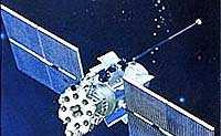
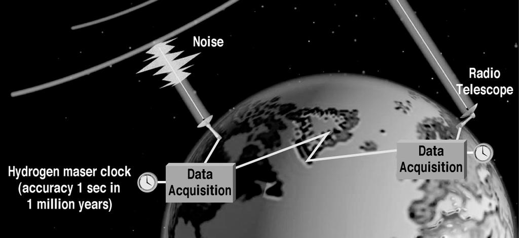
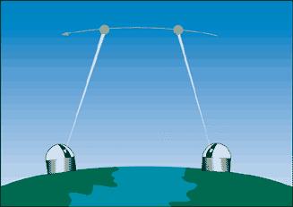
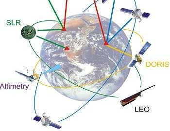
7 VLBI Modern Geodetic Techniques significant ground-based infrastructure GNSS Sup.Grav. Abs.Grav. DORIS Tide Gauges SLR/LLR
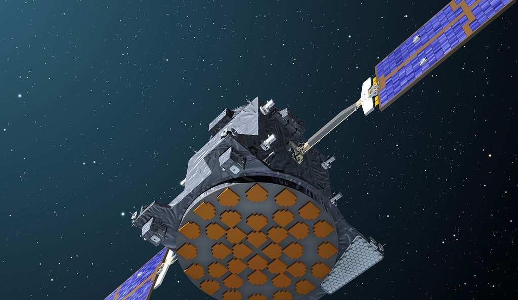
8 IGS Geodetic CORS Network Many countries & organisations contribute to the IGS, and many more benefit from this collective investment free raw GNSS data, derived products & connection to the ITRF. 8


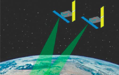
9 EPN/EUREF IGS network relies heavily on regional scientific and national reference frame networks. Regional reference frame activities help to fill in gaps in global network coverage of stations that can be used in the generation of IGS products. 9
10 Our 3D reference system - SWEREF 99 Producer: Lantmäteriet Epoch: (Plate movements) GPS campaign in 1999 Adopted by EUREF as an ETRS 89 realisation in 2000 Introduced as national reference frame in 2001 SWEREF 99 TM SWEREF 99 dd mm 10
11 The Swedish Height System - RH 2000 Third national precise levelling New national height system (RH 2000) in 2005 Connected to EVRS - Baltic Levelling Ring Motorised levelling points, km Standard deviation 1 mm/ km Connected to European Height System Land uplift correction, epoch
12 WE ARE AIMING AT National One 3-D system (SWEREF 99) One horizontal solution (based on SWEREF 99) One height system (RH 2000) Locally Few local horizontal systems Few local height systems Provide the users with necessary tools and support for an efficient use of SWEREF 99 and RH Monitor and secure the use of our current systems for the future. 12


13 We will focus on More accurate heights from Network-RTK Better geoid model; uncertainty (1σ) of 1 cm year 2015, 0.5 cm year 2020 Creating a new gravity system, RG 2000, for Sweden Better gravity observations all over the country Carry out R&D theories and methods for geoid determination Densification of the SWEPOS network Strive to promote an early introduction of modern GNSS 13


14 Geodesy 2010 focusing on the users Who are the users? What do they need? Today: Lower the uncertainty but with high reliability and accesibilty to a lower cost for instruments and services. New user groups: Agriculture and machine guidance. These users are not interested in the geodesy behind the tool, they just want the black box to work. 14
15 We will also focus on Complete transition to SWEREF 99 and RH 2000 R&D work concerning the maintenance of reference systems and their sustainability A better model (3D) for the fennoscandian land uplift To ensure the long-term sustainability of our reference systems SWEREF 99, RH 2000 and RG
16 New reference frames Implementation in the municipalities 243 (out of 290) have changed to SWEREF (out of 290) have changed to RH 2000 (Swedish EVRS realisation) Voluntary changes! No legislation forcing the use of SWEREF99, RH 2000 Well developed cooperation and understanding between Lantmäteriet and the users 16
17 17

18 Geodesy is a vital part in the Climate Change discussion Observations Global and Regional Reference Frames Knowledge 18
19 We will also Contribute to international geodetic co-operation both by supplying data and by actively participating in working groups To ensure that the European reference systems ETRS89 and EVRS still remain in use for technical applications by year
20 Thank You! THANK YOU FOR YOUR ATTENTION 20
A New Co-ordinate System for Sweden
 Lars E. ENGBERG and Mikael LILJE, Sweden Key words: SWEREF 99, Map Projections, UTM. ABSTRACT Sweden introduced the three-dimensional reference frame SWEREF 99 in May 2001. It is based on the permanent
A New Co-ordinate System for Sweden
 199 A New Co-ordinate System for Sweden M. LILJE, L. E. ENGBERG, B. ANDERSSON 1 Abstract Sweden introduced the three-dimensional reference frame SWEREF 99 in May 2001. It is based on the permanent GPS
A New Co-ordinate System for Sweden
 A New Co-ordinate System for Sweden Lars E. Engberg, Bengt Andersson, Lotti Jivall, Mikael Lilje, Bo-Gunnar Reit Lantmäteriet, Geodetic Department, SE-801 82 Gävle, Sweden e-mail: lars.e.engberg@lm.se,
National Report of Sweden to the EUREF 2004 Symposium
 1 National Report of Sweden to the EUREF 2004 Symposium - geodetic activities at Lantmäteriet, the National Land Survey of Sweden Edited by Dan Norin Lantmäteriet, SE-801 82 Gävle, Sweden, dan.norin@lm.se
The Swedish National Geodata Strategy and the Geodata Project
 The Swedish National Geodata Strategy and the Geodata Project Ewa Rannestig, Head of NSDI Co-ordination Unit, Lantmäteriet, ewa.rannstig@lm.se Ulf Sandgren, Project Manager Geodata Project, Lantmäteriet,
ONE YEAR WITH OUR ABSOLUTE GRAVIMETER
 ONE YEAR WITH OUR ABSOLUTE GRAVIMETER Mikael Lilje, Jonas Ågren, Andreas Engfeldt, Per-Anders Olsson Lantmäteriet, Sweden Introduction In Sweden, a new generation of reference systems has been introduced.
UN Resolution on GGRF ( and its implementation in Europe)
") Presented at the FIG Working Week 2017, UN Resolution on GGRF ( and its implementation in Europe) May 29 - June 2, 2017 in Helsinki, Finland Markku Poutanen, FGI Contents Global Geodetic Reference Frame
Presented at the FIG Working Week 2017, UN Resolution on GGRF ( and its implementation in Europe) May 29 - June 2, 2017 in Helsinki, Finland Markku Poutanen, FGI Contents Global Geodetic Reference Frame
UN-GGIM: Europe GRF-Europe. Markku Poutanen
 UN-GGIM: Europe GRF-Europe Markku Poutanen Global Geodetic Reference Frame GGRF The UN Committee of Experts on Global Geospatial Information Management (UN-GGIM) decided in July 2013 to formulate and facilitate
Global & National Geodesy, GNSS Surveying & CORS Infrastructure
 Global & National Geodesy, GNSS Surveying & CORS Infrastructure Chris Rizos School of Surveying & Spatial Information Systems University of New South Wales, Sydney, Australia President-elect, International
The Process of Changing from Local Systems into SWEREF 99
 The Process of Changing from Local Systems into SWEREF 99 A Challenge for Lantmäteriet and a Great Step for the Municipalities Anders Alfredsson, Bengt Andersson, Lars E. Engberg, Fredrik Dahlström, Tina
The Process of Changing from Local Systems into SWEREF 99
 The Process of Changing from Local Systems into SWEREF 99 A Challenge for Lantmäteriet and a Great Step for the Municipalities Anders Alfredsson, Bengt Andersson, Lars E. Engberg, Fredrik Dahlström, Tina
Report for 15th PCGIAP Meeting at 18th UNRCC-AP Working Group 1 Regional Geodesy
 Report for 15th PCGIAP Meeting at 18th UNRCC-AP Working Group 1 Regional Geodesy Chairman Shigeru Matsuzaka, Japan - shigeru@gsi.go.jp Vice Chairman Prof. Pengfei Cheng, China - chengpf@casm.ac.cn John
REGIONAL REFERENCE FRAMES: THE IAG PERSPECTIVE
 REGIONAL REFERENCE FRAMES: THE IAG PERSPECTIVE João Agria Torres SPUIAGG IAG Sub-commission 1.3: Regional Reference Frames jatorres@iol.pt 1. About the IAG CONTENT 2. Objectives and organization of SC
On the Management of Reference Frames in Sweden
 On the Management of Reference Frames in Sweden Christina KEMPE, Lotti JIVALL, Martin LIDBERG, Mikael LILJE, Sweden Key words: Reference frames, three-dimensional reference frame, height reference frame,
On the Use of Crustal Deformation Models. in the Management of ETRS89 Realizations in Fennoscandia
 On the Use of Crustal Deformation Models Presented at the FIG Working Week 2017, May 29 - June 2, 2017 in Helsinki, Finland in the Management of ETRS89 Realizations in Fennoscandia Martin Lidberg, Jonas
Specification of the Baltic Sea Chart Datum 2000 (BSCD2000)
") Specification of the Baltic Sea Chart Datum 2000 (BSCD2000) DRAFT by Jonas Ågren, Gunter Liebsch and Jyrki Mononen Version 3a, 2018-02-06 1. Definition The Baltic Sea Chart Datum 2000 (BSCD2000) is a geodetic
Specification of the Baltic Sea Chart Datum 2000 (BSCD2000) DRAFT by Jonas Ågren, Gunter Liebsch and Jyrki Mononen Version 3a, 2018-02-06 1. Definition The Baltic Sea Chart Datum 2000 (BSCD2000) is a geodetic
One Year with Our Absolute Gravimeter
 Mikael LILJE, Jonas ÅGREN, Andreas ENGFELDT and Per-Anders OLSSON, Sweden ABSTRACT In 2006 Lantmäteriet (the National Land Survey of Sweden) bought an absolute gravimeter (Micro-g Lacoste FG5) together
Reference frames and positioning
 The APREF Project: an Improved Geodetic Infrastructure for Asia and the Pacific (4861) John Dawson (Australia), Graeme Blick (New Zealand), Manoj Deo, Guorong Hu and Gary Johnston (Australia) Reference
SWEDISH SDI DEVELOPMENT & IMPLEMENTATION OF INSPIRE
 SWEDISH SDI DEVELOPMENT & IMPLEMENTATION OF INSPIRE Christina Wasström, Lantmäteriet, 801 82 Gävle, Sweden, christina.wasstrom@lm.se ABSTRACT The Swedish Government and Parliament has given Lantmäteriet
SIRGAS: Basis for Geosciences, Geodata, and Navigation in Latin America
 SIRGAS: Basis for Geosciences, Geodata, and Navigation in Latin America Claudio Brunini President of SIRGAS Universidad Nacional de La Plata, Argentina María Virginia Mackern President of SIRGAS/WG-I:
Working Group 1. Geodetic Reference Frame. Activity Report. for. The UN-GGIM-AP Plenary Meeting
 Regional Committee of United Nations Global Geospatial Information Management for Asia and the Pacific (UN-GGIM-AP) Established by a United Nations Resolution Working Group 1 Geodetic Reference Frame Activity
The New Swedish Height System RH 2000 and Geoid Model SWEN 05LR
 The New Swedish Height System RH 2000 and Geoid Model SWEN 05LR Runar SVENSSON, Jonas ÅGREN, Per-Anders OLSSON, Per-Ola ERIKSSON and Mikael Key words: height system, levelling, postglacial land uplift,
What does EUREF considers as a realisation of EVRS?
 1 (1) DRAFT PM 2010-05-24 previous versions: 2010-03-08 2010-02-15 What does EUREF considers as a realisation of EVRS? Contents Contents...1 Purpose of document...1 Short review on activities towards a
Appropriation Directions for 2007
 INSPIRE in Sweden An Important Part of the National Geodata Strategy Monica Lagerqvist Nilsson Appropriation Directions for 2007 A commission to investigate the necessity to adjust the Swedish legislation
A new transformation including deformation model for the Nordic. and Baltic countries
 A new transformation including deformation model for the Nordic Presented at the FIG Working Week 2017, May 29 - June 2, 2017 in Helsinki, Finland and Baltic countries P. Häkli, M. Lidberg, L. Jivall,
Positioning in the Pacific Islands
 Positioning in the Pacific Islands Andrick Lal United Nations/Nepal Workshop on the Applications of Global Navigation Satellite Systems Kathmandu - Nepal 15 th December 2016 Presentation Outline Introduction
The BIFROST Project: 21 years of search for the true crustal deformation in Fennoscandia
 The BIFROST Project: 21 years of search for the true crustal deformation in Fennoscandia Martin Lidberg and Holger Steffen Lantmäteriet, Sweden Jan Johansson Chalmers University of Technology Halfdan Kierulf
Frames for the Future New Datum Definitions for Modernization of the U.S. National Spatial Reference System
 Figure 10. Horizontal position differences (in meters) between NAD 83 and ITRF 08 at time 2022.00 (January 1, 2022). Positional differences are shown for the North American and Pacific tectonic plates.
From Global to National Geodetic Reference Frames: how are they connected and why are they needed?
 From Global to National Geodetic Reference Frames: how are they connected and why are they needed? Zuheir ALTAMIMI Institut National de l Information Géographique et Forestière, France Vice-President,
Geodetic applications of GNSS in the Black Sea region
 BALGEOS II - Balkan countries integration into GGOS Second workshop, 27-29 January, 2010 Vienna - AUSTRIA Geodetic applications of GNSS in the Black Sea region Lyubka Pashova CENTRAL LABORATORY OF GEODESY
Faatasi Malologa (PGSC Chair) Director Department of Lands & Survey, Tuvalu
 Director Department of Lands & Survey, Tuvalu") Seventh Session of the United Nations Committee of Experts on Global Geospatial Information Management (UN-GGIM) - 31 July -4 August 2017 Faatasi Malologa (PGSC Chair) Director Department of Lands & Survey,
Seventh Session of the United Nations Committee of Experts on Global Geospatial Information Management (UN-GGIM) - 31 July -4 August 2017 Faatasi Malologa (PGSC Chair) Director Department of Lands & Survey,
Reference Frame in Practice Workshop 1A
 Reference Frame in Practice Workshop 1A Status of Geodetic Infrastructure in the Pacific Region Case Studies Rob Sarib - FIG Commission 5 Vice Chair of Administration Welcome! Bula! Who are the International
start of Swedish national maps.
 1809 - start of Swedish national maps. Corps of military field measurement Triangulation network Spheroid: Bessel 1841 Semimajor axis: : 6377397.155 Semiminor axis: : 6356078.963 Inverse flattening: :
INSPIRE in Sweden - an Important Part of the National Geodata Strategy
 INSPIRE in Sweden - an Important Part of the National Geodata Strategy Ewa RANNESTIG and Monica LAGERQVIST NILSSON, Sweden Key words: National Geodata Strategy, National Infrastructure for Spatial Information,
Strategy for the Realization of the International Height Reference System (IHRS)
") Deutsches Geodätisches Forschungsinstitut (DGFI-TUM) Technische Universität München Strategy for the Realization of the International Height Reference System (IHRS) Laura Sánchez 1, Johannes Ihde 2, Roland
Deutsches Geodätisches Forschungsinstitut (DGFI-TUM) Technische Universität München Strategy for the Realization of the International Height Reference System (IHRS) Laura Sánchez 1, Johannes Ihde 2, Roland
Geodetic Observing Systems: tools in observing the Glacial Isostatic Adjustment. Markku Poutanen Finnish Geodetic Institute
 Geodetic Observing Systems: tools in observing the Glacial Isostatic Adjustment Markku Poutanen Finnish Geodetic Institute Glacial Isostatic Adjustment Land uplift is just one consequence of the physical
HMK Swedish handbook in surveying and mapping
 HMK Swedish handbook in surveying and mapping A Alfredsson, J Sunna, C-G Persson TS07B - Standards and Recommended Practices for Positioning and Measurement, Paper no 7072 FIG Congress 2014 Engaging the
Reference Systems Realization for the Territory of Bulgaria - Status and Perspectives
 Conference and plenary meeting of the Permanent Committee on Cadastre in the European Union 13-15 March 2018, Sofia Reference Systems Realization for the Territory of Bulgaria - Status and Perspectives
UN GGIM and National SDI Strategy
 MSDI Open Forum on 26 th January 2016 Contributing to the successful delivery of MSDI UN GGIM and National SDI Strategy Hiroshi Murakami Deputy Administrator Geospatial Information Authority of Japan Geospatial
CHILEAN PART OF SIRGAS REFERENCE FRAME, REALIZATION, ADOPTION, MAINTENANCE AND ACTUAL STATUS. Geodesy for Planet Earth IAG 2009, Buenos Aires
 CHILEAN PART OF SIRGAS REFERENCE FRAME, REALIZATION, ADOPTION, MAINTENANCE AND ACTUAL STATUS Geodesy for Planet Earth IAG 2009, Buenos Aires Ing. Héctor Parra hparra@igm.cl, IGM Chile Dr. Juan Báez jbaez@udec.cl,
CORS Network and Datum Harmonisation in the Asia-Pacific Region. Richard Stanaway and Craig Roberts
 CORS Network and Datum Harmonisation in the Asia-Pacific Region Richard Stanaway and Craig Roberts School of Surveying and Spatial Information Systems University of New South Wales CORS Networks in the
Geodetic Department KTIMATOLOGIO S.A. (Hellenic Cadastre) K. Katsampalos, C. Kotsakis Department of Geodesy and Surveying
 K. Katsampalos, C. Kotsakis Department of Geodesy and Surveying") Realization of ETRS89 in Greece by the HEPOS network M. Gianniou i Geodetic Department KTIMATOLOGIO S.A. (Hellenic Cadastre) mgianniu@ktimatologio.gr K. Katsampalos, C. Kotsakis Department of Geodesy and
Realization of ETRS89 in Greece by the HEPOS network M. Gianniou i Geodetic Department KTIMATOLOGIO S.A. (Hellenic Cadastre) mgianniu@ktimatologio.gr K. Katsampalos, C. Kotsakis Department of Geodesy and
Tide Gauge Benchmark Monitoring Need for Reprocessing in Europe. Tilo Schöne & the IGS TIGA Working Group
 Tide Gauge Benchmark Monitoring Need for Reprocessing in Europe Tilo Schöne & the IGS TIGA Working Group Vertical Tide Gauge Control Long-term stable and consistent frame to relate globally distributed
GGOS, ECGN and NGOS: Global and regional geodetic observing systems. Markku Poutanen Finish Geodetic Institute
 GGOS, ECGN and NGOS: Global and regional geodetic observing systems Markku Poutanen Finish Geodetic Institute Contents GGOS, ECGN, NGOS Why? How? Future? (geodesy) GGOS Structure GGOS Structure European
Modernization of National Geodetic Datum in China *
 UNITED NATIONS E/CONF.102/IP.16 ECONOMIC AND SOCIAL COUNCIL Nineteenth United Nations Regional Cartographic Conference for Asia and the Pacific Bangkok, 29 October 1 November 2012 Item 6(b) of the provisional
Nordic Address Forum. Cooperation with Municipalities & The Geodata Strategy. Angela Fessé Lantmäteriet Odense, June
 Nordic Address Forum Cooperation with Municipalities & The Geodata Strategy Angela Fessé Lantmäteriet Odense, June 3-4 2010 Why collaborate on national databases? The private market and society have broader
MEMORANDUM OF UNDERSTANDING
 MEMORANDUM OF UNDERSTANDING between A: EUREF, the Reference Frame Sub-Commission for Europe of the International Association of Geodesy (IAG) and B: EUMETNET, the Network of European Meteorological Services.
The National Spatial Reference System of the Future
 The National Spatial Reference System of the Future William Stone Southwest Region (AZ, NM, NV, UT) Geodetic Advisor william.stone@noaa.gov NOAA s National Geodetic Survey geodesy.noaa.gov Salt Lake City
EUREF 2014 Resolutions. Z. Altamimi, C. Bruyninx, R. Dach, M. Lidberg, M. Poutanen, W. Sohne, J. Torres, M. Greaves
 EUREF 2014 Resolutions Z. Altamimi, C. Bruyninx, R. Dach, M. Lidberg, M. Poutanen, W. Sohne, J. Torres, M. Greaves Resolution 1 considering the United Nations Committee of Experts on Global Geospatial
National Report of Sweden
 National Report of Sweden NKG geoid WG meeting Jonas Ågren jonas.agren@lm.se Jonas Ågren, 2010-03-09, Masala Summary of Swedish geoid activities Updated GNSS/levelling observations. New gravimetric quasigeoid
Swedish Spatial Data Infrastructure and the National Geodata Strategy
 Submitted to the United Nations Committee of Experts on Global Geospatial Information Management Seventh Session New York, August 2018 Registration number 519-2018/4327 Country Report, Sweden Swedish Spatial
GGOS. Global Geodetic Observing System. Carey Noll NASA GSFC (on behalf of GGOS) WDS Forum September 11, 2016
 WDS Forum September 11, 2016") https://ntrs.nasa.gov/search.jsp?r=20160011397 2018-12-07T18:04:29+00:00Z GGOS Global Geodetic Observing System Carey Noll NASA GSFC (on behalf of GGOS) WDS Forum September 11, 2016 Global Geodetic Observing
https://ntrs.nasa.gov/search.jsp?r=20160011397 2018-12-07T18:04:29+00:00Z GGOS Global Geodetic Observing System Carey Noll NASA GSFC (on behalf of GGOS) WDS Forum September 11, 2016 Global Geodetic Observing
Memo : Specifications for reference frame fixing in the analysis of a EUREF GPS campaign
 ' ' 7 7 7 6 6 ' Memo : Specifications for reference frame fixing in the analysis of a EUREF GPS campaign Version 1 : 30-09-1993 Version 2 : 07-03-1995 Version 3 : 10-02-1997 Version 4 : 0-01-199 Version
What are the social, technical, environmental and economic benefits and opportunities of accessing and sharing geodetic data?
 What are the social, technical, environmental and economic benefits and opportunities of accessing and sharing geodetic data? Graeme Blick Group Manager Positioning and Resilience Land Information New
Geodesy. orientation. shape. gravity field
 Geodesy noun Science of measuring the shape, orientation and gravity field of the Earth and how it changes over time. shape orientation gravity field Positioning has always been important Downstream applications
The Global Geodetic Observing System (GGOS) of the International Association of Geodesy, IAG
 of the International Association of Geodesy, IAG") The Global Geodetic Observing System (GGOS) of the International Association of Geodesy, IAG Hans-Peter Plag (1), Markus Rothacher (2), Richard Gross (3), Srinivas Bettadpur (4) (1) Nevada Bureau of Mines
The Global Geodetic Observing System (GGOS) of the International Association of Geodesy, IAG Hans-Peter Plag (1), Markus Rothacher (2), Richard Gross (3), Srinivas Bettadpur (4) (1) Nevada Bureau of Mines
The International Terrestrial Reference System and ETRS89: Part II : ITRS & ETRS89 relationship
 The International Terrestrial Reference System and ETRS89: Part II : ITRS & ETRS89 relationship Zuheir ALTAMIMI Laboratoire de Recherche en Géodésie Institut national de l information géographique et forestière
Brussels, BELGIUM. Bojan Stopar. Faculty of Civil and Geodetic Engineering
 EUREF 2008 Symposium Brussels, BELGIUM June 18-20, 2008 NATIONAL REPORT OF SLOVENIA Bojan Stopar University of Ljubljana University of Ljubljana Faculty of Civil and Geodetic Engineering ADOPTION OF THE
Vertical Reference Frame Pacific
 Vertical Reference Frame Pacific Andrick Lal SPC Geoscience Division GIS&RS User Conference 29 th November 2016 USP, Fiji. What does it mean? All buildings and features have a height. But what is it relative
Publ. Astron. Obs. Belgrade No. 91 (2012), REALIZATION OF ETRF2000 AS A NEW TERRESTRIAL REFERENCE FRAME IN REPUBLIC OF SERBIA
, REALIZATION OF ETRF2000 AS A NEW TERRESTRIAL REFERENCE FRAME IN REPUBLIC OF SERBIA") Publ. Astron. Obs. Belgrade No. 91 (2012), 199-206 Contributed paper REALIZATION OF ETRF2000 AS A NEW TERRESTRIAL REFERENCE FRAME IN REPUBLIC OF SERBIA D. BLAGOJEVIĆ and V. VASILIĆ Faculty of Civil Engineering,
Publ. Astron. Obs. Belgrade No. 91 (2012), 199-206 Contributed paper REALIZATION OF ETRF2000 AS A NEW TERRESTRIAL REFERENCE FRAME IN REPUBLIC OF SERBIA D. BLAGOJEVIĆ and V. VASILIĆ Faculty of Civil Engineering,
Tectonic deformations in Greece and the operation of HEPOS network
 Tectonic deformations in Greece and the operation of HEPOS network M. Gianniou KTIMATOLOGIO S.A. (Hellenic Cadastre) Abstract Today, networks of permanent reference stations are broadly used for the realization
The Global Geodetic Observing System (GGOS) of the International Association of Geodesy (IAG)
 of the International Association of Geodesy (IAG)") The Global Geodetic Observing System (GGOS) of the International Association of Geodesy (IAG) Hermann Drewes Representative of the International Union of Geodesy and Geophysics (IUGG) to the Cartographic
The Global Geodetic Observing System (GGOS) of the International Association of Geodesy (IAG) Hermann Drewes Representative of the International Union of Geodesy and Geophysics (IUGG) to the Cartographic
Cooperation is the key, FIG can facilitate
 Cooperation is the key, FIG can facilitate Mikael Lilje Vice President 2017-2020 Head, Geodetic infrastructure, Swedish mapping, cadastral and land registration authority Presented at the GIS/RS Conference
GGOS The Global Geodetic Observing System of the International Association of Geodesy (IAG)
") GGOS The Global Geodetic Observing System of the International Association of Geodesy (IAG) Hansjörg KUTTERER, Germany Key words: Geodetic Reference Frames, Global Geodetic Observing System, International
GGOS The Global Geodetic Observing System of the International Association of Geodesy (IAG) Hansjörg KUTTERER, Germany Key words: Geodetic Reference Frames, Global Geodetic Observing System, International
GG S. Internal Vision of GGOS. Markus Rothacher. GFZ Potsdam
 Internal Vision of GGOS Markus Rothacher GFZ Potsdam GGOS Retreat DGFI in Munich February 15-16, 2006 Contents Motivation Four Levels of Products of the IAG Services: First Level: Raw Data Collection Second
Fundamental Station Wettzell - geodetic observatory -
 Fundamental Station Wettzell - geodetic observatory - Wolfgang Schlüter Bundesamt für Kartographie und Geodäsie, Fundamental Station Wettzell Germany Radiometer Workshop, Wettzell, 10.10.06 Evolvement
A New Transformation Including Deformation Model for the Nordic and Baltic Countries
 A New Transformation Including Deformation Model for the Nordic and Baltic Countries Pasi HÄKLI, Finland, Martin LIDBERG, Sweden, Lotti JIVALL, Sweden, Torbjørn NØRBECH, Norway, Oddvar TANGEN, Norway,
Status of the geodetic control of Lithuania and further movements
 National report of LITHUANIA Status of the geodetic control of Lithuania and further movements Eimuntas Parseliunas Geodetic Institute of Vilnius Technical University eimis@vgtu.lt NKG WG for geoid determination
Next Generation Australian Datum. Permanent Committee on Geodesy, ICSM
 Next Generation Australian Datum Permanent Committee on Geodesy, ICSM 2 Presentation: Next Generation Australian Datum Trends in the geospatial sector The Geocentric Datum of Australia 1994 (GDA94) Progress
Contributions of Geodesy to Oceanography
 Contributions of Geodesy to Oceanography B. Tapley and J. Ries Center for Space Research, The University of Texas at Austin Dynamic Planet 2005 Cairns, Australia August 22-26, 2005 August 22-26, 2005 Dynam
Space research. Horizon Work Programme. "Countdown to Horizon 2020 Space" Earth Observation topics. Brussels, 12 December 2013
 Space research Horizon 2020 - Work Programme "Countdown to Horizon 2020 Space" Earth Observation topics Brussels, 12 December 2013 richard.gilmore@ec.europa.eu Table of contents FP/Copernicus - general
GNSS Observations & Sea Level
 with contributions from: - Marta Marcos - Alvaro Santamaria - GNSS Observations & Sea Level Guy Wöppelmann gwoppelm@univ-lr.fr Outline: 1. Introduction 2. The importance of Vertical Land Motions 3. The
Global Geodetic Reference Frame GGRF & Implications for GNSS
 Global Geodetic Reference Frame GGRF & Implications for GNSS On behalf of Gary Johnston Chair GIAC, Ruth Neilan Vice Chair, Global Geodetic Observing System ICG-9 Prague, 10 November 2014 UN GGRF Working
Pacific Geospatial and Surveying Council (PGSC) Geospatial and GNSS CORS Infrastructure Forum. Kuala Lumpur October
 Geospatial and GNSS CORS Infrastructure Forum. Kuala Lumpur October") Pacific Geospatial and Surveying Council (PGSC) Geospatial and GNSS CORS Infrastructure Forum. Kuala Lumpur 16-17 October Beginning and Progress Members PGSC Charter PGSC Strategy 2017-2027 Meetings Geodetic
Pacific Geospatial and Surveying Council (PGSC) Geospatial and GNSS CORS Infrastructure Forum. Kuala Lumpur 16-17 October Beginning and Progress Members PGSC Charter PGSC Strategy 2017-2027 Meetings Geodetic
A Unique Reference Frame: Basis of the Global Geodetic Observing System (GGOS) for Geodynamics and Global Change
 for Geodynamics and Global Change") SRTM (InSAR) A Unique Reference Frame: Basis of the Global Geodetic Observing System (GGOS) for Geodynamics and Global Change Hermann Drewes President IAG Commission 1 Reference Frames Deutsches Geodätisches
SRTM (InSAR) A Unique Reference Frame: Basis of the Global Geodetic Observing System (GGOS) for Geodynamics and Global Change Hermann Drewes President IAG Commission 1 Reference Frames Deutsches Geodätisches
El proyecto Sistema de Observación Geodésico Global [Global Geodetic Observing System (GGOS)] de la Asociación Internacional de Geodesia (IAG)
![El proyecto Sistema de Observación Geodésico Global [Global Geodetic Observing System (GGOS)] de la Asociación Internacional de Geodesia (IAG)](/thumbs/79/79010389.jpg "El proyecto Sistema de Observación Geodésico Global [Global Geodetic Observing System (GGOS)] de la Asociación Internacional de Geodesia (IAG)") El proyecto Sistema de Observación Geodésico Global [Global Geodetic Observing System (GGOS)] de la Asociación Internacional de Geodesia (IAG) Hermann Drewes Deutsches Geodätisches Forschungsinstitut (DGFI)
El proyecto Sistema de Observación Geodésico Global [Global Geodetic Observing System (GGOS)] de la Asociación Internacional de Geodesia (IAG) Hermann Drewes Deutsches Geodätisches Forschungsinstitut (DGFI)
COUNTRY REPORT THE SEVENTEENTH PERMANENT COMMITTEE ON GIS INFRASTRUCTURE FOR ASIA AND THE PACIFIC (PCGIAP) MEETING JULY 21 22, 2011,
 MEETING JULY 21 22, 2011,") COUNTRY REPORT INDONESIA ACTIVITIES IN 2010 THE SEVENTEENTH PERMANENT COMMITTEE ON GIS INFRASTRUCTURE FOR ASIA AND THE PACIFIC (PCGIAP) MEETING JULY 21 22, 2011, CHINGGIS KHAAN HOTEL, ULAANBAATAR CITY,
COUNTRY REPORT INDONESIA ACTIVITIES IN 2010 THE SEVENTEENTH PERMANENT COMMITTEE ON GIS INFRASTRUCTURE FOR ASIA AND THE PACIFIC (PCGIAP) MEETING JULY 21 22, 2011, CHINGGIS KHAAN HOTEL, ULAANBAATAR CITY,
Case Study of Australia
 Case Study of Australia John Dawson, Geoscience Australia 1 Australia s Geodetic eco-system Geocentric Coordinates Observing Infrastructure Height Datum Geoid Models Tools Services Standards 2 Australia
SPLAN-Natura Towards an integrated spatial planning approach for Natura th January, 2017 Brussels. Commissioned by DG Environment
 SPLAN-Natura 2000 Towards an integrated spatial planning approach for Natura 2000 Commissioned by DG Environment 17 th January, 2017 Brussels V. Simeonova (Ph.D.) Drivers towards integrating Biodiversity
Swedish Spatial Data Infrastructure and the National Geodata Strategy
 Submitted to United Nations Committee of Experts on Global Geospatial Information Management Seventh Session New York, August 2017 Country Report of Sweden Swedish Spatial Data Infrastructure and the National
International Union of Geodesy and Geophysics. Resolutions
 International Union of Geodesy and Geophysics Resolutions ADOPTED BY THE COUNCIL AT THE XXVI GENERAL ASSEMBLY PRAGUE, CZECH REPUBLIC (22 JUNE 2 JULY 2015) 0 Page Resolution 1: Role of Ocean in Climate
Modernising the Northern Territory s GRS
 Modernising the Northern Territory s GRS Geospatial & GNSS CORS Forum Kuala Lumpur, Malaysia Amy Peterson; Rob Sarib DIPL Land Information Survey Services Sunday 16 October 2016 Presentation Outline Our
NKG2016LU, an improved postglacial land uplift model over the Nordic-Baltic region
 NKG2016LU, an improved postglacial land uplift model over the Nordic-Baltic region Olav Vestøl, Jonas Ågren, Holger Steffen, Halfdan Kierulf, Martin Lidberg, Tõnis Oja, Andres Rüdja, Veikko Saaranen, Casper
Realizing a geodetic reference frame using GNSS in the presence of crustal deformations: The case of Greece
 Realizing a geodetic reference frame using GNSS in the presence of crustal deformations: The case of Greece M. Gianniou National Cadastre and Mapping Agency S.A. Outline 1. Introduction 2. Deformation
Verification of GNSS data in Estonia
 Verification of GNSS data in Estonia Dr Karin Kollo Department of Geodesy Estonian Land Board Outline Introduction Data used GNSS networks and time series Models (LU, GIA) and comparisons Results Introduction
INSPIRE in Sweden.
 INSPIRE in Sweden Swedish National Data Service Established 2008. SND is a service organisation for Swedish research within the Humanities, Social Sciences and Medicine. SND is the Swedish node in an international
Update on the International Terrestrial Reference Frame (ITRF) : ITRF2014. Zuheir Altamimi
 : ITRF2014. Zuheir Altamimi") Update on the International Terrestrial Reference Frame (ITRF) : ITRF2014 Zuheir Altamimi Head of the IERS ITRF Product Center IAG Vice President IGN, France E-mail: zuheir.altamimi@ign.fr Key Points Introduction:
Update on the International Terrestrial Reference Frame (ITRF) : ITRF2014 Zuheir Altamimi Head of the IERS ITRF Product Center IAG Vice President IGN, France E-mail: zuheir.altamimi@ign.fr Key Points Introduction:
Country Report on SDI Activities in Singapore *
 UNITED NATIONS E/CONF.100/CRP.9 ECONOMIC AND SOCIAL COUNCIL Eighteenth United Nations Regional Cartographic Conference for Asia and the Pacific Bangkok, 26-29 October 2009 Item 7(a) of the provisional
A Glimpse at Geodetic Activities in Latin America
 UNIVERSIDADE DO ESTADO DO RIO DE JANEIRO CENTRO DE TECNOLOGIA E CIÊNCIAS FACULDADE DE ENGENHARIA DEPARTAMENTO DE ENGENHARIA CARTOGRÁFICA A Glimpse at Geodetic Activities in Latin America Prof. Luiz Paulo
Geodesy on the move. Craig Allinson. Dealing with dynamic coordinate reference systems. IOGP Geodesy Subcommittee. EPUG London, November 2017
 Geodesy on the move Dealing with dynamic coordinate reference systems Craig Allinson IOGP Geodesy Subcommittee EPUG London, November 2017 Why the concern? A bridge too far Historic geodesy mental image
Geocentric Reference System for the Americas 4th Session UN-GGIM Americas April 2017, Santiago, Chile
 Geocentric Reference System for the Americas 4th Session UN-GGIM Americas April 2017, Santiago, Chile María Virginia Mackern Vicepresidente SIRGAS Consejo Nacional de Investigaciones Científicas y Técnicas,
The Governance of Land Use
 The planning system Levels of government and their responsibilities The Governance of Land Use Country fact sheet Germany Germany is a federal country with four levels of government. Below the national
European Vertical Reference System Influence in Latvia
 IOP Conference Series: Materials Science and Engineering PAPER OPEN ACCESS European Vertical Reference System Influence in Latvia To cite this article: A Celms et al 2015 IOP Conf. Ser.: Mater. Sci. Eng.
MSGIC Spring Mtg Denton April 23, 2014
 Modernization of the National Spatial Reference System Keeping Pace with Changes in Positioning Technology and User Expectations in a Dynamic World MSGIC Spring Mtg Denton April 23, 2014 Dave Doyle Base
BUILDING AN ACCURATE GIS
 BUILDING AN ACCURATE GIS 2006 GIS in the Rockies Denver, Colorado September 13, 2006 William E. Linzey United States Department of Commerce National Oceanic and Atmospheric Administration National Geodetic
Economic and Social Council 2 July 2015
 ADVANCE UNEDITED VERSION UNITED NATIONS E/C.20/2015/11/Add.1 Economic and Social Council 2 July 2015 Committee of Experts on Global Geospatial Information Management Fifth session New York, 5-7 August
Height Modernization 2013 A New Canadian Vertical Datum
 Height Modernization 2013 A New Canadian Vertical Datum What is Height Modernization? The Height Reference System Modernization is a project at the Geodetic Survey Division (GSD) of Natural Resources Canada
Ireland s Surveying Infrastructure for the 21 st Century
 Ireland s Surveying Infrastructure for the 21 st Century William Patrick PRENDERGAST, Ireland Key words: GPS networks, geoid model, co-ordinate reference systems, co-ordinate transformations, network RTK.
A donor partner view. Olaf Magnus Østensen. 'Modernization of spatial data infrastructure to reduce risks and impacts of floods'
 A donor partner view Olaf Magnus Østensen 'Modernization of spatial data infrastructure to reduce risks and impacts of floods' About the EEA Grants programme http://eeagrants.org/ Beneficiary country Donor
Semi-Dynamic Datum of Indonesia
 Technical Seminar Reference Frame in Practice, Semi-Dynamic Datum of Indonesia H.Z. Abidin, A.B. Wijanarto, S.T. Wibowo, Susilo, J. Efendi Geospatial Information Agency, Indonesia (BIG) Sponsors: Page