GGOS, ECGN and NGOS: Global and regional geodetic observing systems. Markku Poutanen Finish Geodetic Institute
|
|
|
- Bruce Jackson
- 5 years ago
- Views:
Transcription
1 GGOS, ECGN and NGOS: Global and regional geodetic observing systems Markku Poutanen Finish Geodetic Institute
2 Contents GGOS, ECGN, NGOS Why? How? Future?
3
4 (geodesy)
5
6 GGOS Structure
7 GGOS Structure
8 European Combined Geodetic Network Objectives of the ECGN as an integrated European Reference System for Spatial Reference and Gravity are: Realization of a terrestrial reference system and maintenance of long time stability with an accuracy 10-9 for Europe especially in the vertical component In-situ combination of space geodesy (GPS) with Earth gravity parameters (gravity, heights) Modelling of influences of time depended d d parameters to TRF (of the solid Earth of the Earth gravity field, the atmosphere, the oceans, the hydrosphere) Modelling of terrestrial gravity field components to validate satellite gravity missions Geodetic platform in Europe for geo-initiatives (GMES, INSPIRE, GEOSS, GGOS) The ECGN is considered as a European contribution to the IAG s Global Geodetic Observation System (GGOS). At the business meeting of the IGGC at the Gravity and Geoid 2002 Symposium in Thessaloniki the ECGN project as a cross-commission project was approved. The primary concern of the project consists in connecting the height component with the gravity determination while allowing for measuring data that are acquired in the European coastal regions and above adjacent seas.
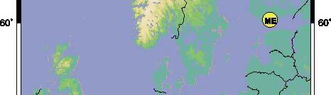

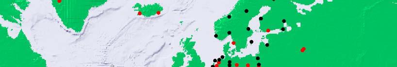
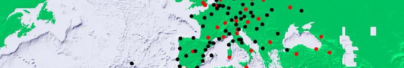
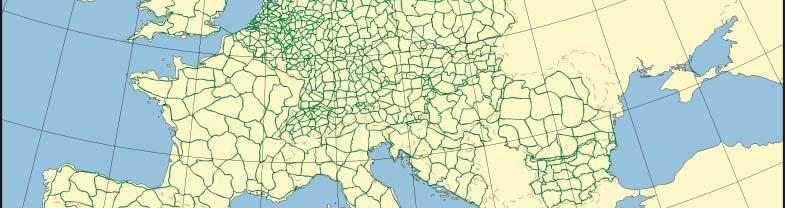
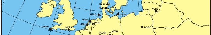
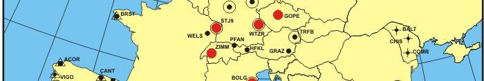
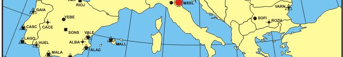
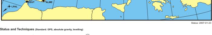
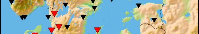
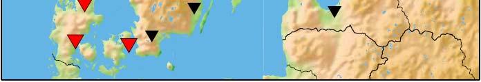
9 Motivation Starting Position Metsähovi UNIGRACE Rostock Wladyslawowo GGP GGP EUVN TG Wettzell Pecny Jozefoslaw Modra Pesky Graz Penc Ljubljana Gilau Trieste Osijek Constanta Varna Dubrovnik Sofia UELN EPN
10 Network Infrastructure 1st Call for Participation (April 2003): Implementation of ECGN Stations Elaboration of the observation network of ECGN stations with the standard observation techniques: - GNSS (GPS/GLONASS, GALILEO) permanent -Gravity(super conducting gravimeter and/or absolute gravimeter) permanent or repeated - Levelling connections to the of UELN/EVRS repeated - Tide gauges permanent - Meteorological o og parameters a permanent. e
11
12 NGOS; Nordic Geodetic Observing System A k f f h P idi f h N di A task force from the Presidium of the Nordic Geodetic Commission (NKG) The Nordic Geodetic Observing System (NGOS) integrates fundamental geodetic techniques for the longterm observation of Earth system parameters NGOS will be a regional implementation and densification of the GGOS
13 NGOS / Key Areas to Study Glacial dynamics, postglacial rebound Crustal stability Global climate change and its consequences NGOS / Key Parameters Height / height systems Sea Level Geodetic position, reference frames Geopotential and gravity anomalies Temporal gravity change


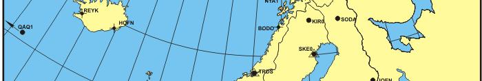
14 NGOS / Geographic extent Formerly and presently ice covered areas of the Northern hemisphere, primarily il Northern Europe and Greenland
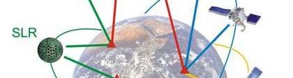
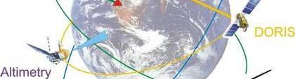
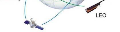
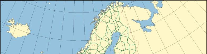
15 NGOS plan, Fennoscandia Absolute gravity points (triangles), Nordic permanent GPS network (upside down triangles) Tide gauges (circles). All absolute gravity points are occupied with a GNSS instrument. + SLR, geo-vlbi, DORIS
16 NGOS Techniques


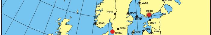
17 Example: Nordic Permanent GNSS Network NKG Analysis Center and National Authorities Contribution to EPN National frames Bifrost NKG WGs
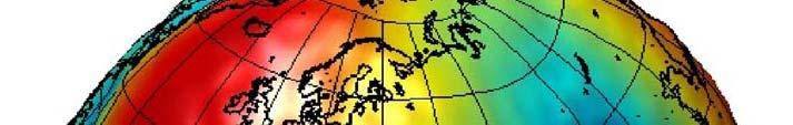
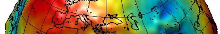
18 Nordic speciality : Postglacial rebound is changing heights
19 Why? Geodetic networks of different techniques separated (reference frames, levelling, gravity) Connection of observations of different techniques Availability of data, access of data Quality control of data Continuation and stability of the infrastructure Response to political and societal needs Delivery or products to the end users Unawareness of geodetic methods
20 How? M. Rothacher
21


22 Motivation for multi- technique sites VLBI SLR GNSS Global Reference Frames BGI Geodynamics Postglacial rebound Earth structure Gravity changes Vertical datums Local coordinates
23 Main contributions of Geodesy to global monitoring 1. Maintenance of a highly hl accurate reference frame as the backbone for all other observation systemsstems Provides the infrastructure and observations to determine and maintain an accurate and stable terrestrial reference frame as the basis for all Earth observations
24 Main contributions of Geodesy to global monitoring 2. Observations of key variables of the Earth system, such as changes in its figure and gravity field, and variations in the Earth's rotation Delivers observations of the changes in the geometry and rotation of the solid Earth as well as changes in the Earth's gravity field.
25 Main contributions of Geodesy to global monitoring 3. Monitoring motion and changes in target areas; regional densification of GNNS networks, extension to tide gauges, g glaciers, tectonically active structures 4. Constrain mass balance, kinematics, rebound, oceanic circulation, ocean and sea dynamics, sea level monitoring,


26 Future?
27 Challenge for geodesy Ignorance and unawareness of geodetic networks and importance of stable and well defined d reference frames is common. Every civilized country needs up-to-date, easily accessible reference frames for its societal tasks, and such frames do not exist without continuous o maintenance. Research of global change is an example of the need of geodesy: stable reference frames and precise geodetic observations
28 To do Convince dear colleagues about the need of geodetic observing system(s) Take a good care of GGOS development + unify conventions of ALL techniques Etblih Establish regional ldensifications (examples: ECGN, NGOS, ; 2-way benefit: use GGOS results locally ll and contribute t to GGOS) Create connections to other organizations (GGOS: a member of GEO) and promote geodesy to the decision p g y makers, politicians and to the great public!
Status. EUREF TWG Meeting November 8 9, 2004, Praha
 ECGN was initiated by IAG Sub-Commission for Europe EUREF (SC1.3a) and IAG Sub-Commission for Europe of the International Gravity and Geoid Commission (IGGC) with relationship to Joint Research Centre
Geodetic Observing Systems: tools in observing the Glacial Isostatic Adjustment. Markku Poutanen Finnish Geodetic Institute
 Geodetic Observing Systems: tools in observing the Glacial Isostatic Adjustment Markku Poutanen Finnish Geodetic Institute Glacial Isostatic Adjustment Land uplift is just one consequence of the physical
The Global Geodetic Observing System (GGOS) of the International Association of Geodesy, IAG
 of the International Association of Geodesy, IAG") The Global Geodetic Observing System (GGOS) of the International Association of Geodesy, IAG Hans-Peter Plag (1), Markus Rothacher (2), Richard Gross (3), Srinivas Bettadpur (4) (1) Nevada Bureau of Mines
The Global Geodetic Observing System (GGOS) of the International Association of Geodesy, IAG Hans-Peter Plag (1), Markus Rothacher (2), Richard Gross (3), Srinivas Bettadpur (4) (1) Nevada Bureau of Mines
The Global Geodetic Observing System (GGOS) of the International Association of Geodesy (IAG)
 of the International Association of Geodesy (IAG)") The Global Geodetic Observing System (GGOS) of the International Association of Geodesy (IAG) Hermann Drewes Representative of the International Union of Geodesy and Geophysics (IUGG) to the Cartographic
The Global Geodetic Observing System (GGOS) of the International Association of Geodesy (IAG) Hermann Drewes Representative of the International Union of Geodesy and Geophysics (IUGG) to the Cartographic
Torsten Mayer-Gürr Institute of Geodesy, NAWI Graz Technische Universität Graz
 GGOS and Reference Systems Introduction 2015-10-12 Torsten Mayer-Gürr Institute of Geodesy, NAWI Graz Technische Universität Graz Torsten Mayer-Gürr 1 Course and exam Lecture Monday 14:00 16:00, A111 (ST01044)
Geodetic applications of GNSS in the Black Sea region
 BALGEOS II - Balkan countries integration into GGOS Second workshop, 27-29 January, 2010 Vienna - AUSTRIA Geodetic applications of GNSS in the Black Sea region Lyubka Pashova CENTRAL LABORATORY OF GEODESY
REGIONAL REFERENCE FRAMES: THE IAG PERSPECTIVE
 REGIONAL REFERENCE FRAMES: THE IAG PERSPECTIVE João Agria Torres SPUIAGG IAG Sub-commission 1.3: Regional Reference Frames jatorres@iol.pt 1. About the IAG CONTENT 2. Objectives and organization of SC
El proyecto Sistema de Observación Geodésico Global [Global Geodetic Observing System (GGOS)] de la Asociación Internacional de Geodesia (IAG)
![El proyecto Sistema de Observación Geodésico Global [Global Geodetic Observing System (GGOS)] de la Asociación Internacional de Geodesia (IAG)](/thumbs/79/79010389.jpg "El proyecto Sistema de Observación Geodésico Global [Global Geodetic Observing System (GGOS)] de la Asociación Internacional de Geodesia (IAG)") El proyecto Sistema de Observación Geodésico Global [Global Geodetic Observing System (GGOS)] de la Asociación Internacional de Geodesia (IAG) Hermann Drewes Deutsches Geodätisches Forschungsinstitut (DGFI)
El proyecto Sistema de Observación Geodésico Global [Global Geodetic Observing System (GGOS)] de la Asociación Internacional de Geodesia (IAG) Hermann Drewes Deutsches Geodätisches Forschungsinstitut (DGFI)
Establishment of a Global Absolute Gravity Network
 Establishment of a Global Absolute Gravity Network H. Wilmes 1), H. Wziontek 1), R. Falk 1), J. Ihde 1), S. Bonvalot 2), R. Forsberg 3), S. Kenyon 4), L. Vitushkin 5) 1) Federal Agency for Cartography
GGOS The Global Geodetic Observing System of the International Association of Geodesy (IAG)
") GGOS The Global Geodetic Observing System of the International Association of Geodesy (IAG) Hansjörg KUTTERER, Germany Key words: Geodetic Reference Frames, Global Geodetic Observing System, International
GGOS The Global Geodetic Observing System of the International Association of Geodesy (IAG) Hansjörg KUTTERER, Germany Key words: Geodetic Reference Frames, Global Geodetic Observing System, International
SIRGAS: Basis for Geosciences, Geodata, and Navigation in Latin America
 SIRGAS: Basis for Geosciences, Geodata, and Navigation in Latin America Claudio Brunini President of SIRGAS Universidad Nacional de La Plata, Argentina María Virginia Mackern President of SIRGAS/WG-I:
GG S. Internal Vision of GGOS. Markus Rothacher. GFZ Potsdam
 Internal Vision of GGOS Markus Rothacher GFZ Potsdam GGOS Retreat DGFI in Munich February 15-16, 2006 Contents Motivation Four Levels of Products of the IAG Services: First Level: Raw Data Collection Second
GG S Global Geodetic Observing System (GGOS): Status and Future. Markus Rothacher, Ruth Neilan, Hans-Peter Plag
: Status and Future. Markus Rothacher, Ruth Neilan, Hans-Peter Plag") 2020 Global Geodetic Observing System (GGOS): Status and Future Markus Rothacher, Ruth Neilan, Hans-Peter Plag GeoForschungsZentrum Potsdam (GFZ) Jet Propulsion Laboratory (JPL) University of Nevada, Reno
2020 Global Geodetic Observing System (GGOS): Status and Future Markus Rothacher, Ruth Neilan, Hans-Peter Plag GeoForschungsZentrum Potsdam (GFZ) Jet Propulsion Laboratory (JPL) University of Nevada, Reno
UN Resolution on GGRF ( and its implementation in Europe)
") Presented at the FIG Working Week 2017, UN Resolution on GGRF ( and its implementation in Europe) May 29 - June 2, 2017 in Helsinki, Finland Markku Poutanen, FGI Contents Global Geodetic Reference Frame
Presented at the FIG Working Week 2017, UN Resolution on GGRF ( and its implementation in Europe) May 29 - June 2, 2017 in Helsinki, Finland Markku Poutanen, FGI Contents Global Geodetic Reference Frame
Reference Systems Realization for the Territory of Bulgaria - Status and Perspectives
 Conference and plenary meeting of the Permanent Committee on Cadastre in the European Union 13-15 March 2018, Sofia Reference Systems Realization for the Territory of Bulgaria - Status and Perspectives
UN-GGIM: Europe GRF-Europe. Markku Poutanen
 UN-GGIM: Europe GRF-Europe Markku Poutanen Global Geodetic Reference Frame GGRF The UN Committee of Experts on Global Geospatial Information Management (UN-GGIM) decided in July 2013 to formulate and facilitate
A Unique Reference Frame: Basis of the Global Geodetic Observing System (GGOS) for Geodynamics and Global Change
 for Geodynamics and Global Change") SRTM (InSAR) A Unique Reference Frame: Basis of the Global Geodetic Observing System (GGOS) for Geodynamics and Global Change Hermann Drewes President IAG Commission 1 Reference Frames Deutsches Geodätisches
SRTM (InSAR) A Unique Reference Frame: Basis of the Global Geodetic Observing System (GGOS) for Geodynamics and Global Change Hermann Drewes President IAG Commission 1 Reference Frames Deutsches Geodätisches
Report for 15th PCGIAP Meeting at 18th UNRCC-AP Working Group 1 Regional Geodesy
 Report for 15th PCGIAP Meeting at 18th UNRCC-AP Working Group 1 Regional Geodesy Chairman Shigeru Matsuzaka, Japan - shigeru@gsi.go.jp Vice Chairman Prof. Pengfei Cheng, China - chengpf@casm.ac.cn John
Status of ECGN Project
 Status of ECGN Project Johannes Ihde, Trevor Baker, Carine Bruyninx, Olivier Francis, Martine Amalvict, Ambrus Kenyeres, Jaakko Makinen, Steve Shipman, Jaroslav Simek, Herbert Wilmes EUREF Symposium 2005
Reference frames and positioning
 The APREF Project: an Improved Geodetic Infrastructure for Asia and the Pacific (4861) John Dawson (Australia), Graeme Blick (New Zealand), Manoj Deo, Guorong Hu and Gary Johnston (Australia) Reference
GGOS The Global Geodetic Observing System of the International Association of Geodesy
 GGOS The Global Geodetic Observing System of the International Association of Geodesy Presented at the FIG Working Week 2017, May 29 - June 2, 2017 in Helsinki, Finland Hansjörg Kutterer BKG, Germany Content
Global & National Geodesy, GNSS Surveying & CORS Infrastructure
 Global & National Geodesy, GNSS Surveying & CORS Infrastructure Chris Rizos School of Surveying & Spatial Information Systems University of New South Wales, Sydney, Australia President-elect, International
Dependences in the pillar Earth s gravity field of
 Reports on Geodesy, vol. 92, no. 1, 2012 Dependences in the pillar Earth s gravity field of GGOS - description using UML notation Małgorzata Paśnicka 1, Karolina Szafranek 2, Agnieszka Zwirowicz Rutkowska
Strategy for the Realization of the International Height Reference System (IHRS)
") Deutsches Geodätisches Forschungsinstitut (DGFI-TUM) Technische Universität München Strategy for the Realization of the International Height Reference System (IHRS) Laura Sánchez 1, Johannes Ihde 2, Roland
Deutsches Geodätisches Forschungsinstitut (DGFI-TUM) Technische Universität München Strategy for the Realization of the International Height Reference System (IHRS) Laura Sánchez 1, Johannes Ihde 2, Roland
GPS time series and sea level
 GPS time series and sea level M. Poutanen 1, H. Koivula 1, M. Tervo 1,2, K. Kahma 3, M. Ollikainen 1, H. Virtanen 1 1 Finnish Geodetic Institute, 2 University of Helsinki, 3 Finnish Institute of Marine
The Implementation of the ECGN Stations Status of the 1 st Call for Participation
 The Implementation of the ECGN Stations Status of the 1 st Call for Participation Johannes Ihde, Trevor Baker, Carine Bruyninx, Olivier Francis, Martine Amalvict, Ambrus Kenyeres, Jaakko Makinen, Steve
Update on the International Terrestrial Reference Frame (ITRF) : ITRF2014. Zuheir Altamimi
 : ITRF2014. Zuheir Altamimi") Update on the International Terrestrial Reference Frame (ITRF) : ITRF2014 Zuheir Altamimi Head of the IERS ITRF Product Center IAG Vice President IGN, France E-mail: zuheir.altamimi@ign.fr Key Points Introduction:
Update on the International Terrestrial Reference Frame (ITRF) : ITRF2014 Zuheir Altamimi Head of the IERS ITRF Product Center IAG Vice President IGN, France E-mail: zuheir.altamimi@ign.fr Key Points Introduction:
ECGN - Development of the European Combined Geodetic Network in Austria
 ECGN - Development of the European Combined Geodetic Network in Austria Diethard Ruess 1, Gelöscht: BEV Dept. Control Survey Abstract Austria takes part in the European Combined Geodetic Network - Project
A Strategic Plan for Geodesy in Sweden. Mikael Lilje Lars E. Engberg Geodesy Department Lantmäteriet Sweden
 A Strategic Plan for Geodesy in Sweden Mikael Lilje Lars E. Engberg Geodesy Department Lantmäteriet Sweden Our vision is to be able to meet Swedish society s needs for a homogeneous, sustainable geodetic
From Global to National Geodetic Reference Frames: how are they connected and why are they needed?
 From Global to National Geodetic Reference Frames: how are they connected and why are they needed? Zuheir ALTAMIMI Institut National de l Information Géographique et Forestière, France Vice-President,
National Report of Sweden to the EUREF 2004 Symposium
 1 National Report of Sweden to the EUREF 2004 Symposium - geodetic activities at Lantmäteriet, the National Land Survey of Sweden Edited by Dan Norin Lantmäteriet, SE-801 82 Gävle, Sweden, dan.norin@lm.se
Linking the Global Geodetic Observing System (GGOS) (IGOS-P) through the Theme Earth System Dynamics. with the Integrated Global Observing Strategy
 (IGOS-P) through the Theme Earth System Dynamics. with the Integrated Global Observing Strategy") Linking the Global Geodetic Observing System (GGOS) to the Integrated Global Observing Strategy Partnership (IGOS-P) through the Theme Earth System Dynamics H.-P. Plag, Nevada Bureau of Mines and Geology
Linking the Global Geodetic Observing System (GGOS) to the Integrated Global Observing Strategy Partnership (IGOS-P) through the Theme Earth System Dynamics H.-P. Plag, Nevada Bureau of Mines and Geology
Fundamental Station Wettzell - geodetic observatory -
 Fundamental Station Wettzell - geodetic observatory - Wolfgang Schlüter Bundesamt für Kartographie und Geodäsie, Fundamental Station Wettzell Germany Radiometer Workshop, Wettzell, 10.10.06 Evolvement
Contributions of Geodesy to Oceanography
 Contributions of Geodesy to Oceanography B. Tapley and J. Ries Center for Space Research, The University of Texas at Austin Dynamic Planet 2005 Cairns, Australia August 22-26, 2005 August 22-26, 2005 Dynam
International Gravity Field Service (IGFS)
") IAG-Services: International Gravity Field Service (IGFS) 477 International Gravity Field Service (IGFS) http://www.gravityfield.org Chairman: Renè Forsberg (Denmark, 2011-2013) - Riccardo Barzaghi (Italy,
IAG-Services: International Gravity Field Service (IGFS) 477 International Gravity Field Service (IGFS) http://www.gravityfield.org Chairman: Renè Forsberg (Denmark, 2011-2013) - Riccardo Barzaghi (Italy,
Realization of the vertical datum and height system of Lithuania
 Realization of the vertical datum and height system of Lithuania B. Krikstaponis, E. Parseliunas, P. Petroskevicius, R. Putrimas, A. Zakarevicius Vilnius Gediminas Technical University, Sauletekio al.
The Interactions between IGS and GGOS
 The Interactions between IGS and GGOS Markus Rothacher Institute of Geodesy and Photogrammetry (IGP) ETH Zurich, Switzerland 2012 IGS Workshop July 23-27, 2012, Olsztyn, Poland Overview GGOS Vision, Mission
On the Use of Crustal Deformation Models. in the Management of ETRS89 Realizations in Fennoscandia
 On the Use of Crustal Deformation Models Presented at the FIG Working Week 2017, May 29 - June 2, 2017 in Helsinki, Finland in the Management of ETRS89 Realizations in Fennoscandia Martin Lidberg, Jonas
GGOS Bureau for Standards and Conventions
 GGOS D. Angermann (1), T. Gruber (2), J. Bouman (1), M. Gerstl (1), R. Heinkelmann (1), U. Hugentobler (2), L. Sánchez (1), P. Steigenberger (2) (1) Deutsches Geodätisches Forschungsinstitut (DGFI), München
MEMORANDUM OF UNDERSTANDING
 MEMORANDUM OF UNDERSTANDING between A: EUREF, the Reference Frame Sub-Commission for Europe of the International Association of Geodesy (IAG) and B: EUMETNET, the Network of European Meteorological Services.
Publ. Astron. Obs. Belgrade No. 91 (2012), REALIZATION OF ETRF2000 AS A NEW TERRESTRIAL REFERENCE FRAME IN REPUBLIC OF SERBIA
, REALIZATION OF ETRF2000 AS A NEW TERRESTRIAL REFERENCE FRAME IN REPUBLIC OF SERBIA") Publ. Astron. Obs. Belgrade No. 91 (2012), 199-206 Contributed paper REALIZATION OF ETRF2000 AS A NEW TERRESTRIAL REFERENCE FRAME IN REPUBLIC OF SERBIA D. BLAGOJEVIĆ and V. VASILIĆ Faculty of Civil Engineering,
Publ. Astron. Obs. Belgrade No. 91 (2012), 199-206 Contributed paper REALIZATION OF ETRF2000 AS A NEW TERRESTRIAL REFERENCE FRAME IN REPUBLIC OF SERBIA D. BLAGOJEVIĆ and V. VASILIĆ Faculty of Civil Engineering,
European Vertical Reference System (EVRS) 2007 a Combination of UELN and ECGN
 2007 a Combination of UELN and ECGN") European Vertical Reference System (EVRS) 2007 a Combination of UELN and ECGN Johannes Ihde, Martina Sacher, Jaakko Mäkinen EUREF Symposium 2006 Riga, June 2006 EUREF Symposium 2006 2 I. Objectives of
European Vertical Reference System (EVRS) 2007 a Combination of UELN and ECGN Johannes Ihde, Martina Sacher, Jaakko Mäkinen EUREF Symposium 2006 Riga, June 2006 EUREF Symposium 2006 2 I. Objectives of
New satellite mission for improving the Terrestrial Reference Frame: means and impacts
 Fourth Swarm science meeting and geodetic missions workshop ESA, 20-24 March 2017, Banff, Alberta, Canada New satellite mission for improving the Terrestrial Reference Frame: means and impacts Richard
GGOS INFORMATION MODELS: ANALYSIS OF INTERRELATIONS BETWEEN OBSERVATION TECHNIQUES AND THE EARTH GRAVITY FIELD
 GGOS INFORMATION MODELS: ANALYSIS OF INTERRELATIONS BETWEEN OBSERVATION TECHNIQUES AND THE EARTH GRAVITY FIELD Wojciech Pachelski 1) Małgorzata Paśnicka-Pawłowska 2) Karolina Szafranek 3) Agnieszka Zwirowicz
What are the social, technical, environmental and economic benefits and opportunities of accessing and sharing geodetic data?
 What are the social, technical, environmental and economic benefits and opportunities of accessing and sharing geodetic data? Graeme Blick Group Manager Positioning and Resilience Land Information New
Tide Gauge Benchmark Monitoring Need for Reprocessing in Europe. Tilo Schöne & the IGS TIGA Working Group
 Tide Gauge Benchmark Monitoring Need for Reprocessing in Europe Tilo Schöne & the IGS TIGA Working Group Vertical Tide Gauge Control Long-term stable and consistent frame to relate globally distributed
Lecture 2 Measurement Systems. GEOS 655 Tectonic Geodesy
 Lecture 2 Measurement Systems GEOS 655 Tectonic Geodesy VLBI and SLR VLBI Very Long Baseline Interferometry SLR Satellite Laser Ranging Very Long Baseline Interferometry VLBI Geometric Delay δg S Baseline
Challenges and perspectives for CRF and TRF determination
 Challenges and perspectives for CRF and TRF determination J. Böhm, Z. Malkin, S. Lambert, C. Ma with contributions by H. Spicakova, L. Plank, and H. Schuh Consistency TRF EOP CRF ITRF2008 from VLBI/GNSS/SLR/DORIS
NATIONAL REPORT OF POLAND TO EUREF 2011
 NATIONAL REPORT OF POLAND TO EUREF 2011 Jan Krynski Institute of Geodesy and Cartography, Warsaw Jerzy B. Rogowski Warsaw University of Technology, Warsaw Outline Main geodetic activities at the national
Co-location of VLBI with other techniques in space: a simulation study
 Co-location of VLBI with other techniques in space: a simulation study B. Männel, M. Rothacher ETH Zürich, Geodesy and Geodynamics Lab 7 th IGS General Meeting, Madrid 212 1 Reference frame and local ties
The European height reference system and its realizations
 The European height reference system and its realizations Martina Sacher, Gunter Liebsch EUREF symposium 2015 Tutorial Height & Gravity June 02, Leipzig, Germany Contents 1. UELN-forerunner - Steps of
Global vertical datum unification based on the combination of the fixed gravimetric and the scalar free geodetic boundary value problems
 Global vertical datum unification based on the combination of the fixed gravimetric and the scalar free geodetic boundary value problems Laura Sánchez contribution to the IAG-IC.: Vertical Reference Frames
Do we need new definitions for the EVRS and EVRF?
 Do we need new definitions for the EVRS and EVRF? Jaakko Mäkinen Finnish Geodetic Institute Jaakko.Makinen@fgi.fi Yes, it is unavoidable Background EVRS2000 is defined as a World Height System: reference
GGOS. Global Geodetic Observing System. Carey Noll NASA GSFC (on behalf of GGOS) WDS Forum September 11, 2016
 WDS Forum September 11, 2016") https://ntrs.nasa.gov/search.jsp?r=20160011397 2018-12-07T18:04:29+00:00Z GGOS Global Geodetic Observing System Carey Noll NASA GSFC (on behalf of GGOS) WDS Forum September 11, 2016 Global Geodetic Observing
https://ntrs.nasa.gov/search.jsp?r=20160011397 2018-12-07T18:04:29+00:00Z GGOS Global Geodetic Observing System Carey Noll NASA GSFC (on behalf of GGOS) WDS Forum September 11, 2016 Global Geodetic Observing
geodynamics
 FGI report on geodynamics 2010-2011 Ruotsalainen H., M.Poutanen J. Mäkinen, M. Bilker- Koivula, M. Nordman, V. Saaranen K. Arsov, N.Zubko, H. Virtanen, U.Kallio, J. Jokela, P. Häkli, H. Koivula, J. Näränen,
The GGOS as the backbone for global observing and local monitoring: A user driven perspective
 Journal of Geodynamics 40 (2005) 479 486 The GGOS as the backbone for global observing and local monitoring: A user driven perspective H.-P. Plag Geodetic Institute, Norwegian Mapping Authority, Honefoss,
Physical Dynamics of the Coastal Zone in the Mediterranean on Annual to Decadal Scales
 Physical Dynamics of the Coastal Zone in the Mediterranean on Annual to Decadal Scales Hans-Peter Plag Nevada Bureau of Mines and Geology and Seismological Laboratory University of Nevada, Reno, Nevada,
Specification of the Baltic Sea Chart Datum 2000 (BSCD2000)
") Specification of the Baltic Sea Chart Datum 2000 (BSCD2000) DRAFT by Jonas Ågren, Gunter Liebsch and Jyrki Mononen Version 3a, 2018-02-06 1. Definition The Baltic Sea Chart Datum 2000 (BSCD2000) is a geodetic
Specification of the Baltic Sea Chart Datum 2000 (BSCD2000) DRAFT by Jonas Ågren, Gunter Liebsch and Jyrki Mononen Version 3a, 2018-02-06 1. Definition The Baltic Sea Chart Datum 2000 (BSCD2000) is a geodetic
Group on Earth Observations (GEO) Cold Regions Work Plan Item WA-01-C3
 Cold Regions Work Plan Item WA-01-C3") EC Panel of Experts on Polar Observations, Research and Services Group on Earth Observations (GEO) Cold Regions Work Plan Item WA-01-C3 Barbara J. Ryan Secretariat Director Lanzhou, China 13 March 2013
EC Panel of Experts on Polar Observations, Research and Services Group on Earth Observations (GEO) Cold Regions Work Plan Item WA-01-C3 Barbara J. Ryan Secretariat Director Lanzhou, China 13 March 2013
Geocentric Reference System for the Americas 4th Session UN-GGIM Americas April 2017, Santiago, Chile
 Geocentric Reference System for the Americas 4th Session UN-GGIM Americas April 2017, Santiago, Chile María Virginia Mackern Vicepresidente SIRGAS Consejo Nacional de Investigaciones Científicas y Técnicas,
GGSP: Realisation of the Galileo Terrestrial Reference Frame
 Galileo Geodetic Service Provider Prototype GGSP: Realisation of the Galileo Terrestrial Reference Frame Wolfgang Söhne, Johannes Ihde Federal Agency for Cartography and Geodesy Gerd Gendt, Markus Rothacher
Incorporation of the Caribbean to the Geocentric Reference System for the Americas SIRGAS
 Incorporation of the Caribbean to the Geocentric Reference System for the Americas SIRGAS W. Martínez M. V. Mackern V. Cioce R. Rodino S.R. De Freitas UN-GGIM: Americas Third Session, October 5 2016, Mexico
Geodesy. orientation. shape. gravity field
 Geodesy noun Science of measuring the shape, orientation and gravity field of the Earth and how it changes over time. shape orientation gravity field Positioning has always been important Downstream applications
INTERNATIONAL SLR SERVICE
 ARTIFICIAL SATELLITES, Vol. 46, No. 4 2011 DOI: 10.2478/v10018-012-0004-z INTERNATIONAL SLR SERVICE Stanisław Schillak Space Research Centre, Polish Academy of Sciences Astrogeodynamic Observatory, Borowiec
A Glimpse at Geodetic Activities in Latin America
 UNIVERSIDADE DO ESTADO DO RIO DE JANEIRO CENTRO DE TECNOLOGIA E CIÊNCIAS FACULDADE DE ENGENHARIA DEPARTAMENTO DE ENGENHARIA CARTOGRÁFICA A Glimpse at Geodetic Activities in Latin America Prof. Luiz Paulo
Modernization of National Geodetic Datum in China *
 UNITED NATIONS E/CONF.102/IP.16 ECONOMIC AND SOCIAL COUNCIL Nineteenth United Nations Regional Cartographic Conference for Asia and the Pacific Bangkok, 29 October 1 November 2012 Item 6(b) of the provisional
One Year with Our Absolute Gravimeter
 Mikael LILJE, Jonas ÅGREN, Andreas ENGFELDT and Per-Anders OLSSON, Sweden ABSTRACT In 2006 Lantmäteriet (the National Land Survey of Sweden) bought an absolute gravimeter (Micro-g Lacoste FG5) together
Roadmap Towards Future Satellite Gravity Missions in Support of Monitoring of Mass Redistribution, Global Change, and Natural Hazards
 Roadmap Towards Future Satellite Gravity Missions in Support of Monitoring of Mass Redistribution, Global Change, and Natural Hazards STRATEGIC TARGET A multi-decade, continuous series of space-based observations
Gravimetry as a tool for hydrologic research at the Sutherland Observatory
 Gravimetry as a tool for hydrologic research at the Sutherland Observatory Andreas Güntner, Christoph Förste, Theresa Blume GFZ German Research Centre for Geosciences Gaathier Mahed, Maarten De Wit, Moctour
A New Transformation Including Deformation Model for the Nordic and Baltic Countries
 A New Transformation Including Deformation Model for the Nordic and Baltic Countries Pasi HÄKLI, Finland, Martin LIDBERG, Sweden, Lotti JIVALL, Sweden, Torbjørn NØRBECH, Norway, Oddvar TANGEN, Norway,
International Union of Geodesy and Geophysics. Resolutions
 International Union of Geodesy and Geophysics Resolutions ADOPTED BY THE COUNCIL AT THE XXVI GENERAL ASSEMBLY PRAGUE, CZECH REPUBLIC (22 JUNE 2 JULY 2015) 0 Page Resolution 1: Role of Ocean in Climate
Call for space geodetic solutions corrected for non-tidal atmospheric loading (NT-ATML) at the observation level
 at the observation level") Call for space geodetic solutions corrected for non-tidal atmospheric loading (NT-ATML) at the observation level Xavier Collilieux, Tonie van Dam, Zuheir Altamimi Outline: Context Why correcting for non-tidal
Call for space geodetic solutions corrected for non-tidal atmospheric loading (NT-ATML) at the observation level Xavier Collilieux, Tonie van Dam, Zuheir Altamimi Outline: Context Why correcting for non-tidal
What we know about regional sea level rise and how we are affected by variations from the global mean
 regional sea level rise and variations from the global Magnus Hieronymus 2018 Regional and Global Sea level Global Density change: thermosteric Regional Density change: thermosteric+ halosteric Land Ice
Contributions of geodesy to monitoring natural hazards and global change
 Contributions of geodesy to monitoring natural hazards and global change Prof. Dr. Harald Schuh Director Dept. 1: Geodesy and Remote Sensing Helmholtz Centre Potsdam, GFZ German Research Centre for Geosciences
C o p e r n i c u s a n d W I G O S
 C o p e r n i c u s a n d W I G O S Jean-Noël Thépaut & Mark Dowell 24 October 2017 GEO XIV, Washington DC, 23-28 October 2017 T h e C o p e r n i c u s P r o g r a m m e Copernicus is the European Union
Preface. About this book. Background
 Foreword The Global Geodetic Observing System (GGOS) has been established by the International Association of Geodesy (IAG) in order to integrate the three fundamental areas of geodesy, so as to monitor
Status of ECGN Project
 Status of ECGN Project Johannes Ihde, Trevor Baker, Carine Bruyninx, Olivier Francis, Martine Amalvict, Ambrus Kenyeres, Jaakko Makinen, Steve Shipman, Jaroslav Simek, Herbert Wilmes EUREF Symposium 2005
Vertical Reference Frame Pacific
 Vertical Reference Frame Pacific Andrick Lal SPC Geoscience Division GIS&RS User Conference 29 th November 2016 USP, Fiji. What does it mean? All buildings and features have a height. But what is it relative
Frames for the Future New Datum Definitions for Modernization of the U.S. National Spatial Reference System
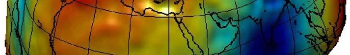
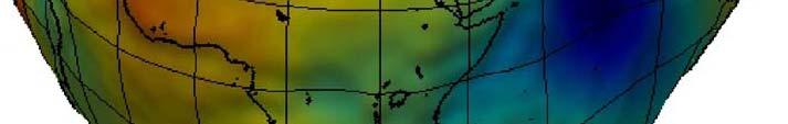
 Figure 10. Horizontal position differences (in meters) between NAD 83 and ITRF 08 at time 2022.00 (January 1, 2022). Positional differences are shown for the North American and Pacific tectonic plates.
Geodetic Observations and Global Reference Frame Contributions to Understanding Sea Level Rise and Variability
 Geodetic Observations and Global Reference Frame Contributions to Understanding Sea Level Rise and Variability G. Blewitt (1), Z. Altamimi (2), J. Davis (3), R. Gross (4), C. Kuo (5), F. Lemoine (6), R.Neilan
What does EUREF considers as a realisation of EVRS?
 1 (1) DRAFT PM 2010-05-24 previous versions: 2010-03-08 2010-02-15 What does EUREF considers as a realisation of EVRS? Contents Contents...1 Purpose of document...1 Short review on activities towards a
Working Group 1. Geodetic Reference Frame. Activity Report. for. The UN-GGIM-AP Plenary Meeting
 Regional Committee of United Nations Global Geospatial Information Management for Asia and the Pacific (UN-GGIM-AP) Established by a United Nations Resolution Working Group 1 Geodetic Reference Frame Activity
Splinter meeting at GGHS2016 Wednesday, Sept. 21, 2016 Laura Sánchez
 Working Group on the Strategy for the Realization of the International Height Reference System (IHRS) Splinter meeting at GGHS2016 Wednesday, Sept. 21, 2016 Laura Sánchez -Brainstorming and definition
IGFS Structure Director : Rene Forsberg
 IGFS Structure Director : Rene Forsberg International Gravimetric Bureau (BGI) Director S. Bonvalot International Geoid Service (IGeS) Director R. Barzaghi International Center for Global Earth Models
geodynamics
 FGI activity report on geodynamics 2009-2010 Ruotsalainen H., J. Mäkinen, M. Bilker- Koivula, M. Nordman, V. Saaranen,K.Arsov, J.Virtanen, H. Virtanen, U.Kallio, J. Jokela, P. Häkli, H. Koivula, M.Poutanen,
National Report for Finland. Jaakko Mäkinen, Markku Poutanen, Hannu Koivula, Matti Ollikainen, Hannu Ruotsalainen and Heikki Virtanen
 Nordic Geodetic Commission Joint Meeting of Working Group for Geodynamics Working Group for Satellite Geodesy Working group for Geoid Determination Hönefoss, October 8 to 10, 2001 National Report for Finland
NKG2016LU, an improved postglacial land uplift model over the Nordic-Baltic region
 NKG2016LU, an improved postglacial land uplift model over the Nordic-Baltic region Olav Vestøl, Jonas Ågren, Holger Steffen, Halfdan Kierulf, Martin Lidberg, Tõnis Oja, Andres Rüdja, Veikko Saaranen, Casper
The BIFROST Project: 21 years of search for the true crustal deformation in Fennoscandia
 The BIFROST Project: 21 years of search for the true crustal deformation in Fennoscandia Martin Lidberg and Holger Steffen Lantmäteriet, Sweden Jan Johansson Chalmers University of Technology Halfdan Kierulf
Global Geodetic Reference Frame GGRF & Implications for GNSS
 Global Geodetic Reference Frame GGRF & Implications for GNSS On behalf of Gary Johnston Chair GIAC, Ruth Neilan Vice Chair, Global Geodetic Observing System ICG-9 Prague, 10 November 2014 UN GGRF Working
COUNTRY REPORT THE SEVENTEENTH PERMANENT COMMITTEE ON GIS INFRASTRUCTURE FOR ASIA AND THE PACIFIC (PCGIAP) MEETING JULY 21 22, 2011,
 MEETING JULY 21 22, 2011,") COUNTRY REPORT INDONESIA ACTIVITIES IN 2010 THE SEVENTEENTH PERMANENT COMMITTEE ON GIS INFRASTRUCTURE FOR ASIA AND THE PACIFIC (PCGIAP) MEETING JULY 21 22, 2011, CHINGGIS KHAAN HOTEL, ULAANBAATAR CITY,
COUNTRY REPORT INDONESIA ACTIVITIES IN 2010 THE SEVENTEENTH PERMANENT COMMITTEE ON GIS INFRASTRUCTURE FOR ASIA AND THE PACIFIC (PCGIAP) MEETING JULY 21 22, 2011, CHINGGIS KHAAN HOTEL, ULAANBAATAR CITY,
Height systems. Rudi Gens Alaska Satellite Facility
 Rudi Gens Alaska Satellite Facility Outline Why bother about height systems? Relevant terms Coordinate systems Reference surfaces Geopotential number 2 Why bother about height systems? give a meaning to
Consideration of a Global Vertical Reference System (GVRS) in the IERS Conventions
 in the IERS Conventions") Consideration of a Global Vertical Reference System (GVRS) in the IERS Conventions Johannes Ihde Federal Agency for Cartography and Geodesy (BKG) Chair of IAG ICP1.2 (2003-2007) Vertical Reference Frames
Consideration of a Global Vertical Reference System (GVRS) in the IERS Conventions Johannes Ihde Federal Agency for Cartography and Geodesy (BKG) Chair of IAG ICP1.2 (2003-2007) Vertical Reference Frames
Challenges and Perspectives for TRF and CRF Determination
 , IVS 2012 General Meeting Proceedings, p.309 313 http://ivscc.gsfc.nasa.gov/publications/gm2012/boehm.pdf Johannes Böhm 1, Zinovy Malkin 2, Sebastien Lambert 3, Chopo Ma 4 1) Vienna University of Technology
A Mission to Planet Mars Gravity Field Determination
 A Mission to Planet Mars Gravity Field Determination Department for Theoretical Geodesy Graz University of Technology and Space Research Institute Austrian Academy of Sciences Gravity field CHAMP GRACE
New height reference surfaces for Norway
 154 European Vertical System New height reference surfaces for Norway D. SOLHEIM 1 Abstract In this article the computation of height reference surfaces at Statens kartverk is described. The difference
Geodetic Observations and Global Reference Frame Contributions to Understanding Sea - Level Rise and Variability
 9 Geodetic Observations and Global Reference Frame Contributions to Understanding Sea - Level Rise and Variability Geoff Blewitt, Zuheir Altamimi, James Davis, Richard Gross, Chung-Yen Kuo, Frank G. Lemoine,
Development of the Czech National Geodetic Control
 252 National Reports Development of the Czech National Geodetic Control J. KOSTELECKÝ 1,2, J. IMEK 1, F. BENEš 3, J. PROVŠZEK 3 1. Densification of EUREF in the Czech Republic, DGPS method In the years
Tectonic deformations in Greece and the operation of HEPOS network
 Tectonic deformations in Greece and the operation of HEPOS network M. Gianniou KTIMATOLOGIO S.A. (Hellenic Cadastre) Abstract Today, networks of permanent reference stations are broadly used for the realization
GNSS Observations & Sea Level
 with contributions from: - Marta Marcos - Alvaro Santamaria - GNSS Observations & Sea Level Guy Wöppelmann gwoppelm@univ-lr.fr Outline: 1. Introduction 2. The importance of Vertical Land Motions 3. The
CEGRN Consortium. A first campaign took place in Since 1997, each two years, a weekly campaign has been observed, normally in June.
 CEGRN 2015 Campaign A. Caporali (1), J. Zurutuza (1), O. Khoda (2), G. Stangl (3), M. Becker (4), M. Bertocco (1), L. Gerhatova (5), M. Mojzes (5), M. Mulic (6), Yu. Stopkhay (7), C. Nagorneac (8), A.