West of Wedge Zone Assessment
|
|
|
- Osborn Anderson
- 5 years ago
- Views:
Transcription
1 Appendix 11 West of Wedge Zone Assessment


2 INITIAL ENVIRONMENTAL ASSESSMENT FOR THE ESTABLISHMENT OF A NEW MARINE FARMING ZONE: WEST OF WEDGE, SOUTHERN TASMANIA Report to Tassal November
3 Document Control and Distribution Date Name Company Document Type Version Copies 9/11/2016 Linda Sams Tassal Electronic /2/2016 Matt Barrenger Tassal Electronic COPYRIGHT: The concepts and information contained in this document are the property of Aquenal Pty Ltd. Use or copying of this document in whole or in part without the written permission of Aquenal Pty Ltd constitutes an infringement of copyright. DISCLAIMER: This report has been prepared on behalf of and for the exclusive use of Aquenal Pty Ltd s client and is subject to and issued in connection with the provisions of the agreement between Aquenal Pty Ltd and its Client. Aquenal Pty Ltd accepts no liability or responsibility whatsoever for or in respect of any use of or reliance upon this report by any third party. Tassal Zone Assessment West of Wedge 2
4 TABLE OF CONTENTS Table of Contents... 3 List of Figures... 4 List of Tables... 4 Executive Summary Introduction Methods Bathymetric mapping Sediment sampling Video data collection - Remotely Operated Vehicle (ROV) Benthic habitat mapping Targeted Gazameda gunnii survey Results Bathymetric Mapping Sediment sampling Video data collection Benthic habitat mapping Targeted Gazameda gunnii survey References Appendices GPS coordinates sediment sampling GPS coordinates ROV video surveys GPS coordinates targeted Gazameda gunnii survey Operational Summary Tassal Zone Assessment West of Wedge 3
5 LIST OF FIGURES Figure 1 Location of zone assessment area, as indicated in red... 6 Figure 2. Location of ROV dives and sediment grabs within the zone assessment area Figure 3 Bathymetric map of the proposed West of Wedge Zone area Figure 4 Bathymetric map of the proposed West of Wedge Zone area with track log overlaid Figure 5. Benthic habitats within the proposed West of Wedge Island assessment area Figure 6. Frame grabs from ROV survey showing representative image of ridged sand habitat Figure 7. Map showing lease block areas where targeted Gazameda gunnii sampling was undertaken.. 23 Figure 8. Results of targeted Gazameda gunnii survey within the proposed West of Wedge zone (Lease block 1) Figure 9. Results of targeted Gazameda gunnii survey within the proposed West of Wedge zone (Lease block 2) Figure 10. Results of targeted Gazameda gunnii survey within the proposed West of Wedge zone (Lease block 3) Figure 11. Results of targeted Gazameda gunnii survey within the proposed West of Wedge zone (Lease block 4) Figure 12. Live specimen of the native screw shell, Gazameda gunnii, collected during the targeted survey. Scale bar = 5 cm LIST OF TABLES Table 1. Sediment sample descriptions for the thirty five samples taken within the proposed marine farming zone. Sampling coordinates are included in Appendix Table 2. Video descriptions for the thirty ROV dives taken within the proposed marine farming zone Table 3. Coordinates showing location of relocated Gazameda gunnii Tassal Zone Assessment West of Wedge 4
6 EXECUTIVE SUMMARY An environmental assessment of a proposed marine farming zone extension west of Wedge Island was conducted during August and September The assessment area covered km 2 (1127 ha), with depths ranging from m. The seabed was gently sloping, with deepest depths measured towards the southwest and shallower depths measured towards the northeast section of the assessment area. Based on the survey outputs, benthic habitats within the 1127 ha zone assessment area were determined to comprise entirely of ridged sand. Environmental data on substrate type, habitat distribution, bathymetry, and benthic flora and fauna were assessed. Video and bathymetry surveys showed the seabed to be relatively featureless and characterised by dark orange brown sand with shell grit throughout the survey area. Diverse assemblages of invertebrates were recorded from 35 sediment grabs spread across the survey area, with no strong patterns in community assemblage composition across the area assessed. A range of faunal groups were observed in the sediment samples including anthozoans, crustaceans (e.g. amphipods, cumaceans, decapods, ostracods, tanaids), molluscs, echinoderms and polychaete worms. One of the most common taxa recorded was the bivalve Glycymeris striatularis which was recorded from 15 of the 40 grab samples collected. Other prominent taxa included an anthozoan (Family Edwardsiidae), brittles stars (Ophiura kinbergi) and trumpet worms (Family Pectinariidae). All of the sediment samples were odourless. One dead shell of the threatened screw shell Gazameda gunnii shell was detected from the 35 samples that were used to characterise sediment condition and fauna communities. A further 120 grab samples were collected as part of targeted sampling effort for Gazameda gunnii. Five Gazameda gunnii were detected across the 120 sites, including a single live specimen and four dead shells. Some old and eroded Gazameda sp. shells were also recorded during the survey, these shells could not be reliably identified as they also resembled the closely related G. tasmanica. Tassal Zone Assessment West of Wedge 5

7 1 INTRODUCTION The Marine Farming Planning Act (1995) requires the preparation of an environmental impact statement in order to assess the suitability of proposed sites for marine farming activities in Tasmania. This report details the extent, depth and details of the substrate, including dominant flora and fauna, comprising the habitat west of Wedge Island in Storm Bay, south eastern Tasmania. The environmental assessment was conducted during August and September Environmental data on substrate type, habitat distribution, bathymetry, benthic flora and fauna were collected. Targeted surveys for the threatened screw shell Gazameda gunnii were also conducted. The survey area covered km2 (1127 ha) (Figure 1). The zone assessment area is indicated in Figure 1 below. It should be noted that a previous zone assessment for West of Wedge was conducted by IMAS in The zone area has since been moved to the north. Although there was some overlap between the previous and new zone proposals, a complete zone assessment was conducted, providing an up to date assessment of the proposed zone area. Note that all methodologies and sampling activities were in accordance with the zone assessment guidelines (DPIPWE 2016). Figure 1 Location of zone assessment area, as indicated in red. Tassal Zone Assessment West of Wedge 6
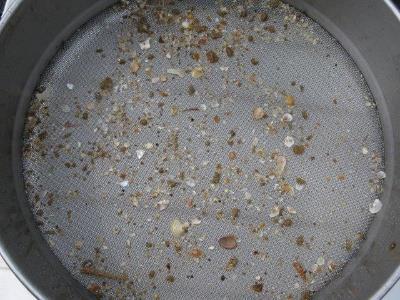
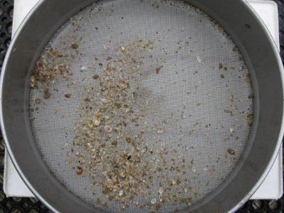
8 2 METHODS 2.1 BATHYMETRIC MAPPING Bathymetric mapping was conducted along 50 m-spaced transects using single beam. A total of 56 transects at approximately 2 km length were travelled at an average speed of approximately 6 knots. The proposed zone was mapped using a vessel mounted Garmin GPS Map 551s running a dual frequency 50/200 transducer. The DGPS signal was from FUGRO, logged through a Trimble TSC1 DGPS station mounted directly above the logging transducer. DGPS positions and water depth were logged every two seconds to Seabed Mapper run on a laptop computer. The depths were tidally and barometrically corrected for Chart Datum using appropriate tide charts and observations from the Bureau of Meteorology station of Hobart. Bathymetric data was mapped with contour lines at intervals of 0.5 m. Note that the data is available in a format suitable for input to DEPOMOD depositional modelling software, and in a format to comply with the DPIPWE zone assessment guidelines. 2.2 SEDIMENT SAMPLING A total of 35 sites were sampled, as per DPIPWE s (2016) specifications for a survey area < 1500 Ha. (Figure 2). Sediment samples were collected using a Van-Veen grab. Once on board the vessel, sediment samples were emptied into a tote box before being photographed and characterised based on colour, texture, layering and odour. Sediment samples were then sieved through a 4 mm sieve and assessed for the presence of large biota, with particular attention paid to examination of sediments for the presence of the threatened screw shell, Gazameda gunnii. All samples were photographed for future reference. 2.3 VIDEO DATA COLLECTION - REMOTELY OPERATED VEHICLE (ROV) Video footage was captured to obtain detailed information on habitat attributes and to verify benthic habitat classification. A total of 30 spot dives were conducted, as per DPIPWE s (2016) specifications for a Tassal Zone Assessment West of Wedge 7
9 survey area < 1500 Ha. The appearance of the seabed was recorded by filming spot dives of the sea floor using a Seabotix LBV150SE Remote Operated Vehicle (ROV). High definition footage was also recorded using a GoPro Hero4 camera mounted to the ROV. Figure 2. Location of ROV dives and sediment grabs within the zone assessment area. 2.4 BENTHIC HABITAT MAPPING Benthic habitat mapping was conducted in conjunction with the bathymetry, video and sediment surveys. Bottom discrimination was undertaken using a Raymarine E120 system running a DSM300 1kW focussed beam, dual frequency transducer. Substrate types were identified based on acoustic roughness and hardness, and were confirmed against video and sediment samples. 2.5 TARGETED GAZAMEDA GUNNII SURVEY DPIPWE s zone assessment specifications state that a targeted Gazameda gunnii survey is required if live specimens are detected in the sediment samples. Although the sediment sampling did not reveal any live Tassal Zone Assessment West of Wedge 8
10 G. gunnii, a conservative approach was adopted and targeted G. gunnii surveys were carried out. This approach was taken because live shells have been recorded during recent sampling of nearby areas (IMAS 2014). A total of 120 grab samples were taken using a van-veen grab across the zone area. This incorporated 30 samples across each of the four proposed lease blocks (i.e. lease blocks 1-4). Samples were sorted through a 4 mm sieve. Dead shells were retained and examined by a taxonomic expert (J. Lane). In accordance with DPIPWE protocols, any live individuals of G. Gunnii were relocated to a location nearby in a similar habitat (i.e. depth and substrate composition) that is outside of the proposed area identified for impact. Tassal Zone Assessment West of Wedge 9

11 3 RESULTS 3.1 BATHYMETRIC MAPPING Results of bathymetric mapping at 0.5 m resolution are shown in Figure 3 and Figure 4. Depth across the assessment area ranged from m. The seabed was gently sloping, with deepest depths measured towards the southwest and shallower depths measured towards the northeast section of the assessment area. No reef features were identified across the assessment area. Figure 3 Bathymetric map of the proposed West of Wedge zone area Tassal Zone Assessment West of Wedge 10
.")
12 Figure 4 Bathymetric map of the proposed West of Wedge zone area with track log overlaid. 3.2 SEDIMENT SAMPLING Sediments consisted of dark orange brown sand with shell grit throughout the survey area (Table 1). Diverse assemblages of invertebrates were recorded, with no strong patterns in community assemblage composition across the extent of the survey area. A range of faunal groups were observed in the sediment samples including anthozoans, crustaceans (e.g. amphipods, cumaceans, decapods, ostracods, tanaids), molluscs, echinoderms and polychaete worms. One of the most common taxa recorded was the bivalve Glycymeris striatularis which was recorded from 15 of the 40 grab samples collected. Other prominent taxa included anthozoans (Family Edwardsiidae), brittles stars (Ophiura kinbergi) and trumpet worms (Family Pectinariidae). A single dead shell of the native screw shell Gazameda gunnii was recorded from grab sample 16. Additional, more intensive survey effort for G. gunnii sampling was undertaken and is described in section 3.5 below. All of the sediment samples were odourless. Tassal Zone Assessment West of Wedge 11


,")
,")

.")
.")
13 Table 1. Sediment sample descriptions for the thirty five samples taken within the proposed marine farming zone. Sampling coordinates are included in Appendix 5.1. Grab # Imagery Description 1 Orange-brown sand with shell grit. Amphipods, anthozoan (Edwardsiidae), bivalve, ostracod, polychaete, tanaids. 2 Orange-brown sand with shell grit. Amphipod, anthozoan (Edwardsiidae), bivalves (Glycymeris striatularis), tanaid. 3 Orange-brown sand with shell grit. Amphipod, anthozoan (Edwardsiidae), bivalve, gastropods, ostracod, polychaete, tanaids. 4 Orange-brown sand with shell grit. Bivalves (Glycymeris striatularis), brittle star (Ophiura kinbergi). 5 Orange-brown sand with shell grit. Gastropod, ostracod, polychaetes, trumpet worm (Pectinariidae). Tassal Zone Assessment West of Wedge 12


.")


14 Grab # Imagery Description 6 Orange-brown sand with shell grit. Amphipods. 7 Orange-brown sand with shell grit. Amphipods, brittle stars (Ophiura kinbergi), gastropods, trumpet worms (Pectinariidae). 8 Orange-brown sand with shell grit. Amphipod, cumacean, gastropods, polychaetes, tanaid. 9 Orange-brown sand with shell grit. Amphipods, bivalve, brittle star (Ophiura kinbergi), gastropod. 10 Orange-brown sand with shell grit. Amphipods, brittle star (Ophiura kinbergi), dead Gazameda gunnii shell, decapod shrimp, ostracod, polychaete, tanaid, trumpet worms (Pectinariidae). No odour. Tassal Zone Assessment West of Wedge 13


, decapod shrimp,")
,")


.")

15 Grab # Imagery Description 11 Orange-brown sand with shell grit. Bivalves (Glycymeris striatularis), cumacean, trumpet worms (Pectinariidae). 12 Orange-brown sand with shell grit. Amphipods, anthozoan (Edwardsiidae), bivalve (Glycymeris striatularis), decapod shrimp, gastropod, polychaete. 13 Orange-brown sand with shell grit. Anthozoan (Edwardsiidae), bivalves (Glycymeris striatularis), hermit crab, ostracod, polychaete, tanaid. 14 Orange-brown sand with shell grit. Amphipods, anthozoan (Edwardsiidae), bivalve (Glycymeris striatularis), cumacean, isopod, polychaete. 15 Orange-brown sand with shell grit. Amphipods, anthozoan (Edwardsiidae), bivalve (Glycymeris striatularis). Tassal Zone Assessment West of Wedge 14

,")

, polychaetes,")

, other bivalves.")


16 Grab # Imagery Description 16 Orange-brown sand with shell grit. Amphipods, bivalve, brittle star (Ophiura kinbergi), dead Gazameda gunnii shell, gastropod. 17 Orange-brown sand with shell grit. Amphipods, bivalve (Glycymeris striatularis), polychaetes, trumpet worms (Pectinariidae). 18 Orange-brown sand with shell grit. Bivalves (Glycymeris striatularis), other bivalves. 19 Orange-brown sand with shell grit. Amphipods, anthozoans (Edwardsiidae), bivalves (Glycymeris striatularis), other bivalves. 20 Orange-brown sand with shell grit. Brittle star (Ophiura kinbergi), cumacean, gastropod, tanaid. Tassal Zone Assessment West of Wedge 15


.")


, large errant")


17 Grab # Imagery Description 21 Orange-brown sand with shell grit. Amphipods, decapod shrimp, isopod, polychaete, tanaid, trumpet worm (Pectinariidae). 22 Orange-brown sand with shell grit. Brittle stars (Ophiura kinbergi), gastropod, polychaete. 23 Orange-brown sand with shell grit. Amphipod, bivalve, decapod shrimp, gastropod, trumpet worm (Pectinariidae). 24 Orange-brown sand with shell grit. Bivalve (Glycymeris striatularis), large errant polychaete. 25 Orange-brown sand with shell grit. Bivalve, gastropod, polychaetes. Tassal Zone Assessment West of Wedge 16


,")


18 Grab # Imagery Description 26 Orange-brown sand with shell grit. Amphipod, anthozoan (Edwardsiidae), bivalve (Glycymeris striatularis), polychaetes, tanaid. 27 Orange-brown sand with shell grit. Amphipod, bivalve, polychaete. 28 Orange-brown sand with shell grit. Amphipod, bivalve, gastropod. 29 Orange-brown sand with shell grit. Amphipod, bivalves (Glycymeris striatularis), polychaetes. 30 Orange-brown sand with shell grit. Bivalves (Glycymeris striatularis), gastropod, hermit crab, tanaid. Tassal Zone Assessment West of Wedge 17

,")

, bivalve, cumacean,")


, ostracod, polychaetes,")

19 Grab # Imagery Description 31 Orange-brown sand with shell grit. Amphipods, cumacean, gastropod, heart urchin (Echinocardium), polychaete, tanaid. 32 Orange-brown sand with shell grit. Polychaetes. 33 Orange-brown sand with shell grit. Amphipods, anthozoan (Edwardsiidae), bivalve, cumacean, polychaetes, tanaid. 34 Orange-brown sand with shell grit. Bivalves (Glycymeris striatularis), gastropod, ostracod, polychaetes, tanaid. 35 Orange-brown sand with shell grit. Amphipods, bivalve, brittle star (Ophiura kinbergi sp), ostracod, polychaetes, trumpet worm (Pectinariidae). Tassal Zone Assessment West of Wedge 18
20 VIDEO DATA COLLECTION The seabed showed little variation across the survey area and was characterized by ridged sand with shell grit (Table 2). Invertebrates were observed in low numbers in most spot dives, with bivalves (Glycymeris striatularis), screw shells (Maoricolpus roseus and Gazameda sp.), ribbon worms (nemerteans) and polychaetes the most commonly recorded taxa. Fish were observed in low densities across the survey area, with sand flathead (Platycephalus bassensis) and sea moth (Pegasus lancifer) the only species recorded from the spot dives. A pale octopus (Octopus pallidus) was also observed at spot dive 7. Table 2. Video descriptions for the thirty ROV dives taken within the proposed marine farming zone. Spot Dive Description sediment. Marine snow. Pebble crab (Dittosa undecimspinosa). Ribbon worms, small translucent fish. sediment. Marine snow. Unknown polychaete, dislodged algae, ribbon worms, a hermit crab, screw shell (suspected Maoricolpus roseus). sediment. Marine snow. Ribbon worms, drift algae and a screw shell (suspected M. roseus). sediment. Marine snow. Polychaete worm tube (empty), screw shell (suspected M. roseus) 5 Ridged sand with shell grit. Pieces of consolidated sediment. Marine snow. M. roseus, flat polychaete. Ridged sand with shell grit. Pieces of consolidated sediment. Marine snow. Screw shells (suspected M. roseus), faunal burrow, bivalve (suspected Glycymeris striatularis), sculptured seamoth (Pegasus 6 lancifer), ribbon worm, drift algae. Ridged sand with shell grit. Pieces of consolidated sediment. Marine snow. Brittle star, hermit crab, 7 dead Gazameda sp., heart urchin tests, drift algae, pale octopus (Octopus pallidus), faunal burrow. sediment. Dense marine snow. Bivalve (suspected G. striatularis), hermit crab, screw shells (unknown 8 sp.), drift algae sediment. Marine snow. Ribbon worms, hermit crab, bivalve (suspected G. striatularis). sediment. Marine snow. Bivalve (suspected G. striatularis), screw shell (suspected Gazameda sp.) sediment. Marine snow. Drift algae, bivalve (suspected G. striatularis), heart urchin tests, ribbon worms, screw shells (unknown sp.). Tassal Zone Assessment West of Wedge 19
21 Spot Dive Description sediment. Marine snow. Ribbon worms (some in burrows), screw shells (suspected Gazameda sp.), drift algae, heart urchin test, bivalve (suspected G. striatularis), screw shell (unknown sp.). sediment. Marine snow. A ribbon worm, a hermit crab, a gastropod shell (suspected volute), a screw shell (unknown sp.). Ridged sand with shell grit. Pieces of consolidated sediment. Marine snow. A heart urchin test, screw shells (unknown sp.), sediment tracks, polychaete tube (suspected Pectinariidae). sediment. Marine snow. Dead gastropod shell, ribbon worm, polychaete tube extending from the sediment (empty). sediment. Marine snow. Algae, ribbon worms, hermit crab. sediment. Marine snow. Screw shells (unknown sp.), bivalve (suspected G. striatularis), drift algae. sediment. Marine snow. Ribbon worms, drift algae, screw shell (suspected M. roseus), hermit crab, bivalve (suspected G. striatularis). sediment. Marine snow. Screw shell (unknown sp.), sand flathead (Platycephalus bassensis), drift algae, ribbon worms (some protruding from burrows). sediment. Marine snow. Faunal burrow, screw shells (unknown sp.), polychaete tube extending from the sea floor. Ridged sand with shell grit. Pieces of consolidated sediment. Marine snow. Drift algae, ribbon worm, sculptured sea moth (Pegasus lancifer). sediment. Swarming crustaceans, screw shell (suspected M. roseus). sediment. Marine snow. Heart urchin tests, screw shell (unknown sp.) Ridged sand with shell grit. Pieces of consolidated sediment. Marine snow. Heart urchin test, hermit crab inside screw shell, bivalve (suspected G. striatularis), drift algae. sediment. Marine snow. Ribbon worms, heart urchin tests, screw shell (suspected M. roseus), bivalve (suspected G. striatularis). sediment. Marine snow. Bivalves (suspected G. striatularis), ribbon worms (in burrows), urchin test, screw shells (unknown sp.). Ridged sand with shell grit. Pieces of consolidated sediment. Light marine snow. Ribbon worms (some in burrows), hermit crab, screw shells (suspected Gazameda sp.), drift algae, trumpet worm (Pectinariidae). Ridged sand with shell grit. Pieces of consolidated sediment. Marine snow. Small swimming crustacean, crab (unknown sp.), hermit crab, drift algae. sediment. Marine snow. Small swarming crustaceans, polynoid scale worms, hermit crab inside screw shell. sediment. Marine snow. Ribbon worms, decapod shrimp, urchin test, drift sponge. Tassal Zone Assessment West of Wedge 20

22 3.3 BENTHIC HABITAT MAPPING Only one habitat category could be identified during the survey area, with ridged sand observed across the entire 1127 ha survey area (Figure 5). Representative images of this habitat, taken from frame grabs of video footage, are shown in Figure 6. Figure 5. Benthic habitats within the proposed West of Wedge Island assessment area. Tassal Zone Assessment West of Wedge 21


23 Site 4 Site 13 Site 22 Site 30 Figure 6. Frame grabs from ROV survey showing representative image of ridged sand habitat. 3.4 TARGETED GAZAMEDA GUNNII SURVEY Results from the survey are presented in Figures 7-11 below. Five Gazameda gunnii shells were detected across the 120 sites, including a single live specimen at site 1.12 (Figure 12) and four dead shells at sites 1.17, 1.27, 3.11 and 4.20 (see Figures 8-11). A number of old and eroded Gazameda sp. shells were also recorded during the survey, these shells could not be reliably identified as they also resembled the closely related G. tasmanica. As per DPIPWE requirements the live G. gunnii was relocated outside the zone area in a similar habitat and depth. Coordinates of the relocated G. gunnii individual is provided in Table 3 below. Tassal Zone Assessment West of Wedge 22
24 Figure 7. Map showing lease block areas where targeted Gazameda gunnii sampling was undertaken. Figure 8. Results of targeted Gazameda gunnii survey within the proposed West of Wedge zone (Lease block 1). Tassal Zone Assessment West of Wedge 23
25 Figure 9. Results of targeted Gazameda gunnii survey within the proposed West of Wedge zone (Lease block 2). Figure 10. Results of targeted Gazameda gunnii survey within the proposed West of Wedge zone (Lease block 3). Tassal Zone Assessment West of Wedge 24
26 Figure 11. Results of targeted Gazameda gunnii survey within the proposed West of Wedge zone (Lease block 4). Table 3. Coordinates showing location of relocated Gazameda gunnii. Date Depth Easting Northing 31/8/ m Tassal Zone Assessment West of Wedge 25
 Initial environmental assessment survey specifications for marine farming zone proposals.")
27 Figure 12. Live specimen of the native screw shell, Gazameda gunnii, collected during the targeted survey. Scale bar = 5 cm. 4 REFERENCES DPIPWE (2016) Initial environmental assessment survey specifications for marine farming zone proposals. Proponent - Tassal Operations Pty Ltd, Proposal Create new marine farming zone, Location West of Wedge Island, 10 pp. IMAS (2014) An environmental assessment of a proposed marine farming zone west of Wedge Island, South Eastern Tasmania. Internal report, 23 pp. Tassal Zone Assessment West of Wedge 26
28 5 APPENDICES 5.1 GPS COORDINATES SEDIMENT SAMPLING Site Easting Northing Depth (m) SPM # NA Tassal Zone Assessment West of Wedge 27
29 5.2 GPS COORDINATES ROV VIDEO SURVEYS Site Easting Northing Depth (m) SPM # NA Tassal Zone Assessment West of Wedge 28
30 5.3 GPS COORDINATES TARGETED GAZAMEDA GUNNII SURVEY Block Site Easting Northing Block Site Easting Northing Tassal Zone Assessment West of Wedge 29
31 Block Site Easting Northing Block Site Easting Northing Tassal Zone Assessment West of Wedge 30
32 5.4 OPERATIONAL SUMMARY Date Personnel Start Time Finish Time Work Conducted Cloud Cover Wind (knots) Sea 31/8/2015 S. Gray 08:00 16:00 Gazameda 5/8 10 NW 1-2 m SW swell J. Lane J. Valentine gunnii survey 1/09/2015 S. Gray J. Lane 08:00 16:00 Gazameda gunnii survey 5/ W 2 m SW swell J. Valentine 5/09/2015 S. Gray J. Lane J. Valentine 23/09/2016 S. Ibbott L. Smith A. Ford 23/09/2015 S. Gray J. Lane I. Cooksey 24/09/2015 S. Ibbott L. Smith A. Ford 21/09/2015 S. Gray J. Lane L.Smith 08:00 16:00 Gazameda gunnii survey 10:45 17:10 Bathymetric mapping 5/8 Light & variable 2 m SW swell 2/8 Light & variable <0.5 m 08:00 17:30 ROV survey 2/8 Light & variable <0.5 m 06:00 17:10 Bathymetric mapping 08:00 17:00 Sediment sampling 3/ N/NW Variable 4/8 Light & variable <0.5 m Tassal Zone Assessment West of Wedge 31
Relationship between gas-bearing (?) sediments and biogenic mounds in the Kalloni Gulf, Lesvos Island, Greece
 sediments and biogenic mounds in the Kalloni Gulf, Lesvos Island, Greece") 6 th Workshop Seabed Acoustics, Rostock, November 14/15, 2013 P13-1 Relationship between gas-bearing (?) sediments and biogenic mounds in the Kalloni Gulf, Lesvos Island, Greece Alexandros Chronis, Dr.
6 th Workshop Seabed Acoustics, Rostock, November 14/15, 2013 P13-1 Relationship between gas-bearing (?) sediments and biogenic mounds in the Kalloni Gulf, Lesvos Island, Greece Alexandros Chronis, Dr.
Eishort 2. Loch Eishort, Isle of Skye. Seabed Video Survey
 Eishort 2 Loch Eishort, Isle of Skye Seabed Video Survey Copyright Hjaltland Seafarms Ltd. All rights reserved. The copyright of this document rests with Hjaltland Seafarms Ltd; no citation from it, in
Form 4 of Schedule 5 of the Exclusive Economic Zone and Continental Shelf (Environmental Effects Permitted Activities) Regulations 2013
 Regulations 2013") FORM 4 Permitted activities: Post-activity report Form 4 of Schedule 5 of the Exclusive Economic Zone and Continental Shelf (Environmental Effects Permitted Activities) Regulations 2013 How to use this
FORM 4 Permitted activities: Post-activity report Form 4 of Schedule 5 of the Exclusive Economic Zone and Continental Shelf (Environmental Effects Permitted Activities) Regulations 2013 How to use this
FINMARINET: Inventories and Planning for the Marine Natura 2000 Network in Finland. A.2 Geological inventories of the seafloor Final Report
 LIFE07 NAT/FIN/000151 FINMARINET: Inventories and Planning for the Marine Natura 2000 Network in Finland A.2 Geological inventories of the seafloor Final Report Geological Survey of Finland, GTK 1. Introduction
FINAL REPORT: Scotian Basin Exploration Drilling Project Aspy D-11A Well Sediment Deposition Survey Report
 FINAL REPORT: Scotian Basin Exploration Drilling Project Aspy D-11A Well Sediment Deposition Survey Report Prepared for: BP Canada Energy Group ULC 1701 Hollis Street 10th Floor Founders Square Halifax,
Marine benthic habitats of the George V Land shelf, Antarctica
 Marine benthic habitats of the George V Land shelf, Antarctica Linking geophysical and biological data in a polar environment Robin J. Beaman Project acknowledgements Geoscience Australia seismic profiles,
Relatively little hard substrate occurs naturally in the
 CHAPTER FIVE Rock Habitats Relatively little hard substrate occurs naturally in the estuary, owing mainly to the vast quantities of fine sediment that have been deposited by the rivers. Rock habitat is
Project 1.3.1: Improved knowledge of biota, habitats and risks. Project Leader: Dr Mick Haywood, CSIRO Division of Marine and Atmospheric Research
 Marine and Tropical Sciences Research Facility (MTSRF) June 2007 Milestone Report Project 1.3.1: Improved knowledge of biota, habitats and risks Project Leader: Dr Mick Haywood, CSIRO Division of Marine
Biological survey of species diversity of sea grass beds in selected sites of southern Sri-Lanka.
 Biological survey of species diversity of sea grass beds in selected sites of southern Sri-Lanka. Hikkaduwa,Weligama,Polhena. Harishcandra K.A.D.A.T FS/2006/010 Introduction. 1.What are Sea grasses? 2.Distribution
Akvaplan-niva rapport
 Grunnlagsundersøkelse på Snøhvit og Område C i Barentshavet, 2003 Akvaplan-niva rapport APN-411.2785-1 Introduction Statoil and Norsk Hydro commissioned Akvaplan-niva AS to perform baseline surveys at
Rock Boulder RockSand 1 RockSand 2 RockSand 3 Sand
 Figure 15. Histogram comparison of ROV observed primary substrates determined from 33,605 dgps positions to RoxAnn seabed classification. Pie charts represent the percentage of ROV modified primary substrate
Marine Life. and Ecology. 2. From phytoplanktons to invertebates
 Marine Life and Ecology 2. From phytoplanktons to invertebates Virtually all primary productivity on land comes from large seaweeds such as these do exist, but they need shallow water where Sunlight is
'0"W. Sigguk 70 45'0"N. B a f f i n. B a y. Bathymetric high referenced in section A l h a. g e. o u g h. i d.
 p 60 50'0"W Baffin Bay Greenland Sigguk B a f f i n B a y S h e l f E d g e Beta 8 6 5 4 19 21 U u m m a n n a q C h a n n e l Note: Lineaments are iceberg scours Gamma 3 10 12 1 11 2 Bathymetric high
Leibniz Institute for Baltic Sea Research Warnemünde (Germany)
") Leibniz Institute for Baltic Sea Research Warnemünde (Germany) C r u i s e R e p o r t r/v "Poseidon" Cruise No. P 475 This report based on preliminary data and results Institut für Ostseeforschung Warnemünde
Leibniz Institute for Baltic Sea Research Warnemünde (Germany) C r u i s e R e p o r t r/v "Poseidon" Cruise No. P 475 This report based on preliminary data and results Institut für Ostseeforschung Warnemünde
Types of intertidal communities
 Between the tides Marine ecosystems 1 Intertidal Delimited by the highest high tide and the lowest low tides marks The best studied and best-understood by humans Relatively easy to sample compared to other
Marine biologists have identified over 250,000 marine species. This number is constantly increasing as new organisms are discovered.
 A wide variety of organisms inhabit the marine environment. These organisms range in size from microscopic bacteria and algae to the largest organisms alive today blue whales, which are as long as three
Marine Farming Site North Kilbrannan North Kilbrannan Video Survey March 2017
 Marine Farming Site North Kilbrannan North Kilbrannan Video Survey March 2017 MARINE HARVEST ( SCOTLAND) LIMITED MARCH 2018 Registered in Scotland No. 138843 Registered Office, 1st Floor, Admiralty Park
Salmon Aquaculture Environmental Monitoring Data Report. Results of Sampling Program for Year Clayton Rd., RR #1 Sidney, BC V8L 5P6
 Salmon Aquaculture Environmental Monitoring Data Report Results of Sampling Program for Year 2002 by Cindy Wright 1, Bernie Taekema 2, Brenda Burd 1, and Eric McGreer 2 1 Ecostat Research Ltd. 1040 Clayton
3.2 Geophysical Habitat Mapping
 APPENDIX 3 GEOPHYSICS Prepared for: Namibian Marine Phosphate (Pty) Ltd. Prepared by: Jeremy Midgley September 2014 Mr Jeremy Midgley Pr.Sci.Nat J. Midgley & Associates PO Box 110 Constantia 7806 South
Jack Sepkoski s Three Great Evolutionary Faunas: Diversity of marine families through time. Revolutions in the History of Life In the Phanerozoic
 Jack Sepkoski s Three Great Evolutionary Faunas: Diversity of marine families through time Soft bodied fauna Revolutions in the History of Life In the Phanerozoic Modern fauna Cambrian fauna Paleozoic
SCONSER QUARRY BASELINE VIDEO SURVE Y JANUARY 2017
 SCONSER QUARRY BASELINE VIDEO SURVE Y JANUARY 2017 Registered in Scotland No. 138843 Registered Office, 1st Floor, Admiralty Park Admiralty Road, Rosyth, Fife KY11 2YW Stob Ban House Glen Nevis Business
Dr. Anthony Grehan + MSR 3.2 Team
 Modelling MPAs The use of ROV s for offshore benthic surveys in Irish waters Dr. Anthony Grehan + MSR 3.2 Team Earth and Ocean Sciences, NUIG, Ireland, Outline Review ROV surveys in Irish waters Rationale
Purpose of large scale mapping/inventories
 Mapping of benthic habitats in NE Baltic Sea Georg Martin Estonian Marine Institute, University of Tartu & good colleagues from EMI, IAE and CORPI Protecting the marine ecosystem Lessons learned from project
VIDEO/LASER HELICOPTER SENSOR TO COLLECT PACK ICE PROPERTIES FOR VALIDATION OF RADARSAT SAR BACKSCATTER VALUES
 VIDEO/LASER HELICOPTER SENSOR TO COLLECT PACK ICE PROPERTIES FOR VALIDATION OF RADARSAT SAR BACKSCATTER VALUES S.J. Prinsenberg 1, I.K. Peterson 1 and L. Lalumiere 2 1 Bedford Institute of Oceanography,
Offshore Video Survey and Oceanographic Analysis: Georges Bank to the Chesapeake project
 Non-Technical Synopsis of the Offshore Video Survey and Oceanographic Analysis: Georges Bank to the Chesapeake project Executive Summary Dave Bethoney Kristin Kleisner Mark Anderson Changsheng Chen Bradley
Arctic stowaways: the potential for species introduction to occur in Svalbard associated with shipping Progress report January 2012
 Arctic stowaways: the potential for species introduction to occur in Svalbard associated with shipping Progress report January 2012 Chris Ware, Inger Greve Alsos Jørgen Berge, Jan H. Sundet og Per Arneberg
FUNDY TIDAL ENERGY DEMONSTRATION PROJECT Environmental Effects Monitoring Report. APPENDIX J Side Scan Sonar Survey Final Monitoring Report
 FUNDY TIDAL ENERGY DEMONSTRATION PROJECT Environmental Effects Monitoring Report APPENDIX J Side Scan Sonar Survey Final Monitoring Report Environmental Monitoring of Seabed Sediment Stability, Transport
Memo. : Desktop Investigation of Offshore Sand Availability EXECUTIVE SUMMARY
 In May 2016 the Special Minister of State asked Infrastructure Victoria to provide advice on the future capacity of Victoria s commercial ports. Specifically, the Minister has asked for advice on when
Topic: Bathymetric Survey Techniques. (a) Single-beam echo-sounders (SBES) (b) Multi-beam echo-sounders (MBES)
 Single-beam echo-sounders (SBES) (b) Multi-beam echo-sounders (MBES)") Topic: Bathymetric Survey Techniques (a) Single-beam echo-sounders (SBES) (b) Multi-beam echo-sounders (MBES) Bathymetry is the measurement of water depths - bathymetry is the underwater equivalent of
Topic: Bathymetric Survey Techniques (a) Single-beam echo-sounders (SBES) (b) Multi-beam echo-sounders (MBES) Bathymetry is the measurement of water depths - bathymetry is the underwater equivalent of
Restoration of a boulder reef in Kattegat a numerical study of the design parameters and impact on sediment transport
 Restoration of a boulder reef in Kattegat a numerical study of the design parameters and impact on sediment transport S. Niemann, K. Bundgaard, et. al. DHI Water Environment Health, Denmark Boulder reef
Observation of Deep Seafloor by Autonomous Underwater Vehicle
 Observation of Deep Seafloor by Autonomous Underwater Vehicle Tamaki Ura 1 Underwater Technology Research Center Institute of Industrial Science, The University of Tokyo 4-6-1, Komaba, Minato, Tokyo, Japan
Observation of Deep Seafloor by Autonomous Underwater Vehicle
 Indian Journal of Geo-Marine Sciences Vol. 42 (8), December 2013,pp. 1028-1033 Observation of Deep Seafloor by Autonomous Underwater Vehicle Tamaki Ura 1 Underwater Technology Research Center, Institute
CHAPTER 28. PHYSIOGRAPHY Cook Inlet Drainages
 PEBBLE PROJECT ENVIRONMENTAL BASELINE DOCUMENT 2004 through 2008 CHAPTER 28. PHYSIOGRAPHY Cook Inlet Drainages PREPARED BY: Knight Piésold Ltd. PHYSIOGRAPHY COOK INLET DRAINAGES TABLE OF CONTENTS TABLE
Geoduck Floating Nursery Monitoring Plan, Quarterly Reporting
 December 23, 2014 Mason County Department of Community Development Attn: Grace Miller, Senior Planner 411 N. Fifth Street PO Box 279 Shelton, WA 98584 Re: Geoduck Floating Nursery Monitoring Plan, Quarterly
ACOUSTIC REMOTE-SENSING OF REEF BENTHOS IN BROWARD COUNTY, FLORIDA (USA)*
*") ACOUSTIC REMOTE-SENSING OF REEF BENTHOS IN BROWARD COUNTY, FLORIDA (USA)* R.P. Moyer, B. Riegl, R.E. Dodge, B.K. Walker, D.S. Gilliam National Coral Reef Institute (NCRI) Nova Southeastern University Oceanographic
ACOUSTIC REMOTE-SENSING OF REEF BENTHOS IN BROWARD COUNTY, FLORIDA (USA)* R.P. Moyer, B. Riegl, R.E. Dodge, B.K. Walker, D.S. Gilliam National Coral Reef Institute (NCRI) Nova Southeastern University Oceanographic
CLAM DREDGE FRAMEWORK ADJUSTMENT
 New England Fishery Management Council 50 WATER STREET NEWBURYPORT, MASSACHUSETTS 01950 PHONE 978 465 0492 FAX 978 465 3116 John F. Quinn, J.D., Ph.D., Chairman Thomas A. Nies, Executive Director CLAM
Data and Information Management. UK All Energy 22 nd May Presented by Leo James
 Data and Information Management UK All Energy 22 nd May 2013 Presented by Leo James Strategic Development Plans Observations at the outset Data and information management and dissemination: company or
Fish and Fish Habitat Follow-up Program. Scotian Basin Exploration Project
 Fish and Fish Habitat Follow-up Program Scotian Basin Exploration Project April 2018 Contents 1 Introduction... 1 2 Scope... 1 3 EIS Commitments and Predictions... 2 4 Methodology and Reporting... 2 4.1
Joint Federal Agency Submerged Aquatic Vegetation Survey Guidance for the New England Region Updated August 11, 2016
 Joint Federal Agency Submerged Aquatic Vegetation Survey Guidance for the New England Region Updated August 11, 2016 FOREWORD This guidance is the result of on-going interagency collaboration between the
ESTUARINE HABITAT MAPPING IN THE DERWENT 2007 A Resurvey of Marine Habitats by SeaMap Tasmania
 ESTUARINE HABITAT MAPPING IN THE DERWENT 2007 A Resurvey of Marine Habitats by SeaMap Tasmania V.L Lucieer, M. Lawler, M. Morffew and A. Pender June 2007 2 ESTUARINE HABITAT MAPPING IN THE DERWENT 2007
Impacts of Deep Sea Mining. Phil Weaver Seascape Consultants Romsey, UK
 Impacts of Deep Sea Mining Phil Weaver Seascape Consultants Romsey, UK phil.weaver@seascapeconsultants.co.uk MIN_GUIDE annual mee?ng, Brussels, 13-14 December, 2017 Three types of Deep Sea Mineral Mn-Nodules
Supplement of Scenario-based numerical modelling and the palaeo-historic record of tsunamis in Wallis and Futuna, Southwest Pacific
 Supplement of Nat. Hazards Earth Syst. Sci., 15, 1763 1784, 2015 http://www.nat-hazards-earth-syst-sci.net/15/1763/2015/ doi:10.5194/nhess-15-1763-2015-supplement Author(s) 2015. CC Attribution 3.0 License.
Lake Worth Lagoon Waterways Town of Palm Beach, Florida North Waterway
 North Waterway STATE OF FLORIDA PROJECT AREA N R-100 R-101 R-102 R-103 R-104 R-105 R-106 R-107 R-108 R-109 R-0 R-1 T-2 R-3 R-4 R-5 R-6 R-7 R-8 North Waterway Central Waterway South Waterway Dredge Hole
National Marine Sanctuary Program
 National Marine Sanctuary Program NMSP/USGS Joint Seabed Mapping Initiative: September 2004 AA National Ocean Service National Marine Sanctuaries Interim Report September 2004 Background: Since 2002,
Risks to Estuarine Biota under Proposed Development in the Whitford Catchment Summary Report
 Risks to Estuarine Biota under Proposed Development in the Whitford Catchment Summary Report August 2003 TP204 Auckland Regional Council Technical Publication No. 204, 2003 ISSN 1175-205X ISBN -1-877353051
J.B. Shaw and D. Mohrig
 GSA DATA REPOSITORY 2014008 J.B. Shaw and D. Mohrig Supplementary Material Methods Bathymetric surveys were conducted on 26 June- 4 July, 2010 (Fig. 2A), 7 March, 2011 (Fig. 2B), 11-12 August, 2011 (Figs.
Mapping intertidal sediment distributions using the RoxAnn System, Dornoch Firth, NE Scotland
 Mapping intertidal sediment distributions using the RoxAnn System, Dornoch Firth, NE Scotland J. HULL & R. NUNNY Ambios Environmental Consultants Ltd, The Ferns, Kilkenny Ave, Taunton, Somerset TA2 7P
Using seascapes to help predict Australia s benthic marine habitat diversity in the development of a national system of marine protected areas
 Using seascapes to help predict Australia s benthic marine habitat diversity in the development of a national system of marine protected areas A.D. Heap 1, T. Whiteway 1, V. Lucieer 2, S. Nichol 1 1. Geoscience
Wilson Bay Sediment Profile Imaging: 1. Instrument Test
 Environment Waikato Technical Report 2006/09 Wilson Bay Sediment Profile Imaging: 1. Instrument Test Prepared by: Kay C. Vopel, Greig Funnell (National Institute of Water & Atmospheric Research Ltd) For:
Marine ecosystem mapping at the Prince Edward Islands
 Marine ecosystem mapping at the Prince Edward Islands Biodiversity Planning Forum NBA special session June 2018 R Adams, C von der Meden, A Dayaram, K Sink, A Lombard, A Bosman, M Dopolo, F Fourie, L Harris,
The Teak-Samaan-Poui marine ecosystem mapping study
 The Teak-Samaan-Poui marine ecosystem mapping study Teak-Samaan-Poui (TSP) Offshore Oil and Gas Production Block operated by Repsol E&P T&T Limited, Trinidad & Tobago Identification of the relevant tip(s)
Benthic habitat mapping: a synopsis of methodologies and approaches. Dr. Craig Brown University of Ulster
 Benthic habitat mapping: a synopsis of methodologies and approaches Dr. Craig Brown University of Ulster Technological advances in remote sensing Insitu sampling Improving technology Single beam acoustics/video
US ARMY CORPS OF ENGINEERS New England District BUILDING STRONG
 US ARMY CORPS OF ENGINEERS New England District STUDIES Sediment Sampling Biological Sampling (benthic community analysis) Hydroacoustic Surveys (side scan sonar, bathymetry) Remotely Operated Vehicle
Chapter 1 Overview of Maps
 Chapter 1 Overview of Maps In this chapter you will learn about: Key points when working with maps General types of maps Incident specific maps Map legend and symbols Map sources A map is a navigational
Appendix G.18 Hatch Report Pacific NorthWest LNG Lelu Island LNG Potential Impacts of the Marine Structures on the Hydrodynamics and Sedimentation
 Appendix G.18 Hatch Report Pacific NorthWest LNG Lelu Island LNG Potential Impacts of the Marine Structures on the Hydrodynamics and Sedimentation Patterns Project Memo H345670 To: Capt. David Kyle From:
Geophysical Site Surveys
 Geophysical Site Surveys Simon Oakley Geoscience Team Leader Fugro Survey Limited 16/04/2014 Contents Menu Introduction Section 1 - Geophysical Site Surveys - Seabed Bathymetry - Shallow Geology - Seabed
200 Meters Down Topic: Ocean Zones (5 th 8 th grade)
") 200 Meters Down Topic: Ocean Zones (5 th 8 th grade) by Lodge 200 Meters Down Have you people heard about the plankton? Just tiny algae and it s floating, right What about the nekton like jellyfish? They
200 Meters Down Topic: Ocean Zones (5 th 8 th grade) by Lodge 200 Meters Down Have you people heard about the plankton? Just tiny algae and it s floating, right What about the nekton like jellyfish? They
Biological long-term experiments in 2500 m water depth at the LTER observatory HAUSGARTEN
 Biological long-term experiments in 2500 m water depth at the LTER observatory HAUSGARTEN T. Soltwedel, C. Hasemann, M. Jacob, I. Schewe Alfred-Wegener-Institut Helmholtz-Zentrum für Polar- und Meeresforschung
SEAFLOOR PROPERTIES AND SEGMENTATION
 SEAFLOOR PROPERTIES AND SEGMENTATION G. CANEPA, N. G. PACE, E. POULIQUEN, P. FRANCHI, R. LOMBARDI, C. SISTI NATO Undersea Research Centre Viale San Bartolomeo 400, I-19138 La Spezia, Italy E-mail: canepa@saclantc.nato.int
What lies beneath the Antarctic Ice? Adele penguins on sea ice Adele penguins on sea-ice
 What lies beneath the Antarctic Ice? Adele penguins on sea ice Adele penguins on sea-ice National Science Week 27: Antarctic Science BIOLOGICAL HISTORY FROM AN ANTARCTIC SEDIMENT CORE Background Information
MARINE FISH AND FISH HABITAT COMPONENT STUDY
 Environmental Impact Assessment Component Study MARINE FISH AND FISH HABITAT COMPONENT STUDY Prepared For: Newfoundland and Labrador Refining Corporation 87 Water St Harvey Building, 2 nd Floor St. John
Earth / Environmental Science. Ch. 14 THE OCEAN FLOOR
 Earth / Environmental Science Ch. 14 THE OCEAN FLOOR The Blue Planet Nearly 70% of the Earth s surface is covered by the global ocean It was not until the 1800s that the ocean became an important focus
4 Project Alternatives
 BSD Deepening EIR Page 50 4 Project Alternatives In terms of the EIA regulations (Regulation 6 (1) (d) GN No. R1183, dated 5 September 1997) and NEMA, the applicant is required to demonstrate that alternatives
BEFORE THE ENVIRONMENTAL PROTECTION AUTHORITY AT WELLINGTON
 BEFORE THE ENVIRONMENTAL PROTECTION AUTHORITY AT WELLINGTON IN THE MATTER of the Exclusive Economic Zone and Continental Shelf (Environmental Effects) Act 2012 (EEZ Act) AND IN THE MATTER BETWEEN AND AND
UNIT 1: WATER SYSTEMS ON EARTH CHAPTER 2: OCEANS CONTROL THE WATER CYCLE
 UNIT 1: WATER SYSTEMS ON EARTH CHAPTER 2: OCEANS CONTROL THE WATER CYCLE ORIGINS OF OCEAN WATER OCEANS HAVE FILLED OVER HUNDREDS OF MILLIONS OF YEARS SCIENTISTS BELIEVE THE OCEANS ARE MORE THAN 3 BILLION
The East of Nantucket Survey. Preliminary Results Presented by Eric Powell to the Habitat PDT on September 14, 2017
 The East of Nantucket Survey Preliminary Results Presented by Eric Powell to the Habitat PDT on September 14, 2017 Thanks Roger Mann who handled the logistics of the cruise Tom Dameron and others who provided
environmental conditions of Jacobsen s Beach, Kigoma, Tanzania.
 Ostracode Abundance and Diversity within Rocky Habitats of Jacobsen s Bay, Lake Tanganyika Heather Heuser and David Knox Introduction Lake Tanganyika, East Africa, is one of the oldest and deepest freshwater
Work Package 5: Signal Processing and Seafloor Classification
 Work Package 5: Signal Processing and Seafloor Classification Jarosław Tęgowski and Karolina Trzcińska Marine Geophysics Lab. Institute of Oceanography University of Gdańsk, Poland Kick-Off Meeting, Kiel,
Confidence Assessment Scoring System
 Confidence Assessment Scoring System Confidence field Confidence group Confidence question Comments Remote sensing data collection RemoteTechnique Were the techniques used appropriate for the ground type?
Significant Ecological Marine Area Assessment Sheet
 Significant Ecological arine Area Assessment Sheet Name: Eastern Bay of Island Biogenic Soft Sediment Complex Summary: The semi-sheltered areas between the central islands of the Eastern Bay of Islands
MARINE GEOLOGY & GEOGRAPHY
 MARINE GEOLOGY & GEOGRAPHY Bathymetry BATHYMETRY BATHYMETRY THE UNDERWATER EQUIVALENT TO TOPOGRAPHY THE STUDY OF WATER DEPTH A BATHYMETRIC MAP SHOWS FLOOR RELIEF OR TERRAIN AS CONTOUR LINES Bathymetry
Benthos of inshore Blueskin Bay
 Benthos of inshore Blueskin Bay Monitoring effects of dredged sediment disposal Prepared for Port Otago Ltd October 2015 Revised 22 December 2015 Prepared by: Graham Fenwick and Jeanie Stenton-Dozey For
E1212 Vol. 3 I~~~~~~~~~~~~~~~~~~~~~~~~~~~~~~~~~~~~~~~~~~~~~~~~~~~~~~~~~~~~~~~~~~~~~~~~~~~~~~~~~~~~~~~~~~~~~~~~~~~~~~~~~~~~~~
 Public Disclosure Authorized Public Disclosure Authorized Public Disclosure Authorized Public Disclosure Authorized EU Tacis: Joint Environment Programme 11 FOREST PROTECTION AND REFORESTATION PROJECT,
Cowichan Estuary Habitat Mapping and Oyster Population Assessment. Cowichan Stewardship Round Table
 Cowichan Estuary Habitat Mapping and Oyster Population Assessment Presentation at Cowichan Stewardship Round Table June 21, 2018 By Dr. Goetz Schuerholz 1 More than 8000 drone photos taken stitched together
Chapter 8. Sponges Phylum Porifera Basic characteristics: simple asymmetric sessile
 Chapter 8 Key Concepts Sponges are asymmetric, sessile animals that filter food from the water circulating through their bodies. Sponges provide habitats for other animals. Cnidarians and ctenophores exhibit
Environmental monitoring survey of oil and gas fields in Region II, 2003
 Environmental monitoring survey of oil and gas fields in Region II, 2003 TL 2003/011 Sediment survey, Region II, 2003 UNIFOB AS SEKSJON FOR ANVENDT MILJØFORSKNING (SAM) Høyteknologisenteret i Bergen, 5020
Non-Technical Summary
 Non-Technical Summary Proposed Project TGS-NOPEC Geophysical Company ASA (TGS) proposes to undertake a two dimensional (2D) seismic survey and seabed sampling in the western Greenland Sea off North East
Three Mile Reef, Bream Bay: A Photographic Survey
 Three Mile Reef, Bream Bay: A Photographic Survey 1 June 2016 2 Cover Photo: Scenes from Three Mile Reef For: Report by: Chancery Green on behalf of the Refining New Zealand V.C. Kerr B.Sc., Roger Grace
Directed Reading. Section: The Water Planet. surface is called the a. Earth s ocean. b. Pacific Ocean. c. salt-water ocean. d. global ocean.
 Skills Worksheet Directed Reading Section: The Water Planet 1. The body of salt water covering nearly three-quarters of the Earth s surface is called the a. Earth s ocean. b. Pacific Ocean. c. salt-water
SEABED CLASSIFICATION FROM MULTIBEAM ECHOSOUNDER BACKSCATTER DATA USING WAVELET TRANSFORMATION AND NEURAL NETWORK APPROACH
 SEABED CLASSIFICATION FROM MULTIBEAM ECHOSOUNDER BACKSCATTER DATA USING WAVELET TRANSFORMATION AND NEURAL NETWORK APPROACH Jaroslaw Tegowski a,b, Jaroslaw Nowak a, Mateusz Moskalik c, Kazimierz Szefler
ABP Southampton. Environmental Statement for Port of Southampton: Berth 201/202 Works. Appendix B. Dredge Material Characterisation
 ABP Southampton Environmental Statement for Port of Southampton: Berth 201/202 Works Appendix B Dredge Material Characterisation Appendix B Dredge Material Characterisation Environmental Statement for
Results of a Sediment Survey in the Near Offshore Waters of the Proposed Quarry Site in the Vicinity of Whites Cove, Digby Neck, Nova Scotia
 Results of a Sediment Survey in the Near Offshore Waters of the Proposed Quarry Site in the Vicinity of Whites Cove, Digby Neck, Nova Scotia Prepared for Paul G. Buxton P.O. Box 98 Annapolis Royal, Nova
FK day Post Cruise Report
 FK190106 30-day Post Cruise Report 1. Ship name: Falkor 2. Cruise Dates - Day Departed: 1/6/2019 3. Cruise Dates - Day Returned: 1/26/2019 4. Cruise Number: FK190106 5. Departure Port: Puntarenas, Costa
APPENDIX B PHYSICAL BASELINE STUDY: NORTHEAST BAFFIN BAY 1
 APPENDIX B PHYSICAL BASELINE STUDY: NORTHEAST BAFFIN BAY 1 1 By David B. Fissel, Mar Martínez de Saavedra Álvarez, and Randy C. Kerr, ASL Environmental Sciences Inc. (Feb. 2012) West Greenland Seismic
Classification of geodiversity in a natural tidal inlet system based on topobathymetric LiDAR data
 Classification of geodiversity in a natural tidal inlet system based on topobathymetric LiDAR data MSc Thesis, September 2015 Mikkel Skovgaard Andersen DANCORE, 2/10-2015, Copenhagen Content 1. Motivation
Multiple methods, maps, and management applications: purpose made maps in support of Ocean Management. Craig J. Brown McGregor GeoScience Ltd.
 Multiple methods, maps, and management applications: purpose made maps in support of Ocean Management Craig J. Brown McGregor GeoScience Ltd. International workshop on seabed mapping methods and technology,
Monitoring The Sand Extraction On The Belgian Continental Shelf
 Monitoring The Sand Extraction On The Belgian Continental Shelf Methodology, Results And Expectations K. Degrendele and M. Roche Within the framework of a sustainable exploitation of the mineral resources
APPENDIX A. Study Team Member Profiles
 APPENDIX A Study Team Member Profiles APPENDIX A Eugene Lee, M.Sc. 28) was an AMEC Senior environmental/aquatic biologist/project manager with 23 years consulting experience. Mr. Lee has extensive experience
Understanding elevation and derivative layers
 Understanding elevation and derivative layers ArcGIS makes it easy to work with elevation data by offering a dynamic world elevation service (TopoBathy) and a specific land elevation (Terrain). These services
CHAPTER 6 RESULTS FIGURE 8.- DATA WORK FLOW FOR BACKSCATTER PROCESSING IN HYPACK
 CHAPTER 6 RESULTS 6.1. Backscatter Workflow Comparison Currently, INOCAR owns and operates RESON and Kongsberg multibeam systems for nearshore surveys. The RESON system is integrated with HYPACK Hysweep
Determination of emamectin benzoate in marine sediments in the vicinity of fish farms in Norway
 Determination of emamectin benzoate in marine sediments in the vicinity of fish farms in Norway (emamectin benzoate) SLI (emamectin benzoate, EMB) is a medicated feed premix indicated for the treatment
Aarno Kotilainen, The Geological Survey of Finland Anu Reijonen, The Geological Survey of Finland. Open
 Title BALANCE Cruise Report: The Archipelago Sea, 18/7 18/8 2006 BALANCE Interim Report No. 6 Editors Aarno Kotilainen, The Geological Survey of Finland Anu Reijonen, The Geological Survey of Finland Date
Modeling Storm Surge for Emergency Management
 Modeling Storm Surge for Emergency Management Study Area: Guam is the southern-most island of the Mariana Archipelago and is located at 13 28 N, 144 47 E. It has a total area of 541.3 sq. km. and the highest
Third Annual Monitoring Report Tidal Wetland Restoration 159 Long Neck Point Road, Darien, CT NAE
 1) Project Overview Third Annual Monitoring Report Tidal Wetland Restoration 159 Long Neck Point Road, Darien, CT NAE-2007-1130 December 15, 2014 This is the third year of a five year monitoring program
Appendix G.19 Hatch Report Pacific NorthWest LNG Lelu Island LNG Maintenance Dredging at the Materials Offloading Facility
 Appendix G.19 Hatch Report Pacific NorthWest LNG Lelu Island LNG Maintenance Dredging at the Materials Offloading Facility Project Memo H345670 To: Capt. David Kyle From: O. Sayao/L. Absalonsen December
A B C D E F G H I J K L M N O
 A B C P Q D E F R S G H I T U J K L V W M N O Supplemental Figure 1. A-F: Continental margin sediments from the Kaikoura Canyon (reprinted with permission from de Leo et al. 2010); G-O: Chile margin (reprinted
Lower 8.3 Miles of the Lower Passaic River Operable Unit 2 Presentation to The Passaic River Community Advisory Group. September 14, 2017
 Lower 8.3 Miles of the Lower Passaic River Operable Unit 2 Presentation to The Passaic River Community Advisory Group September 14, 2017 Agenda Pre-Design Investigation (PDI) Status Geophysical, Bathymetric,
A lithological map created from multibeam backscatter data in challenging circumstances: the Lower Sea Scheldt estuary
 A lithological map created from multibeam backscatter data in challenging circumstances: the Lower Sea Scheldt estuary Mieke Mathys*, Marc Sas*, Frederik Roose** HYDRO12, Rotterdam, 15/11/2012 *International
The Ocean Floor Earth Science, 13e Chapter 13
 The Ocean Floor Earth Science, 13e Chapter 13 Stanley C. Hatfield Southwestern Illinois College The vast world ocean Earth is often referred to as the blue planet Seventy-one percent of Earth s surface
Monitoring Survey Over Boston Harbor CAD Cell M19. Disposal Area Monitoring System DAMOS
 Monitoring Survey Over Boston Harbor CAD Cell M19 Disposal Area Monitoring System DAMOS Contribution 148 October 2003 REPORT DOCUMENTATION PAGE form approved OMB No. 0704-0188 Public reporting concern