Dr. Anthony Grehan + MSR 3.2 Team
|
|
|
- Amelia Stevenson
- 6 years ago
- Views:
Transcription

1 Modelling MPAs The use of ROV s for offshore benthic surveys in Irish waters Dr. Anthony Grehan + MSR 3.2 Team Earth and Ocean Sciences, NUIG, Ireland,
2 Outline Review ROV surveys in Irish waters Rationale for MSR 3.2 CE 0505 as a case study Lessons to be learnt? Equipment Operating constraints
, 30 th July to 15 th August, 2001, volumes 1 and 2. Freiwald, A.")
 (2004).")

, 4 th June to 21 st June, 2004, pp. 64. 2005 O Donnell, C.")


. Cruise Report Belgica 06/12 HERMES Belgica GEO, \"La Chapelle Bank\".")
3 Chronology of ROV Surveys in the Irish offshore 2004 Olu, Karine & Shipboard Party (2002). Caracole cruise Report (Cobh to Foynes), 30 th July to 15 th August, 2001, volumes 1 and 2. Freiwald, A. & Shipboard Party (2002). RV Poseidon Cruise 292 (Reykjavik Galway), 15 th July to 4 th August, 2002, 86 pp. Klages, M., Thiede, J. and Foucher, J.-P. (editors) (2004). The Expedition ARKTIS XIX/3 of the Research Vessel Polarstern in Berichte zur Polar- und Meeresforschung, Vol Dorschel, B., D. Hebbeln, V. Ratmeyer & Shipboard Party (2004). Meteor M61 Leg 3 (Cork to Ponta Delgada), 4 th June to 21 st June, 2004, pp O Donnell, C. & Shipboard Party (2005). Orange Roughy Acoustic Stock Assessment Programme. CE0205 Cruise Report, Marine Institute, Ireland. Grehan, A.J., Wilson, M., Guinan, J., Ullgren, J., Riordan, J., Rooney, S., Sacchetti, F. and Shipboard Party (2005). Ocean habitat mapping in deep-waters off the west coast of Ireland using a Remotely Operated Vehicle. CE0505 Cruise Report, Department of Earth and Ocean Sciences, NUI, Galway.? 2006 Van Rooij, D., Henriet, J.-P. & Shipboard Party (2006). Cruise Report Belgica 06/12 HERMES Belgica GEO, "La Chapelle Bank". RCMG internal publication, 27 pp. Fitzpatrick, F. & Shipboard Party (2007). CE0907 Cruise Report? Marine Institute, Ireland Henriet, J.P. & Shipboard Party (2007). Cruise Report Belgica? 2008 Bett, B.. & Shipboard Party (2008). ISIS ROV survey of Goban Channel? National Oceanographic Centre, Southampton.
4 Summary of ROV Survey Infrastructure No Year Survey Ship Lead ROV Class Navigation System MB TMS Caracole L Atalante FR Victor Work Horse POSIDONIA X X POS 292 Poseidon D Cherokee Inspection ARK 3/A Polarstern D/FR Victor Work Horse POSIDONIA M61-3 Meteor D Quest Work GAPS X Horse CE0205 Celtic Explorer IE Aglantha Inspection GAPS X X CE0505 Celtic Explorer IE Bathysaurus Hybrid GAPS/ PHINS X BEL06/12 Belgica BE Genesis Inspection GAPS X ? CE0907? Celtic Explorer IE?? GAPS/ PHINS? X ? BEL Belgica BE Genesis Inspection GAPS X ? HERMES? UK ISIS Work? X X Horse

 INSS map")


5 PRTLI Cycle 3 MSR 3.2 Completed multi-beam survey of Ireland s deep water territory (Zone 3) INSS map products at 1:250,000 scale Data available to NUIG under MOU Zoom into data for habitat mapping and other research projects
6 MSR 3.2: Multibeam & habitat mapping on the continental slope high-frequency MBES low-frequency MBES ROV high-frequency MBES Extend coverage of direct observation with acquisition of near bottom MB Not to scale
7 Multi-scale analysis of multibeam data and video ground-truthing Derive information which is potentially more relevant to habitat than bathymetry alone Terrain analysis slope, aspect, roughness etc. Multiple scales important assess terrain at local and regional level make informed choice of analysis scale(s) Video ground-truthing Link to habitat classification schemes Provide new information for habitat suitability modeling Relate seabed terrain to the distribution of fauna


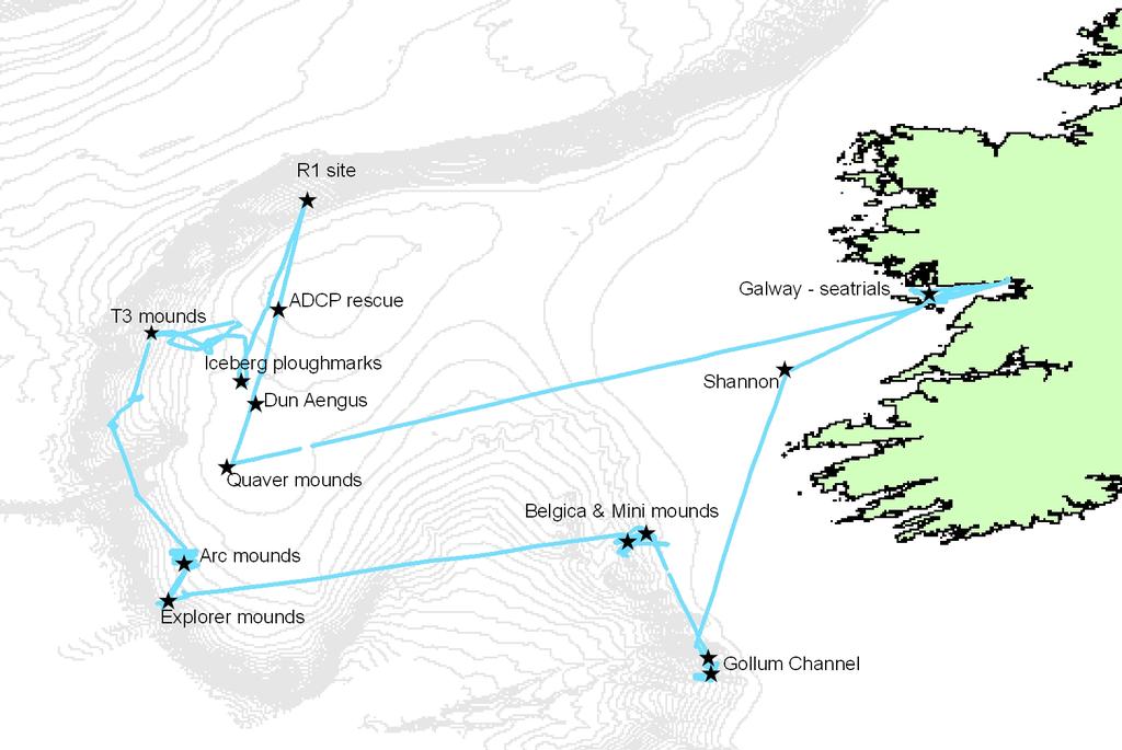
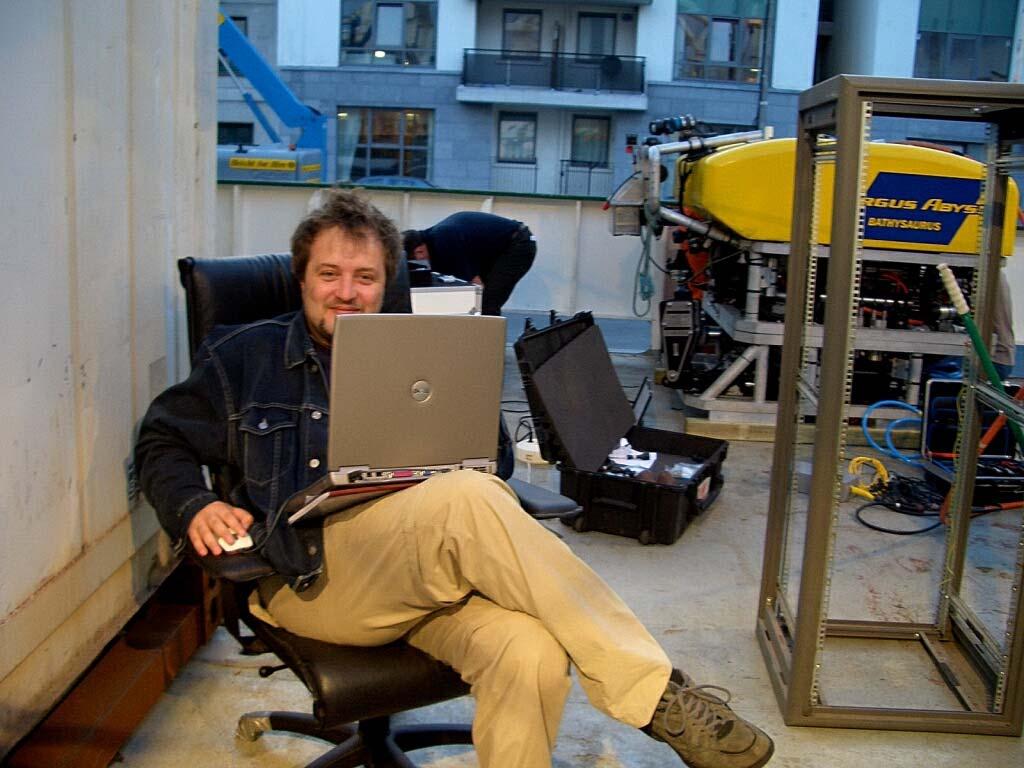
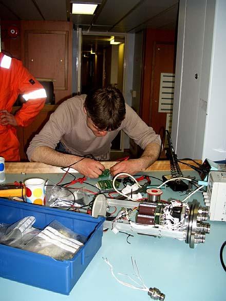
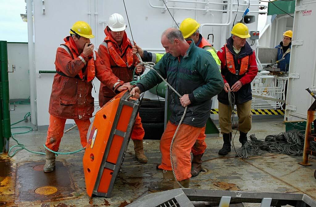
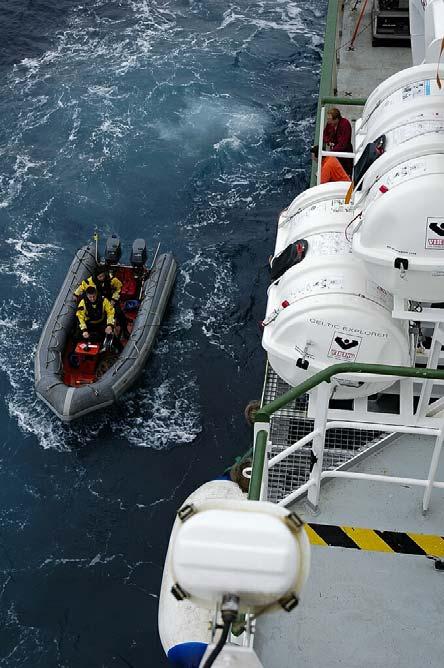
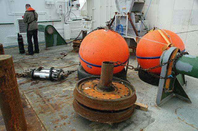
8 Research Cruise CE0505 June 2005 R.V. Celtic Explorer RT PB PSB Bathysaurus ROV First Irish-led deep water ROV habitat survey technical and scientific partnership NUIG/UL ROV multibeam and video surveys high resolution mapping and non-destructive observations of habitat/fauna Use INSS data to identify survey targets and plan surveys essential data for cost effective survey


9 Scientific data acquisition including: ROV multibeam - Reson Seabat 8125 ROV based video - vertical (SDI) and oblique (CCD) colour cameras All supported by high quality position & motion data using INS+DVL (IXSEA Phins) Develop cost effective survey strategy Cognisant of very strong bottom currents (tidal)


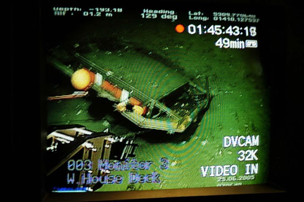
10 BEL 47, Belgica Mounds,Porcupine Seabight Fine scale structure of mound revealed by ROV survey Mound general shape revealed by INSS ship-borne survey INSS data: 25m resolution ROV data: 50cm resolution INSS data: 25m grid ROV data: 0.5m grid Can we get more information from the multibeam data than just bathymetry?


11 Terrain analysis & geo-referenced video observations Visual comparison Extract raster values for statistical comparison Terrain Analysis Slope Can we predict habitat beyond the track? Aspect Scale issues but very good co-location of data-sets Curvature Amenable for training habitat-suitability models Roughness

12 Southern Porcupine Mounds: first look Arc Mounds Explorer Mound


13 Southern Mound Province, south Porcupine Bank: Explorer Mound Faunal composition similar to Therese Mound, in PSB Main mound 130 m high part of small complex Striking hexactinellid sponge characteristic of this site
14 Survey Considerations
15
16
17
18
19 Distribution of wind strength during ARK XIX/3c Frequency (%) Beaufort Force Approximate that Force 5 produces wave height of 3m +
20
21 Cruise planning considerations Tidal currents can be high along slope Weather sub-optimal for ROV surveys Always need Plan B TMS recommended particularly if video mosaicing required Multi-beam can provide useful means of scaling up from small area video survey


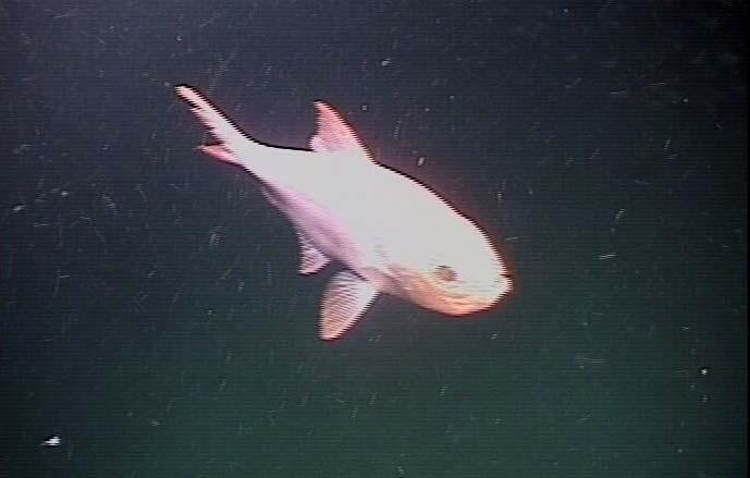
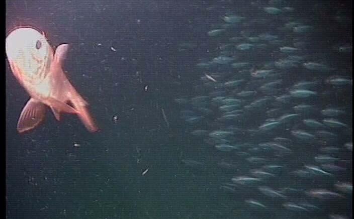
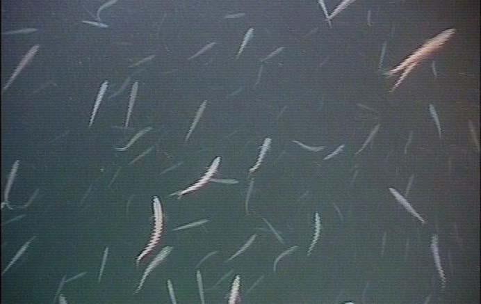
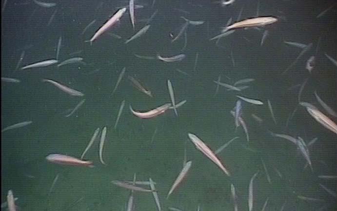
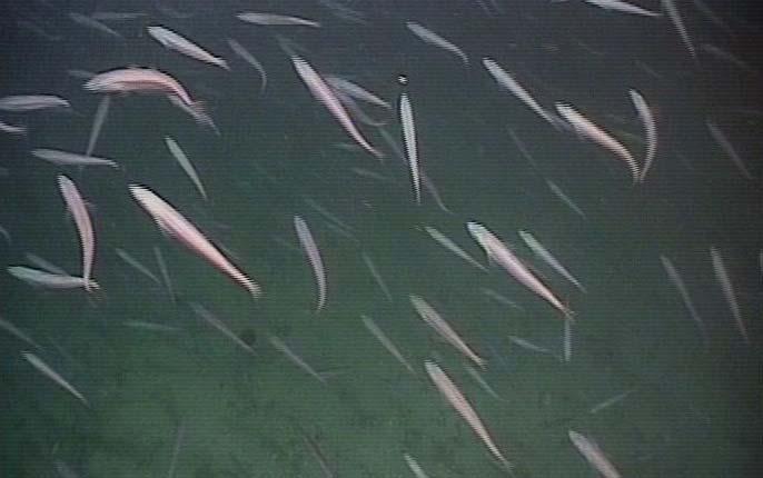
22 There are still some fish in the sea.. Acknowledgments: University of Limerick, RV Celtic Explorer, Argus Remote Systems, Geological Survey of Ireland, Marine Institute, Higher Education Authority

23 MSR 3.2 NUIG/UL Shipboard Team CE0505
24
Predicting drivers and distributions of deep-sea ecosystems: A cold-water coral case study
 3rd Science for the Environment Conference Aarhus, Denmark 1-2 October 2015 AARHUS UNIVERSITY Predicting drivers and distributions of deep-sea ecosystems: A cold-water coral case study Christian Mohn,
An overview of the use of acoustic data for geology and habitat mapping in MAREANO
 An overview of the use of acoustic data for geology and habitat mapping in MAREANO Margaret Dolan, Valerie Bellec, Sigrid Elvenes, Reidulv Bøe, Terje Thorsnes, Shyam Chand, Leif Rise, Monica Winsborrow
Data and Information Management. UK All Energy 22 nd May Presented by Leo James
 Data and Information Management UK All Energy 22 nd May 2013 Presented by Leo James Strategic Development Plans Observations at the outset Data and information management and dissemination: company or
Multiple methods, maps, and management applications: purpose made maps in support of Ocean Management. Craig J. Brown McGregor GeoScience Ltd.
 Multiple methods, maps, and management applications: purpose made maps in support of Ocean Management Craig J. Brown McGregor GeoScience Ltd. International workshop on seabed mapping methods and technology,
Autonomous Platforms for Marine Mapping and Monitoring: A UK Perspective. Dr Russell B Wynn (Head of NOC Marine Geoscience, MARS Chief Scientist)
") Autonomous Platforms for Marine Mapping and Monitoring: A UK Perspective Dr Russell B Wynn (Head of NOC Marine Geoscience, MARS Chief Scientist) Marine mapping and monitoring: an escalating problem. Policy
Autonomous Platforms for Marine Mapping and Monitoring: A UK Perspective Dr Russell B Wynn (Head of NOC Marine Geoscience, MARS Chief Scientist) Marine mapping and monitoring: an escalating problem. Policy
NOAA/University of New Hampshire Joint Hydrographic Center & Center for Coastal and Ocean Mapping. MAPPS Summer Conference July 23, 2013
 NOAA/University of New Hampshire Joint Hydrographic Center & Center for Coastal and Ocean Mapping MAPPS Summer Conference July 23, 2013 07/23/2013 2 07/23/2013 3 Center Goals To be a world leader in the
National Marine Sanctuary Program
 National Marine Sanctuary Program NMSP/USGS Joint Seabed Mapping Initiative: September 2004 AA National Ocean Service National Marine Sanctuaries Interim Report September 2004 Background: Since 2002,
Digital Elevation Model (DEM) of Sable Island Bank and adjacent areas
 of Sable Island Bank and adjacent areas") GEOLOGICAL SURVEY OF CANADA OPEN FILE 5348 Digital Elevation Model (DEM) of Sable Island Bank and adjacent areas K.J. Webb and E.L. King 2014 GEOLOGICAL SURVEY OF CANADA OPEN FILE 5348 Digital Elevation
GEOLOGICAL SURVEY OF CANADA OPEN FILE 5348 Digital Elevation Model (DEM) of Sable Island Bank and adjacent areas K.J. Webb and E.L. King 2014 GEOLOGICAL SURVEY OF CANADA OPEN FILE 5348 Digital Elevation
Reprint of article that appeared in Hydro INTERNATIONAL November 2006 Volume 10 Issue 9
 Reprint of article that appeared in Hydro INTERNATIONAL November 2006 Volume 10 Issue 9 While Google Earth is the best known 3D web-mapping viewer currently in the public domain, there are alternative
Seafloor Mapping and Research Activities
 Seafloor Mapping and Research Activities Marco D Emidio Mississippi Mineral Resources Institute Advisory Board Meeting Jackson, MS February 12, 2015 Outline 1. Define your Goal/Target What do you want
Porcupine/Celtic Observatory Atlantic Ocean
 The Porcupine Seabight and Abyssal Plain area has been an important area for biogeochemical flux studies in the past but is also a very productive fisheries and oil-gas exploration area. It is a stable
The french national programme for claiming continental shelf beyond 200 Miles
 The french national programme for claiming continental shelf beyond 200 Miles Using global bathymetric models in the context of an Extended Continental Shelf submission EXTRAPLAC Using Global Bathymetric
Detailed mapping of seabed topography,
 MAREANO program Detailed mapping of seabed topography, sediments, bottom fauna and pollutants in Norwegian waters HYDROGRAPHIC DATA FOR THE BENEFIT OF SOCIETY MAREANO program - Detailed mapping of seabed
Multi-platform survey for terrestrial and marine integrated mapping
 Multi-platform survey for terrestrial and marine integrated mapping Fabio Sacchetti Hydrographic Team Leader, Advanced Mapping Services On behalf of the INFOMAR Project Team Aims and objectives of the
Future Ocean Floor Mapping: Ocean Stewardship & Initial Industry Contributions. U.S Hydro Galveston, TX March 23, 2017 David Millar - Fugro
 Future Ocean Floor Mapping: Ocean Stewardship & Initial Industry Contributions U.S Hydro 2017 - Galveston, TX March 23, 2017 David Millar - Fugro Presentation Outline The Need for Ocean Mapping GEBCO GEBCO
Kyle Griebel NRS 509 Dr. August & Dr. Wang GIS and remote sensing in Seafloor mapping
 GIS and remote sensing in Seafloor mapping Introduction to seafloor mapping Seafloor maps have a wide variety of uses for scientists and coastal planning needs. Some of these uses include biological assessment
Benthic habitat mapping using multibeam sonar
 Benthic habitat mapping using multibeam sonar Iain M. Parnum 1, Alexander Gavrilov 1 and Justy Siwabessy 2 1. Centre for Marine Science and Technology, Curtin University, Perth, Australia 2. Geoscience
12/11/2013& egm502 seafloor mapping
 egm502 seafloor mapping lecture 13 multi-beam echo-sounders The majority of the current charts of the ocean floors have been produced from single beam echo-sounder data. Even though these data have been
3. UNDERWAY GEOPHYSICS 1
 Sawyer, D.S., Whitmarsh, R.B., Klaus, A., et al., 1994 Proceedings of the Ocean Drilling Program, Initial Reports, Vol. 149 3. UNDERWAY GEOPHYSICS 1 Shipboard Scientific Party 2 EQUIPMENT AND METHODS Navigation
CRUISE SUMMARY REPORT
 CRUISE SUMMARY REPORT Centre: DOD Ref. No.: FOR COLLATIMG CENTRE USE Is data exchange restricted Yes In part No Page 1 SHIP enter the full name and international radio call sign of the ship from which
Relationship between gas-bearing (?) sediments and biogenic mounds in the Kalloni Gulf, Lesvos Island, Greece
 sediments and biogenic mounds in the Kalloni Gulf, Lesvos Island, Greece") 6 th Workshop Seabed Acoustics, Rostock, November 14/15, 2013 P13-1 Relationship between gas-bearing (?) sediments and biogenic mounds in the Kalloni Gulf, Lesvos Island, Greece Alexandros Chronis, Dr.
6 th Workshop Seabed Acoustics, Rostock, November 14/15, 2013 P13-1 Relationship between gas-bearing (?) sediments and biogenic mounds in the Kalloni Gulf, Lesvos Island, Greece Alexandros Chronis, Dr.
SEABED CLASSIFICATION FROM MULTIBEAM ECHOSOUNDER BACKSCATTER DATA USING WAVELET TRANSFORMATION AND NEURAL NETWORK APPROACH
 SEABED CLASSIFICATION FROM MULTIBEAM ECHOSOUNDER BACKSCATTER DATA USING WAVELET TRANSFORMATION AND NEURAL NETWORK APPROACH Jaroslaw Tegowski a,b, Jaroslaw Nowak a, Mateusz Moskalik c, Kazimierz Szefler
The route towards a new GEBCO grid
 The route towards a new GEBCO grid Pauline Weatherall, GEBCO Digital Atlas Manager British Oceanographic Data Centre (BODC) GEBCO TSCOM/SCRUM meeting, Monaco, October 2012 The route towards a new GEBCO
Offshore Operations and Project Execution Geophysical Site Surveys
 Offshore Operations and Project Execution Geophysical Site Surveys Chris Almond Senior Geophysicist Fugro Survey Limited 22/04/2015 Presentation Summary: Office-based Personnel Project Awarded Pre Offshore
Observation of Deep Seafloor by Autonomous Underwater Vehicle
 Indian Journal of Geo-Marine Sciences Vol. 42 (8), December 2013,pp. 1028-1033 Observation of Deep Seafloor by Autonomous Underwater Vehicle Tamaki Ura 1 Underwater Technology Research Center, Institute
Sediment classification from multibeam backscatter images using simple histogram analysis
 Sediment classification from multibeam backscatter images using simple histogram analysis Rozaimi Che Hasan 1,2, Mohd Razali Mahmud 3 and Shahrin Amizul Shamsudin 1 1 UTM Razak School of Engineering and
SW Florida Escarpment Mapping Area
 Overview NOAA s Okeanos Explorer (EX) Program plans to conduct systematic mapping and telepresence-enabled ROV explorations in the Gulf of Mexico during Spring 2014. In 2011, the EX conducted mapping operations
Underwater platforms and photographic techniques
 Underwater platforms and photographic techniques Underwater platforms Robotic vehicles are in use for seafloor surveys aleady since the late 1960's s in deep water archaeology. Submersible technology (human
Outline of presentation
 - lessons learnt from precedent cases of establishing the s Outline of presentation Extending Ireland s continental shelf jurisdiction to the outer s in the Porcupine Abyssal Plain: progress, issues and
Benthic habitat mapping: a synopsis of methodologies and approaches. Dr. Craig Brown University of Ulster
 Benthic habitat mapping: a synopsis of methodologies and approaches Dr. Craig Brown University of Ulster Technological advances in remote sensing Insitu sampling Improving technology Single beam acoustics/video
SITE SURVEY FOR SITE 410, AN EXAMPLE OF THE USE OF LONG-RANGE SIDE-SCAN SONAR (GLORIA)
") 10. SITE SURVEY FOR SITE 410, AN EXAMPLE OF THE USE OF LONG-RANGE SIDE-SCAN SONAR (GLORIA) R. C. Searle and A. S. Laughton, Institute of Oceanographic Sciences, Wormley, GU8 5UB, UK and B. D. Loncarevic,
10. SITE SURVEY FOR SITE 410, AN EXAMPLE OF THE USE OF LONG-RANGE SIDE-SCAN SONAR (GLORIA) R. C. Searle and A. S. Laughton, Institute of Oceanographic Sciences, Wormley, GU8 5UB, UK and B. D. Loncarevic,
A trans-atlantic assessment and deep-water ecosystem-based spatial management plan for Europe
 A trans-atlantic assessment and deep-water ecosystem-based spatial management plan for Europe This project has received funding from the European Union s Horizon 2020 research and innovation programme
BGD. Biogeosciences Discussions
 Biogeosciences Discuss., www.biogeosciences-discuss.net/9/c9301/2013/ Author(s) 2013. This work is distributed under the Creative Commons Attribute 3.0 License. Biogeosciences Discussions comment on Coral
Programme. International workshop on seabed mapping methods and technology, Trondheim 17 th -18 th October 2012
 Programme International workshop on seabed mapping methods and technology, Trondheim 17 th -18 th October 2012 WEDNESDAY 17 TH OCTOBER Introductory talks seabed mapping for ocean management international
Applying GIS to Coastal Management in Cork Harbour: the Corepoint experience
 Applying GIS to Coastal Management in Cork Harbour: the Corepoint experience Kathrin Köpke University College Cork, Ireland Thematic Conference: THE WATERFRONT MANAGEMENT AND GI (IT), 14 th -18 th November
Inspection of Waterfront Facilities Using Vessel-Based Remote Sensing Mitchell, Del Bello, Suarez
 Inspection of Waterfront Facilities Using Vessel-Based Remote Sensing Mitchell, Del Bello, Suarez American Association of Port Authorities Facilities Engineering Conference October 20-22, 2015 Waterfront
NOAA and the National Deep Submergence Facility DEep Submergence Science Committee Meeting NOAA 2006 Report
 NOAA and the National Deep Submergence Facility DEep Submergence Science Committee Meeting NOAA 2006 Report November 9, 2006 Seattle, WA Image courtesy of the MTS 04 science team, IFE, URI/IAO NOAA and
Observation of Deep Seafloor by Autonomous Underwater Vehicle
 Observation of Deep Seafloor by Autonomous Underwater Vehicle Tamaki Ura 1 Underwater Technology Research Center Institute of Industrial Science, The University of Tokyo 4-6-1, Komaba, Minato, Tokyo, Japan
Bathymetry Measures the vertical distance from the ocean surface to mountains, valleys, plains, and other sea floor features
 1 2 3 4 5 6 7 8 9 10 11 CHAPTER 3 Marine Provinces Chapter Overview The study of bathymetry determines ocean depths and ocean floor topography. Echo sounding and satellites are efficient bathymetric tools.
Geophysical Site Surveys
 Geophysical Site Surveys Simon Oakley Geoscience Team Leader Fugro Survey Limited 16/04/2014 Contents Menu Introduction Section 1 - Geophysical Site Surveys - Seabed Bathymetry - Shallow Geology - Seabed
APPLICATION FOR THE CONSENT TO CONDUCT MARINE SCIENTIFIC RESEARCH IN AREAS UNDER NATIONAL JURISDICTION OF THE UNITED KINGDOM
 APPLICATION FOR THE CONSENT TO CONDUCT MARINE SCIENTIFIC RESEARCH IN AREAS UNDER NATIONAL JURISDICTION OF THE UNITED KINGDOM 1. General information Date: 27 th January 2011 1.1 Cruise name and/or number:
Monitoring The Sand Extraction On The Belgian Continental Shelf
 Monitoring The Sand Extraction On The Belgian Continental Shelf Methodology, Results And Expectations K. Degrendele and M. Roche Within the framework of a sustainable exploitation of the mineral resources
Introduction to Acoustic Remote Sensing and Seafloor Mapping (AE4-E13) May 19, 2010
 May 19, 2010") Introduction to Acoustic Remote Sensing and Seafloor Mapping (AE4-E13) May 19, 2010 1 Delft Vermelding Institute onderdeel of Earth organisatie Observation and Space Systems Why Acoustic Remote Sensing?
Introduction to Acoustic Remote Sensing and Seafloor Mapping (AE4-E13) May 19, 2010 1 Delft Vermelding Institute onderdeel of Earth organisatie Observation and Space Systems Why Acoustic Remote Sensing?
UNDERSEA FEATURE NAME PROPOSAL (Sea NOTE overleaf)
") INTERNATIONAL HYDROGRAPHIC ORGANIZATION INTERGOVERNMENTAL OCEANOGRAPHIC COMMISSION (of UNESCO) Note: The boxes will expand as you fill the form. UNDERSEA FEATURE NAME PROPOSAL (Sea NOTE overleaf) Name
INTERNATIONAL HYDROGRAPHIC ORGANIZATION INTERGOVERNMENTAL OCEANOGRAPHIC COMMISSION (of UNESCO) Note: The boxes will expand as you fill the form. UNDERSEA FEATURE NAME PROPOSAL (Sea NOTE overleaf) Name
Aarno Kotilainen, The Geological Survey of Finland Anu Reijonen, The Geological Survey of Finland. Open
 Title BALANCE Cruise Report: The Archipelago Sea, 18/7 18/8 2006 BALANCE Interim Report No. 6 Editors Aarno Kotilainen, The Geological Survey of Finland Anu Reijonen, The Geological Survey of Finland Date
Meteor-Cruise M 75 / 2 Short Cruise Report Chief scientist: Dr. Jürgen Pätzold Universität Bremen Bremen / Germany
 Meteor-Cruise M 75 / 2 Short Cruise Report Chief scientist: Dr. Jürgen Pätzold Universität Bremen Bremen / Germany Dar es Salaam Dar es Salaam Febr. 06 th Febr. 24 th, 2008 1 SHORT CRUISE REPORT RV METEOR
Chapter Overview. Bathymetry. Measuring Bathymetry. Measuring Bathymetry
 CHAPTER 3 Marine Provinces Chapter Overview The study of bathymetry determines ocean depths and ocean floor topography. Echo sounding and satellites are efficient bathymetric tools. Most ocean floor features
Relatively little hard substrate occurs naturally in the
 CHAPTER FIVE Rock Habitats Relatively little hard substrate occurs naturally in the estuary, owing mainly to the vast quantities of fine sediment that have been deposited by the rivers. Rock habitat is
Indonesia Frontier Basin SUNDA (SU-08) NON-EXCLUSIVE 2-D SURVEY 3084km
 NON-EXCLUSIVE 2-D SURVEY 3084km") Indonesia Frontier Basin SUNDA (SU-08) NON-EXCLUSIVE 2-D SURVEY 3084km SEISMIC ACQUISITION PARAMETERS Acquisition Date: January - March 2008 Vessel: M/V Osprey Explorer Shooting Orientation: Strike-Dip
Indonesia Frontier Basin SUNDA (SU-08) NON-EXCLUSIVE 2-D SURVEY 3084km SEISMIC ACQUISITION PARAMETERS Acquisition Date: January - March 2008 Vessel: M/V Osprey Explorer Shooting Orientation: Strike-Dip
Map shows 3 main features of ocean floor
 Map shows 3 main features of ocean floor 2017 Pearson Education, Inc. Chapter 3 Marine Provinces 2017 Pearson Education, Inc. 1 Chapter 3 Overview The study of bathymetry determines ocean depths and ocean
Scottish MPA Project Data confidence assessment SHIANT EAST BANK MPA PROPOSAL
 Scottish MPA Project Data confidence assessment SHIANT EAST BANK MPA PROPOSAL Document version control Version Date Author Reason / Comments Version 1 29/01/2014 Laura Clark Revised MPA proposal format,
Mapping of marine habitats in shallow coastal areas in Denmark
 6 th Workshop Seabed Acoustics, Rostock, November 14/15, 2013 P11-1 Mapping of marine habitats in shallow coastal areas in Denmark Dr. Zyad Al-Hamdani Geological Survey of Denmark and Greenland - GEUS
General Bathymetric Chart of the Oceans
 General Bathymetric Chart of the Oceans GEBCO A look at the world from an ocean s perspective On behalf of GEBCO: Boris Dorschel 1, Martin Jakobsson 2 1 Department of Geophysics, Alfred Wegener Institute
Updating the GEBCO_08 Grid with regional compilations and surveys
 Updating the GEBCO_08 Grid with regional compilations and surveys Pauline Weatherall, GEBCO Digital Atlas Manager, British Oceanographic Data Centre (BODC) GEBCO TSCOM/iSCRUM meeting, SIO, October 2011
GEOPHYSICAL TECHNIQUES FOR MARITIME ARCHAEOLOGICAL SURVEYS. Abstract
 GEOPHYSICAL TECHNIQUES FOR MARITIME ARCHAEOLOGICAL SURVEYS Mark Lawrence, Wessex Archaeology, Salisbury, UK, Ian Oxley, English Heritage, Portsmouth, UK, C. Richard Bates, University of St. Andrews, St.
UNDERSEA FEATURE NAME PROPOSAL (Sea NOTE overleaf)
") INTERNATIONAL HYDROGRAPHIC ORGANIZATION INTERGOVERNMENTAL OCEANOGRAPHIC COMMISSION (of UNESCO) Note: The boxes will expand as you fill the form. UNDERSEA FEATURE NAME PROPOSAL (Sea NOTE overleaf) Name
INTERNATIONAL HYDROGRAPHIC ORGANIZATION INTERGOVERNMENTAL OCEANOGRAPHIC COMMISSION (of UNESCO) Note: The boxes will expand as you fill the form. UNDERSEA FEATURE NAME PROPOSAL (Sea NOTE overleaf) Name
Observations of the Spatial and Temporal Variability of Wave Formed Ripples from the 2007 Martha's Vineyard RipplesDRI Experiment
 Observations of the Spatial and Temporal Variability of Wave Formed Ripples from the 2007 Martha's Vineyard RipplesDRI Experiment Dr. Peter Traykovski Woods Hole Oceanographic Institution Applied Ocean
CHAPTER 6 RESULTS FIGURE 8.- DATA WORK FLOW FOR BACKSCATTER PROCESSING IN HYPACK
 CHAPTER 6 RESULTS 6.1. Backscatter Workflow Comparison Currently, INOCAR owns and operates RESON and Kongsberg multibeam systems for nearshore surveys. The RESON system is integrated with HYPACK Hysweep
Work Package 5: Signal Processing and Seafloor Classification
 Work Package 5: Signal Processing and Seafloor Classification Jarosław Tęgowski and Karolina Trzcińska Marine Geophysics Lab. Institute of Oceanography University of Gdańsk, Poland Kick-Off Meeting, Kiel,
Submersible investigation of unconfirmed western Miami Terrace habitat
 Submersible investigation of unconfirmed western Miami Terrace habitat Prepared By: Brian K. Walker, Ph.D. Nova Southeastern University Oceanographic Center 6/08/2015 On June 5, 2015 Nova Southeastern
Short summary of Project 1 activity during research cruise with RV Poseidon (P408-2a)
") Short summary of Project 1 activity during research cruise with RV Poseidon (P408-2a) Chief scientist: Dr. Mark Schmidt Shipboard scientific party: Dr. Peter Linke, Dr. Daniel McGinnis, Dr. Alaa Al-Barakati,
Short summary of Project 1 activity during research cruise with RV Poseidon (P408-2a) Chief scientist: Dr. Mark Schmidt Shipboard scientific party: Dr. Peter Linke, Dr. Daniel McGinnis, Dr. Alaa Al-Barakati,
NEW SEAFLOOR INSTALLATIONS REQUIRE ULTRA-HIGH RESOLUTION SURVEYS
 NEW SEAFLOOR INSTALLATIONS REQUIRE ULTRA-HIGH RESOLUTION SURVEYS Donald Hussong (Fugro Seafloor Surveys, Inc.) dhussong@fugro.com Fugro Seafloor Surveys, Inc., 1100 Dexter Avenue North (Suite 100), Seattle,
Arctic Ocean Biology. from the surface to the deep sea
 Arctic Ocean Biology from the surface to the deep sea Christina Bienhold Helmholtz Max Planck Research Group for Deep Sea Ecology and Technology cbienhol@mpi-bremen.de ACCESS Summerschool, Bremen, Germany
CANADIAN HYDROGRAPHIC SERVICE
 CANADIAN HYDROGRAPHIC SERVICE Surveying and Charting Canada s Waters Since 1883 Ilulisat Maritime Workshop 2017 The Importance and Need for Hydrography Denis Hains, Hydrographer General of Canada & Director
Regional and Nearshore Bathymetry of American Samoa: Implications for Tsunami Run-Up and Public Awareness
 Regional and Nearshore Bathymetry of American Samoa: Implications for Tsunami Run-Up and Public Awareness Presentation U21D-07 2009 AGU Fall Meeting San Francisco Authors Dawn Wright Dept. of Geosciences,
THE ROLE OF OCEAN OBSERVATORIES IN CLIMATE CHANGE MONITORING, MULTI-HAZARD EARLY WARNING AND DISASTER RISK REDUCTION
 THE ROLE OF OCEAN OBSERVATORIES IN CLIMATE CHANGE MONITORING, MULTI-HAZARD EARLY WARNING AND DISASTER RISK REDUCTION Tania L. Insua, Moran, K., De Leo, F., Sastri, A., Heesemann, M., Dewey, R. UNOOSA Conference
Habitat Mapping in The Hauraki Gulf Marine Park. Dan Breen
 Habitat Mapping in The Hauraki Gulf Marine Park Dan Breen Outline 1. Intro Habitat mapping 2. Coastal marine habitats and marine protected areas in the New Zealand Territorial Sea: a broad scale gap analysis
UNDERSEA FEATURE NAME PROPOSAL (Sea NOTE overleaf)
") INTERNATIONAL HYDROGRAPHIC ORGANIZATION INTERGOVERNMENTAL OCEANOGRAPHIC COMMISSION (of UNESCO) UNDERSEA FEATURE NAME PROPOSAL (Sea NOTE overleaf) Note: The boxes will expand as you fill the form. Name
INTERNATIONAL HYDROGRAPHIC ORGANIZATION INTERGOVERNMENTAL OCEANOGRAPHIC COMMISSION (of UNESCO) UNDERSEA FEATURE NAME PROPOSAL (Sea NOTE overleaf) Note: The boxes will expand as you fill the form. Name
FRontiers in Arctic marine Monitoring: The FRAM Ocean Observing System
 FRontiers in Arctic marine Monitoring: The FRAM Ocean Observing System Thomas Soltwedel Alfred-Wegener-Institute Helmholtz-Center for Polar and Marine Research Arctic Frontiers 2017 Svalbard Symposium
Benefits of Spatial Collaboration in Arctic Research Project Using ArcGIS Online
 Benefits of Spatial Collaboration in Arctic Research Project Using ArcGIS Online Dr. Nataliya Marchenko Prof. Aleksey Marchenko The University Centre in Svalbard, Longyearbyen, Norway Arctic Technology
Dynamics of Ripples on the Sandy Inner Shelf off Martha s Vineyard: Surveys, Field Measurements, and Models
 Dynamics of Ripples on the Sandy Inner Shelf off Martha s Vineyard: Surveys, Field Measurements, and Models Christopher R. Sherwood U.S. Geological Survey, Woods Hole Science Center 384 Woods Hole Road
Applications of GIS and Remote Sensing in Ocean Exploration
 Applications of GIS and Remote Sensing in Ocean Exploration Geographic Information Systems (GIS) and Remote Sensing (RS) are critical to the success of Ocean Exploration. In the most basic sense, there
2) re-positioning of the SSS data, 3) individuation of geomorphological features and morphometrical parameters correlated to instability phenomena.
 re-positioning of the SSS data, 3) individuation of geomorphological features and morphometrical parameters correlated to instability phenomena.") HIGH-RESOLUTION SIDE SCAN SONAR AND MULTIBEAM DATA PROCESSING AND MERGING TO STUDY SUBMARINE INSTABILITY PHENOMENA ON VOLCANIC ISLANDS (PONTINE, CAMPANIAN AND AEOLIAN ARCHIPELAGOS) A. BOSMAN Extended abstract:
HIGH-RESOLUTION SIDE SCAN SONAR AND MULTIBEAM DATA PROCESSING AND MERGING TO STUDY SUBMARINE INSTABILITY PHENOMENA ON VOLCANIC ISLANDS (PONTINE, CAMPANIAN AND AEOLIAN ARCHIPELAGOS) A. BOSMAN Extended abstract:
METEOR Cruise M61 Northeast Atlantic 2004
 METEOR Cruise M61 Northeast Atlantic 2004 Leg 3 Development of Carbonate Mounds on the Celtic Continental Margin Cork Ponta Delgada 04.06. 21.06.2004 Ratmeyer, V., Beck, T., Belling, R., Bergenthal, M.,
High-resolution facies zonation within a cold-water coral mound: The case of the Piddington Mound, Porcupine Seabight, NE Atlantic
 1 Marine Geology August 2017, Volume 390, Pages 120-130 http://dx.doi.org/10.1016/j.margeo.2017.06.009 http://archimer.ifremer.fr/doc/00390/50129/ 2017 Elsevier B.V. All rights reserved. Achimer http://archimer.ifremer.fr
CRUISE SUMMARY REPORT
 CRUISE SUMMARY REPORT Centre: DOD Ref. No.: FOR COLLATIMG CENTRE USE Is data exchange restricted Yes In part No Page 1 SHIP enter the full name and international radio call sign of the ship from which
GEBCO 2013 TSCOM. EMODNET Hydrography status report
 www.emodnet-hydrography.eu GEBCO 2013 TSCOM EMODNET Hydrography status report Eric Moussat, Ifremer on behalf of the Emodnet consortium 1 Background and objectives EU proposed to take steps in 2008 towards
R E P U B L I C O F C Y P R U S NATIONAL REPORT OF CYPRUS TO THE MEDITERRANEAN AND BLACK SEAS HYDROGRAPHIC COMMISSION (MBSHC)
") R E P U B L I C O F C Y P R U S NATIONAL REPORT OF CYPRUS TO THE MEDITERRANEAN AND BLACK SEAS HYDROGRAPHIC COMMISSION (MBSHC) ISTANBUL MEETING 25-27 SEPTEMBER 2013 NATIONAL REPORT OF CYPRUS TO THE MEDITERRANEAN
R E P U B L I C O F C Y P R U S NATIONAL REPORT OF CYPRUS TO THE MEDITERRANEAN AND BLACK SEAS HYDROGRAPHIC COMMISSION (MBSHC) ISTANBUL MEETING 25-27 SEPTEMBER 2013 NATIONAL REPORT OF CYPRUS TO THE MEDITERRANEAN
Automated Seabed Mapping and Data Delivery in the Cloud
 Automated Seabed Mapping and Data Delivery in the Cloud London, 2nd November 2017 11/20/2017 1 2 WE CALL IT SEABED INTELLIGENCE Ocean Infinity are explorers. We go to unmapped locations to survey the seabed
The California current is the eastern boundary current that lies to the west of
 I. INTORDUCTION A. California Current System The California current is the eastern boundary current that lies to the west of North America. The California current flows from north, Washington, to south,
Environmental impact assessment study of the new offshore dumping sites for Šventoji port in Lithuania
 Environmental impact assessment study of the new offshore dumping sites for Šventoji port in Lithuania Introduction Summary In 2003 Lithuanian Ministry of Transport initiated the preparation of feasibility
Charleston to Woods Hole R/V Armstrong Transit: Atlantic Margin Upper Slope Fluid Flow Features, Seafloor and Water Column Surveys
 Charleston to Woods Hole R/V Armstrong Transit: Atlantic Margin Upper Slope Fluid Flow Features, Seafloor and Water Column Surveys Contacts: Carolyn Ruppel (US Geological Survey, cruppel@usgs.gov, 508-457-2339)
Marine Geomorphology as a Determinant for Essential Life Habitat III
 Marine Geomorphology as a Determinant for Essential Life Habitat III marinecoastalgis.net/aag08 10:10 Dawn Wright, Oregon 10:30 Will McClintock, California 10:50 Daniel Sampson, Massachusetts 11:10 Gary
FK day Post Cruise Report
 FK190106 30-day Post Cruise Report 1. Ship name: Falkor 2. Cruise Dates - Day Departed: 1/6/2019 3. Cruise Dates - Day Returned: 1/26/2019 4. Cruise Number: FK190106 5. Departure Port: Puntarenas, Costa
This PowerPoint lecture will provide you with a quick introduction to Cork Harbour
 This PowerPoint lecture will provide you with a quick introduction to Cork Harbour Cork Harbour is arguably one of the biggest natural harbours in the world. It provides access to the sea for the historic
Topic: Bathymetric Survey Techniques. (a) Single-beam echo-sounders (SBES) (b) Multi-beam echo-sounders (MBES)
 Single-beam echo-sounders (SBES) (b) Multi-beam echo-sounders (MBES)") Topic: Bathymetric Survey Techniques (a) Single-beam echo-sounders (SBES) (b) Multi-beam echo-sounders (MBES) Bathymetry is the measurement of water depths - bathymetry is the underwater equivalent of
Topic: Bathymetric Survey Techniques (a) Single-beam echo-sounders (SBES) (b) Multi-beam echo-sounders (MBES) Bathymetry is the measurement of water depths - bathymetry is the underwater equivalent of
Sister Sanctuaries: Linking the Science and Management of Coral Reefs in Cuba and the U.S.
 Sister Sanctuaries: Linking the Science and Management of Coral Reefs in Cuba and the U.S. Memorandum of Understanding on Cooperation in the Conservation and Management of Marine Protected Areas Seventh
Challenges of Collecting Data for Article 76 in Ice Covered Waters of the Arctic
 Challenges of Collecting Data for Article 76 in Ice Covered Waters of the Arctic 5 th ABLOS Conference Monaco October 16, 2008 Richard MacDougall - Canada Jacob Verhoef - Canada Wendell Sanford - Canada
Deep Water Marine Surveys
 Deep Water Marine Surveys Deep Sea International Consortium Workshop Rio de Janeiro, February 01st & 2nd Fred Marins Marketing Director fred.marins@gardline.com.br Key Aspects Gardline: Since 1969 + 1500
Confidence Assessment Scoring System
 Confidence Assessment Scoring System Confidence field Confidence group Confidence question Comments Remote sensing data collection RemoteTechnique Were the techniques used appropriate for the ground type?
2. Identify other PIs associated with the cruise: 3. Identify the at-sea Chief Scientist: Charles Langmuir
 Pre-Cruise Meeting April 17, 2014 AT26-19, Charles Langmuir, Aug 28 Sept 11, 2014. RV Atlantis with OSU Coring Facility General Program Overview: 1. Scientific Objectives: Our aim is to obtain as many
CEND8/12 Cruise Report. RV Cefas Endeavour Cruise Staff. Part A: Part B: Part C: Anna Sypniewska-Huk (Cefas-Marine Chemist)
") CEND8/12 Cruise Report RV Cefas Endeavour Cruise 8 2012 Staff Part A: Dr. Sue Ware (Cefas-Marine Ecologist) Bill Meadows (Cefas-Marine Surveyor) Sally Songer (Cefas-Marine Ecologist) Gary Burt (Cefas-Marine
CEND8/12 Cruise Report RV Cefas Endeavour Cruise 8 2012 Staff Part A: Dr. Sue Ware (Cefas-Marine Ecologist) Bill Meadows (Cefas-Marine Surveyor) Sally Songer (Cefas-Marine Ecologist) Gary Burt (Cefas-Marine
NATIONAL INSTITUTE OF OCEANOGRAPHY WORMLEY. GODALMING. SURREY R. R. S. DISCOVERY SEPTEMBER - OCTOBER 1967 GEOLOGICAL INVESTIGATIONS
 NATIONAL INSTITUTE OF OCEANOGRAPHY WORMLEY. GODALMING. SURREY R. R. S. DISCOVERY CRUISE 19 REPORT SEPTEMBER - OCTOBER 1967 GEOLOGICAL INVESTIGATIONS N. I.O. CRUISE REPORT No. 19 (Issued May 1969) NATIONAL
FINMARINET: Inventories and Planning for the Marine Natura 2000 Network in Finland. A.2 Geological inventories of the seafloor Final Report
 LIFE07 NAT/FIN/000151 FINMARINET: Inventories and Planning for the Marine Natura 2000 Network in Finland A.2 Geological inventories of the seafloor Final Report Geological Survey of Finland, GTK 1. Introduction
SAWS: Met-Ocean Data & Infrastructure in Support of Industry, Research & Public Good. South Africa-Norway Science Week, 2016
 SAWS: Met-Ocean Data & Infrastructure in Support of Industry, Research & Public Good South Africa-Norway Science Week, 2016 Marc de Vos, November 2016 South Africa: Context http://learn.mindset.co.za/sites/default/files/resourcelib/e
Marine Spatial Data for Marine Spatial Planning. Ocean Leadership 2010 Public Policy Forum
 Marine Spatial Data for Marine Spatial Planning Ocean Leadership 2010 Public Policy Forum March 10, 2010 Edward Saade President, Fugro EarthData, Inc 1 Marine Spatial Data What is Marine Spatial Data?
A lithological map created from multibeam backscatter data in challenging circumstances: the Lower Sea Scheldt estuary
 A lithological map created from multibeam backscatter data in challenging circumstances: the Lower Sea Scheldt estuary Mieke Mathys*, Marc Sas*, Frederik Roose** HYDRO12, Rotterdam, 15/11/2012 *International
Are seafloor hydrothermal sulphides deposits valuable mineral resources? Bramley J Murton
 Are seafloor hydrothermal sulphides deposits valuable mineral resources? Bramley J Murton Outline Why do we need new sources of metals? What are seafloor mineral deposits Where do they occur and why: Why
Valdivia Fracture Zone, Mocha Fracture Zone
 lafkeninternational HYDROGRAPHIC ORGANIZATION INTERGOVERNMENTAL OCEANOGRAPHIC COMMISSION (of UNESCO) Note: The boxes will expand as you fill the form. UNDERSEA FEATURE NAME PROPOSAL (Sea NOTE overleaf)
Data archiving and dissemination, sample information, scientists ashore, and multibeam bathymetric collection and data processing (Raineault) 10
 10") Cover: Seafloor image (~0.5 m across) of a methane hydrate shelf above bubble streams discovered on dive H1517 at Astoria Canyon on the southern canyon floor, 850 m depth. 3d background image of Astoria
Cover: Seafloor image (~0.5 m across) of a methane hydrate shelf above bubble streams discovered on dive H1517 at Astoria Canyon on the southern canyon floor, 850 m depth. 3d background image of Astoria