MARINE FISH AND FISH HABITAT COMPONENT STUDY
|
|
|
- Gwen Benson
- 6 years ago
- Views:
Transcription
1 Environmental Impact Assessment Component Study MARINE FISH AND FISH HABITAT COMPONENT STUDY Prepared For: Newfoundland and Labrador Refining Corporation 87 Water St Harvey Building, 2 nd Floor St. John s, NL A1C 1A5 Prepared By: AMEC Earth and Environmental Ltd. July 2007
2
3 Newfoundland and Labrador Refinery Project Southern Head, Placentia Bay, NL Marine Habitat Characterization Submitted to: BAE-Newplan Group Limited A Division of SNC-Lavalin 1133 Topsail Road Mount Pearl, NL A1N 5G2 Submitted By: AMEC Earth & Environmental A Division of AMEC Americas Limited 133 Crosbie Road P.O Box St. John s, NL A1B 4A5 July 2007
4
5 Newfoundland and Labrador Refinery Project Marine Benthic Habitat Characterization Component Study EXECUTIVE SUMMARY On behalf of Newfoundland and Labrador Refinery Corporation, a qualitative and quantitative characterization of the marine habitat was conducted within the footprint of proposed marine facilities associated with the construction and operation of the Newfoundland and Labrador Refinery Project located near Southern Head at the head of Placentia Bay, Newfoundland. For the purposes of the marine habitat quantification, the survey area was divided into four distinct zones including: Zone 1 - Marine Terminal/Tug Berth; Zone 2 - Marine Jetty; Zone 3 - Marine Water Intake; and Zone 4 - Marine Outfall. The marine habitat characterization included substrate distributions, depth profiles, macrofauna and macroflora distributions, and baseline sediment and water chemistry. Underwater video transects were conducted via diving and ROV within each zone. Field notations and video review provided quantitative information with respect to substrate, macrofloral, macrofaunal distributions, and depth profiles. Representative sediment samples were diver collected from all four zones and analyzed for the following parameters: Metals Hydrides BTEX/TPH (RBCA) PAH PCB TOC Particle Size Seawater samples were collected from Zone 3 Marine Water Intake and Zone 4 Marine Outfall. Samples were collected via Nisken Bottle from the surface (0.5 m below surface), mid-column, and bottom (0.5 m from seafloor) at an offshore and inshore location. Seawater samples were analyzed for the following parameters: Metals Hydrides General Chemistry BTEX/TPH (RBCA) PAH VOC TOC Habitat Characterization Zone 1 Marine Terminal and Tug Berth The marine habitat of Zone-1 Marine Terminal and Tug Berth was representative of a semi-exposed marine ecosystem. Shelter is provided to the west and north via the backshore land mass. The wave exposure fetches are approximately 3 km to the west (eastern shoreline of Come By Chance Harbour), 13 km to the south (Merasheen Islands Page ii
6 Newfoundland and Labrador Refinery Project Marine Benthic Habitat Characterization Component Study Archipelago). It should be noted that the Merasheen Island Archipelago, due to its unconsolidated nature provides only partial shelter. The shoreline consisted of small cobble/gravel beaches with scattered boulder and bedrock margins (50 to 100 m in width) rising to steep rock cliffs in the backshore interspersed with rocky headlands (10 to 40 m in width). Shoreline surveys quantified 5 beaches and 8 headlands within Zone-1. Generalized substrate distributions within the entire zone consisted of cobble and small boulder near the shoreline. Following this, the southern portion of Zone 1 transitioned into a region of coarse gravels interspersed with occasional bedrock outcrops followed by a region predominated by sand and fine gravel. The northern section of Zone 1 transitioned from the nearshore cobble and small boulder to a region typified by sand and fine gravels. Sea urchins and starfish in low to moderate numbers were ubiquitous on both hard/coarse and soft/fine substrates from the shoreline to the outer limits of Zone 1. Slightly higher numbers of urchins were associated with sections consisting primarily of large boulder and bedrock. Blue mussels and horse mussels were encountered sporadically on large boulders and bedrock outcrops. Horse mussels were generally encountered in deeper water (10+ m) although blue mussels were also encountered further out on the transect lines on the tops of large boulders. Periwinkles were observed primarily on large substrates within 50 m of the shoreline in water depths < 10 m but were also observed on large shallow substrates at greater distances. Species encountered more sporadically on large substrates (independent of depth) included frilled anemone in low to high numbers and low numbers of tube worms (1-2 per transect line). Eleven winter flounder observed within Zone 1 were usually associated with gravel and sand substrates. Sand dollars were encountered in moderate to high numbers in association with fine gravel and sand substrates. Deepsea scallop in abundances ranging from 0-6 individuals per 5 m section and three American plaice were encountered primarily on soft substrates along the furthest reaches of the transect lines (deeper water). Species encountered infrequently included hermit crab, barnacles (large substrates), sponge, and northern lobster (one individual in a crevice). Crustose algae was consistently encountered on hard substrates in densities ranging from <25 to 50%. Sour weed was also ubiquitous (< 25 to 75%) on all substrates except fine sand although the highest densities were usually observed on small boulder substrate. Edible kelp (Alaria sp.) was commonly observed (<25 to 100%) on large substrates with the highest densities generally associated with the shoreline and intertidal areas. Sea colander was occasionally observed in deeper water at distances greater than 100 m from the shoreline. Shoreline algal species were dominated by rockweed and knotted wrack interspersed with lesser amounts of green filamentous, black whip weed, sea lettuce, coral weed, red tubed weed, and dulse. Species observed infrequently included ribbed lace, Halosaccion sp., laver, and ribbon weed. Page iii
7 Newfoundland and Labrador Refinery Project Marine Benthic Habitat Characterization Component Study Habitat Characterization Zone 2 Marine Jetty The marine habitat of Zone-2 Marine Jetty was representative of a semi-exposed, open water, marine ecosystem. Shelter is provided to the west and north via the backshore land mass. The wave exposure fetches are approximately 3 km to the east (eastern shoreline of Come By Chance Harbour), 13 km to the south (Merasheen Islands Archipelago). It should be noted that the Merasheen Island Archipelago, due to its unconsolidated nature provides only partial shelter. Approximately 250 m of the southwestern extent of T-8 is exposed to a 9 km wave fetch to the west (Sound Island). Substrates were uniform throughout the entire zone consisting primarily of sand with small amounts of gravel and isolated small boulders. Sea urchins, starfish and deep-sea scallop were consistently encountered in relatively low numbers on sand and gravel substrates throughout the entire transect length. Scallop densities averaged approximately one to three individuals per five meter transect section. Species observed infrequently included American plaice (five individuals), Atlantic cod (three individuals), skate (one individual), frilled anemone, and tube worms. Crustose algae was encountered sporadically in association with intermittent cobble and boulder substrate. Sour weed and edible kelp were noted upon isolated hard substrtaes. Storm tossed sour weed, sea colander, kelp (Laminaria sp.), and rockweed were noted sporadically throughout the entire section. Habitat Characterization Zone 3 Marine Water Intake The marine habitat of Zone-3 Marine Water Intake was a combination of both semisheltered and semi-exposed marine ecosystems. Shelter for the first 400 m is provided to the north, west, and east via the shoreline of Hollets Cove. The southern wave exposure fetch is approximately 13 km with partial shelter provided by the Merasheen Islands Archipelago. Shelter for the remaining 560 m is provided to the north via the backshore landmass and to the east via Come By Chance Point. The southern wave exposure fetch is approximately 12 km with partial shelter provided by the Merasheen Islands Archipelago. The western wave exposure fetch is approximately 8 km to Sound Island. Substrates from the shoreline to 60 m were predominantly cobble with lesser amounts of sand and gravel with isolated small boulder and bedrock. From 60 m to 470 m substrates were primarily gravel and sand with lesser amounts of cobble and isolated boulder. From 470 m to 960 m substrates were larger, consisting of large bedrock outcrops interspersed with small boulder and gulches dominated by cobble. Sea urchins and starfish were consistently encountered throughout the entire (960 m) transect length. Horse mussels, blue mussels, and frilled anemone were sporadically encountered on large boulder and bedrock substrates. Species encountered infrequently included hermit crab (one individual), eel pout (two individuals), deep-sea scallop (one individual), and polychaetes (one individual). Crustose algae was consistently encountered on all hard substrates from 200 m to 960 m. Sour weed was fairly abundant on all substrates from 10 m to 630 m. The Page iv
8 Newfoundland and Labrador Refinery Project Marine Benthic Habitat Characterization Component Study predominant shoreline and intertidal species were species were edible kelp, kelp (Laminaria sp.), black whip weed, hollow green weed, smooth chord weed, coral weed, green filamentous, red tubed weed, and rockweed,. Sea colander were noted to occur from over the outside transect portion from 260 to 910 m. Intermittent species included red fern and banded weed. Habitat Characterization Zone 4 Marine Outfall The marine habitat of Zone-4 Marine Outfall was representative of a semi-exposed marine ecosystem. Shelter is provided to the north via the backshore land mass and to the west via Southern Head. The southern wave exposure fetch is approximately 13 km with partial shelter provided by the Merasheen Islands Archipelago. The western wave exposure fetch is approximately 6 km to Sound Island. Substrates from the shoreline to 40 m were predominantly small boulder with lesser amounts of cobble and gravel and isolated small boulder. From 40 m to 200 m substrates were primarily bedrock and large boulder interspersed with cobble and gravel. From 200 to 330 m substrates were dominated by sand and gravels with occasional cobble patches. Sea urchins and starfish were consistently encountered on all substrates throughout the transect length. Deep-sea scallop were encountered in densities ranging from one to two individuals per five meter transect section. Sand dollars were encountered on sections of fine substrate. Periwinkles were encountered on large substrate within the shoreline/intertidal zone. Blue and horse mussels, frilled anemone, and barnacles were observed sporadically on large substrates. Species observed infrequently included hermit crab (one individual), winter flounder (two individuals, and skate (two individuals). Crustose algae was encountered consistently on hard substrates and sour weed on all substrates throughout the transect length. Edible kelp was noted in the shoreline/intertidal area and in a narrow band from 100 to 120 m. Shoreline/intertidal species included rockweed, knotted wrack, coral weed, red fern, sea lettuce, black whip weed, and green filamentous. Commercial Fisheries Although lobsters were not observed in significant numbers within Zones 1, 2, 3, or 4 the nearshore areas are known to contain lobster habitat. This is evidenced by the large numbers of lobster pots observed during the surveys and the long timeline of the traditional lobster fishery in the area. Due to the primarily nocturnal nature of lobster movements it is common for them not to be observed during daylight video surveys. Based upon conversations with local fisher people it has been ascertained that lumpfish, capelin, and scallop are not present in commercial quantities within the boundaries of the proposed marine facilities. There is currently no commercial fishery being prosecuted for either of these species within the marine boundaries of the project. Marine Sediment Chemistry The only metals which exceeded CCME ISQG (2006) were arsenic in two samples from Zone 2 - Marine Jetty and one sample from Zone 4 - Marine Outfall; and copper in two Page v
9 Newfoundland and Labrador Refinery Project Marine Benthic Habitat Characterization Component Study samples from Zone1 Marine Terminal/Tug Berth and one sample from Zone 4 Marine Outfall. Both arsenic and copper are commonly encountered in marine sediments from pristine areas of Newfoundland and Labrador. The exceedances noted are most likely attributable to natural background levels. All other metals analyzed were either not detected or were below CCME ISQG (2006). BTEX/TPH were not detected at the laboratory MDLs (laboratory method detection limits) for any of the samples submitted for analysis. PAHs were either not detected or were below the CCME ISQG (2006) for all samples from all zones. PCBs were not detected at the laboratory MDL (laboratory method detection limits) for all samples from all zones. TOC was detected in all samples in a range from 4,200 to 5,2058 (ug/g). Seawater Chemistry The only metal which exceeded the available CCME guideline (2006) was cadmium which exceeded at both the Zone 3 Intake Location and Zone 4 Outfall Location. Cadmium is a commonly occurring natural metal in the Newfoundland and Labrador Environment. It is likely that the cadmium levels detected are attributable to natural background levels. BTEX/TPH were either not detected or were below the CCME guideline (2006) for all samples from all zones. PAHs were not either not detected at the laboratory MDL (laboratory method detection limits) or were below the CCME guideline (2006) for all samples from all zones. VOCs were not detected at the laboratory MDL (Method Detection Limit) in all samples. Page vi
10
11 Newfoundland and Labrador Refinery Project Marine Benthic Habitat Characterization Component Study TABLE OF CONTENTS 1.0 SCOPE AND METHODOLOGY Transect Methodology Sediment Sampling Seawater Sampling RESULTS Substrate Zone 1 - Marine Terminal and Tug Berth T T T T T T T T T Zone 2 - Marine Jetty T T T Zone 3 - Marine Water Intake T Zone 4 - Marine Outfall T Macrofauna Zone 1 - Marine Terminal and Tug Berth T T T T T T T T T Zone 2 - Marine Jetty T T T Zone 3 - Marine Water Intake T Zone 4 - Marine Outfall T Macroflora Zone 1 - Marine Terminal and Tug Berth T T Page vii
12 Newfoundland and Labrador Refinery Project Marine Benthic Habitat Characterization Component Study T T T T T T T Zone 2 - Marine Jetty T T T Zone 3 - Marine Water Intake T Zone 4 - Marine Outfall T Marine Sediment Chemistry Metals-Hydrides BTEX/TPH PAH PCB TOC Seawater Chemistry General Chemistry Metals - Hydrides BTEX/TPH PAH VOC TRANSECT SUMMARIES Substrate Zone 1 - Marine Terminal and Tug Berth T T T T T T T T T Zone 2 - Marine Jetty T T T Zone 3 - Marine Water Intake T Zone 4 - Marine Outfall T Macrofauna Zone 1 - Marine Terminal and Tug Berth T T T Page viii
13 Newfoundland and Labrador Refinery Project Marine Benthic Habitat Characterization Component Study T T T T T T Zone 2 Marine Jetty T T T Zone 3 Marine Water Intake T Zone 4 Marine Outfall T Macroflora Zone 1 - Marine Terminal and Tug Berth T T T T T T T T T Zone 2 Marine Jetty T T T Zone 3 Marine Water Intake T Zone 3 Marine Outfall T GENERAL SUMMARIES Zone 1 - Marine Terminal and Tug Berth Zone 2 - Marine Jetty Zone 3 - Marine Water Intake Zone 4 - Marine Outfall...80 Page ix
14 Newfoundland and Labrador Refinery Project Marine Benthic Habitat Characterization Component Study LIST OF FIGURES Figure 1.1: General site location plan, Newfoundland and Labrador Refinery Project, South Head, Placentia Bay, May Figure 1.2: Marine habitat zone locations, Newfoundland and Labrador Refinery Project, South Head, Placentia Bay, May Figure 1.3: Habitat transect locations, Newfoundland and Labrador Refinery Project, South Head, Placentia Bay, May Figure 1.4: Zone 1 Shoreline habitat classification, Newfoundland and Labrador Refinery Project, South Head, Placentia Bay, May Figure 1.5: Marine sediment and seawater sample locations, Newfoundland and Labrador Refinery Project, South Head, Placentia Bay, May LIST OF TABLES Table Video transects survey lengths, headings, and location coordinates. Newfoundland and Labrador Refinery Project, South Head, Placentia Bay, May Table Sediment sample coordinates, methods, and zones. Newfoundland and Labrador Refinery Project, South Head, Placentia Bay, May Table Seawater sample coordinates, methods, and zones. Newfoundland and Labrador Refinery Project, South Head, Placentia Bay, May Table Transect T-1, Zone-1, Marine Terminal and Tug Berth, Macrofauna observations, abundances, and individual species numbers. Newfoundland and Labrador Refinery Project, South Head, Placentia Bay, May 17, (A = Abundant, C = Common, O = Occasional, U = Uncommon)...23 Table Transect T-2, Zone-1, Marine Terminal and Tug Berth, Macrofauna observations, abundances, and individual species numbers. Newfoundland and Labrador Refinery Project, South Head, Placentia Bay, May 17, (A = Abundant, C = Common, O = Occasional, U = Uncommon)...24 Table Transect T-3, Zone-1, Marine Terminal and Tug Berth, Macrofauna observations, abundances, and individual species numbers. Newfoundland and Labrador Refinery Project, South Head, Placentia Bay, May 18, (A = Abundant, C = Common, O = Occasional, U = Uncommon)...25 Table Transect T-4, Zone-1, Marine Terminal and Tug Berth, Macrofauna observations, abundances, and individual species numbers. Newfoundland and Labrador Refinery Project, South Head, Placentia Bay, May 18, (A = Abundant, C = Common, O = Occasional, U = Uncommon)...26 Table Transect T-5, Zone-1, Marine Terminal and Tug Berth, Macrofauna observations, abundances, and individual species numbers. Newfoundland and Labrador Refinery Project, South Head, Placentia Bay, May 18, (A = Abundant, C = Common, O = Occasional, U = Uncommon)...27 Page x
15 Newfoundland and Labrador Refinery Project Marine Benthic Habitat Characterization Component Study Table Transect T-6, Zone-1, Marine Terminal and Tug Berth, Macrofauna observations, abundances, and individual species numbers. Newfoundland and Labrador Refinery Project, South Head, Placentia Bay, May 17, (A = Abundant, C = Common, O = Occasional, U = Uncommon)...28 Table Transect T-7, Zone-1, Marine Terminal and Tug Berth, Macrofauna observations, abundances, and individual species numbers. Newfoundland and Labrador Refinery Project, South Head, Placentia Bay, May 17, (A = Abundant, C = Common, O = Occasional, U = Uncommon)...29 Table Transect T-13, Zone-1, Marine Terminal and Tug Berth, Macrofauna observations, abundances, and individual species numbers. Newfoundland and Labrador Refinery Project, South Head, Placentia Bay, May 26, (A = Abundant, C = Common, O = Occasional, U = Uncommon)...30 Table Transect T-14, Zone-1, Marine Terminal and Tug Berth, Macrofauna observations, abundances, and individual species numbers. Newfoundland and Labrador Refinery Project, South Head, Placentia Bay, May 26, (A = Abundant, C = Common, O = Occasional, U = Uncommon)...31 Table Transect T-8, Zone-2, Marine Jetty, Macrofauna observations, abundances, and individual species numbers. Newfoundland and Labrador Refinery Project, South Head, Placentia Bay, May 24, (A = Abundant, C = Common, O = Occasional, U = Uncommon)...32 Table Transect T-9, Zone-2, Marine Jetty, Macrofauna observations, abundances, and individual species numbers. Newfoundland and Labrador Refinery Project, South Head, Placentia Bay, May 24, (A = Abundant, C = Common, O = Occasional, U = Uncommon)...33 Table Transect T-10, Zone-2, Marine Jetty, Macrofauna observations, abundances, and individual species numbers. Newfoundland and Labrador Refinery Project, South Head, Placentia Bay, May 25, (A = Abundant, C = Common, O = Occasional, U = Uncommon)...33 Table Transect T-11, Zone-3, Marine Water Intake, Macrofauna observations, abundances, and individual species numbers. Newfoundland and Labrador Refinery Project, South Head, Placentia Bay, May 23, (A = Abundant, C = Common, O = Occasional, U = Uncommon)...34 Table Transect T-12, Zone-4, Marine Outfall, Macrofauna observations, abundances, and individual species numbers. Newfoundland and Labrador Refinery Project, South Head, Placentia Bay, May 22, (A = Abundant, C = Common, O = Occasional, U = Uncommon)...35 Table Transect T-1, Zone-1, Marine Terminal and Tug Berth, Macroflora observations and estimated (%) abundances. Newfoundland and Labrador Refinery Project, South Head, Placentia Bay, May 17, Table Transect T-2, Zone-1, Marine Terminal and Tug Berth, Macroflora observations and estimated (%) abundances. Newfoundland and Labrador Refinery Project, South Head, Placentia Bay, May 17, Table Transect T-3, Zone-1, Marine Terminal and Tug Berth, Macroflora observations and estimated (%) abundances. Newfoundland and Labrador Refinery Project, South Head, Placentia Bay, May 18, Table Transect T-4, Zone-1, Marine Terminal and Tug Berth, Macroflora observations and estimated (%) abundances. Newfoundland and Labrador Refinery Project, South Head, Placentia Bay, May 18, Table Transect T-5, Zone-1, Marine Terminal and Tug Berth, Macroflora observations and estimated (%) abundances. Newfoundland and Labrador Refinery Project, South Head, Placentia Bay, May 18, Page xi
16 Newfoundland and Labrador Refinery Project Marine Benthic Habitat Characterization Component Study Table Transect T-6, Zone-1, Marine Terminal and Tug Berth, Macroflora observations and estimated (%) abundances. Newfoundland and Labrador Refinery Project, South Head, Placentia Bay, May 17, Table Transect T-7, Zone-1, Marine Terminal and Tug Berth, Macroflora observations and estimated (%) abundances. Newfoundland and Labrador Refinery Project, South Head, Placentia Bay, May 17, Table Transect T-13, Zone-1, Marine Terminal and Tug Berth, Macroflora observations and estimated (%) abundances. Newfoundland and Labrador Refinery Project, South Head, Placentia Bay, May 26, Table Transect T-14, Zone-1, Marine Terminal and Tug Berth, Macroflora observations and estimated (%) abundances. Newfoundland and Labrador Refinery Project, South Head, Placentia Bay, May 26, Table Transect T-8, Zone-2, Marine Jetty, Macroflora observations and estimated (%) abundances. Newfoundland and Labrador Refinery Project, South Head, Placentia Bay, May 24, Table Transect T-9, Zone-1, Marine Jetty, Macroflora observations and estimated (%) abundances. Newfoundland and Labrador Refinery Project, South Head, Placentia Bay, May 24, Table Transect T-10, Zone-1, Marine Jetty, Macroflora observations and estimated (%) abundances. Newfoundland and Labrador Refinery Project, South Head, Placentia Bay, May 25, Table Transect T-11, Zone-3, Marine Water Intake, Macroflora observations and estimated (%) abundances. Newfoundland and Labrador Refinery Project, South Head, Placentia Bay, May 23, Table Transect T-12, Zone-4, Marine Outfall, Macroflora observations and estimated (%) abundances. Newfoundland and Labrador Refinery Project, South Head, Placentia Bay, May 22, Table Marine sediment analytical summary metals and hydrides. Newfoundland and Labrador Refinery Project, South Head, Placentia Bay, May Table Marine sediment analytical summary BTEX/TPH. Newfoundland and Labrador Refinery Project, South Head, Placentia Bay, May Table Marine sediment analytical summary PAH. Newfoundland and Labrador Refinery Project, South Head, Placentia Bay, May Table Marine sediment analytical summary PCB. Newfoundland and Labrador Refinery Project, South Head, Placentia Bay, May Table Marine sediment analytical summary TOC. Newfoundland and Labrador Refinery Project, South Head, Placentia Bay, May Table Marine seawater analytical summary General Chemistry. Newfoundland and Labrador Refinery Project, South Head, Placentia Bay, May Table Marine seawater analytical summary Metals-Hydrides. Newfoundland and Labrador Refinery Project, South Head, Placentia Bay, May Table Marine seawater analytical summary BTEX/TPH (RBCA). Newfoundland and Labrador Refinery Project, South Head, Placentia Bay, May Table Marine seawater analytical summary PAH. Newfoundland and Labrador Refinery Project, South Head, Placentia Bay, May Table Marine seawater analytical summary VOC. Newfoundland and Labrador Refinery Project, South Head, Placentia Bay, May Page xii
17 Newfoundland and Labrador Refinery Project Marine Benthic Habitat Characterization Component Study APPENDICES Appendix A Appendix B Appendix C Appendix D Appendix E Appendix F Appendix F-1 Appendix F-2 Appendix F-3 Appendix F-4 Appendix F-5 Appendix F-6 Appendix G Appendix G-1 Appendix G-2 Appendix G-3 Appendix G-4 Appendix G-5 Zone 1 Marine Terminal and Tug Berth Zone 2 Marine Jetty Location Zone 3 Marine Water Intake Location Zone 4 Marine Outfall Location Marine Water Quality Field Parameters Marine Sediment Analytical Results Marine Sediment Analytical Results Metals Hydrides Marine Sediment Analytical Results BTEX/TPH (RBCA) Marine Sediment Analytical Results PAH Marine Sediment Analytical Results PCB Marine Sediment Analytical Results TOC Marine Sediment Analytical Results Particle Size Analysis Seawater Analytical Results Seawater Analytical Results General Chemistry Seawater Analytical Results Metals - Hydrides Seawater Analytical Results BTEX/TPH (RBCA) Seawater Analytical Results - PAH Seawater Analytical Results - VOC Page xiii
18
19 Newfoundland and Labrador Refinery Project Marine Benthic Habitat Characterization Component Study 1.0 SCOPE AND METHODOLOGY On behalf of Newfoundland and Labrador Refinery Corporation, a qualitative and quantitative characterization of the marine habitat was conducted within the footprint of proposed marine facilities associated with the construction and operation of the Newfoundland and Labrador Refinery Project located near Southern Head at the head of Placentia Bay, Newfoundland (Figure 1.1). For the purposes of the marine habitat quantification, the survey area was divided into four distinct zones (Figure 1.2) including: Zone 1 - Marine Terminal/Tug Berth; Zone 2 - Marine Jetty; Zone 3 - Marine Water Intake; and Zone 4 - Marine Outfall. The marine habitat characterization included substrate distributions, depth profiles, macrofauna and macroflora distributions, and baseline sediment and water chemistry. 1.1 Transect Methodology Video transects are depicted in Figure 1.3 and summarized in Table 1.1. For the purposes of habitat quantification the shoreline within the proposed marine terminal/tug berth footprint was subdivided into headland and beach zones (Figure 1.4). Nine video survey transects were conducted in a grid pattern within the proposed marine terminal/tug berth area (T-1, T-2, T-3, T-4, T-6, T-7, T-13, and T-14). Transects T-1 to T-7 were run perpendicular from the shoreline and spaced in 100 m increments encompassing the entire marine terminal/tug berth footprint. Transect T-13 was parallel to the shoreline and ran north to south along the outside extremity of the marine terminal/tug berth footprint. Transect T-14 ran north to south along the shoreline within the marine terminal/tug berth footprint. Three video transects were conducted along the linear footprint of the proposed marine jetty (T-8, T-9, and T-10). Transect T-8 ran south to north along the southern extension, transect T-9 ran north to south along the northern extension, and transect T-10 ran west to east along the causeway to the shoreline. One video transect (T-11) was conducted from the shoreline in a southerly direction along the linear footprint of the proposed marine water intake pipeline. One video transect (T-12) was conducted from the shoreline in a southerly direction along the linear footprint of the proposed marine outfall pipeline. Page 1

20 Newfoundland and Labrador Refinery Project Marine Benthic Habitat Characterization Component Study Page 2

21 Newfoundland and Labrador Refinery Project Marine Benthic Habitat Characterization Component Study Page 3
22 Newfoundland and Labrador Refinery Project Marine Benthic Habitat Characterization Component Study Page 4

23 Newfoundland and Labrador Refinery Project Marine Benthic Habitat Characterization Component Study Page 5
24 Newfoundland and Labrador Refinery Project Marine Benthic Habitat Characterization Component Study Table Video transects survey lengths, headings, and location coordinates. Newfoundland and Labrador Refinery Project, South Head, Placentia Bay, May Transect # Date (d/m/y) Survey Method Transect Length Heading Start Coordinates (Lat-Long) End Coordinates (Lat-Long) Area Zone T-1 17/05/07 Diver 300 NW N 47º W 54º N 47º W 54º Marine Terminal/Tug Berth 1 T-2 17/05/07 Diver 250 NW N 47º W 54º N 47º W 54º Marine Terminal/Tug Berth 1 T-3 18/05/07 Diver 200 NW N 47º W 54º N 47º W 54º Marine Terminal/Tug Berth 1 T-4 18/05/07 Diver 200 NW N 47º W 54º N 47º W 54º Marine Terminal/Tug Berth 1 T-5 18/05/07 Diver 170 NW N 47º W 54º N 47º W 54º Marine Terminal/Tug Berth 1 T-6 17/05/07 Diver 200 NW N 47º W 54º N 47º W 54º Marine Terminal/Tug Berth 1 T-7 17/05/07 Diver 200 NW N 47º W 54º N 47º W 54º Marine Terminal/Tug Berth 1 T-8 24/05/06 ROV 700 SW N 47º W 54º N 47º W 54º Marine Jetty 2 T-9 24/05/06 ROV 700 SW N 47º W 54º N 47º W 54º Marine Jetty 2 T-10 25/05/06 ROV 200 NW N 47º W 54º N 47º W 54º Marine Jetty 2 T-11 23/05/06 Diver 950 NW N 47º W 54º N 47º W 54º Water Intake Pipeline 3 T-12 22/05/06 Diver 330 NE N 47º W 54º N 47º Water Outfall 4 Page 6
25 Newfoundland and Labrador Refinery Project Marine Benthic Habitat Characterization Component Study Transect # Date (d/m/y) Survey Method Transect Length Heading Start Coordinates (Lat-Long) End Coordinates (Lat-Long) W 54º Area Pipeline Zone T-13 26/05/07 ROV 585 NE N 47º W 54º N 47º W 54º Marine Terminal/Tug Berth 1 T-14 26/05/07 ROV NE N 47º W 54º N 47º W 54º Marine Terminal/Tug Berth 1 Transects were run along a lead line marked in five meter increments. The location of transects were determined in the field based upon coordinates provided by Newfoundland and Labrador Refinery Corporation. Transect start and end positions were determined in the field via by GPS. Transects were surveyed utilizing an underwater video camera operated by a CSA approved diver with surface supplied air and via a tethered ROV unit. Transects T-1, 2, 3, 4, 5, 6, 7, 11, and 12 were conducted by diving and transects T-8, 9, 10, 13, and 14 were conducted by ROV. The ROV unit was deployed in depths greater than 20 m which were prohibitive with respect to dive time limitations. The ROV was also utilized for the nearshore survey (T-14). The underwater video surveillance generally encompassed a span of approximately two meters to either side of the transect line. In some instances, such as the investigation of large boulder clusters or large algal concentrations, video surveillance was conducted at distances greater than one meter from the transect line. For transects T-1, 2, 3, 4, 5, 6, and 7 observations were quantified for each 5 m section. For transects T-11 and T-12 observations were quantified for each 10 m section. For Transects T-8, 9, 10, 13, and 14 observations were quantified based upon changes in habitat type. Habitat characterization consisted of field observations and a quantitative review of the video. Substrate distributions were determined as a percentage of each relevant section and included the following classifications: Bedrock Large Boulder (> 1000 mm) Small Boulder (> 250 mm) Cobble (6 25 mm) Gravel (2 6 mm) Shell (.05 2 mm) Sand Page 7
26 Newfoundland and Labrador Refinery Project Marine Benthic Habitat Characterization Component Study Macroflora distributions were determined as a percentage of each relevant section to the lowest possible taxonomic classification. Macrofaunal distributions to the lowest possible taxonomic level were based upon four categories which included: A = Abundant Numerous (not quantifiable) observations made throughout the entire section. C = Common Numerous (not quantifiable) observations made intermittently along the section. O = Occasional Quantifiable observations made intermittently along the section. U = Uncommon Quantifiable observations made infrequently along the section. Central Diving of Gander, NL was subcontracted by AMEC to provide diving and video services. Narwhal ECS of St. John s was subcontracted by AMEC to provide ROV support and video services. Vessel support for both the diving and ROV programs was provided by the Eastern Point out of North Harbour. 1.2 Sediment Sampling Representative sediment samples were diver collected from all four zones and analyzed for the following parameters: Metals Hydrides BTEX/TPH (RBCA) PAH PCB TOC Particle Size Sediment sample collection distributions/locations are summarized and presented in Table and illustrated in Figure 1.5. Sediment sampling was restricted to finegrained materials from the upper 10 cm of the benthic sediment horizon. Sampling methodology was as per AMEC Standard Operating Procedures and included field and laboratory QA/QC procedures that incorporated strict handling methods, detailed chain of custody documentation and the collection of 10% replicate samples. Sediment samples were held at 4ºC until shipment to AMEC s Mississauga Analytical Laboratory (CAEL Approved). Laboratory QA/QC procedures included the incorporation of laboratory blanks and 10% laboratory replicate analysis. Page 8
27 Newfoundland and Labrador Refinery Project Marine Benthic Habitat Characterization Component Study Table Sediment sample coordinates, methods, and zones. Newfoundland and Labrador Refinery Project, South Head, Placentia Bay, May Transect # Date (d/m/y) Collection Method Depth Coordinates (Lat-Long) Comments Zone T-1-1 Offshore 17/05/07 Diver 10.5 N 47º W 54º Marine Terminal/Tug Berth Area 1 T-1-2 Inshore N/A Diver 2.0 N 47º W 54º Marine Terminal/Tug Berth Area No sample taken, sediment too coarse 1 T-2-1 Offshore 17/05/07 Diver 15.0 N 47º W 54º Marine Terminal/Tug Berth Area 1 T-2-2 Inshore 17/05/07 Diver 3.2 N 47º W 54º Marine Terminal/Tug Berth Area 1 T-3-1 Offshore 18/05/07 Diver 25.0 N 47º W 54º Marine Terminal/Tug Berth Area 1 T-3-2 Inshore 18/05/07 Diver 3.8 N 47º W 54º Marine Terminal/Tug Berth Area 1 T-4-1 Offshore 18/05/07 Diver 22.0 N 47º W 54º Marine Terminal/Tug Berth Area 1 T-4-2 Inshore 18/05/07 Diver 3.0 N 47º W 54º Marine Terminal/Tug Berth Area 1 T-5-1 Offshore 18/05/06 Diver 23.0 N 47º W 54º Marine Terminal/Tug Berth Area 1 T-5-2 Inshore 18/05/06 Diver 2.7 N 47º W 54º Marine Terminal/Tug Berth Area 1 T-6-1 Offshore 17/05/06 Diver 24.5 N 47º W 54º Marine Terminal/Tug Berth Area 1 T-6-2 Inshore 17/05/06 Diver 3.0 N 47º W 54º Marine Terminal/Tug Berth Area 1 T-7-1 Offshore 17/05/06 Diver 33.5 N 47º W 54º Marine Terminal/Tug Berth Area 1 Page 9
28 Newfoundland and Labrador Refinery Project Marine Benthic Habitat Characterization Component Study Transect # Date (d/m/y) Collection Method Depth Coordinates (Lat-Long) Comments Zone T-7-2 Inshore 17/05/07 Diver 3.7 N 47º W 54º Marine Terminal/Tug Berth Area 1 T-8-1 Offshore 17/05/07 Diver 31.0 N 47º W 54º Marine Jetty 2 T-8-2 Offshore 22/05/07 Diver 32.8 N 47º W 54º Marine Jetty 2 T-9-4 Offshore 22/05/07 Diver 34.5 N 47º W 54º Marine Jetty 2 T-9-5 Offshore 17/05/07 Diver 32.0 N 47º W 54º Marine Jetty 2 T-11-1 Offshore 23/05/07 Diver 33.5 N 47º W 54º Water Intake Pipeline 3 T-11-2 Mid 23/05/07 Diver 18.0 N 47º W 54º Water Intake Pipeline 3 T-11-2R Mid 23/05/07 Diver 18.0 N 47º W 54º Water Intake Pipeline 3 T-11-3 Inshore 23/05/07 Diver 3.0 N 47º W 54º Water Intake Pipeline 3 T-11-3R Inshore 23/05/07 Diver 3.0 N 47º W 54º Water Intake Pipeline 4 T-12-1 Offshore 22/05/07 Diver 18.0 N 47º W 54º Water Outfall Pipeline 4 T-12-2 Inshore N/A Diver 2.5 N 47º W 54º Water Outfall Pipeline No sample taken, sediment too coarse 4 Page 10
29 Newfoundland and Labrador Refinery Project Marine Benthic Habitat Characterization Component Study Page 11
30 Newfoundland and Labrador Refinery Project Marine Benthic Habitat Characterization Component Study 1.3 Seawater Sampling Seawater samples were collected from Zone 3 Marine Water Intake (T-11) and Zone 4 Marine Outfall (T-12). Samples were collected via Nisken Bottle from the surface (0.5 m below surface), mid-column, and bottom (0.5 m from seafloor) at an offshore and inshore location. Seawater samples were analyzed for the following parameters: Metals Hydrides General Chemistry BTEX/TPH (RBCA) PAH VOC TOC Sediment sample collection distributions/locations are summarized and presented in Table 1.3 and illustrated in Figure 1.5. Sediment sampling was restricted to fine-grained materials from the upper 10 cm of the benthic sediment horizon. Sampling methodology was as per AMEC Standard Operating Procedures and included field and laboratory QA/QC procedures that incorporated strict handling methods, detailed chain of custody documentation and the collection of 10% replicate samples. Water samples were held at 4ºC and preserved with appropriate chemicals until shipment to AMEC s Mississauga Analytical Laboratory (CAEL Approved). Laboratory QA/QC procedures included the incorporation of laboratory blanks and 10% laboratory replicate analysis. Table Seawater sample coordinates, methods, and zones. Newfoundland and Labrador Refinery Project, South Head, Placentia Bay, May Transect # T-11 Offshore T-11 Inshore T-12 Offshore T-12 Inshore Date (d/m/y) 18/06/06 18/06/06 18/06/06 18/06/06 Collection Method Nisken Bottle Nisken Bottle Nisken Bottle Nisken Bottle Maximum Depth Sample Depth Surface 0.50 Mid 9.00 Bottom Surface 0.50 Mid 3.60 Bottom 6.75 Surface 0.50 Mid Bottom Surface 0.50 Mid 4.25 Bottom 8.00 Coordinates (Lat-Long) N 47º W 54º N 47º W 54º N 47º W 54º N 47º W 54º Comments Water Intake Pipeline Water Intake Pipeline Water Outfall Pipeline Water Outfall Pipeline Zone Page 12
31 Newfoundland and Labrador Refinery Project Marine Benthic Habitat Characterization Component Study 2.0 RESULTS Detailed results of the transect surveys are presented in the following Appendices: 1. Appendix A (Zone 1 - Marine Terminal and Tug Berth; Tables A.1, A.2, A.3, A.4, A.5, A.6, A.7, A.13, and A.14); 2. Appendix B (Zone 2 Marine Jetty; Tables B.8, B.9, and B.10); 3. Appendix C (Zone 3 Marine Water Intake; Table C.11 ); and 4. Appendix D (Zone 4 Marine Outfall; Table D.12). The following information is presented for each increment (5m, 10m, or by habitat variability) of transect line: visual determination of percent substrate type; macrofaunal species identification and percent coverage; and macrofloral species identification and percentage abundance. A summary of the results from Appendices A, B, C, and D is provided in the following sections. If results were similar across a number of sections these were combined for clarity of presentation. 2.1 Substrate Note that in the following text summaries the predominant substrates for each representative section are underlined and the remaining substrate classifications are presented in descending order of percentage occurrence. In order to simplify the summary interpretations the percentage estimates for the various substrates are omitted. These are provided in the detailed appendices A, B, C, and D Zone 1 - Marine Terminal and Tug Berth T m cobble and small boulder gravel (both interstitial and in small patches) shell isolated boulders and bedrock outcrops m gravel and cobble shell and isolated small boulder m bedrock Page 13
32 Newfoundland and Labrador Refinery Project Marine Benthic Habitat Characterization Component Study gravel and shell material isolated small boulder m gravel cobble and isolated small boulder m bedrock small boulder, cobble, and gravel m gravel and cobble small boulder isolated large boulder and bedrock m small boulder large boulder bedrock and cobble m bedrock small boulder and cobble large boulder shell, gravel, and sand T m cobble bedrock small and large boulder low amounts of interstitial gravel m small boulder and cobble gravel and shell isolated large boulder and bedrock m gravel and cobble bedrock small boulder, shell, and sand m bedrock small boulder and cobble gravel and shell m cobble and small boulder gravel, shell, and sand isolated bedrock and large boulder m bedrock small boulder cobble, gravel, and shell Page 14
33 Newfoundland and Labrador Refinery Project Marine Benthic Habitat Characterization Component Study m small boulder and cobble gravel and shell isolated large boulder sand m sand small boulder and cobble gravel isolated large boulder T m bedrock small and large boulder cobble gravel and shell m small boulder and cobble gravel and shell isolated large boulder and bedrock m bedrock large and small boulder cobble gravel and shell m cobble small boulder and gravel gravel and shell isolated bedrock m bedrock small boulder and cobble gravel and shell m cobble and small boulder gravel, sand, and shell isolated large boulder m sand and gravel cobble isolated small boulder Page 15
34 Newfoundland and Labrador Refinery Project Marine Benthic Habitat Characterization Component Study T m cobble small boulder isolated large boulder m bedrock large boulder small boulder and cobble gravel and shells m cobble and small boulder gravel sand and shell m sand gravel cobble and isolated small boulder T m (note negative # was due to tide rising above shore mark) bedrock large and small boulder isolated large boulder 5-15 m gravel small boulder and cobble shell and sand m bedrock cobble and gravel shell and isolated small boulder m cobble gravel shell and sand m gravel cobble and shell sand m sand and gravel cobble shell Page 16
35 Newfoundland and Labrador Refinery Project Marine Benthic Habitat Characterization Component Study T m small boulder cobble isolated large boulder sand m cobble small boulder and gravel shell and sand m sand and gravel shell isolated large and small boulder cobble m small boulder sand gravel cobble and shell m sand and gravel cobble and shell isolated small boulder T m small boulder and cobble gravel and shell isolated bedrock m cobble and gravel small boulder and gravel sand and shell isolated small boulder m sand and gravel cobble and shell isolated small boulder m small boulder and sand cobble and gravel shell and isolated large boulder m sand and gravel cobble and small boulder Page 17
36 Newfoundland and Labrador Refinery Project Marine Benthic Habitat Characterization Component Study shell T m sand cobble gravel and shell isolated small and large boulder m sand small and large boulder cobble and gravel shell m small boulder cobble and large boulder gravel shells and sand m sand gravel cobble and shell m small boulder cobble sand and shell m bedrock small boulder cobble T-14 Headland-1 bedrock large boulder small boulder Beach-1 cobble small boulder gravel Headland-2 bedrock large boulder Headland-3 small boulder cobble Page 18
37 Newfoundland and Labrador Refinery Project Marine Benthic Habitat Characterization Component Study gravel Beach-2 small boulder cobble and gravel isolated bedrock and large boulder Headland-4 bedrock large boulder small boulder Headland-5 small boulder cobble gravel Beach-3 cobble small boulder gravel Headland-6 small boulder cobble Beach-4 small boulder cobble sand and gravel isolated large boulder Headland-7 bedrock cobble isolated large boulder Beach-5 small boulder cobble and gravel isolated bedrock and large gravel Headland-8 bedrock large boulder gravel and cobble small boulder Beach-6 bedrock large boulder gravel and cobble small boulder Beach-7 cobble gravel isolated large boulder and bedrock Headland-9 bedrock Page 19
38 Newfoundland and Labrador Refinery Project Marine Benthic Habitat Characterization Component Study large boulder gravel and cobble small boulder Zone 2 - Marine Jetty T m cobble sand small boulder and gravel m sand cobble gravel isolated small boulder T m sand cobble and gravel isolated small boulder T m sand cobble and gravel shell Zone 3 - Marine Water Intake T m cobble sand and gravel isolated small boulder and bedrock m gravel sand m sand gravel cobble Page 20
39 Newfoundland and Labrador Refinery Project Marine Benthic Habitat Characterization Component Study m bedrock small and large boulder gravel and sand cobble and shell m gravel sand cobble and small boulder shell small boulder cobble and gravel bedrock sand and shells m bedrock cobble and small boulder shell isolated large boulder m cobble small boulder bedrock shells m bedrock small boulder and cobble shell m cobble small boulder isolated large boulder and bedrock shell m bedrock cobble and small boulder shell m cobble bedrock small boulder shell Zone 4 - Marine Outfall T-12 Page 21
40 Newfoundland and Labrador Refinery Project Marine Benthic Habitat Characterization Component Study 0-40 m small boulder cobble gravel isolated large boulder m bedrock large boulder and small boulder cobble and gravel shell m sand gravel cobble shell 2.2 Macrofauna For the purposes of the video survey review and macrofaunal species identification and enumeration, four categories were developed to characterize the observed abundances. A = Abundant Numerous (not quantifiable) observations made throughout the entire 5 m segment. C = Common Numerous (not quantifiable) observations made intermittently along the 5 m segment. O = Occasional Quantifiable observations made intermittently along the 5 m segment. U = Uncommon Quantifiable observations made infrequently along the 5 m segment. Within the individual tables, organisms are presented in the order of occurrence along each individual transect. Page 22
41 Newfoundland and Labrador Refinery Project Marine Benthic Habitat Characterization Component Study Zone 1 - Marine Terminal and Tug Berth T-1 Table Transect T-1, Zone-1, Marine Terminal and Tug Berth, Macrofauna observations, abundances, and individual species numbers. Newfoundland and Labrador Refinery Project, South Head, Placentia Bay, May 17, (A = Abundant, C = Common, O = Occasional, U = Uncommon) Species Mark Observed Abundance # Comments Sea Urchins (Strongylocentrotus droebachiensis) 5-95 O U O U O U O U U O U Periwinkle (Littorina sp.) 5-60 O U O U Starfish (Asterias sp.) U U U U O U O U O C U Blue Mussel (Mytilus edulis) U U O Winter Flounder (Pseudopleuronectes americanus) U U U 1 Hermit Crab (Pagurus sp.) U U Frilled Anemone (Metridium senile) U U U Tube Worm (Spirobis sp.) U Horse Mussel (Modiolus modiolus) U U Deep Sea Scallop (Placopecten magellanicus) U A = Abundant, C = Common, O = Occasional, U = Uncommon Page 23
42 Newfoundland and Labrador Refinery Project Marine Benthic Habitat Characterization Component Study T-2 Table Transect T-2, Zone-1, Marine Terminal and Tug Berth, Macrofauna observations, abundances, and individual species numbers. Newfoundland and Labrador Refinery Project, South Head, Placentia Bay, May 17, (A = Abundant, C = Common, O = Occasional, U = Uncommon) Species Mark Observed Abundance # Comments Blue Mussel (Mytilus edulis) 0-5 U U O O Periwinkle (Littorina sp.) O On rocks and kelp U O Sea Urchins (Strongylocentrotus droebachiensis) O U O U O U O U U Starfish (Asterias sp.) U O U U U O U O U U Frilled Anemone (Metridium senile) O U Hermit Crab (Pagurus sp.) U 1 Tube Worm (Spirobis sp.) U U U 1 Horse Mussel (Modiolus modiolus) O U O U O C Deep Sea Scallop (Placopecten magellanicus) U U O U every 5m Sand Dollar (Echinarachnius parma) O A = Abundant, C = Common, O = Occasional, U = Uncommon Page 24
43 Newfoundland and Labrador Refinery Project Marine Benthic Habitat Characterization Component Study T-3 Table Transect T-3, Zone-1, Marine Terminal and Tug Berth, Macrofauna observations, abundances, and individual species numbers. Newfoundland and Labrador Refinery Project, South Head, Placentia Bay, May 18, (A = Abundant, C = Common, O = Occasional, U = Uncommon) Species Mark Observed Abundance # Comments Sea Urchins (Strongylocentrotus droebachiensis) 0-15 O C O U O U O Frilled Anemone (Metridium senile) 0-20 O Periwinkle (Littorina sp.) 0-10 O O Starfish (Asterias sp.) U O U O U O U Blue Mussel (Mytilus edulis) U U O U Deep Sea Scallop (Placopecten magellanicus) U O U O O every 5m U U 1 Horse Mussel (Modiolus modiolus) U O U Sand Dollar (Echinarachnius parma) U O O O Winter Flounder (Pseudopleuronectes americanus) U O 2 A = Abundant, C = Common, O = Occasional, U = Uncommon Page 25
44 Newfoundland and Labrador Refinery Project Marine Benthic Habitat Characterization Component Study T-4 Table Transect T-4, Zone-1, Marine Terminal and Tug Berth, Macrofauna observations, abundances, and individual species numbers. Newfoundland and Labrador Refinery Project, South Head, Placentia Bay, May 18, (A = Abundant, C = Common, O = Occasional, U = Uncommon) Species Mark Observed Abundance # Comments Periwinkle (Littorina sp.) 5-10 U O U Sea Urchins (Strongylocentrotus droebachiensis) U O C O U O U O Frilled Anemone (Metridium senile) U O C A O U Blue Mussel (Mytilus edulis) U U U Starfish (Asterias sp.) U O U U U U U U U Horse Mussel (Modiolus modiolus) O O U Barnacle (Balanus sp.) U Deep Sea Scallop (Placopecten magellanicus) U U O U O U O U 1 Sand Dollar (Echinarachnius parma) U U A = Abundant, C = Common, O = Occasional, U = Uncommon Page 26
45 Newfoundland and Labrador Refinery Project Marine Benthic Habitat Characterization Component Study T-5 Table Transect T-5, Zone-1, Marine Terminal and Tug Berth, Macrofauna observations, abundances, and individual species numbers. Newfoundland and Labrador Refinery Project, South Head, Placentia Bay, May 18, (A = Abundant, C = Common, O = Occasional, U = Uncommon) Species Mark Observed Abundance # Comments Sea Urchins (Strongylocentrotus droebachiensis) -5-5 O 5-25 U O U O U Frilled Anemone (Metridium senile) 0-5 O U Sponge Porifera sp. 0-5 U 2 Starfish (Asterias sp.) 5-10 U U U U Horse Mussel (Modiolus modiolus) U U Deep Sea Scallop (Placopecten magellanicus) U U O U U O U U 1 Sand Dollar (Echinarachnius parma) U U O U O Winter Flounder (Pseudopleuronectes americanus) U U U U U 1 A = Abundant, C = Common, O = Occasional, U = Uncommon Page 27
46 Newfoundland and Labrador Refinery Project Marine Benthic Habitat Characterization Component Study T-6 Table Transect T-6, Zone-1, Marine Terminal and Tug Berth, Macrofauna observations, abundances, and individual species numbers. Newfoundland and Labrador Refinery Project, South Head, Placentia Bay, May 17, (A = Abundant, C = Common, O = Occasional, U = Uncommon) Species Mark Observed Abundance # Comments Sea Urchins (Strongylocentrotus droebachiensis) 0-45 O U U O U O U Periwinkle (Littorina sp.) 0-20 O Blue Mussel (Mytilus edulis) 0-10 U U U Rock Crab (Cancer sp.) 0-5 U 1 Starfish (Asterias sp.) 5-30 U U C U U U Frilled Anemone (Metridium senile) 5-10 U O U U Barnacle (Balanus sp.) 5-25 O Sand Dollar (Echinarachnius parma) O C U C O U O U Horse Mussel (Modiolus modiolus) U U Deep Sea Scallop (Placopecten magellanicus) U U U O A = Abundant, C = Common, O = Occasional, U = Uncommon Page 28
47 Newfoundland and Labrador Refinery Project Marine Benthic Habitat Characterization Component Study T-7 Table Transect T-7, Zone-1, Marine Terminal and Tug Berth, Macrofauna observations, abundances, and individual species numbers. Newfoundland and Labrador Refinery Project, South Head, Placentia Bay, May 17, (A = Abundant, C = Common, O = Occasional, U = Uncommon) Species Mark Observed Abundance # Comments Sea Urchins (Strongylocentrotus droebachiensis) 5-30 O U O U U O U O U Blue Mussel (Mytilus edulis) 5-35 U Periwinkle (Littorina sp.) 5-30 O Starfish (Asterias sp.) U U Frilled Anemone (Metridium senile) U O U O U Horse Mussel (Modiolus modiolus) U O U U U U Lobster (Homerus americanus) U 1 Deep-Sea Scallop (Placopecten magellanicus) U U Rock Crab (Cancer sp.) U 1 Sand Dollar (Echinarachnius parma) U C O U O C O A = Abundant, C = Common, O = Occasional, U = Uncommon Page 29
48 Newfoundland and Labrador Refinery Project Marine Benthic Habitat Characterization Component Study T-13 Table Transect T-13, Zone-1, Marine Terminal and Tug Berth, Macrofauna observations, abundances, and individual species numbers. Newfoundland and Labrador Refinery Project, South Head, Placentia Bay, May 26, (A = Abundant, C = Common, O = Occasional, U = Uncommon) Species Mark Observed Abundance # Comments Sea Urchins (Strongylocentrotus droebachiensis) 0-20 U U O O 5-10 individuals every 5m U 2-4 individuals every 5m O 5-10 individuals every 5m O individuals every 5m Starfish (Asterias sp.) 0-20 U U U 1-2 individuals every 5m U 1-2 individuals every 5m O individuals every 5m Sand Dollar (Echinarachnius parma) U Deep-Sea Scallop (Placopecten magellanicus) O 4-6 individuals every 5m O 3-6 individuals every 5m U 1-2 individuals every 5m O 4-6 individuals every 5m O 1-2 individuals every 5m U 1 individuals every 5m Horse Mussel (Modiolus modiolus) U U 1-2 individuals every 5m O On Boulders U 1-2 individuals every 5m O On Boulders O American plaice (Hippoglossoides platessoides) U U 1 A = Abundant, C = Common, O = Occasional, U = Uncommon Page 30
49 Newfoundland and Labrador Refinery Project Marine Benthic Habitat Characterization Component Study T14 Table Transect T-14, Zone-1, Marine Terminal and Tug Berth, Macrofauna observations, abundances, and individual species numbers. Newfoundland and Labrador Refinery Project, South Head, Placentia Bay, May 26, (A = Abundant, C = Common, O = Occasional, U = Uncommon) Species Mark Observed Abundance # Comments Sea Urchins (Strongylocentrotus droebachiensis) Headland 1 O Beach 1 U Headland 2-Headland 5 O Beach 3 U Headland 6-Headland 9 O Periwinkle (Littorina sp.) Headland 1 O Beach 1 U Headland 2-Headland 5 O Beach 3-Beach 4 U Headland 7-Headland 8 O Beach 6 U Beach 7 O Blue Mussel (Mytilus edulis) Headland 2 U Headland 8 U Headland 9 U Starfish (Asterias sp.) Beach 4-Headland 7 U Headland 8 U Headland 9 U Frilled Anemone (Metridium senile) Beach 5 O Headland 8 U Page 31
50 Newfoundland and Labrador Refinery Project Marine Benthic Habitat Characterization Component Study Zone 2 - Marine Jetty T-8 Table Transect T-8, Zone-2, Marine Jetty, Macrofauna observations, abundances, and individual species numbers. Newfoundland and Labrador Refinery Project, South Head, Placentia Bay, May 24, (A = Abundant, C = Common, O = Occasional, U = Uncommon) Species Mark Observed Abundance # Comments Sea Urchins (Strongylocentrotus droebachiensis) U 2-4 individuals every 5m O 5-15 individuals every 5m U 2-4 individuals every 5m Deep-Sea Scallop (Placopecten magellanicus) 0-30 U 1 individual every 30m U 1 individual every 30m U 1 individual every 5m U 2-4 individuals every 5m O 4-6 individuals every 5m U 1 individual every 5m O 4-5 individuals every 5m O 1-2 individuals every 5m American plaice (Hippoglossoides platessoides) 0-30 U 2 individuals O 3 individuals Starfish (Asterias sp.) U U 1-2 individuals every 5m O 3-6 individuals every 5m O 1-3 every 5m Frilled Anemone (Metridium senile) U 2 individuals every 30m Tube Worm (Spirobis sp.) U 2 individuals every 180m U 2 individuals every 50m Atlantic Cod (Gadus morhua) U 2 individuals O 1 individual A = Abundant, C = Common, O = Occasional, U = Uncommon Page 32
51 Newfoundland and Labrador Refinery Project Marine Benthic Habitat Characterization Component Study T-9 Table Transect T-9, Zone-2, Marine Jetty, Macrofauna observations, abundances, and individual species numbers. Newfoundland and Labrador Refinery Project, South Head, Placentia Bay, May 24, (A = Abundant, C = Common, O = Occasional, U = Uncommon) Species Mark Observed Abundance # Comments Sea Urchins (Strongylocentrotus droebachiensis) 0-60 U 2-4 individuals every 5m U 1-2 individuals every 5m O 2-6 individuals every 5m U 2-4 individuals every 5m U 1-2 individuals every 5m Starfish (Asterias sp.) U 2 individuals every 5m U 2-3 individuals every 5m O 4-6 individuals every 5m O 3-5 individuals every 5m Deep-Sea Scallop (Placopecten magellanicus) 0-60 O 2-4 individuals every 5m O 3-5 individuals every 5m O 2-3 individuals every 5m O 1-2 individuals every 5m O 1-3 individuals every 5m Starfish (Solaster sp.) U 1 American plaice (Hippoglossoides platessoides) U 2 individuals at 18:34 and 38:25 A = Abundant, C = Common, O = Occasional, U = Uncommon T-10 Table Transect T-10, Zone-2, Marine Jetty, Macrofauna observations, abundances, and individual species numbers. Newfoundland and Labrador Refinery Project, South Head, Placentia Bay, May 25, (A = Abundant, C = Common, O = Occasional, U = Uncommon) Species Mark Observed Abundance # Comments Sea Urchins (Strongylocentrotus droebachiensis) 0-30 U 1-5 individuals every 5m U 1-2 individuals every 5m U 1-2 individuals every 5m Deep-Sea Scallop (Placopecten magellanicus) U 1 individual every 30m U 1-2 individuals every 5m Skate (Raja sp.) U 1 17:59 buried A = Abundant, C = Common, O = Occasional, U = Uncommon Page 33
52 Newfoundland and Labrador Refinery Project Marine Benthic Habitat Characterization Component Study Zone 3 - Marine Water Intake T-11 Table Transect T-11, Zone-3, Marine Water Intake, Macrofauna observations, abundances, and individual species numbers. Newfoundland and Labrador Refinery Project, South Head, Placentia Bay, May 23, (A = Abundant, C = Common, O = Occasional, U = Uncommon) Species Mark Observed Abundance # Comments Sand Dollar (Echinarachnius parma) U O U O U U U U Hermit Crab (Pagurus sp.) U 1 Sea Urchins (Strongylocentrotus droebachiensis) U U U O U O U O U O Starfish (Asterias sp.) U U U O U O U O U Horse Mussel (Modiolus modiolus) U U U O U O U O U Frilled Anemone (Metridium senile) U U U Blue Mussel (Mytilus edulis) U Page 34
53 Newfoundland and Labrador Refinery Project Marine Benthic Habitat Characterization Component Study O C Eel Pout (Lycodes sp.) U U 1 Deep-Sea Scallop (Placopecten magellanicus) U 1 Polychaete U 1 A = Abundant, C = Common, O = Occasional, U = Uncommon Zone 4 - Marine Outfall T-12 Table Transect T-12, Zone-4, Marine Outfall, Macrofauna observations, abundances, and individual species numbers. Newfoundland and Labrador Refinery Project, South Head, Placentia Bay, May 22, (A = Abundant, C = Common, O = Occasional, U = Uncommon) Species Mark Observed Abundance # Comments Sea Urchins (Strongylocentrotus droebachiensis) O Periwinkle (Littorina sp.) 0-10 U O U Starfish (Asterias sp.) U U O U Hermit Crab (Pagurus sp.) U 1 Blue Mussel (Mytilus edulis) O U O U Frilled Anemone (Metridium senile) O U O Horse Mussel (Modiolus modiolus) O U U Deep-Sea Scallop (Placopecten magellanicus) U U O U U 4 Barnacle (Balunus sp.) O U Sand Dollar (Echinarachnius parma) O Winter Flounder (Pseudopleuronectes americanus) U U 1 Skate (Raja sp.) U 2 A = Abundant, C = Common, O = Occasional, U = Uncommon Page 35
54 Newfoundland and Labrador Refinery Project Marine Benthic Habitat Characterization Component Study 2.3 Macroflora Due to the substantial variability encountered with respect to macrofloral percentage distribution, four categories were developed to summarize the data in the following tables, these include: <25%; 25-50%; 50-75%; and %. Please note that the actual percentages for individual transect sections are presented in Appendices A, B, C, and D Zone 1 - Marine Terminal and Tug Berth T-1 Table Transect T-1, Zone-1, Marine Terminal and Tug Berth, Macroflora observations and estimated (%) abundances. Newfoundland and Labrador Refinery Project, South Head, Placentia Bay, May 17, Species Mark Observed Abundance (%) Black Whip Weed (Chordaria flagelliformis) Edible Kelp (Alaria sp.) 5-15 < <25 Crustose Algae (Lithothamnium sp.) < < < < <25 Green Filamentous (Chaetomorpha sp.) <25 Sour Weed (Desmarestia sp.) <25 Ribbed Lace Weed (Membranoptera sp.) <25 Leaf Weed (Phyllophora sp.) <25 Comments Page 36
55 Newfoundland and Labrador Refinery Project Marine Benthic Habitat Characterization Component Study T-2 Table Transect T-2, Zone-1, Marine Terminal and Tug Berth, Macroflora observations and estimated (%) abundances. Newfoundland and Labrador Refinery Project, South Head, Placentia Bay, May 17, Species Mark Observ ed Abundance (%) Rockweed (Fucus sp.) 0-15 <25 Sour Weed (Desmarestia sp.) 0-15 < < <25 Knotted Wrack (Ascophyllum nodosum) 0-10 <25 Edible Kelp (Alaria sp.) < <25 Coral Weed (Corallina officinalis) 5-25 <25 Green Filamentous (Chaetomorpha sp.) <25 Sea Lettuce (Ulva lactuca) <25 Black Whip Weed (Chordaria flagelliformis) < <25 Crustose Algae (Lithothamnium sp.) < <25 Ribbed Lace Weed (Membranoptera sp.) < < < < < <25 Comments T-3 Table Transect T-3, Zone-1, Marine Terminal and Tug Berth, Macroflora observations and estimated (%) abundances. Newfoundland and Labrador Refinery Project, South Head, Placentia Bay, May 18, Species Mark Observed Abundance (%) Comments Rockweed (Fucus sp.) < Storm Toss <25 Knotted Wrack (Ascophyllum nodosum) 0 <25 Edible Kelp (Alaria sp.) < Storm Toss Page 37
56 Newfoundland and Labrador Refinery Project Marine Benthic Habitat Characterization Component Study Species Mark Observed Abundance (%) Black Whip Weed (Chordaria flagelliformis) 0-5 < <25 Green Filamentous (Chaetomorpha sp.) 0-5 < <25 Dulse (Palmeria palmate) 0-5 < <25 Sour Weed (Desmarestia sp.) 0-15 < < < <25 Red Tubed Weed (Rhodomela sp.) <25 Crustose Algae (Lithothamnium sp.) < Coral Weed (Corallina officinalis) <25 Ribbed Lace Weed (Membranoptera sp.) < <25 Sea Colander (Agarum sp.) <25 Comments T-4 Table Transect T-4, Zone-1, Marine Terminal and Tug Berth, Macroflora observations and estimated (%) abundances. Newfoundland and Labrador Refinery Project, South Head, Placentia Bay, May 18, Species Mark Observed Abundance (%) Comments Black Whip Weed (Chordaria flagelliformis) 5-10 <25 Edible Kelp (Alaria sp.) < < < Storm Toss Sour Weed (Desmarestia sp.) < < < <25 Red Tubed Weed (Rhodomela sp.) <25 Crustose Algae (Lithothamnium sp.) < < <25 Knotted Wrack (Ascophyllum nodosum) <25 Green Filamentous (Chaetomorpha sp.) <25 Sea Colander (Agarum sp.) < < Storm Toss Coral Weed (Corallina officinalis) <25 Rockweed (Fucus sp.) Storm Toss Page 38
57 Newfoundland and Labrador Refinery Project Marine Benthic Habitat Characterization Component Study T-5 Table Transect T-5, Zone-1, Marine Terminal and Tug Berth, Macroflora observations and estimated (%) abundances. Newfoundland and Labrador Refinery Project, South Head, Placentia Bay, May 18, Species Mark Observed Abundance (%) Comments Rockweed (Fucus sp.) Shore < <25 Edible Kelp (Alaria sp.) Shore- -5 < < < Storm Toss Storm Toss Storm Toss Storm Toss Sour Weed (Desmarestia sp.) < <25 Dulse (Palmeria palmate) -5-0 <25 Callophyllis sp <25 Coral Weed (Corallina officinalis) -5-0 <25 Kelp (Laminaria sp.) -5-0 < < < < <25 Red Tubed Weed (Rhodomela sp.) -5-0 <25 Green Filamentous (Chaetomorpha sp.) 0-15 < < < <25 Black Whip Weed (Chordaria flagelliformis) 0-5 < < < <25 Crustose Algae (Lithothamnium sp.) <25 Sea Lettuce (Ulva lactuca) <25 Sea Colander (Agarum sp.) Storm Toss Storm Toss Storm Toss Page 39
58 Newfoundland and Labrador Refinery Project Marine Benthic Habitat Characterization Component Study T-6 Table Transect T-6, Zone-1, Marine Terminal and Tug Berth, Macroflora observations and estimated (%) abundances. Newfoundland and Labrador Refinery Project, South Head, Placentia Bay, May 17, Species Mark Observed Abundance (%) Comments Rockweed (Fucus sp.) Shore-0 < <25 Edible Kelp (Alaria sp.) Shore-10 < < < < < Storm Toss Storm Toss Smooth Chord Weed (Chorda filum) 0-10 < < <25 Sour Weed (Desmarestia sp.) 0-70 < < < < <25 Green Filamentous (Cladophora sp.) 0-5 <25 Sea Lettuce (Ulva lactuca) 0-5 < <25 Halosaccion sp. 0-5 <25 Red Tubed Weed (Rhodomela sp.) 0-5 <25 Crustose Algae (Lithothamnium sp.) < < <25 Kelp (Laminaria sp.) < < <25 Dulse (Palmeria palmate) <25 Black Whip Weed (Chordaria flagelliformis) <25 Sea Colander (Agarum sp.) < < Storm Toss Page 40
59 Newfoundland and Labrador Refinery Project Marine Benthic Habitat Characterization Component Study T-7 Table Transect T-7, Zone-1, Marine Terminal and Tug Berth, Macroflora observations and estimated (%) abundances. Newfoundland and Labrador Refinery Project, South Head, Placentia Bay, May 17, Species Mark Observed Abundance (%) Knotted Wrack (Ascophyllum nodosum) Shoreline <25 Rockweed (Fucus sp.) Shoreline < <25 Edible kelp (Alaria sp.) Shoreline < < < < <25 Kelp (Laminaria sp.) 0-10 < < < <25 Red Tubed Weed (Rhodomela sp.) 0-10 <25 Crustose Algae (Lithothamnium sp.) 0-5 < < <25 Sour Weed (Desmarestia sp.) 0-5 < < < <25 Dulse (Palmeria palmata) 0-5 < < <25 Green Filamentous (Chaetomorpha sp.) < < <25 Sea Lettuce (Ulva lactuca) < <25 Laver (Porphyra sp.) < < <25 Banded Weed (Ceramium sp.) < <25 Sea Colander (Agarum cribrosum) < <25 Ribbon Weed (Petalonia sp.) < <25 Black Whip Weed (Chordaria flagelliformis) < <25 Comments Page 41
60 Newfoundland and Labrador Refinery Project Marine Benthic Habitat Characterization Component Study T-13 Table Transect T-13, Zone-1, Marine Terminal and Tug Berth, Macroflora observations and estimated (%) abundances. Newfoundland and Labrador Refinery Project, South Head, Placentia Bay, May 26, Species Mark Observed Abundance (%) Sour Weed (Desmarestia sp.) < <25 Crustose Algae (Lithothamnium sp.) 0-20 < < < <25 Black Whip Weed (Chordaria flagelliformis) 0-20 <25 Sea Colander (Agarum sp.) <25 Edible Kelp (Alaria sp.) <25 Comments T-14 Table Transect T-14, Zone-1, Marine Terminal and Tug Berth, Macroflora observations and estimated (%) abundances. Newfoundland and Labrador Refinery Project, South Head, Placentia Bay, May 26, Species Mark Observed Abundance (%) Edible Kelp (Alaria sp.) Headland Beach 1 <25 Headland 2 Headland Beach 2 Headland 5 <25 Beach Beach Headland 7 Headland 8 <25 Beach Beach 7 Headland 9 <25 Crustose Algae (Lithothamnium sp.) Headland 1 Headland 9 <25 Sour Weed (Desmarestia sp.) Headland 1 Headland 9 <25 Sea Lettuce (Ulva lactuca) Headland 3 <25 Beach 3 <25 Beach 4 <25 Headland 8 Headland 9 <25 Smooth Chord Weed (Chorda filum) Beach 2 Headland 5 <25 Beach 4 Headland 7 <25 Headland 8 <25 Beach 7 Headland 9 <25 Kelp (Laminaria sp.) Beach 3 <25 Green Filamentous (Chaetomorpha sp.) Headland 8 <25 Knotted Wrack (Ascophyllum nodosum) Beach 7 <25 Headland Comments Page 42
61 Newfoundland and Labrador Refinery Project Marine Benthic Habitat Characterization Component Study Zone 2 - Marine Jetty T-8 Table Transect T-8, Zone-2, Marine Jetty, Macroflora observations and estimated (%) abundances. Newfoundland and Labrador Refinery Project, South Head, Placentia Bay, May 24, Species Mark Observed Abundance Comments (%) Crustose Algae (Lithothamnium sp.) < Sour Weed (Desmarestia sp.) Storm Toss Sea Colander (Agarum cribrosum) Storm Toss Kelp (Laminaria sp.) Storm Toss Rockweed (Fucus sp.) Storm Toss T-9 Table Transect T-9, Zone-1, Marine Jetty, Macroflora observations and estimated (%) abundances. Newfoundland and Labrador Refinery Project, South Head, Placentia Bay, May 24, Species Mark Observed Abundance Comments (%) Sea Colander (Agarum cribrosum) Storm Toss Kelp (Laminaria sp.) Storm Toss T-10 Table Transect T-10, Zone-1, Marine Jetty, Macroflora observations and estimated (%) abundances. Newfoundland and Labrador Refinery Project, South Head, Placentia Bay, May 25, Species Mark Observed Abundance (%) Sour Weed (Desmarestia sp.) <25 Crustose Algae (Lithothamnium sp.) <25 Kelp (Laminaria sp.) <25 Edible Kelp (Alaria sp.) <25 Comments Page 43
62 Newfoundland and Labrador Refinery Project Marine Benthic Habitat Characterization Component Study Zone 3 - Marine Water Intake T-11 Table Transect T-11, Zone-3, Marine Water Intake, Macroflora observations and estimated (%) abundances. Newfoundland and Labrador Refinery Project, South Head, Placentia Bay, May 23, Species Mark Observed Abundance (%) Comments Edible Kelp (Alaria sp.) < < < < < <25 Hollow Green Weed (Enteromorpha sp.) <25 Sour Weed (Desmarestia sp.) < < Storm Toss Storm Toss < < < < < < < Storm Toss < Storm Toss Storm Toss Storm Toss Kelp (Laminaria sp.) < Storm Toss <25 Smooth Chord Weed (Chorda filum) <25 Coral Weed (Corallina officinalis) <25 Green Filamentous (Cladophora sp.) < < <25 Green Filamentous (Chaetomorpha sp.) < < <25 Red Tubed Weed (Rhodomela sp.) <25 Rockweed (Fucus sp.) <25 Page 44
63 Newfoundland and Labrador Refinery Project Marine Benthic Habitat Characterization Component Study Species Mark Observed Abundance (%) Comments Black Whip Weed (Chordaria flagelliformis) < < < < <25 Red Fern (Ptilota serrata) < < < < Storm Toss Sea Lettuce (Ulva lactuca) < <25 Green Filamentous (Ulothrix sp.) <25 Dulse (Palmeria palmate) <25 Crustose Algae (Lithothamnium sp.) < < Sea Colander (Agarum sp.) < < < < < < < < Storm Toss Banded Weed (Ceramium sp.) < < < < < <25 Leaf Weed (Phyllophora sp.) Storm Toss Storm Toss Storm Toss Storm Toss Tubed Weed (Polysiphonia sp.) <25 Page 45
64 Newfoundland and Labrador Refinery Project Marine Benthic Habitat Characterization Component Study Zone 4 - Marine Outfall T-12 Table Transect T-12, Zone-4, Marine Outfall, Macroflora observations and estimated (%) abundances. Newfoundland and Labrador Refinery Project, South Head, Placentia Bay, May 22, Species Mark Observed Abundance (%) Comments Rockweed (Fucus sp.) < Storm Toss Knotted Wrack (Ascophyllum nodosum) 0-10 < Storm Toss Storm Toss Edible Kelp (Alaria sp.) 0-40 < <25 Crustose Algae (Lithothamnium sp.) 0-80 < <25 Coral Weed (Corallina officinalis) 0-50 <25 Sour Weed (Desmarestia sp.) < < < <25 Red Fern (Ptilota serrata) <25 Sea Lettuce (Ulva lactuca) <25 Black Whip Weed (Chordaria flagelliformis) <25 Green Filamentous (Cladophora sp.) < <25 Unidentified Brown < < Marine Sediment Chemistry Results for marine sediment chemistry are summarized in the following sections and detailed laboratory analytical results are presented in Appendix F Metals-Hydrides The only metals which exceeded CCME ISQG (2006) were arsenic in two samples from Zone 2 - Marine Jetty and one sample from Zone 4 - Marine Outfall; and copper in two samples from Zone1 Marine Terminal/Tug Berth and one sample from Zone 4 Marine Outfall (Table 2.4.1). Both arsenic and copper are commonly encountered in Page 46
65 Newfoundland and Labrador Refinery Project Marine Benthic Habitat Characterization Component Study marine sediments from pristine areas of Newfoundland and Labrador. The exceedances noted are most likely attributable to natural background levels. All other metals analyzed were either not detected or were below CCME ISQG (2006) BTEX/TPH BTEX/TPH were not detected at the laboratory MDLs (laboratory method detection limits) for any of the samples submitted for analysis (Table 2.4.2) PAH PAHs were either not detected or were below the CCME ISQG (2006) for all samples from all zones (Table 2.4.3) PCB PCBs were not detected at the laboratory MDL (laboratory method detection limits) for all samples from all zones (Table 2.4.4) TOC TOC was detected in all samples in a range from 4,200 to 5,2058 (ug/g) (Table 2.4.5). Page 47
66 Newfoundland and Labrador Refinery Project Marine Benthic Habitat Characterization Component Study Table Marine sediment analytical summary metals and hydrides. Newfoundland and Labrador Refinery Project, South Head, Placentia Bay, May Parameters MDL (µg/g) ISQG (µg/g) CCME Marine Terminal Jetty Water Intake Outfall PEL (µg/g) T1-1 T1-2 T2-1 T2-2 T3-1 T3-2 T4-1 T4-2 T5-1 T5-2 Aluminum 5 ng ng x NS x x x x x x x x x x x x x x x x x x x x x x x x NS Antimony 0.5 ng ng x NS x x x x x x x x x x x x ND ND ND ND ND ND ND ND ND ND ND ND NS Arsenic x NS x x x x x x x x x x x x x x x x x x x x x x x x NS Barium 0.5 ng ng x NS x x x x x x x x x x x x x x x x x x x x x x x x NS Beryllium 0.2 ng ng x NS x x x x x x x x x x x x x x x x x x x x x x x x NS Bismuth 0.2 ng ng ND NS ND ND ND ND ND ND ND ND ND ND ND ND ND ND ND ND ND ND ND ND ND ND ND ND NS Cadmium ND NS ND ND ND ND ND ND ND ND ND ND ND ND ND ND ND ND ND ND ND ND ND ND ND x NS Calcium 25 ng ng x NS x x x x x x x x x x x x x x x x x x x x x x x x NS Chromium x NS x x x x x x x x x x x x x x x x x x x x x x x x NS Cobalt 1 ng ng x NS x x x x x x x x x x x x x x x x x x x x x x x x NS Copper x NS x x x x x x x x x x x x x x x x x x x x x x x x NS Iron 5 ng ng x NS x x x x x x x x x x x x x x x x x x x x x x x x NS Lead x NS x ND x ND x ND ND ND ND ND ND ND x x x x x x x ND ND ND ND x NS Magnesium 10 ng ng x NS x x x x x x x x x x x x x x x x x x x x x x x x NS Manganese 1 ng ng x NS x x x x x x x x x x x x x x x x x x x x x x x x NS Mercury x NS x ND x x x x x x x x x x x x x x x x x x x x x x NS Molybdenum 2 ng ng x NS ND ND ND ND ND ND x x ND x ND ND x ND x x ND ND x x x ND ND x NS Nickel 5 ng ng x NS x x x x x x x x x x x x x x x x x x x x x x x x NS Phosphorus 5 ng ng x NS x x x x x x x x x x x x x x x x x x x x x x x x NS Potassium 10 ng ng x NS x x x x x x x x x x x x x x x x x x x x x x x x NS Selenium 0.1 ng ng x NS ND ND x x x ND x x ND x ND x x x x x x x x x x ND ND x NS Silver 0.25 ng ng ND NS ND ND ND ND ND ND ND ND ND ND ND ND ND ND ND ND ND ND ND ND ND ND ND ND NS Sodium 25 ng ng x NS x x x x x x x x x x x x x x x x x x x x x x x x NS Vanadium 5 ng ng x NS x x x x x x x x x x x x x x x x x x x x x x x x NS Zinc x NS x x x x x x x x x x x x x x x x x x x x x x x x NS NS Not sampled ND Not detected * - Lab Duplicate x Exceeds Metals (CCME ISQG 2006) T6-1 T6-2 T7-1 T7-2 T8-1 T8-2 T9-4* T9-4 T9-5* T9-5 T11-1 T11-2 T11-2R T11-3 T11-3R T12-1 T12-2 Page 48
67 Newfoundland and Labrador Refinery Project Marine Benthic Habitat Characterization Component Study Table Marine sediment analytical summary BTEX/TPH. Newfoundland and Labrador Refinery Project, South Head, Placentia Bay, May CCME Marine Terminal Jetty Parameters MDL (µg/g) ICQG PEL T1-1 T1-2 T2-1 T2-2 T3-1 T3-1* T3-2 T4-1 T4-2 T5-1 T5-2 T6-1 T6-2 T7-1 T7-2 T8-1 T8-2 T9-4 T9-5 Benzene 0.01 ng ng ND NS ND ND ND ND ND ND ND ND ND ND ND ND ND ND ND ND ND Toluene 0.01 ng ng ND NS ND ND ND ND ND ND ND ND ND ND ND ND ND ND ND ND ND Ethylbenzene 0.01 ng ng ND NS ND ND ND ND ND ND ND ND ND ND ND ND ND ND ND ND ND m+p-xylene 0.02 ng ng ND NS ND ND ND ND ND ND ND ND ND ND ND ND ND ND ND ND ND o-xylene 0.01 ng ng ND NS ND ND ND ND ND ND ND ND ND ND ND ND ND ND ND ND ND TPH (C6-C10) 10 ng ng ND NS ND ND ND ND ND ND ND ND ND ND ND ND ND ND ND ND ND TPH (C6-C10) less BTEX 10 ng ng ND NS ND ND ND ND ND ND ND ND ND ND ND ND ND ND ND ND ND TPH (>C10-C21) 10 ng ng ND NS ND ND ND ND ND ND ND ND ND ND ND ND ND ND ND ND ND TPH (>C21-< C32) 50 ng ng ND NS ND ND ND ND ND ND ND ND ND ND ND ND ND ND ND ND ND Modified TPH (Tier 1) ng ng ND NS ND ND ND ND ND ND ND ND ND ND ND ND ND ND ND ND ND Hydrocarbon Identification ng ng ND NS ND ND ND ND ND ND ND ND ND ND ND ND ND ND ND ND ND BTEX, TPH Purgeable Surrogate Recovery Difluorobenzene (%) ng ng 111 NS Bromofluorobenzene (%) ng ng 111 NS Trifluorotoluene (%) ng ng 93 NS TPH Extractable ng ng Surrogate Recovery O-Terphenyl (%) ng ng 83 NS % Moisture ng ng 23 NS NR ND Not Detected NS Not Sampled ng Not Given * - Lab Replicate Page 49
68 Newfoundland and Labrador Refinery Project Marine Benthic Habitat Characterization Component Study CCME Water Intake Outfall Parameters MDL (µg/g) ICQG PEL Benzene 0.01 ng ng ND ND ND ND ND ND ND NS Toluene 0.01 ng ng ND ND ND ND ND ND ND NS Ethylbenzene 0.01 ng ng ND ND ND ND ND ND ND NS m+p-xylene 0.02 ng ng ND ND ND ND ND ND ND NS o-xylene 0.01 ng ng ND ND ND ND ND ND ND NS TPH (C6-C10) 10 ng ng ND ND ND ND ND ND ND NS TPH (C6-C10) less BTEX 10 ng ng ND ND ND ND ND ND ND NS TPH (>C10-C21) 10 ng ng ND ND ND ND ND ND ND NS TPH (>C21-< C32) 50 ng ng ND ND ND ND ND ND ND NS Modified TPH (Tier 1) ng ng ND ND ND ND ND ND ND NS Hydrocarbon Identification ng ng ND ND ND ND ND ND ND NS BTEX, TPH Purgeable Surrogate Recovery Difluorobenzene (%) ng ng NS 4-Bromofluorobenzene (%) ng ng NS Trifluorotoluene (%) ng ng NS TPH Extractable Surrogate Recovery O-Terphenyl (%) ng ng NS % Moisture ng ng NR 43 NS ND Not Detected NS Not Sampled ng Not Given * - Lab Replicate T11-1 T11-2 T11-2R T11-3 T11-3R* T11-3R T12-1 T12-2 Page 50
69 Newfoundland and Labrador Refinery Project Marine Benthic Habitat Characterization Component Study Table Marine sediment analytical summary PAH. Newfoundland and Labrador Refinery Project, South Head, Placentia Bay, May CCME Marine Terminal Jetty MDL Parameters (µg/g) ISQG PEL Naphthalene ND NS ND ND ND ND ND ND ND ND ND ND ND ND ND ND ND ND ND Acenaphthylene ND NS ND ND ND ND ND ND ND ND ND ND ND ND ND ND ND ND x Acenaphthene ND NS ND ND ND ND ND ND ND ND ND ND ND ND ND ND ND ND ND Fluorene ND NS ND ND ND ND ND ND ND ND ND ND ND ND ND ND ND ND ND Phenanthrene x NS ND ND x ND x ND ND ND ND ND ND ND ND ND x x x Anthracene ND NS ND ND ND ND ND ND ND ND ND ND ND ND ND ND x ND ND Fluoranthene x NS ND ND x ND x ND x ND x x ND x ND x x x x Pyrene x NS ND ND x ND x ND ND ND ND x ND ND ND x x x x Benzo(a)anthracene ND NS ND ND ND ND ND ND ND ND ND ND ND ND ND ND x ND x Chrysene x NS ND ND x ND x ND ND ND x x ND ND ND x x x x Benzo(b)fluoranthene ng ng x NS ND ND x ND x ND ND ND ND ND ND ND ND x x x x Benzo(k)fluoranthene ng ng x NS ND ND ND ND x ND ND x ND ND ND ND ND ND ND ND ND Benzo(a)pyrene x NS ND ND x ND x ND ND x ND ND ND ND ND x x x x Indeno(123 cd.)pyrene ng ng x NS ND ND ND ND x ND ND ND ND ND ND ND ND ND ND x x Dibenzo(ah)anthracene ng ng ND NS ND ND ND ND ND ND ND ND ND ND ND ND ND ND ND ND ND Benzo(ghi)perylene ng ng x NS ND ND x ND x ND ND ND ND ND ND ND ND x ND x x Dilution Factor 1 NS Surrogate Recovery Naphthalene-d8 (%) ng ng 63 NS Antracene-d10 (%) ng ng 84 NS Perylene-d12 (%) ng ng 91 NS NS Not Sampled ng Not Given * - Lab Replicate ND Not Detected T1-1 T1-2 T2-1 T2-2 T3-1 T3-2 T4-1 T4-2 T5-1 T5-2 T6-1 T6-1* T6-2 T7-1 T7-2 T8-1 T8-2 T9-4 T9-5 Page 51
70 Newfoundland and Labrador Refinery Project Marine Benthic Habitat Characterization Component Study CCME Water Intake Outfall T11-1 MDL ISQG PEL Parameters (µg/g) Naphthalene ND ND ND ND ND ND ND ND NS Acenaphthylene x x ND ND ND ND ND ND NS Acenaphthene ND ND ND ND ND ND ND ND NS Fluorene ND ND ND ND ND ND ND ND NS Phenanthrene x x ND ND ND ND ND ND NS Anthracene ND ND ND ND ND ND ND ND NS Fluoranthene x x ND ND ND ND x x NS Pyrene x x ND ND ND ND x x NS Benzo(a)anthracene x x ND ND ND ND ND x NS Chrysene x x ND ND ND ND ND ND NS Benzo(b)fluoranthene ng ng x x ND ND ND ND x ND NS Benzo(k)fluoranthene ng ng x x ND ND ND ND ND ND NS Benzo(a)pyrene x x ND ND ND ND x ND NS Indeno(123 cd.)pyrene ng ng x x ND ND ND ND x x NS Dibenzo(ah)anthracene ng ng x x ND ND ND ND ND ND NS Benzo(ghi)perylene ng ng x x ND ND ND ND x x NS Dilution Factor NS Surrogate Recovery Naphthalene-d8 (%) ng ng NS Antracene-d10 (%) ng ng NS Perylene-d12 (%) ng ng NS NS Not Sampled ng Not Given * - Lab Replicate ND Not Detected T11-1* T11-2 T11-2R T11-3 T11-3R T12-1 T12-1* T12-2 Page 52
71 Newfoundland and Labrador Refinery Project Marine Benthic Habitat Characterization Component Study Table Marine sediment analytical summary PCB. Newfoundland and Labrador Refinery Project, South Head, Placentia Bay, May CCME Marine Terminal Jetty Parameters MDL (µg/g) ISQG PEL T1-1 T1-2 T2-1 T2-2 T3-1 T3-2 T4-1 T4-2 T5-1 T5-2 T6-1 T6-2 T7-1 T7-2 T8-1 T8-2 T9-4 T9-5 Total PCB ND NS ND ND ND ND ND ND ND ND ND ND ND ND ND ND ND ND Surrogate Recovery (Decachloro-biphenyl) (%) NS CCME Water Intake Outfall Parameters MDL (µg/g) ISQG PEL T11-1 T11-2 T11-2R T11-3 T11-3R T12-1 T12-2 Total PCB ND ND ND ND ND ND NS Surrogate Recovery (Decachloro-biphenyl) (%) NS NS Not Sampled ND Not Detected Page 53
72 Newfoundland and Labrador Refinery Project Marine Benthic Habitat Characterization Component Study Table Marine sediment analytical summary TOC. Newfoundland and Labrador Refinery Project, South Head, Placentia Bay, May CCME T1-1 T1-2 T2-1 T2-1* T2-2 Marine Terminal Parameters MDL (µg/g) ISQG PEL Total Organic Carbon ng ng ng NS T3-1 T3-2 T4-1 T4-2 T5-1 T5-2 T6-1 T6-2 T7-1 T7-2 CCME Jetty Water Intake Outfall T8-1 T8-1* T8-2 MDL Parameters (µg/g) ISQG PEL Total Organic Carbon ng ng ng NS NS Not Sampled ng Not Given * - Lab Replicate T9-4 T9-5 T11-1 T11-2 T11-2R T11-3 T11-3R T12-1 T12-2 Page 54
73 Newfoundland and Labrador Refinery Project Marine Benthic Habitat Characterization Component Study 2.5 Seawater Chemistry Results for marine seawater chemistry are summarized in the following sections and detailed laboratory analytical results are presented in Appendix G General Chemistry All analytes were either not detected or detected at levels which fall within the range commonly encountered in seawater samples (Table 2.5.1). There are no CCME guidelines available with respect to any of the analytical parameters in seawater Metals - Hydrides The only metal which exceeded the available CCME guideline (2006) was cadmium which exceeded at both the Zone 3 Intake Location and Zone 4 Outfall Location (Table 2.5.2). Cadmium is a commonly occurring natural metal in the Newfoundland and Labrador Environment. It is likely that the cadmium levels detected are attributable to natural background levels BTEX/TPH BTEX/TPH were either not detected or were below the CCME guideline (2006) for all samples from all zones (Table 2.5.3) PAH PAHs were not either not detected at the laboratory MDL (laboratory method detection limits) or were below the CCME guideline (2006) for all samples from all zones (Table 2.5.4) VOC VOCs were not detected at the laboratory MDL (Method Detection Limit) in all samples (Table 2.5.5). Page 55
74 Newfoundland and Labrador Refinery Project Marine Benthic Habitat Characterization Component Study Table Marine seawater analytical summary General Chemistry. Newfoundland and Labrador Refinery Project, South Head, Placentia Bay, May Marine Water Outfall Parameters MDL CCME µg/l µg/l T12-1-Top T12-1-Mid T12-1-Bot T12-2-Top T12-2-Mid T12-2-Bot Ammonia as N 0.01 ng ND ND ND ND ND ND Chloride 0.1 ng x x x x x (x) x Fluoride 0.5 * ng ND ND ND ND ND (ND) ND NaCl ng x x x x x x Nitrate as N 0.5 * ng ND ND ND ND ND (ND) ND ph ng x x x x x x (x) Phenols ng x x x x x x Phosphate 0.5 * ng ND ND ND ND ND (ND) ND Sulphate 0.1 ng x x x x x (x) x Total Dissolved Solids 10 ng x x x x x x Total Organic Carbon 0.5 ng ND 0.7 ND ND ND ND Total Suspended Solids 2 ng x x x x x x MDL NTU CCME µg/l Turbidity 0.1 ng x ND x x x x (x) MDL µs/cm CCME µg/l Conductivity 5 ng x x x x x x (x) MDL µg/l CCME µg/l Cations Calcium 0.5 ng x x x x x x Magnesium 0.02 ng x x x x x x Potassium 0.02 ng x x x x x x Sodium 0.5 ng x x x x x x NR No Lab Replicate ND Not Detected ng No Guideline Results in (brackets) represent lab replicate Page 56
75 Newfoundland and Labrador Refinery Project Marine Benthic Habitat Characterization Component Study * Higher MDL reported due to interferences. x - Detected Marine Water Intake Parameters MDL CCME µg/l µg/l T11-1-Top T11-1-Mid T11-1-Bot T11-2-Top T11-2-Mid T11-2-Bot Ammonia as N 0.01 ng ND ND ND ND ND ND Chloride 0.1 ng x x x x x x Fluoride 0.5 * ng ND ND ND ND ND ND NaCl ng x x x x x x Nitrate as N 0.5 * ng ND ND ND ND ND ND ph ng x x x x x x (x) Phenols ng x x x x (x) x x Phosphate 0.5 * ng ND ND ND ND ND ND Sulphate 0.1 ng x x x x x x Total Dissolved Solids 10 ng x x x x x x Total Organic Carbon 0.5 ng x x x x x x Total Suspended Solids 2 ng x x x x x x MDL NTU CCME µg/l Turbidity 0.1 ng x x ND ND x ND (x) MDL µs/cm CCME µg/l Conductivity 5 ng x x x x x x (x) MDL µg/l CCME µg/l Cations Calcium 0.5 ng x x x x x x Magnesium 0.02 ng x x x x x x Potassium 0.02 ng x x x x x x Sodium 0.5 ng x x x x x x NR No Lab Replicate ND Not Detected ng No Guideline Results in (brackets) represent lab replicate * Higher MDL reported due to interferences x - Detected Page 57
76 Newfoundland and Labrador Refinery Project Marine Benthic Habitat Characterization Component Study Table Marine seawater analytical summary Metals-Hydrides. Newfoundland and Labrador Refinery Project, South Head, Placentia Bay, May Marine Water Outfall Parameters MDL µg/l CCME µg/l T12-1-Top T12-1-Mid T12-1-Bot T12-2-Top T12-2-Mid T12-2-Bot Aluminum ng ND ND ND ND ND ND Arsenic ND ND ND ND ND (ND) ND Barium ng x x x x x x Beryllium ng ND ND ND ND ND ND Bismuth ng x ND x x x ND Cadmium x x x x x x Calcium 0.5 ng x x x x x x Chromium ng ND ND ND ND ND ND Cobalt ng x x x x x x Copper ng ND ND ND ND ND ND Iron ng x x x x x x Lead ng x x x x x x Magnesium 0.02 ng x x x x x x Manganese ng x x x x x x Molybdenum ng x x x x x x Nickel ng x x x x x x Phosphorous ng x x x x x x Potassium 0.02 ng x x x x x x Selenium ng ND ND ND ND ND ND Silver ng ND ND ND ND ND ND Sodium 0.5 ng x x x x x x Vanadium ng ND ND ND ND ND ND Zinc ng x x x x x x NR No Lab Replicate ND Not Detected ng No Guideline Results in (brackets) represent lab replicate x - Exceeds CCME 2006 Guidelines x Detected Page 58
77 Newfoundland and Labrador Refinery Project Marine Benthic Habitat Characterization Component Study Marine Water Intake Parameters MDL µg/l CCME µg/l T11-1-Top T11-1-Mid T11-1-Bot T11-2-Top T11-2-Mid T11-2-Bot Aluminum ng ND ND ND x x x Arsenic ND ND ND ND ND ND Barium ng x x x x x x Beryllium ng ND ND ND ND ND ND Bismuth ng x x ND ND ND x Cadmium x x x x x x Calcium 0.5 ng x x x x x x Chromium ng ND ND ND x ND ND Cobalt ng x x x x x x Copper ng ND ND ND ND ND x Iron ng x x x x x x Lead ng x x x x x x Magnesium 0.02 ng x x x x x x Manganese ng x x x x x x Molybdenum ng x x x x x x Nickel ng x x x x x x Phosphorous ng x x x x x x Potassium 0.02 ng x x x x x x Selenium ng ND ND ND (ND) ND ND ND Silver ng ND ND x ND ND ND Sodium 0.5 ng x x x x x x Vanadium ng ND ND ND ND ND ND Zinc ng x x x x x x NR No Lab Replicate ND Not Detected ng No Guideline Results in (brackets) represent lab replicate x - Exceeds CCME 2006 Guidelines x - Detected Page 59
78 Newfoundland and Labrador Refinery Project Marine Benthic Habitat Characterization Component Study Table Marine seawater analytical summary BTEX/TPH (RBCA). Newfoundland and Labrador Refinery Project, South Head, Placentia Bay, May Parameters MDL µg/l CCME µg/l Marine Water Outfall T12-1-Top T12-1-Top* T12-1-Mid T12-1-Bot T12-2-Top T12-2-Mid T12-2-Bot Benzene ND ND ND ND ND ND ND Toulene ND ND ND ND ND ND ND Ethylbenzene ND ND ND ND ND ND ND M+p-Xylene 0.4 ng ND ND ND ND ND ND ND o-xylene 0.2 ng ND ND ND ND ND ND ND TPH (C6-C10) 50 ng ND ND ND x ND ND ND TPH (C6-C10) less BTEX 50 ng ND ND ND x ND ND ND TPH (>C10-C21) 50 ng ND NR ND ND ND ND ND TPH(>C21-<C32) 50 ng ND NR ND ND ND ND ND Modified TPH (Tier 1) 150 ng ND ND ND ND ND ND ND Hydrocarbon Identification ng ND ND ND ND ND ND ND BTEX, TPH Purgeable Surrogate Recovery 1,4 Difluorobenzene (%) ng Bromofluorobenzene (%) ng TPH Extractable Surrogate Recovery O-Terphenyl (%) ng 80 NR NR No Lab Replicate ND Not Detected * - Lab Replicate ng No Guideline x - Detected Page 60
79 Newfoundland and Labrador Refinery Project Marine Benthic Habitat Characterization Component Study Parameters MDL µg/l CCME µg/l Marine Water Intake T11-1-Top T11-1-Mid T11-1-Bot T11-2-Top T11-2-Top* T11-2-Mid T11-2-Bot Benzene ND ND ND ND NR ND ND Toulene ND ND ND ND NR ND ND Ethylbenzene ND ND ND ND NR ND ND M+p-Xylene 0.4 ng ND ND ND ND NR ND ND o-xylene 0.2 ng ND ND ND ND NR ND ND TPH (C6-C10) 50 ng ND ND ND ND NR ND ND TPH (C6-C10) less BTEX 50 ng ND ND ND ND NR ND ND TPH (>C10-C21) 50 ng ND ND ND ND ND ND ND TPH(>C21-<C32) 50 ng ND ND ND ND ND ND ND Modified TPH (Tier 1) 150 ng ND ND ND ND ND ND ND Hydrocarbon Identification ng ND ND ND ND ND ND ND BTEX, TPH Purgeable Surrogate Recovery 1,4 Difluorobenzene (%) ng NR Bromofluorobenzene (%) ng NR TPH Extractable Surrogate Recovery O-Terphenyl (%) ng NR No Lab Replicate ND Not Detected * - Lab Replicate ng No Guideline x - Detected Page 61
80 Newfoundland and Labrador Refinery Project Marine Benthic Habitat Characterization Component Study Table Marine seawater analytical summary PAH. Newfoundland and Labrador Refinery Project, South Head, Placentia Bay, May Marine Water Outfall Parameters MDL CCME µg/l µg/l T12-1-Top T12-1-Mid T12-1-Bot T12-2-Top T12-2-Mid T12-2-Bot Naphthalene ND ND ND ND x x Acenaphthylene 0.03 a ND x ND x ND ND Acenaphthene 0.04 a ND ND ND ND ND ND Fluorene 0.03 a ND ND ND ND ND ND Phenanthrene 0.04 a ND ND ND ND ND x Anthracene 0.01 a x ND ND ND ND ND Fluoranthene 0.03 a ND ND ND ND ND ND Pyrene 0.01 a x x ND ND ND ND Benzo(a)anthracene 0.01 a x x ND ND ND ND Chrysene 0.04 a ND ND ND ND ND ND Benzo(b)fluoranthene 0.05 ng ND ND ND ND ND ND Benzo(k)fluoranthene 0.05 ng ND ND ND ND ND ND Benzo(a)pyrene a x x ND ND ND ND Indeno(123 cd.)pyrene 0.05 ng ND ND ND ND ND ND Dibenzo(ah)anthracene 0.05 ng ND ND ND ND ND ND Benzo(ghi)perylene 0.03 ng ND ND ND ND ND ND Surrogate Recovery Naphthalene-d8 (%) ng Antracene-d10 (%) ng Perylene-d12 (%) ng NR No Lab Replicate ND Not Detected * - Lab Duplicate ng No Guideline a insufficient data x Detected Page 62
81 Newfoundland and Labrador Refinery Project Marine Benthic Habitat Characterization Component Study Marine Water Intake Parameters MDL CCME µg/l µg/l T11-1-Top T11-1-Mid T11-1-Bot T11-2-Top T11-2-Mid T11-2-Bot Naphthalene ND ND ND ND ND ND Acenaphthylene 0.03 a ND ND ND ND ND ND Acenaphthene 0.04 a ND ND ND ND ND ND Fluorene 0.03 a ND ND ND ND ND ND Phenanthrene 0.04 a ND ND ND ND ND ND Anthracene 0.01 a ND ND ND ND ND ND Fluoranthene 0.03 a ND ND ND ND ND ND Pyrene 0.01 a ND ND ND ND ND ND Benzo(a)anthracene 0.01 a ND ND ND ND ND ND Chrysene 0.04 a ND ND ND ND ND ND Benzo(b)fluoranthene 0.05 ng ND ND ND ND ND ND Benzo(k)fluoranthene 0.05 ng ND ND ND ND ND ND Benzo(a)pyrene a ND ND ND ND ND ND Indeno(123 cd.)pyrene 0.05 ng ND ND ND ND ND ND Dibenzo(ah)anthracene 0.05 ng ND ND ND ND ND ND Benzo(ghi)perylene 0.03 ng ND ND ND ND ND ND Surrogate Recovery Naphthalene-d8 (%) ng Antracene-d10 (%) ng Perylene-d12 (%) ng NR No Lab Replicate ND Not Detected * - Lab Duplicate ng No Guideline a insufficient data x - Detected Page 63
82 Newfoundland and Labrador Refinery Project Marine Benthic Habitat Characterization Component Study Table Marine seawater analytical summary VOC. Newfoundland and Labrador Refinery Project, South Head, Placentia Bay, May Parameters MDL µg/l CCME µg/l Marine Water Outfall T12-1-Top T12-1-Mid T12-1-Bot T12-2-Top T12-2-Mid T12-2-Bot T12-2-Bot* Methyl Chloride 0.3 a ND ND ND ND ND ND ND Vinyl Chloride 0.2 ng ND ND ND ND ND ND ND Bromomethane 0.4 ng ND ND ND ND ND ND ND Chloroethane 0.4 ng ND ND ND ND ND ND ND Trichlorofluoromethane 0.3 a ND ND ND ND ND ND ND 1,1-Dichloroethene 0.3 a ND ND ND ND ND ND ND Methylene Chloride 5.0 a ND ND ND ND ND ND ND Methyl-t-butyl ether ND ND ND ND ND ND ND T1,2-Dichloroethylene 0.2 ng ND ND ND ND ND ND ND 1,1-Dichloroethane 0.6 a ND ND ND ND ND ND ND C1,2-Dichloroethylene 0.7 ng ND ND ND ND ND ND ND Chloroform 0.5 a ND ND ND ND ND ND ND 1,1,1-Trichloroethane 0.5 a ND ND ND ND ND ND ND Carbontetrachloride 0.3 a ND ND ND ND ND ND ND Benzene ND ND ND ND ND ND ND 1,2-Dichloroethane 0.4 a ND ND ND ND ND ND ND Trichloroethylene 0.4 a ND ND ND ND ND ND ND 1,2-Dichloropropane 0.4 ng ND ND ND ND ND ND ND Bromodichloromethane 0.3 ng ND ND ND ND ND ND ND C1,3-Dichloropropene 0.4 ng ND ND ND ND ND ND ND Toluene ND ND ND x ND ND ND T1,3-Dichloropropene 0.3 ng ND ND ND ND ND ND ND 1,1,2-Trichloroethane 0.4 a ND ND ND ND ND ND ND Tetrachloroethylene 0.3 a ND ND ND ND ND ND ND Dibromochloromethane 0.4 a ND ND ND ND ND ND ND Ethylene Dibromide 0.3 ng ND ND ND ND ND ND ND Chlorobenzene 0.3 ng ND ND ND ND ND ND ND 1,1,1,2-Tetracholoroethane 0.3 a ND ND ND ND ND ND ND Page 64
83 Newfoundland and Labrador Refinery Project Marine Benthic Habitat Characterization Component Study Ethylbenzene ND ND ND ND ND ND ND Bromoform 0.3 a ND ND ND ND ND ND ND 1,1,2,2,-Tetrachloroethane 0.3 a ND ND ND ND ND ND ND 1,3-Dichlorobenzene 0.3 a ND ND ND ND ND ND ND 1,4-Dichlorobenzene 0.4 a ND ND ND ND ND ND ND 1,2-Dichlorobenzene ND ND ND ND ND ND ND m/p-xylene 0.6 ng ND ND ND ND ND ND ND o-xylene 0.2 ng ND ND ND ND ND ND ND Styrene 0.2 ng ND ND ND ND ND ND ND 1,2,4-Trichlorobenzene ND ND ND ND ND ND ND Acetone 10.0 ng ND ND ND ND ND ND ND Methyl Ethyl Ketone 10.0 ng ND ND ND ND ND ND ND MIBK 10.0 ng ND ND ND ND ND ND ND 2-Chloroethylvinyl ether 10.0 ng ND ND ND ND ND ND ND Surrogate Recovery Dibromofluoromenthane (%) Toluene-d8 (%) Bromofluorobenzene (%) NR No Lab Replicate ND Not Detected ng No Guideline Results in (brackets) represent lab replicate * - Lab Replicate x - Detected Page 65
84 Newfoundland and Labrador Refinery Project Marine Benthic Habitat Characterization Component Study Parameters MDL µg/l CCME µg/l Marine Water Intake T11-1-Top T11-1-Mid T11-1-Bot T11-2-Top T11-2-Mid T11-2-Bot T11-2-Bot* Methyl Chloride 0.3 a ND ND ND ND ND ND ND Vinyl Chloride 0.2 ng ND ND ND ND ND ND ND Bromomethane 0.4 ng ND ND ND ND ND ND ND Chloroethane 0.4 ng ND ND ND ND ND ND ND Trichlorofluoromethane 0.3 a ND ND ND ND ND ND ND 1,1-Dichloroethene 0.3 a ND ND ND ND ND ND ND Methylene Chloride 5.0 a ND ND ND ND ND ND ND Methyl-t-butyl ether ND ND ND ND ND ND ND T1,2-Dichloroethylene 0.2 ng ND ND ND ND ND ND ND 1,1-Dichloroethane 0.6 a ND ND ND ND ND ND ND C1,2-Dichloroethylene 0.7 ng ND ND ND ND ND ND ND Chloroform 0.5 a ND ND ND ND ND ND ND 1,1,1-Trichloroethane 0.5 a ND ND ND ND ND ND ND Carbontetrachloride 0.3 a ND ND ND ND ND ND ND Benzene ND ND ND ND ND ND ND 1,2-Dichloroethane 0.4 a ND ND ND ND ND ND ND Trichloroethylene 0.4 a ND ND ND ND ND ND ND 1,2-Dichloropropane 0.4 ng ND ND ND ND ND ND ND Bromodichloromethane 0.3 ng ND ND ND ND ND ND ND C1,3-Dichloropropene 0.4 ng ND ND ND ND ND ND ND Toluene ND ND ND ND ND ND ND T1,3-Dichloropropene 0.3 ng ND ND ND ND ND ND ND 1,1,2-Trichloroethane 0.4 a ND ND ND ND ND ND ND Tetrachloroethylene 0.3 a ND ND ND ND ND ND ND Dibromochloromethane 0.4 a ND ND ND ND ND ND ND Ethylene Dibromide 0.3 ng ND ND ND ND ND ND ND Chlorobenzene 0.3 ng ND ND ND ND ND ND ND 1,1,1,2-Tetracholoroethane 0.3 a ND ND ND ND ND ND ND Ethylbenzene ND ND ND ND ND ND ND Bromoform 0.3 a ND ND ND ND ND ND ND 1,1,2,2,-Tetrachloroethane 0.3 a ND ND ND ND ND ND ND 1,3-Dichlorobenzene 0.3 a ND ND ND ND ND ND ND Page 66
85 Newfoundland and Labrador Refinery Project Marine Benthic Habitat Characterization Component Study 1,4-Dichlorobenzene 0.4 a ND ND ND ND ND ND ND 1,2-Dichlorobenzene ND ND ND ND ND ND ND m/p-xylene 0.6 ng ND ND ND ND ND ND ND o-xylene 0.2 ng ND ND ND ND ND ND ND Styrene 0.2 ng ND ND ND ND ND ND ND 1,2,4-Trichlorobenzene ND ND ND ND ND ND ND Acetone 10.0 ng ND ND ND ND ND ND ND Methyl Ethyl Ketone 10.0 ng ND ND ND ND ND ND ND MIBK 10.0 ng ND ND ND ND ND ND ND 2-Chloroethylvinyl ether 10.0 ng ND ND ND ND ND ND ND Surrogate Recovery Dibromofluoromenthane (%) Toluene-d8 (%) Bromofluorobenzene (%) NR No Lab Replicate ND Not Detected ng No Guideline Results in (brackets) represent lab replicate * - Lab Replicate x - Detected Page 67
86
87 Newfoundland and Labrador Refinery Project Marine Benthic Habitat Characterization Component Study 3.0 TRANSECT SUMMARIES 3.1 Substrate Zone 1 - Marine Terminal and Tug Berth T-1 Substrate along T-1 consisted primarily of cobble, boulder, and bedrock from the shoreline to a distance of 125 m. Gravels interspersed with bedrock and boulder predominated from approximately 125 to 180 m and the final 120 m ( m) was primarily bedrock. Depths along T-1 ranged from 10.1m at the 150 m mark to 11.3 m at the 290 m mark T-2 Substrate along T-2 consisted primarily of cobble and small boulder from the shoreline to a distance of 70 m with gravels increasing towards the 70 m mark. From 70 to 85 m was bedrock with lesser amounts of boulder and cobble. Cobble and small boulder were predominant from 85 to 155 m. This was followed by bedrock, small boulder and cobble from 155 to 225 m. The final 25 m ( m) was primarily sand with isolated larger substrates T-3 Substrate along T-3 consisted of bedrock from the shoreline to 15 m followed by a mixture of small boulder and cobble to 70 m. This was followed by another 10 m of bedrock (70-80) m leading into a 45 m section ( m) of cobble and small boulder. The final 75 m ( m) consisted primarily of sand and gravel T-4 Substrate along T-4 consisted of cobble and small boulder from the shoreline to 25 m, followed by 80 m of bedrock ( m) and subsequently 10 m of cobble and small boulder ( m). The remaining 85 m ( m) was primarily sand and lesser amounts of gravel. Page 68
88 Newfoundland and Labrador Refinery Project Marine Benthic Habitat Characterization Component Study T-5 Substrate along T-5 was a mixture of bedrock, gravel, and cobble from the shoreline to 40 m. From 40 to 90 m consisted primarily of gravel and the final 80 m ( m) was sand with lesser amounts of gravel T-6 Substrate along T-6 was characterized by small boulder and cobble from the shoreline to 85 m. The remaining 115 m (85 to 200 m) consisted primarily of sand and gravel T-7 Substrate along T-7 was characterized by small boulder and cobble from the shoreline to 65 m. From 65 m to 120 m was primarily sand leading to 25 m of small boulder and sand to 145 m. The remaining 30 m ( m) consisted primarily of sand and gravel T-13 The first 500 m of T-13 (the offshore periphery of Zone-1) was primarily sand. Small boulder and eventually bedrock typified the final 40 m ( m) T-14 The shoreline of Zone-1 was generally characterized by bedrock and large boulder at the headlands and smaller substrates of small boulder, cobble, and gravels along the beach sections Zone 2 - Marine Jetty T-8 Substrate along T-8 consisted of sand with lesser amounts of cobble and isolated small boulder for the entire 700 m T-9 Substrate along T-9 consisted entirely (700 m) of sand with isolated cobble and small amounts of gravel. Page 69
89 Newfoundland and Labrador Refinery Project Marine Benthic Habitat Characterization Component Study T-10 Substrate along T-10 consisted entirely (200 m) of sand with isolated cobble and small amounts of gravel Zone 3 - Marine Water Intake T-11 Substrate along T-11 consisted of cobble from the shoreline to the 60 m mark followed by a 150 m section of gravel and sand ( m) and alternating sections of bedrock and cobble to the 960 m mark Zone 4 - Marine Outfall T-12 Substrate along T-12 consisted of small boulder and cobble from the shoreline to the 40 m mark, followed by a 160 m section ( m) of bedrock and large boulder and 130 m of sand and gravel to the 330 m mark. 3.2 Macrofauna Zone 1 - Marine Terminal and Tug Berth T-1 Sea urchins were consistently encountered on large and small substrates throughout the entire transect length. Periwinkles were encountered on large substrates from the shoreline to a distance of 110 m. Starfish were encountered consistently from the 10 m mark to the 295 m mark on both large and small substrate. Blue mussel were encountered sporadically and primarily on isolated large boulder and bedrock. Frilled anemone were observed on large substrates from 120 to 185 m. Horse mussel were encountered in low numbers on large substrates in only two locations ( and ). Species observed infrequently included winter flounder (three individuals) hermit crab (two individuals) tube worms. Low numbers (1-2 per 5 m section) of deep-sea scallop were encountered only in small sand/gravel patches towards the outside of the transect ( m). All species observed were in relatively low numbers (uncommon to occasional) with only one section at m exhibiting higher numbers (common) of starfish. Page 70
90 Newfoundland and Labrador Refinery Project Marine Benthic Habitat Characterization Component Study T-2 Sea urchins and starfish were consistently encountered on large and small substrates throughout the transect length. Blue and horse mussel were encountered sporadically on large substrates through the transect length. Periwinkle were restricted to large substrates within 65 m of the shoreline. Frilled anemone, hermit crab, tube worms and sand dollars were observed infrequently. Deep-sea scallop were observed in relative low numbers in sand and gravel substrates from 155 to 250 m. All species observed were in relatively low numbers (uncommon to occasional) with the exception of one section ( m) with high numbers (common) of horse mussel T-3 Sea urchins and starfish were consistently encountered on large and small substrates throughout the transect length. Blue and horse mussel were encountered sporadically on large substrates through the transect length. Periwinkle were restricted to large substrates within 20 m of the shoreline. Both blue and horse mussel were encountered sporadically on large substrates throughout the transect length. Deep-sea scallop (1-6 per 5m) and sand dollar were occasionally encountered on sand and gravel substrates. Species encountered sporadically include frilled anemone (0-20 m) and winter flounder (three individuals) All species observed were in relatively low numbers (uncommon to occasional) with the exception of one section (15-20 m) that exhibited high (common) numbers of sea urchins T-4 Sea urchins and starfish were consistently encountered on large and small substrates throughout the transect length. Frilled anemone were fairly common upon large substrates. Periwinkle were encountered sporadically on large substrates from 5 to 85 m. Both blue and horse mussel were encountered sporadically on large substrates throughout the transect length. Barnacles were observed only on large boulder from m. Sand dollars were observed in low numbers within only two sections ( m and m). Deep-sea scallop were consistently encountered in low numbers on sand and gravel substrates from 90 to 200 m. All species observed were in relatively low numbers (uncommon to occasional) with the exception of frilled anemone which were abundant on large substrate from 60 to 70 m and sea urchin which were observed in high numbers (common) from 115 to 120 m. Page 71
91 Newfoundland and Labrador Refinery Project Marine Benthic Habitat Characterization Component Study T-5 Sea urchins and starfish were consistently encountered on large and small substrates throughout the transect length. Deep-sea scallop and sand dollars were observed in low to moderate numbers on fine substrates from 55 to 170 m. Species observed infrequently included frilled anemone, horse mussel and winter flounder (three individuals) T-6 Sea urchins and starfish were consistently encountered on large and small substrates throughout the transect length. Frilled anemone, blue mussel, and horse mussel were encountered infrequently on large substrates. Barnacle and periwinkle were observed only on large substrate within 25 m of the shoreline. Sand dollar and deep-sea scallop were observed in low numbers on sand and gravel substrates from 95 to 200 m. One rock crab was observed along the shoreline T-7 Sea urchins were consistently encountered on large and small substrates throughout the transect length. Starfish were only noted infrequently from 10 to 65 m and 115 to 175 m. Periwinkles were observed in low numbers from the shoreline to 30 m. Frilled anemone, horse mussel, and blue mussel were observed on large substrates. Sand dollars were observed consistently on sand/gravel from 80 to 175 m. Deep-sea scallop were infrequent from 45 to 55 m and 145 to 155 m. Species observed infrequently included lobster (one individual), rock crab (one individual) T-13 Sea urchins, starfish, and deep-sea scallop were consistently encountered on large and small substrates throughout the transect length. Sand dollars were encountered from 30 to 260 m. Horse mussel were encountered sporadically on isolated boulder substrate along the entire transect length. American plaice (three individuals) were observed over the transect length T-14 Sea urchins and periwinkle were consistently encountered on large substrates along the shoreline. Blue mussel, starfish, and frilled anemone were observed less frequently on large substrates with some degree of shelter. Page 72
92 Newfoundland and Labrador Refinery Project Marine Benthic Habitat Characterization Component Study Zone 2 Marine Jetty T-8 Sea urchins, starfish and deep-sea scallop were consistently encountered on sand and gravel substrate throughout the transect length. Species observed infrequently included American plaice (five individuals), frilled anemone, tube worms, and Atlantic cod (three individuals T-9 Sea urchins, starfish and deep-sea scallop were consistently encountered on sand and gravel substrate throughout the transect length. Two American plaice were observed T-10 Sea urchins and deep-sea scallop were consistently encountered on sand and gravel substrate throughout the transect length. One skate was observed Zone 3 Marine Water Intake T-11 Sea urchins and starfish were consistently encountered from 120 to 960 m. Sand dollars were consistently encountered from 60 to 250 m. Horse mussels were intermittently encountered from 210 to 880 m. Frilled anemone and blue mussel were encountered on large substrates from 320 to 610 m. Species encountered infrequently included hermit crab (one individual), eel pout (two individuals), deep-sea scallop (one individual), and polychaetes (one individual) Zone 4 Marine Outfall T-12 Sea urchins and starfish were consistently encountered on large and small substrates throughout the transect length. Deep-Sea scallop were consistently encountered (2-4 individuals per 10 m) on sand/gravel substrates from 160 to 330 m. Sand dollars were observed from 200 to 330 m. Periwinkles were encountered on large substrate from the shoreline to 130 m. Blue and horse mussels were encountered sporadically on large substrates from 100 to 310 m. Frilled anemone and barnacle were encountered infrequently on large substrates. Species observed infrequently included hermit crab (one individual), winter flounder (two individuals), and skate (two individuals). Page 73
93 Newfoundland and Labrador Refinery Project Marine Benthic Habitat Characterization Component Study 3.3 Macroflora Zone 1 - Marine Terminal and Tug Berth T-1 Crustose algae was encountered consistently on hard substrates throughout the transect length in abundances ranging from < 25% to 25-50%. Sour weed was observed consistently in abundances of < 25% from 30 to 300 m. Black whip weed and edible kelp were observed within 30 m of the shoreline in abundances ranging from < 25 to %. Species observed infrequently in abundances <25% included ribbed lace weed ( m) and leaf weed ( m) and green filamentous (10 to 15 m from the shoreline T-2 Crustose algae was encountered consistently on hard substrates throughout the transect length in abundances ranging from < 25% to 25-50%. Sour weed was observed consistently in abundances of < 25% from 30 to 245 m. Shoreline species consisted of rockweed, knotted wrack, coral weed, and sea lettuce in abundances of < 25%. Edible kelp was encountered from 10 to 55 m in abundances ranging from <25% to 50-75%. Green filamentous was noted from 10 to 50 m (<25%). Black whip weed was observed from 25 to 50 m (<25%). Ribbed lace weed was sporadically encountered from 70 to 250 m (<25%). Black whip weed and edible kelp were observed within 30 m of the shoreline in abundances ranging from < 25 to %. Species observed infrequently in abundances <25% included ribbed lace weed ( m) and leaf weed ( m) T-3 Crustose algae was encountered consistently on hard substrates throughout the transect length in abundances of < 25%. Sour weed was observed consistently in abundances of < 25% from the shoreline to 200 m. Edible kelp was encountered from the shoreline to 200 m in abundances of < 25 to <75%. Shoreline and intertidal species consisted of black whip weed (<25%), red tubed weed (<25%), and knotted wrack (<25%). Species encountered infrequently included green filamentous, sea colander and coral weed. Page 74
94 Newfoundland and Labrador Refinery Project Marine Benthic Habitat Characterization Component Study T-4 Crustose algae was encountered consistently on hard substrates throughout the transect length in abundances of < 25%. Sour weed was observed consistently in abundances of < 25% to <50% from 15 to 200 m. Edible kelp was encountered from 10 to 200 m in abundances of < 25 to 100%. Shoreline and intertidal species (<25%) included black whip weed, red tubed weed, and knotted wrack. Species encountered infrequently (<25%) included green filamentous, sea colander, and coral weed T-5 Crustose algae was encountered consistently on hard substrates throughout the transect length in abundances of < 25%. Sour weed was observed consistently in abundances of < 25% to <50% from the shoreline to 170 m. Edible kelp was encountered from 10 to 170 m in abundances of < 25 to 100%. Kelp (Laminaria sp.), green filamentous, and black whip weed were encountered from the shoreline to 95 m (<25%). Shoreline and intertidal species (<25%) consisted of dulse, callophyllis, coral weed, and red tubed weed. Rockweed was observed sporadically from the shoreline to 70 m (<25%) T-6 Crustose algae was encountered consistently on hard substrates throughout the transect length in abundances of < 25%. Sour weed was observed consistently in abundances of < 25% to <75% from the shoreline to 200 m. Edible kelp was encountered from the shoreline to 175 m in abundances of <25 to <50%. Kelp (Laminaria sp.) was encountered intermittently < 25% to < 50% from 45 to 100 m. Shoreline and intertidal species (<25%) include green filamentous, sea lettuce, Halosaccion sp., and red tubed weed. Species encountered infrequently (<25%) include dulse, black whip weed, sea colander, and smooth cord weed T-7 Crustose algae was encountered consistently on hard substrates throughout the transect length in abundances of < 25%. Sour weed was observed consistently in abundances of < 25% to <75% from the shoreline to 175 m. Edible kelp was encountered from the shoreline to 150 m in abundances of <25%. Kelp (Laminaria sp.) was encountered from the shoreline to 160 m in abundances ranging from < 25% to 100%. Knotted wrack was encountered in abundances up to 100% on the shoreline. Page 75
95 Newfoundland and Labrador Refinery Project Marine Benthic Habitat Characterization Component Study Shoreline and intertidal species (<25%) include rockweed, red tubed weed, and red tubed weed. Species encountered infrequently (<25%) include dulse, black whip weed, sea colander, green filamentous, sea lettuce, laver, and banded weed T-13 Crustose algae was encountered consistently on hard substrates throughout the transect length in abundances of <25 to <50%. Sour weed was observed consistently in abundances of < 25% to <50% from 0 to 585 m. Sea colander was encountered from 30 to 300 m in abundances of <25%. Edible kelp was encountered from the 30 to 125 m in abundances of <25% T-14 Edible kelp was the predominant (< 25 to 75%) inshore and intertidal species and was associated with large substrates within both headland and beach areas of the shoreline transect. Crustose algae and sour weed were encountered consistently on hard substrates associated with the headland areas throughout the transect length in abundances of <25%. Smooth chord weed and sea lettuce were associated with both beach and headland in abundances of < 25%. Knotted wrack (<25 to 50%) was only noted to occur along the margins of Beach #7 (Doughboy Cove) and Headland #9 (Come By Chance Point). Green filamentous (< 25%) was observed only at Headland # Zone 2 Marine Jetty T-8 Crustose algae was observed sporadically (<25 to 50%) in association with intermittent cobble and small boulder habitat from 0 to 450 m. Storm toss of sour weed, sea colander, kelp (Laminaria sp.), and rockweed was observed sporadically from 400 to 700 m (sand and gravel) T-9 Storm toss sea colander was observed sporadically from 0 to 700 m. Storm toss kelp (Laminaria sp.) was observed sporadically from 500 to 625 m T-10 Sour weed, crustose algae, kelp (Laminaria sp.), and edible kelp were noted upon isolated hard substrates in abundances of < 25% on hard substrates from 0 to 100 m. Page 76
96 Newfoundland and Labrador Refinery Project Marine Benthic Habitat Characterization Component Study Zone 3 Marine Water Intake T-11 Crustose algae was encountered consistently on hard substrates occurring from 200 to 960 m in abundances of < 25% to 100%. Sour weed was observed in abundances of < 25 to 50% from 10 m to 630 m. Edible kelp and black whip weed were observed sporadically on large substrates in abundances of <25 to 75% from 10 to 310 m. Sea colander was observed in abundances of <25% from 260 to 910 m. Intermittent species (<25%) included red fern ( m), banded weed ( m), and storm toss leaf weed ( m). Shoreline and intertidal species (<25%) included hollow green weed, smooth chord weed, coral weed, green filamentous, red tubed weed, and rockweed. Kelp (Laminaria sp.) was observed (<25%) upon large substrates from 10 to 20 m and 150 to 200 m respectively. Tubed weed was observed (<25%) from 520 to 530 m Zone 3 Marine Outfall T-12 Crustose algae was encountered consistently on hard substrates occurring from the shoreline to 330 m in abundances of <25% to 50%%. Sour weed was observed in abundances of < 25% from 10 m to 310 m. Edible kelp was noted in abundances of <25 to 75% from the shoreline to 60 m and in abundances of <25% from m. Shoreline and intertidal species included rockweed (< 25 to 75%), knotted wrack (<25%), coral weed (<25%), red fern (<25%), sea lettuce (<25%), black whip weed (<25%), and green filamentous (<25%). Page 77
97 Newfoundland and Labrador Refinery Project Marine Benthic Habitat Characterization Component Study 4.0 GENERAL SUMMARIES Although lobsters were not observed in significant numbers within Zones 1, 2, 3, or 4 the nearshore areas are known to contain lobster habitat. This is evidenced by the large numbers of lobster pots observed during the surveys and the long timeline of the traditional lobster fishery in the area. Due to the primarily nocturnal nature of lobster movements it is common for them not to be observed during daylight video surveys. Based upon conversations with local fisher people it has been ascertained that lumpfish, capelin, and scallop are not present in commercial quantities within the boundaries of the proposed marine facilities. There is currently no commercial fishery being prosecuted for either of these species within the marine boundaries of the project. 4.1 Zone 1 - Marine Terminal and Tug Berth The marine habitat of Zone-1 Marine Terminal and Tug Berth was representative of a semi-exposed marine ecosystem. Shelter is provided to the west and north via the backshore land mass. The wave exposure fetches are approximately 3 km to the west (eastern shoreline of Come By Chance Harbour), 13 km to the south (Merasheen Islands Archipelago). It should be noted that the Merasheen Island Archipelago, due to its unconsolidated nature provides only partial shelter. The shoreline consisted of small cobble/gravel beaches with scattered boulder and bedrock margins (50 to 100 m in width) rising to steep rock cliffs in the backshore interspersed with rocky headlands (10 to 40 m in width). Shoreline surveys quantified 5 beaches and 8 headlands within Zone-1. Generalized substrate distributions within the entire zone consisted of cobble and small boulder (25 to 125 m; mean 70 m) from the shoreline. Following this, the southern portion of Zone 1 (T-1, T-2, T-3, T-4) transitioned into a region of coarse gravels interspersed with occasional bedrock outcrops (15 to 90 m; mean 55 m) followed by a region predominated by sand and fine gravel (75 to 165 m; mean 111 m). The northern section of Zone 1 (T-5, T-6, and T-7) transitioned from the nearshore cobble and small boulder to a region typified by sand and fine gravels (115 to 130 m; mean 115 m). Sea urchins and starfish in low to moderate numbers were ubiquitous on both hard/coarse and soft/fine substrates from the shoreline to the outer limits of Zone 1. Slightly higher numbers of urchins were associated with sections consisting primarily of large boulder and bedrock. Blue mussels and horse mussels were encountered sporadically on large boulders and bedrock outcrops. Horse mussels were generally encountered in deeper water (10+ m) although blue mussels were also encountered further out on the transect lines on the tops of large boulders. Periwinkles were observed primarily on large substrates within 50 m of the shoreline in water depths < 10 m but were also observed on large shallow substrates at greater distances. Species encountered more sporadically on large substrates (independent of depth) included frilled anemone in low to high numbers and low numbers of tube worms (1-2 per transect line). Eleven winter flounder observed within Zone 1 were usually Page 78
98 Newfoundland and Labrador Refinery Project Marine Benthic Habitat Characterization Component Study associated with gravel and sand substrates. Sand dollars were encountered in moderate to high numbers in association with fine gravel and sand substrates. Deepsea scallop in abundances ranging from 0-6 individuals per 5 m section and three American plaice were encountered primarily on soft substrates along the furthest reaches of the transect lines (deeper water). Species encountered infrequently included hermit crab, barnacles (large substrates), sponge, and northern lobster (one individual in a crevice). Crustose algae was consistently encountered on hard substrates in densities ranging from <25 to 50%. Sour weed was also ubiquitous (< 25 to 75%) on all substrates except fine sand although the highest densities were usually observed on small boulder substrate. Edible kelp (Alaria sp.) was commonly observed (<25 to 100%) on large substrates with the highest densities generally associated with the shoreline and intertidal areas. Sea colander was occasionally observed in deeper water at distances greater than 100 m from the shoreline. Shoreline algal species were dominated by rockweed and knotted wrack interspersed with lesser amounts of green filamentous, black whip weed, sea lettuce, coral weed, red tubed weed, and dulse. Species observed infrequently included ribbed lace, Halosaccion sp., laver, and ribbon weed. 4.2 Zone 2 - Marine Jetty The marine habitat of Zone-2 Marine Jetty was representative of a semi-exposed, open water, marine ecosystem. Shelter is provided to the west and north via the backshore land mass. The wave exposure fetches are approximately 3 km to the east (eastern shoreline of Come By Chance Harbour), 13 km to the south (Merasheen Islands Archipelago). It should be noted that the Merasheen Island Archipelago, due to its unconsolidated nature provides only partial shelter. Approximately 250 m of the southwestern extent of T-8 is exposed to a 9 km wave fetch to the west (Sound Island). Substrates were uniform throughout the entire zone consisting primarily of sand with small amounts of gravel and isolated small boulders. Sea urchins, starfish and deep-sea scallop were consistently encountered in relatively low numbers on sand and gravel substrates throughout the entire transect length. Scallop densities averaged approximately one to three individuals per five meter transect section. Species observed infrequently included American plaice (five individuals), Atlantic cod (three individuals), skate (one individual), frilled anemone, and tube worms. Crustose algae was encountered sporadically on T-8 and T-10 in association with intermittent cobble and boulder substrate. Sour weed and edible kelp were noted upon isolated hard substrates on the shoreward portion (100 m) of T-10. Storm tossed sour weed, sea colander, kelp (Laminaria sp.), and rockweed were noted sporadically throughout the entire section. Page 79
99 Newfoundland and Labrador Refinery Project Marine Benthic Habitat Characterization Component Study 4.3 Zone 3 - Marine Water Intake The marine habitat of Zone-3 Marine Water Intake was a combination of both a semisheltered (approximately the first 400 m from shore) and semi-exposed (the remaining 560 m) marine ecosystems. Shelter for the first 400 m is provided to the north, west, and east via the shoreline of Hollets Cove. The southern wave exposure fetch is approximately 13 km with partial shelter provided by the Merasheen Islands Archipelago. Shelter for the remaining 560 m is provided to the north via the backshore landmass and to the east via Come By Chance Point. The southern wave exposure fetch is approximately 12 km with partial shelter provided by the Merasheen Islands Archipelago. The western wave exposure fetch is approximately 8 km to Sound Island. Substrates from the shoreline to 60 m were predominantly cobble with lesser amounts of sand and gravel with isolated small boulder and bedrock. From 60 m to 470 m substrates were primarily gravel and sand with lesser amounts of cobble and isolated boulder. From 470 m to 960 m substrates were larger, consisting of large bedrock outcrops interspersed with small boulder and gulches dominated by cobble. Sea urchins and starfish were consistently encountered throughout the entire (960 m) transect length. Horse mussels, blue mussels, and frilled anemone were sporadically encountered on large boulder and bedrock substrates. Species encountered infrequently included hermit crab (one individual), eel pout (two individuals), deep-sea scallop (one individual), and polychaetes (one individual). Crustose algae was consistently encountered on all hard substrates from 200 m to 960 m. Sour weed was fairly abundant on all substrates from 10 m to 630 m. The predominant shoreline and intertidal species were edible kelp, kelp (Laminaria sp.), black whip weed, hollow green weed, smooth chord weed, coral weed, green filamentous, red tubed weed, and rockweed,. Sea colander were noted to occur from over the outside transect portion from 260 to 910 m. Intermittent species included red fern and banded weed. 4.4 Zone 4 - Marine Outfall The marine habitat of Zone-4 Marine Outfall was representative of a semi-exposed marine ecosystem. Shelter is provided to the north via the backshore land mass and to the west via Southern Head. The southern wave exposure fetch is approximately 13 km with partial shelter provided by the Merasheen Islands Archipelago. The western wave exposure fetch is approximately 6 km to Sound Island. Substrates from the shoreline to 40 m were predominantly small boulder with lesser amounts of cobble and gravel and isolated small boulder. From 40 m to 200 m substrates were primarily bedrock and large boulder interspersed with cobble and gravel. From 200 to 330 m substrates were dominated by sand and gravels with occasional cobble patches. Sea urchins and starfish were consistently encountered on all substrates throughout the transect length. Deep-sea scallop were encountered in densities ranging from one to two individuals per five meter transect section. Sand dollars were encountered on sections of fine substrate. Periwinkles were encountered on large substrate within the Page 80
100 Newfoundland and Labrador Refinery Project Marine Benthic Habitat Characterization Component Study shoreline/intertidal zone. Blue and horse mussels, frilled anemone, and barnacles were observed sporadically on large substrates. Species observed infrequently included hermit crab (one individual), winter flounder (two individuals), and skate (two individuals). Crustose algae was encountered consistently on hard substrates and sour weed on all substrates throughout the transect length. Edible kelp was noted in the shoreline/intertidal area and in a narrow band from 100 to 120 m. Shoreline/intertidal species included rockweed, knotted wrack, coral weed, red fern, sea lettuce, black whip weed, and green filamentous. Page 81
101 Appendix-A Newfoundland and Labrador Refinery Project Marine Habitat Surveys Qualitative and Quantitative Transect Observations Zone 1 - Marine Terminal and Tug Berth A = Abundant, C = Common, O = Occasional, U = Uncommon
102
103 Table A.1 - Transect T-1, Zone-1, Marine Terminal and Tug Berth, Newfoundland and Labrador Refinery Project, South Head, Placentia Bay NL, May 18, Transect Distance Depth Video Time (min:sec) Substrate Type (% Coverage) Macrofaunal Life (Estimated Abundances) Macrofloral Life (Estimated % Coverage) Shoreline 0 27:31 Cobble (65%) Gravel (20%) Sand (15%) :57 Cobble (90%) Small Boulder (5%) Gravel (5%) :14 Cobble (70%) Small Boulder (20%) Gravel (10%) :56 Small Boulder (65%) Cobble (30%) Gravel (5%) :16 Cobble (50%) Small Boulder (40%) Large Boulder (5%) Gravel (5%) :59 Small Boulder (70%) Large Boulder (15%) Cobble (10%) Gravel (5%) :42 Cobble (45%) Small Boulder (40%) Large Boulder (5%) Gravel (5%) Bedrock (5%) No Fauna Observed No Fauna Observed Periwinkle (Littorina sp.) (O) Periwinkle (Littorina sp.) (O) Periwinkle (Littorina sp.) (O) Blue Mussel (Mytilus edulis) (U) Periwinkle (Littorina sp.) (O) Periwinkle (Littorina sp.) (O) No Flora Observed No Flora Observed Black Whip Weed (Chordaria flagelliformis) (80%) Edible Kelp (Alaria sp.) (5%) Crustose Algae (Lithothamnium sp.) (2%) Black Whip Weed (Chordaria flagelliformis) (80%) Edible Kelp (Alaria sp.) (10%) Crustose Algae (Lithothamnium sp.) (5%) Green Filamentous (Chaetomorpha sp.) (2%) Black Whip Weed (Chordaria flagelliformis) (50%) Edible Kelp (Alaria sp.)(40%) Crustose Algae (Lithothamnium sp.) (5%) Crustose Algae (Lithothamnium sp.) (5%) Edible Kelp (Alaria sp.) (30%) Black Whip Weed (Chordaria flagelliformis) (15%) Crustose Algae (Lithothamnium sp.) (5%) Edible Kelp (Alaria sp.) (2%) Page A - 1
104 Transect Distance Depth Video Time (min:sec) Substrate Type (% Coverage) Macrofaunal Life (Estimated Abundances) Macrofloral Life (Estimated % Coverage) :16 Small Boulder (50%) Cobble (30%) Large Boulder (10%) Gravel (5%) Bedrock (5%) :52 Cobble (55%) Small Boulder (30%) Gravel (10%) Bedrock (5%) Periwinkle (Littorina sp.) (O) Periwinkle (Littorina sp.) (O) Crustose Algae (Lithothamnium sp.) (5%) Sour Weed (Desmarestia sp.) (2%) Crustose Algae (Lithothamnium sp.) (5%) Sour Weed (Desmarestia sp.) (2%) :25 Cobble (60%) Small Boulder (30%) Gravel (10%) :58 Cobble (70%) Small Boulder (20%) Gravel (10%) :38 Cobble (75%) Small Boulder (15%) Gravel (10%) :52 Cobble (80%) Gravel (10%) Small Boulder (5%) :22 Cobble (80%) Gravel (10%) Small Boulder (5%) Periwinkle (Littorina sp.) (O) Winter Flounder (Pseudopleuronectes americanus) (U - 1 individual) Periwinkle (Littorina sp.) (O) Periwinkle (Littorina sp.) (O) Periwinkle (Littorina sp.) (O) Periwinkle (Littorina sp.) (U) Winter Flounder (Pseudopleuronectes americanus) (U - 1 individual) Crustose Algae (Lithothamnium sp.) (5%) Sour Weed (Desmarestia sp.) (2%) Crustose Algae (Lithothamnium sp.) (5%) Crustose Algae (Lithothamnium sp.) (10%) Sour Weed (Desmarestia sp.) (2%) Crustose Algae (Lithothamnium sp.) (15%) Crustose Algae (Lithothamnium sp.) (20%) Sour Weed (Desmarestia sp.) (2%) Page A - 2
105 Transect Distance Depth Video Time (min:sec) Substrate Type (% Coverage) Macrofaunal Life (Estimated Abundances) Macrofloral Life (Estimated % Coverage) :51 Cobble (85%) Gravel (10%) :20 Cobble (85%) Gravel (10%) :58 Small Boulder (5%) Cobble (80%) Gravel (10%) :40 Cobble (80%) Gravel (10%) Small Boulder (5%) :15 Cobble (65%) Small Boulder (20%) Gravel (10%) :56 Cobble (70%) Small Boulder (10%) Gravel (10%) Shells (10%) :40 Cobble (65%) Gravel (20%) Shells (10%) Small Boulder (5%) Periwinkle (Littorina sp.) (U) Hermit Crab (Pagurus sp.) (U - 1 individual) Sea Urchins ( Strongylocentrotus droebachiensis ) (O) Periwinkle (Littorina sp.) (U) Hermit Crab (Pagurus sp.) (U - 1 individual) Periwinkle (Littorina sp.) (U) Periwinkle (Littorina sp.) (O) Periwinkle (Littorina sp.) (O) Periwinkle (Littorina sp.) (O) Sea Urchins (Strongylocentrotus droebachiensis) (U) Crustose Algae (Lithothamnium sp). (20%) Sour Weed (Desmarestia sp.) (2%) Crustose Algae (Lithothamnium sp.) (20%) Crustose Algae (Lithothamnium sp.) (15%) Sour Weed (Desmarestia sp.) (2%) Crustose Algae (Lithothamnium sp.) (15%) Sour Weed (Desmarestia sp.) (2%) Crustose Algae (Lithothamnium sp.) (15%) Sour Weed (Desmarestia sp.) (2%) Crustose Algae (Lithothamnium sp.) (15%) Sour Weed (Desmarestia sp.) (5%) Crustose Algae (Lithothamnium sp.) (15%) Sour Weed (Desmarestia sp.) (5%) Ribbed Lace Weed (Membranoptera sp.) (1%) Page A - 3
106 Transect Distance Depth Video Time (min:sec) Substrate Type (% Coverage) Macrofaunal Life (Estimated Abundances) Macrofloral Life (Estimated % Coverage) :14 Cobble (50%) Gravel (35%) Shells (10%) Small Boulder (5%) Sea Urchins (Strongylocentrotus droebachiensis) (U) Blue Mussel (Mytilus edulis) (U) Crustose Algae (Lithothamnium sp.) (30%) Sour Weed (Desmarestia sp.) (2%) Ribbed Lace Weed (Membranoptera sp.) (1%) :47 Gravel (50%) Cobble (35%) Small Boulder (5%) Shells (10%) :30 Gravel (45%) Cobble (40%) Shells (10%) Small Boulder (5%) :05 Bedrock (50%) Cobble (35%) Gravel (10%) Small Boulder (5%) :43 Bedrock (40%) Gravel (40%) Cobble (10%) Small Boulder (5%) :00 Gravel (80%) Shells (10%) Small Boulder (5%) Cobble (5%) :47 Gravel (80%) Cobble (15%) Small Boulder (5%) Sea Urchins (Strongylocentrotus droebachiensis) (U) Periwinkle (Littorina sp.) (U) Sea Urchins (Strongylocentrotus droebachiensis) (U) Starfish (Asterias sp.) (O) Sea Urchins (Strongylocentrotus droebachiensis) (U) Frilled anemone (Metridium senile) (U) Sea Urchins (Strongylocentrotus droebachiensis) (U) Crustose Algae (Lithothamnium sp.) (30%) Sour Weed (Desmarestia sp.) (2%) Ribbed Lace Weed (Membranoptera sp.) (1%) Crustose Algae (Lithothamnium sp.) (30%) Sour Weed (Desmarestia sp.) (5%) Crustose Algae (Lithothamnium sp.) (15%) Sour Weed (Desmarestia sp.) (2%) Crustose Algae (Lithothamnium sp.) (20%) Sour Weed (Desmarestia sp.) (5%) Crustose Algae (Lithothamnium sp.) (30%) Sour Weed (Desmarestia sp.) (10%) Ribbed Lace Weed (Membranoptera sp.) (1%) Crustose Algae (Lithothamnium sp.) (20%) Sour Weed (Desmarestia sp.) (5%) Page A - 4
107 Transect Distance Depth Video Time (min:sec) Substrate Type (% Coverage) Macrofaunal Life (Estimated Abundances) Macrofloral Life (Estimated % Coverage) :21 Gravel (75%) Cobble (20%) Small Boulder (5%) Crustose Algae (Lithothamnium sp.) (20%) Sour Weed (Desmarestia sp.) (2%) :41 Bedrock (40%) Small Boulder (20%) Cobble (20%) Gravel (20%) Tube Worm (U) (Spirobis sp.) Crustose Algae (Lithothamnium sp.) (20%) Sour Weed (Desmarestia sp.) (5%) :22 Bedrock (80%) Small Boulder (10%) Cobble (10%) Crustose Algae (Lithothamnium sp.) (20%) Sour Weed (Desmarestia sp.) (5%) Ribbed Lace Weed (Membranoptera sp.) (1%) :04 Cobble (35%) Gravel (30%) Bedrock (20%) Small Boulder (10%) Large Boulder (5%) :43 Gravel (50%) Cobble (30%) Small Boulder (20%) :28 Gravel (50%) Cobble (30%) Small Boulder (20%) :47 Gravel (50%) Cobble (30%) Small Boulder (20%) :34 Gravel (50%) Small Boulder (30%) Cobble (30%) Starfish (Asterias sp.) (O) Frilled anemone (Metridium senile) (U) Frilled anemone (Metridium senile) (U) Starfish (Asterias sp.) (O) Sea Urchins (Strongylocentrotus droebachiensis) (U) Starfish (Asterias sp.) (O) Crustose Algae (Lithothamnium sp.) (20%) Sour Weed (Desmarestia sp.) (10%) Ribbed Lace Weed (Membranoptera sp.) (2%) Crustose Algae (Lithothamnium sp.) (30%) Sour Weed (Desmarestia sp.) (20%) Ribbed Lace Weed (Membranoptera sp.) (2%) Crustose Algae (Lithothamnium sp.) (30%) Sour Weed (Desmarestia sp.) (20%), Ribbed Lace Weed (Membranoptera sp.) (2%) Crustose Algae (Lithothamnium sp.) (30%) Sour Weed (Desmarestia sp.) (10%) Ribbed Lace Weed (Membranoptera sp.) (2%) Crustose Algae (Lithothamnium sp.) (20%) Sour Weed (Desmarestia sp.) (5%) Page A - 5
108 Transect Distance Depth Video Time (min:sec) Substrate Type (% Coverage) Macrofaunal Life (Estimated Abundances) Macrofloral Life (Estimated % Coverage) :10 Gravel (50%) Small Boulder (30%) Cobble (30%) :33 Large Boulder (60%) Bedrock (20%) Small Boulder (10%) Cobble (10%) :16 Small Boulder (60%) Bedrock (20%) Large Boulder (10%) Cobble (10%) :45 Small Boulder (70%) Cobble (20%) Large Boulder (10%) :12 Small Boulder (65%) Cobble (30%) Large Boulder (5%) Starfish (Asterias sp.) (O) Starfish (Asterias sp.) (O) Frilled anemone (Metridium senile) (U) Starfish (Asterias sp.) (O) Starfish (Asterias sp.) (C) Starfish (Asterias sp.) (C) Horse Mussel (Modiolus modiolus)(u) Crustose Algae (Lithothamnium sp.) (20%) Ribbed Lace Weed (Membranoptera sp.) (2%) Sour Weed (Desmarestia sp.) (1%) Crustose Algae (Lithothamnium sp.) (30%) Ribbed Lace Weed (Membranoptera sp.) (1%) Sour Weed (Desmarestia sp.) (1%) Crustose Algae (Lithothamnium sp.) (30%) Ribbed Lace Weed (Membranoptera sp.) (2%) Sour Weed (Desmarestia sp.) (1%) Crustose Algae (Lithothamnium sp.) (30%) Ribbed Lace Weed (Membranoptera sp.) (2%) Crustose Algae (Lithothamnium sp.) (30%) Ribbed Lace Weed (Membranoptera sp.) (2%) Sour Weed (Desmarestia sp.) (1%) :01 Small Boulder (40%) Cobble (35%) Bedrock (20%) Large Boulder (5%) :45 Small Boulder (40%) Cobble (35%) Bedrock (20%) Large Boulder (5%) :19 Bedrock (50%) Small Boulder (20%) Cobble (20%) Large Boulder (5%) Sea Urchins (Strongylocentrotus droebachiensis ) (O) Horse Mussel (Modiolus modiolus) (U) Crustose Algae (Lithothamnium sp.) (40%) Ribbed Lace Weed (Membranoptera sp.) (2%) Sour Weed (Desmarestia sp.) (1%) Crustose Algae (Lithothamnium sp.) (40%) Ribbed Lace Weed (Membranoptera sp.) (2%) Sour Weed (Desmarestia sp.) (1%) Crustose Algae (Lithothamnium sp.) (40%) Leaf Weeds (Phyllophora sp.) (1%) Page A - 6
109 Transect Distance Depth Video Time (min:sec) Substrate Type (% Coverage) Macrofaunal Life (Estimated Abundances) Macrofloral Life (Estimated % Coverage) :44 Bedrock (45%) Small Boulder (20%) Cobble (20%) Large Boulder (10%) :20 Bedrock (45%) Small Boulder (20%) Cobble (20%) Large Boulder (10%) :55 Bedrock (70%) Small Boulder (10%) Cobble (10%) Large Boulder (10%) :31 Bedrock (70%) Small Boulder (10%) Cobble (10%) Large Boulder (5%) :22 Bedrock (81%) Small Boulder (10%) Cobble (5%) Shells (3%) Sand (1%) :58 Bedrock (89%) Cobble (5%) Small Boulder (2%) Shells (2%) Sand (2%) Sea Urchins (Strongylocentrotus droebachiensis ) (U) Sea Urchins (Strongylocentrotus droebachiensis) (U) Deep-Sea Scallop (Placopecten magellanicus) (U 1 individual) Sea Urchins (Strongylocentrotus droebachiensis) (U) Sea Urchins (Strongylocentrotus droebachiensis ) (U) Crustose Algae (Lithothamnium sp.) (40%) Sour Weed (Desmarestia sp.) (1%) Leaf Weeds (Phyllophora sp.) (1%) Crustose Algae (Lithothamnium sp.) (50%) Crustose Algae (Lithothamnium sp.) (40%) Crustose Algae (Lithothamnium sp.) (30%) Sour Weed (Desmarestia sp.) (1%) Crustose Algae (Lithothamnium sp.) (30%) Crustose Algae (Lithothamnium sp.) (40%) Page A - 7
110 Transect Distance Depth Video Time (min:sec) Substrate Type (% Coverage) Macrofaunal Life (Estimated Abundances) Macrofloral Life (Estimated % Coverage) :58 Bedrock (94%) Small Boulder (2%) Cobble (2%) Mussel and Urchin Shells (2%) :33 Bedrock (94%) Small Boulder (2%) Cobble (2%) Mussel and Urchin Shells (2%) :33 Bedrock (98%) Small Boulder (2%) Sea Urchins (Strongylocentrotus droebachiensis ) (U) Sea Urchins (Strongylocentrotus droebachiensis ) (U) Sea Urchins (Strongylocentrotus droebachiensis) (U) Crustose Algae (Lithothamnium sp.) (40%) Crustose Algae (Lithothamnium sp.) (40%) Crustose Algae (Lithothamnium sp.) (40%) :09 Bedrock (100%) Sea Urchins (Strongylocentrotus droebachiensis ) (U) :09 Bedrock (100%) Sea Urchins (Strongylocentrotus droebachiensis ) (U) :31 Bedrock (100%) Sea Urchins (Strongylocentrotus droebachiensis) (U) Blue Mussel (Mytilus edulis) (U) :02 Bedrock (100%) Blue Mussel (Mytilus edulis) (U) Crustose Algae (Lithothamnium sp.) (30%) Crustose Algae (Lithothamnium sp.) (30%) Crustose Algae (Lithothamnium sp.) (20%) No Flora Observed :18 Bedrock (99%) Small Boulder (1%) :41 Bedrock (88%) Cobble (5%) Sand (5%) Gravel (2%) Sea Urchins (Strongylocentrotus droebachiensis) (U) Sea Urchins (Strongylocentrotus droebachiensis) (U) Deep-Sea Scallop (Placopecten magellanicus) (U) Sour Weed (Desmarestia sp.) (1%) Leaf Weeds (Phyllophora sp.) (1%) Crustose Algae (Lithothamnium sp.) (10%) Sour Weed (Desmarestia sp.) (1%) Page A - 8
111 Transect Distance Depth Video Time (min:sec) Substrate Type (% Coverage) Macrofaunal Life (Estimated Abundances) Macrofloral Life (Estimated % Coverage) :14 Bedrock (98%) Small Boulder (1%) Cobble (1%) :25 Bedrock (98%) Small Boulder (1%) Cobble (1%) Winter Flounder (Pseudopleuronectes americanus) (U - 1 individual) Sea Urchins (Strongylocentrotus droebachiensis) ((U) Blue Mussel (Mytilus edulis) (O) Sour Weed (Desmarestia sp.) (1%) Sour Weed (Desmarestia sp.) (1%) Leaf Weeds (Phyllophora sp.) (1%) A = Abundant, C = Common, O = Occasional, U = Uncommon Page A - 9
112 Table A.2 - Transect T-2, Zone-1, Marine Terminal and Tug Berth, Newfoundland and Labrador Refinery Project, South Head, Placentia Bay, May 18, Transect Distance Depth Video Time (min sec) Substrate Type (% Coverage) Shoreline 0 28:56 Cobble (45%) Bedrock (Cliff) (40%) Small Boulder (10%) Large Boulder (5%) No Fauna Observed Macrofaunal Life (Estimated Abundances) No Flora Observed Macrofloral Life (Estimated % Coverage) :04 Cobble (80%) Bedrock (5%) Small Boulder (5%) Large Boulder (5%) Gravel (5%) :37 Cobble (90%) Bedrock (5%) Small Boulder (5%) :53 Cobble (80%) Bedrock (10%) Small Boulder (10%) :19 Small Boulder (60%) Cobble (30%) Large Boulder (10%) Blue Mussel (Mytilus edulis) (U) Rockweed (Fucus sp.) (5%) Sour Weed (Desmarestia sp.) (2%) Knotted Wrack (Ascophyllum nodosum) (1%) No Fauna Observed Sour Weed (Desmarestia sp.) (2%) Coral Weed (Corallina officinalis) (2%) Rockweed (Fucus sp.) (2%) Knotted Wrack (Ascophyllum nodosum) (1%) Periwinkle (Littorina sp.) (O) Edible Kelp (Alaria sp.) (20%) Rockweed (Fucus sp.) (5%) Sour Weed (Desmarestia sp.) (2%) Coral Weed (Corallina officinalis) (2%) Green Filamentous (Chaetomorpha sp.) (2%) Periwinkle (Littorina sp.) (O) (On Rocks and Kelp) Edible Kelp (Alaria sp.) (40%) Coral Weed (Corallina officinalis) (10%) Sea Lettuce (Ulva lactuca) (5%) Green filamentous (Chaetomorpha sp.) (5%) Page A - 10
113 Transect Distance Depth Video Time (min sec) Substrate Type (% Coverage) :40 Small Boulder (60%) Cobble (35%) Gravel (5%) :57 Small Boulder (50%) Cobble (45%) Gravel (5%) Macrofaunal Life (Estimated Abundances) Macrofloral Life (Estimated % Coverage) No Fauna Observed Edible Kelp (Alaria sp.) (60%) Green Filamentous (Chaetomorpha sp.) (5%) Chordaria flagelliformis (5%) Sour Weed (Desmarestia sp.) (2%) Crustose Algae (Lithothamnium sp.) (2%) Periwinkle (Littorina sp.) (U) Edible Kelp (Alaria sp.) (25%) Green Filamentous (Chaetomorpha sp.) (5%) Chordaria flagelliformis (5%) Sour Weed (Desmarestia sp.) (5%) Crustose Algae (Lithothamnium sp.) (2%) :27 Small Boulder (70%) Cobble (20%) Gravel (5%) :47 Small Boulder (50%) Cobble (40%) Gravel (5%) :09 Small Boulder (45%) Cobble (30%) Bedrock (10%) Gravel (10%) :31 Small Boulder (40%) Cobble (30%) Bedrock (10%) Gravel (10%) Sand (5%) Periwinkle (Littorina sp.) (U) Blue Mussel (Mytilus edulis) (U) Starfish (Asterias sp.) (O) Periwinkle (Littorina sp.) (U) Periwinkle (Littorina sp.) (U) Periwinkle (Littorina sp.) (O) Edible Kelp (Alaria sp.) (25%) Crustose Algae (Lithothamnium sp.) (5%) Green Filamentous (Chaetomorpha sp.) (2%) Edible Kelp (Alaria sp.) (20%) Crustose Algae (Lithothamnium sp.) (5%) Green Filamentous (Chaetomorpha sp.) (5%) Black Whip Weed (Chordaria flagelliformis) (2%) Edible Kelp (Alaria sp.) (20%) Crustose Algae (Lithothamnium sp.) (5%) Green Filamentous (Chaetomorpha sp.) (2%) Sour Weed (Desmarestia sp.) (2%) Black Whip Weed (Chordaria flagelliformis) (1%) Edible Kelp (Alaria sp.) (10%) Crustose Algae (Lithothamnium sp.) (5%) Sour Weed (Desmarestia sp.) (2%) Page A - 11
114 Transect Distance Depth Video Time (min sec) Substrate Type (% Coverage) :19 Small Boulder (50%) Cobble (20%) Bedrock (15%) Gravel (5%) Sand (5%) :02 Small Boulder (50%) Cobble (30%) Gravel (10%) Sand (5%) :38 Small Boulder (30%) Gravel (30%) Cobble (20%) Bedrock (10%) Sand (5%) Macrofaunal Life (Estimated Abundances) Periwinkle (Littorina sp.) (O) Periwinkle (Littorina sp.) (O) Frilled anemone (Metridium senile) (U) Macrofloral Life (Estimated % Coverage) Crustose Algae (Lithothamnium sp.) (5%) Sour Weed (Desmarestia sp.) (2%) Crustose Algae (Lithothamnium sp.) (5%) Sour Weed (Desmarestia sp.) (2%) Crustose Algae (Lithothamnium sp.) (5%) Sour Weed (Desmarestia sp.) (2%) :17 Gravel (45%) Cobble (30%) Bedrock (10%) Small Boulder (5%) Sand (5%) Crustose Algae (Lithothamnium sp.) (5%) Sour Weed (Desmarestia sp.) (2%) Ribbed Lace Weed (Membranoptera sp.) (1%) :11 Cobble (35%) Gravel (25%) Bedrock (20%) Small Boulder (10%) Sand (5%) Hermit Crab (Pagurus sp.) (U - 1 individual) Crustose Algae (Lithothamnium sp.) (5%) Sour Weed (Desmarestia sp.) (2%) Ribbed Lace Weed (Membranoptera sp.) (1%) Page A - 12
115 Transect Distance Depth Video Time (min sec) Substrate Type (% Coverage) :47 Bedrock (90%) Small Boulder (10%) Macrofaunal Life (Estimated Abundances) Macrofloral Life (Estimated % Coverage) Crustose Algae (Lithothamnium sp.) (5%) Sour Weed (Desmarestia sp.) (2%) Ribbed Lace Weed (Membranoptera sp.) (1%) :27 Bedrock (80%) Small Boulder (10%) Cobble (10%) :10 Bedrock (40%) Small Boulder (20%) Cobble (30%) Gravel (5%) :52 Cobble (40%) Bedrock (30%) Small Boulder (20%) Gravel (5%) :29 Cobble (80%) Small Boulder (10%) Gravel (5%) :09 Cobble (50%) Bedrock (20%) Small Boulder (10%) Gravel (10%) Large Boulder (5%) Sea Urchins (Strongylocentrotus droebachiensis) (U) Sea Urchins (Strongylocentrotus droebachiensis) (U) Sea Urchins (Strongylocentrotus droebachiensis) (U) Tube Worm (Spirobis sp.) (U 2 individuals) Sea Urchins (Strongylocentrotus droebachiensis) (U) Sea Urchins (Strongylocentrotus droebachiensis) (U) Crustose Algae (Lithothamnium sp.) (5%) Sour Weed (Desmarestia sp.) (2%) Ribbed Lace Weed (Membranoptera sp.) (1%) Crustose Algae (Lithothamnium sp.) (10%) Sour Weed (Desmarestia sp.) (5%) Ribbed Lace Weed (Membranoptera sp.) (2%) Crustose Algae (Lithothamnium sp.) (20%) Sour Weed (Desmarestia sp.) (5%) Ribbed Lace Weed (Membranoptera sp.) (2%) Crustose Algae (Lithothamnium sp.) (15%) Sour Weed (Desmarestia sp.) (5%) Ribbed Lace Weed (Membranoptera sp.) (2%) Sour Weed (Desmarestia sp.) (20%) Crustose Algae (Lithothamnium sp.) (15%) Ribbed Lace Weed (Membranoptera sp.) (5%) Page A - 13
116 Transect Distance Depth Video Time (min sec) Substrate Type (% Coverage) :12 Cobble (60%) Small Boulder (20%) Gravel (10%) Large Boulder (5%) :50 Cobble (60%) Small Boulder (20%) Gravel (10%) Sand (5%) :06 Cobble (50%) Small Boulder (40%) Gravel (5%) :45 Cobble (50%) Small Boulder (40%) Gravel (5%) :23 Cobble (50%) Small Boulder (40%) Gravel (5%) :08 Cobble (50%) Small Boulder (30%) Gravel (10%) Sand (5%) Macrofaunal Life (Estimated Abundances) Sea Urchins (Strongylocentrotus droebachiensis) (U) Sea Urchins (Strongylocentrotus droebachiensis) (U) Sea Urchins (Strongylocentrotus droebachiensis) (U) Sea Urchins (Strongylocentrotus droebachiensis) (U) Sea Urchins (Strongylocentrotus droebachiensis) (U) Horse Mussel (Modiolus modiolus) (O) Sea Urchins (Strongylocentrotus droebachiensis) (U) Horse Mussel (Modiolus modiolus) (O) Macrofloral Life (Estimated % Coverage) Crustose Algae (Lithothamnium sp.) (15%) Sour Weed (Desmarestia sp.) (15%) Ribbed Lace Weed (Membranoptera sp.) (5%) Crustose Algae (Lithothamnium sp.) (15%) Sour Weed (Desmarestia sp.) (5%) Ribbed Lace Weed (Membranoptera sp.) (2%) Crustose Algae (Lithothamnium sp.) (15%) Sour Weed (Desmarestia sp.) (5%) Ribbed Lace Weed (Membranoptera sp.) (2%) Crustose Algae (Lithothamnium sp.) (15%) Sour Weed (Desmarestia sp.) (5%) Crustose Algae (Lithothamnium sp.) (20%) Sour Weed (Desmarestia sp.) (5%) Crustose Algae (Lithothamnium sp.) (20%) Sour Weed (Desmarestia sp.) (2%) Ribbed Lace Weed (Membranoptera sp.) (1%) Page A - 14
117 Transect Distance Depth Video Time (min sec) Substrate Type (% Coverage) :57 Cobble (50%) Small Boulder (30%) Gravel (10%) Large Boulder (5%) :36 Cobble (45%) Small Boulder (20%) Bedrock (20%) Gravel (5%) Large Boulder (5%) :55 Cobble (30%) Bedrock (30%) Small Boulder (20%) Large Boulder (10%) Gravel (5%) :27 Bedrock (80%) Small Boulder (10%) Cobble (5%) :01 Bedrock (80%) Small Boulder (10%) Cobble (5%) Gravel (3%) Shells (2%) :31 Bedrock (80%) Small Boulder (10%) Cobble (5%) Gravel (3%) Shells (2%) Macrofaunal Life (Estimated Abundances) Sea Urchins (Strongylocentrotus droebachiensis) (U) Horse Mussel (Modiolus modiolus) (U) Sea Urchins (Strongylocentrotus droebachiensis) (U) Horse Mussel (Modiolus modiolus) (O) Sea Urchins (Strongylocentrotus droebachiensis) (U) Starfish (Asterias sp.) (O) Horse Mussel (Modiolus modiolus) (O) Tube Worm (Spirobis sp.) (U 1 individuals) Frilled anemone (Metridium senile) (U) Sea Urchins (Strongylocentrotus droebachiensis) (U) Starfish (Asterias sp.) (O) Horse Mussel (Modiolus modiolus) (O) Deep-Sea Scallop (Placopecten magellanicus) (U) Sea Urchins (Strongylocentrotus droebachiensis) (U) Starfish (Asterias sp.) (O) Horse Mussel (Modiolus modiolus) (O) Deep-Sea Scallop (Placopecten magellanicus) (U) Sea Urchins (Strongylocentrotus droebachiensis) (U) Horse Mussel (Modiolus modiolus) (U) Deep-Sea Scallop (Placopecten magellanicus) (U) Macrofloral Life (Estimated % Coverage) Crustose Algae (Lithothamnium sp.) (20%) Sour Weed (Desmarestia sp.) (3%) Crustose Algae (Lithothamnium sp.) (15%) Sour Weed (Desmarestia sp.) (1%) Crustose Algae (Lithothamnium sp.) (20%) Sour Weed (Desmarestia sp.) (2%) Crustose Algae (Lithothamnium sp.) (15%) Sour Weed (Desmarestia sp.) (1%) Crustose Algae (Lithothamnium sp.) (10%) Sour Weed (Desmarestia sp.) (1%) Ribbed Lace Weed (Membranoptera sp.) (1%) Crustose Algae (Lithothamnium sp.) (5%) Sour Weed (Desmarestia sp.) (1%) Page A - 15
118 Transect Distance Depth Video Time (min sec) Substrate Type (% Coverage) :05 Bedrock (80%) Small Boulder (10%) Cobble (5%) Gravel (3%) Shells (2%) :49 Bedrock (80%) Small Boulder (10%) Cobble (5%) Gravel (3%) Shells (2%) :42 Bedrock (80%) Small Boulder (10%) Cobble (5%) Gravel (3%) Shells (2%) :04 Small Boulder (45%) Bedrock (30%) Large Boulder (10%) Cobble (5%) Gravel (5%) :25 Bedrock (50%) Small Boulder (30%) Gravel (10%) Large Boulder (5%) :55 Small Boulder (55%) Cobble (15%) Bedrock (10%) Large Boulder (10%) Gravel (5%) Macrofaunal Life (Estimated Abundances) Horse Mussel (Modiolus modiolus) (O) Horse Mussel (Modiolus modiolus) (O) Horse Mussel (Modiolus modiolus) (O) Starfish (Asterias sp.) (O) Horse Mussel (Modiolus modiolus) (C) Deep-Sea Scallop (Placopecten magellanicus) (U) Starfish (Asterias sp.) (O) Blue Mussel (Mytilus edulis) (O) Deep-Sea Scallop (Placopecten magellanicus) (U) Sea Urchins (Strongylocentrotus droebachiensis) (U) Deep-Sea Scallop (Placopecten magellanicus) (U) Macrofloral Life (Estimated % Coverage) Crustose Algae (Lithothamnium sp.) (10%) Sour Weed (Desmarestia sp.) (1%) Crustose Algae (Lithothamnium sp.) (15%) Sour Weed (Desmarestia sp.) (1%) Crustose Algae (Lithothamnium sp.) (15%) Sour Weed (Desmarestia sp.) (1%) Crustose Algae (Lithothamnium sp.) (15%) Sour Weed (Desmarestia sp.) (1%) Crustose Algae (Lithothamnium sp.) (20%) Sour Weed (Desmarestia sp.) (1%) Crustose Algae (Lithothamnium sp.) (20%) Sour Weed (Desmarestia sp.) (2%) Page A - 16
119 Transect Distance Depth Video Time (min sec) Substrate Type (% Coverage) :27 Small Boulder (50%) Large Boulder (20%) Cobble (15%) Gravel (5%) Bedrock (5%) :55 Small Boulder (50%) Cobble (25%) Gravel (10%) Large Boulder (10%) :27 Small Boulder (60%) Cobble (20%) Gravel (10%) Large Boulder (5%) :33 Small Boulder (50%) Cobble (28%) Gravel (10%) Large Boulder (5%) Sand (2%) :08 Cobble (38%) Sand (30%) Small Boulder (15%) Gravel (10%) Large Boulder (5%) Shells (2%) :50 Sand (85%) Small Boulder (5%) Cobble (5%) Gravel (5%) Macrofaunal Life (Estimated Abundances) Deep-Sea Scallop (Placopecten magellanicus) (U) Deep-Sea Scallop (Placopecten magellanicus) (U) Sea Urchins (Strongylocentrotus droebachiensis) (U) Deep-Sea Scallop (Placopecten magellanicus) (U) Deep-Sea Scallop (Placopecten magellanicus) (U) Deep-Sea Scallop (Placopecten magellanicus) (O) Deep-Sea Scallop (Placopecten magellanicus) (U 3 individuals) Sand Dollar (Echinarachnius parma) (O) Macrofloral Life (Estimated % Coverage) Crustose Algae (Lithothamnium sp.) (20%) Sour Weed (Desmarestia sp.) (5%) Ribbed Lace Weed (Membranoptera sp.) (1%) Crustose Algae (Lithothamnium sp.) (30%) Sour Weed (Desmarestia sp.) (5%) Ribbed Lace Weed (Membranoptera sp.) (1%) Crustose Algae (Lithothamnium sp.) (30%) Sour Weed (Desmarestia sp.) (5%) Crustose Algae (Lithothamnium sp.) (30%) Sour Weed (Desmarestia sp.) (5%) Ribbed Lace Weed (Membranoptera sp.) (1%) Crustose Algae (Lithothamnium sp.) (20%) Sour Weed (Desmarestia sp.) (5%) Crustose Algae (Lithothamnium sp.) (5%) Sour Weed (Desmarestia sp.) (1%) Page A - 17
120 Transect Distance Depth Video Time (min sec) Substrate Type (% Coverage) :28 Sand (85%) Small Boulder (5%) Cobble (5%) Gravel (5%) :06 Sand (80%) Cobble (10%) Small Boulder (5%) Gravel (5%) :15 Sand (60%) Small Boulder (15%) Cobble (10%) Large Boulder (10%) Gravel (5%) :00 Sand (78%) Cobble (15%) Small Boulder (5%) Gravel (2%) Macrofaunal Life (Estimated Abundances) Sea Urchins (Strongylocentrotus droebachiensis) (U) Deep-Sea Scallop (Placopecten magellanicus) (U 2 individuals) Deep-Sea Scallop (Placopecten magellanicus) (U) Sea Urchins (Strongylocentrotus droebachiensis) (U) Tube Worm (Spirobis sp.) (U 1 individual) Blue Mussel (Mytilus edulis) (O) Deep-Sea Scallop (Placopecten magellanicus) (U - 1 individual) Macrofloral Life (Estimated % Coverage) Crustose Algae (Lithothamnium sp.) (5%) Sour Weed (Desmarestia sp.) (1%) Crustose Algae (Lithothamnium sp.) (5%) Sour Weed (Desmarestia sp.) (1%) Crustose Algae (Lithothamnium sp.) (10%) Sour Weed (Desmarestia sp.) (1%) Ribbed Lace Weed (Membranoptera sp.) (1%) Crustose Algae (Lithothamnium sp.) (5%) Ribbed Lace Weed (Membranoptera sp.) (1%) A = Abundant, C = Common, O = Occasional, U = Uncommon Page A - 18
121 Table A.3 - Transect T-3, Zone-1, Marine Terminal and Tug Berth, Newfoundland and Labrador Refinery Project, South Head, Placentia Bay, May 18, 2007 Transect Distance Depth Video Time (min sec) Substrate Type (% Coverage) Shoreline 0 Bedrock (90%) Large Boulder (10%) Macrofaunal Life (Estimated Abundances) Macrofloral Life (Estimated % Coverage) No Fauna Observed Rockweed (Fucus sp.) (50%) Knotted Wrack (Ascophyllum nodosum) (1%) :22 Bedrock (50%) Small Boulder (30%) Cobble (10%) Large Boulder (5%) Gravel (5%) :00 Bedrock (30%) Small Boulder (20%) Cobble (30%) Gravel (15%) :34 Small Boulder (50%) Bedrock (40%) Cobble (10%) :42 Small Boulder (70%) Bedrock (20%) Cobble (10%) :18 Small Boulder (60%) Cobble (35%) :01 Small Boulder (60%) Cobble (35%) Shell (5%) Frilled anemone (Metridium senile) (O) Periwinkle (Littorina sp.) (O) Frilled anemone (Metridium senile) (O) Periwinkle (Littorina sp.) (O) Frilled anemone (Metridium senile) (O) Sea Urchins (Strongylocentrotus droebachiensis) (C) Frilled anemone (Metridium senile) (O) Periwinkle (Littorina sp.) (O) Blue Mussel (Mytilus edulis) (U) Starfish (Asterias sp.) (O) Edible Kelp (Alaria sp.) (40%) Black Whip Weed (Chordaria flagelliformis) (10%) Green Filamentous (Chaetomorpha sp.) (10%) Red Tubed Weed (Rhodomela sp.) (5%) Rockweed (Fucus sp.) (10%) Dulse (Palmeria palmata) (2%) Edible Kelp (Alaria sp.) (20%) Sour Weed (Desmarestia sp.) (10%) Edible Kelp (Alaria sp.) (15%) Crustose Algae (Lithothamnium sp.) (5%) Black Whip Weed (Chordaria flagelliformis) (5%) Sour Weed (Desmarestia sp.) (2%) Red Tubed Weed (Rhodomela sp.) (1%) Edible Kelp (Alaria sp.) (20%) Black Whip Weed (Chordaria flagelliformis) (10%) Crustose Algae (Lithothamnium sp.) (5%) Green Filamentous (Chaetomorpha sp.) (5%) Crustose Algae (Lithothamnium sp.) (5%) Coral Weed (Corallina officinalis) (1%) Crustose Algae (Lithothamnium sp.) (5%) Sour Weed (Desmarestia sp.) (2%) Storm Toss: Edible Kelp (Alaria sp.) Rockweed (Fucus sp.) Page A - 19
122 Transect Distance Depth Video Time (min sec) Substrate Type (% Coverage) :45 Cobble (55%) Small Boulder (40%) Macrofaunal Life (Estimated Abundances) Macrofloral Life (Estimated % Coverage) Crustose Algae (Lithothamnium sp.) (5%) Sour Weed (Desmarestia sp.) (2%) Storm Toss: Edible Kelp (Alaria sp.) Rockweed (Fucus sp.) :25 Cobble (50%) Small Boulder (30%) Gravel (10%) Large Boulder (5%) Shell (5%) Blue Mussel (Mytilus edulis) (U) Crustose Algae (Lithothamnium sp.) (5%) Sour Weed (Desmarestia sp.) (2%) Storm Toss: Rockweed (Fucus sp.) :11 Small Boulder (50%) Cobble (40%) Gravel (5%) Shell (5%) Crustose Algae (Lithothamnium sp.) (10%) Sour Weed (Desmarestia sp.) (2%) Storm Toss: Rockweed (Fucus sp.) :53 Cobble (50%) Small Boulder (30%) Gravel (10%) Shells (10%) :31 Bedrock (30%) Large Boulder (20%) Small Boulder (20%) Cobble (20%) Gravel (5%) Shell (5%) :12 Cobble (60%) Small Boulder (20%) Bedrock (5%) Gravel (5%) Shell (5%) Sand (5%) Deep-Sea Scallop (Placopecten magellanicus) Blue Mussel (Mytilus edulis) (O) Deep-Sea Scallop (Placopecten magellanicus) (U 1 Individual) Horse Mussel (Modiolus modiolus)(u) Deep-Sea Scallop (Placopecten magellanicus) (U) Crustose Algae (Lithothamnium sp.) (10%) Sour Weed (Desmarestia sp.) (5%) Storm Toss: Rockweed (Fucus sp.) Crustose Algae (Lithothamnium sp.) (15%) Sour Weed (Desmarestia sp.) (10%) Crustose Algae (Lithothamnium sp.) (5%) Sour Weed (Desmarestia sp.) (5%) Page A - 20
123 Transect Distance Depth Video Time (min sec) Substrate Type (% Coverage) :52 Cobble (55%) Gravel (20%) Small Boulder (10%) Shell (10%) Sand (5%) :30 Cobble (60%) Gravel (5%) Small Boulder (20%) Bedrock (5%) Shell (5%) Macrofaunal Life (Estimated Abundances) Horse Mussel (Modiolus modiolus) (U) Sea Urchins (Strongylocentrotus droebachiensis) (U) Starfish (Asterias sp.) (O) Macrofloral Life (Estimated % Coverage) Crustose Algae (Lithothamnium sp.) (15%) Sour Weed (Desmarestia sp.) (5%) Crustose Algae (Lithothamnium sp.) (10%) Sour Weed (Desmarestia sp.) (5%) :07 Bedrock (30%) Small Boulder (20%) Cobble (20%) Gravel (5%) :49 Bedrock (50%) Small Boulder (20%) Cobble (10%) Gravel (10%) Shell (10%) :23 Cobble (50%) Gravel (30%) Shell (20%) Sand (5%) Small Boulder (5%) :03 Small Boulder (40%) Cobble (30%) Gravel (10%) Large Boulder (10%) Shell (5%) Sand (5%) Starfish (Asterias sp.) (O) Horse Mussel (Modiolus modiolus) (O) Horse Mussel (Modiolus modiolus) (O) Deep-Sea Scallop (Placopecten magellanicus) (O) Deep-Sea Scallop (Placopecten magellanicus) (U) Blue Mussel (Mytilus edulis) (U) Crustose Algae (Lithothamnium sp.) (10%) Sour Weed (Desmarestia sp.) (2%) Crustose Algae (Lithothamnium sp.) (20%) Sour Weed (Desmarestia sp.) (5%) Crustose Algae (Lithothamnium sp.) (30%) Sour Weed (Desmarestia sp.) (5%) Rockweed (Fucus sp.) (1%) Crustose Algae (Lithothamnium sp.) (45%) Sour Weed (Desmarestia sp.) (5%) Ribbed Lace Weed (Membranoptera sp.) (2%) Sea Colander (Agarum sp.) (1%) Page A - 21
124 Transect Distance Depth Video Time (min sec) Substrate Type (% Coverage) :43 Small Boulder (40%) Cobble (35%) Gravel (10%) Large Boulder (5%) Shell (5%) Sand (5%) :33 Cobble (40%) Gravel (25%) Sand (20%) Small Boulder (10%) Shell (5%) :12 Cobble (50%) Gravel (25%) Small Boulder (10%) Sand (10%) Shell (5%) :50 Cobble (50%) Gravel (20%) Small Boulder (20%) Large Boulder (5%) Shell (5%) :30 Cobble (60%) Sand (20%) Gravel (10%) Small Boulder (5%) Shell (5%) :11 Cobble (65%) Sand (20%) Gravel (10%) Shell (5%) Macrofaunal Life (Estimated Abundances) Deep-Sea Scallop (Placopecten magellanicus) (U) Blue Mussel (Mytilus edulis) (U) Sea Urchins (Strongylocentrotus droebachiensis) (U) Deep-Sea Scallop (Placopecten magellanicus) (U) Deep-Sea Scallop (Placopecten magellanicus) (U) Deep-Sea Scallop (Placopecten magellanicus) (U) Horse Mussel (Modiolus modiolus) (U) Sand Dollar (Echinarachnius parma) (U) Deep-Sea Scallop (Placopecten magellanicus) (U) Sand Dollar (Echinarachnius parma) (O) Deep-Sea Scallop (Placopecten magellanicus) (U) Sand Dollar (Echinarachnius parma) (O) Macrofloral Life (Estimated % Coverage) Crustose Algae (Lithothamnium sp.) (15%) Sour Weed (Desmarestia sp.) (5%) Ribbed Lace Weed (Membranoptera sp.) (2%) Crustose Algae (Lithothamnium sp.) (10%) Sour Weed (Desmarestia sp.) (5%) Ribbed Lace Weed (Membranoptera sp.) (1%) Crustose Algae (Lithothamnium sp.) (20%) Sour Weed (Desmarestia sp.) (5%) Crustose Algae (Lithothamnium sp.) (10%) Sour Weed (Desmarestia sp.) (5%) Dulse (Palmeria palmata) (1%) Crustose Algae (Lithothamnium sp.) (10%) Sour Weed (Desmarestia sp.) (2%) Ribbed Lace Weed (Membranoptera sp.) (2%) Edible Kelp (Alaria sp.) (1%) Crustose Algae (Lithothamnium sp.) (5%) Sour Weed (Desmarestia sp.) (2%) Page A - 22
125 Transect Distance Depth Video Time (min sec) Substrate Type (% Coverage) :51 Cobble (50%) Sand (30%) Gravel (15%) Shell (5%) :34 Sand (50%) Gravel (30%) Cobble (20%) :15 Sand (50%) Gravel (30%) Cobble (20%) :54 Sand (50%) Gravel (40%) Cobble (10%) Macrofaunal Life (Estimated Abundances) Deep-Sea Scallop (Placopecten magellanicus) (U) Sand Dollar (Echinarachnius parma) (O) Deep-Sea Scallop (Placopecten magellanicus) (U) Sand Dollar (Echinarachnius parma) (O) Deep-Sea Scallop (Placopecten magellanicus) (U) Sand Dollar (Echinarachnius parma) (O) Deep-Sea Scallop (Placopecten magellanicus) (U) Sand Dollar (Echinarachnius parma) (O) Macrofloral Life (Estimated % Coverage) Crustose Algae (Lithothamnium sp.) (5%) Sour Weed (Desmarestia sp.) (2%) Crustose Algae (Lithothamnium sp.) (2%) Sour Weed (Desmarestia sp.) (1%) Crustose Algae (Lithothamnium sp.) (2%) Sour Weed (Desmarestia sp.) (1%) Crustose Algae (Lithothamnium sp.) (2%) :42 to 4:40 Sand (50%) Gravel (40%) Cobble (10%) Deep-Sea Scallop (Placopecten magellanicus) (U) Sand Dollar (Echinarachnius parma) (O) Crustose Algae (Lithothamnium sp.) (2%) :29 Sand (50%) Gravel (40%) Cobble (10%) Deep-Sea Scallop (Placopecten magellanicus) (U) Sand Dollar (Echinarachnius parma) (O) Crustose Algae (Lithothamnium sp.) (2%) Page A - 23
126 Transect Distance Depth Video Time (min sec) Substrate Type (% Coverage) :11 Sand (50%) Gravel (40%) Cobble (10%) :53 Sand (50%) Gravel (40%) Cobble (10%) :26 Sand (50%) Gravel (40%) Cobble (10%) :10 Sand (50%) Gravel (40%) Cobble (9%) Small Boulder (1%) :55 Sand (50%) Gravel (40%) Cobble (10%) :44 Sand (50%) Gravel (40%) Cobble (10%) Macrofaunal Life (Estimated Abundances) Deep-Sea Scallop (Placopecten magellanicus) (O 6 individuals) Sand Dollar (Echinarachnius parma) (O) Winter Flounder (Pseudopleuronectes americanus) (U - 1 individual) Sand Dollar (Echinarachnius parma) (O) Deep-Sea Scallop (Placopecten magellanicus) (O 6 individuals) Sand Dollar (Echinarachnius parma) (O) Deep-Sea Scallop (Placopecten magellanicus) (O 1 individual) Sand Dollar (Echinarachnius parma) (O) Winter Flounder (Pseudopleuronectes americanus) (O 2 individuals) Deep-Sea Scallop (Placopecten magellanicus) (U 1 individual) Sand Dollar (Echinarachnius parma) (O) Starfish (Asterias sp.) (O) Macrofloral Life (Estimated % Coverage) Crustose Algae (Lithothamnium sp.) (2%) Crustose Algae (Lithothamnium sp.) (2%) Crustose Algae (Lithothamnium sp.) (2%) Crustose Algae (Lithothamnium sp.) (2%) Crustose Algae (Lithothamnium sp.) (2%) Sour Weed (Desmarestia sp.) (1%) Crustose Algae (Lithothamnium sp.) (2%) Page A - 24
127 Transect Distance Depth Video Time (min sec) Substrate Type (% Coverage) Macrofaunal Life (Estimated Abundances) Macrofloral Life (Estimated % Coverage) :32 Sand (50%) Gravel (40%) Cobble (10%) :14 Sand (50%) Gravel (40%) Cobble (10%) :53 Sand (50%) Gravel (40%) Cobble (10%) :00 Sand (50%) Gravel (40%) Cobble (10%) Starfish (Asterias sp.) (O) Deep-Sea Scallop (Placopecten magellanicus) (U 1 individual) Sand Dollar (Echinarachnius parma) (O) Starfish (Asterias sp.) (O) Sand Dollar (Echinarachnius parma) (O) Crustose Algae (Lithothamnium sp.) (2%) Sour Weed (Desmarestia sp.) (1%) Crustose Algae (Lithothamnium sp.) (2%) Sour Weed (Desmarestia sp.) (1%) Crustose Algae (Lithothamnium sp.) (2%) Crustose Algae (Lithothamnium sp.) (2%) A = Abundant, C = Common, O = Occasional, U = Uncommon Page A - 25
128 Table A.4 - Transect T-4, Zone-1, Marine Terminal and Tug Berth, Newfoundland and Labrador Refinery Project, South Head, Placentia Bay, May 18, Transect Distance Depth Video Time (min sec) Substrate Type (% Coverage) Shoreline 0 Nearshore: Cobble (70%) Small Boulder (30%) Midshore: Cobble (100%) No Fauna Observed Macrofaunal Life (Estimated Abundances) No Flora Observed Macrofloral Life (Estimated % Coverage) Backshore: Bedrock (100%) (Cliff) Cobble (70%) Small Boulder (30%) :29 Cobble (50%) Small Boulder (50%) :48 Cobble (90%) Small Boulder (10%) :48 Cobble (85%) Small Boulder (10%) Large Boulder (5%) :21 Small Boulder (70%) Cobble (20%) Large Boulder (10%) :02 Bedrock (40%) Large Boulder (30%) Small Boulder (20%) Cobble (10%) No Fauna Observed Periwinkle (Littorina sp.) (U) Sea Urchins (Strongylocentrotus droebachiensis) (U) Periwinkle (Littorina sp.) (O) Sea Urchins (Strongylocentrotus droebachiensis) (U) Periwinkle (Littorina sp.) (O) Frilled anemone (Metridium senile) (U) Sea Urchins (Strongylocentrotus droebachiensis) (U) Periwinkle (Littorina sp.) (O) Sea Urchins (Strongylocentrotus droebachiensis) (U) Periwinkle (Littorina sp.) (O) Frilled anemone (Metridium senile) (U) No Flora Observed Black Whip Weed (Chordaria flagelliformis) (5%) Edible Kelp (Alaria sp.) (80%) Edible Kelp (Alaria sp.) (50%) Sour Weed (Desmarestia sp.) (5%) Red Tubed Weed (Rhodomela sp.) (2%) Edible Kelp (Alaria sp.) (5%) Sour Weed (Desmarestia sp.) (5%) Crustose Algae (Lithothamnium sp.) (2%) Edible Kelp (Alaria sp.) (30%) Sour Weed (Desmarestia sp.) (10%) Crustose Algae (Lithothamnium sp.) (2%) Page A - 26
129 Transect Distance Depth Video Time (min sec) Substrate Type (% Coverage) :30 Bedrock (65%) Large Boulder (20%) Cobble (10%) Small Boulder (5%) :09 Bedrock (95%) Large Boulder (5%) :42 Bedrock (80%) Large Boulder (20%) :03 Bedrock (90%) Large Boulder (10%) Macrofaunal Life (Estimated Abundances) Sea Urchins (Strongylocentrotus droebachiensis) (U) Periwinkle (Littorina sp.) (O) Frilled anemone (Metridium senile) (U) Periwinkle (Littorina sp.) (O) Frilled anemone (Metridium senile) (U) Blue Mussel (Mytilus edulis) (U) Periwinkle (Littorina sp.) (O) Frilled anemone (Metridium senile) (U) Blue Mussel (Mytilus edulis) (U) Periwinkle (Littorina sp.) (O) Frilled anemone (Metridium senile) (O) Macrofloral Life (Estimated % Coverage) Edible Kelp (Alaria sp.) (25%) Sour Weed (Desmarestia sp.) (10%) Crustose Algae (Lithothamnium sp.) (5%) Knotted Wrack (Ascophyllum nodosum) (2%) Sour Weed (Desmarestia sp.) (5%) Crustose Algae (Lithothamnium sp.) (2%) Edible Kelp (Alaria sp.) (25%) Sour Weed (Desmarestia sp.) (10%) Green Filamentous (Chaetomorpha sp.) (5%) Crustose Algae (Lithothamnium sp.) (2%) Edible Kelp (Alaria sp.) (20%) Sour Weed (Desmarestia sp.) (10%) Green Filamentous (Chaetomorpha sp.) (5%) Crustose Algae (Lithothamnium sp.) (2%) :31 Bedrock (100%) Frilled anemone (Metridium senile) (O) Blue Mussel (Mytilus edulis) (U) :06 Bedrock (100%) Frilled anemone (Metridium senile) (O) Crustose Algae (Lithothamnium sp.) (10%) Sour Weed (Desmarestia sp.) (5%) Sour Weed (Desmarestia sp.) (10%) Crustose Algae (Lithothamnium sp.) (5%) :23 Bedrock (90%) Large Boulder (10%) :11 Bedrock (90%) Large Boulder (10%) Frilled anemone (Metridium senile) (C) Horse Mussel (Modiolus modiolus) (O) Frilled anemone (Metridium senile) (A) Horse Mussel (Modiolus modiolus) (O) Starfish (Asterias sp.) (O) Sour Weed (Desmarestia sp.) (15%) Edible Kelp (Alaria sp.) (10%) Sea Colander (Agarum sp.) (1%) Sour Weed (Desmarestia sp.) (10%) Crustose Algae (Lithothamnium sp.) (5%) Coral Weed (Corallina officinalis) (5%) Sea Colander (Agarum sp.) (2%) Note: Large Outcrops Page A - 27
130 Transect Distance Depth Video Time (min sec) Substrate Type (% Coverage) :42 Bedrock (70%) Large Boulder (30%) :19 Bedrock (70%) Gravel (10%) Large Boulder (5%) Small Boulder (5%) Cobble (5%) :06 Bedrock (60%) Gravel (10%) Large Boulder (10%) Small Boulder (10%) Cobble (5%) :40 Bedrock (40%) Cobble (30%) Gravel (20%) Small Boulder (10%) Macrofaunal Life (Estimated Abundances) Frilled anemone (Metridium senile) (O) Periwinkle (Littorina sp.) (U) Frilled anemone (Metridium senile) (U) Periwinkle (Littorina sp.) (U) Barnacle (Balunus sp.) (U) Frilled anemone (Metridium senile) (U) Periwinkle (Littorina sp.) (U) Horse Mussel (Modiolus modiolus) (O) Barnacle (Balunus sp.) (U) Frilled anemone (Metridium senile) (U) Blue Mussel (Mytilus edulis) (U) Macrofloral Life (Estimated % Coverage) Crustose Algae (Lithothamnium sp.) (5%) Sour Weed (Desmarestia sp.) (2%) Note: Large Outcrops Crustose Algae (Lithothamnium sp.) (5%) Sour Weed (Desmarestia sp.) (2%) Crustose Algae (Lithothamnium sp.) (5%) Sour Weed (Desmarestia sp.) (5%) Sea Colander (Agarum sp.) (2%) Crustose Algae (Lithothamnium sp.) (5%) Sour Weed (Desmarestia sp.) (5%) :12 Bedrock (80%) Cobble (10%) Gravel (5%) Small Boulder (5%) Frilled anemone (Metridium senile) (U) Blue Mussel (Mytilus edulis) (U) Deep-Sea Scallop (Placopecten magellanicus) (U) Crustose Algae (Lithothamnium sp.) (5%) :53 Bedrock (100%) Frilled anemone (Metridium senile) (U) Blue Mussel (Mytilus edulis) (U) Crustose Algae (Lithothamnium sp.) (10%) Sour Weed (Desmarestia sp.) (2%) Page A - 28
131 Transect Distance Depth Video Time (min sec) Substrate Type (% Coverage) :22 Bedrock (80%) Large Boulder (10%) Small Boulder (5%) Cobble (5%) :47 Small Boulder (50%) Cobble (20%) Gravel (20%) Sand (5%) :26 Cobble (60%) Gravel (20%) Sand (15%) :12 Sand (50%) Cobble (30%) Gravel (20%) Macrofaunal Life (Estimated Abundances) Frilled anemone (Metridium senile) (U) Blue Mussel (Mytilus edulis) (U) Horse Mussel (Modiolus modiolus) (U) Frilled anemone (Metridium senile) (U) Deep-Sea Scallop (Placopecten magellanicus) (U) Deep-Sea Scallop (Placopecten magellanicus) (U) Sea Urchins (Strongylocentrotus droebachiensis) (C) Deep-Sea Scallop (Placopecten magellanicus) (U) Macrofloral Life (Estimated % Coverage) Crustose Algae (Lithothamnium sp.) (20%) Sour Weed (Desmarestia sp.) (10%) Sour Weed (Desmarestia sp.) (10%) Crustose Algae (Lithothamnium sp.) (5%) Sour Weed (Desmarestia sp.) (10%) Storm Toss: Rockweed (Fucus sp.) Sour Weed (Desmarestia sp.) (5%) Storm Toss: Rockweed (Fucus sp.) :29 Sand (80%) Cobble (10%) Gravel (10%) :35 Sand (90%) Gravel (10%) Deep-Sea Scallop (Placopecten magellanicus) (U) Sea Urchins (Strongylocentrotus droebachiensis) (U) Deep-Sea Scallop (Placopecten magellanicus) (O) Sand Dollar (Echinarachnius parma) (U) Sour Weed (Desmarestia sp.) (5%) Storm Toss: Rockweed (Fucus sp.) Sour Weed (Desmarestia sp.) (5%) Storm Toss: Rockweed (Fucus sp.) Page A - 29
132 Transect Distance Depth Video Time (min sec) Substrate Type (% Coverage) :03 Sand (90%) Gravel (10%) :48 Sand (90%) Gravel (10%) :28 Sand (90%) Gravel (10%) :53 Sand (90%) Gravel (10%) :30 Sand (95%) Gravel (5%) :15 Sand (95%) Gravel (5%) :53 Sand (95%) Gravel (5%) Macrofaunal Life (Estimated Abundances) Sea Urchins (Strongylocentrotus droebachiensis) (U) Deep-Sea Scallop (Placopecten magellanicus) (O) Sand Dollar (Echinarachnius parma) (U) Sea Urchins (Strongylocentrotus droebachiensis) (U) Sand Dollar (Echinarachnius parma) (U) Sea Urchins (Strongylocentrotus droebachiensis) (U) Deep-Sea Scallop (Placopecten magellanicus) (U) Sand Dollar (Echinarachnius parma) (U) Sea Urchins (Strongylocentrotus droebachiensis) (U) Deep-Sea Scallop (Placopecten magellanicus) (U) Starfish (Asterias sp.) (O) Sand Dollar (Echinarachnius parma) (U) Sea Urchins (Strongylocentrotus droebachiensis) (U) Deep-Sea Scallop (Placopecten magellanicus) (U) Sand Dollar (Echinarachnius parma) (U) Deep-Sea Scallop (Placopecten magellanicus) (U) Sand Dollar (Echinarachnius parma) (U) Deep-Sea Scallop (Placopecten magellanicus) (U) Macrofloral Life (Estimated % Coverage) Sour Weed (Desmarestia sp.) (5%) Storm Toss: Rockweed (Fucus sp.) Sour Weed (Desmarestia sp.) (5%) Storm Toss: Rockweed (Fucus sp.) No Flora Found Storm Toss: Rockweed (Fucus sp.) No Flora Found Storm Toss: Rockweed (Fucus sp.) No Flora Found Storm Toss: Rockweed (Fucus sp.) Sour Weed (Desmarestia sp.) (2%) Storm Toss: Rockweed (Fucus sp.) No Flora Found Storm Toss: Rockweed (Fucus sp.) Page A - 30
133 Transect Distance Depth Video Time (min sec) Substrate Type (% Coverage) :30 Sand (85%) Gravel (10%) Cobble (5%) :16 Sand (70%) Gravel (20%) Cobble (10%) :53 Sand (70%) Gravel (20%) Cobble (10%) :20 Sand (50%) Gravel (20%) Cobble (30%) :55 Sand (50%) Gravel (20%) Cobble (30%) :33 Sand (50%) Gravel (20%) Cobble (30%) Macrofaunal Life (Estimated Abundances) Sea Urchins (Strongylocentrotus droebachiensis) (U) Deep-Sea Scallop (Placopecten magellanicus) (O) Sand Dollar (Echinarachnius parma) (U) Deep-Sea Scallop (Placopecten magellanicus) (U) Sand Dollar (Echinarachnius parma) (U) Deep-Sea Scallop (Placopecten magellanicus) (O) Deep-Sea Scallop (Placopecten magellanicus) (O) Deep-Sea Scallop (Placopecten magellanicus) (O) Deep-Sea Scallop (Placopecten magellanicus) (O) Macrofloral Life (Estimated % Coverage) Sour Weed (Desmarestia sp.) (2%) Storm Toss: Rockweed (Fucus sp.) Sour Weed (Desmarestia sp.) (2%) Storm Toss: Rockweed (Fucus sp.) Sour Weed (Desmarestia sp.) (2%) Storm Toss: Rockweed (Fucus sp.) Sour Weed (Desmarestia sp.) (2%) Crustose Algae (Lithothamnium sp.) (2%) Storm Toss: Rockweed (Fucus sp.) Sour Weed (Desmarestia sp.) (5%) Crustose Algae (Lithothamnium sp.) (5%) Storm Toss: Rockweed (Fucus sp.) Sour Weed (Desmarestia sp.) (5%) Crustose Algae (Lithothamnium sp.) (5%) Storm Toss: Rockweed (Fucus sp.) Page A - 31
134 Transect Distance Depth Video Time (min sec) Substrate Type (% Coverage) :00 Sand (65%) Gravel (20%) Cobble (10%) Small Boulder (5%) Macrofaunal Life (Estimated Abundances) Deep-Sea Scallop (Placopecten magellanicus) (U 1 individual) Macrofloral Life (Estimated % Coverage) Sour Weed (Desmarestia sp.) (2%) Crustose Algae (Lithothamnium sp.) (2%) Storm Toss: Edible Kelp (Alaria sp.) Sea Colander (Agarum sp.) Rockweed (Fucus sp.) A = Abundant, C = Common, O = Occasional, U = Uncommon Page A - 32
135 Table A.5 - Transect T-5, Zone-1, Marine Terminal and Tug Berth, Newfoundland and Labrador Refinery Project, South Head, Placentia Bay, May 18, Transect Distance Depth Video Time (min sec) Substrate Type (% Coverage) Shoreline 0 Bedrock (60%) Cobble (30%) Gravel (10%) :31 Bedrock (70%) Small Boulder (10%) Cobble (10%) Gravel (5%) Large Boulder (5%) Macrofaunal Life (Estimated Abundances) Macrofloral Life (Estimated % Coverage) No Fauna Observed Rockweed (Fucus sp.) (60%) Edible Kelp (Alaria sp.) (20%) Edible Kelp (Alaria sp.) (80%) Rockweed (Fucus sp.) (10%) Sour Weed (Desmarestia sp.) (5%) Dulse (Palmeria palmata) (5%) Callophyllis sp. (2%) Coral Weed (Corallina officinalis) (2%) Laminaria (2%) Red Tubed Weed (Rhodomela sp.) (2%) :04 Bedrock (40%) Large Boulder (40%) Small Boulder (10%) Cobble (5%) Gravel (5%) :14 Gravel (50%) Small Boulder (20%) Cobble (20%) Sand (5%) Frilled anemone (Metridium senile) (O) Porifera (U 2 individuals) Sea Urchins (Strongylocentrotus droebachiensis) (U) Edible Kelp (Alaria sp.) (50%) Sour Weed (Desmarestia sp.) (10%) Green Filamentous (Chaetomorpha sp.) (5%) Black Whip Weed (Chordaria flagelliformis) (5%) Edible Kelp (Alaria sp.) (60%) Sour Weed (Desmarestia sp.) (5%) Crustose Algae (Lithothamnium sp.) (2%) Green Filamentous (Chaetomorpha sp.) (2%) :52 Gravel (85%) Cobble (10%) Sea Urchins (Strongylocentrotus droebachiensis) (U) Edible Kelp (Alaria sp.) (30%) Sour Weed (Desmarestia sp.) (10%) Crustose Algae (Lithothamnium sp.) (5%) Green Filamentous (Chaetomorpha sp.) (2%) Page A - 33
136 Transect Distance Depth Video Time (min sec) Substrate Type (% Coverage) :22 Bedrock (55%) Gravel (30%) Cobble (10%) :45 Bedrock (70%) Gravel (20%) Cobble (5%) Macrofaunal Life (Estimated Abundances) Sea Urchins (Strongylocentrotus droebachiensis) (U) Horse Mussel (Modiolus modiolus) (U) Sea Urchins (Strongylocentrotus droebachiensis) (U) Horse Mussel (Modiolus modiolus) (U) Macrofloral Life (Estimated % Coverage) Edible Kelp (Alaria sp.) (10%) Sour Weed (Desmarestia sp.) (10%) Crustose Algae (Lithothamnium sp.) (10%) Crustose Algae (Lithothamnium sp.) (10%) Edible Kelp (Alaria sp.) (5%) Sour Weed (Desmarestia sp.) (5%) :42 Bedrock (40%) Cobble (40%) Gravel (10%) Small Boulder (5%) :24 Cobble (50%) Gravel (45%) Shells (10%) Sand (5%) :01 Cobble (70%) Gravel (15%) Shells (10%) Sand (5%) :16 Gravel (55%) Cobble (30%) Shells (10%) Sand (5%) Frilled anemone (Metridium senile) (U) Horse Mussel (Modiolus modiolus) (U) Sour Weed (Desmarestia sp.) (10%) Crustose Algae (Lithothamnium sp.) (5%) Edible Kelp (Alaria sp.) (5%) Green Filamentous (Chaetomorpha sp.) (2%) No Fauna Observed Sour Weed (Desmarestia sp.) (20%) Crustose Algae (Lithothamnium sp.) (10%) Black Whip Weed (Chordaria flagelliformis) (10%) Kelp (Laminaria sp.) (5%) Edible Kelp (Alaria sp.) (5%) Green Filamentous (Chaetomorpha sp.) (2%) Sea Lettuce (Ulva lactuca) (2%) Horse Mussel (Modiolus modiolus) (U) Sour Weed (Desmarestia sp.) (20%) Crustose Algae (Lithothamnium sp.) (10%) Black Whip Weed (Chordaria flagelliformis) (10%) Kelp (Laminaria sp.) (10%) Edible Kelp (Alaria sp.) (5%) Green Filamentous (Chaetomorpha sp.) (5%) No Fauna Observed Sour Weed (Desmarestia sp.) (30%) Crustose Algae (Lithothamnium sp.) (10%) Black Whip Weed (Chordaria flagelliformis) (10%) Kelp (Laminaria sp.) (10%) Edible Kelp (Alaria sp.) (5%) Page A - 34
137 Transect Distance Depth Video Time (min sec) Substrate Type (% Coverage) :00 Gravel (80%) Shells (10%) Cobble (5%) Sand (5%) :34 Gravel (80%) Shells (10%) Cobble (5%) Sand (5%) Macrofaunal Life (Estimated Abundances) Macrofloral Life (Estimated % Coverage) No Fauna Observed Sour Weed (Desmarestia sp.) (30%) Crustose Algae (Lithothamnium sp.) (10%) Black Whip Weed (Chordaria flagelliformis) (10%) Kelp (Laminaria sp.) (10%) Edible Kelp (Alaria sp.) (5%) Sea Urchins (Strongylocentrotus droebachiensis) (U) Sour Weed (Desmarestia sp.) (30%) Crustose Algae (Lithothamnium sp.) (15%) Black Whip Weed (Chordaria flagelliformis) (10%) Edible Kelp (Alaria sp.) (5%) Green Filamentous (Chaetomorpha sp.) (1%) :12 Gravel (80%) Shells (10%) Cobble (5%) Sand (5%) :40 Gravel (70%) Cobble (10%) Sand (10%) Shells (10%) :07 Gravel (70%) Cobble (10%) Sand (10%) Shells (10%) :40 Gravel (70%) Cobble (10%) Sand (10%) Shells (10%) :28 Gravel (60%) Sand (25%) Cobble (10%) Sea Urchins (Strongylocentrotus droebachiensis) (U) Deep-Sea Scallop (Placopecten magellanicus) (U - 1 individual) Sea Urchins (Strongylocentrotus droebachiensis) (U) Sand Dollar (Echinarachnius parma) (U) Sour Weed (Desmarestia sp.) (30%) Crustose Algae (Lithothamnium sp.) (20%) Edible Kelp (Alaria sp.) (10%) Kelp (Laminaria sp.) (2%) Crustose Algae (Lithothamnium sp.) (20%) Sour Weed (Desmarestia sp.) (20%) Edible Kelp (Alaria sp.) (5%) Kelp (Laminaria sp.) (5%) Sour Weed (Desmarestia sp.) (15%) Crustose Algae (Lithothamnium sp.) (10%) Black Whip Weed (Chordaria flagelliformis) (5%) Edible Kelp (Alaria sp.) (5%) Rockweed (Fucus sp.) (1%) Green Filamentous (Chaetomorpha sp.) (1%) Crustose Algae (Lithothamnium sp.) (15%) Sour Weed (Desmarestia sp.) (10%) Crustose Algae (Lithothamnium sp.) (10%) Sour Weed (Desmarestia sp.) (10%) Kelp (Laminaria sp.) (5%) Page A - 35
138 Transect Distance Depth Video Time (min sec) Substrate Type (% Coverage) Macrofaunal Life (Estimated Abundances) Macrofloral Life (Estimated % Coverage) :48 and 8:13 Gravel (60%) Sand (25%) Cobble (10%) Deep-Sea Scallop (Placopecten magellanicus) (U) Crustose Algae (Lithothamnium sp.) (15%) Sour Weed (Desmarestia sp.) (10%) Edible Kelp (Alaria sp.) (5%) :17 Gravel (40%) Sand (40%) Cobble (15%) :13 Sand (55%) Gravel (30%) Cobble (10%) :47 Sand (55%) Gravel (30%) Cobble (10%) :21 Sand (55%) Gravel (30%) Cobble (10%) :05 Sand (65%) Gravel (20%) Cobble (10%) Deep-Sea Scallop (Placopecten magellanicus) (U) Winter Flounder (Pseudopleuronectes americanus) (U - 1 individual) Deep-Sea Scallop (Placopecten magellanicus) (U) Deep-Sea Scallop (Placopecten magellanicus) (U) Deep-Sea Scallop (Placopecten magellanicus) (O) Sand Dollar (Echinarachnius parma) (U) Deep-Sea Scallop (Placopecten magellanicus) (O) Sand Dollar (Echinarachnius parma) (U) Crustose Algae (Lithothamnium sp.) (10%) Sour Weed (Desmarestia sp.) (10%) Edible Kelp (Alaria sp.) (10%) Kelp (Laminaria sp.) (5%) Black Whip Weed (Chordaria flagelliformis) (5%) Green Filamentous (Chaetomorpha sp.) (1%) Knotted Wrack (Ascophyllum nodosum) (1%) Sour Weed (Desmarestia sp.) (10%) Crustose Algae (Lithothamnium sp.) (5%) Edible Kelp (Alaria sp.) (5%) Kelp (Laminaria sp.) (5%) Sour Weed (Desmarestia sp.) (10%) Crustose Algae (Lithothamnium sp.) (5%) Sour Weed (Desmarestia sp.) (10%) Crustose Algae (Lithothamnium sp.) (5%) Storm Toss: Edible Kelp (Alaria sp.) Sour Weed (Desmarestia sp.) (5%) Crustose Algae (Lithothamnium sp.) (5%) Storm Toss: Edible Kelp (Alaria sp.) Page A - 36
139 Transect Distance Depth Video Time (min sec) Substrate Type (% Coverage) :47 Sand (70%) Gravel (20%) Cobble (5%) :32 Sand (70%) Gravel (20%) Cobble (5%) :05 Sand (70%) Gravel (20%) Cobble (5%) :37 Sand (75%) Gravel (15%) Cobble (5%) :14 Sand (80%) Gravel (10%) Cobble (5%) :49 Sand (80%) Gravel (10%) Cobble (5%) Macrofaunal Life (Estimated Abundances) Deep-Sea Scallop (Placopecten magellanicus) (U 1 individual) Sand Dollar (Echinarachnius parma) (U) Sand Dollar (Echinarachnius parma) (U) Deep-Sea Scallop (Placopecten magellanicus) (U 1 individual) Sand Dollar (Echinarachnius parma) (U) Deep-Sea Scallop (Placopecten magellanicus) (O) Sand Dollar (Echinarachnius parma) (O) Winter Flounder (Pseudopleuronectes americanus) (U - 1 individual) Sea Urchins (Strongylocentrotus droebachiensis) (U) Deep-Sea Scallop (Placopecten magellanicus) (U 2 individuals) Sand Dollar (Echinarachnius parma) (O) Sea Urchins (Strongylocentrotus droebachiensis) (U) Sand Dollar (Echinarachnius parma) (O) Macrofloral Life (Estimated % Coverage) Crustose Algae (Lithothamnium sp.) (5%) Sour Weed (Desmarestia sp.) (5%) Crustose Algae (Lithothamnium sp.) (5%) Sour Weed (Desmarestia sp.) (5%) Storm Toss: Edible Kelp (Alaria sp.) Crustose Algae (Lithothamnium sp.) (5%) Sour Weed (Desmarestia sp.) (5%) Storm Toss: Edible Kelp (Alaria sp.) Sea Colander (Agarum sp.) Crustose Algae (Lithothamnium sp.) (5%) Sour Weed (Desmarestia sp.) (5%) Crustose Algae (Lithothamnium sp.) (5%) Sour Weed (Desmarestia sp.) (5%) Crustose Algae (Lithothamnium sp.) (5%) Sour Weed (Desmarestia sp.) (5%) Page A - 37
140 Transect Distance Depth Video Time (min sec) Substrate Type (% Coverage) :00 Sand (75%) Gravel (10%) Cobble (10%) :30 Sand (80%) Cobble (10%) Gravel (5%) :10 Sand (80%) Cobble (10%) Gravel (5%) :46 Sand (80%) Cobble (10%) Gravel (5%) :21 Sand (80%) Cobble (10%) Gravel (5%) :00 Sand (80%) Cobble (10%) Gravel (5%) Macrofaunal Life (Estimated Abundances) Sea Urchins (Strongylocentrotus droebachiensis) (U) Deep-Sea Scallop (Placopecten magellanicus) (U 1 individual) Sand Dollar (Echinarachnius parma) (O) Winter Flounder (Pseudopleuronectes americanus) (U - 1 individual) Sea Urchins (Strongylocentrotus droebachiensis) (U) Sand Dollar (Echinarachnius parma) (O) Sea Urchins (Strongylocentrotus droebachiensis) (U) Sand Dollar (Echinarachnius parma) (O) Sea Urchins (Strongylocentrotus droebachiensis) (U) Sand Dollar (Echinarachnius parma) (O) Winter Flounder (Pseudopleuronectes americanus) (U - 1 individual) Sea Urchins (Strongylocentrotus droebachiensis) (U) Sand Dollar (Echinarachnius parma) (U) Sea Urchins (Strongylocentrotus droebachiensis) (U) Sand Dollar (Echinarachnius parma) (O) Winter Flounder (Pseudopleuronectes americanus) (U - 1 individual) Macrofloral Life (Estimated % Coverage) Crustose Algae (Lithothamnium sp.) (5%) Sour Weed (Desmarestia sp.) (5%) Crustose Algae (Lithothamnium sp.) (5%) Sour Weed (Desmarestia sp.) (5%) Storm Toss: Sea Colander (Agarum sp.) Crustose Algae (Lithothamnium sp.) (5%) Sour Weed (Desmarestia sp.) (5%) Crustose Algae (Lithothamnium sp.) (5%) Sour Weed (Desmarestia sp.) (5%) Storm Toss: Edible Kelp (Alaria sp.) Sea Colander (Agarum sp.) Crustose Algae (Lithothamnium sp.) (5%) Sour Weed (Desmarestia sp.) (5%) Crustose Algae (Lithothamnium sp.) (5%) Sour Weed (Desmarestia sp.) (5%) Storm Toss: Edible Kelp (Alaria sp.) A = Abundant, C = Common, O = Occasional, U = Uncommon Page A - 38
141 Table A.6 - Transect T-6, Zone-1, Marine Terminal and Tug Berth, Newfoundland and Labrador Refinery Project, South Head, Placentia Bay, May 18, Transect Distance Depth Video Time (min sec) Substrate Type (% Coverage) Shoreline 0 Nearshore: Bedrock (30%) Cobble (20%) Small Boulder (50%) Macrofaunal Life (Estimated Abundances) Macrofloral Life (Estimated % Coverage) No Fauna Observed Edible Kelp (Alaria sp.) (20%) Rockweed (Fucus sp.) (10%) Midshore: Cobble (50%) Bedrock (40%) Small Boulder (5%) Large Boulder (5%) Backshore: Bedrock (100%) (Cliff) :56 Small Boulder (50%) Cobble (40%) Large Boulder (10%) :11 Small Boulder (90%) Cobble (5%) Large Boulder (5%) Periwinkle (Littorina sp.) (O) Blue Mussel (Mytilus edulis) (U) Rock Crab (Cancer sp.) (U 1 individual) Frilled anemone (Metridium senile) (U) Barnacle (Balunus sp.) (O) Periwinkle (Littorina sp.) (O) Blue Mussel (Mytilus edulis) (U) Smooth Chord Weed (Chorda filum) (10%) Edible Kelp (Alaria sp.) (10%) Sour Weed (Desmarestia sp.) (2%) Green Filamentous (Cladophora sp.) (2%) Sea Lettuce (Ulva lactuca) (1%) Halosaccion sp (1%) Red Tubed Weed (Rhodomela sp.) (1%) Edible Kelp (Alaria sp.) (10%) Smooth Chord Weed (Chorda filum) (10%) Sour Weed (Desmarestia sp.) (1%) Page A - 39
142 Transect Distance Depth Video Time (min sec) Substrate Type (% Coverage) :20 Small Boulder (80%) Cobble (20%) :44 Small Boulder (75%) Cobble (20%) Sand (5%) :29 Small Boulder (60%) Cobble (40%) :55 Cobble (60%) Small Boulder (40%) :27 Cobble (60%) Small Boulder (40%) Macrofaunal Life (Estimated Abundances) Frilled anemone (Metridium senile) (O) Barnacle (Balunus sp.) (O) Periwinkle (Littorina sp.) (O) Frilled anemone (Metridium senile) (O) Barnacle (Balunus sp.) (O) Periwinkle (Littorina sp.) (O) Frilled anemone (Metridium senile) (U) Barnacle (Balunus sp.) (U) Blue Mussel (Mytilus edulis) (U) Blue Mussel (Mytilus edulis) (U) Blue Mussel (Mytilus edulis) (U) Macrofloral Life (Estimated % Coverage) Sour Weed (Desmarestia sp.) (1%) Crustose Algae (Lithothamnium sp.) (5%) Sour Weed (Desmarestia sp.) (2%) Edible Kelp (Alaria sp.) (2%) Crustose Algae (Lithothamnium sp.) (2%) Sour Weed (Desmarestia sp.) (2%) Crustose Algae (Lithothamnium sp.) (5%) Sour Weed (Desmarestia sp.) (2%) Crustose Algae (Lithothamnium sp.) (5%) Sour Weed (Desmarestia sp.) (5%) :57 Cobble (90%) Gravel (10%) Crustose Algae (Lithothamnium sp.) (10%) Sour Weed (Desmarestia sp.) (5%) Edible Kelp (Alaria sp.) (5%) Rockweed (Fucus sp.) (1%) :22 Cobble (90%) Small Boulder (5%) Gravel (5%) Blue Mussel (Mytilus edulis) (U) Crustose Algae (Lithothamnium sp.) (10%) Sour Weed (Desmarestia sp.) (5%) Edible Kelp (Alaria sp.) (5%) Rockweed (Fucus sp.) (1%) Page A - 40
143 Transect Distance Depth Video Time (min sec) Substrate Type (% Coverage) :57 Cobble (90%) Small Boulder (5%) Gravel (5%) :28 Cobble (90%) Small Boulder (10%) :32 Cobble (90%) Gravel (10%) :06 Cobble (70%) Gravel (30%) :25 Cobble (60%) Gravel (30%) Small Boulder (5%) :04 Cobble (50%) Gravel (35%) Small Boulder (5%) Sand (5%) Macrofaunal Life (Estimated Abundances) Macrofloral Life (Estimated % Coverage) No Fauna Observed Smooth Chord Weed (Chorda filum) (20%) Kelp (Laminaria sp.) (20%) Sour Weed (Desmarestia sp.) (15%) Edible Kelp (Alaria sp.) (5%) Crustose Algae (Lithothamnium sp.) (5%) No Fauna Observed Smooth Chord Weed (Chorda filum) (30%) Sour Weed (Desmarestia sp.) (20%) Kelp (Laminaria sp.) (15%) Edible Kelp (Alaria sp.) (10%) Crustose Algae (Lithothamnium sp.) (5%) Sour Weed (Desmarestia sp.) (20%) Smooth Chord Weed (Chorda filum) (15%) Kelp (Laminaria sp.) (10%) Edible Kelp (Alaria sp.) (10%) Crustose Algae (Lithothamnium sp.) (5%) Dulse (Palmeria palmata) (1%) Sea Lettuce (Ulva lactuca) (1%) No Fauna Observed Sour Weed (Desmarestia sp.) (20%) Edible Kelp (Alaria sp.) (10%) Kelp (Laminaria sp.) (5%) Smooth Chord Weed (Chorda filum) (5%) Crustose Algae (Lithothamnium sp.) (2%) No Fauna Observed Sour Weed (Desmarestia sp.) (20%) Edible Kelp (Alaria sp.) (10%) Kelp (Laminaria sp.) (10%) Crustose Algae (Lithothamnium sp.) (2%) Smooth Chord Weed (Chorda filum) (1%) No Fauna Observed Sour Weed (Desmarestia sp.) (40%) Kelp (Laminaria sp.) (30%) Edible Kelp (Alaria sp.) (10%) Crustose Algae (Lithothamnium sp.) (2%) Page A - 41
144 Transect Distance Depth Video Time (min sec) Substrate Type (% Coverage) :51 Cobble (40%) Gravel (40%) Sand (15%) :36 Cobble (45%) Gravel (30%) Sand (20%) :21 Sand (45%) Gravel (40%) Cobble (10%) :59 Sand (60%) Gravel (30%) Cobble (5%) :23 Sand (60%) Gravel (30%) Cobble (5%) :06 Sand (85%) Gravel (10%) Macrofaunal Life (Estimated Abundances) Macrofloral Life (Estimated % Coverage) No Fauna Observed Sour Weed (Desmarestia sp.) (40%) Kelp (Laminaria sp.) (30%) Edible Kelp (Alaria sp.) (10%) Crustose Algae (Lithothamnium sp.) (2%) No Fauna Observed Sour Weed (Desmarestia sp.) (40%) Kelp (Laminaria sp.) (20%) Edible Kelp (Alaria sp.) (10%) Crustose Algae (Lithothamnium sp.) (2%) No Fauna Observed Sour Weed (Desmarestia sp.) (40%) Edible Kelp (Alaria sp.) (20%) Kelp (Laminaria sp.) (10%) No Fauna Observed Sour Weed (Desmarestia sp.) (40%) Edible Kelp (Alaria sp.) (20%) Kelp (Laminaria sp.) (10%) Sand Dollar (Echinarachnius parma) (O) Sour Weed (Desmarestia sp.) (40%) Edible Kelp (Alaria sp.) (30%) Kelp (Laminaria sp.) (2%) Black Whip Weed (Chordaria flagelliformis) (2%) Sand Dollar (Echinarachnius parma) (O) Sour Weed (Desmarestia sp.) (20%) Edible Kelp (Alaria sp.) (10%) :46 Sand (85%) Gravel (10%) Sand Dollar (Echinarachnius parma) (O) Sour Weed (Desmarestia sp.) (15%) Edible Kelp (Alaria sp.) (10%) Page A - 42
145 Transect Distance Depth Video Time (min sec) Substrate Type (% Coverage) :16 Sand (80%) Large Boulder (10%) Small Boulder (5%) :46 Sand (60%) Large Boulder (20%) Small Boulder (10%) Cobble (5%) :36 Sand (80%) Small Boulder (10%) Large Boulder (5%) :14 Sand (80%) Small Boulder (10%) Cobble (5%) Macrofaunal Life (Estimated Abundances) Sea Urchins (Strongylocentrotus droebachiensis) (U) Sand Dollar (Echinarachnius parma) (O) Sea Urchins (Strongylocentrotus droebachiensis) (U) Sand Dollar (Echinarachnius parma) (C) Sea Urchins (Strongylocentrotus droebachiensis) (U) Starfish (Asterias sp.) (C) Deep-Sea Scallop (Placopecten magellanicus) (U 1 individual) Sand Dollar (Echinarachnius parma) (U) Horse Mussel (Modiolus modiolus)(u) Frilled anemone (Metridium senile) (U) Sea Urchins (Strongylocentrotus droebachiensis) (U) Deep-Sea Scallop (Placopecten magellanicus) (U) Sand Dollar (Echinarachnius parma) (C) Macrofloral Life (Estimated % Coverage) Sour Weed (Desmarestia sp.) (20%) Edible Kelp (Alaria sp.) (5%) Crustose Algae (Lithothamnium sp.) (5%) Sour Weed (Desmarestia sp.) (20%) Kelp (Laminaria sp.) (10%) Edible Kelp (Alaria sp.) (10%) Crustose Algae (Lithothamnium sp.) (5%) Sour Weed (Desmarestia sp.) (30%) Edible Kelp (Alaria sp.) (5%) Crustose Algae (Lithothamnium sp.) (5%) Sea Colander (Agarum sp.) (2%) Sour Weed (Desmarestia sp.) (5%) Crustose Algae (Lithothamnium sp.) (2%) Edible Kelp (Alaria sp.) (2%) :51 Sand (80%) Small Boulder (10%) Cobble (5%) Sand Dollar (Echinarachnius parma) (C) Sour Weed (Desmarestia sp.) (5%) Crustose Algae (Lithothamnium sp.) (2%) Edible Kelp (Alaria sp.) (2%) :57 Small Boulder (50%) Sand (40%) Cobble (5%) :18 Small Boulder (60%) Sand (30%) Gravel (5%) Sea Urchins (Strongylocentrotus droebachiensis) (U) Sand Dollar (Echinarachnius parma) (O) Sea Urchins (Strongylocentrotus droebachiensis) (U) Deep-Sea Scallop (Placopecten magellanicus) (U) Sand Dollar (Echinarachnius parma) (O) Sour Weed (Desmarestia sp.) (10%) Crustose Algae (Lithothamnium sp.) (10%) Edible Kelp (Alaria sp.) (5%) Sour Weed (Desmarestia sp.) (40%) Crustose Algae (Lithothamnium sp.) (10%) Edible Kelp (Alaria sp.) (10%) Page A - 43
146 Transect Distance Depth Video Time (min sec) Substrate Type (% Coverage) :22 Sand (50%) Small Boulder (40%) Gravel (5%) :31 Small Boulder (60%) Sand (20%) Gravel (10%) Cobble (5%) :59 Sand (50%) Gravel (30%) Cobble (10%) Small Boulder (5%) :40 Sand (40%) Small Boulder (30%) Gravel (20%) Cobble (5%) :46 Sand (40%) Gravel (20%) Cobble (20%) Shells (10%) Small Boulder (10%) :32 Sand (30%) Gravel (30%) Cobble (20%) Shells (10%) Small Boulder (10%) Macrofaunal Life (Estimated Abundances) Horse Mussel (Modiolus modiolus)(u) Sand Dollar (Echinarachnius parma) (O) Sea Urchins (Strongylocentrotus droebachiensis) (U) Deep-Sea Scallop (Placopecten magellanicus) (U) Sand Dollar (Echinarachnius parma) (O) Deep-Sea Scallop (Placopecten magellanicus) (O) Sand Dollar (Echinarachnius parma) (O) Deep-Sea Scallop (Placopecten magellanicus) (O) Sand Dollar (Echinarachnius parma) (O) Deep-Sea Scallop (Placopecten magellanicus) (O) Sand Dollar (Echinarachnius parma) (U) Deep-Sea Scallop (Placopecten magellanicus) (O) Sand Dollar (Echinarachnius parma) (O) Macrofloral Life (Estimated % Coverage) Sour Weed (Desmarestia sp.) (30%) Edible Kelp (Alaria sp.) (10%) Sea Colander (Agarum sp.) (5%) Sour Weed (Desmarestia sp.) (5%) Crustose Algae (Lithothamnium sp.) (5%) Sea Colander (Agarum sp.) (5%) Sour Weed (Desmarestia sp.) (70%) Crustose Algae (Lithothamnium sp.) (5%) Sea Colander (Agarum sp.) (5%) Sour Weed (Desmarestia sp.) (30%) Crustose Algae (Lithothamnium sp.) (5%) Sea Colander (Agarum sp.) (5%) Sour Weed (Desmarestia sp.) (5%) Crustose Algae (Lithothamnium sp.) (5%) Sea Colander (Agarum sp.) (5%) Sour Weed (Desmarestia sp.) (10%) Crustose Algae (Lithothamnium sp.) (5%) Sea Colander (Agarum sp.) (5%) Edible Kelp (Alaria sp.) Page A - 44
147 Transect Distance Depth Video Time (min sec) Substrate Type (% Coverage) Macrofaunal Life (Estimated Abundances) Macrofloral Life (Estimated % Coverage) :13 Sand (30%) Gravel (30%) Cobble (20%) Shells (10%) Small Boulder (10%) :03 Sand (55%) Gravel (20%) Cobble (10%) Shells (10%) Small Boulder (5%) Sand (55%) Gravel (20%) Cobble (10%) Shells (10%) Small Boulder (5%) Sand (50%) Gravel (35%) Cobble (5%) Small Boulder (5%) Sand (50%) Gravel (40%) Cobble (5%) Deep-Sea Scallop (Placopecten magellanicus) (O) Sand Dollar (Echinarachnius parma) (U) Deep-Sea Scallop (Placopecten magellanicus) (O) Deep-Sea Scallop (Placopecten magellanicus) (O) Deep-Sea Scallop (Placopecten magellanicus) (O) Sea Urchins (Strongylocentrotus droebachiensis) (U) Deep-Sea Scallop (Placopecten magellanicus) (O) Sea Colander (Agarum sp.) (5%) Sour Weed (Desmarestia sp.) (5%) Crustose Algae (Lithothamnium sp.) (5%) Crustose Algae (Lithothamnium sp.) (5%) Sour Weed (Desmarestia sp.) (5%) Storm Toss: Edible Kelp (Alaria sp.) Sea Colander (Agarum sp.) Crustose Algae (Lithothamnium sp.) (5%) Sour Weed (Desmarestia sp.) (5%) Storm Toss: Sour Weed (Desmarestia sp.) (5%) Crustose Algae (Lithothamnium sp.) (5%) Sea Colander (Agarum sp.) Crustose Algae (Lithothamnium sp.) (5%) Sour Weed (Desmarestia sp.) (5%) Storm Toss: Edible Kelp (Alaria sp.) Sea Colander (Agarum sp.) Crustose Algae (Lithothamnium sp.) (5%) Sour Weed (Desmarestia sp.) (5%) Storm Toss: Edible Kelp (Alaria sp.) Sea Colander (Agarum sp.) A = Abundant, C = Common, O = Occasional, U = Uncommon Page A - 45
148 Table A.7 - Transect T-7, Zone-1, Marine Terminal and Tug Berth, Newfoundland and Labrador Refinery Project, South Head, Placentia Bay, May 18, Transect Distance Depth Video Time (min sec) Substrate Type (% Coverage) Shoreline 0 44:09 Nearshore: Large Boulder (60%) Bedrock (40%) Midshore: Large Boulder (30%) Bedrock (30%) Small Boulder (20%) Cobble (20%) Backshore: Bedrock (100%) (Cliff) Macrofaunal Life (Estimated Abundances) Macrofloral Life (Estimated % Coverage) No Fauna Observed Knotted Wrack (Ascophyllum nodosum) (80%) Rockweed (Fucus sp.) (10%) Edible Kelp (Alaria sp.) (10%) :42 Small Boulder (60%) Cobble (30%) Gravel (5%) No Fauna Observed Edible Kelp (Alaria sp.) (20%) Rockweed (Fucus sp.) (5%) Kelp (Laminaria sp.) (5%) Coral Weed (Corallina officinalis) (5%) Red Tubed Weed (Rhodomela sp.) (2%) Crustose Algae (Lithothamnium sp.) (2%) Sour Weed (Desmarestia sp.) (2%) Dulse (Palmeria palmata) (1%) :41 Small Boulder (50%) Cobble (40%) Gravel (5%) :06 Cobble (50%) Small Boulder (40%) Gravel (5%) Blue Mussel (Mytilus edulis) (U) Periwinkle (Littorina sp.) (O) Blue Mussel (Mytilus edulis) (U) Frilled anemone (Metridium senile) (U) Periwinkle (Littorina sp.) (O) Edible Kelp (Alaria sp.) (20%) Rockweed (Fucus sp.) (10%) Knotted Wrack (Ascophyllum nodosum) (10%) Kelp (Laminaria sp.) (10%) Coral Weed (Corallina officinalis) (5%) Red Tubed Weed (Rhodomela sp.) (5%) Edible Kelp (Alaria sp.) (15%) Sour Weed (Desmarestia sp.) (5%) Crustose Algae (Lithothamnium sp.) (2%) Page A - 46
149 Transect Distance Depth Video Time (min sec) Substrate Type (% Coverage) :55 Small Boulder (40%) Cobble (35%) Gravel (25%) :44 Small Boulder (40%) Cobble (30%) Gravel (20%) Bedrock (5%) :42 Small Boulder (40%) Cobble (30%) Gravel (20%) Bedrock (5%) :21 Small Boulder (40%) Cobble (30%) Gravel (20%) Bedrock (5%) :55 Cobble (55%) Small Boulder (20%) Gravel (10%) Shells (10%) Sand (5%) :32 Cobble (60%) Gravel (20%) Shells (10%) Small Boulder (5%) Sand (5%) Macrofaunal Life (Estimated Abundances) Blue Mussel (Mytilus edulis) (U) Frilled anemone (Metridium senile) (O) Periwinkle (Littorina sp.) (O) Blue Mussel (Mytilus edulis) (U) Frilled anemone (Metridium senile) (U) Periwinkle (Littorina sp.) (O) Blue Mussel (Mytilus edulis) (U) Frilled anemone (Metridium senile) (O) Periwinkle (Littorina sp.) (O) Sea Urchins (Strongylocentrotus droebachiensis) (U) Blue Mussel (Mytilus edulis) (U) Horse Mussel (Modiolus modiolus) (U) Lobster (Homerus americanus) (U 1 Individual) Horse Mussel (Modiolus modiolus) (U) Sea Urchins (Strongylocentrotus droebachiensis) (U) Horse Mussel (Modiolus modiolus)(u) Frilled anemone (Metridium senile) (U) Macrofloral Life (Estimated % Coverage) Edible Kelp (Alaria sp.) (10%) Sour Weed (Desmarestia sp.) (5%) Crustose Algae (Lithothamnium sp.) (5%) Green Filamentous (Cladophora sp.) (2%) Edible Kelp (Alaria sp.) (10%) Sour Weed (Desmarestia sp.) (10%) Crustose Algae (Lithothamnium sp.) (5%) Edible Kelp (Alaria sp.) (10%) Sour Weed (Desmarestia sp.) (10%) Crustose Algae (Lithothamnium sp.) (10%) Green Filamentous (Chaetomorpha sp.) (2%) Sour Weed (Desmarestia sp.) (5%) Crustose Algae (Lithothamnium sp.) (5%) Crustose Algae (Lithothamnium sp.) (10%) Sour Weed (Desmarestia sp.) (2%) Crustose Algae (Lithothamnium sp.) (10%) Sour Weed (Desmarestia sp.) (5%) Kelp (Laminaria sp.) (2%) Page A - 47
150 Transect Distance Depth Video Time (min sec) Substrate Type (% Coverage) :28 Cobble (60%) Gravel (25%) Shells (10%) Sand (5%) :25 Cobble (60%) Gravel (30%) Sand (5%) Macrofaunal Life (Estimated Abundances) Sea Urchins (Strongylocentrotus droebachiensis) (U) Horse Mussel (Modiolus modiolus)(o) Deep-Sea Scallop (Placopecten magellanicus) (U) Rock Crab (Cancer sp.) (U 1 individual) Sea Urchins (Strongylocentrotus droebachiensis) (U) Horse Mussel (Modiolus modiolus)(o) Deep-Sea Scallop (Placopecten magellanicus) (U) Macrofloral Life (Estimated % Coverage) Crustose Algae (Lithothamnium sp.) (20%) Sour Weed (Desmarestia sp.) (5%) Kelp (Laminaria sp.) (5%) Edible Kelp (Alaria sp.) (5%) Sea Lettuce (Ulva lactuca) (2%) Crustose Algae (Lithothamnium sp.) (20%) Sour Weed (Desmarestia sp.) (10%) Kelp (Laminaria sp.) (10%) Edible Kelp (Alaria sp.) (5%) :32 Cobble (40%) Gravel (40%) Sand (15%) :39 Gravel (40%) Cobble (30%) Sand (25%) :01 Gravel (35%) Sand (35%) Cobble (25%) :45 Sand (40%) Gravel (35%) Cobble (20%) Sea Urchins (Strongylocentrotus droebachiensis) (U) Sea Urchins (Strongylocentrotus droebachiensis) (U) Kelp (Laminaria sp.) (70%) Sour Weed (Desmarestia sp.) (30%) Crustose Algae (Lithothamnium sp.) (10%) Kelp (Laminaria sp.) (80%) Sour Weed (Desmarestia sp.) (20%) Dulse (Palmeria palmata) (5%) Crustose Algae (Lithothamnium sp.) (5%) Laver (Porphyra sp) (2%) No Fauna Observed Kelp (Laminaria sp.) (80%) Sour Weed (Desmarestia sp.) (10%) Dulse (Palmeria palmata) (5%) Laver (Porphyra sp) (2%) No Fauna Observed Kelp (Laminaria sp.) (80%) Sour Weed (Desmarestia sp.) (10%) Dulse (Palmeria palmata) (5%) Sea Lettuce (Ulva lactuca) (1%) :54 Sand (65%) Gravel (30%) Cobble (10%) No Fauna Observed Kelp (Laminaria sp.) (60%) Sour Weed (Desmarestia sp.) (20%) Dulse (Palmeria palmata) (1%) Sea Lettuce (Ulva lactuca) (1%) Page A - 48
151 Transect Distance Depth Video Time (min sec) Substrate Type (% Coverage) :21 Sand (65%) Gravel (30%) Cobble (10%) :48 Sand (65%) Gravel (30%) Cobble (10%) :08 Sand (70%) Gravel (20%) Cobble (5%) :49 Sand (70%) Gravel (20%) Cobble (5%) :43 Sand (80%) Gravel (10%) Cobble (5%) :10 Sand (80%) Gravel (10%) Cobble (5%) :17 Sand (80%) Gravel (10%) Cobble (5%) Macrofaunal Life (Estimated Abundances) Macrofloral Life (Estimated % Coverage) Sand Dollar (Echinarachnius parma) (U) Kelp (Laminaria sp.) (30%) Sour Weed (Desmarestia sp.) (20%) Sea Lettuce (Ulva lactuca) (1%) Laver (Porphyra sp) (1%) Dulse (Palmeria palmata) (1%) Sand Dollar (Echinarachnius parma) (U) Kelp (Laminaria sp.) (30%) Sour Weed (Desmarestia sp.) (20%) Banded Weed (Ceramium sp.) (5%) Sea Lettuce (Ulva lactuca) (1%) Laver (Porphyra sp) (1%) Sand Dollar (Echinarachnius parma) (U) Kelp (Laminaria sp.) (60%) Sour Weed (Desmarestia sp.) (20%) Sea Lettuce (Ulva lactuca) (1%) Banded Weed (Ceramium sp.) Laver (Porphyra sp) (2%) Sand Dollar (Echinarachnius parma) (C) Sour Weed (Desmarestia sp.) (10%) Kelp (Laminaria sp.) (5%) Sea Lettuce (Ulva lactuca) (1%) Sand Dollar (Echinarachnius parma) (C) Sour Weed (Desmarestia sp.) (5%) Kelp (Laminaria sp.) (5%) Sea Lettuce (Ulva lactuca) (1%) Sand Dollar (Echinarachnius parma) (C) Sour Weed (Desmarestia sp.) (5%) Kelp (Laminaria sp.) (5%) Sea Lettuce (Ulva lactuca) (1%) Sand Dollar (Echinarachnius parma) (C) Sour Weed (Desmarestia sp.) (5%) Kelp (Laminaria sp.) (5%) Sea Lettuce (Ulva lactuca) (1%) Page A - 49
152 Transect Distance Depth Video Time (min sec) Substrate Type (% Coverage) :16 Sand (60%) Gravel (20%) Cobble (10%) Small Boulder (5%) :00 Small Boulder (30%) Cobble (30%) Sand (20%) Gravel (10%) Shells (10%) :37 Sand (35%) Small Boulder (30%) Cobble (20%) Gravel (5%) Large Boulder (5%) Shell (5%) :03 Small Boulder (40%) Sand (30%) Cobble (20%) Gravel (5%) Macrofaunal Life (Estimated Abundances) Sea Urchins (Strongylocentrotus droebachiensis) (U) Sand Dollar (Echinarachnius parma) (O) Sand Dollar (Echinarachnius parma) (U) Horse Mussel (Modiolus modiolus)(u) Sea Urchins (Strongylocentrotus droebachiensis) (U) Sand Dollar (Echinarachnius parma) (O) Sand Dollar (Echinarachnius parma) (O) Horse Mussel (Modiolus modiolus)(u) Macrofloral Life (Estimated % Coverage) Kelp (Laminaria sp.) (10%) Sour Weed (Desmarestia sp.) (5%) Edible Kelp (Alaria sp.) (5%) Laver (Porphyra sp) (2%) Sea Lettuce (Ulva lactuca) (1%) Crustose Algae (Lithothamnium sp.) (1%) Kelp (Laminaria sp.) (20%) Sour Weed (Desmarestia sp.) (10%) Crustose Algae (Lithothamnium sp.) (5%) Sea Colander (Agarum sp.) (5%) Ribbon Weed (Petalonia sp.) (20%) Sour Weed (Desmarestia sp.) (10%) Crustose Algae (Lithothamnium sp.) (5%) Kelp (Laminaria sp.) (5%) Sea Colander (Agarum sp.) (5%) Sour Weed (Desmarestia sp.) (15%) Ribbon Weed (Petalonia sp.) (10%) Kelp (Laminaria sp.) (5%) Crustose Algae (Lithothamnium sp.) (2%) Sea Colander (Agarum sp.) (2%) Black Whip Weed (Chordaria flagelliformis) (2%) Green Filamentous (Cladophera sp.)(1%) :47 Small Boulder (40%) Sand (30%) Cobble (20%) Gravel (5%) Sand Dollar (Echinarachnius parma) (O) Horse Mussel (Modiolus modiolus)(u) Sour Weed (Desmarestia sp.) (20%) Kelp (Laminaria sp.) (5%) Crustose Algae (Lithothamnium sp.) (2%) Sea Colander (Agarum sp.) (2%) Page A - 50
153 Transect Distance Depth Video Time (min sec) Substrate Type (% Coverage) :41 Small Boulder (40%) Sand (20%) Cobble (20%) Gravel (15%) :03 Sand (60%) Gravel (20%) Small Boulder (10%) Cobble (5%) :31 Sand (65%) Gravel (20%) Small Boulder (5%) Cobble (5%) :22 Sand (65%) Gravel (20%) Small Boulder (5%) Cobble (5%) :40 Sand (70%) Gravel (20%) Cobble (5%) :03 Sand (45%) Cobble (20%) Small Boulder (20%) Gravel (10%) Macrofaunal Life (Estimated Abundances) Sea Urchins (Strongylocentrotus droebachiensis) (U) Sand Dollar (Echinarachnius parma) (O) Horse Mussel (Modiolus modiolus)(u) Sea Urchins (Strongylocentrotus droebachiensis) (U) Sand Dollar (Echinarachnius parma) (O) Deep-Sea Scallop (Placopecten magellanicus) (U) Sea Urchins (Strongylocentrotus droebachiensis) (U) Sand Dollar (Echinarachnius parma) (O) Deep-Sea Scallop (Placopecten magellanicus) (U) Horse Mussel (Modiolus modiolus) (U) Sand Dollar (Echinarachnius parma) (O) Horse Mussel (Modiolus modiolus)(u) Sand Dollar (Echinarachnius parma) (C) Sand Dollar (Echinarachnius parma) (C) Horse Mussel (Modiolus modiolus) (U) Macrofloral Life (Estimated % Coverage) Sour Weed (Desmarestia sp.) (20%) Kelp (Laminaria sp.) (10%) Crustose Algae (Lithothamnium sp.) (2%) Sea Colander (Agarum sp.) (2%) Sour Weed (Desmarestia sp.) (20%) Kelp (Laminaria sp.) (10%) Crustose Algae (Lithothamnium sp.) (2%) Sea Colander (Agarum sp.) (2%) Edible Kelp (Alaria sp.) (5%) Ribbon Weed (Petalonia sp.) (1%) Sour Weed (Desmarestia sp.) (20%) Crustose Algae (Lithothamnium sp.) (10%) Kelp (Laminaria sp.) (5%) Banded Weed (Ceramium sp) (5%) Black Whip Weed (Chordaria flagelliformis) (2%) Sour Weed (Desmarestia sp.) (50%) Banded Weed (Ceramium sp) Crustose Algae (Lithothamnium sp.) (2%) Black Whip Weed (Chordaria flagelliformis) (2%) Kelp (Laminaria sp.) (1%) Sour Weed (Desmarestia sp.) (20%) Banded Weed (Ceramium sp.) Crustose Algae (Lithothamnium sp.) (2%) Dulse (Palmeria palmata) (1%) Crustose Algae (Lithothamnium sp.) (2%) Page A - 51
154 Transect Distance Depth Video Time (min sec) Substrate Type (% Coverage) :00 Sand (35%) Small Boulder (30%) Cobble (20%) Gravel (10%) Macrofaunal Life (Estimated Abundances) Sand Dollar (Echinarachnius parma) (O) Macrofloral Life (Estimated % Coverage) Crustose Algae (Lithothamnium sp.) (2%) Sea Colander (Agarum sp.) (2%) Dulse (Palmeria palmata) (1%) A = Abundant, C = Common, O = Occasional, U = Uncommon Page A - 52
155 Transect Distance Table A.13 - Transect T-13, Zone-1, Marine Terminal and Tug Berth, Newfoundland and Labrador Refinery Project, South Head, Placentia Bay, May 18, Depth Video Time (min sec) Substrate Type (% Coverage) :11 Sand (60%) Cobble (20%) Small Boulder (10%) Large Boulder (5%) Sea Urchins (U) Macrofaunal Life (Estimated Abundances) Macrofloral Life (Estimated % Coverage) Sour Weed (Desmarestia sp.) (30%) Crustose Algae (Lithothamnium sp.) (5%) Black Whip Weed (Chordaria flagelliformis) (5%) :41 Sand (90%) Cobble (5%) No Fauna Observed Sour Weed (Desmarestia sp.) (30%) :31 Sand (50%) Cobble (30%) Small Boulder (10%) Large Boulder (5%) :27 Sand (90%) Cobble (5%) :58 Sand (50%) Cobble (30%) Gravel (10%) Small Boulder (5%) :00 Sand (85%) Cobble (5%) Gravel (5%) Sea Urchins (U) Sand Dollar (Echinarachnius parma) (U) Deep Sea Scallop (Placopecten magellanicus) (O 4 to 6 individuals every 5m) Horse Mussel (Modiolus modiolus) (U) Sea Urchins (O) Sand Dollar (Echinarachnius parma) (U) Deep Sea Scallop (Placopecten magellanicus) (O 3 to 6 individuals every 5m) American plaice (Hippoglossoides platessoides) (U 2 individuals) Sea Urchins (O 5 to 10 individuals every 5m) Starfish (Asterias sp.) (U 1 to 2 individuals every 5m) Deep Sea Scallop (Placopecten magellanicus) (O 3 to 6 individuals every 5m) Sea Urchins (O 5 to 10 individuals every 5m) Starfish (Asterias sp.) (U 1 to 2 individuals every 5m) Deep Sea Scallop (Placopecten magellanicus) (U 1 to 2 individuals every 5m) Sour Weed (Desmarestia sp.) (25%) Crustose Algae (Lithothamnium sp.) (20%) Sea colander (Agarum sp.) (10%) Edible Kelp (Alaria sp.) (2%) Sour Weed (Desmarestia sp.) (25%) Sea colander (Agarum sp.) (10%) Crustose Algae (Lithothamnium sp.) (20%) Sour Weed (Desmarestia sp.) (10%) Sea colander (Agarum sp.) (2%) Crustose Algae (Lithothamnium sp.) (5%) Sour Weed (Desmarestia sp.) (5%) Page A - 53
156 Transect Distance Depth Video Time (min sec) Substrate Type (% Coverage) :52 Sand (65%) Cobble (20%) Gravel (10%) :42 Sand (85%) Cobble (5%) Gravel (5%) :26 Sand (45%) Small Boulder (20%) Large Boulder (10%) Cobble (10%) Gravel (10%) :03 Small Boulder (40%) Large Boulder (20%) Cobble (20%) Gravel (10%) Sand (5%) :48 Sand (65%) Gravel (20%) Cobble (10%) :14 Small Boulder (65%) Cobble (25%) Sand (10%) Macrofaunal Life (Estimated Abundances) Sea Urchins (U 2 to 4 individuals every 5m) Starfish (Asterias sp.) (U 1 to 2 individuals every 5m) Deep Sea Scallop (Placopecten magellanicus) (U 1 to 2 individuals every 5m) Sea Urchins (U 2 to 4 individuals every 5m) Starfish (Asterias sp.) (U 1 to 2 individuals every 5m) Deep Sea Scallop (Placopecten magellanicus) (U 1 to 2 individuals every 5m) Horse Mussel (Modiolus modiolus) (U 1 to 2 individuals every 5 m) American plaice (Hippoglossoides platessoides) (U 1 individual) Sea Urchins (O 5 to 10 individuals every 5m) Deep Sea Scallop (Placopecten magellanicus) (O 4 to 6 individuals every 5m) Horse Mussel (Modiolus modiolus) (O) (On Boulders) Sea Urchins (O 5 to 10 individuals every 5m) Deep Sea Scallop (Placopecten magellanicus) (O 4 to 6 individuals every 5m) Horse Mussel (Modiolus modiolus) (O) (On Boulders) Sea Urchins (O 5 to 10 individuals every 5m) Deep Sea Scallop (Placopecten magellanicus) (U 1 to 2 individuals every 5m) Horse Mussel (Modiolus modiolus) (U 1 to 2 individuals every 5m) Sea Urchins (O 10 to 15 individuals every 5m) Starfish (Asterias sp.) (U 1 to 2 individuals every 5m) Deep Sea Scallop (Placopecten magellanicus) (U 1 individual every 5m) Horse Mussel (Modiolus modiolus) (O) (On Boulders) Macrofloral Life (Estimated % Coverage) Crustose Algae (Lithothamnium sp.) (5%) Crustose Algae (Lithothamnium sp.) (5%) Crustose Algae (Lithothamnium sp.) (20%) Sour Weed (Desmarestia sp.) (5%) Crustose Algae (Lithothamnium sp.) (40%) Sour Weed (Desmarestia sp.) (10%) Crustose Algae (Lithothamnium sp.) (10%) Sour Weed (Desmarestia sp.) (5%) Crustose Algae (Lithothamnium sp.) (10%) Sour Weed (Desmarestia sp.) (5%) Page A - 54
157 Transect Distance Depth Video Time (min sec) Substrate Type (% Coverage) Macrofaunal Life (Estimated Abundances) Macrofloral Life (Estimated % Coverage) :55 43:52 Bedrock (85%) Small Boulder (10%) Cobble (5%) Sea Urchins (O 10 to 15 individuals every 5m) Starfish (Asterias sp.) (U 4 to 6 individuals every 5m) Horse Mussel (Modiolus modiolus) (O) Crustose Algae (Lithothamnium sp.) (10%) A = Abundant, C = Common, O = Occasional, U = Uncommon Page A - 55
158 Table A.14 - Transect T-14 (Nearshore), Zone-1, Marine Terminal and Tug Berth, Newfoundland and Labrador Refinery Project, South Head, Placentia Bay, May 18, Transect Distance Depth Video Time (min:sec) Substrate Type (% Coverage) Macrofaunal Life (Estimated Abundances) Macrofloral Life (Estimated % Coverage) Headland :00 4:35 Bedrock (85%) Large Boulder (10%) Small Boulder (5%) Periwinkle (Littorina sp.) (O) Edible Kelp (Alaria sp.) (30%) Crustose Algae (Lithothamnium sp.) (10%) Sour Weed (Desmarestia sp.) (10%) Beach :35 5:28 Cobble (50%) Small Boulder (40%) Gravel (10%) Sea Urchins (Strongylocentrotus droebachiensis) (U) Periwinkle (Littorina sp.) (U) Crustose Algae (Lithothamnium sp.) (10%) Edible Kelp (Alaria sp.) (2%) Sour Weed (Desmarestia sp.) (1%) Headland :28 6:06 Bedrock (90%) Large Boulder (10%) Periwinkle (Littorina sp.) (O) Blue Mussel (Mytilus edulis) (U) Edible Kelp (Alaria sp.) (50%) Crustose Algae (Lithothamnium sp.) (10%) Sour Weed (Desmarestia sp.) (10%) Headland :06 7:42 Small Boulder (70%) Cobble (20%) Gravel (10%) Periwinkle (Littorina sp.) (O) Edible Kelp (Alaria sp.) (70%) Crustose Algae (Lithothamnium sp.) (10%) Sour Weed (Desmarestia sp.) (5%) Sea Lettuce (Ulva lactuca) (2%) Cord Weed (Chordaria filum) (1%) Beach :42 9:30 Small Boulder (50%) Cobble (30%) Gravel (10%) Bedrock (5%) Large Boulder (5%) Periwinkle (Littorina sp.) (O) Edible Kelp (Alaria sp.) (10%) Crustose Algae (Lithothamnium sp.) (10%) Cord Weed (Chordaria filum) (10%) Sour Weed (Desmarestia sp.) (5%) Headland :30 10:25 Bedrock (70%) Large Boulder (20%) Small Boulder (10%) Periwinkle (Littorina sp.) (O) Crustose Algae (Lithothamnium sp.) (10%) Cord Weed (Chordaria filum) (5%) Sour Weed (Desmarestia sp.) (5%) Edible Kelp (Alaria sp.) (2%) Headland :25 11:17 Small Boulder (70%) Cobble (25%) Gravel (5%) Periwinkle (Littorina sp.) (O) Crustose Algae (Lithothamnium sp.) (10%) Sour Weed (Desmarestia sp.) (5%) Cord Weed (Chordaria filum) (5%) Page A - 56
159 Transect Distance Depth Video Time (min:sec) Substrate Type (% Coverage) Macrofaunal Life (Estimated Abundances) Macrofloral Life (Estimated % Coverage) Beach :17 12:20 Cobble (60%) Small Boulder (30%) Gravel (10%) Sea Urchins (Strongylocentrotus droebachiensis) (U) Periwinkle (Littorina sp.) (U) Edible Kelp (Alaria sp.) (30%) Sour Weed (Desmarestia sp.) (10%) Crustose Algae (Lithothamnium sp.) (5%) Kelp (Laminaria sp.) (5%) Sea Lettuce (Ulva lactuca) (1%) Headland Beach :22 13:13 13:13 21:11 Small Boulder (70%) Cobble (30%) Small Boulder (35%) Cobble (25%) Sand (20%) Gravel (20%) Large Boulder (5%) Periwinkle (Littorina sp.) (U) Periwinkle (Littorina sp.) (U) Crustose Algae (Lithothamnium sp.) (5%) Sour Weed (Desmarestia sp.) (5%) Edible Kelp (Alaria sp.) (30%) Sour Weed (Desmarestia sp.) (20%) Crustose Algae (Lithothamnium sp.) (5%) Smooth Cord Weed (Chordaria filum) (5%) Sea Lettuce (Ulva lactuca) (2%) Headland :13 22:18 Bedrock (70%) Cobble (20%) Large Boulder (10%) Periwinkle (Littorina sp.) (O) Crustose Algae (Lithothamnium sp.) (20%) Sour Weed (Desmarestia sp.) (20%) Edible Kelp (Alaria sp.) (2%) Smooth Cord Weed (Chordaria filum) (2%) Beach :18 34:45 Small Boulder (40%) Cobble (20%) Gravel (20%) Bedrock (10%) Large Boulder (10%) Periwinkle (Littorina sp.) (O) Frilled anemone (Metridium senile) (O) Sour Weed (Desmarestia sp.) (20%) Crustose Algae (Lithothamnium sp.) (10%) Edible Kelp (Alaria sp.) (10%) Headland :45 40:40 Bedrock (60%) Large Boulder (20%) Gravel (10%) Cobble (5%) Small Boulder (5%) Periwinkle (Littorina sp.) (O) Blue Mussel (Mytilus edulis) (U) Frilled anemone (Metridium senile) (U) Crustose Algae (Lithothamnium sp.) (20%) Edible Kelp (Alaria sp.) (20%) Sour Weed (Desmarestia sp.) (10%) Sea Lettuce (Ulva lactuca) (5%) Green Filamentous (Chaetomorpha sp.) (2%) Smooth Cord Weed (Chordaria filum) (1%) Page A - 57
160 Transect Distance Depth Video Time (min:sec) Substrate Type (% Coverage) Macrofaunal Life (Estimated Abundances) Macrofloral Life (Estimated % Coverage) Beach :40 44:58 Bedrock (30%) Large Boulder (20%) Gravel (20%) Cobble (20%) Small Boulder (10%) Periwinkle (Littorina sp.) (U) Edible Kelp (Alaria sp.) (30%) Crustose Algae (Lithothamnium sp.) (10%) Sour Weed (Desmarestia sp.) (10%) Sea Lettuce (Ulva lactuca) (5%) Beach :58 52:00 Cobble (50%) Gravel (30%) Large Boulder (10%) Bedrock (5%) Sand (5%) Periwinkle (Littorina sp.) (O) Edible Kelp (Alaria sp.) (10%) Sour Weed (Desmarestia sp.) (5%) Crustose Algae (Lithothamnium sp.) (5%) Smooth Cord Weed (Chordaria filum) (5%) Green Filamentous (Cladophora sp.) (5%) Knotted Wrack (Ascophyllum nodosum) (5%) Rockweed (Fucus sp.) (2%) Sea Lettuce (Ulva lactuca) (2%) Headland :00 59:17 Bedrock (65%) Large Boulder (10%) Cobble (10%) Gravel (10%) Small Boulder (5%) Starfish (Asterias sp.) (O) Blue Mussel (Mytilus edulis) (U) Knotted Wrack (Ascophyllum nodosum) (30%) Edible Kelp (Alaria sp.) (10%) Crustose Algae (Lithothamnium sp.) (10%) Sour Weed (Desmarestia sp.) (5%) Smooth Cord Weed (Chordaria filum) (5%) Rockweed (Fucus sp.) (5%) Sea Lettuce (Ulva lactuca) (2%) Dulse (Palmeria palmata) (1%) Page A - 58
161 Appendix-B Newfoundland and Labrador Refinery Project Marine Habitat Surveys Qualitative and Quantitative Transect Observations Zone 2 - Marine Jetty Location A = Abundant, C = Common, O = Occasional, U = Uncommon
162
163 Table B.1 - Transect T-8, Zone - 2, Marine Jetty, Newfoundland and Labrador Refinery Project, South Head, Placentia Bay, May 18, Transect Distance Depth Video Time (min sec) Substrate Type (% Coverage) :30 Cobble (60%) Sand (30%) Small Boulder (5%) Gravel (5%) :06 Sand (75%) Cobble (20%) Gravel (5%) :52 Sand (45%) Cobble (40%) Small Boulder (10%) Gravel (5%) :55 Sand (75%) Cobble (20%) Gravel (5%) :06 Sand (50%) Cobble (30%) Small Boulder (15%) Gravel (5%) Macrofaunal Life (Estimated Abundances) Sea Urchins (U 2 to 4 individuals every 5m) Deep Sea Scallop (Placopecten magellanicus) (U 1 individual every 30m) American plaice (Hippoglossoides platessoides) (U 2 individuals) Sea Urchins (U 2 to 4 individuals every 5m) Sea Urchins (U 2 to 4 individuals every 5m) Starfish (Asterias sp.) (U 1 to 2 individuals every 5m) Deep Sea Scallop (Placopecten magellanicus) (U 1 individual every 30m) Anemone (U 2 individuals every 30m) Sea Urchins (U 2 to 4 individuals every 5m) Starfish (Asterias sp.) (U 1 to 2 individuals every 5m) Deep Sea Scallop (Placopecten magellanicus) (U 1 individual every 5m) Sea Urchins (U 2 to 4 individuals every 5m) Deep-Sea Scallop (Placopecten magellanicus) (U 2 to 4 individual every 5m) Tube Worm (Spirobis sp.) ((U 2 individuals every 180m) Macrofloral Life (Estimated % Coverage) Crustose Algae (Lithothamnium sp.) (30%) Crustose Algae (Lithothamnium sp.) (20%) Crustose Algae (Lithothamnium sp.) (40%) Crustose Algae (Lithothamnium sp.) (40%) Crustose Algae (Lithothamnium sp.) (40%) :00 50:38 Sand (90%) Cobble (5%) Gravel (5%) Sea Urchins (U 2 to 4 individuals every 5m) Deep Sea Scallop (Placopecten magellanicus) (O 4 to 6 individuals every 5m) American plaice (Hippoglossoides platessoides) (O 3 individuals) Atlantic Cod (Gadus morhua) (U 2 individuals) No Fauna Observed Page B - 1
164 Transect Distance Depth Video Time (min sec) Substrate Type (% Coverage) :23 Sand (85%) Cobble (10%) Gravel (5%) :02 Sand (96%) Cobble (2%) Gravel (2%) Macrofaunal Life (Estimated Abundances) Sea Urchins (U 2 to 4 individuals every 5m) Starfish (Asterias sp.) (O 3 to 6 individuals every 5m) Deep Sea Scallop (Placopecten magellanicus) (U 1 individual every 5m) Atlantic Cod (Gadus morhua) (O 1individual) Tube Worm (Spirobis sp.) (U 2 individuals every 50m) Sea Urchins (O 5 to 15 individuals every 5m) Starfish (Asterias sp.) (O 3 to 6 individuals every 5m) Deep Sea Scallop (Placopecten magellanicus) (O 4 to 5 individual every 5m) Macrofloral Life (Estimated % Coverage) Crustose Algae (Lithothamnium sp.) (40%) Storm Toss: Sour Weed (Desmarestia sp.) Storm Toss: Sour Weed (Desmarestia sp.) Sea Colander (Agarum sp.) Kelp (Laminaria sp.) :20:02 1:29:17 Sand (80%) Cobble (15%) Gravel (5%) Sea Urchins (U 2 to 4 individuals every 5m) Starfish (Asterias sp.) (O 1 to 3 every 5m) Deep Sea Scallop (Placopecten magellanicus) (O 1 to 2 individuals every 5m) Storm Toss: Sea Colander (Agarum sp.) Kelp (Laminaria sp.) Rockweed (Fucus sp.) A = Abundant, C = Common, O = Occasional, U = Uncommon Page B - 2
165 Table B.2 - Transect T-9, Zone - 2, Marine Jetty, Newfoundland and Labrador Refinery Project, South Head, Placentia Bay, May 18, Transect Distance Depth Video Time (min sec) Substrate Type (% Coverage) :00 Sand (96%) Cobble (2%) Gravel (2%) Macrofaunal Life (Estimated Abundances) Sea Urchins (U 2 to 4 individuals every 5m) Starfish (Asterias sp.) (U 2 individuals every 5m) Deep Sea Scallop (Placopecten magellanicus) (O 2 to 4 individuals every 5m) Macrofloral Life (Estimated % Coverage) Storm Toss: Sea Colander (Agarum sp.) :00 Sand (90%) Cobble (5%) Gravel (5%) :00 Sand (96%) Cobble (2%) Gravel (2%) Sea Urchins (U 1 to 2 individuals every 5m) Starfish (Asterias sp.) (U 2 individuals every 5m) Starfish (Solaster sp.) (U - 1 individual) Deep Sea Scallop (Placopecten magellanicus) (O 3 to 5 individuals every 5m) American plaice (Hippoglossoides platessoides) (U 1 individual at 18:34) Sea Urchins (U 1 to 2 individuals every 5m) Starfish (Asterias sp.) (U 2 individuals every 5m) Deep Sea Scallop (Placopecten magellanicus) (O 2 to 3 individuals every 5m) American plaice (Hippoglossoides platessoides) (U 1 individual at 38:25) Storm Toss: Sea Colander (Agarum sp.) Storm Toss: Sea Colander (Agarum sp.) :58 Sand (80%) Cobble (10%) Gravel (10%) Sea Urchins (U 1 to 2 individuals every 5m) Starfish (Asterias sp.) (U 2 to 3 individuals every 5m) Deep Sea Scallop (Placopecten magellanicus) (O 1 to 2 individuals every 5m) Storm Toss: Sea Colander (Agarum sp.) :20 36:08 Sand (83%) Cobble (10%) Gravel (5%) Small Boulder (2%) Sea Urchins (O 2 to 6 individuals every 5m) Starfish (Asterias sp.) (O 4 to 6 individuals every 5m) Deep Sea Scallop (Placopecten magellanicus) (O 1 to 3 individuals every 5m) Storm Toss: Sea Colander (Agarum sp.) Page B - 3
166 Transect Distance Depth Video Time (min sec) Substrate Type (% Coverage) :07 Sand (83%) Cobble (10%) Gravel (5%) Small Boulder (2%) :00 Sand (93%) Cobble (5%) Gravel (5%) Macrofaunal Life (Estimated Abundances) Sea Urchins (U 2 to 4 individuals every 5m) Starfish (Asterias sp.) (O 3 to 5 individuals every 5m) Deep Sea Scallop (Placopecten magellanicus) (O 1 to 3 individuals every 5m) Sea Urchins (U 1 to 2 individuals every 5m) Starfish (Asterias sp.) (O 3 to 5 individuals every 5m) Deep Sea Scallop (Placopecten magellanicus) (O 1 to 3 individuals every 5m) Macrofloral Life (Estimated % Coverage) Storm Toss: Sea Colander (Agarum sp.) Kelp (Laminaria sp.) Storm Toss: Sea Colander (Agarum sp.) A = Abundant, C = Common, O = Occasional, U = Uncommon Page B - 4
167 Table B.3 - Transect T-10, Zone - 2, Marine Jetty, Newfoundland and Labrador Refinery Project, South Head, Placentia Bay, May 18, Transect Distance Depth Video Time (min sec) Substrate Type (% Coverage) :04 Sand (65%) Cobble (20%) Gravel (10%) Macrofaunal Life (Estimated Abundances) Sea Urchins (U 1 to 5 individuals every 5m) Deep Sea Scallop (Placopecten magellanicus) (U 1 individual every 30m) Macrofloral Life (Estimated % Coverage) Sour Weed (Desmarestia sp.) (10%) Crustose Algae (Lithothamnium sp.) (5%) :12 Sand (45%) Cobble (40%) Gravel (10%) Sea Urchins (U 1 to 2 individuals every 5m) Deep Sea Scallop (Placopecten magellanicus) (U 1 individual every 30m) Shrimp (U) at 8:21 Sour Weed (Desmarestia sp.) (10%) Crustose Algae (Lithothamnium sp.) (5%) Kelp (Laminaria sp.) (2%) Edible Kelp (Alaria sp.) (2%) :01 24:05 Sand (85%) Cobble (10%) Gravel (5%) Sea Urchins (U 1 to 2 individuals every 10m) Deep Sea Scallop (Placopecten magellanicus) (U 1 to 2 individuals every 5m) Skate (U 1 individual at 17:59, buried) No Flora Observed Page B - 5
168
169 Appendix-C Newfoundland and Labrador Refinery Project Marine Habitat Surveys Qualitative and Quantitative Transect Observations Zone 3 - Marine Water Intake Location A = Abundant, C = Common, O = Occasional, U = Uncommon
170
171 Transect Distance Table C.1 - Transect T-11, Zone - 3, Marine Water Intake Location, Newfoundland and Labrador Refinery Project, South Head, Placentia Bay, May 18, Depth Video Time (hr:min:sec) Substrate Type (% Coverage) Shoreline 0 Cobble (68%) Gravel (20) Bedrock (10%) (Far Edges) Large Boulder (2%) No Fauna Observed Macrofaunal Life (Estimated Abundances) No Flora Observed Macrofloral Life (Estimated % Coverage) :10:44 Cobble (40%) Gravel (40%) Small Boulder (10%) Bedrock (5%) Sand (5%) No Fauna Observed No Flora Observed :09:00 Cobble (60%) Sand (30%) Gravel (10%) :08:01 Cobble (60%) Sand (30%) Gravel (10%) No Fauna Observed Edible Kelp (Alaria sp.) (20%) Hollow Green Weed (Enteromorpha sp.) (10%) Sour Weed (Desmarestia sp.) (5%) Kelp (Laminaria sp.) (5%) Smooth Cord Weed (Chorda filum) (2%) Coral Weed (Corallina officinalis) (2%) Green Filamentous (Cladophora sp.) (2%) Green Filamentous (Chaetomorpha sp.) (2%) No Fauna Observed Edible Kelp (Alaria sp.) (40%) Sour Weed (Desmarestia sp.) (10%) Red Tubed Weed (Rhodomela sp.) (10%) Hollow Green Weed (Enteromorpha sp.) (5%) Rockweed (Fucus sp.) (5%) Page C - 1
172 Transect Distance Depth Video Time (hr:min:sec) Substrate Type (% Coverage) :05:55 Cobble (60%) Sand (30%) Gravel (10%) :05:02 Cobble (60%) Sand (30%) Gravel (10%) :03:39 Cobble (60%) Sand (20%) Gravel (20%) Macrofaunal Life (Estimated Abundances) Macrofloral Life (Estimated % Coverage) No Fauna Observed Edible Kelp (Alaria sp.) (70%) Sour Weed (Desmarestia sp.) (20%) Black Whip Weed (Chordaria flagelliformis) (10%) Red Tubed Weed (Rhodomela sp.) (5%) Red fern (Ptilota serrata) (2%) Sea lettuce (Ulva lactuca) (2%) Green Filamentous (Ulothrix sp.) (1%) Green Filamentous (Chaetomorpha sp.) (1%) Hollow Green Weed (Enteromorpha sp.) (1%) No Fauna Observed Edible Kelp (Alaria sp.) (60%) Sour Weed (Desmarestia sp.) (30%) Red Tubed Weed (Rhodomela sp.) (5%) No Fauna Observed Sour Weed (Desmarestia sp.) (20%) Edible Kelp (Alaria sp.) (10%) Black Whip Weed (Chordaria flagelliformis) (5%) Red fern (Ptilota serrata) (5%) Red Tubed Weed (Rhodomela sp.) (5%) Green Filamentous (Chaetomorpha sp.) (2%) :03:12 Gravel (95%) Sand (5%) :02:41 Gravel (95%) Sand (5%) :01:18 Gravel (95%) Sand (5%) :00:26 Gravel (95%) Sand (5%) Sand Dollar (Echinarachnius parma) (U) Sand Dollar (Echinarachnius parma) (U) Sand Dollar (Echinarachnius parma) (U) Sand Dollar (Echinarachnius parma) (O) Hermit Crab (Pagurus sp.) (U - 1 individual) Storm Toss: Sour Weed (Desmarestia sp.) No Flora Observed Storm Toss: Sour Weed (Desmarestia sp.) Kelp (Laminaria sp.) Sour Weed (Desmarestia sp.) (2%) :59:41 Gravel (95%) Sand (5%) Sand Dollar (Echinarachnius parma) (O) Sour Weed (Desmarestia sp.) (2%) Page C - 2
173 Transect Distance Depth Video Time (hr:min:sec) Substrate Type (% Coverage) :58:59 Gravel (95%) Sand (5%) Macrofaunal Life (Estimated Abundances) Macrofloral Life (Estimated % Coverage) Sand Dollar (Echinarachnius parma) (O) Sour Weed (Desmarestia sp.) (5%) :58:24 Gravel (95%) Sand (5%) Sea Urchins (Strongylocentrotus droebachiensis) (U) Sand Dollar (Echinarachnius parma) (O) Sour Weed (Desmarestia sp.) (5%) :57:34 Gravel (90%) Sand (10%) :57:02 Gravel (90%) Sand (10%) :56:27 Gravel (90%) Sand (10%) :54:14 Gravel (70%) Cobble (20%) Sand (10%) :53:33 Sand (80%) Gravel (10%) Cobble (10%) :52:40 Sand (85%) Gravel (10%) Cobble (5%) Sand Dollar (Echinarachnius parma) (O) Sour Weed (Desmarestia sp.) (10%) Sand Dollar (Echinarachnius parma) (U) Sour Weed (Desmarestia sp.) (10%) Sand Dollar (Echinarachnius parma) (O) Sour Weed (Desmarestia sp.) (20%) Kelp (Laminaria sp.) (5%) Sand Dollar (Echinarachnius parma) (U) Sour Weed (Desmarestia sp.) (20%) Edible Kelp (Alaria sp.) (20%) Red fern (Ptilota serrata) (20%) Black Whip Weed (Chordaria flagelliformis) (10%) Kelp (Laminaria sp.) (5%) Sea lettuce (Ulva lactuca) (2%) Green Filamentous (Cladophora sp.) (1%) Dulse (Palmeria palmata) (1%) Green Filamentous (Chaetomorpha sp.) (1%) Sea Urchins (Strongylocentrotus droebachiensis) (U) Sour Weed (Desmarestia sp.) (20%) Edible Kelp (Alaria sp.) (20%) Red fern (Ptilota serrata) (10%) Black Whip Weed (Chordaria flagelliformis) (10%) Kelp (Laminaria sp.) (10%) Sea lettuce (Ulva lactuca) (2%) Green Filamentous (Cladophora sp.) (2%) Sea Urchins (Strongylocentrotus droebachiensis) (U) Sand Dollar (Echinarachnius parma) (U) Black Whip Weed (Chordaria flagelliformis) (60%) Sour Weed (Desmarestia sp.) (10%) Edible Kelp (Alaria sp.) (10%) Red fern (Ptilota serrata) (10%) Kelp (Laminaria sp.) (5%) Sea lettuce (Ulva lactuca) (2%) Page C - 3
174 Transect Distance Depth Video Time (hr:min:sec) Substrate Type (% Coverage) :51:56 Sand (50%) Gravel (45%) Cobble (15%) Macrofaunal Life (Estimated Abundances) Macrofloral Life (Estimated % Coverage) Sand Dollar (Echinarachnius parma) (U) Black Whip Weed (Chordaria flagelliformis) (60%) Sour Weed (Desmarestia sp.) (10%) Edible Kelp (Alaria sp.) (10%) Kelp (Laminaria sp.) (10%) Sea lettuce (Ulva lactuca) (2%) Red fern (Ptilota serrata) (2%) :51:06 Gravel (60%) Sand (30%) Shell (5%) Cobble (5%) :50:29 Bedrock (40%) Gravel (20%) Sand (10%) Cobble (10%) Small Boulder (10%) Large Boulder (5%) :49:54 Bedrock (60%) Small Boulder (10%) Large Boulder (10%) Gravel (5%) Sand (5%) Cobble (5%) :49:32 Gravel (70%) Sand (20%) Cobble (5%) Sea Urchins (Strongylocentrotus droebachiensis) (U) Horse Mussel (Modiolus modiolus) (U) Sand Dollar (Echinarachnius parma) (U) Horse Mussel (Modiolus modiolus) (U) Sea Urchins (Strongylocentrotus droebachiensis) (U) Sand Dollar (Echinarachnius parma) (U) Black Whip Weed (Chordaria flagelliformis) (50%) Sour Weed (Desmarestia sp.) (30%) Crustose Algae (Lithothamnium sp.) (5%) Sea lettuce (Ulva lactuca) (3%) Red fern (Ptilota serrata) (2%) Edible Kelp (Alaria sp.) (2%) Black Whip Weed (Chordaria flagelliformis) (40%) Sour Weed (Desmarestia sp.) (30%) Edible Kelp (Alaria sp.) (10%) Crustose Algae (Lithothamnium sp.) (5%) Sour Weed (Desmarestia sp.) (20%) Crustose Algae (Lithothamnium sp.) (10%) Black Whip Weed (Chordaria flagelliformis) (40%) Sour Weed (Desmarestia sp.) (30%) Edible Kelp (Alaria sp.) (20%) Crustose Algae (Lithothamnium sp.) (5%) Red fern (Ptilota serrata) (5%) Page C - 4
175 Transect Distance Depth Video Time (hr:min:sec) Substrate Type (% Coverage) :49:10 Gravel (70%) Sand (20%) Cobble (5%) Macrofaunal Life (Estimated Abundances) Sea Urchins (Strongylocentrotus droebachiensis) (U) Sand Dollar (Echinarachnius parma) (U) Macrofloral Life (Estimated % Coverage) Black Whip Weed (Chordaria flagelliformis) (40%) Sour Weed (Desmarestia sp.) (30%) Edible Kelp (Alaria sp.) (20%) Crustose Algae (Lithothamnium sp.) (5%) Red fern (Ptilota serrata) (5%) :46:48 Gravel (80%) Sand (10%) Cobble (5%) :46:27 Gravel (80%) Sand (10%) Cobble (5%) :46:03 Gravel (80%) Shells (10%) Sand (5%) Cobble (5%) :45:43 Gravel (80%) Shells (10%) Sand (5%) Cobble (5%) Sea Urchins (Strongylocentrotus droebachiensis) (U) Sour Weed (Desmarestia sp.) (50%) Black Whip Weed (Chordaria flagelliformis) (40%) Crustose Algae (Lithothamnium sp.) (5%) Red fern (Ptilota serrata) (5%) Sea Urchins (Strongylocentrotus droebachiensis) (U) Black Whip Weed (Chordaria flagelliformis) (20%) Sour Weed (Desmarestia sp.) (20%) Edible Kelp (Alaria sp.) (5%) Crustose Algae (Lithothamnium sp.) (5%) Red fern (Ptilota serrata) (2%) Sea Colander (Agarum cribrosum) (1%) Sea Urchins (Strongylocentrotus droebachiensis) (U) Sour Weed (Desmarestia sp.) (40%) Crustose Algae (Lithothamnium sp.) (5%) Red fern (Ptilota serrata) (2%) Edible Kelp (Alaria sp.) (2%) Black Whip Weed (Chordaria flagelliformis) (2%) Sea Urchins (Strongylocentrotus droebachiensis) (U) Sour Weed (Desmarestia sp.) (50%) Crustose Algae (Lithothamnium sp.) (5%) Red fern (Ptilota serrata) (2%) Black Whip Weed (Chordaria flagelliformis) (2%) :44:52 Gravel (65%) Cobble (20%) Shells (10%) Sand (5%) Sea Urchins (Strongylocentrotus droebachiensis) (U) Horse Mussel (Modiolus modiolus) (U) Sour Weed (Desmarestia sp.) (20%) Crustose Algae (Lithothamnium sp.) (10%) Black Whip Weed (Chordaria flagelliformis) (2%) Red fern (Ptilota serrata) (1%) Page C - 5
176 Transect Distance Depth Video Time (hr:min:sec) Substrate Type (% Coverage) :44:31 Gravel (60%) Cobble (20%) Sand (10%) Small Boulder (5%) Macrofaunal Life (Estimated Abundances) Macrofloral Life (Estimated % Coverage) Sour Weed (Desmarestia sp.) (20%) Crustose Algae (Lithothamnium sp.) (10%) Red fern (Ptilota serrata) (2%) Edible Kelp (Alaria sp.) (2%) Green Filamentous (Cladophora sp.) (1%) :43:35 Gravel (55%) Cobble (20%) Sand (10%) Small Boulder (10%) Sea Urchins (Strongylocentrotus droebachiensis) (U) Sour Weed (Desmarestia sp.) (20%) Crustose Algae (Lithothamnium sp.) (10%) Black Whip Weed (Chordaria flagelliformis) (5%) Red fern (Ptilota serrata) (2%) :43:14 Gravel (55%) Small Boulder (20%) Cobble (20%) Sand (10%) Sea Urchins (Strongylocentrotus droebachiensis) (U) Frilled anemone (Metridium senile) (U) Sour Weed (Desmarestia sp.) (20%) Crustose Algae (Lithothamnium sp.) (10%) Red fern (Ptilota serrata) (1%) :42:57 Gravel (60%) Cobble (20%) Sand (10%) Small Boulder (5%) :42:36 Gravel (60%) Cobble (20%) Sand (10%) Small Boulder (5%) Sea Urchins (Strongylocentrotus droebachiensis) (U) Sour Weed (Desmarestia sp.) (20%) Crustose Algae (Lithothamnium sp.) (10%) Red fern (Ptilota serrata) (1%) Sea Urchins (Strongylocentrotus droebachiensis) (U) Sour Weed (Desmarestia sp.) (20%) Crustose Algae (Lithothamnium sp.) (10%) Red fern (Ptilota serrata) (1%) :42:12 Gravel (55%) Cobble (20%) Sand (10%) Small Boulder (10%) Sea Urchins (Strongylocentrotus droebachiensis) (U) Sour Weed (Desmarestia sp.) (30%) Crustose Algae (Lithothamnium sp.) (10%) Red fern (Ptilota serrata) (2%) Page C - 6
177 Transect Distance Depth Video Time (hr:min:sec) Substrate Type (% Coverage) :41:35 Gravel (60%) Sand (20%) Small Boulder (5%) Large Boulder (5%) Cobble (5%) :41:05 Gravel (55%) Small Boulder (20%) Cobble (10%) Sand (10%) Macrofaunal Life (Estimated Abundances) Sea Urchins (Strongylocentrotus droebachiensis) (U) Sea Urchins (Strongylocentrotus droebachiensis) (U) Horse Mussel (Modiolus modiolus) (U) Macrofloral Life (Estimated % Coverage) Sour Weed (Desmarestia sp.) (40%) Crustose Algae (Lithothamnium sp.) (20%) Red fern (Ptilota serrata) (2%) Sour Weed (Desmarestia sp.) (60%) Crustose Algae (Lithothamnium sp.) (40%) Red fern (Ptilota serrata) (5%) :40:28 Gravel (55%) Small Boulder (20%) Cobble (10%) Sand (10%) :39:46 Gravel (85%) Cobble (5%) Sand (5%) Sea Urchins (Strongylocentrotus droebachiensis) (U) Horse Mussel (Modiolus modiolus) (O) Sea Urchins (Strongylocentrotus droebachiensis) (U) Sour Weed (Desmarestia sp.) (60%) Crustose Algae (Lithothamnium sp.) (40%) Red fern (Ptilota serrata) (2%) Sour Weed (Desmarestia sp.) (60%) Crustose Algae (Lithothamnium sp.) (40%) Red fern (Ptilota serrata) (2%) :38:58 Gravel (85%) Cobble (5%) Sand (5%) Sea Urchins (Strongylocentrotus droebachiensis) (U) Sour Weed (Desmarestia sp.) (60%) Crustose Algae (Lithothamnium sp.) (40%) Red fern (Ptilota serrata) (2%) :38:36 Gravel (85%) Cobble (5%) Sand (5%) Sea Urchins (Strongylocentrotus droebachiensis) (U) Sour Weed (Desmarestia sp.) (60%) Crustose Algae (Lithothamnium sp.) (40%) Page C - 7
178 Transect Distance Depth Video Time (hr:min:sec) Substrate Type (% Coverage) :38:15 Gravel (70%) Small Boulder (10%) Sand (10%) Cobble (5%) :37:01 Gravel (55%) Small Boulder (20%) Sand (15%) Cobble (5%) :36:21 Gravel (70%) Small Boulder (10%) Sand (10%) Cobble (5%) :34:58 Gravel (55%) Small Boulder (20%) Sand (10%) Cobble (10%) :34:26 Gravel (30%) Small Boulder (30%) Cobble (30%) Sand (5%) Macrofaunal Life (Estimated Abundances) Sea Urchins (Strongylocentrotus droebachiensis) (U) Sea Urchins (Strongylocentrotus droebachiensis) (U) Sea Urchins (Strongylocentrotus droebachiensis) (U) Sea Urchins (Strongylocentrotus droebachiensis) (U) Sea Urchins (Strongylocentrotus droebachiensis) (U) Macrofloral Life (Estimated % Coverage) Sour Weed (Desmarestia sp.) (60%) Crustose Algae (Lithothamnium sp.) (40%) Storm Toss: Red fern (Ptilota serrata) Sour Weed (Desmarestia sp.) (20%) Crustose Algae (Lithothamnium sp.) (5%) Sea Colander (Agarum cribrosum) (1%) Banded Weed (Banded Weed (Ceramium sp.) (1%) Storm Toss: Red fern (Ptilota serrata) Leaf Weeds (Phyllophora sp.) Sour Weed (Desmarestia sp.) (10%) Crustose Algae (Lithothamnium sp.) (5%) Sour Weed (Desmarestia sp.) (10%) Crustose Algae (Lithothamnium sp.) (10%) Crustose Algae (Lithothamnium sp.) (20%) Sour Weed (Desmarestia sp.) (15%) Page C - 8
179 Transect Distance Depth Video Time (hr:min:sec) Substrate Type (% Coverage) :32:27 Small Boulder (30%) Cobble (30%) Gravel (20%) Bedrock (10%) Sand (5%) Macrofaunal Life (Estimated Abundances) Sea Urchins (Strongylocentrotus droebachiensis) (U) Blue Mussel (Mytilus edulis) (U) Eel Pout (Lycodes sp.) (U 1 Individual) Macrofloral Life (Estimated % Coverage) Crustose Algae (Lithothamnium sp.) (20%) Sour Weed (Desmarestia sp.) (2%) Sea Colander (Agarum cribrosum) (1%) :31:34 Bedrock (40%) Small Boulder (30%) Cobble (15%) Large Boulder (10%) :30:29 Bedrock (40%) Cobble (25%) Small Boulder (20%) Shells (10%) Large Boulder (5%) :29:59 Small Boulder (40%) Cobble (30%) Bedrock (20%) Large Boulder (5%) :29:26 Bedrock (40%) Small Boulder (30%) Cobble (25%) :28:39 Cobble (65%) Bedrock (20%) Small Boulder (10%) Starfish (Asterias sp.) (O) Blue Mussel (Mytilus edulis) (O) Starfish (Asterias sp.) (O) Blue Mussel (Mytilus edulis) (C) Horse Mussel (Modiolus modiolus) (U) Frilled anemone (Metridium senile) (U) Sea Urchins (Strongylocentrotus droebachiensis) (U) Starfish (Asterias sp.) (O) Horse Mussel (Modiolus modiolus) (U) Sea Urchins (Strongylocentrotus droebachiensis) (U) Horse Mussel (Modiolus modiolus) (U) Sea Urchins (Strongylocentrotus droebachiensis) (U) Horse Mussel (Modiolus modiolus) (U) Crustose Algae (Lithothamnium sp.) (20%) Sour Weed (Desmarestia sp.) (2%) Sea Colander (Agarum cribrosum) (2%) Crustose Algae (Lithothamnium sp.) (20%) Banded Weed (Ceramium sp.) (1%) Crustose Algae (Lithothamnium sp.) (30%) Sour Weed (Desmarestia sp.) (2%) Crustose Algae (Lithothamnium sp.) (30%) Sour Weed (Desmarestia sp.) (1%) Sea Colander (Agarum cribrosum) (1%) Crustose Algae (Lithothamnium sp.) (50%) Tubed Weed (Polysiphonia sp.) (1%) Page C - 9
180 Transect Distance Depth Video Time (hr:min:sec) Substrate Type (% Coverage) :28:13 Cobble (45%) Small Boulder (30%) Bedrock (20%) :27:36 Cobble (40%) Small Boulder (30%) Bedrock (25%) :26:37 Bedrock (70%) Small Boulder (20%) Cobble (5%) :25:49 Bedrock (80%) Small Boulder (10%) Cobble (5%) :24:39 Bedrock (50%) Small Boulder (30%) Cobble (15%) :23:51 Bedrock (60%) Small Boulder (20%) Cobble (15%) :23:17 Bedrock (50%) Small Boulder (20%) Cobble (20%) Large Boulder (5%) Macrofaunal Life (Estimated Abundances) Sea Urchins (Strongylocentrotus droebachiensis) (U) Horse Mussel (Modiolus modiolus) (U) Sea Urchins (Strongylocentrotus droebachiensis) (U) Starfish (Asterias sp.) (O) Horse Mussel (Modiolus modiolus) (O) Horse Mussel (Modiolus modiolus) (U) Horse Mussel (Modiolus modiolus) (U) Horse Mussel (Modiolus modiolus) (U) Horse Mussel (Modiolus modiolus) (U) Horse Mussel (Modiolus modiolus) (U) Macrofloral Life (Estimated % Coverage) Crustose Algae (Lithothamnium sp.) (30%) Banded Weed (Ceramium sp.) (1%) Crustose Algae (Lithothamnium sp.) (40%) Crustose Algae (Lithothamnium sp.) (30%) Sour Weed (Desmarestia sp.) (1%) Crustose Algae (Lithothamnium sp.) (30%) Sour Weed (Desmarestia sp.) (1%) Crustose Algae (Lithothamnium sp.) (30%) Storm Toss: Sour Weed (Desmarestia sp.) Crustose Algae (Lithothamnium sp.) (30%) Sour Weed (Desmarestia sp.) (5%) Crustose Algae (Lithothamnium sp.) (30%) Sour Weed (Desmarestia sp.) (10%) Page C - 10
181 Transect Distance Depth Video Time (hr:min:sec) Substrate Type (% Coverage) :21:51 Bedrock (50%) Small Boulder (20%) Cobble (20%) Large Boulder (5%) :21:20 Bedrock (65%) Small Boulder (20%) Cobble (10%) :20:33 Bedrock (70%) Cobble (20%) Small Boulder (5%) :20:02 Bedrock (60%) Cobble (30%) Small Boulder (5%) :18:40 Cobble (60%) Small Boulder (20%) Bedrock (10%) Large Boulder (5%) :18:15 Cobble (95%) :17:31 Cobble (93%) Large Boulder (2%) Macrofaunal Life (Estimated Abundances) Horse Mussel (Modiolus modiolus) (U) Frilled anemone (Metridium senile) (U) Horse Mussel (Modiolus modiolus) (U) Horse Mussel (Modiolus modiolus) (U) Horse Mussel (Modiolus modiolus) (U) Horse Mussel (Modiolus modiolus) (U) Deep-Sea Scallop (Placopecten magellanicus) (U 1 Individual) Polychaete (U 1 Individual) Horse Mussel (Modiolus modiolus) (U) Horse Mussel (Modiolus modiolus) (U) Macrofloral Life (Estimated % Coverage) Crustose Algae (Lithothamnium sp.) (30%) Sour Weed (Desmarestia sp.) (5%) Crustose Algae (Lithothamnium sp.) (40%) Sour Weed (Desmarestia sp.) (2%) Crustose Algae (Lithothamnium sp.) (40%) Sour Weed (Desmarestia sp.) (2%) Sea Colander (Agarum cribrosum) (1%) Banded Weed (Ceramium sp.) (1%) Crustose Algae (Lithothamnium sp.) (40%) Banded Weed (Ceramium sp.) (5%) Sea Colander (Agarum cribrosum) (2%) Crustose Algae (Lithothamnium sp.) (70%) Banded Weed (Ceramium sp.) (2%) Crustose Algae (Lithothamnium sp.) (80%) Banded Weed (Ceramium sp.) (2%) Crustose Algae (Lithothamnium sp.) (80%) Banded Weed (Ceramium sp.) (2%) Page C - 11
182 Transect Distance Depth Video Time (hr:min:sec) Substrate Type (% Coverage) Macrofaunal Life (Estimated Abundances) Macrofloral Life (Estimated % Coverage) :17:02 Cobble (95%) :16:24 Cobble (85%) Bedrock (10%) :15:49 Cobble (83%) Bedrock (5%) Small Boulder (5%) Large Boulder (2%) :15:11 Cobble (88%) Small Boulder (5%) Bedrock (2%) :14:37 Cobble (90%) Small Boulder (5%) :14:00 Cobble (95%) :13:31 Cobble (85%) Small Boulder (5%) Bedrock (5%) Horse Mussel (Modiolus modiolus) (U) Horse Mussel (Modiolus modiolus) (U) Horse Mussel (Modiolus modiolus) (U) Horse Mussel (Modiolus modiolus) (U) Horse Mussel (Modiolus modiolus) (U) Horse Mussel (Modiolus modiolus) (U) Horse Mussel (Modiolus modiolus) (U) Crustose Algae (Lithothamnium sp.) (90%) Banded Weed (Ceramium sp.) (2%) Storm Toss: Sour Weed (Desmarestia sp.) Crustose Algae (Lithothamnium sp.) (80%) Banded Weed (Ceramium sp.) (2%) Storm Toss: Sour Weed (Desmarestia sp.) Crustose Algae (Lithothamnium sp.) (70%) Banded Weed (Ceramium sp.) (3%) Crustose Algae (Lithothamnium sp.) (80%) Banded Weed (Ceramium sp.) (2%) Crustose Algae (Lithothamnium sp.) (80%) Banded Weed (Ceramium sp.) (2%) Crustose Algae (Lithothamnium sp.) (80%) Banded Weed (Ceramium sp.) (2%) Crustose Algae (Lithothamnium sp.) (70%) Banded Weed (Ceramium sp.) (2%) Storm Toss: Leaf Weeds (Phyllophora sp.) Page C - 12
183 Transect Distance Depth Video Time (hr:min:sec) Substrate Type (% Coverage) :13:03 Cobble (90%) Small Boulder (5%) :12:30 Cobble (50%) Bedrock (40%) Small Boulder (5%) :11:23 Cobble (90%) Small Boulder (5%) :10:53 Bedrock (80%) Cobble (15%) :10:20 Bedrock (70%) Cobble (20%) Small Boulder (5%) :9:52 Bedrock (60%) Cobble (25%) Small Boulder (10%) :9:22 Bedrock (60%) Cobble (25%) Small Boulder (10%) Macrofaunal Life (Estimated Abundances) Horse Mussel (Modiolus modiolus) (U) Horse Mussel (Modiolus modiolus) (O) Starfish (Asterias sp.) (O) Horse Mussel (Modiolus modiolus) (O) Starfish (Asterias sp.) (O) Horse Mussel (Modiolus modiolus) (O) Starfish (Asterias sp.) (O) Horse Mussel (Modiolus modiolus) (O) Starfish (Asterias sp.) (O) Horse Mussel (Modiolus modiolus) (O) Starfish (Asterias sp.) (O) Horse Mussel (Modiolus modiolus) (O) Macrofloral Life (Estimated % Coverage) Sour Weed (Desmarestia sp.) Crustose Algae (Lithothamnium sp.) (80%) Banded Weed (Ceramium sp.) (2%) Storm Toss: Leaf Weeds (Phyllophora sp.) Sour Weed (Desmarestia sp.) Crustose Algae (Lithothamnium sp.) (80%) Sea Colander (Agarum cribrosum) (2%) Banded Weed (Ceramium sp.) (1%) Storm Toss: Leaf Weeds (Phyllophora sp.) Crustose Algae (Lithothamnium sp.) (60%) Sea Colander (Agarum cribrosum) (1%) Banded Weed (Ceramium sp.) (1%) Crustose Algae (Lithothamnium sp.) (40%) Banded Weed (Ceramium sp.) (2%) Sea Colander (Agarum cribrosum) (1%) Crustose Algae (Lithothamnium sp.) (50%) Banded Weed (Ceramium sp.) (2%) Sea Colander (Agarum cribrosum) (2%) Crustose Algae (Lithothamnium sp.) (60%) Banded Weed (Ceramium sp.) (2%) Sea Colander (Agarum cribrosum) (2%) Crustose Algae (Lithothamnium sp.) (60%) Banded Weed (Ceramium sp.) (2%) Sea Colander (Agarum cribrosum) (2%) Storm Toss: Page C - 13
184 Transect Distance Depth Video Time (hr:min:sec) Substrate Type (% Coverage) :8:39 Cobble (45%) Bedrock (40%) Small Boulder (10%) :8:11 Cobble (55%) Bedrock (30%) Small Boulder (10%) :7:33 Cobble (45%) Bedrock (40%) Small Boulder (10%) :6:26 Cobble (65%) Bedrock (20%) Small Boulder (10%) :5:48 Cobble (60%) Bedrock (30%) Small Boulder (5%) :5:13 Cobble (70%) Bedrock (20%) Small Boulder (5%) :4:34 Cobble (70%) Bedrock (20%) Small Boulder (5%) Macrofaunal Life (Estimated Abundances) Starfish (Asterias sp.) (O) Horse Mussel (Modiolus modiolus) (O) Starfish (Asterias sp.) (O) Horse Mussel (Modiolus modiolus) (O) Horse Mussel (Modiolus modiolus) (O) Horse Mussel (Modiolus modiolus) (O) Horse Mussel (Modiolus modiolus) (O) Horse Mussel (Modiolus modiolus) (U) Horse Mussel (Modiolus modiolus) (U) Macrofloral Life (Estimated % Coverage) Leaf Weeds (Phyllophora sp.) Crustose Algae (Lithothamnium sp.) (70%) Banded Weed (Ceramium sp.) (2%) Sea Colander (Agarum cribrosum) (2%) Crustose Algae (Lithothamnium sp.) (80%) Banded Weed (Ceramium sp.) (2%) Sea Colander (Agarum cribrosum) (2%) Crustose Algae (Lithothamnium sp.) (90%) Sea Colander (Agarum cribrosum) (2%) Crustose Algae (Lithothamnium sp.) (90%) Banded Weed (Ceramium sp.) (2%) Crustose Algae (Lithothamnium sp.) (90%) Banded Weed (Ceramium sp.) (2%) Crustose Algae (Lithothamnium sp.) (90%) Banded Weed (Ceramium sp.) (2%) Crustose Algae (Lithothamnium sp.) (90%) Sea Colander (Agarum cribrosum) (2%) Page C - 14
185 Transect Distance Depth Video Time (hr:min:sec) Substrate Type (% Coverage) :3:54 Cobble (50%) Bedrock (40%) Small Boulder (5%) :3:16 Cobble (70%) Bedrock (20%) Small Boulder (5%) :2:48 Cobble (90%) Small Boulder (5%) :2:18 Cobble (90%) Small Boulder (5%) :1:48 Cobble (90%) Small Boulder (5%) Macrofaunal Life (Estimated Abundances) Macrofloral Life (Estimated % Coverage) Crustose Algae (Lithothamnium sp.) (90%) Crustose Algae (Lithothamnium sp.) (90%) Sea Colander (Agarum cribrosum) (2%) Crustose Algae (Lithothamnium sp.) (90%) Storm Toss: Leaf Weeds (Phyllophora sp.) Sea Colander (Agarum cribrosum) Crustose Algae (Lithothamnium sp.) (90%) Storm Toss: Leaf Weeds (Phyllophora sp.) Crustose Algae (Lithothamnium sp.) (90%) Storm Toss: Leaf Weeds (Phyllophora sp.) :1:21 Cobble (90%) Shells (10%) :00:31 Cobble (90%) Shells (10%) Crustose Algae (Lithothamnium sp.) (90%) Storm Toss: Leaf Weeds (Phyllophora sp.) Sour Weed (Desmarestia sp.) Crustose Algae (Lithothamnium sp.) (90%) Storm Toss: Leaf Weeds (Phyllophora sp.) Page C - 15
186 Transect Distance Depth Video Time (hr:min:sec) Substrate Type (% Coverage) :00:00 Cobble (90%) Shells (10%) Macrofaunal Life (Estimated Abundances) Eel Pout (Lycodes sp.) 1 Individual Macrofloral Life (Estimated % Coverage) Crustose Algae (Lithothamnium sp.) (90%) Storm Toss: Leaf Weeds (Phyllophora sp.) A = Abundant, C = Common, O = Occasional, U = Uncommon Page C - 16
187 Appendix-D Newfoundland and Labrador Refinery Project Marine Habitat Surveys Qualitative and Quantitative Transect Observations Zone 4 - Marine Outfall Location A = Abundant, C = Common, O = Occasional, U = Uncommon
188
189 Table D.1 - Transect T-12, Zone - 4, Marine Outfall Location, Newfoundland and Labrador Refinery Project, South Head, Placentia Bay, May 18, Transect Distance Depth Video Time (min:sec) Substrate Type (% Coverage) Shoreline 0 Nearshore: Cobble (65%) Gravel (20%) Bedrock (10%) Large Boulder (5%) Midshore: Cobble (90%) Gravel (10%) Backshore: Bedrock (90%) Large Boulder (10%) No Fauna Observed Macrofaunal Life (Estimated Abundances) No Flora observed Macrofloral Life (Estimated % Coverage) :01 Cobble (40%) Small Boulder (40%) Gravel (20%) :18 Small Boulder (65%) Cobble (20%) Gravel (10%) Large Boulder (5%) :27 Small Boulder (70%) Cobble (20%) Gravel (10%) Periwinkle (Littorina sp.) (U) Periwinkle (Littorina sp.) (O) Periwinkle (Littorina sp.) (O) Rockweed (Fucus sp.) (40%) Knotted Wrack (Ascophyllum nodosum) (40%) Edible Kelp (Alaria sp.) (10%) Crustose Algae (Lithothamnium sp.) (5%) Coral Weed (Corallina officinalis) (5%) Rockweed (Fucus sp.) (600%) Edible Kelp (Alaria sp.) (20%) Coral Weed (Corallina officinalis) (20%) Crustose Algae (Lithothamnium sp.) (10%) Sour Weed (Desmarestia sp.) (5%) Red fern (Ptilota serrata) (5%) Sea lettuce (Ulva lactuca) (2%) Black Whip Weed (Chordaria flagelliformis) (2%) Green Filamentous (Cladophora sp.) (1%) Rockweed (Fucus sp.) (60%) Edible Kelp (Alaria sp.) (20%) Coral Weed (Corallina officinalis) (20%) Page D - 1
190 Transect Distance Depth Video Time (min:sec) Substrate Type (% Coverage) Macrofaunal Life (Estimated Abundances) Macrofloral Life (Estimated % Coverage) Black Whip Weed (Chordaria flagelliformis) (10%) Crustose Algae (Lithothamnium sp.) (10%) Sour Weed (Desmarestia sp.) (5%) Sea lettuce (Ulva lactuca) (5%) Unidentified Brown (5%) :00 Small Boulder (50%) Cobble (30%) Gravel (10%) Bedrock (5%) Large Boulder (5%) :37 Bedrock (70%) Large Boulder (20%) Small Boulder (10%) :50 Small Boulder (40%) Large Boulder (30%) Bedrock (20%) Cobble (10%) :04 Bedrock (70%) Small Boulder (20%) Large Boulder (10%) Periwinkle (Littorina sp.) (O) Periwinkle (Littorina sp.) (O) Periwinkle (Littorina sp.) (O) Periwinkle (Littorina sp.) (O) Rockweed (Fucus sp.) (40%) Edible Kelp (Alaria sp.) (20%) Coral Weed (Corallina officinalis) (20%) Black Whip Weed (Chordaria flagelliformis) (10%) Crustose Algae (Lithothamnium sp.) (10%) Sour Weed (Desmarestia sp.) (5%) Sea lettuce (Ulva lactuca) (5%) Kelp (Laminaria sp.) (20%) Edible Kelp (Alaria sp.) (50%) Coral Weed (Corallina officinalis) (20%) Crustose Algae (Lithothamnium sp.) (10%) Sour Weed (Desmarestia sp.) (5%) Sea lettuce (Ulva lactuca) (5%) Rockweed (Fucus sp.) (5%) Unidentified Brown (5%) Seen at 25:43 Edible Kelp (Alaria sp.) (30%) Crustose Algae (Lithothamnium sp.) (20%) Kelp (Laminaria sp.) (20%) Sour Weed (Desmarestia sp.) (10%) Sea lettuce (Ulva lactuca) (2%) Crustose Algae (Lithothamnium sp.) (20%) Sour Weed (Desmarestia sp.) (5%) :47 Bedrock (100%) Periwinkle (Littorina sp.) (O) Crustose Algae (Lithothamnium sp.) (20%) Page D - 2
191 Transect Distance Depth Video Time (min:sec) Substrate Type (% Coverage) :56 Bedrock (95%) :18 Bedrock (85%) Small Boulder (5%) Large Boulder (5%) :56 Bedrock (80%) Large Boulder (10%) Small Boulder (5%) :11 Bedrock (80%) Large Boulder (10%) Small Boulder (5%) :14 Large Boulder (50%) Bedrock (30%) Small Boulder (10%) Shells (10%) Macrofaunal Life (Estimated Abundances) Periwinkle (Littorina sp.) (O) Hermit Crab (Pagurus sp.) (U - 1 individual) Periwinkle (Littorina sp.) (O) Periwinkle (Littorina sp.) (O) Blue Mussel (Mytilus edulis) (O) Frilled anemone (Metridium senile) (O) Periwinkle (Littorina sp.) (O) Blue Mussel (Mytilus edulis) (O) Frilled anemone (Metridium senile) (U) Periwinkle (Littorina sp.) (U) Frilled anemone (Metridium senile) (U) Macrofloral Life (Estimated % Coverage) Crustose Algae (Lithothamnium sp.) (30%) Crustose Algae (Lithothamnium sp.) (40%) Sour Weed (Desmarestia sp.) (5%) Crustose Algae (Lithothamnium sp.) (40%) Sour Weed (Desmarestia sp.) (10%) Edible Kelp (Alaria sp.) (10%) Note: Large Cliffs and Gulches Crustose Algae (Lithothamnium sp.) (40%) Sour Weed (Desmarestia sp.) (10%) Edible Kelp (Alaria sp.) (5%) Crustose Algae (Lithothamnium sp.) (40%) :40 Large Boulder (50%) Bedrock (30%) Small Boulder (10%) Shells (10%) Crustose Algae (Lithothamnium sp.) (30%) :45 Bedrock (40%) Large Boulder (35%) Small Boulder (10%) Starfish (Asterias sp.) (O) Blue Mussel (Mytilus edulis) (U) Crustose Algae (Lithothamnium sp.) (30%) Note: Page D - 3
192 Transect Distance Depth Video Time (min:sec) Substrate Type (% Coverage) Cobble (5%) Gravel (5%) Macrofaunal Life (Estimated Abundances) Large Cliffs and Gulches Macrofloral Life (Estimated % Coverage) :48 Bedrock (80%) Small Boulder (10%) Large Boulder (5%) :32 Bedrock (55%) Large Boulder (10%) Small Boulder (10%) Cobble (10%) Gravel (10%) :56 Bedrock (65%) Cobble (10%) Gravel (10%) Shells (10%) Small Boulder (5%) :48 Bedrock (85%) Cobble (5%) Small Boulder (5%) :20 Bedrock (50%) Small Boulder (35%) Cobble (10%) Starfish (Asterias sp.) (O) Blue Mussel (Mytilus edulis) (O) Horse Mussel (Modiolus modiolus) (O) Blue Mussel (Mytilus edulis) (U) Horse Mussel (Modiolus modiolus) (O) Deep-Sea Scallop (Placopecten magellanicus) (U 2 Individuals) Frilled anemone (Metridium senile) (O) Horse Mussel (Modiolus modiolus) (O) Deep-Sea Scallop (Placopecten magellanicus) (U 2 Individuals) Horse Mussel (Modiolus modiolus) (O) Horse Mussel (Modiolus modiolus) (U) Barnacle (Balunus sp.) (O) Crustose Algae (Lithothamnium sp.) (30%) Note: Large Cliffs and Gulches Crustose Algae (Lithothamnium sp.) (30%) Note: Large Cliffs and Gulches Crustose Algae (Lithothamnium sp.) (30%) Sour Weed (Desmarestia sp.) (2%) Note: Large Cliffs and Gulches Crustose Algae (Lithothamnium sp.) (30%) Note: Large Cliffs and Gulches Crustose Algae (Lithothamnium sp.) (30%) Sour Weed (Desmarestia sp.) (10%) :38 Sand (50%) Cobble (20%) Gravel (20%) Barnacle (Balunus sp.) (U) Sour Weed (Desmarestia sp.) (15%) Crustose Algae (Lithothamnium sp.) (5%) Page D - 4
193 Transect Distance Depth Video Time (min:sec) Substrate Type (% Coverage) Small Boulder (5%) Macrofaunal Life (Estimated Abundances) Sand Dollar (Echinarachnius parma) (O) Deep-Sea Scallop (Placopecten magellanicus) (U 1 Individual) Winter Flounder (Pseudopleuronectes americanus) (U - 1 individual) Macrofloral Life (Estimated % Coverage) :07 Sand (60%) Gravel (20%) Cobble (15%) :17 Sand (60%) Gravel (20%) Cobble (15%) :39 Sand (60%) Gravel (20%) Cobble (15%) :16 Sand (75%) Gravel (20%) Cobble (5%) Sand Dollar (Echinarachnius parma) (O) Deep-Sea Scallop (Placopecten magellanicus) (U 2 Individuals) Skate (Raja sp.) (U 2 Individual) Sand Dollar (Echinarachnius parma) (O) Deep-Sea Scallop (Placopecten magellanicus) (U 2 Individuals) Sand Dollar (Echinarachnius parma) (O) Deep-Sea Scallop (Placopecten magellanicus) (O 4 Individuals) Winter Flounder (Pseudopleuronectes americanus) (U - 1 individual) Sand Dollar (Echinarachnius parma) (O) Deep-Sea Scallop (Placopecten magellanicus) (U 2 Individuals) Sour Weed (Desmarestia sp.) (20%) Crustose Algae (Lithothamnium sp.) (5%) Sour Weed (Desmarestia sp.) (20%) Crustose Algae (Lithothamnium sp.) (5%) Sour Weed (Desmarestia sp.) (5%) Crustose Algae (Lithothamnium sp.) (5%) Green Filamentous (Cladophora sp.) (1%) Crustose Algae (Lithothamnium sp.) (5%) Sour Weed (Desmarestia sp.) (2%) :58 Sand (75%) Gravel (20%) Cobble (5%) Sand Dollar (Echinarachnius parma) (O) Crustose Algae (Lithothamnium sp.) (5%) Sour Weed (Desmarestia sp.) (2%) Page D - 5
194 Transect Distance Depth Video Time (min:sec) Substrate Type (% Coverage) Macrofaunal Life (Estimated Abundances) Deep-Sea Scallop (Placopecten magellanicus) (U 2 Individuals) Macrofloral Life (Estimated % Coverage) :38 Sand (80%) Gravel (10%) Cobble (5%) Sand Dollar (Echinarachnius parma) (O) Deep-Sea Scallop (Placopecten magellanicus) (U 2 Individuals) Crustose Algae (Lithothamnium sp.) (5%) Sour Weed (Desmarestia sp.) (5%) Storm Toss: Knotted Wrack (Ascophyllum nodosum) Rockweed (Fucus sp.) :23 Sand (80%) Gravel (10%) Cobble (15%) :01 Sand (80%) Gravel (10%) Cobble (15%) Sand Dollar (Echinarachnius parma) (O) Deep-Sea Scallop (Placopecten magellanicus) (U 1 Individual) Horse Mussel (Modiolus modiolus) (U) Sand Dollar (Echinarachnius parma) (O) Horse Mussel (Modiolus modiolus) (U) Crustose Algae (Lithothamnium sp.) (5%) Sour Weed (Desmarestia sp.) (2%) Crustose Algae (Lithothamnium sp.) (5%) Sour Weed (Desmarestia sp.) (2%) :33 Sand (80%) Gravel (10%) Cobble (5%) :37 Sand (80%) Gravel (10%) Cobble (5%) Sand Dollar (Echinarachnius parma) (O) Deep-Sea Scallop (Placopecten magellanicus) (U 1 Individual) Horse Mussel (Modiolus modiolus) (U) Sand Dollar (Echinarachnius parma) (O) Deep-Sea Scallop (Placopecten magellanicus) (U 1 Individual) Horse Mussel (Modiolus modiolus) (U) Crustose Algae (Lithothamnium sp.) (5%) Sour Weed (Desmarestia sp.) (2%) Crustose Algae (Lithothamnium sp.) (5%) Sour Weed (Desmarestia sp.) (2%) Page D - 6
195 Transect Distance Depth Video Time (min:sec) Substrate Type (% Coverage) :07 Sand (80%) Gravel (10%) Cobble (5%) :21 Sand (80%) Gravel (10%) Cobble (5%) Macrofaunal Life (Estimated Abundances) Sand Dollar (Echinarachnius parma) (O) Deep-Sea Scallop (Placopecten magellanicus) (U 1 Individual) Sand Dollar (Echinarachnius parma) (O) Deep-Sea Scallop (Placopecten magellanicus) (U 1 Individual) Macrofloral Life (Estimated % Coverage) Crustose Algae (Lithothamnium sp.) (5%) Storm Toss: Rockweed (Fucus sp.) Crustose Algae (Lithothamnium sp.) (5%) Storm Toss: Knotted Wrack (Ascophyllum nodosum) Rockweed (Fucus sp.) A = Abundant, C = Common, O = Occasional, U = Uncommon Page D - 7
196
197 Appendix-E Newfoundland and Labrador Refinery Project Marine Water Quality Field Parameters
198
199 South Head Water Samples, June 2007 Site T12 (Marine Outfall) Inshore N W Depth Temperature Salinity Conductivity Turbidity DO ph South Head Water Samples, June 2007 Site T12 (Marine Outfall) Offshore N W Depth Temperature Salinity Conductivity Turbidity DO ph Page E - 1
200 South Head Water Samples, June 2007 Site T11 (Marine Water Intake) Inshore N W Depth Temperature Salinity Conductivity Turbidity DO ph South Head Water Samples, June 2007 Site T11 (Marine Water Intake) Offshore N W Depth Temperature Salinity Conductivity Turbidity DO ph Page E - 2
201 Appendix-F Newfoundland and Labrador Refinery Project Marine Sediment Analytical Results
202
203 Appendix F1 Newfoundland and Labrador Refinery Project Marine Sediment Analytical Results Metals - Hydrides
204
205 Client: AMEC Earth & Environmental, Report Date: Received A Division of AMEC Americas Limited Date: June 11, 2007 May 30, Crosbie Road, Suite 202, P.O. Box St. John's, Newfoundland A1B 4A5 Page: 1 of 7 Project Name: NLRC Sample Type: Soil Project Number: TF Lab Ref.: F Contact: Eugene Lee Final ICP Metals + Hydrides Lab Number S CERTIFICATE OF ANALYSIS S S S S S T3-2 (1-2- 4) T11-2 (1-4) T9-5 (1-4) T9-5 (1-4) T6-2 (1-4) Sample ID T3-1 (1-4) Date Collected 18-May May May May May May-07 Unit (µg/g) (µg/g) (µg/g) (µg/g) (µg/g) (µg/g) Parameters MDL (Replicate) (µg/g) Aluminum Antimony <0.5 <0.5 < Arsenic Barium Beryllium Bismuth 0.2 <0.2 <0.2 <0.2 <0.2 <0.2 <0.2 Cadmium 0.5 <0.5 <0.5 <0.5 <0.5 <0.5 <0.5 Calcium Chromium Cobalt Copper Iron Lead 5 10 <5 <5 8 8 <5 Magnesium Manganese Mercury Molybdenum 2 2 <2 2 <2 <2 2 Nickel Phosphorus Potassium Selenium Silver 0.25 <0.25 <0.25 <0.25 <0.25 <0.25 <0.25 Sodium Vanadium Zinc Page F1-1
206 Client: AMEC Earth & Environmental, Report Date: Received A Division of AMEC Americas Limited Date: June 11, 2007 May 30, Crosbie Road, Suite 202, P.O. Box St. John's, Newfoundland A1B 4A5 Page: 2 of 7 Project Name: NLRC Sample Type: Soil Project Number: TF Lab Ref.: F Contact: Eugene Lee Final CERTIFICATE OF ANALYSIS ICP Metals + Hydrides Lab Number S S S S S S Sample ID T7-1 (1-4) T7-2 (1-4) T4-2 (1-4) T5-1 (1-4) T6-1 (1-4) T11-3R (1-4) Date Collected 17-May May May May May May-07 Unit (µg/g) (µg/g) (µg/g) (µg/g) (µg/g) (µg/g) Parameters MDL (µg/g) Aluminum Antimony Arsenic Barium Beryllium Bismuth 0.2 <0.2 <0.2 <0.2 <0.2 <0.2 <0.2 Cadmium 0.5 <0.5 <0.5 <0.5 <0.5 <0.5 <0.5 Calcium Chromium Cobalt Copper Iron Lead 5 <5 <5 <5 10 <5 <5 Magnesium Manganese Mercury Molybdenum 2 <2 <2 <2 5 <2 <2 Nickel Phosphorus Potassium Selenium 0.1 < < <0.1 <0.1 Silver 0.25 <0.25 <0.25 <0.25 <0.25 <0.25 <0.25 Sodium Vanadium Zinc Page F1-2
207 Client: AMEC Earth & Environmental, Report Date: Received A Division of AMEC Americas Limited Date: June 11, 2007 May 30, Crosbie Road, Suite 202, P.O. Box St. John's, Newfoundland A1B 4A5 Page: 3 of 7 Project Name: NLRC Sample Type: Soil Project Number: TF Lab Ref.: F Contact: Eugene Lee Final CERTIFICATE OF ANALYSIS ICP Metals + Hydrides Lab Number S S S S S S Sample ID T11-2R (1-4) T9-4 (1-4) T9-4 (1-4) T8-1 (1-4) T8-2 (1-4) T11-3 (1-4) Date Collected 23-May May May May May May-07 Unit (µg/g) (µg/g) (µg/g) (µg/g) (µg/g) (µg/g) Parameters MDL (Replicate) (µg/g) Aluminum Antimony <0.5 <0.5 < Arsenic Barium Beryllium Bismuth 0.2 <0.2 <0.2 <0.2 <0.2 <0.2 <0.2 Cadmium 0.5 <0.5 <0.5 <0.5 <0.5 <0.5 <0.5 Calcium Chromium Cobalt Copper Iron Lead 5 < <5 Magnesium Manganese Mercury Molybdenum <2 <2 Nickel Phosphorus Potassium Selenium <0.1 Silver 0.25 <0.25 <0.25 <0.25 <0.25 <0.25 <0.25 Sodium Vanadium Zinc Page F1-3
208 Client: AMEC Earth & Environmental, Report Date: Received A Division of AMEC Americas Limited Date: June 11, 2007 May 30, Crosbie Road, Suite 202, P.O. Box St. John's, Newfoundland A1B 4A5 Page: 4 of 7 Project Name: NLRC Sample Type: Soil Project Number: TF Lab Ref.: F Contact: Eugene Lee Final ICP Metals + Hydrides CERTIFICATE OF ANALYSIS Lab Number S S S S S S Sample ID T4-1 (1-4) T5-2 (1-4) T12-1 (1-3- 4) T1-1 (1-4) T2-1 (1-3) T2-2 (1-3-4) Date Collected 18-May May May May May May-07 Unit (µg/g) (µg/g) (µg/g) (µg/g) (µg/g) (µg/g) Parameters MDL (µg/g) Aluminum Antimony Arsenic Barium Beryllium Bismuth 0.2 <0.2 <0.2 <0.2 <0.2 <0.2 <0.2 Cadmium 0.5 <0.5 < <0.5 <0.5 <0.5 Calcium Chromium Cobalt Copper Iron Lead 5 6 < <5 Magnesium Manganese Mercury <0.01 Molybdenum 2 < <2 <2 Nickel Phosphorus Potassium Selenium <0.1 <0.1 Silver 0.25 <0.25 <0.25 <0.25 <0.25 <0.25 <0.25 Sodium Vanadium Zinc Page F1-4
209 Appendix F2 Newfoundland and Labrador Refinery Project Marine Sediment Analytical Results BTEX/TPH (RBCA)
210
211 Client: AMEC Earth & Environmental, Report Date: June 06, 2007 A Division of AMEC Americas Limited Received Date: May 30, Crosbie Road, Suite 202, P.O. Box St. John's, Newfoundland A1B 4A5 Page: 1 of 7 Project Name: NLRC Sample Type: Soil Project Number: TF Lab Ref.: F Contact: Eugene Lee Final CERTIFICATE OF ANALYSIS BTEX, TPH (RBCA Method) Lab Number S S S S S S Sample ID T3-1 (1-4) T3-1 (1-4) T3-2 (1-2-4) T11-2 (1-4) T9-5 (1-4) T6-2 (1-4) Date Collected 18-May May May May May May-07 Unit (µg/g) (µg/g) (µg/g) (µg/g) (µg/g) (µg/g) Parameters MDL (Replicate) (µg/g) Benzene 0.01 <0.01 <0.01 <0.01 <0.01 <0.01 <0.01 Toluene 0.01 <0.01 <0.01 <0.01 <0.01 <0.01 <0.01 Ethylbenzene 0.01 <0.01 <0.01 <0.01 <0.01 <0.01 <0.01 m+p-xylene 0.02 <0.02 <0.02 <0.02 <0.02 <0.02 <0.02 o-xylene 0.01 <0.01 <0.01 <0.01 <0.01 <0.01 <0.01 TPH (C6-C10) 10 <10 <10 <10 <10 <10 <10 TPH (C6-C10) less BTEX 10 <10 <10 <10 <10 <10 <10 TPH (>C10-C21) 10 <10 <10 <10 <10 <10 <10 TPH (>C21-<C32) 50 <50 <50 <50 <50 <50 <50 Modified TPH (Tier 1) <70 <70 <70 <70 <70 <70 Hydrocarbon Identification BTEX, TPH Purgeable Surrogate Recovery Difluorobenzene (%) Bromofluorobenzene (%) Trifluorotoluene (%) TPH Extractable Surrogate Recovery O-Terphenyl (%) % Moisture 30.6 NR Page F2-1
212 Client: AMEC Earth & Environmental, Report Date: June 06, 2007 A Division of AMEC Americas Limited Received Date: May 30, Crosbie Road, Suite 202, P.O. Box St. John's, Newfoundland A1B 4A5 Page: 3 of 7 Project Name: NLRC Sample Type: Soil Project Number: TF Lab Ref.: F Contact: Eugene Lee Final CERTIFICATE OF ANALYSIS BTEX, TPH (RBCA Method) Lab Number S S S S S S Sample ID T11-3R (1-4) T11-2R (1-4) T9-4 (1-4) T8-1 (1-4) T8-2 (1-4) T11-3 (1-4) Date Collected 23-May May May May May May-07 Unit (µg/g) (µg/g) (µg/g) (µg/g) (µg/g) (µg/g) Parameters MDL (Replicate) (µg/g) Benzene 0.01 <0.01 <0.01 <0.01 <0.01 <0.01 <0.01 Toluene 0.01 <0.01 <0.01 <0.01 <0.01 <0.01 <0.01 Ethylbenzene 0.01 <0.01 <0.01 <0.01 <0.01 <0.01 <0.01 m+p-xylene 0.02 <0.02 <0.02 <0.02 <0.02 <0.02 <0.02 o-xylene 0.01 <0.01 <0.01 <0.01 <0.01 <0.01 <0.01 TPH (C6-C10) 10 <10 <10 <10 <10 <10 <10 TPH (C6-C10) less BTEX 10 <10 <10 <10 <10 <10 <10 TPH (>C10-C21) 10 <10 <10 <10 <10 <10 <10 TPH (>C21-<C32) 50 <50 <50 <50 <50 <50 <50 Modified TPH (Tier 1) <70 <70 <70 <70 <70 <70 Hydrocarbon Identification BTEX, TPH Purgeable Surrogate Recovery Difluorobenzene (%) Bromofluorobenzene (%) Trifluorotoluene (%) TPH Extractable Surrogate Recovery O-Terphenyl (%) % Moisture NR Page F2-2
213 Client: AMEC Earth & Environmental, Report Date: June 06, 2007 A Division of AMEC Americas Limited Received Date: May 30, Crosbie Road, Suite 202, P.O. Box St. John's, Newfoundland A1B 4A5 Page: 4 of 7 Project Name: NLRC Sample Type: Soil Project Number: TF Lab Ref.: F Contact: Eugene Lee Final CERTIFICATE OF ANALYSIS BTEX, TPH (RBCA Method) Lab Number S S S S S S Sample ID T4-1 (1-4) T5-2 (1-4) T12-1 (1-3-4) T1-1 (1-4) T2-1 (1-3) T2-2 (1-3-4) Date Collected 18-May May May May May May-07 Unit (µg/g) (µg/g) (µg/g) (µg/g) (µg/g) (µg/g) Parameters MDL (µg/g) Benzene 0.01 <0.01 <0.01 <0.01 <0.01 <0.01 <0.01 Toluene 0.01 <0.01 <0.01 <0.01 <0.01 <0.01 <0.01 Ethylbenzene 0.01 <0.01 <0.01 <0.01 <0.01 <0.01 <0.01 m+p-xylene 0.02 <0.02 <0.02 <0.02 <0.02 <0.02 <0.02 o-xylene 0.01 <0.01 <0.01 <0.01 <0.01 <0.01 <0.01 TPH (C6-C10) 10 <10 <10 <10 <10 <10 <10 TPH (C6-C10) less BTEX 10 <10 <10 <10 <10 <10 <10 TPH (>C10-C21) 10 <10 <10 <10 <10 <10 <10 TPH (>C21-<C32) 50 <50 <50 <50 <50 <50 <50 Modified TPH (Tier 1) <70 <70 <70 <70 <70 <70 Hydrocarbon Identification BTEX, TPH Purgeable Surrogate Recovery Difluorobenzene (%) Bromofluorobenzene (%) Trifluorotoluene (%) TPH Extractable Surrogate Recovery O-Terphenyl (%) % Moisture Page F2-3
214 Client: AMEC Earth & Environmental, Report Date: June 06, 2007 A Division of AMEC Americas Limited Received Date: May 30, Crosbie Road, Suite 202, P.O. Box St. John's, Newfoundland A1B 4A5 Page: 5 of 7 Project Name: NLRC Sample Type: Soil Project Number: TF Lab Ref.: F Contact: Eugene Lee Final BTEX, TPH (RBCA Method) Lab Number S Sample ID T11-1 (1-4) Date Collected 23-May-07 Unit (µg/g) Parameters MDL (µg/g) Benzene 0.01 <0.01 Toluene 0.01 <0.01 Ethylbenzene 0.01 <0.01 m+p-xylene 0.02 <0.02 o-xylene 0.01 <0.01 TPH (C6-C10) 10 <10 TPH (C6-C10) less BTEX 10 <10 TPH (>C10-C21) 10 <10 TPH (>C21-<C32) 50 <50 Modified TPH (Tier 1) <70 Hydrocarbon Identification - CERTIFICATE OF ANALYSIS BTEX, TPH Purgeable Surrogate Recovery Difluorobenzene (%) Bromofluorobenzene (%) 103 Trifluorotoluene (%) 95 TPH Extractable Surrogate Recovery O-Terphenyl (%) 96 % Moisture 41.8 Page F2-4
215 Client: AMEC Earth & Environmental, Report Date: June 06, 2007 A Division of AMEC Americas Limited Received Date: May 30, Crosbie Road, Suite 202, P.O. Box St. John's, Newfoundland A1B 4A5 Page: 6 of 7 Project Name: NLRC Sample Type: Soil Project Number: TF Lab Ref.: F Contact: Eugene Lee Final CERTIFICATE OF ANALYSIS BTEX, TPH (RBCA Method) Lab Blank Blank Date Blank Spike Spike of Recovery Analysis (µg/g) (ug/g) (%) Parameters MDL (µg/g) Benzene 0.01 < Toluene 0.01 < Ethylbenzene 0.01 < May-07 / m+p-xylene 0.02 < Jun-07 o-xylene 0.01 < TPH (C6-C10) 10 < TPH (C6-C10) less BTEX 10 < TPH (>C10-C21) 10 <10 TPH (>C21-<C32) 50 < /04-Jun-07 Modified TPH (Tier 1) < BTEX, TPH Purgeable Surrogate Recovery Difluorobenzene (%) May-07 / 4-Bromofluorobenzene (%) Jun-07 Trifluorotoluene (%) TPH Extractable Surrogate Recovery O-Terphenyl (%) /04-Jun-07 Method Reference Atlantic RBCA Tier 1 Modified TPH is the total of TPH Purgeable (less BTEX) value and TPH Extractable value. Total hydrocarbons quantified as Toluene/Diesel. All values in ppm (ug/g) unless otherwise stated. Results reported on dry weight basis. Cynthia Ridge, C. Chem. Q.A./Q.C. Officer Suman Punani, C. Chem. Laboratory Manager Page F2-5
216
217 Appendix F3 Newfoundland and Labrador Refinery Project Marine Sediment Analytical Results PAH
218
219 Client: AMEC Earth & Environmental, Report Date: June 06, 2007 A Division of AMEC Americas Limited Received Date: May 30, Crosbie Road, Suite 202, P.O. Box St. John's, Newfoundland A1B 4A5 Page: 1 of 6 Project Name: NLRC Sample Type: Soil Project Number: TF Lab Ref.: F Contact: Eugene Lee Final CERTIFICATE OF ANALYSIS Polynuclear Aromatic Hydrocarbons Lab Number S S S S S S Sample ID T3-1 (1-4) T3-2 (1-2-4) T11-2 (1-4) T9-5 (1-4) T6-2 (1-4) T7-1 (1-4) Date Collected 18-May May May May May May-07 Unit (µg/g) (µg/g) (µg/g) (µg/g) (µg/g) (µg/g) Parameters MDL (µg/g) Naphthalene <0.002 <0.002 <0.002 <0.002 <0.002 <0.002 Acenaphthylene <0.001 <0.001 < <0.001 <0.001 Acenaphthene <0.002 <0.002 <0.002 <0.002 <0.002 <0.002 Fluorene <0.001 <0.001 <0.001 <0.001 <0.001 <0.001 Phenanthrene <0.001 < <0.001 <0.001 Anthracene <0.001 <0.001 <0.001 <0.001 <0.001 <0.001 Fluoranthene <0.001 < < Pyrene <0.003 < <0.003 <0.003 Benzo(a)anthracene <0.001 <0.001 < <0.001 <0.001 Chrysene <0.001 < <0.001 <0.001 Benzo(b)fluoranthene <0.004 < <0.004 <0.004 Benzo(k)fluoranthene <0.004 <0.004 <0.004 <0.004 <0.004 <0.004 Benzo(a)pyrene <0.003 < <0.003 <0.003 Indeno(123 cd.)pyrene <0.003 <0.003 < <0.003 <0.003 Dibenzo(ah)anthracene <0.004 <0.004 <0.004 <0.004 <0.004 <0.004 Benzo(ghi)perylene <0.002 < <0.002 <0.002 Dilution Factor Surrogate Recovery Naphthalene-d8 (%) Antracene-d10 (%) Perylene-d12 (%) Page F3-1
220 Client: AMEC Earth & Environmental, Report Date: June 06, 2007 A Division of AMEC Americas Limited Received Date: May 30, Crosbie Road, Suite 202, P.O. Box St. John's, Newfoundland A1B 4A5 Page: 2 of 6 Project Name: NLRC Sample Type: Soil Project Number: TF Lab Ref.: F Contact: Eugene Lee Final CERTIFICATE OF ANALYSIS Polynuclear Aromatic Hydrocarbons Lab Number S S S S S S Sample ID T7-2 (1-4) T4-2 (1-4) T5-1 (1-4) T6-1 (1-4) T6-1 (1-4) T11-3R (1-4) Date Collected 17-May May May May May May-07 Unit (µg/g) (µg/g) (µg/g) (µg/g) (µg/g) (µg/g) Parameters MDL (Replicate) (µg/g) Naphthalene <0.002 <0.002 <0.002 <0.002 <0.002 <0.002 Acenaphthylene <0.001 <0.001 <0.001 <0.001 <0.001 <0.001 Acenaphthene <0.002 <0.002 <0.002 <0.002 <0.002 <0.002 Fluorene <0.001 <0.001 <0.001 <0.001 <0.001 <0.001 Phenanthrene <0.001 <0.001 <0.001 <0.001 <0.001 <0.001 Anthracene <0.001 <0.001 <0.001 <0.001 <0.001 <0.001 Fluoranthene <0.001 < <0.001 Pyrene <0.003 <0.003 <0.003 < <0.003 Benzo(a)anthracene <0.001 <0.001 <0.001 <0.001 <0.001 <0.001 Chrysene <0.001 <0.001 < <0.001 Benzo(b)fluoranthene <0.004 <0.004 <0.004 <0.004 <0.004 <0.004 Benzo(k)fluoranthene <0.004 <0.004 <0.004 <0.004 <0.004 <0.004 Benzo(a)pyrene <0.003 <0.003 <0.003 <0.003 <0.003 <0.003 Indeno(123 cd.)pyrene <0.003 <0.003 <0.003 <0.003 <0.003 <0.003 Dibenzo(ah)anthracene <0.004 <0.004 <0.004 <0.004 <0.004 <0.004 Benzo(ghi)perylene <0.002 <0.002 <0.002 <0.002 <0.002 <0.002 Dilution Factor Surrogate Recovery Naphthalene-d8 (%) Antracene-d10 (%) Perylene-d12 (%) Page F3-2
221 Client: AMEC Earth & Environmental, Report Date: June 06, 2007 A Division of AMEC Americas Limited Received Date: May 30, Crosbie Road, Suite 202, P.O. Box St. John's, Newfoundland A1B 4A5 Page: 3 of 6 Project Name: NLRC Sample Type: Soil Project Number: TF Lab Ref.: F Contact: Eugene Lee Final CERTIFICATE OF ANALYSIS Polynuclear Aromatic Hydrocarbons Lab Number S S S S S S Sample ID T11-2R (1-4) T9-4 (1-4) T8-1 (1-4) T8-2 (1-4) T11-3 (1-4) T4-1 (1-4) Date Collected 23-May May May May May May-07 Unit (µg/g) (µg/g) (µg/g) (µg/g) (µg/g) (µg/g) Parameters MDL (µg/g) Naphthalene <0.002 <0.002 <0.002 <0.002 <0.002 <0.002 Acenaphthylene <0.001 <0.001 <0.001 <0.001 <0.001 <0.001 Acenaphthene <0.002 <0.002 <0.002 <0.002 <0.002 <0.002 Fluorene <0.001 <0.001 <0.001 <0.001 <0.001 <0.001 Phenanthrene < < < Anthracene <0.001 <0.001 < <0.001 <0.001 Fluoranthene < < Pyrene < < Benzo(a)anthracene <0.001 <0.001 < <0.001 <0.001 Chrysene < < Benzo(b)fluoranthene < < Benzo(k)fluoranthene <0.004 <0.004 <0.004 <0.004 < Benzo(a)pyrene < < Indeno(123 cd.)pyrene < <0.003 <0.003 < Dibenzo(ah)anthracene <0.004 <0.004 <0.004 <0.004 <0.004 <0.004 Benzo(ghi)perylene < <0.002 < Dilution Factor Surrogate Recovery Naphthalene-d8 (%) Antracene-d10 (%) Perylene-d12 (%) Page F3-3
222 Client: AMEC Earth & Environmental, Report Date: June 06, 2007 A Division of AMEC Americas Limited Received Date: May 30, Crosbie Road, Suite 202, P.O. Box St. John's, Newfoundland A1B 4A5 Page: 4 of 6 Project Name: NLRC Sample Type: Soil Project Number: TF Lab Ref.: F Contact: Eugene Lee Final CERTIFICATE OF ANALYSIS Polynuclear Aromatic Hydrocarbons Lab Number S S S S S S Sample ID T5-2 (1-4) T12-1 (1-3-4) T12-1 (1-3-4) T1-1 (1-4) T2-1 (1-3) T2-2 (1-3-4) Date Collected 18-May May May May May May-07 Unit (µg/g) (µg/g) (µg/g) (µg/g) (µg/g) (µg/g) Parameters MDL (Replicate) (µg/g) Naphthalene <0.002 <0.002 <0.002 <0.002 <0.002 <0.002 Acenaphthylene <0.001 <0.001 <0.001 <0.001 <0.001 <0.001 Acenaphthene <0.002 <0.002 <0.002 <0.002 <0.002 <0.002 Fluorene <0.001 <0.001 <0.001 <0.001 <0.001 <0.001 Phenanthrene <0.001 <0.001 < <0.001 <0.001 Anthracene <0.001 <0.001 <0.001 <0.001 <0.001 <0.001 Fluoranthene < <0.001 <0.001 Pyrene < <0.003 <0.003 Benzo(a)anthracene <0.001 <0.001 <0.001 <0.001 <0.001 <0.001 Chrysene <0.001 <0.001 < <0.001 <0.001 Benzo(b)fluoranthene < < <0.004 <0.004 Benzo(k)fluoranthene <0.004 < <0.004 <0.004 Benzo(a)pyrene < <0.003 <0.003 Indeno(123 cd.)pyrene < <0.003 <0.003 Dibenzo(ah)anthracene <0.004 <0.004 <0.004 <0.004 <0.004 <0.004 Benzo(ghi)perylene < <0.002 <0.002 Dilution Factor Surrogate Recovery Naphthalene-d8 (%) Antracene-d10 (%) Perylene-d12 (%) Page F3-4
223 Client: AMEC Earth & Environmental, Report Date: June 06, 2007 A Division of AMEC Americas Limited Received Date: May 30, Crosbie Road, Suite 202, P.O. Box St. John's, Newfoundland A1B 4A5 Page: 5 of 6 Project Name: NLRC Sample Type: Soil Project Number: TF Lab Ref.: F Contact: Eugene Lee Final CERTIFICATE OF ANALYSIS Polynuclear Aromatic Hydrocarbons Lab Number S S Lab Blank Blank Sample ID T11-1 (1-4) T11-1 (1-4) Blank Spike Spike Date Collected 23-May May-07 Recovery Unit (µg/g) (µg/g) (µg/g) (µg/g) (%) Parameters MDL (Replicate) (µg/g) Naphthalene <0.002 <0.002 < Acenaphthylene < Acenaphthene <0.002 <0.002 < Fluorene <0.001 <0.001 < Phenanthrene < Anthracene <0.001 <0.001 < Fluoranthene < Pyrene < Benzo(a)anthracene < Chrysene < Benzo(b)fluoranthene < Benzo(k)fluoranthene < Benzo(a)pyrene < Indeno(123 cd.)pyrene < Dibenzo(ah)anthracene < Benzo(ghi)perylene < Dilution Factor Surrogate Recovery Naphthalene-d8 (%) Antracene-d10 (%) Perylene-d12 (%) Date of Analysis Method References 01/05-Jun-07 SW 846, 3550, 3630, 8270 D Page F3-5
224
225 Appendix F4 Newfoundland and Labrador Refinery Project Marine Sediment Analytical Results PCB
226
227 Client: AMEC Earth & Environmental, Report Date: June 06, 2007 A Division of AMEC Americas Limited Received Date: May 30, Crosbie Road, Suite 202, P.O. Box St. John's, Newfoundland A1B 4A5 Page: 1 of 3 Project Name: NLRC Sample Type: Soil Project Number: TF Lab Ref.: F Contact: Eugene Lee Final CERTIFICATE OF ANALYSIS Polychlorinated Biphenyls Parameter Total Surrogate PCB Recovery (Decachloro- Method Detection Limit biphenyl) Unit (µg/g) (%) Lab Sample Date Number ID Collected S T3-1 (1-4) 18-May-07 < S T3-2 (1-2-4) 18-May-07 < S T11-2 (1-4) 23-May-07 < S T9-5 (1-4) 17-May-07 < S T6-2 (1-4) 17-May-07 < S T7-1 (1-4) 17-May-07 < S T7-2 (1-4) 17-May-07 < S T4-2 (1-4) 18-May-07 < S T5-1 (1-4) 18-May-08 < S T6-1 (1-4) 17-May-07 <0.005 (<0.005) 89 (88) S T11-3R (1-4) 23-May-07 < S T11-2R (1-4) 23-May-07 < S T9-4 (1-4) 22-May-07 < S T8-1 (1-4) 17-May-07 < S T8-2 (1-4) 22-May-07 < S T11-3 (1-4) 23-May-07 < S T4-1 (1-4) 18-May-07 < S T5-2 (1-4) 18-May-07 < S T12-1 (1-3-4) 22-May-07 < S T1-1 (1-4) 17-May-07 < S T2-1 (1-3) 17-May-07 < Page F4-1
228 Client: AMEC Earth & Environmental, Report Date: June 06, 2007 A Division of AMEC Americas Limited Received Date: May 30, Crosbie Road, Suite 202, P.O. Box St. John's, Newfoundland A1B 4A5 Page: 2 of 3 Project Name: NLRC Sample Type: Soil Project Number: TF Lab Ref.: F Contact: Eugene Lee Final ANALYSIS CERTIFICATE OF Polychlorinated Biphenyls Parameter Total Surrogate PCB Recovery (Decachloro- Method Detection Limit biphenyl) Unit (µg/g) (%) Lab Sample Date Number ID Collected S T2-2 (1-3-4) 17-May-07 < S T11-1 (1-4) 23-May-07 <0.005 (<0.005) 97 (93) Lab Blank < Blank Spike Blank Spike Recovery (%) Date of Analysis 01/04-Jun-07 Method References SW 846, 3550, 3620C, 8082A Total PCB quantified as Aroclor 1254/60. Results reported on dry weight basis. All values in ppm (ug/g) unless otherwise stated. Page F4-2
229 Appendix F5 Newfoundland and Labrador Refinery Project Marine Sediment Analytical Results TOC
230
231 Sampler Initials: RESULTS OF ANALYSES OF SOIL Maxxam ID S70312 S70313 S70314 S70315 S70316 S70317 S70318 S70319 Sampling Date COC Number Units S / T3-1 S / T3-2 S / T11-2 S / T9-5 S / T6-2 S / T7-1 S / T7-2 S / T4-2 INORGANICS Total Organic Carbon mg/kg RDL = Reportable Detection Limit Lab-Dup = Laboratory Initiated Duplicate QC Batch = Quality Control Batch S70320 S70321 S70322 S70323 S70324 S70325 S70325 S70326 S S / T5-1 S / T6-1 S / T11-3R S / T11-2R S / T9-4 S / T8-1 S / T8-1 Lab-Dup S / T8-2 S / T S70328 S70329 S70330 S70331 S70332 S70332 S70333 S S / T4-1 S / T5-2 S / T12-1 S / T1-1 S / T2-1 S / T2-1 Lab-Dup S / T2-2 S / T11-1 RDL QC Batch Page F5-1
232
233 Appendix F6 Newfoundland and Labrador Refinery Project Marine Sediment Analytical Results Particle Size Analysis
234

235 Page F6-1

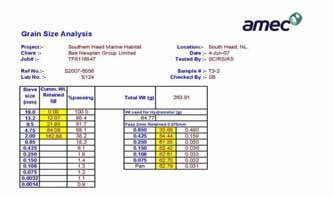
236 Page F6-2

237 Page F6-3


238 Page F6-4

239 Page F6-5

240 Page F6-6

241 Page F6-7

242 Page F6-8

243 Page F6-9

244 Page F6-10

245 Page F6-11
246 Page F6-12

247 Page F6-13

248 Page F6-14

249 Page F6-15


250 Page F6-16

251 Page F6-17

252 Page F6-18


253 Page F6-19

254 Page F6-20


255 Page F6-21

256 Page F6-22


257 Page F6-23
DRAFT REPORT. Submitted to: Public Works and Government Services Canada Saint John, New Brunswick
 PWGSC PROJECT #R.078190.002 UNDERWATER BENTHIC HABITAT SURVEY Proposed Construction and Dredge Areas Leonardville DFO-SCH Leonardville, Deer Island, New Brunswick DRAFT REPORT Submitted to: Public Works
Results of a Sediment Survey in the Near Offshore Waters of the Proposed Quarry Site in the Vicinity of Whites Cove, Digby Neck, Nova Scotia
 Results of a Sediment Survey in the Near Offshore Waters of the Proposed Quarry Site in the Vicinity of Whites Cove, Digby Neck, Nova Scotia Prepared for Paul G. Buxton P.O. Box 98 Annapolis Royal, Nova
Submersible investigation of unconfirmed western Miami Terrace habitat
 Submersible investigation of unconfirmed western Miami Terrace habitat Prepared By: Brian K. Walker, Ph.D. Nova Southeastern University Oceanographic Center 6/08/2015 On June 5, 2015 Nova Southeastern
APPENDIX A. Study Team Member Profiles
 APPENDIX A Study Team Member Profiles APPENDIX A Eugene Lee, M.Sc. 28) was an AMEC Senior environmental/aquatic biologist/project manager with 23 years consulting experience. Mr. Lee has extensive experience
Create your own map for tidepooling, beach field trips, boating, camping, kayaking, fishing, and exploring the beaches in Southcentral Alaska.
 Create your own map for tidepooling, beach field trips, boating, camping, kayaking, fishing, and exploring the beaches in Southcentral Alaska. Here s an opportunity to download and customize your own free
Relatively little hard substrate occurs naturally in the
 CHAPTER FIVE Rock Habitats Relatively little hard substrate occurs naturally in the estuary, owing mainly to the vast quantities of fine sediment that have been deposited by the rivers. Rock habitat is
Significant Ecological Marine Area Assessment Sheet
 Significant Ecological arine Area Assessment Sheet Name: Eastern Bay of Island Biogenic Soft Sediment Complex Summary: The semi-sheltered areas between the central islands of the Eastern Bay of Islands
The East of Nantucket Survey. Preliminary Results Presented by Eric Powell to the Habitat PDT on September 14, 2017
 The East of Nantucket Survey Preliminary Results Presented by Eric Powell to the Habitat PDT on September 14, 2017 Thanks Roger Mann who handled the logistics of the cruise Tom Dameron and others who provided
Offshore Video Survey and Oceanographic Analysis: Georges Bank to the Chesapeake project
 Non-Technical Synopsis of the Offshore Video Survey and Oceanographic Analysis: Georges Bank to the Chesapeake project Executive Summary Dave Bethoney Kristin Kleisner Mark Anderson Changsheng Chen Bradley
Documenting Plants & Animals in Each Habitat
 Documenting Plants & Animals in Each Habitat STEP 25: UNDERSTAND THE QUADRAT SURVEY METHOD It is not possible to count all the plants and animals in a habitat unit, since the habitat unit could be quite
Organisms in the Ocean
 Oceans Objective 8.E.1.2 Summarize evidence that Earth's oceans are a reservoir of nutrients, minerals, dissolved gases, and life forms: estuaries, marine ecosystems, upwelling, and behavior of gases in
The Coast: Beaches and Shoreline Processes
 1 2 3 4 5 6 7 8 9 The Coast: es and Shoreline Processes Trujillo & Thurman, Chapter 10 Oceanography 101 Chapter Objectives Recognize the various landforms characteristic of beaches and coastal regions.
The Coast: Beaches and Shoreline Processes Trujillo & Thurman, Chapter 10
 The Coast: es and Shoreline Processes Trujillo & Thurman, Chapter 10 Oceanography 101 Chapter Objectives Recognize the various landforms characteristic of beaches and coastal regions. Identify seasonal
MAINTENANCE DREDGE BENTHIC ASSESSMENT SUNSET POINT FARM LLC LONG POINT KEY MONROE COUNTY, FLORIDA. Prepared by:
 MAINTENANCE DREDGE BENTHIC ASSESSMENT SUNSET POINT FARM LLC LONG POINT KEY MONROE COUNTY, FLORIDA Prepared by: December 11, 2016 INTRODUCTION The owners of the Sunset Point Farms LLC, located on the northern
FINMARINET: Inventories and Planning for the Marine Natura 2000 Network in Finland. A.2 Geological inventories of the seafloor Final Report
 LIFE07 NAT/FIN/000151 FINMARINET: Inventories and Planning for the Marine Natura 2000 Network in Finland A.2 Geological inventories of the seafloor Final Report Geological Survey of Finland, GTK 1. Introduction
Geoduck Floating Nursery Monitoring Plan, Quarterly Reporting
 December 23, 2014 Mason County Department of Community Development Attn: Grace Miller, Senior Planner 411 N. Fifth Street PO Box 279 Shelton, WA 98584 Re: Geoduck Floating Nursery Monitoring Plan, Quarterly
Marine Farming Site North Kilbrannan North Kilbrannan Video Survey March 2017
 Marine Farming Site North Kilbrannan North Kilbrannan Video Survey March 2017 MARINE HARVEST ( SCOTLAND) LIMITED MARCH 2018 Registered in Scotland No. 138843 Registered Office, 1st Floor, Admiralty Park
Types of intertidal communities
 Between the tides Marine ecosystems 1 Intertidal Delimited by the highest high tide and the lowest low tides marks The best studied and best-understood by humans Relatively easy to sample compared to other
ARE YOU READY TO THINK? Look at the first slide THINK PAIR SHARE!
 ARE YOU READY TO THINK? Look at the first slide THINK PAIR SHARE! WHAT PROMINENT FEATURE CAN YOU IDENTIFY IN THIS PICTURE? What do you think the different colors represent? Who might find such a picture
Small area of the ocean that is partially surrounded by land. The Ocean Basins. Three Major Oceans. Three Major Oceans. What is a SEA?
 The Ocean Basins How Deep is the Ocean? 1 2 Three Major Oceans Three Major Oceans Pacific Atlantic the shallowest ocean (3.3km average depth) Indian second shallowest ocean (3.8km average depth) Pacific
The Problem. Which ecosystems are the most sensitive? Where will ecosystems be migrating? Where will investments be overwhelmed?
 BC Parks BC Parks is responsible for the designation, management and conservation of a system of ecological reserves, provincial parks and recreation areas located throughout the province. British Columbia
Eishort 2. Loch Eishort, Isle of Skye. Seabed Video Survey
 Eishort 2 Loch Eishort, Isle of Skye Seabed Video Survey Copyright Hjaltland Seafarms Ltd. All rights reserved. The copyright of this document rests with Hjaltland Seafarms Ltd; no citation from it, in
Essentials of Oceanography Eleventh Edition
 Chapter Chapter 1 15 Clickers Lecture Essentials of Oceanography Eleventh Edition Animals of the Benthic Environment Alan P. Trujillo Harold V. Thurman Chapter Overview Benthic communities include a variety
Joint Federal Agency Submerged Aquatic Vegetation Survey Guidance for the New England Region Updated August 11, 2016
 Joint Federal Agency Submerged Aquatic Vegetation Survey Guidance for the New England Region Updated August 11, 2016 FOREWORD This guidance is the result of on-going interagency collaboration between the
SCONSER QUARRY BASELINE VIDEO SURVE Y JANUARY 2017
 SCONSER QUARRY BASELINE VIDEO SURVE Y JANUARY 2017 Registered in Scotland No. 138843 Registered Office, 1st Floor, Admiralty Park Admiralty Road, Rosyth, Fife KY11 2YW Stob Ban House Glen Nevis Business
environmental conditions of Jacobsen s Beach, Kigoma, Tanzania.
 Ostracode Abundance and Diversity within Rocky Habitats of Jacobsen s Bay, Lake Tanganyika Heather Heuser and David Knox Introduction Lake Tanganyika, East Africa, is one of the oldest and deepest freshwater
Supplemental Slides. Shore: Junction of Land & Water. Junction of Land & Water. Sea Level Variations. Shore vs. Coast. Sea Level Variations
 Shore: Junction of Land & Water Supplemental Slides Sediments come off land Most get dumped at the beach Sediment interacts with ocean waves and currents Junction of Land & Water Features: Breaking waves,
Shore: Junction of Land & Water. Sediments come off land Most get dumped at the beach Sediment interacts with ocean waves and currents
 Shore: Junction of Land & Water Supplemental Slides Sediments come off land Most get dumped at the beach Sediment interacts with ocean waves and currents Junction of Land & Water Features: Breaking waves,
Fish and Fish Habitat Follow-up Program. Scotian Basin Exploration Project
 Fish and Fish Habitat Follow-up Program Scotian Basin Exploration Project April 2018 Contents 1 Introduction... 1 2 Scope... 1 3 EIS Commitments and Predictions... 2 4 Methodology and Reporting... 2 4.1
UNIT 1: WATER SYSTEMS ON EARTH CHAPTER 2: OCEANS CONTROL THE WATER CYCLE
 UNIT 1: WATER SYSTEMS ON EARTH CHAPTER 2: OCEANS CONTROL THE WATER CYCLE ORIGINS OF OCEAN WATER OCEANS HAVE FILLED OVER HUNDREDS OF MILLIONS OF YEARS SCIENTISTS BELIEVE THE OCEANS ARE MORE THAN 3 BILLION
Aim and objectives Components of vulnerability National Coastal Vulnerability Assessment 2
 ASSESSING THE UTILITY OF GEOMORPHIC SENSITIVITY MAPPING ON THE ILLAWARRA COAST Pamela Abuodha, Christina Baker, Chris Sharples, Darren Skene and Colin Woodroffe Geoquest Research Centre, University of
Habitat Mapping in The Hauraki Gulf Marine Park. Dan Breen
 Habitat Mapping in The Hauraki Gulf Marine Park Dan Breen Outline 1. Intro Habitat mapping 2. Coastal marine habitats and marine protected areas in the New Zealand Territorial Sea: a broad scale gap analysis
Earth / Environmental Science. Ch. 14 THE OCEAN FLOOR
 Earth / Environmental Science Ch. 14 THE OCEAN FLOOR The Blue Planet Nearly 70% of the Earth s surface is covered by the global ocean It was not until the 1800s that the ocean became an important focus
Unit 4 - Water. Earth s Interior. Earth s Interior. Continental Drift. Continental Drift. Continental Drift. Crust. Mantle. Core.
 Unit 4 - Water How did the oceans form? What special adaptations do saltwater organisms have? Where does our water come from? How do humans affect the Earth s water? Crust Rigid outer shell of Earth Oceanic
Labrador Island Transmission Link
 Marine Habitats in the Strait of Belle Isle: Interpretation of 2007 Geophysical (Sonar) Survey Information for the Submarine Cable Crossing Corridors Prepared for: Nalcor Energy Hydro Place, 500 Columbus
Rock Boulder RockSand 1 RockSand 2 RockSand 3 Sand
 Figure 15. Histogram comparison of ROV observed primary substrates determined from 33,605 dgps positions to RoxAnn seabed classification. Pie charts represent the percentage of ROV modified primary substrate
Project 1.3.1: Improved knowledge of biota, habitats and risks. Project Leader: Dr Mick Haywood, CSIRO Division of Marine and Atmospheric Research
 Marine and Tropical Sciences Research Facility (MTSRF) June 2007 Milestone Report Project 1.3.1: Improved knowledge of biota, habitats and risks Project Leader: Dr Mick Haywood, CSIRO Division of Marine
Marine Ecology Pacing Guide
 Marine Ecology Pacing Guide Course Description: The focus of the course is the interrelationships among marine organisms and the physical, chemical, geological and biological factors. North Carolina coastal
200 Meters Down Topic: Ocean Zones (5 th 8 th grade)
") 200 Meters Down Topic: Ocean Zones (5 th 8 th grade) by Lodge 200 Meters Down Have you people heard about the plankton? Just tiny algae and it s floating, right What about the nekton like jellyfish? They
200 Meters Down Topic: Ocean Zones (5 th 8 th grade) by Lodge 200 Meters Down Have you people heard about the plankton? Just tiny algae and it s floating, right What about the nekton like jellyfish? They
Preliminary Report Oceana Important Ecological Areas Seafloor Habitat Expedition Off the Central Oregon Coast. November 1, 2013
 Preliminary Report Oceana Important Ecological Areas Seafloor Habitat Expedition Off the Central Oregon Coast Prepared by: Geoff Shester 1, Ben Enticknap 2, Matthias Gorny 3, and Jason Adelaars 4 November
Confidence Assessment Scoring System
 Confidence Assessment Scoring System Confidence field Confidence group Confidence question Comments Remote sensing data collection RemoteTechnique Were the techniques used appropriate for the ground type?
Marine biologists have identified over 250,000 marine species. This number is constantly increasing as new organisms are discovered.
 A wide variety of organisms inhabit the marine environment. These organisms range in size from microscopic bacteria and algae to the largest organisms alive today blue whales, which are as long as three
Marine Life. and Ecology. 2. From phytoplanktons to invertebates
 Marine Life and Ecology 2. From phytoplanktons to invertebates Virtually all primary productivity on land comes from large seaweeds such as these do exist, but they need shallow water where Sunlight is
are unconsolidated particulate materials that either precipitate from or are deposited by a fluid (e.g., water, wind);
;") Sediments... are unconsolidated particulate materials that either precipitate from or are deposited by a fluid (e.g., water, wind); provide information about the past depositional environments and climatic
Sediments... are unconsolidated particulate materials that either precipitate from or are deposited by a fluid (e.g., water, wind); provide information about the past depositional environments and climatic
Phillip Island Nature Parks Coastal Process Study 8 October 2014
 Phillip Island Nature Parks Coastal Process Study 8 October 2014 Project Overview Coastal Geology Basaltic and fragmented lavas, granite at Pyramid Rock and Cape Woolamai Weathered basalt (>10m thick)
Modeling habitat suitability for the European green crab using the ShoreZone mapping system
 Modeling habitat suitability for the European green crab using the ShoreZone mapping system Jodi N. Harney, Ph.D. and John R. Harper, Ph.D. Coastal and Ocean Resources Inc. Mary Morris, R.P. Bio. Archipelago
Oceanography. Oceanography is the study of the deep sea and shallow coastal oceans.
 Oceanography Oceanography is the study of the deep sea and shallow coastal oceans. Studying the Ocean Floor To determine the shape and composition of the ocean floor, scientists use techniques such as
The Marine Environment
 The Marine Environment SECTION 16.1 Shoreline Features In your textbook, read about erosional landforms, beaches, estuaries, longshore currents, and rip currents. For each statement below, write or. 1.
CHAPTER 28. PHYSIOGRAPHY Cook Inlet Drainages
 PEBBLE PROJECT ENVIRONMENTAL BASELINE DOCUMENT 2004 through 2008 CHAPTER 28. PHYSIOGRAPHY Cook Inlet Drainages PREPARED BY: Knight Piésold Ltd. PHYSIOGRAPHY COOK INLET DRAINAGES TABLE OF CONTENTS TABLE
THE INTERTIDAL ZONE AND BENTHIC ORGANISMS
 THE INTERTIDAL ZONE AND BENTHIC ORGANISMS EPSS 15 Lab #8 OUTLINE I. Intertidal zonation Tides Biotic zonation Physical conditions & biotic interactions II. Intertidal organisms & adaptations Snails Mussels
The Marine Environment
 The Marine Environment SECTION 16.1 Shoreline Features In your textbook, read about erosional landforms, beaches, estuaries, longshore currents, and rip currents. For each statement below, write true or
Final Survey/Data Report
 US ARMY CORPS OF ENGINEERS New England District Contract No. DACW33-03-D-004 Delivery Order No. 05 November 2004 Final Survey/Data Report Boston Harbor Deep Draft Navigation Improvement Project Biological
ssessments Ecoregional Assessment
 Standard 7: Select terrestrial, freshwater and marine conservation targets/biodiversity elements/features across multiple biological and spatial scales. Case Study: Shoreline Habitat Classification for
West of Wedge Zone Assessment
 Appendix 11 West of Wedge Zone Assessment INITIAL ENVIRONMENTAL ASSESSMENT FOR THE ESTABLISHMENT OF A NEW MARINE FARMING ZONE: WEST OF WEDGE, SOUTHERN TASMANIA Report to Tassal November 2016 www.aquenal.com.au.au
14.2 Ocean Floor Features Mapping the Ocean Floor
 14.2 Ocean Floor Features Mapping the Ocean Floor The ocean floor regions are the continental margins, the ocean basin floor, and the mid-ocean ridge. 14.2 Ocean Floor Features Continental Margins A continental
Spatial variation in the abundance of eelgrass (Zostera marina) at eight sites in western Newfoundland, Canada 5/5/2015 V2.0
 at eight sites in western Newfoundland, Canada 5/5/2015 V2.0") Spatial variation in the abundance of eelgrass (Zostera marina) at eight sites in western Newfoundland, Canada 5/5/2015 V2.0 1 Summary The abundance of eelgrass (Zostera marina) was quantified at eight
Spatial variation in the abundance of eelgrass (Zostera marina) at eight sites in western Newfoundland, Canada 5/5/2015 V2.0 1 Summary The abundance of eelgrass (Zostera marina) was quantified at eight
1. Oceans. Example 2. oxygen.
 1. Oceans a) Basic facts: There are five oceans on earth, making up about 72% of the planet s surface and holding 97% of the hydrosphere. Oceans supply the planet with most of its oxygen, play a vital
 http://www.neic.cr.usgs.gov/neis/pands/global.html Global Seismicity and World Cities This map displays the worldwide hazard to cities by large earthquakes. When earthquakes occur near cities, the potential
FINAL REPORT: Scotian Basin Exploration Drilling Project Aspy D-11A Well Sediment Deposition Survey Report
 FINAL REPORT: Scotian Basin Exploration Drilling Project Aspy D-11A Well Sediment Deposition Survey Report Prepared for: BP Canada Energy Group ULC 1701 Hollis Street 10th Floor Founders Square Halifax,
Grade 8 Science. Unit 1: Water Systems on Earth Chapter 2
 Grade 8 Science Unit 1: Water Systems on Earth Chapter 2 Oceans are important... 1. Primary water source for the water cycle 2. Control weather 3. Support diverse life 4. Provides humans with food, minerals,
Lecture Outlines PowerPoint. Chapter 13 Earth Science 11e Tarbuck/Lutgens
 Lecture Outlines PowerPoint Chapter 13 Earth Science 11e Tarbuck/Lutgens 2006 Pearson Prentice Hall This work is protected by United States copyright laws and is provided solely for the use of instructors
CLAM DREDGE FRAMEWORK ADJUSTMENT
 New England Fishery Management Council 50 WATER STREET NEWBURYPORT, MASSACHUSETTS 01950 PHONE 978 465 0492 FAX 978 465 3116 John F. Quinn, J.D., Ph.D., Chairman Thomas A. Nies, Executive Director CLAM
Designing Networks of Marine Protected Areas in DFO s Three Atlantic Bioregions
 Designing Networks of Marine Protected Areas in DFO s Three Atlantic Bioregions Presentation for Indigenous Protected Areas Workshop Max Westhead, DFO and Adrian Gerhartz-Abraham, Dalhousie March 29, 2017
"The Relationship Between Seagrass Cover and Species- richness of Invertebrates"
 "The Relationship Between Seagrass Cover and Species- richness of Invertebrates" SCIE 2204: Marine Systems The Cottesloe Marine Ecosystem Research Project 2014 By Baronie Shaw, K., Bortoloso, T., Cargill,
1 Shoreline Erosion and Deposition
 CHAPTER 12 1 Shoreline Erosion and Deposition SECTION Agents of Erosion and Deposition BEFORE YOU READ After you read this section, you should be able to answer these questions: What is a shoreline? How
A SURVEY OF THE WESTERN BLUE GROPER IN WESTERN SOUTH AUSTRALIA
 A SURVEY OF THE WESTERN BLUE GROPER IN WESTERN SOUTH AUSTRALIA By Scoresby A. Shepherd and James B. Brook Reef Watch, c/o Conservation Council of South Australia, 120 Wakefield St, Adelaide, 5000. 4 January
Section 2.1 Ocean Basins. - Has helped determine where ocean basins are located. - Tectonic plates move changing the position of the continents.
 Science 8 Unit 1: Water Systems on Earth Chapter 2: Oceans Control the Water Cycle Section 2.1 Ocean Basins Oceans are important because: 1. Primary water source for the water cycle 2. Control weather
Question: What is the primary reason for the great abundance of fish along the Peruvian coast?
 Buzzer Question # 1 Question Type: toss-up Question Format: Multiple Choice Category: Biology What is the primary reason for the great abundance of fish along the Peruvian coast? Answer W: upwelling Answer
FRESHWATER FISH AND FISH HABITAT COMPONENT STUDY
 Environmental Impact Assessment Component Study FRESHWATER FISH AND FISH HABITAT COMPONENT STUDY Prepared For: Newfoundland and Labrador Refining Corporation 87 Water St Harvey Building, 2 nd Floor St.
Glacial Geology of Moose Point State Park, ME
 Geologic Site of the Month May, 2013 Glacial Geology of Moose Point State Park, Maine 44 o 25 59.18"N, 68 o 56 37.11"W Text and photos by Woodrow B. Thompson, Department of Agriculture, Conservation &
Salmon Aquaculture Environmental Monitoring Data Report. Results of Sampling Program for Year Clayton Rd., RR #1 Sidney, BC V8L 5P6
 Salmon Aquaculture Environmental Monitoring Data Report Results of Sampling Program for Year 2002 by Cindy Wright 1, Bernie Taekema 2, Brenda Burd 1, and Eric McGreer 2 1 Ecostat Research Ltd. 1040 Clayton
Benthic habitat mapping: a synopsis of methodologies and approaches. Dr. Craig Brown University of Ulster
 Benthic habitat mapping: a synopsis of methodologies and approaches Dr. Craig Brown University of Ulster Technological advances in remote sensing Insitu sampling Improving technology Single beam acoustics/video
Foundations of Earth Science, 6e Lutgens, Tarbuck, & Tasa
 Foundations of Earth Science, 6e Lutgens, Tarbuck, & Tasa Oceans: The Last Frontier Foundations, 6e - Chapter 9 Stan Hatfield Southwestern Illinois College The vast world ocean Earth is often referred
8.1 Attachment 1: Ambient Weather Conditions at Jervoise Bay, Cockburn Sound
 8.1 Attachment 1: Ambient Weather Conditions at Jervoise Bay, Cockburn Sound Cockburn Sound is 20km south of the Perth-Fremantle area and has two features that are unique along Perth s metropolitan coast
Marine ecosystem mapping at the Prince Edward Islands
 Marine ecosystem mapping at the Prince Edward Islands Biodiversity Planning Forum NBA special session June 2018 R Adams, C von der Meden, A Dayaram, K Sink, A Lombard, A Bosman, M Dopolo, F Fourie, L Harris,
Objectives: Describe the structure of the ocean floor. Describe light intensity and temperature characteristics at different ocean depths.
 Ocean Structure Virtual Lab What are some characteristics of the ocean and the ocean floor? Earths highest mountains, deepest valleys, and flattest plains are found not on land but under the ocean. Beyond
Chapter 02 The Sea Floor
 Chapter 02 The Sea Floor Multiple Choice Questions 1. One of the following is not one of the world's major ocean basins: A. Atlantic Ocean B. Arctic Ocean C. Indian Ocean D. Antarctic Ocean E. Pacific
SYDNEY MARINE TERMINAL Second Berth Progress
 SYDNEY MARINE TERMINAL Second Berth Progress Second Berth - Project Proponents Second Berth - Project Partners Second Berth - Key Stakeholder Second Berth Project Components New Second Berth: 1 2 Main
Freshwater Mussel Surveys in Mystic Lake and Middle Pond: (Barnstable, Massachusetts)
") REPORT Freshwater Mussel Surveys in Mystic Lake and Middle Pond: 2007-2017 (Barnstable, Massachusetts) prepared for Town of Barnstable 367 Main Street Hyannis, MA 02601 prepared by biodrawversity Biodrawversity
REPORT Freshwater Mussel Surveys in Mystic Lake and Middle Pond: 2007-2017 (Barnstable, Massachusetts) prepared for Town of Barnstable 367 Main Street Hyannis, MA 02601 prepared by biodrawversity Biodrawversity
Intertidal shellfish monitoring in the northern North Island region,
 Intertidal shellfish monitoring in the northern North Island region, 2014 15 New Zealand Fisheries Assessment Report 2015/59 K. Berkenbusch P. Neubauer ISSN 1179-6480 (online) ISBN 978-1-77665-063-7 (online)
Purpose of large scale mapping/inventories
 Mapping of benthic habitats in NE Baltic Sea Georg Martin Estonian Marine Institute, University of Tartu & good colleagues from EMI, IAE and CORPI Protecting the marine ecosystem Lessons learned from project
Crustose algae communities on Baltic infralittoral rock and mixed substrata
 European Red List of Habitats Marine: Baltic Habitat Group Crustose algae communities on Baltic infralittoral rock and mixed substrata Summary This benthic habitat is present throughout the Baltic where
Introduction: Natural Bridges Setting and Tidepool Habitats
 Introduction: Natural Bridges Setting and Tidepool Habitats 1. Physical setting microcosm of coast- zone influenced by 1) river, 2) waves/tides, 3) wind (NW) Rock Types (wave cut bench) Santa Cruz Mudstone
The Ocean Floor Earth Science, 13e Chapter 13
 The Ocean Floor Earth Science, 13e Chapter 13 Stanley C. Hatfield Southwestern Illinois College The vast world ocean Earth is often referred to as the blue planet Seventy-one percent of Earth s surface
Shoreline and Climate Change Adaptation Alternatives for The Letter Parcel, Bolinas Lagoon
 Shoreline and Climate Change Adaptation Alternatives for The Letter Parcel, Bolinas Lagoon Scenic shoreline vista of Bolinas Lagoon and ridges, from Letter Parcel, March 2016 Peter Baye, Coastal Ecologist
Kigoma Bay bathymetry, sediment distribution, and acoustic mapping
 Kigoma Bay bathymetry, sediment distribution, and acoustic mapping Student: Gwynneth Smith Mentor: Kiram Lezzar Introduction Echosounding is a method commonly employed for determining the bathymetry of
Unit 1: Water Systems on Earth Chapter 2
 Unit 1: Water Systems on Earth Chapter 2 Create a mind map with the driving question, Why are Oceans Important? Remember: Why are oceans so important? Why are oceans so important? Primary water source
Dynamic preservation of the coastline
 Dynamic preservation of the coastline Content Introduction The Dutch coastal defence by dynamic processes Data collection Management of the sand resources Growing importance of marine sand and gravel resources
Shoreline Assessment Job Aid National Oceanic and Atmospheric Administration NOAA Ocean Service Office of Response and Restoration Hazardous
 Shoreline Assessment Job Aid National Oceanic and Atmospheric Administration NOAA Ocean Service Office of Response and Restoration Hazardous Materials Response Division This job aid was produced and published
The Sea Floor. Chapter 2
 The Sea Floor Chapter 2 Geography of the Ocean Basins World ocean is the predominant feature on the Earth in total area Northern Hemisphere = 61% of the total area is ocean. Southern Hemisphere = about
US ARMY CORPS OF ENGINEERS New England District BUILDING STRONG
 US ARMY CORPS OF ENGINEERS New England District STUDIES Sediment Sampling Biological Sampling (benthic community analysis) Hydroacoustic Surveys (side scan sonar, bathymetry) Remotely Operated Vehicle
Lab Activity Mid-Atlantic Ridge
 Lab Activity Mid-Atlantic Ridge Key Features: Constructing Profiles of: Atlantic Ocean floor Age of the Atlantic Ocean bedrock Magnetic Polarity of ocean bedrock By Kaitlin Coder https://www.teacherspayteachers.com/store/nys-earth-science-and-living-environment-regents
17-20 November 2007 Incidental Take Monitoring Methodology and Results
 Sample Site Selection Protocol 17-20 November 2007 Incidental Take Monitoring Methodology and Results On 16 November 2007, the U.S. Fish and Wildlife Service (USFWS) provided the USACE Mobile District
C. STUDENT FIELD DATA SHEETS
 C. STUDENT FIELD DATA SHEETS Student Name Date Time Stream Location Parameter to find Your Group s Results Units trial trial average Transparency cm Water Temperature Air Temperature Weather N sunny N
Almost of Earth is covered by water. On a map, the continents appear as huge islands surrounded by a vast global ocean.
 Earth s Oceans & Ocean Floor Date: Feelin Blue What are Earth s five main oceans? Almost of Earth is covered by water. On a map, the continents appear as huge islands surrounded by a vast global ocean.
III. Acropora coral habitat distribution
 2008 Quick Look Report: Miller et al. III. Acropora coral habitat distribution Background The declines in abundance of two of the principal Caribbean reef-building corals, staghorn coral (Acropora cervicornis)
Bishopville Prong Study
 Bathymetric and Sediment Assessment in the Bishopville Prong of St. Martin River Darlene V. Wells, Richard A. Ortt, Jr., and Stephen Van Ryswick Funded by MCBP 2011-2012 Implementation Grant Objectives
by B.A. Foster THE EFFECT OF ASPECT ON POPULATION COMPOSITION
 TANE (1966) 12 : 37-44 37 THE EFFECTS OF WAVE EXPOSURE AND ASPECT ON THE VERTICAL SHORE DISTRIBUTION AND POPULATION COMPOSITION OF MELARHAPHA OLIVERI. by B.A. Foster INTRODUCTION The periwinkle Melarhapha
The Ocean Floor Chapter 14. Essentials of Geology, 8e. Stan Hatfield and Ken Pinzke Southwestern Illinois College
 The Ocean Floor Chapter 14 Essentials of Geology, 8e Stan Hatfield and Ken Pinzke Southwestern Illinois College The vast world ocean Earth is often referred to as the water planet 71% of Earth s surface
RED LIST OF EUROPEAN HABITATS. Marine Results Presentation 24 th May, 2016
 RED LIST OF EUROPEAN HABITATS Marine Results Presentation 24 th May, 2016 Geographical scope of the project Habitat Typology One typology for marine and terrestrial At the same time... revision of EUNIS