Seafloor Mapping in the High Arctic: The Challenges and the Joys
|
|
|
- Reginald Garrison
- 5 years ago
- Views:
Transcription

1 Seafloor Mapping in the High Arctic: The Challenges and the Joys Larry Mayer Center for Coastal and Ocean Mapping / NOAA- UNH Joint Hydrographic Center University of New Hampshire, USA Martin Jakobsson Dept of Geology and Geochemsitry Stockholm University Arctic Change Quebec City 11 Dec 2008

2 A geospatial context for our studies of Arctic change Nansen soundings.

")

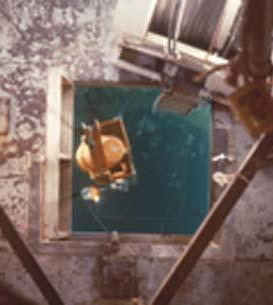
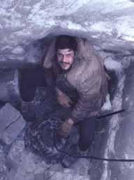
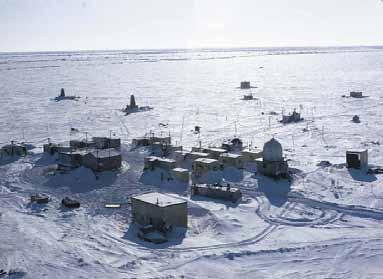
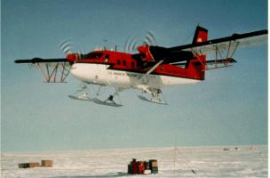
3 Fletcher s Ice Island (T-3) LOREX Hydro-Hole Echo sounder Positioning
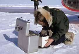
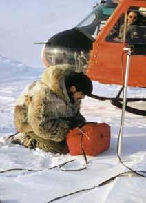

4 Airborne Measurements and Point Soundings Gravity Measurement Magnetometer Depth Sounding
5 CHS & GEBCO (1967,1968,1979)

.")
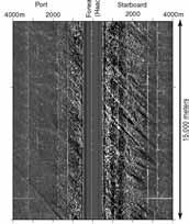
6 Data from Nuclear Submarines Sounding tracks of US Navy submarines from 1983 to 1988 (from Bob Anderson via NGDC).
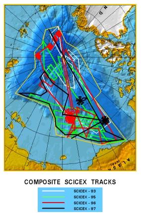
7 SCICEX ( )

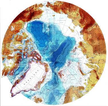
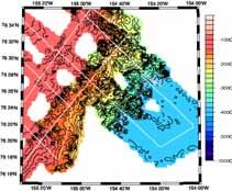
8 IBCAO 1999

9 IBCAO 1999


10 The Drivers Climate Change UNCLOS
11 United Nations Convention on the Law of the Sea Article 76 Six hundred and seventeen words that redefine the continental shelf of a coastal state and provide a mechanism for the state to extend its sovereign rights over the resources of the seabed and subsoil of the continental shelf
 if.")
12 UNCLOS Article 76 The Process All coastal states are entitled to a 200 nm EEZ A coastal state is entitled to sovereign rights over the resources of the seabed and subsoil of "submerged extensions of the continental margin" beyond their 200 nm Exclusive Economic Zone (EEZ) if. Demonstrate a natural prolongation of the coastal state s territorial landmass typically broad continental shelf and/or thick sedimentary wedge
13 Data Required Once the natural prolongation is established the extended continental shelf beyond the 200 nm EEZ is determined by a set of formulae and limit lines defined from the: depth and shape of the seafloor (FOS and 2500m contour) the thickness of the underlying sediments (1% line) distances from the territorial sea baselines (350 nm line) Need to map the seafloor


14 Bering Sea 2003 UNH CCOM-JHC U.S. Law-of of-the-sea Bathymetric Mapping to Date..Arctic Gulf of Alaska 2005 Atlantic soon Marianas Gulf of Mexico 2007 Kingman Reef- Palmyra Atoll soon Mayer et al U.S. Law-of-the-Sea Desktop Study


15 Arctic is unique as an ocean basin in that >52% is made up of shelf (geologic)


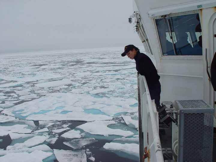
16 Semi-enclosed enclosed basin with five nations having potential extended shelves From Ron McNab


17 Session T12 Law and Politics of Canadian Jurisdiction on the Arctic Ocean Seabed From Durham University

18 Single Beam Echo Sounder

19 Multibeam Echo Sounder
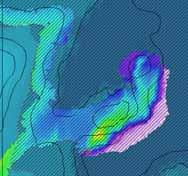
20

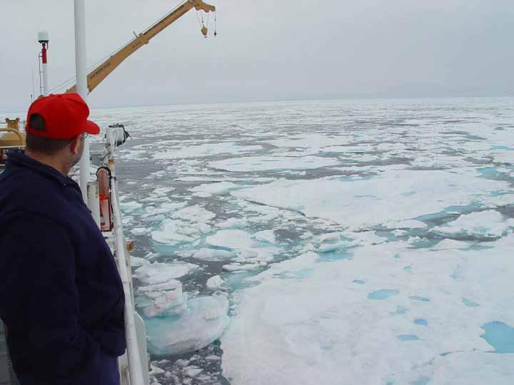
21 A new perspective new insights

22 Arctic - Chukchi Plateau mapping USCGC Healy Andy Larry Seabeam khz, receive beams bathymetry & acoustic backscatter Knudsen 320BR 3.5-kHz chirp profiler UNH: bathymetry, backscatter & 3.5-kHz processing at sea

23 2003 & & 2008 Chukchi plateau Barrow margin
24 Arctic Mapping 2003,2004,2007,2008 cruise statistics operations days transits.. 24 days average speed (in ice)...4 kts average sea-ice state.. 9/10 tracklines ~24,300 km Area mapped.. ~135,000 km 2

25 Healy ~3000 km of multibeam sonar bathymetry Sept 03 8/10 ice

26 typical ice conditions /10 cheesy ice

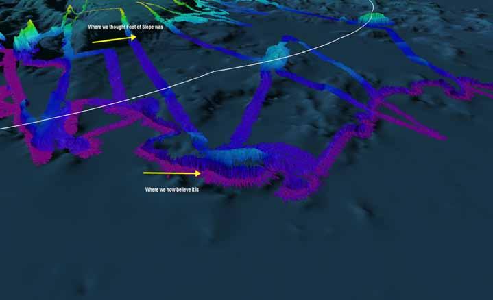
27 Redefinition of the 2500 m contour

28 Healy Seamount looking S, ve=6x water depth (m) 3100 m high, summit at 900 m water depth 45 km long x 15 km wide

29 Healy Seamount Survey

30 2004 Chukchi plateau Radarsat ice coverage for 10 October Image processed at either ASF, Qinetic or CDPF. CSA2004

31 How do we map in this? Grönland

32 HEALY TRACK 6-26 Oct line km Ratchet Surveying Pirouette Surveying

33 mapped 2500-m isobath Barrow margin looking SE, ve=10x ridges <300 m high, ~100 km long 2500 m N erosion

34 HEALY Depart Barrow: 17 Aug. 07 Return Barrow 15 Sept. 07
35
36

37 78 N 81 N HEALY N 72 N mapping the 2500-m isobath & foot of the slope


38 Healy 03-02, 02, 04-05, 05, results perspective view looking SW

39
40

41 HEALY 0805 SHIPTRACK AND DREDGE SITES

42 HEALY 0806 and LOUIS St. LAURENT WORK
43 2003, 2004 & 2007 Arctic surveys scours & bedforms Pt Barrow Barrow margin km

44 ice grooves 3 to 5 m deep -470 m central Chukchi Plateau -380 m A B B A λ = ~2 km H = ~10 m

45 2003, 2004 & 2007 Arctic surveys pockmarks Pt Barrow Barrow margin km

46 central Chukchi Plateau pockmarks 200-m diameter 20-m deep VE = 10x looking SW


47 E u r a s i a n S h e l f S e a s Chukchi Borderland Yermak Plateau Lomonosov Ridge Alpha-Mendeleev Gakkel Ridge Multibeam mapping USCGC Healy I/B Oden R/V Polarstern Mackenzie Canadian Archipelago CCGS Amundsen Morris Jesup Rise

48 Glacial Sole Marks 5 km Click to edit Master text styles Second level Third level Fourth level» Fifth level From S. Blasco Amundsen Gulf

49 Gary Knolls Mud Volcanoes Beaufort Sea From S. Blasco


50 Shelf Slump Beaufort Shelf More at session T34 Eastern Edge Seafloor Mapping of the Western Edge Arctic Ocean - Room 207 From S. Blasco


51 45ºW 90ºW 135ºW 180ºE HOTRAX 2005 IODP Leg 302 0º 45ºE 90ºE 135º SCICEX 99 Polarstern LOMROG 2007 AMORE, Healy/Polarstern


52 Jakobsson et al. 2005, QSR Polyak et al. 2002, Nature Morris- Jessup Rise Kristoffersen & Mikkelsen 2006, Marine Geol. Jakobsson 1999, Marine Geology Polyak et al., 2002, Nature
53 IBCAO Nansen ~6 6 % OF THE ARCTIC OCEAN HAS BEEN MAPPED WITH MULTIBEAM THERE IS MUCH MUCH MORE TO DISCOVER!!!
54

55
56

57 Bathymetric Compilation IBCAO (2002)
58

59 ??? Resources of extended U.S. continental shelf estimated to be worth 1.3 TRILLION $ Murton,, B.J, Parsons, L.M., Hunter, P. and Miles, P., 2001, Global non-living resources on the the extended continental shelf: Prospects at the year 2000, Intl. Seabed Authority Tech. Study No 1
Mapping in the Arctic Ocean in Support of a Potential Extended Continental Shelf
 Mapping in the Arctic Ocean in Support of a Potential Extended Continental Shelf Larry A. Mayer, Andrew A. Armstrong and James V. Gardner Center for Coastal & Ocean Mapping-Joint Hydrographic Center University
Challenges of Collecting Data for Article 76 in Ice Covered Waters of the Arctic
 Challenges of Collecting Data for Article 76 in Ice Covered Waters of the Arctic 5 th ABLOS Conference Monaco October 16, 2008 Richard MacDougall - Canada Jacob Verhoef - Canada Wendell Sanford - Canada
NOAA/University of New Hampshire Joint Hydrographic Center & Center for Coastal and Ocean Mapping. MAPPS Summer Conference July 23, 2013
 NOAA/University of New Hampshire Joint Hydrographic Center & Center for Coastal and Ocean Mapping MAPPS Summer Conference July 23, 2013 07/23/2013 2 07/23/2013 3 Center Goals To be a world leader in the
The Continental Shelf Project: An overview of research activities in the Arctic Ocean on behalf of the Kingdom of Denmark
 The Continental Shelf Project: An overview of research activities in the Arctic Ocean on behalf of the Kingdom of Denmark Geological Survey of Denmark and Greenland Ministry of Climate and Energy John
Proceedings of the Canadian Hydrographic Conference and National Surveyors Conference 2008
 From the Arctic to the Tropics: The U.S. UNCLOS Bathymetric Mapping Program James V. Gardner, Larry A. Mayer and Andrew A. Armstrong CCOM/JHC University of New Hampshire, Durham, NH Abstract Since CHC2006,
Operating conditions in the Arctic: Data acquisition in the Arctic Ocean by the Continental Shelf Project of the Kingdom of Denmark
 Operating conditions in the Arctic: Data acquisition in the Arctic Ocean by the Continental Shelf Project of the Kingdom of Denmark By Christian Marcussen Geological Survey of Denmark and Greenland Danish
The french national programme for claiming continental shelf beyond 200 Miles
 The french national programme for claiming continental shelf beyond 200 Miles Using global bathymetric models in the context of an Extended Continental Shelf submission EXTRAPLAC Using Global Bathymetric
MARINE GEOLOGY & GEOGRAPHY
 MARINE GEOLOGY & GEOGRAPHY Bathymetry BATHYMETRY BATHYMETRY THE UNDERWATER EQUIVALENT TO TOPOGRAPHY THE STUDY OF WATER DEPTH A BATHYMETRIC MAP SHOWS FLOOR RELIEF OR TERRAIN AS CONTOUR LINES Bathymetry
Bathymetric data acquisition in Arctic waters
 Bathymetric data acquisition in Arctic waters within the Danish Continental Shelf Project Morten Sølvsten, Uni Bull, Richard Pedersen & Christian Marcussen Arctic-Antarctic Seafloor Mapping Meeting 2011
UNCLOS Article 76- Formulae and constraint lines
 UNCLOS Article 76- Formulae and constraint lines Dr Lindsay Parson (UNCLOS Group, National Oceanography Centre, UK) ABLOS TUTORIAL SESSION - Article 76 of UNCLOS 10th October 2005 IHO/IAG/IOC Advisory
SCICEX Phase 2 Accommodation Cruises. Provided by T. Boyd
 SCICEX Phase 2 Accommodation Cruises Provided by T. Boyd OBJECTIVES Re-invigorate the SCICEX Science Advisory Committee Maximize the contribution of SCICEX in understanding di the Arctic Ocean processes
COMPLICATIONS IN DELIMITING THE OUTER CONTINENTAL SHELF. Ron Macnab Geological Survey of Canada (Retired)
") COMPLICATIONS IN DELIMITING THE OUTER CONTINENTAL SHELF Ron Macnab Geological Survey of Canada (Retired) DISCLAIMER The contents of this presentation are the author s personal views only, and do not represent
COMPLICATIONS IN DELIMITING THE OUTER CONTINENTAL SHELF Ron Macnab Geological Survey of Canada (Retired) DISCLAIMER The contents of this presentation are the author s personal views only, and do not represent
An improved bathymetric portrayal of the Arctic Ocean: Implications for ocean modeling and geological, geophysical and oceanographic analyses
 GEOPHYSICAL RESEARCH LETTERS, VOL. 35, L07602, doi:10.1029/2008gl033520, 2008 An improved bathymetric portrayal of the Arctic Ocean: Implications for ocean modeling and geological, geophysical and oceanographic
CONFERENCE OF PARLIAMENTARIANS OF THE ARCTIC REGION. UN LOS Convention and the extended continental shelf in the Arctic
 CONFERENCE OF PARLIAMENTARIANS OF THE ARCTIC REGION UN LOS Convention and the extended continental shelf in the Arctic Presentation given by Dr. Kamrul Hossain Finnish Parliament 18 November 2009 Contents
High-resolution Geophysical Mapping of Submarine Glacial Landforms
 High-resolution Geophysical Mapping of Submarine Glacial Landforms M. Jakobsson 1, J.A. Dowdeswell 2, M. Canals 3, B.J. Todd 4, E.K. Dowdeswell 2, K.A. Hogan 5 L.A. Mayer 6 1 Stockholm University, Sweden
OUTER CONTINENTAL SHELF CLAIMS IN THE ARCTIC. Presentation given by Dr. Kamrul Hossain ASA University Bangladesh 15 March 2010
 OUTER CONTINENTAL SHELF CLAIMS IN THE ARCTIC Presentation given by Dr. Kamrul Hossain ASA University Bangladesh 15 March 2010 Contents Historical background of the continental shelf Concept of continental
THE MEASUREMENT AND ANALYSIS OF BATHYMETRY, MORPHOLOGY, AND SEDIMENT THICKNESS
 THE MEASUREMENT AND ANALYSIS OF BATHYMETRY, MORPHOLOGY, AND SEDIMENT THICKNESS Ron Macnab Geological Survey of Canada (Retired) OUTLINE OF PRESENTATION Principles and practice of: Echo-sounding Seismic
SW Florida Escarpment Mapping Area
 Overview NOAA s Okeanos Explorer (EX) Program plans to conduct systematic mapping and telepresence-enabled ROV explorations in the Gulf of Mexico during Spring 2014. In 2011, the EX conducted mapping operations
28 January 2013 Community White Paper for Arctic Observing Summit 2013
 Arctic Ocean Bathymetry: A required geospatial framework 1 Martin Jakobsson, 2 Larry Mayer, and 2 David Monahan Department of Geological Sciences, Stockholm University, Sweden Center for Coastal and Ocean
Bathymetry Measures the vertical distance from the ocean surface to mountains, valleys, plains, and other sea floor features
 1 2 3 4 5 6 7 8 9 10 11 CHAPTER 3 Marine Provinces Chapter Overview The study of bathymetry determines ocean depths and ocean floor topography. Echo sounding and satellites are efficient bathymetric tools.
Canadian activities in the Pacific Arctic Region: 2016 icebreaker plans.
 Canadian activities in the Pacific Arctic Region: 2016 icebreaker plans. Pacific Arctic Group meeting Arctic Science Summit Week, Fairbanks, Alaska 13 March 2016 CCGS Louis S. St-Laurent UNCLOS misson:
Map shows 3 main features of ocean floor
 Map shows 3 main features of ocean floor 2017 Pearson Education, Inc. Chapter 3 Marine Provinces 2017 Pearson Education, Inc. 1 Chapter 3 Overview The study of bathymetry determines ocean depths and ocean
Chapter Overview. Bathymetry. Measuring Bathymetry. Measuring Bathymetry
 CHAPTER 3 Marine Provinces Chapter Overview The study of bathymetry determines ocean depths and ocean floor topography. Echo sounding and satellites are efficient bathymetric tools. Most ocean floor features
Small area of the ocean that is partially surrounded by land. The Ocean Basins. Three Major Oceans. Three Major Oceans. What is a SEA?
 The Ocean Basins How Deep is the Ocean? 1 2 Three Major Oceans Three Major Oceans Pacific Atlantic the shallowest ocean (3.3km average depth) Indian second shallowest ocean (3.8km average depth) Pacific
I. PURPOSE. This White Paper describes the role(s), value, and preparation requirements for a
, value, and preparation requirements for a") USE OF A SUBMARINE IN ICE-COVERED ARCTIC WATERS TO HELP DELIMIT THE U.S. EXTENDED CONTINENTAL SHELF (Draft White Paper from the U.S. Arctic Research Commission) (Rev. 12-18-07) I. PURPOSE. This White Paper
USE OF A SUBMARINE IN ICE-COVERED ARCTIC WATERS TO HELP DELIMIT THE U.S. EXTENDED CONTINENTAL SHELF (Draft White Paper from the U.S. Arctic Research Commission) (Rev. 12-18-07) I. PURPOSE. This White Paper
Bathymetric Attributed Grids (BAGs): Discovery of Marine Datasets and Geospatial Metadata Visualization
: Discovery of Marine Datasets and Geospatial Metadata Visualization") University of New Hampshire University of New Hampshire Scholars' Repository Center for Coastal and Ocean Mapping Center for Coastal and Ocean Mapping 2010 Bathymetric Attributed Grids (BAGs): Discovery
University of New Hampshire University of New Hampshire Scholars' Repository Center for Coastal and Ocean Mapping Center for Coastal and Ocean Mapping 2010 Bathymetric Attributed Grids (BAGs): Discovery
Unit 6: The Sea Floor
 Unit 6: The Sea Floor Turn to Page 62 in Introduction to the World s Oceans Study the bathymetric chart What features do you see? How do the Atlantic and Pacific Oceans differ? What do you think accounts
MARINE GEOLOGY & GEOGRAPHY
 MARINE GEOLOGY MARINE GEOLOGY & GEOGRAPHY Marine Geology 4 LAYERS OF THE EARTH CRUST THICKNESS: VARIES BETWEEN OCEAN & CONTINENTS 5-40 KM STATE: SOLID ELEMENTS: SILICON, ALUMINUM, CALCIUM, SODIUM, POTASSIUM
Multibeam Mapping of Feature Rich Seafloor in the U.S. Pacific Remote Islands Marine National Monument and on Mendocino Ridge off the California Coast
 University of New Hampshire University of New Hampshire Scholars' Repository Center for Coastal and Ocean Mapping Center for Coastal and Ocean Mapping 3-2015 Multibeam Mapping of Feature Rich Seafloor
ANALYSIS OF CLCS RECOMMENDATIONS IN LIGHT OF THEIR RELEVANCE TO THE DELINEATION OF A UNITED STATES EXTENDED CONTINENTAL SHELF (ECS) IN THE ARCTIC
 IN THE ARCTIC") ANALYSIS OF CLCS RECOMMENDATIONS IN LIGHT OF THEIR RELEVANCE TO THE DELINEATION OF A UNITED STATES EXTENDED CONTINENTAL SHELF (ECS) IN THE ARCTIC BY ONNI BOWEN IRISH Bachelor of Science in Foreign Service
ANALYSIS OF CLCS RECOMMENDATIONS IN LIGHT OF THEIR RELEVANCE TO THE DELINEATION OF A UNITED STATES EXTENDED CONTINENTAL SHELF (ECS) IN THE ARCTIC BY ONNI BOWEN IRISH Bachelor of Science in Foreign Service
Oceanography, An Invitation to Marine Science 9e Tom Garrison. Ocean Basins Cengage Learning. All Rights Reserved.
 Oceanography, An Invitation to Marine Science 9e Tom Garrison 4 Ocean Basins Key Concepts Tectonic forces shape the seabed The ocean floor is divided into continental margins and deep ocean basins The
Paleoceanography,, Seabed Morphology, and Geologic Framework of the Northwest Passage ArcticNet Project 1.6
 Paleoceanography,, Seabed Morphology, and Geologic Framework of the Northwest Passage ArcticNet Project 1.6 Robbie Bennett, Steve Blasco, Brian MacLean, Andre Rochon, John Hughes-Clarke, Jonathan Beaudoin,
FOOT OF THE CONTINENTAL SLOPE IN ARTICLE 76
 FOOT OF THE CONTINENTAL SLOPE IN ARTICLE 76 Vaughan Stagpoole, Institute of Geological & Nuclear Sciences, Lower Hutt, New Zealand, v.stagpoole@gns.cri.nz Ray Wood, Institute of Geological & Nuclear Sciences,
The Ocean Floor Earth Science, 13e Chapter 13
 The Ocean Floor Earth Science, 13e Chapter 13 Stanley C. Hatfield Southwestern Illinois College The vast world ocean Earth is often referred to as the blue planet Seventy-one percent of Earth s surface
Ocean Basins, Bathymetry and Sea Levels
 Ocean Basins, Bathymetry and Sea Levels Chapter 4 Please read chapter 5: sediments for next class and start chapter 6 on seawater for Thursday Basic concepts in Chapter 4 Bathymetry the measurement of
UNDERSEA FEATURE NAME PROPOSAL (Sea NOTE overleaf)
") INTERNATIONAL HYDROGRAPHIC ORGANIZATION INTERGOVERNMENTAL OCEANOGRAPHIC COMMISSION (of UNESCO) UNDERSEA FEATURE NAME PROPOSAL (Sea NOTE overleaf) Note: The boxes will expand as you fill the form. Name
INTERNATIONAL HYDROGRAPHIC ORGANIZATION INTERGOVERNMENTAL OCEANOGRAPHIC COMMISSION (of UNESCO) UNDERSEA FEATURE NAME PROPOSAL (Sea NOTE overleaf) Note: The boxes will expand as you fill the form. Name
Introduction to Acoustic Remote Sensing and Seafloor Mapping (AE4-E13) May 19, 2010
 May 19, 2010") Introduction to Acoustic Remote Sensing and Seafloor Mapping (AE4-E13) May 19, 2010 1 Delft Vermelding Institute onderdeel of Earth organisatie Observation and Space Systems Why Acoustic Remote Sensing?
Introduction to Acoustic Remote Sensing and Seafloor Mapping (AE4-E13) May 19, 2010 1 Delft Vermelding Institute onderdeel of Earth organisatie Observation and Space Systems Why Acoustic Remote Sensing?
SEA FLOOR MAPPING IN THE ARCTIC: SUPPORT FOR A POTENTIAL US EXTENDED CONTINENTAL SHELF
 SEA FLOOR MAPPING IN THE ARCTIC: SUPPORT FOR A POTENTIAL US EXTENDED CONTINENTAL SHELF By Larry A. Mayer, A. Armstrong, B, Calder and J. Gardner (USA) Abstract For the United States, the greatest opportunity
FINMARINET: Inventories and Planning for the Marine Natura 2000 Network in Finland. A.2 Geological inventories of the seafloor Final Report
 LIFE07 NAT/FIN/000151 FINMARINET: Inventories and Planning for the Marine Natura 2000 Network in Finland A.2 Geological inventories of the seafloor Final Report Geological Survey of Finland, GTK 1. Introduction
The Ocean Floor Chapter 14. Essentials of Geology, 8e. Stan Hatfield and Ken Pinzke Southwestern Illinois College
 The Ocean Floor Chapter 14 Essentials of Geology, 8e Stan Hatfield and Ken Pinzke Southwestern Illinois College The vast world ocean Earth is often referred to as the water planet 71% of Earth s surface
46ºN to 75ºN (Quebec City to the Beaufort Sea): 2011 Ocean Mapping Group Operations in the Canadian Arctic, Part III. By Doug Cartwright
: 2011 Ocean Mapping Group Operations in the Canadian Arctic, Part III. By Doug Cartwright") 46ºN to 75ºN (Quebec City to the Beaufort Sea): 2011 Ocean Mapping Group Operations in the Canadian Arctic, Part III By Doug Cartwright Doug Cartwright, Christine Legere and Pim Kuus met up with the CCGS
46ºN to 75ºN (Quebec City to the Beaufort Sea): 2011 Ocean Mapping Group Operations in the Canadian Arctic, Part III By Doug Cartwright Doug Cartwright, Christine Legere and Pim Kuus met up with the CCGS
U.S. Arctic Campaign Scenario
 Prepared by the NOAA Office of Ocean Exploration and Research for Nation Ocean Exploration Forum 2016: Beyond the Ships. Sea ice extent from National Snow Service Layer Credits: NOAA National Centers for
The route towards a new GEBCO grid
 The route towards a new GEBCO grid Pauline Weatherall, GEBCO Digital Atlas Manager British Oceanographic Data Centre (BODC) GEBCO TSCOM/SCRUM meeting, Monaco, October 2012 The route towards a new GEBCO
Finding the continental shelf integration of geology and geophysics
 Finding the continental shelf integration of geology and geophysics R Wood Institute of Geological and Nuclear Sciences, PO Box 30-368, Lower Hutt, Telephone 64-4-570 4867, Fax 64-4-570 4803, Email r.wood@gns.cri.nz
EXECUTIVE SUMMARY A SUBMISSION OF DATA AND INFORMATION ON THE OUTER LIMITS OF THE CONTINENTAL SHELF OF THE REPUBLIC OF NIGERIA PURSUANT TO
 EXECUTIVE SUMMARY A SUBMISSION OF DATA AND INFORMATION ON THE OUTER LIMITS OF THE CONTINENTAL SHELF OF THE REPUBLIC OF NIGERIA PURSUANT TO PART VI OF AND ANNEX II TO THE UNITED NATIONS CONVENTION ON THE
Detailed mapping of seabed topography,
 MAREANO program Detailed mapping of seabed topography, sediments, bottom fauna and pollutants in Norwegian waters HYDROGRAPHIC DATA FOR THE BENEFIT OF SOCIETY MAREANO program - Detailed mapping of seabed
MULTIPLE CHOICE. Choose the one alternative that best completes the statement or answers the question.
 Geology 300, Physical Geology Spring 2019 Quiz Chapter 18, Seafloor Name MULTIPLE CHOICE. Choose the one alternative that best completes the statement or answers the question. 1) Abyssal fans are made
Earth in 2-D, 3-D & 4-D
 Earth in 2-D, 3-D & 4-D We will consider the scientific tools and techniques used to map surface features, reconstruct the layered structure of Earth, and interpret Earth history, including the origin
Draft Presentation Carleton Conference on the Arctic Is There a Need for New Legal Regime in the Arctic?
 Draft Presentation Carleton Conference on the Arctic Is There a Need for New Legal Regime in the Arctic? Donald McRae, University of Ottawa The climatic changes affecting the Arctic have lead to visions
Legal Interpretation of Submarine Ridges & Submarine Elevations
 Legal Interpretation of Ridges & Article 76, paragraph 6 New Knowledge and Changing Circumstances in the Law of the Sea Reykjavik, Iceland June 28, 2018 Kevin Baumert U.S. Department of State U.S. ECS
The Continental Shelf Beyond 200 Nautical Miles in the Arctic Basin *
 717 The Continental Shelf Beyond 200 Nautical Miles in the Arctic Basin * Jianjun Gao ** Résumé Cet article traite de la difficile détermination des droits des États côtiers de l océan Arctique au-delà
THE FLOOR OF THE ARCTIC OCEAN: GEOGRAPHIC NAMES
 Commentary THE FLOOR OF THE ARCTIC OCEAN: GEOGRAPHIC NAMES M. A. Beall, F. Edvalson2, K. Hunkins3, A. Molloyl, and N. Ostenso4 HE NAMING OF OCEAN FLOOR features in the Arctic seems to have been done T
U.S. Law of the Sea Cruise to Map the Foot of the Slope and 2500-m Isobath of the U.S. Arctic Ocean Margin, Barrow to Barrow.
 University of New Hampshire University of New Hampshire Scholars' Repository Center for Coastal and Ocean Mapping Center for Coastal and Ocean Mapping 2-15-2004 U.S. Law of the Sea Cruise to Map the Foot
f r o m a H i g h - R e s o l u t i o n I c e - O c e a n M o d e l
 Circulation and Variability in the Western Arctic Ocean f r o m a H i g h - R e s o l u t i o n I c e - O c e a n M o d e l Jeffrey S. Dixon 1, Wieslaw Maslowski 1, Jaclyn Clement 1, Waldemar Walczowski
Geographic Information Systems Tools for Collecting and Accessing Arctic Bathymetry: International Bathymetric Chart of the Arctic Ocean
 University of New Hampshire University of New Hampshire Scholars' Repository Center for Coastal and Ocean Mapping Center for Coastal and Ocean Mapping 1-22-2001 Geographic Information Systems Tools for
JOINT SUBMISSION TO THE COMMISSION ON THE LIMITS OF THE CONTINENTAL SHELF BY TUVALU, THE REPUBLIC OF FRANCE AND NEW ZEALAND (TOKELAU)
") JOINT SUBMISSION TO THE COMMISSION ON THE LIMITS OF THE CONTINENTAL SHELF BY TUVALU, THE REPUBLIC OF FRANCE AND NEW ZEALAND (TOKELAU) TABLE OF CONTENTS i. PREFACE... iii ii. LIST OF FIGURES... iv iii.
JOINT SUBMISSION TO THE COMMISSION ON THE LIMITS OF THE CONTINENTAL SHELF BY TUVALU, THE REPUBLIC OF FRANCE AND NEW ZEALAND (TOKELAU) TABLE OF CONTENTS i. PREFACE... iii ii. LIST OF FIGURES... iv iii.
SEISMIC DATA ACQUISITION IN THE NANSEN BASIN, ARCTIC OCEAN
 SEISMIC DATA ACQUISITION IN THE NANSEN BASIN, ARCTIC OCEAN Øyvind Engen, Department of Geosciences, University of Oslo, P.O. Box 1047 Blindern, N-0316 Oslo, Norway oyvind.engen@geo.uio.no Jakob Andreas
Marine Geospatial Software: Generating Economic Benefits from Hydrographic Data and Calculation of Maritime Boundaries
 Marine Geospatial Software: Generating Economic Benefits from Hydrographic Data and Calculation of Serge LEVESQUE and Alexis CARDENAS, Canada Key words: marine geospatial data, hydrography, economic benefits,
ARE YOU READY TO THINK? Look at the first slide THINK PAIR SHARE!
 ARE YOU READY TO THINK? Look at the first slide THINK PAIR SHARE! WHAT PROMINENT FEATURE CAN YOU IDENTIFY IN THIS PICTURE? What do you think the different colors represent? Who might find such a picture
Charleston to Woods Hole R/V Armstrong Transit: Atlantic Margin Upper Slope Fluid Flow Features, Seafloor and Water Column Surveys
 Charleston to Woods Hole R/V Armstrong Transit: Atlantic Margin Upper Slope Fluid Flow Features, Seafloor and Water Column Surveys Contacts: Carolyn Ruppel (US Geological Survey, cruppel@usgs.gov, 508-457-2339)
Marine Science and Oceanography
 Marine Science and Oceanography Marine geology- study of the ocean floor Physical oceanography- study of waves, currents, and tides Marine biology study of nature and distribution of marine organisms Chemical
Chapter 2. The Planet Oceanus
 Chapter 2 The Planet Oceanus Composition of the Earth The Earth consists of a series of concentric layers or spheres which differ in chemistry and physical properties. There are two different ways to describe
Lecture Outlines PowerPoint. Chapter 13 Earth Science 11e Tarbuck/Lutgens
 Lecture Outlines PowerPoint Chapter 13 Earth Science 11e Tarbuck/Lutgens 2006 Pearson Prentice Hall This work is protected by United States copyright laws and is provided solely for the use of instructors
Earth s Continents and Seafloors. GEOL100 Physical Geology Ray Rector - Instructor
 Earth s Continents and Seafloors GEOL100 Physical Geology Ray Rector - Instructor OCEAN BASINS and CONTINENTAL PLATFORMS Key Concepts I. Earth s rocky surface covered by of two types of crust Dense, thin,
Oceanography. Oceanography is the study of the deep sea and shallow coastal oceans.
 Oceanography Oceanography is the study of the deep sea and shallow coastal oceans. Studying the Ocean Floor To determine the shape and composition of the ocean floor, scientists use techniques such as
R.C. Searle P.M. Hunter Institute of Oceanographic Sciences Wormley, Godalming, Surrey, GU8 SUB
 THE USE OF GLORIA LONG-RANGE SIDESCAN SONAR FOR DEEP-OCEAN MAPPING R.C. Searle P.M. Hunter Institute of Oceanographic Sciences Wormley, Godalming, Surrey, GU8 SUB ABSTRACT The Institute of Oceanographic
Article 76, variations in annotation and implementation seen in submission documents for the claim of Extended Continental Shelf
 Article 76, variations in annotation and implementation seen in submission documents for the claim of Extended Continental Shelf Mr. Shin Tani Chairman, IHO/IAG Advisory Board on the Law of the Sea (ABLOS)
The Arctic - A New Frontier The geological, environmental and engineering challenges for submarine telecommunication cables
 The Arctic - A New Frontier The geological, environmental and engineering challenges for submarine telecommunication cables Ryan Wopschall 5 September 2013 Oceanology International China, Shanghai Fugro
Outline of presentation
 - lessons learnt from precedent cases of establishing the s Outline of presentation Extending Ireland s continental shelf jurisdiction to the outer s in the Porcupine Abyssal Plain: progress, issues and
Updating the GEBCO Grid
 Updating the GEBCO Grid PAULINE WEATHERALL, GEBCO DIGITAL ATLAS MANAGER, BRITISH OCEANOGRAPHIC DATA CENTRE (BODC), NATIONAL OCEANOGRAPHY CENTRE (NOC), LIVERPOOL, UK. GEBCO TSCOM and SCRUM meeting, Kuala
Lecture 05: Ocean Basins. Hypsometric Curve. Consider Ocean Basins: What is the elevation of Chambana?
 Lecture 05: Ocean Basins 1 Hypsometric Curve What is the elevation of Chambana? Shows distribution of surface relative to sea level ~67% below sea level Mean ocean depth ~ -3.7 km (well below sea level)
Mapping and monitoring sedimentary processes and fluxes across fjord deltas - Baffin Island
 Mapping and monitoring sedimentary processes and fluxes across fjord deltas - Baffin Island John E. Hughes Clarke, Steve Brucker, Auke van der Werfe, Ian Church and Kashka Iwanowska Ocean Mapping Group,
Foundations of Earth Science, 6e Lutgens, Tarbuck, & Tasa
 Foundations of Earth Science, 6e Lutgens, Tarbuck, & Tasa Oceans: The Last Frontier Foundations, 6e - Chapter 9 Stan Hatfield Southwestern Illinois College The vast world ocean Earth is often referred
Figure 3.1: Illustration showing the bathymetry s role for the tsunami propagation following the earth quake 26 December 2004 outside of Sumatra.
 Figure 3.1: Illustration showing the bathymetry s role for the tsunami propagation following the earth quake 26 December 2004 outside of Sumatra. The left globe shows the seafloor bathymetry as portrayed
OCEANOGRAPHY MEASURING THE DEPTHS OF THE OCEANS
 Water 2 page 1 OCEANOGRAPHY Name If all the water was drained from the ocean basins, what kind of surface would be revealed? It would not be the quiet, subdued topography as was once thought, but a surface
Senior Seismologist, Office of Nuclear Regulatory Research, United States Nuclear Regulatory Commission, Washington DC, USA
 OVERVIEW OF THE U.S. NUCLEAR REGULATORY COMMISSION COLLABORATIVE RESEARCH PROGRAM TO ASSESS TSUNAMI HAZARD FOR NUCLEAR POWER PLANTS ON THE ATLANTIC AND GULF COASTS A.M. Kammerer 1, U.S. ten Brink 2 and
CONTINENTAL SHELF SUBMISSION OF ANGOLA - EXECUTIVE SUMMARY -
 CONTINENTAL SHELF SUBMISSION OF ANGOLA - EXECUTIVE SUMMARY - INDEX List of Figures 2 List of Tables 3 1 Introduction 5 2 Provisions of Article 76 7 3 Angolan Institutions responsible for the Submission
General Bathymetric Chart of the Oceans (GEBCO) The GEBCO_08 Grid
 The GEBCO_08 Grid") General Bathymetric Chart of the Oceans (GEBCO) The GEBCO_08 Grid Content i. Preface 1. Introduction - The GEBCO_08 Grid 2. Data set update history 3. Grid contents 3.1 Bathymetry data 3.2 Land data 4.
General Bathymetric Chart of the Oceans (GEBCO) The GEBCO_08 Grid Content i. Preface 1. Introduction - The GEBCO_08 Grid 2. Data set update history 3. Grid contents 3.1 Bathymetry data 3.2 Land data 4.
CRUISE REPORT. USCGC Icebreaker Healy (WAGB-20)
") CRUISE REPORT USCGC Icebreaker Healy (WAGB-20) U.S. Law of the Sea cruise to map the foot of the slope and 2500-m isobath of the US Arctic Ocean margin CRUISE HEALY 1102 August 15 to September 28, 2011
CRUISE REPORT USCGC Icebreaker Healy (WAGB-20) U.S. Law of the Sea cruise to map the foot of the slope and 2500-m isobath of the US Arctic Ocean margin CRUISE HEALY 1102 August 15 to September 28, 2011
Chapter 9 Lecture Outline. Oceans: The Last Frontier
 Chapter 9 Lecture Outline Oceans: The Last Frontier The Vast World Ocean Earth is referred to as the blue planet 71% of Earth s surface is oceans and marginal seas Continents and islands comprise the remaining
ARTICLE 76: THE RIDGE ISSUE
 ARTICLE 76: THE RIDGE ISSUE by Alan EVANS 1, Chris CARLETON 2 and Lindsay PARSON 1 Address 1; Address 2; Southampton Oceanography Centre United Kingdom Hydrographic Office European Way Admiralty Way Southampton
Earth Planet Water. Earth 71% Formation of Water on Planet. Nearly ¾ of Earth s surface is covered by liquid water More covered by solid water
 Earth Planet Water 71% Nearly ¾ of Earth s surface is covered by liquid water More covered by solid water Where is it from? Formation of Water on Planet Earth Combination of volcanic activity and strong
Acoustic Thermometry in the Arctic Ocean. Peter Mikhalevsky Acoustic and Marine Systems Operation Science Applications International Corporation
 Acoustic Thermometry in the Arctic Ocean following following Ira to the Arctic Peter Mikhalevsky Acoustic and Marine Systems Operation Science Applications International Corporation Ira Dyer Symposium
Earth / Environmental Science. Ch. 14 THE OCEAN FLOOR
 Earth / Environmental Science Ch. 14 THE OCEAN FLOOR The Blue Planet Nearly 70% of the Earth s surface is covered by the global ocean It was not until the 1800s that the ocean became an important focus
The International Bathymetric Chart of the Arctic Ocean (IBCAO) Version 3.0
 Version 3.0") 1 The International Bathymetric Chart of the Arctic Ocean (IBCAO) Version 3.0 2 3 4 5 6 7 8 1 Martin Jakobsson, 2 Larry Mayer, 3 Bernard Coakley, 4 Julian A. Dowdeswell, 5 Steve Forbes, 6 Boris Fridman,
1 The International Bathymetric Chart of the Arctic Ocean (IBCAO) Version 3.0 2 3 4 5 6 7 8 1 Martin Jakobsson, 2 Larry Mayer, 3 Bernard Coakley, 4 Julian A. Dowdeswell, 5 Steve Forbes, 6 Boris Fridman,
Image Services Providing Access to Scientific Data at NOAA/NCEI
 Image Services Providing Access to Scientific Data at NOAA/NCEI Jesse Varner Cooperative Institute for Research in Environmental Sciences (CIRES), University of Colorado John Cartwright NOAA National Centers
The Relevance of Hydrography to UNCLOS; an Indonesian Perspective By: Prof. Dr. Hasjim Djalal, MA*
 The Relevance of Hydrography to UNCLOS; an Indonesian Perspective By: Prof. Dr. Hasjim Djalal, MA* As I understand it, the theme of this 6 th ABLOS Conference 2010 is Contentious Issues in UNCLOS- surely
Deep-Water Flow over the Lomonosov Ridge in the Arctic Ocean
 AUGUST 2005 N O T E S A N D C O R R E S P O N D E N C E 1489 Deep-Water Flow over the Lomonosov Ridge in the Arctic Ocean M.-L. TIMMERMANS, P. WINSOR, AND J. A. WHITEHEAD Woods Hole Oceanographic Institution,
Lecture Marine Provinces
 Lecture Marine Provinces Measuring bathymetry Ocean depths and topography of ocean floor Sounding Rope/wire with heavy weight Known as lead lining Echo sounding Reflection of sound signals 1925 German
Shape of the seafloor. Shape of the seafloor. Shape of the seafloor. Shape of the seafloor. Shape of the seafloor. Shape of the seafloor
 Multibeam echo sounders - Research vessel Scripps Institution of Oceanography R/V Roger Revelle depth Source: Scripps Institution of Oceanography http://woodshole.er.usgs.gov/project-pages/caribbean/movie1.html
Seafloor evidence for ice shelf flow across the Alaska Beaufort margin of the Arctic Ocean
 Earth Surface Processes and Landforms Ice Earth shelf Surf. flow Process. across Landforms the Alaska Beaufort 33, 1047 1063 margin (2008) 1047 Published online 28 September 2007 in Wiley InterScience
Introduction to Oceanography. Chapter 2: Plate Tectonics Overview
 Introduction to Oceanography Chapter 2: Plate Tectonics Overview Much evidence supports plate tectonics theory. The plate tectonics model describes features and processes on Earth. Plate tectonic science
3-D Visualization of Morphology and Distribution of Acoustic Facies in the Strataform Study Areas
 3-D Visualization of Morphology and Distribution of Acoustic Facies in the Strataform Study Areas Larry Mayer Ocean Mapping Group Dept. of Geodesy and Geomatics Engineering University of New Brunswick
Marine benthic habitats of the George V Land shelf, Antarctica
 Marine benthic habitats of the George V Land shelf, Antarctica Linking geophysical and biological data in a polar environment Robin J. Beaman Project acknowledgements Geoscience Australia seismic profiles,
Regional-scale understanding of the geologic character and sand resources of the Atlantic inner continental shelf, Maine to Virginia
 Regional-scale understanding of the geologic character and sand resources of the Atlantic inner continental shelf, Maine to Virginia Workshop on Dredging, Beach Nourishment and Bird Conservation Atlantic
Coordinates : A - of midpoint or summit : Lat., Long. } to. Description (kind of feature) : seachannel
 : seachannel") INTERNATIONAL HYDROGRAPHIC ORGANIZATION INTERGOVERNMENTAL OCEANOGRAPHIC COMMISSION (of UNESCO) IHO/IOC Form No. 1 UNDERSEA FEATURE NAME PROPOSAL (See NOTE overleaf) Ocean or Sea Japan Sea Name proposed
INTERNATIONAL HYDROGRAPHIC ORGANIZATION INTERGOVERNMENTAL OCEANOGRAPHIC COMMISSION (of UNESCO) IHO/IOC Form No. 1 UNDERSEA FEATURE NAME PROPOSAL (See NOTE overleaf) Ocean or Sea Japan Sea Name proposed
SEABED CLASSIFICATION FROM MULTIBEAM ECHOSOUNDER BACKSCATTER DATA USING WAVELET TRANSFORMATION AND NEURAL NETWORK APPROACH
 SEABED CLASSIFICATION FROM MULTIBEAM ECHOSOUNDER BACKSCATTER DATA USING WAVELET TRANSFORMATION AND NEURAL NETWORK APPROACH Jaroslaw Tegowski a,b, Jaroslaw Nowak a, Mateusz Moskalik c, Kazimierz Szefler
FEDERAL AUTHORITIES RESPONSIBLE FOR THE PREPARATION: Ministry of Foreign Affairs of the Russian Federation
 FEDERAL AUTHORITIES RESPONSIBLE FOR THE PREPARATION: Ministry of Natural Resources and Environment of the Russian Federation Federal Agency on Mineral Resources Ministry of Natural Resources and Environment
FINDING THE CONTINENTAL SHELF EXAMPLES FROM THE NEW ZEALAND REGION
 FINDING THE CONTINENTAL SHELF EXAMPLES FROM THE NEW ZEALAND REGION ABSTRACT New Zealand has nearly completed the surveying phase of its Continental Shelf Project. Some surveys have been designed to fill
Chapter 4. Seafloor & Ocean Basins. Lecture #5 Week #4. A.K. Morris, Ph.D. We are a species of seafarers. Oceanography Lecture #5
 Chapter 4 We are a species of seafarers Seafloor & Ocean Basins Oceanography Lecture #5 1 2 We have become very good at reading the sea surface Despite all that we know historically about the ocean 3 4