Operating conditions in the Arctic: Data acquisition in the Arctic Ocean by the Continental Shelf Project of the Kingdom of Denmark
|
|
|
- Chrystal Pearson
- 6 years ago
- Views:
Transcription

1 Operating conditions in the Arctic: Data acquisition in the Arctic Ocean by the Continental Shelf Project of the Kingdom of Denmark By Christian Marcussen Geological Survey of Denmark and Greenland Danish Ministry of Climate, Energy and Building

2 Continental shelf project of the Kingdom of Denmark - Areas of interest 2 areas around the Faroe Islands 3 areas around Greenland Submission for the area N of the Faroe Islands submitted in April 2009 Submission for the area S of the Faroe Islands submitted in December 2010 Ongoing work in the areas around Greenland with a deadline at the end of
3 3 Extended continental shelf issues (1) A coastal State s entitlement to extended sovereign rights depends on the width of its continental margin. To qualify, the State must meet the criteria specified in Article 76 of the United Nations Conventions on the Law of the Sea (UNCLOS), which are based on a consideration of seafloor morphology, bathymetry and of underlying sediment thickness. To meet these criteria, it is necessary to assemble and analyze data for reliably determining the locations of three undersea features: 1. the foot of slope, defined as the point of maximum change of gradient at the base of the continental slope; 2. the 2500 m isobath; and 3. the location of the so-called Gardiner Points where the sediment thickness equals one percent of the distance back to the foot of slope.
4 4 Extended continental shelf issues (2) Which type of data are needed? Geodetic data are needed to define the territorial sea baseline. Bathymetric data are needed to define the Foot of the Slope (FOS) and the 2500 meter isobath. Seismic data are needed to map the sediment thickness. Other geophysical (seismic refraction, gravimetric and magnetic data) and geological data (sampling, drilling) can support a submission. In ice covered areas (Arctic Ocean) potential field data might be used to interpolate between seismic profiles. The scientific and technical guidelines of the Commission on the Limits of the Continental Shelf (CLCS) define in more detail how data should be documented.

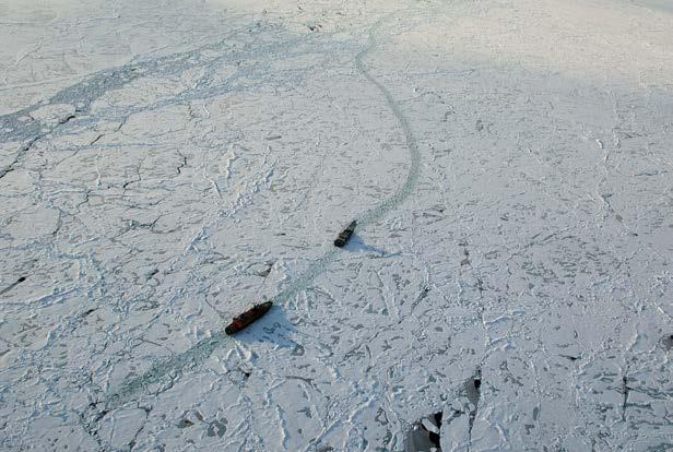
5 The Challenge: Operational difficulties for field work on sea ice or from polar ice breakers in the area north of Greenland IBCAO 2.0 IBCAO 2.0

6 Remoteness Very sparse infrastructure IBCAO - Version
7 7 Weather Average Temperature - Alert March April May June July Aug Sep Oct Hours Daylight C C C C 3.2 C 0.8 C C C Zero: between October 15 to February hours: from April 7 to September 5
8 8 Survey Seasons Winter March and April Daylight Returns Stable Ice conditions Cold and Clear Weather Summer August and September Maximum Ice Melt Optimum period for icebreaker operations
9 9 Costs Icebreakers: $65,000 to $200,000 / Day Aircraft: $1300 to $12500 / Hour; Minimums 3-4 Hr / Day Fuel: Fuel $750 per metric ton HFO 180 (LS max 1,0%) Oden: 48 tons per day (average 2009), total more than $2 mill. Jet Fuel Resolute: $2.50 / L by sea; $7 / L by air Eureka: $3.50 / L by sea; $8 / L by air Alert: $10 / L by air Ice Camp: $14 - $20 / L by air Remote fuel camp: $30 - $35 / L by air 300, ,000 L per Winter Survey = drums
10 10 Logistical challenges No commercial survey vessels can operate in this region of the Arctic Ocean Only a few Polar Class icebreakers are available SCICEX US submarines have been decommissioned, AUV concept under the ice had to be developed Specialized ice strengthened bathymetry and seismic equipment for icebreaker surveys has to be developed Former experience and equipment used in the 80 ties for on-ice surveys had aged Establishment of ice camps on more unstable sea ice
11 11 The concept Sharing of knowledge and cost through cooperation between Canada and Greenland/Denmark Cooperation with Canada started in 2002 Formal Memorandum of Understanding signed in June Cooperation with other scientist working with similar data acquisition in the Arctic Ocean to share knowledge. Cooperation with Sweden regarding the use of the Swedish research icebreaker Oden. Cooperation with Russia. USA, Germany Innermost parts of survey area: logistics based on ice camps Remaining parts based on data acquisition from icebreakers Learning by doing

12 Lorita expedition 2006 Acquisition of seismic refraction data on the sea ice: Study of the crustal structure from the shelf onto the Lomonosov Ridge. Photo: Ron Verrall Results published in Geophysical Journal International,


13 13 CHS bathymetric data acquisition March April 2007 A B A drainage of sea ice from the Lincoln Sea trough the Nares Strait. B Helicopters with no horizon in spring of 2007 data acquisition not possible and complete season lost.


14 Bathymetric measurements 2009 Photo: Uni Bull Joint Canadian-Danish fieldwork based on sea ice in the spring of Temperatures ranged from -50⁰C in March to -20⁰C in the beginning of May. Photo: Uni Bull Data will be included in the new version 3 of the International Bathymetric Chart of the Arctic Ocean (IBCAO) athymetry/arctic/ 14
 and the gravity data in the Arctic Gravity Project (ArcGP).")
15 Photo: Janice Lang, NRCan/DRDC Acquisition of aero-geophysical data - Spring 2009 A joint Danish Canadian project to acquire supporting data on both sides of the Lomonosov Ridge using a DC3T. Map: DTU Space Magnetic data will be included in the World Digital Magnetic Anomaly Map (WDAM) and the gravity data in the Arctic Gravity Project (ArcGP). 15

16 Source: AMSR-E sea ice map - IUP University of Bremen 16 Ice conditions in the Arctic Ocean - August 2007 August 1 September 30

17 Photo: Martin Jakobsson
 Courtesy: Martin Jakobsson")
18 LOMROG I & II: Multi beam acquisition Pirouette surveying 3D-view of the multi-beam mapped Morris Jesup Rise north of Greenland (LOMROG I) Courtesy: Martin Jakobsson 18

19 Multibeam data LOMROG II Fledermouse Multi-beam bathymetric data # acquired during LOMROG II
20 20 Acquisition of seismic data in Arctic sea ice The streamer is considerably shorter than in open water. For the LOMROG II cruise we used a 250 meter long streamer. With a 250 meter streamer, we are able to deploy and recover the streamer with the ship at a standstill without risk of damage. The seismic source is considerably smaller and therefore also more compact than for open water surveys. Both the streamer and guns are towed at a depth of approximately 20 meters, which is more than twice as deep as normal ( survival depth ). Both the airguns and streamer are connected with only one cable to the ship (the umbilical ).


21 21 Seismic equipment develop for acquisition in sea ice Airgun Seismic streamer Winch Recording container
22 22 Acquisition of seismic data in Arctic sea ice Oden s normal mode of operation under heavy ice conditions, is to break ice at as high a speed as possible. If the ship gets stuck in the ice, it would normally back and ram as many times as necessary to pass the obstacle. However neither high speed nor backing and ramming are possible with seismic gear deployed behind the ship: High speed would create an unacceptable noise level behind the ship and the seismic gear is not designed to withstand a high speed. As the ship travels faster, the towed gear gets pulled toward the surface, risking damage by ice. Oden can not back due to the risk of getting the seismic gear tangled in the propellers.

23 Photo: Thomas Funck

24 Photo: Thomas Funck
25 Acquisition of seismic data in Arctic sea ice In light ice conditions, where Oden can break ice continuously at 3 to 4 knots along a pre-planned heading, seismic data of reasonable data quality can be acquired. Ice conditions often prevent Oden from being able to acquire data where needed. A second option is to have Oden break a 25 nautical mile long lead or track along a pre-planned line, going back along the same lead to make it wider, and finally to acquire the seismic data while passing through the lead a third time. A third option is to use two icebreakers for collection of seismic data in ice filled waters. A lead icebreaker as powerful as possible breaks a lead along a pre-planned line, possibly several times in order to prepare as wide a lead as possible. Oden trails behind acquiring seismic data. This concept has been used by Russia and Canada/USA. 25

26 Photo: Thomas Funck


27 LOMROG I: Ice Escort 50 Let Pobedy and Oden 27


28 Photo: Martin Jakobsson Photo: Martin Jakobsson Photo: Thomas Funck Photo: Thomas Funck Acquisition of bathymetric and seismic data 2007 and 2009 Russian nuclear icebreaker as lead icebreaker in areas with extreme ice conditions. 28

29 2010: Akademik Fedorov trailing behind Yamal during multibeam bathymetric data acquisition 29


30 AUV used for bathymetry Louis St Laurent and Healy in 2011 Track as of September 09,

31 31 Continental shelf project of the Kingdom of Denmark Field work north of Greenland from 2006 to 2009 Focus on the acquisition of bathymetric and seismic data. The white ellipses show work areas planned for the LOMROG III cruise in with Oden. White stippled lines unofficial median lines.


32 32 International cooperation Canadian and Danish geophysicists Photo: Martin Jakobsson Russian and Swedish icebreakers working for the Danish project Canadian and US icebreakers Photo: Jon Biggar Photo: Janice Lang, NRCan/DRDC Canadian and Danish hydrographers


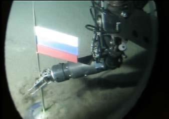
33 Photo: Bjørn Eriksson Russisk flag under Nordpolen

34 34 More flags at the North Pole Photo: Adam Jeppesen

35 Thank you for your attention! Foto: Ludvig Löwemark More information 35
Challenges of Collecting Data for Article 76 in Ice Covered Waters of the Arctic
 Challenges of Collecting Data for Article 76 in Ice Covered Waters of the Arctic 5 th ABLOS Conference Monaco October 16, 2008 Richard MacDougall - Canada Jacob Verhoef - Canada Wendell Sanford - Canada
The Continental Shelf Project: An overview of research activities in the Arctic Ocean on behalf of the Kingdom of Denmark
 The Continental Shelf Project: An overview of research activities in the Arctic Ocean on behalf of the Kingdom of Denmark Geological Survey of Denmark and Greenland Ministry of Climate and Energy John
Bathymetric data acquisition in Arctic waters
 Bathymetric data acquisition in Arctic waters within the Danish Continental Shelf Project Morten Sølvsten, Uni Bull, Richard Pedersen & Christian Marcussen Arctic-Antarctic Seafloor Mapping Meeting 2011
Seafloor Mapping in the High Arctic: The Challenges and the Joys
 Seafloor Mapping in the High Arctic: The Challenges and the Joys Larry Mayer Center for Coastal and Ocean Mapping / NOAA- UNH Joint Hydrographic Center University of New Hampshire, USA Martin Jakobsson
OUTER CONTINENTAL SHELF CLAIMS IN THE ARCTIC. Presentation given by Dr. Kamrul Hossain ASA University Bangladesh 15 March 2010
 OUTER CONTINENTAL SHELF CLAIMS IN THE ARCTIC Presentation given by Dr. Kamrul Hossain ASA University Bangladesh 15 March 2010 Contents Historical background of the continental shelf Concept of continental
The french national programme for claiming continental shelf beyond 200 Miles
 The french national programme for claiming continental shelf beyond 200 Miles Using global bathymetric models in the context of an Extended Continental Shelf submission EXTRAPLAC Using Global Bathymetric
CONFERENCE OF PARLIAMENTARIANS OF THE ARCTIC REGION. UN LOS Convention and the extended continental shelf in the Arctic
 CONFERENCE OF PARLIAMENTARIANS OF THE ARCTIC REGION UN LOS Convention and the extended continental shelf in the Arctic Presentation given by Dr. Kamrul Hossain Finnish Parliament 18 November 2009 Contents
CANADIAN HYDROGRAPHIC SERVICE & OCEANOGRAPHIC SERVICES
 CANADIAN HYDROGRAPHIC SERVICE & OCEANOGRAPHIC SERVICES Presentation to Warming of the North Conference Ottawa, March 2 nd, 2015 Denis Hains, Director General & Hydrographer General of Canada TIP OF THE
The Arctic Cold War The battle to control resources while the future of the earth hangs in the balance.
 The Arctic Cold War The battle to control resources while the future of the earth hangs in the balance. 1 The Arctic Cold War The battle to control resources while the future of the earth hangs in the
Non-Technical Summary
 Non-Technical Summary Proposed Project TGS-NOPEC Geophysical Company ASA (TGS) proposes to undertake a two dimensional (2D) seismic survey and seabed sampling in the western Greenland Sea off North East
COMPLICATIONS IN DELIMITING THE OUTER CONTINENTAL SHELF. Ron Macnab Geological Survey of Canada (Retired)
") COMPLICATIONS IN DELIMITING THE OUTER CONTINENTAL SHELF Ron Macnab Geological Survey of Canada (Retired) DISCLAIMER The contents of this presentation are the author s personal views only, and do not represent
COMPLICATIONS IN DELIMITING THE OUTER CONTINENTAL SHELF Ron Macnab Geological Survey of Canada (Retired) DISCLAIMER The contents of this presentation are the author s personal views only, and do not represent
CONTINENTAL SHELF SUBMISSION OF ANGOLA - EXECUTIVE SUMMARY -
 CONTINENTAL SHELF SUBMISSION OF ANGOLA - EXECUTIVE SUMMARY - INDEX List of Figures 2 List of Tables 3 1 Introduction 5 2 Provisions of Article 76 7 3 Angolan Institutions responsible for the Submission
Proposed travel plan and timing
 Proposed travel plan and timing Figure 1: Proposed GLACE cruise track. The circumnavigation of Greenland will be subdivided into 2 Legs: Leg 1 (Southern Greenland, SG) from Reykjavik to Ilulisat, and Leg
IRELAND. PART I Executive Summary
 IRELAND Submission to the Commission on the Limits of the Continental Shelf pursuant to Article 76, paragraph 8 of the United Nations Convention on the Law of the Sea 1982 in respect of the area abutting
The Arctic - A New Frontier The geological, environmental and engineering challenges for submarine telecommunication cables
 The Arctic - A New Frontier The geological, environmental and engineering challenges for submarine telecommunication cables Ryan Wopschall 5 September 2013 Oceanology International China, Shanghai Fugro
Figure 3.1: Illustration showing the bathymetry s role for the tsunami propagation following the earth quake 26 December 2004 outside of Sumatra.
 Figure 3.1: Illustration showing the bathymetry s role for the tsunami propagation following the earth quake 26 December 2004 outside of Sumatra. The left globe shows the seafloor bathymetry as portrayed
I. PURPOSE. This White Paper describes the role(s), value, and preparation requirements for a
, value, and preparation requirements for a") USE OF A SUBMARINE IN ICE-COVERED ARCTIC WATERS TO HELP DELIMIT THE U.S. EXTENDED CONTINENTAL SHELF (Draft White Paper from the U.S. Arctic Research Commission) (Rev. 12-18-07) I. PURPOSE. This White Paper
USE OF A SUBMARINE IN ICE-COVERED ARCTIC WATERS TO HELP DELIMIT THE U.S. EXTENDED CONTINENTAL SHELF (Draft White Paper from the U.S. Arctic Research Commission) (Rev. 12-18-07) I. PURPOSE. This White Paper
UNCLOS Article 76- Formulae and constraint lines
 UNCLOS Article 76- Formulae and constraint lines Dr Lindsay Parson (UNCLOS Group, National Oceanography Centre, UK) ABLOS TUTORIAL SESSION - Article 76 of UNCLOS 10th October 2005 IHO/IAG/IOC Advisory
MAPS AND COORDINATES...
 Table of Contents 1 INTRODUCTION... 2 2 MAPS AND COORDINATES... 3 3 ADVISORY ASSISTANCE FROM COMMISSION MEMBERS... 3 4 PROVISIONS OF ARTICLE 76 INVOKED... 3 5 OUTSTANDING MARITIME DELIMITATIONS... 4 6
Outline of presentation
 - lessons learnt from precedent cases of establishing the s Outline of presentation Extending Ireland s continental shelf jurisdiction to the outer s in the Porcupine Abyssal Plain: progress, issues and
Buoy deployment by the ice breaker USCG Healy
 Enhancements of the Arctic Buoys for the International Polar Year Buoy deployment by the ice breaker USCG Healy Buoys-on-Ice 2007 a success: Deployment flights 26 and 29 March o Flying hours funded by
Sea-ice change around Alaska & Impacts on Human Activities
 Sea-ice change around Alaska & Impacts on Human Activities Hajo Eicken Geophysical Institute University of Alaska Fairbanks, hajo.eicken@gi.alaska.edu Introduction The Arctic sea-ice cover: Observations
Chapter Overview. Bathymetry. Measuring Bathymetry. Measuring Bathymetry
 CHAPTER 3 Marine Provinces Chapter Overview The study of bathymetry determines ocean depths and ocean floor topography. Echo sounding and satellites are efficient bathymetric tools. Most ocean floor features
HANS ISLAND / TARTUPALUK A year of meteorological measurements
 HANS ISLAND / TARTUPALUK A year of meteorological measurements J.P. Wilkinson, P. Gudmandsen, S. Hanson, R. Saldo, R.M. Samelson, D. Barber, H. Melling, D. Mercer + many more Where is it? http://upload.wikimedia.org/wikipedia/commons/f/f8/nares_strait_border_(kennedy_channel).png
SEISMIC DATA ACQUISITION IN THE NANSEN BASIN, ARCTIC OCEAN
 SEISMIC DATA ACQUISITION IN THE NANSEN BASIN, ARCTIC OCEAN Øyvind Engen, Department of Geosciences, University of Oslo, P.O. Box 1047 Blindern, N-0316 Oslo, Norway oyvind.engen@geo.uio.no Jakob Andreas
Tutorial on Methane Hydrate. Presented by Ad Hoc Group on Methane Hydrate Research March 24, 2004
 Tutorial on Methane Hydrate Presented by Ad Hoc Group on Methane Hydrate Research March 24, 2004 Tutorial on Methane Hydrate What is it and how is it formed? Where is it found? How much may exist? Multi-National
Glaciology Exchange (Glacio-Ex) Norwegian/Canadian/US Partnership Program
 Norwegian/Canadian/US Partnership Program") Glaciology Exchange (Glacio-Ex) Norwegian/Canadian/US Partnership Program Luke Copland University of Ottawa, Canada Jon Ove Hagen University of Oslo, Norway Kronebreeen, Svalbard. Photo: Monica Sund The
Glaciology Exchange (Glacio-Ex) Norwegian/Canadian/US Partnership Program Luke Copland University of Ottawa, Canada Jon Ove Hagen University of Oslo, Norway Kronebreeen, Svalbard. Photo: Monica Sund The
Marine Geospatial Software: Generating Economic Benefits from Hydrographic Data and Calculation of Maritime Boundaries
 Marine Geospatial Software: Generating Economic Benefits from Hydrographic Data and Calculation of Serge LEVESQUE and Alexis CARDENAS, Canada Key words: marine geospatial data, hydrography, economic benefits,
EXECUTIVE SUMMARY A SUBMISSION OF DATA AND INFORMATION ON THE OUTER LIMITS OF THE CONTINENTAL SHELF OF THE REPUBLIC OF NIGERIA PURSUANT TO
 EXECUTIVE SUMMARY A SUBMISSION OF DATA AND INFORMATION ON THE OUTER LIMITS OF THE CONTINENTAL SHELF OF THE REPUBLIC OF NIGERIA PURSUANT TO PART VI OF AND ANNEX II TO THE UNITED NATIONS CONVENTION ON THE
Bathymetry Measures the vertical distance from the ocean surface to mountains, valleys, plains, and other sea floor features
 1 2 3 4 5 6 7 8 9 10 11 CHAPTER 3 Marine Provinces Chapter Overview The study of bathymetry determines ocean depths and ocean floor topography. Echo sounding and satellites are efficient bathymetric tools.
THE MEASUREMENT AND ANALYSIS OF BATHYMETRY, MORPHOLOGY, AND SEDIMENT THICKNESS
 THE MEASUREMENT AND ANALYSIS OF BATHYMETRY, MORPHOLOGY, AND SEDIMENT THICKNESS Ron Macnab Geological Survey of Canada (Retired) OUTLINE OF PRESENTATION Principles and practice of: Echo-sounding Seismic
Appendix E: Oceanographic Databases
 Appendix E: Oceanographic Databases Many of the principal U.S. and international database depositories for worldwide ocean observations are listed below, as are a few technical reports with descriptions
Relationship Between Ice-Management
 ARCTIC Relationship Between Ice-Management and dstation ti Keeping in Ice Åke Rohlén TransAtlantic October 13-14, 2009 Return to Session Directory Relationship between Ice-Management and Station keeping
The Southern Continental Shelf of Greenland
 Partial Submission of the Government of the Kingdom of Denmark together with the Government of Greenland to the Commission on the Limits of the Continental Shelf The Southern Continental Shelf of Greenland
Preliminary Information Indicative of the Outer Limits of the Continental Shelf Beyond 200 Nautical Miles of the People s Republic of China
 (Translation) Preliminary Information Indicative of the Outer Limits of the Continental Shelf Beyond 200 Nautical Miles of the People s Republic of China 1. The People s Republic of China ratified the
ARICE Arctic Research Icebreaker Consortium for Europe A strategy for meeting the needs for marine research in the Arctic
 ARICE Arctic Research Icebreaker Consortium for Europe ARICE Arctic Research Icebreaker Consortium for Europe A strategy for meeting the needs for marine research in the Arctic 20 partners from Europe,
The Continental Shelf North of the Faroe Islands
 Partial Submission of the Government of the Kingdom of Denmark together with the Government of the Faroes to the Commission on the Limits of the Continental Shelf The Continental Shelf North of the Faroe
High-resolution Geophysical Mapping of Submarine Glacial Landforms
 High-resolution Geophysical Mapping of Submarine Glacial Landforms M. Jakobsson 1, J.A. Dowdeswell 2, M. Canals 3, B.J. Todd 4, E.K. Dowdeswell 2, K.A. Hogan 5 L.A. Mayer 6 1 Stockholm University, Sweden
Map shows 3 main features of ocean floor
 Map shows 3 main features of ocean floor 2017 Pearson Education, Inc. Chapter 3 Marine Provinces 2017 Pearson Education, Inc. 1 Chapter 3 Overview The study of bathymetry determines ocean depths and ocean
Draft Presentation Carleton Conference on the Arctic Is There a Need for New Legal Regime in the Arctic?
 Draft Presentation Carleton Conference on the Arctic Is There a Need for New Legal Regime in the Arctic? Donald McRae, University of Ottawa The climatic changes affecting the Arctic have lead to visions
FEATURES OF TERRIGEN1C MATERIAL TRANSPORT BY ICE IN POLAR SEDIMENTATION
 G. A. Tar aso v Murmansk Marine Biological Institute of the Russian Academy of Sciences Robert Spielhagen GEO MOR, Kiel Hannes Grobe Alfred-Wegener-Institute for Polar and Marine Research, Bremerhaven
Article 76, variations in annotation and implementation seen in submission documents for the claim of Extended Continental Shelf
 Article 76, variations in annotation and implementation seen in submission documents for the claim of Extended Continental Shelf Mr. Shin Tani Chairman, IHO/IAG Advisory Board on the Law of the Sea (ABLOS)
NOAA/University of New Hampshire Joint Hydrographic Center & Center for Coastal and Ocean Mapping. MAPPS Summer Conference July 23, 2013
 NOAA/University of New Hampshire Joint Hydrographic Center & Center for Coastal and Ocean Mapping MAPPS Summer Conference July 23, 2013 07/23/2013 2 07/23/2013 3 Center Goals To be a world leader in the
On strategy for the development of the Russian Federation activities in the Antarctic for the period until 2020 and longer-term perspective
 Agenda Item: ATCM 5 Presented by: Original: Russian Federation Russian, English On strategy for the development of the Russian Federation activities in the Antarctic for the period until 2020 and longer-term
FOOT OF THE CONTINENTAL SLOPE IN ARTICLE 76
 FOOT OF THE CONTINENTAL SLOPE IN ARTICLE 76 Vaughan Stagpoole, Institute of Geological & Nuclear Sciences, Lower Hutt, New Zealand, v.stagpoole@gns.cri.nz Ray Wood, Institute of Geological & Nuclear Sciences,
Acoustic Thermometry in the Arctic Ocean. Peter Mikhalevsky Acoustic and Marine Systems Operation Science Applications International Corporation
 Acoustic Thermometry in the Arctic Ocean following following Ira to the Arctic Peter Mikhalevsky Acoustic and Marine Systems Operation Science Applications International Corporation Ira Dyer Symposium
The importance of long-term Arctic weather station data for setting the research stage for climate change studies
 The importance of long-term Arctic weather station data for setting the research stage for climate change studies Taneil Uttal NOAA/Earth Systems Research Laboratory Boulder, Colorado Things to get out
Offshore Operations and Project Execution Geophysical Site Surveys
 Offshore Operations and Project Execution Geophysical Site Surveys Chris Almond Senior Geophysicist Fugro Survey Limited 22/04/2015 Presentation Summary: Office-based Personnel Project Awarded Pre Offshore
NEW SEAFLOOR INSTALLATIONS REQUIRE ULTRA-HIGH RESOLUTION SURVEYS
 NEW SEAFLOOR INSTALLATIONS REQUIRE ULTRA-HIGH RESOLUTION SURVEYS Donald Hussong (Fugro Seafloor Surveys, Inc.) dhussong@fugro.com Fugro Seafloor Surveys, Inc., 1100 Dexter Avenue North (Suite 100), Seattle,
Iceland. Licensing of the Dreki Area. Thorarinn Arnarson
 Iceland Licensing of the Dreki Area Thorarinn Arnarson Stavanger 6 June 2011 Presentation topics Licensing Environmental conditions Geological and geophysical data Second Icelandic licensing round northern
EC-PORS III Research. Sodankylä, February Developing a Polar Prediction System
 EC-PORS III Research Sodankylä, February 2012 Developing a Polar Prediction System Polar Prediction System - Status 1. EC-PORS I (Oct. 2009) -> initial discussions 2. WWRP/THORPEX Polar Prediction Workshop,
Measurement of Arctic sea-ice thickness by submarine 5 years after SCICEX
 200 Annals of Glaciology 44 2006 Measurement of Arctic sea-ice thickness by submarine 5 years after SCICEX Nicholas E. HUGHES, 1 Peter WADHAMS 2,3 1 Scottish Association for Marine Science, Dunstaffnage
Second Session of the Pan-Arctic Regional Climate Outlook Forum (PARCOF-2), virtual forum, October 2018
, virtual forum, October 2018") Second Session of the Pan-Arctic Regional Climate Outlook Forum (PARCOF-2), virtual forum, October 2018 Consensus Statement for the Arctic Winter 2018-2019 Season Outlook Climate change in the Arctic is
Second Session of the Pan-Arctic Regional Climate Outlook Forum (PARCOF-2), virtual forum, October 2018 Consensus Statement for the Arctic Winter 2018-2019 Season Outlook Climate change in the Arctic is
Canadian activities in the Pacific Arctic Region: 2016 icebreaker plans.
 Canadian activities in the Pacific Arctic Region: 2016 icebreaker plans. Pacific Arctic Group meeting Arctic Science Summit Week, Fairbanks, Alaska 13 March 2016 CCGS Louis S. St-Laurent UNCLOS misson:
Changing Marine Access in the Arctic Ocean: The Arctic Climate Impact Assessment Panama Canal Authority 11 January 2005
 Changing Marine Access in the Arctic Ocean: The Arctic Climate Impact Assessment Panama Canal Authority 11 January 2005 Lawson Brigham Deputy Director, U.S. Arctic Research Commission ACIA Contributing
Anfang. German Arctic expeditions ASSW, March 27 April 1, 2011, Seoul, Korea. Foto: L. Tadday
 Anfang German Arctic expeditions 2010-2011 ASSW, March 27 April 1, 2011, Seoul, Korea Foto: L. Tadday Overview: Research facilities around the globe Arctic Science Summit Week, March 27 April 1, 2011,
German Arctic Expeditions
 German Arctic Expeditions 2015-2016 FARO/ASSW, 2016, Fairbanks Dirk Mengedoht (Alfred Wegener Institute, Germany) Dirk Mengedoht, AWI Logistics 2015 Polarstern Arctic Expeditions 2015 Leg Start End Mission
Korean Arctic Research 2015 update
 FARO Annual Meeting, ASSW 2016 Fairbanks, Alaska, 12 March 2016 Korean Arctic Research 2015 update International Cooperation Department Korea Polar Research Institute Outline KOPRI and Korean Arctic research;
ARTICLE 76: THE RIDGE ISSUE
 ARTICLE 76: THE RIDGE ISSUE by Alan EVANS 1, Chris CARLETON 2 and Lindsay PARSON 1 Address 1; Address 2; Southampton Oceanography Centre United Kingdom Hydrographic Office European Way Admiralty Way Southampton
ARTICLE. Defining Canada s Extended Continental Shelves. GEOSCIENCE CANADA Volume 38 Number 2 June
 GEOSCIENCE CANADA Volume 38 Number 2 June 2011 85 ARTICLE Defining Canada s Extended Continental Shelves Jacob Verhoef 1, David Mosher 1, and Steve Forbes 2 1 Geological Survey of Canada Natural Resources
Deke Arndt, Chief, Climate Monitoring Branch, NOAA s National Climatic Data Center
 Thomas R. Karl, L.H.D., Director, NOAA s National Climatic Data Center, and Chair of the Subcommittee on Global Change Research Peter Thorne, PhD, Senior Scientist, Cooperative Institute for Climate and
Observing the ice-covered oceans around Antarctica by profiling floats
 Observing the ice-covered oceans around Antarctica by profiling floats Annie Wong, Stephen Riser School of Oceanography University of Washington, USA Aug 1 2007 Since 2007, UW has deployed 83 profiling
British Colombia Knight Inlet Strait of Georgia Strait of Juan de Fuca
 An Atlas of Oceanic Internal Solitary Waves (February 2004) Knight Inlet Strait of Georgia Strait of Juan de Fuca Overview Knight Inlet, the Strait of Georgia and the Strait of Juan de Fuca are all shallow
NASA Images of Antarctica and the Arctic covered in both land and sea ice
 ICE SHELVES ACTIVITY 1: DECODING THE ROLE OF ANTARCTIC ICE IN GLOBAL CLIMATE Ice Shelves play a critical role in Antarctica, serving as a buffer between the ocean and the continental ice sheet covering
A Warming Arctic: Regional Drama with Global Consequences
 A Warming Arctic: Regional Drama with Global Consequences Norway: Temperature in March was 3,8 C above the normal, 4th highest since 1900 Monthly precipitation for Norway was 120 % above the normal Temperaturein
25. SURVEY AT SITE 337, NEAR THE EXTINCT AXIS IN THE NORWAY BASIN
 25. SURVEY AT SITE 337, NEAR THE EXTINCT AXIS IN THE NORWAY BASIN M. Talwani and S. Sandal, Lamont-Doherty Geological Observatory of Columbia University, Palisades, New York In order to explain the asymmetric
Coordinates : A - of midpoint or summit : Lat., Long. } to. Description (kind of feature) : seachannel
 : seachannel") INTERNATIONAL HYDROGRAPHIC ORGANIZATION INTERGOVERNMENTAL OCEANOGRAPHIC COMMISSION (of UNESCO) IHO/IOC Form No. 1 UNDERSEA FEATURE NAME PROPOSAL (See NOTE overleaf) Ocean or Sea Japan Sea Name proposed
INTERNATIONAL HYDROGRAPHIC ORGANIZATION INTERGOVERNMENTAL OCEANOGRAPHIC COMMISSION (of UNESCO) IHO/IOC Form No. 1 UNDERSEA FEATURE NAME PROPOSAL (See NOTE overleaf) Ocean or Sea Japan Sea Name proposed
Deep-Water Flow over the Lomonosov Ridge in the Arctic Ocean
 AUGUST 2005 N O T E S A N D C O R R E S P O N D E N C E 1489 Deep-Water Flow over the Lomonosov Ridge in the Arctic Ocean M.-L. TIMMERMANS, P. WINSOR, AND J. A. WHITEHEAD Woods Hole Oceanographic Institution,
Mapping in the Arctic Ocean in Support of a Potential Extended Continental Shelf
 Mapping in the Arctic Ocean in Support of a Potential Extended Continental Shelf Larry A. Mayer, Andrew A. Armstrong and James V. Gardner Center for Coastal & Ocean Mapping-Joint Hydrographic Center University
NT10-09 Cruise Report KUMANO-NADA DONET Node Installation & Observatory Construction
 NT10-09 Cruise Report KUMANO-NADA DONET Node Installation & Observatory Construction June 2010 Table of Contents 1. Overview 2. Schedule 3. Dive Summary 4. Concluding Remarks 1. Overview DONET is a program
APPENDIX B PHYSICAL BASELINE STUDY: NORTHEAST BAFFIN BAY 1
 APPENDIX B PHYSICAL BASELINE STUDY: NORTHEAST BAFFIN BAY 1 1 By David B. Fissel, Mar Martínez de Saavedra Álvarez, and Randy C. Kerr, ASL Environmental Sciences Inc. (Feb. 2012) West Greenland Seismic
Arctic Hydrographic Adequacy an Update
 Arctic Hydrographic Adequacy an Update Lt Cmd. Samuel F. Greenaway 1 and Amber Batts 1,2 1. NOAA Office of Coast Survey Development Lab, Hydrographic Systems & Technology Branch, Silver Spring, Maryland,
Future Ocean Floor Mapping: Ocean Stewardship & Initial Industry Contributions. U.S Hydro Galveston, TX March 23, 2017 David Millar - Fugro
 Future Ocean Floor Mapping: Ocean Stewardship & Initial Industry Contributions U.S Hydro 2017 - Galveston, TX March 23, 2017 David Millar - Fugro Presentation Outline The Need for Ocean Mapping GEBCO GEBCO
1 Earth s Oceans. TAKE A LOOK 2. Identify What are the five main oceans?
 CHAPTER 13 1 Earth s Oceans SECTION Exploring the Oceans BEFORE YOU READ After you read this section, you should be able to answer these questions: What affects the salinity of ocean water? What affects
3. UNDERWAY GEOPHYSICS 1
 Sawyer, D.S., Whitmarsh, R.B., Klaus, A., et al., 1994 Proceedings of the Ocean Drilling Program, Initial Reports, Vol. 149 3. UNDERWAY GEOPHYSICS 1 Shipboard Scientific Party 2 EQUIPMENT AND METHODS Navigation
Canadian Ice Service
 Canadian Ice Service Key Points and Details concerning the 2009 Arctic Minimum Summer Sea Ice Extent October 1 st, 2009 http://ice-glaces.ec.gc.ca 1 Key Points of Interest Arctic-wide The Arctic-wide minimum
Oceanography. Oceanography is the study of the deep sea and shallow coastal oceans.
 Oceanography Oceanography is the study of the deep sea and shallow coastal oceans. Studying the Ocean Floor To determine the shape and composition of the ocean floor, scientists use techniques such as
Legal Interpretation of Submarine Ridges & Submarine Elevations
 Legal Interpretation of Ridges & Article 76, paragraph 6 New Knowledge and Changing Circumstances in the Law of the Sea Reykjavik, Iceland June 28, 2018 Kevin Baumert U.S. Department of State U.S. ECS
Regional Outlook for the Bering-Chukchi-Beaufort Seas Contribution to the 2018 Sea Ice Outlook
 Regional Outlook for the Bering-Chukchi-Beaufort Seas Contribution to the 2018 Sea Ice Outlook 25 July 2018 Matthew Druckenmiller (National Snow and Ice Data Center, Univ. Colorado Boulder) & Hajo Eicken
Office of Naval Research Arctic Observing Activities
 Office of Naval Research Arctic Observing Activities Jim Thomson Applied Physics Laboratory, University of Washington jthomson@apl.washington.edu Scott L. Harper, Program Officer, Arctic and Global Prediction
UNIT 1: WATER SYSTEMS ON EARTH CHAPTER 2: OCEANS CONTROL THE WATER CYCLE
 UNIT 1: WATER SYSTEMS ON EARTH CHAPTER 2: OCEANS CONTROL THE WATER CYCLE ORIGINS OF OCEAN WATER OCEANS HAVE FILLED OVER HUNDREDS OF MILLIONS OF YEARS SCIENTISTS BELIEVE THE OCEANS ARE MORE THAN 3 BILLION
IODP Science Evaluation Panel: Guidelines and Rationale for Site Characterization Data (Revised: August 2013)
") Site Characterization Data Guidelines IODP Science Evaluation Panel: Guidelines and Rationale for Site Characterization Data (Revised: August 2013) This document outlines the method and rationale for data
Site Characterization Data Guidelines IODP Science Evaluation Panel: Guidelines and Rationale for Site Characterization Data (Revised: August 2013) This document outlines the method and rationale for data
FAST- CHANGING MARITIME ARCTIC
 Proceedings THE FAST- CHANGING MARITIME ARCTIC By Captain Lawson W. Brigham, U.S. Coast Guard (Retired) Globalization, climate change, and geopolitics converge in this already challenging region. 54 The
TEACHER PAGE Trial Version
 TEACHER PAGE Trial Version * After completion of the lesson, please take a moment to fill out the feedback form on our web site (https://www.cresis.ku.edu/education/k-12/online-data-portal)* Lesson Title:
Ocean Basins, Bathymetry and Sea Levels
 Ocean Basins, Bathymetry and Sea Levels Chapter 4 Please read chapter 5: sediments for next class and start chapter 6 on seawater for Thursday Basic concepts in Chapter 4 Bathymetry the measurement of
Modern geodynamic model of the Arctic Ocean
 Modern geodynamic model of the Arctic Ocean O. Petrov, N. Sobolev, A. Morozov, G. Grikurov, S. Shokalsky, S. Kashubin, E. Petrov Vienna, April 2012 Atlas of Geological Maps of the Circumpolar Arctic Magnetic
EXECUTIVE SUMMARY A PARTIAL SUBMISSION OF DATA AND INFORMATION ON THE OUTER LIMITS OF THE CONTINENTAL SHELF OF THE KINGDOM OF TONGA PURSUANT TO
 EXECUTIVE SUMMARY A PARTIAL SUBMISSION OF DATA AND INFORMATION ON THE OUTER LIMITS OF THE CONTINENTAL SHELF OF THE KINGDOM OF TONGA PURSUANT TO PART VI OF AND ANNEX II TO THE UNITED NATIONS CONVENTION
Plate Tectonics 2. Ocean crust forms at mid-ocean ridges (with magnetic stripes )
") Plate Tectonics 2 Ocean crust forms at mid-ocean ridges (with magnetic stripes )! some more evidence for plate tectonics: (1)! magnetic stripes (conclusion) and (2) seeing it live with high-precision GPS!
Plate Tectonics 2 Ocean crust forms at mid-ocean ridges (with magnetic stripes )! some more evidence for plate tectonics: (1)! magnetic stripes (conclusion) and (2) seeing it live with high-precision GPS!
Almost of Earth is covered by water. On a map, the continents appear as huge islands surrounded by a vast global ocean.
 Earth s Oceans & Ocean Floor Date: Feelin Blue What are Earth s five main oceans? Almost of Earth is covered by water. On a map, the continents appear as huge islands surrounded by a vast global ocean.
MiSP Ecology/Pollution Global Warming Worksheet #1, L2 GLOBAL WARMING AND ICE EXTENT
 MiSP Ecology/Pollution Global Warming Worksheet #1, L2 Name Date GLOBAL WARMING AND ICE EXTENT Introduction: Sea ice is found in remote polar oceans. On average, sea ice covers about 25 million square
JOINT SUBMISSION TO THE COMMISSION ON THE LIMITS OF THE CONTINENTAL SHELF BY TUVALU, THE REPUBLIC OF FRANCE AND NEW ZEALAND (TOKELAU)
") JOINT SUBMISSION TO THE COMMISSION ON THE LIMITS OF THE CONTINENTAL SHELF BY TUVALU, THE REPUBLIC OF FRANCE AND NEW ZEALAND (TOKELAU) TABLE OF CONTENTS i. PREFACE... iii ii. LIST OF FIGURES... iv iii.
JOINT SUBMISSION TO THE COMMISSION ON THE LIMITS OF THE CONTINENTAL SHELF BY TUVALU, THE REPUBLIC OF FRANCE AND NEW ZEALAND (TOKELAU) TABLE OF CONTENTS i. PREFACE... iii ii. LIST OF FIGURES... iv iii.
Observing Arctic Sea Ice Change. Christian Haas
 Observing Arctic Sea Ice Change Christian Haas Decreasing Arctic sea ice extent in September Ice extent is decreasing, but regional patterns are very different every year The Cryosphere Today, http://arctic.atmos.uiuc.edu;
Spectral Albedos. a: dry snow. b: wet new snow. c: melting old snow. a: cold MY ice. b: melting MY ice. d: frozen pond. c: melting FY white ice
 Spectral Albedos a: dry snow b: wet new snow a: cold MY ice c: melting old snow b: melting MY ice d: frozen pond c: melting FY white ice d: melting FY blue ice e: early MY pond e: ageing ponds Extinction
Activity 1 Eyewitnesses to Change
 Activity 1 Eyewitnesses to Change Forces of Change >> Arctic >> Activity 1 >> Page 1 EYEWITNESSES TO CHANGE NATIVE PEOPLES OBSERVE CLIMATE CHANGES IN THE ARCTIC Living With Change Sachs Harbour, Canada
On Modeling the Oceanic Heat Fluxes from the North Pacific / Atlantic into the Arctic Ocean
 On Modeling the Oceanic Heat Fluxes from the North Pacific / Atlantic into the Arctic Ocean Wieslaw Maslowski Naval Postgraduate School Collaborators: Jaclyn Clement Kinney Terry McNamara, John Whelan
Geographic Information Systems Tools for Collecting and Accessing Arctic Bathymetry: International Bathymetric Chart of the Arctic Ocean
 University of New Hampshire University of New Hampshire Scholars' Repository Center for Coastal and Ocean Mapping Center for Coastal and Ocean Mapping 1-22-2001 Geographic Information Systems Tools for
Mapping Undersea Feature Names in S-100. UFNPT at SCUFN 31 Wellington, New Zealand October, 2018
 Mapping Undersea Feature Names in S-100 UFNPT at SCUFN 31 Wellington, New Zealand October, 2018 Content - Update about UFNPT - Discovery of Undersea Features - excercise Work Plan of the UFNPT November
IHO HYDROGRAPHIC COMMISION ON ANTARCTICA (HCA) 9 th Meeting, Simon's Town, Cape Town, South Africa, October 2009
 9 th Meeting, Simon's Town, Cape Town, South Africa, October 2009") HCA9-07.4Ac IHO HYDROGRAPHIC COMMISION ON ANTARCTICA (HCA) 9 th Meeting, Simon's Town, Cape Town, South Africa, 12-14 October 2009 National Report - JAPAN Hydrographic and Oceanographic Department of Japan
HCA9-07.4Ac IHO HYDROGRAPHIC COMMISION ON ANTARCTICA (HCA) 9 th Meeting, Simon's Town, Cape Town, South Africa, 12-14 October 2009 National Report - JAPAN Hydrographic and Oceanographic Department of Japan
Impact of changing Siberian land-shelf-basin on the Arctic Ocean biogeochemical dynamics
 Impact of changing Siberian land-shelf-basin on the Arctic Ocean biogeochemical dynamics PI: Shigeto Nishino (JAMSTEC) Co-PI: Igor Semiletov (IARC/UAF) Other Investigators: Natalia Shakhova (IARC/UAF),