Paleoceanography,, Seabed Morphology, and Geologic Framework of the Northwest Passage ArcticNet Project 1.6
|
|
|
- Leonard Horn
- 5 years ago
- Views:
Transcription

1 Paleoceanography,, Seabed Morphology, and Geologic Framework of the Northwest Passage ArcticNet Project 1.6 Robbie Bennett, Steve Blasco, Brian MacLean, Andre Rochon, John Hughes-Clarke, Jonathan Beaudoin, Jason Bartlett, Kimberley Jenner, Trecia Schell

2 Contributors NRCan Climate Change Program, Don Forbes Paola Traviglini, CHS Bob Harmes, NRCan Kate Jarrett, NRCan Dave Scott, Dalhousie Bob Covill, TekMap Ian Church, UNB Bill Livingstone, Devon Energy Photos courtesy: Andre Rochon, Jonathan Beaudoin, Corinne Pomerleau, Simon Belt, Martin Fortier
3 Partnerships Natural Resources Canada Earth Science Sector Geological Survey of Canada Universities ArcticNet Canadian Arctic Shelf Exchange Study (CASES) University of Quebec, Rimouski University of New Brunswick Dalhousie University Inuvialuit Joint Secretariat (IJC) Oil Industry Devon Energy Corp. Government Indian and Northern Affairs Canada (INAC) Department of Fisheries and Oceans (DFO) Canadian Hydrographic Service (CHS) Institute of Ocean Sciences (IOS) Program of Energy Research and Development (PERD) Canadian Coast Guard
4 ArcticNet ArcticNet Sub-project 1.6 Goals collect as much bathymetry data as possible, study the geology and geohazards of the Passage and investigate the paleoceanography and sea ice regime for the past 10,000 years
5 Outline 1.6 Geoscience Research Introduction / Methods Preliminary Results Future Work for 1.6


6 Technology


7 Multibeam Echosounder GPS Satellite Multibeam Profiling Singlebeam Profiling

8 Sub-bottom Profiler 10 km


9 Box Coring


10 Piston Coring

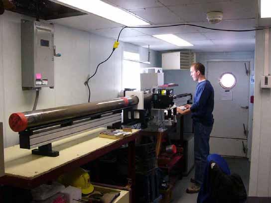


11 Core Analysis
 2005 Amundsen (ArcticNet) Core Samples")
12 Data Coverage 2003 Amundsen (CASES) 2004 Amundsen (ArcticNet) 2005 Amundsen (ArcticNet) Core Samples (ArcticNet & CASES)

13 NW Passage Geology HOLOCENE SEDIMENT!! Bedrock 10 km Glacial Sediment
14 Lancaster Sound Core 009

15 Lancaster Sound Core Site Selection
16 meters Olive grey, massive silty clay Tan calcareousrich mud Olive grey, massive silty clay With increasing amounts of bioturbation, mottling and pyritization Lancaster Sound Core 009 (collected in 2004) ,700 10,500 yr BP Medium-light brown silty clay interlaminated with very fine silt,
17 Glacial Features Amundsen Gulf

18 Glacial Features Glacial Fluting / Streamlined Drumlins in Amundsen Gulf, ~400m water depth

19 Flutes / Drumlins -Up to 40m high above surrounding seabed -300m wide -4km long -Indicates ice flow direction to the NW
20 Flutes in the NW Passage
21 Ice Scours Amundsen Gulf

22 Ice Scours 410m water depth 3.6m deep scour ~400m water depth Widespread scouring in the area Deepest scour occurs in 410m water depth Scours as deep as 3.6m into the seabed
 present scour regime) Low stand Late- Pleistocene Sea")
23 Low 175 stand m Late-Pleistocene Sea Level (~120m below present) bathymetry contour Area of Active Scouring Scoured area during (Present Regime, ~55m low stand (assuming water depth) present scour regime) Low stand Late- Pleistocene Sea Level
24 Amundsen Gulf 410m Deep Ice Scours What caused these features? Glacial Ice Dynamics (iceberg calving, etc.)? More extreme ice scour regime than present?
25 Amundsen Gulf Glaciation Indicators Features formed at glacier front Features formed under glacier
26 Barrow Strait Pockmarks / Gas Vents
27 Pockmarks/Gas Vents ~300m water depth 9 gas vents observed Active venting Most of the features are oriented along a NW-SE line One of the vents appears to be active
28 Future NW Passage Research -Continue analysis of piston and box cores collected in the NW Passage -Continue to collect multibeam and sub-bottom data in the NW Passage -Build on some of the multibeam survey blocks from CASES and ArcticNet -Collect piston cores over some of the seabed features (i.e. drumlins, slump, ice scours, etc.) -GSC will expand our research in the NW Passage over the next 3 years -International Polar Year (IPY)
29 Other 1.6 posters by: Jonathan Beaudoin, Walli Rainey, Andre Rochon, Trecia Schell, Dave Scott
 or Robbie Bennett (902-426-8159) Email: sblasco@nrcan.gc.")
30 Thank you For additional information please visit: or contact Steve Blasco ( ) or Robbie Bennett ( ) / rbennett@nrcan.gc.ca
1.6 The Opening NW Passage: Resources, Navigation, Sovereignty & Security
 1.6 The Opening NW Passage: Resources, Navigation, Sovereignty & Security Summary Project Leader(s) Hughes Clarke, John Blasco, Steve This project will map the bottom topography and geological structure
Mapping and monitoring sedimentary processes and fluxes across fjord deltas - Baffin Island
 Mapping and monitoring sedimentary processes and fluxes across fjord deltas - Baffin Island John E. Hughes Clarke, Steve Brucker, Auke van der Werfe, Ian Church and Kashka Iwanowska Ocean Mapping Group,
David Scott and Trecia Schell,Dalhousie University, Department of Earth Sciences and André Rochon, Universitè à Quebec à Rimouski,PQ.
 DISTRIBUTIONS OF FORAMINIFERA OVER THE LAST 15,000 YEARS INCLUDING STABLE ISOTOPIC DATA FROM THE BEAUFORT SLOPE, BEAUFORT SEA, CANADA: IMPLICATIONS FOR PAST SEA-ICE CONDITIONS David Scott and Trecia Schell,Dalhousie
Use of a nested finite-element hydrodynamic model to predict phase and amplitude modification of tide within narrow fjords
 Use of a nested finite-element hydrodynamic model to predict phase and amplitude modification of tide within narrow fjords Ian Church, John E. Hughes Clarke and Susan Haigh Dept. Geodesy and Geomatics
Seafloor Mapping in the High Arctic: The Challenges and the Joys
 Seafloor Mapping in the High Arctic: The Challenges and the Joys Larry Mayer Center for Coastal and Ocean Mapping / NOAA- UNH Joint Hydrographic Center University of New Hampshire, USA Martin Jakobsson
GSC 107 Lab # 3 Calculating sea level changes
 GSC 107 Lab # 3 Calculating sea level changes Student name Student ID Background Glacial-Interglacial Cycles Climate-related sea-level changes of the last century are very minor compared with the large
Canadian activities in the Pacific Arctic Region: 2016 icebreaker plans.
 Canadian activities in the Pacific Arctic Region: 2016 icebreaker plans. Pacific Arctic Group meeting Arctic Science Summit Week, Fairbanks, Alaska 13 March 2016 CCGS Louis S. St-Laurent UNCLOS misson:
Detailed mapping of seabed topography,
 MAREANO program Detailed mapping of seabed topography, sediments, bottom fauna and pollutants in Norwegian waters HYDROGRAPHIC DATA FOR THE BENEFIT OF SOCIETY MAREANO program - Detailed mapping of seabed
46ºN to 75ºN (Quebec City to the Beaufort Sea): 2011 Ocean Mapping Group Operations in the Canadian Arctic, Part III. By Doug Cartwright
: 2011 Ocean Mapping Group Operations in the Canadian Arctic, Part III. By Doug Cartwright") 46ºN to 75ºN (Quebec City to the Beaufort Sea): 2011 Ocean Mapping Group Operations in the Canadian Arctic, Part III By Doug Cartwright Doug Cartwright, Christine Legere and Pim Kuus met up with the CCGS
46ºN to 75ºN (Quebec City to the Beaufort Sea): 2011 Ocean Mapping Group Operations in the Canadian Arctic, Part III By Doug Cartwright Doug Cartwright, Christine Legere and Pim Kuus met up with the CCGS
Ocean Basins, Bathymetry and Sea Levels
 Ocean Basins, Bathymetry and Sea Levels Chapter 4 Please read chapter 5: sediments for next class and start chapter 6 on seawater for Thursday Basic concepts in Chapter 4 Bathymetry the measurement of
CANADIAN HYDROGRAPHIC SERVICE & OCEANOGRAPHIC SERVICES
 CANADIAN HYDROGRAPHIC SERVICE & OCEANOGRAPHIC SERVICES Presentation to Warming of the North Conference Ottawa, March 2 nd, 2015 Denis Hains, Director General & Hydrographer General of Canada TIP OF THE
GIS compilation of coastline variability spanning 60 years in the Mackenzie Delta and Tuktoyaktuk in the Beaufort Sea
 GEOLOGICAL SURVEY OF CANADA OPEN FILE 7685 GIS compilation of coastline variability spanning 60 years in the Mackenzie Delta and Tuktoyaktuk in the Beaufort Sea S. Hynes, S.M. Solomon, and D. Whalen 2014
MARINE GEOLOGY & GEOGRAPHY
 MARINE GEOLOGY & GEOGRAPHY Bathymetry BATHYMETRY BATHYMETRY THE UNDERWATER EQUIVALENT TO TOPOGRAPHY THE STUDY OF WATER DEPTH A BATHYMETRIC MAP SHOWS FLOOR RELIEF OR TERRAIN AS CONTOUR LINES Bathymetry
Risks and Opportunities : Canadian Research on Arctic Shipping. Dr. Ronald Pelot Dept. Industrial Engineering, Dalhousie University
 Risks and Opportunities : Canadian Research on Arctic Shipping Dr. Ronald Pelot Dept. Industrial Engineering, Dalhousie University 1 Outline Major Research Topics for Shipping in the Arctic Environment
Preliminary report on ice-flow history, deglacial chronology, and surficial geology, Foxe Peninsula, southwest Baffin Island
 Earth Sciences Sector Northern Resources Development Preliminary report on ice-flow history, deglacial chronology, and surficial geology, Foxe Peninsula, southwest Baffin Island Daniel Utting Southwest
Seamless Online Distribution of Amundsen Multibeam Data
 Seamless Online Distribution of Amundsen Multibeam Data J. Muggah 1, I. Church 1, J. Beaudoin 1 and J. Hughes Clarke 1 1 Ocean Mapping Group, University of New Brunswick. Abstract Since 2003, all underway
Sea-level change: A scientific and societal challenge for the 21 st century John Church International GNSS Service Workshop, Sydney, Feb 11, 2016
 Sea-level change: A scientific and societal challenge for the 21 st century John Church International GNSS Service Workshop, Sydney, Feb 11, 2016 OCEANS AND ATMOSPHERE NATIONAL RESEARCH FLAGSHIP Our coastal
Outline 23: The Ice Ages-Cenozoic Climatic History
 Outline 23: The Ice Ages-Cenozoic Climatic History Continental Glacier in Antarctica Valley Glaciers in Alaska, note the moraines Valley Glaciers in Alaska, note the moraines Mendenhall Glacier, Juneau,
ArcticNet Western & Central Canadian Arctic
 ArcticNet Western & Central Canadian Arctic In this bulletin: ArcticNet Page 1 The ArcticNet IRIS framework Page 2 CCGS Amundsen and ArcticNet field work Page 3 Regional Impact Assessment Page 4 ArcticNet
Canadian Ice Service
 Canadian Ice Service Key Points and Details concerning the 2009 Arctic Minimum Summer Sea Ice Extent October 1 st, 2009 http://ice-glaces.ec.gc.ca 1 Key Points of Interest Arctic-wide The Arctic-wide minimum
Geophysical Site Surveys
 Geophysical Site Surveys Simon Oakley Geoscience Team Leader Fugro Survey Limited 16/04/2014 Contents Menu Introduction Section 1 - Geophysical Site Surveys - Seabed Bathymetry - Shallow Geology - Seabed
Chair in Ocean Mapping
 Research Activity - 2006 Calendar Year home of the Heron January 2007 John E. Hughes Clarke Professor, Ocean Mapping Group Dept.Geodesy and Geomatics Engineering University of New Brunswick P.O. Box 4400
Lake Levels and Climate Change in Maine and Eastern North America during the last 12,000 years
 Maine Geologic Facts and Localities December, 2000 Lake Levels and Climate Change in Maine and Eastern North America during the last 12,000 years Text by Robert A. Johnston, Department of Agriculture,
The Arctic - A New Frontier The geological, environmental and engineering challenges for submarine telecommunication cables
 The Arctic - A New Frontier The geological, environmental and engineering challenges for submarine telecommunication cables Ryan Wopschall 5 September 2013 Oceanology International China, Shanghai Fugro
Last Time. Submarine Canyons and Fans. Turbidites. MAS 603: Geological Oceanography. Lecture 16: Greenhouse vs. Icehouse Earths
 UNIVERSITY OF SOUTH ALABAMA Last Time MAS 603: Geological Oceanography Lecture 16: Greenhouse vs. Icehouse Earths Submarine Fans Definition and morphology Transport mechanisms (density currents) Submarine
Canada-Nunavut Geoscience Office Report of Activities By: David Mate, Chief Geologist Canada-Nunavut Geoscience Office
 Canada-Nunavut Geoscience Office Report of Activities 2013 By: David Mate, Chief Geologist Canada-Nunavut Geoscience Office Introduction Provide an update on the activities of the Canada- Nunavut Geoscience
Figure 3.1: Illustration showing the bathymetry s role for the tsunami propagation following the earth quake 26 December 2004 outside of Sumatra.
 Figure 3.1: Illustration showing the bathymetry s role for the tsunami propagation following the earth quake 26 December 2004 outside of Sumatra. The left globe shows the seafloor bathymetry as portrayed
SEAFLOOR CHARACTERIZATION BY ELECTROMAGNETIC BENTHIC PROFILING
 SEAFLOOR CHARACTERIZATION BY ELECTROMAGNETIC BENTHIC PROFILING Hendrik Müller Christian Hilgenfeldt Tilo von Dobeneck Benjamin Baasch Thomas Frederichs MARUM Center for Marine Environmental Sciences (University
Moosehead Lake and the Tale of Two Rivers
 Maine Geologic Facts and Localities June, 2005 45 o 53 5.09 N, 69 o 42 14.54 W Text by Kelley, A.R.; Kelley, J.T.; Belknap, D.F.; and Gontz, A.M. Department of Earth Sciences, University of Maine, Orono,
The Continental Shelf Project: An overview of research activities in the Arctic Ocean on behalf of the Kingdom of Denmark
 The Continental Shelf Project: An overview of research activities in the Arctic Ocean on behalf of the Kingdom of Denmark Geological Survey of Denmark and Greenland Ministry of Climate and Energy John
Multiple methods, maps, and management applications: purpose made maps in support of Ocean Management. Craig J. Brown McGregor GeoScience Ltd.
 Multiple methods, maps, and management applications: purpose made maps in support of Ocean Management Craig J. Brown McGregor GeoScience Ltd. International workshop on seabed mapping methods and technology,
Supplementary Fig. 1. Locations of thinning transects and photos of example samples. Mt Suess/Gondola Ridge transects extended metres above
 Supplementary Fig. 1. Locations of thinning transects and photos of example samples. Mt Suess/Gondola Ridge transects extended 260 24 metres above the modern surface of Mackay Glacier, and included 16
& $ CORED mbsf SITE 932 HOLE A. Graphic Lith. Section Age. Sample. Disturb. Meter. Color. Description. Structure. CALCAREOUS CLAY and CLAY
 SITE 932 HOLE A Meter 1_ 2_ 3_ 4_ 5_ 6 : 3 α IV.V.V a πt = π 4..-.V. Section Age 1 2 3 4 CC late Pleistocene \ Holocene CORE & & $ Disturb 1H Sample S S S S I M Color 1YR 5/3 2. 4/2 4/1 CORED.-6. mbsf
Digital Elevation Model (DEM) of Sable Island Bank and adjacent areas
 of Sable Island Bank and adjacent areas") GEOLOGICAL SURVEY OF CANADA OPEN FILE 5348 Digital Elevation Model (DEM) of Sable Island Bank and adjacent areas K.J. Webb and E.L. King 2014 GEOLOGICAL SURVEY OF CANADA OPEN FILE 5348 Digital Elevation
GEOLOGICAL SURVEY OF CANADA OPEN FILE 5348 Digital Elevation Model (DEM) of Sable Island Bank and adjacent areas K.J. Webb and E.L. King 2014 GEOLOGICAL SURVEY OF CANADA OPEN FILE 5348 Digital Elevation
Estimating sea-level allowances for Atlantic Canada under conditions of uncertain sea-level rise
 doi:10.5194/piahs-365-16-2015 16 Complex Interfaces Under Change: Sea River Groundwater Lake Proceedings of HP2, IAHS-IAPSO-IASPEI Assembly, Gothenburg, Sweden, July 2013 (IAHS Publ. 365, 2014). Estimating
Coastal Evolution in Sedimentary Areas in Greenland
 Coastal Evolution in Sedimentary Areas in Greenland Mette Bendixen P h D s t u d e n t DANCORE Young Professionals Day Dias 1 Outline Motivation State of the art on Arctic coasts Purpose of my Phd Presentation
Any Questions? Glacier
 Geology of the Hawaiian Islands Class 25 13 April 2004 Any Questions? Earth Systems Today CD Click on Weather and Climate Look at the sections on El Niño Ozone Hole Glaciers Why do we care? They help control
Glaciers. Geology of the Hawaiian Islands. Any Questions? Earth Systems Today CD. Class April Why do we care?
 Geology of the Hawaiian Islands Class 25 13 April 2004 Any Questions? Earth Systems Today CD Click on Weather and Climate Look at the sections on El Niño Ozone Hole Glaciers Why do we care? They help control
Preliminary interpretation of the marine geology of Frobisher Bay, Baffin Island, Nunavut
 Preliminary interpretation of the marine geology of Frobisher Bay, Baffin Island, Nunavut B.J. Todd 1, J. Shaw 2, D.C. Campbell 2 and D.J. Mate 3 1 Natural Resources Canada, Geological Survey of Canada,
Ice and Ocean Mooring Data Statistics from Barrow Strait, the Central Section of the NW Passage in the Canadian Arctic Archipelago
 Ice and Ocean Mooring Data Statistics from Barrow Strait, the Central Section of the NW Passage in the Canadian Arctic Archipelago Simon Prinsenberg and Roger Pettipas Bedford Institute of Oceanography,
Pleistocene Glaciation (Ch.14) Geologic evidence Milankovitch cycles Glacial climate feedbacks
 Geologic evidence Milankovitch cycles Glacial climate feedbacks") Pleistocene Glaciation (Ch.14) Geologic evidence Milankovitch cycles Glacial climate feedbacks End of last ice-age rise of human civilization Modern ice-ages begin Asteroid impact end of dinosaurs Cambrian
Pleistocene Glaciation (Ch.14) Geologic evidence Milankovitch cycles Glacial climate feedbacks End of last ice-age rise of human civilization Modern ice-ages begin Asteroid impact end of dinosaurs Cambrian
3-D Visualization of Morphology and Distribution of Acoustic Facies in the Strataform Study Areas
 3-D Visualization of Morphology and Distribution of Acoustic Facies in the Strataform Study Areas Larry Mayer Ocean Mapping Group Dept. of Geodesy and Geomatics Engineering University of New Brunswick
4. The map below shows a meandering stream. Points A, B, C, and D represent locations along the stream bottom.
 1. Sediment is deposited as a river enters a lake because the A) velocity of the river decreases B) force of gravity decreases C) volume of water increases D) slope of the river increases 2. Which diagram
Changing Marine Access in the Arctic Ocean: The Arctic Climate Impact Assessment Panama Canal Authority 11 January 2005
 Changing Marine Access in the Arctic Ocean: The Arctic Climate Impact Assessment Panama Canal Authority 11 January 2005 Lawson Brigham Deputy Director, U.S. Arctic Research Commission ACIA Contributing
Loess and dust. Jonathan A. Holmes Environmental Change Research Centre
 Loess and dust Jonathan A. Holmes Environmental Change Research Centre Why is dust important? Mineral dust is an important constituent of the solid load in Earth's atmosphere, the total atmospheric aerosol
Detailed structure of buried glacial landforms revealed by high-resolution 3D seismic data in the SW Barents Sea
 Detailed structure of buried glacial landforms revealed by high-resolution 3D seismic data in the SW Barents Sea Benjamin Bellwald 1, Sverre Planke 1,2, Stéphane Polteau 1, Nina Lebedova-Ivanova 1, Amer
MARINE GEOLOGY & GEOGRAPHY
 MARINE GEOLOGY MARINE GEOLOGY & GEOGRAPHY Marine Geology 4 LAYERS OF THE EARTH CRUST THICKNESS: VARIES BETWEEN OCEAN & CONTINENTS 5-40 KM STATE: SOLID ELEMENTS: SILICON, ALUMINUM, CALCIUM, SODIUM, POTASSIUM
Foundations of Earth Science, 6e Lutgens, Tarbuck, & Tasa
 Foundations of Earth Science, 6e Lutgens, Tarbuck, & Tasa Oceans: The Last Frontier Foundations, 6e - Chapter 9 Stan Hatfield Southwestern Illinois College The vast world ocean Earth is often referred
UNSTOPPABLE COLLAPSE OF THE WEST ANTARCTIC ICE SHEET IS NOT HAPPENING
 UNSTOPPABLE COLLAPSE OF THE WEST ANTARCTIC ICE SHEET IS NOT HAPPENING Dr. Don J. Easterbrook, Western Washington University, Bellingham, WA May 19, 2014 A New York Times headline reads Scientists Warn
The Petroleum Industry. Phonse Fagan, P. Geo. President A.J. Fagan Consulting Inc. and
 The Petroleum Industry by Phonse Fagan, P. Geo. President A.J. Fagan Consulting Inc. and Terminology Petroleum Natural Gas Oil Crude Hydrocarbons http://www.kerrheating.com/products/fuel_oil_tanks_liberty.htm
CANADIAN HYDROGRAPHIC SERVICE
 CANADIAN HYDROGRAPHIC SERVICE Surveying and Charting Canada s Waters Since 1883 Ilulisat Maritime Workshop 2017 The Importance and Need for Hydrography Denis Hains, Hydrographer General of Canada & Director
Figure 3.1: Illustration showing the bathymetry s role for the tsunami propagation following the earth quake 26 December 2004 outside of Sumatra.
 Figure 3.1: Illustration showing the bathymetry s role for the tsunami propagation following the earth quake 26 December 2004 outside of Sumatra. The left globe shows the seafloor bathymetry as portrayed
4. What type of glacier forms in a sloping valley between rock walls? a. firn glacier b. ice sheet c. cirque d. alpine glacier
 Multiple Choice Questions 1. The term means the loss of snow and ice by evaporation and melting. a. sublimation b. ablation c. erosion d. abrasion 2. What condition must be met for a glacier to begin flowing
Relationship between gas-bearing (?) sediments and biogenic mounds in the Kalloni Gulf, Lesvos Island, Greece
 sediments and biogenic mounds in the Kalloni Gulf, Lesvos Island, Greece") 6 th Workshop Seabed Acoustics, Rostock, November 14/15, 2013 P13-1 Relationship between gas-bearing (?) sediments and biogenic mounds in the Kalloni Gulf, Lesvos Island, Greece Alexandros Chronis, Dr.
6 th Workshop Seabed Acoustics, Rostock, November 14/15, 2013 P13-1 Relationship between gas-bearing (?) sediments and biogenic mounds in the Kalloni Gulf, Lesvos Island, Greece Alexandros Chronis, Dr.
Tony Pratt, DNREC to The Center for the Inland Bays Scientific and Technical Advisory Committee. August 21, 2009
 Sea Level Rise in Delaware Presented by Tony Pratt, DNREC to The Center for the Inland Bays Scientific and Technical Advisory Committee August 21, 2009 Sea level has been fluctuating ever since there have
ALASKA GEOLOGICAL SOCIETY PUBLICATIONS Stratigraphic And Structure Sections
 ALASKA GEOLOGICAL SOCIETY PUBLICATIONS 2007-2008 Stratigraphic And Structure Sections Price Western Alaska Bristol Bay Region Stratigraphic Correlation Sections (CD)... $12.00 AGS Member Price... $10.00
Ocean circulation, sedimentation in the San Juans - compilation of mainstream scientific literature by Dave Hyde -
 Ocean circulation, sedimentation in the San Juans - compilation of mainstream scientific literature by Dave Hyde - Salish Sea has 3 principal estuaries SG, JDF,PS San Juan Islands ocean setting uniquely
Bell Ringer. Are soil and dirt the same material? In your explanation be sure to talk about plants.
 Bell Ringer Are soil and dirt the same material? In your explanation be sure to talk about plants. 5.3 Mass Movements Triggers of Mass Movements The transfer of rock and soil downslope due to gravity is
Chapter 9 Lecture Outline. Oceans: The Last Frontier
 Chapter 9 Lecture Outline Oceans: The Last Frontier The Vast World Ocean Earth is referred to as the blue planet 71% of Earth s surface is oceans and marginal seas Continents and islands comprise the remaining
Resume components. Assignments due Monday. Shape of Puget Sound. Formation and bathymetry
 Assignments due Monday Resume Top four choices of projects, in order of preference One paragraph proposal about topic of choice Weekly schedule Topics you d like to cover in class Math: Complete the calculus
High-resolution Geophysical Mapping of Submarine Glacial Landforms
 High-resolution Geophysical Mapping of Submarine Glacial Landforms M. Jakobsson 1, J.A. Dowdeswell 2, M. Canals 3, B.J. Todd 4, E.K. Dowdeswell 2, K.A. Hogan 5 L.A. Mayer 6 1 Stockholm University, Sweden
Prentice Hall EARTH SCIENCE
 Prentice Hall EARTH SCIENCE Tarbuck Lutgens Chapter 7 Glaciers, Desert, and Wind 7.1 Glaciers Types of Glaciers A glacier is a thick ice mass that forms above the snowline over hundreds or thousands of
The Palmer Hill Glacial-Marine Delta, Whitefield, Maine
 Maine Geologic Facts and Localities December, 2010, Maine 44 o 10 12.16 N, 69 o 37 18.93 W Text by Woodrow Thompson, Department of Agriculture, Conservation & Forestry 1 Introduction The most recent continental
ENIGMA: something that is mysterious, puzzling, or difficult to understand.
 Lecture 12. Attempts to solve the Eccentricity Enigma ENIGMA: something that is mysterious, puzzling, or difficult to understand. Milankovitch forcing glacier responses pre-900,000 yr BP glacier responses
SW Florida Escarpment Mapping Area
 Overview NOAA s Okeanos Explorer (EX) Program plans to conduct systematic mapping and telepresence-enabled ROV explorations in the Gulf of Mexico during Spring 2014. In 2011, the EX conducted mapping operations
Lower GRACE estimates of Antarctic sea-level contribution
 Lower GRACE estimates of Antarctic sea-level contribution Matt King 1,2, Rory Bingham 1, Philip Moore 1, Pippa Whitehouse 3, Mike Bentley 3, Glenn Milne 4 1 Newcastle University, 2 University of Tasmania,
Updating the GEBCO Grid
 Updating the GEBCO Grid PAULINE WEATHERALL, GEBCO DIGITAL ATLAS MANAGER, BRITISH OCEANOGRAPHIC DATA CENTRE (BODC), NATIONAL OCEANOGRAPHY CENTRE (NOC), LIVERPOOL, UK. GEBCO TSCOM and SCRUM meeting, Kuala
Bulletin of Earth Sciences of Thailand
 Quantitative Seismic Geomorphology of Early Miocene to Pleistocene Fluvial System of Northern Songkhla Basin, Gulf of Thailand Oanh Thi Tran Petroleum Geoscience Program, Department of Geology, Faculty
CSL HERON MAPPING OPERATIONS, MAY 23 RD -JUNE 4 TH BLUE HILL BAY, MAINE, USA OCEAN MAPPING GROUP CRUISE REPORT JAMES MUGGAH AND TRAVIS HAMILTON
 CSL HERON MAPPING OPERATIONS, MAY 23 RD -JUNE 4 TH BLUE HILL BAY, MAINE, USA OCEAN MAPPING GROUP CRUISE REPORT JAMES MUGGAH AND TRAVIS HAMILTON SPRING 2009 / NOVEMBER 2009 OCEAN MAPPING GROUP UNIVERSITY
SIMULATION OF ARCTIC STORMS 7B.3. Zhenxia Long 1, Will Perrie 1, 2 and Lujun Zhang 2
 7B.3 SIMULATION OF ARCTIC STORMS Zhenxia Long 1, Will Perrie 1, 2 and Lujun Zhang 2 1 Fisheries & Oceans Canada, Bedford Institute of Oceanography, Dartmouth NS, Canada 2 Department of Engineering Math,
Glaciology Exchange (Glacio-Ex) Norwegian/Canadian/US Partnership Program
 Norwegian/Canadian/US Partnership Program") Glaciology Exchange (Glacio-Ex) Norwegian/Canadian/US Partnership Program Luke Copland University of Ottawa, Canada Jon Ove Hagen University of Oslo, Norway Kronebreeen, Svalbard. Photo: Monica Sund The
Glaciology Exchange (Glacio-Ex) Norwegian/Canadian/US Partnership Program Luke Copland University of Ottawa, Canada Jon Ove Hagen University of Oslo, Norway Kronebreeen, Svalbard. Photo: Monica Sund The
Bathymetric data acquisition in Arctic waters
 Bathymetric data acquisition in Arctic waters within the Danish Continental Shelf Project Morten Sølvsten, Uni Bull, Richard Pedersen & Christian Marcussen Arctic-Antarctic Seafloor Mapping Meeting 2011
THE INCORPORATION OF AN OCEAN TEMPERATURE PROFILE INTO AN EXISTING ICEBERG DETERIORATION MODEL CANADA CANADA
 POAC 11 Montréal, Canada Proceedings of the 21 st International Conference on Port and Ocean Engineering under Arctic Conditions July 10-14, 2011 Montréal, Canada THE INCORPORATION OF AN OCEAN TEMPERATURE
The Ocean Networks Canada Observatory Science, Industry and Society
 The Ocean Networks Canada Observatory Science, Industry and Society S. Martin Taylor President and CEO, Ocean Networks Canada (www.oceannetworks.ca) May 31st, 2012 Global challenges of ocean events, processes
APPENDIX B PHYSICAL BASELINE STUDY: NORTHEAST BAFFIN BAY 1
 APPENDIX B PHYSICAL BASELINE STUDY: NORTHEAST BAFFIN BAY 1 1 By David B. Fissel, Mar Martínez de Saavedra Álvarez, and Randy C. Kerr, ASL Environmental Sciences Inc. (Feb. 2012) West Greenland Seismic
National Oceanography Centre. Research & Consultancy Report No. 36
 National Oceanography Centre Research & Consultancy Report No. 36 State of the eastern North Atlantic subpolar gyre: The Extended Ellett Line Programme Annual Report No. 1 N P Holliday 1, S Cunningham
1. Introduction 2. Organization of the meeting 3. Project aims, hypothesis and structure 4. AWAKE phases 5. Project prolongation? 6.
 Second meeting 1. Introduction 2. Organization of the meeting 3. Project aims, hypothesis and structure 4. AWAKE phases 5. Project prolongation? 6. Additional measurements? 7. Papers!!!!! 8. EGU 2015 9.
Productivity in a Changing Southern Ocean. Kevin R. Arrigo Stanford University
 Productivity in a Changing Southern Ocean Kevin R. Arrigo Stanford University 1 Productivity in a Changing Southern Ocean A Paleo-perspective Satellite view of the Southern Ocean Role of ice and iron Controls
The Southeastern and Northeastern Beaufort Sea Marine Observatories
 The Southeastern and Northeastern Beaufort Sea Marine Observatories ArcticNet and IMG-Golder Alexandre Forest, Ph.D. Oceanographer, Golder Associates Ltd. BREA Meeting 2015, Inuvik, NWT 24-26 February
'0"W. Sigguk 70 45'0"N. B a f f i n. B a y. Bathymetric high referenced in section A l h a. g e. o u g h. i d.
 p 60 50'0"W Baffin Bay Greenland Sigguk B a f f i n B a y S h e l f E d g e Beta 8 6 5 4 19 21 U u m m a n n a q C h a n n e l Note: Lineaments are iceberg scours Gamma 3 10 12 1 11 2 Bathymetric high
Interactions between water, ice and sediment during spring breakup at the mouth of the Mackenzie River, Northwest Territories
 Interactions between water, ice and sediment during spring breakup at the mouth of the Mackenzie River, Northwest Territories Steven M. Solomon 1, Donald L. Forbes 1, Maxime Belanger 2, Dustin Whalen 1,
Snowcover accumulation and soil temperature at sites in the western Canadian Arctic
 Snowcover accumulation and soil temperature at sites in the western Canadian Arctic Philip Marsh 1, C. Cuell 1, S. Endrizzi 1, M. Sturm 2, M. Russell 1, C. Onclin 1, and J. Pomeroy 3 1. National Hydrology
The Southern Ocean. Copyright 2010 LessonSnips
 The Southern Ocean Even though oceanographers currently define five oceans on earth, in reality there is but one ocean. The fact that the ocean is one single entity and the divisions of the ocean are man-made
ALASKA GEOLOGICAL SOCIETY PUBLICATIONS. Stratigraphic And Structure Sections
 ALASKA GEOLOGICAL SOCIETY PUBLICATIONS 2010 Stratigraphic And Structure Sections Price Western Alaska Bristol Bay Region Stratigraphic Correlation Sections (CD)...Item # WA01... $12.00 AGS Member Price...
Geochemical and Mineralogical Dispersion Models in Till: Physical Process Constraints and Impacts on Geochemical Exploration Interpretation
 Geochemical and Mineralogical Dispersion Models in Till: Physical Process Constraints and Impacts on Geochemical Exploration Interpretation Cliff Stanley Dept. of Geology Acadia University Wolfville, Nova
Lecture Outline Lecture Outline Monday April 9-16, 2018 Questions? Announcements:
 Lecture Outline Lecture Outline Monday April 9-16, 2018 Questions? Announcements: Geology 101 Night Video: The Day After Tomorrow Hollywood disaster movie about the onset of a glacial period When: Monday
Produced by Canadian Ice Service of. 2 December Seasonal Outlook Gulf of St Lawrence and East Newfoundland Waters Winter
 Environment Canada Environnement Canada Produced by Canadian Ice Service of Environment Canada 2 December 2010 Seasonal Outlook Gulf of St Lawrence and East Newfoundland Waters Winter 2010-2011 2010 Canadian
Evidence for distribution and thickness of Athens Sub-episode and older sediments in Ottawa County, Michigan
 Evidence for distribution and thickness of Athens Sub-episode and older sediments in Ottawa County, Michigan Patrick M. Colgan Department of Geology Grand Valley State University With thanks to Al Kehew
AN ASSESSMENT OF GROUND ICE VOLUME NEAR EUREKA, NORTHWEST TERRITORIES
 AN ASSESSMENT OF GROUND ICE VOLUME NEAR EUREKA, NORTHWEST TERRITORIES Nicole J. Couture, Wayne H. Pollard Department of Geography McGill University 805 Sherbrooke St. W. Montreal, Quebec H3A 2K6 e-mail:
Reading Material. See class website. Sediments, from Oceanography M.G. Gross, Prentice-Hall
 Reading Material See class website Sediments, from Oceanography M.G. Gross, Prentice-Hall Materials filling ocean basins Dissolved chemicals especially from rivers and mid-ocean ridges (volcanic eruptions)
The french national programme for claiming continental shelf beyond 200 Miles
 The french national programme for claiming continental shelf beyond 200 Miles Using global bathymetric models in the context of an Extended Continental Shelf submission EXTRAPLAC Using Global Bathymetric
The Geology of Sebago Lake State Park
 Maine Geologic Facts and Localities September, 2002 43 55 17.46 N, 70 34 13.07 W Text by Robert Johnston, Department of Agriculture, Conservation & Forestry 1 Map by Robert Johnston Introduction Sebago
Geological Survey of Canada Lands and Minerals Sector Natural Resources Canada OneGeology, June 2018
 Geological Survey of Canada Lands and Minerals Sector Natural Resources Canada OneGeology, June 2018 Geological Survey of Canada Mission The Geological Survey of Canada provides public geoscience knowledge
ALASKA DEEP-DRAFT ARCTIC PORT EVALUATION
 ALASKA DEEP-DRAFT ARCTIC PORT EVALUATION Joint Study of Federal and State June 20, 2012 Opportunity and Constraint Warming of Arctic region is leading to new maritime opportunities. Thawing of permafrost
Tutorial on Methane Hydrate. Presented by Ad Hoc Group on Methane Hydrate Research March 24, 2004
 Tutorial on Methane Hydrate Presented by Ad Hoc Group on Methane Hydrate Research March 24, 2004 Tutorial on Methane Hydrate What is it and how is it formed? Where is it found? How much may exist? Multi-National
REVIEW OF ALTERNATE BALLAST WATER EXCHANGE ZONES FOR VESSEL TRAFFIC TO NEWFOUNDLAND AND LABRADOR AND THE CANADIAN ARCTIC
 Canadian Science Advisory Secretariat Science Advisory Report 2010/026 REVIEW OF ALTERNATE BALLAST WATER EXCHANGE ZONES FOR VESSEL TRAFFIC TO NEWFOUNDLAND AND LABRADOR AND THE CANADIAN ARCTIC Figure 1:
An Investigation of Antarctic Circumpolar Current Strength in Response to Changes in Climate. Presented by Matt Laffin
 An Investigation of Antarctic Circumpolar Current Strength in Response to Changes in Climate Presented by Matt Laffin Presentation Outline Introduction to Marine Sediment as a Proxy Introduction to McCave
Offshore Geosequestration Potential in the Gulf of Mexico. Carbon Sequestration Opportunities in the North Sea Conference March, 2010
 Offshore Geosequestration Potential in the Gulf of Mexico Presenter: Ramón Treviño Gulf Coast Carbon Center Bureau of Economic Geology University of Texas at Austin, Carbon Sequestration Opportunities
Bishopville Prong Study
 Bathymetric and Sediment Assessment in the Bishopville Prong of St. Martin River Darlene V. Wells, Richard A. Ortt, Jr., and Stephen Van Ryswick Funded by MCBP 2011-2012 Implementation Grant Objectives
MODELLING TSUNAMIS ASSOCIATED WITH RECENTLY IDENTIFIED SLOPE FAILURES IN DOUGLAS CHANNEL
 Canadian Science Advisory Secretariat Science Response 2012/037 MODELLING TSUNAMIS ASSOCIATED WITH RECENTLY IDENTIFIED SLOPE FAILURES IN DOUGLAS CHANNEL November 2012 Context Enbridge Northern Gateway