Timing and magnitude of late Pleistocene and Holocene glaciations in Yosemite National Park
|
|
|
- Alyson Jackson
- 5 years ago
- Views:
Transcription

1 National Park Service U.S. Department of the Interior Yosemite National Park Timing and magnitude of late Pleistocene and Holocene glaciations in Yosemite National Park Greg Stock Yosemite National Park Co-authors: Robert Anderson, Miriam Dunforth, Mark Kessler (CU Boulder), Pete Devine (Yosemite Association)


2 Simplified Sierra Nevada glacial history 1. Matthes Little Ice Age Relatively small in extent Very fresh, sharp-crested moraines 2. Recess Peak Sherwin Till Little Ice Age moraines Middle Palisade glaciers 760,000 yr old Bishop Tuff Sherwin Summit, Hwy Tioga 18,000 yrs ago Most recent large glaciation Fresh, relatively sharpcrested moraines 4. Tahoe 80,000 or 130,000 yrs ago Larger than Tioga Glaciation More weathered, diffused moraines 5. Mono Basin (?) 6. Sherwin >760,000 yrs ago Largest glaciation in Sierra Nevada Scattered till and erratics Lee Vining Canyon

3 Mapping the extent of past glaciations Yosemite Valley region glacial map of Matthes (1930)


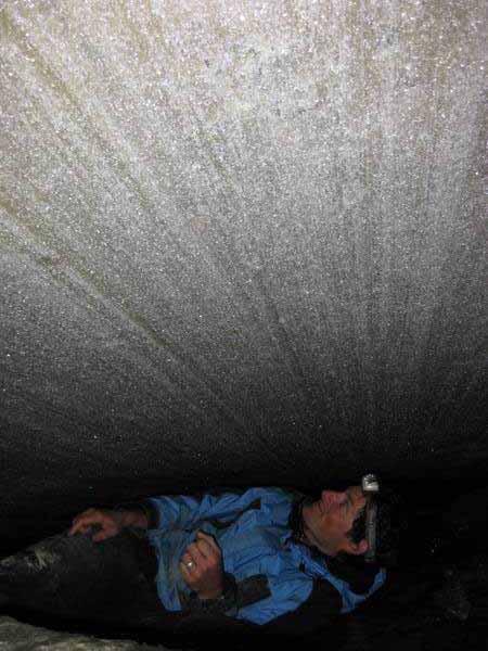
4 Determining the extent of pre-tahoe glaciations Pre-Tahoe (?) till on Diving Board west of Half Dome Looking down from Diving Board


5 Determining the extent of pre-tahoe glaciations Several deposits appear to represent pre-tahoe till, but how to confirm that? Utility of cosmogenic 10 Be dating limited with deposits of this age Quantifying till lithologies Pre-Tahoe erratic, Turtleback Dome Glacial till (?) at Turtleback Dome Cathedral Peak Granodiorite (?) boulder

6 Geologic map of Yosemite National Park Huber et al., 1987 Cathedral Peak Granodiorite 88 Ma El Capitan Granodiorite 102 Ma Turtleback Dome

7 Determining the extent of pre-tahoe glaciations Data courtesy Drew Coleman, UNC Chapel Hill

8 Determining the extent of pre-tahoe glaciations Perched erratic, Middle Fork Tuolumne Canyon
9 Mapping the extent of the Tioga Glaciation Glacial mapping aided by LiDAR (Light Detection and Ranging) Tuolumne Meadows 1 m Digital Elevation Model (DEM) shaded relief
 Tuolumne Meadows 1 m Digital Elevation Model (DEM) shaded")
10 Mapping the extent of the Tioga Glaciation Glacial mapping aided by LiDAR (Light Detection and Ranging) Tuolumne Meadows 1 m Digital Elevation Model (DEM) shaded relief


11 Glacial mapping aided by LiDAR 10 m versus 1 m Digital Elevation Model of western Yosemite Valley 10 m DEM 1 m DEM Bridalveil meadow moraine El Capitan moraine
, exposure time (t), and rock erosion rate (ε): Glacial erratic on polished, striated bedrock surface, Pothole")
12 Dating the Tioga Glaciation with cosmogenic 10 Be Concentration of cosmogenic 10 Be (N) is a function of production rate (P), exposure time (t), and rock erosion rate (ε): Glacial erratic on polished, striated bedrock surface, Pothole Dome

13 Dating the Tioga Glaciation with cosmogenic 10 Be 20,350 +/ yr BP 17,550 +/ yr BP 18,630 +/ yr BP Boulder moraine in lower Yosemite Creek
14 Dating the Tioga Glaciation with cosmogenic 10 Be 21 samples analyzed thus far, 8 remaining 3 samples from deposits mapped as pre-tahoe are >100 kyr 2 samples from deposits mapped as Tahoe are >100 kyr 1 sample from deposit mapped as Tahoe ~20 kyr 14 samples from deposits mapped as Tioga are 8-25 kyr Age distribution of Tioga moraine boulders

15 Dating the Tioga Glaciation with cosmogenic 10 Be
 Kessler et al. (2006)")
16 Glacier extent in Yosemite National Park during the Last Glacial Maximum (Tioga Glaciation) Kessler et al. (2006)


17 Documenting retreat of modern glaciers Resurvey of transects established in 1930 s using standard survey methods and GPS Repeat photography from established photo points LiDAR data collection Lyell Glacier, Yosemite National Park
: 35% reduction of west lobe 70% reduction of east lobe West Lobe East")
18 Documenting retreat of modern glaciers Lyell Glacier surface area reduction since 1900 (Basagic, 2008): 35% reduction of west lobe 70% reduction of east lobe West Lobe East Lobe

19 1 m DEM of Lyell and Maclure glaciers from airborne LiDAR


20 Lyell Glacier, Yosemite National Park August 7, 1903 Photo by G.K. Gilbert August 14, 2004 Photo by H. Basagic


21 Maclure Glacier, Yosemite National Park August 7, 1903 Photo by G.K. Gilbert August 14, 2003 Photo by H. Basagic


22 Documenting retreat of modern glaciers

23 Impacts to Downstream Ecosystems Melting glaciers provide critical late-season water to the Upper Tuolumne River - glacier loss will affect aquatic and riparian ecosystems downstream.
FINAL REPORT December 2012
 FINAL REPORT December 2012 Project Title: Yosemite s Melting Glaciers Project Start Date: January 2009 Principle Investigators: Greg Stock, Yosemite National Park Robert Anderson, University of Colorado,
ANALYSIS OF GLACIER CHANGE IN THE SIERRA NEVADA PORTLAND STATE UNIVERSITY DEPARTMENT OF GEOLOGY BRADLEY BUSELLI
 ANALYSIS OF GLACIER CHANGE IN THE SIERRA NEVADA PORTLAND STATE UNIVERSITY DEPARTMENT OF GEOLOGY BRADLEY BUSELLI Study area: Sierra Nevada (Glaciers, 2015) Closer look (Glaciers, 2015) Primary goal: Research
radionuclide laboratory using procedures according to Kohl and Nishiizumi (1992), Ivy-Ochs
, Ivy-Ochs") GSA DATA REPOSITORY 2010117 APPENDIX DR1 Methodology: Cosmogenic 10 Be exposure dating The cosmogenic 10 Be samples were processed at the University of Colorado cosmogenic radionuclide laboratory using
GSA DATA REPOSITORY 2010117 APPENDIX DR1 Methodology: Cosmogenic 10 Be exposure dating The cosmogenic 10 Be samples were processed at the University of Colorado cosmogenic radionuclide laboratory using
Margie B. DeRose Martin J. Kennedy. Department of Earth Sciences University of California, Riverside
 Limitations of absolute age constraints for the Quaternary morainal record in the Eastern Sierra Nevada, California from detailed stratigraphic relationships of the Casa Diablo till Margie B. DeRose Martin
ADDITIONS TO CLASSICAL SEQUENCE OF PLEISTOCENE GLACIATIONS, SIERRA NEVADA, CALIFORNIA
 ROBERT P. SHARP JOSEPH H. BIRMAN ADDITIONS TO CLASSICAL SEQUENCE OF PLEISTOCENE GLACIATIONS, SIERRA NEVADA, CALIFORNIA Mono Basin, fills the long-recognized gap between and Sherwin; it is possibly Illinoian.
Water, geology, climate & soils: Sierra Nevada, Merced River & Central Valley connections
 Water, geology, climate & soils: Sierra Nevada, Merced River & Central Valley connections Geography & geology Merced River basin Climate & hydrology Soils & soil formation Roger Bales UC Merced Water,
THE ACTION OF GLACIERS
 Surface processes THE ACTION OF GLACIERS Glaciers are enormous masses of ice which are formed due to accumulation, compaction and re-crystallisation of the snow deposited in very cold regions (the majority
The Geology of Sebago Lake State Park
 Maine Geologic Facts and Localities September, 2002 43 55 17.46 N, 70 34 13.07 W Text by Robert Johnston, Department of Agriculture, Conservation & Forestry 1 Map by Robert Johnston Introduction Sebago
Glacial Modification of Terrain
 Glacial Modification Part I Stupendous glaciers and crystal snowflakes -- every form of animate or inanimate existence leaves its impress upon the soul of man. 1 -Orison Swett Marden Glacial Modification
California Parks (C18A-2)
") California Parks (C18A-2) After I left Los Angeles I headed north with plans to visit some California parks, including Carrizo Plain National Monument, Sequoia and Kings Canyon National Parks (technically
California Parks (C18A-2) After I left Los Angeles I headed north with plans to visit some California parks, including Carrizo Plain National Monument, Sequoia and Kings Canyon National Parks (technically
 Page 1 of 9 Name: Base your answer to the question on the diagram below. The arrows show the direction in which sediment is being transported along the shoreline. A barrier beach has formed, creating a
Geologic Evolution of the Skagit River Channel Migration Zone. J. Riedel National Park Service
 Geologic Evolution of the Skagit River Channel Migration Zone J. Riedel National Park Service LSWT BT OT CMZ defined by: 1) Areas within FEMA floodplain of Skagit River (100 and 500 year); 2) Areas within
Name: Mid-Year Review #2 SAR
 Name: Mid-Year Review #2 SAR Base your answers to questions 1 through 3 on on the diagram below, which shows laboratory materials used for an investigation of the effects of sediment size on permeability,
PHYSICAL GEOGRAPHY. By Brett Lucas
 PHYSICAL GEOGRAPHY By Brett Lucas GLACIAL PROCESSES Glacial Processes The Impact of Glaciers on the Landscape Glaciations Past and Present Types of Glaciers Glacier Formation and Movement The Effects of
The Devils Postpile and its Unusual Surroundings. Shannon B. Carpenter A May 3, 2001
 The Devils Postpile and its Unusual Surroundings Shannon B. Carpenter A25584605 May 3, 2001 Abstract: The Devils Postpile is located in the eastern Sierra Nevada region just a few miles southwest of the
mountain rivers fixed channel boundaries (bedrock banks and bed) high transport capacity low storage input output
 high transport capacity low storage input output") mountain rivers fixed channel boundaries (bedrock banks and bed) high transport capacity low storage input output strong interaction between streams & hillslopes Sediment Budgets for Mountain Rivers Little
mountain rivers fixed channel boundaries (bedrock banks and bed) high transport capacity low storage input output strong interaction between streams & hillslopes Sediment Budgets for Mountain Rivers Little
Michigan s Geology and Groundwater
 Michigan s Geology and Groundwater Ralph J. Haefner Deputy Director U.S. Geological Survey Michigan-Ohio Water Science Center Lansing, Michigan Outline About the USGS Geology 101 Michigan s geology Bedrock
Rock-fall Potential in the Yosemite Valley, California
 U.S. Department of the Interior U.S. Geological Survey Rock-fall Potential in the Yosemite Valley, California by Gerald F. Wieczorek, Meghan M. Morrissey, Giulio lovine and Jonathan Godt U.S. Geological
Guide to Streamgauging Sites in the Tuolumne River Drainage
 Guide to Streamgauging Sites in the Tuolumne River Drainage measurements by Jessica Lundquist, Brian Huggett, Jim Roche, Mike Dettinger, Dan Cayan, Dave Peterson, and Rich Smith version 1.2 October 3,
Guided Notes Surface Processes. Erosion & Deposition By: Glaciers
 Guided Notes Surface Processes Erosion & Deposition By: Glaciers K. Coder 2015 26) How does moving ice erode and deposit sediments? Glaciers (Movement of Ice): a naturally formed mass of ice and snow that
Landscape. Review Note Cards
 Landscape Review Note Cards Last Ice Age Pleistocene Epoch that occurred about 22,000 Years ago Glacier A large, long lasting mass of ice which forms on land and moves downhill because of gravity. Continental
7.5 THERMALLY-DRIVEN WIND SYSTEMS AND HIGH-ALTITUDE OZONE CONCENTRATIONS IN YOSEMITE NATIONAL PARK
 21-25 June 24, Bartlett NH 7.5 THERMALLY-DRIVEN WIND SYSTEMS AND HIGH-ALTITUDE OZONE CONCENTRATIONS IN YOSEMITE NATIONAL PARK Craig B. Clements 1, Sharon Zhong 1, and Joel D. Burley 2 1 Institute for Multidimensional
Page 1. Name:
 Name: 1) Which property would best distinguish sediment deposited by a river from sediment deposited by a glacier? thickness of sediment layers age of fossils found in the sediment mineral composition
Geology (Mellow) Hike, Santa Lucia Memorial Park February 16, I. Overview of Santa Lucia Range geology and tectonic history
 Hike, Santa Lucia Memorial Park February 16, I. Overview of Santa Lucia Range geology and tectonic history") Geology (Mellow) Hike, Santa Lucia Memorial Park February 16, 2015 I. Overview of Santa Lucia Range geology and tectonic history A. Basement Rocks 1. Salinian Block Rocks Sierra Nevada Type, continental
Geology (Mellow) Hike, Santa Lucia Memorial Park February 16, 2015 I. Overview of Santa Lucia Range geology and tectonic history A. Basement Rocks 1. Salinian Block Rocks Sierra Nevada Type, continental
Which landscape best represents the shape of the valleys occupied by glaciers? A) B) C) D)
 B) C) D)") 1. Glaciers often form parallel scratches and grooves in bedrock because glaciers A) deposit sediment in unsorted piles B) deposit rounded sand in V-shaped valleys C) continually melt and refreeze D) drag
1. Glaciers often form parallel scratches and grooves in bedrock because glaciers A) deposit sediment in unsorted piles B) deposit rounded sand in V-shaped valleys C) continually melt and refreeze D) drag
Supplementary Fig. 1. Locations of thinning transects and photos of example samples. Mt Suess/Gondola Ridge transects extended metres above
 Supplementary Fig. 1. Locations of thinning transects and photos of example samples. Mt Suess/Gondola Ridge transects extended 260 24 metres above the modern surface of Mackay Glacier, and included 16
Geologic Trips, Sierra Nevada
 ISBN 0-9661316-5-7 GeoPress Excerpt from Geologic Trips, Sierra Nevada by Ted onigsmark All rights reserved. No part of this book may be reproduced without written permission, except for critical articles
Pleistocene Glaciations
 Chapter 14 Pleistocene Glaciations I. Geologic evidence 1. glacial deposits, etc. Pleistocene Glaciations 2. The Oxygen Isotope Record (1970s) II. Explanation of the glacial-interglacial periods The Milankovitch
Determining the Direction of Ice Advance Forming the Roanoke Point Moraine From a Survey of Hartford Basin Erratics
 Determining the Direction of Ice Advance Forming the Roanoke Point Moraine From a Survey of Hartford Basin Erratics J Bret Bennington 1 and Tim Young 2 1 Department of Geology, 114 Hofstra University,
Mountain Rivers. Gutta cavat lapidem. (Dripping water hollows out a stone) -Ovid, Epistulae Ex Ponto, Book 3, no. 10, 1. 5
 -Ovid, Epistulae Ex Ponto, Book 3, no. 10, 1. 5") Mountain Rivers Gutta cavat lapidem (Dripping water hollows out a stone) -Ovid, Epistulae Ex Ponto, Book 3, no. 10, 1. 5 Mountain Rivers Fixed channel boundaries (bedrock banks and bed) High transport
Mountain Rivers Gutta cavat lapidem (Dripping water hollows out a stone) -Ovid, Epistulae Ex Ponto, Book 3, no. 10, 1. 5 Mountain Rivers Fixed channel boundaries (bedrock banks and bed) High transport
Chapter 5: Glaciers and Deserts
 I. Glaciers and Glaciation Chapter 5: Glaciers and Deserts A. A thick mass of ice that forms over land from the compaction and recrystallization of snow and shows evidence of past or present flow B. Types
Landscape evolution. An Anthropic landscape is the landscape modified by humans for their activities and life
 Landforms Landscape evolution A Natural landscape is the original landscape that exists before it is acted upon by human culture. An Anthropic landscape is the landscape modified by humans for their activities
Goals of Glacial Geomorphology Lectures
 Goals of Glacial Geomorphology Lectures 1. Answer question: How do glaciers modulate landscape development? 2. To introduce Earth s glacial history. 3. To discuss the formation and movement of different
Outline 23: The Ice Ages-Cenozoic Climatic History
 Outline 23: The Ice Ages-Cenozoic Climatic History Continental Glacier in Antarctica Valley Glaciers in Alaska, note the moraines Valley Glaciers in Alaska, note the moraines Mendenhall Glacier, Juneau,
Goals of Glacial Geomorphology Lectures
 Goals of Glacial Geomorphology Lectures 1. Answer question: How do glaciers modulate landscape development? 2. To introduce Earth s glacial history. 3. To discuss the formation and movement of different
Down-stream process transition (f (q s ) = 1)
 = 1)") Down-stream process transition (f (q s ) = 1) Detachment Limited S d >> S t Transport Limited Channel Gradient (m/m) 10-1 Stochastic Variation { Detachment Limited Equilibrium Slope S d = k sd A -θ d S
Down-stream process transition (f (q s ) = 1) Detachment Limited S d >> S t Transport Limited Channel Gradient (m/m) 10-1 Stochastic Variation { Detachment Limited Equilibrium Slope S d = k sd A -θ d S
The Building of the NYC Region
 The Building of the NYC Region Definitions Fall Line marks the area where an upland region (continental bedrock) and a coastal plain meet Piedmont the plateau region of the eastern United States which
Amazing Ice: Glaciers and Ice Ages
 Amazing Ice: Glaciers and Ice Ages Updated by: Rick Oches, Professor of Geology & Environmental Sciences Bentley University Waltham, Massachusetts Based on slides prepared by: Ronald L. Parker, Senior
Glacial Geology of Moose Point State Park, ME
 Geologic Site of the Month May, 2013 Glacial Geology of Moose Point State Park, Maine 44 o 25 59.18"N, 68 o 56 37.11"W Text and photos by Woodrow B. Thompson, Department of Agriculture, Conservation &
Evidence for distribution and thickness of Athens Sub-episode and older sediments in Ottawa County, Michigan
 Evidence for distribution and thickness of Athens Sub-episode and older sediments in Ottawa County, Michigan Patrick M. Colgan Department of Geology Grand Valley State University With thanks to Al Kehew
TOPOGRAPHY GLACIATION. 1 Monograph XV, U. S. Geological Survey, pp
 PLEISTOCENE GEOLOGY OF THE SAWATCH RANGE, NEAR LEADVILLE, COLO. THE writers, as students of geology in the University of Chicago, spent two months of the past summer in studying the glacial geology about
Maximum Extent of Pleistocene Glaciation - 1/3 of land surface Most recent glacial maximum peaked 18,000 years ago and is considered to have ended
 Glaciers Maximum Extent of Pleistocene Glaciation - 1/3 of land surface Most recent glacial maximum peaked 18,000 years ago and is considered to have ended 10,000 B.P. Current Extent of Glaciation - about
Assessing Climate Change Vulnerability of Cultural Resources
 National Park Service U.S. Department of the Interior Klondike Gold Rush National Historical Park Assessing Climate Change Vulnerability of Cultural Resources Cultural Resources Caitlin Rankin, YLCC Climate
Chapter 2. Wearing Down Landforms: Rivers and Ice. Physical Weathering
 Chapter 2 Wearing Down Landforms: Rivers and Ice Physical Weathering Weathering vs. Erosion Weathering is the breakdown of rock and minerals. Erosion is a two fold process that starts with 1) breakdown
CARD #1 The Shape of the Land: Effects of Crustal Tilting
 CARD #1 The Shape of the Land: Effects of Crustal Tilting When we look at a birds-eye view of the Great Lakes, it is easy to assume the lakes are all at a similar elevation, but viewed in this way, we
Debris Flow Fans in Yosemite Valley National Park, California
 San Jose State University SJSU ScholarWorks Master's Theses Master's Theses and Graduate Research Summer 2016 Debris Flow Fans in Yosemite Valley National Park, California Evan Scott Enriquez San Jose
PHASE 1 STUDIES UPDATE EROSION WORKING GROUP
 PHASE 1 STUDIES UPDATE EROSION WORKING GROUP Presented By MICHAEL WOLFF, PG Erosion Study Area Manager West Valley Demonstration Project Quarterly Public Meeting February 24, 2016 OUTLINE Study 1 Terrain
Sierra Nevada Hydroclimatology: An Experimental Prediction of Maximum Daily Snowmelt Discharge in 2005
 Sierra Nevada Hydroclimatology: An Experimental Prediction of Maximum Daily Snowmelt Discharge in 2005 David Peterson, Jessica Lundquist, Iris Stewart, Noah Knowles, Madeline Solomon and Stephen Hager
History. Late 18 th /early 19 th century Europeans observed that erratic boulders dispersed due to the retention of glaciers caused by climate chance
 Ice ages What is an ice age? Geological period of long-term reduction in the temperature of the Earth's surface and atmosphere which results in the formation and expansion of continental ice sheets, polar
FACTORS CONTRIBUTING TO THE FORMATION OF SHEETING JOINTS: A STUDY OF SHEETING JOINTS ON A DOME IN YOSEMITE NATIONAL PARK
 FACTORS CONTRIBUTING TO THE FORMATION OF SHEETING JOINTS: A STUDY OF SHEETING JOINTS ON A DOME IN YOSEMITE NATIONAL PARK A THESIS SUBMITTED TO THE GRADUATE DIVISION OF THE UNIVERSITY OF HAWAI I AT MĀNOA
What is a Glacier? Types of Glaciers
 Alpine & Continental Glaciers Glacial Mass Balance Glacial Ice Formation Glacial Movement & Erosion Erosional and Depositional Landforms The Pleistocene Epoch Geomorphology of SW Manitoba Chapter 17 1
Glaciers. (Shaping Earth s Surface, Part 6) Science 330 Summer 2005
 Science 330 Summer 2005") Glaciers (Shaping Earth s Surface, Part 6) Science 330 Summer 2005 1 Glaciers Glaciers are parts of two basic cycles Hydrologic cycle Rock cycle Glacier a thick mass of ice that originates on land from
Glaciers (Shaping Earth s Surface, Part 6) Science 330 Summer 2005 1 Glaciers Glaciers are parts of two basic cycles Hydrologic cycle Rock cycle Glacier a thick mass of ice that originates on land from
PALEOGEOGRAPHY of NYS. Definitions GEOLOGIC PROCESSES. Faulting. Folding 9/6/2012. TOPOGRAPHIC RELIEF MAP of NYS GRADATIONAL TECTONIC
 TOPOGRAPHIC RELIEF MAP of NYS PALEOGEOGRAPHY of NYS Prof. Anthony Grande AFG 2012 Definitions GEOLOGIC PROCESSES Geography: study of people living on the surface of the earth. Geology: the scientific study
Clast fabric in a Stony Brook campus moraine: Testing models for the process of glacial lobe dynamics
 Clast fabric in a Stony Brook campus moraine: Testing models for the process of glacial lobe dynamics Jennifer DePaoli, Charles Regulinski, Josh Timlin, Dan Davis and Elliot Klein Department of Geosciences
RIVERS, GROUNDWATER, AND GLACIERS
 RIVERS, GROUNDWATER, AND GLACIERS Delta A fan-shaped deposit that forms when a river flows into a quiet or large body of water, such as a lake, an ocean, or an inland sea. Alluvial Fan A sloping triangle
Surface & subsurface processes in mountain environments
 Surface & subsurface processes in mountain environments evapotranspiration snowmelt precipitation infiltration Roger Bales Martha Conklin Robert Rice Fengjing Liu Peter Kirchner runoff sublimation ground
Quantifying 20th Century Glacier Change in the Sierra Nevada, California
 Arctic, Antarctic, and Alpine Research, Vol. 43, No. 3, 2011, pp. 317 330 Quantifying 20th Century Glacier Change in the Sierra Nevada, California H. J. Basagic*{ and A. G. Fountain* *Department of Geology,
Watershed concepts for community environmental planning
 Purpose and Objectives Watershed concepts for community environmental planning Dale Bruns, Wilkes University USDA Rural GIS Consortium May 2007 Provide background on basic concepts in watershed, stream,
T. Perron Glaciers 1. Glaciers
 T. Perron 12.001 Glaciers 1 Glaciers I. Why study glaciers? [PPT: Perito Moreno glacier, Argentina] Role in freshwater budget o Fraction of earth s water that is fresh (non-saline): 3% o Fraction of earth
Lecture 10 Glaciers and glaciation
 Lecture 10 Glaciers and glaciation Outline Importance of ice to people! Basics of glaciers formation, classification, mechanisms of movement Glacial landscapes erosion and deposition by glaciers and the
Glaciers Earth 9th Edition Chapter 18 Glaciers: summary in haiku form Key Concepts Glaciers Glaciers Glaciers Glaciers
 1 2 3 4 5 6 7 8 9 10 11 12 13 14 Earth 9 th Edition Chapter 18 : summary in haiku form Ten thousand years thence big glaciers began to melt - called "global warming." Key Concepts and types of glaciers.
THE JUAN DE FUCA LOBE OF THE CORDILLERAN ICE SHEET
 THE JUAN DE FUCA LOBE OF THE CORDILLERAN ICE SHEET There were two large glaciers in western Washington during the latest, or Vashon, glaciation of that region. Each was essentially an elongated lobe of
The Agents of Erosion
 The Agents of Erosion 1. Erosion & Deposition 2. Water 3. Wind 4. Ice California Science Project 1 1. Erosion and Deposition Erosion is the physical removal and transport of material by mobile agents such
Pat Dryer Half Moon Lake: A True Oxbow Lake? Geography 364 April 1 st, 2007
 Pat Dryer Half Moon Lake: A True Oxbow Lake? Geography 364 April 1 st, 2007 Appendix Abstract 2 Introduction 3 Methods 3 Results 3 Discussion 5 Conclusion 11 1 Abstract Half Moon Lake appears to be an
Prentice Hall EARTH SCIENCE
 Prentice Hall EARTH SCIENCE Tarbuck Lutgens Chapter 7 Glaciers, Desert, and Wind 7.1 Glaciers Types of Glaciers A glacier is a thick ice mass that forms above the snowline over hundreds or thousands of
GLACIER VARIABILITY IN WYOMING'S WIND RIVER & TETON RANGES
 GLACIER VARIABILITY IN WYOMING'S WIND RIVER & TETON RANGES Derrick Thompson, Jeb Bell, Jake Edmunds, Glen Tootle & Greg Kerr University of Wyoming Department of Civil Engineering OUTLINE Background Research
The boulder was most likely moved to this location by A) glacial ice B) prevailing wind C) streamfiow D) volcanic action
 glacial ice B) prevailing wind C) streamfiow D) volcanic action") 1. Which rock material was most likely transported to its present location by a glacier? A) rounded sand grains found in a river delta B) rounded grains found in a sand dune C) residual soil found on a
1. Which rock material was most likely transported to its present location by a glacier? A) rounded sand grains found in a river delta B) rounded grains found in a sand dune C) residual soil found on a
ABC s. Indiana Geology. Anhydrite, Ais for
 Ais for Anhydrite, a blueish to gray mineral that is formed from the dehydration the mineral gypsum. Anhydrite occurs with gypsum in the lower part the St. Louis Limestone in south-central Indiana near
Geology & Teaching Geology in the Lander Sinks Canyon Area
 Geology & Teaching Geology in the Lander Sinks Canyon Area A Historical Perspective from the University of Missouri s s Branson Field Laboratory - Bob Bauer - This Evening s s Presentation Why does MU
Waterbury Dam Disturbance Mike Fitzgerald Devin Rowland
 Waterbury Dam Disturbance Mike Fitzgerald Devin Rowland Abstract The Waterbury Dam was completed in October 1938 as a method of flood control in the Winooski Valley. The construction began in April1935
Science Olympiad Dynamic Earth: Glaciers
 Science Olympiad Dynamic Earth: Glaciers Write the appropriate response next to the corresponding number on the answer sheet. 1. Name 2 aspects of a glacier that define it as such (questions #1-2, 1 point
A Geological Tour of Tumbledown Mountain, Maine
 Maine Geologic Facts and Localities April, 1998 A Geological Tour of Tumbledown Mountain, Maine 44 45 3.21 N, 70 32 50.24 W Text by Robert G. Marvinney, Department of Agriculture, Conservation & Forestry
1. Any process that causes rock to crack or break into pieces is called physical weathering. Initial product = final product
 Weathering 1. Any process that causes rock to crack or break into pieces is called physical weathering. Initial product = final product End Result of physical weathering is increased surface area. 2. Physical
Lecture Outlines PowerPoint. Chapter 6 Earth Science 11e Tarbuck/Lutgens
 Lecture Outlines PowerPoint Chapter 6 Earth Science 11e Tarbuck/Lutgens 2006 Pearson Prentice Hall This work is protected by United States copyright laws and is provided solely for the use of instructors
The Palmer Hill Glacial-Marine Delta, Whitefield, Maine
 Maine Geologic Facts and Localities December, 2010, Maine 44 o 10 12.16 N, 69 o 37 18.93 W Text by Woodrow Thompson, Department of Agriculture, Conservation & Forestry 1 Introduction The most recent continental
How do glaciers form?
 Glaciers What is a Glacier? A large mass of moving ice that exists year round is called a glacier. Glaciers are formed when snowfall exceeds snow melt year after year Snow and ice remain on the ground
4. What type of glacier forms in a sloping valley between rock walls? a. firn glacier b. ice sheet c. cirque d. alpine glacier
 Multiple Choice Questions 1. The term means the loss of snow and ice by evaporation and melting. a. sublimation b. ablation c. erosion d. abrasion 2. What condition must be met for a glacier to begin flowing
Before 2 billion years -?? no rocks preserved
 California Geology California Geology Science Content Standards for California Public Schools 6 th Grade Focus on Earth Sciences Students know how to explain major features of California geology (including
Weathering, Erosion, Deposition
 Weathering, Erosion, Deposition The breakdown of rocks at or near the Earth s Surface. Physical Chemical - The breakdown of rock into smaller pieces without chemical change. - Dominant in moist /cold conditions
Moosehead Lake and the Tale of Two Rivers
 Maine Geologic Facts and Localities June, 2005 45 o 53 5.09 N, 69 o 42 14.54 W Text by Kelley, A.R.; Kelley, J.T.; Belknap, D.F.; and Gontz, A.M. Department of Earth Sciences, University of Maine, Orono,
Erratic Behavior on Rattlesnake Mountain, Hanford Reach National Monument, South-Central Washington
 Erratic Behavior on Rattlesnake Mountain, Hanford Reach National Monument, South-Central Washington Bruce Bjornstad, Pacific Northwest National Laboratory Elysia Jennett, Northern Arizona University Jenna
THE RELATION OF GREAT BASIN LATE QUATERNARY HYDROLOGIC AND CRYOLOGIC VARIABILITY TO NORTH ATLANTIC CLIMATE OSCILLATIONS
 THE RELATION OF GREAT BASIN LATE QUATERNARY HYDROLOGIC AND CRYOLOGIC VARIABILITY TO NORTH ATLANTIC CLIMATE OSCILLATIONS L. Benson a, R. Spencer b, D. Rhode c, L. Louderback d, R. Rye e a U. S. Geological
Active Coastal Processes in the Lubec Embayment
 The Lubec Embayment Maine Geologic Facts and Localities August, 1998 Active Coastal Processes in the Lubec Embayment 44 49 50.51 N, 66 59 34.16 W Text by Joseph T. Kelley, Department of Agriculture, Conservation
High-Resolution Imaging of Rock Falls in Yosemite National Park
 Carnegie Mellon University Research Showcase Fine International Conference on Gigapixel Imaging for Science Conferences and Events 11-1-2010 High-Resolution Imaging of Rock Falls in Yosemite National Park
A High Elevation Climate Monitoring Network
 A High Elevation Climate Monitoring Network Kelly T. Redmond Western Regional Climate Center Desert Research Institute Reno Nevada AGU San Francisco WRCC / OSU Nevada Precip-Elevation Distribution 100%
A physical feature of the Earth s surface
 Earth s Landforms A physical feature of the Earth s surface A physical feature of the Earth s surface LANDFORM Highest of Earth s physical features Highest of Earth s physical features MOUNTAIN Low area
W he natural resources of Adams
 Above: Houghton Rock, Town of Adams. Following Page: "The Hole in the Rock" on Rattlesnake Mound--both remnants of rock formed by ancient seas hundreds of millions of year5 ago. (Courtesy, H.H. Bennett
Name. 4. The diagram below shows a soil profile formed in an area of granite bedrock. Four different soil horizons, A, B, C, and D, are shown.
 Name 1. In the cross section of the hill shown below, which rock units are probably most resistant to weathering? 4. The diagram below shows a soil profile formed in an area of granite bedrock. Four different
Elevations are in meters above mean sea level. Scale 1:2000
 12.001 LAB 7: TOPOGRAPHIC MAPS Due: Monday, April 11 PART I: CONTOURING AND PROFILES (20 PTS) 1. Contour this area map using a 5 meter contour interval. Remember some fundamental rules of contour lines,
CURRICULUM TR AILING ICE AGE M YST ERI E S
 MIDDLE SCHOOL CURRICULUM TR AILING ICE AGE M YST ERI E S THE Driftless Area CONTENTS I. Enduring Knowledge... 3 II. Teacher Background... 3 III. Before Viewing the Video... 5 IV. Viewing Guide... 5 V.
Detailed Surficial Geologic Mapping and Terrain Analysis of the Blue Hills Felsenmeer Valley, Rusk County, Wisconsin
 Detailed Surficial Geologic Mapping and Terrain Analysis of the Blue Hills Felsenmeer Valley, Rusk County, Wisconsin Department of Geology, University of Wisconsin, Eau Claire, WI 54702 Jeremy Hinke and
Determination of uplift rates of fluvial terraces across the Siwaliks Hills, Himalayas of central Nepal
 Determination of uplift rates of fluvial terraces across the Siwaliks Hills, Himalayas of central Nepal Martina Böhme Institute of Geology, University of Mining and Technology, Freiberg, Germany Abstract.
A BRIEF HISTORY OF EVALUATIONS PERFORMED ON THE OPERATIONAL KINGS RIVER WINTER OROGRAPHIC CLOUD SEEDING PROGRAM. Don A. Griffith and David P.
 AUGUST 2014 GRIFFITH ET AL. 29 A BRIEF HISTORY OF EVALUATIONS PERFORMED ON THE OPERATIONAL KINGS RIVER WINTER OROGRAPHIC CLOUD SEEDING PROGRAM Don A. Griffith and David P. Yorty North American Weather
Geologic Trips San Francisco and the Bay Area
 Excerpt from Geologic Trips San Francisco and the Bay Area by Ted Konigsmark ISBN 0-9661316-4-9 GeoPress All rights reserved. No part of this book may be reproduced without written permission in writing,
Topic 6: Weathering, Erosion and Erosional-Deposition Systems (workbook p ) Workbook Chapter 4, 5 WEATHERING
 Workbook Chapter 4, 5 WEATHERING") Topic 6: Weathering, Erosion and Erosional-Deposition Systems (workbook p. 95-125) Workbook Chapter 4, 5 THE BIG PICTURE: Weathering, erosion and deposition are processes that cause changes to rock material
Topic 6: Weathering, Erosion and Erosional-Deposition Systems (workbook p. 95-125) Workbook Chapter 4, 5 THE BIG PICTURE: Weathering, erosion and deposition are processes that cause changes to rock material
Lecture Outline Lecture Outline Monday April 9-16, 2018 Questions? Announcements:
 Lecture Outline Lecture Outline Monday April 9-16, 2018 Questions? Announcements: Geology 101 Night Video: The Day After Tomorrow Hollywood disaster movie about the onset of a glacial period When: Monday
Surficial Geologic Map of Kings Canyon: Implications for Relatively Slow Stream Incision Rates. A Senior Project Presented to
 Surficial Geologic Map of Kings Canyon: Implications for Relatively Slow Stream Incision Rates A Senior Project Presented to The Faculty of the NRES Department California Polytechnic State University,
Reconstruction of the Vistula ice stream lobe during LGM: preliminary results of the research project
 Ice, water, humans Quaternary landscape evolution in the Peribaltic Region 35th Annual conference of the German Quaternary Association DEUQUA e.v. 12th Annual Conference of the INQUA PeriBaltic WG 13th-17th
LANDSLIDE RISK ASSESSMENT IN YOSEMITE NATIONAL PARK. Edna Rodriguez December 1 st, 2016 Final Project
 LANDSLIDE RISK ASSESSMENT IN YOSEMITE NATIONAL PARK Edna Rodriguez December 1 st, 2016 Final Project Table of Contents Introduction... 2 Data Collection... 2 Data Preprocessing... 3 ArcGIS Processing...
Glacial Erosion Polished on front side Glacial striations (scratches) on top
 on top") St Mary s Cemetery Glacial Erosion Polished on front side Glacial striations (scratches) on top Weathering Water channel in the rock mechanical weathering Some rocks eroding faster than others mechanical
St Mary s Cemetery Glacial Erosion Polished on front side Glacial striations (scratches) on top Weathering Water channel in the rock mechanical weathering Some rocks eroding faster than others mechanical