The Geohazard Supersites and Natural Laboratories (GSNL).
|
|
|
- Linda McCarthy
- 6 years ago
- Views:
Transcription
1 The Geohazard Supersites and Natural Laboratories (GSNL). Falk Amelung, University of Miami Mike Poland, Hawaii Volcano Observatory Scott Baker, U of Miami, Unavco Outline: Overview over GSNL (Phase 2) Examples from Hawaii Oberpfaffenhofen, 10 th June 2013


2 Group on Earth Observations Intergovernmental Organization with 83 members and 59 participating organization Construct by 2015: Global Earth Observation System of Systems (GEOSS) GEO data sharing principles: open, free access for science U.S. Department of State, Washington DC July 31, 2003 GEO Secretariat

3 GEOSS - System of Systems The Global Earth Observation System of Systems addresses nine areas of critical importance to people and society.
4 Terms and Definitions Permanent Supersites ( Supersites ) Seismic, GPS, SAR, optical (e infrastructure) Proposal process. Reviewed by SAC, CEOS SST. Candidate Supersites Sites that should become permanent Supersites. Natural Laboratories Larger geographical regions exposed to geohazards. Event Supersites Forum with data access.
5 Permanent Supersites Proposal Process: Invitation by Scientific Advisory Committee (SAC) Review by SAC accepted: Hawaii, Iceland, (North Anatolian Fault, San Andreas Fault)


6 Permanent Supersites 3 European Supersites (6 Mill Euro each)
 Galeras (Colombia) Dead Sea fault Piton de La Fournaise")
7 Candidate Supersites high priority Formal interest expressed: Tungarahua (Ecuador) Galeras (Colombia) Dead Sea fault Piton de La Fournaise (Santorini)

8 Natural Laboratories Americas USGS Europe/Africa EPOS Asia?

9 Candidate Supersites: TSX tasking initiated

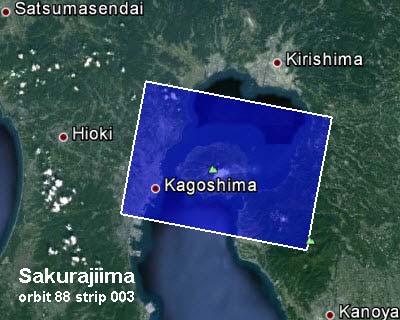
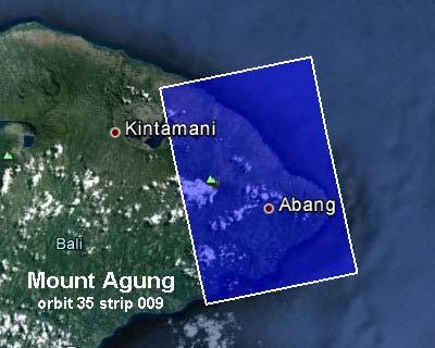
10 Plans for Southeast Asia Geohazard Natural laboratory: Volcano Monitoring Background monitoring with Sentinel 1a,b, ALOS 2 High res imaging of selected volcanoes with TerraSAR X, Cosmo In situ data from PHIVOLCS, CVGHM Special Session at Cities on Volcanoes, Yogyakarta, 9/2014 For ALOS 1 results: Chaussard and Amelung, GRL, 2012
")
11 Cyberinfrastructure (under development)


12 Federated data viewer (under development) GPS stations Seismic stations SAR frames Display all data, Initiate processing jobs on ESA s Science Cloud (InSAR, GPS, Seismic)
13 Hawaii Supersite: data holdings as of June 7, 2013 COSMO-SkyMed: 109 scenes 1.3 TB TerraSAR-X: 184 scenes 3.7 TB ENVISAT: 756 scenes 0.2 TB RADARSAT-1: 500 scenes 0.2 TB ALOS-1: 414 scenes 0.2 TB TOTAL HOLDINGS: 1963 scenes 5.6 TB Others: UAVSAR: 3 overflights Cosmo-Skymed ~300 older scenes Radarsat scenes just approved Issue: No one stop shopping archive yet. No Supersite:
14 Major users USGS Hawaiian Volcano Observatory University of Miami NASA Jet Propulsion Laboratory Stanford University University of Wisconsin Arizona State University UNAVCO IREA-CNR INGV Natural Resources Canada GFZ Potsdam
15 Procedures Time delay Data Access COSMO-SkyMed: made available to POC and distributed to registered users TerraSAR-X: PIs submit proposals to DLR and order/receive data directly TanDEM-X: currently only available to a small group via a PI project. COSMO-SkyMed: sent to PoC within 4 hours of data acquisition, interferograms available 2 hours later. TerraSAR-X: downloaded following acquisition, interferograms available within 1-2 days (since March 2012, only about 1 scene/month owing to TDX operations). The Hawaiian Volcano Observatory uses data for crisis response.

 Blue: subsidence,")
16 Vertical ground deformation from multi sensor InSARs (~1500 scenes) Blue: subsidence, red: uplift

17 Kīlauea caldera Halema uma u Crater Exceptional resolution of deformation 3-m-resolution LIDAR DEM small-scale deformation patterns around summit vent visibile Richter et al., m-resolution LIDAR DEM 30-m-resolution TSX interferogram spanning January 19 April 17, 2009

 Ground")

18 June 2012 M3.6 Koa e earthquakes (processed at 5-m resolution) Ground cracks e F a o K one z t a ul range change cm
19 Conclusions Hawaii Supersite working well: ~2000 SAR observations. Archive growing at a rate of observations/year. The Hawaiian Volcano Observatory uses data for crisis response. Supersites data transformative for (1) Hawaii volcano science, (2) data analysis technique development, (3) computational methods. Issue: Homogeneous archive and easier access needed. Technical and educational goal In 5 years, Remote Sensing students should be able to analyze the entire Hawaii archive within a few hours processing time!
Geohazard Supersites and Natural Laboratories
 Geohazard Supersites and Natural Laboratories FRINGE 2011, Frascati, Italy, September 19, 2011 Wolfgang Lengert, ESA Falk Amelung, University of Miami, GEO task lead Craig Dobson, NASA, CEOS task lead
Geohazard Supersites and Natural Laboratories
 Geohazard Supersites and Natural Laboratories FRINGE 2011, Frascati, Italy, September 19, 2011 Wolfgang Lengert, ESA Falk Amelung, University of Miami, GEO task lead Craig Dobson, NASA, CEOS task lead
GEO-VIII November Geohazard Supersites and Natural Laboratories Progress Report. Document 9
 GEO-VIII 16-17 November 2011 Geohazard Supersites and Natural Laboratories Progress Report Document 9 This document is submitted to GEO-VIII for information. Geohazard Supersites and Natural Laboratories
CEOS Support to the Geohazard Supersites
 The CEOS Supersite Coordination Team: Simona Zoffoli, ASI Steven Hosford, CNES Christine Giguère, CSA Jörn Hoffmann, DLR (Chair) Wolfgang Lengert, ESA Kazuo Umezawa, JAXA Shizu Yabe, JAXA Francis Lindsay,
Volcano Monitoring on a Regional Scale:
 Volcano Monitoring on a Regional Scale: Results from the CEOS Disaster Risk Management Volcano Pilot David Arnold 1 Juliet Biggs 1 Francisco Delgado 2 Matt Pritchard 2 Susi Ebmeier 1 Mike Poland 3 Simona
Q1-Q CEOS Seismic Pilot report. CEOS Thematic Pilots
 CEOS Thematic Pilots Q1-Q2 2016 CEOS Seismic Pilot report Seismic Pilot/ Objective A, B and C March 2016- PI or PoC: Philippe Bally August 2016 (ESA) and Stefano Salvi (INGV). Collaborating organisations:
Photo credit: S Dumont
 Satellite Monitoring of the 2014 Dyke Intrusion and Eruption within the Bárðarbunga Volcanic System, facilitated by the CEOS Icelandic SUPERSITE M Parks, S Dumont, V Drouin, F Sigmundsson, K Spaans, A
Volcanoes Session. Chairs: Y. Fukushima & G. Puglisi
 Volcanoes Session Chairs: Y. Fukushima & G. Puglisi Presentation Summary We had presentations on volcanoes all over the world, more than the last FRINGE workshops: Etna, Campi Flegrei, Ethiopian rift,
Geohazard Supersites Phase- 2: Selection of candidate Supersites
 Geohazard Supersites Phase- 2: Selection of candidate Supersites Falk Amelung, Thomas Walter, Mahdi Motagh, Andy Hooper, Tim Wright, Eugenio Sansosti, Matt Prittchard, Eric Fielding, Zhong Lu, Juliet Biggs,
Status Report on Volcano Pilot Project
 Status Report on Volcano Pilot Project Mike Poland (USGS) Simona Zoffoli (ASI) WG Disasters Bonn, Germany 8-10 March, 2017 Overview Motivation and objectives Data usage New results Interfacing with end
GSNL - Geohazard Supersites and Natural Laboratories. Biennial report for Candidate/Permanent Supersite. Hawaiʻi Supersite. Annex to report
 Introduction Biennial report for Candidate/Permanent Supersite Hawaiʻi Supersite Annex to 2014 2016 report During 2014 2016, the Hawaiʻi Supersite achieved a number of noteworthy results. This annex details
Supporting the response to the 2018 lower East Rift Zone and summit collapse at Kīlauea Volcano, Hawaiʻi
 Hawaiʻi Supersite success story Supporting the response to the 2018 lower East Rift Zone and summit collapse at Kīlauea Volcano, Hawaiʻi Since 1983, Kīlauea Volcano, on the Island of Hawaiʻi, has actively
CEOS WG Disasters Report
 Committee on Earth Observation Satellites CEOS WG Disasters Report Stéphane Chalifoux SIT Tech Workshop 2016 Agenda Item # 16 CEOS Strategic Implementation Team Tech Workshop Oxford, UK 14 th -15 th September
The Geohazards Lab. CEOS WG Disasters. CEOS Disaster Risk Management. CEOS WG Disasters 10 th meeting
 CEOS Disaster Risk Management CEOS WG Disasters The Geohazards Lab CEOS WG Disasters 10 th meeting Philippe Bally, ESA Theodora Papadopoulou, ARGANS c/ ESA Michael Foumelis, BRGM CEOS WG Disasters Buenos
Status of the GEO-GSNL initiative
 Status of the GEO-GSNL initiative Stefano Salvi Chair of the Supersites Advisory Committee CEOS WG Disasters meeting #9, Brussels, March 2018 The Supersite network in 2018 Permanent Supersites Supersite
The Polar Ice Sheets Monitoring Project A Coordinated Response from Space Agencies
 The Polar Ice Sheets Monitoring Project A Coordinated Response from Space Agencies Yves Crevier / Members of the PSTG SAR Coordination WG Canadian Space Agency CEOS SIT-28 Meeting Hampton, Virginia, USA
The Geohazard Supersites Consortium. White Paper and Implementation Plan DRAFT VERSION 2.0, FA, 6 September 2010
 5 The Geohazard Supersites Consortium 10 White Paper and Implementation Plan DRAFT VERSION 2.0, FA, 6 September 2010 15 20 25 30 35 40 45 50 Potential Participating Organizations and Contributors Canadian
The March 11, 2011, Tohoku-oki earthquake (Japan): surface displacement and source modelling
: surface displacement and source modelling") The March 11, 2011, Tohoku-oki earthquake (Japan): surface displacement and source modelling Salvatore Stramondo Bignami C., Borgstrom S., Chini M., Guglielmino F., Melini D., Puglisi G., Siniscalchi V.,
The March 11, 2011, Tohoku-oki earthquake (Japan): surface displacement and source modelling Salvatore Stramondo Bignami C., Borgstrom S., Chini M., Guglielmino F., Melini D., Puglisi G., Siniscalchi V.,
InSAR results from the WInSAR Consortium
 InSAR results from the WInSAR Consortium Matt Pritchard (1); Eric Fielding (2); Shimon Wdowinski (3); Scott Baker (4); Zhong Lu (5); and 160 WInSAR Institution members (6) 1: Cornell University; 2: Jet
Geohazard Supersite Initiative to.
 Geohazard Supersite Initiative to. stimulate an international effort to study selected sites by establishing open access to relevant datasets according to GEO principles fostering the collaboration between
Falk Amelung. Sang-Ho Yun. Thomas Walter. Asta Miklius. now at GFZ Potsdam. Hawaii Volcano Observatory. Stanford University
 Falk Amelung RSMAS - University of Miami Thomas Walter now at GFZ Potsdam Sang-Ho Yun Stanford University Asta Miklius Hawaii Volcano Observatory Pinatubo 1991 Bautista et al., 98 Mount Pinatubo erupted
Committee on Earth Observation Satellites. The CEOS Volcano Demonstrator Rationale and Implementation
 Committee on Earth Observation Satellites The CEOS Volcano Demonstrator Rationale and Implementation Why focus on volcanoes? Over 300,000 people have been killed by volcanoes since the 1600s Globally,
Geoscience Australia Report on Cal/Val Activities
 Medhavy Thankappan Geoscience Australia Agency Report I Berlin May 6-8, 2015 Outline 1. Calibration / validation at Geoscience Australia Corner reflector infrastructure for SAR calibration (for information)
CEOS Volcano Pilot Overview 7 October, 2014
 CEOS Volcano Pilot Overview 7 October, 2014 Volcano Pilot April 2014- end 2017 Theme area: Volcanoes Geographic areas of focus: A. The Latin American volcanic arc (Mexico through southern Chile, including
The Italian Supersites Volcanoes: a long-term monitoring experiment in active volcanic areas prone to natural hazard
 The Italian Supersites Volcanoes: a long-term monitoring experiment in active volcanic areas prone to natural hazard S. Borgstrom (1), A. Bonforte (2), F. Buongiorno (3), A. Camacho (4), C. Del Gaudio
Ivana Zinno, Francesco Casu, Claudio De Luca, Riccardo Lanari, Michele Manunta. CNR IREA, Napoli, Italy
 An Unsupervised Implementation of the P-SBAS DiNSAR Algorithm for Processing Large Data Volumes through Distributed Computing Infrastructures within Operational Environments Ivana Zinno, Francesco Casu,
The Santorini Inflation Episode, Monitored by InSAR and GPS
 The Santorini Inflation Episode, Monitored by InSAR and GPS Ioannis Papoutsis 1,2, Xanthos Papanikolaou 2, Michael Floyd 3, Kang Hyeun Ji 4, Charalampos Kontoes 1, Demitris Paradissis 2, Demitris Anastasiou
Status Report on the Seismic Hazards Pilot
 Status Report on the Seismic Hazards Pilot Philippe Bally (ESA) Stefano Salvi (INGV) Theodora Papadopoulou (ARGANS c/ ESA) WG Disasters #5 Bonn, Germany 8-10 March, 2016 Outline Seismic Hazards pilot -
Volcano Pilot Long-term Objectives
 Volcano Pilot Long-term Objectives Stepping-stone towards the long-term goals of the Santorini Report (2012): 1) global background observations at all Holocene volcanoes; 2) weekly observations at restless
UNAVCO Annual Report. EarthScope Comprehensive SAR Archive
 UNAVCO Annual Report EarthScope Comprehensive SAR Archive Report Date: August 2013 For period of performance September 2012 August 2013 NSF Grant EAR-0952375 Submitted to: Russell Kelz National Science
WGCapD Support to AmeriGEOSS Week Disaster Training Report
 WGCapD Support to AmeriGEOSS Week Disaster Training Report 1 6-9 June 2016 CEOS WGCapD Support to AmeriGEOSS Week Disaster training DRAFT REPORT Hosted by: The government's Institute of Hydrology, Meteorology,
Diverse deformation patterns of Aleutian volcanoes from InSAR
 Diverse deformation patterns of Aleutian volcanoes from InSAR Zhong Lu 1, Dan Dzurisin 1, Chuck Wicks 2, and John Power 3 U.S. Geological Survey 1 Cascades Volcano Observatory, Vancouver, Washington 2
A new era of geodetic big data - challenges and opportunities Tim Wright (COMET, University of
 A new era of geodetic big data - challenges and opportunities Tim Wright (COMET, University of Leeds) S @NERC_COMET N A New Era of Geodetic Big Data? GEM Strain Rate Model 17,491 GNSS sites included in
Improved sea-ice monitoring for the Baltic Sea Project summary
 Improved sea-ice monitoring for the Baltic Sea Project summary Leif E.B. Eriksson (1), Karin Borenäs (2), Wolfgang Dierking (3), Anders Berg (1) and Per Pemberton (2) (1) Chalmers University of Technology,
SAN ANDREAS FAULT SUPERSITE
 SAN ANDREAS FAULT SUPERSITE A.1 Proposal Title A.2 Supersite Coordinator (Organization only) : : : Personal web page: : type (Government, Education, other): web address: : : cwicks@usgs.gov Charles Wicks
DLR s TerraSAR-X contributes to international fleet of radar satellites to map the Arctic and Antarctica
 DLR s TerraSAR-X contributes to international fleet of radar satellites to map the Arctic and Antarctica The polar regions play an important role in the Earth system. The snow and ice covered ocean and
The Geohazards Lab. Proposition to the CEOS WG Disasters: CEOS Disaster Risk Management. CEOS WG Disasters meeting, March 2017
 CEOS Disaster Risk Management Proposition to the CEOS WG Disasters: The Geohazards Lab CEOS WG Disasters meeting, 14-16 March 2017 CEOS WG Disasters Rome 14-16 March 2017 Slide: 1 Overview of the Proposition
Radar Remote Sensing: Monitoring Ground Deformations and Geohazards from Space
 Radar Remote Sensing: Monitoring Ground Deformations and Geohazards from Space Xiaoli Ding Department of Land Surveying and Geo-Informatics The Hong Kong Polytechnic University A Question 100 km 100 km
Terrafirma Extension Tectonic Theme. 6 th Terrafirma Workshop ESA-ESRIN, December 1st, 2010
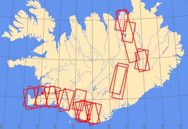
 Terrafirma Extension Tectonic Theme 6 th Terrafirma Workshop ESA-ESRIN, December 1st, 2010 Summary - Service Prospectus Presentation - The Terrafirma Extension Tectonic Theme (TFX-TT) - Greek Task Force
Estelle Chaussard Berkeley Seismological Laboratory
 Estelle Chaussard Berkeley Seismological Laboratory Data integra1on of data we ALREADY have à con1nua1on + ready for large datasets + use exis1ng data for new purposes (improved processing, resolu1on,...)
Committee on Earth Observation Satellites. Landslide Disaster Working Group Pilot: Status Report. March 8th, 2016
 Committee on Earth Observation Satellites Landslide Disaster Working Group Pilot: Status Report March 8th, 2016 Motivation Langtang Valley, Nepal View from the ground (Photo credit USGS) Landsat-8 Pre
IGOS Geohazards: toward an improved use of Earth Observations for Geohazards mitigation
 IGOS Geohazards: toward an improved use of Earth Observations for Geohazards mitigation Scientific and Technical Subcommittee session Vienna, 15th February 2007 Gonéri Le Cozannet IGOS Geohazards Bureau
Geochemistry, Geophysics, Geosystems. Supporting Information for
 1 2 3 4 5 6 7 8 Geochemistry, Geophysics, Geosystems Supporting Information for Volcano Deformation Survey over the Northern and Central Andes with ALOS InSAR Time Series Anieri M. Morales Rivera 1, Falk
Lecture 19: Volcanoes II. GEOS 655 Tectonic Geodesy Jeff Freymueller
 Lecture 19: Volcanoes II GEOS 655 Tectonic Geodesy Jeff Freymueller July-August 2008 Photo J. Larsen, AVO Volume Change Inferred from Model GPS Site Time Series Average rate from 2005.0-2008.0 subtracted
The Potential of High Resolution Satellite Interferometry for Monitoring Enhanced Oil Recovery
 The Potential of High Resolution Satellite Interferometry for Monitoring Enhanced Oil Recovery Urs Wegmüller a Lutz Petrat b Karsten Zimmermann c Issa al Quseimi d 1 Introduction Over the last years land
Contribution to global Earth observation from satellites
 Contribution to global Earth observation from satellites - JAXA s Earth Observation strategy - April 16, 2008 Makoto Kajii Japan Aerospace Exploration Agency Earth Observation Summits and GEOSS 1 st EO
The Tohoku Earthquake 2011 Case.
 Wide Area Deformation map generation with TerraSAR-X Data. The Tohoku Earthquake 2011 Case. N. Yague-Martinez (1), C. Minet (2), M. Eineder (2), B. Schättler (2) (1) Starlab, Spain (2) Remote Sensing Technology
The BEYOND Center of Excellence for monitoring natural disasters from space
 The BEYOND Center of Excellence for monitoring natural disasters from space Ioannis Papoutsis National Observatory of Athens Institute for Astronomy, Astrophysics, Space Applications & Remote Sensing MOWE-IT
High-resolution temporal imaging of. Howard Zebker
 High-resolution temporal imaging of crustal deformation using InSAR Howard Zebker Stanford University InSAR Prehistory SEASAT Topographic Fringes SEASAT Deformation ERS Earthquake Image Accurate imaging
Group on Earth Observations (GEO) Cold Regions Work Plan Item WA-01-C3
 Cold Regions Work Plan Item WA-01-C3") EC Panel of Experts on Polar Observations, Research and Services Group on Earth Observations (GEO) Cold Regions Work Plan Item WA-01-C3 Barbara J. Ryan Secretariat Director Lanzhou, China 13 March 2013
EC Panel of Experts on Polar Observations, Research and Services Group on Earth Observations (GEO) Cold Regions Work Plan Item WA-01-C3 Barbara J. Ryan Secretariat Director Lanzhou, China 13 March 2013
Volcano Pilot Final Report (April 2014 November 2017) Draft as of March 2017
 Draft as of March 2017") Volcano Pilot Final Report (April 2014 November 2017) Draft as of March 2017 Summary: please provide a short statement (about ten lines) indicating what the pilot has achieved, using the pilot objectives
Volcano Pilot Final Report (April 2014 November 2017) Draft as of March 2017 Summary: please provide a short statement (about ten lines) indicating what the pilot has achieved, using the pilot objectives
The Global Geodetic Observing System (GGOS) of the International Association of Geodesy, IAG
 of the International Association of Geodesy, IAG") The Global Geodetic Observing System (GGOS) of the International Association of Geodesy, IAG Hans-Peter Plag (1), Markus Rothacher (2), Richard Gross (3), Srinivas Bettadpur (4) (1) Nevada Bureau of Mines
The Global Geodetic Observing System (GGOS) of the International Association of Geodesy, IAG Hans-Peter Plag (1), Markus Rothacher (2), Richard Gross (3), Srinivas Bettadpur (4) (1) Nevada Bureau of Mines
Copernicus Schaffung einer europäischen Kapazität für die operationelle Erdbeobachtung
 Copernicus Schaffung einer europäischen Kapazität für die operationelle Erdbeobachtung ESOC, Darmstadt, 23 April 2015 Simon Jutz, ESA Head, Copernicus Space Office (EOP-CO) Earth Observation Programmes
EAS 116 Earthquakes and Volcanoes
 EAS 116 Earthquakes and Volcanoes J. Haase Forecasting Volcanic Eruptions Assessment of Volcanic Hazard Is that volcano active? Mount Lassen: 12000 BP and 1915 Santorini, IT: 180,000 BP, 70,000 BP, 21000
Subsidence Monitoring in Hampton Roads Using InSAR
 Subsidence Monitoring in Hampton Roads Using InSAR Ben Hamlington, David Bekaert, Cathleen Jones, Brett Buzzanga, John Murray Commonwealth Center for Recurrent Flooding Resiliency (CCRFR) NASA Jet Propulsion
Copernicus Today and Tomorrow GEO Week Group on Earth Observation Geneva, 16 January 2014 The Copernicus Space Infrastructure
 Copernicus Today and Tomorrow GEO Week Group on Earth Observation Geneva, 16 January 2014 The Copernicus Space Infrastructure Thomas Beer, Policy Coordinator, Copernicus Space Office, ESA-ESRIN, Frascati
Volcano Pilot Final Report (April 2014 November 2017) Draft as of September 2017
 Draft as of September 2017") Volcano Pilot Final Report (April 2014 November 2017) Draft as of September 2017 Summary: The volcano pilot project was designed to be a stepping-stone towards the long-term goals of the Santorini Report
Volcano Pilot Final Report (April 2014 November 2017) Draft as of September 2017 Summary: The volcano pilot project was designed to be a stepping-stone towards the long-term goals of the Santorini Report
MONITORING THE CAMPI FLEGREI CALDERA BY EXPLOITING SAR AND GEODETICAL DATA: RECENT RESULTS AND FUTURE APPLICATIONS
 MONITORING THE CAMPI FLEGREI CALDERA BY EXPLOITING SAR AND GEODETICAL DATA: RECENT RESULTS AND FUTURE APPLICATIONS P. Berardino (1), S. Borgström (2), I. Aquino (2), F. Casu (1), C. Del Gaudio (2), R.
An Overview. Jeff Key (NOAA) PSTG Vice-Chair. on behalf of Polar Space Task Group. Polar Space Task Group
 PSTG Vice-Chair. on behalf of Polar Space Task Group. Polar Space Task Group") An Overview Jeff Key (NOAA) PSTG Vice-Chair on behalf of Asia CryoNet Meeting 4 December 2013, Beijing Cryosphere Satellite Missions International Year (IPY) The IPY provided an international framework
An Overview Jeff Key (NOAA) PSTG Vice-Chair on behalf of Asia CryoNet Meeting 4 December 2013, Beijing Cryosphere Satellite Missions International Year (IPY) The IPY provided an international framework
Subsidence Monitoring in Hampton Roads Using Satellites
 ODU Digital Commons July 29, 2016: The Latest in Sea Level Rise Science Hampton Roads Sea Level Rise/Flooding Adaptation Forum 7-29-2016 Subsidence Monitoring in Hampton Roads Using Satellites Ben Hamlington
Geological Mapping Using EO Data for Onshore O&G Exploration
 Geological Mapping Using EO Data for Onshore O&G Exploration Michael Hall ESA Oil and Gas Workshop, Frascati, Italy michael.hall@infoterra-global.com Why use EO data for Geological Mapping? Availability
Summaries and Recommendations of the Fringe 2007 Workshop
 Summaries and Recommendations of the Fringe 2007 Workshop The Fringe 2007 summaries and recommendations have been prepared by the session chairpersons and are grouped by session. Methodology: General -
Application of satellite InSAR data for hydrocarbon reservoir monitoring
 Application of satellite InSAR data for hydrocarbon reservoir monitoring A. Tamburini, A. Belson, A. Ferretti, F. Novali TRE Milano, Italy Copyright - Tele-Rilevamento Europa - 2004 Outline SqueeSAR TM
Contribution of Sentinel Asia Activities to Disaster Management in Asia Pacific Region: Sentinel Asia Success Story in the Philippines Project
 Contribution of Sentinel Asia Activities to Disaster Management in Asia Pacific Region: Sentinel Asia Success Story in the Philippines Project Arturo Daag PHIVOLCS, PHILIPPINES 13 October 2015 Bangkok
SAR interferometry Status and future directions. Rüdiger Gens
 SAR interferometry Status and future directions Rüdiger Gens Polarimetric InSAR Polarimetric InSAR InSAR - Status and future directions sensitivity to changes in surface scattering, even in the presence
Osservazione della terra da piattaforme remore ed in-situ fisse e mobili. Massimo Caccia CNR - ISSIA
 Osservazione della terra da piattaforme remore ed in-situ fisse e mobili Massimo Caccia CNR - ISSIA massimo.caccia@ge.issia.cnr.it 1 Research themes geo-physical monitoring environmental hazards monitoring
DIFFERENTIAL INSAR STUDIES IN THE BOREAL FOREST ZONE IN FINLAND
 DIFFERENTIAL INSAR STUDIES IN THE BOREAL FOREST ZONE IN FINLAND Kirsi Karila (1,2), Mika Karjalainen (1), Juha Hyyppä (1) (1) Finnish Geodetic Institute, P.O. Box 15, FIN-02431 Masala, Finland, Email:
Paul A. Rosen Jet Propulsion Laboratory, California Institute of Technology. UNAVCO Workshop Boulder, Colorado March 10, 2010
 GSHAP L. Wood, P. Worfolk et al., SaVi - Satellite constellation Visualisation software, http://savi.sf.net/, 2010. Paul A. Rosen Jet Propulsion Laboratory, California Institute of Technology UNAVCO Workshop
Land subsidence induced by groundwater extraction in the Alto Guadalentín aquifer, SE Spain.
 Land subsidence induced by groundwater extraction in the Alto Guadalentín aquifer, SE Spain. Pablo Ezquerro, Marta Béjar-Pizarro, Gerardo Herrera, José A. Fernández Merodo, Roberto Tomás, Carolina Guardiola-Albert,
ESA's Thematic Exploitation Platform initiative and the GEP for terrain motion measurements
 ESA's Thematic Exploitation Platform initiative and the GEP for terrain motion measurements ESA, October 2017 Philippe Bally (ESA), Theodora Papadopoulou (Argans Ltd c/ ESA), Fabrizio Pacini (Terradue)
GLOBVOLCANO: EARTH OBSERVATION SERVICES FOR GLOBAL MONITORING OF ACTIVE VOLCANOES
 GLOBVOLCANO: EARTH OBSERVATION SERVICES FOR GLOBAL MONITORING OF ACTIVE VOLCANOES S. Borgström (1), M. Bianchi (2), W. Bronson (3), M.L. Tampellini (4), R. Ratti (4), F.M. Seifert (5), J. C. Komorowski
Continuous Caldera Changes in Miyakejima Volcano after Hiroyuki HASEGAWA, Hiroshi P. SATO and Junko IWAHASHI
 Continuous Caldera Changes in Miyakejima Volcano after 2001 60 Hiroyuki HASEGAWA, Hiroshi P. SATO and Junko IWAHASHI Abstract This study investigated the evolvement of the caldera at Miyakejima volcano
New Era of Global Monitoring by ALOS-2: Advanced Land Observing Satellite-2 DAICHI-2 Yuko Suzuki
 New Era of Global Monitoring by ALOS-2: Advanced Land Observing Satellite-2 DAICHI-2 Yuko Suzuki International Relations and Research Department Japan Aerospace Exploration Agency (JAXA) 1 Dawning Era
Polar Space Task Group Permafrost Review of Requirements, Achievements and Expected Data
 Permafrost Review of Requirements, Achievements and Expected Data Annett Bartsch HORIZON2020 project NUNATARYUK (lead AWI with focus on coastal erosion and infrastructure) Dedicated Pleiades acquisitions
GSDI Global Spatial Data Infrastructure. Convergences between Geo Spatial Communities: key decision for decision making
 GSDI Global Spatial Data Infrastructure Convergences between Geo Spatial Communities: key decision for decision making April 14 th 2010 Bas Kok GSDI Past-President Director of International Affairs, Dutch
GEOMATICS AND DISASTER MANAGEMENT: Early Impact assessment in Haiti
 GEOMATICS AND DISASTER MANAGEMENT: Early Impact assessment in Haiti We will talk about... Post-disaster response: the main questions to be answered Post-disaster rapid mapping: the role of Geomatics The
GEO Coastal Zone Community of Practice (CZCP)
") ! "#$%&" $'( )$*+,-.'// Global, regional and local trends in natural processes and human demands on coastal ecosystems jeopardize the ability of these ecosystems to support commerce, living resources,
! "#$%&" $'( )$*+,-.'// Global, regional and local trends in natural processes and human demands on coastal ecosystems jeopardize the ability of these ecosystems to support commerce, living resources,
LANDSLIDE IDENTIFICATION, MOVEMENT MONITORING AND RISK ASSESSMENT USING ADVANCED EARTH OBSERVATION TECHNIQUES
 LANDSLIDE IDENTIFICATION, MOVEMENT MONITORING AND RISK ASSESSMENT USING ADVANCED EARTH OBSERVATION TECHNIQUES European Leader Investigator Dr. Zbigniew Perski Carpathian Branch, Polish Geological Institute
Sentinel Asia Tsunami Working Group
 Sentinel Asia Tsunami Working Group Co-Chairman: Prof. Shunichi Koshimura Abdul Muhari, PhD 4 th Joint Project Team Meeting (JPTM 2017): Sentinel Asia STEP 3 Abdul MUHARI, PhD Ministry of Marine Affairs
Ground deformation monitoring at the Phlegrean Fields (Naples, Italy) from the exploitation of SAR data in the framework of CAT-1 and DUP activities
 from the exploitation of SAR data in the framework of CAT-1 and DUP activities") Ground deformation monitoring at the Phlegrean Fields (Naples, Italy) from the exploitation of SAR data in the framework of CAT-1 and DUP activities Borgström S., Aquino I., Del Gaudio C., Ricco C., Siniscalchi
Ground deformation monitoring at the Phlegrean Fields (Naples, Italy) from the exploitation of SAR data in the framework of CAT-1 and DUP activities Borgström S., Aquino I., Del Gaudio C., Ricco C., Siniscalchi
Snow property extraction based on polarimetry and differential SAR interferometry
 Snow property extraction based on polarimetry and differential SAR interferometry S. Leinß, I. Hajnsek Earth Observation and Remote Sensing, Institute of Enviromental Science, ETH Zürich TerraSAR X and
Earthquakes and Faulting
 Earthquakes and Faulting Crustal Strength Profile Quakes happen in the strong, brittle layers Great San Francisco Earthquake April 18, 1906, 5:12 AM Quake lasted about 60 seconds San Francisco was devastated
Status DLR (TerraSAR X / TanDEM X)
") SAR Coordination Working Meeting 5 Status DLR (TerraSAR X / TanDEM X) Dana Floricioiu, Achim Roth Imaging Requirements for TerraSAR X & TanDEM X Missions Ice Sheets: TSX supports Greenland outlet glaciers,
SAR Coordination Working Meeting 5 Status DLR (TerraSAR X / TanDEM X) Dana Floricioiu, Achim Roth Imaging Requirements for TerraSAR X & TanDEM X Missions Ice Sheets: TSX supports Greenland outlet glaciers,
Infrastructure monitoring using SAR interferometry
 Infrastructure monitoring using SAR interferometry Hossein Nahavandchi Roghayeh Shamshiri Norwegian University of Science and Technology (NTNU), Department of Civil and Environmental Engineering Geodesy
Innovative Applications of Satellite Interferometry in the Oil&Gas Industry
 Innovative Applications of Satellite Interferometry in the Oil&Gas Industry A. Ferretti (1), G. Falorni (3), F. Novali (1), F. Rocca (2), A. Rucci (2), A. Tamburini (1) (1) Tele-Rilevamento Europa - TRE
German Remote Sensing Data Center (DFD) of DLR Department on Environment and Security. Training Course. Introduction to Geospatial Data Analysis
 of DLR Department on Environment and Security. Training Course. Introduction to Geospatial Data Analysis") Training Course Introduction to Geospatial Data Analysis 11-15 February 2008, NAM Center, Jakarta German Aerospace Center - DLR Information about the German Aerospace Center (DLR) DLR is Germany s national
Training Course Introduction to Geospatial Data Analysis 11-15 February 2008, NAM Center, Jakarta German Aerospace Center - DLR Information about the German Aerospace Center (DLR) DLR is Germany s national
InSAR practical considerations
 InSAR practical considerations How to get data Understanding the Line of Sight Sources of error Resampling/downsampling data Multi-interferogram methods: time series PSInSAR Matthew Pritchard Cornell University
the IRIS Consortium Collaborative, Multi-user Facilities for Research and Education Briefing NSF Business Systems Review September 9, 2008
 the IRIS Consortium Collaborative, Multi-user Facilities for Research and Education Briefing NSF Business Systems Review September 9, 2008 A facilities program for collection and distribution of seismological
EarthScope Comprehensive SAR Archive
 EarthScope Comprehensive SAR Archive PI: Frances Boler, UNAVCO Co-PIs: Falk Amelung, University of Miami; Roland Burgmann, UC Berkeley; David Phillips, UNAVCO. Proposal Submitted 16 July 2009 to National
The April 6 th 2009, L Aquila (Italy) earthquake: DInSAR analysis and seismic source model inversion
 earthquake: DInSAR analysis and seismic source model inversion") ESA ESRIN 30th November - 4th December 2009 Frascati, Italy The April 6 th 2009, L Aquila (Italy) earthquake: DInSAR analysis and seismic source model inversion Simone Atzori, Christian Bignami, Marco
ESA ESRIN 30th November - 4th December 2009 Frascati, Italy The April 6 th 2009, L Aquila (Italy) earthquake: DInSAR analysis and seismic source model inversion Simone Atzori, Christian Bignami, Marco
TerraSAR-X and TanDEM-X Applications for Maritime Domain Awereness
 TerraSAR-X and TanDEM-X Applications for Maritime Domain Awereness Dr. Stephan Brusch German Aerospace Center DLR Remote Sensing Technology Institute DLR Oberpfaffenhofen (Germany) Dr. Jürgen Drescher
EO Information Services in support of Satellite Tools for Building Flood Defence Systems in Guyana
 EO Information Services in support of Satellite Tools for Building Flood Defence Systems in Guyana F. N. Koudogbo and A. Arnaud Altamira Information J. Leen, Eurosense World Bank HQ, Washington DC Date
Gets Boost from a New Satellite
 Earthquake Monitoring Gets Boost from a New Satellite By J. R. Elliott, A. J. Elliott, A. Hooper, Y. Larsen, P. Marinkovic, T. J. Wright Fig. 1. Sentinel-1A interferogram built by comparing scans near
K&C Phase 4 Status report. Use of short-period ALOS-2 observations for vegetation characterization and classification
 K&C Phase 4 Status report Use of short-period ALOS-2 observations for vegetation characterization and classification Paul Siqueira, Tracy Whelen University of Massachusetts, Amherst Yang Lei NASA JPL Science
Interferometric Synthetic Aperture Radar (InSAR) and GGOS. Andrea Donnellan NASA/JPL February 21, 2007
 and GGOS. Andrea Donnellan NASA/JPL February 21, 2007") Interferometric Synthetic Aperture Radar (InSAR) and GGOS Andrea Donnellan NASA/JPL February 21, 2007 Sources for Science Objectives Fourth component of EarthScope Involvement: NSF, NASA, USGS, Universities
Interferometric Synthetic Aperture Radar (InSAR) and GGOS Andrea Donnellan NASA/JPL February 21, 2007 Sources for Science Objectives Fourth component of EarthScope Involvement: NSF, NASA, USGS, Universities
INGV. Giuseppe Pezzo. Istituto Nazionale di Geofisica e Vulcanologia, CNT, Roma. Sessione 1.1: Terremoti e le loro faglie
 Giuseppe Pezzo Istituto Nazionale di Geofisica e Vulcanologia, CNT, Roma giuseppe.pezzo@ingv.it The study of surface deformation is one of the most important topics to improve the knowledge of the deep
Plate Boundary Observatory the first five years
 www.earthscope.org Plate Boundary Observatory the first five years Plate Boundary Observatory A Continental-Scale, Integrated Geodetic By the Numbers (2003 2008) Installed 891 permanent Global Positioning
Breakout Session III Evolving landscapes and global environmental change
 Breakout Session III Evolving landscapes and global environmental change 1. Hydrology and critical zone imaging 2. Glaciology: Instrumenting glaciers and ice sheets 3. Polar networks and glacial isostatic
Ground surface deformation of L Aquila. earthquake revealed by InSAR time series
 Ground surface deformation of L Aquila earthquake revealed by InSAR time series Reporter: Xiangang Meng Institution: First Crust Monitoring and Application Center, CEA Address: 7 Naihuo Road, Hedong District
GEORED Project: GNSS Geodesy Network for Geodynamics Research in Colombia, South America. Héctor Mora-Páez
 GEORED Project: GNSS Geodesy Network for Geodynamics Research in Colombia, South America. Héctor Mora-Páez Colombian Geological Survey UNAVCO SCIENCE MEETING Feb 27 March 1, 2012 Boulder, CO, TECTONIC