Status Report on Volcano Pilot Project
|
|
|
- Jesse Potter
- 6 years ago
- Views:
Transcription
 WG Disasters Bonn, Germany 8-10 March,")
1 Status Report on Volcano Pilot Project Mike Poland (USGS) Simona Zoffoli (ASI) WG Disasters Bonn, Germany 8-10 March, 2017


2 Overview Motivation and objectives Data usage New results Interfacing with end users Milestones Issues
3 Pilot Team Juliet Biggs, David Arnold, James Hickey, Susi Ebmeier (University of Bristol) Matt Pritchard, Francisco Delgado (Cornell University) Christelle Wauthier, Kendall Wnuk (Penn State University) Falk Amelung (University of Miami) Fabrizio Ferrucci (Open University) Mike Pavolonis (NOAA) Rick Wessels (USGS) Eugenio Sansosti (IREA-CNR)


4 Volcano Pilot WG WGDisasters Disasters#4 Frascati, Italy Bonn, Germany September, March, WHY? Over 300,000 people have been killed by volcanoes since the 1600s. Hundreds of millions live within 20 km of an active volcano today. In 2010, the Eyjafjallajökull eruption brought losses of $200m/day, and 100,000 cancelled flights.
5 Volcano Pilot WG WGDisasters Disasters#4 Frascati, Italy Bonn, Germany September, March, WHAT IS MISSING? Large monitoring gaps exist at many hazardous volcanoes around the world Current EO data collection is not usually coordinated for volcano monitoring Need systematic observations before, during, and after volcanic events
6 Pilot objectives Objective A Regional Demonstration Demonstrate the feasibility of global volcano monitoring of Holocene volcanoes by undertaking regional monitoring of volcanic arcs in Latin America, stretching from Mexico to southern Chile, and including the Lesser Antilles, using satellite EO data to track deformation as well as gas, ash, and thermal emissions. Objective B Geohazard Supersites and Natural Laboratories Multi-disciplinary, multi-platform monitoring of a few volcanoes that represent a diverse cross section of eruptive activity and unrest. Objective C Significant Global Event Specific studies in case of a major eruption with significant regional or global impact, providing data for a comprehensive analysis of all aspects of the eruption cycle, including local (e.g., mass flows on the volcanic slopes), regional (e.g., ash emissions that may be hazardous to aircrafts), and global (e.g., volatile and aerosol emissions that may influence climate) impacts.
7 Objective B: Supersites Work continues on approved volcano Supersites: Hawai i Iceland Italy Ecuador New Zealand Critical for hazards assessment and mitigation efforts and highly valued by local agencies Volcano supersites provide opportunities for scientific innovation due to the availability of high spatial and temporal resolution datasets

8 Objective B: Supersites (hazards)
 east")

9 Objective B: Supersites (science) east displacement (cm) cm GPS Horizontal 1 cm InSAR east


10 Objective B: Supersites (both!) Mauna Kea Home to several world-class telescopes


11 Objective B: Supersites (both!)
12 Objective C: Large event Proposal has been submitted to ensure rapid access to data if a large volcanic event occurs Fogo eruption serves as a demonstration courtesy Fabrizzio Ferucci, Open University
13 Objective A: Regional demonstration Demonstrate how EO data can be used to costeffectively monitor all 315 volcanoes in the region that erupted in the last 10,000 years Identify volcanoes that may became active in the near future Track new and ongoing eruptive activity Why Latin America? Diversity of environments Abundant volcanic activity Benefits to local users 64% of volcanoes in the region have no ground monitoring of any type
14 Objective A Efforts by Partner Topic/region Value Added Partner Northern Andes and Lesser Antilles SAR Southern and Austral Andes SAR Galápagos SAR Mexico SAR Central America SAR Detection of ash plumes and thermal anomalies University of Bristol Cornell University IREA/CNR University of Miami Penn State, University of Bristol NOAA Development and testing of EO-based methodology for improved monitoring of surface deformation All Capacity-building and training activities in countries that do not currently have access to abundant EO data and/or the ability to process and interpret such data Collect feedback from users All All
15 SAR Data Usage Mission Ordered / Allocated Noteworthy results RADARSAT / 270 Cordon Caulle, Pacaya, Villarica COSMO-SkyMed 381 / 600 Cordon Caulle, Chiles Cerro Negro, Villarica TSX 135 / 400 Chiles Cerro Negro, Ubinas ALOS-2 84 / 200 Momotombo, Santiaguito TDX (CoSSC exp.) 14/150 Reventador, Soufriére Hills Volcano *Sentinel-1A data have not been included, since those data are distributed at no cost and with no restrictions.
16 Utility of data How have satellite data been useful? Monitored volcanoes with no ground networks and motivated installation of new sensors (Cordon Caulle) Provided data for determining alert levels (Chiles-CN) Complemented ground-based data and contributed to situational awareness during a crisis (Calbuco, Momotombo) Filled gaps at volcanoes that have some ground-based monitoring (Tungarahua, Pacaya, Santiaguito) Provide otherwise inaccessible data (Reventador, SHV) Research (Ubinas)

17 Results: Cordón Caulle Rapid uplift following end of eruption Uplift is aseismic (no associated earthquakes) OVDAS wants to deploy a GPS based, but had to postpone due to the Villarrica and Calbuco eruptions in 2015 Recognition of uplift motivated NOAA to increase detection sensitivity for ash and thermal anomalies Uplift 2013/ /06: 16 cm/yr uplift Uplift 2012/ /12: 45 cm cm/yr
18 Results: automated alerts courtesy Mike Pavolonis, NOAA

19 Results: automated alerts courtesy Mike Pavolonis, NOAA


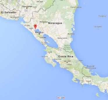
20 Results: Chiles Cerro Negro Seismic unrest events 2000 events 1000 events Oct 2013 February 2014 May 2014 Oct 2014


21 Results: Chiles Cerro Negro Cerro Negro Chiles TerraSAR-X 18 th Oct- 27 th Nov Ground deformation is it magma or just the earthquake?
 and Servicio Geologico (Colombia) every ~6 days.")
22 Results: Chiles Cerro Negro Modeling of InSAR data indicate it was just the EQ! Regular CSK and TSX acquisitions were processed as part of the CEOS pilot, and interferograms were provided to the Instituto Geofisico (Ecuador) and Servicio Geologico (Colombia) every ~6 days. Interferograms, with GPS and decrease in seismic events, were in helping us arrive to the decision to lower the alert level from orange to yellow. (P. Mothes, IG)

23 Results: Calbuco Feedback from Buenos Aires VAAC manager on May 3, 2015: I thank you and congratulate you for the excellent work in making available of all images and products that allow us to significantly improve the tasks of detecting and tracking volcanic eruptions and clouds and ash, since we only have GOES13 and some polar satellites images. In the wake of the explosive eruption of Calbuco, the Buenos Aires VAAC used the products to help brief aviation stakeholders


24 Results: Momotombo ALOS to


25 Results: Tungaraua RSAT2 April 15 May 9, 2011 Outcome of CEOS pilot investigation: IG installs new ground sensors in monitoring gap
, or tilt (blue triangles).")
26 Results: VIllarica Most dangerous volcano in the southern Andes, experienced a small eruption in March No clear evidence of co-eruptive deformation from InSAR, GPS (purple triangles), or tilt (blue triangles).
, and resulted in an increase in the volcano s")
27 Results: VIllarica One GPS station (purple triangle) suggested deformation in May This result was corroborated by InSAR (CSK), and resulted in an increase in the volcano s alert level.

28 Results: Pacaya Interferogram spanning the 2014 eruption shows deformation that is likely magmatic in origin on the NE flank, while deformation on the SW flank resembles that from other time periods and is probably related to flank instability.


29 Results: Santiaguito
 Thickness of new lava flows between 2011 and 2014 from TDX CoSSCs InSAR")

30 Results: Reventador IG monitors lava effusion rate using field measurements and photos from overflights (irregular sampling and dependent on clear weather) Thickness of new lava flows between 2011 and 2014 from TDX CoSSCs InSAR data provide independent measure of effusion rates. Recent data from CoSSCs have imaged activity that was unknown to IG Interferograms provide the only source of deformation measurement, important for assessing whether magma is accumulating


31 Results: TDX for Topography 2 km Topographic fringes from a TanDEM-X image pair showing thickness of new lava flows at Volcán Reventador, Ecuador. One complete color cycle corresponds to 25 m of new lava. Images like these supplement limited ground based measurements and allow volcano observatories to see how the rate of eruption is changing over time. Thickness of volcanic deposits on Montserrat measured by TanDEM-X. These results can be used to update DEMs and improve hazard maps and geophysical models

32 Results: Ubinas TSX Most active and dangerous volcano in Peru and in a state of continuous unrest since 2013, with several small eruptions. But no evidence of deformation!

33 Users who are they? End-users are scientists in volcano observatories or VAACs who interface with local government officials
34 Users who are they? [HAZARD] Volcano observatories are the experts that are governmentally mandated to monitor volcanic hazards and usually set alert levels. [RISK] The authorities (local or national governmental bodies) have the final decision on response (e.g. evacuation) and have the responsibility to advise the local communities etc. [ALERTS] In practice, response and communication is directly linked to the alert level. Thus when a volcano observatory changes the alert level, a pre-defined response is triggered and in almost all cases, the recommendations of the volcano observatories are followed. If the CEOS pilot were to communicate directly with the local decision makers and communities, it would potentially undermine the authority of the observatories and bypass the alert system. The technical information would likely be either not used or misunderstood.
35 User feedback 1.Name of your organization and brief statement of mandate. 2.What satellite data were provided to you as part of the CEOS volcano pilot project? How was the data used? (For example, images used in staff meetings, discussions of volcano alert levels, strategies for deploying ground sensors used in making figures for internal or external distribution, etc.)? 3. Were the data useful? If so, please describe in a few lines what level of products was most useful: (For example, raw data, interferograms, google earth files, a written summary of the significance of the data, etc.). If not, how could we improve on the use of satellite data for your needs? For example, by sending data in a more timely manner or in a different format. 4. Looking to the future, would your organization like increase the use satellite of observations and what do you think is needed to make that happen? 35
36 User Feedback Interviews conducted with users in: Guatemala Costa Rica Columbia Ecuador Peru Chile
37 User Feedback What do end users want? Data provided as Google Earth and/or ArcGIS files, and some interpretation of imagery More frequent data (in terms of volume and latency between tasking, acquisition, processing, and interpretation) for use in regular reports Graduate-level training for students (short courses are valuable, but will not train remote sensing experts) Peru provides a good example of how remote sensing data are used and what is needed in the future.
38 Upcoming milestones 2016 Achieve monitoring of Latin American volcanoes Continue to provide products and collect feedback from end users Evaluate results from site-specific studies Prepare a Journal of Applied Volcanology article describing the results of our work, focusing on the value to end users 2017 Develop broader space-based EO strategy using insights from pilot
39 Strategy for volcano EO SAR observations of Holocene volcanoes ALOS-2 and Sentinel-1 can provide broad routine wide-area coverage (based on environment) High spatial- and temporal-resolution sensors (CSK, TSX) focus on specific targets of concern/interest Flexible sensors (RSAT-2) for challenging problems Visible and thermal monitoring is already somewhat mature (for example, MODVOLC, NOAA system) Coordinate systems for alerting one another (already done in some cases with visible/thermal systems) Dedicated FTE, capacity building, data acquisition
40 Strategy for interfacing with users Proximity (What is the current status of the volcano?) Integrity (What is the status of ground-based monitoring? How will EO products be used?) Comprehensibility (Products versus data; ability to process/interpret data) Materiality (What is needed at the volcano? What features are of greatest interest?)
41 Issues ACQUISITION Consistent acquisition strategy for volcanoes (background TSX program?) COMMUNICATION Improve dialogue to avoid conflicts in data acquisition INTEGRATION SAR versus visible/thermal wavelengths, better use of Geohazards Exploitation Platform EXPANSION Resources for expanding to global monitoring will be extreme (student case-study projects do not constitute a sustainable capability PhD students have other demands on their time!)

42 Thank you
Volcano Monitoring on a Regional Scale:
 Volcano Monitoring on a Regional Scale: Results from the CEOS Disaster Risk Management Volcano Pilot David Arnold 1 Juliet Biggs 1 Francisco Delgado 2 Matt Pritchard 2 Susi Ebmeier 1 Mike Poland 3 Simona
Committee on Earth Observation Satellites. The CEOS Volcano Demonstrator Rationale and Implementation
 Committee on Earth Observation Satellites The CEOS Volcano Demonstrator Rationale and Implementation Why focus on volcanoes? Over 300,000 people have been killed by volcanoes since the 1600s Globally,
CEOS Volcano Pilot Overview 7 October, 2014
 CEOS Volcano Pilot Overview 7 October, 2014 Volcano Pilot April 2014- end 2017 Theme area: Volcanoes Geographic areas of focus: A. The Latin American volcanic arc (Mexico through southern Chile, including
Volcano Pilot Long-term Objectives
 Volcano Pilot Long-term Objectives Stepping-stone towards the long-term goals of the Santorini Report (2012): 1) global background observations at all Holocene volcanoes; 2) weekly observations at restless
Volcano Pilot Final Report (April 2014 November 2017) Draft as of March 2017
 Draft as of March 2017") Volcano Pilot Final Report (April 2014 November 2017) Draft as of March 2017 Summary: please provide a short statement (about ten lines) indicating what the pilot has achieved, using the pilot objectives
Volcano Pilot Final Report (April 2014 November 2017) Draft as of March 2017 Summary: please provide a short statement (about ten lines) indicating what the pilot has achieved, using the pilot objectives
Volcano Pilot Final Report (April 2014 November 2017) Draft as of September 2017
 Draft as of September 2017") Volcano Pilot Final Report (April 2014 November 2017) Draft as of September 2017 Summary: The volcano pilot project was designed to be a stepping-stone towards the long-term goals of the Santorini Report
Volcano Pilot Final Report (April 2014 November 2017) Draft as of September 2017 Summary: The volcano pilot project was designed to be a stepping-stone towards the long-term goals of the Santorini Report
The Geohazard Supersites and Natural Laboratories (GSNL).
.") The Geohazard Supersites and Natural Laboratories (GSNL). Falk Amelung, University of Miami Mike Poland, Hawaii Volcano Observatory Scott Baker, U of Miami, Unavco Outline: Overview over GSNL (Phase 2)
The Geohazard Supersites and Natural Laboratories (GSNL). Falk Amelung, University of Miami Mike Poland, Hawaii Volcano Observatory Scott Baker, U of Miami, Unavco Outline: Overview over GSNL (Phase 2)
Geohazard Supersites and Natural Laboratories
 Geohazard Supersites and Natural Laboratories FRINGE 2011, Frascati, Italy, September 19, 2011 Wolfgang Lengert, ESA Falk Amelung, University of Miami, GEO task lead Craig Dobson, NASA, CEOS task lead
Geohazard Supersites and Natural Laboratories
 Geohazard Supersites and Natural Laboratories FRINGE 2011, Frascati, Italy, September 19, 2011 Wolfgang Lengert, ESA Falk Amelung, University of Miami, GEO task lead Craig Dobson, NASA, CEOS task lead
Volcanoes Session. Chairs: Y. Fukushima & G. Puglisi
 Volcanoes Session Chairs: Y. Fukushima & G. Puglisi Presentation Summary We had presentations on volcanoes all over the world, more than the last FRINGE workshops: Etna, Campi Flegrei, Ethiopian rift,
GEO-VIII November Geohazard Supersites and Natural Laboratories Progress Report. Document 9
 GEO-VIII 16-17 November 2011 Geohazard Supersites and Natural Laboratories Progress Report Document 9 This document is submitted to GEO-VIII for information. Geohazard Supersites and Natural Laboratories
GSNL - Geohazard Supersites and Natural Laboratories. Biennial report for Candidate/Permanent Supersite. Hawaiʻi Supersite. Annex to report
 Introduction Biennial report for Candidate/Permanent Supersite Hawaiʻi Supersite Annex to 2014 2016 report During 2014 2016, the Hawaiʻi Supersite achieved a number of noteworthy results. This annex details
Geochemistry, Geophysics, Geosystems. Supporting Information for
 1 2 3 4 5 6 7 8 Geochemistry, Geophysics, Geosystems Supporting Information for Volcano Deformation Survey over the Northern and Central Andes with ALOS InSAR Time Series Anieri M. Morales Rivera 1, Falk
CEOS Support to the Geohazard Supersites
 The CEOS Supersite Coordination Team: Simona Zoffoli, ASI Steven Hosford, CNES Christine Giguère, CSA Jörn Hoffmann, DLR (Chair) Wolfgang Lengert, ESA Kazuo Umezawa, JAXA Shizu Yabe, JAXA Francis Lindsay,
CEOS WG Disasters Report
 Committee on Earth Observation Satellites CEOS WG Disasters Report Stéphane Chalifoux SIT Tech Workshop 2016 Agenda Item # 16 CEOS Strategic Implementation Team Tech Workshop Oxford, UK 14 th -15 th September
Photo credit: S Dumont
 Satellite Monitoring of the 2014 Dyke Intrusion and Eruption within the Bárðarbunga Volcanic System, facilitated by the CEOS Icelandic SUPERSITE M Parks, S Dumont, V Drouin, F Sigmundsson, K Spaans, A
Supporting the response to the 2018 lower East Rift Zone and summit collapse at Kīlauea Volcano, Hawaiʻi
 Hawaiʻi Supersite success story Supporting the response to the 2018 lower East Rift Zone and summit collapse at Kīlauea Volcano, Hawaiʻi Since 1983, Kīlauea Volcano, on the Island of Hawaiʻi, has actively
The Geohazards Lab. CEOS WG Disasters. CEOS Disaster Risk Management. CEOS WG Disasters 10 th meeting
 CEOS Disaster Risk Management CEOS WG Disasters The Geohazards Lab CEOS WG Disasters 10 th meeting Philippe Bally, ESA Theodora Papadopoulou, ARGANS c/ ESA Michael Foumelis, BRGM CEOS WG Disasters Buenos
WGCapD Support to AmeriGEOSS Week Disaster Training Report
 WGCapD Support to AmeriGEOSS Week Disaster Training Report 1 6-9 June 2016 CEOS WGCapD Support to AmeriGEOSS Week Disaster training DRAFT REPORT Hosted by: The government's Institute of Hydrology, Meteorology,
DEBRIEFING REPORT. COTOPAXI VOLCANO EXERCISE 13 th NOVEMBER WP 9: Decision-making and unrest management
 COTOPAXI VOLCANO EXERCISE 13 th NOVEMBER 2014 WP 9: Decision-making and unrest management Task 9.6: Simulation of unrest and decision making DEBRIEFING REPORT INTRODUCTION The third VUELCO exercise took
Earth Observatory of Singapore. Nina Lin 22 Jan 2018
 Earth Observatory of Singapore Nina Lin 22 Jan 2018 EOS Our Mission Our Mission Director Prof. Kerry Sieh The Earth Observatory of Singapore conducts fundamental research on earthquakes, volcanic eruptions,
The Santorini Inflation Episode, Monitored by InSAR and GPS
 The Santorini Inflation Episode, Monitored by InSAR and GPS Ioannis Papoutsis 1,2, Xanthos Papanikolaou 2, Michael Floyd 3, Kang Hyeun Ji 4, Charalampos Kontoes 1, Demitris Paradissis 2, Demitris Anastasiou
Module 1, Investigation 3: Predicting Eruptions
 Module 1, Investigation 3: Predicting Eruptions Introduction Welcome! Volcanoes are either "active" or "extinct". Active means that the volcano has erupted during the past 10,000 years. It can also mean
The Polar Ice Sheets Monitoring Project A Coordinated Response from Space Agencies
 The Polar Ice Sheets Monitoring Project A Coordinated Response from Space Agencies Yves Crevier / Members of the PSTG SAR Coordination WG Canadian Space Agency CEOS SIT-28 Meeting Hampton, Virginia, USA
Near real-time monitoring of the April-May 2010 Eyjafjöll s ash cloud
 Near real-time monitoring of the April-May 2010 Eyjafjöll s ash cloud Labazuy P. and the HotVolc Team Observatoire de Physique du Globe de Clermont-Ferrand, CNRS, Université Blaise Pascal 13th International
Images from: Boston.com
 Images from: Boston.com Ireland in the shadow of a volcano: Understanding the 2010 eruption at Eyjafjallajökull, Iceland. Chris Bean, School of Geological Sciences, UCD. World Quakes and Volcanoes 1960-2010
Q1-Q CEOS Seismic Pilot report. CEOS Thematic Pilots
 CEOS Thematic Pilots Q1-Q2 2016 CEOS Seismic Pilot report Seismic Pilot/ Objective A, B and C March 2016- PI or PoC: Philippe Bally August 2016 (ESA) and Stefano Salvi (INGV). Collaborating organisations:
Growth of International Collaboration in Monitoring Volcanic Ash Eruptions in the North Pacific
 Growth of International Collaboration in Monitoring Volcanic Ash Eruptions in the North Pacific John C. Eichelberger and Christina Neal U.S. Geological Survey U.S. Department of the Interior U.S. Geological
Diverse deformation patterns of Aleutian volcanoes from InSAR
 Diverse deformation patterns of Aleutian volcanoes from InSAR Zhong Lu 1, Dan Dzurisin 1, Chuck Wicks 2, and John Power 3 U.S. Geological Survey 1 Cascades Volcano Observatory, Vancouver, Washington 2
What is the Relationship between Pressure & Volume Change in a Magma Chamber and Surface Deformation at Active Volcanoes?
 SSAC-pv2007.QE522.PL1.1 What is the Relationship between Pressure & Volume Change in a Magma Chamber and Surface Deformation at Active Volcanoes? What factors control the magnitude of surface deformation?
Volcanic eruptions: Introduction to remote sensing techniques for fine ash and SO2 detection
 Volcanic eruptions: Introduction to remote sensing techniques for fine ash and SO2 detection Bernie Connell Cooperative Institute for Research in the Atmosphere Colorado State University USA Ash clouds
Earthquake and Volcano Service
 Ref. Ares(2014)73773-15/01/2014 Earthquake and Volcano Service WP Leader: Istituto Nazionale di Geofisica e Vulcanologia (Italy) Contributors: NILU (Norway), EUCENTRE (Italy), GAMMA (Switzerland), IGAR
Credits: Fa. Ilv im Auftrag von LMBV mbh. CEOS Disaster Risk Management Observation Strategy Issue 2.1
 Credits: Fa. Ilv im Auftrag von LMBV mbh. CEOS Disaster Risk Management Observation Strategy Issue 2.1 CEOS ad hoc Disasters Team November 1, 2013 Table of Contents CEOS Disaster Risk Management Observation
Volcanic Hazards in Guatemala Dr. Matt Watson School of Earth Sciences
 Volcanic Hazards in Guatemala Dr. Matt Watson School of Earth Sciences Presentation to the Bristol Branch of the Geographical Association in September 2018 Image credit: Albert Dros. www.albertdros.com
Wireless Networks in Geophysical Monitoring
 Workshop on New Frontiers in Internet of Things 7-18 March 2016 Trieste, Italy Wireless Networks in Geophysical Monitoring Hairo Villalobos Vulcanological and Seismological Observatory of Costa Rica, National
Volcanic Ash Monitoring Claus Zehner, ESA
 Volcanic Ash Monitoring Claus Zehner, ESA Slide: 1 Support to Aviation Control Service A global Alert (and Analysis demonstration only) system for volcanic Ash and SO2 emissions using satellite measurements
The 2010 Eyjafjallajökull eruption: overview and OMI observations. Simon A. Carn Michigan Technological University, Houghton, MI, USA
 The 2010 Eyjafjallajökull eruption: overview and OMI observations Simon A. Carn Michigan Technological University, Houghton, MI, USA Global air routes and potentially active volcanoes Map courtesy of F.
Advanced Workshop on Evaluating, Monitoring and Communicating Volcanic and Seismic Hazards in East Africa.
 2053-13 Advanced Workshop on Evaluating, Monitoring and Communicating Volcanic and Seismic Hazards in East Africa 17-28 August 2009 Hazard Communication: Examples From Tanzania, Mozambique, and Cameroon
Volcanoes and Urban Planning
 Background Reading & Lesson Plan Document ID: 10_04_04_1 Date Received: 2004-10-04 Date Revised: 2004-11-16 Date Accepted: 2004-11-23 Curriculum Topic Benchmarks: M1.3.5, M3.3.17, M5.3.3, M9.3.2, S12.3.7,
Agency Vision and Decision- Maker Needs: A USGS Perspective
 Agency Vision and Decision- Maker Needs: A USGS Perspective Connecting Grassroots to Government for Disaster Management David Applegate USGS Associate Director for Natural Hazards September 13, 2012 U.S.
Advantages of Regional and Global Data Exchange. Gavin Hayes U.S. Geological Survey, National Earthquake Information Center
 Advantages of Regional and Global Data Exchange Gavin Hayes U.S. Geological Survey, National Earthquake Information Center USGS NEIC Global Earthquake Response Area of responsibility => Global BUT - domestically,
DLR s TerraSAR-X contributes to international fleet of radar satellites to map the Arctic and Antarctica
 DLR s TerraSAR-X contributes to international fleet of radar satellites to map the Arctic and Antarctica The polar regions play an important role in the Earth system. The snow and ice covered ocean and
Explosive volcanic eruptions in the North Pacific: Interactions between the Alaska Volcano Observatory and Volcanic Ash Advisory Centers
 Explosive volcanic eruptions in the North Pacific: Interactions between the Alaska Volcano Observatory and Volcanic Ash Advisory Centers David Schneider U.S. Geological Survey Alaska Volcano Observatory
The new challenge of community-based environmental monitoring and information systems: the Citizens Obsrevatories Tito Scalo (PZ) 13 July 2016
 13 July 2016") The new challenge of community-based environmental monitoring and information systems: the Citizens Obsrevatories Tito Scalo (PZ) 13 July 2016 Involving citizens in environmental monitoring and awareness:
The new challenge of community-based environmental monitoring and information systems: the Citizens Obsrevatories Tito Scalo (PZ) 13 July 2016 Involving citizens in environmental monitoring and awareness:
Kīlauea Volcano: Be a Volcanologist. Image Credit: Julien Millet / Unsplash. Final Project
 The Kīlauea Volcano: Be a Volcanologist Image Credit: Julien Millet / Unsplash Final Project Final Project The Kīlauea Volcano: Be a Volcanologist In this two-day project, students apply their previous
What is the threat? Sue Loughlin and Julia Crummy British Geological Survey. NERC All rights reserved NERC All rights reserved
 What is the threat? Sue Loughlin and Julia Crummy British Geological Survey BATA Conference, London 15 th October 2013 What is a volcano? Where and how many? There are more than 1500 known potentially
Coordinated Monitoring of Ash Eruptions in the Russian Far East and Alaska
 Coordinated Monitoring of Ash Eruptions in the Russian Far East and Alaska Dr. John Eichelberger, Program Coordinator, Volcano Hazards Program, US Geological Survey, Reston, Virginia, USA Academician Evgeny
Sentinel Asia Tsunami Working Group
 Sentinel Asia Tsunami Working Group Co-Chairman: Prof. Shunichi Koshimura Abdul Muhari, PhD 4 th Joint Project Team Meeting (JPTM 2017): Sentinel Asia STEP 3 Abdul MUHARI, PhD Ministry of Marine Affairs
Wednesday, May 23, :30 a.m. EDT
 Wednesday, May 23, 2018 8:30 a.m. EDT Significant Activity May 22-23 Significant Events: Kīlauea Volcano eruption Tropical Activity: Atlantic Invest 90L MEDIUM chance (60%) Significant Weather: Severe
( ) USGS (United States Geological Survey) Watch Green. Normal. alert level 1 Normal
 USGS (United States Geological Survey) Watch Green. Normal. alert level 1 Normal") (200610.1) USGS (United States Geological Survey) 1014 alert level 1 Normal Watch Green Normal USGS WARNING WATCH ADVISORY NORMAL SUMMARY OF VOLCANIC-ALERT LEVELS Highly hazardous eruption underway or
(200610.1) USGS (United States Geological Survey) 1014 alert level 1 Normal Watch Green Normal USGS WARNING WATCH ADVISORY NORMAL SUMMARY OF VOLCANIC-ALERT LEVELS Highly hazardous eruption underway or
NOAA s National Weather Service VAAC Anchorage. Don Moore
 NOAA s National Weather Service VAAC Anchorage Don Moore VAAC Best Practices Workshop May 2015 Volcanic Eruptions Volcanic Eruptions Volcanic Eruptions VAAC Anchorage and Alaska Aviation Weather Unit (AAWU)
Situation Report. Situation Overview. Volcanic Activity Ambae & Ambrym. Situation Report 08. Time & Date 17:00 18 th October 2017
 Situation Report Response Name Volcanic Activity Ambae & Ambrym Situation Report 08 Time & Date 17:00 18 th October 2017 Reporting period 18/10/2017 Provinces affected Penama, Sanma, Malampa Attachment(s)
Regional mechanisms for satellite data access and exchange: RA III/IV
 WORLD METEOROLOGICAL ORGANIZATION COMMISSION FOR BASIC SYSTEMS OPEN PROGRAMME AREA GROUP ON INTEGRATED OBSERVING SYSTEMS EXPERT TEAM ON SATELLITE UTILIZATION AND PRODUCTS ET-SUP-8/Doc. 5.1.3 (25.III.2014)
Breakout Session III Evolving landscapes and global environmental change
 Breakout Session III Evolving landscapes and global environmental change 1. Hydrology and critical zone imaging 2. Glaciology: Instrumenting glaciers and ice sheets 3. Polar networks and glacial isostatic
REFERENCE: The Blue Planet An Introduction to Earth System Science. Brian J. Skinner and Barbara W. Murck (2011) Third Edition. John Wiley and Sons
 Third Edition. John Wiley and Sons") REFERENCE: The Blue Planet An Introduction to Earth System Science. Brian J. Skinner and Barbara W. Murck (2011) Third Edition. John Wiley and Sons Inc. PLATE BOUNDARIES OCEAN FLOOR SEISMIC ACTIVITY WORLD'S
REFERENCE: The Blue Planet An Introduction to Earth System Science. Brian J. Skinner and Barbara W. Murck (2011) Third Edition. John Wiley and Sons Inc. PLATE BOUNDARIES OCEAN FLOOR SEISMIC ACTIVITY WORLD'S
Pipeline Integrity Monitoring
 A Global Communications and Information Company Pipeline Integrity Monitoring is subject to the restrictions on the title page of this document. COPYRIGHT 2014 MDA 1 1 Corporate Overview Business Space-based
Capacity Building Activities at CRECTEALC. Ing. Jerjes Molina Blancas Professor and Developer.
 Capacity Building Activities at CRECTEALC Ing. Jerjes Molina Blancas Professor and Developer. Centro Regional de Enseñanza de Ciencia y Tecnología del Espacio para América Latina y el Caribe (CRECTEALC)
Response of the London Volcanic Ash Advisory Centre to the Eyjafjallajökull Eruption
 Paper 1B.3 Response of the London Volcanic Ash Advisory Centre to the Eyjafjallajökull Eruption Ian Lisk, Volcanic Ash Programme Manager, Met Office, UK 1. INTRODUCTION The Met Office is home to the London
Transparency: Redoubt ash cloud
 Module 1 Investigation 3 Transparency: Redoubt ash cloud Aerial view of Redoubt Volcano during a continuous, low-level eruption of steam and ash December 18, 1989 Source: photo by W. White, USGS, http://www.avo.alaska.edu/avo3/volc/redou/photo.htm
Investigation 3: Predicting Eruptions
 Investigation 3: Predicting Eruptions Table of Contents Folder 1: Seismic Activity... 23 Folder 2: Ground Deformation (Mount St. Helens, Washington)... 25 Folder 3: Hot Spots... 26 Folder 4: Gas Emissions...
Key Stage 4 - Volcano Eruption! Task sheet: phase 1
 Task sheet: phase 1 Rotimon is an imaginary island. La Soufriere is its youngest volcano. It last erupted in the 1970s. It is not monitored at the moment. Recently the volcano has shown some strange signs.
Slow Deformation of Mt. Baekdu Stratovolcano Observed by Satellite Radar Interferometry
 Slow Deformation of Mt. Baekdu Stratovolcano Observed by Satellite Radar Interferometry Sang-Wan Kim and Joong-Sun Won Department of Earth System Sciences, Yonsei University 134 Shinchon-dong, Seodaemun-gu,
The BEYOND Center of Excellence for monitoring natural disasters from space
 The BEYOND Center of Excellence for monitoring natural disasters from space Ioannis Papoutsis National Observatory of Athens Institute for Astronomy, Astrophysics, Space Applications & Remote Sensing MOWE-IT
EuroGeoSurveys & ASGMI The Geological Surveys of Europe and IberoAmerica
 EuroGeoSurveys & ASGMI The Geological Surveys of Europe and IberoAmerica Geological Surveys, what role? Legal mandate for data & information: Research Collection Management Interpretation/transformation
Geohazard Supersites Phase- 2: Selection of candidate Supersites
 Geohazard Supersites Phase- 2: Selection of candidate Supersites Falk Amelung, Thomas Walter, Mahdi Motagh, Andy Hooper, Tim Wright, Eugenio Sansosti, Matt Prittchard, Eric Fielding, Zhong Lu, Juliet Biggs,
DIFFERING REGIONAL CAPABILITIES IN SATELLITE-BASED VOLCANIC ASH CLOUD DETECTION
 Prepared by NOAA Agenda Item: II/8 Discussed in WGII DIFFERING REGIONAL CAPABILITIES IN SATELLITE-BASED VOLCANIC ASH CLOUD DETECTION The GOES-R AWG is responsible for the developing the algorithms that
Thursday, May 17, :30 a.m. EDT
 Thursday, May 17, 2018 8:30 a.m. EDT Significant Activity May 16-17 Significant Events: Kīlauea Volcano eruption Tropical Activity: Western Pacific no activity affecting U.S. interests Significant Weather:
Proper Data Management Responsibilities to Meet the Global Ocean Observing System (GOOS) Requirements
 Requirements") Data Buoy Cooperation Panel XXVI Oban, Scotland, UK 27 September 2010 Proper Data Management Responsibilities to Meet the Global Ocean Observing System (GOOS) Requirements William Burnett Data Management
Data Buoy Cooperation Panel XXVI Oban, Scotland, UK 27 September 2010 Proper Data Management Responsibilities to Meet the Global Ocean Observing System (GOOS) Requirements William Burnett Data Management
NASA Jet Propulsion Laboratory Data Products
 NASA Jet Propulsion Laboratory Data Products 17 April 2014 Emergency Response Spatial Tools Technical Interchange Maggi Glasscoe Margaret.T.Glasscoe@jpl.nasa.gov Sang-Ho Yun Sang-Ho.Yun@jpl.nasa.gov www.nasa.gov
Aira/Sakura-jima. Kyushu, Japan N, E; summit elev m. All times are local (= UTC + 9 hours)
") Aira/Sakura-jima Kyushu, Japan 31.593 N, 130.657 E; summit elev. 1117 m All times are local (= UTC + 9 hours) 2012-2013 Ongoing frequent explosions; ashfall on Kagoshima City This report summarizes activity
Aira/Sakura-jima Kyushu, Japan 31.593 N, 130.657 E; summit elev. 1117 m All times are local (= UTC + 9 hours) 2012-2013 Ongoing frequent explosions; ashfall on Kagoshima City This report summarizes activity
Geological Mapping Using EO Data for Onshore O&G Exploration
 Geological Mapping Using EO Data for Onshore O&G Exploration Michael Hall ESA Oil and Gas Workshop, Frascati, Italy michael.hall@infoterra-global.com Why use EO data for Geological Mapping? Availability
Satellite Data For Applications: Aviation/Volcanic Ash. Richard Eckman NASA 27 May 2013
 Satellite Data For Applications: Aviation/Volcanic Ash Richard Eckman NASA 27 May 2013 Background Following the unprecedented disruption to aviation by the recent eruptions of Eyjafjallajökull and Grímsvötn
The Continuously Operation Caribbean Observational Network: COCONet
 The Continuously Operation Caribbean Observational Network: COCONet Glen S. Mattioli University of Texas at Arlington Presenting for COCONet Executive Committee: M. Miller(1), E. Calais(2), C. Meertens(1),
Assessing the Volcanic Threat in Latin America. Jose L. Palma, University at Buffalo Bill Rose, Michigan Technological University
 Assessing the Volcanic Threat in Latin America Jose L. Palma, University at Buffalo Bill Rose, Michigan Technological University PASI Workshop, January 2011 Natural Disasters by Type, 1991-2005 90% 7%
SCIENTIFIC RESEARCH AND EDUCATION IN THE AIR FORCE AFASES2017
 SCIENTIFIC RESEARCH AND EDUCATION IN THE AIR FORCE AFASES2017 PROBABILITY ASSESSMENT OF POSSIBLE VOLCANIC ASH CONTAMINATION FOR THE BULGARIAN AIRSPACE BY DEVELOPING OF EVENT TREE AND RISK MATRIX FOR HYPOTHETICAL
Oceanic Weather Product Development Team
 Oceanic Weather Product Development Team Cathy Kessinger, Ted Tsui, Paul Herzegh, Earle Williams, Gary Blackburn, Gary Ellrod ASAP Science Review 13-14 April 2005 2005 NASA ASAP Science Meeting, Boulder,
Pavlof. Alaska Peninsula N, W; summit elev. 2,519 m. All times are local (= UTC - 9 hours)
") Pavlof Alaska Peninsula 55.42 N, 161.887 W; summit elev. 2,519 m All times are local (= UTC - 9 hours) Eruption in May-June 2013 with lava flows and ash emissions to ~8.5 km a.s.l. Pavlof, the most active
Pavlof Alaska Peninsula 55.42 N, 161.887 W; summit elev. 2,519 m All times are local (= UTC - 9 hours) Eruption in May-June 2013 with lava flows and ash emissions to ~8.5 km a.s.l. Pavlof, the most active
Space-based Weather and Climate Extremes Monitoring (SWCEM) Toshiyuki Kurino WMO Space Programme IPET-SUP-3, 2-4 May 2017
 Toshiyuki Kurino WMO Space Programme IPET-SUP-3, 2-4 May 2017") Space-based Weather and Climate Extremes Monitoring (SWCEM) Toshiyuki Kurino WMO Space Programme IPET-SUP-3, 2-4 May 2017 based on outcome from Workshop on Operational SWCEM 15-17 February 2017, Geneva
Space-based Weather and Climate Extremes Monitoring (SWCEM) Toshiyuki Kurino WMO Space Programme IPET-SUP-3, 2-4 May 2017 based on outcome from Workshop on Operational SWCEM 15-17 February 2017, Geneva
Global Volcano Model GAR Risk Management Solutions
 Global Volcano Model GAR Risk Management Solutions Sparks, R. S. J., Loughlin, S. C., Vye, C. L. Global Volcano Model An international platform for information on volcanic hazard and risk Start-up funded
Establishment of WINDS Ground Station in Sri Lanka. By G.K.D. Amarawardena Additional Secretary Ministry of Disaster Management Sri Lanka
 Establishment of WINDS Ground Station in Sri Lanka By G.K.D. Amarawardena Additional Secretary Ministry of Disaster Management Sri Lanka Contents Background SAS Implementation Progress of WINDS establishment
GEO Geohazards Community of Practice
 GEO Geohazards Community of Practice 1) Co-Chair of GHCP With input from: Stuart Marsh, GHCP Co-Chair Francesco Gaetani, GEO Secretariat and many GHCP contributors 1) Nevada Bureau of Mines and Geology
GEOMATICS AND DISASTER MANAGEMENT: Early Impact assessment in Haiti
 GEOMATICS AND DISASTER MANAGEMENT: Early Impact assessment in Haiti We will talk about... Post-disaster response: the main questions to be answered Post-disaster rapid mapping: the role of Geomatics The
Name: Page 1. 2) What do increases and decreases in RSAM data indicate about magma movement inside the volcano?
 What do increases and decreases in RSAM data indicate about magma movement inside the volcano?") Name: Page 1 Living on the Edge Unit 5: SEISMOLOGISTS A report on the seismic activity must be prepared in order to assess and forecast future activity. Complete the following components of the seismology
Name: Page 1 Living on the Edge Unit 5: SEISMOLOGISTS A report on the seismic activity must be prepared in order to assess and forecast future activity. Complete the following components of the seismology
IGOS Geohazards: toward an improved use of Earth Observations for Geohazards mitigation
 IGOS Geohazards: toward an improved use of Earth Observations for Geohazards mitigation Scientific and Technical Subcommittee session Vienna, 15th February 2007 Gonéri Le Cozannet IGOS Geohazards Bureau
Recent activity. Current episode 12 years Transition between styles 4 periods of dome growth Since 2003, Vulcanian explosions (4 25 per day)
") Recent activity Current episode 12 years Transition between styles 4 periods of dome growth Since 2003, Vulcanian explosions (4 25 per day) 02 December 09 Explosions originating from dome e.g. 10 Jan 2010
Recent activity Current episode 12 years Transition between styles 4 periods of dome growth Since 2003, Vulcanian explosions (4 25 per day) 02 December 09 Explosions originating from dome e.g. 10 Jan 2010
In order to obtain a long term monitoring result for the Kilauea Volcano, ALOS PALSAR images taken on Track 287, Frame 38, ascending orbit with 21.5 d
 ALOS PALSAR OBSERVATION OF KILAUEA VOLCANO ACTIVITIES FROM 2006 TO 2009 Zhe Hu, Linlin Ge, Xiaojing Li, Kui Zhang, Alex Hay-Man NG and Chris Rizos Cooperative Research Centre for Spatial Information &
MET PANEL (METP) MET OPERATIONS GROUP (MOG) VOLCANIC ASH (VA)
 MET OPERATIONS GROUP (MOG) VOLCANIC ASH (VA)") MOG VA /2 SN/18 18/04/16 MET PANEL (METP) MET OPERATIONS GROUP (MOG) VOLCANIC ASH (VA) SECOND MEETING Buenos Aires, Argentina, 29 April 2016 Agenda Item 6 VAAC Management Reports: VAAC Toulouse, IAVW Management
MOG VA /2 SN/18 18/04/16 MET PANEL (METP) MET OPERATIONS GROUP (MOG) VOLCANIC ASH (VA) SECOND MEETING Buenos Aires, Argentina, 29 April 2016 Agenda Item 6 VAAC Management Reports: VAAC Toulouse, IAVW Management
FINAL EXAM December 20 th, here at 1:00 3:00 pm
 FINAL EXAM December 20 th, here at 1:00 3:00 pm REVIEW SESSION December 11 th at 6:00-7:30 pm Morrill I Auditorium (Room N375) Same as last time Don t forget your online course evaluations! Major Volcanic
Geoscience Australia Report on Cal/Val Activities
 Medhavy Thankappan Geoscience Australia Agency Report I Berlin May 6-8, 2015 Outline 1. Calibration / validation at Geoscience Australia Corner reflector infrastructure for SAR calibration (for information)
IVATF/4-WP/11 Revision 1 07/06/12. International WORKING PAPER IVATF TASK. (Presented SUMMARY 1.1. (5 pages)
") International Civil Aviation Organization WORKING PAPER Revision 1 07/06/12 INTERNATIONAL VOLCANIC ASH TASK FORCE (IVATF) FOURTH MEETING Montréal, 13 to 15 June 2012 Agenda Item 2: Report of the science
International Civil Aviation Organization WORKING PAPER Revision 1 07/06/12 INTERNATIONAL VOLCANIC ASH TASK FORCE (IVATF) FOURTH MEETING Montréal, 13 to 15 June 2012 Agenda Item 2: Report of the science
Volcanic Disaster Mitigation for Living in Harmony with Active Volcanoes
 Volcanic Disaster Mitigation for Living in Harmony with Active Volcanoes SURONO Expert Staf of Ministry of Energy and Mineral Resources, Republic of Indonesia Presented on : The 9 th International Graduate
NASA-led campaign studies Hawaii's iconic volcanoes 9 February 2017, by Alan Buis
 NASA-led campaign studies Hawaii's iconic volcanoes 9 February 2017, by Alan Buis Night view of Hawaii's Kilauea Volcano, one of Earth's most active volcanoes. A NASA-led team is studying Hawaiian volcanoes
Synthetic Weather Radar: Offshore Precipitation Capability
 Synthetic Weather Radar: Offshore Precipitation Capability Mark S. Veillette 5 December 2017 Sponsors: Randy Bass, FAA ANG-C6 and Rogan Flowers, FAA AJM-33 DISTRIBUTION STATEMENT A: Approved for public
Crisis Support and Disaster Response. in Latin America and the Caribbean
 Crisis Support and Disaster Response in Latin America and the Caribbean The Pan American Agenda 2010-2020 of the Pan American Institute of Geography and History (PAIGH), and the resulting 2010 Implementation
The CEOS Atmospheric Composition Constellation (ACC) An Example of an Integrated Earth Observing System for GEOSS
 An Example of an Integrated Earth Observing System for GEOSS") The CEOS Atmospheric Composition Constellation (ACC) An Example of an Integrated Earth Observing System for GEOSS Presentation Authors: E. Hilsenrath NASA, C. Zehner ESA, J. Langen ESA, J. Fishman NASA
The CEOS Atmospheric Composition Constellation (ACC) An Example of an Integrated Earth Observing System for GEOSS Presentation Authors: E. Hilsenrath NASA, C. Zehner ESA, J. Langen ESA, J. Fishman NASA
The Eyjafjallajökull eruption
 The Eyjafjallajökull eruption and its aftermath The monitoring and guidance process Photo: B. Pálmason Contents The role of IMO The role of London VAAC Volcanic Monitoring network and other observations
Kadovar Eruption: Multi-Hazard Monitoring and Response
 2018/SOM1/EPWG/016 Agenda Item: 11.10 Kadovar Eruption: Multi-Hazard Monitoring and Response Purpose: Information Submitted by: Papua New Guinea 13 th Emergency Preparedness Working Group Meeting Port
GEONETCast Future Plans at CIMH
 GEONETCast Future Plans at CIMH Operations, Training, Climate Monitoring and Disaster Preparedness WORLD METEOROLOGICAL ORGANIZATION COORDINATION GROUP ON SATELLITE DATA REQUIREMENTS FOR REGION III AND
The Tohoku Earthquake 2011 Case.
 Wide Area Deformation map generation with TerraSAR-X Data. The Tohoku Earthquake 2011 Case. N. Yague-Martinez (1), C. Minet (2), M. Eineder (2), B. Schättler (2) (1) Starlab, Spain (2) Remote Sensing Technology
About Volcanoes Volcanology IMPORTANT TERMS
 About Volcanoes IMPORTANT TERMS magma Rock that is molten (in liquid form due to heating). When magma reaches the surface, it is called lava. lava magma reservoir An underground pool that is filled with