The Continuously Operation Caribbean Observational Network: COCONet
|
|
|
- Delphia Mitchell
- 5 years ago
- Views:
Transcription

 (1) UNAVCO; (2) Purdue University; (3) Univ.")
1 The Continuously Operation Caribbean Observational Network: COCONet Glen S. Mattioli University of Texas at Arlington Presenting for COCONet Executive Committee: M. Miller(1), E. Calais(2), C. Meertens(1), G. Wang(3), J. Braun(4) (1) UNAVCO; (2) Purdue University; (3) Univ. of Puerto Rico at Mayaguez; Now at Univ. of Houston; (4) COSMIC/UCAR
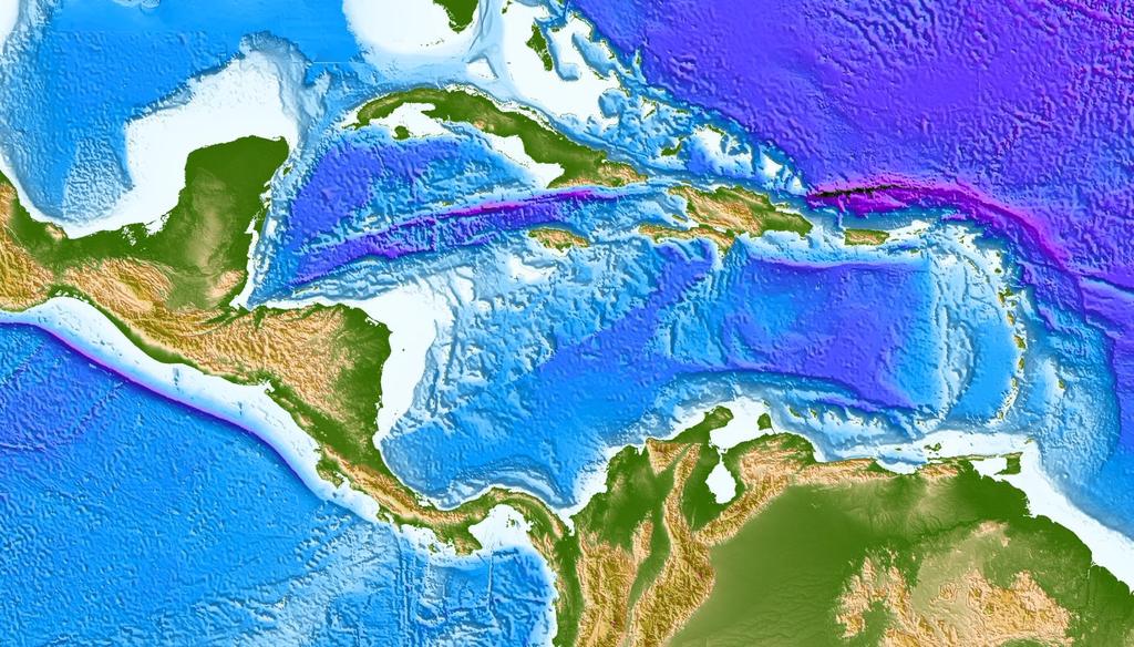
2 What is COCONet? A multidisciplinary research project focused on improving our understanding and ability to prepare for and predict natural hazards in the Caribbean, Central America, and Northern Andes - the Caribbean plate and its surrounding neighbors. Earthquake hazards, tectonic deformation, climate change, severe weather A 5-year project funded by the National Science Foundation both in response to the 2010 Haiti earthquake and an broader recognition of the vulnerability of the region to devastating hazards. COCONet proposal Collaborative Research partners are UNAVCO, UCAR, Purdue University, and University of Puerto Rico Mayaguez International research partners include BME-Haiti, INGEOMINAS (Mora), IPGP, SRC-UWI, Simon Bolivar Univ. (Perez), OVSICORI, INETER, UNAM, and many other institutions representing 31 circum- Caribbean countries.

3 Cicum-Caribbean Population at Risk for Natural Hazards 0.3 M Source: CIA Factbook Total = 130 M 11.3 M 3.9 M 6.8 M 2.7 M 16.5 M 2.0 M 6.6 M 5.4 M 4.0 M 3.0 M 42 M 25 M 1.1 M


4 Some recent geophysical events and their impacts in the Caribbean region 1976 Motagua EQ 23,000 dead; 76,000 injured; 20% Guatemalans homeless Soufriere Hills eruption: capital abandoned; 2/3 of island inhabitants flee 2010 Haiti EQ: 200, ,000 dead, 1.5 million homeless
5 COCONet Boundary Conditions Focus on natural hazards and improving regional understanding of geo-dynamic & atm-dynamic processes All raw data and data products must be shared, open, and available free-of-charge to users Synoptic-scale observations, which may be augmented with targeted, PI-driven projects Use data to enhance both technical and human capacity in region Develop strategic partnerships between US and local and regional institutions in 31 circum-caribbean countries


6 From Braun et al., 2012
 PBO-style")
 All data will be available for free and")
7 COCONet: Design Components cgnss station (Trimble R9) Surface meteorology station Geodetic quality monument Robust power system Communications infrastructure (cellular, satellite, local ISP) PBO-style data products (raw data, daily positions, linear velocities) Real-time positioning (10 sites) Atmospheric data products (PW, Ps, T, RH, u and v winds, precip) All data will be available for free and open dissemination
; DeMets & Wiggins-Grandison (2007); DeMets (unpub. 2011); Rodriguez et al. (2009) Turner et al. (2007); LaFemina et al. (2009); Calais et al. (2010); Weber et al.")
8 What are the kinematics of the Caribbean domain? How rigid is the Caribbean plate? What Caribbean reference frame is appropriate for tectonic studies? Alvarado et al. (2010); DeMets & Wiggins-Grandison (2007); DeMets (unpub. 2011); Rodriguez et al. (2009) Turner et al. (2007); LaFemina et al. (2009); Calais et al. (2010); Weber et al. (2001) Jansma & Mattioli (2005); Turner et al. (2010); Mattioli (unpub. 2011); Trenkamp et al (2002)

9 How is stress released at slow, obliquely convergent plate boundaries? What controls interplate coupling? How does interseismic plate coupling change along strike? (Manaker et al., GJI, 2008)
 Is")

 What are interseismic strain")
?")
10 CAR-NAM Boundary Zone and the northern Lesser Antilles 1) Is part of Lesser Antilles forearc detached from Caribbean plate (Lopez et al. 2006)? 2) What are interseismic strain accumulation rates (Manaker et al. 2008; Stafford-Glenn et al. 2011)? GPS vels in Fixed NAM frame
11 How is stress transferred across plate boundaries? What drives motion and deformation of crustal blocks? What controls strain partitioning at convergent margins? (LaFemina et al., G3, 2010)

.")
12 What are the physical mechanisms for the coupling between sea surface temperatures and atmospheric water vapor? PW estimates from network show high correlation between SST and total column water vapor (not just surface humidity). These results show the strong link between sea-surface temperature and atmospheric water vapor.
 for stations within 200km of hurricane landfall.")
13 What is the impact of continuous estimates of PW on hurricane intensity forecasts? The map on the left shows GPS stations (in blue), and locations of hurricane landfall. The scatterplot on the upper right shows the correlation between GPS PW and drop in surface pressure ( Surf_Press) for stations within 200km of hurricane landfall. The correlation between PW and surface pressure is This high correlation is a positive sign that GPS PW can be used to improve intensity forecasts.

14 Radiosonde Observation Availability

15 PW anomaly mean of minus 30-year climatology

16 Satellite Calibration (IR/nIR/μwave) Land Water Microwave Liu et al, 2010 JGR Figures courtesy of C. Mears, RSS
17 COCONet: Community Building This is an international and interdisciplinary project Therefore we require input regarding design and active participation from both researchers and end-users within the Caribbean community. Ultimate measure of success will be if our circum-caribbean collaborators feel that COCONet is their network. Continued efforts are ongoing to better engage local scientists, government agencies, and community in Caribbean. COCONet will build scientific, technical and educational capacity in the region and serve as a successful model for regional cooperation and community building.


18 COCONet Status Funded with start date of 15 Sept, Actual reconnaissance began in February, 2011 in order to wait for results of the first siting meeting. Network Status through December 31, 2011 Completed Reconnaissance:43 Permits Received:13 Stations Installed: 7 Will install 50 new and 15 refurbished stations in the Caribbean region. Budget re-baseline completed and approved by NSF Program Manager in July Installation plan extended to four years. Final network includes Integration of 61 existing stations into open data model. Cooperative agreements drafted and signed, registered UNAVCO for US State Department shipping through diplomatic pouch. Reconnaissance 66% complete, permits inprocess, and currently 7 new stations have been installed (Jamaica-3, Costa Rica,Curacao, Bahamas, Panama). Upcoming Installations: Dominican Republic, Colombia, Costa Rica, Nicaragua.
COCONet: Network: Plans and Status SIRGAS Meeting Concepción, Chile - October 29-31, 2012 Glen S. Mattioli
 COCONet: Network: Plans and Status 2012 SIRGAS Meeting Concepción, Chile - October 29-31, 2012 Glen S. Mattioli with help from John Braun, Karl Feaux, Jim Normandeau, and Barrett Friesen Glen Mattioli
COCONet EAR /9 Quarterly Report
 COCONet FY2012-Q4 Report 1 COCONet EAR 1042906/9 Quarterly Report June 2012 - August 2012 (FY2012-Q4) SUMMARY This quarterly report covers the COCONet project (EAR-1042906/EAR-1042909) activities for the
Incorporation of the Caribbean to the Geocentric Reference System for the Americas SIRGAS
 Incorporation of the Caribbean to the Geocentric Reference System for the Americas SIRGAS W. Martínez M. V. Mackern V. Cioce R. Rodino S.R. De Freitas UN-GGIM: Americas Third Session, October 5 2016, Mexico
GEORED Project: GNSS Geodesy Network for Geodynamics Research in Colombia, South America. Héctor Mora-Páez
 GEORED Project: GNSS Geodesy Network for Geodynamics Research in Colombia, South America. Héctor Mora-Páez Colombian Geological Survey UNAVCO SCIENCE MEETING Feb 27 March 1, 2012 Boulder, CO, TECTONIC
GRUAN GNSS Precipitable Water (GNSS-PW) Task Team: Accomplishment, Progress and Plan
 Task Team: Accomplishment, Progress and Plan") GRUAN GNSS Precipitable Water (GNSS-PW) Task Team: Accomplishment, Progress and Plan Co-chairs: Junhong (June) Wang and Kalev Rannat Members: John Braun, UCAR, USA Galina Dick, GeoForschungsZentrum Potsdam,
GRUAN GNSS Precipitable Water (GNSS-PW) Task Team: Accomplishment, Progress and Plan Co-chairs: Junhong (June) Wang and Kalev Rannat Members: John Braun, UCAR, USA Galina Dick, GeoForschungsZentrum Potsdam,
September 5, 2012 M 7.6 Costa Rica Earthquake
 September 5, 2012 M 7.6 Costa Rica Earthquake On September 5, 2012, a Magnitude 7.6 earthquake occurred in the Nicoya Peninsula of northwestern Costa Rica, along a locked segment of the subduction boundary
COCONet EAR /9 Quarterly Report
 COCONet FY2013-Q4 Report 1 COCONet EAR 1042906/9 Quarterly Report June 2013 - August 2013 (FY2013-Q4) SUMMARY This quarterly report covers COCONet project (EAR-1042906/EAR-1042909) activities for the time
Geodesy. orientation. shape. gravity field
 Geodesy noun Science of measuring the shape, orientation and gravity field of the Earth and how it changes over time. shape orientation gravity field Positioning has always been important Downstream applications
Electronic supplement for Forearc motion and deformation between El Salvador and Nicaragua: GPS, seismic, structural, and paleomagnetic observations
 DR2011053 Electronic supplement for Forearc motion and deformation between El Salvador and Nicaragua: GPS, seismic, structural, and paleomagnetic observations by D. Alvarado et al., Lithosphere, April,
COCONet EAR /9 Quarterly Report
 COCONet FY2012-Q3 Report 1 COCONet EAR 1042906/9 Quarterly Report March 2012 - May 2012 (FY2012-Q3) SUMMARY This quarterly report covers the COCONet project (EAR-1042906/EAR-1042909) activities for the
UN-GGIM:Americas Regional Report
 UN-GGIM:Americas Regional Report 2016-2017 Seventh Session of UN-GGIM 2-4 August 2017, United Nations Headquarters, New York. Rolando Ocampo President of UN-GGIM: Americas Content Activities, Areas of
Crisis Support and Disaster Response. in Latin America and the Caribbean
 Crisis Support and Disaster Response in Latin America and the Caribbean The Pan American Agenda 2010-2020 of the Pan American Institute of Geography and History (PAIGH), and the resulting 2010 Implementation
Status of Real Time Broadband Seismic Monitoring in the Caribbean and Adjacent Regions
 Status of Real Time Broadband Seismic Monitoring in the Caribbean and Adjacent Regions Special presentation prepared by Christa G. von Hillebrandt for FDSN meeting, South Africa, 2009 Introductory Remarks
The Role of Data & Information Infrastructures in Supporting Climate Change Adaptation in Latin America & the Caribbean
 The Role of Data & Information Infrastructures in Supporting Climate Change Adaptation in Latin America & the Caribbean Emil A. Cherrington Senior Scientist Water Center for the Humid Tropics of Latin
Caribbean OBS Fault Research Survey. Iniciative (COFRESI)
") Caribbean OBS Fault Research Survey Iniciative (COFRESI) May 6, 2013 PROPOSAL Submitted to: National Science Fundation Submitted by: Department of Geology, University of Puerto Rico at Mayagüez Proposal
Caribbean OBS Fault Research Survey Iniciative (COFRESI) May 6, 2013 PROPOSAL Submitted to: National Science Fundation Submitted by: Department of Geology, University of Puerto Rico at Mayagüez Proposal
COCONet EAR /9 Quarterly Report
 COCONet PY2016-Q3 Report 1 COCONet EAR 1042906/9 Quarterly Report March 2016 - May 2016 (PY2016-Q3) SUMMARY This quarterly report covers COCONet project (EAR-1042906/EAR-1042909) activities for the time
USE OF TOTAL COLUMN WATER VAPOR MEASUREMENTS FOR FORECASTS OF THE NORTH AMERICAN MONSOON PRECIPITATION
 USE OF TOTAL COLUMN WATER VAPOR MEASUREMENTS FOR FORECASTS OF THE NORTH AMERICAN MONSOON PRECIPITATION Presented by Yolande Serra University of Arizona Collaborators / Support Ave Arellano (UA Faculty)
August Forecast Update for Atlantic Hurricane Activity in 2015
 August Forecast Update for Atlantic Hurricane Activity in 2015 Issued: 5 th August 2015 by Professor Mark Saunders and Dr Adam Lea Dept. of Space and Climate Physics, UCL (University College London), UK
THE PHENOMENON WE CALL A TSUNAMI
 THE PHENOMENON WE CALL A TSUNAMI Dr. Victor Huérfano PUERTO RICO UNIVERSITY MAYAGUEZ CAMPUS GEOLOGY PUERTO RICO SEISMIC NETWORK WHAT IS A TSUNAMI? Global Distribution of Tsunamis 1410 BC AD 2011 NOAA
Advantages of Regional and Global Data Exchange. Gavin Hayes U.S. Geological Survey, National Earthquake Information Center
 Advantages of Regional and Global Data Exchange Gavin Hayes U.S. Geological Survey, National Earthquake Information Center USGS NEIC Global Earthquake Response Area of responsibility => Global BUT - domestically,
INTERNATIONAL HYDROGRAPHIC ORGANIZATION MESO AMERICAN & CARIBBEAN SEA HYDROGRAPHIC COMMISSION
 INTERNATIONAL HYDROGRAPHIC ORGANIZATION MESO AMERICAN & CARIBBEAN SEA HYDROGRAPHIC COMMISSION CAPACITY BUILDING PLAN Programme document for the period 2010-2012 1. INTRODUCTION 1.1. Rationale It is estimated
Proper Data Management Responsibilities to Meet the Global Ocean Observing System (GOOS) Requirements
 Requirements") Data Buoy Cooperation Panel XXVI Oban, Scotland, UK 27 September 2010 Proper Data Management Responsibilities to Meet the Global Ocean Observing System (GOOS) Requirements William Burnett Data Management
Data Buoy Cooperation Panel XXVI Oban, Scotland, UK 27 September 2010 Proper Data Management Responsibilities to Meet the Global Ocean Observing System (GOOS) Requirements William Burnett Data Management
April Forecast Update for Atlantic Hurricane Activity in 2016
 April Forecast Update for Atlantic Hurricane Activity in 2016 Issued: 5 th April 2016 by Professor Mark Saunders and Dr Adam Lea Dept. of Space and Climate Physics, UCL (University College London), UK
Tropical Cyclone Decision Support Tool for IFRC operations in Latin America and the Caribbean
 Tropical Cyclone Decision Support Tool for IFRC operations in Latin America and the Caribbean Eric Holthaus, Caitlin Kopcik, Daniel Osgood Presented by Daniel Osgood deo@iri.columbia.edu The International
Wireless Networks in Geophysical Monitoring
 Workshop on New Frontiers in Internet of Things 7-18 March 2016 Trieste, Italy Wireless Networks in Geophysical Monitoring Hairo Villalobos Vulcanological and Seismological Observatory of Costa Rica, National
GEO-VIII November Geohazard Supersites and Natural Laboratories Progress Report. Document 9
 GEO-VIII 16-17 November 2011 Geohazard Supersites and Natural Laboratories Progress Report Document 9 This document is submitted to GEO-VIII for information. Geohazard Supersites and Natural Laboratories
Eric. W. Harmsen 1, John Mecikalski 2, Pedro Tosado Cruz 1 Ariel Mercado Vargas 1
 Estimating Evapotranspiration using Satellite Remote Sensing in Puerto Rico, Haiti and the Dominican Republic Eric. W. Harmsen 1, John Mecikalski 2, Pedro Tosado Cruz 1 Ariel Mercado Vargas 1 1. University
April Forecast Update for Atlantic Hurricane Activity in 2018
 April Forecast Update for Atlantic Hurricane Activity in 2018 Issued: 5 th April 2018 by Professor Mark Saunders and Dr Adam Lea Dept. of Space and Climate Physics, UCL (University College London), UK
ASSOCIATION OF CARIBBEAN STATES (ACS / AEC)
") ASSOCIATION OF CARIBBEAN STATES (ACS / AEC) 1 SHOCS (Strengthening Hydrometorological Operations and Services in Caribbean SIDS) The ACS/Finnish Government response to Hydrometorological risk in Caribbean
ASSOCIATION OF CARIBBEAN STATES (ACS / AEC) 1 SHOCS (Strengthening Hydrometorological Operations and Services in Caribbean SIDS) The ACS/Finnish Government response to Hydrometorological risk in Caribbean
Operational Monsoon Monitoring at NCEP
 Operational Monsoon Monitoring at NCEP Wassila M. Thiaw Climate Prediction Center National Centers for Environmental Predictions Operational Monsoon Monitoring at NCEP Wassila M. Thiaw Climate Prediction
Inter-institutional and Intergovernmental Arrangements: MIDAS and the Caribbean Tsunami Warning System
 Inter-institutional and Intergovernmental Arrangements: MIDAS and the Caribbean Tsunami Warning System Christa G. von Hillebrandt-Andrade Manager NOAA NWS Caribbean Tsunami Warning Program Vice Chair UNESCO
Geospatial Information Management in the Americas: Lessons for the Post-2015 development agenda
 Geospatial Information Management in the Americas: Lessons for the Post-2015 development agenda Rolando Ocampo President, UN-GGIM: Americas October 2014 The integration of statistical and geographical
July Forecast Update for North Atlantic Hurricane Activity in 2018
 July Forecast Update for North Atlantic Hurricane Activity in 2018 Issued: 5 th July 2018 by Professor Mark Saunders and Dr Adam Lea Dept. of Space and Climate Physics, UCL (University College London),
April Forecast Update for North Atlantic Hurricane Activity in 2019
 April Forecast Update for North Atlantic Hurricane Activity in 2019 Issued: 5 th April 2019 by Professor Mark Saunders and Dr Adam Lea Dept. of Space and Climate Physics, UCL (University College London),
July Forecast Update for Atlantic Hurricane Activity in 2017
 July Forecast Update for Atlantic Hurricane Activity in 2017 Issued: 4 th July 2017 by Professor Mark Saunders and Dr Adam Lea Dept. of Space and Climate Physics, UCL (University College London), UK Forecast
August Forecast Update for Atlantic Hurricane Activity in 2016
 August Forecast Update for Atlantic Hurricane Activity in 2016 Issued: 5 th August 2016 by Professor Mark Saunders and Dr Adam Lea Dept. of Space and Climate Physics, UCL (University College London), UK
Haiti: Earthquake on January 12, 2010
 Geophysical Hazards and Plate Boundary Processes In Central America, Mexico and the Caribbean Haiti: Earthquake on January 12, 2010 Situation, achievements and perspective. Hotel La Condesa, Costa Rica
Strategic Framework on Geospatial Information and Services for Disasters Relevance for the Americas Region
 Strategic Framework on Geospatial Information and Services for Disasters Relevance for the Americas Region Seventh Session of the Committee of Experts on UN-GGIM Side Event --- UN Headquarters, New York
August Forecast Update for Atlantic Hurricane Activity in 2012
 August Forecast Update for Atlantic Hurricane Activity in 2012 Issued: 6 th August 2012 by Professor Mark Saunders and Dr Adam Lea Dept. of Space and Climate Physics, UCL (University College London), UK
Disaster Risk Reduction in Survey for Seismic Protection of MES
 Survey for Seismic Protection Ministry of Emergency Situations of Republic of Armenia Disaster Risk Reduction in Survey for Seismic Protection of MES Syuzanna Kakoyan Leading specialist at the Department
17 th Session of RA IV
 17 th Session of RA IV Agenda Item 4.1: Disaster Risk Reduction, Resilience and Prevention, Focusing on Impact-Based Decision Support Services Doc 4.1.(6):Coastal Inundation Forecasting Demonstration Project
What are the social, technical, environmental and economic benefits and opportunities of accessing and sharing geodetic data?
 What are the social, technical, environmental and economic benefits and opportunities of accessing and sharing geodetic data? Graeme Blick Group Manager Positioning and Resilience Land Information New
July Forecast Update for Atlantic Hurricane Activity in 2016
 July Forecast Update for Atlantic Hurricane Activity in 2016 Issued: 5 th July 2016 by Professor Mark Saunders and Dr Adam Lea Dept. of Space and Climate Physics, UCL (University College London), UK Forecast
Gaps in Space Weather Forecasting
 Gaps in Space Weather Forecasting Awareness Gap: Where is there uncertainty about how the scientific community can contribute to space weather operations? Areas With Good Awareness - All agencies recognize
Pre-Season Forecast for North Atlantic Hurricane Activity in 2018
 Pre-Season Forecast for North Atlantic Hurricane Activity in 2018 Issued: 30 th May 2018 by Professor Mark Saunders and Dr Adam Lea Dept. of Space and Climate Physics, UCL (University College London),
Broader Impacts of the Application of the Combined Use of Data-Driven Methodology and Physics-Based Weather and Climate Prediction Models
 Broader Impacts of the Application of the Combined Use of Data-Driven Methodology and Physics-Based Weather and Climate Prediction Models Professor Fredrick Semazzi North Carolina State University Department
Yev Kontar. Illinois State Geological Survey, University of Illinois at Urbana-Champaign
 Addressing Caribbean Geophysical Hazards through the Continuously Operating Caribbean GPS Observational Network (COCONet) and International Ocean Drilling Program (IODP) Yev Kontar Illinois State Geological
Adaptive sounding arrays for tropical regions
 Adaptive sounding arrays for tropical regions Michael W. Douglas NOAA/National Severe Storms Laboratory Norman, Oklahoma Michael.Douglas@noaa.gov Abstract The advent of low-initial cost radiosonde systems
STATUS OF HAZARD MAPS VULNERABILITY ASSESSMENTS AND DIGITAL MAPS
 JapanInternational Cooperation Agency STATUS OF HAZARD MAPS VULNERABILITY ASSESSMENTS AND DIGITAL MAPS ANGUILLA REPORT THE CARIBBEAN DISASTER EMERGENCY RESPONSE AGENCY () Table of Contents Page Preface
Annual Report:
 Annual Report: 1042906 Annual Report for Period:09/2011-08/2012 Submitted on: 07/19/2012 Principal Investigator: Miller, M. Meghan. Award ID: 1042906 Organization: UNAVCO, Inc. Submitted By: Miller, M.
Puerto Rico Tsunami Mitigation and Warning Program: Update and Future
 Puerto Rico Tsunami Mitigation and Warning Program: Update and Future Christa G. von Hillebrandt- Andrade, Puerto Rico Seismic Network, UPRM Aurelio Mercado Dept. Marine Sciences, UPRM Status in 1999,
PRELIMINARY AGENDA. President IRIS Consortium Introduction of the Speaker Dr. Olga Cabello
 PRELIMINARY AGENDA Sunday October 24 18:00 Networking Reception 19:30 Dinner 20:30 Welcome and Opening Address Call to order Dr. Olga Cabello Welcome Dr. Marino Protti Opening Remarks Dr. David Simpson
International Union of Geodesy and Geophysics. Resolutions
 International Union of Geodesy and Geophysics Resolutions ADOPTED BY THE COUNCIL AT THE XXVI GENERAL ASSEMBLY PRAGUE, CZECH REPUBLIC (22 JUNE 2 JULY 2015) 0 Page Resolution 1: Role of Ocean in Climate
Weather Information for Surface Transportation (WIST): Update on Weather Impacts and WIST Progress
: Update on Weather Impacts and WIST Progress") Weather Information for Surface Transportation (WIST): Update on Weather Impacts and WIST Progress Samuel P. Williamson Office of the Federal Coordinator for Meteorological Services and Supporting Research
Weather Information for Surface Transportation (WIST): Update on Weather Impacts and WIST Progress Samuel P. Williamson Office of the Federal Coordinator for Meteorological Services and Supporting Research
LEVERAGING DWFI RESOURCES TO ADDRESS WATER FOR AGRICULTURE IN LATIN AMERICA UNDER A CHANGING CLIMATE
 LEVERAGING DWFI RESOURCES TO ADDRESS WATER FOR AGRICULTURE IN LATIN AMERICA UNDER A CHANGING CLIMATE Rachindra Mawalagedara Robert J. Oglesby Presented at the DWFI Student Support Research Forum, May 12,
Present day plate boundary deformation in the Caribbean and crustal deformation on southern Haiti
 Purdue University Purdue e-pubs Open Access Dissertations Theses and Dissertations 4-2016 Present day plate boundary deformation in the Caribbean and crustal deformation on southern Haiti Steeve Symithe
JCOMM-CHy Coastal Inundation Forecasting Demonstration Project (CIFDP)
") WMO World Meteorological Organization Working together in weather, climate and water JCOMM-CHy Coastal Inundation Forecasting Demonstration Project (CIFDP) Coastal Flooding & Vulnerable Populations Coastal
WMO World Meteorological Organization Working together in weather, climate and water JCOMM-CHy Coastal Inundation Forecasting Demonstration Project (CIFDP) Coastal Flooding & Vulnerable Populations Coastal
GEONETCast Future Plans at CIMH
 GEONETCast Future Plans at CIMH Operations, Training, Climate Monitoring and Disaster Preparedness WORLD METEOROLOGICAL ORGANIZATION COORDINATION GROUP ON SATELLITE DATA REQUIREMENTS FOR REGION III AND
Solid Earth Science... 5 Atmospheric Science... 7 Collateral Benefits Revised COCONet Siting Plan and Future Activities...
 Sponsors The COCONet workshop was supported by NSF-EAR Instrumentation and Facilities Award #1042906. Supplemental contributions were made by NSF-EAR Education & Human Resources, and the Tectonics program;
Land under Siege: Recent Variations in Sea Level through the Americas
 86 LCR Sustainable Development Working Paper No. 32 Land under Siege: Recent Variations in Sea Level through the Americas Keith M. Miller University of the West Indies, Trinidad Introduction. We are familiar
Experiences on Data and Observational Requirements in the Caribbean
 Experiences on Data and Observational Requirements in the Caribbean UNFCCC Expert Workshop on Methods & Tools and on Data & Observations under the NWP on Impacts, Vulnerability & Adaptation to Climate
A/AC.105/C.1/2016/CRP.17
 19 February 2016 English only Committee on the Peaceful Uses of Outer Space Scientific and Technical Subcommittee Fifty-third session Vienna, 15-26 February 2016 Item 11 of the provisional agenda Space
WEATHER AND CLIMATE EXTREMES MONITORING BASED ON SATELLITE OBSERVATION : INDONESIA PERSPECTIVE RIRIS ADRIYANTO
 WEATHER AND CLIMATE EXTREMES MONITORING BASED ON SATELLITE OBSERVATION : INDONESIA PERSPECTIVE RIRIS ADRIYANTO INDONESIA AGENCY FOR METEOROLOGY, CLIMATOLOGY AND GEOPHYSICS (BM KG) 1. INTRODUCTION - BMKG
Report of PCGIAP to the 18 th United Nations Regional Cartographic Conference for Asia and the Pacific (UNRCC-AP) for the period
 for the period") Permanent Committee on GIS Infrastructure for Asia and the Pacific (PCGIAP) Established in 1995 by a United Nations Resolution Report of PCGIAP to the 18 th United Nations Regional Cartographic Conference
Permanent Committee on GIS Infrastructure for Asia and the Pacific (PCGIAP) Established in 1995 by a United Nations Resolution Report of PCGIAP to the 18 th United Nations Regional Cartographic Conference
Faatasi Malologa (PGSC Chair) Director Department of Lands & Survey, Tuvalu
 Director Department of Lands & Survey, Tuvalu") Seventh Session of the United Nations Committee of Experts on Global Geospatial Information Management (UN-GGIM) - 31 July -4 August 2017 Faatasi Malologa (PGSC Chair) Director Department of Lands & Survey,
Seventh Session of the United Nations Committee of Experts on Global Geospatial Information Management (UN-GGIM) - 31 July -4 August 2017 Faatasi Malologa (PGSC Chair) Director Department of Lands & Survey,
CORRELATION BETWEEN TEMPERATURE CHANGE AND EARTHQUAKE IN BANGLADESH
 CORRELATION BETWEEN TEMPERATURE CHANGE AND EARTHQUAKE IN BANGLADESH A. Hossain *, F. Kabir & K. Roy Department of Civil Engineering, Rajshahi University of Engineering & Technology, Rajshahi, Bangladesh
Climate Change Impacts and Adaptation for Coastal Transport Infrastructure in Caribbean SIDS
 UNCTAD National Workshop Saint Lucia 24 26 May 2017, Rodney Bay, Saint Lucia Climate Change Impacts and Adaptation for Coastal Transport Infrastructure in Caribbean SIDS Impacts of Natural Hazards on the
COORDINATION WITH OTHER ACTIVITIES OF THE WMO TROPICAL CYCLONE PROGRAMME. (Submitted by the WMO Secretariat) Summary and Purpose of Document
 Summary and Purpose of Document") ESCAP/WMO TYPHOON COMMITTEE FORTY-NINTH SESSION 21-24 FEBRUARY 2017 YOKOHAMA, JAPAN FOR PARTICIPANTS ONLY WRD/TC.49/16 13 February 2017 ENGLISH ONLY COORDINATION WITH OTHER ACTIVITIES OF THE WMO TROPICAL
ESCAP/WMO TYPHOON COMMITTEE FORTY-NINTH SESSION 21-24 FEBRUARY 2017 YOKOHAMA, JAPAN FOR PARTICIPANTS ONLY WRD/TC.49/16 13 February 2017 ENGLISH ONLY COORDINATION WITH OTHER ACTIVITIES OF THE WMO TROPICAL
Unit 5 Lesson 3 How is Weather Predicted? Copyright Houghton Mifflin Harcourt Publishing Company
 Tracking the Weather Warm up 1 Why is it important to watch the weather forecast before traveling to another country? Tracking the Weather A meteorologist is a scientist who studies weather. Meteorologists
Country Report Vanuatu
 Country Report Vanuatu Ministry Infrastructure and Public Utilities. Application of Space Technology and the Geographic information system for DRR and Sustainable Development 18 th 22 nd December 2012
12/07/2013. Apparent sea level rise and earthquakes
 Main collaborations: - P. Simeoni - M. N. Bouin - S. Calmant Valérie Ballu Valerie.ballu@univ-lr.fr Apparent sea level rise and earthquakes possibly the world s first community to be formally moved out
XXII GENERAL ASSEMBLY OF MINISTERS AND MAXIMUM AUTHORITIES OF HOUSING AND URBANISM OF LATIN AMERICA AND THE CARIBBEAN
 XXII GENERAL ASSEMBLY OF MINISTERS AND MAXIMUM AUTHORITIES OF HOUSING AND URBANISM OF LATIN AMERICA AND THE CARIBBEAN Taking into account: Santiago, Chile 1 and 2 October 2013 DECLARATION OF SANTIAGO 1.
NOAA Hurricane Forecast Improvement Project
 NOAA Hurricane Forecast Improvement Project Fred Toepfer Hurricane Forecast Improvement Project Manager November 9 th, 2009 Outline NOAA Hurricane Forecast Improvement Project Driving Issue Purpose NOAA
WELCOME TO THE 2018 RA-IV WORKSHOP ON HURRICANE FORECASTING AND WARNING
 WELCOME TO THE 2018 RA-IV WORKSHOP ON HURRICANE FORECASTING AND WARNING Richard J. Pasch and Daniel P. Brown Senior Hurricane Specialists National Hurricane Center ORIENTATION Use of PCs NHC Facility Workshop
HURRICANE JEANNE CHARACTERISTICS and STORM TIDE EVALUATION
 HURRICANE JEANNE CHARACTERISTICS and STORM TIDE EVALUATION ((DRAFT)) By Robert Wang and Michael Manausa Sponsored by Florida Department of Environmental Protection, Bureau of Beaches and Coastal Systems
Yellowstone Hotspot Component of the Plate Boundary Observatory
 Yellowstone Hotspot Component of the Plate Boundary Observatory (Investigators: Smith, Thatcher, Meertens, Humphreys, Dzurisin, Oldow Co-Investigators: Christiansen, Doss, Schwartz, Machette, Wong, Olig,
FIG Asia Pacific Capacity Development Network
 FIG Asia Pacific Capacity Development Network Report to the 41th General Assembly FIG Congress 2018, Istanbul - Turkey Rob Sarib Chair FIG Asia Pacific Capacity Development Network (AP CDN) Story of the
National Disaster Management Centre (NDMC) Republic of Maldives. Location
 Republic of Maldives. Location") National Disaster Management Centre (NDMC) Republic of Maldives Location Country Profile 1,190 islands. 198 Inhabited Islands. Total land area 300 sq km Islands range b/w 0.2 5 sq km Population approx.
National Disaster Management Centre (NDMC) Republic of Maldives Location Country Profile 1,190 islands. 198 Inhabited Islands. Total land area 300 sq km Islands range b/w 0.2 5 sq km Population approx.
EPIC2001 was conceived as an intensive process study along and near 95 o W during September and October 2001 used to make measurements of the atmosphe
 EPIC2001 was conceived as an intensive process study along and near 95 o W during September and October 2001 used to make measurements of the atmosphere and ocean in this region. Two aircraft, the National
Meteorological instruments and observations methods: a key component of the Global Earth Observing System of Systems (GEOSS)
") GLOBAL OBSERVING SYSTEMS Instruments and Methods of Observation Programme Meteorological instruments and observations methods: a key component of the Global Earth Observing System of Systems (GEOSS) Dr.
GLOBAL OBSERVING SYSTEMS Instruments and Methods of Observation Programme Meteorological instruments and observations methods: a key component of the Global Earth Observing System of Systems (GEOSS) Dr.
Interferometric Synthetic Aperture Radar (InSAR) and GGOS. Andrea Donnellan NASA/JPL February 21, 2007
 and GGOS. Andrea Donnellan NASA/JPL February 21, 2007") Interferometric Synthetic Aperture Radar (InSAR) and GGOS Andrea Donnellan NASA/JPL February 21, 2007 Sources for Science Objectives Fourth component of EarthScope Involvement: NSF, NASA, USGS, Universities
Interferometric Synthetic Aperture Radar (InSAR) and GGOS Andrea Donnellan NASA/JPL February 21, 2007 Sources for Science Objectives Fourth component of EarthScope Involvement: NSF, NASA, USGS, Universities
Tropical Update. 5 PM EDT Thursday, August 27, 2015 Tropical Storm Erika
 Tropical Update 5 PM EDT Thursday, August 27, 2015 Tropical Storm Erika This update is intended for government and emergency response officials, and is provided for informational and situational awareness
the IRIS Consortium Collaborative, Multi-user Facilities for Research and Education Briefing NSF Business Systems Review September 9, 2008
 the IRIS Consortium Collaborative, Multi-user Facilities for Research and Education Briefing NSF Business Systems Review September 9, 2008 A facilities program for collection and distribution of seismological
Himawari-8 BUFR Development for Winds Processing and Radiances - Packaging for Algorithm Integration Team (AIT)
") Sandy Supplemental Grant Recipient Quarterly Progress Report Himawari-8 BUFR Development for Winds Processing and Radiances - Packaging for Algorithm Integration Team (AIT) Award Number: NA14NWS4830052
Sandy Supplemental Grant Recipient Quarterly Progress Report Himawari-8 BUFR Development for Winds Processing and Radiances - Packaging for Algorithm Integration Team (AIT) Award Number: NA14NWS4830052
Bugs in JRA-55 snow depth analysis
 14 December 2015 Climate Prediction Division, Japan Meteorological Agency Bugs in JRA-55 snow depth analysis Bugs were recently found in the snow depth analysis (i.e., the snow depth data generation process)
Network of Direct Broadcast Antenna Systems to Provide Real-Time Infrared and Microwave Sounder Data to NOAA for Numerical Weather Prediction
 Sandy Supplemental Grant Recipient Quarterly Progress Report Network of Direct Broadcast Antenna Systems to Provide Real-Time Infrared and Microwave Sounder Data to NOAA for Numerical Award Number: NA13NES4830007
Lessons Learned from Hurricane Harvey and Irma
 EOL Visit to NSF 3 March 2016 Lessons Learned from Hurricane Harvey and Irma Wen-Chau Lee National Center for Atmospheric Research 23 November 2017 Outline: Meteorological elements of the active 2017 Atlantic
GCOS Cooperation Mechanism
 GCOS Cooperation Mechanism GCOS Cooperation Mechanism (GCM) The GCM was established to identify and make the most effective use of resources available for improving climate observing systems in developing
EXPLORE PLATE TECTONICS & MORE THROUGH GPS DATA. Shelley Olds, UNAVCO April 12, 2018 NGSS Webinar
 EXPLORE PLATE TECTONICS & MORE THROUGH GPS DATA Shelley Olds, UNAVCO April 12, 2018 NGSS Webinar Today s Outline Central question: How do we know the tectonic plates are still moving? -- What evidence
INCA CE: Integrating Nowcasting with crisis management and risk prevention in a transnational framework
 INCA CE: Integrating Nowcasting with crisis management and risk prevention in a transnational framework Yong Wang ZAMG, Austria This project is implemented through the CENTRAL EUROPE Programme co-financed
The Earth Explorer Missions - Current Status
 EOQ N 66 July 2000 meteorology earthnet remote sensing solid earth future programmes Earth Observation Quarterly The Earth Explorer Missions - Current Status G. Mégie (1) and C.J. Readings (2) (1) Institut
PRMS WHITE PAPER 2014 NORTH ATLANTIC HURRICANE SEASON OUTLOOK. June RMS Event Response
 PRMS WHITE PAPER 2014 NORTH ATLANTIC HURRICANE SEASON OUTLOOK June 2014 - RMS Event Response 2014 SEASON OUTLOOK The 2013 North Atlantic hurricane season saw the fewest hurricanes in the Atlantic Basin
Regional Flash Flood Guidance and Early Warning System
 WMO Training for Trainers Workshop on Integrated approach to flash flood and flood risk management 24-28 October 2010 Kathmandu, Nepal Regional Flash Flood Guidance and Early Warning System Dr. W. E. Grabs
Journal Publications (current reporting period , not reported below)
") Journal Publications (2005 to 2011) A number of papers have been published related to CALIPSO, SEA-CALIPSO, and the CALIPSO Facility, including many recently. Seven papers were presented at the Soufriere
Journal Publications (2005 to 2011) A number of papers have been published related to CALIPSO, SEA-CALIPSO, and the CALIPSO Facility, including many recently. Seven papers were presented at the Soufriere
CONFERENCE STATEMENT
 Final draft CONFERENCE STATEMENT We, the elected representatives of Canada, Denmark/Greenland, the European Parliament, Finland, Iceland, Norway, Russia, Sweden and the United States of America; In collaboration
The Global Geodetic Observing System (GGOS) of the International Association of Geodesy, IAG
 of the International Association of Geodesy, IAG") The Global Geodetic Observing System (GGOS) of the International Association of Geodesy, IAG Hans-Peter Plag (1), Markus Rothacher (2), Richard Gross (3), Srinivas Bettadpur (4) (1) Nevada Bureau of Mines
The Global Geodetic Observing System (GGOS) of the International Association of Geodesy, IAG Hans-Peter Plag (1), Markus Rothacher (2), Richard Gross (3), Srinivas Bettadpur (4) (1) Nevada Bureau of Mines
Character of the Caribbean Gônave North America plate boundaries in the upper mantle based on shear-wave splitting
 GEOPHYSICAL RESEARCH LETTERS, VOL. 39,, doi:10.1029/2012gl053766, 2012 Character of the Caribbean Gônave North America plate boundaries in the upper mantle based on shear-wave splitting B. Benford, 1 B.
OPAG on Integrated Observing Systems. Workshop to Improve the Usefulness of Operational Radiosonde Data. (Submitted by the Secretariat)
") WORLD METEOROLOGICAL ORGANIZATION COMMISSION FOR BASIC SYSTEMS CBS MANAGEMENT GROUP Fourth session Langen, Germany, 13-16 October 2003 Distr.: RESTRICTED CBS/MG-IV/Doc. 3.1(5) (24.IX.2003) ITEM: 3.1 ENGLISH
WORLD METEOROLOGICAL ORGANIZATION COMMISSION FOR BASIC SYSTEMS CBS MANAGEMENT GROUP Fourth session Langen, Germany, 13-16 October 2003 Distr.: RESTRICTED CBS/MG-IV/Doc. 3.1(5) (24.IX.2003) ITEM: 3.1 ENGLISH
IMPACT OF GROUND-BASED GPS PRECIPITABLE WATER VAPOR AND COSMIC GPS REFRACTIVITY PROFILE ON HURRICANE DEAN FORECAST. (a) (b) (c)
 (b) (c)") 9B.3 IMPACT OF GROUND-BASED GPS PRECIPITABLE WATER VAPOR AND COSMIC GPS REFRACTIVITY PROFILE ON HURRICANE DEAN FORECAST Tetsuya Iwabuchi *, J. J. Braun, and T. Van Hove UCAR, Boulder, Colorado 1. INTRODUCTION
9B.3 IMPACT OF GROUND-BASED GPS PRECIPITABLE WATER VAPOR AND COSMIC GPS REFRACTIVITY PROFILE ON HURRICANE DEAN FORECAST Tetsuya Iwabuchi *, J. J. Braun, and T. Van Hove UCAR, Boulder, Colorado 1. INTRODUCTION
COUNTRY PRESENTATION ON MR JAYNAL ABEDIN JOINT SECRETARY ( WORKS & DEVELOPMENT ) MINISTRY OF DEFENCE
 MINISTRY OF DEFENCE") COUNTRY PRESENTATION ON By MR JAYNAL ABEDIN JOINT SECRETARY ( WORKS & DEVELOPMENT ) MINISTRY OF DEFENCE Bangladesh Geographical Location of Bangladesh Bangladesh Country at a Glance Physical Features 1,230
COUNTRY PRESENTATION ON By MR JAYNAL ABEDIN JOINT SECRETARY ( WORKS & DEVELOPMENT ) MINISTRY OF DEFENCE Bangladesh Geographical Location of Bangladesh Bangladesh Country at a Glance Physical Features 1,230