EXPLORE PLATE TECTONICS & MORE THROUGH GPS DATA. Shelley Olds, UNAVCO April 12, 2018 NGSS Webinar
|
|
|
- Beatrice Bates
- 5 years ago
- Views:
Transcription


1 EXPLORE PLATE TECTONICS & MORE THROUGH GPS DATA Shelley Olds, UNAVCO April 12, 2018 NGSS Webinar
2 Today s Outline Central question: How do we know the tectonic plates are still moving? -- What evidence do we have to answer this question?! UNAVCO Overview! Education & Community Engagement Resources! Activities & Modules w/ NGSS! o High level explorations! o Diving into the data!


3 a non-profit university-governed consortium, facilitating geoscience research and education using geodesy


4 UNAVCO = Community + Facility


5 UNAVCO Program Areas Geodetic Data Services Geodetic Infrastructure Education & Community Engagement


6 Science Discoveries using Geodesy Crustal Kinematics and Mantle Dynamics Understanding mantle and plate motions to enhance resilience to earthquakes, tsunamis and volcanic eruptions Coseismic Deformation and GPS Seismology Earthquake and tsunami early warning to save lives and property Hydrogeodesy Helps with planning emergency response and for engineering structures in tsunami-prone areas GPS Meteorology Improve hurricane forecasting and severe storm tracking Volcanic Deformation Decipher surface rise or fall related to magma movement with volcano early warning benefits Glaciology Assess ice mass, forecast melting and estimate climate change effects Earthquake Hazards Assess earthquake hazard to mitigate future losses
7 Education & Community Engagement Resources


8 Student Opportunities & Geo-workforce Development K-12 student s Upper division undergraduate Geo- Launchpad Lower division undergraduat e RESESS USIP Graduate student Faculty mentor training Post-doc/ early career EarthConnections UNAVCO Student Internship Program!


9 ! Mentoring Resources Access resources for working effectively with students from diverse backgrounds.!

10 Undergraduate & Secondary-level o Using high resolution topography, UAVs, and GPS in undergraduate field education o Using Recreational Drones for STEM Explorations o Using GPS data in undergraduate courses Communicating Science o Communicating Science for Impact o Communicating Science to the Public Geodesy Technical Tools o InSAR Processing and Theory o High Resolution Topography and 3D Imaging Short Courses & Webinars: Content for the classroom, Communicating Science, & Technical Tools
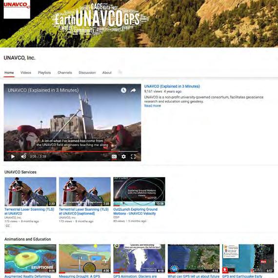
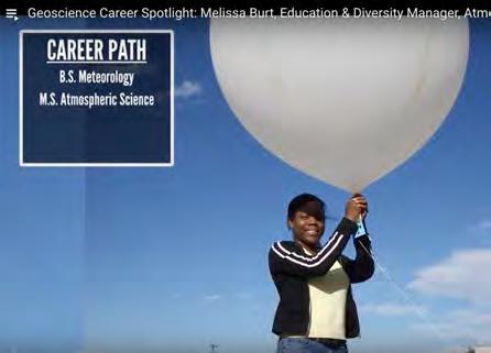

11 YouTube: Animations & Career Spotlights
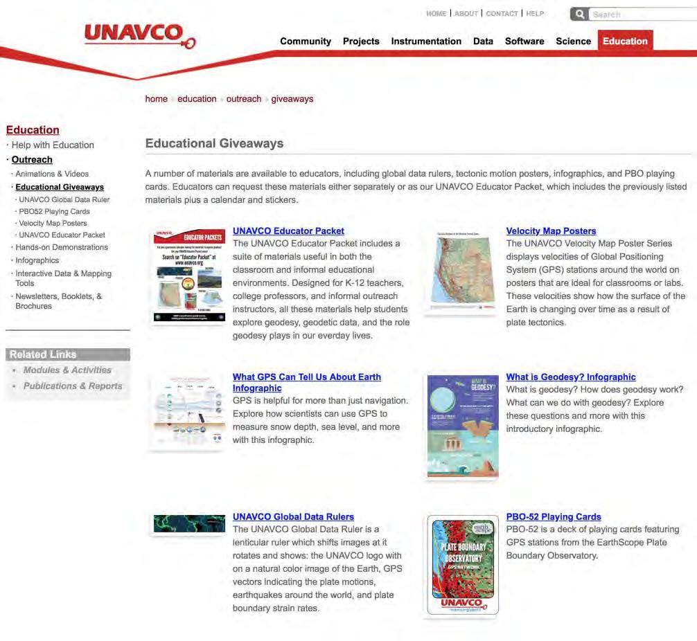
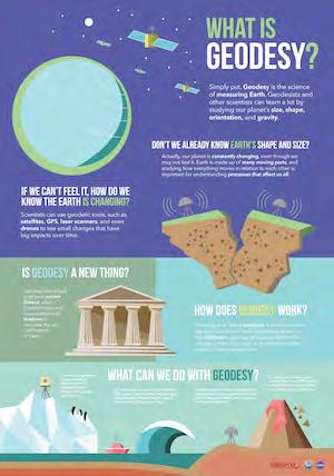


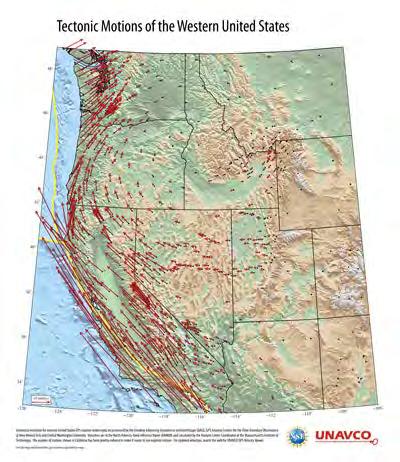
12 Posters & Infographics


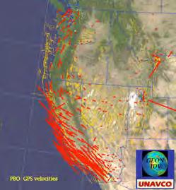
13 Interactive Data & Mapping Tools GPS Velocity Viewer

14 Interactive Data & Mapping Tools GPS Velocity Viewer Processed GPS data formatted for ease of use


15 Interactive Data & Mapping Tools GPS Velocity Viewer Processed GPS data formatted for ease of use GPS Spotlight

16 Interactive Data & Mapping Tools GPS Velocity Viewer Processed GPS data formatted for ease of use GPS Spotlight Power through the Night


17 Hands-on Demonstrations Measure a changing volcano! Make tectonic plates converge! Science with Flubber: Glacial Isostasy!

18 Activities & Modules w/ NGSS

19 Activities & Modules w/ NGSS High level explorations using data visualizations! Detailed data dive through process of science! Connecting multiple lines of evidence: in-depth project-based modules!


20 Poster based - Exploring Tectonic Motions of Alaska & Western United States! High level explorations using data visualizations Online tool based - Visualizing Relationships with Data: EarthScope Voyager Jr or Velocity Viewer!
21 Measuring plate motion with GPS: Iceland! Exploring plate motion and deformation in California with GPS! Episodic tremor and slip: The Case of the Mystery Earthquakes! supporting: Introduction to graphing GPS data - Lessons on Plate Tectonics! Detailed data dive through process of science


22 Detailed data dive through process of science Basic Outline The data collection instrument: GPS! o How does GPS work to pinpoint a location on Earth?! Exploring the data: What can GPS data tell us about...! o Looking at the data... as numbers & as time series plots graphs! o Analyzing & interpreting the data! Date North (mm) East (mm) Vertical (mm) 1/1/ /2/ /3/ /4/ /5/ /1/ /1/ /1/ North (mm) East (mm)
 o")


23 Detailed data dive through process of science Basic Outline (continued) o Creating vector plots from the data! o Displaying vectors on a map! o Interpreting the vectors... in the context of plate tectonics! Extending to more settings!

24 In-depth project-based modules w/ multiple lines of evidence Taking the pulse of Yellowstone s breathing volcano: Problem-based learning in America s first national park! Detecting Cascadia s changing shape with GPS!


25 In-depth project-based modules w/ multiple lines of evidence Taking the Pulse of Yellowstone s Breathing Volcano! Where can the Park place a safe long-term research station?! Monitoring Volcanic Activity! Jigsaw! o History of eruption! OFW2 HVWY Mount Washburn LKWY WLWY Lake Butte Overlook o Current seismicity! o Hydrothermal events! o Ground deformation.! OFW2 HVW Y LKW Y WLW Y


26 In-depth project-based modules w/ multiple lines of evidence Detecting Cascadia s changing shape with GPS! Jigsaw:! o Ghost forest! o Orphan tsunami! o Eye-witness accounts! o Physical evidence! Hands on deformation and strain! Determining strain graphically! Societal relevance!
 Surface Process Hazards (topographic maps, slope and aspect maps, Lidar, digital elevation models, InSAR, aerial imagery, and precipitation data)")
27 Learning Modules from GEodesy Tools for Societal Issues (GETSI) Geodetic data and quantitative skills applied to societally important issues Introductory-level Changing Ice Mass and Sea Level (Sea level altimetry, InSAR, ICESat, GRACE, vertical GPS) Surface Process Hazards (topographic maps, slope and aspect maps, Lidar, digital elevation models, InSAR, aerial imagery, and precipitation data) Majors-level Measuring Water Resources with GPS, Gravity, and Traditional Methods Analyzing High Resolution Topography with TLS and SfM Imaging Active Tectonics with InSAR and LiDAR data GPS, Strain, and Earthquakes
28 Thank You! Connect with us
Getting to know EarthScope Plate
 Getting to know EarthScope Plate Boundary Observatory & UNAVCO Shelley Olds, UNAVCO !!"#$%&'$!("($)*&'+'$$!!,&-./,01$!2,&3,/4*5$!6+57+/389.-:,;+/&+'$ About UNAVCO!"#$%$&"&'()*'+(#$',#') -'('"-#.)",/)'/0#"1+,)
Lab 9: Satellite Geodesy (35 points)
") Lab 9: Satellite Geodesy (35 points) Here you will work with GPS Time Series data to explore plate motion and deformation in California. This lab modifies an exercise found here: http://www.unavco.org:8080/cws/pbonucleus/draftresources/sanandreas/
Lab 9: Satellite Geodesy (35 points) Here you will work with GPS Time Series data to explore plate motion and deformation in California. This lab modifies an exercise found here: http://www.unavco.org:8080/cws/pbonucleus/draftresources/sanandreas/
Breakout Session III Evolving landscapes and global environmental change
 Breakout Session III Evolving landscapes and global environmental change 1. Hydrology and critical zone imaging 2. Glaciology: Instrumenting glaciers and ice sheets 3. Polar networks and glacial isostatic
Syllabus and Course Description Geophysical Geodesy Fall 2013 GPH 411/611
 Syllabus and Course Description Geophysical Geodesy Fall 2013 GPH 411/611 Course Location: LME 422 Course Time: Tuesday & Thursday 12:00-1:15 Units: 3 Instructor Name: Bill Hammond Office Location: SEM
The Global Geodetic Observing System (GGOS) of the International Association of Geodesy, IAG
 of the International Association of Geodesy, IAG") The Global Geodetic Observing System (GGOS) of the International Association of Geodesy, IAG Hans-Peter Plag (1), Markus Rothacher (2), Richard Gross (3), Srinivas Bettadpur (4) (1) Nevada Bureau of Mines
The Global Geodetic Observing System (GGOS) of the International Association of Geodesy, IAG Hans-Peter Plag (1), Markus Rothacher (2), Richard Gross (3), Srinivas Bettadpur (4) (1) Nevada Bureau of Mines
Name: Page 1. 2) What do increases and decreases in RSAM data indicate about magma movement inside the volcano?
 What do increases and decreases in RSAM data indicate about magma movement inside the volcano?") Name: Page 1 Living on the Edge Unit 5: SEISMOLOGISTS A report on the seismic activity must be prepared in order to assess and forecast future activity. Complete the following components of the seismology
Name: Page 1 Living on the Edge Unit 5: SEISMOLOGISTS A report on the seismic activity must be prepared in order to assess and forecast future activity. Complete the following components of the seismology
Earth Systems Curriculum
 Earth Systems Curriculum Course Description This course provides the opportunity to develop knowledge and understanding about the relationships between the structure, processes, and resources on Earth
All instruction should be three-dimensional. NGSS Example Bundles. Page 1 of 14
 Middle School Topic Model Course II Bundle 3 Geologic Changes to the Earth This is the third bundle of the Middle School Topics Model Course II. Each bundle has connections to the other bundles in the
Georgia Standards of Excellence for Science Grade 6
 A Correlation of To the Georgia Standards of Excellence for Science A Correlation of,, Introduction This document demonstrates how, supports the Georgia Standards of Excellence for Science. Correlation
CEETEP Related Digital Resources
 CEETEP Related Digital Resources The resources on the CEETEP DVD and USB drive include many items developed by or in collaboration with other organizations. Here we overview some of the partner and related
What are the social, technical, environmental and economic benefits and opportunities of accessing and sharing geodetic data?
 What are the social, technical, environmental and economic benefits and opportunities of accessing and sharing geodetic data? Graeme Blick Group Manager Positioning and Resilience Land Information New
GEOSCIENCES (GEO) Geosciences (GEO) 1. GEO 307H. *NATIONAL PARK GEOLOGY AND PRESERVATION. (3 Credits)
 Geosciences (GEO) 1. GEO 307H. *NATIONAL PARK GEOLOGY AND PRESERVATION. (3 Credits)") Geosciences (GEO) 1 GEOSCIENCES (GEO) GEO 100. *NATURAL DISASTERS: HOLLYWOOD VERSUS REALITY. (4 Introduction to natural hazards, as seen through the lens of popular media. Course will explore the causes
Geosciences (GEO) 1 GEOSCIENCES (GEO) GEO 100. *NATURAL DISASTERS: HOLLYWOOD VERSUS REALITY. (4 Introduction to natural hazards, as seen through the lens of popular media. Course will explore the causes
NORTH VISTA SECONDARY SCHOOL HUMANITIES DEPARTMENT SECONDARY 3 EXPRESS HUMANITIES (GEOGRAPHY) 2272/02 CONTENT OUTLINE Term 1
 2272/02 CONTENT OUTLINE Term 1") NORTH VISTA SECONDARY SCHOOL HUMANITIES DEPARTMENT SECONDARY 3 EXPRESS HUMANITIES (GEOGRAPHY) 2272/02 CONTENT OUTLINE 2019 Term 1 Week Learning Outcomes Skills to be covered Assignment Test Project 1-2
NORTH VISTA SECONDARY SCHOOL HUMANITIES DEPARTMENT SECONDARY 3 EXPRESS HUMANITIES (GEOGRAPHY) 2272/02 CONTENT OUTLINE 2019 Term 1 Week Learning Outcomes Skills to be covered Assignment Test Project 1-2
Tectonic Processes and Hazards Enquiry Question 1: Why are some locations more at risk from tectonic hazards?
 Tectonic Processes and Hazards Enquiry Question 1: Why are some locations more at risk from tectonic hazards? Key words Basalt Andesite Rhyolite Benioff Zone Subduction zone Crustal fracturing Definition
Estelle Chaussard Berkeley Seismological Laboratory
 Estelle Chaussard Berkeley Seismological Laboratory Data integra1on of data we ALREADY have à con1nua1on + ready for large datasets + use exis1ng data for new purposes (improved processing, resolu1on,...)
From Global to National Geodetic Reference Frames: how are they connected and why are they needed?
 From Global to National Geodetic Reference Frames: how are they connected and why are they needed? Zuheir ALTAMIMI Institut National de l Information Géographique et Forestière, France Vice-President,
SIO15 Midterm 1, Monday Oct. 30, 2017 TEST VARIATION: 2
 SIO15 Midterm 1, Monday Oct. 30, 2017 TEST VARIATION: 2 1) Over the last 20 years, which of these natural disasters killed the most people in the U.S.? a) heat waves b) hurricanes c) lightning strikes
East Penn School District Curriculum and Instruction
 East Penn School District Curriculum and Instruction Curriculum for: Geology of National Parks Course(s): Geology of the National Parks Grades: 10-12 Department: Science Length of Period (average minutes):
The Scientific Value of High-Rate, Low-Latency GPS Data
 The Scientific Value of High-Rate, Low-Latency GPS Data by W.C. Hammond, B.A. Brooks, R. Bürgmann, T. Heaton, M. Jackson, A.R. Lowry, S. Anandakrishnan Recent and ongoing technical advances in uses of
Activity Pacific Northwest Tectonic Block Model
 Activity Pacific Northwest Tectonic Block Model The Cascadia tectonic margin is caught between several tectonic forces, during the relentless motions of the giant Pacific Plate, the smaller subducting
Required Materials Plummer, C., Physical geology. Columbus, OH: McGraw Hill Higher Education
 Butler Community College Science, Technology, Engineering, and Math Division Robert Carlson Revised Fall 2017 Implemented Spring 2018 Textbook Update Spring 2018 COURSE OUTLINE Physical Geology Course
Module 1, Investigation 3: Predicting Eruptions
 Module 1, Investigation 3: Predicting Eruptions Introduction Welcome! Volcanoes are either "active" or "extinct". Active means that the volcano has erupted during the past 10,000 years. It can also mean
Geodetic Observing Systems: tools in observing the Glacial Isostatic Adjustment. Markku Poutanen Finnish Geodetic Institute
 Geodetic Observing Systems: tools in observing the Glacial Isostatic Adjustment Markku Poutanen Finnish Geodetic Institute Glacial Isostatic Adjustment Land uplift is just one consequence of the physical
What scientists know and do not know about the big one at Cascadia
 What scientists know and do not know about the big one at Cascadia Kelin Wang Pacific Geoscience Centre, Geological Survey of Canada Natural Resources Canada The Cascadia Subduction Zone M 7.3, 1946 Rupture
Grade 8 Learning Objectives MS-PS2-4.
 MS-PS2-4. Construct and present arguments using evidence to support the claim that gravitational interactions are attractive and depend on the masses of interacting objects. [Clarification Statement: Examples
GPS Strain & Earthquakes Unit 3: Finding location and velocity data for PBO GPS stations
 GPS Strain & Earthquakes Unit 3: Finding location and velocity data for PBO GPS stations Original activity by Vince Cronin (Baylor University). Revisions by Beth Pratt-Sitaula (UNAVCO). Analyzing the velocities
Plate Boundary Observatory the first five years
 www.earthscope.org Plate Boundary Observatory the first five years Plate Boundary Observatory A Continental-Scale, Integrated Geodetic By the Numbers (2003 2008) Installed 891 permanent Global Positioning
LECTURE #11: Volcanoes: Monitoring & Mitigation
 GEOL 0820 Ramsey Natural Disasters Spring, 2018 LECTURE #11: Volcanoes: Monitoring & Mitigation Date: 15 February 2018 I. What is volcanic monitoring? the continuous collection of one or more data sources
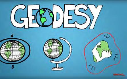
Geodesy. orientation. shape. gravity field
 Geodesy noun Science of measuring the shape, orientation and gravity field of the Earth and how it changes over time. shape orientation gravity field Positioning has always been important Downstream applications
NCC roles in successful disaster response I.R.IRAN
 The Second UN-GGIM-AP Plenary Meeting NCC roles in successful disaster response I.R.IRAN Teheran Iran 28-30 October 2013 Ali Javidaneh Technical Deputy of National Cartographic Center (NCC) Outline Types
EARTH S SYSTEMS: PROCESSES THAT SHAPE THE EARTH
 9 Week Unit UNIT 2 EARTH S SYSTEMS: PROCESSES THAT SHAPE THE EARTH Fourth Grade Rogers Public Schools : Earth s Systems: Processes that Shape the Earth 9 weeks In this unit, students develop understandings
COMPOSITION and PHYSICAL PROPERTIES GENERAL SUBJECTS. GEODESY and GRAVITY
 COMPOSITION and PHYSICAL PROPERTIES Composition and structure of the continental crust Composition and structure of the core Composition and structure of the mantle Composition and structure of the oceanic
EAS 116 Earthquakes and Volcanoes
 EAS 116 Earthquakes and Volcanoes J. Haase Forecasting Volcanic Eruptions Assessment of Volcanic Hazard Is that volcano active? Mount Lassen: 12000 BP and 1915 Santorini, IT: 180,000 BP, 70,000 BP, 21000
GG S. Internal Vision of GGOS. Markus Rothacher. GFZ Potsdam
 Internal Vision of GGOS Markus Rothacher GFZ Potsdam GGOS Retreat DGFI in Munich February 15-16, 2006 Contents Motivation Four Levels of Products of the IAG Services: First Level: Raw Data Collection Second
PLEASE FILL AND BUBBLE IN THE FOLLOWING INFORMATION ON THE SCANTRON:
 TEST VARIATION 1 STUDENT ID: FAMILY NAME (last name): YOUR OWN NAME (first name): PLEASE FILL AND BUBBLE IN THE FOLLOWING INFORMATION ON THE SCANTRON: your name Family name first! upper portion of scantron
Assessment Objectives Grid for Geography - G1. Summer Application Skills Total. (a) (b) (c) (a)
 (b) (c) (a)") Assessment Objectives Grid for Geography - G1 Summer 2014 Question 1 Knowledge and Understanding Application Skills Total Key Question (a) 0 2 3 5 1.5 (b) 8 2 10 1.3 (c) 7 3 10 1.4 15 7 3 25 Question 2
Assessment Objectives Grid for Geography - G1 Summer 2014 Question 1 Knowledge and Understanding Application Skills Total Key Question (a) 0 2 3 5 1.5 (b) 8 2 10 1.3 (c) 7 3 10 1.4 15 7 3 25 Question 2
Down-stream process transition (f (q s ) = 1)
 = 1)") Down-stream process transition (f (q s ) = 1) Detachment Limited S d >> S t Transport Limited Channel Gradient (m/m) 10-1 Stochastic Variation { Detachment Limited Equilibrium Slope S d = k sd A -θ d S
Down-stream process transition (f (q s ) = 1) Detachment Limited S d >> S t Transport Limited Channel Gradient (m/m) 10-1 Stochastic Variation { Detachment Limited Equilibrium Slope S d = k sd A -θ d S
Exploring Plate Motion and Deformation in California with GPS
 Exploring Plate Motion and Deformation in California with GPS Cate Fox-Lent, UNAVCO Master Teacher; Andy Newman, Georgia Institute of Technology; Shelley Olds, UNAVCO; revised by Nancy West Part 1: Analyze
the IRIS Consortium Collaborative, Multi-user Facilities for Research and Education Briefing NSF Business Systems Review September 9, 2008
 the IRIS Consortium Collaborative, Multi-user Facilities for Research and Education Briefing NSF Business Systems Review September 9, 2008 A facilities program for collection and distribution of seismological
Earth Science (Tarbuck, et al) 2009 Correlated to: Colorado Academic Standards Science (High School)
 2009 Correlated to: Colorado Academic Standards Science (High School)") Content Area: Science Standard: Earth Systems Science Prepared Graduates: Describe and interpret how Earth's geologic history and place in space are relevant to our understanding of the processes that
Content Area: Science Standard: Earth Systems Science Prepared Graduates: Describe and interpret how Earth's geologic history and place in space are relevant to our understanding of the processes that
Yellowstone Hotspot Component of the Plate Boundary Observatory
 Yellowstone Hotspot Component of the Plate Boundary Observatory (Investigators: Smith, Thatcher, Meertens, Humphreys, Dzurisin, Oldow Co-Investigators: Christiansen, Doss, Schwartz, Machette, Wong, Olig,
Increasingly technological
 QU: How can tectonic events be managed? AIM: To explain the approaches to tectonic hazard prediction, monitoring and event modification. Hazard Modification, Mitigation and Adaption Modify the loss Modify
Citizen Science at the. U.S. Geological Survey
 Citizen Science at the U.S. Geological Survey David Applegate USGS Associate Director for Natural Hazards NRC Board on Earth Science & Resources December 5, 2014 U.S. Department of the Interior U.S. Geological
A new era of geodetic big data - challenges and opportunities Tim Wright (COMET, University of
 A new era of geodetic big data - challenges and opportunities Tim Wright (COMET, University of Leeds) S @NERC_COMET N A New Era of Geodetic Big Data? GEM Strain Rate Model 17,491 GNSS sites included in
TS Tectonics & Structural Geology Orals and PICOs Monday, 08 April
 TS Tectonics & Structural Geology Orals and PICOs Monday, 08 April MO1, 08:30 10:00 MO2, 10:30 12:00 MOL, 12:15 13:15 MO3, 13:30 15:00 MO4, 15:30 17:00 GD3.3/GM3.3/GMPV16/TS4.7, The evolution of plate
Cascadia EarthScope Earthquake and Tsunami Education Program (CEETEP)
") Cascadia EarthScope Earthquake and Tsunami Education Program (CEETEP) Workshop for Teachers, Interpreters, and Emergency Management Educators August 12-15, 2013 Guin Library Seminar Room OSU Hatfield Marine
Cascadia EarthScope Earthquake and Tsunami Education Program (CEETEP) Workshop for Teachers, Interpreters, and Emergency Management Educators August 12-15, 2013 Guin Library Seminar Room OSU Hatfield Marine
Section 11.1 pp Where Mountains Form
 Section 11.1 pp. 236 237 Where Mountains Form Chapter 11 Set a Purpose: TE, p. 236 Reading Study Guide, p. 36 Discussion: TE, p. 236 Differentiating ion Reading Support: TE, p. 236 Visual Teaching Interpret
Course Description. Course Objectives and Standards
 Earth and Space Science Curriculum Course Description Earth and Space Science 1 State # 3044 Grades offered: 10-12 Credits: A two credit course Prerequisite: none Counts as a Science Course for the General,
EARTH/SPACE SCIENCE. Earth Materials and Changes
 EARTH/SPACE SCIENCE This Earth/Space science course is designed to continue student investigations of the earth sciences that began in grades K-8 while providing students the experiences and necessary
COURSE OUTLINE Physical Geology
 Butler Community College Science, Technology, Engineering, and Math Division Robert Carlson and Kim E. Karr Revised Fall 2011 Implemented Spring 2012 Textbook Update Fall 2015 COURSE OUTLINE Physical Geology
The Afar Rift Consortium
 The Afar Rift Consortium University of Bristol University of Oxford University of Cambridge British Geological Survey University of Rochester University of Auckland, NZ Opportunistic programme following
Diverse deformation patterns of Aleutian volcanoes from InSAR
 Diverse deformation patterns of Aleutian volcanoes from InSAR Zhong Lu 1, Dan Dzurisin 1, Chuck Wicks 2, and John Power 3 U.S. Geological Survey 1 Cascades Volcano Observatory, Vancouver, Washington 2
Positioning the Pacific: NOAA s Geospatial Activities. Juliana Blackwell, Director NOAA s National Geodetic Survey March 6, 2012
 Positioning the Pacific: NOAA s Geospatial Activities Juliana Blackwell, Director NOAA s National Geodetic Survey March 6, 2012 A Common Problem of the Early 19 th Century 1807 President Thomas Jefferson
PLATE TECTONIC PROCESSES
 Lab 9 Name Sec PLATE TECTONIC PROCESSES 1. Fill in the blank spaces on the chart with the correct answers. Refer to figures 2.3, 2.4 p.33 (2.2 and 2.3 on p. 23) as needed. 2. With your knowledge of different
Evidence for plate tectonics
 Evidence for plate tectonics See class powerpoint Printed tables 2x essay Qs markschemes Discuss/Evaluate the evidence for plate tectonics Discuss/evaluate the evidence for plate tectonics Essay: To what
Changing the World of Geosciences
 Changing the World of Geosciences This is a great time to pursue graduate studies at the Jackson School of Geosciences. Since receiving one of the largest bequests in the history of higher education, we
GEODETIC NETWORK OF SAUDI ARABIA AND FIDUCIAL STATIONS. GFN OF Saudi Arabia in Based on ITRF2000 Datum
 STUDIES OF TECTONIC MOVEMENTS IN SAUDI ARABIA USING CORS M. Al Rajhi, Ali Al Omar, R. Yanar, F. Kartal, K. Eren, SUBJECT TO TALKS BACKGROUND GEODETIC NETWORK OF SAUDI ARABIA AND FIDUCIAL STATIONS GFN OF
Activity Template. Drexel-SDP GK-12 ACTIVITY. Subject Area(s): Sound Associated Unit: Associated Lesson: None
: Sound Associated Unit: Associated Lesson: None") Activity Template Subject Area(s): Sound Associated Unit: Associated Lesson: None Drexel-SDP GK-12 ACTIVITY Activity Title: Where did the earthquake begin? Grade Level: 8 (7-9) Activity Dependency: None
Activity Template Subject Area(s): Sound Associated Unit: Associated Lesson: None Drexel-SDP GK-12 ACTIVITY Activity Title: Where did the earthquake begin? Grade Level: 8 (7-9) Activity Dependency: None
5-E CLASSROOM STEM ACTIVITY: MODELING GEOLOGICAL EVENTS. By Jill C. Cataldi
 5-E CLASSROOM STEM ACTIVITY: MODELING GEOLOGICAL EVENTS By Jill C. Cataldi GEOLOGY // DENNY CAPPS MUCH MORE THAN ROCKS Digging Deeper for a Career in Geology BY DOROTHY CROUCH When thinking about STEM
Earth Science. Explain how Earth's biogeochemical cycles create a balance of materials. Examine the importance of biogeochemical cycles.
 Unit 1: DYNAMIC STRUCTURE OF EARTH Introduction to Understand that earth science is based upon the four sciences of astronomy, geology, meteorology, and oceanography. Identify topics studied within the
Chino Valley Unified School District High School Course Description
 CONTACTS 1. School/District Information: School/District: Chino Valley Unified School District Street Address: 5130 Riverside Dr., Chino, CA 91710 Phone: (909) 628-1201 Web Site: chino.k12.ca.us 2. Course
Disciplinary Core List of Standards (NGSS) for 3-5 Earth Science Progression - 3-ESS2 Earth s Systems ESS2.D Weather and Climate -
 for 3-5 Earth Science Progression - 3-ESS2 Earth s Systems ESS2.D Weather and Climate -") Disciplinary Core List of Standards (NGSS) for 3-5 Earth Science Progression - 3-ESS2 Earth s Systems ESS2.D Weather and Climate - Scientists record patterns of the weather across different times and areas
Disciplinary Core List of Standards (NGSS) for 3-5 Earth Science Progression - 3-ESS2 Earth s Systems ESS2.D Weather and Climate - Scientists record patterns of the weather across different times and areas
FINAL EXAM December 20 th, here at 1:00 3:00 pm
 FINAL EXAM December 20 th, here at 1:00 3:00 pm REVIEW SESSION December 11 th at 6:00-7:30 pm Morrill I Auditorium (Room N375) Same as last time Don t forget your online course evaluations! Major Volcanic
The Dynamic Earth Section 1. Chapter 3 The Dynamic Earth Section 1: The Geosphere DAY 1
 Chapter 3 The Dynamic Earth Section 1: The Geosphere DAY 1 The Earth as a System The Earth is an integrated system that consists of rock, air, water, and living things that all interact with each other.
Prentice Hall: Science Explorer, 16 Book Series 2005 Correlated to: Alabama Science Standards for Earth and Space Science Core (Grade 6)
") Alabama Science Standards for Earth and Space Science Core (Grade 6) 1. Identify global patterns of atmospheric movement, including El Niño, the Gulf Stream, the jet stream, the Coriolis effect, and global
Alabama Science Standards for Earth and Space Science Core (Grade 6) 1. Identify global patterns of atmospheric movement, including El Niño, the Gulf Stream, the jet stream, the Coriolis effect, and global
Science 10 PROVINCIAL EXAM STUDY BOOKLET. Unit 4. Earth Science
 Science 10 PROVNCAL EXAM STUDY BOOKLET Unit 4 Earth Science Student nstructions 1. Ensure that you have blank paper and a Data Booklet. 2. Record all answers on a separate piece of paper. 3. Answer keys
Education Toolkits for the 21 rst Century Ecological Research
 Education Toolkits for the 21 rst Century Ecological Research NEON s University Education / Outreach Program Leah A. Wasser, Sr. Science Educator, Remote Sensing Ecologist Wendy Gram, Liz Goehring National
Plate Tectonics. By Destiny, Jarrek, Kaidence, and Autumn
 Plate Tectonics By Destiny, Jarrek, Kaidence, and Autumn .The Denali Fault and San Andreas Fault - The San Andreas Fault is a continental transform fault that extends roughly 1300 km (810 miles) through
Volcanic Benefits & Forecasting
 Volcanic Benefits & Forecasting Review: https://www.youtube.com/watch?v=ydy28qtdyjy 1. Based on what we know about volcanoes, predict where you might you expect to see volcanoes in and around New Zealand?
Geospatial Information Management in the Americas: Lessons for the Post-2015 development agenda
 Geospatial Information Management in the Americas: Lessons for the Post-2015 development agenda Rolando Ocampo President, UN-GGIM: Americas October 2014 The integration of statistical and geographical
Earth and Space Science Semester 2 Exam Review. Part 1. - Convection currents circulate in the Asthenosphere located in the Upper Mantle.
 Earth and Space Science 2015 Semester 2 Exam Review Part 1 Convection -A form of heat transfer. - Convection currents circulate in the Asthenosphere located in the Upper Mantle. - Source of heat is from
Kīlauea Volcano: Be a Volcanologist. Image Credit: Julien Millet / Unsplash. Final Project
 The Kīlauea Volcano: Be a Volcanologist Image Credit: Julien Millet / Unsplash Final Project Final Project The Kīlauea Volcano: Be a Volcanologist In this two-day project, students apply their previous
Determining strain graphically
 Nancy West, Beth Pratt-Sitaula, and Shelley Olds, expanded from work by Vince Cronin, Baylor University and Anne Egger, Central Washington University. We have ample evidence that Earth deforms deformed
The Bottom of the Ocean
 The Bottom of the Ocean Overview: In this lesson, students study bathymetric features of the ocean, predict how bathymetric features influence propagation and runup, then analyze an animation of a tsunami
GEO-VIII November Geohazard Supersites and Natural Laboratories Progress Report. Document 9
 GEO-VIII 16-17 November 2011 Geohazard Supersites and Natural Laboratories Progress Report Document 9 This document is submitted to GEO-VIII for information. Geohazard Supersites and Natural Laboratories
NGSS Example Bundles. Page 1 of 14
 Middle School Phenomenon Model Course 2 Bundle 2 Climate Diversity This is the second bundle of the Middle School Phenomenon Model Course 2. Each bundle has connections to the other bundles in the course,
Operational Aspects of GNSS CORS What is a GNSS CORS system used for?
 Please insert a picture (Insert, Picture, from file). Size according to grey field (10 cm x 25.4 cm). Scale picture: highlight, pull corner point Cut picture: highlight, choose the cutting icon from the
JICA s Experiences of Connecting Japanese Science & Technologies for Disaster Risk Reduction in Developing Countries
 JICA s Experiences of Connecting Japanese Science & Technologies for Disaster Risk Reduction in Developing Countries Junji WAKUI Deputy Director General, Group Leader Disaster Risk Reduction Group Global
Lesson 14: Plate Tectonics II
 Standards Addressed Lesson 14: Plate Tectonics II Overview Lesson 14 builds on the previous lesson on plate tectonics in which students learned about Earth s layers and plates. This lesson presents specific
SYLLABUS FORM WESTCHESTER COMMUNITY COLLEGE Valhalla, NY lo CURRENT DATE: Please indicate whether this is a NEW COURSE or a REVISION:
 SYLLABUS FORM WESTCHESTER COMMUNITY COLLEGE Valhalla, NY lo595 l. Course #: 2. NAME OF ORIGINATOR /REVISOR: PHYSC 143 Laurel Senft, Rob Applebaum, Eryn Klosko NAME OF COURSE Earth Science 3. CURRENT DATE:
GEOLOGY CURRICULUM. Unit 1: Introduction to Geology
 Chariho Regional School District - Science Curriculum September, 2016 GEOLOGY CURRICULUM Unit 1: Introduction to Geology OVERVIEW Summary In this unit students will be introduced to the field of geology.
2018 Geography Mock Examination
 2018 Geography Mock Examination Your Geography mock examination will test your understanding of Paper 1 (Living with the physical environment) and Section B (Fieldwork) from Paper 2. Attached are the necessary
Applications of GIS-based Laboratory Exercises In Entry-level Geoscience Courses
 Applications of GIS-based Laboratory Exercises In Entry-level Geoscience Courses Laurel P. Goodell Department of Geosciences Princeton University Princeton, NJ 08544 laurel@princeton.edu As instructional
Standards. Lesson Plan: Glaciers. Earth Science Grade 3. Grade 4. Grade 7. Grade 8
 Lesson Plan: Glaciers Grade 3 Standards 3-5 Benchmark C. Describe Earth s resources including rocks, soil, water, air, animals and plants and the ways in which they can be conserved. Earth Systems / Y2003.CSC.S01.G03-05.BC.L03.I03
Geography General Course Year 12. Selected Unit 3 syllabus content for the. Externally set task 2019
 Geography General Course Year 12 Selected Unit 3 syllabus content for the Externally set task 2019 This document is an extract from the Geography General Course Year 12 syllabus, featuring all of the content
Case study of Japan: Reference Frames in Practice
 Case study of Japan: Reference Frames in Practice Basara Miyahara and Koji Matsuo Sponsors: 1 Outline Introduction - Geodetic reference frame of Japan - GEONET : continuous GNSS observation system Geometric
Chapter 2: Plate Tectonics: A Unifying Theory
 Chapter 2: Plate Tectonics: A Unifying Theory Chapter Outline 2.1 Introduction 2.2 Early Ideas About Continental Drift 2.3 What Is the Evidence for Continental Drift? 2.4 Features of the Seafloor 2.5 Earth
Weather Extremes in Canada: Understanding the Sources and Dangers of Weather
 Weather Extremes in Canada: Understanding the Sources and Dangers of Weather Lesson Overview This lesson will focus on the extremes of weather and how they affect Canada. Important meteorological factors
Curriculum Vitae April, 2013
 Curriculum Vitae April, 2013 Name: D of B: Nationality: Jamie Farrell 10-Nov-1976 U.S. Address: University of Utah Department of Geology & Geophysics Frederick Albert Sutton Building 282 115 S. 1460 E.
GPS Strain & Earthquakes Unit 4: GPS strain analysis examples Student exercise
 GPS Strain & Earthquakes Unit 4: GPS strain analysis examples Student exercise Example 1: Olympic Peninsula Name: Please complete the following worksheet to estimate, calculate, and interpret the strain
Interferometric Synthetic Aperture Radar (InSAR) and GGOS. Andrea Donnellan NASA/JPL February 21, 2007
 and GGOS. Andrea Donnellan NASA/JPL February 21, 2007") Interferometric Synthetic Aperture Radar (InSAR) and GGOS Andrea Donnellan NASA/JPL February 21, 2007 Sources for Science Objectives Fourth component of EarthScope Involvement: NSF, NASA, USGS, Universities
Interferometric Synthetic Aperture Radar (InSAR) and GGOS Andrea Donnellan NASA/JPL February 21, 2007 Sources for Science Objectives Fourth component of EarthScope Involvement: NSF, NASA, USGS, Universities
Earthquakes. Earthquakes are caused by a sudden release of energy
 Earthquakes Earthquakes are caused by a sudden release of energy The amount of energy released determines the magnitude of the earthquake Seismic waves carry the energy away from its origin Fig. 18.1 Origin
2. Explain why there are these two predominate elevations. (Hint: think about isostasy and the type of materials we used to demonstrate buoyancy).
.") IDS 102 Plate Tectonics Questions Part I: Observations- Four maps of world are positioned around the room. Answer the questions associated with each map and record your general observations about the maps.
IDS 102 Plate Tectonics Questions Part I: Observations- Four maps of world are positioned around the room. Answer the questions associated with each map and record your general observations about the maps.
The Importance of Cultural Contexts in Climate Education
 The Importance of Cultural Contexts in Climate Education Kathryn Berry Bertram, Ph.D., University of Alaska Fairbanks Geophysical Institute Education Director Climate education for indigenous students
NOAA s Regional Climate Science & Information: Opportunities and Challenges
 NOAA s Regional Climate Science & Information: Opportunities and Challenges Dr. Wayne Higgins Climate Program Office, Director Office of Oceanic and Atmospheric Research National Oceanic and Atmospheric
Subject Classification
 Istituto Nazionale di Geofisica e Vulcanologia earth-prints home page roma library bologna library catania library milano library napoli library palerm Subject Classification Earth-prints organize its
Status and Challenges on Geo-DRM Information Systems in Tonga
 Name: Mafua- i-vai utukakau Maka Status and Challenges on Geo-DRM Information Systems in Tonga 1 Roles and Relationships Land and Geographic Information Systems (LGIS) Unit: Establish updated high-resolution
TO GO TO ANY OF THE PAGES LISTED BELOW, CLICK ON ITS TITLE
 TO GO TO ANY OF THE PAGES LISTED BELOW, CLICK ON ITS TITLE CHAPTER 6 Plate Tectonics 1 6-1 What is continental drift? 2 6-2 Why is the seafloor spreading? 3 6-3 What evidence supports seafloor spreading?
Section 1: The Geosphere
 Section 1: The Geosphere Preview Classroom Catalyst Objectives The Earth as a System Discovering Earth s Interior The Composition of the Earth The Structure of the Earth Plate Tectonics Section 1: The
Concepts and Challenges Earth Science. Correlated to. Alabama Course of Study: Science Sixth Grade Earth and Space Science
 Correlated to Students will: 1. Identify global patterns of atmosheric movement, including El Nino, the Gulf Stream, the jet stream, the Coriolis effect, and global winds that influence local weather.