Education Toolkits for the 21 rst Century Ecological Research
|
|
|
- Opal Wells
- 6 years ago
- Views:
Transcription

 Boulder, CO LeahAWasser")
1 Education Toolkits for the 21 rst Century Ecological Research NEON s University Education / Outreach Program Leah A. Wasser, Sr. Science Educator, Remote Sensing Ecologist Wendy Gram, Liz Goehring National Ecological Observatory Network (NEON) Boulder, CO LeahAWasser Solely Sponsored by the NSF
2 National Ecological Observatory Network Boulder, CO
3 Continental-Scale Ecological Observatory Fully funded by the National Science Foundation Collects and provide data on the drivers/responses of ecological change (30 years) Serves as an infrastructure/backbone for other research Develops and provides educational resources to engage communities in working with scientific data Project Timeline
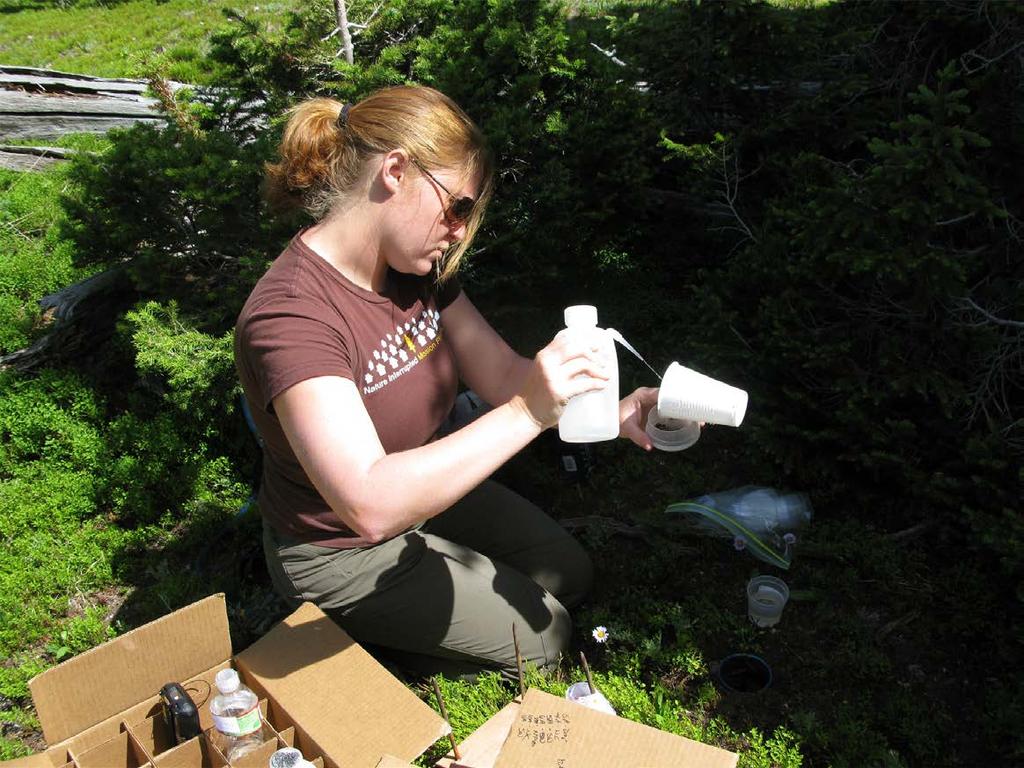
4 1. Core sites: Located in unmanaged wildland conditions 2. Relocatable sites: Important ecological and/or human disturbance gradients. 3. Aquatic sites: Changes in aquatic systems
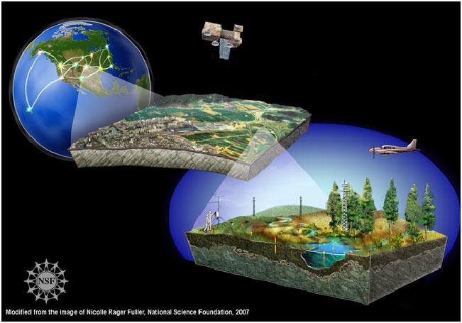
5


6 Image courtesy of People Productions

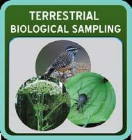
7 Starting with individual organisms
8
9

10 Image courtesy of People Productions
11
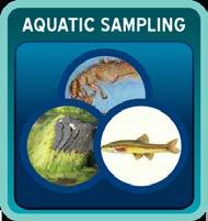
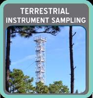
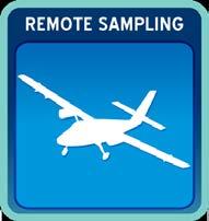
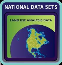
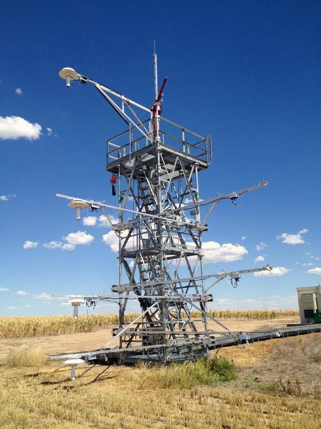
12 Terrestrial Aquatic National Data Sets Atmospheric Airborne Observations


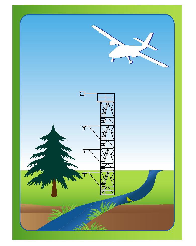
13 A CONTINENTAL-SCALE OBSERVATION SYSTEM
14 NEON Offers: Free Data Assignable Assets: Scientists can propose to fly our airborne system over sites of interest. Scientists can propose to add additional sensors, or conduct experiments within NEON infrastructure Educators can utilize prepackaged NEON datasets and associated activities in classroom settings Students can apply for internships and REUs (future)
15
16 National Ecological Observatory Network
17
18 GOALS: 1. Facilitate NEON data classroom use (Videos, Online Modules, Workshops) 2. Train next generation scientists: data analysis skills (Workshops, Graduate Course, Internship, REU) 3. Provide real world experiences for students (Internship, REU) Data Videos Workshops Conference Sessions: 4. Call attention to NEON relevant science (Conference Sessions) Online Education Internship / Reu s
19 Online Education Education Modules: Online materials to facilitate the use of NEON data in the classroom Short videos: YouTube style, watch at home on relevant data topics Data Focused Workshops / Webinars Applied Student Experiences Internship Program REU (Future) Graduate Course (Future) Scientific Awareness Conference Sessions: NEON relevant topics (e.g. scaling, uncertainty)


20 Graduate Course Workshops: Training & Science Organized Conference Sessions: Online Modules: facilitate data in the classroom Internship Program / Reu s Short Chalk Talk Videos YouTube Style, teach basic data concepts
21 National Ecological Observatory Network


22 Prepare future STEM professionals Broaden participation in STEM careers by traditionally under-represented groups in science and engineering
23 Real-world projects Mentorship by NEON staff Project, Writing and Community mentors Career exploration and support Leadership Training, Weekly Career Series, Informational interviews and Career Counseling Resume-building deliverables Department specific documents (e.g., Data Processing Algorithms, Engineering drawings, research paper) Published Abstracts Formal Poster Sessions with other local REU and Internship Programs Outreach: blog entries, elevator speeches Program evaluation CU-Boulder W. Penuel and graduate student E. Dutilly
24 National Ecological Observatory Network


25 Skills Needed to Explore Ecological Questions 21 st Century Ecologist Toolbox Build Data Analysis / Comprehension / Awareness Skills Facilitate Use of Big Data in Research & Classroom Engage: working with NEON data
26 organisms, populations, communities atmosphere biogeochemistry Lots of Data! ecohydrology landcover / landuse
27 Big data generally refer to massive volumes of data not readily handled by the usual data tools and practices and present unprecedented opportunities for advancing science and informing resource management through data-intensive approaches. Hampton et al, 2013 Frontiers in Ecology


28 Development of Custom Data Analysis Techniques Required Computing Resources Huge Data Volume Software: Cost, complexity Student Frustration in the Classroom!!!

")

29 Programming Data Management GNU Octave Spatial Analysis (GIS) Remote Sensing GRASS GIS Quantum GIS Opticks
30 Image: doglistener.tv

31 How to integrate into the classroom? Data Formats Data / Metadata Data management Processing Storage


32 Modular Interactive Community Driven Multi-media Open Source data Analysis Tools Packaged with Relevant Peer Reviewed Literature

33 Online Learning Map Imagery Data Specific Crossover Topics Remote Sensing LiDAR data Eco- Hydrology MetaData Vegetation Change Uncertainty Disturbance Processing Methods 2013 National Ecological Observatory Network, Inc. ALL RIGHTS RESERVED.


34 Modular THEME: Landcover / Landuse Sub-Theme: Regional Vegetation Change Topic / Question: Structural Attributes of Forest Trees & Understory Methods: Remote Sensing LiDAR Data 2013 National Ecological Observatory Network, Inc. ALL RIGHTS RESERVED.
35 Understanding Vegetation Structure Imagery Intro Videos 1 & 2 Working with Data Demo Remote Sensing LiDAR data Eco- Hydrology MetaData Data Analysis Activity Uncertainty Vegetation Change Wrap Up Processing Methods Disturbance 2013 National Ecological Observatory Network, Inc. ALL RIGHTS RESERVED.
36 Why A Modular Approach? 2013 National Ecological Observatory Network, Inc. ALL RIGHTS RESERVED.
37 Things Change National Ecological Observatory Network, Inc. ALL RIGHTS RESERVED.


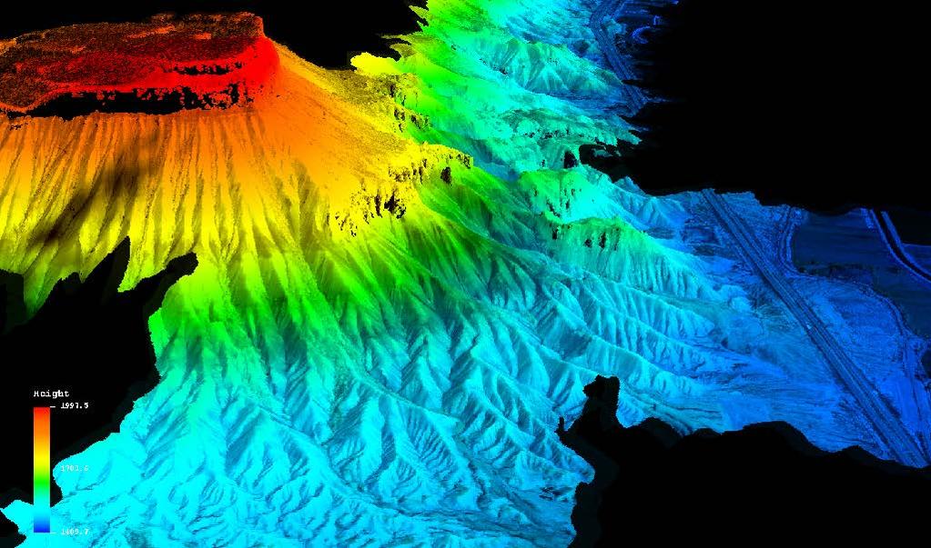
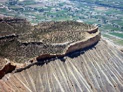
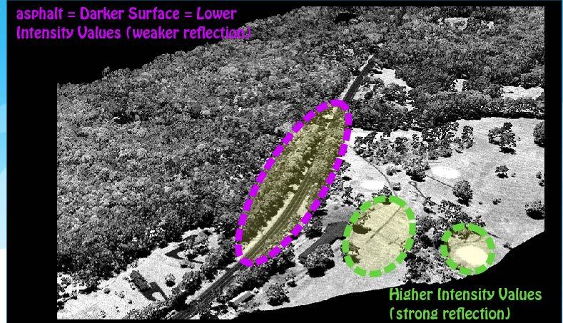
38 Vegetation Change What is LiDAR Data? 2013 National Ecological Observatory Network, Inc. ALL RIGHTS RESERVED.
39 LiDAR Data Products Legend 2013 National Ecological Observatory Network, Inc. ALL RIGHTS RESERVED. Shorter Trees Taller Trees

40

41

42 Open Source Tools 2013 National Ecological Observatory Network, Inc. ALL RIGHTS RESERVED.


43 Example Data Activity Assess relationships between in situ measured canopy height and lidar data derived height 2013 National Ecological Observatory Network, Inc. ALL RIGHTS RESERVED.


44 Online Learning Map Remote Sensing Intro Videos 1 & 2 LiDAR data Working with Data Video Data Analysis Activity Classroom Lab Vegetation Change Wrap Up 2013 National Ecological Observatory Network, Inc. ALL RIGHTS RESERVED.
45 To Be Freely Available on the NEONinc.org Education Portal 2013 National Ecological Observatory Network, Inc. ALL RIGHTS RESERVED.
46 Collaborate with Us! Community Input LiDAR data Imagery Review existing materials Remote Sensing Contribute lesson content Share topic ideas Vegetation Change Contribute graphics, videos Disturbance 2013 National Ecological Observatory Network, Inc. ALL RIGHTS RESERVED.
47 Partner with experts in respective fields (LiDAR) Jan Van Aardt (Rochester Institute of Technology) Stuart Phinn / Alex Held: Australia TERN/ CSIRO Crystal Schaaf (Boston University) Laura Chasmer (Wilfrid Laurier University) many others! External Review
48 Identify Important Topics (data & Ecology) that are supported using NEON data Characterizing Vegetation Structure over Broad Areas (ESA 2014 Workshop) Data Topic: LiDAR data products (under development) Sampling Design Topic: NEON In Situ Veg Sampling Activity: Scaling In Situ to Remote (Lidar) using R


49 Leah A. Wasser, Ph.D. LeahAWasser
ENVS S102 Earth and Environment (Cross-listed as GEOG 102) ENVS S110 Introduction to ArcGIS (Cross-listed as GEOG 110)
 ENVS S110 Introduction to ArcGIS (Cross-listed as GEOG 110)") ENVS S102 Earth and Environment (Cross-listed as GEOG 102) 1. Describe the fundamental workings of the atmospheric, hydrospheric, lithospheric, and oceanic systems of Earth 2. Explain the interactions
ENVS S102 Earth and Environment (Cross-listed as GEOG 102) 1. Describe the fundamental workings of the atmospheric, hydrospheric, lithospheric, and oceanic systems of Earth 2. Explain the interactions
Chemical Safety as a Core ACS Value: Report on the 2018 Safety Summit
 Chemical Safety as a Core ACS Value: Report on the 2018 Safety Summit Introduction In December 2016, the ACS Board of Directors adopted safety as one of the Society s core values, thus affirming that the
INTEGRATING GEOSPATIAL PERSPECTIVES IN THE ANTHROPOLOGY CURRICULUM AT THE UNIVERSITY OF NEW MEXICO (UNM)
") INTEGRATING GEOSPATIAL PERSPECTIVES IN THE ANTHROPOLOGY CURRICULUM AT THE UNIVERSITY OF NEW MEXICO (UNM) VERONICA ARIAS HEATHER RICHARDS JUDITH VAN DER ELST DEPARTMENT OF ANTHROPOLOGY MARCH 2005 INTEGRATING
INTEGRATING GEOSPATIAL PERSPECTIVES IN THE ANTHROPOLOGY CURRICULUM AT THE UNIVERSITY OF NEW MEXICO (UNM) VERONICA ARIAS HEATHER RICHARDS JUDITH VAN DER ELST DEPARTMENT OF ANTHROPOLOGY MARCH 2005 INTEGRATING
EXPLORE PLATE TECTONICS & MORE THROUGH GPS DATA. Shelley Olds, UNAVCO April 12, 2018 NGSS Webinar
 EXPLORE PLATE TECTONICS & MORE THROUGH GPS DATA Shelley Olds, UNAVCO April 12, 2018 NGSS Webinar Today s Outline Central question: How do we know the tectonic plates are still moving? -- What evidence
GIS Applications on Environmental Education in Taiwan
 GIS Applications on Environmental Education in Taiwan Track: Education Authors: Yu-Chen Lai, Mei-Ling Yeh, Tien-Yin Chou Abstract GIS is a perfect vehicle to deliver environmental knowledge and spatial
EXECUTIVE SUMMARY OF EVALUATION FINDINGS
 B R A I N P R O F E S S I O N A L D E V E L O P M E N T EXECUTIVE SUMMARY OF EVALUATION FINDINGS R E P O R T B Y : J E A N I N E A N C E L E T N O V E M B E R 1 5, 2 0 1 7 Jeanine E. Ancelet - Audience
the IRIS Consortium Collaborative, Multi-user Facilities for Research and Education Briefing NSF Business Systems Review September 9, 2008
 the IRIS Consortium Collaborative, Multi-user Facilities for Research and Education Briefing NSF Business Systems Review September 9, 2008 A facilities program for collection and distribution of seismological
Breakout Session III Evolving landscapes and global environmental change
 Breakout Session III Evolving landscapes and global environmental change 1. Hydrology and critical zone imaging 2. Glaciology: Instrumenting glaciers and ice sheets 3. Polar networks and glacial isostatic
department of chemistry
 department of chemistry Why Chemistry? You enjoy problem solving. You want to learn about how the world works at the molecular level. Chemistry provides excellent preparation for graduate and professional
Geospatial Science and Technology Model Courses and Certificate:
 Geospatial Science and Technology Model Courses and Certificate: Guidelines and Tools to Align Curriculum to Workforce Needs Ann Johnson Associate Director gisajohnson@delmar.edu Funded by National Science
Geospatial Intelligence
 Geospatial Intelligence Geospatial analysis has existed as long as humans have made and studied maps but its importance to the intelligence community has skyrocketed in the past several years, with Unmanned
Evaluation Module: Care for the Chronically ill Person Spring 2010 Responsible for the evaluation process: Project manager, Mette Bro Jansen
 2010 Evaluation Module: Care for the Chronically ill Person Spring 2010 Responsible for the evaluation process: Project manager, Mette Bro Jansen Table of contents Questions concerning the learning outcome
Chemistry with Spanish for Science
 Programme Specification (Undergraduate) Chemistry with Spanish for Science This document provides a definitive record of the main features of the programme and the learning outcomes that a typical student
Improvement of the National Hydrography Dataset for US Forest Service Region 3 in Cooperation with the National Forest Service
 Improvement of the National Hydrography Dataset for US Forest Service Region 3 in Cooperation with the National Forest Service Christian L. DeCasas California State University, Northridge November 7 th,
2018 AWS Global Summit Sponsorship Overview
 2018 AWS Global Summit Sponsorship Overview 1 A W S G L O B A L S U M M I T S O V E R V I E W AWS Global Summits are free events designed to bring together the cloud computing community to connect, collaborate,
RSC Analytical Division Strategy
 RSC Analytical Division Strategy 2013-2017 The Analytical Division aims to promote and support analytical chemistry at all levels from public outreach and school education to the most innovative and cutting
Lesson Plan 3 Land Cover Changes Over Time. An Introduction to Land Cover Changes over Time
 An Introduction to Land Cover Changes over Time This lesson plan builds on the lesson plan on Understanding Land Use and Land Cover Using Google Earth. Please refer to it in terms of definitions on land
BASIC TECHNOLOGY Pre K starts and shuts down computer, monitor, and printer E E D D P P P P P P P P P P
 BASIC TECHNOLOGY Pre K 1 2 3 4 5 6 7 8 9 10 11 12 starts and shuts down computer, monitor, and printer P P P P P P practices responsible use and care of technology devices P P P P P P opens and quits an
Night Comes to the Cumberlands and It s Awesome: Promoting Night Sky Conservation and Development in the Upper Cumberland
 Night Comes to the Cumberlands and It s Awesome: Promoting Night Sky Conservation and Development in the Upper Cumberland Jean Mercer Assistant Vice Chancellor for Research Office of Sponsored Programs
STScI at the AAS 231: January 2018, Washington, D.C.
 STScI at the AAS 231: January 2018, Washington, D.C. The Space Telescope Science Institute (STScI) will be at the 231st AAS meeting in Washington, D.C. with an exhibit booth and several associated events
Developing a Community Geographical Information System (GIS) in Rural India
 in Rural India") Developing a Community Geographical Information System (GIS) in Rural India Before rushing off and describing the unique challenges of developing a small scale GIS system India I better first describe
Developing a Community Geographical Information System (GIS) in Rural India Before rushing off and describing the unique challenges of developing a small scale GIS system India I better first describe
Tulare County Office of Education BTSA Induction Consortium
 Tulare County Office of Education BTSA Induction Consortium Biennial Report 5/17/10 Page 1 of 15 Local Educational Agency CD Code 54-10546 Section A, Part I: Contextual Information Biennial Report Contextual
Module 4 Educator s Guide Overview
 Module 4 Educator s Guide Overview Paths Module Overview This module looks at many different kinds of paths and considers why paths are where they are and how they look from space. Paths are usually not
ACS SHANGHAI INTERNATIONAL CHEMICAL SCIENCES CHAPTER 2014 ANNUAL REPORT
 ACS SHANGHAI INTERNATIONAL CHEMICAL SCIENCES CHAPTER 2014 ANNUAL REPORT Jingye Zhou, Luoheng Qin, Quan Zhou, Hongyu Chen, Andrew Feng, Minmin Wang 2/14/2015 ACS Shanghai International Chemical Sciences
Data Aggregation with InfraWorks and ArcGIS for Visualization, Analysis, and Planning
 Data Aggregation with InfraWorks and ArcGIS for Visualization, Analysis, and Planning Stephen Brockwell President, Brockwell IT Consulting, Inc. Join the conversation #AU2017 KEYWORD Class Summary Silos
GIS Visualization: A Library s Pursuit Towards Creative and Innovative Research
 GIS Visualization: A Library s Pursuit Towards Creative and Innovative Research Justin B. Sorensen J. Willard Marriott Library University of Utah justin.sorensen@utah.edu Abstract As emerging technologies
Tell students that Earth is the only planet in our solar system known to have life. Ask:
 This website would like to remind you: Your browser (Safari 7) is out of date. Update your browser for more security, comfort and the best experience on this site. Activityengage The Vastness of Space
Introduction to NMSI through Experimental Design Module 1
 Introduction to NMSI through Experimental Design Module 1 Module 1 Description: This is the first module of any science training series, and is presented to a mixed audience of middle school and high school
Diffusion of GIS in Public Policy Doctoral Program
 Diffusion of GIS in Public Policy Doctoral Program By Fulbert Namwamba PhD Southern University This presentation demonstrate how GIS was introduced in the Public Policy Doctoral Program at Southern University,
The Importance of Cultural Contexts in Climate Education
 The Importance of Cultural Contexts in Climate Education Kathryn Berry Bertram, Ph.D., University of Alaska Fairbanks Geophysical Institute Education Director Climate education for indigenous students
Ticketed Sessions 1 Information in this list current as of August 2008
 Ticketed Sessions in this list current as of August 2008 1 2011 Annual Conference and Exhibit Show Ticketed Sessions Ticketed Sessions Saturday, March 26 8:00 9:00 a.m. 1101T Achievement Is Not Just a
Purdue QuarkNetWorkshop 2012
 Purdue QuarkNetWorkshop 2012 Schedule Monday: Introduction to QuarkNet Particle Physics and Cosmic Rays Online Resources Using the Cosmic Ray Detector Hands on work Tuesday: Contemporary Cosmic Ray Physics
Hunting for Planets. Overview. Directions. Content Created by. Activitydevelop. How can you use star brightness to find planets?
 This website would like to remind you: Your browser (Safari 7) is out of date. Update your browser for more security, comfort and the best experience on this site. Activitydevelop Hunting for Planets How
Chapter 5 LiDAR Survey and Analysis in
 Chapter 5 LiDAR Survey and Analysis in 2010-2011 Christopher Fennell A surveyor s plat and town plan filed in 1836 set out an intended grid of blocks, lots, alleys, and streets for New Philadelphia. Geophysical,
Demystifying ArcGIS Online. Karen Lizcano Esri
 Demystifying ArcGIS Online Karen Lizcano Esri An Integrated Web GIS Platform Desktop Web Device Powered by Services Managed via Portal Access from any Device Portal Server Online Content and Services ArcGIS
ENV208/ENV508 Applied GIS. Week 1: What is GIS?
 ENV208/ENV508 Applied GIS Week 1: What is GIS? 1 WHAT IS GIS? A GIS integrates hardware, software, and data for capturing, managing, analyzing, and displaying all forms of geographically referenced information.
Student Nowcasting and Observations of Winter Weather with the DOW at University of North Dakota Education in Research (SNOWD-UNDER)
") Student Nowcasting and Observations of Winter Weather with the DOW at University of North Dakota Education in Research (SNOWD-UNDER) Matthew S. Gilmore Dept. of Atmospheric Sciences University of North
Student Nowcasting and Observations of Winter Weather with the DOW at University of North Dakota Education in Research (SNOWD-UNDER) Matthew S. Gilmore Dept. of Atmospheric Sciences University of North
AIMS Education Foundation
 Developed and Published by AIMS Education Foundation TM This book contains materials developed by the AIMS Education Foundation. AIMS (Activities Integrating Mathematics and Science) began in 1981 with
Hydrologic Analysis for Ecosystem Restoration
 Hydrologic Analysis for Ecosystem Restoration Davis, California Objectives: To provide participants with: 1) an understanding of the issues in restoration studies; 2) an overview of Corps policies and
TASC Transition Curriculum Project
 TASC Transition Curriculum Project MODULE 3: WORKSHOP 9 REVIEWING THE CROSS-CUTTING CONCEPTS INVOLVED IN SOLVING PROBLEMS PLACED ON STUDENTS IN TASC ABOUT DISCIPLINARY CORE IDEAS POSED IN THE PHYSICAL
Alaska ACE Education Programs
 Alaska ACE Education Programs Elena Bautista Sparrow, Tania Clucas, Holly McQueen, Sarai, Timothy, Chip McMuellen, Gary Kofinas, Sanjay Pyare, Andy Kliskey, Tom Moran, Alan Boraas, John Monahan, Denise
Manual of Digital Earth
 V8.0 March 27, 2018 International Society for Digital Earth Manual of Digital Earth (Tentative Title) OUTLINE Foreword Chapter 1 Understanding Digital Earth 1.1 Origins and Precursors of Digital Earth
Remote Sensing for Ecosystems
 MODULE GUIDE MSc ENR Remote Sensing for Ecosystems Semester 01 Modul coordinator Lecturers Michael Döring Pascal Ochsner, Diego Tonolla, Diane Whited, Michael Döring Martin Geilhausen Latest update August
Building a Vibrant and Enduring Spatial Science John P. Wilson IWGIS2014 Beijing, China
 Building a Vibrant and Enduring Spatial Science John P. Wilson IWGIS2014 Beijing, China Outline Spatial roots o Geography o Landscape architecture o Computer science The (current) opportunity Guiding principles
Swedish Institute of Space Physics Research Strategies
 Dnr 1.1-147/14 (replaces Dnr 1-309/04) Swedish Institute of Space Physics Research Strategies The Swedish Institute of Space Physics (IRF) is a national research institute under the auspices of the Swedish
CAS GE 365 Introduction to Geographical Information Systems. The Applications of GIS are endless
 Spring 2007 CAS GE 365 Introduction to Geographical Information Systems Boston University Department of Geography and Environment The Applications of GIS are endless images from www.esri.com CAS GE 365
GEOMATICS. Shaping our world. A company of
 GEOMATICS Shaping our world A company of OUR EXPERTISE Geomatics Geomatics plays a mayor role in hydropower, land and water resources, urban development, transport & mobility, renewable energy, and infrastructure
2018 ESRI Education Summit. San Diego. California. Sunday July 8 th 2018 Harper College, Palatine, Illinois, USA Dr. Tong Cheng (Biology), Dr.
, Dr.") 2018 ESRI Education Summit. San Diego. California. Sunday July 8 th 2018 Harper College, Palatine, Illinois, USA Dr. Tong Cheng (Biology), Dr. James Gramlich (Sociology), Mukila Maitha (Geography), Dr.
2018 ESRI Education Summit. San Diego. California. Sunday July 8 th 2018 Harper College, Palatine, Illinois, USA Dr. Tong Cheng (Biology), Dr. James Gramlich (Sociology), Mukila Maitha (Geography), Dr.
XXIII CONGRESS OF ISPRS RESOLUTIONS
 XXIII CONGRESS OF ISPRS RESOLUTIONS General Resolutions Resolution 0: Thanks to the Czech Society commends: To congratulate The Czech Society, its president and the Congress Director Lena Halounová, the
A Natural History of our Local Park: Geology and Ecological Succession
 Overview This lesson provides an opportunity for students to apply foundational ecological and geological concepts to investigate the natural history of their own local environment. Using field investigation
Geospatial Services in Special Libraries: A Needs Assessment Perspective
 Purdue University Purdue e-pubs Libraries Faculty and Staff Scholarship and Research Purdue Libraries 5-17-2013 Geospatial Services in Special Libraries: A Needs Assessment Perspective Ilana R. Barnes
FACULTY OF NATURAL SCIENCES. School of Physical and Geographical Sciences. CHEMISTRY at Keele entry
 FACULTY OF NATURAL SCIENCES School of Physical and Geographical Sciences CHEMISTRY at Keele 2016 2017 entry Chemistry at Keele Undergraduate Chemistry and Medicinal Chemistry Degree Programmes 2 3 Introduction
OUTREACH TERC.UCDAVIS.EDU
 E D U C AT I O N A N D OUTREACH 12 TERC education and outreach Part of TERC s mission is education and outreach. Our public, K-12, teacher professional development, and volunteer programs are designed
ASSESSING THE ARTS COMMUNITY: Mapping with GIS and Social Media Tools
 ASSESSING THE ARTS COMMUNITY: Mapping with GIS and Social Media Tools Gary Coutu Associate Professor Department of Geography and Planning West Chester University July 15, 2014 Mapping with GIS and Social
Reducing Consumer Uncertainty
 Spatial Analytics Reducing Consumer Uncertainty Eliciting User and Producer Views on Geospatial Data Quality Introduction Cooperative Research Centre for Spatial Information (CRCSI) in Australia Communicate
GIS Education Activities in Detroit Public Schools Preparing Students for Careers in the Geospatial Industry A Multi-Agency Collaboration
 GIS Education Activities in Detroit Public Schools Preparing Students for Careers in the Geospatial Industry A Multi-Agency Collaboration Marsha A. Lewis, Social Studies Curriculum Specialist, Detroit
Ministry of Health and Long-Term Care Geographic Information System (GIS) Strategy An Overview of the Strategy Implementation Plan November 2009
 Strategy An Overview of the Strategy Implementation Plan November 2009") Ministry of Health and Long-Term Care Geographic Information System (GIS) Strategy An Overview of the Strategy Implementation Plan November 2009 John Hill, Health Analytics Branch Health System Information
Ministry of Health and Long-Term Care Geographic Information System (GIS) Strategy An Overview of the Strategy Implementation Plan November 2009 John Hill, Health Analytics Branch Health System Information
Proposal Requesting to use NSF Facilities for Education. Project: TOM: Teaching flow Over Mountains
 Proposal Requesting to use NSF Facilities for Education Project: TOM: Teaching flow Over Mountains Requestor: Drs. Katja Friedrich & Julie Lundquist Department of Atmospheric and Ocean Sciences University
1. Engage students in a discussion about conditions that are necessary for life.
 This website would like to remind you: Your browser (Safari 7) is out of date. Update your browser for more security, comfort and the best experience on this site. Activitydevelop Habitable Conditions
Elem Reading I Methods. Elem Writing Methods. Elem SS Methods. Elem Reading II Methods
 Crosswalk: CO TQ + INTASC + CAEP Standards with TE Courses: July 2015 DRAFT 1 Learning & Dev Foundations 4322/ CO TQ 1a Teachers provide instruction that is aligned with the Colorado Academic Standards
Earth Lab Post-Doctoral Research and Teaching Scholars at the University of Colorado-Boulder
 Earth Lab Post-Doctoral Research and Teaching Scholars at the University of Colorado-Boulder The Earth Lab initiative, part of the University of Colorado Boulder s Grand Challenge: Our Space, Our Future,
An Instructional Module. FieldScope Unit 1. Introduction to National Geographic Society s FieldScope Program.
 An Instructional Module FieldScope Unit 1 www.budburst.org/fieldscope Introduction to National Geographic Society s FieldScope Program Unit Contents Overview 3 Learning Objectives Time Commitment Technical
Programme Specification (Undergraduate) Chemistry
 Chemistry") Programme Specification (Undergraduate) BSc Chemistry This document provides a definitive record of the main features of the programme and the learning outcomes that a typical student may reasonably be
Programme Specification (Undergraduate) BSc Chemistry This document provides a definitive record of the main features of the programme and the learning outcomes that a typical student may reasonably be
Conference panel Session 98, Defining Data Professionals A Geospatial Industry Perspective on Becoming a Data Professional
 Conference panel Session 98, Defining Data Professionals A Geospatial Industry Perspective on Becoming a Data Professional Dawn J. Wright, Environmental Systems Research Institute (aka Esri), Redlands,
Arctic Spatial Data Infrastructure Enabling Access to Arctic Location-Based Information
 Arctic Spatial Data Infrastructure Enabling Access to Arctic Location-Based Information Arctic SDI Side Event Co-Chairs: Arvo Kokkonen Arctic SDI Board Chair & Director General, National Land Survey of
Esri India User Conference
 Esri India User Conference The Leela Ambience Convention Hotel, Delhi January 19 20, 2017 Keynote Speaker Jack Dangermond Founder and President, Esri Inc. Register Today esriindia.com/indiauc About Esri
Catching the Rain. Lesson Objective: Students will understand how scientists measure rain by using a rain gauge in a small group setting.
 Catching the Rain Standard Addressed: Earth Science Students know how to use simple tools (e.g., thermometer, wind vane) to measure weather conditions and record changes from day to day and across the
Algorithms for GIS csci3225
 Algorithms for GIS csci3225 Laura Toma Bowdoin College Spatial analysis: the beginnings Finding: nb. cholera deaths aer spatially clustered around the Broad St pump 1848, London, John Snow Claim: Cholera
Getting Started with Community Maps
 Esri International User Conference San Diego, California Technical Workshops July 24, 2012 Getting Started with Community Maps Shane Matthews and Tamara Yoder Topics for this Session ArcGIS is a complete
Physical Science Capstone Instructional Segment This is a two-week summative designed to give students an opportunity to review and re-examine the
 Physical Science Capstone Instructional Segment This is a two-week summative designed to give students an opportunity to review and re-examine the concepts covered in this course. Student Science Performance
Changing the World of Geosciences
 Changing the World of Geosciences This is a great time to pursue graduate studies at the Jackson School of Geosciences. Since receiving one of the largest bequests in the history of higher education, we
Green Chemistry Commitment
 Info Kit Green Chemistry Commitment What is the Green Chemistry Commitment? The Green Chemistry Commitment (GCC) is a consortium program that unites the green chemistry community around shared goals and
The Parkes Radio Telescope as a tool for STEM engagement
 The Parkes Radio Telescope as a tool for STEM engagement Jimi Green Parkes Senior System Scientist, CASS Group Leader ASA Annual Science Meeting, Swinburne 27 June 2018 CSIRO ASTRONOMY AND SPACE SCIENCE
Using Big Interagency Databases to Identify Climate Refugia for Idaho s Species of Concern
 Using Big Interagency Databases to Identify Climate Refugia for Idaho s Species of Concern What is a Climate Refugia? habitat that supports a locally reproducing population [or key life history stage]
GIS at UCAR. The evolution of NCAR s GIS Initiative. Olga Wilhelmi ESIG-NCAR Unidata Workshop 24 June, 2003
 GIS at UCAR The evolution of NCAR s GIS Initiative Olga Wilhelmi ESIG-NCAR Unidata Workshop 24 June, 2003 Why GIS? z z z z More questions about various climatological, meteorological, hydrological and
Update on Green Chemistry Education
 Update on Green Chemistry Education IGSS 09 Carl Lecher, Ph.D. Assistant Professor of Chemistry Director of the Marian University Institute for Green and Sustainable Science June 29 th -July 31 st, 2009
MATLAB-Based Electromagnetics PDF
 MATLAB-Based Electromagnetics PDF This is the ebook of the printed book and may not include any media, website access codes, or print supplements that may come packaged with the bound book.â This title
GIS Education in Finnish Upper Secondary Schools
 GIS Education in Finnish Upper Secondary Schools Simo Tolvanen, MA Geography and Biology lecturer Kauhajoki Upper Secondary School Finland simo.tolvanen@kauhajoki.fi Photo: Simo Tolvanen Finland in Brief
Bringing high energy physics to the classroom with HY.P.A.T.I.A.
 EPJ Web of Conferences 71, 00137 (2014) DOI: 10.1051/ epjconf/ 20147100137 C Owned by the authors, published by EDP Sciences, 2014 Bringing high energy physics to the classroom with HY.P.A.T.I.A. Stylianos
PoS(EPS-HEP2015)358. Inspiring Students Through Masterclasses. K.J.C. Leney. University College London
358. Inspiring Students Through Masterclasses. K.J.C. Leney. University College London") University College London E-mail: katharine.leney@cern.ch Masterclasses are an excellent platform to inspire, motivate and educate students about High Energy Physics (HEP). They typically entail lectures
University College London E-mail: katharine.leney@cern.ch Masterclasses are an excellent platform to inspire, motivate and educate students about High Energy Physics (HEP). They typically entail lectures
ENVIRONMENT AND NATURAL RESOURCES 3700 Introduction to Spatial Information for Environment and Natural Resources. (2 Credit Hours) Semester Syllabus
 Semester Syllabus") ENVIRONMENT AND NATURAL RESOURCES 3700 Introduction to Spatial Information for Environment and Natural Resources COURSE INSTRUCTOR: Dr. Kris Jaeger Assistant Professor 359 Kottman Hall (Mondays and Tuesdays)
ENVIRONMENT AND NATURAL RESOURCES 3700 Introduction to Spatial Information for Environment and Natural Resources COURSE INSTRUCTOR: Dr. Kris Jaeger Assistant Professor 359 Kottman Hall (Mondays and Tuesdays)
LISTEN A MINUTE.com. Halloween. Focus on new words, grammar and pronunciation in this short text.
 LISTEN A MINUTE.com Halloween http://www.listenaminute.com/h/halloween.html One minute a day is all you need to improve your listening skills. Focus on new words, grammar and pronunciation in this short
How to Increase the Significance of your GIS
 How to Increase the Significance of your GIS Wade Kloos, GIS Director, Utah Department of Natural Resources wkloos@utah.gov 2014 Esri International User Conference July 17 How to Increase the Significance
Forecasting Solar Flare Events: A Critical Review
 Forecasting Solar Flare Events: A Critical Review K D Leka NorthWest Research Associates (NWRA) Boulder, CO, USA Acknowledging funding from AFOSR, NASA, and NOAA. Why Important? Time-of-flight = c Space
Outreach Products integrated under Virtual Observatories and IDIS
 Europlanet N4 Outreach Products integrated under Virtual Observatories and IDIS Pedro Russo (Max Planck Institute for Solar System Research) russo@mps.mpg.de Virtual Observatories European Virtual Observatory
Astronomy Conversations & Guided Tours of the Universe: A Partnership Between University of Chicago & Adler Planetarium Abstract:
 Astronomy Conversations & Guided Tours of the Universe: A Partnership Between University of Chicago & Adler Planetarium Randall H. Landsberg Kavli Institute for Cosmological Physics 5640 South Ellis Ave.
Middle School. Teacher s Guide MICROPLANTS MAJOR SPONSOR:
 Middle School Teacher s Guide MICROPLANTS MAJOR SPONSOR: Introduction As technology continues to rapidly evolve, scientists are able to collect and store more data. Some scientists find themselves with
Featured Alumna Sarah Caudill ( 06)
") Featured Alumna Sarah Caudill ( 06) As a high school student applying to colleges, I had a choice between Stetson and the University of Florida. I reasoned that I would receive a more personalized education
Featured Alumna Sarah Caudill ( 06) As a high school student applying to colleges, I had a choice between Stetson and the University of Florida. I reasoned that I would receive a more personalized education
B R E C K E N R I D G E
 Weather & Climate Summit B R E C K E N R I D G E 2 0 1 2 Advancing Weather Technology Awareness and Climate Science Knowledge for Broadcast Meteorologists Dave Jones, CEO StormCenter Communications, Inc.
Remote Sensing And GIS For Ecologists: Using Open Source Software (Data In The Wild) READ ONLINE
 READ ONLINE") Remote Sensing And GIS For Ecologists: Using Open Source Software (Data In The Wild) READ ONLINE If you are looking for the ebook Remote Sensing and GIS for Ecologists: Using Open Source Software (Data
Remote Sensing And GIS For Ecologists: Using Open Source Software (Data In The Wild) READ ONLINE If you are looking for the ebook Remote Sensing and GIS for Ecologists: Using Open Source Software (Data
Safeguards Education Outreach at Texas A&M University
 Safeguards Education Outreach at Texas A&M University David Grant Ford Jr, William S. Charlton, Kelley Ragusa Texas A&M University, College Station, TX 77843-3133 USA Abstract: The Nuclear Security Science
HISTORY 1XX/ DH 1XX. Introduction to Geospatial Humanities. Instructor: Zephyr Frank, Associate Professor, History Department Office: Building
 HISTORY 1XX/ DH 1XX Introduction to Geospatial Humanities Instructor: Zephyr Frank, Associate Professor, History Department Office: Building 200-332 Course Description This course introduces undergraduate
Programme Specification (Undergraduate) MSci Physics
 MSci Physics") Programme Specification (Undergraduate) MSci Physics This document provides a definitive record of the main features of the programme and the learning outcomes that a typical student may reasonably be
Programme Specification (Undergraduate) MSci Physics This document provides a definitive record of the main features of the programme and the learning outcomes that a typical student may reasonably be
Living in a Watershed
 Living in a Watershed Department of Ecosystem Science and Ma... http://ecosystems.psu.edu/youth/sftrc/lesson-plans/water/k-5/watershed Department of Ecosystem Science and Management Youth Living in a Watershed
USGS National Geospatial Program Understanding User Needs. Dick Vraga National Map Liaison for Federal Agencies July 2015
 + USGS National Geospatial Program Understanding User Needs Dick Vraga National Map Liaison for Federal Agencies July 2015 + Topics 2 Background Communities of Use User Surveys National Map Liaisons Partnerships
Spatial Data Availability Energizes Florida s Citizens
 NASCIO 2016 Recognition Awards Nomination Spatial Data Availability Energizes Florida s Citizens State of Florida Agency for State Technology & Department of Environmental Protection Category: ICT Innovations
Increasing GI awareness in local authorities in Poland experiences from the INSPIRE Academy training programme
 Increasing GI awareness in local authorities in Poland experiences from the INSPIRE Academy training programme http://www.akademiainspire.pl Maria Andrzejewska, Monika Rusztecka UNEP/GRID-Warsaw Centre,
Computational Biology, University of Maryland, College Park, MD, USA
 1 Data Sharing in Ecology and Evolution: Why Not? Cynthia S. Parr 1 and Michael P. Cummings 2 1 Institute for Advanced Computer Studies, 2 Center for Bioinformatics and Computational Biology, University
Unit: Inside the Earth Inquiry Task Topography of the Oceans
 OneStopShopForEducators The following instructional plan is part of a GaDOE collection of Unit Frameworks, Performance Tasks, examples of Student Work, and Teacher Commentary. Many more GaDOE approved
E S T H E R P R E N E U R P R O G R A M I N V E S T I N Y O U R E M P L O Y E E S D A U G H T E R S
 E S T H E R P R E N E U R P R O G R A M I N V E S T I N Y O U R E M P L O Y E E S D A U G H T E R S W H Y? INVEST IN THE MOST IMPORTANT THING TO YOUR EMPLOYEES... THEIR CHILDREN STRENGTHEN YOUR WOMEN INITIATIVE