Regional and Nearshore Bathymetry of American Samoa: Implications for Tsunami Run-Up and Public Awareness
|
|
|
- Clare Wright
- 5 years ago
- Views:
Transcription


1 Regional and Nearshore Bathymetry of American Samoa: Implications for Tsunami Run-Up and Public Awareness Presentation U21D AGU Fall Meeting San Francisco


2 Authors Dawn Wright Dept. of Geosciences, Oregon State University Jed Roberts Oregon Department of Geology Kyle Hogrefe USGS Alaska Science Center David Naar College of Marine Science, University of South Florida Joyce Miller Joint Institute for Marine & Atm Research, University of Hawaii Scott Ferguson NOAA Pacific Islands Fisheries Science Center Anthony Koppers College of Oceanic & Atm. Sciences, Oregon State University Tim Battista NOAA Centers for Coastal Ocean Science Elliot Lim Cooperative Institute for Research in Env Sci, CU-Boulder Lisa Taylor NOAA National Geophysical Data Center Paul Anderson American Samoa Government, Coastal Mgmt Program

 from Ruellan et al.")
3 Tectonic Setting Savai i Upolu Tutuila 200 km radius Image modified by Hart et al. (2004) from Ruellan et al. (2003)

4 September 29 Quake & Tsunami Bathymetry of Sandwell & Smith, Global Topo v and Wright et al. (2000), ve = 6
, Eos, Transactions AGU; Image courtesy of Steve Miller, Scripps GDC Graphic courtesy of Christina Massel, Steve Miller, Scripps")
5 Only 5-10% of global seafloor charted with ships - We Ocean need ~125 Thematic more years! Layers * *Sandwell et al. (2003), Eos, Transactions AGU; Image courtesy of Steve Miller, Scripps GDC Graphic courtesy of Christina Massel, Steve Miller, Scripps Institution of Oceanography
 Multibeam sonar, regional scale, 200 m")
6 Primary Data Acquisition: Deep Image from Lost City Expedition (2003) Multibeam sonar, regional scale, 200 m and deeper


7 Primary Data Acquisition: Shallow Ikonos satellite (Image from SatMagazine) R/V Acoustic Habitat Investigator w/ RESON 8101 Portable, pole-mounted EM3000 Multibeam sonar, 200 m and shallower Ikonos, shoreline to 15 m
8 Data Description Multiple datasets collected during separate research cruises ( ) Surveys operated by numerous institutions with a variety of scientific objectives Data collected by various shipboard multibeam sonar systems with differing quality Regional data merged at a resolution of 200 m, covering an area of 28,446 km 2
9 Deep Multibeam by Expedition Expedition Year Institution(s) Vessel Marathon 1984 Papatua Roundabout 1989 Boomerang 1996 Kiwi 1997 AVON 1999 Scripps Institution of Oceanography Scripps Institution of Oceanography Scripps Institution of Oceanography Oregon State University, Scripps Institution of Oceanography Scripps Institution of Oceanography Scripps Institution of Oceanography, Woods Hole Oceanographic Institution R/V Thomas Washington R/V Thomas Washington R/V Thomas Washington R/V Melville R/V Revelle R/V Melville Cook 2001 University of Rhode Island R/V Melville Drift 2002 ALIA 2005 Scripps Institution of Oceanography, University of South Florida Woods Hole Oceanographic Institution R/V Revelle R/V Kilo Moana HURL Hawaii Undersea Research Lab R/V Ka imikai-o-kanaloa

10 Multibeam Swaths by Expedition

11 Deeper Multibeam Compilation

12 Interpretation of Major Features

13
14
15

16


17


18 American Samoa Hazard Mitigation Plan of 2008 Pago Pago Harbor could sustain the worst damage due to amplifica8on of the tsunami by the narrowing of the channel.


19 Shallow Bathy w/tutuila Island Kyle Hogrefe OSU M.S. Thesis Hogrefe, Wright, & Hochberg, Marine Geodesy, 2008


20 Lim, Eakins, & Taylor U21E-2188 Poster Tsunami Inundation DEM Elliott Lim et al., NOAA NGDC


21 Community Engagement Coastal Mgmt Program AS GIS Users Group Dept of Marine & Wildlife Resources Dept of Public Works AS Power Authority National Park of AS AS Environmental Protection Agency AS Community College AS Historic Preservation Office


22 Initial Tsunami Damage Maps Paul Anderson American Samoa Government
23 Continuing Work Includes Ongoing collaborations with American Samoa Government agencies NOAA Coral Reef Ecosystem Division, NOAA Biogeography, NGDC Eastern Samoa Volcanic Province bathy compilation and seamount statistics paper to G-Cubed HURL submersible dives proposed for 2011 Continued updates at dusk.geo.orst.edu/djl/samoa seafloormapping.net earthref.org/sbn (Seamount Biogeosciences Network)


24 Benthic Terrain Modeler

25 Fa afetai Download: More info:
NOAA Seafloor Mapping in the Pacific Islands Region
 NOAA Seafloor Mapping in the Pacific Islands Region NOAA Coral Reef Ecosystem Division Pacific Island Fisheries Science Center Mission Statement Conduct research that provides scientific information and
Digital Elevation Model of Tutuila, American Samoa: Procedures, Data Sources, and Analysis
 Digital Elevation Model of Tutuila, American Samoa: Procedures, Data Sources, and Analysis Prepared for the National Tsunami Hazard Mitigation Program (NTHMP) by the NOAA National Geophysical Data Center
Multibeam Mapping of Feature Rich Seafloor in the U.S. Pacific Remote Islands Marine National Monument and on Mendocino Ridge off the California Coast
 University of New Hampshire University of New Hampshire Scholars' Repository Center for Coastal and Ocean Mapping Center for Coastal and Ocean Mapping 3-2015 Multibeam Mapping of Feature Rich Seafloor
Bathymetry Data and Models: Best Practices
 Bathymetry Data and Models: Best Practices Barry Eakins & Lisa Taylor The NOAA National Geophysical Data Center Over 600 data types - from the core of the Earth to the surface of the Sun NGDC Bathymetry
National Marine Sanctuary Program
 National Marine Sanctuary Program NMSP/USGS Joint Seabed Mapping Initiative: September 2004 AA National Ocean Service National Marine Sanctuaries Interim Report September 2004 Background: Since 2002,
Mapping and GIS Capacity Building in American Samoa Proceedings of the 22nd Annual ESRI User Conference, San Diego, CA, Paper 101, 2002
 Dawn Wright Mapping and GIS Capacity Building in American Samoa Proceedings of the 22nd Annual ESRI User Conference, San Diego, CA, Paper 101, 2002 This paper presents
Marine Geomorphology as a Determinant for Essential Life Habitat III
 Marine Geomorphology as a Determinant for Essential Life Habitat III marinecoastalgis.net/aag08 10:10 Dawn Wright, Oregon 10:30 Will McClintock, California 10:50 Daniel Sampson, Massachusetts 11:10 Gary
Appendix I: Geographic Information System Data Sources
 Appendix I: Geographic Information System Data Sources Draft Environmental Impact Statement/Overseas Environmental Impact Statement Hawaii-Southern California Training and Testing TABLE OF CONTENTS...
The route towards a new GEBCO grid
 The route towards a new GEBCO grid Pauline Weatherall, GEBCO Digital Atlas Manager British Oceanographic Data Centre (BODC) GEBCO TSCOM/SCRUM meeting, Monaco, October 2012 The route towards a new GEBCO
Regional-scale understanding of the geologic character and sand resources of the Atlantic inner continental shelf, Maine to Virginia
 Regional-scale understanding of the geologic character and sand resources of the Atlantic inner continental shelf, Maine to Virginia Workshop on Dredging, Beach Nourishment and Bird Conservation Atlantic
Benthic Terrain Modeler
 Benthic Terrain Modeler - Introduction Introduction to Benthic Terrain Modeling Exercise A Setting up your workspace: Installing the BTM and activating the Spatial Analyst Extension Exercise B Calculating
Kyle Griebel NRS 509 Dr. August & Dr. Wang GIS and remote sensing in Seafloor mapping
 GIS and remote sensing in Seafloor mapping Introduction to seafloor mapping Seafloor maps have a wide variety of uses for scientists and coastal planning needs. Some of these uses include biological assessment
by Kyle Richard Hogrefe A THESIS submitted to Oregon State University in partial fulfillment of the requirements for the degree of Masters of Science
 v Derivation of Near-shore Bathymetry from Multispectral Satellite Imagery used in a Coastal Terrain Model for the Topographic Analysis of Human Influence on Coral Reefs by Kyle Richard Hogrefe A THESIS
Shape of the seafloor. Shape of the seafloor. Shape of the seafloor. Shape of the seafloor. Shape of the seafloor. Shape of the seafloor
 Multibeam echo sounders - Research vessel Scripps Institution of Oceanography R/V Roger Revelle depth Source: Scripps Institution of Oceanography http://woodshole.er.usgs.gov/project-pages/caribbean/movie1.html
OSU Ocean Observing Center
 OSU Ocean Observing Center and The Ocean Observatories Initiative OSU Retirement Association March 10,19 2016 2 Early Ocean Observations OSU Retirement Association March 10,19 2016 3 No information off
SW Florida Escarpment Mapping Area
 Overview NOAA s Okeanos Explorer (EX) Program plans to conduct systematic mapping and telepresence-enabled ROV explorations in the Gulf of Mexico during Spring 2014. In 2011, the EX conducted mapping operations
Data archiving and dissemination, sample information, scientists ashore, and multibeam bathymetric collection and data processing (Raineault) 10
 10") Cover: Seafloor image (~0.5 m across) of a methane hydrate shelf above bubble streams discovered on dive H1517 at Astoria Canyon on the southern canyon floor, 850 m depth. 3d background image of Astoria
Cover: Seafloor image (~0.5 m across) of a methane hydrate shelf above bubble streams discovered on dive H1517 at Astoria Canyon on the southern canyon floor, 850 m depth. 3d background image of Astoria
Applied Geoscience and Technology Division SOPAC. Joy Papao, Risk Information Systems Officer
 Joy Papao, Risk Information Systems Officer Secretariat of the Pacific Community SPC 22 Pacific Island States Head office in Noumea, New Caledonia 2 Regional offices (Pohnpei and Honiara) 600 staff 9 Technical
NOAA/University of New Hampshire Joint Hydrographic Center & Center for Coastal and Ocean Mapping. MAPPS Summer Conference July 23, 2013
 NOAA/University of New Hampshire Joint Hydrographic Center & Center for Coastal and Ocean Mapping MAPPS Summer Conference July 23, 2013 07/23/2013 2 07/23/2013 3 Center Goals To be a world leader in the
Seafloor Morphology. Techniques of Investigation. Bathymetry and Sediment Studies
 Seafloor Morphology I f we select a grid for the surface of the earth (i.e. 5 km 2 ) and assign it an average elevation in relation to sea level, we can construct a graph of elevation versus area of the
NEW SEAFLOOR INSTALLATIONS REQUIRE ULTRA-HIGH RESOLUTION SURVEYS
 NEW SEAFLOOR INSTALLATIONS REQUIRE ULTRA-HIGH RESOLUTION SURVEYS Donald Hussong (Fugro Seafloor Surveys, Inc.) dhussong@fugro.com Fugro Seafloor Surveys, Inc., 1100 Dexter Avenue North (Suite 100), Seattle,
Joint Hydrographic Center, National Oceanic and Atmospheric Administration, Durham, NH 03824, USA
 Future directions in hydrography using satellite-derived bathymetry Shachak Pe eri 1, Christopher Parrish 2, 3, Lee Alexander 1, Chukwuma Azuike 1, Andrew Armstrong 1,3 and Maryellen Sault 2 1 Center for
Coastal Response Research Center. Nancy Kinner University of New Hampshire (UNH) Michele Jacobi NOAA ORR. September 27, 2007
 Michele Jacobi NOAA ORR. September 27, 2007") Coastal Response Research Center Nancy Kinner University of New Hampshire (UNH) Michele Jacobi NOAA ORR September 27, 2007 1 Coastal Response Research Center (CRRC) CRRC is partnership between NOAA s Office
Coastal Response Research Center Nancy Kinner University of New Hampshire (UNH) Michele Jacobi NOAA ORR September 27, 2007 1 Coastal Response Research Center (CRRC) CRRC is partnership between NOAA s Office
BI 101: Marine Biology
 WELCOME BI 101: Marine Biology Contact Info 1. Full Name 2. Student I.D. Number 3. Major 4. Email address 5. Preferred phone contact 6. Have you taken any other BI 101 courses at LBCC? 7. Why did you decide
Morphology of Canal Isabela in the Galapagos Islands
 Morphology of Canal Isabela in the Galapagos Islands Allison Cougan University of Washington School of Oceanography Box 357940 Seattle, WA 98195 allcoug@u.washington.edu 206.427.9084 November 23, 2005
Topic: Bathymetric Survey Techniques. (a) Single-beam echo-sounders (SBES) (b) Multi-beam echo-sounders (MBES)
 Single-beam echo-sounders (SBES) (b) Multi-beam echo-sounders (MBES)") Topic: Bathymetric Survey Techniques (a) Single-beam echo-sounders (SBES) (b) Multi-beam echo-sounders (MBES) Bathymetry is the measurement of water depths - bathymetry is the underwater equivalent of
Topic: Bathymetric Survey Techniques (a) Single-beam echo-sounders (SBES) (b) Multi-beam echo-sounders (MBES) Bathymetry is the measurement of water depths - bathymetry is the underwater equivalent of
Sister Sanctuaries: Linking the Science and Management of Coral Reefs in Cuba and the U.S.
 Sister Sanctuaries: Linking the Science and Management of Coral Reefs in Cuba and the U.S. Memorandum of Understanding on Cooperation in the Conservation and Management of Marine Protected Areas Seventh
Positioning the Pacific: NOAA s Geospatial Activities. Juliana Blackwell, Director NOAA s National Geodetic Survey March 6, 2012
 Positioning the Pacific: NOAA s Geospatial Activities Juliana Blackwell, Director NOAA s National Geodetic Survey March 6, 2012 A Common Problem of the Early 19 th Century 1807 President Thomas Jefferson
NOAA and the National Deep Submergence Facility DEep Submergence Science Committee Meeting NOAA 2006 Report
 NOAA and the National Deep Submergence Facility DEep Submergence Science Committee Meeting NOAA 2006 Report November 9, 2006 Seattle, WA Image courtesy of the MTS 04 science team, IFE, URI/IAO NOAA and
Applications of GIS and Remote Sensing in Ocean Exploration
 Applications of GIS and Remote Sensing in Ocean Exploration Geographic Information Systems (GIS) and Remote Sensing (RS) are critical to the success of Ocean Exploration. In the most basic sense, there
Future Ocean Floor Mapping: Ocean Stewardship & Initial Industry Contributions. U.S Hydro Galveston, TX March 23, 2017 David Millar - Fugro
 Future Ocean Floor Mapping: Ocean Stewardship & Initial Industry Contributions U.S Hydro 2017 - Galveston, TX March 23, 2017 David Millar - Fugro Presentation Outline The Need for Ocean Mapping GEBCO GEBCO
Africa Partnership Station: Coastal Processes
 DISTRIBUTION STATEMENT A. Approved for public release; distribution is unlimited. Africa Partnership Station: Coastal Processes Cheryl Hapke U.S. Geological Survey 600 Fourth St. South St. Petersburg,
The Growth of Oceanography
 The Growth of Oceanography Why study oceanography? Scientific Curiosity How do oceans operate and interact with entire earth system? Why study oceanography? Scientific Curiosity How do oceans operate and
The Science of Coastal and Marine Spatial Planning A Workshop for Oregon Academic Faculty
 The Science of Coastal and Marine Spatial Planning A Workshop for Oregon Academic Faculty November 29 30, 2011 Oregon State University Lisa DeBruyckere, Coordinator West Coast Governors Agreement on Ocean
Biogeographic Approach to Coastal Assessments & Spatial Planning
 NOAA s Biogeographic Approach to Coastal Assessments & Spatial Planning Mark E. Monaco Mark.Monaco@noaa.gov Center for Coastal Monitoring and Assessment http://ccma.nos.noaa.gov/about/biogeography Biogeography
MARINE GEOLOGY & GEOGRAPHY
 MARINE GEOLOGY & GEOGRAPHY Bathymetry BATHYMETRY BATHYMETRY THE UNDERWATER EQUIVALENT TO TOPOGRAPHY THE STUDY OF WATER DEPTH A BATHYMETRIC MAP SHOWS FLOOR RELIEF OR TERRAIN AS CONTOUR LINES Bathymetry
Supplement of Scenario-based numerical modelling and the palaeo-historic record of tsunamis in Wallis and Futuna, Southwest Pacific
 Supplement of Nat. Hazards Earth Syst. Sci., 15, 1763 1784, 2015 http://www.nat-hazards-earth-syst-sci.net/15/1763/2015/ doi:10.5194/nhess-15-1763-2015-supplement Author(s) 2015. CC Attribution 3.0 License.
Marine Information Objects: What, Why and How
 Marine Information Objects: What, Why and How Dr. Lee Alexander, Univ. of New Hampshire Michel Huet, IHB Marine Information Objects (MIOs) - Chart and navigation-related information that supplement the
Benjamin Franklin ( )
") MARITIME HISTORY Benjamin Franklin (1706-1790) Published the 1 st map of the Gulf Stream To increase postal speed To gain advantage in war time Franklin s Gulf Stream Map 1761 John Harrison Working class
MARITIME HISTORY Benjamin Franklin (1706-1790) Published the 1 st map of the Gulf Stream To increase postal speed To gain advantage in war time Franklin s Gulf Stream Map 1761 John Harrison Working class
Indian Ocean Tsunami Warning System: Example from the 12 th September 2007 Tsunami
 Indian Ocean Tsunami Warning System: Example from the 12 th September 2007 Tsunami Charitha Pattiaratchi 1 Professor of Coastal Oceanography, The University of Western Australia Email: chari.pattiaratchi@uwa.edu.au
General Oceanography Geology 105 Expedition 14 Dive & Discover Explorations of the Seafloor See Due Date in Greensheet or in Module Area of Canvas
 General Oceanography Name Geology 105 Expedition 14 Dive & Discover Explorations of the Seafloor See Due Date in Greensheet or in Module Area of Canvas Expedition Objective: In this expedition, we will
Benthic habitat mapping using multibeam sonar
 Benthic habitat mapping using multibeam sonar Iain M. Parnum 1, Alexander Gavrilov 1 and Justy Siwabessy 2 1. Centre for Marine Science and Technology, Curtin University, Perth, Australia 2. Geoscience
Marine Information Objects (MIOs)
") Marine Information Objects (MIOs) Part 1: What They Are and Why Important Dr. Lee Alexander, Univ. of New Hampshire Michel Huet, IHB Marine Information Objects (MIOs) - Chart and navigation-related information
Marine Information Objects (MIOs) Part 1: What They Are and Why Important Dr. Lee Alexander, Univ. of New Hampshire Michel Huet, IHB Marine Information Objects (MIOs) - Chart and navigation-related information
IWG-OCM Update For NCSS
 IWG-OCM Update For NCSS Data Supporting Science and Sound Decision-Making Ashley Chappell January 9, 2018 NOAA IOCM Coordination Team Members National Environmental Satellite, Data and Information Service:
GeoLink: Semantics and Linked Data for the Geosciences. The Web is the API.
 GeoLink: Semantics and Linked Data for the Geosciences The Web is the API. Goal: Bring together experts from the geo sciences, computer science, and library science; to develop Semantic Web components;
Underway Data Management via the SAMOS Initiative
 Underway Data Management via the SAMOS Initiative Shawn R. Smith 1, Jeremy Rolph 1, Kristen Briggs 1, Mark A. Bourassa 1,2, Daniel Wolfe 3, and Chris Fairall 4 1 COAPS, Florida State University, Tallahassee,
Appendix E: Oceanographic Databases
 Appendix E: Oceanographic Databases Many of the principal U.S. and international database depositories for worldwide ocean observations are listed below, as are a few technical reports with descriptions
Evaluating the USACE's NCMP for NOAA charting operations
 University of New Hampshire University of New Hampshire Scholars' Repository Center for Coastal and Ocean Mapping Center for Coastal and Ocean Mapping 8-2013 Evaluating the USACE's NCMP for NOAA charting
Science --- San Francisco Chronicle
 Science --- San Francisco Chronicle 8-1-2013 Google's voyage to bottom of the sea's dead zone Google executive Schmidt backs ship's scientific expeditions Jason Henry, Special To The Chronicle Research
Geochemistry, Geophysics, Geosystems. Supporting Information for
 Geochemistry, Geophysics, Geosystems Supporting Information for Segment-scale variations in seafloor volcanic and tectonic processes from multibeam sonar imaging, Mid-Atlantic Ridge Rainbow region (35º45-36º35
A Factor of 2-4 Improvement in Marine Gravity and Predicted Bathymetry from CryoSat, Jason-1, and Envisat Radar Altimetry: Arctic and Coastal Regions
 DISTRIBUTION STATEMENT A. Approved for public release; distribution is unlimited. A Factor of 2-4 Improvement in Marine Gravity and Predicted Bathymetry from CryoSat, Jason-1, and Envisat Radar Altimetry:
Linkage to the National Program
 Linkage to the National Program Frank González Pacific Marine Environmental Laboratory Seattle, WA Frank González, NOAA TIME Center, PMEL, Seattle, WA NOAA is about FORECASTS and WARNINGS -Hurricanes Sunspots
Abstract. Introduction
 Southern California Aquaculture Site Assessment Model Caitlyn Raines University of Redlands Master of Science in Geographic Information Systems Program Abstract The Southern California Aquaculture Site
an accessible interface to marine environmental data Russell Moffitt
 an accessible interface to marine environmental data Russell Moffitt The Atlas Project GOAL: To provide a single point of access to oceanographic and environmental data for use by marine resource researchers,
Storm Surge Analysis Update Meeting Cross City, Florida June 17, 2014
 Big Bend Coastal Storm Surge Study Storm Surge Analysis Update Meeting Cross City, Florida June 17, 2014 Introductions Risk MAP Project Team FEMA Region IV Florida Division of Emergency Management (FDEM)
GEOL- 270: Issues in Oceanography Developed by Jessica Kleiss, Lewis & Clark College
 GEOL- 270: Issues in Oceanography Developed by Jessica Kleiss, Lewis & Clark College Lab 02: Ocean floor bathymetry. Material for students to bring: A calculator A ruler Pens and pencils Objectives: Interpret
A National Outer Continental Shelf Sand / Sediment Inventory
 A National Outer Continental Shelf Sand / Sediment Inventory Sand Resource Areas Lease Areas Lora Turner December 15, 2016 Restoring and Protecting Our Nation s Coasts through Stewardship of OCS Resources
Charleston to Woods Hole R/V Armstrong Transit: Atlantic Margin Upper Slope Fluid Flow Features, Seafloor and Water Column Surveys
 Charleston to Woods Hole R/V Armstrong Transit: Atlantic Margin Upper Slope Fluid Flow Features, Seafloor and Water Column Surveys Contacts: Carolyn Ruppel (US Geological Survey, cruppel@usgs.gov, 508-457-2339)
Unit 6: The Sea Floor
 Unit 6: The Sea Floor Turn to Page 62 in Introduction to the World s Oceans Study the bathymetric chart What features do you see? How do the Atlantic and Pacific Oceans differ? What do you think accounts
Automated ocean color product validation for the Southern California Bight
 Automated ocean color product validation for the Southern California Bight Curtiss O. Davis a, Nicholas Tufillaro a, Burt Jones b, and Robert Arnone c a College of Earth, Ocean and Atmospheric Sciences,
Your web browser (Safari 7) is out of date. For more security, comfort and the best experience on this site: Update your browser Ignore
 is out of date. For more security, comfort and the best experience on this site: Update your browser Ignore") Your web browser (Safari 7) is out of date. For more security, comfort and the best experience on this site: Update your browser Ignore BATHYMETRY For the complete encyclopedic entry with media resources,
Your web browser (Safari 7) is out of date. For more security, comfort and the best experience on this site: Update your browser Ignore BATHYMETRY For the complete encyclopedic entry with media resources,
Alexandra Carvalho, Ph.D., GISP Kathy Fitzpatrick, P.E.
 Coastal Data Organization for Project Management and Coastal Planning Martin County, Florida Alexandra Carvalho, Ph.D., GISP Kathy Fitzpatrick, P.E. Outline County Coastal Programs Coastal Geodatabase
Chapter 4. Seafloor & Ocean Basins. Lecture #5 Week #4. A.K. Morris, Ph.D. We are a species of seafarers. Oceanography Lecture #5
 Chapter 4 We are a species of seafarers Seafloor & Ocean Basins Oceanography Lecture #5 1 2 We have become very good at reading the sea surface Despite all that we know historically about the ocean 3 4
SAFMC Habitat and Ecosystem IMS. Habitat and Environmental Protection Advisory Panel Meeting
 SAFMC Habitat and Ecosystem IMS Habitat and Environmental Protection Advisory Panel Meeting Charleston, SC November 18, 2008 Project Overview Phase 1 develop and host an Internet Map Server (IMS) application
Atmospheric Radiation Measurement Climate Research Facility Teacher s Lounge: Resources for Teachers
 Lesson Summary Students will graph past sea level data obtained from the dating of coral reefs off Papua New Guinea and discuss the implications of changing sea levels. Prior Knowledge & Skills Graphing
Multiple methods, maps, and management applications: purpose made maps in support of Ocean Management. Craig J. Brown McGregor GeoScience Ltd.
 Multiple methods, maps, and management applications: purpose made maps in support of Ocean Management Craig J. Brown McGregor GeoScience Ltd. International workshop on seabed mapping methods and technology,
Bathymetric Attributed Grids (BAGs): Discovery of Marine Datasets and Geospatial Metadata Visualization
: Discovery of Marine Datasets and Geospatial Metadata Visualization") University of New Hampshire University of New Hampshire Scholars' Repository Center for Coastal and Ocean Mapping Center for Coastal and Ocean Mapping 2010 Bathymetric Attributed Grids (BAGs): Discovery
University of New Hampshire University of New Hampshire Scholars' Repository Center for Coastal and Ocean Mapping Center for Coastal and Ocean Mapping 2010 Bathymetric Attributed Grids (BAGs): Discovery
PG&E OFFSHORE CENTRAL COASTAL CALIFORNIA SEISMIC IMAGING PROJECT
 PG&E OFFSHORE CENTRAL COASTAL CALIFORNIA SEISMIC IMAGING PROJECT Public Scoping Meeting California State Lands Commission July 21, 2011 Project Area Project Commitments Assessment of the Hosgri, Shoreline,
Status & Challengers of Cook Islands GEO DRM. Cook Islands GEO S/GIS History
 Status & Challengers of Cook Islands GEO DRM By Patrick A. ARIOKA Planning & Advisory Officer EMERGENCY MANAGEMENT COOK ISLANDS Cook Islands GEO S/GIS History 1990 NZODA/MFAT trained by Landcare Research
MARINE GEOLOGY & GEOGRAPHY
 MARINE GEOLOGY MARINE GEOLOGY & GEOGRAPHY Marine Geology 4 LAYERS OF THE EARTH CRUST THICKNESS: VARIES BETWEEN OCEAN & CONTINENTS 5-40 KM STATE: SOLID ELEMENTS: SILICON, ALUMINUM, CALCIUM, SODIUM, POTASSIUM
Seabed 2030: A Call to Action
 Seabed 2030: A Call to Action Rear Adm. Shepard Smith NOAA Office of Coast Survey shep.smith@noaa.gov Introduction Many people like me start speeches about mapping the ocean with we know more about the
Updating the GEBCO Grid
 Updating the GEBCO Grid PAULINE WEATHERALL, GEBCO DIGITAL ATLAS MANAGER, BRITISH OCEANOGRAPHIC DATA CENTRE (BODC), NATIONAL OCEANOGRAPHY CENTRE (NOC), LIVERPOOL, UK. GEBCO TSCOM and SCRUM meeting, Kuala
Environmental Response Management Application
 Environmental Response Management Application Coastal Response Research Center Nancy Kinner, Michele Jacobi, Rob Braswell, Kurt Schwehr & Amy Merten RRT III May 14, 2008 1 Talk Outline Overview of Center
Shelf And Slope Sediment Transport In Strataform
 Shelf And Slope Sediment Transport In Strataform David A. Cacchione Woods Hole Group 1167 Oddstad Drive Redwood City, MA 94063 phone: 650-298-0520 fax: 650-298-0523 email: dcacchione@whgrp.com Award #:
Modeling Storm Surge for Emergency Management
 Modeling Storm Surge for Emergency Management Study Area: Guam is the southern-most island of the Mariana Archipelago and is located at 13 28 N, 144 47 E. It has a total area of 541.3 sq. km. and the highest
Adaptive Bathymetric System Mapping of Champagne Reef and Scott s Head
 Adaptive Bathymetric System Mapping of Champagne Reef and Scott s Head TRAVIS ROOF¹ ABSRACT Bathymetric maps are crucial not only for navigational purposes but also for conservation of marine environments.
Seamounts, Ridges, and Reef Habitats of American Samoa
 Seamounts, Ridges, and Reef Habitats of American Samoa Dawn J. Wright* Department of Geosciences, Oregon State University, 104 Wilkinson Hall, Corvallis, Oregon 97331-5506 USA; dawn@dusk.geo.orst.edu,
Tropjcal Cyclone Warning and Response Mulipola A. Titimaea (ACEO-Met) Filomena Nelson (ACEO-Disaster Management
 Filomena Nelson (ACEO-Disaster Management") Tropjcal Cyclone Warning and Response Mulipola A. Titimaea (ACEO-Met) Filomena Nelson (ACEO-Disaster Management Overview Monitoring & Warnings Case study Tropical Cyclone Evans, 11-15 December 2012 Responses
Tropjcal Cyclone Warning and Response Mulipola A. Titimaea (ACEO-Met) Filomena Nelson (ACEO-Disaster Management Overview Monitoring & Warnings Case study Tropical Cyclone Evans, 11-15 December 2012 Responses
Marine Spatial Planning: A Tool for Implementing Ecosystem-Based Management
 Marine Spatial Planning: A Tool for Implementing Ecosystem-Based Management Steven Murawski, Ph.D., Ecosystem Goal Team Lead National Oceanic and Atmospheric Administration NOAA November 16, 2009 1 To
Seabed knowledge In support of UN SDGs
 Seabed knowledge In support of UN SDGs Evert Flier Fiskerifaglig forum 2. november 2017 Hydrography & small scale fishing Hydrography in Transition Serving the Maritime Community Hydrography in Transition
NOAA s OCM: Services, tools and collaboration opportunities & Puerto Rico s NE Marine Corridor as a case study
 NOAA s OCM: Services, tools and collaboration opportunities & Puerto Rico s NE Marine Corridor as a case study Dr. Antares Ramos Álvarez NOAA s Office of Coastal Management September 15 th, 2016 Conservation
Seafloor Geomorphology as Benthic Habitat
 Seafloor Geomorphology as Benthic Habitat p0010 p9000 p0015 p0020 p9010 p0025 Peter T. Harris Senior Marine Science Advisor Geoscience Australia, Canberra, Australia Elaine K. Baker Marine Scientist, UNEP/GRID
Introduction: The Gulf of Mexico Alliance. The Gulf GAME project MERMAid and PHINS Results & Conclusions What s next? Examples
 AAG Las Vegas March 25, 2009 Introduction: Ocean governance and Ecosystem-Based Management The Gulf of Mexico Alliance Habitat Identification and Characterization The Gulf GAME project MERMAid and PHINS
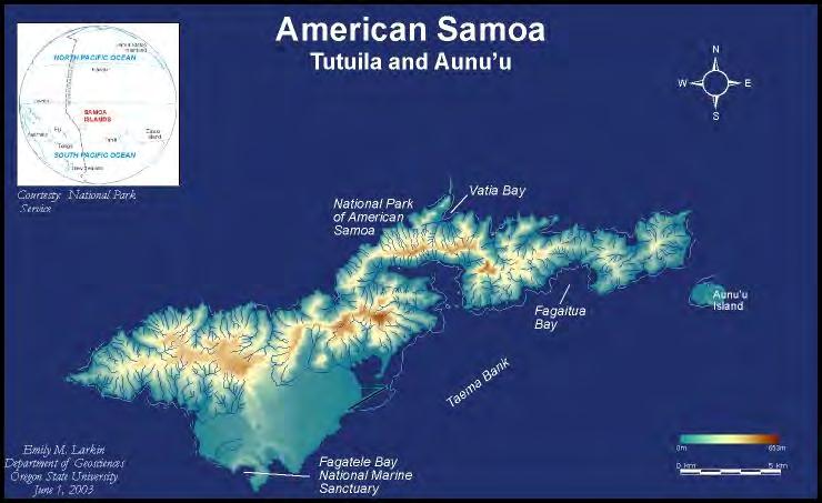
by Emily M. Larkin A THESIS Submitted to Oregon State University in partial fulfillment of the requirements for the degree of Master of Science
 Geographic Information Systems for Coral Reef Conservation, Capacity Building, and Public Education in American Samoa by Emily M. Larkin
Dr. ELIAS A., International Day for Disaster Risk Reduction, AUB - 15 Oct 2012
 3/3/14 Dr. Ata ELIAS, Geology department AUB Outline 1. Tsunami events: 2. The physical and geological tsunami event 3. Global tsunami mitigation efforts Tsunami hazard 1. The tsunami hazard in the Mediterranean
Advancing Real Time Observations and Coastal Modeling Forecasts-
 Advancing Real Time Observations and Coastal Modeling Forecasts- Moving Forward in a Changing Coastal Landscape Next Generation Navigation-Coastal Operations- Coastal and Nearshore Coastal Operational
Earthquake Hazards. Tsunami
 Earthquake Hazards Tsunami Measuring Earthquakes Two measurements that describe the power or strength of an earthquake are: Intensity a measure of the degree of earthquake shaking at a given locale based
An Arctic Perspective NCEI's Prototype Arctic Data Viewer
 An Arctic Perspective NCEI's Prototype Arctic Data Viewer NCEI Arctic Action Team Kate Rose NOAA National Environmental Satellite, Data, and Information Service National Centers for Environmental Information
Initiatives in Using Crowdsourcing, Satellite Derived Bathymetry, and Other Non-Traditional Hydrographic/Bathymetric Measurements
 University of New Hampshire University of New Hampshire Scholars' Repository Center for Coastal and Ocean Mapping Center for Coastal and Ocean Mapping 10-5-2015 Initiatives in Using Crowdsourcing, Satellite
Latitude and Longitude
 Seafloor Magnetism, Seafloor Spreading: Developing the Theory of Plate Tectonics Graphics: (top) Earth topography, (bottom) Garrison, Fig. 3.14. Earthquakes and the Dynamic Earth The Earth is not entirely
AIRBORNE LIDAR BATHYMETRY By the Japan Hydrographic and Oceanographic Department
 AIRBORNE LIDAR BATHYMETRY By the Japan Hydrographic and Oceanographic Department H. OGAWA, K. OYAKAWA, K. KAWAI, H. OZAWA, H. YAJIMA, H. SHIRANE, H. YAMANO, N. HIRATA, N. IWAMOTO, T. ONO, S. TOMIZAWA,
The Index to Marine and Lacustrine Geological Samples
 The Index to Marine and Lacustrine Geological Samples Community access to common information on sample collections Kelly J. Stroker 1, Jennifer Jencks 2 1 Cooperative Institute for Research in Environmental
ICAN Great Lakes Workshop
 Washington Coastal latlas ICAN Great Lakes Workshop September 13 15, 15 2010 Current Washington Coastal Atlas http://www.ecy.wa.gov/programs/sea/sma/atlas_home.html 1 st version of WA Coastal Atlas was
EROSIONAL RATES IN THE POINT AUX CHENES BAY AREA, MISSISSIPPI: Kathleen P. Wacker G. Alan Criss INTRODUCTION
 Summary of a Paper Presented at the: Sixtieth Annual Meeting of the Mississippi Academy of Sciences in Jackson, Mississippi February 22, 1996 ===============================================================
Magnetotelluric and Seismic Investigation of Arc Melt Generation, Delivery, and Storage beneath Okmok Volcano
 Magnetotelluric and Seismic Investigation of Arc Melt Generation, Delivery, and Storage beneath Okmok Volcano PIs Ninfa Bennington (U. Wisconsin-Madison) and Kerry Key (Scripps Institution of Oceanography)
THE USE OF GEOSPATIAL DATA TO SUPPORT VULNERABILITY MAPPING OF THE OREGON COAST. Kelvin Raiford MS Candidate Geography Department of Geosciences
 THE USE OF GEOSPATIAL DATA TO SUPPORT VULNERABILITY MAPPING OF THE OREGON COAST Kelvin Raiford MS Candidate Geography Department of Geosciences INTRODUCTION This study is an outcome of the project Geospatial
Image Services Providing Access to Scientific Data at NOAA/NCEI
 Image Services Providing Access to Scientific Data at NOAA/NCEI Jesse Varner Cooperative Institute for Research in Environmental Sciences (CIRES), University of Colorado John Cartwright NOAA National Centers
The Bottom of the Ocean
 The Bottom of the Ocean Overview: In this lesson, students study bathymetric features of the ocean, predict how bathymetric features influence propagation and runup, then analyze an animation of a tsunami
Mapping, monitoring, and modeling: USGS Coastal and Marine Geology activities along the Northeast coast
 Mapping, monitoring, and modeling: USGS Coastal and Marine Geology activities along the Northeast coast Coastal and Marine Geology Program Woods Hole Coastal and Marine Science Center St. Petersburg Coastal
University of New Hampshire Scholars' Repository
 University of New Hampshire University of New Hampshire Scholars' Repository Center for Coastal and Ocean Mapping Center for Coastal and Ocean Mapping 3-2009 Environmental Response Management Application