NOAA and the National Deep Submergence Facility DEep Submergence Science Committee Meeting NOAA 2006 Report
|
|
|
- Ira Walton
- 5 years ago
- Views:
Transcription

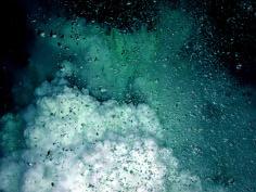
1 NOAA and the National Deep Submergence Facility DEep Submergence Science Committee Meeting NOAA 2006 Report November 9, 2006 Seattle, WA Image courtesy of the MTS 04 science team, IFE, URI/IAO
2 NOAA and the NDSF NOAA, Navy, and NSF fund the NDSF through an MOA Two NOAA programs use NDSF:
3 NOAA and the NDSF NURP Mission: To support NOAA s mission through advanced undersea research, sampling, observation, and education. For more info contact: Kimberly.Pugliese@noaa.gov OE Mission: To support NOAA and national objectives by exploring our largely unknown ocean in all its dimensions for the purpose of discovery and the advancement of knowledge. For more info contact: Reginald.Beach@noaa.gov
4 Past NOAA NDSF Funding Levels US $M Planned
 of")

5 NDSF Support in FY2006 NOAA portion (20%) of Alvin overhaul & certification costs WHOI WHOI
 Gulf of Mexico Systematic exploration of")

 Galapagos Explore a section of the")

6 Project Objectives NDSF Use in FY2006 Expedition to the Deep Slope Chuck Fisher Alvin (Atlantis) Gulf of Mexico Systematic exploration of hydrocarbon seep Communities deeper than 1000m Image courtesy of AquaPix, Ian MacDonald, Expedition to the Deep Slope Project Objectives GalAPAGoS Expedition Rachel M. Haymon DSL-120 and Medea (Thompson) Galapagos Explore a section of the Galapagos Spreading Center located above the mantle plume Image courtesy of the Expedition to the Deep Slope Image courtesy of UCSB, Univ. S. Carolina, NOAA, WHOI Image courtesy of UCSB, Univ. S. Carolina, NOAA, WHOI
 Western Pacific Conduct intensive")

7 NDSF Use in FY2006 Project Objective Submarine Ring of Fire Bob Embley Jason (Melville) Western Pacific Conduct intensive explorations, mapping and sampling at 6 to 8 sites Image courtesy of Submarine Ring of Fire 2006 Exploration, NOAA Vents Program Image courtesy of Submarine Ring of Fire 2006 Exploration, NOAA Vents Program Image courtesy of Submarine Ring of Fire 2006 Exploration, NOAA Vents Program
 Gulf of Mexico Cold water seep larval dispersal Project Davidson Seamount")

8 Other Deep Assets Used in FY2006 Project Objective Artificial Seep Experiment Bob Carney Johnson Sea-Link (Seward Johnson) Gulf of Mexico Cold water seep larval dispersal Project Davidson Seamount Andrew DeVogelaere Image courtesy of NOAA/MBARI Objective Tiburon (Western Flyer) Davidson Seamount Explore deep coral habitats around one of the largest seamounts in Western US Image courtesy of NOAA/MBARI
 Olympic Coast NMS Exploration, mapping and")


9 Other Deep Assets Used in FY2006 Project Objective Olympic Coast Deep Corals Ed Bowlby Ropos (McArthur II) Olympic Coast NMS Exploration, mapping and investigation of deep sea corals, sponges and associated fauna Image courtesy of NOAA OCNMS Project Objective Deep Water Shipwreck Hi-res Mapping Brendan Foley SeaBED, Thetis (Aegaeo) Greek National Waters Locate, map, and assess ancient shipwrecks and active geologic and chemical features at three areas in Greece s deep-sea basins Image courtesy of NOAA OCNMS Image courtesy of Kostas Katsaros, HCMR Image courtesy of Richard Camilli, Project PHAEDRA 2006, WHOI, HCMR, Thera Foundation, NOAA
 Image")
 Graduate School of Oceanography (GSO), and the URI Institute for")
10 Other Deep Assets Used in FY2006 Project Objective Southern Mid-Atlantic Ridge Exploration Chris German ABE, Quest (Meteor) Southern Mid-Atlantic Ridge Understand biogeography and biodiversity of chemosynthetic ecosystems at 4 vent-fields Project Unexplored regions of the Aegean, Black, and Eastern Mediterranean Seas Robert Ballard Argus, Hercules (Endeavor) Image courtesy of URI/IFE Aegean, Black, & Eastern Mediterranean Seas Image courtesy of URI/IFE Objective Search for well-preserved archaeological sites and investigate complex undersea terrains where discovery potential is high Image courtesy of the Institute for Exploration, the University of Rhode Island (URI) Graduate School of Oceanography (GSO), and the URI Institute for Archaeological Oceanography


11 Other Deep Assets Used in FY2006 KOK & NURP Submersibles Pisces IV and V - 60 Dive Days in the Hawaiian Archipelago Autonomous Underwater Vehicle Eagle Ray - Sea Trials Max. Depth = 2,200 m Capabilities: -High Resolution Multibeam -Conductivity/Temperature -Expandable Science Payload
12 Ocean Exploration and Research Budgets in FY NURP ? OE ? Combined ? 1 Red number indicates budget change from previous year in $Millions
13 NOAA Deep Submergence Facility Planned Use in FY2007 Project Objective Expedition to the Deep Slope Chuck Fisher Jason (Ron Brown) Gulf of Mexico Systematic exploration of hydrocarbon seep communities deeper than 1000m


14 Other opportunities NURP Grant/ Proposal Process OE Grant/ Proposal Process For more info contact: For more info contact:

15 NOAA Ship Okeanos Explorer
16 NOAA Ship Okeanos Explorer T-AGOS Vessel Acquired from Navy in 2004 Undergoing Conversion at Todd Pacific Shipyard in Seattle Phased Conversion Process: Phase I: Major vessel infrastructure modifications and select mission systems (Oct 06-Jul 07) Phase II: Most science/mission systems (Sep 07 Apr 08) Phase III: Additional science/mission systems, auxiliary vessel systems (TBD) Planned operations Spring 2008


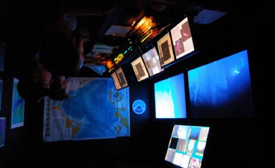
17 Capabilities: Mapping ROV Telepresence NOAA Ship Okeanos Explorer Image courtesy of URI/IFE Kongsberg EM302 Image courtesy of URI/IFE Image courtesy of URI/IFE


18 NOAA Ship Okeanos Explorer Dry Dock 1: October 6, 2006
19 Thank you. Craig W. Russell, MMA NOAA Office of Ocean Exploration th Ave SW Seattle, WA for Barbara Moore, Director NOAA National Undersea Research Program 1315 East-West Hwy Silver Spring, MD & Stephen R. Hammond, Acting Director NOAA Office of Ocean Exploration 1315 East-West Hwy Silver Spring, MD
SW Florida Escarpment Mapping Area
 Overview NOAA s Okeanos Explorer (EX) Program plans to conduct systematic mapping and telepresence-enabled ROV explorations in the Gulf of Mexico during Spring 2014. In 2011, the EX conducted mapping operations
Underwater platforms and photographic techniques
 Underwater platforms and photographic techniques Underwater platforms Robotic vehicles are in use for seafloor surveys aleady since the late 1960's s in deep water archaeology. Submersible technology (human
Multibeam Mapping of Feature Rich Seafloor in the U.S. Pacific Remote Islands Marine National Monument and on Mendocino Ridge off the California Coast
 University of New Hampshire University of New Hampshire Scholars' Repository Center for Coastal and Ocean Mapping Center for Coastal and Ocean Mapping 3-2015 Multibeam Mapping of Feature Rich Seafloor
Data archiving and dissemination, sample information, scientists ashore, and multibeam bathymetric collection and data processing (Raineault) 10
 10") Cover: Seafloor image (~0.5 m across) of a methane hydrate shelf above bubble streams discovered on dive H1517 at Astoria Canyon on the southern canyon floor, 850 m depth. 3d background image of Astoria
Cover: Seafloor image (~0.5 m across) of a methane hydrate shelf above bubble streams discovered on dive H1517 at Astoria Canyon on the southern canyon floor, 850 m depth. 3d background image of Astoria
General Oceanography Geology 105 Expedition 14 Dive & Discover Explorations of the Seafloor See Due Date in Greensheet or in Module Area of Canvas
 General Oceanography Name Geology 105 Expedition 14 Dive & Discover Explorations of the Seafloor See Due Date in Greensheet or in Module Area of Canvas Expedition Objective: In this expedition, we will
Shape of the seafloor. Shape of the seafloor. Shape of the seafloor. Shape of the seafloor. Shape of the seafloor. Shape of the seafloor
 Multibeam echo sounders - Research vessel Scripps Institution of Oceanography R/V Roger Revelle depth Source: Scripps Institution of Oceanography http://woodshole.er.usgs.gov/project-pages/caribbean/movie1.html
Deep Submergence Science Committee A summary of Activities, Plans, Issues from Patricia Fryer, Chair
 Deep Submergence Science Committee A summary of Activities, Plans, Issues from 2003 Patricia Fryer, Chair NDSF Chief Scientist Replacement A decision was made to search outside WHOI for a replacement for
MARINE GEOLOGY & GEOGRAPHY
 MARINE GEOLOGY & GEOGRAPHY Bathymetry BATHYMETRY BATHYMETRY THE UNDERWATER EQUIVALENT TO TOPOGRAPHY THE STUDY OF WATER DEPTH A BATHYMETRIC MAP SHOWS FLOOR RELIEF OR TERRAIN AS CONTOUR LINES Bathymetry
Non-NDSF Vehicle Science Reports
 Non-NDSF Vehicle Science Reports Control Vehicle Debbie Kelley Presenter (if no SIO rep present) Control Vehicle Heavy lift capability of 1300 kg at 5000 m with sub-meter control on package placement Contact:
Small area of the ocean that is partially surrounded by land. The Ocean Basins. Three Major Oceans. Three Major Oceans. What is a SEA?
 The Ocean Basins How Deep is the Ocean? 1 2 Three Major Oceans Three Major Oceans Pacific Atlantic the shallowest ocean (3.3km average depth) Indian second shallowest ocean (3.8km average depth) Pacific
FK day Post Cruise Report
 FK190106 30-day Post Cruise Report 1. Ship name: Falkor 2. Cruise Dates - Day Departed: 1/6/2019 3. Cruise Dates - Day Returned: 1/26/2019 4. Cruise Number: FK190106 5. Departure Port: Puntarenas, Costa
MARINE GEOLOGY & GEOGRAPHY
 MARINE GEOLOGY MARINE GEOLOGY & GEOGRAPHY Marine Geology 4 LAYERS OF THE EARTH CRUST THICKNESS: VARIES BETWEEN OCEAN & CONTINENTS 5-40 KM STATE: SOLID ELEMENTS: SILICON, ALUMINUM, CALCIUM, SODIUM, POTASSIUM
Oceanography, An Invitation to Marine Science 9e Tom Garrison. Ocean Basins Cengage Learning. All Rights Reserved.
 Oceanography, An Invitation to Marine Science 9e Tom Garrison 4 Ocean Basins Key Concepts Tectonic forces shape the seabed The ocean floor is divided into continental margins and deep ocean basins The
Regional and Nearshore Bathymetry of American Samoa: Implications for Tsunami Run-Up and Public Awareness
 Regional and Nearshore Bathymetry of American Samoa: Implications for Tsunami Run-Up and Public Awareness Presentation U21D-07 2009 AGU Fall Meeting San Francisco Authors Dawn Wright Dept. of Geosciences,
Benthic Deep Ocean Zone. By: Amanda, Alyssa, Mason, and Skai
 Benthic Deep Ocean Zone By: Amanda, Alyssa, Mason, and Skai The Benthic Zone The darkest, deepest, and best part of the ocean Benthic Zone Basic Info The Benthic Zone is located at the bottom of the ocean,
NEW SEAFLOOR INSTALLATIONS REQUIRE ULTRA-HIGH RESOLUTION SURVEYS
 NEW SEAFLOOR INSTALLATIONS REQUIRE ULTRA-HIGH RESOLUTION SURVEYS Donald Hussong (Fugro Seafloor Surveys, Inc.) dhussong@fugro.com Fugro Seafloor Surveys, Inc., 1100 Dexter Avenue North (Suite 100), Seattle,
Unit 6: The Sea Floor
 Unit 6: The Sea Floor Turn to Page 62 in Introduction to the World s Oceans Study the bathymetric chart What features do you see? How do the Atlantic and Pacific Oceans differ? What do you think accounts
The Sea Floor. Chapter 2
 The Sea Floor Chapter 2 Geography of the Ocean Basins World ocean is the predominant feature on the Earth in total area Northern Hemisphere = 61% of the total area is ocean. Southern Hemisphere = about
ARE YOU READY TO THINK? Look at the first slide THINK PAIR SHARE!
 ARE YOU READY TO THINK? Look at the first slide THINK PAIR SHARE! WHAT PROMINENT FEATURE CAN YOU IDENTIFY IN THIS PICTURE? What do you think the different colors represent? Who might find such a picture
Benjamin Franklin ( )
") MARITIME HISTORY Benjamin Franklin (1706-1790) Published the 1 st map of the Gulf Stream To increase postal speed To gain advantage in war time Franklin s Gulf Stream Map 1761 John Harrison Working class
MARITIME HISTORY Benjamin Franklin (1706-1790) Published the 1 st map of the Gulf Stream To increase postal speed To gain advantage in war time Franklin s Gulf Stream Map 1761 John Harrison Working class
Organisms in the Ocean
 Oceans Objective 8.E.1.2 Summarize evidence that Earth's oceans are a reservoir of nutrients, minerals, dissolved gases, and life forms: estuaries, marine ecosystems, upwelling, and behavior of gases in
Bathymetry Measures the vertical distance from the ocean surface to mountains, valleys, plains, and other sea floor features
 1 2 3 4 5 6 7 8 9 10 11 CHAPTER 3 Marine Provinces Chapter Overview The study of bathymetry determines ocean depths and ocean floor topography. Echo sounding and satellites are efficient bathymetric tools.
Where is Ocean Engineering at URI? November 13-15, 2006 Overview of Ocean Engineering at URI
 November 13-15, 2006 Overview of Ocean Engineering at URI OCEAN ENGINEERING, UNIVERSITY OF RHODE ISLAND: AN OVERVIEW By Dr. Jim Miller Professor of Ocean Engineering Where is Ocean Engineering? What is
Chapter 02 The Sea Floor
 Chapter 02 The Sea Floor Multiple Choice Questions 1. One of the following is not one of the world's major ocean basins: A. Atlantic Ocean B. Arctic Ocean C. Indian Ocean D. Antarctic Ocean E. Pacific
East Pacific Rise. Hydrothermal vent ecology - Larval supply, colonization, and community development. Biogeography of hydrothermal vent fauna
 149 sites visually confirmed as active hydrothermal vents Hydrothermal vent ecology - Larval supply, colonization, and community development Presented by: Stace Beaulieu InterRidge Coordinator and Research
You should be able to identify a few of the key cultures, individuals and expeditions in the history of marine science:
 Ocean History You should be able to identify a few of the key cultures, individuals and expeditions in the history of marine science: Phoenicians Arabs Micronesians Polynesians Aristotle Erikson Columbus
Map shows 3 main features of ocean floor
 Map shows 3 main features of ocean floor 2017 Pearson Education, Inc. Chapter 3 Marine Provinces 2017 Pearson Education, Inc. 1 Chapter 3 Overview The study of bathymetry determines ocean depths and ocean
Chapter Overview. Bathymetry. Measuring Bathymetry. Measuring Bathymetry
 CHAPTER 3 Marine Provinces Chapter Overview The study of bathymetry determines ocean depths and ocean floor topography. Echo sounding and satellites are efficient bathymetric tools. Most ocean floor features
Full file at
 Essentials of Oceanography, 10e (Trujillo/Keller) Chapter 2 Plate Tectonics and the Ocean Floor Match the term with the appropriate phrase. You may use each answer once, more than once or not at all. A)
JOIDES Resolution Facility Board
 21-23 June, 2017 SEP 1706 MEETING Update by Anthony Koppers Slide 1 of 17 Outline 1 JOIDES Resolution Schedule FY 19-20 1A 7 New Expeditions from Jan 2019 to May 2020 Including 1 CPP Expedition (w/ US-DOE
Early Career Scientists/Student Introduction. Part II
 Early Career Scientists/Student Introduction Part II Jeffrey Marlow // 4 th year (already?) grad student // Caltech Anaerobic Methane Oxidation Endolithic Activity & Community Diversity Methane Seep Proteomics
Hydrothermal Vent Challenge
 2004 Ring of Fire Expedition Hydrothermal Vent Challenge FOCUS Chemistry of hydrothermal vents GRADE LEVEL 9-12 (Chemistry) FOCUS QUESTION What are common features of hydrothermal vent fluids, and how
Using SBSE for the study of organic compounds in submarine hydrothermal vents: from the research vessel to the lab
 Using SBSE for the study of organic compounds in submarine hydrothermal vents: from the research vessel to the lab Cécile Konn, Sophie Chataing LGM, Ifremer, Brest 2 nd SBSE technical meeting, Paris, 11&12
Impacts of Deep Sea Mining. Phil Weaver Seascape Consultants Romsey, UK
 Impacts of Deep Sea Mining Phil Weaver Seascape Consultants Romsey, UK phil.weaver@seascapeconsultants.co.uk MIN_GUIDE annual mee?ng, Brussels, 13-14 December, 2017 Three types of Deep Sea Mineral Mn-Nodules
Directed Reading. Section: The Water Planet. surface is called the a. Earth s ocean. b. Pacific Ocean. c. salt-water ocean. d. global ocean.
 Skills Worksheet Directed Reading Section: The Water Planet 1. The body of salt water covering nearly three-quarters of the Earth s surface is called the a. Earth s ocean. b. Pacific Ocean. c. salt-water
EDUCATION PROGRAMS GUIDE
 EDUCATION PROGRAMS GUIDE Inner Space Center University of Rhode Island Graduate School of Oceanography innerspacecenter.org ABOUT THE ISC The Inner Space Center (ISC) is an international leader in ocean
ATOC 5051 INTRODUCTION TO PHYSICAL OCEANOGRAPHY. Lecture 2
 ATOC 5051 INTRODUCTION TO PHYSICAL OCEANOGRAPHY Lecture 2 Ocean basins and relation to climate Learning objectives: (1)What are the similarities and differences among different ocean basins? (2) How does
Deep sea floor By. The structures and features of ocean basin are summarized in Fig. 1. Ocean basin
 Deep sea floor By Sufia Zaman 1, Tanmay Ray Chaudhuri 2, Prosenjit Pramanick 2 and Abhijit Mitra 1 1 Department of Marine Science, University of Calcutta, 35, B. C. Road, Kolkata-700 019, India. 2 Department
USU 1360 TECTONICS / PROCESSES
 USU 1360 TECTONICS / PROCESSES Observe the world map and each enlargement Pacific Northwest Tibet South America Japan 03.00.a1 South Atlantic Arabian Peninsula Observe features near the Pacific Northwest
Earth s Continents and Seafloors. GEOL100 Physical Geology Ray Rector - Instructor
 Earth s Continents and Seafloors GEOL100 Physical Geology Ray Rector - Instructor OCEAN BASINS and CONTINENTAL PLATFORMS Key Concepts I. Earth s rocky surface covered by of two types of crust Dense, thin,
Geologic Evolution of Latin America. Plate Tectonics: General Concepts & Applications to Latin America
 Geologic Evolution of Latin America Plate Tectonics: General Concepts & Applications to Latin America Structure of Earth: 3 major divisions of Core, Mantle, and Crust Upper mantle differs in the way that
Geography of the world s oceans and major current systems. Lecture 2
 Geography of the world s oceans and major current systems Lecture 2 WHY is the GEOMORPHOLOGY OF THE OCEAN FLOOR important? (in the context of Oceanography) WHY is the GEOMORPHOLOGY OF THE OCEAN FLOOR important?
The Major Ocean Basins and Their Features
 Where Submarines Lurk Recent satellite studies and deep-sea mapping programs have revealed in dramatic fashion that the ocean floor is not flat. Indeed, the terrain of the ocean floor surpasses that of
UNOLS DeSSC Meeting December 14, 2014 DeSSC New-Users Program Introductions Part 2
 University-National Oceanographic Laboratory System ~UNOLS ~ Deep Submergence Science Committee Meeting UNOLS DeSSC Meeting December 14, 2014 DeSSC New-Users Program Introductions Part 2 AIDA FAROUGH Looking
Chapter Overview. Evidence for Continental Drift. Plate Tectonics. Evidence for Continental Drift. Evidence for Continental Drift 9/28/2010
 Chapter Overview CHAPTER 2 Plate Tectonics and the Ocean Floor Much evidence supports plate tectonics theory. Different plate boundaries have different features. Tectonic plates continue to move today.
Understanding The Seafloor. Dr. Frank R. Hall. Resources for pictures, etc. used in this presentation
 Slide 1 Understanding The Seafloor Dr. Frank R. Hall Geological Oceanographer University of New Orleans New Orleans, LA 2003 This is a presentation prepared in the Summer 2003 for the Gulf Coast COSSEE
OSU Ocean Observing Center
 OSU Ocean Observing Center and The Ocean Observatories Initiative OSU Retirement Association March 10,19 2016 2 Early Ocean Observations OSU Retirement Association March 10,19 2016 3 No information off
NOAA Seafloor Mapping in the Pacific Islands Region
 NOAA Seafloor Mapping in the Pacific Islands Region NOAA Coral Reef Ecosystem Division Pacific Island Fisheries Science Center Mission Statement Conduct research that provides scientific information and
Earth Planet Water. Earth 71% Formation of Water on Planet. Nearly ¾ of Earth s surface is covered by liquid water More covered by solid water
 Earth Planet Water 71% Nearly ¾ of Earth s surface is covered by liquid water More covered by solid water Where is it from? Formation of Water on Planet Earth Combination of volcanic activity and strong
OCN 201 Mantle plumes and hot spots
 OCN 201 Mantle plumes and hot spots Question Long-term (>50 million years) changes in sea level are caused by: A. Changes in the volume of water in the ocean B. Changes in the volume of the ocean basins
Crustal Boundaries. As they move across the asthenosphere and form plate boundaries they interact in various ways. Convergent Transform Divergent
 Name: Date: Period: Plate Tectonics The Physical Setting: Earth Science CLASS NOTES Tectonic plates are constantly moving and interacting As they move across the asthenosphere and form plate boundaries
An Atlas of Oceanic Internal Solitary Waves (February 2004) by Global Ocean Associates Prepared for Office of Naval Research Code 322 PO
 by Global Ocean Associates Prepared for Office of Naval Research Code 322 PO") Overview is located in the western Equatorial Pacific Ocean. The Island is immediately north of Queensland Australia and adjacent to the Bismark Archipelago. (Figure 1). The region is influenced by the
Overview is located in the western Equatorial Pacific Ocean. The Island is immediately north of Queensland Australia and adjacent to the Bismark Archipelago. (Figure 1). The region is influenced by the
Earth / Environmental Science. Ch. 14 THE OCEAN FLOOR
 Earth / Environmental Science Ch. 14 THE OCEAN FLOOR The Blue Planet Nearly 70% of the Earth s surface is covered by the global ocean It was not until the 1800s that the ocean became an important focus
Deepwater Horizon Gulf of Mexico Oil Spill NSF Rapid Response Research
 Deepwater Horizon Gulf of Mexico Oil Spill NSF Rapid Response Research Presentation to the Ocean Leadership 2011 Public Policy Forum Consortium for Ocean Leadership Dr. David Conover National Science Foundation
4) Treyson Gillespie and Dr. Leslie Sautter Bathymetric Analysis of Glaciokarstic Limestone Substrate on the Western Irish Coast
 Treyson Gillespie and Dr. Leslie Sautter Bathymetric Analysis of Glaciokarstic Limestone Substrate on the Western Irish Coast") 2017 US Hydro Conference Academic Poster Abstracts by College of Charleston BEAMS Program students 1) Evalynn Barbare and Dr. Leslie Sautter Using Multibeam Sonar to Identify Potential Deep Sea Coral Habitat
2017 US Hydro Conference Academic Poster Abstracts by College of Charleston BEAMS Program students 1) Evalynn Barbare and Dr. Leslie Sautter Using Multibeam Sonar to Identify Potential Deep Sea Coral Habitat
Science --- San Francisco Chronicle
 Science --- San Francisco Chronicle 8-1-2013 Google's voyage to bottom of the sea's dead zone Google executive Schmidt backs ship's scientific expeditions Jason Henry, Special To The Chronicle Research
LAST NAME: FIRST NAME: LAS POSITAS COLLEGE OCEANOGRAPHY LAB LAB 6 PLATE TECTONICS
 LAST NAME: FIRST NAME: LAS POSITAS COLLEGE OCEANOGRAPHY LAB LAB 6 PLATE TECTONICS (Modified from Exercise 4, Sea Floor Spreading and Plate Tectonics, Laboratory Exercises in Oceanography, Bernard W. Pipkin
Chapter 2 Plate Tectonics and the Ocean Floor
 Chapter 2 Plate Tectonics and the Ocean Floor Chapter Overview Much evidence supports plate tectonics theory. The plate tectonics model describes features and processes on Earth. Plate tectonic science
Introduction to Oceanography. Chapter 2: Plate Tectonics Overview
 Introduction to Oceanography Chapter 2: Plate Tectonics Overview Much evidence supports plate tectonics theory. The plate tectonics model describes features and processes on Earth. Plate tectonic science
OCEANOGRAPHY MEASURING THE DEPTHS OF THE OCEANS
 Water 2 page 1 OCEANOGRAPHY Name If all the water was drained from the ocean basins, what kind of surface would be revealed? It would not be the quiet, subdued topography as was once thought, but a surface
Seafloor Spreading and Paleomagnetism Activity
 Name: PART A: Ocean Bottom Profile Background: Seafloor spreading is the hypothesis that the sea floor moves sideways away from the crest of the mid- ocean ridge. It is estimated that 20 volcanic eruptions
Are seafloor hydrothermal sulphides deposits valuable mineral resources? Bramley J Murton
 Are seafloor hydrothermal sulphides deposits valuable mineral resources? Bramley J Murton Outline Why do we need new sources of metals? What are seafloor mineral deposits Where do they occur and why: Why
discussion of North America s physical features, including its landforms and bodies of
 Chapter 7 Natural Environments of North America Chapter 7 focuses on the natural environments of North America. The chapter opens with a discussion of North America s physical features, including its landforms
Chapter 2 Plate Tectonics and the Ocean Floor
 Chapter 2 Plate Tectonics and the Ocean Floor Matching. Match the term or person with the appropriate phrase. You may use each answer once, more than once or not at all. 1. hydrothermal vents A. convergent
GEOSCIENCE 105 THE DYNAMIC EARTH FIRST ONE-HOUR EXAMINATION. Tuesday, October 20, 1998 NAME STUDENT #
 GEOSCIENCE 105 THE DYNAMIC EARTH FIRST ONE-HOUR EXAMINATION Tuesday, October 20, 1998 NAME STUDENT # Instructions: 1. Answer all questions legibly. 2. Put your name and student number on this front page.
Chapter Nineteen: Changing Earth
 Chapter Nineteen: Changing Earth 19.1 Inside Earth 19.2 Plate Tectonics 19.3 Plate Boundaries 19.4 Metamorphic Rocks 19.2 Learning Goals Discuss hypotheses which ultimately led to plate tectonics theory.
A) B) C) D) 4. Which diagram below best represents the pattern of magnetic orientation in the seafloor on the west (left) side of the ocean ridge?
 B) C) D) 4. Which diagram below best represents the pattern of magnetic orientation in the seafloor on the west (left) side of the ocean ridge?") 1. Crustal formation, which may cause the widening of an ocean, is most likely occurring at the boundary between the A) African Plate and the Eurasian Plate B) Pacific Plate and the Philippine Plate C)
1. Crustal formation, which may cause the widening of an ocean, is most likely occurring at the boundary between the A) African Plate and the Eurasian Plate B) Pacific Plate and the Philippine Plate C)
U.S. Coast Guard Polar Icebreaker Program
 U.S. Coast Guard Polar Icebreaker Program November 2003 USCG Polar Icebreaker Program Update USCG Polar Ice OPs Program History 1885 Cutter Bear explores Alaskan waters for 40 years 1965-66 1950 s Joint
Atmospheric Radiation Measurement Climate Research Facility Teacher s Lounge: Resources for Teachers
 Lesson Summary Students will graph past sea level data obtained from the dating of coral reefs off Papua New Guinea and discuss the implications of changing sea levels. Prior Knowledge & Skills Graphing
Plate Tectonic Vocabulary Chapter 10 Pages
 Name: Period: Plate Tectonic Vocabulary Chapter 10 Pages 239-260 Vocabulary Word What is this? What are some examples? What does it look like? (draw a picture or diagram) Continental drift Mid-ocean ridge
Essentials of Oceanography Eleventh Edition
 Chapter Chapter 1 2 Clickers Lecture Essentials of Oceanography Eleventh Edition Plate Tectonics and the Ocean Floor Alan P. Trujillo Harold V. Thurman Chapter Overview Much evidence supports plate tectonics
Plate Tectonics GEOL 101 Lecture 22 How Are Mountains Built?
 Plate Tectonics GEOL 101 Lecture 22 How Are Mountains Built? The Grand Tetons, Wyoming First a Brief Review of Sea Floor Spreading Prop: Test 3 Invitations Break-Up of a Continent and Origin of an Ocean
Realizing the Dreams of da Vinci and Verne A diverse fleet of innovative deep-submergence vehicles heralds a new era of ocean exploration
 http://oceanusmag.whoi.edu/v42n2/fornari.html Emerging Technology Realizing the Dreams of da Vinci and Verne A diverse fleet of innovative deep-submergence vehicles heralds a new era of ocean exploration
Ocean Observatories Initiative
 Ocean Observatories Initiative Pioneer Array Micro-Siting Process Meeting URI Coastal Institute November 15, 2010 Jean McGovern, NSF Al Plueddemann, WHOI Action Items from 5 Oct Meeting NSF will address
UNIT SIX: Earth s Structure. Chapter 18 Earth s History and Rocks Chapter 19 Changing Earth Chapter 20 Earthquakes and Volcanoes
 UNIT SIX: Earth s Structure Chapter 18 Earth s History and Rocks Chapter 19 Changing Earth Chapter 20 Earthquakes and Volcanoes Chapter Nineteen: Changing Earth 19.1 Inside Earth 19.2 Plate Tectonics
Sir Francis Bacon, 1620, noted that the continental coasts on opposites sides of the Atlantic fit together like puzzle pieces.
 Plate Tectonics Sir Francis Bacon, 1620, noted that the continental coasts on opposites sides of the Atlantic fit together like puzzle pieces. Could North and South America once have been joined to Europe
Marine Spatial Planning: A Tool for Implementing Ecosystem-Based Management
 Marine Spatial Planning: A Tool for Implementing Ecosystem-Based Management Steven Murawski, Ph.D., Ecosystem Goal Team Lead National Oceanic and Atmospheric Administration NOAA November 16, 2009 1 To
Ocean Basins, Bathymetry and Sea Levels
 Ocean Basins, Bathymetry and Sea Levels Chapter 4 Please read chapter 5: sediments for next class and start chapter 6 on seawater for Thursday Basic concepts in Chapter 4 Bathymetry the measurement of
OCN 201 Physiography of the Seafloor
 OCN 201 Physiography of the Seafloor Hypsometric Curve for Earth s solid surface Note histogram Hypsometric curve of Earth shows two modes. Hypsometric curve of Venus shows only one! Why? Ocean Depth vs.
Protecting the ocean s final frontiers the high seas and deep ocean. Callum Roberts University of York
 Protecting the ocean s final frontiers the high seas and deep ocean Callum Roberts University of York The high seas = 61% of the oceans and 43% of the surface of the Earth Courtesy of NASA Goddard Space
National Marine Sanctuary Program
 National Marine Sanctuary Program NMSP/USGS Joint Seabed Mapping Initiative: September 2004 AA National Ocean Service National Marine Sanctuaries Interim Report September 2004 Background: Since 2002,
The surface of the ocean floor is as varied as the land. The five major oceans, from largest to smallest, are
 11.1 Ocean Basins The surface of the ocean floor is as varied as the land. The five major oceans, from largest to smallest, are w the Pacific w the Atlantic w the Indian w the Southern w the Arctic The
Managing Impacts of Deep-seA resource exploitation - the MIDAS project. Phil Weaver Seascape Consultants Romsey, UK
 Managing Impacts of Deep-seA resource exploitation - the MIDAS project Phil Weaver Seascape Consultants Romsey, UK Seas at Risk workshop, Brussels 5 th November 2014 Total number of ISA Contractors Number
The Moving Story of Plate Tectonics
 08 January 2012 MP3 at voaspecialenglish.com The Moving Story of Plate Tectonics AP Smoke and ash from Italy's Mount Etna volcano last week FAITH LAPIDUS: This is SCIENCE IN THE NEWS in VOA Special English.
2004 Jason II and DSL-120 science programs
 2004 Jason II and DSL-120 science programs Pockalny/Larson 8 Jan 9 Feb Rob Pockalny Presenter Deep Endeavors - Pockalny, Larson & Natland TN165 R/V Thomas G. Thompson Easter Island to Easter Island (2004/01/09-2004/02/16)
The Puzzling Plates Part I. Follow the steps below while taking notes in your science notebook.
 Procedure Follow the steps below while taking notes in your science notebook. 1. On the table is a pile of cardboard puzzle pieces. Work with your team to assemble the puzzle. The edges of the completed
Plate Tectonics: A Unifying Theory
 Plate Tectonics: A Unifying Theory What is Plate Tectonics? - 7 large tectonic plates and many smaller ones that break up the lithosphere - Plates are brittle and float on asthenosphere and glide past
General Oceanography Geology 105 Expedition 10 - Whole Lotta Shakin' Goin' On
 General Oceanography Geology 105 Expedition 10 - Whole Lotta Shakin' Goin' On Name Not attempting to answer questions on expeditions will result in point deductions on course workbook (two or more blank
OS 1 The Oceans Fall 2007
 Name: Plate Tectonics (you must turn Activities 1-2 in during Section) Activity 1: Plate Boundaries A plate boundary simply describes where two plates (either oceanic or continental material) meet. There
6. In the diagram below, letters A and B represent locations near the edge of a continent.
 1. Base your answer to the following question on the cross section below and on your knowledge of Earth science. The cross section represents the distance and age of ocean-floor bedrock found on both sides
1. Name at least one place that the mid-atlantic Ridge is exposed above sea level.
 Interpreting Tectonic and Bathymetric Maps. The purpose of this lab is to provide experience interpreting the bathymetry of the seafloor in terms of tectonic and geologic settings and processes. Use the
3. PLATE TECTONICS LAST NAME (ALL IN CAPS): FIRST NAME: PLATES
: FIRST NAME: PLATES") LAST NAME (ALL IN CAPS): FIRST NAME: PLATES 3. PLATE TECTONICS The outer layers of the Earth are divided into the lithosphere and asthenosphere. The division is based on differences in mechanical properties
LAST NAME (ALL IN CAPS): FIRST NAME: PLATES 3. PLATE TECTONICS The outer layers of the Earth are divided into the lithosphere and asthenosphere. The division is based on differences in mechanical properties
Oceanography is the scientific study of oceans Oceans make up over 70% of the Earth s surface
 Oceanography Oceanography is the scientific study of oceans Oceans make up over 70% of the Earth s surface An ocean must be large and have features which set it apart from other oceans (currents, water
1.2 DEVELOPMENT OF THE NWS PROBABILISTIC EXTRA-TROPICAL STORM SURGE MODEL AND POST PROCESSING METHODOLOGY
 1.2 DEVELOPMENT OF THE NWS PROBABILISTIC EXTRA-TROPICAL STORM SURGE MODEL AND POST PROCESSING METHODOLOGY Huiqing Liu 1 and Arthur Taylor 2* 1. Ace Info Solutions, Reston, VA 2. NOAA / NWS / Science and
MAR110 LECTURE #6 West Coast Earthquakes & Hot Spots
 17 September 2007 Lecture 6 West Coast Earthquakes & Hot Spots 1 MAR110 LECTURE #6 West Coast Earthquakes & Hot Spots Figure 6.1 Plate Formation & Subduction Destruction The formation of the ocean crust
Alfred Wegener gave us Continental Drift. Fifty years later...
 CHAPTER 2 Plate Tectonics and the Ocean Floor Plate Tectonics: summary in haiku form Alfred Wegener gave us Continental Drift. Fifty years later... Words Chapter Overview Much evidence supports plate tectonics
The United States & Canada. A Regional Study of Anglo America
 A Regional Study of Anglo America Landform Regions of the United States & Canada world leaders in agricultural and industrial production because of... VAST LANDS stretch from the Atlantic Ocean on the
Studying the Ocean Using Live Data
 Studying the Ocean Using Live Data Overview The Argo buoy project is a major oceanographic study that harnesses the power of automated unmanned buoys traveling the world s oceans (http://www.argo.ucsd.edu/).
NOAA/University of New Hampshire Joint Hydrographic Center & Center for Coastal and Ocean Mapping. MAPPS Summer Conference July 23, 2013
 NOAA/University of New Hampshire Joint Hydrographic Center & Center for Coastal and Ocean Mapping MAPPS Summer Conference July 23, 2013 07/23/2013 2 07/23/2013 3 Center Goals To be a world leader in the
Charleston to Woods Hole R/V Armstrong Transit: Atlantic Margin Upper Slope Fluid Flow Features, Seafloor and Water Column Surveys
 Charleston to Woods Hole R/V Armstrong Transit: Atlantic Margin Upper Slope Fluid Flow Features, Seafloor and Water Column Surveys Contacts: Carolyn Ruppel (US Geological Survey, cruppel@usgs.gov, 508-457-2339)