Emergent Geospatial Data & Measurement Issues
|
|
|
- Scot Reynolds
- 5 years ago
- Views:
Transcription

1 CUNY Institute for Demographic Research Emergent Geospatial Data & Measurement Issues Deborah Balk CUNY Institute for Demographic Research (CIDR) & School of Public Affairs, Baruch College City University of New York Comments prepared for Future Directions in Spatial Demography Santa Barbara, CA December 2011
2 Where have we come from? & where are we going to?
3 Transformation from tables to maps In little more than a decade, demographers have gone from a rather tabular view of the world to a spatial one Spatial data have become seemingly abundant Spatial demography is not population geography The former is typically based in the study of individual or population-level rather than the study of place. These different traditions have lead to different data and methodological requirements. Even as Demography has become more spatial it remains quite distinct from population geography
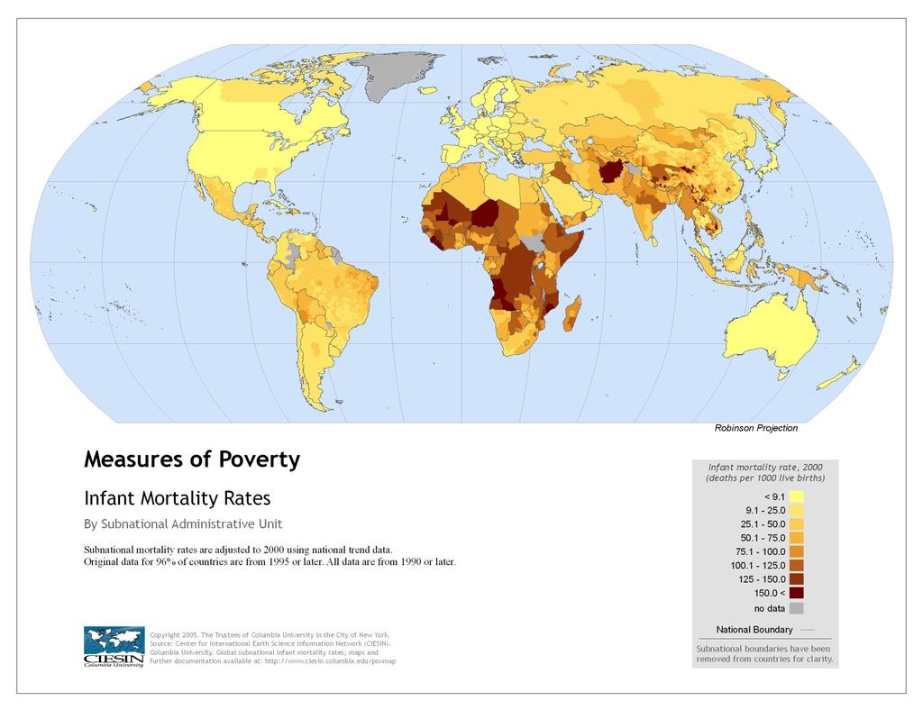
4 IMR Afghanistan 168 Australia 5 Brazil 33 Cambodia 97 Cameroon 95 China 30 Zimbabwe 78
5

6 Survey cluster locations Balk et al, 2004

7 Classify demographic rates by spatial features Infant and child survival by distance to city of 50K persons or more Or by length of growing season
8 We now expect Micro-data Publicly available Some information about respondents location Survey cluster and/or Corresponding spatial boundaries Restricted data Full access to micro data though level of address matching varies Aggregated data Increasingly fine resolution census (or other administrative) units Basic population grids that are constructed with demographically rigorous methodologies
9 New and (Re-emergent) Data & Methods On what topics?
10 Demographic inquiry that require spatial data What are the dominant demographic issues of the 21 st century? Migration Urbanization Aging Changing family and household structures that arise from these many demographic shifts Migration and urbanization are intrinsically spatial phenomena Associated characteristics Vulnerabilities (including age and sex) Inequality Spatial inequality is often one aspect
11 Emergent data And under utilized data
12 Cell phones Useful for measuring mobility, if not migration, and population distribution Concerns: Analytical: how to use these data meaningfully? Look at how daily temp and precip data for clues Ethical: Privacy concerns would need to be addressed But there are precedent for this Computational: Volume of data are very large Practical: Data ownership and stewardship

13 Night-time lights time series Urban Spatial Change Compare change over time, annual data from1992/3 Red = 1992 Blue = 2009 Before using Annual data available Needs careful vetting Method to calibrate between years and reduce blooming
14 New Methods Primarily for data integration (or for creating new data)
15 Make better use of existing data Remote sensing data is underutilized by demographers Main exception to this is subfield of pop & environment where moderate and high resolution satellite data have been coupled with household survey data, typically For example, the night-time lights: Recent study uses night-time lights brightness to indicate seasonal migration and population density changes to predict measles outbreaks in Niger (see next slide, by Nita Bharti et al. Science, 2011)

16 Bharti et al. 2001
17 Urban change over time This is really low hanging fruit Requires satellites Night-time lights time series Landsat or higher resolution place-specific comparison SRTM Would be great to have finely resolved census data to correspond (closely) with satellite views but this is not a prerequisite Though some way to add names and population characteristics is essential

18 Urban Spatial Change: Landsat Sheppard et al, 2008

19 Urban Spatial Change: SRTM Kilometers Scatterometer - Average High : Scatterometer - Standard Deviation High : Low : Low :

20 Urban Spatial Change: Phoenix Kilometers Population Density 2000 Scatterometer - Average High : Low : ,000 1, ,500 2, ,000 More than 5,000 Ngheim et al., 2009
21 Create better spatial aggregates Combine census with survey data Poverty Maps Some have used this method for demographic rates Average Daily Consumption By Administrative Level South Africa 1 Average Daily Consumption (PPP) Muniz et al, Graphs by country Average Daily Consumption (PPP) 60
 Percent of ward-level")
 Tatem et")
22 Create better population grids: Age-sex specific+ Mapping the denominator Malaria transmission classes (a) Percent of ward-level population under age five (b) Ward-level misestimation that would result from use of national-level age distribution (c) Tatem et al, 2011
23 Quantify spatial uncertainty The more we mix and match data sets of differing underlying resolutions, the more we will need to quantify the uncertainty of resultant data products This will require some additional methodological work Greater transparency on how integrated data products are produced is an important first step Spatial metadata are necessary but insufficient for downstream use. Traditional codebooks that accompany data tables are also necessary Along with clear descriptions of integration
24 Create flexible spatial aggregates of census micro-data Census micro-data availability Fairly coarse admin units In the US & Canada, in enclaves (RDC) Fee-for use tabulations to census (at least, in USA) Greater flexibility in creating summaries by userspecific-aggregates For example, demographic characteristics (beyond what is available in block-level data) of flood plains or narrow coastal zones Confidentiality issues: Enclaves or on-line? Technological solutions More common protocols across countries statistical offices
25 Consider new study designs and sample frames Except for some exemplary place-based work, we are largely retrofitting yesteryears study designs to meet our current needs Do we need to rethinking our sampling frames? If we are interested in sorting our results by various ecological units, why not treat ecological characteristics like other strata? Geographic data, especially RS data, can be helpful in constructing sampling frames Detection of slums Emergence of new cities, town, or temporary dwelling (refugee camps)
26 Conclusions Challenges?
27 Conclusion and a caution Do more with what we have Embrace new data and methods Embrace google Earth Spatial data awareness and interest is much greater than in the past. Double edge sword: Much investment and education is still needed to use these data rigorously

28 A cautionary note Non-demographers often want demographic data If there is not high engagement from the spatial demographic community, non-demographers will create it anyway, often inadequately One way to avoid this is through interdisciplinary collaboration McDonald et al., 2011 (PNAS)
What s new (or not so new) in Population and Poverty Data Initiatives
 in Population and Poverty Data Initiatives") What s new (or not so new) in Population and Poverty Data Initiatives Deborah Balk Global Spatial Data and Information User Workshop 21 September 2004 Evolution in global collection of population and poverty
What s new (or not so new) in Population and Poverty Data Initiatives Deborah Balk Global Spatial Data and Information User Workshop 21 September 2004 Evolution in global collection of population and poverty
Gridded Population of the World Version 4 (GPWv4)
") Gridded Population of the World Version 4 (GPWv4) Greg Yetman Chris Small Erin Doxsey-Whitfield Kytt MacManus May 28, 2015 Global Urbanization Workshop http://sedac.ciesin.columbia.edu 1 Focus on applying
Gridded Population of the World Version 4 (GPWv4) Greg Yetman Chris Small Erin Doxsey-Whitfield Kytt MacManus May 28, 2015 Global Urbanization Workshop http://sedac.ciesin.columbia.edu 1 Focus on applying
Space-adjusting Technologies and the Social Ecologies of Place
 Space-adjusting Technologies and the Social Ecologies of Place Donald G. Janelle University of California, Santa Barbara Reflections on Geographic Information Science Session in Honor of Michael Goodchild
Medical GIS: New Uses of Mapping Technology in Public Health. Peter Hayward, PhD Department of Geography SUNY College at Oneonta
 Medical GIS: New Uses of Mapping Technology in Public Health Peter Hayward, PhD Department of Geography SUNY College at Oneonta Invited research seminar presentation at Bassett Healthcare. Cooperstown,
Geographic Data and Privacy
 Geographic Data and Privacy June 5, 2006 Stephen A. Matthews Associate Professor of Sociology & Anthropology, Geography and Demography Director of the Geographic Information Analysis Core Population Research
Geographical knowledge and understanding scope and sequence: Foundation to Year 10
 Geographical knowledge and understanding scope and sequence: Foundation to Year 10 Foundation Year 1 Year 2 Year 3 Year 4 Year 5 Year 6 Year level focus People live in places Places have distinctive features
Understanding China Census Data with GIS By Shuming Bao and Susan Haynie China Data Center, University of Michigan
 Understanding China Census Data with GIS By Shuming Bao and Susan Haynie China Data Center, University of Michigan The Census data for China provides comprehensive demographic and business information
Constructing Global-Scale Spatial Population Scenarios. Bryan Jones, CGD-IAM, NCAR Boulder, CO August 19, 2013
 Constructing Global-Scale Spatial Population Scenarios Bryan Jones, CGD-IAM, NCAR Boulder, CO August 19, 2013 NCAR Community Demographic Model (CDM) Urbanization Projection (National) Household Projection
Preparing the GEOGRAPHY for the 2011 Population Census of South Africa
 Preparing the GEOGRAPHY for the 2011 Population Census of South Africa Sharthi Laldaparsad Statistics South Africa; E-mail: sharthil@statssa.gov.za Abstract: Statistics South Africa (Stats SA) s Geography
DATA DISAGGREGATION BY GEOGRAPHIC
 PROGRAM CYCLE ADS 201 Additional Help DATA DISAGGREGATION BY GEOGRAPHIC LOCATION Introduction This document provides supplemental guidance to ADS 201.3.5.7.G Indicator Disaggregation, and discusses concepts
Lessons Learned from the production of Gridded Population of the World Version 4 (GPW4) Columbia University, CIESIN, USA EFGS October 2014
 Columbia University, CIESIN, USA EFGS October 2014") Lessons Learned from the production of Gridded Population of the World Version 4 (GPW4) Columbia University, CIESIN, USA EFGS October 2014 Gridded Population of the World Gridded (raster) data product
Lessons Learned from the production of Gridded Population of the World Version 4 (GPW4) Columbia University, CIESIN, USA EFGS October 2014 Gridded Population of the World Gridded (raster) data product
Indicator: Proportion of the rural population who live within 2 km of an all-season road
 Goal: 9 Build resilient infrastructure, promote inclusive and sustainable industrialization and foster innovation Target: 9.1 Develop quality, reliable, sustainable and resilient infrastructure, including
Topic 4: Changing cities
 Topic 4: Changing cities Overview of urban patterns and processes 4.1 Urbanisation is a global process a. Contrasting trends in urbanisation over the last 50 years in different parts of the world (developed,
Rules of the territorial division
 Rules of the territorial division Janusz Dygaszewicz Central Statistical Office of Poland Jerusalem, 4-7 December 2016 Rules of territory division (the Polish case) The area of each unit of territorial
Deborah Balk 1,2 Gordon McGranahan 3 Bridget Anderson 2
 Preference and Risks of Coastal Population Distribution: A systematic assessment of population and land area in urban and rural areas of coastal zones. Deborah Balk 1,2 Gordon McGranahan 3 Bridget Anderson
Poverty and Hazard Linkages
 Poverty and Hazard Linkages Global Risk Identification Programme Proposal Development Coordination Meeting Friday, 19 May 2006 CIESIN Earth Institute Columbia University www.ciesin.columbia.edu Data Improvements
Conducting Fieldwork and Survey Design
 Conducting Fieldwork and Survey Design (Prepared for Young South Asian Scholars Participating in SARNET Training Programme at IHD) Dr. G. C. Manna Structure of Presentation Advantages of Sample Surveys
Integrating Official Statistics and Geospatial Information NBS Experience
 Integrating Official Statistics and Geospatial Information NBS Experience Presented by Eng. Reda AL Sabbagh Director of IT Dept. Prepared by Eng. Adham Makky GIS Specialist Topics to be covered: Background
Disaster Management & Recovery Framework: The Surveyors Response
 Disaster Management & Recovery Framework: The Surveyors Response Greg Scott Inter-Regional Advisor Global Geospatial Information Management United Nations Statistics Division Department of Economic and
Welcome. C o n n e c t i n g
 Welcome C o n n e c t i n g YOU D i s c i p l i n e s Why is This Meeting......So Important Now? OUR WORLD Is Increasingly Challenged The Evidence Is Clear We Need Better Understanding and More Collaboration
The contents of the full book can be found here: This pdf was downloaded from
 This pdf contains: Balk, D., M.R. Montgomery, G. McGranahan and M. Todd 2009. Understanding the Impacts of Climate Change: Linking Satellite and Other Spatial Data with Population Data. Pp 206 217 in:
GIS and Demography. John R. Weeks Professor of Geography and Director International Population Center
 GIS and Demography John R. Weeks Professor of Geography and Director International Population Center Introduction to Spatial Pattern Analysis in a GIS Environment Center for Spatially Integrated Social
The Spatial Perspective
 Department of Geography University of California at Santa Barbara GEOGRAPHY 5 MIDTERM REVIEW SHEET The Spatial Perspective - Review all of chapter 1 carefully except for Box 1.B (but do review Box 1.A
BASE FOR. New York CIES. in this paper Nations or
 UNITED NATIONS N EXPERT GROUP MEETING ON STRENGTHENING THE DEMOGRAPHIC EVIDENCE BASE FOR THE POST-2015 DEVELOPMENT AGENDA Population Division Department of Economic and Social Affairs United Nations Secretariat
Developing a global, people-based definition of cities and settlements
 Developing a global, people-based definition of cities and settlements Cooperation between: Directorate General for Regional and, Joint Research Centre, EUROSTAT (European Commission, European Union) OECD,
Urban Climate Resilience
 Urban Climate Resilience in Southeast Asia Partnership Project Introduction Planning for climate change is a daunting challenge for governments in the Mekong Region. Limited capacity at the municipal level,
Achieving the Vision Geo-statistical integration addressing South Africa s Developmental Agenda. geospatial + statistics. The Data Revolution
 Achieving the Vision Geo-statistical integration addressing South Africa s Developmental Agenda geospatial + statistics The Data Revolution humble beginnings, present & future - South Africa UN World Data
An Introduction to China and US Map Library. Shuming Bao Spatial Data Center & China Data Center University of Michigan
 An Introduction to China and US Map Library Shuming Bao Spatial Data Center & China Data Center University of Michigan Current Spatial Data Services http://chinadataonline.org China Geo-Explorer http://chinageoexplorer.org
Georeferencing and Satellite Image Support: Lessons learned, Challenges and Opportunities
 Georeferencing and Satellite Image Support: Lessons learned, Challenges and Opportunities Shirish Ravan shirish.ravan@unoosa.org UN-SPIDER United Nations Office for Outer Space Affairs (UNOOSA) UN-SPIDER
Excel Geomatics. Rajesh Paul Excel Geomatics Pvt. Ltd., Noida February, 2015 India Geospatial Forum, Hyderabad
 Excel Geomatics Geo-marketing for Product Sales and Customer Services Rajesh Paul Excel Geomatics Pvt. Ltd., Noida 10-12 February, 2015 India Geospatial Forum, Hyderabad Presentation Outline About Excel
Foundation Geospatial Information to serve National and Global Priorities
 Foundation Geospatial Information to serve National and Global Priorities Greg Scott Inter-Regional Advisor Global Geospatial Information Management United Nations Statistics Division UN-GGIM: A global
Indicator : Average share of the built-up area of cities that is open space for public use for all, by sex, age and persons with disabilities
 Goal 11: Make cities and human settlements inclusive, safe, resilient and sustainable Target 11.7: By 2030, provide universal access to safe, inclusive and accessible, green and public spaces, in particular
Vanessa Nadalin Lucas Mation IPEA - Institute for Applied Economic Research Regional Studies Association Global Conference Fortaleza 2014
 Spatial distribution of sanitation and income inequality in Brazilian Slums Vanessa Nadalin Lucas Mation IPEA - Institute for Applied Economic Research Regional Studies Association Global Conference Fortaleza
Jay Lawrimore NOAA National Climatic Data Center 9 October 2013
 Jay Lawrimore NOAA National Climatic Data Center 9 October 2013 Daily data GHCN-Daily as the GSN Archive Monthly data GHCN-Monthly and CLIMAT messages International Surface Temperature Initiative Global
Common geographies for dissemination of SDG Indicators
 5 th High Level Forum on United Nations GGIM, Mexico 2017 Common geographies for dissemination of SDG Indicators Understanding statistical and geodetic division of territory Janusz Dygaszewicz Central
Globally Estimating the Population Characteristics of Small Geographic Areas. Tom Fitzwater
 Globally Estimating the Population Characteristics of Small Geographic Areas Tom Fitzwater U.S. Census Bureau Population Division What we know 2 Where do people live? Difficult to measure and quantify.
UNIVERSITY OF KWAZULU-NATAL EXAMINATION: JUNE 2012 Howard College and Westville Campuses
 UNIVERSITY OF KWAZULU-NATAL EXAMINATION: JUNE 2012 Howard College and Westville Campuses SCHOOL : AGRICULTURE, EARTH AND ENVIRONMENTAL SCIENCES LEVEL : 1 MODULE : HUMAN ENVIRONMENTS CODE : GEOG 110 H1/W1
2. What characteristics of population are important to demography? 3. Describe what overpopulation looks like at a local or regional level.
 Ch. 2: Population Name: Introduction & Case Study (p. 44-47) 1. Why is the study of population so critical? 2. What characteristics of population are important to demography? 3. Describe what overpopulation
GIS (GEOGRAPHICAL INFORMATION SYSTEMS) AS A FACILITATION TOOL FOR SUSTAINABLE DEVELOPMENT IN AFRICA
 AS A FACILITATION TOOL FOR SUSTAINABLE DEVELOPMENT IN AFRICA") GIS (GEOGRAPHICAL INFORMATION SYSTEMS) AS A FACILITATION TOOL FOR SUSTAINABLE DEVELOPMENT IN AFRICA a presentation by Elizabeth Hicken GDEST Conference on Geospatial Sciences for Sustainable Development
GIS (GEOGRAPHICAL INFORMATION SYSTEMS) AS A FACILITATION TOOL FOR SUSTAINABLE DEVELOPMENT IN AFRICA a presentation by Elizabeth Hicken GDEST Conference on Geospatial Sciences for Sustainable Development
Module 10 Summative Assessment
 Module 10 Summative Assessment Activity In this activity you will use the three dimensions of vulnerability that you learned about in this module exposure, sensitivity, and adaptive capacity to assess
ACCESSIBILITY TO SERVICES IN REGIONS AND CITIES: MEASURES AND POLICIES NOTE FOR THE WPTI WORKSHOP, 18 JUNE 2013
 ACCESSIBILITY TO SERVICES IN REGIONS AND CITIES: MEASURES AND POLICIES NOTE FOR THE WPTI WORKSHOP, 18 JUNE 2013 1. Significant differences in the access to basic and advanced services, such as transport,
Frontier and Remote (FAR) Area Codes: A Preliminary View of Upcoming Changes John Cromartie Economic Research Service, USDA
 Area Codes: A Preliminary View of Upcoming Changes John Cromartie Economic Research Service, USDA") National Center for Frontier Communities webinar, January 27, 2015 Frontier and Remote (FAR) Area Codes: A Preliminary View of Upcoming Changes John Cromartie Economic Research Service, USDA The views
National Center for Frontier Communities webinar, January 27, 2015 Frontier and Remote (FAR) Area Codes: A Preliminary View of Upcoming Changes John Cromartie Economic Research Service, USDA The views
A Case Study of Regional Dynamics of China 中国区域动态案例研究
 A Case Study of Regional Dynamics of China 中国区域动态案例研究 Shuming Bao Spatial Data Center & China Data Center University of Michigan 1:00 PM - 2:00 PM, Tue, Feb 6, 2018 EST USA A Case Study of Regional Dynamics
Geography General Course Year 12. Selected Unit 3 syllabus content for the. Externally set task 2019
 Geography General Course Year 12 Selected Unit 3 syllabus content for the Externally set task 2019 This document is an extract from the Geography General Course Year 12 syllabus, featuring all of the content
Brazil Experience in SDG data production, dissemination and capacity building
 Brazil Experience in SDG data production, dissemination and capacity building Claudio Stenner Coordinator of Geography 4th Meeting of the Working Group on Geospatial Information IAEG-SDG United Nations
Poverty statistics in Mongolia
 HIGH-LEVEL SEMINAR ON HARMONISATION OF POVERTY STATISTICS IN CIS COUNTRIES SOCHI (RUSSIAN FEDERATION) Poverty statistics in Mongolia Oyunchimeg Dandar Director Population and Social Statistics Department,
Typical information required from the data collection can be grouped into four categories, enumerated as below.
 Chapter 6 Data Collection 6.1 Overview The four-stage modeling, an important tool for forecasting future demand and performance of a transportation system, was developed for evaluating large-scale infrastructure
There is great variation in urban-rural. poverty. differentials globally, but, at a national scale, urban dwellers are generally better off.
 Integration of Poverty and Remote Sensing Data Alex de Sherbinin Socioeconomic Data and Applications Center (SEDAC) CIESIN, The Earth Institute at Columbia University Expert Group Meeting on Slum Identification
The History Behind Census Geography
 The History Behind Census Geography Michael Ratcliffe Geography Division US Census Bureau Tennessee State Data Center August 8, 2017 Today s Presentation A brief look at the history behind some of the
Exploring the Association Between Family Planning and Developing Telecommunications Infrastructure in Rural Peru
 Exploring the Association Between Family Planning and Developing Telecommunications Infrastructure in Rural Peru Heide Jackson, University of Wisconsin-Madison September 21, 2011 Abstract This paper explores
WHO lunchtime seminar Mapping child growth failure in Africa between 2000 and Professor Simon I. Hay March 12, 2018
 WHO lunchtime seminar Mapping child growth failure in Africa between 2000 and 2015 Professor Simon I. Hay March 12, 2018 Outline Local Burden of Disease (LBD) at IHME Child growth failure From global to
TELE-EPIDEMIOLOGY URBAN MALARIA MAPPING
 TELE-EPIDEMIOLOGY URBAN MALARIA MAPPING Ministère de la Défense Vanessa Machault Advances in Geospatial Technologies for Health 12-13/09/2011 Objective To develop a robust pre-operational methodology to
The Global Statistical Geospatial Framework and the Global Fundamental Geospatial Themes
 The Global Statistical Geospatial Framework and the Global Fundamental Geospatial Themes Sub-regional workshop on integration of administrative data, big data and geospatial information for the compilation
DRAFT RURAL-URBAN POPULATION CHANGE IN PUERTO RICO, 1990 TO 2000
 DRAFT RURAL-URBAN POPULATION CHANGE IN PUERTO RICO, 1990 TO 2000 Mei-Ling Freeman Geographic Standards and Criteria Branch Geography Division US Census Bureau For presentation at the Western Regional Science
AP Human Geography Free-response Questions
 AP Human Geography Free-response Questions 2000-2010 2000-preliminary test 1. A student concludes from maps of world languages and religions that Western Europe has greater cultural diversity than the
A proposal for building an infrastructure for European geospatial statistics
 A proposal for building an infrastructure for European geospatial statistics Marie Haldorson, Statistics Sweden Ekkehard Petri, Eurostat What is geospatial statistics? The location, extent or spatial relations
Earth Observation for Sustainable Development to Support Land Use Planning in Urban Areas
 Background Image Source bbc.co.uk Human Planet 2011 BBC Earth Observation for Sustainable Development to Support Land Use Planning in Urban Areas Thomas Häusler, Sharon Gomez, Fabian Enssle GAF AG Land
Use of GIS in road sector analysis
 Use of GIS in road sector analysis Uwe Deichmann, DECRG March 30, 2007 Transport Forum and Learning Week 2007 Transport Measurement Matters Indicators of Performance and Impact Geographic information Using
Finding Poverty in Satellite Images
 Finding Poverty in Satellite Images Neal Jean Stanford University Department of Electrical Engineering nealjean@stanford.edu Rachel Luo Stanford University Department of Electrical Engineering rsluo@stanford.edu
AP HUG REVIEW WELCOME TO 2 ND SEMESTER! Annette Parkhurst, M.Ed. January, 2015
 AP HUG REVIEW WELCOME TO 2 ND SEMESTER! Annette Parkhurst, M.Ed. January, 2015 Movement Globalization Latitude & Elevation Levels of Economic Activities CONNECTIONS Human Geography Human is the geography
Final report for the Expert Group on the Integration of Statistical and Geospatial Information, May 2015
 Final report for the Expert Group on the Integration of Statistical and Geospatial Information, May 2015 Global geographic classification and geocoding practices Executive summary This final report was
THE ESTABLISHMENT SURVEY TECHNICAL REPORT
 THE ESTABLISHMENT SURVEY TECHNICAL REPORT March 2017 1 1. Introduction The collection of data for the Establishment Survey commenced on 1 July 2016. The aim is for media owners, marketers, and advertisers
Indicator 5.4.1: Proportion of time spent on unpaid domestic and care work, by sex, age and location
 Goal 5: Achieve gender equality and empower all women and girls Target 5.4: Recognize and value unpaid care and domestic work through the provision of public services, infrastructure and social protection
2015 Nigerian National Settlement Dataset (including Population Estimates)
") 2015 Nigerian National Settlement Dataset (including Population Estimates) Data Users Report and Meta Data (version 2.0) A Commercial Spatial Data Product Developed by GeoTerraImage (Pty) Ltd, South Africa
2015 Nigerian National Settlement Dataset (including Population Estimates) Data Users Report and Meta Data (version 2.0) A Commercial Spatial Data Product Developed by GeoTerraImage (Pty) Ltd, South Africa
SUPPORTS SUSTAINABLE GROWTH
 DDSS BBUUN NDDLLEE G E O S P AT I A L G O V E R N A N C E P A C K A G E SUPPORTS SUSTAINABLE GROWTH www.digitalglobe.com BRISBANE, AUSTRALIA WORLDVIEW-3 30 CM International Civil Government Programs US
8 th Meeting of IAEG-SDGs 5 8 November 2018, Stockholm, Sweden. Meetings. Report
 Meetings 8 th Meeting of IAEG-SDGs Between April 2018 and November 2018, the Working Group on Geospatial Information of the IAEG- SDGs held two online meetings; presented a report to the United Nations
Data Collection. Lecture Notes in Transportation Systems Engineering. Prof. Tom V. Mathew. 1 Overview 1
 Data Collection Lecture Notes in Transportation Systems Engineering Prof. Tom V. Mathew Contents 1 Overview 1 2 Survey design 2 2.1 Information needed................................. 2 2.2 Study area.....................................
Urbanisation Dynamics in West Africa AFRICAPOLIS I, 2015 UPDATE
 Public Disclosure Authorized Public Disclosure Authorized Urbanisation Dynamics in West Africa 1950 2010 AFRICAPOLIS I, 2015 UPDATE uy François Moriconi-Ebrard, Dominique Harre, Philipp Heinrigs Washington
SDG s and the role of Earth Observation
 SDG s and the role of Earth Observation Christian Heipke IPI - Institute for Photogrammetry and GeoInformation Leibniz Universität Hannover Germany Secretary General, ISPRS 1. No Poverty 2. Zero Hunger
What Is Urban? Comparing a Satellite View with the Demographic and Health Surveys
 What Is Urban? Comparing a Satellite View with the Demographic and Health Surveys Audrey Dorélien Deborah Balk Megan Todd There is widespread awareness that the world is becoming increasingly urban, both
GLA small area population projection methodology
 Update 2017-04 GLA small area population projection methodology 2015-based projections February 2017 Introduction The GLA produces a range of annually updated demographic projections for London. Among
Working with Census 2000 Data from MassGIS
 Tufts University GIS Tutorial Working with Census 2000 Data from MassGIS Revised September 26, 2007 Overview In this tutorial, you will use pre-processed census data from Massachusetts to create maps of
Review 5 Themes of Geography
 Review 5 Themes of Geography Five Themes of Geography Location Place Human-Environment Interaction Movement Regions Theme 1: Absolute Location Every point on earth can be determined using an imaginary
Global City Definition
 Regional Training Workshop on Human Settlement Indicators Global City Definition Dennis Mwaniki Global Urban Observatory, Research and Capacity Development Branch, UN-Habitat Bangkok, Thailand Outline
Apéndice 1: Figuras y Tablas del Marco Teórico
 Apéndice 1: Figuras y Tablas del Marco Teórico FIGURA A.1.1 Manufacture poles and manufacture regions Poles: Share of employment in manufacture at least 12% and population of 250,000 or more. Regions:
Global Spatial Population Projections: What Can Be Done Now?
 Global Spatial Population Projections: What Can Be Done Now? Roosevelt House (New York, NY) September 20, 2013 Attendance Mark Montgomery (SUNY Stony Brook) Barney Cohen (UN Population Division) Corrie
GIS and Health Geography. What is epidemiology?
 GIS and Health Geography { What is epidemiology? TOC GIS and health geography Major applications for GIS Epidemiology What is health (and how location matters) What is a disease (and how to identify one)
GEOGRAPHY YEAR 11 ATAR 2019 COURSE OUTLINE
 GEOGRAPHY YEAR 11 ATAR 2019 COURSE OUTLINE Geography ATAR Year 11 Semester 1 Unit 1 Natural and ecological hazards 1 3 Geographical skills Mapping skills identify and interpret a variety of topographic
2002 HSC Notes from the Marking Centre Geography
 2002 HSC Notes from the Marking Centre Geography 2003 Copyright Board of Studies NSW for and on behalf of the Crown in right of the State of New South Wales. This document contains Material prepared by
A proposal for building an infrastructure for European geospatial statistics. Marie Haldorson, Statistics Sweden Ekkehard Petri, Eurostat
 A proposal for building an infrastructure for European geospatial statistics Marie Haldorson, Statistics Sweden Ekkehard Petri, Eurostat What is geospatial statistics? The location, extent or spatial relations
Neighborhood social characteristics and chronic disease outcomes: does the geographic scale of neighborhood matter? Malia Jones
 Neighborhood social characteristics and chronic disease outcomes: does the geographic scale of neighborhood matter? Malia Jones Prepared for consideration for PAA 2013 Short Abstract Empirical research
C1: From Weather to Climate Looking at Air Temperature Data
 C1: From Weather to Climate Looking at Air Temperature Data Purpose Students will work with short- and longterm air temperature data in order to better understand the differences between weather and climate.
International Development
 International Development Office: The Payson Center for International Development and Technology Transfer, 300 Hébert Hall Phone: 504-865-5240 Fax: 504-865-5241 Website: www.payson.tulane.edu/ Program
Level 1 Geography PROGRAMME OVERVIEW 2014
 Ruawai College Social Sciences Department Level 1 Geography PROGRAMME OVERVIEW 2014 Topic/Theme EXTREME NATURAL EVENTS: TSUNAMIS Case Study: 2004 Indian Ocean Tsunami/Boxin g Day Tsunami, Indian Ocean
Spotlight on Population Resources for Geography Teachers. Pat Beeson, Education Services, Australian Bureau of Statistics
 Spotlight on Population Resources for Geography Teachers Pat Beeson, Education Services, Australian Bureau of Statistics Population Population size Distribution Age Structure Ethnic composition Gender
A Comprehensive Method for Identifying Optimal Areas for Supermarket Development. TRF Policy Solutions April 28, 2011
 A Comprehensive Method for Identifying Optimal Areas for Supermarket Development TRF Policy Solutions April 28, 2011 Profile of TRF The Reinvestment Fund builds wealth and opportunity for lowwealth communities
Range of Opportunities
 Geograhy Curriculum Cropwell Bishop Primary School Range of Opportunities Year 1 Year 2 Year 3 Year 4 Year 5 Year 6 All Key Stage 1 Key Stage 2 Investigate the countries and capitals of the United Kingdom.
Rural Pennsylvania: Where Is It Anyway? A Compendium of the Definitions of Rural and Rationale for Their Use
 Rural Pennsylvania: Where Is It Anyway? A Compendium of the Definitions of Rural and Rationale for Their Use Pennsylvania Office of Rural Health 310 Nursing Sciences Building University Park, PA 16802
Urban Expansion and Loss of Agricultural Land: A Remote Sensing Based Study of Shirpur City, Maharashtra
 Cloud Publications International Journal of Advanced Remote Sensing and GIS 2017, Volume 6, Issue 1, pp. 2097-2102 ISSN 2320 0243, Crossref: 10.23953/cloud.ijarsg.113 Research Article Open Access Urban
GOVERNMENT MAPPING WORKSHOP RECOVER Edmonton s Urban Wellness Plan Mapping Workshop December 4, 2017
 GOVERNMENT MAPPING WORKSHOP 12.4.17 RECOVER Edmonton s Urban Wellness Plan Mapping Workshop December 4, 2017 In July of 2017, City Council directed administration to develop RECOVER, Edmonton s Urban Wellness
Urban remote sensing: from local to global and back
 Urban remote sensing: from local to global and back Paolo Gamba University of Pavia, Italy A few words about Pavia Historical University (1361) in a nice town slide 3 Geoscience and Remote Sensing Society
Spatial Analysis of Natural Hazard and Climate Change Risks in Peri-Urban Expansion Areas of Dakar, Senegal
 1 Spatial Analysis of Natural Hazard and Climate Change Risks in Peri-Urban Expansion Areas of Dakar, Senegal URBAN WEEK 2009 BBL Preston Lounge Thursday, March 12, 2009 Christian Hoffmann GeoVille group
Urban Transportation Planning Prof. Dr.V.Thamizh Arasan Department of Civil Engineering Indian Institute of Technology Madras
 Urban Transportation Planning Prof. Dr.V.Thamizh Arasan Department of Civil Engineering Indian Institute of Technology Madras Module #03 Lecture #12 Trip Generation Analysis Contd. This is lecture 12 on
Geographic Information Systems and Science: Today and Tomorrow. Michael F. Goodchild University of California Santa Barbara
 Geographic Information Systems and Science: Today and Tomorrow Michael F. Goodchild University of California Santa Barbara Geospatial technologies Positioning on the Earth s surface GPS, RFID Acquisition
Exemplar for Internal Assessment Resource Geography Level 3. Resource title: Water, water, everywhere?
 Exemplar for internal assessment resource Geography 3.7A for Achievement Standard 91432 Exemplar for Internal Assessment Resource Geography Level 3 Resource title: Water, water, everywhere? This exemplar
Climate change and the drivers of seasonal nutritional status - food access, infectious disease and the care environment
 Climate change and the drivers of seasonal nutritional status - food access, infectious disease and the care environment SEASONAL HUNGER AND PUBLIC POLICY: INTERSECTORAL SOLUTIONS NEEDED 7 th CUGH Annual
The geography of domestic energy consumption
 The geography of domestic energy consumption Anastasia Ushakova PhD student at CDRC UCL Ellen Talbot PhD student at CDRC Liverpool Some important research questions How can we classify energy consumption
 TABLE I SUMMARY STATISTICS a Sample Falls Within
 Measuring Disaster Risk for Urban areas in Asia-Pacific
 Measuring Disaster Risk for Urban areas in Asia-Pacific Acknowledgement: Trevor Clifford, Intl Consultant 1 SDG 11 Make cities and human settlements inclusive, safe, resilient and sustainable 11.1: By
Monica Brezzi (with (with Justine Boulant and Paolo Veneri) OECD EFGS Conference Paris 16 November 2016
 OECD EFGS Conference Paris 16 November 2016") ESTIMATING INCOME INEQUALITY IN OECD METROPOLITAN AREAS Monica Brezzi (with (with Justine Boulant and Paolo Veneri) OECD EFGS Conference Paris 16 November 2016 Outline 1. 2. 3. 4. 5. 6. Context and objectives
ESTIMATING INCOME INEQUALITY IN OECD METROPOLITAN AREAS Monica Brezzi (with (with Justine Boulant and Paolo Veneri) OECD EFGS Conference Paris 16 November 2016 Outline 1. 2. 3. 4. 5. 6. Context and objectives