Achieving the Vision Geo-statistical integration addressing South Africa s Developmental Agenda. geospatial + statistics. The Data Revolution
|
|
|
- Peter Thompson
- 5 years ago
- Views:
Transcription
 Sub theme (Integrating geospatial, statistical data and other information) Cape Town, South Africa, January 2017 Sharthi")
1 Achieving the Vision Geo-statistical integration addressing South Africa s Developmental Agenda geospatial + statistics The Data Revolution humble beginnings, present & future - South Africa UN World Data Forum Theme (Innovations and synergies across different data ecosystems) Sub theme (Integrating geospatial, statistical data and other information) Cape Town, South Africa, January 2017 Sharthi Laldaparsad Statistics South Africa Policy Research & Analysis

2 From paper maps to geo-statistical frames


3 Statistical geography a key strategic direction for Stats SA Standard Geographic Frame (consistent & stable over time) Geo-statistical Building Block against which information can be collected & rolled up for dissemination Updated & reliable fundamental sampling/ estimation frames: Dwelling/ Address Frames; the Business Frame; the National Population Register Built a dependency on other data suppliers/ producers. We want quality data from them. Dependency on a functioning SASDI. Therefore statistics supports the SASDI development. SDI Act (policies, standards, data, technologies, capacity building, etc.)


4 Agenda 2063-The Africa We Want The Policy Drivers : Global Need for Spatially-Enabled Complex Information Clear articulation of vision, goals and aspirations. Impetus to align and build capacity. Recognised the need for quality statistical and locational management of data. Need for disaggregated data (people, gender, age, by place; urban/ rural; economic sectors). Place & space very important for vertical and horizontal analysis Round of Censuses UN Principles and Recommendations for Population and Housing Censuses, Rev.3, to ensure complete integration of statistical and geospatial information (para. 349, UNSD, 2015)
5 South Africa s National Development Plan (NDP) - Vision 2030 Evidence-based. Spatial & Statistical information basis for planning, monitoring and evaluation South Africa s Developmental Agenda Clear statement of Government priorities. Alignment of short-term, medium-term & long-term planning Not all data used for planning is produced by Stats SA. Will involve collecting, standardizing, utilizing important information from other sources. Creating accountability. Appropriate legislation. Dependency on a functioning NSS.

6 The Global Statistical Geospatial Framework (abbreviated as GSGFramework) General comments: High-level framework Not a one-size-fits-all Start anywhere Demand for small geography data. More frequent data. Policy impact - SDGs, Africa 2063, NDP. Census UN Expert Group on the Integration of Statistical and Geospatial Information Principle 5 (Analysis, policy impact) Data Ecosystem ISO & OGC Standards. Guiding Principle 4 Principles (Technical standards, become data sharing) important Principles of Official Statistics (trust, concepts, classifications, consistent, etc.) wards, etc.). Principles Principle of the 3 (Output GSGFramework geographies ) Changing (SDI, boundaries. standards, classifications, data sharing, etc.) Principle 2 (Unique identifiers) Standard geographic administrative boundaries (province, municipality, electoral No PIN. Link mainly thro the geography. Geography not always standardised. Principle 1 (NSDI, Seamless integration ) SDI Act 2003 Stats Act - Legislative reform More institutional/ political leadership/ support
7 Policy Analysis = Geo + Stats Identifies constraints. Feeds back into the geospatial and statistical processes. For quality data. Testing of the integration. Will it deliver where are we in the developmental agenda? What are the challenges? What are the priorities?
 Population share a measure of")

8 Census 2011 Population (Census 2011, CS 2016) Population share a measure of primacy CS 2016 Population itself an indicator. Geo(graphy) itself an indicator.

9 2006 Number of buildings completed How is growth promoted in all regions? Is there a minimal set of core economic activities for regional economic sustenance? 2013 Vulnerability and sustainability of regions. Resilience In both 2006 differs and 2013, from Cape region to Town and Tswhane completed the region. most number of buildings Uneven geographical development. Grow the economy. Create jobs.
 Grow the economy. Create jobs.")
10 2010/11 New VAT Registrations (2010/11, 2014/15) Boundaries blurred 2014/15 Data supplied by South African Revenue Services (SARS) Grow the economy. Create jobs.


11 Municipal Capital Investment Framework & Spatial Development Frameworks Census 2001 Population Census 2011 Population Metros public capital spending, for 5 years i.e. 2009/ /14


12 Disaggregating - Where people are? Characteristics of the area they live in? Problems of people, livestock, draught, fires, land degradation,...? Census 2011: Population DU Count Listing Capture 2011 DU Count 2014 Trends in population distribution over space & time City of Jo Burg SAE using census-survey-admin-other data
13 Data sources: Socio-demographic (Census 2011); Environmental (Dwelling Frame & satellite imagery) Census 2011 Population density %Females %0 to 6 year old %7 to 18 year old %19 to 34 year old %35 to 64 year old %65 plus %No or some schooling %Unemployed %No income %Working in the formal sector %In-migration %Basic services (water, electricity, sanitation, refuse) %Traditional dwellings %Dwelling owned, not paid up %Rented Etc. Dwelling Frame %Residential Dwelling points %Commercial points Methodology: LLR, PCA, GWR, AMOEBA algorithm Population Density was modeled. Classified satellite imagery %Built-up dense settlements %Roads & rail %Natural water & wetlands Mixed data sources Sound methods Source: Aldstadt and Getis, 2006

14 Stats SA Geography-types LLR Predictions AMOEBA Clusters GWR Predictions


15 GWR detail analysis Local R 2 Standardized residuals Standardized residuals: Anselin Local Moran s I
16 Achieving the Vision Geo-statistical integration addressing South Africa s Developmental Agenda Have we leveraged? What are the levers moving forward? Past and present very successful at linking censuses and surveys to spatial frames and visualising trends. Well supported by the international community (Handbooks, Principles, Guidelines, etc.) Goals and targets for sustainable development and its measurements are well articulated. Problem Data Demand (geographic detail, more frequent data), reducing costs, sustaining trust. Capacity for geospatial analysis and regional science expertise. Stats SA CRUISE programme. Lets discuss. use of admin data - it s the one legacy we can leave behind (DG-Statistics Denmark) Future linking censuses and surveys to administrative and other data sources. Embedding the geography. Institutionalising. Coordinating. Standardising. Sound methodologies. Capacity building. Innovating. Re-organising, restructuring and managing the data ecosystem. Lets discuss. Thank you sharthil@statssa.gov.za
Sharthi Laldaparsad Statistics South Africa, Policy Research & Analysis. Sub-regional workshop on integration of administrative data,
 Sub-regional workshop on integration of administrative data, big data and geospatial information for the compilation of SDG indicators and International Workshop on Global Fundamental Geospatial Data Themes
Preparing the GEOGRAPHY for the 2011 Population Census of South Africa
 Preparing the GEOGRAPHY for the 2011 Population Census of South Africa Sharthi Laldaparsad Statistics South Africa; E-mail: sharthil@statssa.gov.za Abstract: Statistics South Africa (Stats SA) s Geography
Disaster Management & Recovery Framework: The Surveyors Response
 Disaster Management & Recovery Framework: The Surveyors Response Greg Scott Inter-Regional Advisor Global Geospatial Information Management United Nations Statistics Division Department of Economic and
The Global Statistical Geospatial Framework and the Global Fundamental Geospatial Themes
 The Global Statistical Geospatial Framework and the Global Fundamental Geospatial Themes Sub-regional workshop on integration of administrative data, big data and geospatial information for the compilation
CHAPTER 4 HIGH LEVEL SPATIAL DEVELOPMENT FRAMEWORK (SDF) Page 95
 Page 95") CHAPTER 4 HIGH LEVEL SPATIAL DEVELOPMENT FRAMEWORK (SDF) Page 95 CHAPTER 4 HIGH LEVEL SPATIAL DEVELOPMENT FRAMEWORK 4.1 INTRODUCTION This chapter provides a high level overview of George Municipality s
CHAPTER 4 HIGH LEVEL SPATIAL DEVELOPMENT FRAMEWORK (SDF) Page 95 CHAPTER 4 HIGH LEVEL SPATIAL DEVELOPMENT FRAMEWORK 4.1 INTRODUCTION This chapter provides a high level overview of George Municipality s
KUNMING FORUM ON UNITED NATIONS GLOBAL GEOSPATIAL INFORMATION MANAGEMENT CITIES OF THE FUTURE: SMART, RESILIENT
 KUNMING FORUM ON UNITED NATIONS GLOBAL GEOSPATIAL INFORMATION MANAGEMENT CITIES OF THE FUTURE: SMART, RESILIENT and SUSTAINABLE Yunnan Zhenzhuang Guest House, Kunming, China 10 12 May 2017 BACKGROUND CONCEPT
Foundation Geospatial Information to serve National and Global Priorities
 Foundation Geospatial Information to serve National and Global Priorities Greg Scott Inter-Regional Advisor Global Geospatial Information Management United Nations Statistics Division UN-GGIM: A global
International Guidelines on Access to Basic Services for All
 International Guidelines on Access to Basic Services for All Presentation and initials lessons from implementation Accessibility to services in regions and cities : measures and policies, OECD 18 June
Geospatial and Statistical Data Integration
 Geospatial and Statistical Data Integration Dr. Emmanuel Nkurunziza Director General Outline I. About RCMRD II. Evolution of Rwanda s geospatial and statistics systems III. Statistics in Rwanda IV. Geospatial
UN GGIM and National SDI Strategy
 MSDI Open Forum on 26 th January 2016 Contributing to the successful delivery of MSDI UN GGIM and National SDI Strategy Hiroshi Murakami Deputy Administrator Geospatial Information Authority of Japan Geospatial
THE ROLE OF GEOSPATIAL AT THE WORLD BANK
 THE ROLE OF GEOSPATIAL AT THE WORLD BANK INSPIRE Conference Barcelona, Spain September 26, 2016 Kathrine Kelm Senior Land Administration Specialist Global Land and Geospatial Unit The World Bank Group
Implementing the Sustainable Development Goals: The Role of Geospatial Technology and Innovation
 Fifth High Level Forum on UN Global Geospatial Information Management Implementing the Sustainable Development Goals: The Role of Geospatial Technology and Innovation 28-30 November 2017 Sheraton Maria
Brazil Experience in SDG data production, dissemination and capacity building
 Brazil Experience in SDG data production, dissemination and capacity building Claudio Stenner Coordinator of Geography 4th Meeting of the Working Group on Geospatial Information IAEG-SDG United Nations
Challenges and Successes in Sharing Geospatial Data in Africa
 Challenges and Successes in Sharing Geospatial Data in Africa 2018 GeoNode Summit Torino, Italy March 26-28, 2018 Bernard Justus Muhwezi Manager, Geo-Information Services Uganda Bureau of Statistics, Kampala,
Integration for Informed Decision Making
 Geospatial and Statistics Policy Intervention: Integration for Informed Decision Making Greg Scott Global Geospatial Information Management United Nations Statistics Division Department of Economic and
UN-GGIM: Strengthening Geospatial Capability
 Fifth Plenary Meeting of UN-GGIM: Europe Brussels, 6-7 June 2018 UN-GGIM: Strengthening Geospatial Capability Walking the talk to leave no one behind Greg Scott, UN-GGIM Secretariat Environmental Statistics
Colin Bray, OSi CEO. Collaboration to develop a data platform for geospatial and statistical information in Ireland
 Colin Bray, OSi CEO Collaboration to develop a data platform for geospatial and statistical information in Ireland Organisations Ireland s National Mapping Agency Established in 1824 Operates under the
KENYA NATIONAL BUREAU OF STATISTICS Workshop on
 KENYA NATIONAL BUREAU OF STATISTICS Workshop on Capacity Building in Environment Statistics: the Framework for the Development of Environment Statistics (FDES 2013) Coordination with Sector Ministries
A proposal for building an infrastructure for European geospatial statistics
 A proposal for building an infrastructure for European geospatial statistics Marie Haldorson, Statistics Sweden Ekkehard Petri, Eurostat What is geospatial statistics? The location, extent or spatial relations
SAHEL AND. Club WEST AFRICA
 SAHEL AND Club WEST AFRICA Informing policies for Africa s urban future Africa is projected to have the fastest urban growth rate in the world by 2050, Africa s cities will be home to an additional 950
Key Indicators for Territorial Cohesion & Spatial Planning Stakeholder Workshop - Project Update. 13 th December 2012 San Sebastián, Basque Country
 Key Indicators for Territorial Cohesion & Spatial Planning Stakeholder Workshop - Project Update 13 th December 2012 San Sebastián, Basque Country Key Aims Explore the use of territorial data in developing
Operational Definitions of Urban, Rural and Urban Agglomeration for Monitoring Human Settlements
 Operational Definitions of Urban, Rural and Urban Agglomeration for Monitoring Human Settlements By Markandey Rai United Nations Human Settlements Programme PO Box-30030 Nairobi, Kenya Abstract The United
GIS (GEOGRAPHICAL INFORMATION SYSTEMS) AS A FACILITATION TOOL FOR SUSTAINABLE DEVELOPMENT IN AFRICA
 AS A FACILITATION TOOL FOR SUSTAINABLE DEVELOPMENT IN AFRICA") GIS (GEOGRAPHICAL INFORMATION SYSTEMS) AS A FACILITATION TOOL FOR SUSTAINABLE DEVELOPMENT IN AFRICA a presentation by Elizabeth Hicken GDEST Conference on Geospatial Sciences for Sustainable Development
GIS (GEOGRAPHICAL INFORMATION SYSTEMS) AS A FACILITATION TOOL FOR SUSTAINABLE DEVELOPMENT IN AFRICA a presentation by Elizabeth Hicken GDEST Conference on Geospatial Sciences for Sustainable Development
A proposal for building an infrastructure for European geospatial statistics. Marie Haldorson, Statistics Sweden Ekkehard Petri, Eurostat
 A proposal for building an infrastructure for European geospatial statistics Marie Haldorson, Statistics Sweden Ekkehard Petri, Eurostat What is geospatial statistics? The location, extent or spatial relations
The Integrated Ge spatial Information Framework to the strengthening of NSDI, Mongolia
 Young Geospatial Professionals Summit 21 NOV 2018 The Integrated Ge spatial Information Framework to the strengthening of NSDI, Mongolia BAYARMAA ENKHTUR Geospatial information and technology department
Engagement on Strategies to Overcome Inequality
 Engagement on Strategies to Overcome Inequality Civil Society Engagement with Poverty Julian Sendin 1-2 June 2017 Kievits Kroon Country Estate, Pretoria, South Africa 1. Ndifuna Ukwazi Ndifuna Ukwazi is
Bengt Kjellson Chair of the Executive Committee UN-GGIM: Europe. 2 nd Joint UN-GGIM: Europe ESS Meeting 11 th March 2016, Luxembourg
 Bengt Kjellson Chair of the Executive Committee UN-GGIM: Europe 2 nd Joint UN-GGIM: Europe ESS Meeting 11 th March 2016, Luxembourg A global geospatial mandate At its 47th plenary in July 2011, ECOSOC,
Botswana National Spatial Plan Botsreal Property Forum- 30 May, 2018
 Botswana National Spatial Plan 2036 Botsreal Property Forum- 30 May, 2018 What is the National Spatial Plan? A framework and process for planning that is: National (to guide national development policies,
ITHUBA COMMUNITY CENTRE BLACKBURN VILLAGE SOCIAL SUSTAINABLE INTERGRATED PROGRAM
 Response to How the City s approached on attaining Urban Opportunities, Social Capital through meaningful collaborations & partnerships that places people at the heart. ITHUBA COMMUNITY CENTRE BLACKBURN
AFRICAN URBANIZATION: SOME KEY ISSUES. Patricia Jones University of Oxford IGC Conference, Dar es Salaam 25 th February 2015
 AFRICAN URBANIZATION: SOME KEY ISSUES Patricia Jones University of Oxford IGC Conference, Dar es Salaam 25 th February 2015 Introduction New project on urbanization in Africa. World Bank funded but independent
WORLD COUNCIL ON CITY DATA
 WORLD COUNCIL ON CITY DATA WCCD ISO 37120 STANDARDIZED CITY DATA TO MEET UN SDG TARGETS UN WORLD DATA FORUM Presented by: James Patava www.dataforcities.org @wccitydata PUBLICATION OF THE FIRST ISO STANDARD
ReCAP Status Review of the Updated Rural Access Index (RAI) Stephen Vincent, Principal Investigator
 Stephen Vincent, Principal Investigator") ReCAP Status Review of the Updated Rural Access Index (RAI) Stephen Vincent, Principal Investigator Establishment of RAI in 2005/2006 2006 Definition of the RAI Note by Peter Roberts Dated September 2005
ReCAP Status Review of the Updated Rural Access Index (RAI) Stephen Vincent, Principal Investigator Establishment of RAI in 2005/2006 2006 Definition of the RAI Note by Peter Roberts Dated September 2005
Cities and Human Settlements: Operationalising SDGs interlinkages through spatial approaches and place-making Maruxa Cardama
 Cities and Human Settlements: Operationalising SDGs interlinkages through spatial approaches and place-making Maruxa Cardama UN-DESA EGM in preparation of HLPF UN Headquarters, NYC 25-26 January 2018 Is
Integrating Official Statistics and Geospatial Information NBS Experience
 Integrating Official Statistics and Geospatial Information NBS Experience Presented by Eng. Reda AL Sabbagh Director of IT Dept. Prepared by Eng. Adham Makky GIS Specialist Topics to be covered: Background
Improving rural statistics. Defining rural territories and key indicators of rural development
 Improving rural statistics Defining rural territories and key indicators of rural development Improving rural statistics Improving Rural Statistics In 2016, the Global Strategy to improve Agricultural
Key messages of the `Urbanization Review, and other CSP work on urban development in South Africa. 31 st August 2018
 Key messages of the `Urbanization Review, and other CSP work on urban development in South Africa 31 st August 2018 Comments 1. Really appreciate the detailed mechanics on the `Housing Economic Value Chain
THE ROLE OF REGIONAL SPATIAL PLANNING IN SUPPORTING LONG-TERM ECONOMIC GROWTH IN NORTHERN IRELAND
 THE ROLE OF REGIONAL SPATIAL PLANNING IN SUPPORTING LONG-TERM ECONOMIC GROWTH IN NORTHERN IRELAND Jenny Pyper Director 6 th Annual ICLRD Conference 20 January 2011 PURPOSE OF REGIONAL PLANNING Framework
Indicator: Proportion of the rural population who live within 2 km of an all-season road
 Goal: 9 Build resilient infrastructure, promote inclusive and sustainable industrialization and foster innovation Target: 9.1 Develop quality, reliable, sustainable and resilient infrastructure, including
GIS Geographical Information Systems. GIS Management
 GIS Geographical Information Systems GIS Management Difficulties on establishing a GIS Funding GIS Determining Project Standards Data Gathering Map Development Recruiting GIS Professionals Educating Staff
National Spatial Development Perspective (NSDP) Policy Coordination and Advisory Service
 Policy Coordination and Advisory Service") National Spatial Development Perspective (NSDP) Policy Coordination and Advisory Service 1 BACKGROUND The advances made in the First Decade by far supersede the weaknesses. Yet, if all indicators were
National Spatial Development Perspective (NSDP) Policy Coordination and Advisory Service 1 BACKGROUND The advances made in the First Decade by far supersede the weaknesses. Yet, if all indicators were
MODULE 1 INTRODUCING THE TOWNSHIP RENEWAL CHALLENGE
 MODULE 1 INTRODUCING THE TOWNSHIP RENEWAL CHALLENGE FOCUS OF THE MODULE Township renewal challenges and developmental outcomes covered in this module: Historical origins of townships and the inherited
THE ESTABLISHMENT SURVEY TECHNICAL REPORT
 THE ESTABLISHMENT SURVEY TECHNICAL REPORT March 2017 1 1. Introduction The collection of data for the Establishment Survey commenced on 1 July 2016. The aim is for media owners, marketers, and advertisers
Measuring Disaster Risk for Urban areas in Asia-Pacific
 Measuring Disaster Risk for Urban areas in Asia-Pacific Acknowledgement: Trevor Clifford, Intl Consultant 1 SDG 11 Make cities and human settlements inclusive, safe, resilient and sustainable 11.1: By
TOWARDS STRATEGIC SPATIAL PLANNING IN JAMAICA: THE NATIONAL SPATIAL PLAN
 TOWARDS STRATEGIC SPATIAL PLANNING IN JAMAICA: THE NATIONAL SPATIAL PLAN JIEP 5th Biennial Conference on the Environment: Balancing National Development and Environmental Protection June 6, 2011 Jamaica
Maanmittauspäivät 2018 Helsinki Maanmittauspäivät 2018 The Danish initiatives regarding open and free basic data including effect studies
 Maanmittauspäivät 2018 The Danish initiatives regarding open and free basic data including effect studies 22.03.2018 Agenda 1. Intro overall frame / selfie 2. Data Infrastructure 3. The Danish Digital
How the science of cities can help European policy makers: new analysis and perspectives
 How the science of cities can help European policy makers: new analysis and perspectives By Lewis Dijkstra, PhD Deputy Head of the Economic Analysis Unit, DG Regional and European Commission Overview Data
Land Use in the context of sustainable, smart and inclusive growth
 Land Use in the context of sustainable, smart and inclusive growth François Salgé Ministry of sustainable development France facilitator EUROGI vice president AFIGéO board member 1 Introduction e-content+
Sustainable Development Goal 11 and the New Urban Agenda: can planning deliver? Vanessa Watson University of Cape Town 2016
 Sustainable Development Goal 11 and the New Urban Agenda: can planning deliver? Vanessa Watson University of Cape Town 2016 .to reinvigorate the global political commitment to the sustainable development
Spatial Analysis and Modeling of Urban Land Use Changes in Lusaka, Zambia: A Case Study of a Rapidly Urbanizing Sub- Saharan African City
 Spatial Analysis and Modeling of Urban Land Use Changes in Lusaka, Zambia: A Case Study of a Rapidly Urbanizing Sub- Saharan African City January 2018 Matamyo SIMWANDA Spatial Analysis and Modeling of
Prof Chryssy Potsiou, FIG President
 THE VALUE OF GEOSPATIAL DATA AND ROLE OF SURVEYORS IN SUSTAINABLE DEVELOPMENT Prof Chryssy Potsiou, FIG President National Technical University of Athens School of Rural and Surveying Engineering, Greece
The Governance of Land Use
 The planning system The Governance of Land Use United Kingdom Levels of government and their responsibilities The United Kingdom is a unitary state with three devolved governments in Northern Ireland,
DBSA Knowledge Week Yusuf Patel South African Planning Institute
 Sustainable Human Settlements - Institutional Issues DBSA Knowledge Week Yusuf Patel South African Planning Institute 20 October 2010 Spatial Planning for Long Term Apartheid engineered spatial economy
Towards a City Model for Heritage-Led Regeneration and Tourism Development
 Towards a City Model for Heritage-Led Regeneration and Tourism Development Brian Smith, Secretary General European Association of Historic Towns and Regions Summary of Presentation Objective Background
UN-GGIM: An Overview Stefan Schweinfest, Director (UNSD) Bangkok, 27 March 2015
 Bangkok, 27 March 2015") UN-GGIM: An Overview Stefan Schweinfest, Director (UNSD) Bangkok, 27 March 2015 ggim.un.org UN-GGIM: A global initiative Formal inter-governmental UN Committee of Experts to: Discuss, enhance and coordinate
UN-GGIM: An Overview Stefan Schweinfest, Director (UNSD) Bangkok, 27 March 2015 ggim.un.org UN-GGIM: A global initiative Formal inter-governmental UN Committee of Experts to: Discuss, enhance and coordinate
The Global Statistical Geospatial Framework. Martin Brady Director Geospatial Solutions Australian Bureau of Statistics Australia
 The Global Statistical Geospatial Framework Martin Brady Director Geospatial Solutions Australian Bureau of Statistics Australia Outline 1. Origins of the Global Statistical Geospatial Framework 2. Global
The Added Value of Geospatial Data in a Statistical Office. Pedro Diaz Munoz Director Sectoral and Regional Statistics EUROSTAT European Commission
 The Added Value of Geospatial Data in a Statistical Office Pedro Diaz Munoz Director Sectoral and Regional Statistics EUROSTAT European Commission Why integrate Responsibility of all the information we
A tale of two cities. John Daley, CEO, Grattan Institute Work and life in cities: City strategy in Australia Melbourne Economic Forum 27 October 2016
 A tale of two cities John Daley, CEO, Grattan Institute Work and life in cities: City strategy in Australia Melbourne Economic Forum 27 October 2016 A tale of two cities Shifts in consumption are driving
Challenges and Potentials of Place Based Information Management in Nepal"
 Nineteenth United Nations Regional Cartographic Conference for Asia and the Pacific, Bangkok, Thailand, 29 October 1 November 2012 Challenges and Potentials of Place Based Information Management in Nepal"
Geospatial Enabling Resilient Development. Latin America Geospatial Forum Río de Janeiro September 2013
 Geospatial Enabling Resilient Development Latin America Geospatial Forum Río de Janeiro September 2013 Presentation Index INEGI /SNIEG Geostatistical Frame - Georeferenciation Issues Legal Framework Mexican
Presentation by Thangavel Palanivel Senior Strategic Advisor and Chief Economist UNDP Regional Bureau for Asia-Pacific
 Presentation by Thangavel Palanivel Senior Strategic Advisor and Chief Economist UNDP Regional Bureau for Asia-Pacific The High-Level Euro-Asia Regional Meeting on Improving Cooperation on Transit, Trade
ikapa GDS White Paper Governance and Integration Department of the Premier Department of the Premier 2 December 2008
 ikapa GDS White Paper Governance and Integration Outline of presentation Western Cape Situation Strategic Framework Implementation Framework Alignment and implementation example Diversified economy Small
Urbanisation Dynamics in West Africa AFRICAPOLIS I, 2015 UPDATE
 Public Disclosure Authorized Public Disclosure Authorized Urbanisation Dynamics in West Africa 1950 2010 AFRICAPOLIS I, 2015 UPDATE uy François Moriconi-Ebrard, Dominique Harre, Philipp Heinrigs Washington
The Global Fundamental Geospatial Data Themes Journey. April Clare Hadley WG Chair
 The Global Fundamental Geospatial Data Themes Journey April 2018 Clare Hadley WG Chair The Road to here Why Global? Why Geospatial? Why Fundamental? Why Themes? The route we took Where does the road go
Department of Economic and Social Affairs May 2007
 UNITED NATIONS SECRETARIAT ESA/STAT/AC.115/2 Department of Economic and Social Affairs May 2007 Statistics Division English only United Nations Expert Group Meeting on Contemporary Practices in Census
Land Use Advisory Committee. Updating the Transit Market Areas
 Land Use Advisory Committee Updating the Transit Market Areas March 20, 2014 Agenda Transit Market Areas Purpose of Transit Market Areas Transit Market Index Current Market Area boundaries Updating the
16540/14 EE/cm 1 DG E 1A
 Council of the European Union Brussels, 5 December 2014 (OR. en) 16540/14 ENV 965 CULT 139 NOTE From: To: Subject: General Secretariat of the Council Delegations Charter of Rome on Natural and Cultural
Understanding China Census Data with GIS By Shuming Bao and Susan Haynie China Data Center, University of Michigan
 Understanding China Census Data with GIS By Shuming Bao and Susan Haynie China Data Center, University of Michigan The Census data for China provides comprehensive demographic and business information
Economic and Social Council
 United Nations Economic and Social Council Distr.: General 18 July 2016 Original: English Committee of Experts on Global Geospatial Information Management Sixth session New York, 3-5 August 2016 Item 2
SPIMA Spatial dynamics and strategic planning in metropolitan areas
 SPIMA Spatial dynamics and strategic planning in metropolitan areas Dr. Vanya Simeonova Wageningen Environmental Research Wageningen University and research, The Netherlands Key outcomes: SPIMA Framework
SPLAN-Natura Towards an integrated spatial planning approach for Natura th January, 2017 Brussels. Commissioned by DG Environment
 SPLAN-Natura 2000 Towards an integrated spatial planning approach for Natura 2000 Commissioned by DG Environment 17 th January, 2017 Brussels V. Simeonova (Ph.D.) Drivers towards integrating Biodiversity
South African Functional Town Typology 2018
 South African Functional Town Typology 2018 van Huyssteen, E. Green, C. Sogoni, Z., Maritz, J. and McKelly, D. South African Functional Town Typology (CSIR 2018 v2). Available at http://stepsa.org/socio_econ.html#indicator
National SDG Data Hubs: Statistical integration and geographic disaggregation (Philippines)
") National SDG Data Hubs: Statistical integration and geographic disaggregation (Philippines) 5 th High Level Forum on United Nations Global Geospatial Information Management Implementing the Sustainable
National SDG Data Hubs: Statistical integration and geographic disaggregation (Philippines) 5 th High Level Forum on United Nations Global Geospatial Information Management Implementing the Sustainable
The National Spatial Strategy. Where did it come from? Where is it going?
 The National Spatial Strategy Where did it come from? Where is it going? Niall Cussen Senior Planning Adviser Department of Environment (RoI) Derry Letterkenny Larne Belfast Sligo Enniskillen Newry Ballina
National Land Use Policy and National Integrated Planning Framework for Land Resource Development
 Title National Land Use Policy and National Integrated Planning Framework for Land Resource Development Duration: 32 Weeks Objective: Adoption of appropriate land use planning approaches to: Maintain the
Spatially Enabled Society
 International Seminar on Land Administration Trends and Issues in Asia and the Pacific Region Spatially Enabled Society Abbas Rajabifard Vice Chair PCGIAP-WG3 Vice-President (President Elect), GSDI Association
UN-GGIM & UN SDGs - better integration of geospatial information and statistics to support the UN SDG monitoring
 UN-GGIM & UN SDGs - better integration of geospatial information and statistics to support the UN SDG monitoring Pier-Giorgio Zaccheddu, International affairs @ BKG Content Connecting geospatial and statistical
Regional Growth Strategy Work Session Growth Management Policy Board
 Regional Growth Strategy Work Session Growth Management Policy Board September 6, 2018 1 Overview Recap June GMPB work session Objectives and outcomes Regional geographies Growth scenarios Breakout Discussion:
Department of Statistics Malaysia
 Department of Statistics Malaysia 1 2 1 2 3 4 5 Introduction Geographic Information Systems (GIS) Geospatial activities for 2020 Modernisation Way Forward 3 Malaysia Population (Millions) Census 2010 2018
Set-up of subnational statistical systems Statistical Development Strategy for the State of Jalisco México, 2016
 Set-up of subnational statistical systems Statistical Development Strategy for the State of Jalisco México, 2016 Statistical and Geographical Information Institute of Jalisco (IIEG) 2013. Merger of three
Geospatial activities during the 47 th UN Statistical Commission
 Geospatial activities during the 47 th UN Statistical Commission A Summary Rolando Ocampo Alcántar April 2016 47 th Session of the United Nations Statistical Commission Side Events Friday Seminar on Emerging
1) United Nations Committee of Experts on Global Geospatial Information Management (UN-GGIM)
 United Nations Committee of Experts on Global Geospatial Information Management (UN-GGIM)") International Workshop on Legal and Policy Frameworks for Geospatial Information Management Licensing of Geospatial Information 7 9 November 2017 Tianjin Zhengxie Club Hotel Tianjin, China Outline of presentation
International Workshop on Legal and Policy Frameworks for Geospatial Information Management Licensing of Geospatial Information 7 9 November 2017 Tianjin Zhengxie Club Hotel Tianjin, China Outline of presentation
Exploring GIS Potential for Northwestern Ontario Land Information Ontario
 Exploring GIS Potential for Northwestern Ontario Land Information Ontario May 13, 2015 The LIO Vision LIO Vision: That all geographic information about Ontario is fully integrated and accessible LIO Goal:
Implementation of the ESPON 2020 cooperation program. 16 January 2017 Anneloes van Noordt
 Implementation of the ESPON 2020 cooperation program 16 January 2017 Anneloes van Noordt Outline! ESPON Cooperation Program! Specific Objectives! Applied Research! Targeted Analysis! Database & Tools!
Tackling urban sprawl: towards a compact model of cities? David Ludlow University of the West of England (UWE) 19 June 2014
 19 June 2014") Tackling urban sprawl: towards a compact model of cities? David Ludlow University of the West of England (UWE) 19 June 2014 Impacts on Natural & Protected Areas why sprawl matters? Sprawl creates environmental,
Tackling urban sprawl: towards a compact model of cities? David Ludlow University of the West of England (UWE) 19 June 2014 Impacts on Natural & Protected Areas why sprawl matters? Sprawl creates environmental,
Norwegian spatial data infrastructure supporting disaster risk management Norwegian Mapping Authority
 Norwegian spatial data infrastructure supporting disaster risk management Norwegian Mapping Authority Arvid Lillethun, Norwegian Mapping Authority Land and Poverty 2018 Conference, World Bank 19.-23. March
SPIMA Spatial dynamics and strategic planning in metropolitan areas
 Targeted Analysis SPIMA Spatial dynamics and strategic planning in metropolitan areas Executive Summary Conference version 1 February 2018 0 1. Background To address the challenges of metropolitan development
Analysis of travel-to-work patterns and the identification and classification of REDZs
 Analysis of travel-to-work patterns and the identification and classification of REDZs Dr David Meredith, Teagasc, Spatial Analysis Unit, Rural Economy Development Programme, Ashtown, Dublin 15. david.meredith@teagasc.ie
International Workshop on Legal and Policy Frameworks for Geospatial Information Management: Licensing of Geospatial Information
 United Nations Committee of Experts on Global Geospatial Information Management International Workshop on Legal and Policy Frameworks for Geospatial Information Management: Licensing of Geospatial Information
Launch of the ESPON 2013 Programme. European observation network on territorial development and cohesion
 Launch of the ESPON 2013 Programme European observation network on territorial development and cohesion Framework conditions for the ESPON 2013 Programme Policy development in use of territorial evidence
Geospatial Information Management in the Americas: Lessons for the Post-2015 development agenda
 Geospatial Information Management in the Americas: Lessons for the Post-2015 development agenda Rolando Ocampo President, UN-GGIM: Americas October 2014 The integration of statistical and geographical
Together towards a Sustainable Urban Agenda
 Together towards a Sustainable Urban Agenda The City We (Youth) Want Preliminary findings from youth consultations Areas Issue Papers Policy Units 1.Social Cohesion and Equity - Livable Cities 2.Urban
Statement of Mr. Sandagdorj Erdenebileg, Chief, Policy Development, Coordination, Monitoring and Reporting Service, UN-OHRLLS.
 Statement of Mr. Sandagdorj Erdenebileg, Chief, Policy Development, Coordination, Monitoring and Reporting Service, UN-OHRLLS at the Botswana National Workshop on the Vienna Programme of Action 27 th October
SEEA Experimental Ecosystem Accounting Testing and research agenda Alessandra Alfieri UN Statistics Division
 SEEA Experimental Ecosystem Accounting Testing and research agenda Alessandra Alfieri UN Statistics Division Background Development of SEEA Experimental Ecosystem Accounting as a synthesis of developments
Oman NSDI Business Values and Future Directions. Hassan Alawi Alghazali Acting Director General National Spatial Data Infrastructure
 Oman NSDI Business Values and Future Directions Hassan Alawi Alghazali Acting Director General National Spatial Data Infrastructure Presentation Outline Geospatial Maturity Current Challenges NCSI s Role
Regional Growth Strategy Regional Staff Committee
 Regional Growth Strategy Regional Staff Committee June 21, 2018 1 Overview Summary of June Growth Management Policy Board Regional Growth Strategy Objectives Regional Geographies Regional Growth Strategy
IAEG SDGs WG GI, , Mexico City
 IAEG SDGs WG GI, 12-14.12.2016, Mexico City UN-GGIM:Europe s perspective and activities to support better integration of geospatial information and statistics and the UN SDG monitoring Pier-Giorgio Zaccheddu,
Economic and Social Council
 United Nations Economic and Social Council Distr.: General 2 July 2012 E/C.20/2012/10/Add.1 Original: English Committee of Experts on Global Geospatial Information Management Second session New York, 13-15
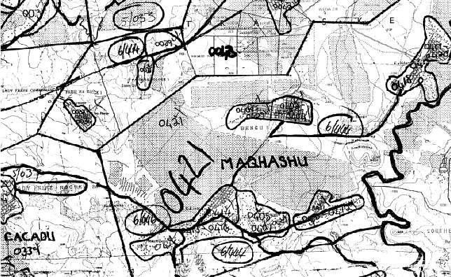
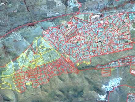
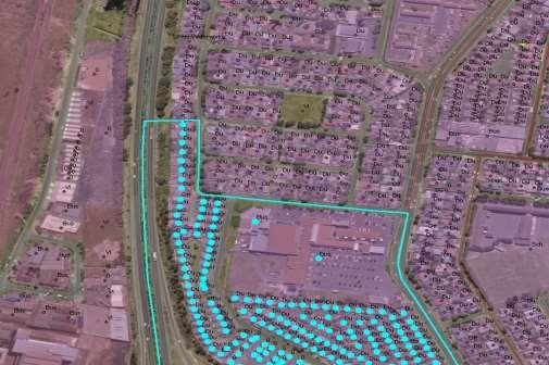
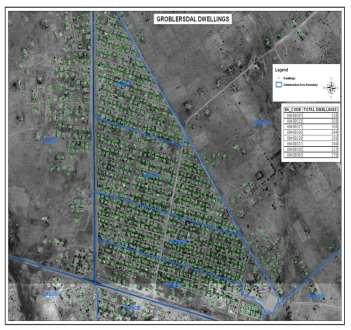
In order to determine the accuracy
 Visualisation Developing a geo-data frame to facilitate data integration (Part 2) by Gerbrand Mans, CSIR This article discusses the development of a disaggregation procedure for socio-economic data based
Spatial Planning and Territorial Development at the Regional Level
 Spatial Planning and Territorial Development at the Regional Level Vincent Nadin University of the West of England, UK Spatial Planning and Territorial Development at the Regional Level Vincent Nadin University
Key Elements of the Geographical Information System of Mexico *
 UNITED NATIONS E/CONF.99/IP.1 ECONOMIC AND SOCIAL COUNCIL Ninth United Nations Regional Cartographic Conference for the Americas New York, 10-14 August 2009 Item 7(a) of the provisional agenda Strategy,