National SDG Data Hubs: Statistical integration and geographic disaggregation (Philippines)
|
|
|
- Jewel Beasley
- 5 years ago
- Views:
Transcription
 5 th High Level Forum on United Nations Global Geospatial")

1 National SDG Data Hubs: Statistical integration and geographic disaggregation (Philippines) 5 th High Level Forum on United Nations Global Geospatial Information Management Implementing the Sustainable Development Goals: The Role of Geospatial Technology and Innovation Mexico City, Mexico November 28 30,
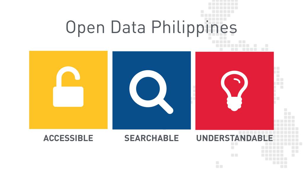
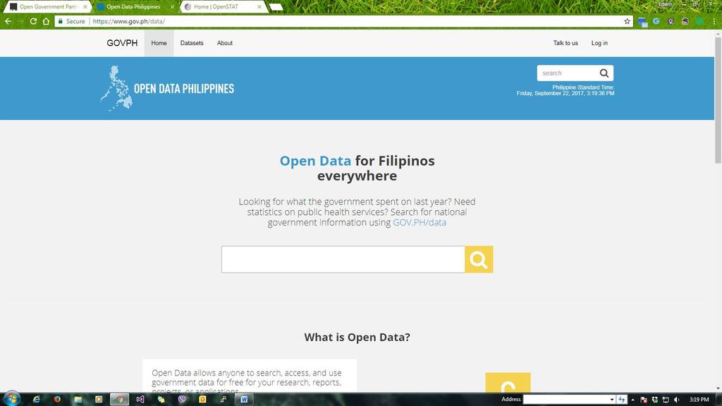
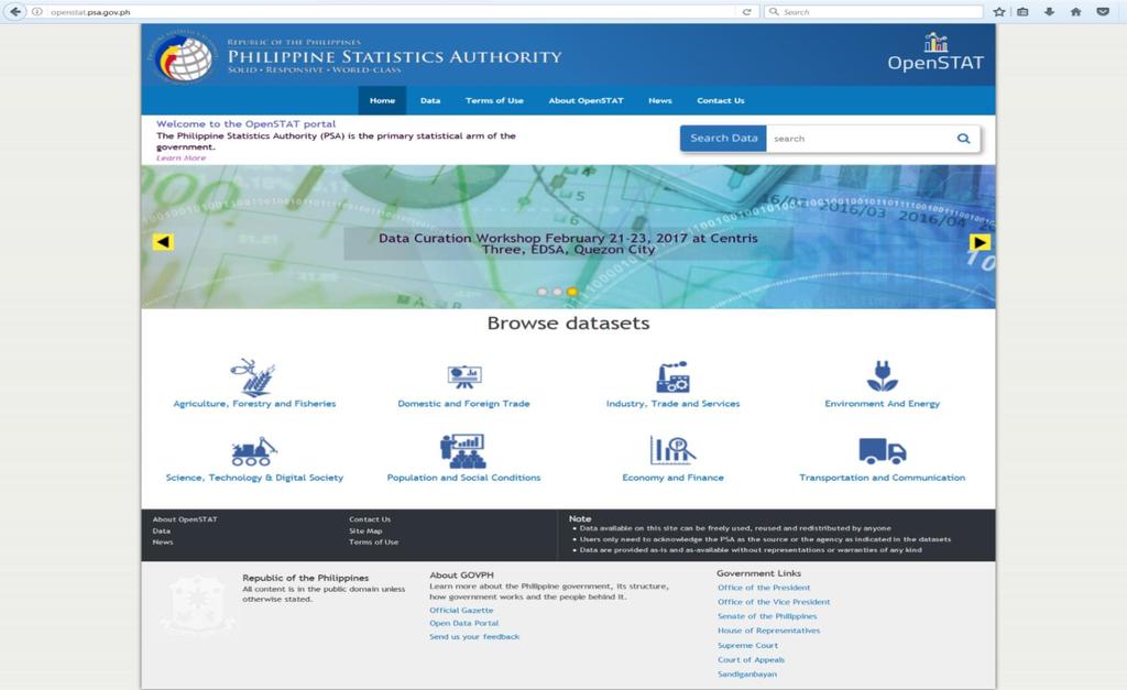
2 Outline of Presentation I. Status of Philippine Data Hub Project II. Updating SDG data and Data Hub III. Open Data Initiatives IV. Linking SDG and Data Hub to National Outcome V. Country work on integrating statistical and geospatial information VI. Data Hub (available data) 2
3 Status of Philippine Data Hub Project Servers ArcGIS software 3

4 Data Hub 4

5 Data Hub 5
6 Updating SDG data and the Data hub Republic Act No Poverty and Human Development Statistics Division 6
 Overall Coordinator Technical")

7 Data Hub PSA SDG Team 7 Advisers National Statistician Deputy National Statistician Assistant National Statistician Director, Statistical Methodologies Unit Director, International Cooperation Unit Team Leader Chief Statistical Specialist Poverty and Human Development Statistics Division (PHDSD) Overall Coordinator Technical Specialists on SDGs, PHDSD Members Sector Specialists for each Goal The assessment made on the availability of the SDG indicators in the Philippines showed that out of 244 indicators, 103 indicators are classified as Tier 1 indicators, 59 are Tier 2 indicators, 71 are Tier 3 indicators and 11 indicators are not applicable to the country.
8 8 8


9 9 9


10 Distribution of the Initial List of Philippine SDG Indicators, by data source agency 10
 11")
11 Distribution of the Initial List of Philippine SDG Indicators, by by source agency (in percentage) 11

12 12 12
13 13
14 Linking SDG and Data Hub to National Outcome Ambisyon Natin 2040 Philippine Development Plan Philippine Statistical Development Plan Inter-Agency Committees IAC Statistical Information Management and Dissemination (SIMD) 14


15 Linking SDG and Data Hub to National Outcome Inter-Agency Committee 15
16 2040 FILIPINOS ENJOY STRONG BONDS WITH FAMILY AND FRIENDS, A COMFORTABLE LIFESTYLE AND SECURE FUTURE 2022 TO LAY DOWN THE FOUNDATION FOR INCLUSIVE GROWTH, A HIGH-TRUST AND RESILIENT SOCIETY, AND A GLOBALLY-COMPETITIVE KNOWLEDGE ECONOMY MALASAKIT ENHANCING THE SOCIAL FABRIC PAGBABAGO INEQUALITY-REDUCING TRANSFORMATION PATULOY NA PAG-UNLAD INCREASING GROWTH POTENTIAL Ensure people-centered, clean, and efficient governance Expand economic opportunities Increase access to economic opportunities Advance technology adoption Stimulate innovation Pursue swift and fair administration of justice IMPLEMENT STRATEGIC TRADE AND FISCAL POLICY, MAINTAIN MACROECONOMIC STABILITY, AND PROMOTE COMPETITION Promote Philippine culture and awareness Accelerate human capital development Reduce vulnerability of individuals Reach for demographic dividend Ensure peace and security Accelerate strategic infrastructure development Ensure safety and build resilience Ensure ecological integrity, clean and healthy environment 16


17 2040 FILIPINOS ENJOY STRONG BONDS WITH FAMILY AND FRIENDS, A COMFORTABLE LIFESTYLE AND SECURE FUTURE 2022 TO LAY DOWN THE FOUNDATION FOR INCLUSIVE GROWTH, A HIGH-TRUST AND RESILIENT SOCIETY, AND A GLOBALLY-COMPETITIVE KNOWLEDGE ECONOMY MALASAKIT ENHANCING THE SOCIAL FABRIC PAGBABAGO INEQUALITY-REDUCING TRANSFORMATION PATULOY NA PAG-UNLAD INCREASING GROWTH POTENTIAL Ensure people-centered, clean, and efficient governance Expand economic opportunities Increase access to economic opportunities Advance technology adoption Stimulate innovation Pursue swift and fair administration of justice IMPLEMENT STRATEGIC TRADE AND FISCAL POLICY, MAINTAIN MACROECONOMIC STABILITY, AND PROMOTE COMPETITION Promote Philippine culture and awareness Accelerate human capital development Reduce vulnerability of individuals Reach for demographic dividend Ensure peace and security Accelerate strategic infrastructure development Ensure safety and build resilience Ensure ecological integrity, clean and healthy environment 17
18 Country work on integrating statistical and geospatial information 18

19 19
20 Philippine Data Hub Available Data 1) Employment at National Level 2) Employment at Regional Level 3) Poverty at the National Level 4) Poverty at the Regional Level 5) Poverty at the Provincial Level 6) Poverty among Population in Basic Sector at Regional Level 7) Poverty among Population in Basic Sector in the Philippines 8) Population at Municipality Level 9) Index Crimes at National Level 10) Index Crimes at Regional Level 11) Net Enrollment Rate at National Level 12) Net Enrollment Rate at Regional Level 13) Gross Domestic Product per capita 14) Gross Regional Domestic Product 20

21 Data Hub 21

22 Data Hub 22

23 Data Hub 23

24 Data Hub 24


25 Thank You! 25
Cordillera Regional Development Plan
 Cordillera Regional Development Plan (RDP 2017-2022) NEDA-CAR RLECC Meeting May 18, 2017 Baguio City Police Office 1 Provincial, Regional & National Events in the Formulation of the Cordillera RDP 2017-2022
Disaster Management & Recovery Framework: The Surveyors Response
 Disaster Management & Recovery Framework: The Surveyors Response Greg Scott Inter-Regional Advisor Global Geospatial Information Management United Nations Statistics Division Department of Economic and
KUNMING FORUM ON UNITED NATIONS GLOBAL GEOSPATIAL INFORMATION MANAGEMENT CITIES OF THE FUTURE: SMART, RESILIENT
 KUNMING FORUM ON UNITED NATIONS GLOBAL GEOSPATIAL INFORMATION MANAGEMENT CITIES OF THE FUTURE: SMART, RESILIENT and SUSTAINABLE Yunnan Zhenzhuang Guest House, Kunming, China 10 12 May 2017 BACKGROUND CONCEPT
Measuring Disaster Risk for Urban areas in Asia-Pacific
 Measuring Disaster Risk for Urban areas in Asia-Pacific Acknowledgement: Trevor Clifford, Intl Consultant 1 SDG 11 Make cities and human settlements inclusive, safe, resilient and sustainable 11.1: By
Experience of Mexico in using GIS and spatial
 Experience of Mexico in using GIS and spatial data as a tool for data integration Francisco Javier Jimenez Nava Deputy General Director of Natural Resources and Environment Outline Introduction National
Implementing the Sustainable Development Goals: The Role of Geospatial Technology and Innovation
 Fifth High Level Forum on UN Global Geospatial Information Management Implementing the Sustainable Development Goals: The Role of Geospatial Technology and Innovation 28-30 November 2017 Sheraton Maria
Foundation Geospatial Information to serve National and Global Priorities
 Foundation Geospatial Information to serve National and Global Priorities Greg Scott Inter-Regional Advisor Global Geospatial Information Management United Nations Statistics Division UN-GGIM: A global
UN GGIM and National SDI Strategy
 MSDI Open Forum on 26 th January 2016 Contributing to the successful delivery of MSDI UN GGIM and National SDI Strategy Hiroshi Murakami Deputy Administrator Geospatial Information Authority of Japan Geospatial
Urbanization and Sustainable Development of Cities: A Ready Engine to Promote Economic Growth and Cooperation
 Urbanization and Sustainable Development of Cities: A Ready Engine to Promote Economic Growth and Cooperation Wan Portia Hamzah Institute of Strategic and International Studies (ISIS) Malaysia 10 September
IAEG SDGs WG GI, , Mexico City
 IAEG SDGs WG GI, 12-14.12.2016, Mexico City UN-GGIM:Europe s perspective and activities to support better integration of geospatial information and statistics and the UN SDG monitoring Pier-Giorgio Zaccheddu,
TERRITORIAL COHESION MEASUREMENT AT THE REGIONAL SCALE. A METHODOLOGICAL PROPOSAL AND APPLICATION IN ANDALUSIA
 Boletín Territorial de la Asociación cohesion measurement de Geógrafos at Españoles the regional N.º scale. 68-2015, A methodological págs. 455-459 proposal and application in Andalusia I.S.S.N.: 0212-9426
THE ROLE OF GEOSPATIAL AT THE WORLD BANK
 THE ROLE OF GEOSPATIAL AT THE WORLD BANK INSPIRE Conference Barcelona, Spain September 26, 2016 Kathrine Kelm Senior Land Administration Specialist Global Land and Geospatial Unit The World Bank Group
16540/14 EE/cm 1 DG E 1A
 Council of the European Union Brussels, 5 December 2014 (OR. en) 16540/14 ENV 965 CULT 139 NOTE From: To: Subject: General Secretariat of the Council Delegations Charter of Rome on Natural and Cultural
Economic and Social Council
 United Nations Economic and Social Council Distr.: General 18 July 2016 Original: English Committee of Experts on Global Geospatial Information Management Sixth session New York, 3-5 August 2016 Item 2
Governance and Urban Nexus: Closing the gaps
 Governance and Urban Nexus: Closing the gaps Donovan Storey Chief, Sustainable Urban Development, Environment & Development Division National Dialogue on Urban Nexus in Thailand Bangkok, UNCC, 19 March
WORLD COUNCIL ON CITY DATA
 WORLD COUNCIL ON CITY DATA WCCD ISO 37120 STANDARDIZED CITY DATA TO MEET UN SDG TARGETS UN WORLD DATA FORUM Presented by: James Patava www.dataforcities.org @wccitydata PUBLICATION OF THE FIRST ISO STANDARD
Concept note. High-Level Seminar: Accelerating Sustainable Energy for All in Landlocked Developing Countries through Innovative Partnerships
 Concept note High-Level Seminar: Accelerating Sustainable Energy for All in Landlocked Developing Countries through Innovative Partnerships Date: 24 and 25 October 2016 Venue: Conference Room C3, Vienna
Welcome. C o n n e c t i n g
 Welcome C o n n e c t i n g YOU D i s c i p l i n e s Why is This Meeting......So Important Now? OUR WORLD Is Increasingly Challenged The Evidence Is Clear We Need Better Understanding and More Collaboration
Presentation by Thangavel Palanivel Senior Strategic Advisor and Chief Economist UNDP Regional Bureau for Asia-Pacific
 Presentation by Thangavel Palanivel Senior Strategic Advisor and Chief Economist UNDP Regional Bureau for Asia-Pacific The High-Level Euro-Asia Regional Meeting on Improving Cooperation on Transit, Trade
Launch of the ESPON 2013 Programme. European observation network on territorial development and cohesion
 Launch of the ESPON 2013 Programme European observation network on territorial development and cohesion Framework conditions for the ESPON 2013 Programme Policy development in use of territorial evidence
Urban Climate Resilience
 Urban Climate Resilience in Southeast Asia Partnership Project Introduction Planning for climate change is a daunting challenge for governments in the Mekong Region. Limited capacity at the municipal level,
Seabed knowledge In support of UN SDGs
 Seabed knowledge In support of UN SDGs Evert Flier Fiskerifaglig forum 2. november 2017 Hydrography & small scale fishing Hydrography in Transition Serving the Maritime Community Hydrography in Transition
INTERNATIONAL CULTURAL TOURISM CHARTER Managing Tourism at Places of Heritage Significance (1999)
") INTERNATIONAL CULTURAL TOURISM CHARTER Managing Tourism at Places of Heritage Significance (1999) Adopted by ICOMOS at the 12th General Assembly in Mexico, October 1999. INTRODUCTION The Charter Ethos
INTERNATIONAL CULTURAL TOURISM CHARTER Managing Tourism at Places of Heritage Significance (1999) Adopted by ICOMOS at the 12th General Assembly in Mexico, October 1999. INTRODUCTION The Charter Ethos
Economic and Social Council
 United Nation E/C.20/2012/4/Add.1 Economic and Social Council Distr.: General 2 July 2012 Original: English Committee of Experts on Global Geospatial Information Management Second session New York, 13-15
UN-GGIM: Strengthening Geospatial Capability
 Fifth Plenary Meeting of UN-GGIM: Europe Brussels, 6-7 June 2018 UN-GGIM: Strengthening Geospatial Capability Walking the talk to leave no one behind Greg Scott, UN-GGIM Secretariat Environmental Statistics
Disaggregation according to geographic location the need and the challenges
 International Seminar On United Nations Global Geospatial Information Management Disaggregation according to geographic location the need and the challenges 6 th 7 th November 2018 Tribe Hotel, Nairobi,
Conference on Urban Development Strategies in the Mediterranean Barcelona, March 14-15, 2011
 Analysing Urban Development Strategies: the OECD Approach by Adam Knelman Ostry Counsellor, Regional Development Policy adam.ostry@oecd.org Conference on Urban Development Strategies in the Mediterranean
CONFERENCE STATEMENT
 Final draft CONFERENCE STATEMENT We, the elected representatives of Canada, Denmark/Greenland, the European Parliament, Finland, Iceland, Norway, Russia, Sweden and the United States of America; In collaboration
Institute of Statistical and Geographical Information of Jalisco State Geospatial Technologies, platforms and services at a subnational level
 Institute of Statistical and Geographical Information of Jalisco State Geospatial Technologies, platforms and services at a subnational level México, November 2017 Unique organization in its type SDG 17.18:
Key Indicators for Territorial Cohesion and Spatial Planning in Preparing Territorial Development Strategies
 ESPON Evidence in a North European Context Challenges and Opportunities for Territorial Development and Cohesion in a North European Macro Region, 10-11 April, 2014, Vilnius, Lithuania Key Indicators for
The Council Study: Social assessment approach and methodology
 Preliminary draft for internal discussion The Council Study: Social assessment approach and methodology Vientiane, September 24 2015 Social /economic assessment team Basin Development Plan (BDP) Programme
Low Density Areas : Places of Opportunity. Enrique Garcilazo, OECD Directorate for Public Governance and Territorial Development
 Low Density Areas : Places of Opportunity Enrique Garcilazo, OECD Directorate for Public Governance and Territorial Development Open Days, Brussels, 11 th October, 2016 Outline 1. Performance low density
BUILDING SOUND AND COMPARABLE METRICS FOR SDGS: THE CONTRIBUTION OF THE OECD DATA AND TOOLS FOR CITIES AND REGIONS
 BUILDING SOUND AND COMPARABLE METRICS FOR SDGS: THE CONTRIBUTION OF THE OECD DATA AND TOOLS FOR CITIES AND REGIONS STATISTICAL CAPACITY BUILDING FOR MONITORING OF SUSTAINABLE DEVELOPMENT GOALS Lukas Kleine-Rueschkamp
Topic 4: Changing cities
 Topic 4: Changing cities Overview of urban patterns and processes 4.1 Urbanisation is a global process a. Contrasting trends in urbanisation over the last 50 years in different parts of the world (developed,
Set-up of subnational statistical systems Statistical Development Strategy for the State of Jalisco México, 2016
 Set-up of subnational statistical systems Statistical Development Strategy for the State of Jalisco México, 2016 Statistical and Geographical Information Institute of Jalisco (IIEG) 2013. Merger of three
Second High Level Forum on GGIM Seminar on Regional Cooperation in Geospatial Information Management Doha, Qatar, 7 February 2013
 Second High Level Forum on GGIM Seminar on Regional Cooperation in Geospatial Information Management Doha, Qatar, 7 February 2013 Overview on Geospatial Activities in Egypt BY : Eng.Nahla Seddik Mohamed
The Global Statistical Geospatial Framework and the Global Fundamental Geospatial Themes
 The Global Statistical Geospatial Framework and the Global Fundamental Geospatial Themes Sub-regional workshop on integration of administrative data, big data and geospatial information for the compilation
Esri and GIS Education
 Esri and GIS Education Organizations Esri Users 1,200 National Government Agencies 11,500 States & Regional Agencies 30,800 Cities & Local Governments 32,000 Businesses 8,500 Utilities 12,600 NGOs 11,000
International Development
 International Development Discipline/Multi-discipline or trans-disciplinary field Tahmina Rashid Associate Professor, International Studies What is Development? a. Development as a state or condition-static
November 29, World Urban Forum 6. Prosperity of Cities: Balancing Ecology, Economy and Equity. Concept Note
 November 29, 2010 World Urban Forum 6 Prosperity of Cities: Balancing Ecology, Economy and Equity Concept Note 1 CONTENT Thematic Continuity Conceptualizing the Theme The 6 Domains of Prosperity The WUF
Geospatial Technologies for Resources Planning & Management
 Geospatial Technologies for Resources Planning & Management Lal Samarakoon, PhD Director, Geoinformatics Center Asian Institute of Technology, Thailand Content Geoinformatics for SDG Information Integration
Achieving the Vision Geo-statistical integration addressing South Africa s Developmental Agenda. geospatial + statistics. The Data Revolution
 Achieving the Vision Geo-statistical integration addressing South Africa s Developmental Agenda geospatial + statistics The Data Revolution humble beginnings, present & future - South Africa UN World Data
Dr. Biliana Cicin-Sain President, Global Ocean Forum 1
 Towards a Sustainable Development Goal on Oceans and Seas: Healthy, Productive and Resilient Oceans and Seas- Prosperous and Resilient Peoples and Communities Dr. Biliana Cicin-Sain President, Global Ocean
Sustainable Development Goal 11 and the New Urban Agenda: can planning deliver? Vanessa Watson University of Cape Town 2016
 Sustainable Development Goal 11 and the New Urban Agenda: can planning deliver? Vanessa Watson University of Cape Town 2016 .to reinvigorate the global political commitment to the sustainable development
2018/1 The integration of statistical and geospatial information. The Regional Committee of UN-GGIM: Americas:
 The following are the conclusions and recommendations of the Regional Committee of the United Nations on Global Geospatial Information Management for the Americas, during its Fifth Session, Thursday 8
A study on the design and analysis of the assessment system of China s financial ecological environment
 Available online www.jocpr.com Journal of Chemical and Pharmaceutical Research, 2014, 6(7):898-902 Research Article ISSN : 0975-7384 CODEN(USA) : JCPRC5 A study on the design and analysis of the assessment
ikapa GDS White Paper Governance and Integration Department of the Premier Department of the Premier 2 December 2008
 ikapa GDS White Paper Governance and Integration Outline of presentation Western Cape Situation Strategic Framework Implementation Framework Alignment and implementation example Diversified economy Small
Together towards a Sustainable Urban Agenda
 Together towards a Sustainable Urban Agenda The City We (Youth) Want Preliminary findings from youth consultations Areas Issue Papers Policy Units 1.Social Cohesion and Equity - Livable Cities 2.Urban
Introduction and Project Overview
 Greater New Orleans Regional Land Use Modeling GIS Techniques in a P olitical C ontext Louisiana Remote Sensing and GIS Workshop Wednesday, April 24, 2013 Working Towards a Shared Regional Vision Introduction
Inventory of United Nations Resolutions on Cartography Coordination, Geographic Information and SDI 1
 Inventory of United Nations Resolutions on Cartography Coordination, Geographic Information and SDI I. Resolutions on Cartography Coordination and Establishment of United Nations Regional Cartographic
National Spatial Development Perspective (NSDP) Policy Coordination and Advisory Service
 Policy Coordination and Advisory Service") National Spatial Development Perspective (NSDP) Policy Coordination and Advisory Service 1 BACKGROUND The advances made in the First Decade by far supersede the weaknesses. Yet, if all indicators were
National Spatial Development Perspective (NSDP) Policy Coordination and Advisory Service 1 BACKGROUND The advances made in the First Decade by far supersede the weaknesses. Yet, if all indicators were
The international patterns of spatial planning system and choice of China. Cai yumei China land use planning and surveying institute (China, beijing)
") FIG Working Week, Rome, Italy 6 10 May 2012 The international patterns of spatial system and choice of China Cai yumei China land use and surveying institute (China, beijing) Outline Background Problem
FIG Working Week, Rome, Italy 6 10 May 2012 The international patterns of spatial system and choice of China Cai yumei China land use and surveying institute (China, beijing) Outline Background Problem
GIS (GEOGRAPHICAL INFORMATION SYSTEMS) AS A FACILITATION TOOL FOR SUSTAINABLE DEVELOPMENT IN AFRICA
 AS A FACILITATION TOOL FOR SUSTAINABLE DEVELOPMENT IN AFRICA") GIS (GEOGRAPHICAL INFORMATION SYSTEMS) AS A FACILITATION TOOL FOR SUSTAINABLE DEVELOPMENT IN AFRICA a presentation by Elizabeth Hicken GDEST Conference on Geospatial Sciences for Sustainable Development
GIS (GEOGRAPHICAL INFORMATION SYSTEMS) AS A FACILITATION TOOL FOR SUSTAINABLE DEVELOPMENT IN AFRICA a presentation by Elizabeth Hicken GDEST Conference on Geospatial Sciences for Sustainable Development
Geospatial Policy Development and Institutional Arrangements *
 HIGH LEVEL FORUM ON GLOBAL GEOSPATIAL MANAGEMENT INFORMATION WORKING PAPER No. 13 First Forum Seoul, Republic of Korea, 24-26 October 2011 Geospatial Policy Development and Institutional Arrangements *
Realizing benefits of Spatial Data Infrastructure A user s perspective from Environment Agency - Abu Dhabi
 Realizing benefits of Spatial Data Infrastructure A user s perspective from Environment Agency - Abu Dhabi Anil Kumar Director, Environment Information Management 26 April 2012 Geospatial World Forum,
PAN AMERICAN INSTITUTE OF GEOGRAPHY AND HISTORY Specialized Organization of the OAS
 PAN AMERICAN INSTITUTE OF GEOGRAPHY AND HISTORY Specialized Organization of the OAS 10 th UNRCC Americas United Nations, New York, 20 August 2013 PAIGH, SIRGAS, PC-IDEA and GeoSUR 2013-2015 Joint Action
REPUBLIC OF ZAMBIA STATEMENT THE HONOURABLE LUCKY MULUSA, M.P., MINISTER OF NATIONAL DEVELOPMENT PLANNING,
 REPUBLIC OF ZAMBIA Permanent Mi$sion of Zambia to the United Nations, 237 East 52nd Street, New York, NY 10022 Tex: (212) 888-5770 Fax: (212) 888-5213 E-mail: zambia@un.int Please check against delivery
CHAPTER 4 HIGH LEVEL SPATIAL DEVELOPMENT FRAMEWORK (SDF) Page 95
 Page 95") CHAPTER 4 HIGH LEVEL SPATIAL DEVELOPMENT FRAMEWORK (SDF) Page 95 CHAPTER 4 HIGH LEVEL SPATIAL DEVELOPMENT FRAMEWORK 4.1 INTRODUCTION This chapter provides a high level overview of George Municipality s
CHAPTER 4 HIGH LEVEL SPATIAL DEVELOPMENT FRAMEWORK (SDF) Page 95 CHAPTER 4 HIGH LEVEL SPATIAL DEVELOPMENT FRAMEWORK 4.1 INTRODUCTION This chapter provides a high level overview of George Municipality s
THE SEVILLE STRATEGY ON BIOSPHERE RESERVES
 THE SEVILLE STRATEGY ON BIOSPHERE RESERVES 1 VISION FOR BIOSPHERE RESERVES IN THE 21 ST CENTURY The international Seville Conference on Biosphere Reserves, organised by UNESCO, adopted a two-pronged approach,
Background Document: Report of the Regional Committee of United Nations Global Geospatial Information Management for Asia and the Pacific
 Background Document: Report of the Regional Committee of United Nations Global Geospatial Information Management for Asia and the Pacific 1. Summary 1. This report highlights the activities carried out
De-complexifying SPLUMA principles
 Development Planning Law Reform De-complexifying SPLUMA principles Prof Verna Nel Tony Barnes Dr E Barclay Helena Jacobs Chantel Hauptfleisch Sumaya Orie Nathaneal Jacobs What is SPLUMA about? A single
Geospatial framework for monitoring SDGs/Sendai targets By Shimonti Paul Sr. Assistant Editor Geospatial Media & Communications
 Geospatial framework for monitoring SDGs/Sendai targets By Shimonti Paul Sr. Assistant Editor Geospatial Media & Communications Outline 1. Introduction to Geospatial Media and Communications 2. Geospatial
Use of Geospatial Data: Philippine Statistics Authority 1
 Use of Geospatial Data: Philippine Statistics Authority 1 1 Presentation by Lisa Grace S. Bersales at the UNSC 2016 side event on Geospatial information and earth observations: supporting official statistics
Prof Chryssy Potsiou, FIG President
 THE VALUE OF GEOSPATIAL DATA AND ROLE OF SURVEYORS IN SUSTAINABLE DEVELOPMENT Prof Chryssy Potsiou, FIG President National Technical University of Athens School of Rural and Surveying Engineering, Greece
ReCAP Status Review of the Updated Rural Access Index (RAI) Stephen Vincent, Principal Investigator
 Stephen Vincent, Principal Investigator") ReCAP Status Review of the Updated Rural Access Index (RAI) Stephen Vincent, Principal Investigator Establishment of RAI in 2005/2006 2006 Definition of the RAI Note by Peter Roberts Dated September 2005
ReCAP Status Review of the Updated Rural Access Index (RAI) Stephen Vincent, Principal Investigator Establishment of RAI in 2005/2006 2006 Definition of the RAI Note by Peter Roberts Dated September 2005
Summary. Recommendations on the Fifth Policy Document on Spatial Planning September 2001
 Summary Recommendations on the Fifth Policy Document on Spatial Planning September 2001 2 Introduction In December 2000 the Dutch Cabinet issued Part 1 of the Fifth National Policy Document on Spatial
ACCESSIBILITY TO SERVICES IN REGIONS AND CITIES: MEASURES AND POLICIES NOTE FOR THE WPTI WORKSHOP, 18 JUNE 2013
 ACCESSIBILITY TO SERVICES IN REGIONS AND CITIES: MEASURES AND POLICIES NOTE FOR THE WPTI WORKSHOP, 18 JUNE 2013 1. Significant differences in the access to basic and advanced services, such as transport,
TOWARDS STRATEGIC SPATIAL PLANNING IN JAMAICA: THE NATIONAL SPATIAL PLAN
 TOWARDS STRATEGIC SPATIAL PLANNING IN JAMAICA: THE NATIONAL SPATIAL PLAN JIEP 5th Biennial Conference on the Environment: Balancing National Development and Environmental Protection June 6, 2011 Jamaica
LLDCS IN THE GLOBAL AGENDA: CHALLENGES AND INTERNATIONAL RESPONSES CHAIR OF THE GROUP OF LLDCS IN GENEVA
 LLDCS IN THE GLOBAL AGENDA: CHALLENGES AND INTERNATIONAL RESPONSES CHAIR OF THE GROUP OF LLDCS IN GENEVA E X P E R T G R O U P M E E T I N G O N T H E M I D T E R M R E V I E W O F T H E V P O A F O R
Healthy Cities. Lecture 4 Planning and Regeneration, Sustainable and Healthy. Opening Address
 Healthy Cities Lecture 4 Planning and Regeneration, Sustainable and Healthy Opening Address Suzanne Wylie Director of Health and Environmental Services, Belfast City Council Belfast The Past The Present
Merging statistics and geospatial information
 Merging statistics and geospatial information Demography / Commuting / Spatial planning / Registers Mirosław Migacz Chief GIS Specialist Janusz Dygaszewicz Director Central Statistical Office of Poland
OECD PERSPECTIVE ON METROPOLITAN AREAS
 Final conference of ESPON Targeted Analysis SPIMA (Spatial dynamics and strategic planning in Metropolitan Areas) Brussels, 6 February 2018 OECD PERSPECTIVE ON METROPOLITAN AREAS Soo-Jin KIM OECD Centre
Second Administrative Level Boundaries (SALB) initiative & geographic names in cartography. Geospatial Information Section
 initiative & geographic names in cartography. Geospatial Information Section") Second Administrative Level Boundaries (SALB) initiative & geographic names in cartography Geospatial Information Section Introduction Goals Global agenda How does SALB work? Latest News on geographic
Second Administrative Level Boundaries (SALB) initiative & geographic names in cartography Geospatial Information Section Introduction Goals Global agenda How does SALB work? Latest News on geographic
Geological Survey of Canada Lands and Minerals Sector Natural Resources Canada OneGeology, June 2018
 Geological Survey of Canada Lands and Minerals Sector Natural Resources Canada OneGeology, June 2018 Geological Survey of Canada Mission The Geological Survey of Canada provides public geoscience knowledge
Land Use in the context of sustainable, smart and inclusive growth
 Land Use in the context of sustainable, smart and inclusive growth François Salgé Ministry of sustainable development France facilitator EUROGI vice president AFIGéO board member 1 Introduction e-content+
PURR: POTENTIAL OF RURAL REGIONS UK ESPON WORKSHOP Newcastle 23 rd November Neil Adams
 PURR: POTENTIAL OF RURAL REGIONS UK ESPON WORKSHOP Newcastle 23 rd November 2012 Neil Adams PURR: Potential of Rural Regions Introduction Context for the project A spectrum of knowledge Rural Potentials
Seaport Status, Access, and Regional Development in Indonesia
 Seaport Status, Access, and Regional Development in Indonesia Muhammad Halley Yudhistira Yusuf Sofiyandi Institute for Economic and Social Research (LPEM), Faculty of Economics and Business, University
Institute of Statistical and Geographical Information of Jalisco State Subnational Statistical and Geographical System India.
 Institute of Statistical and Geographical Information of Jalisco State Subnational Statistical and Geographical System India. January 2017 Subnational Statistical and Geographical System National Statistical
CHAPTER 22 GEOGRAPHIC INFORMATION SYSTEMS
 CHAPTER 22 GEOGRAPHIC INFORMATION SYSTEMS PURPOSE: This chapter establishes the administration and use of to improve the quality and accessibility of Department s spatial information and support graphical
KENYA NATIONAL BUREAU OF STATISTICS Workshop on
 KENYA NATIONAL BUREAU OF STATISTICS Workshop on Capacity Building in Environment Statistics: the Framework for the Development of Environment Statistics (FDES 2013) Coordination with Sector Ministries
ESCAP Promotes Geo-referenced Information System for Disaster Risk Management in Asia and the Pacific
 Third High Level Forum on UNGGIM 22-24 October 2014 Beijing, China ESCAP Promotes Geo-referenced Information System for Disaster Risk Management in Asia and the Pacific Keran Wang Space Applications Section,
National planning report for Denmark
 National planning report for Denmark from the Minister for Environment and Energy Local identity and new challenges Summary 2000 1 CONTENTS 4 PREFACE: REGIONAL DEVELOPMENT AND SPATIAL PLANNING 6 1. BALANCED
Geospatial Enabling Resilient Development. Latin America Geospatial Forum Río de Janeiro September 2013
 Geospatial Enabling Resilient Development Latin America Geospatial Forum Río de Janeiro September 2013 Presentation Index INEGI /SNIEG Geostatistical Frame - Georeferenciation Issues Legal Framework Mexican
Outline National legislative & policy context Regional history with ESSIM ESSIM Evaluation Phase Government Integration via RCCOM Regional ICOM Framew
 What MSP Implementation could change in the Maritimes Region Tim Hall, Regional Manager Oceans and Coastal Management Division Ecosystem Management Branch Fisheries and Oceans Canada Maritimes Region BIO
SDG s and the role of Earth Observation
 SDG s and the role of Earth Observation Christian Heipke IPI - Institute for Photogrammetry and GeoInformation Leibniz Universität Hannover Germany Secretary General, ISPRS 1. No Poverty 2. Zero Hunger
Oman NSDI Business Values and Future Directions. Hassan Alawi Alghazali Acting Director General National Spatial Data Infrastructure
 Oman NSDI Business Values and Future Directions Hassan Alawi Alghazali Acting Director General National Spatial Data Infrastructure Presentation Outline Geospatial Maturity Current Challenges NCSI s Role
Integration for Informed Decision Making
 Geospatial and Statistics Policy Intervention: Integration for Informed Decision Making Greg Scott Global Geospatial Information Management United Nations Statistics Division Department of Economic and
Economic and Social Council
 United Nations Economic and Social Council Distr.: General 2 July 2012 E/C.20/2012/10/Add.1 Original: English Committee of Experts on Global Geospatial Information Management Second session New York, 13-15
INTELLIGENT CITIES AND A NEW ECONOMIC STORY CASES FOR HOUSING DUNCAN MACLENNAN UNIVERSITIES OF GLASGOW AND ST ANDREWS
 INTELLIGENT CITIES AND A NEW ECONOMIC STORY CASES FOR HOUSING DUNCAN MACLENNAN UNIVERSITIES OF GLASGOW AND ST ANDREWS THREE POLICY PARADOXES 16-11-08 1. GROWING FISCAL IMBALANCE 1. All orders of government
II Podkarpackie Territorial Forum
 II Podkarpackie Territorial Forum Regional Cluster-based Policy: Some Theoretical and Practical Aspects Zbigniew Bochniarz Evans School of Public Affairs University of Washington Seattle, U.S.A. March
Geospatial Information Management in the Americas: Lessons for the Post-2015 development agenda
 Geospatial Information Management in the Americas: Lessons for the Post-2015 development agenda Rolando Ocampo President, UN-GGIM: Americas October 2014 The integration of statistical and geographical
PLANNING (PLAN) Planning (PLAN) 1
 Planning (PLAN) 1") Planning (PLAN) 1 PLANNING (PLAN) PLAN 500. Economics for Public Affairs Description: An introduction to basic economic concepts and their application to public affairs and urban planning. Note: Cross-listed
Planning (PLAN) 1 PLANNING (PLAN) PLAN 500. Economics for Public Affairs Description: An introduction to basic economic concepts and their application to public affairs and urban planning. Note: Cross-listed
UNCTAD Single-year Expert Meeting on Tourism s Contribution to Sustainable Development
 UNCTAD Single-year Expert Meeting on Tourism s Contribution to Sustainable Development Geneva, Palais des Nations, Salle XXVI, 14-15 March 2013 Zoritsa Urosevic Head, Institutional & Corporate Relations,
8 th Meeting of IAEG-SDGs 5 8 November 2018, Stockholm, Sweden. Meetings. Report
 Meetings 8 th Meeting of IAEG-SDGs Between April 2018 and November 2018, the Working Group on Geospatial Information of the IAEG- SDGs held two online meetings; presented a report to the United Nations
OC Enterprise GIS. Kevin Hills, PLS Cameron Smith, GISP. OC Survey
 OC Enterprise GIS Kevin Hills, PLS Cameron Smith, GISP OC Survey Discussion Points Background & Organizational Structure of OCPW Past practices prior to Enterprise Wide GIS License (ELA) Participating
INSTITUTIONAL BRIEF National Secretariat for Housing and Habitat
 INSTITUTIONAL BRIEF National Secretariat for Housing and Habitat Minister Soledad Nuñez @solenu www.senavitat.gov.py ASUNCION, PARAGUAY PARAGUAY LOCATION Landlocked with dry and wet borders PARAGUAY KEY
Making the SDGs work for the Lake Chad Basin
 Making the SDGs work for the Lake Chad Basin SIDE EVENT ON THE MARGINS OF THE 2018 HIGH LEVEL POLITICAL FORUM 16 JULY 2018, 18.30 20.00 CONFERENCE ROOM 11, UN CONFERENCE BUILDING, UNITED NATIONS HEADQUARTERS,
RETA 6422: Mainstreaming Environment for Poverty Reduction Category 2 Subproject
 RETA 6422: Mainstreaming Environment for Poverty Reduction Category 2 Subproject A. Basic Data 1. Subproject Title: Poverty-Environment Mapping to Support Decision Making 2. Country Director: Adrian Ruthenberg
Strategic Framework on Geospatial Information and Services for Disasters
 Strategic Framework on Geospatial Information and Services for Disasters Case Studies for the Caribbean and the Philippines --- Kunming Forum on United Nations Global Geospatial Information Management
Mapping Secondary Cities for Resiliency and Emergency Preparedness
 Mapping Secondary Cities for Resiliency and Emergency Preparedness Secondary Cities Geospatial Training Workshop Pilot Project: Cusco, Peru June 29 July 3 2015 WHO ARE WE? Office of the Geographer (GGI)