Fire effects on tinajas and amphibian habitat at Saguaro National Park
|
|
|
- Allyson Barker
- 6 years ago
- Views:
Transcription


1 Fire effects on tinajas and amphibian habitat at Saguaro National Park Don Swann, Kara O Brien, and Chuck Perger Saguaro National Park, Tucson, Arizona


 Cecil")
 Dennis")

")
2 Thanks to: Mike Sredl (Arizona Game and Fish) Ann Youberg (Arizona Geological Survey) Adam Springer (Chiricahua National Monument) Eric Wallace, Erin Zylstra, Kris Ratzlaff (UA) Cecil Schwalbe, John Parker (USGS) Dennis Caldwell (Tucson Herpetological Society) Josh Taiz, Tom Skinner (USNFS) Mike Ward, Perry Grissom (Saguaro National Park)
3 Outline

4 Saguaro National Park east and west

5 Saguaro National Park east Rincon Mountain District

6 Saguaro NP Rincon Mountain District Sky Island ecological zones


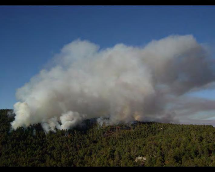
7 Fire in Rincon Mountains and other Sky Islands Historic fire return interval ~ 10 years Periodic fire stimulates regeneration, promotes nutrient recycling, protects forests from catastrophic fire Ponderosa pine ( feet) Increase in very large wildfires during past few decades Mixed Conifer ( feet)

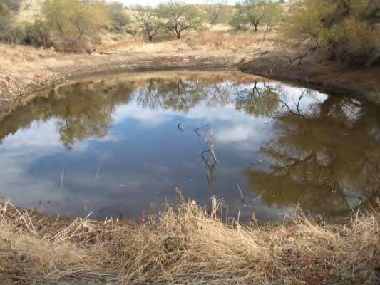
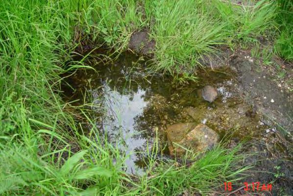
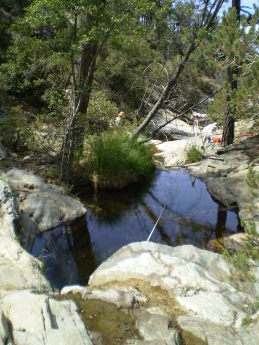
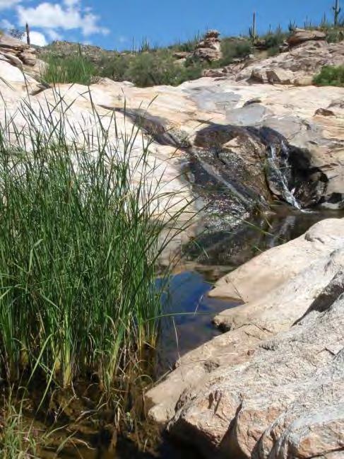
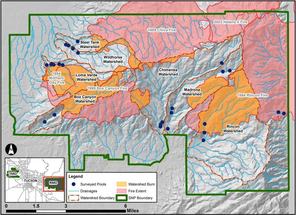
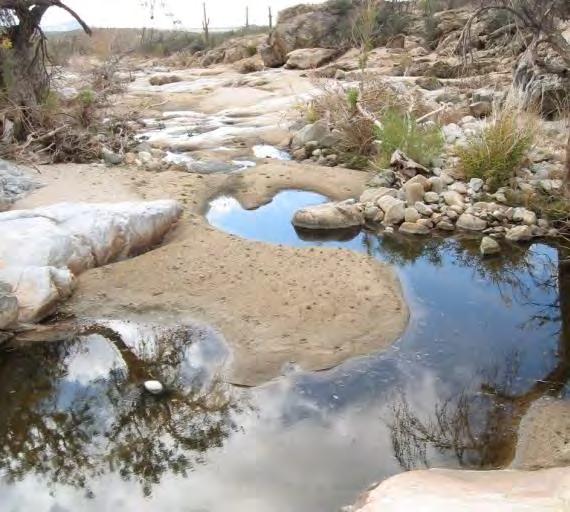
8 Surface water - intermittent streams Springs and tanks
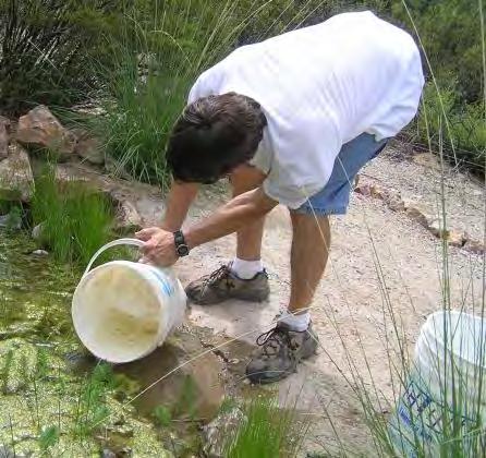
9 Tinajas earthenware jar in Spanish


10 Major source of water in Rincons during dry season


11 Value for people, past and present


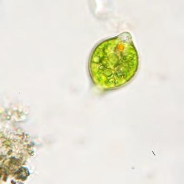
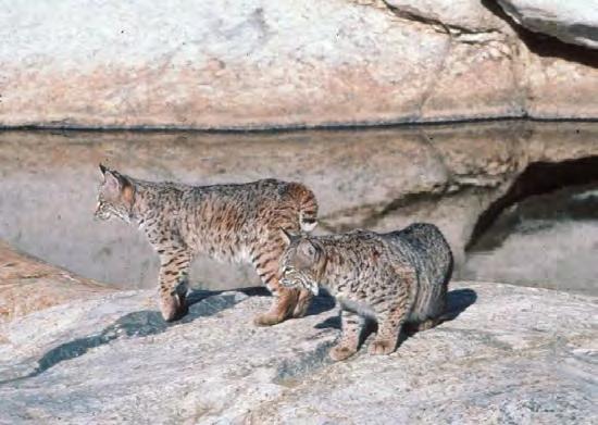
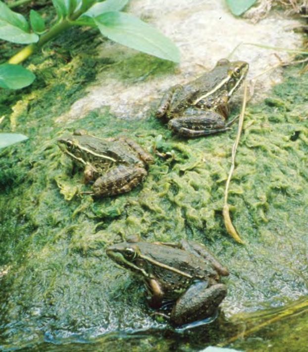
12 Essential for wildlife Canyon treefrog Bobcats Single-celled algae Dragonfly Mallard Gary Slaten photo


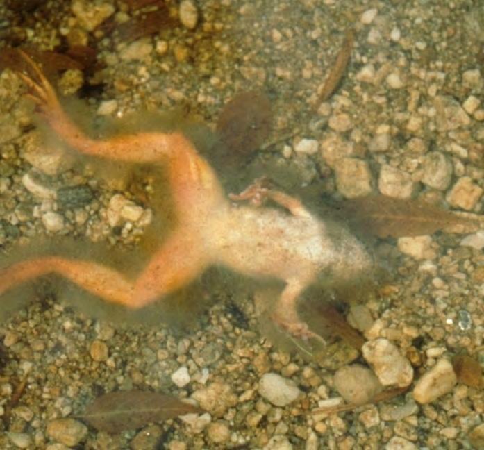
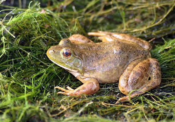
13 Lowland leopard frog (Lithobates [Rana] yavapaiensis) tadpoles ~ 9 months in water webbed feet Jumps!


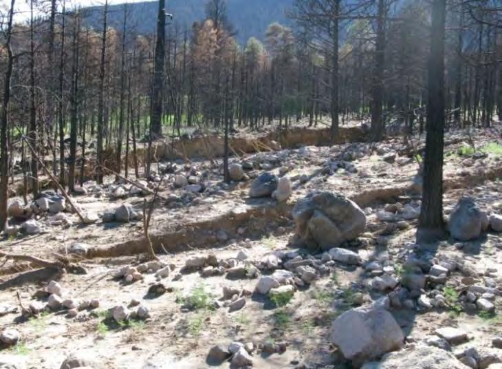
14 Declining amphibians globally and locally Tarahumara frog (extirpated in US)

15 Local declines of the lowland leopard frog Major known populations of Lowland Leopard Frogs extirpated since 1940s near Tucson

16 Crayfish (non-native) American bullfrog (non-native) Disease Habitat loss


17 Lowland leopard frog habitat in Saguaro National Park
18 Saguaro National Park Arizona Tamarisk: Follow-Up Surveys ^_ ^_^_^_ Loma Verde ^_ ^_ ^_^_^_ ^_ ^_ ^_ ^_^_^_^_ Wildhorse ^_^_ ^_ ^_^_ Tanque ^_ Verde/Joaquin ^_ ^_ ^_ ^_ ^_^_^_ ^_^_^_^_ National Park Service U.S. Department of the Interior Leopard frog monitoring in Saguaro, 1996-present Rock Spring L. Verde South Turkey Legend ^_ Undergoing Treatment Features Drainages Surveyed Drainages 5000ft elevation 6000ft elevation State Trust Land Private Inholding RMD Boundary Forest Service Land Private Land ^_ ^_ Box Park-wide, biannual surveys ^_^_^_^_ ^_ Lower Rincon Chimenea ^_ ^_ ^_^_^_^_ ^_ ² Madrona ^_ ^_ ^_ ^_ ^_ ^_^_^_ ^_ ^_ Rincon ^_ ^_ Rincon North ^_ Miles

19 Visual encounter surveys for leopard frogs and other aquatic species Photograph and record water status of each tinaja (>240)
20 Results (Zylstra et al. 2015) Average # Lowland Leopard Frogs Per Survey Adults Spring 96 Fall 96 Spring 97 Fall 97 Spring 98 Fall 98 Spring 99 Fall 99 Spring 00 Fall 00 Spring 01 Fall 01 Spring 02 Fall 02 Spring 03 Fall 03 Spring 04 Fall 04 Spring 05 Fall 05 Spring 06 Fall 06 Spring 07 Fall 07 Spring 08 Fall 08 Spring 09 Fall 09 Spring 10 Fall 10 Spring 11 Fall 11 Mean frog counts per biannual survey,
; pools where frogs always observed")
21 Pools where frogs observed, (green); pools where frogs always observed (red)
22 More water = more frogs Juveniles surviving Figure 1. Predicted number of recruits (a) and monthly survival (b) of adult lowland leopard frogs (with 95% confidence intervals) as a function of surface water availability, with other model variables held constant. Zylstra et al Adults surviving

23 Water available to frogs in tinajas is related to rain, but not always Before 1999 Box Canyon fire 2001 Post Fire
24 Example: Box Canyon Fire - 6,500 acres June NPS photo


25 NPS photos Large areas of moderatehigh severity

26 March Loma Verde Pool 10, below fire perimeter
, tadpole")
27 July ash in water, water temps C ( F), tadpole mortality

28 October (filled after rain of on July )

 filled with ash on")

29 July Nov March Pool 1 (about 1 mile downstream of Pool 10) filled with ash on July 12, 1999 but did not receive sediment until winter rains of 2000.


30 June 2002 all pools in Loma Verde dry due to 1-2 meters of sediment last leopard frogs died
31 Number of frogs observed, Loma Verde Canyon, Loma Verde Lowland Leopard Frog Survey Data: Box Canyon Fire July All pools dry; Frogs disappear Spring 2002 Total Adults Juveniles Tadpoles Frogs re-appear fall 2007 Disappear early

32 Example: 2003 Helen s 2 Fire 3,600 acres NPS photo

33 2003 Helen s 2 Fire Joaquin Canyon Parker 2006


34 Course, poorly-sorted overbank deposits, Joaquin Canyon Erosion pillars created by sheetwash From Parker (2006)

 July 4")

35 Repeat photos Joaquin Canyon (2003 Helen s 2 Fire) July July November 2, 2005
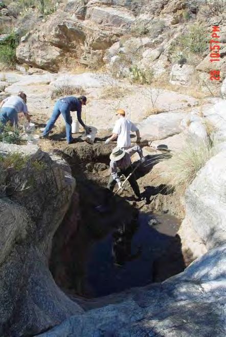
36 Number of adult and juvenile frogs observed on surveys in Joaquin Canyon following 2003 Helen s 2 Fire Helen s 2 Fire, June Summer 2005, no frogs detected ; frogs returned, then disappeared again Sep Jan May Oct Feb Jul Nov Apr Aug-13


37 How long does sediment persist in tinajas? Sediment surveys at SNP, 2005-present

38 Sediment surveys Bedrock contours, Madrona #2
39 Sediment surveys 42% Bedrock contours, Madrona #2 Sediment contours % 33% Sediment contours 2007 Sediment contours 2010
40


41 How long does sediment persist? Shorter duration high energy areas, larger watersheds Repeat photos Loma Verde Canyon (1999 fire)


42 Longer duration pools in smaller, less steep watersheds Repeat photos Loma Verde Canyon (1999 fire)


43 Longer duration pools in low energy areas Repeat photos Wildhorse Canyon (1989 Chiva Fire) 2012
44 Mean sediment volume/pool by stream, Loma Verde 68% burned (1999 fire) Rincon 73% (1994 fire) Chimenea 11.8% (misc. small fires) Wildhorse 31% 1989 fire) 2005/
45 Changes in tinaja sediment volume, all combined Percent Sediment Volume Average for All Pools (+/- one standard error) Percent Sediment Volume (%) Year of Survey


46 Fire, floods, and sediment good for frogs issue of scale


47 Fire effects on other frogs in Arizona Chiricahua leopard frog - threatened Photo by J. Rorabaugh Tarahumara frog extirpated/reintroduced AGFD photo.

48 Management what can we do as land, fire, and wildlife managers?


")
49 a. Measures to prevent post-fire erosion Staw bale erosion barrier **Wood strand mulch Log erosion barrier Robichaud (2009) Robichaud et al. (2012)
.")
50 b. Habitat restoration Miller Canyon frog habitat restoration (AGFD photo).
 and fully")
51 b. Habitat restoration Pool 1 being excavated partially (left) and fully (right) in 2005


52 Pool 1 on July 8, 2006 Pool 1 dry on June 6, 2013 Lowland Leopard Frog in Loma Verde on October 15, 2006


53 c. Salvage and re-introduction Chiricahua leopard frog salvage and release, Miller Canyon. Glendale Community College photos.


54 Backyard pond project near Saguaro National Park

55 d. Pre-fire actions

56 Letting natural fires burn Deer Head Fire, 2014

57 General concepts for conservation/management How great is the risk? How important is the population? Consider the no-action alternative where ever possible Erik Enderson photo


58 Long-term view ecological change and management Time s circle: What are the natural patterns over time? Time s arrow: What are the long-term trends? Potential threats When to respond Time s arrow, time s circle

59 Healthy forests, healthy frogs

60 Stand on Tanque Verde Ridge in Saguaro National Park and see, in one compelling panorama, all that makes fire management in the western U.S. problematic Saguaro will have to be lucky as well as good. --Steve Pyne, A Fire History of America (2012)
Figure 1. Map of drainages above Beatty s property.
 July 13, 2011, corrected Observations of post-monument Fire flows at, Miller Canyon, Coronado National Forest, July 11 th, 2011 Ann Youberg, AZGS Tom Beatty reported 1.05 of rain at his house on July 10
NORTHUMBERLAND COUNTY, PA
 QUAKER RUN Stream and Wetland Restoration As-Built Completion Report and First Year Monitoring Data Coal Township NORTHUMBERLAND COUNTY, PA Upstream Before Upstream After Prepared for: COAL TOWNSHIP 805
3.0 TECHNICAL FEASIBILITY
 3.0 TECHNICAL FEASIBILITY 3.1 INTRODUCTION To enable seasonal storage and release of water from Lake Wenatchee, an impoundment structure would need to be constructed on the lake outlet channel. The structure
Lower South Fork McKenzie River Floodplain Enhancement Project
 Lower South Fork McKenzie River Floodplain Enhancement Project McKenzie River Ranger District Willamette National Forest Project Location The project is located in the South Fork McKenzie River Watershed,
2. PHYSICAL SETTING FINAL GROUNDWATER MANAGEMENT PLAN. 2.1 Topography. 2.2 Climate
 FINAL GROUNDWATER MANAGEMENT PLAN 2. PHYSICAL SETTING Lassen County is a topographically diverse area at the confluence of the Cascade Range, Modoc Plateau, Sierra Nevada and Basin and Range geologic provinces.
PRELIMINARY DRAFT FOR DISCUSSION PURPOSES
 Memorandum To: David Thompson From: John Haapala CC: Dan McDonald Bob Montgomery Date: February 24, 2003 File #: 1003551 Re: Lake Wenatchee Historic Water Levels, Operation Model, and Flood Operation This
Climate also has a large influence on how local ecosystems have evolved and how we interact with them.
 The Mississippi River in a Changing Climate By Paul Lehman, P.Eng., General Manager Mississippi Valley Conservation (This article originally appeared in the Mississippi Lakes Association s 212 Mississippi
Restoration Goals TFG Meeting. Agenda
 San Joaquin River Restoration Program Restoration Goals TFG Meeting Reach 2B Update April 28, 2010 Agenda 1. Introductions 2. Program Restoration Goal Context 3. Program Update a) Interim Flows b) EIS/EIR
The Climate of Oregon Climate Zone 4 Northern Cascades
 /05 E55 Unbound issue No. 9/ is Does not circulate Special Report 916 May 1993 The Climate of Oregon Climate Zone 4 Property of OREGON STATE UNIVERSITY Library Serials Corvallis, OR 97331-4503 Agricultural
Study of Changes in Climate Parameters at Regional Level: Indian Scenarios
 Study of Changes in Climate Parameters at Regional Level: Indian Scenarios S K Dash Centre for Atmospheric Sciences Indian Institute of Technology Delhi Climate Change and Animal Populations - The golden
January 25, Summary
 January 25, 2013 Summary Precipitation since the December 17, 2012, Drought Update has been slightly below average in parts of central and northern Illinois and above average in southern Illinois. Soil
Investigating the contribution of allochthonous subsidies to kelp forests in central California
 Investigating the contribution of allochthonous subsidies to kelp forests in central California melissa m foley UCSC Institute of Marine Science and Center for Ocean Solutions system connectivity rivers
Albeni Falls Operations Meeting 2015
 Albeni Falls Operations Meeting 2015 Katherine Rowden NWS Joel Fenolio Corps of Engineers Agenda Introductions Drought-Weather Conditions Free flow operations Review of Clarified Operations Albeni Falls
WHEN IS IT EVER GOING TO RAIN? Table of Average Annual Rainfall and Rainfall For Selected Arizona Cities
 WHEN IS IT EVER GOING TO RAIN? Table of Average Annual Rainfall and 2001-2002 Rainfall For Selected Arizona Cities Phoenix Tucson Flagstaff Avg. 2001-2002 Avg. 2001-2002 Avg. 2001-2002 October 0.7 0.0
Climate Change and Arizona s Rangelands: Management Challenges and Opportunities
 Climate Change and Arizona s Rangelands: Management Challenges and Opportunities Mike Crimmins Climate Science Extension Specialist Dept. of Soil, Water, & Env. Science & Arizona Cooperative Extension
3/3/2013. The hydro cycle water returns from the sea. All "toilet to tap." Introduction to Environmental Geology, 5e
 Introduction to Environmental Geology, 5e Running Water: summary in haiku form Edward A. Keller Chapter 9 Rivers and Flooding Lecture Presentation prepared by X. Mara Chen, Salisbury University The hydro
Weather History on the Bishop Paiute Reservation
 Weather History on the Bishop Paiute Reservation -211 For additional information contact Toni Richards, Air Quality Specialist 76 873 784 toni.richards@bishoppaiute.org Updated 2//214 3:14 PM Weather History
Conceptual Model of Stream Flow Processes for the Russian River Watershed. Chris Farrar
 Conceptual Model of Stream Flow Processes for the Russian River Watershed Chris Farrar Several features of creeks affect the interactions between surface and groundwater. This conceptual model uses the
The Climate of Oregon Climate Zone 5 High Plateau
 105 E55 Unbound issue i". 9 13oes not circulate CZe Special Report 917 May 1993 The Climate of Oregon Climate Zone 5 Property of OREGON STATE UNIVERSITY Library Serials Corvallis, OR 97331-4503 Agricultural
TSEGI WASH 50% DESIGN REPORT
 TSEGI WASH 50% DESIGN REPORT 2/28/2014 Daniel Larson, Leticia Delgado, Jessica Carnes I Table of Contents Acknowledgements... IV 1.0 Project Description... 1 1.1 Purpose... 1 Figure 1. Erosion of a Headcut...
Rocky Mountain Field Institute 2015 Annual Report Waldo Canyon Fire Restoration December 17, 2015
 December 17, 2015 815 South 25 th St, Suite 101 Colorado Springs, CO 80904 www.rmfi.org Dedicated to the conservation and stewardship of public lands in the Pikes Peak Region 2 Background In the summer
REDWOOD VALLEY SUBAREA
 Independent Science Review Panel Conceptual Model of Watershed Hydrology, Surface Water and Groundwater Interactions and Stream Ecology for the Russian River Watershed Appendices A-1 APPENDIX A A-2 REDWOOD
High School Student Stewardship in Saguaro National Park Wilderness
 High School Student Stewardship in Saguaro National Park Wilderness Students from Arizona College Prep Academy taking a break during a hike in the Saguaro National Park Wilderness, April 2016 Prepared
The Climate of Oregon Climate Zone 3 Southwest Interior
 .k) 105 Unbound issue " " 1 4oes not circulate C4P. Special Report 915 May 1993 The Climate of Oregon Climate Zone 3 Southwest Interior Property of OREGON STATE UNIVERSITY Library Serials Corvallis, OR
2015 Fall Conditions Report
 2015 Fall Conditions Report Prepared by: Hydrologic Forecast Centre Date: December 21 st, 2015 Table of Contents Table of Figures... ii EXECUTIVE SUMMARY... 1 BACKGROUND... 2 SUMMER AND FALL PRECIPITATION...
1.0 Introduction 1.1 Geographic Location 1.2 Topography 1.3 Climate and Rainfall 1.4 Geology and Hydrogeology 1.5 Water Availability 1.
 1.0 1.1 Geographic Location 1.2 Topography 1.3 Climate and Rainfall 1.4 Geology and Hydrogeology 1.5 Water Availability 1.6 Demography 1.0 1.1 Geographic Location St. Lucia forms part of an archipelago
MONITORING THE EFFECTS OF CLIMATE CHANGE ON SPRINGS, SEEPS AND OTHER WATER NATIONAL PRESERVE
 MONITORING THE EFFECTS OF CLIMATE CHANGE ON SPRINGS, SEEPS AND OTHER WATER RESOURCES IN THE MOJAVE NATIONAL PRESERVE Boris Poff and Debra Hughson Mojave National Preserve, California CLIMATE CHANGE Predictions
This presentation includes vital contributions from:
 Fossil Creek, Arizona Childs-Irving Decommissioning, Fish Restoration, Research & Monitoring Charlie Schlinger, College of Engineering & Natural Sciences, Northern Arizona University (NAU) This presentation
A Recap of Colorado s Water Year 2018
 A Recap of Colorado s Water Year 2018 For further inquiries, please contact: Russ Schumacher, State Climatologist (970) 491-8084 Becky Bolinger, Assistant State Climatologist (970) 491-8506 Peter Goble,
National Integrated Drought Information System Southeast US Pilot for Apalachicola- Flint-Chattahoochee River Basin. 22 May 2012
 National Integrated Drought Information System Southeast US Pilot for Apalachicola- Flint-Chattahoochee River Basin 22 May 2012 Outline Welcome Keith Ingram, UF, Southeast Climate Consortium Current drought
Lake Tahoe Watershed Model. Lessons Learned through the Model Development Process
 Lake Tahoe Watershed Model Lessons Learned through the Model Development Process Presentation Outline Discussion of Project Objectives Model Configuration/Special Considerations Data and Research Integration
Lower Tuolumne River Accretion (La Grange to Modesto) Estimated daily flows ( ) for the Operations Model Don Pedro Project Relicensing
 Estimated daily flows ( ) for the Operations Model Don Pedro Project Relicensing") Lower Tuolumne River Accretion (La Grange to Modesto) Estimated daily flows (1970-2010) for the Operations Model Don Pedro Project Relicensing 1.0 Objective Using available data, develop a daily time series
Lower Tuolumne River Accretion (La Grange to Modesto) Estimated daily flows (1970-2010) for the Operations Model Don Pedro Project Relicensing 1.0 Objective Using available data, develop a daily time series
Fluvial Driven Alluvial Fans
 Fluvial Driven Alluvial Fans Restoration Project Evaluations - Examples from the Russian and Napa River Watersheds Mia Docto Masters Thesis UC Berkeley 1. Basic Fan Description 2. Fluvial Driven Fan Characteristics
YACT (Yet Another Climate Tool)? The SPI Explorer
? The SPI Explorer") YACT (Yet Another Climate Tool)? The SPI Explorer Mike Crimmins Assoc. Professor/Extension Specialist Dept. of Soil, Water, & Environmental Science The University of Arizona Yes, another climate tool for
YACT (Yet Another Climate Tool)? The SPI Explorer Mike Crimmins Assoc. Professor/Extension Specialist Dept. of Soil, Water, & Environmental Science The University of Arizona Yes, another climate tool for
Sierra Weather and Climate Update
 Sierra Weather and Climate Update 2014-15 Kelly Redmond Western Regional Climate Center Desert Research Institute Reno Nevada Yosemite Hydroclimate Workshop Yosemite Valley, 2015 October 8-9 Percent of
Flooding. April 21, Notes 4/20 CONGRATULATIONS!!!!! Activity 2: AZ State Museum due TODAY. Extra Credit 2: Returned at end of class
 April 21, 2011 Flooding 1927 Mississippi Flood Notes 4/20 Activity 2: AZ State Museum due TODAY Extra Credit 2: Returned at end of class CONGRATULATIONS!!!!! Andrew Richard Undergraduate Research Grant
Weather and Climate of the Rogue Valley By Gregory V. Jones, Ph.D., Southern Oregon University
 Weather and Climate of the Rogue Valley By Gregory V. Jones, Ph.D., Southern Oregon University The Rogue Valley region is one of many intermountain valley areas along the west coast of the United States.
APPENDIX E. GEOMORPHOLOGICAL MONTORING REPORT Prepared by Steve Vrooman, Keystone Restoration Ecology September 2013
 APPENDIX E GEOMORPHOLOGICAL MONTORING REPORT Prepared by Steve Vrooman, Keystone Restoration Ecology September 2 Introduction Keystone Restoration Ecology (KRE) conducted geomorphological monitoring in
Upper Truckee River Restoration Lake Tahoe, California Presented by Brendan Belby Sacramento, California
 Upper Truckee River Restoration Lake Tahoe, California Presented by Brendan Belby Sacramento, California Mike Rudd (Project Manager), Charley Miller & Chad Krofta Declines in Tahoe s Water Clarity The
Hillslope Erosion Rates in the Oak Savannas of the Southwestern Borderlands Region
 Hillslope Erosion Rates in the Oak Savannas of the Southwestern Borderlands Region Item type Authors Publisher Journal Rights text; Proceedings Kauffman, Arron T.; Stropki, Cody L.; Ffolliott, Peter F.;
A High Elevation Climate Monitoring Network
 A High Elevation Climate Monitoring Network Kelly T. Redmond Western Regional Climate Center Desert Research Institute Reno Nevada AGU San Francisco WRCC / OSU Nevada Precip-Elevation Distribution 100%
Columbia Estuary Province
 Rolling Provincial Review: Implementation 2001-2004 Province 73 Columbia Basin Fish & Wildlife Authority Province FY 2001-2004 Spending Summaries NPCC Recommendations and BPA Spending by Project Category,
TRINITY COUNTY. Board Item Request Form Phone
 County Contract No. Department Board of Supervisors TRINITY COUNTY 6.01 Board Item Request Form 2014-08-12 Contact Judy Pflueger Phone 623-1217 Requested Agenda Location County Matters Requested Board
APPENDIX B. NMFWRI Field Inventory Summary for Three L Canyon, pre-treatment (2008 and 2009) and post-treatment (2013)
 and post-treatment (2013)") SACRAMENTO MOUNTAINS WATERSHED STUDY APPENDIX B NMFWRI Field Inventory Summary for Three L Canyon, pre-treatment (2008 and 2009) and post-treatment (2013) These documents describe efforts and results from
SACRAMENTO MOUNTAINS WATERSHED STUDY APPENDIX B NMFWRI Field Inventory Summary for Three L Canyon, pre-treatment (2008 and 2009) and post-treatment (2013) These documents describe efforts and results from
Natural Variability in Annual Maximum Water Level and Outflow of Yellowstone Lake
 Natural Variability in Annual Maximum Water Level and Outflow of Yellowstone Lake Phillip E. Farnes Abstract The water level in Yellowstone Lake varies each year in response to differences in the winter
How Do Human Impacts and Geomorphological Responses Vary with Spatial Scale in the Streams and Rivers of the Illinois Basin?
 How Do Human Impacts and Geomorphological Responses Vary with Spatial Scale in the Streams and Rivers of the Illinois Basin? Bruce Rhoads Department of Geography University of Illinois at Urbana-Champaign
WHITE POINT LANDSLIDE GEOTECHNICAL INVESTIGATION November 29, 2012 Status Report
 Gary Lee Moore, P.E., City Engineer Vince Jones, P.E., Deputy City Engineer WHITE POINT LANDSLIDE GEOTECHNICAL INVESTIGATION November 29, 2012 Status Report White Point Landslide Geotechnical Investigation
Chiang Rai Province CC Threat overview AAS1109 Mekong ARCC
 Chiang Rai Province CC Threat overview AAS1109 Mekong ARCC This threat overview relies on projections of future climate change in the Mekong Basin for the period 2045-2069 compared to a baseline of 1980-2005.
National Integrated Drought Information System. Southeast US Pilot for Apalachicola- Flint-Chattahoochee River Basin 20-March-2012
 National Integrated Drought Information System Southeast US Pilot for Apalachicola- Flint-Chattahoochee River Basin 20-March-2012 Current drought status from Drought Monitor http://www.drought.unl.edu/dm/monitor.html
The Climate of Payne County
 The Climate of Payne County Payne County is part of the Central Great Plains in the west, encompassing some of the best agricultural land in Oklahoma. Payne County is also part of the Crosstimbers in the
A Review of the 2007 Water Year in Colorado
 A Review of the 2007 Water Year in Colorado Nolan Doesken Colorado Climate Center, CSU Mike Gillespie Snow Survey Division, USDA, NRCS Presented at the 28 th Annual AGU Hydrology Days, March 26, 2008,
ZUMWALT WEATHER AND CLIMATE ANNUAL REPORT ( )
") ZUMWALT WEATHER AND CLIMATE ANNUAL REPORT (26-29) FINAL DRAFT (9 AUGUST 21) J.D. HANSEN 1, R.V. TAYLOR 2, AND V.S. JANSEN 3 INTRODUCTION The Zumwalt Prairie in northeastern Oregon is a unique grassland
ZUMWALT WEATHER AND CLIMATE ANNUAL REPORT (26-29) FINAL DRAFT (9 AUGUST 21) J.D. HANSEN 1, R.V. TAYLOR 2, AND V.S. JANSEN 3 INTRODUCTION The Zumwalt Prairie in northeastern Oregon is a unique grassland
Changes in Texas Ecoregions
 Comment On Lesson Changes in Texas Ecoregions The state of Texas can be divided into 10 distinct areas based on unique combinations of vegetation, topography, landforms, wildlife, soil, rock, climate,
Case Study 2: Twenty-mile Creek Rock Fords
 Case Study : Twenty-mile Creek Rock Fords Location Crossing Description Washington. Okanagan National Forest. Methow Valley Ranger District. Chewuch river basin, East Chewuch Road. The Twenty-mile Creek
Climate Variability. Eric Salathé. Climate Impacts Group & Department of Atmospheric Sciences University of Washington. Thanks to Nathan Mantua
 Climate Variability Eric Salathé Climate Impacts Group & Department of Atmospheric Sciences University of Washington Thanks to Nathan Mantua Northwest Climate: the mean Factors that influence local/regional
Unmanned Aircraft Systems (UAS) Activities in Earth Sciences
 Activities in Earth Sciences") Unmanned Aircraft Systems (UAS) Activities in Earth Sciences Bruce K. Quirk quirk@usgs.gov Department of the Interior U.S. Geological Survey June 22, 2015 Department of the Interior Bureau of Land Management
Unmanned Aircraft Systems (UAS) Activities in Earth Sciences Bruce K. Quirk quirk@usgs.gov Department of the Interior U.S. Geological Survey June 22, 2015 Department of the Interior Bureau of Land Management
TUNKHANNOCK AREA SCHOOL DISTRICT SCIENCE CURRIULUM GRADE 2
 TUNKHANNOCK AREA SCHOOL DISTRICT SCIENCE CURRIULUM GRADE 2 Chapter 4 (How Living Things Grow and Change) 3.1.2.C.2. Explain that living things can only survive if their needs are being met. 3.1.2.A.3.
APPENDIX A GLOSSARY. Appendix A.1
 APPENDIX A GLOSSARY Appendix A.1 Appendix A.2 Back Bearing A back bearing is measured from the object to your position. It is the exact opposite of a direct bearing. Base Line An imaginary line on the
APPENDIX A TREATMENT ACTIVITIES BY ALTERNATIVE
 APPENDIX A TREATMENT ACTIVITIES BY ALTERNATIVE Table B-1: Summary of Activities by Alternative Activity Regeneration Harvest acres Intermediate Harvest acres Total Harvest Acres No Action Alt. 2 Proposed
Current Climate Trends and Implications
 Current Climate Trends and Implications Dr. Mark Seeley Professor emeritus Department of Soil, Water, and Climate University of Minnesota St Paul, MN 55108 Crop Insurance Conference September 12, 2018
Learning Objectives: I can identify and interpret river flows and directions.
 Learning Objectives: I can identify and interpret river flows and directions. Bellringer Review: Check for Understanding Questions: 1 2 What Are The Key Parts Of A River s Anatomy? In your data notebooks
Minnesota s Climatic Conditions, Outlook, and Impacts on Agriculture. Today. 1. The weather and climate of 2017 to date
 Minnesota s Climatic Conditions, Outlook, and Impacts on Agriculture Kenny Blumenfeld, State Climatology Office Crop Insurance Conference, Sep 13, 2017 Today 1. The weather and climate of 2017 to date
Funding provided by NOAA Sectoral Applications Research Project CLIMATE. Basic Climatology Colorado Climate Center
 Funding provided by NOAA Sectoral Applications Research Project CLIMATE Basic Climatology Colorado Climate Center Remember These? Factor 1: Our Energy Source Factor 2: Revolution & Tilt Factor 3: Rotation!
Flooding in Western North Carolina: Some Spatial, Hydrologic, and Seasonal Characteristics CAUTION!! Outline. Basic Flood Facts.
 Flooding in Western North Carolina: Some Spatial, Hydrologic, and Seasonal Characteristics J. Greg Dobson CAUTION!! National Environmental Modeling and Analysis Center RENCI at UNC-Asheville Engagement
Direction and range of change expected in the future
 Direction and range of Air Temperature Over the past 30 years, air Across the greater PNW and temperature has been Columbia Basin, an ensemble increasing an average of forecast from ten of the best 0.13
John G. Watson Judith C. Chow Mark C. Green Xiaoliang Wang Desert Research Institute, Reno, NV
 One Year Survey of Brown and Black Carbon Contributions in the U.S. John G. Watson (john.watson@dri.edu) Judith C. Chow Mark C. Green Xiaoliang Wang Desert Research Institute, Reno, NV Presented at: 17
The Colorado Drought of 2002 in Perspective
 The Colorado Drought of 2002 in Perspective Colorado Climate Center Nolan Doesken and Roger Pielke, Sr. Prepared by Tara Green and Odie Bliss http://climate.atmos.colostate.edu Known Characteristics of
Water Temperature Monitoring of the Klamath River Mainstem
 Water Temperature Monitoring of the Klamath River Mainstem Progress Report #3 Prepared by Robert Rohde and Leaf Hillman with assistance provided by Susan Smith and William Tripp Karuk Tribe of California
Statistical Forecast of the 2001 Western Wildfire Season Using Principal Components Regression. Experimental Long-Lead Forecast Bulletin
 Statistical Forecast of the 2001 Western Wildfire Season Using Principal Components Regression contributed by Anthony L. Westerling 1, Daniel R. Cayan 1,2, Alexander Gershunov 1, Michael D. Dettinger 2
Project (Project No. US-CA-62-2) Maintenance Inspection and Reports (Subtask 14.1) Inspection Report No.2
 Maintenance Inspection and Reports (Subtask 14.1) Inspection Report No.2") MEMORANDUM TO: FROM: Jim Well, Ducks Unlimited Mike Harvey, PhD, PG SUBJECT: M&T/ Llano Seco Fish Screen Project (Project No. US-CA-62-2) Maintenance Inspection and Reports (Subtask 14.1) Inspection Report
MEMORANDUM TO: FROM: Jim Well, Ducks Unlimited Mike Harvey, PhD, PG SUBJECT: M&T/ Llano Seco Fish Screen Project (Project No. US-CA-62-2) Maintenance Inspection and Reports (Subtask 14.1) Inspection Report
Restoring the Napa River:
 Restoring the Napa River: lessons learned from a long term private-public project Andy Collison Environmental Science Associates acollison@esassoc.com 1 Napa River Restoration Projects Rutherford Reach
Assessment. Assessment
 2001 SPRINGBROOK CREEK RESTORATION - THREE YEAR POST-CONSTRUCTION REVIEW - Presented by Bruce Henderson and Andy Harris 2005 River Restoration Northwest Symposium Skamania Lodge, Washington www.hendersonlandservices.com
Landslide Hazards: A Stealth Threat to the Nation
 Landslide Hazards: A Stealth Threat to the Nation Sponsored by the Geological Society of America Association of Environmental & Engineering Geologists American Society of Civil Engineers In Cooperation
Eagle Creek Post Fire Erosion Hazard Analysis Using the WEPP Model. John Rogers & Lauren McKinney
 Eagle Creek Post Fire Erosion Hazard Analysis Using the WEPP Model John Rogers & Lauren McKinney Columbia River Gorge at Risk: Using LiDAR and GIS-based predictive modeling for regional-scale erosion susceptibility
Scientific research and tools to support management and protection of water supplies from the effects of wildfires
 Scientific research and tools to support management and protection of water supplies from the effects of wildfires Deborah A., Martin, U.S. Geological Survey Managing for Uncertainty and Climatic Variability:
UK Flooding Feb 2003
 UK Flooding 2000 06 Feb 2003 Britain has taken a battering from floods in the last 5 years, with major events in 1998 and 2000, significant floods in 2001 and minor events in each of the other years. So
Algae and Dissolved Oxygen Dynamics of Landa Lake and the Upper Spring Run
 Algae and Dissolved Oxygen Dynamics of Landa Lake and the Upper Spring Run Why study algae and dissolved oxygen dynamics of Landa Lake and the Upper Spring Run? During low-flow conditions, extensive algal
EAGLES NEST AND PIASA ISLANDS
 EAGLES NEST AND PIASA ISLANDS HABITAT REHABILITATION AND ENHANCEMENT PROJECT MADISON AND JERSEY COUNTIES, ILLINOIS ENVIRONMENTAL MANAGEMENT PROGRAM ST. LOUIS DISTRICT FACT SHEET I. LOCATION The proposed
The Climate of Murray County
 The Climate of Murray County Murray County is part of the Crosstimbers. This region is a transition between prairies and the mountains of southeastern Oklahoma. Average annual precipitation ranges from
Elwha River response to dam removals through four years and a big flood:
 Elwha River response to dam removals through four years and a big flood: Lessons learned, channel response, and sediment effects from the world s largest engineered dam removal Andy Ritchie NPS Elwha Restoration
Climate Change and Water Supply Research. Drought Response Workshop October 8, 2013
 Climate Change and Water Supply Research Drought Response Workshop October 8, 2013 DWR Photo Oroville Reservoir, 2009 Talk Overview Expectations History Atmospheric Rivers and Water Supply Current Research
This Powerpoint presentation summarizes the use of NetMap for a Fire Decision Support System. Created on Sept 25, 2015 by Dr. Lee Benda and Kevin
 This Powerpoint presentation summarizes the use of NetMap for a Fire Decision Support System. Created on Sept 25, 2015 by Dr. Lee Benda and Kevin Andras (TerrainWorks). 1 The general approach strategy:
Lesson Nine Population Problems. Key question How does growth of Florida s human population affect bear populations?
 Lesson Nine Population Problems Key question How does growth of Florida s human population affect bear populations? Conceptual frameworks topics IV.C. Florida black bear seasonal activities and movements
CoCoRaHS Monitoring Colorado s s Water Resources through Community Collaborations
 CoCoRaHS Monitoring Colorado s s Water Resources through Community Collaborations Nolan Doesken Colorado Climate Center Atmospheric Science Department Colorado State University Presented at Sustaining
Agricultural Science Climatology Semester 2, Anne Green / Richard Thompson
 Agricultural Science Climatology Semester 2, 2006 Anne Green / Richard Thompson http://www.physics.usyd.edu.au/ag/agschome.htm Course Coordinator: Mike Wheatland Course Goals Evaluate & interpret information,
MISSION DEBRIEFING: Teacher Guide
 Activity 2: It s Raining Again?! Using real data from one particular location, students will interpret a graph that relates rainfall to the number of cases of malaria. Background The relationship between
Severe Thunderstorm Forecasting and Climatology in Arizona. Ken Drozd Warning Coordination Meteorologist NOAA/NWS Tucson, AZ
 Severe Thunderstorm Forecasting and Climatology in Arizona Ken Drozd Warning Coordination Meteorologist NOAA/NWS Tucson, AZ THUNDERSTORM FORMATION All thunderstorms result from the same necessary conditions
Attachment B to Technical Memorandum No.2. Operations Plan of Ross Valley Detention Basins
 Attachment B to Technical Memorandum No.2 Operations Plan of Ross Valley Detention Basins Operations Plan of Ross Valley Detention Basins Stetson Engineers Inc. January 26, 2011 1.0 Introduction Achieving
a) Piedmont: e) Monument: f) Plateau: g) Mesa: h) Butte: i) Playa: j) Perennial Stream:
 Piedmont: e) Monument: f) Plateau: g) Mesa: h) Butte: i) Playa: j) Perennial Stream:") Name: Lab day: Tuesday Wednesday CEEES/SC 10110L-20110L Planet Earth Laboratory Laboratory #11: Arid Environments & Landforms Readings: See handout at http://www.nd.edu/~cneal/physicalgeo/lab-deserts/index.html.
Name: Lab day: Tuesday Wednesday CEEES/SC 10110L-20110L Planet Earth Laboratory Laboratory #11: Arid Environments & Landforms Readings: See handout at http://www.nd.edu/~cneal/physicalgeo/lab-deserts/index.html.
Presentation Overview. Southwestern Climate: Past, present and future. Global Energy Balance. What is climate?
 Southwestern Climate: Past, present and future Mike Crimmins Climate Science Extension Specialist Dept. of Soil, Water, & Env. Science & Arizona Cooperative Extension The University of Arizona Presentation
1999 Landslide at Avalanche Pass. Interpretation and Extrapolation of Geologic Data. Mary Blackwell and Andrew Duling
 1999 Landslide at Avalanche Pass Interpretation and Extrapolation of Geologic Data Mary Blackwell and Andrew Duling Abstract: As part of a University of Vermont Geomorphology project, we conducted field
Midwest and Great Plains Climate and Drought Update
 Midwest and Great Plains Climate and Drought Update June 20,2013 Laura Edwards Climate Field Specialist Laura.edwards@sdstate.edu 605-626-2870 2012 Board of Regents, South Dakota State University General
MAUI. Introduction - Maui ISLAND OF MAUI
 ISLAND OF MAUI MAUI Located about 30 miles NNW of the Island of Hawaiÿi, Maui is the second youngest island in the Hawaiian Chain and roughly one-fifth the size (729 square miles) of the Big Island. It
Oregon Water Conditions Report April 17, 2017
 Oregon Water Conditions Report April 17, 2017 Mountain snowpack continues to maintain significant levels for mid-april. By late March, statewide snowpack had declined to 118 percent of normal after starting
SURVEY OF EGRETS AND HERONS USING COLLEGE OF MARIN ECOLOGICAL STUDY AREA AND ADJACENT SLOUGH. William H. Lenarz April 8, 2005 INTRODUCTION
 SURVEY OF EGRETS AND HERONS USING COLLEGE OF MARIN ECOLOGICAL STUDY AREA AND ADJACENT SLOUGH William H. Lenarz April 8, 2005 INTRODUCTION The Friends of Corte Madera Creek Watershed have a goal of restoring
Rainfall Observations in the Loxahatchee River Watershed
 Rainfall Observations in the Loxahatchee River Watershed Richard C. Dent Loxahatchee River District September 1997 Introduction Rain is a common occurrence in south Florida, yet its presence or absence
Unit 4 Lesson 1 What Are Populations, Habitats, and Niches? Copyright Houghton Mifflin Harcourt Publishing Company
 Unit 4 Lesson 1 What Are Populations, Habitats, and Niches? Question 1 Who Lives Where? ( living & non living) Who Lives Where? All living and nonliving things in an area and their interactions make up
Module/Unit: Landforms Grade Level: Fifth
 Module/Unit: Landforms Grade Level: Fifth PA Academic Standards for Science and Technology and Environment and Ecology: 3.1.7.B Describe the use of models as an application or scientific or technological
Climate Change Scenario Planning: A Tool for Managing Resources in an Era of Uncertainty
 Climate Change Scenario Planning: A Tool for Managing Resources in an Era of Uncertainty Leigh Welling Climate Change Coordinator National Park Service Natural Resource Stewardship & Science Mount Rainier
60 PERCENT DESIGN REPORT HABITAT RESTORATION OF THE CHELAN RIVER REACH 4 AND TAILRACE
 60 PERCENT DESIGN REPORT HABITAT RESTORATION OF THE CHELAN RIVER REACH 4 AND TAILRACE Prepared for Public Utility District Number 1 of Chelan County 327 North Wenatchee Avenue Wenatchee, Washington 98801