Scientific research and tools to support management and protection of water supplies from the effects of wildfires
|
|
|
- Theodore Bennett
- 6 years ago
- Views:
Transcription

1 Scientific research and tools to support management and protection of water supplies from the effects of wildfires Deborah A., Martin, U.S. Geological Survey Managing for Uncertainty and Climatic Variability: Post-fire Flooding and Extreme Precipitation Workshop Las Vegas, Nevada September 22-23, 2014 Photo: John Moody, USGS
2 Strontia Springs Reservoir near Denver, Colorado July 1996 Photo: John Moody, USGS

3 Why are we here? What is the scope of the issue? GIS analysis: Ann Youberg AZ Geological Survey
4 Review of key concepts presented by Chi Ho: Fire or burn severity: organic matter loss Magnitude of the effects of severity on soil a function of: Fuel properties Fire behavior Soil moisture Soil texture and properties Timing, magnitude, duration and location of storms after wildfire Landscape susceptibility

5 Burn Severity Mapping


6 GROUND COVER Burn Severity: Surface and Soil Parsons et al., 2010 Low severity: Little change <50% litter consumption Needles and leaves intact Soil structure unchanged SOIL STRUCTURE Moderate severity: Up to 80% litter consumption Needles and leaves recognizable or leaf/ needle fall Soil structure slightly altered High severity: <20% remaining ground cover Nearly all litter and duff consumed Little to no leaf or needle fall to shield ground Soil structure reduced or destroyed
7 Sequence of rainstorms is important! Colorado 1996 Buffalo Creek Fire First large storm New Mexico 2000 Cerro Grande Fire First large storm
8 Rainfall intensity is key! (in western United States) Threshold at ~0.5 inch/hr I 30 Source: Moody, An analytical method for predicting post-fire peak discharge.

9 Hydrologic response depends on footprint of storm over burned area 13 July August Buffalo Creek Fire

10 Landscape susceptibility 2005 Harvard Fire near Burbank, CA Photo: John Moody, USGS
11 Research, Tools and Planning Pre-Fire Fire Post-Fire
12 Research, Tools and Planning Pre-Fire Fire Post-Fire Establish communication and collaborations Identify Values at Risk and threats e.g. WFDSS, SWAP, Contingency planning e.g. CDPHE recommendations Identify potential for post-fire response (Cont.)

13 Identify Values at Risk e.g. WFDSS: Wildland Fire Decision Support System Where are your intakes and diversion? Where are critical watersheds or infrastructure? What are your access routes? Are there other values at risk?

14 Guidance from CDPHE
15
16 Wildfire Impacts on Water Supplies and the Potential for Mitigation Source: Emelko and Sham, 2014.

17 Wildfire Impacts on Water Supplies and the Potential for Mitigation Source: Emelko and Sham, 2014.

18 Identify potential for post-fire response Grand Lake, CO Tree mortality, high-risk slopes, and structure locations

19 USGS Colorado Water Science Center
20 Research, Tools and Planning Pre-Fire Fire Post-Fire (Continued) Identify legacies of previous land use e.g. mining Fuel management Plan for new infrastructure, extreme weather, and climate change: resiliency and redundancy

21 Identify legacies of previous land use: e.g. mining Photo: Claire DeLeo

22 Plan fuel management based on research! Source: Ager et al., 2013; Figure 10


23 Plan for new infrastructure, extreme weather, and climate change: resiliency and redundancy
24 Research, Tools and Planning Pre-Fire Fire Post-Fire Communicate with Incident Command Team Monitor intakes, diversions, infrastructure
25 Research, Tools and Planning Pre-Fire Fire Post-Fire Participate on BAER Teams Apply post-fire stabilization measures Monitor rain predictions Be prepared to shut intakes and diversions After careful analysis, install sediment retention basins etc.


26 Most common post-fire stabilization technique: Mulching
 - Structure loss - Roughness Before fire Before fire After fire After fire litter organic rich soil mineral soil ash ash/soil mineral")
27 Scientific basis for mulching: Restore surface cover Source: Ebel, 2012 Changes Interception - Canopy - Litter Storage - Canopy/litter - Soil Infiltration rates - Clogging (fines) - Structure loss - Roughness Before fire Before fire After fire After fire litter organic rich soil mineral soil ash ash/soil mineral soil
28 Sediment Yield Post-fire Action:? Install sediment basins? Sediment Yield after Wildfire Fire-Induced Accelerated Sediment Yield Baseflow Sediment Yield FIRE TIME After Swanson, 1981
29 Sediment Yield Punctuated Sediment Supply (Benda and Dunne, 1997 a,b) Also called pulsed disturbance FIRE FIRE FIRE TIME After Swanson, 1981

30 Fire-Flood Frequency Buffalo Creek Watershed in Colorado ~100 years BP ~950 years BP ~1,020 years BP ~1,030 years BP ~1,970 years BP ~2,900 years BP Photo by Bob Meade Elliott and Parker, 2001
31 Research, Tools and Planning Pre-Fire Fire Post-Fire Establish communication and collaborations Identify Values at Risk e.g. WFDSS, SWAP Contingency planning e.g. CDPHE recommendations Identify potential for post-fire response Etc. Communicate with Incident Command Team Monitor intakes, diversions, infrastructure Participate on BAER Teams Monitor rain predictions Be prepared to shut intakes and diversions After careful analysis, install sediment retention basins etc.
32 A few more thoughts..

33 A few more thoughts..
34
35
36 ALWAYS!

37 Questions? Many thanks!
38 References Ager, A.A., Vaillant, N.M., McMahan, A Restoration of fire in managed forests a model to prioritize landscapes and analyze tradeoffs. Ecosphere 4(2)29. http//dx.doi.org/ /es Ebel, B.A., 2012, Impacts of wildfire and slope aspect on soil temperature in a mountainous environment Vadose Zone Journal, v. 11, vzj Emelko, M., Sham, C.H., Wildfire Impacts on Water Supplies and the Potential for Mitigation Workshop Report. Canadian Water Network and Water Research Foundation, 25 p. Available at http// rce.ca/assets/resources/pdf/wildfire-impacts-on-water-supplies-and-the- Potential-for-Mitigation_Workshop-Report.pdf Milly, P.C.D., Betancourt, J., Falkenmark, M., Hirsch, R.M., Kundzewicz, Z.W., Lettenmaier, D.P., and Stouffer, R.J., 2008, Stationarity is dead Whither water management? Science, v. 319, p DOI /science
39 References Moody, J.A., An analytical method for predicting postwildfire peak discharges U.S. Geological Survey Scientific Investigations Report , 36 p. Available at http//pubs.er.usgs.gov/publication/sir Parsons, A., Robichaud, P.R., Lewis, S.A., Napper, C., Clark, J.T., Field guide for mapping post-fire soil burn severity. General Technical Report RMRS-GTR-243. Fort Collins, CO U.S. Department of Agriculture, Forest Service, Rocky Mountain Research Station. 49 p. Available at http//
40 Resources
41
42
43
44
45
Landslide Hazards: A Stealth Threat to the Nation
 Landslide Hazards: A Stealth Threat to the Nation Sponsored by the Geological Society of America Association of Environmental & Engineering Geologists American Society of Civil Engineers In Cooperation
Assessing Impacts of Fire and Post-fire Mitigation on Runoff and Erosion from Rangelands
 Number 11 2015 Assessing Impacts of Fire and Post-fire Mitigation on Runoff and Erosion from Rangelands Fire Impacts on Infiltration, Runoff Generation, and Erosion Wildfires are a natural component of
A probabilistic approach to modeling postfire erosion after the 2009 Australian bushfires
 18 th World IMACS / MODSIM Congress, Cairns, Australia 13-17 July 2009 http://mssanz.org.au/modsim09 A probabilistic approach to modeling postfire erosion after the 2009 Australian bushfires P.R. Robichaud
 W. Elliot, PE, PhD USDA Forest Service, Rocky Mountain Research Station Moscow, Idaho Version: April, 2017 WEPP PEP The Water Erosion Prediction Project (WEPP) Post Fire Erosion Predictor (PEP) is an online
Flood Forecasting Tools for Ungauged Streams in Alberta: Status and Lessons from the Flood of 2013
 Flood Forecasting Tools for Ungauged Streams in Alberta: Status and Lessons from the Flood of 2013 John Pomeroy, Xing Fang, Kevin Shook, Tom Brown Centre for Hydrology, University of Saskatchewan, Saskatoon
Eagle Creek Post Fire Erosion Hazard Analysis Using the WEPP Model. John Rogers & Lauren McKinney
 Eagle Creek Post Fire Erosion Hazard Analysis Using the WEPP Model John Rogers & Lauren McKinney Columbia River Gorge at Risk: Using LiDAR and GIS-based predictive modeling for regional-scale erosion susceptibility
Using Weather and Climate Information for Landslide Prevention and Mitigation
 Using Weather and Climate Information for Landslide Prevention and Mitigation Professor Roy C. Sidle Disaster Prevention Research Institute Kyoto University, Japan International Workshop on Climate and
Doug Kluck NOAA Kansas City, MO National Center for Environmental Information (NCEI) National Integrated Drought Information System (NIDIS)
 National Integrated Drought Information System (NIDIS)") National Integrated Drought Information System (NIDIS) for the Missouri River Basin Drought Early Warning Information System (DEWS) & Runoff Trends in the Missouri Basin & Latest Flood Outlook Doug Kluck
National Integrated Drought Information System (NIDIS) for the Missouri River Basin Drought Early Warning Information System (DEWS) & Runoff Trends in the Missouri Basin & Latest Flood Outlook Doug Kluck
Jim Fox. copyright UNC Asheville's NEMAC
 Decisions and System Thinking Jim Fox November, 2012 1 UNC Asheville s s NEMAC National Environmental Modeling and Analysis Center Applied Research and technology development on integration of environmental
The U.S. National Integrated Drought Information System. Roger S. Pulwarty National Oceanic and Atmospheric Administration USA
 The U.S. National Integrated Drought Information System Roger S. Pulwarty National Oceanic and Atmospheric Administration USA Drought: Weather-climate continuum and adaptation deficits 2010 2011 2012 2015
2011 National Seasonal Assessment Workshop for the Eastern, Southern, & Southwest Geographic Areas
 2011 National Seasonal Assessment Workshop for the Eastern, Southern, & Southwest Geographic Areas On January 11-13, 2011, wildland fire, weather, and climate met virtually for the ninth annual National
Forecast Challenges for the Colorado Basin River Forecast Center
 Forecast Challenges for the Colorado Basin River Forecast Center John Lhotak, Development and Operations Hydrologist Improving Sub-Seasonal to Seasonal (S2S) Workshop May 16th, 2018 1 River Forecast Centers
MINISTRY OF FORESTS, LANDS AND NATURAL RESOURCE OPERATIONS, POST-WILDFIRE RISK ANALYSIS PRELIMINARY REPORT
 MINISTRY OF FORESTS, ANDS AND NATURA RESOURCE OPERATIONS, POST-WIDFIRE RISK ANAYSIS PREIMINARY REPORT NOTE: The results given on this form are preliminary in nature and are intended to be a warning of
PREDICTING BACKGROUND AND RISK-BASED SEDIMENTATION FOR FOREST WATERSHED TMDLS
 This is not a peer-reviewed article. Watershed Management to Meet Water Quality Standards and TMDLS (Total Maximum Daily Load) Proceedings of the Fourth Conference 10-14 March 2007 (San Antonio, Texas
Instructions for Running the FVS-WRENSS Water Yield Post-processor
 Instructions for Running the FVS-WRENSS Water Yield Post-processor Overview The FVS-WRENSS post processor uses the stand attributes and vegetative data from the Forest Vegetation Simulator (Dixon, 2002)
United States Multi-Hazard Early Warning System
 United States Multi-Hazard Early Warning System Saving Lives Through Partnership Lynn Maximuk National Weather Service Director, Central Region Kansas City, Missouri America s s Weather Enterprise: Protecting
Climate Change in Colorado: Recent Trends, Future Projections and Impacts An Update to the Executive Summary of the 2014 Report
 Climate Change in Colorado: Recent Trends, Future Projections and Impacts An Update to the Executive Summary of the 2014 Report Jeff Lukas, Western Water Assessment, University of Colorado Boulder - Lukas@colorado.edu
Using WEPP Technology to Predict Erosion and Runoff Following Wildfire
 An ASABE Meeting Presentation Paper Number: 068011 Using WEPP Technology to Predict Erosion and Runoff Following Wildfire William J. Elliot, PE, PhD, Project Leader (welliot@fs.fed.us) Ina Sue Miller,
Erosion Risk Management Tool (ERMiT) User Manual
 User Manual") United States Department of Agriculture Forest Service Rocky Mountain Research Station General Technical Report RMRS-GTR-188 April 2007 Erosion Risk Management Tool (ERMiT) User Manual (version 2006.01.18)
United States Department of Agriculture Forest Service Rocky Mountain Research Station General Technical Report RMRS-GTR-188 April 2007 Erosion Risk Management Tool (ERMiT) User Manual (version 2006.01.18)
2017 Fall Conditions Report
 2017 Fall Conditions Report Prepared by: Hydrologic Forecast Centre Date: November 15, 2017 Table of Contents TABLE OF FIGURES... ii EXECUTIVE SUMMARY... 1 BACKGROUND... 4 SUMMER AND FALL PRECIPITATION...
CoCoRaHS Monitoring Colorado s s Water Resources through Community Collaborations
 CoCoRaHS Monitoring Colorado s s Water Resources through Community Collaborations Nolan Doesken Colorado Climate Center Atmospheric Science Department Colorado State University Presented at Sustaining
Wind Erosion from Soils Burned by Wildfire
 Wind Erosion from Soils Burned by Wildfire Natalie Wagenbrenner 1,3 Matthew Germino 2, Brian Lamb 3, Peter Robichaud 1, Randy Foltz 1 1 Rocky Mountain Research Station, 2 USGS, 3 Washington State University
Each basin is surrounded & defined by a drainage divide (high point from which water flows away) Channel initiation
 Channel initiation") DRAINAGE BASINS A drainage basin or watershed is defined from a downstream point, working upstream, to include all of the hillslope & channel areas which drain to that point Each basin is surrounded &
DRAINAGE BASINS A drainage basin or watershed is defined from a downstream point, working upstream, to include all of the hillslope & channel areas which drain to that point Each basin is surrounded &
Great Lakes Online Watershed Interface W. Elliot, Research Engineer USDA Forest Service Rocky Mountain Research Station, Moscow, ID March, 2016
 Great Lakes Online Watershed Interface W. Elliot, Research Engineer USDA Forest Service Rocky Mountain Research Station, Moscow, ID March, 2016 Guidelines for using the Web WEPP Watershed Tool to Support
CLIMATE RESILIENT ALTITUDINAL GRADIENTS (CRAGs)
") CLIMATE RESILIENT ALTITUDINAL GRADIENTS (CRAGs) BUILDING CLIMATE CHANGE RESILIENCE IN THE KIVU- RUSIZI WATERSHEDS Great Lake Conference Entebbe 2017 Chris Magero WHAT ARE CRAGs? Climate-Resilient Altitudinal
CLIMATE RESILIENT ALTITUDINAL GRADIENTS (CRAGs) BUILDING CLIMATE CHANGE RESILIENCE IN THE KIVU- RUSIZI WATERSHEDS Great Lake Conference Entebbe 2017 Chris Magero WHAT ARE CRAGs? Climate-Resilient Altitudinal
Lake Tahoe Watershed Model. Lessons Learned through the Model Development Process
 Lake Tahoe Watershed Model Lessons Learned through the Model Development Process Presentation Outline Discussion of Project Objectives Model Configuration/Special Considerations Data and Research Integration
Outline. Floods Follow Fires. Define the problem Identify Vulnerabilities Determine the Risk Manage the Risk Resources 9/16/2016
 Floods Follow Fires APWA 2016 Fall Conference Spokane, WA Katherine Rowden Service Hydrologist National Weather Service / NOAA Outline Define the problem Identify Vulnerabilities Determine the Risk Manage
Post-Fire Treatment Effectiveness for Hillslope Stabilization
 University of Nebraska - Lincoln DigitalCommons@University of Nebraska - Lincoln JFSP Synthesis Reports U.S. Joint Fire Science Program 2010 Post-Fire Treatment Effectiveness for Hillslope Stabilization
TABLE OF CONTENTS LIST OF TABLES. Page
 TABLE OF CONTENTS Page 11.0 EFFECTS OF THE ENVIRONMENT ON THE PROJECT... 11-1 11.1 Weather Conditions... 11-1 11.2 Flooding... 11-2 11.3 Forest Fires... 11-2 11.4 Permafrost and Subsidence Risk... 11-3
Wetland & Floodplain Functional Assessments and Mapping To Protect and Restore Riverine Systems in Vermont. Mike Kline and Laura Lapierre Vermont DEC
 Wetland & Floodplain Functional Assessments and Mapping To Protect and Restore Riverine Systems in Vermont Mike Kline and Laura Lapierre Vermont DEC NWI+ Hydro-Geomorphic Characterization of Wetlands and
2002 Drought History in Colorado A Brief Summary
 1 2002 Drought History in Colorado A Brief Summary Colorado Climate Center Roger Pielke, Sr, Director and Nolan Doesken, Research Associate Prepared by Odie Bliss & Tara Green http://climate.atmos.colostate.edu
The Effectiveness of Aerial Hydromulch as an Erosion Control Treatment in Burned Chaparral Watersheds, Southern California
 The Effectiveness of Aerial Hydromulch as an Erosion Control Treatment in Burned Chaparral Watersheds, Southern California Peter M. Wohlgemuth, Jan L. Beyers, Peter R. Robichaud Abstract High severity
Drought Criteria. Richard J. Heggen Department of Civil Engineering University of New Mexico, USA Abstract
 Drought Criteria Richard J. Heggen Department of Civil Engineering University of New Mexico, USA rheggen@unm.edu Abstract Rainwater catchment is an anticipatory response to drought. Catchment design requires
Hillslope Hydrology Q 1 Q Understand hillslope runoff processes. 2. Understand the contribution of groundwater to storm runoff.
 Objectives Hillslope Hydrology Streams are the conduits of the surface and subsurface runoff generated in watersheds. SW-GW interaction needs to be understood from the watershed perspective. During a storm
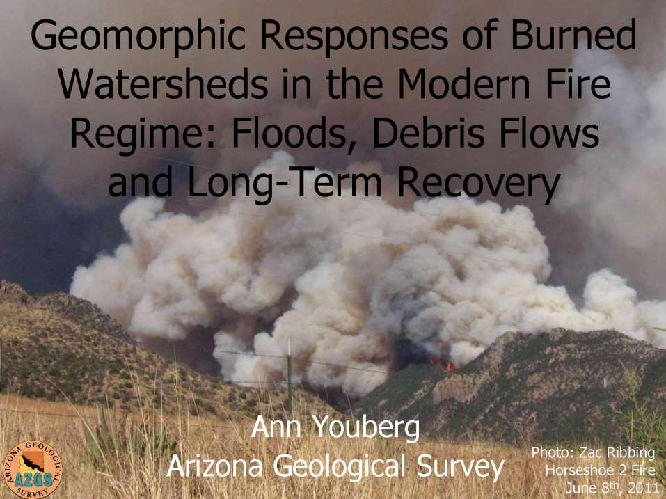
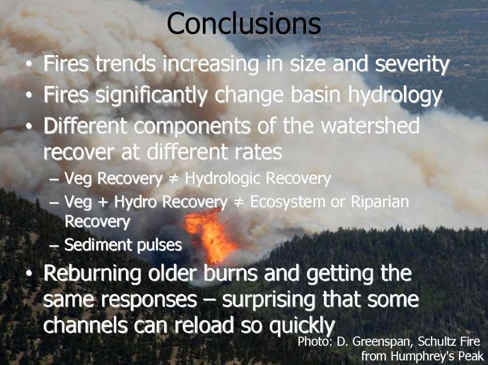
Geomorphic Responses of Burned Watersheds in the Modern Fire Regime: Floods, Debris Flows and Long-Term Recovery. Fire Regimes: Tree Ring Data
 Geomorphic Responses of Burned Watersheds in the Modern Fire Regime: Floods, Debris Flows and Long-Term Recovery Outline Fire Regimes and Trends Post-fire Hydrologic Changes Post-fire Geomorphic Responses
GIS in Weather and Society
 GIS in Weather and Society Olga Wilhelmi Institute for the Study of Society and Environment National Center for Atmospheric Research WAS*IS November 8, 2005 Boulder, Colorado Presentation Outline GIS basic
Land Use Methods & Metrics Development Outcome
 Quarterly Progress Meeting November 15, 2018 Land Use Methods & Metrics Development Outcome Peter Claggett, USGS LUWG Coordinator Through the Chesapeake Bay Watershed Agreement, the Chesapeake Bay Program
Chippewa County Natural Hazards Mitigation Plan
 2014 Chippewa County Natural Hazards Mitigation Plan Prepared for: Chippewa County Office of Emergency Management With the Assistance of: Eastern U.P. Regional Planning & Development Commission April,
Chapter 3 Erosion in the Las Vegas Wash
 Chapter 3 Erosion in the Las Vegas Wash Introduction As described in Chapter 1, the Las Vegas Wash (Wash) has experienced considerable change as a result of development of the Las Vegas Valley (Valley).
Global Flash Flood Guidance System Status and Outlook
 Global Flash Flood Guidance System Status and Outlook HYDROLOGIC RESEARCH CENTER San Diego, CA 92130 http://www.hrcwater.org Initial Planning Meeting on the WMO HydroSOS, Entebbe, Uganda 26-28 September
Detection and attribution of flood change across the United States
 Detection and attribution of flood change across the United States Stacey Archfield, U.S. Geological Survey, USA USGS responds to recent flooding near Houston, Texas on April 20, 2016. Credit: Tom Pistillo,
Figure 1. Map of drainages above Beatty s property.
 July 13, 2011, corrected Observations of post-monument Fire flows at, Miller Canyon, Coronado National Forest, July 11 th, 2011 Ann Youberg, AZGS Tom Beatty reported 1.05 of rain at his house on July 10
Missouri River Basin Water Management
 Missouri River Basin Water Management US Army Corps of Engineers Missouri River Navigator s Meeting February 12, 2014 Bill Doan, P.E. Missouri River Basin Water Management US Army Corps of Engineers BUILDING
2016 Fall Conditions Report
 2016 Fall Conditions Report Prepared by: Hydrologic Forecast Centre Date: December 13, 2016 Table of Contents TABLE OF FIGURES... ii EXECUTIVE SUMMARY... 1 BACKGROUND... 5 SUMMER AND FALL PRECIPITATION...
NIDIS Intermountain West Drought Early Warning System December 11, 2018
 NIDIS Drought and Water Assessment NIDIS Intermountain West Drought Early Warning System December 11, 2018 Precipitation The images above use daily precipitation statistics from NWS COOP, CoCoRaHS, and
ASSESSMENT OF POTENTIAL DEBRIS-FLOW PEAK DISCHARGES FROM BASINS BURNED BY THE 2002 MISSIONARY RIDGE FIRE, COLORADO. Abstract
 OPEN-FILE REPORT OF-03-332 ASSESSMENT OF POTENTIAL DEBRIS-FLOW PEAK DISCHARGES FROM BASINS BURNED BY THE 2002 MISSIONARY RIDGE FIRE, COLORADO By Susan H. Cannon, U.S. Geological Survey John A. Michael,
Sediment loads and erosion in forest headwater streams of the Sierra Nevada, California
 Revisiting Experimental Catchment Studies in Forest Hydrology (Proceedings of a Workshop held during the XXV IUGG General Assembly in Melbourne, June July 2011) (IAHS Publ. 353, 2012). 195 Sediment loads
A mitigation perspective on three GIS case studies on post-fire debris flows along the Wasatch Front, Northern Utah
 Chelsea Welker GEOG 5340 Final paper August 3, 2016 A mitigation perspective on three GIS case studies on post-fire debris flows along the Wasatch Front, Northern Utah Abstract The combination of wildfire
INTRODUCTION TO HEC-HMS
 INTRODUCTION TO HEC-HMS Hydrologic Engineering Center- Hydrologic Modeling System US Army Corps of Engineers Hydrologic Engineering Center HEC-HMS Uses Schematics Enter properties: watershed, rivers (reaches),
Hillslope Erosion Rates in the Oak Savannas of the Southwestern Borderlands Region
 Hillslope Erosion Rates in the Oak Savannas of the Southwestern Borderlands Region Item type Authors Publisher Journal Rights text; Proceedings Kauffman, Arron T.; Stropki, Cody L.; Ffolliott, Peter F.;
TEXAS WILDLAND FIRE POTENTIAL WINTER/SPRING 2018/2019
 TEXAS WILDLAND FIRE POTENTIAL WINTER/SPRING 2018/2019 Texas A&M Forest Service Predictive Services Prepared December 12 th 2018 Brad Smith Luke Kanclerz Scott Breit Tom Spencer Mike Dunivan 2 Fire Potential
Delaware River Flood Advisory Committee
 Delaware River Flood Advisory Committee A Partnership to Support Flood Mitigation Alan Tamm Pennsylvania Emergency Management Agency Bureau of Recovery and Mitigation atamm@state.pa.us Peter Gabrielsen
Dan Miller + Kelly Burnett, Kelly Christiansen, Sharon Clarke, Lee Benda. GOAL Predict Channel Characteristics in Space and Time
 Broad-Scale Models Dan Miller + Kelly Burnett, Kelly Christiansen, Sharon Clarke, Lee Benda GOAL Predict Channel Characteristics in Space and Time Assess Potential for Fish Use and Productivity Assess
SOUTH MOUNTAIN WEATHER STATION: REPORT FOR QUARTER 2 (APRIL JUNE) 2011
 2011") SOUTH MOUNTAIN WEATHER STATION: REPORT FOR QUARTER 2 (APRIL JUNE) 2011 Prepared for ESTANCIA BASIN WATERSHED HEALTH, RESTORATION AND MONITORING STEERING COMMITTEE c/o CLAUNCH-PINTO SOIL AND WATER CONSERVATION
SOUTH MOUNTAIN WEATHER STATION: REPORT FOR QUARTER 2 (APRIL JUNE) 2011 Prepared for ESTANCIA BASIN WATERSHED HEALTH, RESTORATION AND MONITORING STEERING COMMITTEE c/o CLAUNCH-PINTO SOIL AND WATER CONSERVATION
HOLOCENE FIRE, CLIMATE & EROSION
 HOLOCENE FIRE, CLIMATE & EROSION IN THE JEMEZ MOUNTAINS, NM NATURAL AND ANTHROPOGENIC CONTROLS Erin Fitch 1 & Grant Meyer 2 1 University of Hawai i at Mānoa 2 University of New Mexico 2011 Las Conchas
MEANDER MIGRATION MODEL ASSESSMENT FOR THE JANUARY 2005 STORM, WHITMAN PROPERTY, SAN ANTONIO CREEK, VENTURA COUNTY, CALIFORNIA
 MEANDER MIGRATION MODEL ASSESSMENT FOR THE JANUARY 2005 STORM, WHITMAN PROPERTY, SAN ANTONIO CREEK, VENTURA COUNTY, CALIFORNIA Prepared by Eric Larsen, Ph.D. Mark Rains, Ph.D. October 2006 INTRODUCTION
Probability and Volume of Potential Postwildfire Debris Flows in the 2010 Fourmile Burn Area, Boulder County, Colorado
 Prepared in cooperation with the U.S. Department of Agriculture Forest Service Arapaho and Roosevelt National Forests and Boulder County Probability and Volume of Potential Postwildfire Debris Flows in
Adapting to Climate Change in Black River First Nation
 Adapting to Climate Change in Black River First Nation Dr. Brian G. Kotak, General Manager -Manitoba Model Forest Jack Johnson, Special Projects Black River First Nation Climate Change & Health Adaptation
The Colorado Drought : 2003: A Growing Concern. Roger Pielke, Sr. Colorado Climate Center.
 The Colorado Drought 2001-2003: 2003: A Growing Concern Roger Pielke, Sr. Colorado Climate Center Prepared by Tara Green and Odie Bliss http://climate.atmos.colostate.edu 2 2002 Drought History in Colorado
Water Availability and Drought Conditions Report. October 2015
 Water Availability and Drought Conditions Report October 2015 Executive Summary The Water Availability and Drought Conditions Report provides an update on drought conditions throughout Manitoba for October
A Data Fusion Approach to Real-time Monitoring Systems and Information Management
 Landslide Preparedness in the ASEAN Member States A Data Fusion Approach to Real-time Monitoring Systems and Information Management Jessada Karnjana, PhD National Electronics and Computer Technology Center
Water & Climate; Floods & Droughts (The yin & yang of water availablilty) Water & Climate; Floods & Droughts (The yin & yang of water availablilty)
 Water & Climate; Floods & Droughts (The yin & yang of water availablilty)") (Acknowledgment: This presentation was developed in collaboration with ESA, NEON and NCEAS, federal agencies and academic team members from minority serving institutions.) Water & Climate; Floods & Droughts
(Acknowledgment: This presentation was developed in collaboration with ESA, NEON and NCEAS, federal agencies and academic team members from minority serving institutions.) Water & Climate; Floods & Droughts
Catastrophic Events Impact on Ecosystems
 Catastrophic Events Impact on Ecosystems Hurricanes Hurricanes An intense, rotating oceanic weather system with sustained winds of at least 74 mph and a welldefined eye Conditions for formation: Warm water
Quenching the Valley s thirst: The connection between Sierra Nevada snowpack & regional water supply
 Quenching the Valley s thirst: The connection between Sierra Nevada snowpack & regional water supply Roger Bales, UC Merced Snow conditions Snow & climate change Research directions Sierra Nevada snow
Physical Geography: Patterns, Processes, and Interactions, Grade 11, University/College Expectations
 Geographic Foundations: Space and Systems SSV.01 explain major theories of the origin and internal structure of the earth; Page 1 SSV.02 demonstrate an understanding of the principal features of the earth
The Effectiveness of Aerial Hydromulch as an Erosion Control Treatment in Burned Chaparral Watersheds, Southern California
 The Effectiveness of Aerial as an Erosion Treatment in Burned Chaparral Watersheds, Southern California Peter M. Wohlgemuth, Jan L. Beyers, Peter R. Robichaud Abstract High severity wildfire can make watersheds
Predicting Fire Season Severity in the Pacific Northwest
 Predicting Fire Season Severity in the Pacific Northwest Paul Werth 1 Abstract Projections of fire season severity that integrate historical weather and fire information can be used by fire managers when
5.2. IDENTIFICATION OF NATURAL HAZARDS OF CONCERN
 5.2. IDENTIFICATION OF NATURAL HAZARDS OF CONCERN To provide a strong foundation for mitigation strategies considered in Sections 6 and 9, County considered a full range of natural hazards that could impact
Lessons Learned and Shared
 Lessons Learned and Shared Plan for the worst. Hope for the best. Remember that hope is not a strategy. Agnes 8 Lessons 1. Identify Susceptible Communities 2. Develop a Plan 3. Threat Recognition 4. Review
Section 4: Model Development and Application
 Section 4: Model Development and Application The hydrologic model for the Wissahickon Act 167 study was built using GIS layers of land use, hydrologic soil groups, terrain and orthophotography. Within
Drought Monitoring with Hydrological Modelling
 st Joint EARS/JRC International Drought Workshop, Ljubljana,.-5. September 009 Drought Monitoring with Hydrological Modelling Stefan Niemeyer IES - Institute for Environment and Sustainability Ispra -
Southern California Edison Wildfire Mitigation & Grid Resiliency
 Southern California Edison Wildfire Mitigation & Grid Resiliency California State Legislative Conference Committee on Wildfire Preparedness and Response August 7, 2018 CALIFORNIA S WILDFIRE RISK Year-Round
Oregon Water Conditions Report May 1, 2017
 Oregon Water Conditions Report May 1, 2017 Mountain snowpack in the higher elevations has continued to increase over the last two weeks. Statewide, most low and mid elevation snow has melted so the basin
Seasonal Climate Transitions in New England
 1 Seasonal Climate Transitions in New England Alan K Betts Atmospheric Research Pittsford, VT 05763 akbetts@aol.com Revised October 6, 2010 (submitted to Weather) Abstract For continental climates at northern
Sediment and nutrient transport and storage along the urban stream corridor
 Sediment and nutrient transport and storage along the urban stream corridor Greg Noe, Cliff Hupp, Ed Schenk, Jackie Batson, Nancy Rybicki, Allen Gellis What is the role of floodplains everywhere? Noe 2013,
Oregon Water Conditions Report April 17, 2017
 Oregon Water Conditions Report April 17, 2017 Mountain snowpack continues to maintain significant levels for mid-april. By late March, statewide snowpack had declined to 118 percent of normal after starting
MODELING LIGHTNING AS AN IGNITION SOURCE OF RANGELAND WILDFIRE IN SOUTHEASTERN IDAHO
 MODELING LIGHTNING AS AN IGNITION SOURCE OF RANGELAND WILDFIRE IN SOUTHEASTERN IDAHO Keith T. Weber, Ben McMahan, Paul Johnson, and Glenn Russell GIS Training and Research Center Idaho State University
Influence of the Major Drainages to the Mississippi River and Implications for System Level Management
 Influence of the Major Drainages to the Mississippi River and Implications for System Level Management Brian M. Vosburg Geologist Louisiana Coastal Protection and Restoration Authority brian.vosburg@la.gov
It is relatively simple to comprehend the characteristics and effects of an individual id fire. However, it is much more difficult to do the same for
 Interactive Effects of Plant Invasions and Fire in the Hot Deserts of North America Matt Brooks U.S. Geological Survey Western Ecological Research Center Yosemite Field Station, El Portal CA Presentation
National Wildland Significant Fire Potential Outlook
 National Wildland Significant Fire Potential Outlook National Interagency Fire Center Predictive Services Issued: April 1, 2008 Next Issue: May 1, 2008 Wildland Fire Outlook April 2008 through July 2008
Flash Flood Guidance System On-going Enhancements
 Flash Flood Guidance System On-going Enhancements Hydrologic Research Center, USA Technical Developer SAOFFG Steering Committee Meeting 1 10-12 July 2017 Jakarta, INDONESIA Theresa M. Modrick Hansen, PhD
FFGS Advances. Initial planning meeting, Nay Pyi Taw, Myanmar February, Eylon Shamir, Ph.D,
 FFGS Advances Initial planning meeting, Nay Pyi Taw, Myanmar 26-28 February, 2018 Eylon Shamir, Ph.D, EShamir@hrcwater.org Hydrologic Research Center San Diego, California FFG System Enhancements The following
Rocky Mountain Field Institute 2015 Annual Report Waldo Canyon Fire Restoration December 17, 2015
 December 17, 2015 815 South 25 th St, Suite 101 Colorado Springs, CO 80904 www.rmfi.org Dedicated to the conservation and stewardship of public lands in the Pikes Peak Region 2 Background In the summer
Lecture 6: Precipitation Averages and Interception
 Lecture 6: Precipitation Averages and Interception Key Questions 1. How much and when does Whatcom County receive rain? 2. Where online can you find rainfall data for the state? 3. How is rainfall averaged
Existing NWS Flash Flood Guidance
 Introduction The Flash Flood Potential Index (FFPI) incorporates physiographic characteristics of an individual drainage basin to determine its hydrologic response. In flash flood situations, the hydrologic
Negligible soil erosion in a burned mountain watershed, Canadian Rockies: field and modelling investigations considering the role of duff
 EARTH SURFACE PROCESSES AND LANDFORMS Earth Surf. Process. Landforms 36, 97 113 (11) Copyright 11 John Wiley & Sons, Ltd. Published online October 11 in Wiley Online Library (wileyonlinelibrary.com) DOI:
Post-Wildfire Risk Analysis, Fire N70261, 2015, Sitkum-Duhamel. Peter Jordan, P.Geo., MFLNRO, Nelson 22 Sept 2015
 Post-Wildfire Risk Analysis, Fire N70261, 2015, Sitkum-Duhamel Peter Jordan, P.Geo., MFLNRO, Nelson 22 Sept 2015 Introduction and methods This memo gives further information on post-wildfire natural hazards
This Powerpoint presentation summarizes the use of NetMap for a Fire Decision Support System. Created on Sept 25, 2015 by Dr. Lee Benda and Kevin
 This Powerpoint presentation summarizes the use of NetMap for a Fire Decision Support System. Created on Sept 25, 2015 by Dr. Lee Benda and Kevin Andras (TerrainWorks). 1 The general approach strategy:
Estimates of Peak Discharge for the September 2013 Floods in Boulder County, Colorado. John Moody 17 November 2015 AWRA Meeting--Denver
 Estimates of Peak Discharge for the September 2013 Floods in Boulder County, Colorado John Moody 17 November 2015 AWRA Meeting--Denver Location Colorado Front Range Boulder County Streams, rainfall and
Chris Lenhart, John Nieber, Ann Lewandowski, Jason Ulrich TOOLS AND STRATEGIES FOR REDUCING CHANNEL EROSION IN MINNESOTA
 Chris Lenhart, John Nieber, Ann Lewandowski, Jason Ulrich TOOLS AND STRATEGIES FOR REDUCING CHANNEL EROSION IN MINNESOTA Background and approach Channel loading major source of sediment in much of MN River
GEOL 1121 Earth Processes and Environments
 GEOL 1121 Earth Processes and Environments Wondwosen Seyoum Department of Geology University of Georgia e-mail: seyoum@uga.edu G/G Bldg., Rm. No. 122 Seyoum, 2015 Chapter 6 Streams and Flooding Seyoum,
Climatic and Ecological Conditions in the Klamath Basin of Southern Oregon and Northern California: Projections for the Future
 Climatic and Ecological Conditions in the Klamath Basin of Southern Oregon and Northern California: Projections for the Future A Collaborative Effort by: CLIMATE LEADERSHIP INITIATIVE INSTITUTE FOR A SUSTAINABLE
Manitoba s Elevation (LiDAR) & Imagery Datasets. Acquisition Plans & Opportunities for Collaboration
 & Imagery Datasets. Acquisition Plans & Opportunities for Collaboration") Manitoba s Elevation (LiDAR) & Imagery Datasets Acquisition Plans & Opportunities for Collaboration Manitoba Planning Conference May 2017 Presentation Outline Manitoba s Elevation (LiDAR) and Imagery Datasets
Manitoba s Elevation (LiDAR) & Imagery Datasets Acquisition Plans & Opportunities for Collaboration Manitoba Planning Conference May 2017 Presentation Outline Manitoba s Elevation (LiDAR) and Imagery Datasets
Improvement of the National Hydrography Dataset for Parts of the Lower Colorado Region and Additional Areas of Importance to the DLCC
 Improvement of the National Hydrography Dataset for Parts of the Lower Colorado Region and Additional Areas of Importance to the DLCC Carlos Reyes-Andrade California State University, Northridge September
Appendix D. Model Setup, Calibration, and Validation
 . Model Setup, Calibration, and Validation Lower Grand River Watershed TMDL January 1 1. Model Selection and Setup The Loading Simulation Program in C++ (LSPC) was selected to address the modeling needs
Areal Reduction Factors for the Colorado Front Range and Analysis of the September 2013 Colorado Storm
 Areal Reduction Factors for the Colorado Front Range and Analysis of the September 2013 Colorado Storm Doug Hultstrand, Bill Kappel, Geoff Muhlestein Applied Weather Associates, LLC - Monument, Colorado
investment decisions
 Climate modelling: A guide to investment decisions Vicky Pope Met Office Hadley Centre This is not an ADB material. The views expressed in this document are the views of the author/s and/or their organizations
AHEAD OF THE STORM: Extreme Weather Resilience in the City of Toronto
 AHEAD OF THE STORM: Extreme Weather Resilience in the City of Toronto David MacLeod Toronto Environment and Energy Office Environmental Applied Science and Management Symposium 2013 March 21, 2013 Ahead
Water information system advances American River basin. Roger Bales, Martha Conklin, Steve Glaser, Bob Rice & collaborators UC: SNRI & CITRIS
 Water information system advances American River basin Roger Bales, Martha Conklin, Steve Glaser, Bob Rice & collaborators UC: SNRI & CITRIS Opportunities Unprecedented level of information from low-cost
Evaluation of a MODIS Triangle-based Algorithm for Improving ET Estimates in the Northern Sierra Nevada Mountain Range
 Evaluation of a MODIS Triangle-based Algorithm for Improving ET Estimates in the Northern Sierra Nevada Mountain Range Kyle R. Knipper 1, Alicia M. Kinoshita 2, and Terri S. Hogue 1 January 5 th, 2015