Evaluating and improving the developed algorithms for effective snow cover mapping on mountainous terrain for hydrological applications
|
|
|
- Dwayne Leonard
- 5 years ago
- Views:
Transcription
1 Satellite Application Facility for Hydrology Final Report on the Visiting Scientist activities: Evaluating and improving the developed algorithms for effective snow cover mapping on mountainous terrain for hydrological applications Zuhal AKYUREK* and A.Unal SORMAN* 15. November.2008 * METU, Civil Eng. Dept. Water Resources Lab. Ankara TURKEY
2 Summary Snow covered area depletion curves represent a key input for snow runoff melting models like the snowmelt runoff model (SRM). SRM is a degree-day-based model for daily runoff simulations and forecasts in mountainous areas in which snowmelt is the major runoff contributor. Satellite images and aerial photographs are valuable sources for retrieving snow covered areas on non-cloudy days. The accuracy of the snow cover mapping studies in the optical wavebands mostly depends on the algorithm's ability to detect clouds. On very cloudy days it is not possible to make accurate snow cover mapping using only optical sensors. Microwave sensors can be used to obtain snow information on cloudy days. The snow-water equivalent (SWE) of a dry snow pack can be estimated with passivemicrowave sensors such as Special Sensor Microwave/Imager (SSM/I) and Advanced Microwave Scanning Radiometer for EOS (AMSR-E). Development of snow cover products based on multi-sensor data sources is needed for continuous regional and global snow cover mapping for climate, hydrological and weather applications. The proposed algorithms for snow recognition and effective snow cover products do not take the optic and microwave data into account at the same time. However the optical data do not provide information on cloudy days. In order to evaluate snow cover maps obtained by MSG- SEVIRI, NOAA/AVHRR, Terra-Aqua-EOS/MODIS, the blending methodology of snow products obtained from MODIS and AMSR-E, will be implemented and tested for mountainous areas. A preliminary blended snow product has been developed jointly by the U.S. Air Force Weather Agency (AFWA) and NASA / Goddard Space Flight Center. The AFWA NASA or ANSA blended snow product is an all-weather product that utilizes both visible and near-ir (MODIS) and microwave (AMSR-E) data. In this study the validation of the ANSA blended snow cover product, having 25 and 5 km spatial resolution, respectively, was performed for the eastern part of Turkey for five months in the winter of This is the first time that the blended snow cover product has been evaluated in a mountainous area, where the elevation ranges between 850 and 3000 m. Daily snow data collected at 36 meteorological stations were used in the analysis. The utility of ANSA products in mountainous areas of Slovakia covered with forest was also analyzed. The ANSA blended snow products improve the mapping of snow cover extent relative to using either MODIS or AMSR-E products, alone, for the winter in the eastern part of Turkey. However in Slovakia ANSA products do not improve the mapping of snow cover extent. 5 km resolution ANSA prototype ANSA maps from February and March 2008 were used to derive snow cover depletion curves for the upper Euphrates basin located in the eastern part of Turkey. The results are compared with the curves obtained from MODIS daily snow products, and found to provide an improvement over using MODIS daily maps alone. This is because of cloud obscuration on the MODIS maps. 1
3 Acknowledgements The authors were supported by EUMETSAT as visiting scientists at NASA-GSFC within the H-SAF project, the first author was also funded by TUBITAK during the VS activity. We would like to express our sincere appreciations to Dr. Dorothy K.Hall, who took part in this VS activity from the beginning till the end. She shared her valuable experience throughout the entire duration of project. Not only her scientific support, her friendship, understanding, professional attitude made priceless contribution to our study. Special thanks go to Dr. George Riggs, who produce the data and help in technical issues. The meetings with Dr. Jim Foster and Dr. Ed Kim were invaluable. It has been a true pleasure to work in collaboration with the branch of Hydrospheric and Biospheric Sciences Laboratory at NASA/Goddard Space Flight Center. We are grateful to the branch chairman, Dr. Markus Thorsten, in helping us with all the administrative issues. Special thanks go to the H-SAF management on behalf of Dr. Roberto Sorani and H-SAF science manager, Luigi de Leonibus, for their help. The last but not the least thanks go to the Turkish Snow Team, for their support and help. 2
4 Content Summary 1 Acknowledgements 2 Content 3 Chapter 1 The Use of Optical and Microwave Data in Snow Cover Retrieval 4 2 Blended Snow Cover Product: AFWA NASA (ANSA) MODIS Data AMSR-E Data Blending Procedure 9 3 Validation Analyses of Blended Snow Cover Product Validation for Turkey Validation for Slovakia 15 4 Results and Discussion Validation of ANSA having 25km resolution Validation of ANSA having 5km resolution for February and 23 March for the eastern part of Turkey 4.3 SCA estimation from ANSA having 5km resolution for the upper 25 Euphrates basin 4.4 Hydrological Impact of ANSA blended snow cover product 30 compared to MODIS snow products 5 Conclusions and Recommendations Conclusions Recommendations 36 References 37 Appendix 39 3
5 Chapter 1 The Use of Optical and Microwave Data in Snow Cover Retrieval Monitoring the snow parameters (e.g. snow cover area, snow water equivalent) is a challenging work for the meteorologists and climatologists, who are studying climatic and atmospheric variability on a global scale. Because of its natural physical properties, snow highly affects the evolution of weather from daily bases to climate on a longer time scale. Due to its high albedo, snow also plays an important role in the earth's energy balance, affecting weather and climate. Thus, the accurate observation of the spatial and temporal variability of snow covered area is an important tool for monitoring of the global changes. From the hydrological point of view, snow acts as a high-volume water storage controlling water reservoirs, affecting the evaporation process, and is a source of sometimes uncontrolled discharge when starting to melt. Snow melting constitutes a potential risk of flooding in certain areas, but it is also an excellent source of energy for power plants Remote sensing constitutes a unique technique to obtain spatially and temporally welldistributed information on snow parameters to complement ground-based observation networks. Snow can be mapped through optic wavebands (e.g. MODIS) with high accuracy under cloud-free conditions. Various studies were done on the validation of MODIS snow cover products under a variety of snow and land cover conditions. Hall and Riggs (2007) state that, most studies show an overall accuracy of ~94% compared with ground measurements. The lower accuracies were obtained in the fall and spring and under thinsnow conditions and in dense forests. They also indicate; the significant source of error in the MODIS snow products is due to the cloud-masking algorithm used in the snow algorithm. Parajka and Blöschl (2008) presented an evaluation of simple mapping methods that reduce cloud coverage by using information from neighboring non-cloud covered pixels in time and space and by combining MODIS data from the Terra and Aqua satellites. Ault et al. (2006) performed the validation of the MODIS snow product (MOD10_L2) and cloud mask (MOD35) in the Lower Great Lake regions. They found that when cloud cover does not obscure the ground, the MOD10_L2 snow product provides an accurate and reliable record of snow and ice extent. On the other hand, when cloud cover is prevalent in an image, the MOD10_L2 snow product can sometimes misinterpret the cloud cover as either ice or snow. In Tekeli et al. (2005), comparison of MODIS snow maps with in situ measurements over the snow season show good agreement with overall accuracies ranging between 62% and 82% considering the shift in the days of comparison. In that study the main reasons to have disagreement between MODIS and in situ data were referred as the high cloud cover frequency in the area and the current version of the MODIS cloud mask that appears to frequently map edges of snow-covered areas and land surfaces. Cloud cover is a challenging problem in retrieving snow cover information from the satellite images acquired in optical portion of the spectrum. Microwave wavebands can help to map snow through clouds and darkness at a lower spatial resolution. AMSR-E increases the accuracy of snow cover retrieval from passive microwave sensors especially near the snowline. Despite the near all-weather capability, the current microwave sensors provide measurements, at much coarser resolution (25 km) than the visible satellite sensors (1km). 4
6 Another disadvantage of passive microwave imagery is its limited capability to penetrate wet snow cover. Development of snow cover products based on multi-sensor data sources have been performed recently, because of the need for continuous regional and global snow cover mapping for climate, hydrological and weather applications. Romanov et al. (2000) proposed a system using a combination of observations in the visible, mid-infrared, and infrared made by the Imager instrument aboard Geostationary Operational Environmental Satellites (GOES) and microwave observations of the Special Sensor Microwave Imager (SSM/I) aboard the polar-orbiting Defense Meteorological Satellite Program platform. The devised technique was applied to satellite data for mapping snow cover for the North American continent during the winter season of 1998/99. In their study snow identification with the combination of GOES and SSM/I observations was found to be more efficient than the one based solely on satellite microwave data. Kongoli et al. (2006) blended Advanced Microwave Sounding Unit (AMSU) and Interactive Multi-Sensor Snow and Ice Mapping System (IMS) data to map snow cover and extent. A preliminary blended-snow product has been developed jointly by the U.S. Air Force Weather Agency (AFWA) and the Hydrospheric and Biospheric Sciences Laboratory (HBSL) at NASA / Goddard Space Flight Center. A description of the preliminary product, called the AFWA NASA or ANSA blended snow-cover product is given in Foster et al. (2008a). The prototype product utilizes the Moderate-Resolution Imaging Spectroradiometer (MODIS) standard daily global (5-km resolution) snow-cover product (Hall and Riggs, 2007) and the Advanced Microwave Scanning Radiometer for EOS (AMSR-E) standard daily global (25 km resolution) snow-water equivalent (SWE) product (Kelly et al., 2003) to map snow cover and SWE. Preliminary evaluation of the ANSA blended snow product was performed in several studies. Hall et al. (2007) performed the validation of the blended snow cover product over the Lower Great Lakes region. They indicated the use of the new product improve the mapping of snow cover compared to using either the MODIS or AMSR-E product, alone. Casey et al. (2008) evaluated the new product in Finland for the snow season using 9 ground observations. Satellite Application Facility on Support to Operational Hydrology and Water Management (H-SAF) is established with an aim of generating satellite-derived products specifically designed as to comply with requirements for operational hydrology and water management. The main objectives of H-SAF are to provide new satellite-derived products from existing and future satellites with sufficient temporal and spatial resolution to satisfy the needs of operational hydrology and to perform independent validation of the usefulness of the products on hydrological applications. So far the snow recognition (SN_OBS1), and snow cover (SN_OBS3) products retrieved from satellite data for the mountainous areas within the HSAF domain were put in the processing chain. The snow water equivalent (SN_OBS4) product will be available in the mid of During the improvement and tuning of the snow retrieval algorithms, the intensive validation studies will be implemented. The combination of snow cover products obtained from optic and microwave data can provide continuous regional and global snow cover maps. 5
7 In this study, we evaluate the utility of a blended snow product, namely ANSA in snowmelt modeling. First the algorithms and the blending procedure were analyzed. The blended snow product in two different spatial resolutions (25 km and 5 km) was generated over the eastern part of Turkey for the snow season. The 25 km ANSA product was used in validating the blended snow product for Slovakia for January This is the first time of validating the blended snow cover product in a mountainous area, where the elevation ranges between 850 m to 3000m in Turkey. In terms of snow cover mapping we discuss the contribution of blended snow product compared to MODIS and AMSR-E product alone. 5 km resolution ANSA prototype ANSA maps from February, March and April 2008 were used to derive snow cover depletion curves for the upper Euphrates basin located in the eastern part of Turkey. The results were compared with the curves obtained from MODIS daily snow products, and found to provide an improvement over using MODIS daily maps alone. SCA depletion curves obtained from ANSA and MODIS snow products were used in the snowmelt runoff simulations. In this study the preliminary results obtained from hydrological impact analyses of satellite snow products are presented. 6
 as well as snow albedo (Hall et al., 2007; Riggs et al.")
8 Chapter 2 Blended Snow Cover Product: AFWA NASA (ANSA) 2.1. MODIS data: MODIS data have been used since early 2000 to produce validated daily, global snow maps in an automated environment. These maps, available at a variety of spatial resolutions 500 m, 0.05 deg. and 0.25 deg. provide snow extent and fractional snow cover (FSC) as well as snow albedo (Hall et al., 2007; Riggs et al., 2005; Klein and Stroeve, 2002). Inputs to the products include the MODIS cloud mask (Ackerman et al., 1998), land/water mask, geolocation product (Wolfe et al., 2002), radiance products and surface-reflectance product (for snow albedo) and land cover. The resulting snow product is using the MOD10C1 snow product (Figure 2.1). In developing the MOD10C1 product, snow cover extent is mapped by processing the MOD10A1 and MYD10A1 products for a day into the CMG. Snow cover extent is expressed as a percentage of coverage of the input data at 500 m resolution in a cell of the CMG. These snow products are archived and distributed through the National Snow and Ice Data Center. Figure 2.1. MOD10C1 product for January 19, AMSR-E data: A validated global daily SWE product is currently unavailable, however, passive microwave-derived methods to estimate regional to global snow depth or SWE have been developed that use frequent and wide-swath-coverage observations from satellite passivemicrowave instruments. The AMSR-E sensor, on board Aqua, is the most recent addition to 7

9 the passive microwave suite of instruments. The AMSR-E snow products (Kelly et al., 2003) are archived and distributed through the National Snow and Ice Data Center. Passive-microwave satellite footprints are currently ~25 km. There is a large body of literature describing the ability of passive-microwave instruments to estimate snow extent, SWE and melt onset (e.g. Chang et al., 1987). There are also studies describing systematic errors and uncertainties in SWE retrievals using passive-microwave data (Kelly et al., 2003; Foster et al., 2005). Microwave data can be used to get information on snow for cloudy days. The SWE of dry snow pack can be estimated with passive-microwave sensors such as SSM/I (Chang et al., 2005) and AMSR-E (Kelly et al., 2003) (Figure 2.2). Kelly et al. (2003) developed a methodology to estimate snow grain size and density as they evolve through the season using SSM/I and simple statistical growth models. The approach uses the scattering signal determined by the difference in brightness temperature between 10 and 36 GHz at vertical and horizontal polarizations (Tb10V-Tb36V and Tb10H-Tb36H). A variable parameter (a) is calculated from the polarization difference at 36 GHz brightness temperatures which is used to multiply the brightness temperature differences (Tb10V-Tb36V and Tb10H- Tb36H). The overall approach is split into two parts with one part retrieving snow depth for the fraction of a footprint that is forest covered and the other retrieving the fraction that is forest-free. The AMSR-E data products are in HDF-EOS format, they are generated at different spatial (500 m to 25 km) and temporal (multiple swaths or daily) resolution. Figure 2.2. AMSR-E snow water equivalent product for January 19,
10 2.3. Blending Procedure ANSA-blended snow product is an all-weather product with snow mapped by both visible and near-ir (MODIS) and microwave (AMSR-E) data. ANSA data will be available for use in a near-real time basis as a single global daily, 25-km resolution, user friendly product (Casey et al., 2008). The thematic values of ANSA and ANSA aggregated product are given in Figure 2.3 and 2.4 respectively. During the blending procedure the MOD10C1 product is re-sampled to 25km with nearest neighborhood re-sampling method and then the blending is performed with the AMSR-E product. ANSA snow map 15 January 2007 Blended Snow Grid Values (575) MODIS snow % and SWE mm (550) MODIS snow 21-79% and SWE mm (450) MODIS snow 1-20% and SWE mm (390) MODIS snow % and SWE 0 mm (370) MODIS snow 21-79% and SWE 0 mm (360) MODIS snow 1-20% and SWE 0 mm (375) MODIS snow 1-100% and SWE water mask (355) MODIS snow 0% and SWE mm (350) MODIS cloud and SWE mm (330) MODIS cloud and SWE 0 mm (300) MODIS cloud in AMSR-E swath gap (345) MODIS snow1-100% in AMSR-E swath gap (305, 290) MODIS no data SWE mm (295) MODIS in darkness and SWE 2-480mm (250) MODIS in darkness and SWE 0 mm (253) AMSR-E Permanent Snow/Ice (201) MODIS snow 1-100% and SWE land not processed (200) MODIS snow 1-100% and SWE no data (0) Land (1508) Ocean (1498) Fill Figure 2.3. ANSA snow map 15 January
11 ANSA snow map 15 January 2007 Aggregated Blended Snow Grid Legend Snow Land snow free Uncertain Ocean Fill Figure 2.4. ANSA aggregated blended snow map 15 January
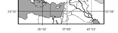
12 Chapter 3 Validation Analyses of Blended Snow Cover Product The validation analyses were done for two study areas within the HSAF domain. The first analysis was performed for the eastern part of Turkey and the second one was performed for Slovakia Validation for Turkey Hydrological processes and climate in the mountainous areas are highly affected by the seasonal snow cover. Essential characteristics both for hydrology and climatology include snow cover, snow depth (SD) and snow water equivalent (SWE). The maximum SWE prior to the onset of spring snowmelt is typically the most important snow characteristic for operational runoff and river discharge forecasts. The concentration of discharge mainly from snowmelt during the spring and early summer months causes not only extensive flooding, inundating large areas, but also the loss of much needed water required for irrigation and power generation purposes during the summer season. Accordingly, modelling snow-covered area in the mountainous regions of Eastern Turkey, as being one of the major headwaters of the Euphrates Tigris basin, has significant importance in forecasting snowmelt discharge, especially for energy production, flood control, irrigation and reservoir operation optimization. However, the accuracy of SD and SWE information is currently limited as the level of SD and SWE can only be assessed by interpolating observations, typically sparse, both spatially and temporally, from gauging networks and snow courses. The observations are more difficult for mountainous regions compared to flat areas. Besides knowing the importance of snow as water resources for Turkey, there is not yet a well established operational snow monitoring system in the country. Therefore comparison of satellite derived snow maps and snow course ground measurements are vital for improvement of the existing mapping algorithms. In this study 30 climate stations and 6 automated weather stations (AWOS) are used in the validation of ANSA products for eastern part of Turkey (Table 3.1). The validation was performed for the months November, December, January, February and March for the snow year. In Figure 3.1 the elevation variation in Turkey is given and in Figure 3.2 the locations of the stations used in the validation study are depicted. The name and the altitudes of the stations are also given in Table 3.1. The precipitation and the temperature values for climate stations for the listed months were obtained and the total precipitation values for 10 stations are given in Figure 3.3. The ANSA products were obtained for the snow year and samples of MOD10C1, AMSR-E and ANSA products are given for January 19, 2008 in Figure 3.4. A systematic positional shift was observed between ANSA products and the boundary coverage of Turkey, which was obtained from scaled topographic maps. Therefore all the products were geocoded with the help of the same coverage in order to have an RMS error lower than one 11
13 pixel. Then the thematic values corresponding to the filed observations were extracted from the products on daily basis. Table 3.1. The name and the altitude of the stations located in Turkey Station Name Elevation (m) Type Guzelyayla 2070 AWOS Ovacik 1980 AWOS Ilica 2094 AWOS Çat 2220 AWOS Dumlu 2666 AWOS Palandoken 2937 AWOS ERZURUM 1758 B.Climate AGRI 1632 B.Climate IGDIR 858 B.Climate TUNCELI 981 B.Climate MALATYA 948 B.Climate BINGOL 1177 B.Climate MUS 1323 B.Climate TATVAN 1665 B.Climate ERZINCAN 1218 B.Climate KARS 1775 B.Climate ELAZIG 990 B.Climate ISPIR 1222 B.Climate OLTU 1322 B.Climate TORTUM 1572 B.Climate HORASAN 1540 B.Climate SARIKAMIS 2102 B.Climate TERCAN 1425 B.Climate DIVRIGI 1120 B.Climate MAZGIRT 1400 B.Climate HINIS 1715 B.Climate ARAPKIR 1200 B.Climate AGIN 900 B.Climate CEMISGEZEK 953 B.Climate KARAKOCAN 1090 B.Climate SOLHAN 1366 B.Climate VARTO 1650 B.Climate MALAZGIRT 1565 B.Climate KEBAN 808 B.Climate PALU 1000 B.Climate GENC 1250 B.Climate 12


14 Figure 3.1. The DEM of Turkey and the location of the meteorological stations in the eastern part of Turkey Figure 3.2. The elevation zones in the upper Euphrates basin 13
15 Total Precipitation (m Erzincan Erzurum Kars Agri Igdir Tunceli Malatya Elazig Mus Ispir Total Precipitation (m Erzincan Erzurum Kars Agri Igdir Tunceli Malatya Elazig Mus Ispir November, 2007 December, Total Precipitation (m Erzincan Erzurum Kars Agri Igdir Tunceli Malatya Elazig Mus Ispir Total Precipitation (m Erzincan Erzurum Kars Agri Igdir Tunceli Malatya Elazig Mus Ispir January, 2008 February, Total Precipitation (m Erzincan Erzurum Kars Agri Igdir Tunceli Malatya Elazig Mus Ispir March, 2008 Figure 3.3. The daily precipitation observed at climate stations for November 2007 March
, MOD10C1 (b) and ANSA (c) products for January 19, 2008.")


16 (a) (c) Figure 3.4. Samples for AMSR-E (a), MOD10C1 (b) and ANSA (c) products for January 19, (b) 3.2. Validation for Slovakia In this study 62 stations are used in the validation of ANSA products for Slovakia. The validation was performed for January In Figure 3.5 the elevation variation in Slovakia and the locations of the stations used in the validation study are depicted. The number and the altitudes of the stations are also given in Table 3.2. The ANSA snow products for January 2008 were geocoded for Slovakia. Then the thematic values corresponding to the field observations were extracted from the products on daily basis. 15


17 Figure 3.5. Location of stations on DEM of Slovakia 16
18 Table 3.2.The name and the altitude of the stations located in Slovakia Station Number Altitude (m) Station Number Altitude (m) Station Number Altitude (m)
19 Chapter 4 Results and Discussion 4.1. Validation of ANSA having 25km resolution i- Validation for Turkey Results of snow extent comparison are presented in Figures 4.1 and 4.2. The comparison was performed on agreement and disagreement percentages on a daily basis (Figure 4.1). The relationship of the percent agreement of the ANSA blended product and the MODIS and AMSR- E input products alone for five months are given in Figure 4.2. It is observed that the ANSA blended snow products improve the mapping of snow cover extent relative to using either MODIS or AMSR-E products alone for the snow year in the east part of Turkey. The strength of the MODIS capturing the fresh snow on the ground is seen when the precipitation and the agreement percentages are compared (Figure 3.3). The agreement percentage is high for months January and February where the snow is thick and dry in these months, but as the snow gets shallow and wet, the agreement in the snow extent is decreased. To make the comparison of the ANSA product among the months, metrics derived from the contingency table were used (Table 4.1). The Probability of detection (POD), hit rate (HR) and critical success index (CSI) were calculated as given in the equations Table 4.2 presents the calculated metrics for the five months. The highest values were obtained for February where the maximum agreement was observed. The lowest values were obtained for March indicating the lowest performance of the ANSA product for this month. This is due to decrease in the snow depth and increase in the wetness of the snow. The agreement of the ANSA blended products and the field observations was analyzed in the spatial distribution, and the higher disagreement percentages were seen for the stations (namely Keban, Arapkir, Malatya, Elazig, Palu), which are located near the reservoir lakes. This is due to the mix- pixel problem contributed from the smaller spatial resolution of AMSR-E product. 18
20 Agreement of ANSA product field observations (%) agreement disagreement Agreement of ANSA product field observations (%) agreement disagreement November, December, Agreement of ANSA product field observations (%) agreement disagreement Agreement of ANSA product field observations (%) agreement disagreement January, 2008 February, Agreement of ANSA product field observations (%) agreement disagreement March, 2008 Figure 4.1. The percent of agreement and disagreement of ANSA product for November 2007 March
21 %Agreemen MODIS AMSR-E Blended %Agreemen MODIS AMSR-E Blended November, 2007 December, %Agreement MODIS AMSR-E Blended %Agreemen MODIS AMSR-E Blended January, 2008 February, %Agreement MODIS AMSR-E Blended March, 2008 Figure 4.2.The percent of agreement of ANSA product, the MODIS and AMSR-E input products alone for November 2007 March
22 Table 4.1. Contingency table for the snow cover product validation. Snow Cover Product Snow Presence None In-situ Observation Snow Presence a b None c d POD = a / (a+b) (4.1) HR = (a+d) / (a+b+c+d) (4.2) CSI = a / (a+b+c) (4.3) Table 4.2. The comparison of the validation in terms of POD, HR, and CSI Nov Dec Jan Feb Mar ANSA- 25km ANSA- 5km ANSA- 25km ANSA- 5km POD (%) HR (%) CSI (%) ii-validation for Slovakia Results of snow extent comparison are presented in Figures 4.3 and 4.4. The comparison was performed on agreement and disagreement percentages on a daily basis (Figure 4.3). The relationship of the percent agreement of the ANSA blended product and the MODIS and AMSR- E input products alone for January 2008 are given in Figure 4.4. It is observed that the ANSA blended snow products do not improve the mapping of snow cover extent relative to using either MODIS or AMSR-E products alone for January 2008 in Slovakia. The Probability of detection (POD), hit rate (HR) and critical success index (CSI) for January 2008 are presented in Table 4.3. In the first five days in January 2008, the agreement of ANSA with field observations is around 80%. During this period blended snow products improve the snow mapping compared to MODIS and AMSR-E products alone. In the second and third weeks of January due to high cloud coverage, only contribution was observed from AMSR-E. The low spatial resolution of AMSR- E, and shallow snow cover decrease the agreement percentages. Increased snow extent comparison agreement was seen in the last five days of January. The difficulty of retrieving old snow fell on the forest area was seen in the validation of blended snow products. 21
23 Agreement of ANSA product with field observations (%) agreement disagreement January, 2008 Figure 4.3. The percent of agreement and disagreement of ANSA product for January 2008 for Slovakia %Agreement MODIS AMSR-E Blended January, 2008 Figure 4.4. The percent of agreement of ANSA product, the MODIS and AMSR-E input products alone for January 2008 for Slovakia. Table 4.3. The comparison of the validation in terms of POD, HR, and CSI for Slovakia data Jan POD (%) HR (%) CSI (%)
24 4.2. Validation of ANSA having 5km resolution for February and March for the eastern part of Turkey In order to see the effect of spatial resolution on snow mapping, ANSA-blended snow products having 5 km resolution were obtained for February and March Similar validation analysis performed for ANSA-25km product was performed for ANSA-5km product for February and March Figures 4.3 and 4.4 show the agreement, disagreement percentages for ANSA-5km product, MODIS and AMSR-E products alone for February and March Agreement (% agreement disagreement change February, %Agreemen MODIS AMSR-E Blended February, 2008 Figure 4.3. Agreement percentage of ANSA-5 product, the MODIS and AMSR-E input products alone for February
25 Agreement (% agreement disagreement change March, 2008 (a) %Agreemen MODIS AMSR-E Blended March, 2008 (b) Figure 4.4. Agreement percentage of ANSA-5 product (a), the MODIS and AMSR-E input products alone for February (b). 24
26 With the ANSA-5km product the agreement percentages are increased for all the days except 3 rd and 15 th of February. In Figure 4.4a, the changes in the percentages are plotted with blue color. With ANSA-5km product, the no-snow cover observations at the site was started to be mapped better with the product. In the spatial extent for three of the stations (Agin, Cemisgezek and Malatya) located nearby the reservoirs, the disagreement percentages are decreased. However for the other three stations (Keban, Palu, Genc) the same disagreement percentages are obtained. In terms of POD, HR and CSI metrics, all of them are increased for the 5km product (Table 4.2). Although 5km resolution product do not get additional information from AMSR-E SWE product, but MODIS snow cover product contribution is increased with a better spatial resolution SCA estimation from ANSA having 5km resolution for the upper Euphrates basin Snow covered area depletion curves represent a key input for snow runoff melting models like the snowmelt runoff model (SRM). SRM is a degree-day-based model for daily runoff simulations and forecasts in mountainous areas in which snowmelt is the major runoff contributor (Martinec, 1975; Rango and Martinec, 1979). In order to see the utility of the ANSA product in obtaining the snow cover area depletion curves, ANSA having 5 km resolution images for March and April were used. The thematic maps were indicating the snow and no-snow classes were used to obtain snow covered area values for the upper Euphrates basin. Snow melting model SRM has been used for the area for ten years and the model parameters specific to the pilot basin have been already studied for the basin. Since the model uses different elevation zones and accepts SCA depletion curves for these elevation zones, five elevation zones determined in previous studies were used to obtain corresponding SCA depletion curves. The elevation ranges for the proposed elevation zones are given in Figure 3.2. The SCA depletion curves for five elevation zones are given in Figure 4.5. The SCA values for the corresponding elevation zones were obtained from MOD10A1 and MOD10A2 snow products. The snow areas and the snow and cloud areas are considered separately in deriving the SCA depletion curves. These values are also plotted on the curves given in Figure 4.5. For lower elevations ANSA predicts more SCA compared to ones derived from MOD10A1 and MOD10A2, even the cloud and snow classes are considered as snow covered area, the values are lower than the ANSA predictions. On 21 st of April precipitation was detected from the meteorological observations. At higher elevations the ANSA predictions are between the values derived from snow only class and cloud added to snow class. This indicates that ANSA finds snow under the clouds on the ground. With the MOD10A1 data if the clouds are not considered in the SCA values, they are underestimating the SCA, but if the clouds are considered in the SCA values, they are overestimating the SCA. 25
27 SCA-ANSA A SCA-MODIS A with clouds SCA-MODIS A SCA-ANSA B SCA-MODIS B with clouds SCA-MODIS B Feb 12-Feb 17-Feb 22-Feb 27-Feb 3-Mar 8-Mar 13-Mar 18-Mar 23-Mar 28-Mar 2-Apr 7-Apr 12-Apr 17-Apr 22-Apr 27-Apr 2-May 7-May Feb 12-Feb 17-Feb 22-Feb 27-Feb 3-Mar 8-Mar 13-Mar 18-Mar 23-Mar 28-Mar 2-Apr 7-Apr 12-Apr 17-Apr 22-Apr 27-Apr 2-May 7-May date date SCA-ANSA C SCA-MODIS C with clouds SCA-MODIS C SCA-ANSA D SCA-MODIS D with clouds SCA-MODIS D Feb 12-Feb 17-Feb 22-Feb 27-Feb 3-Mar 8-Mar 13-Mar 18-Mar 23-Mar 28-Mar 2-Apr 7-Apr 12-Apr 17-Apr 22-Apr 27-Apr 2-May 7-May Feb 12-Feb 17-Feb 22-Feb 27-Feb 3-Mar 8-Mar 13-Mar 18-Mar 23-Mar 28-Mar 2-Apr 7-Apr 12-Apr 17-Apr 22-Apr 27-Apr 2-May 7-May date date SCA-ANSA E SCA-MODIS E with clouds SCA-MODIS E Feb 12-Feb 17-Feb 22-Feb 27-Feb 3-Mar 8-Mar 13-Mar 18-Mar 23-Mar 28-Mar 2-Apr 7-Apr 12-Apr 17-Apr 22-Apr 27-Apr 2-May 7-May date Figure 4.5. SCA depletion curves derived from ANSA and MOD10A1 products. The ANSA product aims to detect the snow on the ground; therefore the thresholds used to classify the snow were set their minimum values. In SWE retrieval the snow determination is done if the SWE retrieval is between 2mm and 450 mm. This range is quiet large for modeling issues. Especially knowing the limitations of AMSR-E for shallow snow depth (SD =5cm, SWE= 15 mm), the lower limitation for snow detection was changed to 15mm in the SWE contribution of ANSA product. The snow cover depletion curves with this modification were obtained for five elevation zones and they are given in Figure 4.6 and 4.7. In these figures the SCA values obtained from MODIS 8 day (MOD10A2) snow products are also drawn. The mean temperatures distributed to the corresponding elevation zones were obtained and put on the 26


28 figures to give information about the relationship between the temperature and accumulation, depletion parts in the SCA depletion curves. Figure 4.6. SCA depletion curves derived from modified ANSA and MOD10A1 products. 27


29 Figure 4.7. SCA depletion curves derived from modified ANSA and MOD10A1 products. The major difference in SCA depletion curves derived from original and modified ANSA products was observed for April 4 and 5, A detailed spatial analysis was performed for these two dates. The spatial distribution of SWE values lower than 15mm was analyzed. In this spatial analysis larger areal extent of SWE values lower than 15mm were observed at lower elevation zones. Within the same elevation zone the areal distribution for the aspect classes were obtained. As it is given in Table 4.4 at zone A and B, larger areal coverage of SWE=< 15mm is 28
30 seen on flat, southwest and southeast slopes. Due to solar illumination and shadowing the northsouth difference in snow melt is expected. This analyses prove that snow on flat and south facing slopes are shallower compared to the snow on north faced slopes (Akyurek and Sorman, 2002). SCA depletion curves obtained from modified ANSA products still overestimate the snow cover extent obtained from MODIS snow products. This is due to the wet snow in month of April, which is a known AMSR-E snow mapping weakness. Table 4.4. The spatial distribution (areal %) of SWE lower than 15mm according to the elevation and aspect classes. A ( m) date F NE SE SW NW 4.April April B( m) date F NE SE SW NW 4.April April C( m) date F NE SE SW NW 4.April April D( m) date F NE SE SW NW 4.April April
31 4.4 Hydrological Impact of ANSA blended snow cover product compared to MODIS snow products Impact assessment of different snow covered area products is done by using them as an input parameter to a hydrological model. Snow covered area of each elevation zone is defined as Snow Depletion Curve (SDC) to indicate the snow decrease/increase with time as continuous data input to the model SRM. One of the test sites, described in H-SAF project is used to test the impact of different snow covered area products. SDCs are derived on a daily basis for each of the five elevation zones of Karasu Basin (Upper Euphrates Basin) with a total approximate drainage area of km 2. During the model application, different SDCs obtained using different products as MODIS daily and 8 day composite product, ANSA and modified ANSA products. SCA values were obtained from ANSA and modified ANSA products for each day of February, March and April of the year MODIS snow covered area products (MOD10A1 and MOD10A2) were analyzed for relatively clear sky days when the cloud covered area is less than an average of 25% of whole basin. MODIS SCA products were evaluated from February to the end of May of the year Cloud coverage percentages are evaluated in two different approaches, firstly, all the cloud percentage of related zone is assumed to be snow for that zone, and secondly, all the cloud percentage of related zone is assumed to be apart from snow, thus snow covered area of the zone is assumed to be composed of snow pixels only. In order to derive a continuous SDC from the snow products, the unknown dates were simply interpolated from the known values of SCA for MODIS products. Since the SDCs obtained from different snow products or from combination of these products are different, modeling is resulted in different visual and statistical evaluation of observed and modeled discharges at the outlet of the basin. The same model parameters were used for each simulation to concentrate on the impact of different SDCs on the hydrograph computation. However, model parameter modifications especially on snowmelt and rainfall runoff coefficient were done basically for the first case where MODIS daily and 8 day composite products were used together to derive SDC of Karasu Basin. The SRM model was applied only for the snowmelt season where the effect of SDC are obvious, therefore the model application period was defined as 15 Feb May 2008 starting and terminating with fully snow covered and totally land covered areas, respectively. Model results are presented in Figures with hydrograph comparison for the simulated and observed discharges and some statistical evaluation of the modeling results. 30
32 SRM Modeling Results for Karasu Basin Observed Modeled Feb Feb Feb Mar-08 Discharges (m 3 /s) 14-Mar Mar Mar Apr Apr Apr Apr May May May May May-08 Measured Runoff Volume (10^6 m 3 ) Average Measured Runoff (m3/s) Computed Runoff Volume (10^6 m 3 ) Average Computed Runoff (m 3 /s) Coefficient of Determination (R 2 ) Volume Difference (%) Figure 4.8. Model application using SDC obtained from MODIS daily and 8 day composite products where clouds are classified as snow. 31
33 SRM Modeling Results for Karasu Basin Observed Modeled Feb Feb Feb Mar-08 Discharges (m 3 /s) 14-Mar Mar Mar Apr Apr Apr Apr May May May May May-08 Measured Runoff Volume (10^6 m 3 ) Average Measured Runoff (m3/s) Computed Runoff Volume (10^6 m 3 ) Average Computed Runoff (m 3 /s) Coefficient of Determination (R 2 ) Volume Difference (%) Figure 4.9. Model application using SDC obtained from ANSA original (5km) daily products 32
34 SRM Modeling Results for Karasu Basin Observed Modeled Feb Feb Feb Mar Mar Mar-08 Discharges (m 3 /s) 28-Mar Apr Apr Apr Apr May May May May May-08 Measured Runoff Volume (10^6 m 3 ) Average Measured Runoff (m3/s) Computed Runoff Volume (10^6 m 3 ) Average Computed Runoff (m 3 /s) Coefficient of Determination (R 2 ) Volume Difference (%) Figure Model application using SDC obtained from modified ANSA (5 km) daily products As discussed in SDC evaluation, ANSA product by itself seem to overestimate the snow covered area compared to that of MODIS products during the early periods of melting. This situation is also observed in hydrograph simulation, the first and the biggest peak of the hydrograph reflects the overestimation in ANSA product. However, there is a significant improvement with the modification of the product as shown in the last simulation results. However, the new snowfall detection of ANSA during the later stages of melting is effective on the correct evaluation of snow depletion curves. Since the first peak is dominating the modeling results of the second and 33
35 the third cases, the effect of new fallen fresh snow in the later stages could not be felt realistically. Since ANSA products were not evaluated for the month May 2008 due to wet snow in this time of the year, the area was assumed to be snow free for the last two simulations above. The difference in the observed and simulated hydrographs during May can be disregarded for the product performance evaluation. SCA computations with ANSA during the last days of April resulted in an underestimation of SCA compared with that of MODIS most probably due to wet snow conditions and this lead to a sharp decrease in the hydrograph for the second and the third model simulations. On the other hand, since optic satellite products are dependent on cloud cover, it is almost impossible to detect newly fallen snow with MODIS, but ANSA product can be helpful in this regard. In addition, the number of images with optical satellite data is limited due to cloud obscured problem, especially for the short melting period and it causes linear interpolation between two clear sky dates which could take prolong time periods. The strength of spatial resolution of MODIS daily snow products in mapping snow and the use of optical data in capturing the fresh snow can not be disregarded in snow melt modeling. The course resolution of AMSR-E contributes the course resolution in the blended snow product. Besides the spatial resolution limitations, the shallow depth and wet snow weaknesses of AMSR-E are still a problem in snow mapping and using snow products in snowmelt modeling. The blended snow products improvement by introducing improved spatial resolution and inclusion of the QuickSCAT scatterometer data (14GHz) in mapping areas of actively melting snow will improve the results of snow melting runoff simulations (Foster et al., 2008b). The work done during the VS activity will be presented in AGU Fall Meeting in San Francisco between December 2008 and in a national meeting in 3 rd National Snow Conference, in Erzurum, between February The abstracts submitted to these meetings are given in Appendix. 34
36 Chapter 5 Conclusions and Recommendations 5.1. Conclusions The VS activity showed the utility of the blended-snow product in mapping snow covered area and in snowmelt modeling. We examine the ability of the preliminary ANSA blended-snow product to improve the mapping of snow-covered area on mountainous terrain relative to using either MODIS or AMSR-E products alone. The utility of the blended snow products in deriving snow cover depletion curves to be used in the snow modeling is also analyzed. Results demonstrate a strong improvement of snow-cover extent mapping as compared to using either optical data (e.g. MODIS) or microwave data (e.g. AMSR-E) alone. The strength of optical data in determining the fresh snow on the ground is observed. The contribution from microwave data during the cloud cover days is also seen. The results support the need of developing snow cover products based on multi-sensor data sources to provide continuous regional and global snow cover mapping for climate, hydrological and weather applications. The accuracy of the blended snow cover products, namely ANSA, under development and verification by NASA-GSFC were tested for the first time in Turkey for the mountainous part of the country. Both 25 km and 5km resolution products were used during the accumulation and melting seasons of Not only for snow cover mapping the products were used in obtaining the snow cover depletion curves, which are the input parameters in snowmelt modeling. The snow cover area depletion curves were obtained from i. MODIS (daily(mod10a1) and 8 day (MOD10A2)) products with and without including the percentages of cloud coverages of the respective day ii.with ANSA blended snow covered products with and without modification. One of the weaknesses of the ANSA blended snow product is the course resolution based on the SWE product resolution. The course resolution problem leading the mix-pixel problem can be more important for hydrological studies on a regional basis. The main objective of the ANSA blended snow product is to map snow on the ground on a global basis. Therefore the snow/nosnow thresholds are set at minimum levels. In using the ANSA snow product in hydrological implementations the SWE thresholds were modified. In this preliminary modification, the limitation of the AMSR-E in retrieving shallow SWE is considered and 5cm snow depth threshold is used in the modified ANSA snow product. This modification helps to obtain more reasonable SCA depletion curves compared to SCA depletion curves obtained from MOD10A1 products. However the abrupt changes in the SCA depletion curves, which are not, recommended in the manual of snow melting model (SRM), lead overestimation in the runoff predictions. Considering 30% cloud cover in the snow classification from MODIS daily snow products produce comparatively reasonable runoff predictions in the preliminary modeling analysis. One another weakness of the ANSA blended snow cover product is the limitations of AMSR-E instrument in wet snow retrieval. This limitation affects the correctness of SCA depletion curves for the melting period. 35
Commentary on comparison of MODIS snow cover and albedo products with ground observations over the mountainous terrain of Turkey
 Author(s) 2007. This work is licensed under a Creative Commons License. Hydrology and Earth System Sciences Commentary on comparison of MODIS snow cover and albedo products with ground observations over
A HISTORICAL PERSPECTIVE ON THE SNOW STUDIES IN TURKEY. Prof.Dr. A. Ünal ŞORMAN 1,2
 A HISTORICAL PERSPECTIVE ON THE SNOW STUDIES IN TURKEY Prof.Dr. A. Ünal ŞORMAN 1,2 Aynur Şensoy 3, Arda Şorman 3, Gökçen Uysal 3, Cansaran Ertaş 3, Bulut Akkol 3, Cihan Çoşkun 3 1 N e a r E a s t U n i
Studying snow cover in European Russia with the use of remote sensing methods
 40 Remote Sensing and GIS for Hydrology and Water Resources (IAHS Publ. 368, 2015) (Proceedings RSHS14 and ICGRHWE14, Guangzhou, China, August 2014). Studying snow cover in European Russia with the use
MAIN ATTRIBUTES OF THE PRECIPITATION PRODUCTS DEVELOPED BY THE HYDROLOGY SAF PROJECT RESULTS OF THE VALIDATION IN HUNGARY
 MAIN ATTRIBUTES OF THE PRECIPITATION PRODUCTS DEVELOPED BY THE HYDROLOGY SAF PROJECT RESULTS OF THE VALIDATION IN HUNGARY Eszter Lábó OMSZ-Hungarian Meteorological Service, Budapest, Hungary labo.e@met.hu
Central Asia Regional Flash Flood Guidance System 4-6 October Hydrologic Research Center A Nonprofit, Public-Benefit Corporation
 http://www.hrcwater.org Central Asia Regional Flash Flood Guidance System 4-6 October 2016 Hydrologic Research Center A Nonprofit, Public-Benefit Corporation FFGS Snow Components Snow Accumulation and
Remote Sensing of Snow and Ice. Lecture 21 Nov. 9, 2005
 Remote Sensing of Snow and Ice Lecture 21 Nov. 9, 2005 Topics Remote sensing snow depth: passive microwave (covered in Lecture 14) Remote sensing sea ice and ice sheet elevation change: Lidar - ICESat
ESTIMATING SNOWMELT CONTRIBUTION FROM THE GANGOTRI GLACIER CATCHMENT INTO THE BHAGIRATHI RIVER, INDIA ABSTRACT INTRODUCTION
 ESTIMATING SNOWMELT CONTRIBUTION FROM THE GANGOTRI GLACIER CATCHMENT INTO THE BHAGIRATHI RIVER, INDIA Rodney M. Chai 1, Leigh A. Stearns 2, C. J. van der Veen 1 ABSTRACT The Bhagirathi River emerges from
VALIDATION RESULTS OF THE OPERATIONAL LSA-SAF SNOW COVER MAPPING
 VALIDATION RESULTS OF THE OPERATIONAL LSA-SAF SNOW COVER MAPPING Niilo Siljamo, Otto Hyvärinen Finnish Meteorological Institute, Erik Palménin aukio 1, P.O.Box 503, FI-00101 HELSINKI Abstract Hydrological
SNOW COVER MAPPING USING METOP/AVHRR AND MSG/SEVIRI
 SNOW COVER MAPPING USING METOP/AVHRR AND MSG/SEVIRI Niilo Siljamo, Markku Suomalainen, Otto Hyvärinen Finnish Meteorological Institute, P.O.Box 503, FI-00101 Helsinki, Finland Abstract Weather and meteorological
Remote Sensing of SWE in Canada
 Remote Sensing of SWE in Canada Anne Walker Climate Research Division, Environment Canada Polar Snowfall Hydrology Mission Workshop, June 26-28, 2007 Satellite Remote Sensing Snow Cover Optical -- Snow
Modelling snow accumulation and snow melt in a continuous hydrological model for real-time flood forecasting
 IOP Conference Series: Earth and Environmental Science Modelling snow accumulation and snow melt in a continuous hydrological model for real-time flood forecasting To cite this article: Ph Stanzel et al
H SAF SATELLITE APPLICATION FACILITY ON SUPPORT TO OPERATIONAL HYDROLOGY AND WATER MANAGEMENT EUMETSAT NETWORK OF SATELLITE APPLICATION FACILITIES
 H SAF SATELLITE APPLICATION FACILITY ON SUPPORT TO OPERATIONAL HYDROLOGY AND WATER MANAGEMENT EUMETSAT NETWORK OF SATELLITE APPLICATION FACILITIES H-SAF: SATELLITE PRODUCTS FOR OPERATIONAL HYDROLOGY H-SAF
THE VALIDATION OF THE SNOW COVER MAPPING DERIVED FROM NOAA AVHRR/3 OVER TURKEY
 THE VALIDATION OF THE SNOW COVER MAPPING DERIVED FROM NOAA AVHRR/3 OVER TURKEY Aydın Gürol Ertürk 1, İbrahim Sönmez 1, A. Ünal Şorman 2 1 Turkish State Meteorological Service, Remote Sensing Division,
MSG/SEVIRI AND METOP/AVHRR SNOW EXTENT PRODUCTS IN H-SAF
 MSG/SEVIRI AND METOP/AVHRR SNOW EXTENT PRODUCTS IN H-SAF Niilo Siljamo, Otto Hyvärinen Finnish Meteorological Institute, Erik Palménin aukio 1, Helsinki, Finland Abstract Weather and meteorological processes
Using MODIS imagery to validate the spatial representation of snow cover extent obtained from SWAT in a data-scarce Chilean Andean watershed
 Using MODIS imagery to validate the spatial representation of snow cover extent obtained from SWAT in a data-scarce Chilean Andean watershed Alejandra Stehr 1, Oscar Link 2, Mauricio Aguayo 1 1 Centro
NASA Flood Monitoring and Mapping Tools
 National Aeronautics and Space Administration ARSET Applied Remote Sensing Training http://arset.gsfc.nasa.gov @NASAARSET NASA Flood Monitoring and Mapping Tools www.nasa.gov Outline Overview of Flood
Remote Sensing of Snow GEOG 454 / 654
 Remote Sensing of Snow GEOG 454 / 654 What crysopheric questions can RS help to answer? 2 o Where is snow lying? (Snow-covered area or extent) o How much is there? o How rapidly is it melting? (Area, depth,
[Final report of the visiting stay.] Assoc. Prof. Juraj Parajka. TU Vienna, Austria
![[Final report of the visiting stay.] Assoc. Prof. Juraj Parajka. TU Vienna, Austria](/thumbs/73/68603022.jpg "[Final report of the visiting stay.] Assoc. Prof. Juraj Parajka. TU Vienna, Austria") Validation of HSAF snow products in mountainous terrain in Austria and assimilating the snow products into a conceptual hydrological model at regional scale [Final report of the visiting stay.] Assoc.
Validation of HSAF snow products in mountainous terrain in Austria and assimilating the snow products into a conceptual hydrological model at regional scale [Final report of the visiting stay.] Assoc.
This article appeared in a journal published by Elsevier. The attached copy is furnished to the author for internal non-commercial research and
 This article appeared in a journal published by Elsevier. The attached copy is furnished to the author for internal non-commercial research and education use, including for instruction at the authors institution
Two New Snow Products: NASA MEaSUREs and MODIS Collec<on- 6 Snow Cover
 Two New Snow Products: NASA MEaSUREs and MODIS Collec
THE USE OF MERIS SPECTROMETER DATA IN SEASONAL SNOW MAPPING
 THE USE OF MERIS SPECTROMETER DATA IN SEASONAL SNOW MAPPING Miia Eskelinen, Sari Metsämäki The Finnish Environment Institute Geoinformatics and Land use division P.O.Box 140, FI 00251 Helsinki, Finland
MODIS Snow Cover Mapping Decision Tree Technique: Snow and Cloud Discrimination
 67 th EASTERN SNOW CONFERENCE Jiminy Peak Mountain Resort, Hancock, MA, USA 2010 MODIS Snow Cover Mapping Decision Tree Technique: Snow and Cloud Discrimination GEORGE RIGGS 1, AND DOROTHY K. HALL 2 ABSTRACT
Preliminary Runoff Outlook February 2018
 Preliminary Runoff Outlook February 2018 Prepared by: Flow Forecasting & Operations Planning Water Security Agency General Overview The Water Security Agency (WSA) is preparing for 2018 spring runoff including
Remote sensing of snow at SYKE Sari Metsämäki
 Remote sensing of snow at SYKE 2011-01-21 Sari Metsämäki Activities in different projects Snow extent product in ESA DUE-project GlobSnow Long term datasets (15-30 years) on Snow Extent (SE) and Snow Water
Snow Cover Applications: Major Gaps in Current EO Measurement Capabilities
 Snow Cover Applications: Major Gaps in Current EO Measurement Capabilities Thomas NAGLER ENVEO Environmental Earth Observation IT GmbH INNSBRUCK, AUSTRIA Polar and Snow Cover Applications User Requirements
NESDIS Global Automated Satellite Snow Product: Current Status and Recent Results Peter Romanov
 NESDIS Global Automated Satellite Snow Product: Current Status and Recent Results Peter Romanov NOAA-CREST, City University of New York (CUNY) Center for Satellite Applications and Research (STAR), NOAA/NESDIS
Discritnination of a wet snow cover using passive tnicrowa ve satellite data
 Annals of Glaciology 17 1993 International Glaciological Society Discritnination of a wet snow cover using passive tnicrowa ve satellite data A. E. WALKER AND B. E. GOODISON Canadian Climate Centre, 4905
SIMULATION OF SPACEBORNE MICROWAVE RADIOMETER MEASUREMENTS OF SNOW COVER FROM IN-SITU DATA AND EMISSION MODELS
 SIMULATION OF SPACEBORNE MICROWAVE RADIOMETER MEASUREMENTS OF SNOW COVER FROM IN-SITU DATA AND EMISSION MODELS Anna Kontu 1 and Jouni Pulliainen 1 1. Finnish Meteorological Institute, Arctic Research,
Modelling runoff from large glacierized basins in the Karakoram Himalaya using remote sensing of the transient snowline
 Remote Sensing and Hydrology 2000 (Proceedings of a symposium held at Santa Fe, New Mexico, USA, April 2000). IAHS Publ. no. 267, 2001. 99 Modelling runoff from large glacierized basins in the Karakoram
The Importance of Snowmelt Runoff Modeling for Sustainable Development and Disaster Prevention
 The Importance of Snowmelt Runoff Modeling for Sustainable Development and Disaster Prevention Muzafar Malikov Space Research Centre Academy of Sciences Republic of Uzbekistan Water H 2 O Gas - Water Vapor
H-SAF Snow products and their use in applications. Matias Takala
 H-SAF Snow products and their use in applications Matias Takala Matias.takala@fmi.fi H-SAF snow products H-SAF: EUMETSAT funded satellite application facility (SAF) for Support to Operational Hydrology
A Comparison of A MSR-E/Aqua Snow Products with in situ Observations and M O DIS Snow Cover Products in the Mackenzie River Basin, Canada
 Remote Sensing 2010, 2, 2313-2322; doi:10.3390/rs2102313 Letter OPE N A C C ESS Remote Sensing ISSN 2072-4292 www.mdpi.com/journal/remotesensing A Comparison of A MSR-E/Aqua Snow Products with in situ
Passive Microwave Sea Ice Concentration Climate Data Record
 Passive Microwave Sea Ice Concentration Climate Data Record 1. Intent of This Document and POC 1a) This document is intended for users who wish to compare satellite derived observations with climate model
H-SAF future developments on Convective Precipitation Retrieval
 H-SAF future developments on Convective Precipitation Retrieval Francesco Zauli 1, Daniele Biron 1, Davide Melfi 1, Antonio Vocino 1, Massimiliano Sist 2, Michele De Rosa 2, Matteo Picchiani 2, De Leonibus
HyMet Company. Streamflow and Energy Generation Forecasting Model Columbia River Basin
 HyMet Company Streamflow and Energy Generation Forecasting Model Columbia River Basin HyMet Inc. Courthouse Square 19001 Vashon Hwy SW Suite 201 Vashon Island, WA 98070 Phone: 206-463-1610 Columbia River
Souris River Basin Spring Runoff Outlook As of March 1, 2019
 Souris River Basin Spring Runoff Outlook As of March 1, 2019 Prepared by: Flow Forecasting & Operations Planning Water Security Agency Basin Conditions Summer rainfall in 2018 over the Saskatchewan portion
Determination of the NDSI index and cloud mask algorithm (The Case Study: Sepidan Region, Iran)
") 2012 International Conference on Future Environment and Energy IPCBEE vol.28(2012) (2012)IACSIT Press, Singapoore Determination of the NDSI index and cloud mask algorithm (The Case Study: Sepidan Region,
2012 International Conference on Future Environment and Energy IPCBEE vol.28(2012) (2012)IACSIT Press, Singapoore Determination of the NDSI index and cloud mask algorithm (The Case Study: Sepidan Region,
Creating a cloud-free MODIS snow cover product using spatial and temporal interpolation and temperature thresholds
 Creating a cloud-free MODIS snow cover product using spatial and temporal interpolation and temperature thresholds Justinas Kilpys, Egidijus Rimkus, Silvija Pipiraitė Vilnius University, Institute of Geosciences
CLIMATE CHANGE AND REGIONAL HYDROLOGY ACROSS THE NORTHEAST US: Evidence of Changes, Model Projections, and Remote Sensing Approaches
 CLIMATE CHANGE AND REGIONAL HYDROLOGY ACROSS THE NORTHEAST US: Evidence of Changes, Model Projections, and Remote Sensing Approaches Michael A. Rawlins Dept of Geosciences University of Massachusetts OUTLINE
Description of Snow Depth Retrieval Algorithm for ADEOS II AMSR
 1. Introduction Description of Snow Depth Retrieval Algorithm for ADEOS II AMSR Dr. Alfred Chang and Dr. Richard Kelly NASA/GSFC The development of a snow depth retrieval algorithm for ADEOS II AMSR has
Souris River Basin Spring Runoff Outlook As of March 15, 2018
 Souris River Basin Spring Runoff Outlook As of March 15, 2018 Prepared by: Flow Forecasting & Operations Planning Water Security Agency Basin Conditions Summer rainfall in 2017 in the Saskatchewan portion
Snow cover monitoring and modelling in the Alps using multi temporal MODIS data
 cover monitoring and modelling in the Alps using multi temporal MODIS data Rastner P. 1, Irsara L. 1, Schellenberger T. 1, Della Chiesa S. 2, Bertoldi G. 2, Endrizzi S. 3, Notarnicola C. 1 and Zebisch
USE OF SATELLITE INFORMATION IN THE HUNGARIAN NOWCASTING SYSTEM
 USE OF SATELLITE INFORMATION IN THE HUNGARIAN NOWCASTING SYSTEM Mária Putsay, Zsófia Kocsis and Ildikó Szenyán Hungarian Meteorological Service, Kitaibel Pál u. 1, H-1024, Budapest, Hungary Abstract The
Using satellite-derived snow cover data to implement a snow analysis in the Met Office global NWP model
 Using satellite-derived snow cover data to implement a snow analysis in the Met Office global NWP model Pullen, C Jones, and G Rooney Met Office, Exeter, UK amantha.pullen@metoffice.gov.uk 1. Introduction
We greatly appreciate the thoughtful comments from the reviewers. According to the reviewer s comments, we revised the original manuscript.
 Response to the reviews of TC-2018-108 The potential of sea ice leads as a predictor for seasonal Arctic sea ice extent prediction by Yuanyuan Zhang, Xiao Cheng, Jiping Liu, and Fengming Hui We greatly
Remote sensing of sea ice
 Remote sensing of sea ice Ice concentration/extent Age/type Drift Melting Thickness Christian Haas Remote Sensing Methods Passive: senses shortwave (visible), thermal (infrared) or microwave radiation
Canadian Prairie Snow Cover Variability
 Canadian Prairie Snow Cover Variability Chris Derksen, Ross Brown, Murray MacKay, Anne Walker Climate Research Division Environment Canada Ongoing Activities: Snow Cover Variability and Links to Atmospheric
Interannual variation of MODIS NDVI in Lake Taihu and its relation to climate in submerged macrophyte region
 Yale-NUIST Center on Atmospheric Environment Interannual variation of MODIS NDVI in Lake Taihu and its relation to climate in submerged macrophyte region ZhangZhen 2015.07.10 1 Outline Introduction Data
12.1 A NEW BLENDED GLOBAL SNOW PRODUCT USING VISIBLE, MICROWAVE AND SCATTEROMETER SATELLITE DATA
 12.1 A NEW BLENDED GLOBAL SNOW PRODUCT USING VISIBLE, MICROWAVE AND SCATTEROMETER SATELLITE DATA JAMES FOSTER 1, DOROTHY HALL 1, JOHN EYLANDER 2, GEORGE RIGGS 3, ED KIM 1, MARCO TEDESCO 4, SON NGHIEM 5,
Comparing different MODIS snow products with distributed simulation of the snowpack in the French Alps
 Comparing different MODIS snow products with distributed simulation of the snowpack in the French Alps Luc Charrois 1, Marie Dumont 1,*, Pascal Sirguey 2, Samuel Morin 1, Matthieu Lafaysse 1 and Fatima
Retrieving Snowfall Rate with Satellite Passive Microwave Measurements
 Retrieving Snowfall Rate with Satellite Passive Microwave Measurements Huan Meng 1, Ralph Ferraro 1, Banghua Yan 1, Cezar Kongoli 2, Nai-Yu Wang 2, Jun Dong 2, Limin Zhao 1 1 NOAA/NESDIS, USA 2 Earth System
Remote Sensing of Precipitation
 Lecture Notes Prepared by Prof. J. Francis Spring 2003 Remote Sensing of Precipitation Primary reference: Chapter 9 of KVH I. Motivation -- why do we need to measure precipitation with remote sensing instruments?
Prediction of Snow Water Equivalent in the Snake River Basin
 Hobbs et al. Seasonal Forecasting 1 Jon Hobbs Steve Guimond Nate Snook Meteorology 455 Seasonal Forecasting Prediction of Snow Water Equivalent in the Snake River Basin Abstract Mountainous regions of
SNOWFALL RATE RETRIEVAL USING AMSU/MHS PASSIVE MICROWAVE DATA
 SNOWFALL RATE RETRIEVAL USING AMSU/MHS PASSIVE MICROWAVE DATA Huan Meng 1, Ralph Ferraro 1, Banghua Yan 2 1 NOAA/NESDIS/STAR, 5200 Auth Road Room 701, Camp Spring, MD, USA 20746 2 Perot Systems Government
RELATIVE IMPORTANCE OF GLACIER CONTRIBUTIONS TO STREAMFLOW IN A CHANGING CLIMATE
 Proceedings of the Second IASTED International Conference WATER RESOURCE MANAGEMENT August 20-22, 2007, Honolulu, Hawaii, USA ISGN Hardcopy: 978-0-88986-679-9 CD: 978-0-88-986-680-5 RELATIVE IMPORTANCE
Reduction of Cloud Obscuration in the MODIS Snow Data Product
 59th EASTERN SNOW CONFERENCE Stowe, Vermont USA 2002 Reduction of Cloud Obscuration in the MODIS Snow Data Product GEORGE RIGGS 1 AND DOROTHY K. HALL 2 ABSTRACT A challenging problem in snow mapping is
REVISION OF THE STATEMENT OF GUIDANCE FOR GLOBAL NUMERICAL WEATHER PREDICTION. (Submitted by Dr. J. Eyre)
") WORLD METEOROLOGICAL ORGANIZATION Distr.: RESTRICTED CBS/OPAG-IOS (ODRRGOS-5)/Doc.5, Add.5 (11.VI.2002) COMMISSION FOR BASIC SYSTEMS OPEN PROGRAMME AREA GROUP ON INTEGRATED OBSERVING SYSTEMS ITEM: 4 EXPERT
WORLD METEOROLOGICAL ORGANIZATION Distr.: RESTRICTED CBS/OPAG-IOS (ODRRGOS-5)/Doc.5, Add.5 (11.VI.2002) COMMISSION FOR BASIC SYSTEMS OPEN PROGRAMME AREA GROUP ON INTEGRATED OBSERVING SYSTEMS ITEM: 4 EXPERT
The assimilation of AMSU and SSM/I brightness temperatures in clear skies at the Meteorological Service of Canada
 The assimilation of AMSU and SSM/I brightness temperatures in clear skies at the Meteorological Service of Canada Abstract David Anselmo and Godelieve Deblonde Meteorological Service of Canada, Dorval,
Meteorological Satellite Image Interpretations, Part III. Acknowledgement: Dr. S. Kidder at Colorado State Univ.
 Meteorological Satellite Image Interpretations, Part III Acknowledgement: Dr. S. Kidder at Colorado State Univ. Dates EAS417 Topics Jan 30 Introduction & Matlab tutorial Feb 1 Satellite orbits & navigation
NESDIS Polar (Region) Products and Plans. Jeff Key NOAA/NESDIS Madison, Wisconsin USA
 Products and Plans. Jeff Key NOAA/NESDIS Madison, Wisconsin USA") NESDIS Polar (Region) Products and Plans Jeff Key NOAA/NESDIS Madison, Wisconsin USA WMO Polar Space Task Group, 2 nd meeting, Geneva, 12 14 June 2012 Relevant Missions and Products GOES R ABI Fractional
NESDIS Polar (Region) Products and Plans Jeff Key NOAA/NESDIS Madison, Wisconsin USA WMO Polar Space Task Group, 2 nd meeting, Geneva, 12 14 June 2012 Relevant Missions and Products GOES R ABI Fractional
The indicator can be used for awareness raising, evaluation of occurred droughts, forecasting future drought risks and management purposes.
 INDICATOR FACT SHEET SSPI: Standardized SnowPack Index Indicator definition The availability of water in rivers, lakes and ground is mainly related to precipitation. However, in the cold climate when precipitation
Snowcover along elevation gradients in the Upper Merced and Tuolumne River basin of the Sierra Nevada of California from MODIS and blended ground data
 Snowcover along elevation gradients in the Upper Merced and Tuolumne River basin of the Sierra Nevada of California from MODIS and blended ground data Robert Rice a, Roger Bales a, Thomas H. Painter b,
Evaluation of MODIS snow cover and cloud mask and its application in Northern Xinjiang, China
 Available online at www.sciencedirect.com Remote Sensing of Environment 112 (2008) 1497 1513 www.elsevier.com/locate/rse Evaluation of MODIS snow cover and cloud mask and its application in Northern Xinjiang,
LANDSAF SNOW COVER MAPPING USING MSG/SEVIRI DATA
 LANDSAF SNOW COVER MAPPING USING MSG/SEVIRI DATA Niilo Siljamo and Otto Hyvärinen Finnish Meteorological Institute, Erik Palménin aukio 1, P.O.Box 503, FI-00101 Helsinki, Finland Abstract Land Surface
Inter-linkage case study in Pakistan
 7 th GEOSS Asia Pacific Symposium GEOSS AWCI Parallel Session: 26-28 May, 2014, Tokyo, Japan Inter-linkage case study in Pakistan Snow and glaciermelt runoff modeling in Upper Indus Basin of Pakistan Maheswor
A Report on a Statistical Model to Forecast Seasonal Inflows to Cowichan Lake
 A Report on a Statistical Model to Forecast Seasonal Inflows to Cowichan Lake Prepared by: Allan Chapman, MSc, PGeo Hydrologist, Chapman Geoscience Ltd., and Former Head, BC River Forecast Centre Victoria
APPENDIX 2 OVERVIEW OF THE GLOBAL PRECIPITATION MEASUREMENT (GPM) AND THE TROPICAL RAINFALL MEASURING MISSION (TRMM) 2-1
 AND THE TROPICAL RAINFALL MEASURING MISSION (TRMM) 2-1") APPENDIX 2 OVERVIEW OF THE GLOBAL PRECIPITATION MEASUREMENT (GPM) AND THE TROPICAL RAINFALL MEASURING MISSION (TRMM) 2-1 1. Introduction Precipitation is one of most important environmental parameters.
APPENDIX 2 OVERVIEW OF THE GLOBAL PRECIPITATION MEASUREMENT (GPM) AND THE TROPICAL RAINFALL MEASURING MISSION (TRMM) 2-1 1. Introduction Precipitation is one of most important environmental parameters.
Comparison of NASA AIRS and MODIS Land Surface Temperature and Infrared Emissivity Measurements from the EOS AQUA platform
 Comparison of NASA AIRS and MODIS Land Surface Temperature and Infrared Emissivity Measurements from the EOS AQUA platform Robert Knuteson, Steve Ackerman, Hank Revercomb, Dave Tobin University of Wisconsin-Madison
Snowfall Detection and Rate Retrieval from ATMS
 Snowfall Detection and Rate Retrieval from ATMS Jun Dong 1, Huan Meng 2, Cezar Kongoli 1, Ralph Ferraro 2, Banghua Yan 2, Nai-Yu Wang 1, Bradley Zavodsky 3 1 University of Maryland/ESSIC/Cooperative Institute
ASSESSMENT OF NORTHERN HEMISPHERE SWE DATASETS IN THE ESA SNOWPEX INITIATIVE
 ASSESSMENT OF NORTHERN HEMISPHERE SWE DATASETS IN THE ESA SNOWPEX INITIATIVE Kari Luojus 1), Jouni Pulliainen 1), Matias Takala 1), Juha Lemmetyinen 1), Chris Derksen 2), Lawrence Mudryk 2), Michael Kern
GIS based Estimation of snow depth in mountainous Himalayan region: A case study
 GIS based Estimation of snow depth in mountainous Himalayan region: A case study Chander Shekhar *1, S K Dewali *, Snehmani * * Snow and Avalanche Study Establishment, Chandigarh, India 160036, India 1
Evapotranspiration monitoring with Meteosat Second Generation satellites: method, products and utility in drought detection.
 Evapotranspiration monitoring with Meteosat Second Generation satellites: method, products and utility in drought detection. Nicolas Ghilain Royal Meteorological Institute Belgium EUMeTrain Event week
2015 Fall Conditions Report
 2015 Fall Conditions Report Prepared by: Hydrologic Forecast Centre Date: December 21 st, 2015 Table of Contents Table of Figures... ii EXECUTIVE SUMMARY... 1 BACKGROUND... 2 SUMMER AND FALL PRECIPITATION...
EVALUATION AND MONITORING OF SNOWCOVER WATER RESOURCES IN CARPATHIAN BASINS USING GEOGRAPHIC INFORMATION AND SATELLITE DATA
 EVALUATION AND MONITORING OF SNOWCOVER WATER RESOURCES IN CARPATHIAN BASINS USING GEOGRAPHIC INFORMATION AND SATELLITE DATA Gheorghe Stancalie, Simona Catana, Anisoara Iordache National Institute of Meteorology
MODIS/Terra observed seasonal variations of snow cover over the Tibetan Plateau
 Click Here for Full Article GEOPHYSICAL RESEARCH LETTERS, VOL. 34, L06706, doi:10.1029/2007gl029262, 2007 MODIS/Terra observed seasonal variations of snow cover over the Tibetan Plateau Zhaoxia Pu, 1,2
Estimation of seasonal runoff using remote sensing satellite data
 Remote Sensing and Geographic nformation Systems for Design and Operation of Water Resources Systems (Proceedings of Rabat Symposium S3, April 1997). AHS Pub!, no. 242, 1997 103 Estimation of seasonal
SNOW AS POTENTIAL FLOOD THREAT
 SNOW AS POTENTIAL FLOOD THREAT DANIELA KYSELOVÁ, KATEŘINA HRUŠKOVÁ, ZORA SNOPKOVÁ Slovak hydrometeorological institute, Zelená 5, 974 04 Banská Bystrica, Slovakia In the physical-geographic conditions
CARFFG System Development and Theoretical Background
 CARFFG Steering Committee Meeting 15 SEPTEMBER 2015 Astana, KAZAKHSTAN CARFFG System Development and Theoretical Background Theresa M. Modrick, PhD Hydrologic Research Center Key Technical Components -
Validation of NOAA Interactive Snow Maps in the North American region with National Climatic Data Center Ground-based Data
 City University of New York (CUNY) CUNY Academic Works Master's Theses City College of New York 2011 Validation of NOAA Interactive Snow Maps in the North American region with National Climatic Data Center
A. Windnagel M. Savoie NSIDC
 National Snow and Ice Data Center ADVANCING KNOWLEDGE OF EARTH'S FROZEN REGIONS Special Report #18 06 July 2016 A. Windnagel M. Savoie NSIDC W. Meier NASA GSFC i 2 Contents List of Figures... 4 List of
THE ROLE OF MICROSTRUCTURE IN FORWARD MODELING AND DATA ASSIMILATION SCHEMES: A CASE STUDY IN THE KERN RIVER, SIERRA NEVADA, USA
 MICHAEL DURAND (DURAND.8@OSU.EDU), DONGYUE LI, STEVE MARGULIS Photo: Danielle Perrot THE ROLE OF MICROSTRUCTURE IN FORWARD MODELING AND DATA ASSIMILATION SCHEMES: A CASE STUDY IN THE KERN RIVER, SIERRA
SATELLITE BASED SNOW COVER VALIDATION AND LONG TERM TREND ANALYSIS OVER TURKEY ABSTRACT
 SATELLITE BASED SNOW COVER VALIDATION AND LONG TERM TREND ANALYSIS OVER TURKEY İbrahim SÖNMEZ 1, Ahmet Emre TEKELİ 2, Erdem ERDİ 3 1 Department of Meteorology, Ondokuz Mayıs University, Samsun, Turkey
Assimilation of GlobSnow Data in HIRLAM. Suleiman Mostamandy Kalle Eerola Laura Rontu Katya Kourzeneva
 Assimilation of GlobSnow Data in HIRLAM Suleiman Mostamandy Kalle Eerola Laura Rontu Katya Kourzeneva 10/03/2011 Contents Introduction Snow from satellites Globsnow Other satellites The current study Experiment
Drought Monitoring with Hydrological Modelling
 st Joint EARS/JRC International Drought Workshop, Ljubljana,.-5. September 009 Drought Monitoring with Hydrological Modelling Stefan Niemeyer IES - Institute for Environment and Sustainability Ispra -
Missouri River Basin Water Management Monthly Update
 Missouri River Basin Water Management Monthly Update Participating Agencies 255 255 255 237 237 237 0 0 0 217 217 217 163 163 163 200 200 200 131 132 122 239 65 53 80 119 27 National Oceanic and Atmospheric
Radiative Climatology of the North Slope of Alaska and the Adjacent Arctic Ocean
 Radiative Climatology of the North Slope of Alaska and the Adjacent Arctic Ocean C. Marty, R. Storvold, and X. Xiong Geophysical Institute University of Alaska Fairbanks, Alaska K. H. Stamnes Stevens Institute
A statistical approach for rainfall confidence estimation using MSG-SEVIRI observations
 A statistical approach for rainfall confidence estimation using MSG-SEVIRI observations Elisabetta Ricciardelli*, Filomena Romano*, Nico Cimini*, Frank Silvio Marzano, Vincenzo Cuomo* *Institute of Methodologies
Indian National (Weather) SATellites for Agrometeorological Applications
 SATellites for Agrometeorological Applications") Indian National (Weather) SATellites for Agrometeorological Applications Bimal K. Bhattacharya Agriculture-Terrestrial Biosphere- Hydrology Group Space Applications Centre (ISRO) Ahmedabad 380015, India
Indian National (Weather) SATellites for Agrometeorological Applications Bimal K. Bhattacharya Agriculture-Terrestrial Biosphere- Hydrology Group Space Applications Centre (ISRO) Ahmedabad 380015, India
C o p e r n i c u s L a n d M o n i t o r i n g S e r v i c e
 C o p e r n i c u s L a n d M o n i t o r i n g S e r v i c e Integration into existing Snow and Ice Services and draft product specifications Annett BARTSCH b.geos Copernicus High Resolution Snow and
Real Time Snow Water Equivalent (SWE) Simulation March 29, 2015 Sierra Nevada Mountains, California
 Simulation March 29, 2015 Sierra Nevada Mountains, California") Real Time Snow Water Equivalent (SWE) Simulation March 29, 2015 Sierra Nevada Mountains, California Introduction We have developed a real-time SWE estimation scheme based on historical SWE reconstructions
Real Time Snow Water Equivalent (SWE) Simulation March 29, 2015 Sierra Nevada Mountains, California Introduction We have developed a real-time SWE estimation scheme based on historical SWE reconstructions
Validation of passive microwave snow algorithms
 Remote Sensing and Hydrology 2000 (Proceedings of a symposium held at Santa Fe, New Mexico, USA, April 2000). IAHS Publ. no. 267, 2001. 87 Validation of passive microwave snow algorithms RICHARD L. ARMSTRONG
PRELIMINARY DRAFT FOR DISCUSSION PURPOSES
 Memorandum To: David Thompson From: John Haapala CC: Dan McDonald Bob Montgomery Date: February 24, 2003 File #: 1003551 Re: Lake Wenatchee Historic Water Levels, Operation Model, and Flood Operation This
Development of Pakistan s New Area Weighted Rainfall Using Thiessen Polygon Method
 Pakistan Journal of Meteorology Vol. 9, Issue 17: July 2012 Technical Note Development of Pakistan s New Area Weighted Rainfall Using Thiessen Polygon Method Faisal, N. 1, 2, A. Gaffar 2 ABSTRACT In this
Intercomparison of Snow Extent Products from Earth Observation Data
 Intercomparison of Snow Extent Products from Earth Observation Data, Elisabeth Ripper, Gabriele Bippus, Helmut Rott FMI Richard Fernandes Kari Luojus Sari Metsämäki Dorothy Hall David Robinson Bojan Bojkov
THESIS A CLIMATOLOGICAL STUDY OF SNOW COVERED AREAS IN THE WESTERN UNITED STATES. Submitted by. Cara Moore
 THESIS A CLIMATOLOGICAL STUDY OF SNOW COVERED AREAS IN THE WESTERN UNITED STATES Submitted by Cara Moore Department of Ecosystem Science and Sustainability In partial fulfillment of the requirements For
MONITORING OF SEASONAL SNOW COVER IN YAMUNA BASIN OF UTTARAKAHND HIMALAYA USING REMOTE SENSING TECHNIQUES
 MONITORING OF SEASONAL SNOW COVER IN YAMUNA BASIN OF UTTARAKAHND HIMALAYA USING REMOTE SENSING TECHNIQUES Anju Panwar, Devendra Singh Uttarakhand Space Application Centre, Dehradun, India ABSTRACT Himalaya
Long-Term Time Series of Water Vapour Total Columns from GOME, SCIAMACHY and GOME-2
 Graphics: ESA Graphics: ESA Graphics: ESA Long-Term Time Series of Water Vapour Total Columns from GOME, SCIAMACHY and GOME-2 S. Noël, S. Mieruch, H. Bovensmann, J. P. Burrows Institute of Environmental
Short Communication Mapping snow characteristics based on snow observation probability
 INTERNATIONAL JOURNAL OF CLIMATOLOGY Int. J. Climatol. 27: 1277 1286 (27) Published online 22 May 27 in Wiley InterScience (www.interscience.wiley.com) DOI: 1.12/joc.1494 Short Communication Mapping snow
Using PRISM Climate Grids and GIS for Extreme Precipitation Mapping
 Using PRISM Climate Grids and GIS for Extreme Precipitation Mapping George H. Taylor, State Climatologist Oregon Climate Service 316 Strand Ag Hall Oregon State University Corvallis OR 97331-2209 Tel:
Automatic mapping of snow cover depletion curves using optical remote sensing data under conditions of frequent cloud cover and temporary snow
 HYDROLOGICAL PROCESSES Hydrol. Process. (2007) Published online in Wiley InterScience (www.interscience.wiley.com).6891 Automatic mapping of snow cover depletion curves using optical remote sensing data