Evapotranspiration monitoring with Meteosat Second Generation satellites: method, products and utility in drought detection.
|
|
|
- Jason Carroll
- 5 years ago
- Views:
Transcription


1 Evapotranspiration monitoring with Meteosat Second Generation satellites: method, products and utility in drought detection. Nicolas Ghilain Royal Meteorological Institute Belgium EUMeTrain Event week on drought, floods & landslides, 1-5 December 2014
2 Evapotranspiration

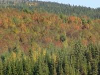
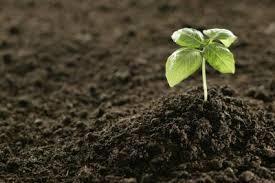
3 Credit: Ming Kei College, Hong Kong Plants do transpire.


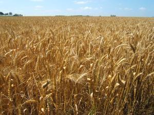
4 Corn field (100x100 m 2 ):?? 150 liters in 1 day liters in 1 day liters in 1 day large oak tree: Plants do transpire a lot liters in 1 year


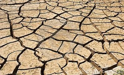
5 With plausible large consequences Evapotranspiration monitoring can be essential for drought detection.


6 Evapotranspiration can be measured! Indirectly, though Models compute evapotranspiration Satellite observation complement models!


7 Royal Meteorological Institute of Belgium services supported by research and long term standardised meteorological, climatological and geophysical observations ( Reliable public service realised by empowered staff and based on research, innovation and continuity. HydroMeteorology group on modelling& remote sensing F. Meulenberghs A. Arboleda J.M. Barrios

8 Where are you?
9 Who are you? I m a researcher I work for governmental decision planning Other:
10 Who are you? I plan to use EUMETSAT products I am here for general interest I m already a EUMETSAT user I m already using remote sensing products from other agencies I m prospecting for satellite products Other:
11 Outline 1. What is evapotranspiration (ET)? 2. The role of satellites for ET monitoring 3. LSA-SAF ET: algorithm & product 4. Utility of ET in drought monitoring
12 Outline 1. What is evapotranspiration (ET)? 2. The role of satellites for ET monitoring 3. LSA-SAF ET: algorithm & product 4. Utility of ET in drought monitoring


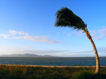
13 The transpiration process Plant «Breathing» and the Transpiration Process 1. Root-zone water For transpiration to occur, there must be water available! 3. Exchange plant-atmosphere 2. Root water uptake -Water taken to leaves through roots -Light is necessary Water vapour is released into the air through leaves stomata

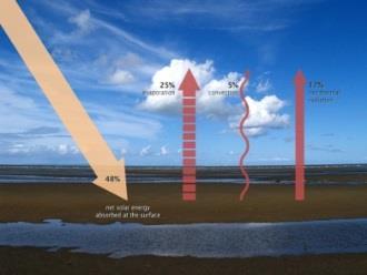
14 The water cycle On land, ET returns 58% of precipitation! From (
15 Evapotranspiration: List of ingredients Energy Interface Surface net radiation Soil occupation Plant type & characteristics Water Soil moisture Ambiant atmosphere Wind Air movement Air humidity Air temperature
16 Outline 1. What is evapotranspiration (ET)? 2. The role of satellites for ET monitoring 3. LSA-SAF ET: algorithm & product 4. Utility of ET in drought monitoring
 Polar orbiter, sun-synchronous -low orbit (~1000 km) -earth")


17 Remote Sensing Opportunities Orbits preferred for earth monitoring 1. (Near-) Polar orbiter, sun-synchronous -low orbit (~1000 km) -earth revolution in ~100 min Need of several ground receivers for the data flow Polar orbiters: Terra, Aqua, METOP, MODIS 2. Geostationary (geo-synchronous) -altitude (~36000 km) -over equator Depending on longitude, need to correct longitudinal drift Geostationary satellites: Meteosat, GOES, MSG


18 What useful variables derived from remote sensing? 1. Describe surface properties 3. Atmosphere Cloudiness Land cover 2. Surface variables Surface temperature Greeness of vegetation Snow cover
19 EUMETSAT SATELLITE APPLICATION FACILITIES (SAF S) EUMETSAT SAF on Land Surface Analysis LSA -SAF Land Surface Analysis OSI -SAF Ocean and Sea Ice LSA -SAF OBJECTIVES Develop techniques to retrieve parameters related to land, land-atmosphere interactions and biospheric applications, by using data from MSG and EPS satellites GRAS -SAF Meteorology O3M Ozone Monitoring NWP SAF Numerical Weather Prediction CM -SAF Climate Monitoring NWC-SAF - Nowcasting and very Short Range Forecasting
20 Outline 1. What is evapotranspiration (ET)? 2. The role of satellites for ET monitoring 3. LSA-SAF ET: algorithm & product 4. Utility of ET in drought monitoring
21 The LSA-SAF evapotranspiration model Meteosat Second Generation MSG/SEVIRI pixel Energy balance: (1-a).S + e.(l-s.t sk,i4 ) + H i + LE i G i = 0 ET ~ S LE i (Land Cover, LAI, Wind, T air, Q air, Soil Moist) (Ghilain N., Arboleda A., Gellens- Meulenberghs F., 2011, Hydrol. Earth Syst. Sci.) ECOCLIMAP-I ECMWF weather forecasts

22 The LSA-SAF evapotranspiration model Examples validation LSA-SAF MET product Dataset: 2007


23 The LSA-SAF evapotranspiration model Product Required Accuracy (LSA-SAF MET) if ET > 0.4 mm h -1 if ET < 0.4 mm h -1 Error < 25% Error < 0.1 mm h -1
24 The LSA-SAF evapotranspiration products Two images are generated: the first one contains instantaneous ET estimates in mm/h while the second one is the quality flag image, provides information on the quality of estimates pixel by pixel ET (mm/h) for 2010/10/29 at 12:00 UTC Associated quality flag (-)
25
26 Instantaneous ET LSA-SAF MET Surface type Quality input data Overall quality
")
27 The LSA-SAF evapotranspiration products a) DMET (mm/day) b) Percent of missing values for every pixel (mm/d) (%)

28 The LSA-SAF evapotranspiration products DMET images from 06/09 to 15/ ET [mm/day]
 2.")
, reproject and interpolate 4.")
29 Near-real time production: how it works 1.Acquisition of MSG/SEVIRI corrected radiances and Clouds mapping (from EUMETSAT, Darmstadt, Germany) 2.Computation of radiation components (Land SAF computing facility) 3. Acquisition of the global weather forecasts (ECMWF), reproject and interpolate 4. Computation of ET over 4 areas (Europe, North/South Africa and South America) 5. Compute a quality index 6. Creation HDF5 files 7. Distribution through web or satellite to users 8. Distribution of regular update of User Manual and Validation Reports

30
31 Outline 1. What is evapotranspiration (ET)? 2. The role of satellites for ET monitoring 3. LSA-SAF ET: algorithm & product 4. Utility of ET in drought monitoring
32 Clarification of concepts Natural Evapotranspiration (ET) = Actual evapotranspiration (AET) = Real evapotranspiration (ETR) Evaporation of natural surfaces + plant transpiration Potential Evapotranspiration (PET) Maximum evapotranspiration for a given climate and continuous vegetated surface (no hydric stress) Reference Evapotranspiration (ET0) Used for agricultural irrigation management (FAO standard). Evapotranspiration (can be potential) of a well-watered grass patch. Crop Evapotranspiration (ETc) Optimum evapotranspiration of a given crop (productivity not affected by hydric stress).
33 Clarification of concepts Natural Evapotranspiration (ET) = Actual evapotranspiration (AET) = Real evapotranspiration (ETR) Evaporation of natural surfaces + plant transpiration Potential Evapotranspiration (PET) Maximum evapotranspiration for a given climate and continuous vegetated surface (no hydric stress) Reference Evapotranspiration (ET0) Used for agricultural irrigation management (FAO standard). Evapotranspiration (can be potential) of a well-watered grass patch. Crop Evapotranspiration (ETc) Optimum evapotranspiration of a given crop (productivity not affected by hydric stress).
34 Clarification of concepts For crops Daily Evapotranspiration PET (ETc) ET0 AET For a given crop: ETc = Kc x ET0 A year


35 Application perspectives Meteorological drought Europe, Spring 2011 Drought index (%) = AET PET Rhin river basin Danube river basin


36 Application perspectives Agricultural drought Europe, Spring 2011 Fundulea, Romania Zhiten, Bulgaria Winter wheat flowering Maize silking PET - AET = Water deficit
 Evapotranspiration estimation over wide and remote areas in near-real time, thanks to remote sensing.")
37 Summary Operational production in near-real time: every 30 min & daily 3 km sub-satellite ( Evapotranspiration estimation over wide and remote areas in near-real time, thanks to remote sensing. LSA-SAF evapotranspiration products monitor quantitatively the water loss from the surface into the atmosphere. Available products have been checked and show good comparison with in-situ observations (at least) over Europe. (Provided by A. Arboleda) LSA-SAF ET products could be a useful tool for drought monitoring. ET [mm/h] for 2010/10/29 at 12:00 UTC
38 Contact:
EUMETSAT LSA-SAF EVAPOTRANSPIRATION PRODUCTS STATUS AND PERSPECTIVES
 EUMETSAT LSA-SAF EVAPOTRANSPIRATION PRODUCTS STATUS AND PERSPECTIVES Arboleda, N. Ghilain, F. Gellens-Meulenberghs Royal Meteorological Institute, Avenue Circulaire, 3, B-1180 Bruxelles, BELGIUM Corresponding
Remote sensing derived evapotranspiration: comparisons to observations and models and results over the full MSG disk and selected basins
 4 th LSA-SAF WORKSHOP Toulouse,France, 15 th to 17 th November 2010 Remote sensing derived evapotranspiration: comparisons to observations and models and results over the full MSG disk and selected basins
EUMETSAT SAF NETWORK. Lothar Schüller, EUMETSAT SAF Network Manager
 1 EUMETSAT SAF NETWORK Lothar Schüller, EUMETSAT SAF Network Manager EUMETSAT ground segment overview METEOSAT JASON-2 INITIAL JOINT POLAR SYSTEM METOP NOAA SATELLITES CONTROL AND DATA ACQUISITION FLIGHT
LSA SAF evapotranspiration products and on going research at RMI
 WMO RAVI Hydrological Forum 2016 Workshop on hydrological modelling, forecasting and warnings 20 September 2016, Oslo, Norway LSA SAF evapotranspiration products and on going research at RMI by Françoise
LAND SURFACE ALBEDO AND DOWNWELLING SHORTWAVE RADIATION FROM MSG GEOSTATIONARY SATELLITE (METHOD FOR RETRIEVAL, VALIDATION, AND APPLICATION)
") LAND SURFACE ALBEDO AND DOWNWELLING SHORTWAVE RADIATION FROM MSG GEOSTATIONARY SATELLITE (METHOD FOR RETRIEVAL, VALIDATION, AND APPLICATION) Dominique Carrer, Jean-Louis Roujean, Olivier Hautecoeur, Jean-Christophe
LAND SURFACE ALBEDO AND DOWNWELLING SHORTWAVE RADIATION FROM MSG GEOSTATIONARY SATELLITE (METHOD FOR RETRIEVAL, VALIDATION, AND APPLICATION) Dominique Carrer, Jean-Louis Roujean, Olivier Hautecoeur, Jean-Christophe
EUMETSAT SAF NETWORK. Lothar Schüller, EUMETSAT SAF Network Manager
 1 EUMETSAT SAF NETWORK Lothar Schüller, EUMETSAT SAF Network Manager EUMETSAT ground segment overview METEOSAT JASON-2 INITIAL JOINT POLAR SYSTEM METOP NOAA SATELLITES CONTROL AND DATA ACQUISITION FLIGHT
NWC-SAF Satellite Application Facility in Support to Nowcasting and Very Short Range Forecasting
 NWC-SAF Satellite Application Facility in Support to Nowcasting and Very Short Range Forecasting Marianne König Slide 1 Satellite Application Facilities (SAFs) in Europe Member State Cooperating State
EUMETSAT. A global operational satellite agency at the heart of Europe. Presentation for the Spanish Industry Day Madrid, 15 March 2012
 EUMETSAT A global operational satellite agency at the heart of Europe Presentation for the Spanish Industry Day Madrid, Angiolo Rolli EUMETSAT Director of Administration EUMETSAT objectives The primary
VALIDATION RESULTS OF THE OPERATIONAL LSA-SAF SNOW COVER MAPPING
 VALIDATION RESULTS OF THE OPERATIONAL LSA-SAF SNOW COVER MAPPING Niilo Siljamo, Otto Hyvärinen Finnish Meteorological Institute, Erik Palménin aukio 1, P.O.Box 503, FI-00101 HELSINKI Abstract Hydrological
USE OF SATELLITE INFORMATION IN THE HUNGARIAN NOWCASTING SYSTEM
 USE OF SATELLITE INFORMATION IN THE HUNGARIAN NOWCASTING SYSTEM Mária Putsay, Zsófia Kocsis and Ildikó Szenyán Hungarian Meteorological Service, Kitaibel Pál u. 1, H-1024, Budapest, Hungary Abstract The
THE LAND-SAF SURFACE ALBEDO AND DOWNWELLING SHORTWAVE RADIATION FLUX PRODUCTS
 THE LAND-SAF SURFACE ALBEDO AND DOWNWELLING SHORTWAVE RADIATION FLUX PRODUCTS Bernhard Geiger, Dulce Lajas, Laurent Franchistéguy, Dominique Carrer, Jean-Louis Roujean, Siham Lanjeri, and Catherine Meurey
EUMETSAT Activities Related to Climate
 EUMETSAT Activities Related to Climate Jörg Schulz joerg.schulz@eumetsat.int Slide: 1 What we do USER REQUIREMENTS European National Meteorological Services Operating Agency! European Space Industry Private
H SAF SATELLITE APPLICATION FACILITY ON SUPPORT TO OPERATIONAL HYDROLOGY AND WATER MANAGEMENT EUMETSAT NETWORK OF SATELLITE APPLICATION FACILITIES
 H SAF SATELLITE APPLICATION FACILITY ON SUPPORT TO OPERATIONAL HYDROLOGY AND WATER MANAGEMENT EUMETSAT NETWORK OF SATELLITE APPLICATION FACILITIES H-SAF: SATELLITE PRODUCTS FOR OPERATIONAL HYDROLOGY H-SAF
Use of satellite information in research and operational activities at NIMH of Bulgaria
 Use of satellite information in research and operational activities at NIMH of Bulgaria Rilka Valcheva NIMH, Bulgaria WMO/EUMETSAT Satellite Products Training Course 24-28 April 2017, Budapest, Hungary
EUMETSAT Climate Activities
 EUMETSAT Climate Activities Jörg Schulz EUMETSAT s Role in Climate Monitoring EUMETSAT has a prominent role in the world for providing services relevant to climate: EUMETSAT maintains some of the longest
Joint International Surface Working Group and Satellite Applications Facility on Land Surface Analysis Workshop, IPMA, Lisboa, June 2018
 Joint International Surface Working Group and Satellite Applications Facility on Land Surface Analysis Workshop, IPMA, Lisboa, 26-28 June 2018 Introduction Soil moisture Evapotranspiration Future plan
MSG system over view
 MSG system over view 1 Introduction METEOSAT SECOND GENERATION Overview 2 MSG Missions and Services 3 The SEVIRI Instrument 4 The MSG Ground Segment 5 SAF Network 6 Conclusions METEOSAT SECOND GENERATION
An Eye in the Sky EUMETSAT. Monitoring Weather, Climate and the Environment
 An Eye in the Sky EUMETSAT Monitoring Weather, Climate and the Environment Slide: 1 Hazardous Weather Slide: 2 Hazardous Weather Slide: 3 Natural Disasters set off by severe weather Slide: 4 EUMETSAT Objectives...
Satellite Application Facility on Land Surface Analysis (LSA-SAF/Land SAF): Products and applications
: Products and applications") Satellite Application Facility on Land Surface Analysis (LSA-SAF/Land SAF): Products and applications by: Alirio Arboleda Acknowledgments: Carla Barroso Isabel Trigo LSA SAF consortium Layout What is the
Satellite Application Facility on Land Surface Analysis (LSA-SAF/Land SAF): Products and applications by: Alirio Arboleda Acknowledgments: Carla Barroso Isabel Trigo LSA SAF consortium Layout What is the
METRIC tm. Mapping Evapotranspiration at high Resolution with Internalized Calibration. Shifa Dinesh
 METRIC tm Mapping Evapotranspiration at high Resolution with Internalized Calibration Shifa Dinesh Outline Introduction Background of METRIC tm Surface Energy Balance Image Processing Estimation of Energy
The use of Direct Broadcast Processing System in Poland
 The use of Direct Broadcast Processing System in Poland B.Łapeta, P.Struzik Satellite Remote Sensing Department, Institute of Meteortology and Water Management National Reasearch Institute About IMWM-NRI
Land atmosphere atmosphere coupling: How satellite LST data contribute to drought assessment and yield prediction
 Land atmosphere atmosphere coupling: How satellite LST data contribute to drought assessment and yield prediction Julia Stoyanova & Christo Georgiev National Institute of Meteorology and Hydrology (NIMH),
1 5 th RAIDEG PUMA 2010 Upgrade - EUM/OPS/VWG/14/ September 2014 PUMA-2010 UPGRADE
 1 5 th RAIDEG PUMA 2010 Upgrade - EUM/OPS/VWG/14/770918-6 September 2014 PUMA-2010 UPGRADE Category Product Title Format Consolidation of MDD stream, change of channel, no LRIT wrapping, use of wmo filenames
The Delaware Environmental Monitoring & Analysis Center
 The Delaware Environmental Monitoring & Analysis Center Tina Callahan Delaware Estuary Science & Environmental Summit 2013 January 27-30, 2013 What is DEMAC? Delaware Environmental Monitoring & Analysis
EUMETSAT PLANS. Dr. K. Dieter Klaes EUMETSAT Am Kavalleriesand 31 D Darmstadt Germany
 EUMETSAT PLANS Dr. K. Dieter Klaes EUMETSAT Am Kavalleriesand 31 D-64295 Darmstadt Germany Page 1 EUMETSAT SATELLITE PROGRAMMES 96 97 98 99 00 01 02 03 04 05 06 07 08 09 10 11 12 13 14 15 16 17 18 METEOSAT
Land Surface Temperature in the EUMETSAT LSA SAF: Current Service and Perspectives. Isabel Trigo
 Land Surface Temperature in the EUMETSAT LSA SAF: Current Service and Perspectives Isabel Trigo Outline EUMETSAT Land-SAF: Land Surface Temperature Geostationary Service SEVIRI Polar-Orbiter AVHRR/Metop
SNOW COVER MAPPING USING METOP/AVHRR DATA
 SNOW COVER MAPPING USING METOP/AVHRR DATA Niilo Siljamo, Markku Suomalainen, Otto Hyvärinen Finnish Meteorological Institute, Erik Palménin Aukio 1, FI-00101 Helsinki, Finland Abstract LSA SAF snow cover
REVISION OF THE STATEMENT OF GUIDANCE FOR GLOBAL NUMERICAL WEATHER PREDICTION. (Submitted by Dr. J. Eyre)
") WORLD METEOROLOGICAL ORGANIZATION Distr.: RESTRICTED CBS/OPAG-IOS (ODRRGOS-5)/Doc.5, Add.5 (11.VI.2002) COMMISSION FOR BASIC SYSTEMS OPEN PROGRAMME AREA GROUP ON INTEGRATED OBSERVING SYSTEMS ITEM: 4 EXPERT
WORLD METEOROLOGICAL ORGANIZATION Distr.: RESTRICTED CBS/OPAG-IOS (ODRRGOS-5)/Doc.5, Add.5 (11.VI.2002) COMMISSION FOR BASIC SYSTEMS OPEN PROGRAMME AREA GROUP ON INTEGRATED OBSERVING SYSTEMS ITEM: 4 EXPERT
ASSESSMENT OF DIFFERENT WATER STRESS INDICATORS BASED ON EUMETSAT LSA SAF PRODUCTS FOR DROUGHT MONITORING IN EUROPE
 ASSESSMENT OF DIFFERENT WATER STRESS INDICATORS BASED ON EUMETSAT LSA SAF PRODUCTS FOR DROUGHT MONITORING IN EUROPE G. Sepulcre Canto, A. Singleton, J. Vogt European Commission, DG Joint Research Centre,
H-SAF future developments on Convective Precipitation Retrieval
 H-SAF future developments on Convective Precipitation Retrieval Francesco Zauli 1, Daniele Biron 1, Davide Melfi 1, Antonio Vocino 1, Massimiliano Sist 2, Michele De Rosa 2, Matteo Picchiani 2, De Leonibus
Monitoring daily evapotranspiration in the Alps exploiting Sentinel-2 and meteorological data
 Monitoring daily evapotranspiration in the Alps exploiting Sentinel-2 and meteorological data M. Castelli, S. Asam, A. Jacob, M. Zebisch, and C. Notarnicola Institute for Earth Observation, Eurac Research,
CIMIS. California Irrigation Management Information System
 CIMIS California Irrigation Management Information System What is CIMIS? A network of over 130 fully automated weather stations that collect weather data throughout California and provide estimates of
SAFNWC/MSG SEVIRI CLOUD PRODUCTS
 SAFNWC/MSG SEVIRI CLOUD PRODUCTS M. Derrien and H. Le Gléau Météo-France / DP / Centre de Météorologie Spatiale BP 147 22302 Lannion. France ABSTRACT Within the SAF in support to Nowcasting and Very Short
The role of soil moisture in influencing climate and terrestrial ecosystem processes
 1of 18 The role of soil moisture in influencing climate and terrestrial ecosystem processes Vivek Arora Canadian Centre for Climate Modelling and Analysis Meteorological Service of Canada Outline 2of 18
CGMS Baseline. Sustained contributions to the Global Observing System. Endorsed by CGMS-46 in Bengaluru, June 2018
 CGMS Baseline Sustained contributions to the Global Observing System Best Practices for Achieving User Readiness for New Meteorological Satellites Endorsed by CGMS-46 in Bengaluru, June 2018 CGMS/DOC/18/1028862,
Next generation of EUMETSAT microwave imagers and sounders: new opportunities for cloud and precipitation retrieval
 Next generation of EUMETSAT microwave imagers and sounders: new opportunities for cloud and precipitation retrieval Christophe Accadia, Sabatino Di Michele, Vinia Mattioli, Jörg Ackermann, Sreerekha Thonipparambil,
Climate Change Service
 Service Metadata for the Data Store Dick Dee, ECMWF C3S: data + expertise + operational Open and free access to climate data (observations, reanalyses, model predictions) Tools and best scientific practices
Satellite data for hydrological forecasting
 Satellite data for hydrological forecasting Current use at ECMWF and perspective Shopping list! Our current tools does not allow direct use, but could be modified Christel Prudhomme Christel.prudhomme@ecmwf.int
ASSESSMENT OF ALGORITHMS FOR LAND SURFACE ANALYSIS DOWN-WELLING LONG-WAVE RADIATION AT THE SURFACE
 ASSESSMENT OF ALGORITHMS FOR LAND SURFACE ANALYSIS DOWN-WELLING LONG-WAVE RADIATION AT THE SURFACE Isabel F. Trigo, Carla Barroso, Sandra C. Freitas, Pedro Viterbo Instituto de Meteorologia, Rua C- Aeroporto,
Land Data Assimilation for operational weather forecasting
 Land Data Assimilation for operational weather forecasting Brett Candy Richard Renshaw, JuHyoung Lee & Imtiaz Dharssi * *Centre Australian Weather and Climate Research Contents An overview of the Current
VALIDATION OF MSG DERIVED SURFACE INCOMING GLOBAL SHORT-WAVE RADIATION PRODUCTS OVER BELGIUM
 VALIDATION OF MSG DERIVED SURFACE INCOMING GLOBAL SHORT-WAVE RADIATION PRODUCTS OVER BELGIUM C. Bertrand 1, R. Stöckli 2, M. Journée 1 1 Royal Meteorological Institute of Belgium (RMIB), Brussels, Belgium
INTERCOMPARISON OF METEOSAT-8 DERIVED LST WITH MODIS AND AATSR SIMILAR PRODUCTS
 INTERCOMPARISON OF METEOSAT-8 DERIVED LST WITH MODIS AND AATSR SIMILAR PRODUCTS Cristina Madeira, Prasanjit Dash, Folke Olesen, and Isabel Trigo, Instituto de Meteorologia, Rua C- Aeroporto, 700-09 Lisboa,
MxVision WeatherSentry Web Services Content Guide
 MxVision WeatherSentry Web Services Content Guide July 2014 DTN 11400 Rupp Drive Minneapolis, MN 55337 00.1.952.890.0609 This document and the software it describes are copyrighted with all rights reserved.
Agrometeorological activities in RHMSS
 Republic of Serbia Republic Hydrometeorological Service of Serbia Agrometeorological activities in RHMSS Department for applied climatology and agrometeorology www.hidmet.gov.rs Meteorological Observing
Mapping Evapotranspiration and Drought at Local to Continental Scales Using Thermal Remote Sensing
 Mapping Evapotranspiration and Drought at Local to Continental Scales Using Thermal Remote Sensing M.C. Anderson, W.P. Kustas USDA-ARS, Hydrology and Remote Sensing Laboratory J.M Norman University of
SEVIRI - Cloud Top Height Factsheet
 Doc.No. : EUM/OPS/DOC/11/4199 Issue : v2a Date : 28 December 2011 WBS : EUMETSAT Eumetsat-Allee 1, D-64295 Darmstadt, Germany Tel: +49 6151 807-7 Fax: +49 6151 807 555 http://www.eumetsat.int EUMETSAT
The TexasET Network and Website User s Manual
 The TexasET Network and Website http://texaset.tamu.edu User s Manual By Charles Swanson and Guy Fipps 1 September 2013 Texas AgriLIFE Extension Service Texas A&M System 1 Extension Program Specialist;
NEW OSI SAF SST GEOSTATIONARY CHAIN VALIDATION RESULTS
 NEW OSI SAF SST GEOSTATIONARY CHAIN VALIDATION RESULTS Anne Marsouin, Pierre Le Borgne, Gérard Legendre, Sonia Péré Météo-France/DP/Centre de Météorologie Spatiale BP 50747, 22307 Lannion, France Abstract
OSI SAF SST Products and Services
 OSI SAF SST Products and Services Pierre Le Borgne Météo-France/DP/CMS (With G. Legendre, A. Marsouin, S. Péré, S. Philippe, H. Roquet) 2 Outline Satellite IR radiometric measurements From Brightness Temperatures
Instrumentation planned for MetOp-SG
 Instrumentation planned for MetOp-SG Bill Bell Satellite Radiance Assimilation Group Met Office Crown copyright Met Office Outline Background - the MetOp-SG programme The MetOp-SG instruments Summary Acknowledgements:
IMPORTANCE OF SATELLITE DATA (FOR REANALYSIS AND BEYOND) Jörg Schulz EUMETSAT
 Jörg Schulz EUMETSAT") IMPORTANCE OF SATELLITE DATA (FOR REANALYSIS AND BEYOND) Jörg Schulz EUMETSAT Why satellite data for climate monitoring? Global coverage Global consistency, sometimes also temporal consistency High spatial
IMPORTANCE OF SATELLITE DATA (FOR REANALYSIS AND BEYOND) Jörg Schulz EUMETSAT Why satellite data for climate monitoring? Global coverage Global consistency, sometimes also temporal consistency High spatial
WMO RA VI Hydrological Forum. H-SAF: from products to end users
 WMO RA VI Hydrological Forum Oslo, 20 September 2016 H-SAF: from products to end users Lt. Col. Francesco Zauli ITAF-COMet H-SAF Project Manager 1 H-SAF Objectives Satellite Application Facility in Support
A satellite-based long-term Land Surface Temperature Climate Data Record
 Federal Department of Home Affairs FDHA Federal Office of Meteorology and Climatology MeteoSwiss A satellite-based long-term Land Surface Temperature Climate Data Record, Virgílio A. Bento, Frank M. Göttsche,
EUMETSAT STATUS AND PLANS
 1 EUM/TSS/VWG/15/826793 07/10/2015 EUMETSAT STATUS AND PLANS François Montagner, Marine Applications Manager, EUMETSAT WMO Polar Space Task Group 5 5-7 October 2015, DLR, Oberpfaffenhofen PSTG Strategic
H2020-TWINN Guest lecture. 9May2018 Vienna, Austria
 H2020-TWINN-2015 Meteorological data: sources, representativeness & use + Brčko Ao. Prof. Branislava Lalic Guest lecture 9May2018 Vienna, Austria Institution: Faculty of Agriculture, University of Novi
Amita Mehta and Ana Prados
 Building Capacity in Utilizing NASA Remote Sensing Observations in SWAT for Water Resources and Agricultural Management Applications Amita Mehta and Ana Prados NASA - University of Maryland Baltimore County
EUMETSAT Polar System (EPS)
") EUMETSAT Polar System (EPS) Synergetic Operational Earth Observations with the EPS/MetOp System Dieter Klaes EPS Programme Scientist Outline 1. Introduction 2. EPS System and Observations 3. Outlook 1.
EUMETSAT Polar System (EPS) Synergetic Operational Earth Observations with the EPS/MetOp System Dieter Klaes EPS Programme Scientist Outline 1. Introduction 2. EPS System and Observations 3. Outlook 1.
A 2016 CEOS Chair Initiative. Non-meteorological Applications for Next Generation Geostationary Satellites
 A 2016 CEOS Chair Initiative Committee on Earth Observation Satellites Non-meteorological Applications for Next Generation Geostationary Satellites Co-chaired by EUMETSAT (Holmlund), CSIRO (Schroeder),
Back to basics: From Sputnik to Envisat, and beyond: The use of satellite measurements in weather forecasting and research: Part 1 A history
 Back to basics: From Sputnik to Envisat, and beyond: The use of satellite measurements in weather forecasting and research: Part 1 A history Roger Brugge 1 and Matthew Stuttard 2 1 NERC Data Assimilation
and their applications in Africa
 Satellite-based climate data records and their applications in Africa Steffen Kothe and CM SAF team Climate Monitoring State of climate system Better understanding of climate change Basis are in situ measurements
METEOSAT THIRD GENERATION
 METEOSAT THIRD GENERATION FACTS AND FIGURES MONITORING WEATHER AND CLIMATE FROM SPACE A HIGHLY INNOVATIVE GEOSTATIONARY SATELLITE SYSTEM FOR EUROPE AND AFRICA The Meteosat Third Generation (MTG) system
EUMETSAT Data and Services for Climate Services and Research. Jörg Schulz
 EUMETSAT Data and Services for Climate Services and Research Jörg Schulz 1 WMO Workshop on Operational Space-based Weather and Climate Extremes Monitoring, WMO HQ, Geneva, Switzerland, 15-17 February 2017
VERIFICATION OF HIGH-RESOLUTION MESOSCALE SIMULATIONS USING LAND-SURFACE TEMPERATURE FIELDS DERIVED FROM SATELLITES
 VERIFICATION OF HIGH-RESOLUTION MESOSCALE SIMULATIONS USING LAND-SURFACE TEMPERATURE FIELDS DERIVED FROM SATELLITES M.A. Jiménez and J.Cuxart Universitat de les Illes Balears Palma de Mallorca, Spain ü
Introduction to the NWC SAF
 Introduction to the NWC SAF NWC SAF Event Week EUMeTrain course 18-22 November, online P. Fernández 1 Where are you listening from? Contents SAF Network scope NWC SAF Overview Products Next versions 2014
PRECONVECTIVE SOUNDING ANALYSIS USING IASI AND MSG- SEVIRI
 PRECONVECTIVE SOUNDING ANALYSIS USING IASI AND MSG- SEVIRI Marianne König, Dieter Klaes EUMETSAT, Eumetsat-Allee 1, 64295 Darmstadt, Germany Abstract EUMETSAT operationally generates the Global Instability
Atmospheric Processes
 Atmospheric Processes Atmospheric prognostic variables Wind Temperature Humidity Cloud Water/Ice Atmospheric processes Mixing Radiation Condensation/ Evaporation Precipitation Surface exchanges Friction
MAIA a software package for cloud detection and characterization for VIIRS and AVHRR imagers
 MAIA a software package for cloud detection and characterization for VIIRS and AVHRR imagers Pascale Roquet, Lydie Lavanant, Pascal Brunel CSPP/IMAPP USERS' GROUP MEETING 2017 27-29 June 2017 Outline MAIA
5B.1 DEVELOPING A REFERENCE CROP EVAPOTRANSPIRATION CLIMATOLOGY FOR THE SOUTHEASTERN UNITED STATES USING THE FAO PENMAN-MONTEITH ESTIMATION TECHNIQUE
 DEVELOPING A REFERENCE CROP EVAPOTRANSPIRATION CLIMATOLOGY FOR THE SOUTHEASTERN UNITED STATES USING THE FAO PENMAN-MONTEITH ESTIMATION TECHNIQUE Heather A. Dinon*, Ryan P. Boyles, and Gail G. Wilkerson
onboard of Metop-A COSMIC Workshop 2009 Boulder, USA
 GRAS Radio Occultation Measurements onboard of Metop-A A. von Engeln 1, Y. Andres 1, C. Cardinali 2, S. Healy 2,3, K. Lauritsen 3, C. Marquardt 1, F. Sancho 1, S. Syndergaard 3 1 2 3 EUMETSAT, ECMWF, GRAS
EARS-ATMS, EARS-CrIS and EARS-VIIRS: Three New Regional Services
 EARS-, EARS- and EARS-VIIRS: Three New Regional Services Anders Meier Soerensen, Ester Rojo, Thomas Heinemann, Michele Burla, Susanne Dieterle EUMETSAT Monitoring weather and climate from space Meteosat-7
Report. Northern Africa. RAIDEG-8, 1-2 Nov 2017
 Report Northern Africa RAIDEG-8, 1-2 Nov 2017 Report Northern Africa RAIDEG-8, 1-2 Nov 2017 Important Note: Formal letters have been sent from the PR of Morocco with WMO to PRs of Algeria, Tunisia, Libya
EUMETSAT PLANS. K. Dieter Klaes EUMETSAT Darmstadt, Germany
 EUMETSAT PLANS K. Dieter Klaes EUMETSAT Darmstadt, Germany 1. INTRODUCTION The European Organisation for the Exploitation of Meteorological Satellites (EUMETSAT), contributes to the World Weather Watch
Weather and climate outlooks for crop estimates
 Weather and climate outlooks for crop estimates CELC meeting 2016-04-21 ARC ISCW Observed weather data Modeled weather data Short-range forecasts Seasonal forecasts Climate change scenario data Introduction
The LSA-SAF Albedo products
 The LSA-SAF Albedo products G. Jacob, D. Carrer & J.-L. Roujean CNRM-GAME, Météo France, Toulouse 2 Outline Method for retrieval Theoretical Framework Available Input BRDF Inversion Algorithm overview
EUMETSAT Satellite Status
 EUMETSAT Satellite Status Dr. K. Dieter Klaes EUMETSAT 1 ET-SAT Meeting 4-6 April 2017, WMO, Geneva, Switzerland EUMETSAT is an intergovernmental organisation with 30 Member States and 1 Cooperating State
Application and verification of ECMWF products 2015
 Application and verification of ECMWF products 2015 Hungarian Meteorological Service 1. Summary of major highlights The objective verification of ECMWF forecasts have been continued on all the time ranges
Land surface albedo from MSG/SEVIRI: retrieval method, validation, and application for weather forecast
 Land surface albedo from MSG/SEVIRI: retrieval method, validation, and application for weather forecast Dominique Carrer, Benhard Geiger, Jean-Louis Roujean, Olivier Hautecoeur, Jure Cedilnik, Jean-François
Development of the Canadian Precipitation Analysis (CaPA) and the Canadian Land Data Assimilation System (CaLDAS)
 and the Canadian Land Data Assimilation System (CaLDAS)") Development of the Canadian Precipitation Analysis (CaPA) and the Canadian Land Data Assimilation System (CaLDAS) Marco L. Carrera, Vincent Fortin and Stéphane Bélair Meteorological Research Division Environment
Development of the Canadian Precipitation Analysis (CaPA) and the Canadian Land Data Assimilation System (CaLDAS) Marco L. Carrera, Vincent Fortin and Stéphane Bélair Meteorological Research Division Environment
LANDSAF SNOW COVER MAPPING USING MSG/SEVIRI DATA
 LANDSAF SNOW COVER MAPPING USING MSG/SEVIRI DATA Niilo Siljamo and Otto Hyvärinen Finnish Meteorological Institute, Erik Palménin aukio 1, P.O.Box 503, FI-00101 Helsinki, Finland Abstract Land Surface
The Canadian Land Data Assimilation System (CaLDAS)
") The Canadian Land Data Assimilation System (CaLDAS) Marco L. Carrera, Stéphane Bélair, Bernard Bilodeau and Sheena Solomon Meteorological Research Division, Environment Canada Dorval, QC, Canada 2 nd Workshop
The Canadian Land Data Assimilation System (CaLDAS) Marco L. Carrera, Stéphane Bélair, Bernard Bilodeau and Sheena Solomon Meteorological Research Division, Environment Canada Dorval, QC, Canada 2 nd Workshop
Judit Kerényi. OMSZ - Hungarian Meteorological Service, Budapest, Hungary. H-1525 Budapest, P.O.Box 38, Hungary.
 SATELLITE-DERIVED PRECIPITATION ESTIMATIONS DEVELOPED BY THE HYDROLOGY SAF PROJECT CASE STUDIES FOR THE INVESTIGATION OF THEIR ACCURACY AND FEATURES IN HUNGARY Judit Kerényi OMSZ - Hungarian Meteorological
Evaporative Fraction and Bulk Transfer Coefficients Estimate through Radiometric Surface Temperature Assimilation
 Evaporative Fraction and Bulk Transfer Coefficients Estimate through Radiometric Surface Temperature Assimilation Francesca Sini, Giorgio Boni CIMA Centro di ricerca Interuniversitario in Monitoraggio
CGMS Baseline In response to CGMS action/recommendation A45.01 HLPP reference: 1.1.8
 Prepared by WGIII Agenda Item: 7.1 Discussed in WGIII CGMS Baseline In response to CGMS action/recommendation A45.01 HLPP reference: 1.1.8 In CGMS-45, Working Group III agreed to hold a review of the CGMS
DROUGHT ASSESSMENT USING SATELLITE DERIVED METEOROLOGICAL PARAMETERS AND NDVI IN POTOHAR REGION
 DROUGHT ASSESSMENT USING SATELLITE DERIVED METEOROLOGICAL PARAMETERS AND NDVI IN POTOHAR REGION Researcher: Saad-ul-Haque Supervisor: Dr. Badar Ghauri Department of RS & GISc Institute of Space Technology
EUMETSAT products and services for monitoring storms - New missions, more data and more meteorological products
 EUMETSAT products and services for monitoring storms - New missions, more data and more meteorological products Jochen Grandell 1 EUM/RSP/VWG/17/921460 Outline Overview of EUMETSAT missions Current...and
Julia Figa-Saldaña & Klaus Scipal
 Julia Figa-Saldaña & Klaus Scipal julia.figa@eumetsat.int klaus.scipal@esa.int Meeting, Outline MetOp/EPS status MetOp/EPS Second Generation status 2016 scatterometer conference Other European ocean programme
Climate Data Records (CDR) provided by CM SAF. Martin Werscheck Deutscher Wetterdienst
 provided by CM SAF. Martin Werscheck Deutscher Wetterdienst") Climate Data Records (CDR) provided by CM SAF Martin Werscheck Deutscher Wetterdienst CM SAF: EUMETSAT Satellite Application Facility on Climate Monitoring GCOS SCIENCE DAY IMPORTANCE OF THE CLIMATE OBSERVATIONS
Climate Data Records (CDR) provided by CM SAF Martin Werscheck Deutscher Wetterdienst CM SAF: EUMETSAT Satellite Application Facility on Climate Monitoring GCOS SCIENCE DAY IMPORTANCE OF THE CLIMATE OBSERVATIONS
VALIDATION OF THE OSI SAF RADIATIVE FLUXES
 VALIDATION OF THE OSI SAF RADIATIVE FLUXES Pierre Le Borgne, Gérard Legendre, Anne Marsouin Météo-France/DP/Centre de Météorologie Spatiale BP 50747, 22307 Lannion, France Abstract The Ocean and Sea Ice
Transboundary water management with Remote Sensing. Oluf Jessen DHI Head of Projects, Water Resources Technical overview
 Transboundary water management with Remote Sensing Oluf Jessen DHI Head of Projects, Water Resources Technical overview ozj@dhigroup.com Transboundary water management Water management across national
NIDIS Intermountain West Drought Early Warning System January 15, 2019
 NIDIS Drought and Water Assessment NIDIS Intermountain West Drought Early Warning System January 15, 2019 Precipitation The images above use daily precipitation statistics from NWS COOP, CoCoRaHS, and
Copernicus Today and Tomorrow GEO Week Group on Earth Observation Geneva, 16 January 2014 The Copernicus Space Infrastructure
 Copernicus Today and Tomorrow GEO Week Group on Earth Observation Geneva, 16 January 2014 The Copernicus Space Infrastructure Thomas Beer, Policy Coordinator, Copernicus Space Office, ESA-ESRIN, Frascati
NIDIS Intermountain West Drought Early Warning System September 4, 2018
 NIDIS Drought and Water Assessment NIDIS Intermountain West Drought Early Warning System September 4, 2018 Precipitation The images above use daily precipitation statistics from NWS COOP, CoCoRaHS, and
- satellite orbits. Further Reading: Chapter 04 of the text book. Outline. - satellite sensor measurements
 (1 of 12) Further Reading: Chapter 04 of the text book Outline - satellite orbits - satellite sensor measurements - remote sensing of land, atmosphere and oceans (2 of 12) Introduction Remote Sensing:
International Cooperation in Operational Environmental Satellites: The U.S. Experience
 Committee on the Peaceful Uses of Outer Space Science and Technology Sub committee Forty seventh session February 17, 2010 Vienna, Austria International Cooperation in Operational Environmental Satellites:
Presentation of met.no s experience and expertise related to high resolution reanalysis
 Presentation of met.no s experience and expertise related to high resolution reanalysis Oyvind Saetra, Ole Einar Tveito, Harald Schyberg and Lars Anders Breivik Norwegian Meteorological Institute Daily
eport Nataša Strelec Mahović Meteorological and Hydrological Service, Grič 3, Zagreb, Croatia EUMeTrain project Abstract
 eport Nataša Strelec Mahović Meteorological and Hydrological Service, Grič 3, Zagreb, Croatia EUMeTrain project Abstract The paper presents the concept of eport, an interface enabling the combined analysis
THE ATMOSPHERIC MOTION VECTOR RETRIEVAL SCHEME FOR METEOSAT SECOND GENERATION. Kenneth Holmlund. EUMETSAT Am Kavalleriesand Darmstadt Germany
 THE ATMOSPHERIC MOTION VECTOR RETRIEVAL SCHEME FOR METEOSAT SECOND GENERATION Kenneth Holmlund EUMETSAT Am Kavalleriesand 31 64293 Darmstadt Germany ABSTRACT The advent of the Meteosat Second Generation
STATUS AND DEVELOPMENT OF SATELLITE WIND MONITORING BY THE NWP SAF
 STATUS AND DEVELOPMENT OF SATELLITE WIND MONITORING BY THE NWP SAF Mary Forsythe (1), Antonio Garcia-Mendez (2), Howard Berger (1,3), Bryan Conway (4), Sarah Watkin (1) (1) Met Office, Fitzroy Road, Exeter,
Product User Manual for Cloud. Products (CMa-PGE01 v3.2, CT-
 Page: 1/34 Product User Manual for Cloud SAF/NWC/CDOP2/MFL/SCI/PUM/01, Issue 3, Rev. 2.3 4 December 2014 Applicable to SAFNWC/MSG version 2013 Prepared by Météo-France / Centre de Météorologie Spatiale
ERA5 and the use of ERA data
 ERA5 and the use of ERA data Hans Hersbach, and many colleagues European Centre for Medium-Range Weather Forecasts Overview Overview of Reanalysis products at ECMWF ERA5, the follow up of ERA-Interim,