Training on FY 3 product suite
|
|
|
- Ezra Crawford
- 6 years ago
- Views:
Transcription


1 Training on FY 3 product suite Xiang Fang National Satellite Meteorological Center,CMA
2 Outline Status of FY 3 satellite Training Actions Training Plan

3 Status of FY 3 satellite Currently On Orbit Satellites: 6/8 FY-3A/FY-3C FY-3B FY-2D 86.5 FY-2E 105 FY-2F 112


4 FY-3 FengYun LEO. Satellites 11 instruments on board FY-3A/B, including: VIRR: Visible and Infra-Red Radiometer MERSI: Medium Resolution Spectral Imager IRAS: Infrared Atmospheric Sounder MWTS:MicroWave Temperature Sounder MWHS: MicroWave Humidity Sounder MWRI: MicroWave Radiation Imager SBUS: Solar Backscatter Ultraviolet Sounder TOU: Total Ozone mapping Unit SIM: Solar Irritation Monitor ERM: Earth Radiation Monitor SEM: Space Environment Monitor Station Name Longitude Latitude Beijing Station E N Guangzhou Station E N Wulumuqi Station E N Jiamusi Station E N Kiruna Station E N
 + FY 3B(PM) Global")
 LTC")
5 Fengyun Polar Satellites: AM+PM FY 3A(AM) + FY 3B(PM) Global Coverage per 6 hours FY 3A (AM) LTC 10:00 AM FY 3B (PM) LTC 13:40 PM
6 FY 3 Data and Products Discipline Measurement FY-3B Instruments Atmosphere Land Ocean Cryosphere Radiation Budget Space Environment Cloud/Fog Properties Total Water Vapor Precipitation Aerosol Properties Atmospheric Temperature and Humidity Total Ozone and Ozone Profile Land Cover Surface Temperature Vegetation Dynamics Fire and Flood Monitoring Surface Wetness Sea Surface Temperature Sea Surface color Sea Ice Snow Cover Earth s Radiation and Solar Irradiance High Energy Particles Radiation Dose MERSI VIRR IRAS MWRI MWHS VIRR MERSI MWRI MWHS MWRI MERSI VIRR IRAS MWTS MWHS TOU SBUS IRAS VIRR MERSI VIRR VIRR MERSI VIRR MERSI MWRI VIRR MWRI MERSI MERSI VIRR MWRI VIRR MWHS MERSI MWRI ERM SIM SEM


7 New baby: FY 3C Launched on 23, Sept ok FY-3C, as the first operational one of the 2 nd generation of FengYun polar-orbiting satellites, is the successor of the R&D satellites FY-3A/B working in orbit.
8 FY 3C instruments(12) FY-3 OPERATIONAL SATELLITE INSTRUMENTS MERSI Medium Resolution Spectral Imager (I, II) MWTS Microwave Temperature Sounder (I, II) MWHS Microwave Humidity Sounder (I, II) MWRI Microwave Radiation Imager WindRAD - Wind Radar GAS - Greenhouse Gases Absorption Spectromete HIRAS Hyperspectral Infrared Atmospheric Sounder OMS Ozone Mapping Spectrometer GNOS GNSS Occultation Sounder ERM Earth Radiation Measurement (I, II) SIM Solar irritation Monitor (I, II) SES Space Environment Suite IRAS Infrared Atmospheric Sounder VIRR visible and Infrared Radiometer SBUS Solar Backscattered Ultraviolet Sounder TOU Total Ozone Unit FY-3C (I) (II) (II) (I) (II) Major Improvements compared with FY-3A/B: A GNSS Occultation Sounder added for GPS sounding MWTS sounding channels increased from 4 to 13, while spatial resolution from 70Km to 20Km MWHS sounding channels increased from 5 to 15, with 118GHz O2 absorbing band new added Auto solar-tracking capability for SIM to improve measurement accurcy Better performance for at least 60% of instrument specifications Longer design life, more reliable for operational guarantee

9 The First Global Mosaic Image by FY 3C MERSI Oct. 2, 2013


10 Tropical Cyclone SEPAT by FY 3C MWRI, at 0:29 UTC, 30 Sept As shown in the images, obvious scattering signal exists only in area of SEPAT in low frequency channel(10ghz) ; With the frequency increasing, the features of typhoon structure become more and more clear.
11 Four FY-3 operational satellites planned by 2020 No. Launch Orbit Status FY-3C 2013 AM launched FY-3D 2015 PM under manufacture FY-3E 2017 AM planned FY-3F 2019 PM planned
 in FY-3D, 3E, 3F Greenhouse Gases Absorption")

12 New capabilities in FY 3C follow ons Improved Medium Resolution Spectrum Imager (MERSI II) in FY-3D, 3E, 3F Greenhouse Gases Absorption Spectrometer (GAS) in FY-3D,3F Hyper-Spectral Infrared Sounder (HIRAS ) will take replace of current IRAS in FY-3D,F Sea Surface Wind Radar (WindRAD) in FY-3E
 4) Artificial Service (applicants only) 5) DB Users (any) 300 250 200 Terabytes 150 100 50 0 2000 2001 2002 2003 2004 2005 2006 FY1 FY2 FY3 FY4 2007 2008 2009 2010 2011 2012 2013")
13 User Preparedness for FY 3 3 operational satellites Data Delivery Services 1) Web based based Service(registered registered users) 2) CMACast (registered users) 3) FTP Push & Pull (VIP users) 4) Artificial Service (applicants only) 5) DB Users (any) Terabytes FY1 FY2 FY3 FY


14 FY-3 DB Users free access to software package FY-3 International Pre-processing Package 5 Instruments available MERSI, VIRR, MWTS, MWHS, IRAS Hardware recommended CPU: Intel Pentium Duo Core processor (>3.0Ghz) Hard disk: >200GB Operating system tested RedHat Fedora Linux 6.0/8.0/10.0 Software packages released FY3L0pp: unpack raw data in both X/L bands to generate level 0 data from the 5 instruments FY3L1pp: processes level 0 data to generate corresponding level 1 data respectively.
 - for FY 3 Reading and")


15 Satellite Monitoring Analysis Remote sensing Toolkit (SMART) - for FY 3 Reading and displaying Satellite data Reading and displaying GIS data Customizable color palette for data displaying Source image Objective image Matched image Multiple functions of color adjustment Multiple image adjustment functions Multiple auxiliary tools including magnetic lasso etc. Customization of thematic map templates Label for thematic map Multi source data reading and displaying Specialized toolkit in remote sensing Common toolkit in image processing Thematic products analyzing Thematic products generation Public service map projections in multiple windows Image geometrical correction Image split or and mosaic Analyzing and processing of environmental change monitoring Temporal analysis function of monitoring products Thematic products Statistic table Operational reports, etc.


")


16 Technology Architecture Multi satellite, Multi Sensor, Multi Format ImageProcessingTools Enhancing Filtering Merging ThematicProductsGeneration (InfoExtracting&Analyzing) RSDataProcessingTools Radiometric correction Fine Geometrical correction Projection Clipping Mosaic Dust Fog Fire Water Snow Sea-Ice ThematicMapGeneration Cyanophyta Vegetation Drought Land Surface temperature Urban Heat Island New product 19


17 Application Examples Fog monitoring Fog RS Image Liquid Water Path Map Fog Droplet Scale Map Fog Optical Depth Map 4th Asia Oceania Meteorological Satellite Users Conference National Satellite Meteorological Center,CMA


18 Application Examples Dust monitoring Dust RS Image Dust Visibility Thematic Map Dust Area Statistics Chart Dust Monitoring Thematic Map 4th Asia Oceania Meteorological Satellite Users Conference National Satellite Meteorological Center,CMA
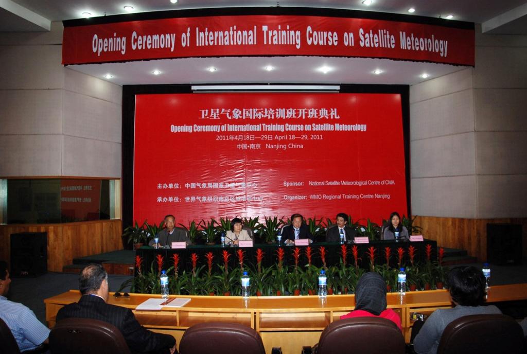
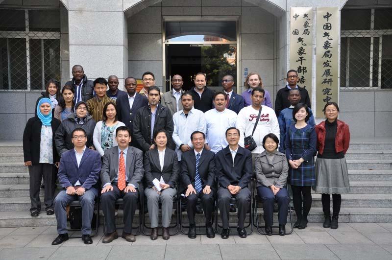
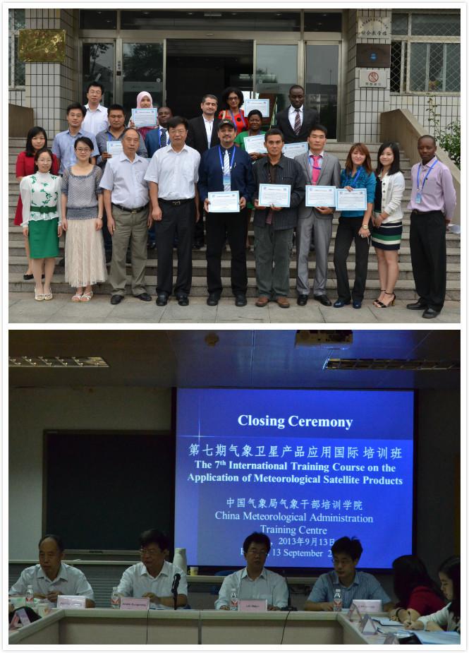
19 Training Actions In order to improve the FY 3 satellite data application, CMA designs many training courses for domestic and foreign students. There are four international training courses in recent years. Many students who come from more than 20 countries belonging to Asia, Oceania, Africa and North America attend these courses. the information of FY 3 satellite data, the principle and methods of satellite products and the application of satellite data are introduced in these training courses. Training features: FY 3 dominants the training, other satellite data applications contained. International Training Courses in Recent Years Class Date Students 1 Specialized Course For BMKG Technicians 2 Application of Meteorological Satellite in Disaster Risk Reduction and Environment 22, Sep., , Sep., , Nov., , Nov., 2012 Asia(5) Asia(6), Oceania (5), Africa(3) North America(1) 3 4 6th International Training Course on Satellite Course 7th International Training Course on Satellite Met. 22, Oct., ,Nov., , Sep., , Sep., 2013 Asia(12), Europe(1), Africa(10), Asia(6) Africa(7) 22

20 23
21 Case Showing The latest training was held between 3, Sep., , Sep., Aim: focused on the application of meteorological satellite data, including the basic methods of satellite products and data analysis. contents: general introduction to Fengyun meteorological satellites and their application infrared precipitation estimation and microwave precipitation retrieval Retrieval Method of Cloud Parameters by Remote Sensing Data.etc 24
22 Training course schedule Date Content Instructor Venue 9:00 9:30 Opening Ceremony 9:30 9:35 Group Photo in front of Office Building CMA Leaders CMATC leader (Host) Room 506, Integrated Lecture Building Sep.3, Tues. Morning 9:40 11:30 CMA s cooperative programs Icebreaking and training policies briefing YU Jun WANG Caifang GAO Feng Room 506 Afternoon 14:00 17:00 General introduction to Fengyun meteorological satellites and their application ZHANG Peng Room 506 Sep. 4, Wed. Sep. 5, Thurs. Morning Afternoon Morning Afternoon 8:30 11:30 Infrared Precipitation estimation and microwave precipitation retrieval 14:00 17:00 Cloud motion wind products and its application 8:30 11:30 Participants Forum (Please copy your presentations into the computer before 8:20) 14:00 17:00 Visits to CMA centers LU Naimeng Room 506 XU Jianmin Room 506 GAO Feng WANG Tingbo LI Huanlian GAO Feng WANG Tingbo Room 506 Room 506 Sep. 6, Fri. Morning Afternoon 8:30 11:30 Satellite atmospheric composition observation and its Application on environment and climate 14:00 17:00 Drought Monitoring using Met. Satellite and lab practice ZHANG Xingying Room 506 ZHANG Yeping Floor 9 Computer Lab To be continue 25
23 Sep. 7 Sat. Sep.8 City Tour Free Morning 8:30 11:30 Met. Satellite and Space Weather ZHANG Xiaoxin Room 506 Sep. 09, Mon. Afternoon 14:00 17:00 Wild fire monitoring by using meteorological satellite introduction and lab practice LIU Cheng Room 506 and Floor 9 Computer Lab Morning 8:30 11:30 Monitoring on Tropical Cyclones FANG Xiang Room 506 Sep. 10, Tues. Afternoon 14:00 17:00 Lab Practice on Tropical Cyclones, Rainstorm and Strong Convective Weather FANG Xiang Room 506 and Floor 9 Computer Lab Sep. 11, Wed. Sep. 12, Thurs. Morning Afternoon Morning 8:30 11:30 Visits to Huayun ShineTek 14:00 17:00 Remote sensing of snow and sea ice Remote sensing of volcanic eruption 8:30 10:00 Retrieval Method of Cloud Parameters by Remote Sensing Data 10:20 11:50 Atmospheric Sounding from Satellite and Its Application CHEN Jinyang GAO Feng LI Huanlian WU Shengli ZHU Lin LIU Jian WU Xuebao Room 506 Room 506 Room 506 Afternoon 14:00 17:00 Introduction to the Synoptic Scale Cloud Features NIU Ning Room 506 Sep. 13, Fri. Morning 8:30 11:30 Course conclusion & Closing Ceremony (Please get ready for a closing speech at the Ceremony) CMATC leader LUO Linming CHEN Jinyang Room 506 Afternoon Prepare to departure All Participants 26
. Apply Effect Training and promotion for SMART (2013) On June 14 th 2013, the version 1.")


, and promation at substrations of CMA at Beijing, Inner Mongolia and")
24 The domestic training courses are mainly about FY 3 Satellite Monitoring Analysis Remotesensing Toolkit (SMART). Apply Effect Training and promotion for SMART (2013) On June 14 th 2013, the version 1.0 of the SMART system passed the review of the China Meteorological Administration, and formally relased the product. June 27 th 28 th, training courses for substations of the China Meteorological Administration. On September 12 th 2013, the 7 th International Training Course o meteorological satellite applications was held by training center. International trainingcourses From May 2013, the SMART software was installed in 31 substations of Chinese Meteorological Administration(CMA), and promation at substrations of CMA at Beijing, Inner Mongolia and Yunnan provinces. Nationaltraining courses Beijingmeteorological bureau InnerMongolia meteorologicalbureau 27
25 Training Plan In the future, CMA plans to promote the application of FY 3 data through two ways, one is to set up more training courses, the other is to provide an application software. The 8th International Training Course on Satellite will be hold in 2014, and some special training courses for domestic users will also be hold one by one. The International version of SMART,which can support the disaster monitoring, data analysis and public service, is being developed and will be issued all over the world. 28
26 THANKS! 29
The current status of FY-3D
 The current status of FY-3D Xiang Fang National Satellite Meteorological Center, China Meteorological Administration (NSMC/CMA) OUTLINE Overview Key instruments onboard FY-3D Products and data service
CMA Consideration on early-morning orbit satellite
 CMA Consideration on early-morning orbit satellite National Satellite Meteorological Center,CMA Yang Jun CGMS 40 in Lugano, 5-9 Nov., 2012 Outline Background Gap analysis on the sounding data coverage
Updates on CMA FENGYUN Meteorological Satellite Programs
 Updates on CMA FENGYUN Meteorological Satellite Programs Peng ZHANG National Satellite Meteorological Center, China Meteorological Administration (NSMC/CMA) 29 Nov. - 5 Dec. 2017, Darmstadt, Germany 1.
The current status of FY-3D. (Submitted by Xiang Fang, CMA) Summary and Purpose of Document
 Summary and Purpose of Document") WORLD METEOROLOGICAL ORGANIZATION COMMISSION FOR BASIC SYSTEMS OPEN PROGRAMME AREA GROUP ON INTEGRATED OBSERVING SYSTEMS INTER-PROGRAMME EXPERT TEAM ON SATELLITE UTILIZATION AND PRODUCTS FOURTH SESSION
WORLD METEOROLOGICAL ORGANIZATION COMMISSION FOR BASIC SYSTEMS OPEN PROGRAMME AREA GROUP ON INTEGRATED OBSERVING SYSTEMS INTER-PROGRAMME EXPERT TEAM ON SATELLITE UTILIZATION AND PRODUCTS FOURTH SESSION
Updates on Chinese Meteorological Satellite Programs
 6 th Asia/Oceania Meteorological Satellite Users Conference Updates on Chinese Meteorological Satellite Programs Caiying Wei Deputy director-general of NSMC National Satellite Meteorological Center (NSMC)
Status report on the current and future satellite systems by CMA. Presented to CGMS46-CMA-WP-01, Plenary session, agenda item D.1
 Status report on the current and future satellite systems by CMA Presented to CGMS46-CMA-WP-01, Plenary session, agenda item D.1 Overview - Planning of CMA satellite systems FengYun Meteorological Satellites
Brief introduction to. National Satellite Meteorological Center, CMA. Jinsong Wang Deputy Director-General NSMC/CMA
 Brief introduction to National Satellite Meteorological Center, CMA Jinsong Wang Deputy Director-General NSMC/CMA Rio de Janerio, Oct. 12-15, 10 Beijing Guangzhou Urumuqi Jiamusi 2 NSMC DPC@NSMC KIRUNA
Progress on CMA s Meteorological Satellites
 CMA report on ET SAT 6, Geneva, April 12 16, 11 Progress on CMA s Meteorological Satellites YANG Jun Director General, National Satellite Meteorological Center, CMA 1 FENGYUN satellite programs Current
Xiang FNAG National Satellite Meteorological Center, China Meteorological Administration (NSMC/CMA)
") CMA Fengyun Meteorological Satellite Program Xiang FNAG National Satellite Meteorological Center, China Meteorological Administration (NSMC/CMA) Outline Overview Current Missions Latest Progress Future
CMA Fengyun Meteorological Satellite Program Xiang FNAG National Satellite Meteorological Center, China Meteorological Administration (NSMC/CMA) Outline Overview Current Missions Latest Progress Future
Status report on the current and future meteorological satellite systems by CMA
 Status report on the current and future meteorological satellite systems by CMA Presented to CGMS-44Plenary session, agenda item [D.1] Overview - Planning of China satellite systems by year 2025 NSIP:
Interpretation of Polar-orbiting Satellite Observations. Atmospheric Instrumentation
 Interpretation of Polar-orbiting Satellite Observations Outline Polar-Orbiting Observations: Review of Polar-Orbiting Satellite Systems Overview of Currently Active Satellites / Sensors Overview of Sensor
The Status Report of FY-2F
 Seventh Session of the Expert Team on Satellite Utilization and Products The Status Report of FY-2F Presented by Xiang Fang National Satellite Meteorological Center (NSMC) China Meteorological Administration
An Introduction of FY3 Satellite Project ---Status and Future Plan
 7 th GPM workshop An Introduction of FY3 Satellite Project ---Status and Future Plan National Satellite Meteorological Center, CMA Hu Yang Naimeng Lu Dec 04,2007 7 th GPM workshop Contents 1.Introduction
CGMS Baseline. Sustained contributions to the Global Observing System. Endorsed by CGMS-46 in Bengaluru, June 2018
 CGMS Baseline Sustained contributions to the Global Observing System Best Practices for Achieving User Readiness for New Meteorological Satellites Endorsed by CGMS-46 in Bengaluru, June 2018 CGMS/DOC/18/1028862,
Recent Progress of Fengyun Meteorology Satellites
 Recent Progress of Fengyun Meteorology Satellites ZHANG Peng, CHEN Lin, XIAN di, XU Zhe (National Satellite Meteorological Center/National Center for Space Weather, China Meteorological Administration,
Instrumentation planned for MetOp-SG
 Instrumentation planned for MetOp-SG Bill Bell Satellite Radiance Assimilation Group Met Office Crown copyright Met Office Outline Background - the MetOp-SG programme The MetOp-SG instruments Summary Acknowledgements:
An Evaluation of FY-3C MWHS-2 and its potential to improve forecast accuracy at ECMWF
 An Evaluation of FY-3C MWHS-2 and its potential to improve forecast accuracy at ECMWF Heather Lawrence, final-year EUMETSAT fellow, ECMWF Supervised by: Niels Bormann & Stephen English Slide 1 China s
Preparation for FY-4A. (Submitted by Xiang Fang, CMA)
") WORLD METEOROLOGICAL ORGANIZATION COMMISSION FOR BASIC SYSTEMS OPEN PROGRAMME AREA GROUP ON INTEGRATED OBSERVING SYSTEMS EXPERT TEAM ON SATELLITE UTILIZATION AND PRODUCTS ET-SUP-8/Doc. 10.3 (2.IV.2014)
WORLD METEOROLOGICAL ORGANIZATION COMMISSION FOR BASIC SYSTEMS OPEN PROGRAMME AREA GROUP ON INTEGRATED OBSERVING SYSTEMS EXPERT TEAM ON SATELLITE UTILIZATION AND PRODUCTS ET-SUP-8/Doc. 10.3 (2.IV.2014)
MONITORING WEATHER AND CLIMATE FROM SPACE
 MONITORING WEATHER AND CLIMATE FROM SPACE EUMETSAT Report on New Services Anders Meier Soerensen New X/L-band antenna, Greenland Athens: New 3.0 m L/X-band antenna New 2.4 m L/Xband antenna Installations
Lecture 19: Operational Remote Sensing in Visible, IR, and Microwave Channels
 MET 4994 Remote Sensing: Radar and Satellite Meteorology MET 5994 Remote Sensing in Meteorology Lecture 19: Operational Remote Sensing in Visible, IR, and Microwave Channels Before you use data from any
INTERNATIONAL TRAINING COURSE ON THE APPLICATION OF METEOROLOGICAL SATELLITE PRODUCTS 20 June to 1 July 2016, Beijing, China ENROLMENT INFORMATION
 ETR/CRS-316, ANNEX 1 INTERNATIONAL TRAINING COURSE ON THE APPLICATION OF METEOROLOGICAL SATELLITE PRODUCTS 20 June to 1 July 2016, Beijing, China ENROLMENT INFORMATION The International Training Course
REMOTE SENSING OF THE ATMOSPHERE AND OCEANS
 EAS 6145 SPRING 2007 REMOTE SENSING OF THE ATMOSPHERE AND OCEANS Instructor: Prof. Irina N. Sokolik office 2258, phone 404-894-6180 isokolik@eas.gatech.edu Meeting Time: Mondays: 3:05-4:25 PM Wednesdays:
CGMS Baseline In response to CGMS action/recommendation A45.01 HLPP reference: 1.1.8
 Prepared by WGIII Agenda Item: 7.1 Discussed in WGIII CGMS Baseline In response to CGMS action/recommendation A45.01 HLPP reference: 1.1.8 In CGMS-45, Working Group III agreed to hold a review of the CGMS
Meteorological Satellite Image Interpretations, Part III. Acknowledgement: Dr. S. Kidder at Colorado State Univ.
 Meteorological Satellite Image Interpretations, Part III Acknowledgement: Dr. S. Kidder at Colorado State Univ. Dates EAS417 Topics Jan 30 Introduction & Matlab tutorial Feb 1 Satellite orbits & navigation
McIDAS support of Suomi-NPP /JPSS and GOES-R L2
 McIDAS support of Suomi-NPP /JPSS and GOES-R L2 William Straka III 1 Tommy Jasmin 1, Bob Carp 1 1 Cooperative Institute for Meteorological Satellite Studies, Space Science and Engineering Center, University
APPLICATIONS WITH METEOROLOGICAL SATELLITES. W. Paul Menzel. Office of Research and Applications NOAA/NESDIS University of Wisconsin Madison, WI
 APPLICATIONS WITH METEOROLOGICAL SATELLITES by W. Paul Menzel Office of Research and Applications NOAA/NESDIS University of Wisconsin Madison, WI July 2004 Unpublished Work Copyright Pending TABLE OF CONTENTS
National Remote Sensing Center of China. Space Technology for Sustainable Development in China Status, Achievements and Futures.
 National Remote Sensing Center of China Space Technology for Sustainable Development in China Status, Achievements and Futures Jing Li National Remote Sensing Center of China Ministry of Science and Technology,
Application of Radio Occultation Data in Analyses and Forecasts of Tropical Cyclones Using an Ensemble Assimilation System
 Application of Radio Occultation Data in Analyses and Forecasts of Tropical Cyclones Using an Assimilation System Hui Liu, Jeff Anderson, and Bill Kuo NCAR Acknowledgment: C. Snyder, Y. Chen, T. Hoar,
Use of FY-3C/GNOS Data for Assessing the on-orbit Performance of Microwave Sounding Instruments
 Use of FY-3C/GNOS Data for Assessing the on-orbit Performance of Microwave Sounding Instruments Xiuqing Hu 1 Xueyan Hou 2, and Mi Liao 1 1 National Satellite Meteorological Center (NSMC), CMA 2 Chinese
Update on SCOPE-Nowcasting Pilot Project Real Time Ocean Products Suman Goyal Scientist-E
 Update on SCOPE-Nowcasting Pilot Project Real Time Ocean Products Suman Goyal Scientist-E 19-22 Nov 2013 SCOPE-Nowcasting-1 Agenda Item 5 Pilot Projects Overview Users /Clients User requirements Product
REVISION OF THE STATEMENT OF GUIDANCE FOR GLOBAL NUMERICAL WEATHER PREDICTION. (Submitted by Dr. J. Eyre)
") WORLD METEOROLOGICAL ORGANIZATION Distr.: RESTRICTED CBS/OPAG-IOS (ODRRGOS-5)/Doc.5, Add.5 (11.VI.2002) COMMISSION FOR BASIC SYSTEMS OPEN PROGRAMME AREA GROUP ON INTEGRATED OBSERVING SYSTEMS ITEM: 4 EXPERT
WORLD METEOROLOGICAL ORGANIZATION Distr.: RESTRICTED CBS/OPAG-IOS (ODRRGOS-5)/Doc.5, Add.5 (11.VI.2002) COMMISSION FOR BASIC SYSTEMS OPEN PROGRAMME AREA GROUP ON INTEGRATED OBSERVING SYSTEMS ITEM: 4 EXPERT
MONITORING WEATHER AND CLIMATE FROM SPACE
 1 EUM/TSS/VWG/15/801307, April 2015 MONITORING WEATHER AND CLIMATE FROM SPACE Evolution of the EUMETSAT Advanced Retransmission Service (EARS) Anders Soerensen EUMETSAT EUMETSAT Advanced Retransmission
Lecture 4: Meteorological Satellites and Instruments. Acknowledgement: Dr. S. Kidder at Colorado State Univ.
 Lecture 4: Meteorological Satellites and Instruments Acknowledgement: Dr. S. Kidder at Colorado State Univ. Homework for the Spring Break: get some tangible, preliminary results for your final project.
TWO APPLICATIONS OF IMPROVEMENTS FOR AMVS OF NSMC/CMA
 TWO APPLICATIONS OF IMPROVEMENTS FOR AMVS OF NSMC/CMA RE-NAVIGATION BASED ON FULL EARTH DISC IMAGE & CALCULATION OF RADIATION TRANSFER USING NWP DATA Zhang Xiaohu, Xu Jianmin National Satellite Meteorological
Performance and Application of CSPP/IMAPP in East China
 Performance and Application of CSPP/IMAPP in East China Yan-An Liu 1, Wei Gao 1, Runhe Shi 1, Allen Huang 2, Kathy Strabala 2, Liam Gumley 2 1. East China Normal University 2. University of Wisconsin-Madison
The impact of assimilation of microwave radiance in HWRF on the forecast over the western Pacific Ocean
 The impact of assimilation of microwave radiance in HWRF on the forecast over the western Pacific Ocean Chun-Chieh Chao, 1 Chien-Ben Chou 2 and Huei-Ping Huang 3 1Meteorological Informatics Business Division,
MSG system over view
 MSG system over view 1 Introduction METEOSAT SECOND GENERATION Overview 2 MSG Missions and Services 3 The SEVIRI Instrument 4 The MSG Ground Segment 5 SAF Network 6 Conclusions METEOSAT SECOND GENERATION
MONITORING WEATHER AND CLIMATE FROM SPACE
 1 EUM/SEP/VWG/16/876485 Version 20 September 2016 MONITORING WEATHER AND CLIMATE FROM SPACE Evolution of the EUMETSAT Advanced Retransmission Service (EARS) EUMETSAT EUMETSAT Advanced Retransmission Service
Joint Polar Satellite System. 3 rd Post-EPS User Consultation Workshop Mike Haas
 3 rd Post-EPS User Consultation Workshop Mike Haas Overview Introduction - Policy Drivers - Management System Description - Space Segment - Ground Segment Partnerships Status Benefits 2 Introduction (Policy
Progress on GCOS-China CMA IOS Development Plan ( ) PEI, Chong Department of Integrated Observation of CMA 09/25/2017 Hangzhou, China
 PEI, Chong Department of Integrated Observation of CMA 09/25/2017 Hangzhou, China") Progress on GCOS-China CMA IOS Development Plan (2016-2020) PEI, Chong Department of Integrated Observation of CMA 09/25/2017 Hangzhou, China 1. Progress on GCOS-China 1 Organized GCOS-China GCOS-China
Progress on GCOS-China CMA IOS Development Plan (2016-2020) PEI, Chong Department of Integrated Observation of CMA 09/25/2017 Hangzhou, China 1. Progress on GCOS-China 1 Organized GCOS-China GCOS-China
The use and impacts of sea surface temperature from passive microwave measurements
 The use and impacts of sea surface temperature from passive microwave measurements Anne O Carroll 6/12/2017 ECMWF workshop on using low frequency passive microwave measurements in research and operational
APPENDIX 2 OVERVIEW OF THE GLOBAL PRECIPITATION MEASUREMENT (GPM) AND THE TROPICAL RAINFALL MEASURING MISSION (TRMM) 2-1
 AND THE TROPICAL RAINFALL MEASURING MISSION (TRMM) 2-1") APPENDIX 2 OVERVIEW OF THE GLOBAL PRECIPITATION MEASUREMENT (GPM) AND THE TROPICAL RAINFALL MEASURING MISSION (TRMM) 2-1 1. Introduction Precipitation is one of most important environmental parameters.
APPENDIX 2 OVERVIEW OF THE GLOBAL PRECIPITATION MEASUREMENT (GPM) AND THE TROPICAL RAINFALL MEASURING MISSION (TRMM) 2-1 1. Introduction Precipitation is one of most important environmental parameters.
Future Opportunities of Using Microwave Data from Small Satellites for Monitoring and Predicting Severe Storms
 Future Opportunities of Using Microwave Data from Small Satellites for Monitoring and Predicting Severe Storms Fuzhong Weng Environmental Model and Data Optima Inc., Laurel, MD 21 st International TOV
Introduction to Climatology. GEOG/ENST 2331: Lecture 1
 Introduction to Climatology GEOG/ENST 2331: Lecture 1 Us! Graham Saunders (RC 2006C) graham.saundersl@lakeheadu.ca! Jason Freeburn (RC 2004) jtfreebu@lakeheadu.ca Graham Saunders! Australian Weather Bureau!
Country Report - Singapore
 Country Report - Singapore The 5th Meeting of the Coordinating Group Vladivostok city, Russky Island, Russia Far Eastern Federal University of the RA II WIGOS Satellite Project 21 October 2017 Outline
CALIBRATION INFRASTRUCTURE AND TYPICAL APPLICATIONS OF CHINA LAND OBSERVATION SATELLITES. Li Liu. Executive summary (corresponding to ca ½ a page)
") Prepared by CNSA Agenda Item: WG.3 CALIBRATION INFRASTRUCTURE AND TYPICAL APPLICATIONS OF CHINA LAND OBSERVATION SATELLITES Li Liu Executive summary (corresponding to ca ½ a page) This report introduces
Prepared by CNSA Agenda Item: WG.3 CALIBRATION INFRASTRUCTURE AND TYPICAL APPLICATIONS OF CHINA LAND OBSERVATION SATELLITES Li Liu Executive summary (corresponding to ca ½ a page) This report introduces
Evaluation of FY-3B data and an assessment of passband shifts in AMSU-A and MSU during the period
 Interim report of Visiting Scientist mission NWP_11_05 Document NWPSAF-EC-VS-023 Version 0.1 28 March 2012 Evaluation of FY-3B data and an assessment of passband Qifeng Lu 1 and William Bell 2 1. China
Introduction of the Hyperspectral Environmental Suite (HES) on GOES-R and beyond
 on GOES-R and beyond") Introduction of the Hyperspectral Environmental Suite (HES) on GOES-R and beyond 1 Timothy J. Schmit, 2 Jun Li, 3 James Gurka 1 NOAA/NESDIS, Office of Research and Applications, Advanced Satellite Products
Introduction of the Hyperspectral Environmental Suite (HES) on GOES-R and beyond 1 Timothy J. Schmit, 2 Jun Li, 3 James Gurka 1 NOAA/NESDIS, Office of Research and Applications, Advanced Satellite Products
The Earth Explorer Missions - Current Status
 EOQ N 66 July 2000 meteorology earthnet remote sensing solid earth future programmes Earth Observation Quarterly The Earth Explorer Missions - Current Status G. Mégie (1) and C.J. Readings (2) (1) Institut
Course outline, objectives, workload, projects, expectations
 Course outline, objectives, workload, projects, expectations Introductions Remote Sensing Overview Elements of a remote sensing observing system 1. platform (satellite, surface, etc) 2. experimental design
F O U N D A T I O N A L C O U R S E
 F O U N D A T I O N A L C O U R S E December 6, 2018 Satellite Foundational Course for JPSS (SatFC-J) F O U N D A T I O N A L C O U R S E Introduction to Microwave Remote Sensing (with a focus on passive
The warm-core structure of Super Typhoon Rammasun derived by FY-3C microwave temperature sounder measurements
 ATMOSPHERIC SCIENCE LETTERS Atmos. Sci. Let. 17: 432 43 (21) Published online 22 June 21 in Wiley Online Library (wileyonlinelibrary.com) DOI: 1.12/asl.75 The warm-core structure of Super Typhoon Rammasun
Remote Sensing I: Basics
 Remote Sensing I: Basics Kelly M. Brunt Earth System Science Interdisciplinary Center, University of Maryland Cryospheric Science Laboratory, Goddard Space Flight Center kelly.m.brunt@nasa.gov (Based on
VISION FOR THE GOS IN 2025 ( Approved by CBS-XIV and Adopted by EC LXI in June 2009)
") WORLD METEOROLOGICAL ORGANIZATION Weather Climate Water VISION FOR THE GOS IN 2025 ( Approved by CBS-XIV and Adopted by EC LXI in June 2009) PREAMBLE This Vision provides high-level goals to guide the
WORLD METEOROLOGICAL ORGANIZATION Weather Climate Water VISION FOR THE GOS IN 2025 ( Approved by CBS-XIV and Adopted by EC LXI in June 2009) PREAMBLE This Vision provides high-level goals to guide the
Satellite observation of atmospheric dust
 Satellite observation of atmospheric dust Taichu Y. Tanaka Meteorological Research Institute, Japan Meteorological Agency 11 April 2017, SDS WAS: Dust observation and modeling @WMO, Geneva Dust observations
DATA AND PRODUCT EXCHANGE ISSUES Formats and standards: FY-3C GNOS Data Formats. (Submitted by Xiaoxin Zhang) Summary and Purpose of Document
 Summary and Purpose of Document") WORLD METEOROLOGICAL ORGANIZATION COMMISSION FOR BASIC SYSTEMS COMMISSION FOR AERONAUTICAL METEOROLOGY INTER-PROGRAMME COORDINATION TEAM ON SPACE WEATHER ICTSW-4/Doc. 8.2(4) (25.XI. 2013) ITEM: 8.2 FOURTH
WORLD METEOROLOGICAL ORGANIZATION COMMISSION FOR BASIC SYSTEMS COMMISSION FOR AERONAUTICAL METEOROLOGY INTER-PROGRAMME COORDINATION TEAM ON SPACE WEATHER ICTSW-4/Doc. 8.2(4) (25.XI. 2013) ITEM: 8.2 FOURTH
NEW CGMS BASELINE FOR THE SPACE-BASED GOS. (Submitted by the WMO Secretariat) Summary and Purpose of Document
 Summary and Purpose of Document") WORLD METEOROLOGICAL ORGANIZATION COMMISSION FOR BASIC SYSTEMS OPEN PROGRAMME AREA GROUP ON INTEGRATED OBSERVING SYSTEMS EXPERT TEAM ON SATELLITE SYSTEMS ET-SAT-7/Inf. 2 (12.III.2012) ITEM: 8.1 SEVENTH
WORLD METEOROLOGICAL ORGANIZATION COMMISSION FOR BASIC SYSTEMS OPEN PROGRAMME AREA GROUP ON INTEGRATED OBSERVING SYSTEMS EXPERT TEAM ON SATELLITE SYSTEMS ET-SAT-7/Inf. 2 (12.III.2012) ITEM: 8.1 SEVENTH
ESM 186 Environmental Remote Sensing and ESM 186 Lab Syllabus Winter 2012
 ESM 186 Environmental Remote Sensing and ESM 186 Lab Syllabus Winter 2012 Instructor: Susan Ustin (slustin@ucdavis.edu) Phone: 752-0621 Office: 233 Veihmeyer Hall and 115A, the Barn Office Hours: Tuesday
HY-2A Satellite User s Guide
 National Satellite Ocean Application Service 2013-5-16 Document Change Record Revision Date Changed Pages/Paragraphs Edit Description i Contents 1 Introduction to HY-2 Satellite... 1 2 HY-2 satellite data
Meteorological Products Generation Using Combined Analysis of NOAA AVHRR and ATOVS Data.
 Meteorological Products Generation Using Combined Analysis of NOAA AVHRR and ATOVS Data. Izabela Dyras, Danuta Serafin-Rek, Zofia Adamczyk Institute of Meteorology and Water Management, P. Borowego 14,
A 2016 CEOS Chair Initiative. Non-meteorological Applications for Next Generation Geostationary Satellites
 A 2016 CEOS Chair Initiative Committee on Earth Observation Satellites Non-meteorological Applications for Next Generation Geostationary Satellites Co-chaired by EUMETSAT (Holmlund), CSIRO (Schroeder),
Megha-Tropiques Presentation by Indian Delegation at the 55th Session of UNCOPUOS Vienna 12 June 2012
 Megha-Tropiques Presentation by Indian Delegation at the 55 th Session of UNCOPUOS Vienna 12 June 2012 Megha-Tropiques Mission Indo-French Joint Satellite for studying tropical atmosphere Megha in Sanskrit
How to display RGB imagery by SATAID
 How to display RGB imagery by SATAID Akihiro SHIMIZU Meteorological Satellite Center (MSC), Japan Meteorological Agency (JMA) Ver. 2015110500 RGB imagery on SATAID SATAID software has a function of overlapping
Sand and Dust Monitoring in RA II
 Sand and Dust Monitoring in RA II Xiang Fang National Satellite Meteorological Center,CMA Outline Dust products in RA II Validation of multi-satellite products Action Proposed Dust products in RA II Operational
Yi Liu TanSat Science Team
 12th International Workshop on Greenhouse Gas Measurements from Space The Pre Launch Status of TanSat Mission Yi Liu TanSat Science Team Institute of Atmospheric Physics, Chinese Academy of Sciences 9
4.1 New Generation Satellite Data and Nowcasting Products: Himawari
 4.1 New Generation Satellite Data and Nowcasting Products: Himawari SCOPE-Nowcasting-EP 18-20 September 2017 Koji Yamashita kobo.yamashita@met.kishou.go.jp Meteorological Satellite Center (MSC) Japan Meteorological
METEOSAT THIRD GENERATION
 METEOSAT THIRD GENERATION FACTS AND FIGURES MONITORING WEATHER AND CLIMATE FROM SPACE A HIGHLY INNOVATIVE GEOSTATIONARY SATELLITE SYSTEM FOR EUROPE AND AFRICA The Meteosat Third Generation (MTG) system
GSICS in CMA. Peng ZHANG, Xiuqing Hu, Ling Sun, Lin Chen, Na Xu, Yuan Li, Chengli Qi, Qiang Guo etc
 GSICS in CMA Peng ZHANG, Xiuqing Hu, Ling Sun, Lin Chen, Na Xu, Yuan Li, Chengli Qi, Qiang Guo etc National Satellite Meteorological Center, CMA July 15-16, Tokyo, Japan Outline GSICS history in CMA Current
Determination of aerosol optical depth using a Micro Total Ozone Spectrometer II. (MICROTOPS II) sun-photometer
 sun-photometer") Determination of aerosol optical depth using a Micro Total Ozone Spectrometer II (MICROTOPS II) sun-photometer Agossa Segla, Antonio Aguirre, and VivianaVladutescu Office of Educational Program (FAST Program)
Determination of aerosol optical depth using a Micro Total Ozone Spectrometer II (MICROTOPS II) sun-photometer Agossa Segla, Antonio Aguirre, and VivianaVladutescu Office of Educational Program (FAST Program)
EUMETSAT SAF NETWORK. Lothar Schüller, EUMETSAT SAF Network Manager
 1 EUMETSAT SAF NETWORK Lothar Schüller, EUMETSAT SAF Network Manager EUMETSAT ground segment overview METEOSAT JASON-2 INITIAL JOINT POLAR SYSTEM METOP NOAA SATELLITES CONTROL AND DATA ACQUISITION FLIGHT
The use of satellite images to forecast agricultural production
 The use of satellite images to forecast agricultural production Artur Łączyński Central Statistical Office, Agriculture Department Niepodległości 208 Warsaw, Poland E-mail a.laczynski@stat.gov.pl DOI:
Ocean Observation from Haiyang Satellites:
 SPACE SCIENCE ACTIVITIES IN CHINA Ocean Observation from Haiyang Satellites: 2012 2014 AUTHORS JIANG Xingwei LIN Mingsen National Satellite Ocean Application Service, Beijing 100081 ABSTRACT During 2012
Lecture 4: Radiation Transfer
 Lecture 4: Radiation Transfer Spectrum of radiation Stefan-Boltzmann law Selective absorption and emission Reflection and scattering Remote sensing Importance of Radiation Transfer Virtually all the exchange
EUMETSAT STATUS AND PLANS
 1 EUM/TSS/VWG/15/826793 07/10/2015 EUMETSAT STATUS AND PLANS François Montagner, Marine Applications Manager, EUMETSAT WMO Polar Space Task Group 5 5-7 October 2015, DLR, Oberpfaffenhofen PSTG Strategic
Hyperspectral Atmospheric Correction
 Hyperspectral Atmospheric Correction Bo-Cai Gao June 2015 Remote Sensing Division Naval Research Laboratory, Washington, DC USA BACKGROUND The concept of imaging spectroscopy, or hyperspectral imaging,
Lecture 4b: Meteorological Satellites and Instruments. Acknowledgement: Dr. S. Kidder at Colorado State Univ.
 Lecture 4b: Meteorological Satellites and Instruments Acknowledgement: Dr. S. Kidder at Colorado State Univ. US Geostationary satellites - GOES (Geostationary Operational Environmental Satellites) US
Introductions to RIC-Beijing. NAN Xuejing, CUI Xiai Meteorological Observation Center China Meteorological Administration March,2018
 Introductions to RIC-Beijing NAN Xuejing, CUI Xiai China Meteorological Administration March,2018 Contents 1. China Meteorological Administration (CMA) Organization 2. (MOC) Functional Structure Responsibilities
P6.13 GLOBAL AND MONTHLY DIURNAL PRECIPITATION STATISTICS BASED ON PASSIVE MICROWAVE OBSERVATIONS FROM AMSU
 P6.13 GLOBAL AND MONTHLY DIURNAL PRECIPITATION STATISTICS BASED ON PASSIVE MICROWAVE OBSERVATIONS FROM AMSU Frederick W. Chen*, David H. Staelin, and Chinnawat Surussavadee Massachusetts Institute of Technology,
Shipboard measurements of Sea Surface Skin Temperature in the Northwest Pacific
 Shipboard measurements of Sea Surface Skin Temperature in the Northwest Pacific Lei Guan, Kailin Zhang, Minglun Yang, Liqin Qu, and Mingkun Liu Department of Marine Technology College of Information Science
Space Based Global Observing System Requirements for Satellite Sounders. Dr. Jian Liu Space Programme World Meteorological Organization
 Space Based Global Observing System Requirements for Satellite Sounders Dr. Jian Liu Space Programme World Meteorological Organization Outline 1. satellite sounders capabilities 2. User requirements 3.
What are Aerosols? Suspension of very small solid particles or liquid droplets Radii typically in the range of 10nm to
 What are Aerosols? Suspension of very small solid particles or liquid droplets Radii typically in the range of 10nm to 10µm Concentrations decrease exponentially with height N(z) = N(0)exp(-z/H) Long-lived
,Solar Energy, Greenhouse effect, Convection.notebook October 31, 2016
 Essential Question: How is weather created? What is Solar Energy? The driving source of energy for Earth. 1. Heats Earth's land, water, and air. 2. Causes movement in the atmosphere. Key Topics: The sun
Remote Sensing of Precipitation
 Lecture Notes Prepared by Prof. J. Francis Spring 2003 Remote Sensing of Precipitation Primary reference: Chapter 9 of KVH I. Motivation -- why do we need to measure precipitation with remote sensing instruments?
Day Microphysics RGB Nephanalysis in daytime. Meteorological Satellite Center, JMA
 Day Microphysics RGB Nephanalysis in daytime Meteorological Satellite Center, JMA What s Day Microphysics RGB? R : B04 (N1 0.86) Range : 0~100 [%] Gamma : 1.0 G : B07(I4 3.9) (Solar component) Range :
National Aeronautics and Space Administration. Earth Day is everyday at NASA. activity booklet
 National Aeronautics and Space Administration Earth Day is everyday at NASA activity booklet Earth Day is everyday at NASA NASA s Fleet of Earth Observing Satellites ACRIMSAT Landsat 7 Aqua SORCE Terra
Arctic Weather Every 10 Minutes: Design & Operation of ABI for PCW
 Arctic Weather Every 10 Minutes: Design and Operation of ABI for PCW Dr. Paul C. Griffith and Sue Wirth 31st Space Symposium, Technical Track, Colorado Springs, Colorado This document is not subject to
Status of Indian Satellite Meteorological Programme
 Status of Indian Satellite Meteorological Programme Pradeep K Thapliyal Space Applications Centre (SAC) Indian Space research Organisation (ISRO) Ahmedabad (INDIA) Email: pkthapliyal@sac.isro.gov.in International
The construction and application of the AMSR-E global microwave emissivity database
 IOP Conference Series: Earth and Environmental Science OPEN ACCESS The construction and application of the AMSR-E global microwave emissivity database To cite this article: Shi Lijuan et al 014 IOP Conf.
Weather & Climate. Sanjay S. Limaye Space Science & Engineering Center University of Wisconsin-Madison
 Weather & Climate Sanjay S. Limaye Space Science & Engineering Center University of Wisconsin-Madison 1 What is Weather? Webster s New Collegiate Dictionary: state of the atmosphere with respect to heat
Topic 6: Insolation and the Seasons
 Topic 6: Insolation and the Seasons Solar Radiation and Insolation Insolation: In Sol ation The Sun is the primary source of energy for the earth. The rate at which energy is radiated is called Intensity
FUTURE PLAN AND RECENT ACTIVITIES FOR THE JAPANESE FOLLOW-ON GEOSTATIONARY METEOROLOGICAL SATELLITE HIMAWARI-8/9
 FUTURE PLAN AND RECENT ACTIVITIES FOR THE JAPANESE FOLLOW-ON GEOSTATIONARY METEOROLOGICAL SATELLITE HIMAWARI-8/9 Toshiyuki Kurino Japan Meteorological Agency, 1-3-4 Otemachi Chiyodaku, Tokyo 100-8122,
EUMETSAT PLANS. K. Dieter Klaes EUMETSAT Darmstadt, Germany
 EUMETSAT PLANS K. Dieter Klaes EUMETSAT Darmstadt, Germany 1. INTRODUCTION The European Organisation for the Exploitation of Meteorological Satellites (EUMETSAT), contributes to the World Weather Watch
Asian THORPEX Implementation Plan
 Asian THORPEX Implementation Plan 1. Introduction This document is to describe the Implementation Plan of the Asian THORPEX, that the Asian THORPEX Regional Committee (ARC) approves. THORPEX was established
CMA/NSMC Satellite Data Assimilation Activities: Uses of ATOVS and Fengyun VASS Data in WRF
 CMA/NSMC Satellite Data Assimilation Activities: Uses of ATOVS and Fengyun VASS Data in WRF Lu Qifeng 1, Liu Zhiquan 1,2,Wu Xuebao 1, Zhang Peng 1, Lu Naimeng 1, Zhang Fengying 1, Ma gang 1, Yang jun 1,
Evaluation of Satellite and Reanalysis Products of Downward Surface Solar Radiation over East Asia
 International Workshop on Land Use/Cover Changes and Air Pollution in Asia August 4-7th, 2015, Bogor, Indonesia Evaluation of Satellite and Reanalysis Products of Downward Surface Solar Radiation over
Lecture Outlines PowerPoint. Chapter 16 Earth Science 11e Tarbuck/Lutgens
 Lecture Outlines PowerPoint Chapter 16 Earth Science 11e Tarbuck/Lutgens 2006 Pearson Prentice Hall This work is protected by United States copyright laws and is provided solely for the use of instructors
Radio Frequency Earth Science
 Radio Frequency Earth Science Overview for Committee On Radio Frequency (CORF) National Academy of Science National Research Council April 27, 2005 Bill.Watson@NASA.Gov Program Executive for Ground Networks
EUMETSAT Beitrag zu CAMS und C3S. Jörg Schulz. Credits to many EUMETSAT Staff
 ETSAT Beitrag zu CAMS und C3S Jörg Schulz Credits to many ETSAT Staff The Copernicus Programme at ETSAT ETSAT is entrusted by the European Commission; ETSAT s Delegation Agreement is organised in 3 major
Back to basics: From Sputnik to Envisat, and beyond: The use of satellite measurements in weather forecasting and research: Part 1 A history
 Back to basics: From Sputnik to Envisat, and beyond: The use of satellite measurements in weather forecasting and research: Part 1 A history Roger Brugge 1 and Matthew Stuttard 2 1 NERC Data Assimilation
EUMETSAT SAF NETWORK. Lothar Schüller, EUMETSAT SAF Network Manager
 1 EUMETSAT SAF NETWORK Lothar Schüller, EUMETSAT SAF Network Manager EUMETSAT ground segment overview METEOSAT JASON-2 INITIAL JOINT POLAR SYSTEM METOP NOAA SATELLITES CONTROL AND DATA ACQUISITION FLIGHT