Mapping of Flooding Points and Rainfall Data using ArcGIS Rio de Janeiro City - RJ - Brazil Events
|
|
|
- Joleen Lambert
- 6 years ago
- Views:
Transcription

1 RIO DE JANEIRO CITY HALL MUNICIPALSECRETARY OF SANITATION AND WATER RESOURCES - SMAR WATER SANITATION AND DRAINAGE AUTHORITY - RIOÁGUAS BOARD OF STUDIES AND PROJECTS MANAGEMENT OF RESEARCH AND TECHNICAL SUPPORT Mapping of Flooding Points and Rainfall Data using ArcGIS Rio de Janeiro City - RJ - Brazil Events Nelson Luiz de Andrade Lima Civil Engineer Manager of Research and Technical Support BSP RioÁguas Prof. Veiga de Almeida University UVA Faculty of Civil Engineering


2 2 - The Phenomenon of Rain: Types of Rain Convective Precipitation great intensity short duration small areas Frontal Precipitation medium intensity long duration large areas Orographic Precipitation low intensity high duration small areas


3 3 - The Data Source: Satellite Images Water Level Meters Lightning Detectors Radar Images Rain Gauges Field Operators Teams

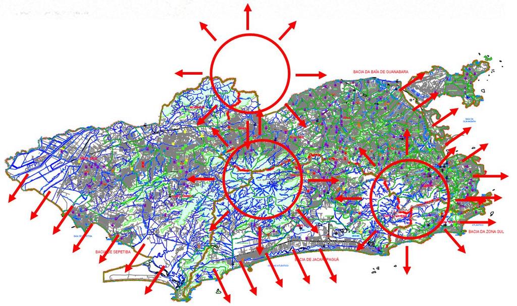
4 4 - City Topography and Hydrography:


5 5 - The Necessity of Mapping: Where to proceed dredging? For which place prepare a drainage project? To which place send the maintenance team?

6 6 - The Necessity of Mapping: Where to proceed dredging? Limitations due to Scarcity of Resources! For which place prepare a drainage project? What are the Criteria for Setting the Priorities of Action? To which place send the maintenance team?

 Flooding Data")
7 7 - Involved Agencies and Data Collection Mode: Field Teams Operators Rain Gauges (Pluviographs) Flooding Data Rain Data
8 8 - Mapped Information: N o DATE START (DAY HOUR) END (DAY HOUR) 1 02/01/ /01/ :45 02/01/ : /01/ /01/ :30 14/01/ : /01/ /01/ :15 16/01/ : /02/ /02/ :00 16/02/ : /03/ /03/ :45 08/03/ : /03/ /03/ :15 23/03/ : /04/ /04/ :40 16/04/ : /04/ /04/ :10 25/04/ : /04/ /04/ :13 28/04/ : /06/ /06/ :30 30/06/ : /07/ /07/ :00 09/07/ : /07/ /07/ :45 11/07/ : /08/ /08/ :45 14/08/ : /09/ /09/ :00 03/09/ : /11/ /11/ :45 27/11/ : /11/ /11/ :15 29/11/ : /12/ /12/ :30 05/12/ : /12/ /12/ :15 14/12/ : /12/ /12/ :15 24/12/ : /12/ /12/ :00 31/12/ :00 Rainy Days in 2014
9 9 - Mapped Information: N o DATE START (DAY HOUR) END (DAY HOUR) 1 22/01/ /01/ :15:00 22/01/ :00: /01/ /01/ :30:00 28/01/ :00: /01/ /01/ :00:00 31/01/ :15: /02/ /01/ :45:00 01/02/ :30: /02/ /02/ :15:00 02/02/ :00: /02/ /02/ :30:00 06/02/ :15: /02/ /02/ :30:00 07/02/ :45: /02/ /02/ :45:00 15/02/ :30: /02/ /02/ :15:00 16/02/ :45: /02/ /02/ :00:00 17/02/ :00: /03/ /03/ :45:00 08/03/ :30: /03/ /03/ :00:00 18/03/ :15: /03/ /03/ :30:00 23/03/ :30: /03/ /03/ :00:00 30/03/ :00: /05/ /05/ :00:00 05/05/ :15: /05/ /05/ :45:00 08/05/ :45: /05/ /05/ :30:00 28/05/ :15: /06/ /06/ :15:00 24/06/ :15: /11/ /11/ :00:00 03/11/ :45: /11/ /11/ :30:00 05/11/ :15: /11/ /11/ :00:00 07/11/ :30: /11/ /11/ :30:00 08/11/ :45: /11/ /11/ :00:00 21/11/ :15: /11/ /11/ :00:00 23/11/ :00: /11/ /11/ :45:00 28/11/ :15: /11/ /11/ :45:00 01/12/ :45: /12/ /12/ :15:00 07/12/ :15: /12/ /12/ :00:00 12/12/ :30:00 Rainy Days in 2015
10 10 - Mapped Information: Rain Data I Intensity (mm/h) (mm/15min.) Alert when I>15mm/15min! Alert when Alert when D is short for high I! D Duration (min.) F Frequency (years) F rain > F conduit! Galleries for Rainwater (F conduit =10) Channels (F conduit =25)


11 11 - Mapped Information: Flooding Data (Sent by Field Operators Teams)
12 12 - Mapped Information: Rain Gauges Data

13 13 Rain Data X Flooding Data

14 14 - Obtained Information with Mapping: Pluviometric Indexes
15 15 - Obtained Information with Mapping:
16 16 - Obtained Information with Mapping: - Points of flooding in areas I<15mm /15min - Points with supposedly high rainfall intensity (by the alert criteria), but no floods - Floods in places attended by raiwater galleries with F rain <10 years and channels with F rain <25 years - Ocurrence of floods is associated with a distributed rainfall throughout the territory of the city, but with an average intensity lower than the warning index - Rain gauges whose area of influence had more points of flooding - Points of flooding that had never been indentified before, with frequency index for each point - Indication of rainfalls intensity associated with each of the points of flooding formed
17 17 - Future Implementations: - Inclusion of the digital elevation model processed by NISR and TOPODATA - Altimetry (three-dimensional mapping of terrain) and hydraulic data associated with rivers and channels - Flow direction of rivers and channels - Surface flow coefficients (runoff) from the land use map - Inclusion of the drainage network (as built) - Set rainfall indexes to rivers and channnels basins - Influence of the tides in the rivers and channnels outflows - Inclusion of the RioÁguas monitoring system (hydrometric network) - Extension of the regions affected by floods - Temperature, relative humidity and wind speed just before the rainy event - Hydrological Analysis with Spatial Analyst - Integration between different archiving systems: SISARQ, SigÁguas and Geovias - Drainage network extraction, algebra maps and watersheds delimitation - Indication of alternate routes of traffic considering the flood points


18 18 - Future Implementations: App that allows field operator teams to communicate with the RJ Operational Center and make real-time mapping of points of flooding (using Collector) App for smartphones in Ios / Android / Windows language for images and datalogging related to the points of flooding.


19 19 RIO DE JANEIRO CITY HALL SECRETARY OF SANITATION AND WATER RESOURCES - SMAR FOUNDATION INSTITUTE OF MUNICIPAL WATERS - RIOÁGUAS BOARD OF STUDIES AND PROJECTS MANAGEMENT OF RESEARCH AND TECHNICAL SUPPORT Thanks for Your Attention! Contacts: nelson_lima@hotmail.com nelson.lima@1968@gmail.com Rio de Janeiro RJ Brazil
MAPPING OF FLOODING POINTS AND RAINFALL DATA USING ARCGIS RIO DE JANEIRO CITY - RJ - BRAZIL RAINY EVENTS
 MAPPING OF FLOODING POINTS AND RAINFALL DATA USING ARCGIS RIO DE JANEIRO CITY - RJ - BRAZIL 2014-2015 RAINY EVENTS Author: Nelson Luiz de Andrade Lima Management of Research and Technical Support Board
Flash Flood Guidance System On-going Enhancements
 Flash Flood Guidance System On-going Enhancements Hydrologic Research Center, USA Technical Developer SAOFFG Steering Committee Meeting 1 10-12 July 2017 Jakarta, INDONESIA Theresa M. Modrick Hansen, PhD
EFFICIENCY OF THE INTEGRATED RESERVOIR OPERATION FOR FLOOD CONTROL IN THE UPPER TONE RIVER OF JAPAN CONSIDERING SPATIAL DISTRIBUTION OF RAINFALL
 EFFICIENCY OF THE INTEGRATED RESERVOIR OPERATION FOR FLOOD CONTROL IN THE UPPER TONE RIVER OF JAPAN CONSIDERING SPATIAL DISTRIBUTION OF RAINFALL Dawen YANG, Eik Chay LOW and Toshio KOIKE Department of
Regional Flash Flood Guidance and Early Warning System
 WMO Training for Trainers Workshop on Integrated approach to flash flood and flood risk management 24-28 October 2010 Kathmandu, Nepal Regional Flash Flood Guidance and Early Warning System Dr. W. E. Grabs
Study 16.5 Probable Maximum Flood (PMF)
") Initial Study Report Meeting Study 16.5 Probable Maximum Flood (PMF) October 22, 2014 Prepared by 10/22/2014 1 Study 16.5 Objectives Develop a site-specific PMP to be used for the derivation of the PMF
Initial Study Report Meeting Study 16.5 Probable Maximum Flood (PMF) October 22, 2014 Prepared by 10/22/2014 1 Study 16.5 Objectives Develop a site-specific PMP to be used for the derivation of the PMF
URBAN WATERSHED RUNOFF MODELING USING GEOSPATIAL TECHNIQUES
 URBAN WATERSHED RUNOFF MODELING USING GEOSPATIAL TECHNIQUES DST Sponsored Research Project (NRDMS Division) By Prof. M. GOPAL NAIK Professor & Chairman, Board of Studies Email: mgnaikc@gmail.com Department
4 Precipitation. 4.1 Rainfall characteristics
 4 Precipitation 4.1 Rainfall characteristics As rainfall and rainfall properties are the main controlling factors in runoff production, the rainfall characteristics of the study area were carefully studied.
Uncertainty in the SWAT Model Simulations due to Different Spatial Resolution of Gridded Precipitation Data
 Uncertainty in the SWAT Model Simulations due to Different Spatial Resolution of Gridded Precipitation Data Vamsi Krishna Vema 1, Jobin Thomas 2, Jayaprathiga Mahalingam 1, P. Athira 4, Cicily Kurian 1,
12/07/2017. Flash Flood Warning Service, an advanced approach towards flood resilient cities Floodplain Management Association Conference, Newcastle
 12/07/2017 Worldwide problem: Flash Floods Flash Floods are a Global Problem Flash Flood Warning Service, an advanced approach towards flood resilient cities Floodplain Management Association Conference,
Striving Sufficient Lead Time of Flood Forecasts via Integrated Hydro-meteorological Intelligence
 Striving Sufficient Lead Time of Flood Forecasts via Integrated Hydro-meteorological Intelligence Dong-Sin Shih Assistant Professor, National Chung Hsing University, Taiwan, Sep. 6, 2013 Outlines Introductions
FLOOD RISK MAPPING AND ANALYSIS OF THE M ZAB VALLEY, ALGERIA
 River Basin Management IX 69 FLOOD RISK MAPPING AND ANALYSIS OF THE M ZAB VALLEY, ALGERIA AMEL OUCHERIF & SAADIA BENMAMAR National Polytechnic School of Algiers, Algeria ABSTRACT To contribute to flood
THE DEVELOPMENT OF RAIN-BASED URBAN FLOOD FORECASTING METHOD FOR RIVER MANAGEMENT PRACTICE USING X-MP RADAR OBSERVATION
 Research Paper Advances in River Engineering, JSCE, Vol.19, 2013,June THE DEVELOPMENT OF RAIN-BASED URBAN FLOOD FORECASTING METHOD FOR RIVER MANAGEMENT PRACTICE USING X-MP RADAR OBSERVATION Seongsim YOON
Innovative Ways to Monitor Land Displacement
 ARTICLE Innovative Ways to Monitor Land Displacement When people think about landslides, they usually imagine large mud streams which cause considerable loss of life. Whereas such large-scale disasters
Flood Hazard Inundation Mapping. Presentation. Flood Hazard Mapping
 Flood Hazard Inundation Mapping Verne Schneider, James Verdin, and JeradBales U.S. Geological Survey Reston, VA Presentation Flood Hazard Mapping Requirements Practice in the United States Real Time Inundation
Basin characteristics
 Basin characteristics From hydrological processes at the point scale to hydrological processes throughout the space continuum: point scale à river basin The watershed characteristics (shape, length, topography,
Emerging Needs, Challenges and Response Strategy
 Emerging Needs, Challenges and Response Strategy Development of Integrated Observing Systems in China JIAO Meiyan Deputy Administrator China Meteorological Administration September 2011 Geneva Outline
Ground Water Protection Council 2017 Annual Forum Boston, Massachusetts. Ben Binder (303)
") Ground Water Protection Council 2017 Annual Forum Boston, Massachusetts Protecting Groundwater Sources from Flood Borne Contamination Ben Binder (303) 860-0600 Digital Design Group, Inc. The Problem Houston
Ground Water Protection Council 2017 Annual Forum Boston, Massachusetts Protecting Groundwater Sources from Flood Borne Contamination Ben Binder (303) 860-0600 Digital Design Group, Inc. The Problem Houston
Hydrologic Overview & Quantities
 Hydrologic Overview & Quantities It is important to understand the big picture when attempting to forecast. This includes the interactive components and hydrologic quantities. Hydrologic Cycle The complexity
Advanced /Surface Hydrology Dr. Jagadish Torlapati Fall 2017 MODULE 2 - ROUTING METHODS
 Routing MODULE - ROUTING METHODS Routing is the process of find the distribution of flow rate and depth in space and time along a river or storm sewer. Routing is also called Flow routing or flood routing.
Flash Flood Flash Flood Forecasting and Early Warning System (FFEWS)
") Stakeholder Workshop of Haor Area Livelihoods Improvement Project (HALIP) 15 January 2016, Sunamganj, Bangladesh Flash Flood Flash Flood Forecasting and Early Warning System (FFEWS) BUET Study Team Prof
Stakeholder Workshop of Haor Area Livelihoods Improvement Project (HALIP) 15 January 2016, Sunamganj, Bangladesh Flash Flood Flash Flood Forecasting and Early Warning System (FFEWS) BUET Study Team Prof
MODULE 7 LECTURE NOTES 5 DRAINAGE PATTERN AND CATCHMENT AREA DELINEATION
 MODULE 7 LECTURE NOTES 5 DRAINAGE PATTERN AND CATCHMENT AREA DELINEATION 1. Introduction Topography of the river basin plays an important role in hydrologic modelling, by providing information on different
A GIS-based Approach to Watershed Analysis in Texas Author: Allison Guettner
 Texas A&M University Zachry Department of Civil Engineering CVEN 658 Civil Engineering Applications of GIS Instructor: Dr. Francisco Olivera A GIS-based Approach to Watershed Analysis in Texas Author:
Evaluation of Flash flood Events Using NWP Model and Remotely Sensed Rainfall Estimates
 Evaluation of Flash flood Events Using NWP Model and Remotely Sensed Rainfall Estimates Dr. Ismail Yucel METU Civil Engineering Department and Fatih Keskin State Hydraulic Works HydroPredict 2010 Prague
Identification of Areas with Potential for Flooding in South America
 Identification of Areas with Potential for Flooding in South America Sergio Rosim, João Ricardo de Freitas Oliveira, Alexandre Copertino Jardim, Laércio Massaru Namikawa, Cláudia Maria de Almeida Image
Haiti and Dominican Republic Flash Flood Initial Planning Meeting
 Dr Rochelle Graham Climate Scientist Haiti and Dominican Republic Flash Flood Initial Planning Meeting September 7 th to 9 th, 2016 Hydrologic Research Center http://www.hrcwater.org Haiti and Dominican
Determination of Urban Runoff Using ILLUDAS and GIS
 Texas A&M University Department of Civil Engineering Instructor: Dr. Francisco Olivera CVEN689 Applications of GIS to Civil Engineering Determination of Urban Runoff Using ILLUDAS and GIS Tae Jin Kim 03.
USING 3D GIS TO ASSESS ENVIRONMENTAL FLOOD HAZARDS IN MINA
 King Fahd University of Petroleum & Minerals College of Environmental Design Geographical Information system USING 3D GIS TO ASSESS ENVIRONMENTAL FLOOD HAZARDS IN MINA Prepared by : Ali AL-Zahrani OUTLINE
An Overview of Operations at the West Gulf River Forecast Center Gregory Waller Service Coordination Hydrologist NWS - West Gulf River Forecast Center
 National Weather Service West Gulf River Forecast Center An Overview of Operations at the West Gulf River Forecast Center Gregory Waller Service Coordination Hydrologist NWS - West Gulf River Forecast
CARFFG System Development and Theoretical Background
 CARFFG Steering Committee Meeting 15 SEPTEMBER 2015 Astana, KAZAKHSTAN CARFFG System Development and Theoretical Background Theresa M. Modrick, PhD Hydrologic Research Center Key Technical Components -
Results of Intensity-Duration- Frequency Analysis for Precipitation and Runoff under Changing Climate
 Results of Intensity-Duration- Frequency Analysis for Precipitation and Runoff under Changing Climate Supporting Casco Bay Region Climate Change Adaptation RRAP Eugene Yan, Alissa Jared, Julia Pierce,
GIS Techniques for Floodplain Delineation. Dean Djokic
 GIS Techniques for Floodplain Delineation Dean Djokic (ddjokic@esri.com) Content What is a floodplain? How to get a floodplain? What can GIS do for floodplain modeling? Simple GIS techniques for floodplain
SOP/EOP Implementation Plan -Overview for the Eastern Mediterranean Target Area Emmanouil Anagnostou
 SOP/EOP Implementation Plan -Overview for the Eastern Mediterranean Target Area Emmanouil Anagnostou University of Connecticut & Hellenic Center for Marine Research Contributions from Efrat Morin The Hebrew
Floodplain modeling. Ovidius University of Constanta (P4) Romania & Technological Educational Institute of Serres, Greece
 Romania & Technological Educational Institute of Serres, Greece") Floodplain modeling Ovidius University of Constanta (P4) Romania & Technological Educational Institute of Serres, Greece Scientific Staff: Dr Carmen Maftei, Professor, Civil Engineering Dept. Dr Konstantinos
Floodplain modeling Ovidius University of Constanta (P4) Romania & Technological Educational Institute of Serres, Greece Scientific Staff: Dr Carmen Maftei, Professor, Civil Engineering Dept. Dr Konstantinos
(case study Karaj watershed)
") River sediment monitoring using remote sensing and GIS (case study Karaj watershed) M. Shafaie a,h.ghodosi b, K. H. Mostofi c * a professor, Department of Civil Engineering, Faculty of Engineering, University
River sediment monitoring using remote sensing and GIS (case study Karaj watershed) M. Shafaie a,h.ghodosi b, K. H. Mostofi c * a professor, Department of Civil Engineering, Faculty of Engineering, University
Rainwater storage facilities
 Rainwater storage facilities Development of facilities for target rainfall Planned discharge in pump drainage areas City Yokohama Kawasaki Total Discharge area Tsuzuki Kouhoku Hokubu Kase Planned discharge
A GIS-based Subcatchments Division Approach for SWMM
 Send Orders for Reprints to reprints@benthamscience.ae The Open Civil Engineering Journal, 2015, 9, 515-521 515 A GIS-based Subcatchments Division Approach for SWMM Open Access Shen Ji and Zhang Qiuwen
Study 16.5 Probable Maximum Flood (PMF)
") Initial Study Report Meeting Study 16.5 Probable Maximum Flood (PMF) March 30, 2016 Prepared by 3/30/2016 1 Study 16.5 Status ISR documents (ISR Part D Overview): Status: Initial Study Report: Parts A,
Initial Study Report Meeting Study 16.5 Probable Maximum Flood (PMF) March 30, 2016 Prepared by 3/30/2016 1 Study 16.5 Status ISR documents (ISR Part D Overview): Status: Initial Study Report: Parts A,
INFLOW DESIGN FLOOD CONTROL SYSTEM PLAN 40 C.F.R. PART PLANT YATES ASH POND 2 (AP-2) GEORGIA POWER COMPANY
 GEORGIA POWER COMPANY") INFLOW DESIGN FLOOD CONTROL SYSTEM PLAN 40 C.F.R. PART 257.82 PLANT YATES ASH POND 2 (AP-2) GEORGIA POWER COMPANY EPA s Disposal of Coal Combustion Residuals from Electric Utilities Final Rule (40 C.F.R.
INFLOW DESIGN FLOOD CONTROL SYSTEM PLAN 40 C.F.R. PART 257.82 PLANT YATES ASH POND 2 (AP-2) GEORGIA POWER COMPANY EPA s Disposal of Coal Combustion Residuals from Electric Utilities Final Rule (40 C.F.R.
Space for Sustainable Development. Disasters
 Rio+20 - United Nations Conference on Sustainable Development, June 2012 Rio de Janeiro, Brazil Space for Sustainable Development Disasters Carlos AfonsoNobre Carlos FredericoAngelis Why natural disasters
CE 394K.3 GIS in Water Resources Midterm Quiz Fall There are 5 questions on this exam. Please do all 5. They are of equal credit.
 Name: CE 394K.3 GIS in Water Resources Midterm Quiz Fall 2000 There are 5 questions on this exam. Please do all 5. They are of equal credit. 1. The ArcView Geographic Information System can display different
Lecture 5: Precipitation
 Lecture 5: Precipitation Key Questions 1. What physical concepts control the formation of precipitation (air pressure, expanding gases and cooling, and vapor pressure)? 2. What are some air mass lifting
Measures Also Significant Factors of Flood Disaster Reduction
 Non-Structual Measures Also Significant Factors of Flood Disaster Reduction Babiaková Gabriela, Leškov ková Danica Slovak Hydrometeorological Institute, Bratislava Hydrological Forecasts and Warning Department
ENGRG Introduction to GIS
 ENGRG 59910 Introduction to GIS Michael Piasecki March 17, 2014 Lecture 08: Terrain Analysis Outline: Terrain Analysis Earth Surface Representation Contour TIN Mass Points Digital Elevation Models Slope
Improving Situational Awareness of Flash Flooding in a Small Urban Catchment by Integrating Meteorological Analysis into a Geospatial Framework
 Improving Situational Awareness of Flash Flooding in a Small Urban Catchment by Integrating Meteorological Analysis into a Geospatial Framework John M. Goff 1, Lesley-Ann Dupigny-Giroux 2, John Kilbride
National Weather Service Flood Forecast Needs: Improved Rainfall Estimates
 National Weather Service Flood Forecast Needs: Improved Rainfall Estimates Weather Forecast Offices Cleveland and Northern Indiana Ohio River Forecast Center Presenter: Sarah Jamison, Service Hydrologist
DRR-related mandates and relevant activities and projects of RA III
 DRR-related mandates and relevant activities and projects of RA III 2015 Meeting of the Disaster Risk Reduction Focal Points of WMO Regional Associations, Technical Commissions and Programmes (DRR FP RA-TC-TP)
IJESRT INTERNATIONAL JOURNAL OF ENGINEERING SCIENCES & RESEARCH TECHNOLOGY
 IJESRT INTERNATIONAL JOURNAL OF ENGINEERING SCIENCES & RESEARCH TECHNOLOGY Use of Digital Elevation Model to compute Storm Water Drainage Network Manisha Desai *1, Dr. J. N. Patel 2 *1 Ph. D. Student of
ENGRG Introduction to GIS
 ENGRG 59910 Introduction to GIS Michael Piasecki November 17, 2017 Lecture 11: Terrain Analysis Outline: Terrain Analysis Earth Surface Representation Contour TIN Mass Points Digital Elevation Models Slope
Hydrology and Hydraulics Design Report. Background Summary
 To: National Park Services Montezuma Castle National Monument Richard Goepfrich, Facility Manager From: Multicultural Technical Engineers Date: Tuesday - February 13, 2018 Subject: 30% Hydrology and Hydraulics
Table 1 PRISM/OB1 data summary in this study. PI400-2 Table 2 PRISM/OB1 data summary in this study. 2'#7-#/ :> 8>?= B-/"# 899:;98;<= :> 8A89
 PI400-1 EVALUATION ANALYSIS FOR DIGITAL TERRAIN MODELS GENERATED FROM ALOS/PRISM -OB2 DATA PI No. 400 Tomohito Asaka (PI) 1, Yoshiyuki Yamamoto (CI) 2 1 Nihon University, Izumi 1-2-1, Narashino Chiba,
Digital Elevation Models. Using elevation data in raster format in a GIS
 Digital Elevation Models Using elevation data in raster format in a GIS What is a Digital Elevation Model (DEM)? Digital representation of topography Model based on scale of original data Commonly a raster
Ingo Meirold-Mautner Yong Wang Alexander Kann Benedikt Bica Georg Pistotnik
 INCA-CE: The challenge of severe weather warnings Ingo Meirold-Mautner Yong Wang Alexander Kann Benedikt Bica Georg Pistotnik INCA Central Europe Integrated nowcasting for the Central European area BALTRAD
A Tale of Time Travel Year 2018
 A Tale of Time Travel Year 2018 1 1 Question: 2 2 Answer: Integrated Modeling for Road Condition Prediction (IMRCP) Kyle Garrett, Synesis Partners Nancy Powell, MoDOT/KC Scout 3 So what is it? Historic
A Natural Disaster Monitoring and Warning System SISMADEN
 ABCC Program Workshop Ottawa, September 2010 A Natural Disaster Monitoring and Warning System SISMADEN Dr. Laércio M. Namikawa Eymar S.S. Lopes rincipais Desastres Naturais no Brasil 2000-2007 Natural
Floodplain Modeling and Mapping Using The Geographical Information Systems (GIS) and Hec-RAS/Hec-GeoRAS Applications. Case of Edirne, Turkey.
 and Hec-RAS/Hec-GeoRAS Applications. Case of Edirne, Turkey.") Floodplain Modeling and Mapping Using The Geographical Information Systems (GIS) and Hec-RAS/Hec-GeoRAS Applications. Case of Edirne, Turkey. Fuad Hajibayov *1, Basak Demires Ozkul 1, Fatih Terzi 1 1 Istanbul
Floodplain Modeling and Mapping Using The Geographical Information Systems (GIS) and Hec-RAS/Hec-GeoRAS Applications. Case of Edirne, Turkey. Fuad Hajibayov *1, Basak Demires Ozkul 1, Fatih Terzi 1 1 Istanbul
Advanced Hydrology Prof. Dr. Ashu Jain Department of Civil Engineering Indian Institute of Technology, Kanpur. Lecture 14
 Advanced Hydrology Prof. Dr. Ashu Jain Department of Civil Engineering Indian Institute of Technology, Kanpur Lecture 14 Good morning and welcome to this video course on advanced hydrology. In the last
Hydrologic Engineering Applications of Geographic Information Systems
 Hydrologic Engineering Applications of Geographic Information Systems Davis, California Objectives: The participant will acquire practical knowledge and skills in the application of GIS technologies for
Flood Forecasting Tools for Ungauged Streams in Alberta: Status and Lessons from the Flood of 2013
 Flood Forecasting Tools for Ungauged Streams in Alberta: Status and Lessons from the Flood of 2013 John Pomeroy, Xing Fang, Kevin Shook, Tom Brown Centre for Hydrology, University of Saskatchewan, Saskatoon
ENGINEERING HYDROLOGY
 ENGINEERING HYDROLOGY Prof. Rajesh Bhagat Asst. Professor Civil Engineering Department Yeshwantrao Chavan College Of Engineering Nagpur B. E. (Civil Engg.) M. Tech. (Enviro. Engg.) GCOE, Amravati VNIT,
A Cloud-Based Flood Warning System For Forecasting Impacts to Transportation Infrastructure Systems
 A Cloud-Based Flood Warning System For Forecasting Impacts to Transportation Infrastructure Systems Jon Goodall Associate Professor, Civil and Environmental Engineering Associate Director, Link Lab April
Geomorphometric analysis and drainage network for the territory of Republic of Croatia
 Geomorphometric analysis and drainage network for the territory of Republic of Croatia Marta Pokupić, Matej Varga, prof. dr. sc. Tomislav Bašić Faculty of Geodesy, University of Zagreb 13th International
Intensity-Duration-Frequency (IDF) Curves Example
 Curves Example") Intensity-Duration-Frequency (IDF) Curves Example Intensity-Duration-Frequency (IDF) curves describe the relationship between rainfall intensity, rainfall duration, and return period (or its inverse, probability
Intensity-Duration-Frequency (IDF) Curves Example Intensity-Duration-Frequency (IDF) curves describe the relationship between rainfall intensity, rainfall duration, and return period (or its inverse, probability
Precipitation. Prof. M.M.M. Najim
 Precipitation Prof. M.M.M. Najim Learning Outcome At the end of this section students will be able to Explain different forms of precipitation Identify different types of rain gauges Measure rainfall using
Geog Lecture 19
 Geog 1000 - Lecture 19 Fluvial Geomorphology and River Systems http://scholar.ulethbridge.ca/chasmer/classes/ Today s Lecture (Pgs 346 355) 1. What is Fluvial Geomorphology? 2. Hydrology and the Water
KULLEĠĠ SAN BENEDITTU Boys Secondary, Kirkop HALF-YEARLY EXAMINATION 2012/13
 KULLEĠĠ SAN BENEDITTU Boys Secondary, Kirkop HALF-YEARLY EXAMINATION 2012/13 Mark Track 2 (AS) FORM 3 GEOGRAPHY TIME: 1h 30min Question 1 2 3 4 5 6 7 8 9 10 11 12 13 14 15 16 17 18 Global Mark Max. Mark
13 Watershed Delineation & Modeling
 Module 4 (L12 - L18): Watershed Modeling Standard modeling approaches and classifications, system concept for watershed modeling, overall description of different hydrologic processes, modeling of rainfall,
EO Information Services. Assessing Vulnerability in the metropolitan area of Rio de Janeiro (Floods & Landslides) Project
 Project") EO Information Services in support of Assessing Vulnerability in the metropolitan area of Rio de Janeiro (Floods & Landslides) Project Ricardo Armas, Critical Software SA Haris Kontoes, ISARS NOA World
EO Information Services in support of Assessing Vulnerability in the metropolitan area of Rio de Janeiro (Floods & Landslides) Project Ricardo Armas, Critical Software SA Haris Kontoes, ISARS NOA World
Radars, Hydrology and Uncertainty
 Radars, Hydrology and Uncertainty Francesca Cecinati University of Bristol, Department of Civil Engineering francesca.cecinati@bristol.ac.uk Supervisor: Miguel A. Rico-Ramirez Research objectives Study
FFGS Concept HYDROLOGIC RESEARCH CENTER. 2 May 2017
 FFGS Concept HYDROLOGIC RESEARCH CENTER 2 May 2017 Research and Development History 1970-1988: US NWS Produces FFG statistically for each River Forecast Center. Also, research in adaptive site specific
DEVELOPMENT OF A FORECAST EARLY WARNING SYSTEM ethekwini Municipality, Durban, RSA. Clint Chrystal, Natasha Ramdass, Mlondi Hlongwae
 DEVELOPMENT OF A FORECAST EARLY WARNING SYSTEM ethekwini Municipality, Durban, RSA Clint Chrystal, Natasha Ramdass, Mlondi Hlongwae LOCATION DETAILS AND BOUNDARIES ethekwini Municipal Area = 2297 km 2
FROM FLOOD FORECAST TO FLOOD FIGHTING Georg Johann , Tiel
 FROM FLOOD FORECAST TO FLOOD FIGHTING Georg Johann 2016-11-04, Tiel Dutch-German exchange of knowledge and experience COMING FROM FORECASTS TO EFFECTIVE FLOOD DEFENDING EMERGENCY MEASURES Flood forecasting
USGS Hydrography Overview. May 9, 2018
 + 1 USGS Hydrography Overview May 9, 2018 + 2 The National Geospatial Program Provides the geospatial baseline of the Nation s topography, natural landscape and built environment through The National Map,
Role of Arc GIS in developing Real Time and Forecasting Water Resource System ANMOL BHARDWAJ 1, ANIL VYAS 2 1
 Role of Arc GIS in developing Real Time and Forecasting Water Resource System ANMOL BHARDWAJ 1, ANIL VYAS 2 1 Project Associate, Indian Institute of Technology Roorkee 2 ADE National Hydrology Project,
Rainfall Analysis. Prof. M.M.M. Najim
 Rainfall Analysis Prof. M.M.M. Najim Learning Outcome At the end of this section students will be able to Estimate long term mean rainfall for a new station Describe the usage of a hyetograph Define recurrence
Climate change and natural disasters, Athens, Greece October 31, 2018
 Flood early warning systems: operational approaches and challenges Climate change and natural disasters, Athens, Greece October 31, 2018 Athens, October 31, 2018 Marco Borga University of Padova, Italy
Complete Weather Intelligence for Public Safety from DTN
 Complete Weather Intelligence for Public Safety from DTN September 2017 White Paper www.dtn.com / 1.800.610.0777 From flooding to tornados to severe winter storms, the threats to public safety from weather-related
Las Colonias Subdivision September 2010 Flood Study
 Las Colonias Subdivision September 2010 Flood Study Curtis Beitel, P.E., CFM Scott Muchard, P.E. Project Engineer William Badini, CFM Senior Meteorologist Location Map Background Los Colonias Subdivision
Progress Report. Flood Hazard Mapping in Thailand
 Progress Report Flood Hazard Mapping in Thailand Prepared By: Mr. PAITOON NAKTAE Chief of Safety Standard sub-beuro Disaster Prevention beuro Department of Disaster Prevention and Mitigation THAILAND E-mail:
Vulnerability of Flood Hazard in Selected Ayeyarwady Delta Region, Myanmar
 Vulnerability of Flood Hazard in Selected Ayeyarwady Delta Region, Myanmar Khin Thandar Win Department of Civil Engineering Nilar Aye Department of Civil Engineering Kyaw Zaya Htun Department of Remote
Governing Rules of Water Movement
 Governing Rules of Water Movement Like all physical processes, the flow of water always occurs across some form of energy gradient from high to low e.g., a topographic (slope) gradient from high to low
Assessment of rainfall observed by weather radar and its effect on hydrological simulation performance
 386 Hydrology in a Changing World: Environmental and Human Dimensions Proceedings of FRIED-Water 2014, Montpellier, France, October 2014 (IAHS Publ. 363, 2014). Assessment of rainfall observed by weather
Error Propagation from Radar Rainfall Nowcasting Fields to a Fully-Distributed Flood Forecasting Model
 Error Propagation from Radar Rainfall Nowcasting Fields to a Fully-Distributed Flood Forecasting Model Enrique R. Vivoni 1, Dara Entekhabi 2 and Ross N. Hoffman 3 1. Department of Earth and Environmental
Rainfall-Flood Hazard along the Cagayan River in Carmen
 -Flood Hazard along the Cagayan River in Carmen Things to watch out for when rain falls intensity 12 December 2013, Cagayan de Oro City Hall 3 +1 main questions I What do we need to understand about rainfall
THE IMPACT OF THE TORRENTIAL PRECIPITATIONS IN THE FORMATION OF FLOODS IN THE METROPOLITAN AREA OF SATU MARE
 RISCURI ŞI CATASTROFE, NR. XVII, VOL. 22, NR.1/2018 THE IMPACT OF THE TORRENTIAL PRECIPITATIONS IN THE FORMATION OF FLOODS IN THE METROPOLITAN AREA OF SATU MARE C.-O. MAREŞ Abstract. The impact of the
Deterministic Hydrological Model For Flood Risk Assessment Of Mexico City
 City University of New York (CUNY) CUNY Academic Works International Conference on Hydroinformatics 8-1-2014 Deterministic Hydrological Model For Flood Risk Assessment Of Mexico City Vargas Bringas Rafael
VIC Hydrology Model Training Workshop Part II: Building a model
 VIC Hydrology Model Training Workshop Part II: Building a model 11-12 Oct 2011 Centro de Cambio Global Pontificia Universidad Católica de Chile Ed Maurer Civil Engineering Department Santa Clara University
![)UDQFR54XHQWLQ(DQG'tD]'HOJDGR&](/thumbs/95/125846872.jpg ")UDQFR54XHQWLQ(DQG'tD]'HOJDGR&") &21&(37,21$1',03/(0(17$7,212)$1+
&21&(37,21$1',03/(0(17$7,212)$1+ Application of Mathematical Modeling to Study Flood Wave Behavior in Natural Rivers as Function of Hydraulic and Hydrological Parameters of the Basin
 Hydrology Days 2010 Application of Mathematical Modeling to Study Flood Wave Behavior in Natural Rivers as Function of Hydraulic and Hydrological Parameters of the Basin Patrícia Freire Chagas 2, Silvia
Notes: We all know that Toulmins Spring Branch is a sub-watershed of Three Mile Creek watershed. Some part of it is in Mobile area and rest of it is
 1 Notes: This presentation is about some of our findings from a study carried out over the last 3-4 months on stormwater management of Toulmins Spring Branch watershed by NEP. The objective of this study
Hydrologic Modelling of the Upper Malaprabha Catchment using ArcView SWAT
 Hydrologic Modelling of the Upper Malaprabha Catchment using ArcView SWAT Technical briefs are short summaries of the models used in the project aimed at nontechnical readers. The aim of the PES India
Lecture 6: Precipitation Averages and Interception
 Lecture 6: Precipitation Averages and Interception Key Questions 1. How much and when does Whatcom County receive rain? 2. Where online can you find rainfall data for the state? 3. How is rainfall averaged
IMPACT OF CLIMATE CHANGE OVER THE ARABIAN PENINSULA
 IMPACT OF CLIMATE CHANGE OVER THE ARABIAN PENINSULA By: Talal Alharbi June, 29 2017 1 Motivation: In arid and semi-arid regions of the world the demand for fresh water resources is increasing due to: increasing
Leveraging new models and data to improve flood stage forecast. Improving Flood Stage Forecasting in the Feather River Watershed. September 11 th 2015
 Leveraging new models and data to improve flood stage forecast Improving Flood Stage Forecasting in the Feather River Watershed September 11 th 2015 Mitch Russo, P.E. (DWR) Ashok Bathulla, P.E., CFM (GEI)
FFGS Advances. Initial planning meeting, Nay Pyi Taw, Myanmar February, Eylon Shamir, Ph.D,
 FFGS Advances Initial planning meeting, Nay Pyi Taw, Myanmar 26-28 February, 2018 Eylon Shamir, Ph.D, EShamir@hrcwater.org Hydrologic Research Center San Diego, California FFG System Enhancements The following
SUPPORTS SUSTAINABLE GROWTH
 DDSS BBUUN NDDLLEE G E O S P AT I A L G O V E R N A N C E P A C K A G E SUPPORTS SUSTAINABLE GROWTH www.digitalglobe.com BRISBANE, AUSTRALIA WORLDVIEW-3 30 CM International Civil Government Programs US
Estimating Probable Maximum Precipitation for Linau River Basin in Sarawak
 Estimating Probable Maximum Precipitation for Linau River Basin in Sarawak M. Hussain, S. Nadya and F.J. Chia Hydropower Development Division, Sarawak Energy Berhad, 93050, Kuching, Sarawak, Malaysia Date
Prediction of Rapid Floods from Big Data using Map Reduce Technique
 Global Journal of Pure and Applied Mathematics. ISSN 0973-1768 Volume 12, Number 1 (2016), pp. 369-373 Research India Publications http://www.ripublication.com Prediction of Rapid Floods from Big Data
Parameterization using ArcView GIS in medium and large watershed modelling
 50 GIS and Remote Sensing in Hydrology, Water Resources and Environment (Proceedings of ICGRHWE held at the Three Gorges Dam, China, September 2003). IAHS Publ. 289, 2004 Parameterization using ArcView
GRAPEVINE LAKE MODELING & WATERSHED CHARACTERISTICS
 GRAPEVINE LAKE MODELING & WATERSHED CHARACTERISTICS Photo Credit: Lake Grapevine Boat Ramps Nash Mock GIS in Water Resources Fall 2016 Table of Contents Figures and Tables... 2 Introduction... 3 Objectives...
FLOOD HAZARD AND RISK ASSESSMENT IN MID- EASTERN PART OF DHAKA, BANGLADESH
 FLOOD HAZARD AND RISK ASSESSMENT IN MID- EASTERN PART OF DHAKA, BANGLADESH Muhammad MASOOD MEE07180 Supervisor: Prof. Kuniyoshi TAKEUCHI ABSTRACT An inundation simulation has been done for the mid-eastern