Geomorphometric analysis and drainage network for the territory of Republic of Croatia
|
|
|
- Barnaby Garrison
- 5 years ago
- Views:
Transcription
1 Geomorphometric analysis and drainage network for the territory of Republic of Croatia Marta Pokupić, Matej Varga, prof. dr. sc. Tomislav Bašić Faculty of Geodesy, University of Zagreb 13th International Conference GEOHERITAGE, GEOINFORMATION AND CARTOGRAPHY Selce, Croatia, September 8,
2 Summary Basic terms and importances of models Analysis Geomorphometric parameters Slope, Aspect, Ruggedness index Drainage network Outputs Algorithm comparison DEMs comparison Conclusions 2


3 Geomorphometry: introduction science of quantitative land surface analysis DEM Slope it collects various mathematical, statistical and image processing techniques Source: Aspect Ruggedness index 3


4 Drainage network: introduction Drainage network - network of channels and drains of all drainage basins of an area Channels = stream segments Drainage basin - any area of land where rainfall collects and drains off into a common outlet Source: Source: 4


5 Importance of geomorphometric analysis and drainage network hazard assessment - landslide prediction and mitigation coastal protection planning the installations of lines of renewable and non-renewable energy sources space planning in civil engineering needs of the military and tourism ecological problems design of a stable system Source: Source: 5

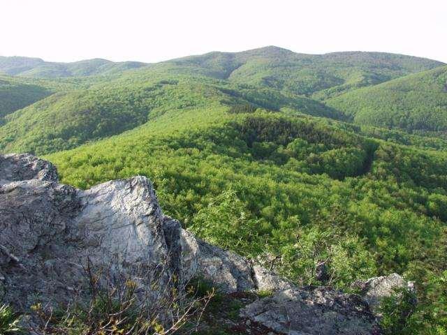
6 Study area Republic of Croatia variety of reliefs Source data: digital elevation model (DEM) Used DEMs: SRTM30, SRTM15, SRTM3, SRTM1, GTOPO30, ETOPO1 Source: 6
7 Summary Basic terms and importances of models Analysis Geomorphometric parameters Slope, Aspect, Ruggedness index Drainage network Outputs Algorithm comparison DEMs comparison Conclusions 7
8 Slope map of Croatia the steepness or the degree of incline of a surface Min 0 Max 52,2 Avg 5,5 Slope ( ) Characteristics <2 Plain 2-5 Mildly inclined terrain 5-12 Inclined terrain Significant inclination Very steep terrain >55 Escarpments, cliffs 8

9 Aspect map of Croatia can be thought of as the slope direction 9
10 Ruggedness index map of Croatia the difference between the value of a cell and the mean of its 8 neighboring cells. Min Max Avg 0 m 351,2 m 26,4 m Ruggedness index (m) Characteristics Level Nearly Level Slightly Rugged Intermediately Rugged Moderately Rugged 10
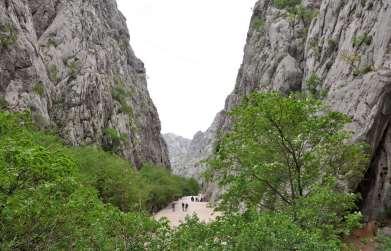


11 Geomorphometric analysis: extreme values Paklenica national park Source: 11
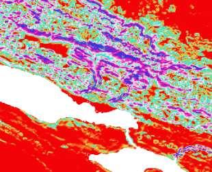
12 Geomorphometric analysis Source: 12


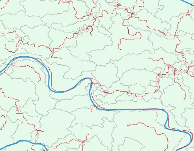
13 Geomorphometric analysis Aspect River basins according to EEA 13
14 Summary Basic terms and importances of models Analysis Geomorphometric parameters Slope, Aspect, Ruggedness index Drainage network Outputs Algorithm comparison DEMs comparison Conclusions 14
15 Drainage networks: algorithms Single flow direction algorithm (D8) SFD Multiple flow direction algorithm MFD In steepest downslope direction In all downslope directions 15

16 Drainage network outputs Stream segment Drainage basin 16
17 Algorithm comparison Both vector layers of stream were overlapped with the vector layer of the Croatian rivers MFD algorithm produced more accurate and denser drainage pattern MFD algorithm produced more basins Source: 17


18 DEMs comparison ETOPO1 GTOPO30 SRTM30 SRTM15 SRTM basins 1597 basins 1566 basins 2355 basins 4863 basins 18


19 DEMs comparison SRTM3 SRTM1 19
20 Summary Basic terms and importances of models Analysis Geomorphometric parameters Slope, Aspect, Ruggedness index Drainage network Outputs Algorithm comparison DEMs comparison Conclusions 20


21 Conclusions Results: maps of slope, aspect, ruggedness index and drainage network analysed and studied compatible with other agencies' data Drainage network created with different input DEMs and with different algorithms the sensitivity and influence of all input variables Optimal solution: drainage network from SRTM3 with MFD algorithm 21

22 Conclusions Drainage network + geomorphometric parameters = preserving and planning space Identifying and planning the groundwater potential zones and watershed management irrigation and drainage of surface Geomorphometric analyzes determine the variety of life in each site 22
23 Thanks for attention!
GIS Mapping of Croatian Landform Diversity Using the Geomorphons Approach
 GEOHERITAGE, GEOINFORMATION AND CARTOGRAPHY GIS Mapping of Croatian Landform Diversity Using the Geomorphons Approach Matjaž ŠTANFEL, Dražen TUTIĆ University of Zagreb, Faculty of Geodesy mastanfel@geof.hr,
Basin characteristics
 Basin characteristics From hydrological processes at the point scale to hydrological processes throughout the space continuum: point scale à river basin The watershed characteristics (shape, length, topography,
Remote Sensing and GIS Applications for Hilly Watersheds SUBASHISA DUTTA DEPARTMENT OF CIVIL ENGINEERING IIT GUWAHATI
 Remote Sensing and GIS Applications for Hilly Watersheds SUBASHISA DUTTA DEPARTMENT OF CIVIL ENGINEERING IIT GUWAHATI Deciding Alternative Land Use Options in a Watershed Using GIS Source: Anita Prakash
SPATIAL AND TEMPORAL ANALYSIS OF THE DEGRADATION OF NATURAL RESOURCES IN RIVER LIKODRA WATERSHED
 Soil Erosion Modelling JRC Ispra 20-21-22 March 2017 University of Belgrade, Faculty of Forestry Department for Ecological Engineering in Protection of Soil and Water Resources SPATIAL AND TEMPORAL ANALYSIS
Digital Elevation Models. Using elevation data in raster format in a GIS
 Digital Elevation Models Using elevation data in raster format in a GIS What is a Digital Elevation Model (DEM)? Digital representation of topography Model based on scale of original data Commonly a raster
International Journal of Advance Engineering and Research Development
 Scientific Journal of Impact Factor (SJIF): 4.72 International Journal of Advance Engineering and Research Development Volume 4, Issue 5, May -2017 Watershed Delineation of Purna River using Geographical
Dr. S.SURIYA. Assistant professor. Department of Civil Engineering. B. S. Abdur Rahman University. Chennai
 Hydrograph simulation for a rural watershed using SCS curve number and Geographic Information System Dr. S.SURIYA Assistant professor Department of Civil Engineering B. S. Abdur Rahman University Chennai
MODULE 7 LECTURE NOTES 5 DRAINAGE PATTERN AND CATCHMENT AREA DELINEATION
 MODULE 7 LECTURE NOTES 5 DRAINAGE PATTERN AND CATCHMENT AREA DELINEATION 1. Introduction Topography of the river basin plays an important role in hydrologic modelling, by providing information on different
EMERGENCY PLANNING IN NORTHERN ALGERIA BASED ON REMOTE SENSING DATA IN RESPECT TO TSUNAMI HAZARD PREPAREDNESS
 EMERGENCY PLANNING IN NORTHERN ALGERIA BASED ON REMOTE SENSING DATA IN RESPECT TO TSUNAMI HAZARD PREPAREDNESS Barbara Theilen-Willige Technical University of Berlin, Institute of Applied Geosciences Department
ENGRG Introduction to GIS
 ENGRG 59910 Introduction to GIS Michael Piasecki March 17, 2014 Lecture 08: Terrain Analysis Outline: Terrain Analysis Earth Surface Representation Contour TIN Mass Points Digital Elevation Models Slope
Governing Rules of Water Movement
 Governing Rules of Water Movement Like all physical processes, the flow of water always occurs across some form of energy gradient from high to low e.g., a topographic (slope) gradient from high to low
!" &#'(&) %*!+,*" -./0"1$ 1% % % - % 8 99:; < % % % % = 1. % % 2 /0 2 8 $ ' 99!; & %% % 2,A 1% %,1 % % % 2 3 %3 % / % / "1 % ; /0 % 2% % % %36
 %*!+,* -./01$ 1% % % - % 8 99:; < % % % % = 1. % % 2 /0 2 8 $ ' 99!; & %% % 2,A 1% %,1 % % % 2 3 %3 % / % / 1 % ; /0 % 2% % % %36") !" #$ &#'(&) *!+,*" - /0"1$ 1 1/0/// 0/02 /04"1 /0//,1$ 5/ - ( 6/027/ ///0 (/0// // - /002220(2 8 99:; < (/ = 1 2 /0$17899; 2 /0 2 8 $ 99?6 @ ' 99!; & 2,A 1,1 2 / / "1 -,14/02- ; /0 2 6,; B,1$ 2"1/0
!" #$ &#'(&) *!+,*" - /0"1$ 1 1/0/// 0/02 /04"1 /0//,1$ 5/ - ( 6/027/ ///0 (/0// // - /002220(2 8 99:; < (/ = 1 2 /0$17899; 2 /0 2 8 $ 99?6 @ ' 99!; & 2,A 1,1 2 / / "1 -,14/02- ; /0 2 6,; B,1$ 2"1/0
ENGINEERING HYDROLOGY
 ENGINEERING HYDROLOGY Prof. Rajesh Bhagat Asst. Professor Civil Engineering Department Yeshwantrao Chavan College Of Engineering Nagpur B. E. (Civil Engg.) M. Tech. (Enviro. Engg.) GCOE, Amravati VNIT,
ENGRG Introduction to GIS
 ENGRG 59910 Introduction to GIS Michael Piasecki November 17, 2017 Lecture 11: Terrain Analysis Outline: Terrain Analysis Earth Surface Representation Contour TIN Mass Points Digital Elevation Models Slope
HYDROLOGIC AND WATER RESOURCES EVALUATIONS FOR SG. LUI WATERSHED
 HYDROLOGIC AND WATER RESOURCES EVALUATIONS FOR SG. LUI WATERSHED 1.0 Introduction The Sg. Lui watershed is the upper part of Langat River Basin, in the state of Selangor which located approximately 20
Figure 1. Which part of the river is labelled in Figure 1? a) Mouth b) Source c) Lower course d) channel
 Mouth b) Source c) Lower course d) channel") Rivers 1. Study Figure 1 showing the long profile of a river Figure 1 A Which part of the river is labelled in Figure 1? a) Mouth b) Source c) Lower course d) channel (1 mark) 2. Complete the sentences
Rivers 1. Study Figure 1 showing the long profile of a river Figure 1 A Which part of the river is labelled in Figure 1? a) Mouth b) Source c) Lower course d) channel (1 mark) 2. Complete the sentences
AUTOMATIC EXTRACTION OF ALUVIAL FANS FROM ASTER L1 SATELLITE DATA AND A DIGITAL ELEVATION MODEL USING OBJECT-ORIENTED IMAGE ANALYSIS
 AUTOMATIC EXTRACTION OF ALUVIAL FANS FROM ASTER L1 SATELLITE DATA AND A DIGITAL ELEVATION MODEL USING OBJECT-ORIENTED IMAGE ANALYSIS Demetre P. Argialas, Angelos Tzotsos Laboratory of Remote Sensing, Department
4. GIS Implementation of the TxDOT Hydrology Extensions
 4. GIS Implementation of the TxDOT Hydrology Extensions A Geographic Information System (GIS) is a computer-assisted system for the capture, storage, retrieval, analysis and display of spatial data. It
Uses of free satellite imagery for Disaster Risk Reduction (DRR)
") Centre of Applied Geoscience, Disaster Risk Reduction Research Group, School of Earth and Environmental Science, University of Portsmouth, UK Uses of free satellite imagery for Disaster Risk Reduction
Centre of Applied Geoscience, Disaster Risk Reduction Research Group, School of Earth and Environmental Science, University of Portsmouth, UK Uses of free satellite imagery for Disaster Risk Reduction
Error Quantification of Topographic Index in Relation to Terrain Condition and Grid Spacing
 Error Quantification of Topographic Index in Relation to Terrain Condition and Grid Spacing Samadrita Adhikari January, 2008 i Error Quantification of Topographic Index in Relation to Terrain Condition
Tuul River and Its Catchment Area Delineation from Satellite Image *
 Computational Water, Energy, and Environmental Engineering, 212, 1, 923 http://dx.doi.org/1.4236/cweee.212.122 Published Online July 212 (http://www.scirp.org/journal/cweee) Tuul River and Its Catchment
STUDY GUIDE FOR CONTENT MASTERY. Surface Water Movement
 Surface Water SECTION 9.1 Surface Water Movement In your textbook, read about surface water and the way in which it moves sediment. Complete each statement. 1. An excessive amount of water flowing downslope
APPLICATION OF REMOTE SENSING & GIS ON LANDSLIDE HAZARD ZONE IDENTIFICATION & MANAGEMENT
 APPLICATION OF REMOTE SENSING & GIS ON LANDSLIDE HAZARD ZONE IDENTIFICATION & MANAGEMENT PRESENTED BY SUPRITI PRAMANIK M.TECH IN ENVIRONMENTAL SCIENCE AND TECHNOLOGY NIT,DURGAPUR 25-04-2015 1 INTRODUCTION
Watershed Delineation in GIS Environment Rasheed Saleem Abed Lecturer, Remote Sensing Centre, University of Mosul, Iraq
 Watershed Delineation in GIS Environment Rasheed Saleem Abed Lecturer, Remote Sensing Centre, University of Mosul, Iraq Abstract: The management and protection of watershed areas is a major issue for human
Welcome to NetMap Portal Tutorial
 Welcome to NetMap Portal Tutorial Potential Applications What Can you do with the Portal? At least 25 things! 1) Locate the best potential fish habitats. 2) Identify biological hotspots. 3) Map floodplain
Recent Advances in Continuum Mechanics, Hydrology and Ecology
 Effect of DEM Type and Resolution in Extraction of Hydro- Geomorphologic Parameters Vahid Nourani 1, Safa Mokhtarian Asl 2 and Maryam Khosravi Sorkhkolaee 3, Elnaz Sharghi 4 1 Associate Prof., 2,3 M.Sc.
Need of Proper Development in Hilly Urban Areas to Avoid
 Need of Proper Development in Hilly Urban Areas to Avoid Landslide Hazard Dr. Arvind Phukan, P.E. Cosultant/Former Professor of Civil Engineering University of Alaska, Anchorage, USA RI District Governor
Geog Lecture 19
 Geog 1000 - Lecture 19 Fluvial Geomorphology and River Systems http://scholar.ulethbridge.ca/chasmer/classes/ Today s Lecture (Pgs 346 355) 1. What is Fluvial Geomorphology? 2. Hydrology and the Water
Creating Watersheds and Stream Networks. Steve Kopp
 Creating Watersheds and Stream Networks Steve Kopp Workshop Overview Demo Data Understanding the tools Elevation Data Types DEM : Digital Elevation Model bare Earth DSM : Digital Surface Model Data Structure
Landform Classification in Raster Geo-images
 Landform Classification in Raster Geo-images Marco Moreno, Serguei Levachkine, Miguel Torres, and Rolando Quintero Geoprocessing Laboratory-Centre for Computing Research-National Polytechnic Institute,
ISSN Vol.03,Issue.10 May-2014, Pages:
 www.semargroup.org, www.ijsetr.com ISSN 2319-8885 Vol.03,Issue.10 May-2014, Pages:2187-2191 YIN YIN HTWE 1, AYE AYE THANT 2 1 Dept of Civil Engineering, Mandalay Technological University, Mandalay, Myanmar,
ANALYSIS OF THE PIT REMOVAL METHODS IN DIGITAL TERRAIN MODELS OF VARIOUS RESOLUTIONS
 ANALYSIS OF THE PIT REMOVAL METHODS IN DIGITAL TERRAIN MODELS OF VARIOUS RESOLUTIONS S. Šamanović (a), D. Medak (b), D. Gajski (a) (a) Faculty of Geodesy, Institute of Cartography and Photogrammetry, Kačićeva
Background Paper for the Mountain GIS e-conference January 2008
 Background Paper for the Mountain GIS e-conference 14-25 January 2008 Monitoring/Impact of Wild Fires of the August 2007 in the Mountain Region of Ilia Prefecture (Western Greece) from Web Spatial (no
Vol.3,No.3,September2017
 Vol.3,No.3,September2017 Int. J. of Geol. & Earth Sci., 2017 Abiodun O Adebola et al., 2017 Research Paper ISSN 2395-647X www.ijges.com Vol. 3, No. 3, September 2017 2017 IJGES. All Rights Reserved MORPHOMETRIC
Eagle Creek Post Fire Erosion Hazard Analysis Using the WEPP Model. John Rogers & Lauren McKinney
 Eagle Creek Post Fire Erosion Hazard Analysis Using the WEPP Model John Rogers & Lauren McKinney Columbia River Gorge at Risk: Using LiDAR and GIS-based predictive modeling for regional-scale erosion susceptibility
13 Watershed Delineation & Modeling
 Module 4 (L12 - L18): Watershed Modeling Standard modeling approaches and classifications, system concept for watershed modeling, overall description of different hydrologic processes, modeling of rainfall,
DEM-based Ecological Rainfall-Runoff Modelling in. Mountainous Area of Hong Kong
 DEM-based Ecological Rainfall-Runoff Modelling in Mountainous Area of Hong Kong Qiming Zhou 1,2, Junyi Huang 1* 1 Department of Geography and Centre for Geo-computation Studies, Hong Kong Baptist University,
Influence of the timing of flood events on sediment yield in the north-western Algeria
 Calabria, 5-7 Septembre 2 4th International Workshop on Hydrological Extremes Session A : Modelling and forecast of hydrological extreme event Influence of the timing of flood events on sediment yield
Land recycling and reusing: man made terraces as a peculiar problem in the Liguria region.
 Land recycling and reusing: man made terraces as a peculiar problem in the Liguria region. G. Brancucci and G. Paliaga & Francesca Nervi POLIS Department University of Genova - Italy The Ligurian territory
General Overview and Facts about the Irobland
 Using Geoinformation Science to Reveal the Impact of the Eritrea-Ethiopia Boundary Commission s Decision on Irobland and People By Alema Tesfaye, Washington DC, USA Part I General Overview and Facts about
Terrain Modelling for Specific Geomorphologic Processing
 Terrain Modelling for Specific Geomorphologic Processing George Miliaresis Department of Geology, University of Patras, Rion 26504, Greece gmiliar@upatras.gr phone: +30-2610-996296; fax: +30-2610-991900
Floodplain modeling. Ovidius University of Constanta (P4) Romania & Technological Educational Institute of Serres, Greece
 Romania & Technological Educational Institute of Serres, Greece") Floodplain modeling Ovidius University of Constanta (P4) Romania & Technological Educational Institute of Serres, Greece Scientific Staff: Dr Carmen Maftei, Professor, Civil Engineering Dept. Dr Konstantinos
Floodplain modeling Ovidius University of Constanta (P4) Romania & Technological Educational Institute of Serres, Greece Scientific Staff: Dr Carmen Maftei, Professor, Civil Engineering Dept. Dr Konstantinos
Landscape. Review Note Cards
 Landscape Review Note Cards Last Ice Age Pleistocene Epoch that occurred about 22,000 Years ago Glacier A large, long lasting mass of ice which forms on land and moves downhill because of gravity. Continental
Digital Elevation Model
 Digital Elevation Model DEM, DSM, DTM? DSM: digital surface model. Height of the earth s surface, including houses, trees, boulders...etc. DTM: digital terrain model. Bare-earth earth surface model. Filtered
Mapping of Flooding Points and Rainfall Data using ArcGIS Rio de Janeiro City - RJ - Brazil Events
 RIO DE JANEIRO CITY HALL MUNICIPALSECRETARY OF SANITATION AND WATER RESOURCES - SMAR WATER SANITATION AND DRAINAGE AUTHORITY - RIOÁGUAS BOARD OF STUDIES AND PROJECTS MANAGEMENT OF RESEARCH AND TECHNICAL
MORPHOMETRIC ANALYSIS OF ADYAR WATERSHED
 MORPHOMETRIC ANALYSIS OF ADYAR WATERSHED A.K.Bharadwaj 1,Pradeep.C 2,D.Thirumalaivasan 3,C.P.Shankar 4, N.Madhavan 5 1,2,3,4,5 Institute of Remote Sensing, Anna University, Guindy, Chennai, India- 600025.
SUB CATCHMENT AREA DELINEATION BY POUR POINT IN BATU PAHAT DISTRICT
 SUB CATCHMENT AREA DELINEATION BY POUR POINT IN BATU PAHAT DISTRICT Saifullizan Mohd Bukari, Tan Lai Wai &Mustaffa Anjang Ahmad Faculty of Civil Engineering & Environmental University Tun Hussein Onn Malaysia
Introduction to HEC-GeoHMS. Watershed boundary delineation. Assembling Hydrologic Modeling System
 Introduction to HEC-GeoHMS Watershed boundary delineation Assembling Hydrologic Modeling System HEC-GeoHMS GIS tool set supporting HEC-HMS modeling S Developed by USACE S ArcView 3.x extension v1.1 supported
Rick Faber CE 513 Watershed and Streamwork Delineation Lab # 3 4/24/2006
 Rick Faber CE 513 Watershed and Streamwork Delineation Lab # 3 4/24/2006 1. Objective & Discussion: 2 To learn to use the ArcHydro tools to produce hydrologically descriptive data sets starting from a
Geo-spatial Analysis for Prediction of River Floods
 Geo-spatial Analysis for Prediction of River Floods Abstract. Due to the serious climate change, severe weather conditions constantly change the environment s phenomena. Floods turned out to be one of
Lecture 3. Data Sources for GIS in Water Resources
 Lecture 3 Data Sources for GIS in Water Resources GIS in Water Resources Spring 2015 http://www.data.gov/ 1 USGS GIS data for Water http://water.usgs.gov/maps.html Watersheds of the US 2-digit water resource
A STUDY ON MORPHOMETRIC PARAMETER OF A WATERSHED FOR SUSTAINABLE WATER CONSERVATION
 International Journal of Civil Engineering and Technology (IJCIET) Volume 8, Issue 9, September 2017, pp. 271 278, Article ID: IJCIET_08_09_031 Available online at http://http://www.iaeme.com/ijciet/issues.asp?jtype=ijciet&vtype=8&itype=9
GIS Geographic Information System
 GIS Geographic Information System Andrea Petroselli Tuscia University, Italy petro@unitus.it SUMMARY Part 1: Part 2: Part 3: Part 4: What is a GIS? Why do we need a GIS? Which are the possibilities of
Landslide Susceptibility in Tryon State Park, Oregon
 1 Landslide Susceptibility in Tryon State Park, Oregon Tracy E. Handrich 1 1 Geology Department, Portland State University, P.O. Box 751, Portland, Oregon, 97207 ABSTRACT LIDAR and topographic data were
INTERNATIONAL JOURNAL OF GEOMATICS AND GEOSCIENCES Volume 2, No 2, 2011
 INTERNATIONAL JOURNAL OF GEOMATICS AND GEOSCIENCES Volume 2, No 2, 2011 Copyright 2010 All rights reserved Integrated Publishing services Research article ISSN 0976 4380 A GIS morphometric analysis of
Engineering Hydrology
 Engineering Hydrology Prof. Rajesh Bhagat Asst. Professor Civil Engineering Department Yeshwantrao Chavan College Of Engineering Nagpur B. E. (Civil Engg.) M. Tech. (Enviro. Engg.) GCOE, Amravati VNIT,
Effect of land cover / use change on soil erosion assessment in Dubračina catchment (Croatia)
") European Water 57: 171-177, 2017. 2017 E.W. Publications Effect of land cover / use change on soil erosion assessment in Dubračina catchment (Croatia) N. Dragičević *, B. Karleuša and N. Ožanić Faculty
European Water 57: 171-177, 2017. 2017 E.W. Publications Effect of land cover / use change on soil erosion assessment in Dubračina catchment (Croatia) N. Dragičević *, B. Karleuša and N. Ožanić Faculty
GIS Based Delineation of Micro-watershed and its Applications: Mahendergarh District, Haryana
 Kamla-Raj 2012 J Hum Ecol, 38(2): 155-164 (2012) GIS Based Delineation of Micro-watershed and its Applications: Mahendergarh District, Haryana Gulshan Mehra and Rajeshwari * Department of Geography, Kurukshetra
4 th Joint Project Team Meeting for Sentinel Asia 2011
 A Revisit on the Structural Flood Mitigation Measure with the Application of Remote Sensing and GIS in Gin River Basin, Sri Lanka 4 th Joint Project Team Meeting for Sentinel Asia 2011 Geoinformatics Center
Evaluation of Morphometric parameters of drainage networks derived from Topographic Map and Digital Elevation Model using Remote Sensing and GIS
 INTERNATIONAL JOURNAL OF GEOMATICS AND GEOSCIENCES Volume 5, No 4, 2015 Copyright by the authors - Licensee IPA- Under Creative Commons license 3.0 Research article ISSN 0976 4380 Evaluation of Morphometric
Progress Report. Flood Hazard Mapping in Thailand
 Progress Report Flood Hazard Mapping in Thailand Prepared By: Mr. PAITOON NAKTAE Chief of Safety Standard sub-beuro Disaster Prevention beuro Department of Disaster Prevention and Mitigation THAILAND E-mail:
Multicriteria GIS Modelling of Terrain Susceptibility to Gully Erosion, using the Example of the Island of Pag
 14th International Conference on Geoinformation and Cartography Zagreb, September 27-29, 2018. Multicriteria GIS Modelling of Terrain Susceptibility to Gully Erosion, using the Example of the Island of
Topographic Maps Knowledge of Maps What are they? What are they used for? Why are they important?
 Topographic Maps Knowledge of Maps What are they? What are they used for? Why are they important? Topographic Maps Maps that show the change in elevation of land. Elevation is the height of land above
CE 394K.3 GIS in Water Resources Midterm Quiz Fall There are 5 questions on this exam. Please do all 5. They are of equal credit.
 Name: CE 394K.3 GIS in Water Resources Midterm Quiz Fall 2000 There are 5 questions on this exam. Please do all 5. They are of equal credit. 1. The ArcView Geographic Information System can display different
GIS application to make geomorphometric analysis in raster data
 GIS application to make geomorphometric analysis in raster data M. Moreno, M. Torres, S. Levachkine & R. Quintero Geoprocessing Laboratory, Centre for Computing Research, National Polytechnic Institute,
COMPARISON OF MULTI-SCALE DIGITAL ELEVATION MODELS FOR DEFINING WATERWAYS AND CATCHMENTS OVER LARGE AREAS
 COMPARISON OF MULTI-SCALE DIGITAL ELEVATION MODELS FOR DEFINING WATERWAYS AND CATCHMENTS OVER LARGE AREAS Bruce Harris¹ ² Kevin McDougall¹, Michael Barry² ¹ University of Southern Queensland ² BMT WBM
Flow simulation in an ungauged basin using a digital elevation model
 282 Predictions in Ungauged Basins: PUB Kick-off (Proceedings of the PUB Kick-off meeting held in Brasilia, 20 22 November 2002). IAHS Publ. 309, 2007. Flow simulation in an ungauged basin using a digital
MORPHOMETRIC ANALYSIS OF WATERSHEDS IN THE KUNIGAL AREA OF TUMKUR DISTRICT, SOUTH INDIA USING REMOTE SENSING AND GIS TECHNOLOGY
 MORPHOMETRIC ANALYSIS OF WATERSHEDS IN THE KUNIGAL AREA OF TUMKUR DISTRICT, SOUTH INDIA USING REMOTE SENSING AND GIS TECHNOLOGY PROJECT REFERENCE NO. : 37S1170 COLLEGE : SIDDAGANGA INSTITUTE OF TECHNOLOGY,
Disaster Mitigation of Debris Flows, Slope Failures and Landslides 803
 Disaster Mitigation of Debris Flows, Slope Failures and Landslides 803 GIS Application on Drainage Network Extraction Madhusudan B. Shrestha and Toshitaka Miyazaki Department of Forestry, Faculty of Agriculture,
Applying Hazard Maps to Urban Planning
 Applying Hazard Maps to Urban Planning September 10th, 2014 SAKAI Yuko Disaster Management Expert JICA Study Team for the Metro Cebu Roadmap Study on the Sustainable Urban Development 1 Contents 1. Outline
mountain rivers fixed channel boundaries (bedrock banks and bed) high transport capacity low storage input output
 high transport capacity low storage input output") mountain rivers fixed channel boundaries (bedrock banks and bed) high transport capacity low storage input output strong interaction between streams & hillslopes Sediment Budgets for Mountain Rivers Little
mountain rivers fixed channel boundaries (bedrock banks and bed) high transport capacity low storage input output strong interaction between streams & hillslopes Sediment Budgets for Mountain Rivers Little
Classification of geodiversity in a natural tidal inlet system based on topobathymetric LiDAR data
 Classification of geodiversity in a natural tidal inlet system based on topobathymetric LiDAR data MSc Thesis, September 2015 Mikkel Skovgaard Andersen DANCORE, 2/10-2015, Copenhagen Content 1. Motivation
Geometric and Landcover Signatures of Local Authorities in Peloponnesus
 Geometric and Landcover Signatures of Local Authorities in Peloponnesus GEORGE CH. MILIARESIS Department of Geology University of Patras Geology Department, University of Patras, Rion 265-04 GREECE gmiliar@upatras.gr
APPROACH TO THE SPANISH WATER ORGANISATION IMPROVING FLOOD HAZARD MAPPING, LAWS AND AUTHORITIES COORDINATION
 "Workshop On Land Use Planning And Water Management, With Focus On Flood Risk Management Oslo, Norway. Wednesday 31 January and Thursday 1 February 2007 APPROACH TO THE SPANISH WATER ORGANISATION IMPROVING
Vulnerability of Flood Hazard in Selected Ayeyarwady Delta Region, Myanmar
 Vulnerability of Flood Hazard in Selected Ayeyarwady Delta Region, Myanmar Khin Thandar Win Department of Civil Engineering Nilar Aye Department of Civil Engineering Kyaw Zaya Htun Department of Remote
Morphometric Analysis of Didessa River Catchment in Blue Nile Basin, Western Ethiopia
 DOI: http://dx.doi.org/10.4314/star.v3i3.31 ISSN: 2226-7522(Print) and 2305-3372 (Online) Science, Technology and Arts Research Journal Sci. Technol. Arts Res. J., July-Sep 2014, 3(3): 191-197 Journal
Great Basin. Location: latitude to 42 N, longitude to W Grid size: 925 m. highest elevation)
") The Global Digital Elevation Model (GTOPO30) of Great Basin Location: latitude 38 15 to 42 N, longitude 118 30 to 115 30 W Grid size: 925 m Elevation range: 1,005 3,651 m (rescaled to the interval of 0
The Global Digital Elevation Model (GTOPO30) of Great Basin Location: latitude 38 15 to 42 N, longitude 118 30 to 115 30 W Grid size: 925 m Elevation range: 1,005 3,651 m (rescaled to the interval of 0
THE ROLE OF GEOCOMPUTATION IN THE HYDROLOGICAL SCIENCES
 INTERNATIONAL SYMPOSIUM ON GEOCOMPUTATION AND ANALYSIS THE ROLE OF GEOCOMPUTATION IN THE HYDROLOGICAL SCIENCES JOHN P. WILSON UNIVERSITY OF SOUTHERN CALIFORNIA GIS RESEARCH LABORATORY Outline Background
Characteristic analysis of a flash flood-affected creek catchment using LiDAR-derived DEM
 19th International Congress on Modelling and Simulation, Perth, Australia, 12 16 December 2011 http://mssanz.org.au/modsim2011 Characteristic analysis of a flash flood-affected creek catchment using LiDAR-derived
MORPHOMETRIC ANALYSIS OF RAJGARDH WATERSHED OF MADHYA PRADESH
 International Journal of Civil Engineering and Technology (IJCIET) Volume 8, Issue 4, April 2017, pp. 1319 1328 Article ID: IJCIET_08_04_149 Available online at http://www.iaeme.com/ijciet/issues.asp?jtypeijciet&vtype8&itype4
***When doing the lab report write-up, be sure to follow the guidelines.***
 Topographic Maps Lab Vocabulary: topography - study of the shapes and features of the earth's surface elevation - height above sea level bench mark - a point that has been accurately measured for its position
THE GLOBE DEM PARAMETERIZATION OF THE MOUNTAIN FEATURES OF MINOR ASIA INTRODUCTION AND AIM
 THE GLOBE DEM PARAMETERIZATION OF THE MOUNTAIN FEATURES OF MINOR ASIA George Ch. Miliaresis Department of Topography Technological Educational Institute of Athens 38 Tripoleos Str. Athens, 104-42, Greece
Georeferencing and Satellite Image Support: Lessons learned, Challenges and Opportunities
 Georeferencing and Satellite Image Support: Lessons learned, Challenges and Opportunities Shirish Ravan shirish.ravan@unoosa.org UN-SPIDER United Nations Office for Outer Space Affairs (UNOOSA) UN-SPIDER
RiparianZone = buffer( River, 100 Feet )
") GIS Analysts perform spatial analysis when they need to derive new data from existing data. In GIS I, for example, you used the vector approach to derive a riparian buffer feature (output polygon) around
GIS Analysts perform spatial analysis when they need to derive new data from existing data. In GIS I, for example, you used the vector approach to derive a riparian buffer feature (output polygon) around
STREAM SYSTEMS and FLOODS
 STREAM SYSTEMS and FLOODS The Hydrologic Cycle Precipitation Evaporation Infiltration Runoff Transpiration Earth s Water and the Hydrologic Cycle The Hydrologic Cycle The Hydrologic Cycle Oceans not filling
Precipitation Evaporation Infiltration Earth s Water and the Hydrologic Cycle. Runoff Transpiration
 STREAM SYSTEMS and FLOODS The Hydrologic Cycle Precipitation Evaporation Infiltration Earth s Water and the Hydrologic Cycle Runoff Transpiration The Hydrologic Cycle The Hydrologic Cycle Oceans not filling
A GIS-based Approach to Watershed Analysis in Texas Author: Allison Guettner
 Texas A&M University Zachry Department of Civil Engineering CVEN 658 Civil Engineering Applications of GIS Instructor: Dr. Francisco Olivera A GIS-based Approach to Watershed Analysis in Texas Author:
Extraction and analysis of morphologic and hydrologic properties for Luvuvhu River Catchment in Limpopo province, South Africa
 Water and Society II 9 Extraction and analysis of morphologic and hydrologic properties for Luvuvhu River Catchment in Limpopo province, South Africa P. M. Kundu, R. L. Singo, J. O. Odiyo, F. I. Mathivha
EFFICIENCY OF THE INTEGRATED RESERVOIR OPERATION FOR FLOOD CONTROL IN THE UPPER TONE RIVER OF JAPAN CONSIDERING SPATIAL DISTRIBUTION OF RAINFALL
 EFFICIENCY OF THE INTEGRATED RESERVOIR OPERATION FOR FLOOD CONTROL IN THE UPPER TONE RIVER OF JAPAN CONSIDERING SPATIAL DISTRIBUTION OF RAINFALL Dawen YANG, Eik Chay LOW and Toshio KOIKE Department of
GIS feature extraction tools in diverse landscapes
 CE 394K.3 GIS in Water Resources GIS feature extraction tools in diverse landscapes Final Project Anna G. Kladzyk M.S. Candidate, Expected 2015 Department of Environmental and Water Resources Engineering
COMMUNITY EMERGENCY RESPONSE TEAM FLOODS INTRODUCTION
 INTRODUCTION Floods are one of the most common hazards in the United States. A flood occurs any time a body of water rises to cover what is usually dry land. Flood effects can be local, impacting a neighborhood
presented by Umut Türker Open Channel Flow
 presented by Umut Türker Open Channel Flow What is open channel flow? Open channel flow is a flow which has a free surface and flows due to the gravitational effect What is open channel flow? Open channel
Each basin is surrounded & defined by a drainage divide (high point from which water flows away) Channel initiation
 Channel initiation") DRAINAGE BASINS A drainage basin or watershed is defined from a downstream point, working upstream, to include all of the hillslope & channel areas which drain to that point Each basin is surrounded &
DRAINAGE BASINS A drainage basin or watershed is defined from a downstream point, working upstream, to include all of the hillslope & channel areas which drain to that point Each basin is surrounded &
Characterisation of valleys from DEMs
 18 th World IMACS / MODSIM Congress, Cairns, Australia 13-17 July 2009 http://mssanz.org.au/modsim09 Characterisation of valleys from DEMs Wang, D. 1,2 and Laffan, S.W. 1 1. School of Biological, Earth
Workshops funded by the Minnesota Environment and Natural Resources Trust Fund
 Workshops funded by the Minnesota Environment and Natural Resources Trust Fund Conservation Applications of LiDAR Data Workshops funded by: Minnesota Environment and Natural Resources Trust Fund Presented
Using ArcGIS for Hydrology and Watershed Analysis:
 Using ArcGIS 10.2.2 for Hydrology and Watershed Analysis: A guide for running hydrologic analysis using elevation and a suite of ArcGIS tools Anna Nakae Feb. 10, 2015 Introduction Hydrology and watershed
Watershed concepts for community environmental planning
 Purpose and Objectives Watershed concepts for community environmental planning Dale Bruns, Wilkes University USDA Rural GIS Consortium May 2007 Provide background on basic concepts in watershed, stream,
ACCURACY ASSESSMENT OF ASTER GLOBAL DEM OVER TURKEY
 ACCURACY ASSESSMENT OF ASTER GLOBAL DEM OVER TURKEY E. Sertel a a ITU, Civil Engineering Faculty, Geomatic Engineering Department, 34469 Maslak Istanbul, Turkey sertele@itu.edu.tr Commission IV, WG IV/6
1. 1 What hazard maps have been developed in your country?
 REPUBLIC OF SLOVENIA MINISTRY OF DEFENCE ADMINISTRATION FOR CIVIL PROTECTION AND DISASTER RELIEF Kardeljeva plošcad 21, 1000 Ljubljana telephone: (+386) 1 471 33 22, fax: (+386) 1 431 81 17 ANSWERS TO
Issue 44: Phase II & III H&H Issues Date: 07/03/2006 Page 1
 Background Phase I of the NCFMP studies have primarily focused on the coastal plain and sandhills physiographic regions in of the State. Phase II and III study areas will focus on the piedmont, foothills,