URBAN WATERSHED RUNOFF MODELING USING GEOSPATIAL TECHNIQUES
|
|
|
- Garey Sims
- 6 years ago
- Views:
Transcription
, Osmania University, Hyderabad-500007, Telangana State, India")
1 URBAN WATERSHED RUNOFF MODELING USING GEOSPATIAL TECHNIQUES DST Sponsored Research Project (NRDMS Division) By Prof. M. GOPAL NAIK Professor & Chairman, Board of Studies Department of Civil Engineering University College of Engineering (Autonomous), Osmania University, Hyderabad , Telangana State, India
2 OUTLINE OF THE PRESENTATION Introduction Need of the study Objectives of the Study Overview Methodology Study area Description Data Collection Thematic map Generation InfoSWMM Model Simulation Concluding Remarks Future Scope of the Work
3 INTRODUCTION The distribution of rainfall over a year is uneven and therefore during the non monsoon months sufficient water is not available especially for agriculture and drinking. It is an essential task to optimize the utilization of water resources within the technical and economic framework. In this study spatial and temporal variations of meteorological and watershed characteristics are incorporated.
4 Cont... Storm Water Management Model (SWMM) is used for planning, analysis and design related to storm water runoff, drainage systems, etc in urban areas. This software is a dynamic rainfall-runoff simulation model used for single event or continuous simulation of runoff quantity and quality from urban areas. The runoff component of SWMM operates on collection of sub catchment areas that receive precipitation and generate runoff.
5 NEED OF THE STUDY Recognition of the specific hydrological problem. Measuring the necessary variables by means of remote sensing and conventional methods. Design of GIS including data layers and attributes information. Building of database for managing required data set. The first aspect is to locate, measure, evaluate and distribute the natural resources available in an accurate and detailed manner as possible. Spatial data consist of base drainage, transport and land use/landcover.
6 MOTIVATION OF THE STUDY The first aspect is to locate, measure, evaluate and distribute the natural resources available in an accurate and detailed manner as possible. Spatial data consist of base drainage, transport and land use/landcover. Thematic maps are useful for management of natural resources and are prepared using satellite imageries and toposheet data using visual interpretation and digital interpretation techniques.
7 OBJECTIVES OF THE STUDY To investigate the utility of remotely sensed data and geographical information system for urban watershed runoff modelling. To develop an integrated approach using remote sensing and GIS to examine the effects of urban growth on surface runoff at the local level by using distributed storm water management model (InfoSWMM). To identify the sub-watersheds that is potentially most vulnerable to flood due to urbanization and suggesting the implications of the results for decision making and long-term urban planning. To carry out the flow analysis to identify the significant parameters effecting the rainfall-runoff of the watershed.
8 METHODOLOGY Selection Watershed Input data Rainfall Intensity Field data, high resolution remotely sensed data and GIS GIS Analysis DEM Land Use/ Land Cover InfoSWMM Slope Roughness Watershed model output
9 INFOSWMM MODEL InfoSWMM is a dynamic rainfall-runoff model. It computes runoff quantity and quality from primarily urban areas. The runoff component of InfoSWMM operates on a collection of sub catchment areas that receive precipitation and generates runoff and pollutant loads. InfoSWMM tracks the quantity and quality of runoff generated within each sub catchment. It also calculates flow rate, flow depth and quality of water in each channel during a simulation period comprised of multiple time steps.
10 Cont At time (t+ t) the values for the nodes from the properties at time t are computed Iterate at least 2 times until either all nodes and links are covered or a maximum of iterations are reached. Use the values of Q and H at time (t+ t) for the new times. The SWMM solutions for flow and depth at each time step. The SWMM solution for flow and depth is solved explicitly at each time step. The new depth and new flow is always based on the old depth and old flow and half and full time step during the time step.
11 Study Area The case study is considered as Osmania University Campus area, which is located in the north eastern flank of Hyderabad. The study area lies in between the longitude of to and latitude of N to N. The Osmania University was established in the year 1918, with the area of acres.


12 Boundary of Osmania University Campus Figure1 The boundary map of the Osmania University campus
13 Data Required: Data collection Toposheet of the study area - scale: 1: 25,000 and 1: 50,000 Satellite data of the study area. - High Resolution satellite data - Resource Sat-2, LISS-IV, dt:3 rd Dec meter Spatial Resolution Daily and Monthly rainfall data. - Rainfall data collected from NGRI Raingauge Station located eastern part of the study area and IMD Begumpet station.
14 The Toposheets of scales 1:25000 and 1:50000 were collected from the Survey of India, Hyderabad. The Osmania University falls over the toposheet no. 56/k/11NW with a scale of 1: Remotely Sensed Data The geo-referenced image of Resourcesat-2 (IRS-R5) dated 03- DEC-2013 with resolution of 5.8 metre have been purchased from NRSC, Hyderabad. Meteorological data Historical metrological data has been collected from Indian metrological department, Begumpet, Hyderabad. The daily data is for a period of 2 years January 2011 to December The monthly data is collected for a period of 5 years January 2007 to November 2012 from NGRI.

 dated 03-DEC-2013 Figure 3.")
15 Figure 2. Standard False Color Composite satellite image of Resourcesat-2 (IRS-R5) dated 03-DEC-2013 Figure 3. Toposheet 56/K/11 NW from Survey of India
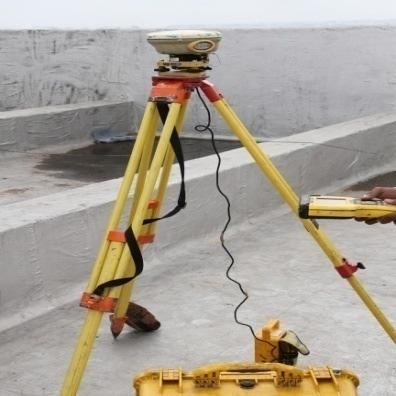
16 Total Station and DGPS Survey Total station survey to extract 1 meter contour throughout the Osmania University campus. Total Station Survey to explore the roads and drainage system along the manholes of Osmania University campus. DGPS survey was done for checking the accuracy and any corrections if needed. The spot heights were used along the contours for creation of DEM


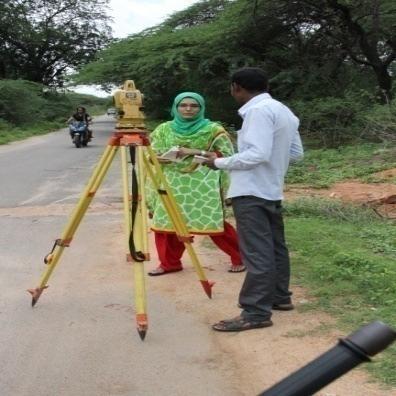
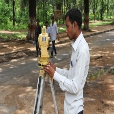
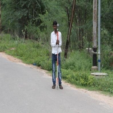
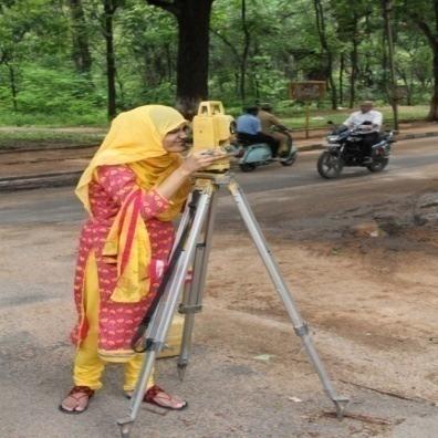
17 DGPS and Total Station Survey Figure.4_Identifying the spot heights to create a contour map using the Total Station and DGPS.


18 Figure 5. One meter contour map of the watershed along with the spot heights
19 Thematic map generation Base map. OU Watershed Storm water network map. Road network map. DEM map of Osmania University campus Slope map Land Use and Land Cover map


20 OU Watershed Figure 6. Sub-watershed map of the study area
21 Figure 7. watershed drain networks

22 Storm water network map Figure 8. Storm water network map
23 Road network map. Figure 9. Road network map of Osmania university
24 Figure 10. Contour map of the watershed
25 DEM Map of Osmania University Campus Figure 11. DEM map of Osmania university
26 Slope Map Figure 12. Slope map of the watershed
27 Figure 13. Digitized land water bodies


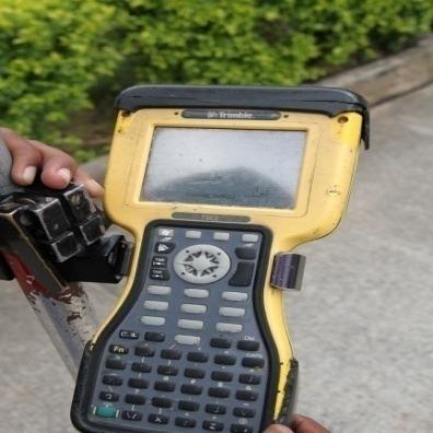
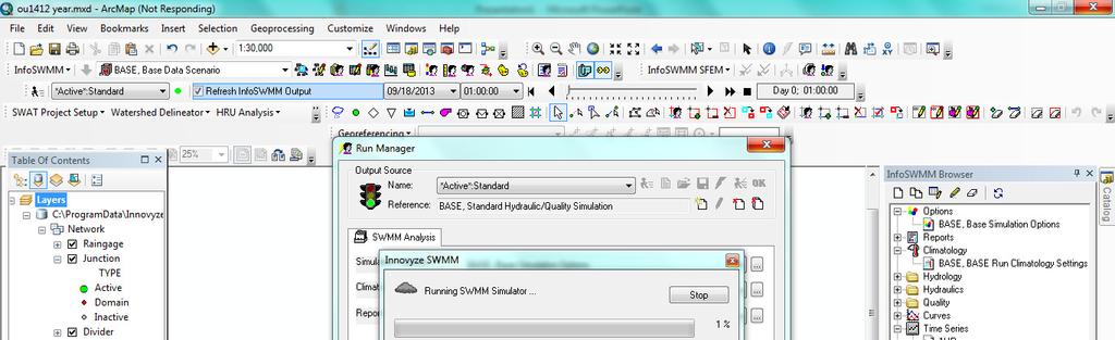
28 Metrological Data InfoSWMM takes met data in.txt format. All met data has been converted as per the format required by InfoSWMM Met data includes Temperature Relative Humidity Evapotranspiration Wind speed Figure 14. Snapshot of InfoSWMM along with rainfall data
29 Input data In InfoSWMM the junction nodes are created that comprise part of drainage network. The depth and elevation are important components for creating junction nodes. For Creating an outfall the elevation is used. Conduits are created by joining to junction nodes. For creating the rainguage the parameters used are intensity, time interval and time series is used
30 Rainfall Rainfall Rainfa all(mm) time Figure 15.Time vs. intensity graph

31 Rainfall mm/h Figure 16.Elapsed time vs. intensity graph
32 Figure 17. Creation urban drainage system


33 Figure 18. Watershed road network and drainage systems

34 Figure 18. Model screenshot

35 Figure 19. Flow accumulation map

36 Figure 20. Flow direction map


37 Figure 21. Storm water drains

38 Junction depth Figure 22. Graph of junction depths versus elapsed time


39 Junction flow Figure 23. Graph of junction flow versus elapsed time

40 Rainfall mm/h Figure 24. Graph of rainfall versus elapsed time
41 Sub-catchment Runoff Figure 25. Sub-watershed wise surface flow versus elapsed time
42 Figure 26. Flow versus elapsed time Conduit Flow

43 Conduit Velocity Figure 27. Velocity versus elapsed time
44 Figure 28. Flow versus elapsed time
45 Figure 29. Flooding flow versus elapsed time

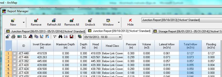
46 Junction Report (18/09/2013 at 1830 )
47 Profile Plot Figure 30. Profile plots of elevation versus distance
48 Concluding Remarks The base map, boundary and the thematic maps have been prepared Total Station and DGPS survey have also been done for the study area of Osmania University One meter contour map has been created by using total station data and DGPS spot height data. Storm water drainage and road network maps created based the one meter contour data. Slope map and DEM are created based on one meter contour data. Flow Accumulation and Flow Direction maps are also created The model is run for flow analysis and profile plots are also generated.
49 Work to be Done Generation of flow hydrograph of the study area. Trying to get 1-hour rainfall data for accurate flow analysis. Based on the flow analysis data, rainwater harvesting structures and storage ponds have to be created Identification and design of storage ponds in the Osmania University study area for recharging the groundwater table.
50
Effect of land use/land cover changes on runoff in a river basin: a case study
 Water Resources Management VI 139 Effect of land use/land cover changes on runoff in a river basin: a case study J. Letha, B. Thulasidharan Nair & B. Amruth Chand College of Engineering, Trivandrum, Kerala,
Remote Sensing and GIS Applications for Hilly Watersheds SUBASHISA DUTTA DEPARTMENT OF CIVIL ENGINEERING IIT GUWAHATI
 Remote Sensing and GIS Applications for Hilly Watersheds SUBASHISA DUTTA DEPARTMENT OF CIVIL ENGINEERING IIT GUWAHATI Deciding Alternative Land Use Options in a Watershed Using GIS Source: Anita Prakash
Hydrologic Modelling of the Upper Malaprabha Catchment using ArcView SWAT
 Hydrologic Modelling of the Upper Malaprabha Catchment using ArcView SWAT Technical briefs are short summaries of the models used in the project aimed at nontechnical readers. The aim of the PES India
CHAPTER VII FULLY DISTRIBUTED RAINFALL-RUNOFF MODEL USING GIS
 80 CHAPTER VII FULLY DISTRIBUTED RAINFALL-RUNOFF MODEL USING GIS 7.1GENERAL This chapter is discussed in six parts. Introduction to Runoff estimation using fully Distributed model is discussed in first
Outline. Remote Sensing, GIS and DEM Applications for Flood Monitoring. Introduction. Satellites and their Sensors used for Flood Mapping
 Outline Remote Sensing, GIS and DEM Applications for Flood Monitoring Prof. D. Nagesh Kumar Chairman, Centre for Earth Sciences Professor, Dept. of Civil Engg. Indian Institute of Science Bangalore 560
VILLAGE INFORMATION SYSTEM (V.I.S) FOR WATERSHED MANAGEMENT IN THE NORTH AHMADNAGAR DISTRICT, MAHARASHTRA
 FOR WATERSHED MANAGEMENT IN THE NORTH AHMADNAGAR DISTRICT, MAHARASHTRA") VILLAGE INFORMATION SYSTEM (V.I.S) FOR WATERSHED MANAGEMENT IN THE NORTH AHMADNAGAR DISTRICT, MAHARASHTRA Abstract: The drought prone zone in the Western Maharashtra is not in position to achieve the agricultural
VILLAGE INFORMATION SYSTEM (V.I.S) FOR WATERSHED MANAGEMENT IN THE NORTH AHMADNAGAR DISTRICT, MAHARASHTRA Abstract: The drought prone zone in the Western Maharashtra is not in position to achieve the agricultural
Uncertainty in the SWAT Model Simulations due to Different Spatial Resolution of Gridded Precipitation Data
 Uncertainty in the SWAT Model Simulations due to Different Spatial Resolution of Gridded Precipitation Data Vamsi Krishna Vema 1, Jobin Thomas 2, Jayaprathiga Mahalingam 1, P. Athira 4, Cicily Kurian 1,
IJESRT INTERNATIONAL JOURNAL OF ENGINEERING SCIENCES & RESEARCH TECHNOLOGY
 IJESRT INTERNATIONAL JOURNAL OF ENGINEERING SCIENCES & RESEARCH TECHNOLOGY Use of Digital Elevation Model to compute Storm Water Drainage Network Manisha Desai *1, Dr. J. N. Patel 2 *1 Ph. D. Student of
Dr. S.SURIYA. Assistant professor. Department of Civil Engineering. B. S. Abdur Rahman University. Chennai
 Hydrograph simulation for a rural watershed using SCS curve number and Geographic Information System Dr. S.SURIYA Assistant professor Department of Civil Engineering B. S. Abdur Rahman University Chennai
Comparison of GIS based SCS-CN and Strange table Method of Rainfall-Runoff Models for Veeranam Tank, Tamil Nadu, India.
 International Journal of Scientific & Engineering Research, Volume 3, Issue 10, October-2012 1 Comparison of GIS based SCS-CN and Strange table Method of Rainfall-Runoff Models for Veeranam Tank, Tamil
13 Watershed Delineation & Modeling
 Module 4 (L12 - L18): Watershed Modeling Standard modeling approaches and classifications, system concept for watershed modeling, overall description of different hydrologic processes, modeling of rainfall,
HYDROLOGIC AND WATER RESOURCES EVALUATIONS FOR SG. LUI WATERSHED
 HYDROLOGIC AND WATER RESOURCES EVALUATIONS FOR SG. LUI WATERSHED 1.0 Introduction The Sg. Lui watershed is the upper part of Langat River Basin, in the state of Selangor which located approximately 20
Digital Elevation Models. Using elevation data in raster format in a GIS
 Digital Elevation Models Using elevation data in raster format in a GIS What is a Digital Elevation Model (DEM)? Digital representation of topography Model based on scale of original data Commonly a raster
Application of Geographical Information System (GIS) tools in watershed analysis
 tools in watershed analysis") Application of Geographical Information System (GIS) tools in watershed analysis Paritosh Gupta 1, Damanjit S Minhas 2, Rajendra M Tamhane 1, A K Mookerjee 2 1.ESRI India New Delhi 2. LEA Associates South
Application of Geographical Information System (GIS) tools in watershed analysis Paritosh Gupta 1, Damanjit S Minhas 2, Rajendra M Tamhane 1, A K Mookerjee 2 1.ESRI India New Delhi 2. LEA Associates South
Block Level Micro Watershed Prioritization Based on Morphometric and Runoff Parameters
 Cloud Publications International Journal of Advanced Remote Sensing and GIS 2016, Volume 5, Issue 11, pp. 1981-1987 ISSN 2320-0243, Crossref: 10.23953/cloud.ijarsg.76 Research Article Open Access Block
International Journal of Advance Research in Engineering, Science & Technology
 Impact Factor (SJIF): 3.632 International Journal of Advance Research in Engineering, Science & Technology e-issn: 2393-9877, p-issn: 2394-2444 Volume 3, Issue 7, July-2016 Water Supply Network Study of
MODULE 8 LECTURE NOTES 2 REMOTE SENSING APPLICATIONS IN RAINFALL-RUNOFF MODELLING
 MODULE 8 LECTURE NOTES 2 REMOTE SENSING APPLICATIONS IN RAINFALL-RUNOFF MODELLING 1. Introduction The most common application of the remote sensing techniques in the rainfall-runoff studies is the estimation
July, International SWAT Conference & Workshops
 July, 212 212 International SWAT Conference & Workshops Hydrological Modelling of Kosi and Gandak Basins using SWAT Model S. Dutta, Pritam Biswas, Sangita Devi, Suresh A Karth and Bimlesh kumar, Ganga
Inflow forecasting for lakes using Artificial Neural Networks
 Flood Recovery Innovation and Response III 143 Inflow forecasting for lakes using Artificial Neural Networks R. K. Suryawanshi 1, S. S. Gedam 1 & R. N. Sankhua 2 1 CSRE, IIT Bombay, Mumbai, India 2 National
GROUNDWATER CONFIGURATION IN THE UPPER CATCHMENT OF MEGHADRIGEDDA RESERVOIR, VISAKHAPATNAM DISTRICT, ANDHRA PRADESH
 GROUNDWATER CONFIGURATION IN THE UPPER CATCHMENT OF MEGHADRIGEDDA RESERVOIR, VISAKHAPATNAM DISTRICT, ANDHRA PRADESH Prof.P.Jagadeesara Rao Department of Geo-Engineering and Centre for Remote Sensing, College
Urban Hydrology - A Case Study On Water Supply And Sewage Network For Madurai Region, Using Remote Sensing & GIS Techniques
 RESEARCH INVENTY: International Journal of Engineering and Science ISBN: 2319-6483, ISSN: 2278-4721, Vol. 1, Issue 8 (November 2012), PP 07-12 www.researchinventy.com Urban Hydrology - A Case Study On
Indexing vulnerability of an embankment reach against breaching: A remote sensing and hydrodynamic based study
 European Water 60: 67-71, 2017. 2017 E.W. Publications Indexing vulnerability of an embankment reach against breaching: A remote sensing and hydrodynamic based study B. Talukdar *, A. Baid and R. Das Civil
DEVELOPMENT OF MAXIMUM AVERAGE RAINFALL INTENSITY RELATIONSHIPS WITH 24 HOUR AVERAGE RAINFALL INTENSITY
 International Journal of Civil Engineering and Technology (IJCIET) Volume 8, Issue, June, pp., Article ID: IJCIET_8 Available online at http://www.ia aeme.com/ijciet/issues.asp?jtype=ijciet&vtyp pe=8&itype=
Use of Geospatial data for disaster managements
 Use of Geospatial data for disaster managements Source: http://alertsystemsgroup.com Instructor : Professor Dr. Yuji Murayama Teaching Assistant : Manjula Ranagalage What is GIS? A powerful set of tools
Report for Area Drainage Studies for 1320 MW (2x660 MW) THERMAL POWER PROJECT AT MIRZAPUR, U.P.
 THERMAL POWER PROJECT AT MIRZAPUR, U.P.") Report for Area Drainage Studies for 1320 MW (2x660 MW) THERMAL POWER PROJECT AT MIRZAPUR, U.P. 1. Introduction M/s Welspun Energy Uttar Pradesh Ltd. (WEUPL) is putting up 1320 MW (2 x 660 MW) coal fired
Report for Area Drainage Studies for 1320 MW (2x660 MW) THERMAL POWER PROJECT AT MIRZAPUR, U.P. 1. Introduction M/s Welspun Energy Uttar Pradesh Ltd. (WEUPL) is putting up 1320 MW (2 x 660 MW) coal fired
Flood Level Simulation Modeling And Vulnerability Of Slums Along Musiriver, Hyderabad
 International Journal of Humanities and Social Science Invention (IJHSSI) ISSN (Online): 2319 7722, ISSN (Print): 2319 7714 Volume 7 Issue 05 Ver. I May. 2018 PP.51-56 Flood Level Simulation Modeling And
Civil Engineering Journal
 Available online at www.civilejournal.org Civil Engineering Journal Vol. 1, No. 2, December, 2015 Comparative Study of Landsat and Aster Data by Morphometric Analysis Sujit Kumar a*, Tapasi Bhandary b
MODELING RUNOFF RESPONSE TO CHANGING LAND COVER IN PENGANGA SUBWATERSHED, MAHARASHTRA
 MODELING RUNOFF RESPONSE TO CHANGING LAND COVER IN PENGANGA SUBWATERSHED, MAHARASHTRA Abira Dutta Roy*, S.Sreekesh** *Research Scholar, **Associate Professor Centre for the Study of Regional Development,
Delineation of Groundwater Potential Zone on Brantas Groundwater Basin
 Delineation of Groundwater Potential Zone on Brantas Groundwater Basin Andi Rachman Putra 1, Ali Masduqi 2 1,2 Departement of Environmental Engineering, Sepuluh Nopember Institute of Technology, Indonesia
7.1 INTRODUCTION 7.2 OBJECTIVE
 7 LAND USE AND LAND COVER 7.1 INTRODUCTION The knowledge of land use and land cover is important for many planning and management activities as it is considered as an essential element for modeling and
Hydrological parameters Controls Vulnerable Zones in Calicut Nilambur Gudalur Ghat section, Gudalur, The Nilgiris, Tamil Nadu.
 International Journal of ChemTech Research CODEN (USA): IJCRGG ISSN: 0974-4290 Vol.9, No.03 pp 248-253, 2016 Hydrological parameters Controls Vulnerable Zones in Calicut Nilambur Gudalur Ghat section,
CHANGE DETECTION USING REMOTE SENSING- LAND COVER CHANGE ANALYSIS OF THE TEBA CATCHMENT IN SPAIN (A CASE STUDY)
") CHANGE DETECTION USING REMOTE SENSING- LAND COVER CHANGE ANALYSIS OF THE TEBA CATCHMENT IN SPAIN (A CASE STUDY) Sharda Singh, Professor & Programme Director CENTRE FOR GEO-INFORMATICS RESEARCH AND TRAINING
CHANGE DETECTION USING REMOTE SENSING- LAND COVER CHANGE ANALYSIS OF THE TEBA CATCHMENT IN SPAIN (A CASE STUDY) Sharda Singh, Professor & Programme Director CENTRE FOR GEO-INFORMATICS RESEARCH AND TRAINING
INTERNATIONAL JOURNAL OF PURE AND APPLIED RESEARCH IN ENGINEERING AND TECHNOLOGY
 INTERNATIONAL JOURNAL OF PURE AND APPLIED RESEARCH IN ENGINEERING AND TECHNOLOGY A PATH FOR HORIZING YOUR INNOVATIVE WORK SPECIAL ISSUE FOR NATIONAL LEVEL CONFERENCE "SUSTAINABLE TECHNOLOGIES IN CIVIL
USING 3D GIS TO ASSESS ENVIRONMENTAL FLOOD HAZARDS IN MINA
 King Fahd University of Petroleum & Minerals College of Environmental Design Geographical Information system USING 3D GIS TO ASSESS ENVIRONMENTAL FLOOD HAZARDS IN MINA Prepared by : Ali AL-Zahrani OUTLINE
Promoting Rainwater Harvesting in Caribbean Small Island Developing States Water Availability Mapping for Grenada Preliminary findings
 Promoting Rainwater Harvesting in Caribbean Small Island Developing States Water Availability Mapping for Grenada Preliminary findings National Workshop Pilot Project funded by The United Nations Environment
Integrating Geographical Information Systems (GIS) with Hydrological Modelling Applicability and Limitations
 with Hydrological Modelling Applicability and Limitations") Integrating Geographical Information Systems (GIS) with Hydrological Modelling Applicability and Limitations Rajesh VijayKumar Kherde *1, Dr. Priyadarshi. H. Sawant #2 * Department of Civil Engineering,
Integrating Geographical Information Systems (GIS) with Hydrological Modelling Applicability and Limitations Rajesh VijayKumar Kherde *1, Dr. Priyadarshi. H. Sawant #2 * Department of Civil Engineering,
Basin characteristics
 Basin characteristics From hydrological processes at the point scale to hydrological processes throughout the space continuum: point scale à river basin The watershed characteristics (shape, length, topography,
CARFFG System Development and Theoretical Background
 CARFFG Steering Committee Meeting 15 SEPTEMBER 2015 Astana, KAZAKHSTAN CARFFG System Development and Theoretical Background Theresa M. Modrick, PhD Hydrologic Research Center Key Technical Components -
Determination of Urban Runoff Using ILLUDAS and GIS
 Texas A&M University Department of Civil Engineering Instructor: Dr. Francisco Olivera CVEN689 Applications of GIS to Civil Engineering Determination of Urban Runoff Using ILLUDAS and GIS Tae Jin Kim 03.
Rainfall Analysis. Prof. M.M.M. Najim
 Rainfall Analysis Prof. M.M.M. Najim Learning Outcome At the end of this section students will be able to Estimate long term mean rainfall for a new station Describe the usage of a hyetograph Define recurrence
GIS Based Delineation of Micro-watershed and its Applications: Mahendergarh District, Haryana
 Kamla-Raj 2012 J Hum Ecol, 38(2): 155-164 (2012) GIS Based Delineation of Micro-watershed and its Applications: Mahendergarh District, Haryana Gulshan Mehra and Rajeshwari * Department of Geography, Kurukshetra
Introduction-Overview. Why use a GIS? What can a GIS do? Spatial (coordinate) data model Relational (tabular) data model
 data model Relational (tabular) data model") Introduction-Overview Why use a GIS? What can a GIS do? How does a GIS work? GIS definitions Spatial (coordinate) data model Relational (tabular) data model intro_gis.ppt 1 Why use a GIS? An extension
Introduction-Overview Why use a GIS? What can a GIS do? How does a GIS work? GIS definitions Spatial (coordinate) data model Relational (tabular) data model intro_gis.ppt 1 Why use a GIS? An extension
Assessing Vulnerability to Soil Erosion of a Watershed of Tons River Basin in Madhya Pradesh using Remote Sensing and GIS
 International Journal of Environmental Research and Development. ISSN 2249-3131 Volume 4, Number 2 (2014), pp. 153-164 Research India Publications http://www.ripublication.com/ijerd.htm Assessing Vulnerability
SWIM and Horizon 2020 Support Mechanism
 SWIM and Horizon 2020 Support Mechanism Working for a Sustainable Mediterranean, Caring for our Future REG-7: Training Session #1: Drought Hazard Monitoring Example from real data from the Republic of
EFFECT OF WATERSHED DEVELOPMENT PROGRAMME IN GUDHA GOKALPURA VILLAGE, BUNDI DISTRICT, RAJASTHAN - A REMOTE SENSING STUDY
 EFFECT OF WATERSHED DEVELOPMENT PROGRAMME IN GUDHA GOKALPURA VILLAGE, BUNDI DISTRICT, RAJASTHAN - A REMOTE SENSING STUDY G. Sajeevan, C. P. Johnson, D. J. Pal and B. K. Kakade* C-DAC, Pune University Campus,
GIS in Weather and Society
 GIS in Weather and Society Olga Wilhelmi Institute for the Study of Society and Environment National Center for Atmospheric Research WAS*IS November 8, 2005 Boulder, Colorado Presentation Outline GIS basic
A distributed runoff model for flood prediction in ungauged basins
 Predictions in Ungauged Basins: PUB Kick-off (Proceedings of the PUB Kick-off meeting held in Brasilia, 2 22 November 22). IAHS Publ. 39, 27. 267 A distributed runoff model for flood prediction in ungauged
MORPHOMETRIC ANALYSIS OF WATERSHEDS IN THE KUNIGAL AREA OF TUMKUR DISTRICT, SOUTH INDIA USING REMOTE SENSING AND GIS TECHNOLOGY
 MORPHOMETRIC ANALYSIS OF WATERSHEDS IN THE KUNIGAL AREA OF TUMKUR DISTRICT, SOUTH INDIA USING REMOTE SENSING AND GIS TECHNOLOGY PROJECT REFERENCE NO. : 37S1170 COLLEGE : SIDDAGANGA INSTITUTE OF TECHNOLOGY,
Impact of different types of meteorological data inputs on predicted hydrological and erosive responses to projected land use change
 Impact of different types of meteorological data inputs on predicted hydrological and erosive responses to projected land use change Suman Bhattacharyya 1 & Joy Sanyal * 1 2 1 Department of Geography,
Geostatistical Analysis of Rainfall Temperature and Evaporation Data of Owerri for Ten Years
 Atmospheric and Climate Sciences, 2012, 2, 196-205 http://dx.doi.org/10.4236/acs.2012.22020 Published Online April 2012 (http://www.scirp.org/journal/acs) Geostatistical Analysis of Rainfall Temperature
Soil Erosion Calculation using Remote Sensing and GIS in Río Grande de Arecibo Watershed, Puerto Rico
 Soil Erosion Calculation using Remote Sensing and GIS in Río Grande de Arecibo Watershed, Puerto Rico Alejandra M. Rojas González Department of Civil Engineering University of Puerto Rico at Mayaguez.
International Journal of Scientific & Engineering Research, Volume 6, Issue 7, July ISSN
 International Journal of Scientific & Engineering Research, Volume 6, Issue 7, July-2015 1428 Accuracy Assessment of Land Cover /Land Use Mapping Using Medium Resolution Satellite Imagery Paliwal M.C &.
REMOTE SENSING AND GIS BASED APPROACH FOR DELINEATION OF ARTIFICIAL RECHARGE SITES IN PALANI TALUK, DINDIGUL DISTRICT, TAMILNADU, INDIA
 International Journal of Civil Engineering and Technology (IJCIET) Volume 8, Issue 8, August 2017, pp. 698 706, Article ID: IJCIET_08_08_070 Available online at http://http://www.iaeme.com/ijciet/issues.asp?jtype=ijciet&vtype=8&itype=8
HIGH RESOLUTION BASE MAP: A CASE STUDY OF JNTUH-HYDERABAD CAMPUS
 HIGH RESOLUTION BASE MAP: A CASE STUDY OF JNTUH-HYDERABAD CAMPUS K.Manjula Vani, Abhinay Reddy, J. Venkatesh, Ballu Harish and R.S. Dwivedi ABSTRACT The proposed work High Resolution Base map: A Case study
DEM-based Ecological Rainfall-Runoff Modelling in. Mountainous Area of Hong Kong
 DEM-based Ecological Rainfall-Runoff Modelling in Mountainous Area of Hong Kong Qiming Zhou 1,2, Junyi Huang 1* 1 Department of Geography and Centre for Geo-computation Studies, Hong Kong Baptist University,
Stochastic Hydrology. a) Data Mining for Evolution of Association Rules for Droughts and Floods in India using Climate Inputs
 Data Mining for Evolution of Association Rules for Droughts and Floods in India using Climate Inputs") Stochastic Hydrology a) Data Mining for Evolution of Association Rules for Droughts and Floods in India using Climate Inputs An accurate prediction of extreme rainfall events can significantly aid in policy
Stochastic Hydrology a) Data Mining for Evolution of Association Rules for Droughts and Floods in India using Climate Inputs An accurate prediction of extreme rainfall events can significantly aid in policy
![)UDQFR54XHQWLQ(DQG'tD]'HOJDGR&](/thumbs/95/125846872.jpg ")UDQFR54XHQWLQ(DQG'tD]'HOJDGR&") &21&(37,21$1',03/(0(17$7,212)$1+
&21&(37,21$1',03/(0(17$7,212)$1+ CHAPTER 1 INTRODUCTION
 1 CHAPTER 1 INTRODUCTION 1.1 GENERAL Precipitation is the primary input to a watershed system. Hydrologic analysis cannot be performed with confidence until the precipitation input is adequately measured
GIS Based Approach for Calculation of Canal Conveyance Losses
 GIS Based Approach for Calculation of Canal Conveyance Losses Ch Ramesh Naidu 1, Mvss Giridhar 2 1 Research Scholar, Civil Engineering Department, JNTUH, Hyderabad, India 2 Assistant Professor, Centre
UNITED NATIONS E/CONF.96/CRP. 5
 UNITED NATIONS E/CONF.96/CRP. 5 ECONOMIC AND SOCIAL COUNCIL Eighth United Nations Regional Cartographic Conference for the Americas New York, 27 June -1 July 2005 Item 5 of the provisional agenda* COUNTRY
ENGINEERING HYDROLOGY
 ENGINEERING HYDROLOGY Prof. Rajesh Bhagat Asst. Professor Civil Engineering Department Yeshwantrao Chavan College Of Engineering Nagpur B. E. (Civil Engg.) M. Tech. (Enviro. Engg.) GCOE, Amravati VNIT,
A GIS-based Subcatchments Division Approach for SWMM
 Send Orders for Reprints to reprints@benthamscience.ae The Open Civil Engineering Journal, 2015, 9, 515-521 515 A GIS-based Subcatchments Division Approach for SWMM Open Access Shen Ji and Zhang Qiuwen
A Comparison of Rainfall Estimation Techniques
 A Comparison of Rainfall Estimation Techniques Barry F. W. Croke 1,2, Juliet K. Gilmour 2 and Lachlan T. H. Newham 2 SUMMARY: This study compares two techniques that have been developed for rainfall and
FLOOD HAZARD MAPPING OF DHAKA-NARAYANGANJ-DEMRA (DND) PROJECT USING GEO-INFORMATICS TOOLS
 PROJECT USING GEO-INFORMATICS TOOLS") FLOOD HAZARD MAPPING OF DHAKA-NARAYANGANJ-DEMRA (DND) PROJECT USING GEO-INFORMATICS TOOLS Md. Aminul Islam MEE07178 Supervisor: Prof. Kuniyoshi TAKEUCHI ABSTRACT Dhaka-Narayanganj-Demra (DND) Project is
FLOOD HAZARD MAPPING OF DHAKA-NARAYANGANJ-DEMRA (DND) PROJECT USING GEO-INFORMATICS TOOLS Md. Aminul Islam MEE07178 Supervisor: Prof. Kuniyoshi TAKEUCHI ABSTRACT Dhaka-Narayanganj-Demra (DND) Project is
Indian National (Weather) SATellites for Agrometeorological Applications
 SATellites for Agrometeorological Applications") Indian National (Weather) SATellites for Agrometeorological Applications Bimal K. Bhattacharya Agriculture-Terrestrial Biosphere- Hydrology Group Space Applications Centre (ISRO) Ahmedabad 380015, India
Indian National (Weather) SATellites for Agrometeorological Applications Bimal K. Bhattacharya Agriculture-Terrestrial Biosphere- Hydrology Group Space Applications Centre (ISRO) Ahmedabad 380015, India
International Journal of Advance Engineering and Research Development
 Scientific Journal of Impact Factor (SJIF): 4.72 International Journal of Advance Engineering and Research Development Volume 4, Issue 5, May -2017 Watershed Delineation of Purna River using Geographical
Land Use and Land Cover Mapping and Change Detection in Jind District of Haryana Using Multi-Temporal Satellite Data
 Land Use and Land Cover Mapping and Change Detection in Jind District of Haryana Using Multi-Temporal Satellite Data Ravindra Prawasi, M.P. Sharma, T. P. Babu, Om Pal, Saroj, Kirti Yadav, R.S.Hooda Abstract
Chiang Rai Province CC Threat overview AAS1109 Mekong ARCC
 Chiang Rai Province CC Threat overview AAS1109 Mekong ARCC This threat overview relies on projections of future climate change in the Mekong Basin for the period 2045-2069 compared to a baseline of 1980-2005.
The Delaware Environmental Monitoring & Analysis Center
 The Delaware Environmental Monitoring & Analysis Center Tina Callahan Delaware Estuary Science & Environmental Summit 2013 January 27-30, 2013 What is DEMAC? Delaware Environmental Monitoring & Analysis
KEY WORDS: Palmer Meteorological Drought Index, SWAP, Kriging spatial analysis and Digital Map.
 PALMER METEOROLOGICAL DROUGHT CLASSIFICATION USING TECHNIQUES OF GEOGRAPHIC INFORMATION SYSTEM IN THAILAND S. Baimoung, W. Waranuchit, S. Prakanrat, P. Amatayakul, N. Sukhanthamat, A. Yuthaphan, A. Pyomjamsri,
Assessing bias in satellite rainfall products and their impact in water balance closure at the Zambezi headwaters
 Assessing bias in satellite rainfall products and their impact in water balance closure at the Zambezi headwaters Omondi C.K. 1 Rientjes T.H.M. 1, Haile T.A. 2, Gumindoga W. 1,3 (1) Faculty ITC, University
CHAPTER 4 METHODOLOGY
 71 CHAPTER 4 METHODOLOGY 4.1 GENERAL Drought, a vague phenomenon, has been defined and analyzed in various ways. Drought assessment involves analysis of spatially and temporally varying water related data.
HYDROLOGICAL MODELLING OF COOUM RIVER BASIN USING GIS AND SWAT MODEL
 HYDROLOGICAL MODELLING OF COOUM RIVER BASIN USING GIS AND SWAT MODEL Sravani Duvvuri Assistant Professor in Civil Engineering Rajiv Gandhi University of Knowledge Technologies, IIIT Nuzvid, Quarter No:
Geospatial Data Mining to Explore Watershed Development in Rainfed Regions
 Geospatial Data Mining to Explore Watershed Development in Rainfed Regions S. Nallan 1, L. Armstrong 1, Andreas Neuhaus 1,2, B. Croke 3, N. Dunstan 1,4 1 School of Computer and Security Science, Edith
Favorable potential zone map using Remote sensing and GIS
 Favorable potential zone map using Remote sensing and GIS M. Devarajan & S.Mohan GIS Cell, Hydrogeology Wing Tamilnadu Water Supply and Drainage Board, Chennai Abstract: TWAD Board is shouldering the responsibility
Projected Change in Climate Under A2 Scenario in Dal Lake Catchment Area of Srinagar City in Jammu and Kashmir
 Current World Environment Vol. 11(2), 429-438 (2016) Projected Change in Climate Under A2 Scenario in Dal Lake Catchment Area of Srinagar City in Jammu and Kashmir Saqib Parvaze 1, Sabah Parvaze 2, Sheeza
The Importance of Snowmelt Runoff Modeling for Sustainable Development and Disaster Prevention
 The Importance of Snowmelt Runoff Modeling for Sustainable Development and Disaster Prevention Muzafar Malikov Space Research Centre Academy of Sciences Republic of Uzbekistan Water H 2 O Gas - Water Vapor
Climatic Change Implications for Hydrologic Systems in the Sierra Nevada
 Climatic Change Implications for Hydrologic Systems in the Sierra Nevada Part Two: The HSPF Model: Basis For Watershed Yield Calculator Part two presents an an overview of why the hydrologic yield calculator
GIS AND REMOTE SENSING FOR WATER RESOURCE MANAGEMENT
 GIS AND REMOTE SENSING FOR WATER RESOURCE MANAGEMENT G. GHIANNI, G. ADDEO, P. TANO CO.T.IR. Extension and experimental station for irrigation technique - Vasto (Ch) Italy. E-mail : ghianni@cotir.it, addeo@cotir.it,
What is GIS? Introduction to data. Introduction to data modeling
 What is GIS? Introduction to data Introduction to data modeling 2 A GIS is similar, layering mapped information in a computer to help us view our world as a system A Geographic Information System is a
INFLOW DESIGN FLOOD CONTROL SYSTEM PLAN 40 C.F.R. PART PLANT YATES ASH POND 2 (AP-2) GEORGIA POWER COMPANY
 GEORGIA POWER COMPANY") INFLOW DESIGN FLOOD CONTROL SYSTEM PLAN 40 C.F.R. PART 257.82 PLANT YATES ASH POND 2 (AP-2) GEORGIA POWER COMPANY EPA s Disposal of Coal Combustion Residuals from Electric Utilities Final Rule (40 C.F.R.
INFLOW DESIGN FLOOD CONTROL SYSTEM PLAN 40 C.F.R. PART 257.82 PLANT YATES ASH POND 2 (AP-2) GEORGIA POWER COMPANY EPA s Disposal of Coal Combustion Residuals from Electric Utilities Final Rule (40 C.F.R.
Abstract: About the Author:
 REMOTE SENSING AND GIS IN LAND USE PLANNING Sathees kumar P 1, Nisha Radhakrishnan 2 1 1 Ph.D Research Scholar, Department of Civil Engineering, National Institute of Technology, Tiruchirappalli- 620015,
ISSN Vol.03,Issue.10 May-2014, Pages:
 www.semargroup.org, www.ijsetr.com ISSN 2319-8885 Vol.03,Issue.10 May-2014, Pages:2187-2191 YIN YIN HTWE 1, AYE AYE THANT 2 1 Dept of Civil Engineering, Mandalay Technological University, Mandalay, Myanmar,
Lake Tahoe Watershed Model. Lessons Learned through the Model Development Process
 Lake Tahoe Watershed Model Lessons Learned through the Model Development Process Presentation Outline Discussion of Project Objectives Model Configuration/Special Considerations Data and Research Integration
Watershed simulation and forecasting system with a GIS-oriented user interface
 HydroGIS 96: Application of Geographic Information Systems in Hydrology and Water Resources Management (Proceedings of the Vienna Conference, April 1996). IAHS Publ. no. 235, 1996. 493 Watershed simulation
Study of Hydrometeorology in a Hard Rock Terrain, Kadirischist Belt Area, Anantapur District, Andhra Pradesh
 Open Journal of Geology, 2012, 2, 294-300 http://dx.doi.org/10.4236/ojg.2012.24028 Published Online October 2012 (http://www.scirp.org/journal/ojg) Study of Hydrometeorology in a Hard Rock Terrain, Kadirischist
DROUGHT ASSESSMENT USING SATELLITE DERIVED METEOROLOGICAL PARAMETERS AND NDVI IN POTOHAR REGION
 DROUGHT ASSESSMENT USING SATELLITE DERIVED METEOROLOGICAL PARAMETERS AND NDVI IN POTOHAR REGION Researcher: Saad-ul-Haque Supervisor: Dr. Badar Ghauri Department of RS & GISc Institute of Space Technology
Overview of Data for CREST Model
 Overview of Data for CREST Model Xianwu Xue April 2 nd 2012 CREST V2.0 CREST V2.0 Real-Time Mode Forcasting Mode Data Assimilation Precipitation PET DEM, FDR, FAC, Slope Observed Discharge a-priori parameter
Regionalization Methods for Watershed Management - Hydrology and Soil Erosion from Point to Regional Scales
 This paper was peer-reviewed for scientific content. Pages 1062-1067. In: D.E. Stott, R.H. Mohtar and G.C. Steinhardt (eds). 2001. Sustaining the Global Farm. Selected papers from the 10th International
A SIMPLE GIS METHOD FOR OBTAINING FLOODED AREAS
 A SIMPLE GIS METHOD FOR OBTAINING FLOODED AREAS ROMAN P., I. 1, OROS C., R. 2 ABSTRACT. A simple GIS method for obtaining flooded areas. This paper presents a method for obtaining flooded areas near to
Preparation of Database for Urban Development
 Preparation of Database for Urban Development By PunyaP OLI, 1. Chairman, ERMC (P) Ltd., Kathmandu, Nepal. Email: punyaoli@ermcnepal.com 2. Coordinator, Himalayan College of Geomatic Engineering and Land
Impacts of precipitation interpolation on hydrologic modeling in data scarce regions
 Impacts of precipitation interpolation on hydrologic modeling in data scarce regions 1, Shamita Kumar, Florian Wilken 1, Peter Fiener 1 and Karl Schneider 1 1 Hydrogeography and Climatology Research Group,
JUNE 2004 Flood hydrology of the Waiwhetu Stream
 JUNE 2004 Flood hydrology of the Waiwhetu Stream Laura Watts Resource Investigations Contents 1. Introduction 1 2. Catchment description 2 3. Data availability and quality 3 3.1 Rainfall data 3 3.2 Water
Appendix D. Model Setup, Calibration, and Validation
 . Model Setup, Calibration, and Validation Lower Grand River Watershed TMDL January 1 1. Model Selection and Setup The Loading Simulation Program in C++ (LSPC) was selected to address the modeling needs
INTERNATIONAL JOURNAL OF PURE AND APPLIED RESEARCH IN ENGINEERING AND TECHNOLOGY
 INTERNATIONAL JOURNAL OF PURE AND APPLIED RESEARCH IN ENGINEERING AND TECHNOLOGY A PATH FOR HORIZING YOUR INNOVATIVE WORK ASSESSMENT OF RESERVOIR SEDIMENTATION IN PANSHET RESERVOIR BY HYBRID METHOD N.
Application of Remote Sensing and GIS for Identification and Assessment Proceedings of AIPA 2012, INDIA 79
 Application of Remote Sensing and GIS for Identification and Assessment Proceedings of AIPA 2012, INDIA 79 APPLICATION OF REMOTE SENSING AND GIS FOR IDENTIFICATION AND ASSESSMENT OF CROP GROWTH IN WAZIRABAD
INTEGRATING NASA DATA AND MODEL PRODUCTS IN HSPF AND SWAT HYDROLOGIC SIMULATION MODELS
 Rapid Prototyping Experiment: INTEGRATING NASA DATA AND MODEL PRODUCTS IN HSPF AND SWAT HYDROLOGIC SIMULATION MODELS Charles G. O Hara 1, Vladimir J. Alarcon 1, Ted Engman 2, Joe Nigro 2, David Toll 2,
INTRODUCTION TO HEC-HMS
 INTRODUCTION TO HEC-HMS Hydrologic Engineering Center- Hydrologic Modeling System US Army Corps of Engineers Hydrologic Engineering Center HEC-HMS Uses Schematics Enter properties: watershed, rivers (reaches),
Analyzing spatial and temporal variation of water balance components in La Vi catchment, Binh Dinh province, Vietnam
 Analyzing spatial and temporal variation of water balance components in La Vi catchment, Binh Dinh province, Vietnam Nguyen Duy Liem, Vo Ngoc Quynh Tram, Nguyen Le Tan Dat, Nguyen Kim Loi Nong Lam University-
Landuse/Landcover Change Detection in Umshing- Mawkynroh of East Khasi Hills District, Meghalaya Using Spatial Information Technology
 International Journal of Scientific and Research Publications, Volume 6, Issue 1, January 2016 197 Landuse/Landcover Change Detection in Umshing- Mawkynroh of East Khasi Hills District, Meghalaya Using