Copernicus Opportunities and Challenges in Europe s eyes on Earth
|
|
|
- Maurice Thompson
- 5 years ago
- Views:
Transcription

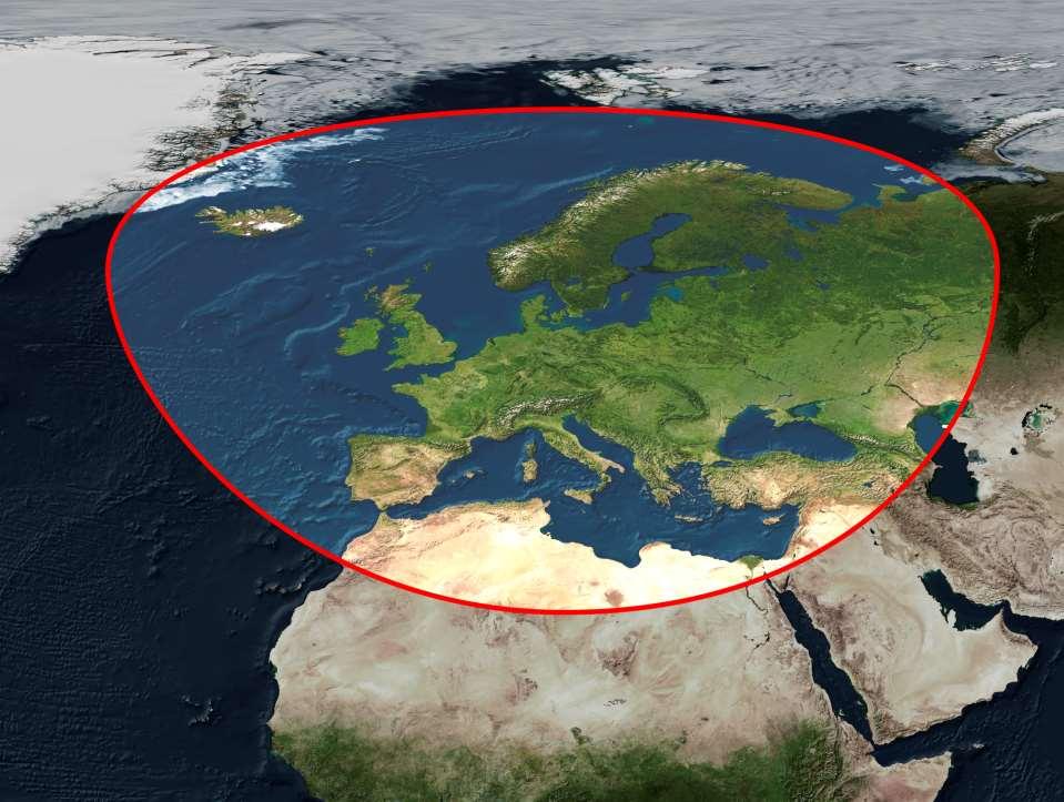
1 Copernicus Opportunities and Challenges in Europe s eyes on Earth Gunter Schreier Deputy Director DLR German Remote Sensing Data Center - Earth Observation Center Rotterdam 25. Mai 2016


2 Sentinel - Missions Contributing- Missions In situ Data Core Ground Segment Core Ground Segment Contribut. Ground Missions Segment Ground Segment Collaborative Ground Segment Core Services Downstream Services 2 /11

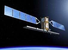
3 Sentinel-1 Copernicus processed at D-PAC 3 /11
 images.")
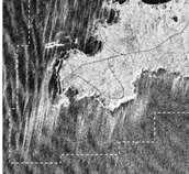
4 Spotting geohazards with Sentinel-1 Released 12/05/2016 2:58 pm Copyright contains modified Copernicus Sentinel data (2016), processed by DLR/ESA/Terradue Description Earth Observation Center Pairs of Sentinel-1A radar images from consecutive passes over the same spot on Earth s service are processed continuously and automatically to provide medium-resolution (200 m) images. This, and related interferograms, allows users to identify ground movement and other changes that may have occurred between satellite acquisitions. The service currently covers tectonic areas in Europe. Covering three million square km, this represents 360 interferometric pairs every 12 days 4 /11

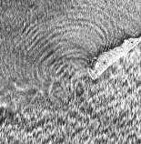
5 Released 23/03/2015 4:12 pm Copyright Copernicus data (2015)/ESA/DLR Microwaves and Radar Institute/INGV/e-GEOS/GFZ SEOM INSARAP study Ten Sentinel-1A radar scans acquired between 7 October 2014 and 12 March 2015 were combined to create this image of ground deformation around the city of Naples, which includes the active volcanic areas of Italy s Phlegraean Fields or Campi Flegrei 5 /11

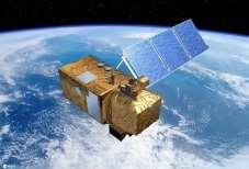
6 Summer in the Netherlands Released 05/10/2015 2:27 pm Copyright Copernicus Sentinel data (2015)/ESA Description This image was captured by Sentinel-2A on 5 August 2015 from over 780 km above Earth. 6 /11

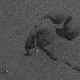
7 Agriculture in Saudi Arabia Released 27/07/2015 3:23 pm Copyright Copernicus Sentinel data (2015)/ESA This false-colour image from the Sentinel-2A satellite shows agricultural structures near Tubarjal, Saudi Arabia.. 7 /11

8 African mosaic Released 18/05/ :45 am Copyright contains modified Copernicus Sentinel data (2016), processed by Brockmann Consult/ Université catholique de Louvain as part of ESA s Climate Change Initiative Land Cover project Using almost 7000 images captured by the Sentinel-2A satellite. The majority of these separate images were taken between December 2015 and April 2016, totalling 32 TB of data. 8 /11

9 Frozen Hudson/ Sentinel 3 Released 23/03/2016 4:42 pm Copyright Contains modified Copernicus Sentinel data [2016] 9 /11

10 Sentinel-3: better than good Released 01/04/ :05 am Copyright Contains modified Copernicus Sentinel data [2016], processed by ESA. 10 /11

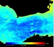
11 Title Thermal signature of Namibian coastline The first image from the Sentinel-3A Sea and Land Surface Temperature Radiometer (SLSTR) thermal-infrared channels depicts thermal signatures over a part of western Namibia and the South Atlantic Ocean 05/04/ :02 am Copyright Contains modified Copernicus Sentinel data [2016] 11 /11
12 The Sentinel Missions Earth Observation Center Sentinel 1 SAR imaging a 25. April Sentinel 2 Multispectral imaging a b b c d c d Sentinel 3 Ocean and global land monitoring a Sentinel 4 Geostationary Atmosphere Payload on EUMETSAT geostationary S5 Precursor Sentinel 5 Low-orbit Atmosphere/ Air quality Sentinel 6 Low-orbit Altimetry b c d. Sentinel-7 Atmospheric CO 2 12 /11
 WorldView-2/3 (EUSI) RapidEye (Blackbridge/PlanetLabs) EnMAP (DLR) and many more from EU based distributors & agencies TanDEM-X 13")
13 Copernicus Contributing Missions from Germany Earth Observation Center TerraSAR-X/ TanDEM-X (DLR-Airbus-PPP) Resourcesat; Indian Satellites (GAF) WorldView-2/3 (EUSI) RapidEye (Blackbridge/PlanetLabs) EnMAP (DLR) and many more from EU based distributors & agencies TanDEM-X 13 /11
14 Copernicus Core Payload Data Ground Segment In operation Near to operation ESA Sentinel Space Segment Ka-Band Earth Observation Center S-1A S-1B S-2A S-2B S-3A S-3B S-5PC X-Band X EDRS-Stations Weilheim Harwell Redu X Svalbard X Inuvik X Matera X Maspalomas ESA Sentinel Payload Data Ground Segment PDMC KSAT KSAT e-geos INTA ESRIN GMES-WAN / ESA Data Circulation and Dissemination Network (T-Systems) S2-PAC Indra S2-MPC CS S2-PAC Airbus S1-PAC Airbus S1-MPC CLS S1-PAC DLR S3-PAC OLCI DLR S5-PC PAC DLR S1S3-PAC-DLR & S5-PC PAC S3-PAC SLSTR+ Synergy ACRI S3-MPC ACRI S3-PAC SRAL CLS CDS Copernicus Services Users 14 /11
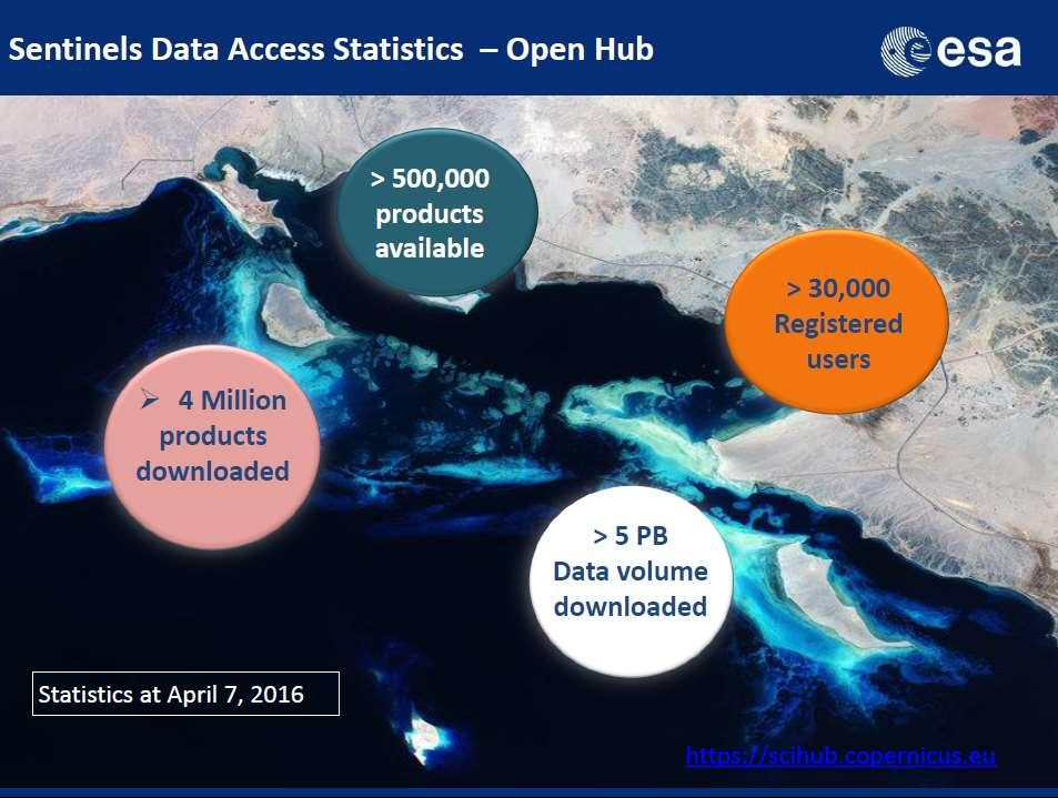
 PetaByte storage capacity ~ 1,5 PetaByte of product")

15 German Satellite Data Archive Sentinel PAC Archive 50 (+33) PetaByte storage capacity ~ 1,5 PetaByte of product data per year per Sentinel - Feb 2016: 1 PB of S1a data after 14 months of operations (> than entire 10yrs of ENVISAT ASAR)

16 No Poverty Zero Hunger Good Health and Well-Being Qualiy Education Gender Equality Clean Water and Sanitation Affordable Clean Energy Decent Work and Economic Growth Industry, Innovation and Infrastrcuture Reduced Inequalities Sustainable Cities and Communities Responsible Consumption and Production Climate Action Life below Water Life on Land Peace, Justice and Strong Institutions Partnership for the Goals Where can Earth Observation help

17 Copernicus Core Services Earth Observation Center LAND ATMOSPHERE DISASTERS RAPID MAPPING CLIMATE CHANGE OCEANS CIVIL SECURITY Operated by European Consortia Funded by the European Commission through delegated entities 17 /11
18 Copernicus Sentinel Data Policy Sentinel Data Policy = FREE and OPEN access EU Delegated Act on Copernicus Data and Information Policy has been published in the EU s Official Journal on 19 November Approved by PB-EO on 24/25 Sep Main principles of Sentinel data policy: Open access to Sentinel data by anybody and for any use Free of charge data licenses Restrictions possible due to technical limitations or security constraints All Sentinels data is available to anybody (worldwide) at no costs Same for all Copernicus Core Service Products Restricted free access to EC purchased data from contributing missions 18 /11
19 COPERNIUS Opportunities 19
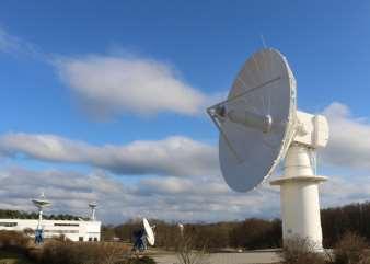
20 NEUSTRELITZ 20 /11

21 Sentinel-1 Acquired and processed at DLR Neustrelitz Collaborative Ground Segment 21 /11
22


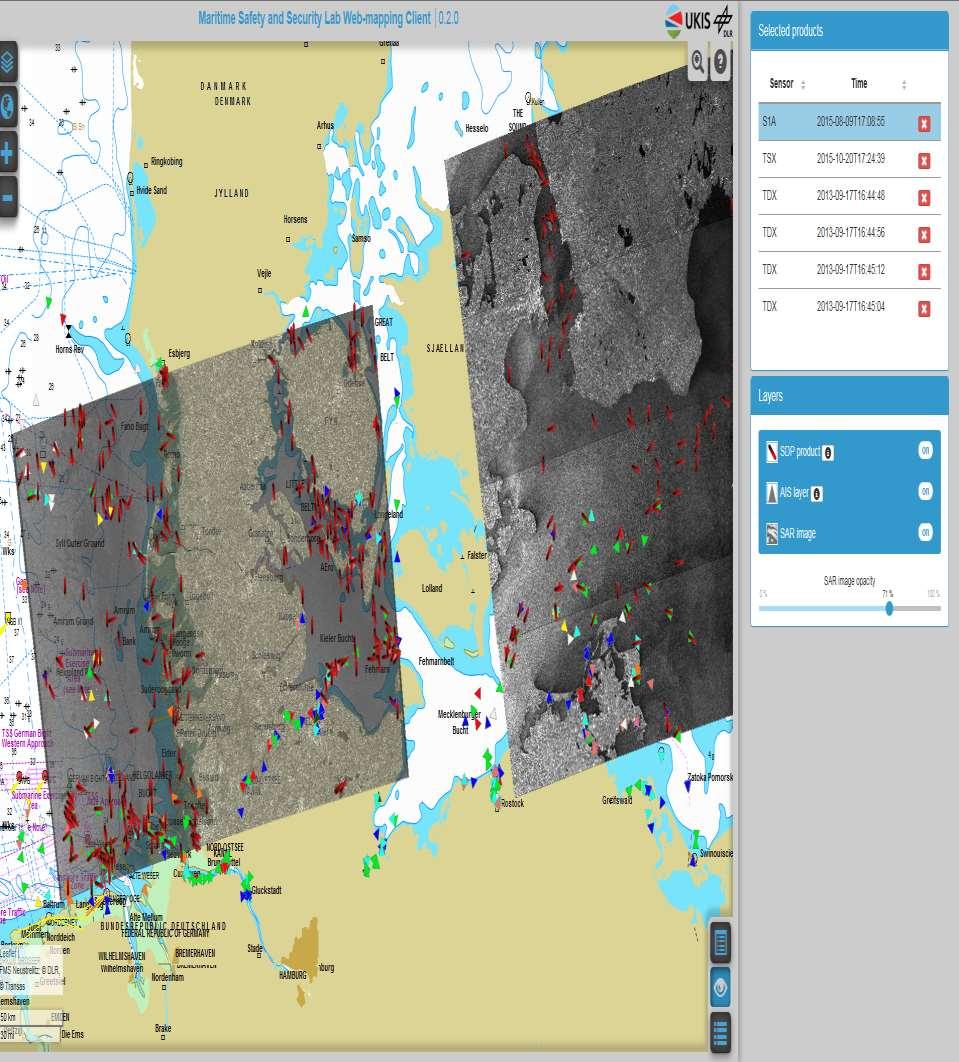
23 Ocean Surface Parameter from space based SAR Earth Observation Center Wind Waves Oil Coast line Currents Ships Bathymetry Breaking Waves Single waves Sea Ice Sentinel-1 Radarsat-2 23 /11
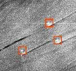
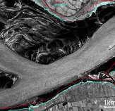
![Released 20/05/2016 1:25 pm Copyright contains modified Copernicus Sentinel data [2016], processed by ESA & Sentinel-1 Mission Performance Centre Description The Sentinel-1A radar satellite detected](/docs-images/91/105037924/images/24-0.jpg "a slick in the eastern Mediterranean Sea in the same area that EgyptAir flight MS804 disappeared early morning of 19 May 2016 on its way from Paris to Cairo.")
24 Released 20/05/2016 1:25 pm Copyright contains modified Copernicus Sentinel data [2016], processed by ESA & Sentinel-1 Mission Performance Centre Description The Sentinel-1A radar satellite detected a slick in the eastern Mediterranean Sea in the same area that EgyptAir flight MS804 disappeared early morning of 19 May 2016 on its way from Paris to Cairo. The 2 km-long slick is located at 33 32' N / 29 13' E about 40 km southeast of the last known location of the aircraft.. 24 /11
")
25 Quasi Real Time Demo: Data Take, Acquisition, Processing, Info LCT-Link and data reception Neustrelitz Oberpfaffenhofen Reception in Oberpfaffenhofen via Alphasat Ka- Band Antenna L0 Processing in Oberpfaffenhofen Alphasat Transfer to Neustrelitz and QRT processing and automated ship detection End-to-End time: 18 min (further optimization possible) 25 /11

26 EMSA NRT AlphaSat Sentinel-1 Demo: L2 ship detection product E2E time from Alphasat downlink to availability of value added product 18 min ( )

27 Deutsches Fernerkundungsdatenzentrum Hong-Kong Kowloon 27 / 18

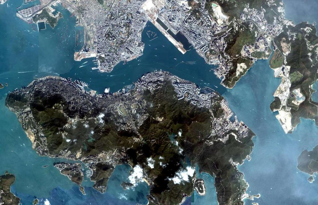
28 15 km

29
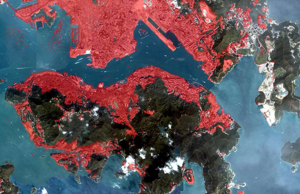
 structures Spatial resolution 0.4 arcsec (12.")
.")
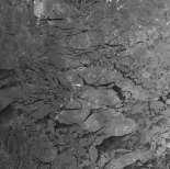
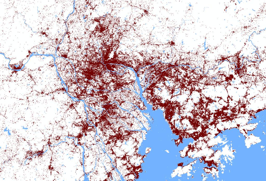
30 Human Footprint: Urbanization Global Urban Footprint Binary mask of all artificial (vertical) structures Spatial resolution 0.4 arcsec (12.5 m) Global coverage by ~ TerraSAR-X annd TanDEM-X Data takes (~300 TB). SAR Coverage by TerraSAR- X and TanDEM-X between 2011 and 2013; Worldbank 30

31 Global Urban Footprint TanDEM-X: Central Europe 31
32 COPERNIUS Challenges 32 /11
33
34 34

35 Core and Collaborative Ground Segment Copernicus Core Ground Segment and Services Earth Observation Center National Collaborative Ground Segment Copernicus Service Entities EO Data Users Exploitation Entities and Cloud Providers Copernicus Data Access and Exploitation Collaborative Infrastructure CGS MPC circulation network CQC POD dissemination network PAC Data Hub Portals Data and Product Access Archive Ingestion Information Systems & Services Processing Sentinel Core PDGS Acquisition Station, EDRS Third Party Data 35


36 37

37 NEW Copernicus Integrated Ground Segment 38


38 Developing a European Market Place for EO Services Earth Observation Center 39
39 Copernicus impact to employment in Europe (by 2030): - creation or maintenance of approximately direct jobs in Europe,. if enabling factors are put in place. - the cumulative growth until 2030 in comparison with 2011 is new jobs in the downstream sector. - the economic stimulus by Copernicus could also result in a wider economic effect, with an additional indirect jobs secured or created December

40 41

41 Gunter Schreier Earth Observation Center EOC German Aerospace Center DLR Oberpfaffenhofen Germany Copyright Copernicus Sentinel-1 data (2015)/ESA 42
42 43 /11
43 SPARE Earth Observation Center 44
Copernicus Space Component
 Copernicus Space Component Core and Collaborative Ground Segment, Operations Concept, Data Access Simon.Jutz (@esa.int) Head, Copernicus Space Office European Space Agency, Earth Observation Programmes
UN COPUOS 52 nd session of the Scientific and Technical Subcommittee. COPERNICUS - an European Achievement. S. Jutz Head, ESA Copernicus Space Office
 UN COPUOS 52 nd session of the Scientific and Technical Subcommittee COPERNICUS - an European Achievement S. Jutz Head, ESA Copernicus Space Office 11 Feb 2015, Vienna 1 2 What is Copernicus? European
SDG s and the role of Earth Observation
 SDG s and the role of Earth Observation Christian Heipke IPI - Institute for Photogrammetry and GeoInformation Leibniz Universität Hannover Germany Secretary General, ISPRS 1. No Poverty 2. Zero Hunger
CopernicusEU. the EU's Earth Observation Programme. Sara Zennaro Atre Delegation of the European Union to Japan
 Copernicus the EU's Earth Observation Programme Sara Zennaro Atre Delegation of the European Union to Japan Status Overview, Sept 2016 & Ocean Policies Seminar 4 October 2016 ollow us on: Copernicus EU
Copernicus Today and Tomorrow GEO Week Group on Earth Observation Geneva, 16 January 2014 The Copernicus Space Infrastructure
 Copernicus Today and Tomorrow GEO Week Group on Earth Observation Geneva, 16 January 2014 The Copernicus Space Infrastructure Thomas Beer, Policy Coordinator, Copernicus Space Office, ESA-ESRIN, Frascati
C o p e r n i c u s a n d W I G O S
 C o p e r n i c u s a n d W I G O S Jean-Noël Thépaut & Mark Dowell 24 October 2017 GEO XIV, Washington DC, 23-28 October 2017 T h e C o p e r n i c u s P r o g r a m m e Copernicus is the European Union
Sentinel-1 Mission Status
 Sentinel-1 Mission Status Pierre Potin, Sentinel-1 Mission Manager, ESA Luca Martino, Technical Support Engineer, ESA... and the Sentinel-1 operations team PSTG SAR Coordination Working Group 14 December
Near Real Time Applications for Maritime Situational Awareness
 Near Real Time Applications for Maritime Situational Awareness Egbert Schwarz Maritime Security Lab Neustrelitz (DFD) ATLAS MEETS SCIENCE Bremen, 12.-13. October 2016 Presentation Outline Background Earth
sentinel-3 A BIGGER PICTURE FOR COPERNICUS
 sentinel-3 A BIGGER PICTURE FOR COPERNICUS SATELLITES TO SERVE By providing a set of key information services for a wide range of practical applications, Europe s Copernicus programme has been put in place
Towards eenvironment Prague, March GMES Space Component. Josef Aschbacher Head, ESA GMES Space Office
 Towards eenvironment Prague, 25-27 March 2009 GMES Space Component Josef Aschbacher Head, ESA GMES Space Office Prague from Space Segment 2 05 Nov 2003 CNES 2003 GISAT 2007 ESA GSELAND GMES is an EU led
sentinel-2 COLOUR VISION FOR COPERNICUS
 sentinel-2 COLOUR VISION FOR COPERNICUS SATELLITES TO SERVE By providing a set of key information services for a wide range of practical applications, Europe s Copernicus programme is providing a step
Emergency Management Service (EMS) mapping
 mapping") GMES Emergency Management Service (EMS) mapping Frédéric BASTIDE GMES unit, European Commission UN-SPIDER Expert Meeting: "Crowdsource Mapping for Disaster Risk Management and Emergency Response" 3-5 December,
GMES Emergency Management Service (EMS) mapping Frédéric BASTIDE GMES unit, European Commission UN-SPIDER Expert Meeting: "Crowdsource Mapping for Disaster Risk Management and Emergency Response" 3-5 December,
Status report on current and future satellite systems by EUMETSAT Presented to CGMS-44, Plenary session, agenda item D.1
 Status report on current and future satellite systems by EUMETSAT Presented to CGMS-44, Plenary session, agenda item D.1 CGMS-44-EUMETSAT-WP-19.ppt, version 1 (# 859110), 8 June 2016 MISSION PLANNING YEAR...
ESA s Earth Observation Programmes
 ESA s Earth Observation Programmes 2015 DRAGON Symposium Interlaken, 23 June 2015 Maurice Borgeaud Head of the Department Science, Applications, and Future Technologies ESA Earth Observation Programmes
Sentinel-1 Mission Status
 Sentinel-1 Mission Status Pierre Potin, Sentinel-1 Mission Manager 5TH GEOGLAM RAPP Workshop 16-17 May 2017, ESRIN Sentinel-1: Copernicus radar imaging mission for ocean, land, emergency Part of the Copernicus
Copernicus Space Component Status & Evolution
 Copernicus Space Component Status & Evolution ESCAP, Bangkok 09 October 2017 Simon Jutz Head of the ESA Copernicus Space Office Directorate of Earth Observation Programmes 28 satellites in development
Copernicus Schaffung einer europäischen Kapazität für die operationelle Erdbeobachtung
 Copernicus Schaffung einer europäischen Kapazität für die operationelle Erdbeobachtung ESOC, Darmstadt, 23 April 2015 Simon Jutz, ESA Head, Copernicus Space Office (EOP-CO) Earth Observation Programmes
IPSENTINEL. The Collaborative Infrastructure for Sentinel Data in Portugal. IPSentinel
 IPSENTINEL The Collaborative Infrastructure for Sentinel Data in Portugal 1 MISSION The Directorate-General for the Territory Development (DGT) and the Portuguese Institute for the Sea and the Atmosphere
The ESA Earth observation programmes overview and outlook
 The ESA Earth observation programmes overview and outlook Dr. Volker Liebig Director, ESA EO Programmes ILA 2008, Berlin ENVISAT mission: 6 years! Bam earthquake Tectonic uplift (Andaman) Arctic 2007 First
EO4SEE - THE PATHFINDER OF OPERATIONAL SATELLITE MONITORING FOR THE REGION OF THE BLACK SEA AND CENTRAL EUROPE
 EO4SEE: Pathfinder assessment for regional high volume data access, processing and information service delivery platforms - South East Region EO4SEE - THE PATHFINDER OF OPERATIONAL SATELLITE MONITORING
Infrastructure monitoring using SAR interferometry
 Infrastructure monitoring using SAR interferometry Hossein Nahavandchi Roghayeh Shamshiri Norwegian University of Science and Technology (NTNU), Department of Civil and Environmental Engineering Geodesy
U s i n g t h e E S A / E U M E T C A S T N a v i g a t o r s
 U s i n g t h e E S A / E U M E T C A S T N a v i g a t o r s Copernicus User Uptake Information Sessions Copernicus EU Copernicus EU Copernicus EU www.copernicus.eu I N T R O D U C T I O N O F U S E C
METEOSAT THIRD GENERATION
 METEOSAT THIRD GENERATION FACTS AND FIGURES MONITORING WEATHER AND CLIMATE FROM SPACE A HIGHLY INNOVATIVE GEOSTATIONARY SATELLITE SYSTEM FOR EUROPE AND AFRICA The Meteosat Third Generation (MTG) system
Arctic Observing Systems Challenges, New opportunities and Integration
 Arctic Observing Systems Challenges, New opportunities and Integration Japan Norway Arctic Science Week 03 June 2016 By Stein Sandven, NERSC Building an integrated Arctic Observing System Need to collect,
National Satellite Data Centre and Finnish Sentinel Collaborative Ground Segment. Jyri Heilimo Finnish Meteorological Instute
 National Satellite Data Centre and Finnish Sentinel Collaborative Ground Segment Jyri Heilimo Finnish Meteorological Instute Sodankylä National Satellite Data Centre National satellite data centre providing
TerraSAR-X and TanDEM-X Applications for Maritime Domain Awereness
 TerraSAR-X and TanDEM-X Applications for Maritime Domain Awereness Dr. Stephan Brusch German Aerospace Center DLR Remote Sensing Technology Institute DLR Oberpfaffenhofen (Germany) Dr. Jürgen Drescher
DLR s TerraSAR-X contributes to international fleet of radar satellites to map the Arctic and Antarctica
 DLR s TerraSAR-X contributes to international fleet of radar satellites to map the Arctic and Antarctica The polar regions play an important role in the Earth system. The snow and ice covered ocean and
EUMETSAT Satellite Status
 EUMETSAT Satellite Status Dr. K. Dieter Klaes EUMETSAT 1 ET-SAT Meeting 4-6 April 2017, WMO, Geneva, Switzerland EUMETSAT is an intergovernmental organisation with 30 Member States and 1 Cooperating State
The Copernicus Sentinel-5 Mission: Daily Global Data for Air Quality, Climate and Stratospheric Ozone Applications
 SENTINEL-5 The Copernicus Sentinel-5 Mission: Daily Global Data for Air Quality, Climate and Stratospheric Ozone Applications Yasjka Meijer RHEA for ESA, Noordwijk, NL 15/04/2016 Co-Authors: Jörg Langen,
Copernicus Overview and Emergency Management Service
 Copernicus Overview and Emergency Management Service Frédéric BASTIDE European Commission Open informal session of the United Nations Inter-Agency Meeting on Outer Space Activities 12 March 2013, Geneva
Status of EUMETSAT Operational Services & EUMETCast Africa Dissemination Baseline Updates
 Status of EUMETSAT Operational Services & EUMETCast Africa Dissemination Baseline Updates Sally Wannop User Relations Manager 1 8th WMO RAIDEG meeting 1-2 November 2017 # 951881 Overview EUMETCast Overview
Julia Figa-Saldaña & Klaus Scipal
 Julia Figa-Saldaña & Klaus Scipal julia.figa@eumetsat.int klaus.scipal@esa.int Meeting, Outline MetOp/EPS status MetOp/EPS Second Generation status 2016 scatterometer conference Other European ocean programme
Earth Observation and Renewable Energy
 ESMAP Knowledge Exchange Forum 2013 November 21 The Hague, Netherlands Earth Observation and Renewable Energy Zoltan Bartalis Earth Observation Exploitation Engineer Science, Applications and Future Technologies
Sentinel-5 Precursor: Preparing the first Copernicus Atmospheric Mission
 Sentinel-5 Precursor: Preparing the first Copernicus Atmospheric Mission Herbert Nett 1, Kevin McMullan 1, Paul Ingmann 1, Thorsten Fehr 2 (1) ESA/ESTEC, Keplerlaan 1, NL-2201 AZ Noordwijk (2) ESA/ESRIN,
THE COPERNICUS SPACE COMPONENT: Sentinels Data Products List
 esrin Via Galileo Galilei Casella Postale 64 00044 Frascati Italy T +39 06 9418 01 F +39 06 9418 0280 www.esa.int THE COPERNICUS SPACE COMPONENT: Sentinels Data Products List Prepared by Copernicus Space
ESA UNCLASSIFIED For Official Use
 First revision (draft for Commission review) 15.06.2015 See track changes Second update following comments from Commission 15.08.2015 See track changes Third and final update following final comments from
THE COPERNICUS PROGRAMME
 THE COPERNICUS PROGRAMME Jolyon Martin, Sentinel Data Access Manager & Sentinel-5P Operations Manager, ESA Pierre Potin, Sentinel-1 Mission Manager, ESA Earth Observation Showcase Emerging Applications
The Future of Remote Sensing
 The Future of Remote Sensing BELSPO - 30 Years of Remote Sensing Research 17 September 2015, Brussels Research and Michael Berger Earth Observation Sector Directorate Climate Action and Resource Efficiency
Status of the Sentinel-5 Precursor Presented by C. Zehner S5p, S4, and S5 Missions Manager - ESA
 Status of the Sentinel-5 Precursor Presented by C. Zehner S5p, S4, and S5 Missions Manager - ESA European response to global needs: to manage the environment, to mitigate the effects of climate change
Status of ESA EO Programmes
 Status of ESA EO Programmes 54 th ESSC Plenary Meeting 24 November 2017 Maurice Borgeaud, ESA Head of the ESA Earth Observation Science, Applications and Climate Department Issue/Revision: 0.0 Reference:
EUMETSAT SAF NETWORK. Lothar Schüller, EUMETSAT SAF Network Manager
 1 EUMETSAT SAF NETWORK Lothar Schüller, EUMETSAT SAF Network Manager EUMETSAT ground segment overview METEOSAT JASON-2 INITIAL JOINT POLAR SYSTEM METOP NOAA SATELLITES CONTROL AND DATA ACQUISITION FLIGHT
Satelliten- gestuetzte Erdbeobachtung
 Satelliten- gestuetzte Erdbeobachtung SPIK 2018, Bern 21. Maerz 2018 Dr. Thomas Beer, ESA- ESRIN Politik Koordinator im Copernicus Weltraum- Buero Issue/Revision: 0.0 Reference: Status: ESA UNCLASSIFIED
A state of the art and user driven Copernicus service Physics and Biogeochemistry
 C M E M S P r e s e n t a n d F u t u r e R e q u i r e m e n t s f o r I n - S i t u a n d S a t e l l i t e O b s e r v a t i o n s Antonio REPPUCCI; Pierre Yves LE TRAON Mercator Ocean International
Marine Monitoring. The Copernicus Marine Service
 Marine The Copernicus Marine Service Why is the marine sector so important? Marine Blue Economy, 5 million jobs, gross added value almost 500bn/year 90% of international trade is maritime Half of the world's
EUMETSAT STATUS AND PLANS
 1 EUM/TSS/VWG/15/826793 07/10/2015 EUMETSAT STATUS AND PLANS François Montagner, Marine Applications Manager, EUMETSAT WMO Polar Space Task Group 5 5-7 October 2015, DLR, Oberpfaffenhofen PSTG Strategic
Space research. Horizon Work Programme. "Countdown to Horizon 2020 Space" Earth Observation topics. Brussels, 12 December 2013
 Space research Horizon 2020 - Work Programme "Countdown to Horizon 2020 Space" Earth Observation topics Brussels, 12 December 2013 richard.gilmore@ec.europa.eu Table of contents FP/Copernicus - general
Canadian Space Agency Update. STG 3 ESRIN, Frascati May 5-6, 2008 Yves Crevier
 Canadian Space Agency Update STG 3 ESRIN, Frascati May 5-6, 2008 Yves Crevier Role of CSA in IPY Ensure the use of Space Technologies in IPY Science initiatives Guarantee fluid and continued availability
An Eye in the Sky EUMETSAT. Monitoring Weather, Climate and the Environment
 An Eye in the Sky EUMETSAT Monitoring Weather, Climate and the Environment Slide: 1 Hazardous Weather Slide: 2 Hazardous Weather Slide: 3 Natural Disasters set off by severe weather Slide: 4 EUMETSAT Objectives...
The International Charter Space and Major Disasters is further strengthening its contribution to disaster management worldwide.
 28 September 2012 Issue 3 The International Charter Space and Major Disasters is further strengthening its contribution to disaster management worldwide. Building on a decade of success in making satellite
GEO-VIII November Geohazard Supersites and Natural Laboratories Progress Report. Document 9
 GEO-VIII 16-17 November 2011 Geohazard Supersites and Natural Laboratories Progress Report Document 9 This document is submitted to GEO-VIII for information. Geohazard Supersites and Natural Laboratories
Overview and Status of ESA Earth Observation Programmes
 Overview and Status of ESA Earth Observation Programmes Maurice Borgeaud, ESA Head of the Science, Applications and Future Technologies Department Directorate of Earth Observation Programmes ADM-Aeolus
Geospatial Information and Services for Disasters (GIS4D)
") Geospatial Information and Services for Disasters (GIS4D) 31 July 2017 Tae Hyung KIM ICT and Disaster Risk Reduction Division (IDD) UNESCAP 1 About ESCAP Who is ESCAP? United Nations Economic and Social
Geospatial Information and Services for Disasters (GIS4D) 31 July 2017 Tae Hyung KIM ICT and Disaster Risk Reduction Division (IDD) UNESCAP 1 About ESCAP Who is ESCAP? United Nations Economic and Social
Copernicus the European Space Programme for Earth Observation
 Copernicus the European Space Programme for Earth Observation http://www.copernicus.eu http://www.esa.int An Introduction Rome 2017 by Giorgio Bagnasco Issue/Revision: 0.0 Reference: ESA UNCLASSIFIED Status:
A.2 Copernicus, Sentinels und Meer. Daten der Sentinel Satelliten - Datenprodukte und Anwendungsbeispiele
 Nationales Forum fuer Fernerkundung und Copernicus, 3. 5. Nov 2015, Berlin A.2 Copernicus, Sentinels und Meer Daten der Sentinel Satelliten - Datenprodukte und Anwendungsbeispiele Simon Jutz, Head, ESA
HY-2A Satellite User s Guide
 National Satellite Ocean Application Service 2013-5-16 Document Change Record Revision Date Changed Pages/Paragraphs Edit Description i Contents 1 Introduction to HY-2 Satellite... 1 2 HY-2 satellite data
COPERNICUS SPACE DATA OFFER FOR PUBLIC AUTHORITIES DISTRIBUTED BY ESA
 COPERNICUS SPACE DATA OFFER FOR PUBLIC AUTHORITIES DISTRIBUTED BY ESA The Copernicus Space Component Data Access (CSC-DA) service - financed by the EU and operated by ESA - grants National Public Authorities
ESA Status Report. ET-SAT-11, WMO, Geneva, CH, 4 April Prepared by Earth Observation Programmes Directorate
 ESA Status Report ET-SAT-11, WMO, Geneva, CH, 4 April 2017 Prepared by Earth Observation Programmes Directorate Presented by Ivan Petiteville, ESA, Earth Observation Programmes Issue/Revision: 0.0 Reference:
Status of EUMETSAT Current and Future Programmes
 Status of EUMETSAT Current and Future Programmes Ernst Koenemann Director Programme Development Spanish Industry Day 15 th Slide: 1 Brief Status of MSG and EPS All operational Missions are performing as
The Copernicus Climate Change (C3) service: State of play
 service: State of play") Enterprise and Industry The Copernicus Climate Change (C3) service: State of play B. Pinty (a) & J-N. Thépaut (b) (a) Copernicus G.2 unit (b) ECMWF CCI October2014 Legal frame & MS consultations Publica6on
Enterprise and Industry The Copernicus Climate Change (C3) service: State of play B. Pinty (a) & J-N. Thépaut (b) (a) Copernicus G.2 unit (b) ECMWF CCI October2014 Legal frame & MS consultations Publica6on
T h e C o p e r n i c u s m a r i n e s e r v i c e. DG-GROW, Copernicus. Copernicus EU
 T h e C o p e r n i c u s m a r i n e s e r v i c e DG-GROW, Copernicus Copernicus EU Copernicus EU Copernicus EU www.copernicus.eu 2 W h y is t h e m a r i n e s e c t o r so i m p o r t a n t? Blue Economy,
Near Real Time Applications for Maritime Situational Awareness
 Near Real Time Applications for Maritime Situational Awareness Egbert Schwarz Maritime Security Lab Neustrelitz (DFD) Fourth International Conference on Remote Sensing and Geoinformation of Environment
Earth Observation + Artificial Intelligence = Smart Society 2.0
 Earth Observation + Artificial Intelligence = Smart Society 2.0 Dag Anders Moldestad Norwegian Space Centre Dag.anders.moldestad@spacecentre.no 22 51 18 09 Automatic sea ice analysis based on AMSR2 & Sentinel-1
FMI Arctic Space Centre. Jyri Heilimo Finnish Meteorological Institute
 FMI Arctic Space Centre Jyri Heilimo Finnish Meteorological Institute FMI - Arctic Space Center Studies of atmospheric phenomena and their interaction with biosphere and cryosphere in high latitudes Hydrology,
Polar Space Task Group Space Agency Report
 Polar Agency Report EUMETSAT WMO HQ, Geneva 16-18 October, 2018 EUMETSAT News EPS OSI SAF products Sentinel-3 PSTG8 Meeting, WMO, 16-18 Oct., 2018 EUMETSAT Polar System: Metop- C Launch Preparation Metop-C
German Remote Sensing Data Center (DFD) of DLR Department on Environment and Security. Training Course. Introduction to Geospatial Data Analysis
 of DLR Department on Environment and Security. Training Course. Introduction to Geospatial Data Analysis") Training Course Introduction to Geospatial Data Analysis 11-15 February 2008, NAM Center, Jakarta German Aerospace Center - DLR Information about the German Aerospace Center (DLR) DLR is Germany s national
Training Course Introduction to Geospatial Data Analysis 11-15 February 2008, NAM Center, Jakarta German Aerospace Center - DLR Information about the German Aerospace Center (DLR) DLR is Germany s national
The Polar Ice Sheets Monitoring Project A Coordinated Response from Space Agencies
 The Polar Ice Sheets Monitoring Project A Coordinated Response from Space Agencies Yves Crevier / Members of the PSTG SAR Coordination WG Canadian Space Agency CEOS SIT-28 Meeting Hampton, Virginia, USA
EU collaborations with NASA LCLUC Program & Current Priorities
 & Current Priorities ioannis Manakos, Dr. Centre for Research and Technology Hellas Information Technologies Institute Visual Analytics, Virtual & Augmented Reality Laboratory European Association of Remote
ESA s Payload Data Handling and Preservation
 ESA s Payload Data Handling and Preservation Damiano Guerrucci, Joost van Bemmelen, Roberto Biasutti, Jose Antonio Rodriquez Vazquez, Stefano Tatoni, Andrea Schedid Bruno Schmitt, Nicola Lorusso, Jon Earl
MONITORING THE ATMOSPHERE, OCEAN AND CLIMATE FROM SPACE
 MONITORING THE ATMOSPHERE, OCEAN AND CLIMATE FROM SPACE TRANSFORMING OUR WORLD MONITORING WEATHER AND CLIMATE FROM SPACE MONITORING THE ATMOSPHERE, OCEAN AND CLIMATE FROM SPACE FOR TRANSFORMING OUR WORLD
Sentinel and ESA Third-Party Mission data access and processing tools
 Sentinel and ESA Third-Party Mission data access and processing tools Magdalena Fitrzyk RSAC c/o ESA ESRIN 11/09/2018 Content Copernicus Sentinel missions Copernicus Open Access Hub: Sentinels Data Access
Status DLR (TerraSAR X / TanDEM X)
") SAR Coordination Working Meeting 5 Status DLR (TerraSAR X / TanDEM X) Dana Floricioiu, Achim Roth Imaging Requirements for TerraSAR X & TanDEM X Missions Ice Sheets: TSX supports Greenland outlet glaciers,
SAR Coordination Working Meeting 5 Status DLR (TerraSAR X / TanDEM X) Dana Floricioiu, Achim Roth Imaging Requirements for TerraSAR X & TanDEM X Missions Ice Sheets: TSX supports Greenland outlet glaciers,
Urban areas & climate change
 Urban areas & climate change Paolo Gamba University of Pavia University of Pavia The UNIPV TLC & RS Lab is a dynamic research group developing in the past years many techniques devoted to the analysis
GEOSC/METEO 597K Kevin Bowley Kaitlin Walsh
 GEOSC/METEO 597K Kevin Bowley Kaitlin Walsh Timeline of Satellites ERS-1 (1991-2000) NSCAT (1996) Envisat (2002) RADARSAT (2007) Seasat (1978) TOPEX/Poseidon (1992-2005) QuikSCAT (1999) Jason-2 (2008)
MONITORING WEATHER AND CLIMATE FROM SPACE
 MONITORING WEATHER AND CLIMATE FROM SPACE EUMETSAT Report on New Services Anders Meier Soerensen New X/L-band antenna, Greenland Athens: New 3.0 m L/X-band antenna New 2.4 m L/Xband antenna Installations
EUMETSAT. A global operational satellite agency at the heart of Europe. Presentation for the Spanish Industry Day Madrid, 15 March 2012
 EUMETSAT A global operational satellite agency at the heart of Europe Presentation for the Spanish Industry Day Madrid, Angiolo Rolli EUMETSAT Director of Administration EUMETSAT objectives The primary
Opportunities for advanced Remote Sensing; an outsider s perspective
 Opportunities for advanced Remote Sensing; an outsider s perspective Ramon Hanssen Delft University of Technology 1 Starting questions Can we do more with the data we are already acquire? What s in stock
Sentinels and Waves. GMES Sentinel-1 SAR GMES Sentinel-3 Altimeter
 Sentinels and Waves GMES Sentinel-1 SAR GMES Sentinel-3 Altimeter Simon Pinnock, ESA-ESRIN, Frascati, Italy with help from Craig Donlon (ESTEC) & Nuno Miranda (ESRIN) et al. GMES Space Component: dedicated
CEOS Support to the Geohazard Supersites
 The CEOS Supersite Coordination Team: Simona Zoffoli, ASI Steven Hosford, CNES Christine Giguère, CSA Jörn Hoffmann, DLR (Chair) Wolfgang Lengert, ESA Kazuo Umezawa, JAXA Shizu Yabe, JAXA Francis Lindsay,
Securing EUMETSAT s Mission from an Evolving Space Environment
 Securing EUMETSAT s Mission from an Evolving Space Environment ESPI 12 th Autumn Conference Andrew Monham 1 EUMETSAT: Intergovernmental Organisation of 30 Member States Presentation Contents AUSTRIA BELGIU
Spaceborne Wind Lidar Observations by Aeolus Data Products and Pre-Launch Validation with an Airborne Instrument
 DRAGON 3 Project ID 10532 Cal/Val Spaceborne Wind Lidar Observations by Aeolus Data Products and Pre-Launch Validation with an Airborne Instrument Reitebuch Oliver, Lemmerz Christian, Marksteiner Uwe,
Aerosols from Sentinel 3 and EarthCARE missions
 Aerosols from Sentinel 3 and EarthCARE missions Michael Eisinger, Tobias Wehr, Dulce Lajas, Alain Lefebvre European Space Agency Aerosol Observability Workshop 27-29 April 2010 Monterey, CA Page 1 Outline
Essential Biodiversity Variables Workshop
 Essential Biodiversity Variables Workshop Dr. Maurice Borgeaud ESA Earth Observation Programmes ESA ESRIN 27 February 2012 The European Space Agency To provide for and promote, for exclusively peaceful
NWC-SAF Satellite Application Facility in Support to Nowcasting and Very Short Range Forecasting
 NWC-SAF Satellite Application Facility in Support to Nowcasting and Very Short Range Forecasting Marianne König Slide 1 Satellite Application Facilities (SAFs) in Europe Member State Cooperating State
Current experiences in the use of satellite information in development aid activities
 Current experiences in the use of satellite information in development aid activities Meeting at ESA/ESRIN in Frascati 16 th of September 2017 #WorldInCommon AGENCE FRANÇAISE DE DÉVELOPPEMENT FRENCH DEVELOPMENT
RUSSIAN EARTH OBSERVATION MISSIONS: satellites, ground segment and data access evolution
 RUSSIAN EARTH OBSERVATION MISSIONS: satellites, ground segment and data access evolution Tamara Ganina Deputy Chief of Prospective Development Dep. WGISS-40 UKSA, Harwell, UK September 28 October 2, 2015
Space for the Arctic
 Space for the Arctic Bo Andersen Norwegian Polar Committee & Norwegian Space Centre 1 My Mantra for Space Few, if any of the global challenges can be resolved by space alone But Few, if any can be resolved
The Eumetsat Polar System
 The Eumetsat Polar System A Major Step for Operational Meteorology MetOp Marc Cohen, Graeme Mason, Yves Buhler, Dany Provost, Dieter Klaes & Xavier Calbet Eumetsat Programme Development Department, Darmstadt,
Ivana Zinno, Francesco Casu, Claudio De Luca, Riccardo Lanari, Michele Manunta. CNR IREA, Napoli, Italy
 An Unsupervised Implementation of the P-SBAS DiNSAR Algorithm for Processing Large Data Volumes through Distributed Computing Infrastructures within Operational Environments Ivana Zinno, Francesco Casu,
EUMETSAT Climate Activities
 EUMETSAT Climate Activities Jörg Schulz EUMETSAT s Role in Climate Monitoring EUMETSAT has a prominent role in the world for providing services relevant to climate: EUMETSAT maintains some of the longest
COMBINING EUMETSAT AND SENTINEL MISSIONS TO CREATE NEW OPPORTUNITIES MONITORING WEATHER AND CLIMATE FROM SPACE
 COPERNICUS @EUMETSAT COMBINING EUMETSAT AND SENTINEL MISSIONS TO CREATE NEW OPPORTUNITIES MONITORING WEATHER AND CLIMATE FROM SPACE COPERNICUS A EUROPEAN RESPONSE TO THE CHALLENGE OF GLOBAL MONITORING
Copernicus the EU's Earth Observation Programme
 Copernicus the EU's Earth Observation Programme Cristina Ananasso Copernicus Unit I2 DG GROW Status Overview, Nov 2016 Horizon 2020 Info Day - Rome Follow us on: Copernicus EU CopernicusEU www.copernicus.eu
Sentinel-1/-2/-3 Overview and Status
 Sentinel-1/-2/-3 Overview and Status Meeting with Austrian Partners 27 May 2014, Vienna Slide 1 Copernicus Components Coordinators: Partners: Space Component Industries National Space Agencies Private
«Data management and visualization issues of the Copernicus satellite data»
 «Data management and visualization issues of the Copernicus satellite data» Dr. Panos Lolonis Member of the Scientific Council NATIONAL CADASTRE AND MAPPING AGENCY S.A. 288 Mesogion Ave 155 62 Holaros
Currents and Objects
 SAR Marine Applications Currents and Objects Martin Gade Uni Hamburg, Institut für Meereskunde martin.gade@uni-hamburg.de SAR Maritime Applications Friday, 9 Sep, Morning: 1 - History & Basics Introduction
GSCB Workshop 2009: EUMETSAT Missions
 GSCB Workshop 2009: EUMETSAT Missions Dr. Harald Rothfuss, EUMETSAT. GSCB Workshop 2007, ESRIN, Frascati, 18-19 June 2009. Slide: 1 Introduction To EUMETSAT The European Organisation for the Exploitation
Supporting GPSC Cities with Satellite Earth Observation for Sustainable Urban Development
 Supporting GPSC Cities with Satellite Earth Observation for Sustainable Urban Development Global Platform for Sustainable Cities African Regional Workshop 14 May 2018 AfDB Headquarters Abidjan, Côte d'ivoire
A c c e s s t o C o p e r n i c u s D a t a
 A c c e s s t o C o p e r n i c u s D a t a Overview and Introduction Copernicus EU Copernicus EU Copernicus EU www.copernicus.eu C O P E R N I C U S I N B R I E F Copernicus Copernicus, a flagship programme
Earth Observation and GEOSS in Horizon Copernicus for Raw Material Workshop 5 th September 2016
 Earth Observation and GEOSS in Horizon 2020 Copernicus for Raw Material Workshop 5 th September 2016 Gilles OLLIER Head of Sector -Earth observation Directorate Environment Unit I.4 Climate Actions and
Copernicus Global Land Service
 Copernicus Global Land Service Cryosphere Products Kari Luojus on behalf the consortium Follow us on: Copernicus EU CopernicusEU www.copernicus.eu Copernicus Services Land Marine Atmosphere Emergency Security
REPORT ON EUMETCAST INCLUDING GEONETCAST
 Prepared by EUMETSAT Agenda Item: F.2 Discussed in Plenary REPORT ON EUMETCAST INCLUDING GEONETCAST This paper presents the actual status of the system architecture, data services supported, and registration