Using GNSS Signals to Measure Soil Moisture, Vegetation Water Content, Snow Depth, Water Levels, Permafrost, and Volcanic Plumes
|
|
|
- Dorcas Hunt
- 5 years ago
- Views:
Transcription
1 Using GNSS Signals to Measure Soil Moisture, Vegetation Water Content, Snow Depth, Water Levels, Permafrost, and Volcanic Plumes Kristine M. Larson Department of Aerospace Engineering Sciences University of Colorado Contact info:
2 Outline Multipath Ground-based reflectometry Snow Soil Moisture Vegetation Water Content Water Levels (Cryosphere) Volcanic Plume Sensing
3 Multipath and 1.2 GHz frequency of signal strength data depends on H, the GPS transmit frequency, and the reflecting medium


4 EarthScope Plate Boundary Observatory (PBO) A network of 1100 continuously-operating GPS receivers - deployed to measure ground motions from plate tectonics, earthquakes, and volcanos. Data are freely available (often in real-time) and are used by geoscientists and surveyors.


5


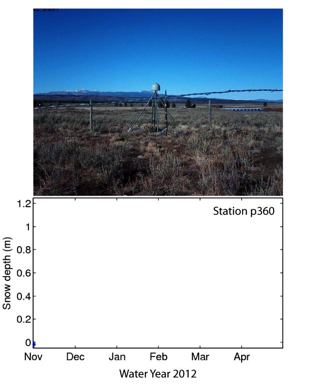
6 Measuring Snow

7 Installed a camera to take a picture of this stick every day
8
9
10 Note: we also provide a SWE product Snow Climatology
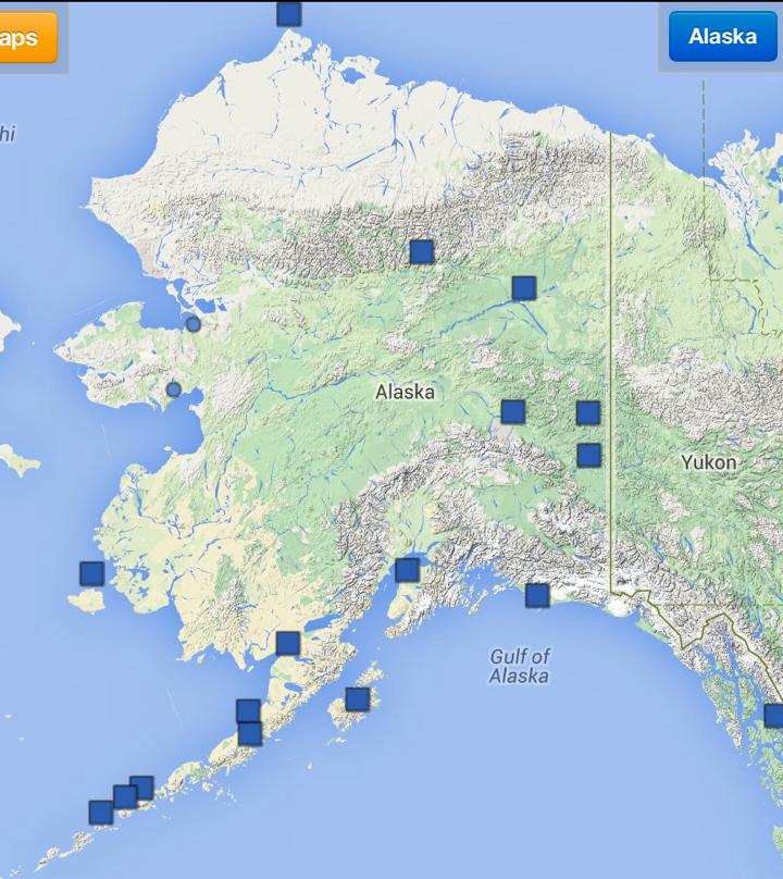
11 Barrow, Alaska
12 Monitoring Vegetation Water Content
13

14
15 Peak Vegetation Water Content wet avg dry very dry relative to average
16 Monitoring Soil Moisture Soil Moisture

17

18

19

20 What else can you do with reflected GPS signals? Kachemak Bay, Alaska GPS site installed by Jeff Freymueller University of Alaska at Fairbanks

21 Comparison between GPS and Real Tide Gauge Larson et al., The Accidental Tide Gauge, IEEE GRSL, 2013

22 Friday Harbor, Washington, USA Fit to tidal coefficients: 7.5 cm for NOAA, 8.4 cm for GPS


23 SBAS Steenbras Dam, Republic of South Africa GPS Data courtesy of Trignet
 water storage")
24 water level derived GPS from reflected derived water GPS signals level water storage (outline added) water storage data:


25 Cryosphere applications Data from the GLISN network Seismologist not drawn to scale.
26 On an ice sheet, you can infer firn density Larson, Wahr, Kuipers Munneke, 2015.
27 GPS Antenna On permafrost, you are sensitive to changes in the active layer Active Layer Thickness ~50 cm at Barrow 4 meters deep

28 Plume Sensing: Mt Redoubt, Alaska
29 GPS site installed by Jeff Freymueller, UAF SNR Data for Mt. Redoubt, Alaska Larson, A new way to detect volcanic plumes, GRL, 2013 March 24 March 25 March 26 March 27 March 28
30 Why are these data valuable? Any information about the timing, ascent rate, and height of a volcanic plume is useful for volcano ash dispersion models, which are used to make decisions about global airline routes and closure of airports.

31

32 Sea Level & Water Management Snow Ash Detection New Applications for GNSS: Validation of satellite sensors, in situ data for climate and sea level studies; water management, drought/flooding mitigation; permafrost monitoring; hazards assessments for airports. >>>Increases stakeholders in GNSS networks<<< Soil Moisture Vegetation Water Content Cryosphere
33 Take Home Messages The environmental products shown here were derived entirely from GPS data - no ancillary instrumentation was needed; existing instrumentation was used. There is no reason this could not be done with GLONASS, Beidou, and Galileo. New GNSS sites could be installed to take advantage of GNSS reflectometry.
34 Acknowledgements Eric Small, Valery Zavorotny, John Braun, Felipe Nievinski, Penina Axelrad, Ethan Gutmann, Clara Chew, Sarah Evans, Praveen Vikram, Evan Pugh, Bill Smith, John Kimball, Brian Hornbuckle, Tyson Ochsner, Jobie Carlisle, Mark Williams, Matt Jones, Mesa County (CO) Surveyors, Jeff Freymueller, John Wahr, Simon Williams, Karen Boniface, John Pratt, Andria Bilich, Minnesota DOT, RSA Trignet. NSF GEO: Climate and Large-Scale Dynamics, Physical and Dynamic Meteorology, Hydrologic Sciences, EarthScope, Instrumentation and Facilities, Education and Outreach. NASA: Earth Surface and Interior, Natural Hazards, AIST, and Terrestrial Hydrology. UNAVCO maintains the EarthScope PBO sites with funding from NSF.


35
Data Portal Documentation. Data Products
 Retrieved from http://xenon.colorado.edu/portal/ on Sep 19, 2018 at 10:10 AM MDT Data Products OVERVIEW The Global Positioning System continuously transmits L-band signals (wavelengths of 19 and 24.4 cm)
The Scientific Value of High-Rate, Low-Latency GPS Data
 The Scientific Value of High-Rate, Low-Latency GPS Data by W.C. Hammond, B.A. Brooks, R. Bürgmann, T. Heaton, M. Jackson, A.R. Lowry, S. Anandakrishnan Recent and ongoing technical advances in uses of
IEEE TRANSACTIONS ON GEOSCIENCE AND REMOTE SENSING, VOL. 53, NO. 5, MAY
 IEEE TRANSACTIONS ON GEOSCIENCE AND REMOTE SENSING, VOL. 53, NO. 5, MAY 2015 2755 Vegetation Sensing Using GPS-Interferometric Reflectometry: Theoretical Effects of Canopy Parameters on Signal-to-Noise
GPS snow sensing: results from the EarthScope Plate Boundary Observatory
 DOI 1.17/s1291-12-259-7 ORIGINAL ARTICLE GPS snow sensing: results from the EarthScope Plate Boundary Observatory Kristine M. Larson Felipe G. Nievinski Received: 26 November 211 / Accepted: 7 February
Soil Moisture Remote Sensing using GPS-Interferometric Reflectometry. Clara Chew. B.A., Dartmouth College, 2009
 Soil Moisture Remote Sensing using GPS-Interferometric Reflectometry by Clara Chew B.A., Dartmouth College, 2009 A thesis submitted to the Faculty of the Graduate School of the University of Colorado in
Climate Change Impacts in Alaska: the Weather Perspective
 Climate Change Impacts in Alaska: the Weather Perspective September 18, 2007 NOAA s National Weather Service, Alaska Region James Partain, Chief Environmental and Scientific Services Division NOAA NWS
Lessons from the 2004 Sumatra earthquake and the Asian tsunami
 Lessons from the 2004 Sumatra earthquake and the Asian tsunami Kenji Satake National Institute of Advanced Industrial Science and Technology Outline 1. The largest earthquake in the last 40 years 2. Tsunami
Emerging Needs and Opportunities in Ocean Remote Sensing
 Emerging Needs and Opportunities in Ocean Remote Sensing Christine Gommenginger National Oceanography Centre, Southampton With thanks to: Chris Banks, Val Byfield, Paolo Cipollini, Nadim Dayoub, Giuseppe
Eldgos í Eyjafjallajökli hlutverk Veðurstofu Íslands
 Photo: B. Pálmason Eldgos í Eyjafjallajökli hlutverk Veðurstofu Íslands Sigrún Karlsdóttir, Guðrún Nína Petersen, Halldór Björnsson, Halldór Pétursson, Hróbjartur Þorsteinsson, Kristín Vogfjörð og Þórður
GPS Strain & Earthquakes Unit 3: Finding location and velocity data for PBO GPS stations
 GPS Strain & Earthquakes Unit 3: Finding location and velocity data for PBO GPS stations Original activity by Vince Cronin (Baylor University). Revisions by Beth Pratt-Sitaula (UNAVCO). Analyzing the velocities
Geodetics measurements within the scope of current and future perspectives of GNSS-Reflectometry and GNSS-Radio Occultation
 Geodetics measurements within the scope of current and future perspectives of GNSS-Reflectometry and GNSS-Radio Occultation Introduction The aim of this presentation is to provide an overview of the GNSS-R
Tandem-L: A Mission Proposal for Monitoring Dynamic Earth Processes
 Tandem-L: A Mission Proposal for Monitoring Dynamic Earth Processes A. Moreira, G. Krieger, M. Younis, I. Hajnsek, K. Papathanassiou, M. Eineder, P. Dekker, F. De Zan German Aerospace Center (DLR) Dynamic
High resolution ground-based snow measurements during the NASA CLPX-II campaign, North Slope, Alaska
 High resolution ground-based snow measurements during the NASA CLPX-II campaign, North Slope, Alaska H.P. Marshall1, N. Rutter2, K. Tape3, M. Sturm4, R. Essery5 1 Boise State University, Department of
Seismic Recording Station AZ_PFO Summary Report
 Seismic Recording Station AZ_PFO Summary Report Thank you for hosting station AZ_PFO on your property. We hope that you find the enclosed report interesting. Your station is one of the 2000 USArray seismic
Climate Roles of Land Surface
 Lecture 5: Land Surface and Cryosphere (Outline) Climate Roles Surface Energy Balance Surface Water Balance Sea Ice Land Ice (from Our Changing Planet) Surface Albedo Climate Roles of Land Surface greenhouse
Interferometric Synthetic Aperture Radar (InSAR) and GGOS. Andrea Donnellan NASA/JPL February 21, 2007
 and GGOS. Andrea Donnellan NASA/JPL February 21, 2007") Interferometric Synthetic Aperture Radar (InSAR) and GGOS Andrea Donnellan NASA/JPL February 21, 2007 Sources for Science Objectives Fourth component of EarthScope Involvement: NSF, NASA, USGS, Universities
Interferometric Synthetic Aperture Radar (InSAR) and GGOS Andrea Donnellan NASA/JPL February 21, 2007 Sources for Science Objectives Fourth component of EarthScope Involvement: NSF, NASA, USGS, Universities
Science of Global Warming and Climate Change
 Science of Global Warming and Climate Change Part 1 Science Dr. David H. Manz, P. Eng. University of Calgary May 2015 Weather vs. Climate Weather happens day to day (moment to moment) best forecast is
Sinéad Louise Farrell1,2,3 Thomas Newman1,2,, Alek Petty 1,2, Jackie Richter-Menge4, Dave McAdoo1,2, Larry Connor2
 Sinéad Louise Farrell1,2,3 Thomas Newman1,2,, Alek Petty 1,2, Jackie Richter-Menge4, Dave McAdoo1,2, Larry Connor2 1 Earth System Science Interdisciplinary Center, University of Maryland, USA 2 NOAA Laboratory
Alaska Statewide Climate Summary November 2018
 Alaska Statewide Climate Summary November 2018 The following report provides an overview of the November 2018 weather. The report is based on preliminary data from selected weather stations throughout
Explosive volcanic eruptions in the North Pacific: Interactions between the Alaska Volcano Observatory and Volcanic Ash Advisory Centers
 Explosive volcanic eruptions in the North Pacific: Interactions between the Alaska Volcano Observatory and Volcanic Ash Advisory Centers David Schneider U.S. Geological Survey Alaska Volcano Observatory
Alaska Earthquake Center. By Natalia A. Ruppert Seismic Network Manager
 Alaska Earthquake Center By Natalia A. Ruppert Seismic Network Manager Geophysical Institute, University of Alaska Fairbanks Alaska Earthquake Center mission and historical perspective! Regional seismic
Some NOAA Products that Address PSTG Satellite Observing Requirements. Jeff Key NOAA/NESDIS Madison, Wisconsin USA
 Some NOAA Products that Address PSTG Satellite Observing Requirements Jeff Key NOAA/NESDIS Madison, Wisconsin USA WMO Polar Space Task Group, 4 th meeting, Greenbelt, 30 September 2014 Relevant Missions
The Global Geodetic Observing System (GGOS) of the International Association of Geodesy, IAG
 of the International Association of Geodesy, IAG") The Global Geodetic Observing System (GGOS) of the International Association of Geodesy, IAG Hans-Peter Plag (1), Markus Rothacher (2), Richard Gross (3), Srinivas Bettadpur (4) (1) Nevada Bureau of Mines
The Global Geodetic Observing System (GGOS) of the International Association of Geodesy, IAG Hans-Peter Plag (1), Markus Rothacher (2), Richard Gross (3), Srinivas Bettadpur (4) (1) Nevada Bureau of Mines
Terrestrial Snow Cover: Properties, Trends, and Feedbacks. Chris Derksen Climate Research Division, ECCC
 Terrestrial Snow Cover: Properties, Trends, and Feedbacks Chris Derksen Climate Research Division, ECCC Outline Three Snow Lectures: 1. Why you should care about snow: Snow and the cryosphere Classes of
LECTURE #11: Volcanoes: Monitoring & Mitigation
 GEOL 0820 Ramsey Natural Disasters Spring, 2018 LECTURE #11: Volcanoes: Monitoring & Mitigation Date: 15 February 2018 I. What is volcanic monitoring? the continuous collection of one or more data sources
What s New in the World of Winter Maintenance Technology. Laser Road Surface Sensor (LRSS) Functional Description
 Functional Description") What s New in the World of Winter Maintenance Technology Dennis Burkheimer Winter Operations Administrator Iowa Department of Transportation John Scharffbillig Fleet Manager Minnesota Department of Transportation
What s New in the World of Winter Maintenance Technology Dennis Burkheimer Winter Operations Administrator Iowa Department of Transportation John Scharffbillig Fleet Manager Minnesota Department of Transportation
MAGMATIC, ERUPTIVE AND TECTONIC PROCESSES IN THE ALEUTIAN ARC, ALASKA
 MAGMATIC, ERUPTIVE AND TECTONIC PROCESSES IN THE ALEUTIAN ARC, ALASKA Introduction The Aleutian Arc contains roughly ten percent of the world s active volcanoes. Hardly a year goes by without a major eruption
Seismic Recording Station TA_109C Summary Report
 Seismic Recording Station TA_109C Summary Report Thank you for hosting station TA_109C on your property. We hope that you find the enclosed report interesting. Your station is one of the 2000 USArray seismic
Climate of Alaska: Past, Present and Future
 Climate of Alaska: Past, Present and Future Pond shrinkage in Alaska's Yukon Flats National Wildlife Refuge, 1951-2000. Source: USGCRP (2009) Uma S. Bhatt, usbhatt@alaska.edu John Walsh for many of today
Field Trip Overview Map
 CEETEP Field Trip Guide October 11, 2014 Cascadia Subduction Zone CASCADE VOLCANOES COAST RANGE North American Plate get Pu Juan De Fuca Ridge & tte Locked Zone Earthquake me MID-OCEAN RIDGE lla Pacific
Growth of International Collaboration in Monitoring Volcanic Ash Eruptions in the North Pacific
 Growth of International Collaboration in Monitoring Volcanic Ash Eruptions in the North Pacific John C. Eichelberger and Christina Neal U.S. Geological Survey U.S. Department of the Interior U.S. Geological
EXPLORE PLATE TECTONICS & MORE THROUGH GPS DATA. Shelley Olds, UNAVCO April 12, 2018 NGSS Webinar
 EXPLORE PLATE TECTONICS & MORE THROUGH GPS DATA Shelley Olds, UNAVCO April 12, 2018 NGSS Webinar Today s Outline Central question: How do we know the tectonic plates are still moving? -- What evidence
Land surface precipitation and hydrology in MERRA-2
 Land surface precipitation and hydrology in MERRA-2 R. Reichle, R. Koster, C. Draper, Q. Liu, M. Girotto, S. Mahanama, G. De Lannoy, G. Partyka, and many others 5th International Conference on Reanalysis
Hydrological Processes. Snow measurement by GPS interferometric reflectometry: an evaluation at Niwot Ridge, Colorado
 Snow measurement by GPS interferometric reflectometry: an evaluation at Niwot Ridge, Colorado Journal: Manuscript ID: HYP--00.R Wiley - Manuscript type: Research Article Date Submitted by the Author: n/a
Breakout Session III Evolving landscapes and global environmental change
 Breakout Session III Evolving landscapes and global environmental change 1. Hydrology and critical zone imaging 2. Glaciology: Instrumenting glaciers and ice sheets 3. Polar networks and glacial isostatic
Geodesy. orientation. shape. gravity field
 Geodesy noun Science of measuring the shape, orientation and gravity field of the Earth and how it changes over time. shape orientation gravity field Positioning has always been important Downstream applications
Getting to know EarthScope Plate
 Getting to know EarthScope Plate Boundary Observatory & UNAVCO Shelley Olds, UNAVCO !!"#$%&'$!("($)*&'+'$$!!,&-./,01$!2,&3,/4*5$!6+57+/389.-:,;+/&+'$ About UNAVCO!"#$%$&"&'()*'+(#$',#') -'('"-#.)",/)'/0#"1+,)
Ash Plumes. Teacher Instructions. Overview: Objectives: National Standards: Alaska Grade Level Expectations Addressed:
 Teacher Instructions Ash Plumes Overview: Composite volcanoes usually erupt with large clouds of ash, called ash plumes. Volcanologists track ash plumes and relay the information to air traffic controllers
The Earth Explorer Missions - Current Status
 EOQ N 66 July 2000 meteorology earthnet remote sensing solid earth future programmes Earth Observation Quarterly The Earth Explorer Missions - Current Status G. Mégie (1) and C.J. Readings (2) (1) Institut
Land Surface Sea Ice Land Ice. (from Our Changing Planet)
") Lecture 5: Land Surface and Cryosphere (Outline) Land Surface Sea Ice Land Ice (from Our Changing Planet) Earth s s Climate System Solar forcing Atmosphere Ocean Land Solid Earth Energy, Water, and Biochemistry
Lecture 5: Land Surface and Cryosphere (Outline) Land Surface Sea Ice Land Ice (from Our Changing Planet) Earth s s Climate System Solar forcing Atmosphere Ocean Land Solid Earth Energy, Water, and Biochemistry
Earth s Climate System. Surface Albedo. Climate Roles of Land Surface. Lecture 5: Land Surface and Cryosphere (Outline) Land Surface Sea Ice Land Ice
 Land Surface Sea Ice Land Ice") Lecture 5: Land Surface and Cryosphere (Outline) Earth s Climate System Solar forcing Land Surface Sea Ice Land Ice Atmosphere Ocean Land Solid Earth Energy, Water, and Biochemistry Cycles (from Our Changing
Lecture 5: Land Surface and Cryosphere (Outline) Earth s Climate System Solar forcing Land Surface Sea Ice Land Ice Atmosphere Ocean Land Solid Earth Energy, Water, and Biochemistry Cycles (from Our Changing
What are the social, technical, environmental and economic benefits and opportunities of accessing and sharing geodetic data?
 What are the social, technical, environmental and economic benefits and opportunities of accessing and sharing geodetic data? Graeme Blick Group Manager Positioning and Resilience Land Information New
Dual-Frequency Ku- Band Radar Mission Concept for Snow Mass
 Dual-Frequency Ku- Band Radar Mission Concept for Snow Mass Chris Derksen Environment and Climate Change Canada Study Team: Climate Research Division/Meteorological Research Division, ECCC Canadian Space
Plate Boundary Observatory the first five years
 www.earthscope.org Plate Boundary Observatory the first five years Plate Boundary Observatory A Continental-Scale, Integrated Geodetic By the Numbers (2003 2008) Installed 891 permanent Global Positioning
MEETING MINUTES WCFLAMS Chapter. Teach the Teachers Workshop
 DATE: March 23, 2010 MEETING MINUTES WCFLAMS Chapter Teach the Teachers Workshop LOCATION: University of South Florida C.W. Bill Young Auditorium Tampa, FL 33620 PRESENTATIONS: The Teach the Teachers Workshop
B.A. (Physics) May 1999 Whitman College, Walla Walla, Washington
 May 1999 Whitman College, Walla Walla, Washington") Julie Elliott Department of Earth and Atmospheric Sciences, Cornell University, Ithaca, NY 14853 julie.elliott@cornell.edu www.geo.cornell.edu/research_staff/jle84 Education Ph.D. (Geophysics) August 2011
Julie Elliott Department of Earth and Atmospheric Sciences, Cornell University, Ithaca, NY 14853 julie.elliott@cornell.edu www.geo.cornell.edu/research_staff/jle84 Education Ph.D. (Geophysics) August 2011
Earthquake Hazards. Tsunami
 Earthquake Hazards Tsunami Measuring Earthquakes Two measurements that describe the power or strength of an earthquake are: Intensity a measure of the degree of earthquake shaking at a given locale based
Microwave, portable FMCW radar: a tool for measuring snow depth, stratigraphy, and snow water equivalent
 Microwave, portable FMCW radar: a tool for measuring snow depth, stratigraphy, and snow water equivalent Hans-Peter Marshall CGISS, Boise State University U.S. Army Cold Regions Research and Engineering
Decadal changes of surface elevation over permafrost area estimated using reflected GPS signals
 The Cryosphere Discuss., https://doi.org/.194/tc-17-139 Decadal changes of surface elevation over permafrost area estimated using reflected GPS signals 1 Lin Liu 1, Kristine M. Larson 2 1 Earth System
Earthquake Hazards. Tsunami
 Earthquake Hazards Tsunami Review: What is an earthquake? Earthquake is the vibration (shaking) and/or displacement of the ground produced by the sudden release of energy. The point inside the Earth where
Augustine Volcano, Calculating Ash Fallout
 Augustine Volcano, 1986 - Calculating Fallout -What controls the fallout of particles through the atmosphere? -Can we predict when and where an erupted ash cloud will fall out on the Earth? Summit: 1260
Your Advisor Said, Get the GPS Data and Plot it. Jeff Freymueller Geophysical University of Alaska Fairbanks
 Your Advisor Said, Get the GPS Data and Plot it Jeff Freymueller Geophysical Ins@tute University of Alaska Fairbanks Actual GPS Data GPS Data are phase and pseudorange data that measure distances to satellites.
CLIMATE CHANGE AND REGIONAL HYDROLOGY ACROSS THE NORTHEAST US: Evidence of Changes, Model Projections, and Remote Sensing Approaches
 CLIMATE CHANGE AND REGIONAL HYDROLOGY ACROSS THE NORTHEAST US: Evidence of Changes, Model Projections, and Remote Sensing Approaches Michael A. Rawlins Dept of Geosciences University of Massachusetts OUTLINE
Views of the 2016 Northern Plains Flash Drought: Farmer Perspectives and Remote Sensing Data
 Views of the 2016 Northern Plains Flash Drought: Farmer Perspectives and Remote Sensing Data PRESENTATION BY TONY MUCIA RESEARCH CONDUCTED BY JASON OTKIN, TONYA HAIGHT, AND TONY MUCIA Project Overview
1. Draw a line from each ocean listed below to its location on the map. 2. Label the Pacific Ring of Fire on the map above.
 1. Draw a line from each ocean listed below to its location on the map. Atlantic Ocean Pacific Ocean Indian Ocean Arctic Ocean 2. Label the Pacific Ring of Fire on the map above. 3. Find Fairbanks on the
Coastal Erosion & Climate Change: PRIDE 2005 Towards an Alaska Wind/Wave Climatology
 Coastal Erosion & Climate Change: PRIDE 2005 Towards an Alaska Wind/Wave Climatology 2 nd PRIDE Workshop August 9-10, 2005 David Atkinson, Int l Arctic Research Center, Univ. Of Alaska-Fairbanks James
The Importance of Cultural Contexts in Climate Education
 The Importance of Cultural Contexts in Climate Education Kathryn Berry Bertram, Ph.D., University of Alaska Fairbanks Geophysical Institute Education Director Climate education for indigenous students
THE ROLE OF MICROSTRUCTURE IN FORWARD MODELING AND DATA ASSIMILATION SCHEMES: A CASE STUDY IN THE KERN RIVER, SIERRA NEVADA, USA
 MICHAEL DURAND (DURAND.8@OSU.EDU), DONGYUE LI, STEVE MARGULIS Photo: Danielle Perrot THE ROLE OF MICROSTRUCTURE IN FORWARD MODELING AND DATA ASSIMILATION SCHEMES: A CASE STUDY IN THE KERN RIVER, SIERRA
ASimultaneousRadiometricand Gravimetric Framework
 Towards Multisensor Snow Assimilation: ASimultaneousRadiometricand Gravimetric Framework Assistant Professor, University of Maryland Department of Civil and Environmental Engineering September 8 th, 2014
THE ROLE OF OCEAN OBSERVATORIES IN CLIMATE CHANGE MONITORING, MULTI-HAZARD EARLY WARNING AND DISASTER RISK REDUCTION
 THE ROLE OF OCEAN OBSERVATORIES IN CLIMATE CHANGE MONITORING, MULTI-HAZARD EARLY WARNING AND DISASTER RISK REDUCTION Tania L. Insua, Moran, K., De Leo, F., Sastri, A., Heesemann, M., Dewey, R. UNOOSA Conference
GG S Global Geodetic Observing System (GGOS): Status and Future. Markus Rothacher, Ruth Neilan, Hans-Peter Plag
: Status and Future. Markus Rothacher, Ruth Neilan, Hans-Peter Plag") 2020 Global Geodetic Observing System (GGOS): Status and Future Markus Rothacher, Ruth Neilan, Hans-Peter Plag GeoForschungsZentrum Potsdam (GFZ) Jet Propulsion Laboratory (JPL) University of Nevada, Reno
2020 Global Geodetic Observing System (GGOS): Status and Future Markus Rothacher, Ruth Neilan, Hans-Peter Plag GeoForschungsZentrum Potsdam (GFZ) Jet Propulsion Laboratory (JPL) University of Nevada, Reno
INFERRING LARGE-SCALE TERRESTRIAL WATER STORAGE THROUGH GRACE AND GPS DATA FUSION
 INFERRING LARGE-SCALE TERRESTRIAL WATER STORAGE THROUGH GRACE AND GPS DATA FUSION CODY RUDE 1, JUSTIN LI 1, MICHAEL GOWANLOCK 1, THOMAS HERRING 2, AND VICTOR PANKRATIUS 1 1 MIT HAYSTACK OBSERVATORY 2 MIT
COCONet: Network: Plans and Status SIRGAS Meeting Concepción, Chile - October 29-31, 2012 Glen S. Mattioli
 COCONet: Network: Plans and Status 2012 SIRGAS Meeting Concepción, Chile - October 29-31, 2012 Glen S. Mattioli with help from John Braun, Karl Feaux, Jim Normandeau, and Barrett Friesen Glen Mattioli
Operational Aspects of GNSS CORS What is a GNSS CORS system used for?
 Please insert a picture (Insert, Picture, from file). Size according to grey field (10 cm x 25.4 cm). Scale picture: highlight, pull corner point Cut picture: highlight, choose the cutting icon from the
AMAP. Climate Change in the Cryosphere: Snow, Water, Ice and Permafrost in the Arctic (SWIPA) Assessment Summary
 Assessment Summary") Cooperative Institute for Research in Environmental Sciences University of Colorado AMAP Climate Change in the Cryosphere: Snow, Water, Ice and Permafrost in the Arctic (SWIPA) Assessment Summary Arctic
Cooperative Institute for Research in Environmental Sciences University of Colorado AMAP Climate Change in the Cryosphere: Snow, Water, Ice and Permafrost in the Arctic (SWIPA) Assessment Summary Arctic
The known requirements for Arctic climate services
 The known requirements for Arctic climate services based on findings described in STT White paper 8/2015 Johanna Ekman / EC PHORS STT Regional drivers The Arctic region is home to almost four million people
Review of GNSS as sources of opportunity for Earth Observation
 NOAA UK-MetOffice Joofix Review of GNSS as sources of opportunity for Earth Observation Dr. Estel Cardellach (ICE-CSIC/IEEC, Spain) HISDESAT ESA Overview Motivation: contribution to a sustained and efficient
May Global Warming: Recent Developments and the Outlook for the Pacific Northwest
 Global Warming: Recent Developments and the Outlook for the Pacific Northwest Pat Bartlein Department of Geography University of Oregon (bartlein@uoregon.edu) http://geography.uoregon.edu/envchange/gwhr/
GEO-VIII November Geohazard Supersites and Natural Laboratories Progress Report. Document 9
 GEO-VIII 16-17 November 2011 Geohazard Supersites and Natural Laboratories Progress Report Document 9 This document is submitted to GEO-VIII for information. Geohazard Supersites and Natural Laboratories
SCIGN science report & GPS fault slip sensors
 SCIGN science report & GPS fault slip sensors Kenneth W. Hudnut USGS, Pasadena, CA UJNR Earthquake Research Panel Meeting Morioka, Japan Nov. 6-7, 2002 GPS is now vital to earthquake monitoring (array
Snow measurement by GPS interferometric reflectometry: an evaluation at Niwot Ridge, Colorado
 HYDROLOGICAL PROCESSES Hydrol. Process. (2011) Published online in Wiley Online Library (wileyonlinelibrary.com).8329 Snow measurement by GPS interferometric reflectometry: an evaluation at Niwot Ridge,
Subject Classification
 Istituto Nazionale di Geofisica e Vulcanologia earth-prints home page roma library bologna library catania library milano library napoli library palerm Subject Classification Earth-prints organize its
Plant Available Water Monitoring with the Oklahoma Mesonet
 Plant Available Water Monitoring with the Oklahoma Mesonet 2013 No Till Oklahoma Conference, Norman, OK, Feb. 19 20, 2013 Tyson Ochsner Plant and Soil Sciences, Oklahoma State University Funding provided
Estimating runoff from glaciers to the Gulf of Alaska Anthony Arendt
 Estimating runoff from glaciers to the Gulf of Alaska Anthony Arendt Geophysical Institute University of Alaska, Fairbanks Funding Collaborators J. Freymueller, A. Gusmeroli, A. Gardner, D. Hill, E. Hood,
Future cm & mm Wavelength Occultation System: Active Temperature, Ozone and Moisture Microwave Spectrometer (ATOMMS) E. R.
 E. R.") Future cm & mm Wavelength Occultation System: Active Temperature, Ozone and Moisture Microwave Spectrometer (ATOMMS) E. R. Kursinski 1 D. Ward 2, A. Otarola 3, J. McGhee 1, H. Reed 4, & D. Erickson 4 1
Future cm & mm Wavelength Occultation System: Active Temperature, Ozone and Moisture Microwave Spectrometer (ATOMMS) E. R. Kursinski 1 D. Ward 2, A. Otarola 3, J. McGhee 1, H. Reed 4, & D. Erickson 4 1
Activity 2.2: Recognizing Change (Observation vs. Inference)
") Activity 2.2: Recognizing Change (Observation vs. Inference) Teacher Notes: Evidence for Climate Change PowerPoint Slide 1 Slide 2 Introduction Image 1 (Namib Desert, Namibia) The sun is on the horizon
Activity 2.2: Recognizing Change (Observation vs. Inference) Teacher Notes: Evidence for Climate Change PowerPoint Slide 1 Slide 2 Introduction Image 1 (Namib Desert, Namibia) The sun is on the horizon
Arctic Science & Engineering. Martin Jeffries. Ron Liston Seminar, 17 October PhD. MSc. Calgary ( ) UK ( )
 UK ( )") Arctic Science & Calgary (1981-1985) Engineering PhD Martin Jeffries MSc Ron Liston Seminar, 17 October 2018. UK (1979-1981) Outline Career Background Research Background The State of the Arctic Arctic
Arctic Science & Calgary (1981-1985) Engineering PhD Martin Jeffries MSc Ron Liston Seminar, 17 October 2018. UK (1979-1981) Outline Career Background Research Background The State of the Arctic Arctic
Global Climate Change
 Global Climate Change Overview: Students will learn about global climate change, what causes global warming, and scientific projections about climate change in the near future. Levels V-VI Grades 9-12
THE IMPACTS ON AIR TRAFFIC FROM VOLCANIC ASH FROM THE 2009 MT. REDOUBT ERUPTIONS
 3.1 THE IMPACTS ON AIR TRAFFIC FROM VOLCANIC ASH FROM THE 2009 MT. REDOUBT ERUPTIONS Alexander Matus a *, L. A. Hudnall a, J. J. Murray b, A. Krueger c a LARSS Program NASA LaRC, Hampton, Virginia b NASA
GG S. Internal Vision of GGOS. Markus Rothacher. GFZ Potsdam
 Internal Vision of GGOS Markus Rothacher GFZ Potsdam GGOS Retreat DGFI in Munich February 15-16, 2006 Contents Motivation Four Levels of Products of the IAG Services: First Level: Raw Data Collection Second
Images from: Boston.com
 Images from: Boston.com Ireland in the shadow of a volcano: Understanding the 2010 eruption at Eyjafjallajökull, Iceland. Chris Bean, School of Geological Sciences, UCD. World Quakes and Volcanoes 1960-2010
The Eyjafjallajökull eruption
 The Eyjafjallajökull eruption and its aftermath The monitoring and guidance process Photo: B. Pálmason Contents The role of IMO The role of London VAAC Volcanic Monitoring network and other observations
WEATHER AND CLIMATE EXTREMES MONITORING BASED ON SATELLITE OBSERVATION : INDONESIA PERSPECTIVE RIRIS ADRIYANTO
 WEATHER AND CLIMATE EXTREMES MONITORING BASED ON SATELLITE OBSERVATION : INDONESIA PERSPECTIVE RIRIS ADRIYANTO INDONESIA AGENCY FOR METEOROLOGY, CLIMATOLOGY AND GEOPHYSICS (BM KG) 1. INTRODUCTION - BMKG
Winter Precipitation, Sublimation, and Snow-Depth in the Pan-Arctic: Critical Processes and a Half Century of Change
 Winter Precipitation, Sublimation, and Snow-Depth in the Pan-Arctic: Critical Processes and a Half Century of Change PI s: Glen E. Liston, Colorado State University Larry J. Mahrt, Oregon State University
Arctic System Reanalysis *
 Arctic System Reanalysis * David H. Bromwich 1,2, Keith M. Hines 1 and Le-Sheng Bai 1 1 Polar Meteorology Group, Byrd Polar Research Center 2 Atmospheric Sciences Program, Dept. of Geography The Ohio State
Water information system advances American River basin. Roger Bales, Martha Conklin, Steve Glaser, Bob Rice & collaborators UC: SNRI & CITRIS
 Water information system advances American River basin Roger Bales, Martha Conklin, Steve Glaser, Bob Rice & collaborators UC: SNRI & CITRIS Opportunities Unprecedented level of information from low-cost
NCAR UCAR. 50 th Anniversary Lecture
 NCAR & UCAR 50 th Anniversary Lecture Turbulence, Wind Shear, Toxin Attacks, and Other Things That Go Bump In the Night: Applied Research for Real-Life Problems Bill Mahoney National Center for Atmospheric
Background. Points of Discussion. Hydrographic Models
 Airborne Laser Remote Sensing Technology: Providing Essential Hydrologic Information in the 21 st Century Warwick Hadley, Optech Incorporated Presented by: Warwick Hadley Sales Manager, Middle East and
Volcanoes and Urban Planning
 Background Reading & Lesson Plan Document ID: 10_04_04_1 Date Received: 2004-10-04 Date Revised: 2004-11-16 Date Accepted: 2004-11-23 Curriculum Topic Benchmarks: M1.3.5, M3.3.17, M5.3.3, M9.3.2, S12.3.7,
Magnitude 8.2 NORTHWEST OF IQUIQUE, CHILE
 An 8.2-magnitude earthquake struck off the coast of northern Chile, generating a local tsunami. The USGS reported the earthquake was centered 95 km (59 miles) northwest of Iquique at a depth of 20.1km
Color Figures for Curbing Catastrophe
 Color Figures for Curbing Catastrophe To reduce costs for the buyer, all figures in the print version of the book are reproduced in black and white or grey tone. Some of those figures were originally in
- satellite orbits. Further Reading: Chapter 04 of the text book. Outline. - satellite sensor measurements
 (1 of 12) Further Reading: Chapter 04 of the text book Outline - satellite orbits - satellite sensor measurements - remote sensing of land, atmosphere and oceans (2 of 12) Introduction Remote Sensing:
Education. B.A. (Physics) May 1999 Whitman College, Walla Walla, Washington. Professional Experience
 May 1999 Whitman College, Walla Walla, Washington. Professional Experience") Julie Elliott Earth, Atmospheric, and Planetary Sciences, Purdue University West Lafayette, IN 47906 765-494-0484 (work) 509-961-3568 (cell) julieelliott@purdue.edu Education Ph.D. (Geophysics) August
Julie Elliott Earth, Atmospheric, and Planetary Sciences, Purdue University West Lafayette, IN 47906 765-494-0484 (work) 509-961-3568 (cell) julieelliott@purdue.edu Education Ph.D. (Geophysics) August
LOG_aLevel. Tsunami Warning System
 LOG_aLevel Tsunami Warning System General Acoustics e.k. Am Kiel-Kanal 1 24106 Kiel Germany Phone: +49 431 5 80 81 80 www.generalacoustics.com Info@generalacoustics.com LOG_aLevel Tsunami Warning System
Normalized Microwave Reflection Index: Validation of Vegetation Water Content Estimates from Montana Grasslands
 Normalized Microwave Reflection Index: Validation of Vegetation Water Content Estimates from Montana Grasslands Eric E. Small a, Kristine M. Larson b, and W. Kolby Smith c a Department of Geological Sciences,
Yellowstone Hotspot Component of the Plate Boundary Observatory
 Yellowstone Hotspot Component of the Plate Boundary Observatory (Investigators: Smith, Thatcher, Meertens, Humphreys, Dzurisin, Oldow Co-Investigators: Christiansen, Doss, Schwartz, Machette, Wong, Olig,
Fate of permafrost in Denali National Park and Preserve - A modeling investigation
 Photo credit: Jacob W Frank Fate of permafrost in Denali National Park and Preserve - A modeling investigation Santosh K Panda, Sergey S Marchenko, Vladimir E Romanovsky Permafrost Laboratory, Geophysical
RECENT ADVANCES IN SEISMIC AND INFRASONIC ANALYSES OF VOLCANIC ERUPTIONS AND POTENTIAL FOR USING EARTHSCOPE DATA
 RECENT ADVANCES IN SEISMIC AND INFRASONIC ANALYSES OF VOLCANIC ERUPTIONS AND POTENTIAL FOR USING EARTHSCOPE DATA DAVID FEE WILSON ALASKA TECHNICAL CENTER, ALASKA VOLCANO OBSERVATORY GEOPHYSICAL INSTITUTE,
The San Andreas Fault Observatory at Depth: Recent Site Characterization Studies and the 2.2-Km-Deep Pilot Hole
 The San Andreas Fault Observatory at Depth: Recent Site Characterization Studies and the 2.2-Km-Deep Pilot Hole Steve Hickman and Bill Ellsworth (USGS) Mark Zoback (Stanford University) and the Pre-EarthScope
TEACHER CERTIFICATION STUDY GUIDE KNOWLEDGE OF THE NATURE OF SCIENCE...1. Skill 1.1 Identify the components of scientific inquiry...
 Table of Contents COMPETENCY 1.0 KNOWLEDGE OF THE NATURE OF SCIENCE...1 Skill 1.1 Identify the components of scientific inquiry...1 Skill 1.2 Skill 1.3 Skill 1.4 Skill 1.5 Identify the consistent patterns