Making Sense of Evolving Reference Frames for North America
|
|
|
- Jody Willis
- 5 years ago
- Views:
Transcription


1 Making Sense of Evolving Reference Frames for North America Mike Craymer Geodetic Survey Division, Natural Resources Canada Giovanni Sella U.S. National Geodesy Survey American Geophysical Union 2007 Joint Assembly Acapulco, May 22-25, 2006
2 Abstract The World Geodetic System 1984 (WGS84) and North American Datum of 1983 (NAD83) are the most widely-used spatial reference systems in North America. NAD83 is the national reference system used for georeferencing by most federal and provincial/state agencies while WGS84 is the default "native" system used by the Global Positioning System (GPS) and commercial GPS receivers. The physical realization of these reference systems have undergone several updates since they were first introduced over two decades ago. NAD83 has evolved from a traditional, ground-based horizontal control network to a space-based 3D realization fully supporting modern GPS techniques and the integration of both horizontal and vertical reference systems. WGS84, on the other hand, has no publicly accessible ground-based network. It is accessible only via broadcast orbits that provide positions with an accuracy of about a meter at best (with augmented corrections). More recently, a new reference systems called the Stable North American Reference Frame (SNARF) has been created primarily in support of Plate Boundary Observatory component of the EarthScope project. We explain the differences between these global and regional reference frames and as well as their relationship to each other. We also discuss some problems that occur when these relationships are not properly represented as done, for example, with NAD83 in the vast majority of GPS receivers.
3 Outline Old Reference Frames : World Geodetic System 1984 (WGS84) North American Datum of 1983 (NAD83) Modern Reference Frames: International Terrestrial Reference Frame (ITRF) WGS84(G ) NAD83(CSRS/CORS96) SNARF Some practical issues
4 Old Reference Frames WGS84 NAD83
5 Original WGS84 Native reference frame of GPS Datum WGS84 ellipsoid (=GRS80) Based on Doppler & BTS84 Aligned to international BTS84 Near-geocentric +/- 1 m (best could do at the time) No physical ground network or coordinates Geoid Geocentred on Earth s centre of mass (as known in 1986) Satellites (brdcst orbits) are only accessible control Enables point positioning only: 1-10 m accuracy WGS84 Ellipsoid
 Defined same as WGS84 Identical to WGS84 Fixed to North American plate Physical")
6 Original NAD83 National reference system in Canada & U.S. Datum GRS80 ellipsoid (=WGS84) Defined same as WGS84 Identical to WGS84 Fixed to North American plate Physical realization Traditional control networks & published coordinates
7 Limitations of Original WGS84/NAD83 Revealed by advances in GPS 1) Non-geocentric Offset from geocenter by 1-2 meters Incompatible with modern reference frames 2) NAD83 primarily a horizontal reference frame Densified using traditional 2D survey methods Errors of up to 1 m and more

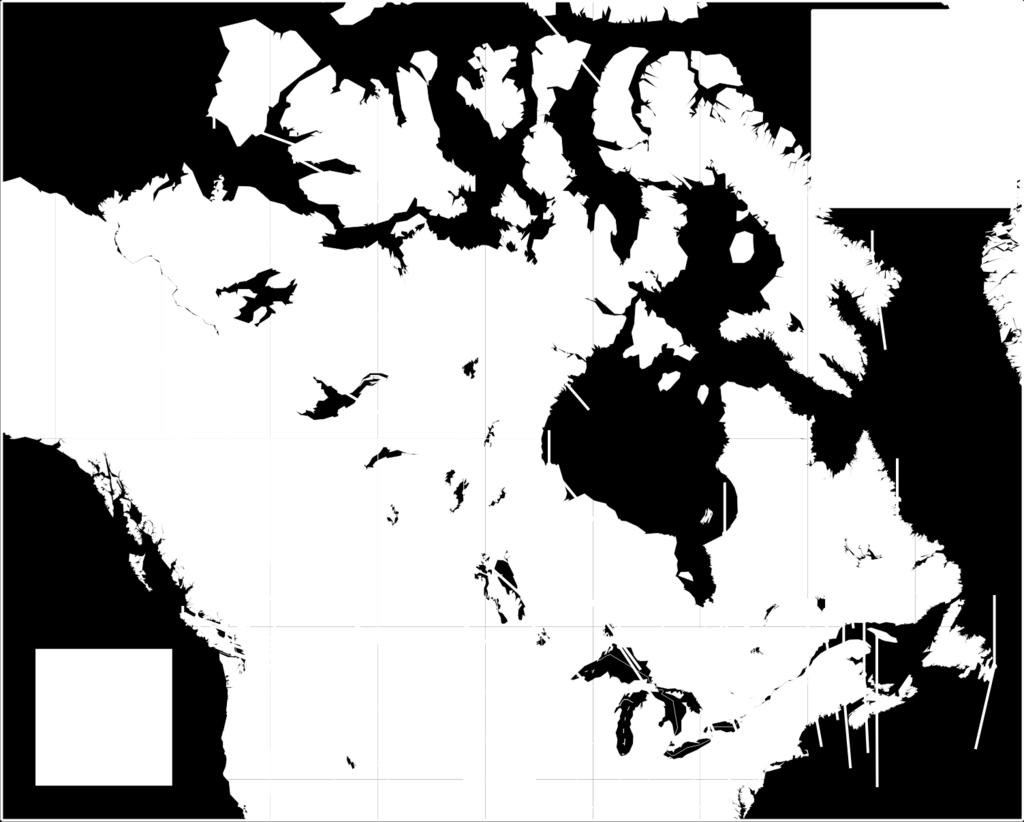
8 Errors in Original NAD83
9 Modern Reference Frames ITRF WGS84 G series NAD83(CSRS/CORS96) SNARF


10 International Terrestrial Reference Frame Best geocentric system available Stable to about a cm Maintained by IERS under auspices of IAG Primarily for scientific community & national datums Dynamic system Coordinates changing due to plate tectonics Valid only for a specific date (epoch) Velocities provided to update to other epochs Frequent new realizations Due to more data & improved techniques ITRF88 ITRF89 ITRF90 ITRF91 ITRF92 ITRF93 ITRF94 ITRF96 ITRF97 ITRF2000 ITRF2005

11 Plate Tectonic Motions ~2 cm/y
12 WGS84 G Series Original WGS84 Realigned to ITRF (shifted/reoriented) Better accuracy & stability than original Based on (compatible with) internationally adopted ITRF Version Based on Introduced WGS84(G730) ITRF WGS84(G873) ITRF WGS84(G1150) ITRF Still no ground network -- point positioning only Introduced a coordinate shift In Canada: 1.5 m horiz m vert. Not noticeable in WGS84 (+/- 1 m) but is in NAD83

13 Original WGS84/NAD83 vs WGS84(G1150)/ITRF2000
14 NAD83(CSRS/CORS96) Defined as a best fitting transformation from ITRF 14 parameter transformation Models tectonic motion of North America As accurate & stable as ITRF Adopted in Canada (CSRS) and U.S. (CORS96) Transformation updated for new ITRFs Web & software tools available at NRCan & NGS Still compatible with NAD83(Orig) Differences due to errors in original realization Different from new WGS84(G ) by 1.5 m!!
15 NAD83 WGS84 ITRF Fixed 1986 Original NAD83 - NAD83 reference system based on Doppler - Coordinate shifts of 1.5 m horizontally, 1 m vertically - metre-accuracy NAD83 Fixed 1987 Original WGS84 - same as NAD83 - +/- 1 m accuracy Dynamic 1.5 m shift Dynamic 1988 ITRF88 - geocentric ITRF89 ITRF NAD83 (CSRS/CORS96) - same NAD83 reference system - same geocentre offset/misalign - transformation from ITRF - cm-accuracy NAD WGS84(G730) - aligned with ITRF WGS84(G873) - aligned with ITRF WGS84(G1150) - aligned with ITRF2000 ITRF91 ITRF92 ITRF93 ITRF94 ITRF96 ITRF97 ITRF2000 ITRF2005 Small incremental changes
16 Stable North American Reference Frame (SNARF) Fixed to stable part of North American tectonic plate True geocentric version of NAD83 Defined by translation + rotation rates from ITRF that minimizes motion of frame sites More stable & consistent frame for EarthScope/PBO studies Includes model of glacial isostatic adjustment Based on novel technique by Jim Davis Weighted assimilation of GPS and a priori GIA model Provides estimates of both vertical & horizontal velocities SNARF Releases Initial release Dec in use by PBO Next version planned for end of 2007 Will use more reliable GPS velocity fields

17 SNARF v1.0 GIA Model
18 Practical Issues NGA Datum Shift for NAD83 GPS Correction Sevices
19 National Geospatial-Intelligence Agency Datum Shift for NAD83 NGA (publishers of WGS84) official datum shift table Used by majority of GSP receivers Set receiver to NAD83 output Zero datum shift applied (incorrect) NAD83-WGS84 zero 3 parameter shift (incorrect) Still in WGS84 -- need to transform using adopted procedure
20 GPS Correction/Processing Services Reference frame depends on service/source Uncorrected or WAAS corrections Receiver positions always in WGS84 But still in WGS84 if receiver applies zero shift to NAD83 Canadian CDGPS or Coast Guard corrections Receiver positions in NAD83(CSRS) Falls back to WGS84 without warning if service signal lost Post-processing with OPUS (US) Output in both NAD83(CORS96) & ITRF/WGS84(G) Post-processing with CSRS-PPP (Canada) Select output in either NAD83(CSRS) or ITRF/WGS84(G)
21 For More Information Craymer, M. (2006) The evolution of NAD83 in Canada. Geomatica, Vol. 60, No. 2, pp Soler, T., R. Snay (2004). Transforming Positions and Velocities between the International Terrestrial Reference Frame of 2000 and North American Datum of Journal of Surveying Engineering, Vol. 130, No. 2, pp Snay, R. (2003) NGS Geodetic Toolkit, Part 5, Horizontal Time- Dependent Positioning. Professional Surveyor, Vol. 23, No. 11, p. 30. Stable North American Reference Frame <
Frames for the Future New Datum Definitions for Modernization of the U.S. National Spatial Reference System
 Figure 10. Horizontal position differences (in meters) between NAD 83 and ITRF 08 at time 2022.00 (January 1, 2022). Positional differences are shown for the North American and Pacific tectonic plates.
Height Modernization 2013 A New Canadian Vertical Datum
 Height Modernization 2013 A New Canadian Vertical Datum What is Height Modernization? The Height Reference System Modernization is a project at the Geodetic Survey Division (GSD) of Natural Resources Canada
NATRF 2022 AND LDP OCTOBER 11, 2017
 NATRF 2022 AND LDP OCTOBER 11, 2017 MODERNIZATION OF THE NSRS Why? Leaving passive control marks behind and relying solely on the CORS network for 3D positions: Older methodology relies on terrestrial
MODERNIZATION OF THE NSRS
 NATRF 2022 AND LDP SEPTEMBER 12, 2017 MODERNIZATION OF THE NSRS Why? Leaving passive control marks behind and relying solely on the CORS network for 3D positions: Older methodology relies on terrestrial
Geospatial Data Standards Considerations for the delivery of 2D and 3D spatial data February 2019
 Geospatial Data Standards Considerations for the delivery of 2D and 3D spatial data February 2019 Prepared by: GRCA Geomatics Version Date Summary of Changes Changes Made By: 1.00 March 16, 2018 Version
United States NSRS 2022: Terrestrial Reference Frames
 United States NSRS 2022: Terrestrial Reference Frames Daniel ROMAN, U.S.A. Key words: Capacity building; Positioning; Reference frames; Reference systems, Cadastre SUMMARY In 2022, the United States will
SIRGAS: Basis for Geosciences, Geodata, and Navigation in Latin America
 SIRGAS: Basis for Geosciences, Geodata, and Navigation in Latin America Claudio Brunini President of SIRGAS Universidad Nacional de La Plata, Argentina María Virginia Mackern President of SIRGAS/WG-I:
Geodesy on the move. Craig Allinson. Dealing with dynamic coordinate reference systems. IOGP Geodesy Subcommittee. EPUG London, November 2017
 Geodesy on the move Dealing with dynamic coordinate reference systems Craig Allinson IOGP Geodesy Subcommittee EPUG London, November 2017 Why the concern? A bridge too far Historic geodesy mental image
The U.S. National Spatial Reference System in 2022
 Presented at the, May 29 - June 2, 2017 in The U.S. National Spatial Reference System in 2022 Daniel R. Roman, (Chief Geodesist) NOAA s National Geodetic Survey 1 Why change? Outline Naming conventions
NGS is Scheduled to Replace NAVD 88 and NAD 83 In 2022
 NGS is Scheduled to Replace NAVD 88 and NAD 83 In 2022 Indiana Society of Professional Land Surveyors Conference January 2017 John Ellingson NGS Geodetic Advisor john.ellingson@noaa.gov 202-306-6904 1
Fusion of Geodesy and GIS at NOAA s National Geodetic Survey
 Fusion of Geodesy and GIS at NOAA s National Geodetic Survey Esri Survey Summit July 6-9, 2013 San Diego, CA Michael Dennis, RLS, PE michael.dennis@noaa.gov The Plan Background NGS Data Explorer New Datasheet
BUILDING AN ACCURATE GIS
 BUILDING AN ACCURATE GIS 2006 GIS in the Rockies Denver, Colorado September 13, 2006 William E. Linzey United States Department of Commerce National Oceanic and Atmospheric Administration National Geodetic
NGS and the Modernization of the National Spatial Reference System (NSRS)
") NGS and the Modernization of the National Spatial Reference System (NSRS) Dr. Dana Caccamise Pacific Southwest Region (CA,NV) Geodetic Advisor dana.caccamise@noaa.gov NOAA s National Geodetic Survey geodesy.noaa.gov
NGS and the Modernization of the National Spatial Reference System (NSRS) Dr. Dana Caccamise Pacific Southwest Region (CA,NV) Geodetic Advisor dana.caccamise@noaa.gov NOAA s National Geodetic Survey geodesy.noaa.gov
Modernization of the National Spatial Reference System 2022 Datum. Jacksonville Chapter July 2018
 Modernization of the National Spatial Reference System 2022 Datum Jacksonville Chapter July 2018 Randy Tompkins, PSM, PLS Geomatics Project Manager Surveyor, Hydrographer, & Geodesist DRMP, Inc. Jacksonville,
The Usefulness of WADGPS Satellite Orbit and Clock Corrections for Dual-Frequency Precise Point Positioning
 The Usefulness of WADGPS Satellite Orbit and Clock Corrections for Dual-Frequency Precise Point Positioning Hyunho Rho and Richard B. Langley Department of Geodesy and Geomatics Engineering, University
Publ. Astron. Obs. Belgrade No. 91 (2012), REALIZATION OF ETRF2000 AS A NEW TERRESTRIAL REFERENCE FRAME IN REPUBLIC OF SERBIA
, REALIZATION OF ETRF2000 AS A NEW TERRESTRIAL REFERENCE FRAME IN REPUBLIC OF SERBIA") Publ. Astron. Obs. Belgrade No. 91 (2012), 199-206 Contributed paper REALIZATION OF ETRF2000 AS A NEW TERRESTRIAL REFERENCE FRAME IN REPUBLIC OF SERBIA D. BLAGOJEVIĆ and V. VASILIĆ Faculty of Civil Engineering,
Publ. Astron. Obs. Belgrade No. 91 (2012), 199-206 Contributed paper REALIZATION OF ETRF2000 AS A NEW TERRESTRIAL REFERENCE FRAME IN REPUBLIC OF SERBIA D. BLAGOJEVIĆ and V. VASILIĆ Faculty of Civil Engineering,
Modern Navigation. Thomas Herring
 12.215 Modern Navigation Thomas Herring Today s Class Latitude and Longitude Simple spherical definitions Geodetic definition: For an ellipsoid Astronomical definition: Based on direction of gravity Relationships
GEOID UNDULATIONS OF SUDAN USING ORTHOMETRIC HEIGHTS COMPARED WITH THE EGM96 ANG EGM2008
 GEOID UNDULATIONS OF SUDAN USING ORTHOMETRIC HEIGHTS COMPARED Dr. Abdelrahim Elgizouli Mohamed Ahmed* WITH THE EGM96 ANG EGM2008 Abstract: Positioning by satellite system determine the normal height above
GGOS Bureau for Standards and Conventions
 GGOS D. Angermann (1), T. Gruber (2), J. Bouman (1), M. Gerstl (1), R. Heinkelmann (1), U. Hugentobler (2), L. Sánchez (1), P. Steigenberger (2) (1) Deutsches Geodätisches Forschungsinstitut (DGFI), München
Global & National Geodesy, GNSS Surveying & CORS Infrastructure
 Global & National Geodesy, GNSS Surveying & CORS Infrastructure Chris Rizos School of Surveying & Spatial Information Systems University of New South Wales, Sydney, Australia President-elect, International
Fundamentals of Surveying (LE/ESSE ) Lecture 10
 Lecture 10") Fundamentals of Surveying (LE/ESSE 2620 3.0) Lecture 10 Topographic Mapping Dr.-Ing. Jianguo Wang Geomatics Engineering York University Fall 2017 1 10-1 Introduction Two main types of maps: Line maps Orthophotographic
Fundamentals of Surveying (LE/ESSE 2620 3.0) Lecture 10 Topographic Mapping Dr.-Ing. Jianguo Wang Geomatics Engineering York University Fall 2017 1 10-1 Introduction Two main types of maps: Line maps Orthophotographic
MSGIC Spring Mtg Denton April 23, 2014
 Modernization of the National Spatial Reference System Keeping Pace with Changes in Positioning Technology and User Expectations in a Dynamic World MSGIC Spring Mtg Denton April 23, 2014 Dave Doyle Base
GEOGRAPHIC COORDINATE SYSTEMS
 GEOGRAPHIC COORDINATE SYSTEMS Introduction to GIS Winter 2015 What is Georeferencing? Used to establish a location on the Earth s surface 1 st order polynomial transformation Georeferencing toolbar What
REGIONAL REFERENCE FRAMES: THE IAG PERSPECTIVE
 REGIONAL REFERENCE FRAMES: THE IAG PERSPECTIVE João Agria Torres SPUIAGG IAG Sub-commission 1.3: Regional Reference Frames jatorres@iol.pt 1. About the IAG CONTENT 2. Objectives and organization of SC
CHILEAN PART OF SIRGAS REFERENCE FRAME, REALIZATION, ADOPTION, MAINTENANCE AND ACTUAL STATUS. Geodesy for Planet Earth IAG 2009, Buenos Aires
 CHILEAN PART OF SIRGAS REFERENCE FRAME, REALIZATION, ADOPTION, MAINTENANCE AND ACTUAL STATUS Geodesy for Planet Earth IAG 2009, Buenos Aires Ing. Héctor Parra hparra@igm.cl, IGM Chile Dr. Juan Báez jbaez@udec.cl,
An Assessment of the Accuracy of PPP in Remote Areas in Oman
 An Assessment of the Accuracy of PPP in Remote Areas in Oman Rashid AL ALAWI, Sultanate of Oman and Audrey MARTIN, Ireland Keywords: GNSS, PPP, Oman Survey Infrastructure SUMMARY Traditionally, high accuracy
Vertical Reference Frame Pacific
 Vertical Reference Frame Pacific Andrick Lal SPC Geoscience Division GIS&RS User Conference 29 th November 2016 USP, Fiji. What does it mean? All buildings and features have a height. But what is it relative
How significant is the dynamic component of the North American vertical datum?
 CGU Annual Scientific Meeting -8 June 212, Banff, Canada How significant is the dynamic component of the North American vertical datum? E. Rangelova, M.G. Sideris (University of Calgary) W. van der Wal
New Datums: Replacing NAVD 88 and NAD 83
 New Datums: Replacing NAVD 88 and NAD 83 By Dave Zenk PE, LS National Geodetic Survey Northern Plains Regional Advisor 1735 Lake Drive West Chanhassen, MN 55317-8581 952-368-2548 office 612-414-9522 mobile
The National Spatial Reference System of the Future
 The National Spatial Reference System of the Future William Stone Southwest Region (AZ, NM, NV, UT) Geodetic Advisor william.stone@noaa.gov NOAA s National Geodetic Survey geodesy.noaa.gov Salt Lake City
A Glimpse at Geodetic Activities in Latin America
 UNIVERSIDADE DO ESTADO DO RIO DE JANEIRO CENTRO DE TECNOLOGIA E CIÊNCIAS FACULDADE DE ENGENHARIA DEPARTAMENTO DE ENGENHARIA CARTOGRÁFICA A Glimpse at Geodetic Activities in Latin America Prof. Luiz Paulo
Semi-Dynamic Datum of Indonesia
 Technical Seminar Reference Frame in Practice, Semi-Dynamic Datum of Indonesia H.Z. Abidin, A.B. Wijanarto, S.T. Wibowo, Susilo, J. Efendi Geospatial Information Agency, Indonesia (BIG) Sponsors: Page
GEODETIC NETWORK OF SAUDI ARABIA AND FIDUCIAL STATIONS. GFN OF Saudi Arabia in Based on ITRF2000 Datum
 STUDIES OF TECTONIC MOVEMENTS IN SAUDI ARABIA USING CORS M. Al Rajhi, Ali Al Omar, R. Yanar, F. Kartal, K. Eren, SUBJECT TO TALKS BACKGROUND GEODETIC NETWORK OF SAUDI ARABIA AND FIDUCIAL STATIONS GFN OF
Positioning in the Pacific Islands
 Positioning in the Pacific Islands Andrick Lal United Nations/Nepal Workshop on the Applications of Global Navigation Satellite Systems Kathmandu - Nepal 15 th December 2016 Presentation Outline Introduction
TOWARDS ROBUST LOCALIZATION OF RTK-GPS TOPOGRAPHIC SURVEYS 23
 TOWARDS ROBUST LOCALIZATION OF RTK-GPS TOPOGRAPHIC SURVEYS Jerry W. Nave, North Carolina A&T University; Tarig A. Ali, American University of Sharjah Abstract Localization is performed to fit the observed
Positioning the Pacific: NOAA s Geospatial Activities. Juliana Blackwell, Director NOAA s National Geodetic Survey March 6, 2012
 Positioning the Pacific: NOAA s Geospatial Activities Juliana Blackwell, Director NOAA s National Geodetic Survey March 6, 2012 A Common Problem of the Early 19 th Century 1807 President Thomas Jefferson
How GNSS CORS in Japan works for geodetic control and disaster mitigations
 ICG Working Group D Reference Frames, Timing and Applications How GNSS CORS in Japan works for geodetic control and disaster mitigations ICG11, Nov. 7-11, 2016, Sochi, Russia Hiromichi TSUJI Geodetic Observation
The International Terrestrial Reference System and ETRS89: Part I : General concepts
 The International Terrestrial Reference System and ETRS89: Part I : General concepts Zuheir ALTAMIMI Laboratoire de Recherche en Géodésie Institut national de l information géographique et forestière (IGN),
Next Generation Australian Datum. Permanent Committee on Geodesy, ICSM
 Next Generation Australian Datum Permanent Committee on Geodesy, ICSM 2 Presentation: Next Generation Australian Datum Trends in the geospatial sector The Geocentric Datum of Australia 1994 (GDA94) Progress
ESTIMATES OF HORIZONTAL DISPLACEMENTS ASSOCIATED WITH THE 1999 TAIWAN EARTHQUAKE
 ESTIMATES OF HORIZONTAL DISPLACEMENTS ASSOCIATED WITH THE 1999 TAIWAN EARTHQUAKE C. C. Chang Department of Surveying and Mapping Engineering Chung Cheng Institute of Technology, Taiwan, ROC ABSTRACT A
Consideration of a Global Vertical Reference System (GVRS) in the IERS Conventions
 in the IERS Conventions") Consideration of a Global Vertical Reference System (GVRS) in the IERS Conventions Johannes Ihde Federal Agency for Cartography and Geodesy (BKG) Chair of IAG ICP1.2 (2003-2007) Vertical Reference Frames
Consideration of a Global Vertical Reference System (GVRS) in the IERS Conventions Johannes Ihde Federal Agency for Cartography and Geodesy (BKG) Chair of IAG ICP1.2 (2003-2007) Vertical Reference Frames
Lecture 2. Map Projections and GIS Coordinate Systems. Tomislav Sapic GIS Technologist Faculty of Natural Resources Management Lakehead University
 Lecture 2 Map Projections and GIS Coordinate Systems Tomislav Sapic GIS Technologist Faculty of Natural Resources Management Lakehead University Map Projections Map projections are mathematical formulas
Intro to GIS Fall 2010 Georeferencing & Map Projections
 Intro to GIS Fall 2010 Georeferencing & Map Projections SHAPE OF THE EARTH Earth's Shape Geoid: shape of earth minus topographic features (irregular due to local variations in gravity) Ellipsoid: elongated
The U.S. National Spatial Reference System in 2022
 The U.S. National Spatial Reference System in 2022 Daniel ROMAN, U.S.A. Key words: Capacity Building; GNSS/GPS; Legislation; Positioning; Reference Frames; Reference Systems; Standards SUMMARY In 2022,
Positioning a nation for the future: Modernizing the United States National Spatial Reference System
 Positioning a nation for the future: Modernizing the United States National Spatial Reference System Dr. Dana Caccamise USA Representative Pacific Southwest Region Geodetic Advisor dana.caccamise@noaa.gov
The European Surveying Plot A surveying map of land property: A proposal and it s perspectives
 The European Surveying Plot A surveying map of land property: A proposal and it s perspectives Nikolaos KALAMAKIS, Greece Key words: INSPIRE, Interoperability, National Geographic Organizations, technical
U.S. Datums: Where We ve Been,
 U.S. Datums: Where We ve Been, Where We re Going Modernizing the National Spatial Reference System Matt Wellslager RFA, South Carolina Geodetic Survey Presentation Outline 1. - Introductions. 2. - National
The many paths to a common ground: A comparison of transformations between GDA94 and ITRF
 International Global Navigation Satellite Systems Society IGNSS Symposium 2011 University of New South Wales, Sydney, NSW, Australia 15 17 November 2011 The many paths to a common ground: A comparison
The Global Geodetic Observing System (GGOS) of the International Association of Geodesy (IAG)
 of the International Association of Geodesy (IAG)") The Global Geodetic Observing System (GGOS) of the International Association of Geodesy (IAG) Hermann Drewes Representative of the International Union of Geodesy and Geophysics (IUGG) to the Cartographic
The Global Geodetic Observing System (GGOS) of the International Association of Geodesy (IAG) Hermann Drewes Representative of the International Union of Geodesy and Geophysics (IUGG) to the Cartographic
New satellite mission for improving the Terrestrial Reference Frame: means and impacts
 Fourth Swarm science meeting and geodetic missions workshop ESA, 20-24 March 2017, Banff, Alberta, Canada New satellite mission for improving the Terrestrial Reference Frame: means and impacts Richard
Constraints on Intra-Continental Strain Rates and Glacial Isostatic Adjustment from Thousands of GPS Velocities
 Constraints on Intra-Continental Strain Rates and Glacial Isostatic Adjustment from Thousands of GPS Velocities Corné Kreemer William Hammond & Geoffrey Blewitt Nevada Geodetic Laboratory, NV Bureau of
VT State Plane. Daniel J. Martin National Geodetic Survey VT Geodetic Advisor. VSLS Conference Rutland VT April 11, 2008
 VT State Plane Daniel J. Martin National Geodetic Survey VT Geodetic Advisor VSLS Conference Rutland VT April 11, 2008 Today s Outline Define the problem Review of VT State Plane System Relationship
Relating the Nigerian Reference Frame and AFREF
 Relating the Nigerian Reference Frame and AFREF Eugene Chukwunwike ONYEKA, Nigeria Key words: Reference frame, ellipsoid, AFREF, Geoid, GPS SUMMARY A reference frame serves to define the position of an
The Canadian Height Modernization Initiative. Information for British Columbia Stakeholders / Clients
 The Canadian Height Modernization Initiative Information for British Columbia Stakeholders / Clients Introduction A modern society requires the ability to measure elevations relative to mean sea level
Rigid Plate Transformations to Support PPP and Absolute Positioning in Africa
 Rigid Plate Transformations to Support PPP and Absolute Positioning in Africa Richard STANAWAY and Craig ROBERTS, Australia Key words: Rigid Plate Transformations, ITRF, Kinematic Datums, PPP SUMMARY PPP,
Modernization of National Geodetic Datum in China *
 UNITED NATIONS E/CONF.102/IP.16 ECONOMIC AND SOCIAL COUNCIL Nineteenth United Nations Regional Cartographic Conference for Asia and the Pacific Bangkok, 29 October 1 November 2012 Item 6(b) of the provisional
The 3-D Global Spatial Data Model: Geometrical Foundation of the Global Spatial Data Infrastructure
 The 3-D Global Spatial Data Model: Geometrical Foundation of the Global Spatial Data Infrastructure Earl F. Burkholder, PS, PE Annotated Table of Contents July 8,2006 I. The Global Spatial Data Model (GSDM)
Geographic Information Systems class # 1 February 19, Coordinate reference systems in GIS: geodetic coordinates
 Geographic Information Systems class # 1 February 19, 2013 Coordinate reference systems in GIS: geodetic coordinates Manuel Campagnolo ISA Manuel Campagnolo (ISA) GIS/SIG 2012 2013 February 19, 2013 1
Spatial Data Collection using GPS: BEST PRACTICES
 Spatial Data Collection using GPS: BEST PRACTICES - 2007 Page 1 of 10 Best practices for GPS & Spatial Data Collection, Storage and Documentation These Best Practices are designed to maximize positional
The International Terrestrial Reference System and ETRS89: Part II : ITRS & ETRS89 relationship
 The International Terrestrial Reference System and ETRS89: Part II : ITRS & ETRS89 relationship Zuheir ALTAMIMI Laboratoire de Recherche en Géodésie Institut national de l information géographique et forestière
On the Development and Implementations of the New Semi- Dynamic Datum for Indonesia
 On the Development and Implementations of the New Semi- Dynamic Datum for Indonesia SusiloSUSILO 1, HasanuddinZ. ABIDIN 2, IrwanMEILANO 2, Benyamin SAPEII 2 1) Center for Geodetic Control Network and Geodynamic,
Report for 15th PCGIAP Meeting at 18th UNRCC-AP Working Group 1 Regional Geodesy
 Report for 15th PCGIAP Meeting at 18th UNRCC-AP Working Group 1 Regional Geodesy Chairman Shigeru Matsuzaka, Japan - shigeru@gsi.go.jp Vice Chairman Prof. Pengfei Cheng, China - chengpf@casm.ac.cn John
Height systems. Rudi Gens Alaska Satellite Facility
 Rudi Gens Alaska Satellite Facility Outline Why bother about height systems? Relevant terms Coordinate systems Reference surfaces Geopotential number 2 Why bother about height systems? give a meaning to
Do we need to update PNG94 to PNG2020?
 Do we need to update PNG94 to PNG2020? Richard Stanaway Quickclose Pty Ltd Robert Rosa PNG University of Technology, Lae Does PNG94 have a use by date? PNG94 is now 23 years old (reference epoch) Users
From Global to National Geodetic Reference Frames: how are they connected and why are they needed?
 From Global to National Geodetic Reference Frames: how are they connected and why are they needed? Zuheir ALTAMIMI Institut National de l Information Géographique et Forestière, France Vice-President,
Working Group 1. Geodetic Reference Frame. Activity Report. for. The UN-GGIM-AP Plenary Meeting
 Regional Committee of United Nations Global Geospatial Information Management for Asia and the Pacific (UN-GGIM-AP) Established by a United Nations Resolution Working Group 1 Geodetic Reference Frame Activity
New Datums: Replacing NAVD 88 and NAD 83
 New Datums: Replacing NAVD 88 and NAD 83 Professional Surveyors Association of Nebraska Winter Seminar Dave Zenk NGS Advisor February 9, 2018 Kearney, NE February 9, 2018 Professional Surveyors Association
LEADS. The Essential Elements of a 3-D Geographic Coordinate
 The Essential Elements of a 3-D Geographic Coordinate John W. Dix 13 September 2005 ESRI Homeland Security GIS Summit - Denver, CO John.W.Dix@nga.mil NATIONAL GEOSPATIAL-INTELLIGENCE AGENCY Overview is
Town of Chino Valley. Survey Control Network Report. mgfneerhg mc N. Willow Creek Road Prescott AZ
 Town of Chino Valley Survey Control Network Report mgfneerhg mc. 2050 N. Willow Creek Road Prescott AZ 86301 928-771-2376 Page 1 of 70 Table of Contents Town of Chino Valley Survey Datum Outline A short
Your Advisor Said, Get the GPS Data and Plot it. Jeff Freymueller Geophysical University of Alaska Fairbanks
 Your Advisor Said, Get the GPS Data and Plot it Jeff Freymueller Geophysical Ins@tute University of Alaska Fairbanks Actual GPS Data GPS Data are phase and pseudorange data that measure distances to satellites.
System of Geodetic Parameters Parametry Zemli 1990 PZ-90.11
 System of Geodetic Parameters Parametry Zemli 1990 PZ-90.11 Authors: PhD Anastasiya N. Zueva, PhD Evgeniy V. Novikov, Dr. Dmitriy I. Pleshakov, PhD Igor V. Gusev Speaker: Igor Gusev 9 th Mee'ng of the
Georeferencing, Map Projections, Cartographic Concepts. -Coordinate Systems -Datum
 Georeferencing, Map Projections, Cartographic Concepts -Map Projections -Coordinate Systems -Datum Map projection is "the process of systematically transforming positions on the Earth's spherical surface
Post-Processed Precise Point Positioning: A Viable Alternative?
 Post-Processed Precise Point Positioning: A Viable Alternative? Thomas Grinter Survey Infrastructure and Geodesy, Land and Property Information NSW Department of Finance & Services Thomas.Grinter@lpi.nsw.gov.au
Modern Terrestrial Reference Systems (Part 1)
") REFERENCE SYSTEMS Modern Terrestrial Reference Systems (Part 1) S urveyors, GIS/LIS pro f e s s i o n a l s, engineers, cartographers, and others who work in North America face the challenge of dealing
REFERENCE SYSTEMS Modern Terrestrial Reference Systems (Part 1) S urveyors, GIS/LIS pro f e s s i o n a l s, engineers, cartographers, and others who work in North America face the challenge of dealing
Canadian Board of Examiners for Professional Surveyors Core Syllabus Item C 6: GEODETIC POSITIONING
 Study Guide: Canadian Board of Examiners for Professional Surveyors Core Syllabus Item C 6: GEODETIC POSITIONING The material is organized in sections that reflect the recommended progression of study.
International boundaries on a dynamic planet issues relating to plate tectonics and reference frame changes
 International boundaries on a dynamic planet issues relating to plate tectonics and reference frame changes Presented at the FIG Working Week 2017, May 29 - June 2, 2017 in Helsinki, Finland D Grant (RMIT
Strategy for the Realization of the International Height Reference System (IHRS)
") Deutsches Geodätisches Forschungsinstitut (DGFI-TUM) Technische Universität München Strategy for the Realization of the International Height Reference System (IHRS) Laura Sánchez 1, Johannes Ihde 2, Roland
Deutsches Geodätisches Forschungsinstitut (DGFI-TUM) Technische Universität München Strategy for the Realization of the International Height Reference System (IHRS) Laura Sánchez 1, Johannes Ihde 2, Roland
The International Terrestrial Reference Frame. What is a Terrestrial Reference Frame?
 The International Terrestrial Reference Frame As early as the 15th century, Swedes noticed that rocks in their harbors were slowly rising out of the sea [Ekman, 1991]. These local observations were not
EUREF Technical Note 1: Relationship and Transformation between the International and the European Terrestrial Reference Systems
 EUREF Technical Note 1: Relationship and Transformation between the International and the European Terrestrial Reference Systems Zuheir Altamimi Institut National de l Information Géographique et Forestière
A Deformation Model to support a Next Generation Australian Geodetic Datum
 A Deformation Model to support a Next Generation Australian Geodetic Datum Richard Stanaway, Surveying and Geospatial Engineering School of Civil and Environmental Engineering multi-gnss + augmentation
Beyond GEOID12: Implementing a New Vertical Datum for North America
 Daniel R. ROMAN, Neil D. WESTON, UNITED STATES Key words: Positioning, Heights, GPS/Leveling, Geoid, Vertical Datum SUMMARY The National Geodetic Survey (NGS) is responsible for maintaining both the horizontal
Specification of the Baltic Sea Chart Datum 2000 (BSCD2000)
") Specification of the Baltic Sea Chart Datum 2000 (BSCD2000) DRAFT by Jonas Ågren, Gunter Liebsch and Jyrki Mononen Version 3a, 2018-02-06 1. Definition The Baltic Sea Chart Datum 2000 (BSCD2000) is a geodetic
Specification of the Baltic Sea Chart Datum 2000 (BSCD2000) DRAFT by Jonas Ågren, Gunter Liebsch and Jyrki Mononen Version 3a, 2018-02-06 1. Definition The Baltic Sea Chart Datum 2000 (BSCD2000) is a geodetic
Understanding Projections for GIS
 Presented by John Schaeffer Juniper GIS Services, Inc. This PowerPoint is available at JuniperGIS.com Presentation Objectives To understand basic concepts on projections and coordinate systems for the
DETERMINATION OF THE STATION COORDINATES FOR QUALITY CONTROL OF THE SATELLITE LASER RANGING DATA S.
 DETERMINATION OF THE STATION COORDINATES FOR QUALITY CONTROL OF THE SATELLITE LASER RANGING DATA S. Schillak Space Research Centre of the Polish Academy of Sciences. Astrogeodynamic Observatory, Borowiec
GISC3325 Spring 2011 Final Exam
 GISC3325 Spring 2011 Final Exam Name: Carefully read each question. Identify the important elements and the question being asked. Show your work for partial credit. No credit for undocumented wrong answers.
Georeferencing. Place names Postal addresses Postal codes Coordinate systems (lat/long, UTM, etc.)
") Georeferencing Georeferencing Used to describe the act of assigning locations to data or information Certain requirements include that they are: unique, have shared meaning, and are persistent through
Georeferencing Georeferencing Used to describe the act of assigning locations to data or information Certain requirements include that they are: unique, have shared meaning, and are persistent through
Global reference systems and Earth rotation
 current realizations and scientific problems Aleksander Brzeziński 1,2, Tomasz Liwosz 1, Jerzy Rogowski 1, Jan Kryński 3 1 Department of Geodesy and Geodetic Astronomy Warsaw University of Technology 2
Geocentric Datum of Australia - GDA
 Geocentric Datum of Australia - GDA Supporting GDA94 ARC/INFO 7.2.1 ArcView 3.1 An ESRI Australia White Paper September 1999 White Paper Series OVERVIEW... 1 INTRODUCTION... 1 PART 1 ESRI SOLUTION... 2
A new transformation including deformation model for the Nordic. and Baltic countries
 A new transformation including deformation model for the Nordic Presented at the FIG Working Week 2017, May 29 - June 2, 2017 in Helsinki, Finland and Baltic countries P. Häkli, M. Lidberg, L. Jivall,
Contributions of Geodesy to Oceanography
 Contributions of Geodesy to Oceanography B. Tapley and J. Ries Center for Space Research, The University of Texas at Austin Dynamic Planet 2005 Cairns, Australia August 22-26, 2005 August 22-26, 2005 Dynam
RELATIVISTIC ASPECTS IN ASTRONOMICAL STANDARDS AND THE IERS CONVENTIONS
 RELATIVISTIC ASPECTS IN ASTRONOMICAL STANDARDS AND THE IERS CONVENTIONS G. PETIT Bureau International des Poids et Mesures 92312 Sèvres France e-mail: gpetit@bipm.org ABSTRACT. In the last years, the definition
WHERE ARE YOU? Maps & Geospatial Concepts Fall 2012
 WHERE ARE YOU? Maps & Geospatial Concepts Fall 2012 Where are you? Relative location I m at school Absolute Location 45 26 18.07 122 43 50.78 Datums Datums A reference surface of the Earth Used as the
Spatial Reference Systems. Introduction
 Spatial Reference Systems Wolfgang Kainz Professor of Cartography and Geoinformation Department of Geography and Regional Research University of Vienna wolfgang.kainz@univie.ac.at Introduction Historic
Global Inverse for Surface Mass Variations, Geocenter Motion, and Earth Rheology
 Global Inverse for Surface Mass Variations, Geocenter Motion, and Earth Rheology Xiaoping Frank Wu Objectives Seasonal to Interannual Mass Variation: Elastic Earth - Multi-satellite data combination to
A Strategic Plan for Geodesy in Sweden. Mikael Lilje Lars E. Engberg Geodesy Department Lantmäteriet Sweden
 A Strategic Plan for Geodesy in Sweden Mikael Lilje Lars E. Engberg Geodesy Department Lantmäteriet Sweden Our vision is to be able to meet Swedish society s needs for a homogeneous, sustainable geodetic
Height Modernization Program in the United States: Implementing a Vertical Datum Referenced to a Gravimetric Geoid Model
 Height Modernization Program in the United States: Implementing a Vertical Datum Referenced to a Gravimetric Geoid Renee Shields, Christine Gallagher, USA Key words: GNSS, orthometric height, elevation,
4 Survey Datums. 4.1 Horizontal Datum Policy SURVEY DATUMS SEPTEMBER 2006
 4 Survey Datums Today s multi-organizational Project Development efforts require the use of common, accurate horizontal and vertical survey datums and consistent, precise control-survey procedures to ensure
REFERENCING COORDINATE SYSTEMS MAP PROJECTIONS GEOREFERENCING
 GIS in Ecology SPATIAL REFERENCING COORDINATE SYSTEMS MAP PROJECTIONS GEOREFERENCING : :1 Where on earth? Early mapmakers recognized the need for a system that could locate features on the earth's surface.
Changes are coming NGS NSRS Modernization Are you Ready?
 Changes are coming NGS 2022 - NSRS Modernization Are you Ready? Pam Fromhertz Rocky Mountain Regional Advisor Pamela.Fromhertz@noaa.gov 240-988-6363 John Hunter CO State Geomatics Coordinator DRCOG March
Establishment of a Global Absolute Gravity Network
 Establishment of a Global Absolute Gravity Network H. Wilmes 1), H. Wziontek 1), R. Falk 1), J. Ihde 1), S. Bonvalot 2), R. Forsberg 3), S. Kenyon 4), L. Vitushkin 5) 1) Federal Agency for Cartography