Town of Chino Valley. Survey Control Network Report. mgfneerhg mc N. Willow Creek Road Prescott AZ
|
|
|
- Cornelia Warren
- 6 years ago
- Views:
Transcription

1 Town of Chino Valley Survey Control Network Report mgfneerhg mc N. Willow Creek Road Prescott AZ Page 1 of 70
2 Table of Contents Town of Chino Valley Survey Datum Outline A short outline of how the data for the Town of Chino Valley and it s GPS system has been developed. Converting between NAD 1983 Survey Data and Chino Valley Survey Datum (CVSD) A description of the steps to take in order to convert NAD83 data (state plane grid) to Chino Valley Survey Datum (on the ground). Survey Monument Record Details This section has the following data for each of the 10 Town Reference Point Monument Records: 1. Monument Field Visit Information 2. Corner Tie and Location Sketch 3. Satellite Obstruction Chart 4. Site photographs Town of Chino Valley Survey Datum Conversion Spreadsheet This section consists of a spreadsheet that lists all of the coordinates for each of the Control Points. Listed are NAD83 epoch 2002 Latitude/ Longitude, State Plane Grid (Arizona Central zone) coordinates international feet, and CVSD coordinates (Local Datum at Ground values). Control Monument Location Map This is a vicinity map showing the approximate locations of the Town s control points scattered throughout the Town and surrounding area. Page 2 of 70
3 Town of Chino Valley SURVEY DATUM NARRATIVE Page 3 of 70
4 TOWN OF CHINO VALLEY SURVEY DATUM NARRATIVE A static GPS network survey was performed in April of 2007 of twelve reference points in the Chino Valley area. Ten of these points are generally surrounding Chino Valley, one point is located to the northwest of the Town, and one point is located to the southeast of the Town. The GPS static network utilized three nearby CORS stations for base control. All CORS stations used have been established utilizing the NAD83 (2002) horizontal control and NAVD88 vertical control. The static GPS network was performed with Trimble GPS survey equipment and adjusted using Trimble Geomatics least squares adjustment routines with 99% confidence limits. NAD83 geodetic coordinates and State Plane (AZ Central zone 0202) were derived. Three existing NGS monuments have been included in this network and have been assigned coordinate values for the Chino Valley Survey Datum. These NGS monuments are Prescott North Base Reset (PID ET0892), COTT (PID ET0893), and Prescott South Base (PID ET1887). State Plane Coordinates established for those points herein differ from the previously established NGS State Plane Coordinates. An average elevation of the Town was derived from modeling the USGS Digital Elevation Models (DEM s) within Town limits. An average elevation of 4743 above MSL (NAVD88) was calculated using this methodology. A Town centroid was calculated by creating a closed polyline of the town boundary, and utilizing AutoCad 2002 centroid function to derive the state plane coordinates of said centroid. A combined scale factor was calculated based on the average Town elevation (sea level scale factor) and the centroid location (mapping projection scale factor) and is utilized in the calculations herein. It is the desire of Town officials to use this coordinate system in the Town of Chino Valley for future mapping projects. The Town has adopted a requirement that all future development projects shall be tied into this system. This system is not intended to replace the Public Land Survey system. It is intended to supplement it and allow for the easy conversion of data into and out of the Town s Geographic Information System (GIS). The specific requirements for survey ties for new development projects are available on the Development home page on the Town s web site. Page 4 of 70
5 Converting between NAD 1983 Survey Data and Chino Valley Survey Datum (CVSD) Page 5 of 70
 State Plane: Coordinate System: US State Plane 1983 Datum: NAD 83 (2002) Zone: Arizona Central 0202 Geoid Model: GEOID03 (Conus) To")
6 TOWN OF CHINO VALLEY SURVEY DATUM CONVERSION METHODS Coordinate Units: International Feet (ift) Distance Units: International Feet (ift) Ellipsoid Height Units: International Feet (ift) Vertical Datum: NAVD 88 Otrhometric Height Units: International Feet (ift) State Plane: Coordinate System: US State Plane 1983 Datum: NAD 83 (2002) Zone: Arizona Central 0202 Geoid Model: GEOID03 (Conus) To convert from State Plane (grid NAD 83 epoch 2002) coordinates to Town of Chino Valley coordinates (ground): Northing: (State Plane x ) 1,000,000 Easting: (State Plane x ) 400,000 Example: Given State Plane coordinates: N State Plane = 1,346, ift E State Plane = 549, ift Town of Chino Valley ground coordinates are derived as follows: N CVSD = (1,346, x ) 1,000,000 = 346, ift E CVSD = (549, x ) 400,000 = 149, ift Page 6 of 70
7 To convert from Town of Chino Valley Survey Datum (ground) coordinates to State Plane (grid NAD 83 epoch 2002) coordinates: Northing: (CVSD + 1,000,000) x Easting: (CVSD + 400,000) x Example: CVSD coordinates: N CVSD = 412, ift E CVSD = 134, ift State Plane (grid) coordinates are derived as follows: N State Plane = (412, ,000,000) x = 1,412, ift E State Plane = (134, ,000) x = 534, ift Town Centroid (NAD 83): N lat W long. Town Average Elevation: 4,743 feet above MSL (NAVD 88) Page 7 of 70
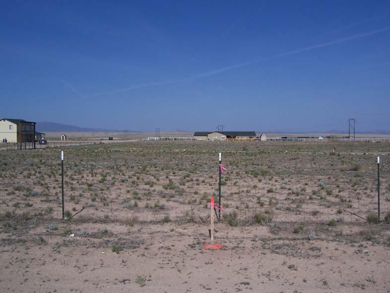
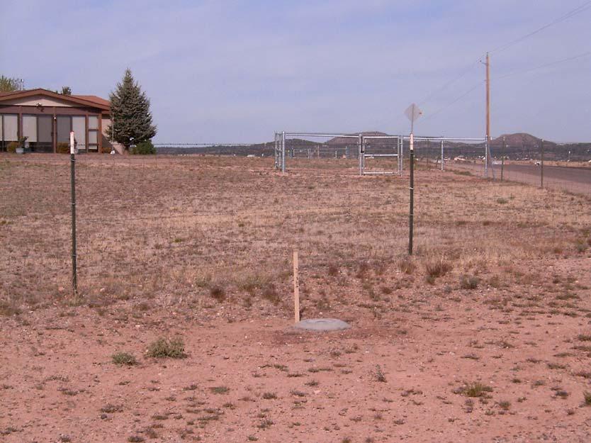
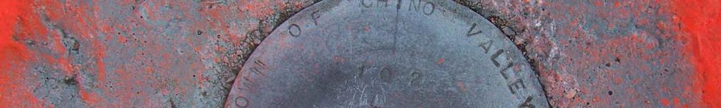
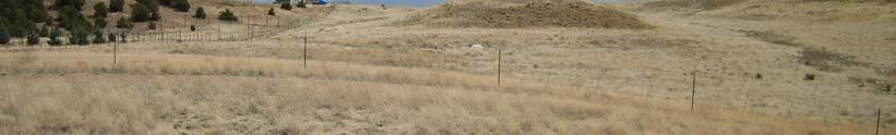
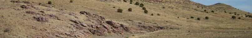
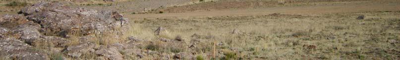
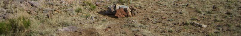
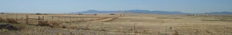
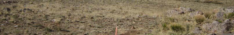
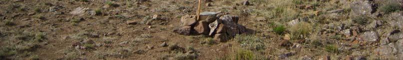
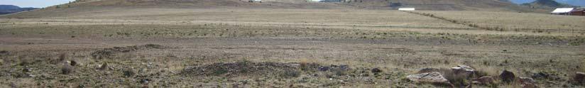
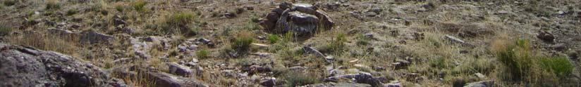
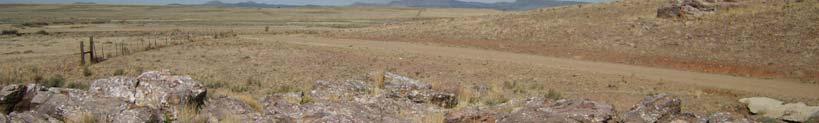
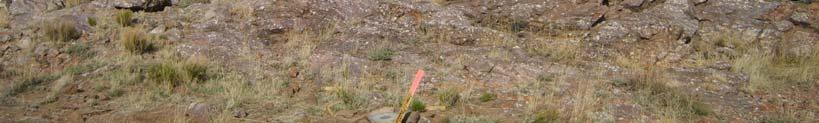
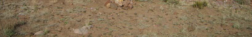
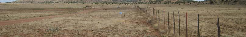
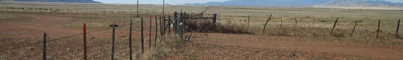
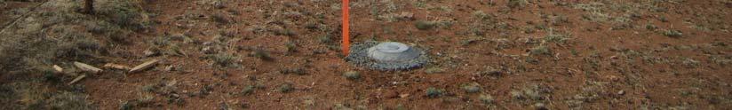
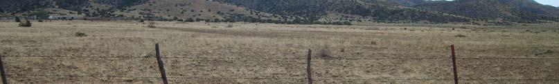
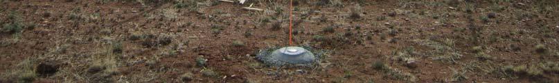
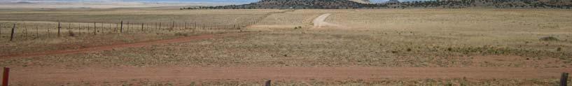
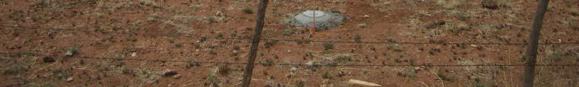
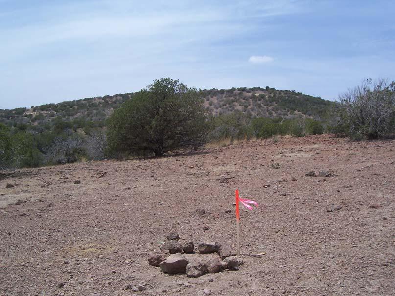
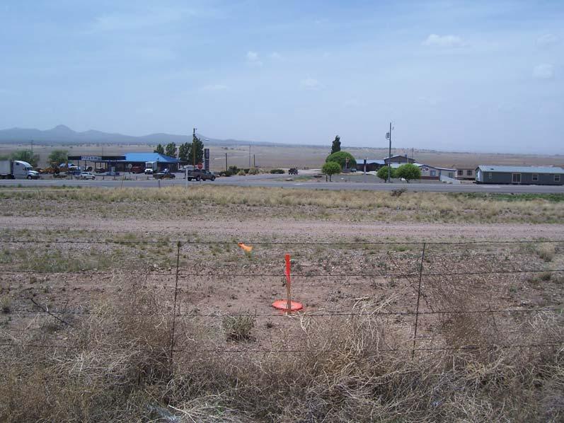
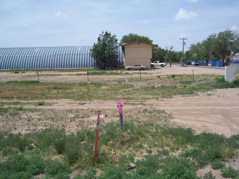
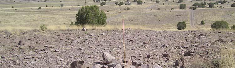
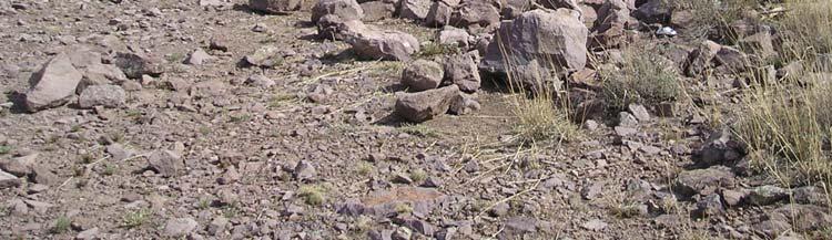
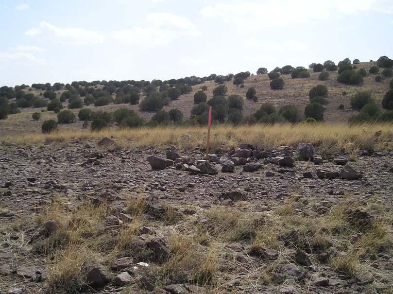
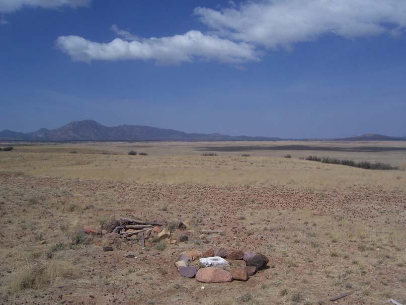
8 SURVEY MONUMENT RECORD DETAILS Page 8 of 70
9 Page 9 of 70
10 Page 10 of 70
11 Page 11 of 70

12 Page 12 of 70


13 North South Page 13 of 70

14 East West Page 14 of 70
15 Page 15 of 70
16 Page 16 of 70
17 Page 17 of 70

18 Page 18 of 70


19 North South Page 19 of 70

20 East West Page 20 of 70
21 Page 21 of 70
22 Page 22 of 70
23 Page 23 of 70


24 Page 24 of 70


25 North South Page 25 of 70
26 Page 26 of 70
27 Page 27 of 70
28 Page 28 of 70


29 Page 29 of 70


30 North South Page 30 of 70


31 East West Page 31 of 70
32 Page 32 of 70
33 Page 33 of 70
34 Page 34 of 70


35 Page 35 of 70


36 North South Page 36 of 70


37 East West Page 37 of 70
38 Page 38 of 70
39 Page 39 of 70
40 Page 40 of 70

41 Page 41 of 70


42 North South Page 42 of 70

43 East West Page 43 of 70
44 Page 44 of 70
45 Page 45 of 70
46 Page 46 of 70

47 Page 47 of 70

48 North South Page 48 of 70

49 East West Page 49 of 70

50 Page 50 of 70
51 Page 51 of 70
52 Page 52 of 70


53 Page 53 of 70

54 North South Page 54 of 70

55 East West Page 55 of 70

56 Page 56 of 70
57 Page 57 of 70
58 Page 58 of 70

59 Page 59 of 70


60 North South Page 60 of 70

61 East West Page 61 of 70

62 Page 62 of 70
63 Page 63 of 70
64 Page 64 of 70


65 Page 65 of 70


66 North South Page 66 of 70

67 East West Page 67 of 70
68 TOWN OF CHINO VALLEY DATUM CONVERSION SPREADSHEET Page 68 of 70
69 State Plane Coordinates (Meters) NAD83 (Conus) AZ Central Zone (epoch 2002) NAVD88 Name Latitude Longitude Height Northing Easting Elevation ' "N ' "W ' "N ' "W ' "N ' "W ' "N ' "W ' "N ' "W ' "N ' "W ' "N ' "W ' "N ' "W ' "N ' "W COTT 34 47' "N ' "W Prescott North Base Reset 34 50' "N ' "W Prescott South Base 34 41' "N ' "W AZAH 33 46' "N ' "W AZPE 33 34' "N ' "W FST ' "N ' "W State Plane Coordinates AZ Central, epoch 2002 (NAD ) to Chino Valley Survey Datum (CVSD) State Plane Coordinates (International Feet) Town of Chino Valley Survey Datum AZ Central Zone (epoch 2002) NAVD88 Name Northing Easting Elevation Northing Easting Elevation Centroid COTT Prescott North Base Reset Prescott South Base Page 69 of 70
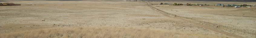
70 CONTROL MONUMENT LOCATION MAP Page 70 of 70
SURVEYING AND MAPPING, INC. COORDINATE DATA SHEET JOB: CITY OF DECATUR CLIENT: CITY OF DECATUR SAM JOB#:
 13 March 2001 SURVEYING AND MAPPING, INC. COORDINATE DATA SHEET JOB: CITY OF DECATUR CLIENT: CITY OF DECATUR SAM JOB#: 21038-20 HORIZONTAL DATUM: NAD-83 GEODETIC VERTICAL STATION ID LATITUDE LONGITUDE
HORIZONTAL PROJECTION PARAMETERS: DANE COUNTY COORDINATES
 Recommended RTK GPS Configuration Parameters for the City of Madison, WI Base Station Compiled by: Dan Rodman RLS, City of Madison (608)266-6674 drodman@cityofmadison.com For base station information see
4 Survey Datums. 4.1 Horizontal Datum Policy SURVEY DATUMS SEPTEMBER 2006
 4 Survey Datums Today s multi-organizational Project Development efforts require the use of common, accurate horizontal and vertical survey datums and consistent, precise control-survey procedures to ensure
GRAVITY SURVEY TEELS MARSH PROSPECT
 GRAVITY SURVEY over the TEELS MARSH PROSPECT MINERAL COUNTY, NV for Dajin Resources (US) Corp. March 2015 SUBMITTED BY Magee Geophysical Services LLC 465 Leventina Canyon Road Reno, Nevada 89523 USA TEL
Positioning the Pacific: NOAA s Geospatial Activities. Juliana Blackwell, Director NOAA s National Geodetic Survey March 6, 2012
 Positioning the Pacific: NOAA s Geospatial Activities Juliana Blackwell, Director NOAA s National Geodetic Survey March 6, 2012 A Common Problem of the Early 19 th Century 1807 President Thomas Jefferson
Control Surveys and Coordinate Systems
 Control Surveys and Coordinate Systems The Earth is Round Basic Shape of the Earth: Oblate Spheroid of Revolution The length of the equatorial axis is approximately 27 miles greater than the polar axis.
VT State Plane. Daniel J. Martin National Geodetic Survey VT Geodetic Advisor. VSLS Conference Rutland VT April 11, 2008
 VT State Plane Daniel J. Martin National Geodetic Survey VT Geodetic Advisor VSLS Conference Rutland VT April 11, 2008 Today s Outline Define the problem Review of VT State Plane System Relationship
BUILDING AN ACCURATE GIS
 BUILDING AN ACCURATE GIS 2006 GIS in the Rockies Denver, Colorado September 13, 2006 William E. Linzey United States Department of Commerce National Oceanic and Atmospheric Administration National Geodetic
The National Spatial Reference System of the Future
 The National Spatial Reference System of the Future William Stone Southwest Region (AZ, NM, NV, UT) Geodetic Advisor william.stone@noaa.gov NOAA s National Geodetic Survey geodesy.noaa.gov Salt Lake City
NATRF 2022 AND LDP OCTOBER 11, 2017
 NATRF 2022 AND LDP OCTOBER 11, 2017 MODERNIZATION OF THE NSRS Why? Leaving passive control marks behind and relying solely on the CORS network for 3D positions: Older methodology relies on terrestrial
GIS in Water Resources. Fall Homework #1
 GIS in Water Resources Fall 2015 Homework #1 Goal The goal of this homework is to reinforce the lecture material on Geodesy, Map Projections and Coordinate Systems by having you identify attributes and
ELECTRONICS DIVISION INTERNAL REPORT NO. 324
 NATIONAL RADIO ASTRONOMY OBSERVATORY Green Bank, West Virginia ELECTRONICS DIVISION INTERNAL REPORT NO. 324 NRAO 43m Antenna Coordinates and Angular Limits (Version 4) Glen Langston September 14, 2012
NGS and the Modernization of the National Spatial Reference System (NSRS)
") NGS and the Modernization of the National Spatial Reference System (NSRS) Dr. Dana Caccamise Pacific Southwest Region (CA,NV) Geodetic Advisor dana.caccamise@noaa.gov NOAA s National Geodetic Survey geodesy.noaa.gov
NGS and the Modernization of the National Spatial Reference System (NSRS) Dr. Dana Caccamise Pacific Southwest Region (CA,NV) Geodetic Advisor dana.caccamise@noaa.gov NOAA s National Geodetic Survey geodesy.noaa.gov
LEADS. The Essential Elements of a 3-D Geographic Coordinate
 The Essential Elements of a 3-D Geographic Coordinate John W. Dix 13 September 2005 ESRI Homeland Security GIS Summit - Denver, CO John.W.Dix@nga.mil NATIONAL GEOSPATIAL-INTELLIGENCE AGENCY Overview is
GISC3325 Spring 2011 Final Exam
 GISC3325 Spring 2011 Final Exam Name: Carefully read each question. Identify the important elements and the question being asked. Show your work for partial credit. No credit for undocumented wrong answers.
Fusion of Geodesy and GIS at NOAA s National Geodetic Survey
 Fusion of Geodesy and GIS at NOAA s National Geodetic Survey Esri Survey Summit July 6-9, 2013 San Diego, CA Michael Dennis, RLS, PE michael.dennis@noaa.gov The Plan Background NGS Data Explorer New Datasheet
ch02.pdf chap2.pdf chap02.pdf
 Introduction to Geographic Information Systems 8th Edition Karl Solutions Manual Full Download: http://testbanklive.com/download/introduction-to-geographic-information-systems-8th-edition-karl-solutions-manu
Georeferencing, Map Projections, Cartographic Concepts. -Coordinate Systems -Datum
 Georeferencing, Map Projections, Cartographic Concepts -Map Projections -Coordinate Systems -Datum Map projection is "the process of systematically transforming positions on the Earth's spherical surface
KEYSTONE PROPERTY GRAVITY GIS DATABASE. Residual Gravity Looking Down to Northwest
 KEYSTONE PROPERTY GRAVITY - 2018 GIS DATABASE Residual Gravity Looking Down to Northwest James L. Wright M.Sc. May 11, 2018 TABLE OF CONTENTS INTRODUCTION......................... 2 SURVEY PROCEDURE......................
TOWN OF WESTLAKE GPS CONTROL MONUMENTS 1-10
 GPS CONTROL MONUMENTS 1-1 GPS MONUMENT NO. 1 September 22, 1999 NAO 1983 (H.A.R.N. 1993) POSTON Latitude: Longitude: 32 58' 16.59982" N 97 1' 42.52797" W TEXAS GRD COORDNATES - North Central Zone (422)
Ground Truth Annual Conference. Optimized Design of Low Distortion Projections. Michael L. Dennis, RLS, PE
 Arizona Professional Land Surveyors Association 016 Annual Conference Ground Truth Optimized Design of Low Distortion Projections Michael L. Dennis, RLS, PE Version 3 (rev 1), May 016 Design and metadata
12/26/2012. Geographic Information Systems * * * * GIS (... yrezaei
 ( - Geographic Information Systems ( ( 1 2 3 Information System Data base DB IS IS DB (Knowledge ( ( (System (Information System - (Georefrence Analysis Data + Knowledge ======== Information 4 5 ( < 10%
Ground Truth Annual Conference. Design and Documentation of Low Distortion Projections for Surveying and GIS
 Professional Land Surveyors of Oregon 15 Annual Conference Ground Truth Design and Documentation of Low Distortion Projections for Surveying and GIS Michael L Dennis, RLS, PE v. (rev 1), January 15, Design
Frames for the Future New Datum Definitions for Modernization of the U.S. National Spatial Reference System
 Figure 10. Horizontal position differences (in meters) between NAD 83 and ITRF 08 at time 2022.00 (January 1, 2022). Positional differences are shown for the North American and Pacific tectonic plates.
What is a Map Projection?
 What is a Map Projection? It is how we represent a three dimensional Earth on a flat piece of paper However The process of transferring information from the Earth to a map causes every projection to distort
The U.S. National Spatial Reference System in 2022
 Presented at the, May 29 - June 2, 2017 in The U.S. National Spatial Reference System in 2022 Daniel R. Roman, (Chief Geodesist) NOAA s National Geodetic Survey 1 Why change? Outline Naming conventions
Spatial Data Collection using GPS: BEST PRACTICES
 Spatial Data Collection using GPS: BEST PRACTICES - 2007 Page 1 of 10 Best practices for GPS & Spatial Data Collection, Storage and Documentation These Best Practices are designed to maximize positional
GPS- vs. DEM-Derived Elevation Estimates from a Hardwood Dominated Forest Watershed
 Journal of Geographic Information System, 2010, 2, 147-151 doi:10.4236/jgis.2010.23021 Published Online July 2010 (http://www.scirp.org/journal/jgis) GPS- vs. DEM-Derived Elevation Estimates from a Hardwood
Introduction to Geographic Information Science. Updates/News. Last Lecture. Geography 4103 / Map Projections and Coordinate Systems
 Geography 4103 / 5103 Introduction to Geographic Information Science Map Projections and Coordinate Systems Updates/News Thursday s lecture Reading discussion 1 find the readings online open questions,
CONTROL MONUMENT REPORT
 CONTROL MONUMENT REPORT This document was prepared by Altus Geomatics for use by City of Yorkton staff and contractors working in and for the City of Yorkton. This document is meant to inform readers about
NGS Data Sheets for Rifle HARN Points
 NGS Data Sheets for Rifle HARN Points DATABASE = Sybase,PROGRAM = datasheet, VERSION = 6.98 1 National Geodetic Survey, Retrieval Date = MARCH 17, 2004 ***********************************************************************
REFERENCING COORDINATE SYSTEMS MAP PROJECTIONS GEOREFERENCING
 GIS in Ecology SPATIAL REFERENCING COORDINATE SYSTEMS MAP PROJECTIONS GEOREFERENCING : :1 Where on earth? Early mapmakers recognized the need for a system that could locate features on the earth's surface.
Height Modernization 2013 A New Canadian Vertical Datum
 Height Modernization 2013 A New Canadian Vertical Datum What is Height Modernization? The Height Reference System Modernization is a project at the Geodetic Survey Division (GSD) of Natural Resources Canada
Preventing Coordinate- System Confusion (maybe?)
") Preventing Coordinate- System Confusion (maybe?) Montana Association of Registered Land Surveyors 2008 Convention Bozeman, Montana 07 & 08 February 2008 Glenn Borkenhagen Inland GPS Inc. - Cody, Wyoming
Preventing Coordinate- System Confusion (maybe?) Montana Association of Registered Land Surveyors 2008 Convention Bozeman, Montana 07 & 08 February 2008 Glenn Borkenhagen Inland GPS Inc. - Cody, Wyoming
Meeting the ODOT Survey & Mapping Specifications
 Meeting the ODOT Survey & Mapping Specifications A Simple Solution Presented by Ray Foos, P.S, ODOT CADD & Mapping Services & Jon Keller, P.S., ODOT District 3 Phases of an ODOT Survey Project Research
METHODOLOGY & TESTING PROCEDURE
 METHODOLOGY & TESTING PROCEDURE Bartlett & West is committed to using the MidStates VRS system going forward into 2016. We realize that having a state wide VRS will mean a savings of time on our projects
Map Projections. What does the world look like? AITOFF AZIMUTHAL EQUIDISTANT BEHRMANN EQUAL AREA CYLINDRICAL
 Map Projections What does the world look like? AITOFF AZIMUTHAL EQUIDISTANT BEHRMANN EQUAL AREA CYLINDRICAL 1 CYLINDRICAL EQUAL AREA BONNE CRASTER PARABOLIC 2 ECKERT I ECKERT III ECKERT V There are many
Proceedings of the First International Conference on Civil Engineering, Assiut University, Volume 2, pp , October 7-8.
 Proceedings of the First International Conference on Civil Engineering, Assiut University, Volume 2, pp. 246-253, October 7-8. PRODUCTIVE GPS TOPOGRAPHIC MAPPING FOR NATIONAL DEVELOPMENT PROJECTS IN EGYPT
MODERNIZATION OF THE NSRS
 NATRF 2022 AND LDP SEPTEMBER 12, 2017 MODERNIZATION OF THE NSRS Why? Leaving passive control marks behind and relying solely on the CORS network for 3D positions: Older methodology relies on terrestrial
This Land Surveying course has been developed by Failure & Damage Analysis, Inc.
 This Land Surveying course has been developed by Failure & Damage Analysis, Inc. www.discountpdh.com DEPARTMENT OF THE ARMY U.S. Army Corps of Engineers CECW-EP Washington, DC 20314-1000 ETL 1110-1-183
CHAIRMAN OF THE JOINT CHIEFS OF STAFF INSTRUCTION
 CHAIRMAN OF THE JOINT CHIEFS OF STAFF INSTRUCTION J-3 CJCSI 3900.01C DISTRIBUTION: A, B, C, J POSITION (POINT AND AREA) REFERENCE PROCEDURES Reference: DODD 5105.60, 11 October 1996, National Imagery and
GEOGRAPHIC COORDINATE SYSTEMS
 GEOGRAPHIC COORDINATE SYSTEMS Introduction to GIS Winter 2015 What is Georeferencing? Used to establish a location on the Earth s surface 1 st order polynomial transformation Georeferencing toolbar What
EnvSci360 Computer and Analytical Cartography
 EnvSci360 Computer and Analytical Cartography Lecture 3 Geodesy Map Projections, Datums, and Coordinate Systems 1 Geodesy The science of measuring and representing the shape and size of the earth, and
SOURCE: NAVD88 (Computed using GEOID12B)
") Shared Solution https://www.ngs.noaa.gov/opus/getdatasheet.jsp?pid=... 1 of 1 10/2/2018, 2:52 PM Shared Solution PID: Designation: NYKT R1 Stamping: NYKT R1 2005 Stability: May hold commonly subject to
Shared Solution https://www.ngs.noaa.gov/opus/getdatasheet.jsp?pid=... 1 of 1 10/2/2018, 2:52 PM Shared Solution PID: Designation: NYKT R1 Stamping: NYKT R1 2005 Stability: May hold commonly subject to
Low Distortion Projections Part 2 Ground versus Grid
 Blue Marble Geographic Calculator provides an incredible variety of tools for working with an infinite combination of datums and projections. Shown here, I ve entered the parameters for a Low Distortion
Understanding Projections for GIS
 Presented by John Schaeffer Juniper GIS Services, Inc. This PowerPoint is available at JuniperGIS.com Presentation Objectives To understand basic concepts on projections and coordinate systems for the
Canadian Digital Elevation Data
 Natural Resources Canada Geomatics Canada Ressources naturelles Canada Géomatique Canada Canadian Digital Elevation Data Standards and Specifications Centre for Topographic Information Customer Support
Georeferencing. Place names Postal addresses Postal codes Coordinate systems (lat/long, UTM, etc.)
") Georeferencing Georeferencing Used to describe the act of assigning locations to data or information Certain requirements include that they are: unique, have shared meaning, and are persistent through
Georeferencing Georeferencing Used to describe the act of assigning locations to data or information Certain requirements include that they are: unique, have shared meaning, and are persistent through
Intro to GIS Fall 2010 Georeferencing & Map Projections
 Intro to GIS Fall 2010 Georeferencing & Map Projections SHAPE OF THE EARTH Earth's Shape Geoid: shape of earth minus topographic features (irregular due to local variations in gravity) Ellipsoid: elongated
When the Earth Was Flat. Measurements were made using a plumb bob, a spirit level, and a stick. Also, the Stars.
 ABSTRACT Defining the shape of the Earth geoid. Mathematical models spheroid or ellipsoid Mathematical projection of geodetic systems GIS/GPS technology The need for a unified projection systems World
GEOIDS FAQ. November
 GEOIDS FAQ 1. What is a geoid? A geoid is a representation of the equipotential surface of the Earth s gravity field. It can be thought of as a surface coinciding with the undisturbed mean sea level extended
Shape of the Earth. Data Output by the Receiver
 It is quite common for confusion to arise about the process used during a hydrographic survey when GPS-derived water surface elevation is incorporated into the data as an RTK Tide correction. This article
Geographic Information Systems class # 1 February 19, Coordinate reference systems in GIS: geodetic coordinates
 Geographic Information Systems class # 1 February 19, 2013 Coordinate reference systems in GIS: geodetic coordinates Manuel Campagnolo ISA Manuel Campagnolo (ISA) GIS/SIG 2012 2013 February 19, 2013 1
GIS in Water Resources Midterm Exam Fall 2016 There are four questions on this exam. Please do all four. They are not all of equal weight.
 Page 1 of 7 Name: GIS in Water Resources Midterm Exam Fall 2016 There are four questions on this exam. Please do all four. They are not all of equal weight. Question 1. (20%) (a) Three key functions of
2. GETTING STARTED WITH GIS
 2. GETTING STARTED WITH GIS What are geographic information systems and what are they used for? ArcGIS: ArcMap, ArcCatalog and ArcToolbox Vector data vs. raster data vs. attribute tables Polygons, polylines,
Boolean Operators and Topological OVERLAY FUNCTIONS IN GIS
 Boolean Operators and Topological OVERLAY FUNCTIONS IN GIS Query asking a question of the attribute data Standard Query Language (SQL) is used to query the data There are 4 basic statements used to get
Geog Lecture 29 Mapping and GIS Continued
 Geog 1000 - Lecture 29 Mapping and GIS Continued http://scholar.ulethbridge.ca/chasmer/classes/ Today s Lecture (Pgs 13-25, 28-29) 1. Hand back Assignment 3 2. Review of Dr. Peddle s lecture last week
ALLEGHENY COUNTY AIRPORT AUTHORITY PITTSBURGH INTERNATIONAL AIRPORT
 ALLEGHENY COUNTY AIRPORT AUTHORITY PITTSBURGH INTERNATIONAL AIRPORT SURVEYING STANDARDS AND RECOVERY NOTES Prepared by: BSC Group, Inc. 15 Elkins Street Boston, Massachusetts 02127 August 2003 Survey Standards
Lesson 5: Map Scale and Projections
 Organizing Data and Information Lesson 5: Map Scale and Projections Map Scales Projections Information can be organized as lists, numbers, tables, text, pictures, maps, or indexes. Clusters of information
Outline. Shape of the Earth. Geographic Coordinates (φ, λ, z) Ellipsoid or Spheroid Rotate an ellipse around an axis. Ellipse.
 Ellipsoid or Spheroid Rotate an ellipse around an axis. Ellipse.") Map Projections Outline Geodesy and map projections Prof. D. Nagesh Kumar Department of Civil Engineering Indian Institute of Science Bangalore 560 012, India http://www.civil.iisc.ernet.in/~nagesh Shape
Map Projections Outline Geodesy and map projections Prof. D. Nagesh Kumar Department of Civil Engineering Indian Institute of Science Bangalore 560 012, India http://www.civil.iisc.ernet.in/~nagesh Shape
Topographic Maps and Profiles
 Name: Date: Period: Earth Science Foundations The Physical Setting: Earth Science CLASS NOTES! Topographic Maps [contour maps] -! Topographic maps show three-dimensional shapes in two dimensions Elevation
This week s topics. Week 6. FE 257. GIS and Forest Engineering Applications. Week 6
 FE 257. GIS and Forest Engineering Applications Week 6 Week 6 Last week Chapter 8 Combining and splitting landscape features and merging GIS databases Chapter 11 Overlay processes Questions? Next week
Fundamentals of Surveying (LE/ESSE ) Lecture 10
 Lecture 10") Fundamentals of Surveying (LE/ESSE 2620 3.0) Lecture 10 Topographic Mapping Dr.-Ing. Jianguo Wang Geomatics Engineering York University Fall 2017 1 10-1 Introduction Two main types of maps: Line maps Orthophotographic
Fundamentals of Surveying (LE/ESSE 2620 3.0) Lecture 10 Topographic Mapping Dr.-Ing. Jianguo Wang Geomatics Engineering York University Fall 2017 1 10-1 Introduction Two main types of maps: Line maps Orthophotographic
GPS and Mean Sea Level in ESRI ArcPad
 Summary In order to record elevation values as accurately as possible with, it is necessary to understand how ArcPad records elevation. Rather than storing elevation values relative to Mean Sea Level (MSL),
Analytical and Computer Cartography Lecture 3: Review: Coordinate Systems
 Analytical and Computer Cartography Lecture 3: Review: Coordinate Systems Geographic Coordinates NAD83 NAD27 remained in use until the earthcentered international GRS80 was complete (Geodetic Reference
Positional Accuracy of the Google Earth Imagery In The Gaza Strip
 Positional Accuracy of the Google Earth Imagery In The Gaza Strip Maher A. El-Hallaq Associate Professor of Surveying Civil Engineering Department The Islamic University of Gaza, Palestine mhallaq@iugaza.edu.ps
Height systems. Rudi Gens Alaska Satellite Facility
 Rudi Gens Alaska Satellite Facility Outline Why bother about height systems? Relevant terms Coordinate systems Reference surfaces Geopotential number 2 Why bother about height systems? give a meaning to
Coordinate Systems. Location on earth is defined by coordinates
 Coordinate Systems We think of the earth as a sphere It is actually a spheroid (ellipsoid), slightly larger in radius at the equator than at the poles Shape of the Earth Location on earth is defined by
NR402 GIS Applications in Natural Resources Lesson 4 Map Projections
 NR402 GIS Applications in Natural Resources Lesson 4 Map Projections From http://www.or.blm.gov/gis/ 1 Geographic coordinates Coordinates are expressed as Latitude and Longitude in Degrees, Minutes, Seconds
How does an ellipsoid differ from a sphere in approximating the shape and size of the Earth?
 Chapter 02 Test Bank Worksheet Questions 1. What is a map projection? Topic: Map Projection 2. How does an ellipsoid differ from a sphere in approximating the shape and size of the Earth? Topic: Ellipsoid
WHERE ARE YOU? Maps & Geospatial Concepts Fall 2015
 WHERE ARE YOU? Maps & Geospatial Concepts Fall 2015 Where are you? Relative location I m at school Absolute Location 45 26 18.07 122 43 50.78 Where is Boston? Introducing Geodesy, Ellipsoids & Geoids Geodesy
Scott A. True Project Scientist Geodesy & Geophysics Division Basic and Applied Research Office InnoVision Directorate
 EGM96 Variable Resolution Geoid Implementation Error in GEOTRANS 2.3 Scott A. True Project Scientist Geodesy & Geophysics Division Basic and Applied Research Office InnoVision Directorate Introduction
WHERE ARE YOU? Maps & Geospatial Concepts Fall 2012
 WHERE ARE YOU? Maps & Geospatial Concepts Fall 2012 Where are you? Relative location I m at school Absolute Location 45 26 18.07 122 43 50.78 Datums Datums A reference surface of the Earth Used as the
10/24/2017. Determining Location. Where in the World are We Geodetically Speaking. Meades Ranch
 Determining Location Where in the World are We Geodetically Speaking Meades Ranch 1 How do we find the Mark? KG0640 DESCRIBED BY COAST AND GEODETIC SURVEY 1948 (MZB) KG0640 STATION IS LOCATED ABOUT 12
Using UNAVCO Real-Time CORS Data, a No-Cost Positioning Resource
 Using UNAVCO Real-Time CORS Data, a No-Cost Positioning Resource By: Mark Silver, ms@igage.com, +1-801-412-0011 Date: 19 August 2014 UNAVCO is a non-profit consortium of Universities that coordinates the
Bathymetry Data and Models: Best Practices
 Bathymetry Data and Models: Best Practices Barry Eakins & Lisa Taylor The NOAA National Geophysical Data Center Over 600 data types - from the core of the Earth to the surface of the Sun NGDC Bathymetry
GPS Strain & Earthquakes Unit 3: Finding location and velocity data for PBO GPS stations
 GPS Strain & Earthquakes Unit 3: Finding location and velocity data for PBO GPS stations Original activity by Vince Cronin (Baylor University). Revisions by Beth Pratt-Sitaula (UNAVCO). Analyzing the velocities
What Do You See? FOR 274: Forest Measurements and Inventory. Area Determination: Frequency and Cover
 What Do You See? Message of the Day: Many options exist to determine the size, area, or extent of a feature on a landscape FOR 274: Forest Measurements and Inventory Lecture 7: Measures of Land Area Frequency
Laboratory Exercise #2 Introduction to Quadrangle Maps
 page - Laboratory Exercise #2 Introduction to Quadrangle Maps A. Introduction to Quadrangle Maps The United States Geological Survey has developed a nationwide series of quadrangle maps that cover small
Achieving Great Height with GNSS
 Achieving Great Height with GNSS Oregon GPS Users Group 2015 Annual Meeting January 23, 2015 Salem, Oregon Salem Convention Center Michael Dennis, RLS, PE Oregon State University National Geodetic Survey
Technical Support: Data Submission
 Why do we want your data? How should I observe data for submission? The objective behind data submissions is to leverage ongoing field work to provide industry with an up-todate network of NAD83 (CSRS)
Basic Map Skills for the Outdoors
 Geography 80-20 80% of what there is to know, for 20% of the sweat Basic Map Skills for the Outdoors Map Scale Map source: US Geological Survey Four ways to indicate map scale: Representative fraction
DEPARTMENT OF ENVIRONMENTAL PROTECTION Bureau of Watershed Management
 DEPARTMENT OF ENVIRONMENTAL PROTECTION Bureau of Watershed Management DOCUMENT NUMBER: 392-0830-001 TITLE: Locational Data Policy for Water Allocation Program and the Water Use Data System EFFECTIVE DATE:
Mapping coordinate systems
 Mapping coordinate systems 1. The Earth's Graticule Latitude and Longitude The graticule is the imaginary grid of lines running east-west (lines of latitude = parallels) and north-south lines of longitude
GIS in Water Resources Fall 2018 Homework #1
 GIS in Water Resources Fall 2018 Homework #1 Goal The goal of this homework is to reinforce the lecture material on Geodesy, Map Projections and Coordinate Systems by having you identify attributes and
A PRIMER ON COORDINATE SYSTEMS Commonly Used in Michigan
 A PRIMER ON COORDINATE SYSTEMS Commonly Used in Michigan David P. Lusch, Ph.D., GISP Department of Geography Remote Sensing & GIS Research and Outreach Services Group Michigan State University September,
Geodetics: Implications for GIS Professionals May 10, 2018
 Experts in Geomatics, Surveying, Positioning, Geospatial Data, and Mapping Sciences Geodetics: Implications for GIS Professionals May 10, 2018 Michael Barnes APSG Education Foundation Chair 2010-2020 APSG
National Oilwell Varco Survey Report
 Note: KOP @ 8,995' per e-mail dated 08/20/2015 from Operator. The vertical portion of well is plugged off from TD to KOP. OXY USA Andrews County University DC 1H Surveys: 131`MD - 12280`MD National Oilwell
SECTION 4 PARCEL IDENTIFIERS 4.1 LONGITUDE AND LATITUDE
 SECTION 4 PARCEL IDENTIFIERS 4.1 LONGITUDE AND LATITUDE Most maps must be drawn in such a way that points and areas can be located accurately on the earth's surface and described objectively. A uniform
1/28/16. EGM101 Skills Toolbox. Oblate spheroid. The shape of the earth Co-ordinate systems Map projections. Geoid
 EGM101 Skills Toolbox Oblate spheroid The shape of the earth Co-ordinate systems Map projections The geoid is the shape that the surface of the oceans would take under the influence of Earth's gravitation
Distance Determination between the MINOS Detectors for TOF Measurements. Dr. Virgil Bocean Alignment & Metrology Department Fermilab
 Distance Determination between the MINOS Detectors for TOF Measurements Dr. Virgil Bocean Alignment & Metrology Department Fermilab 1 1 Introduction Part of the neutrino research program at Fermilab is
Modernization of the National Spatial Reference System 2022 Datum. Jacksonville Chapter July 2018
 Modernization of the National Spatial Reference System 2022 Datum Jacksonville Chapter July 2018 Randy Tompkins, PSM, PLS Geomatics Project Manager Surveyor, Hydrographer, & Geodesist DRMP, Inc. Jacksonville,
CE 316 GEOMATICS COURSE NOTES DR. MOIR D HAUG, C.L.S., P. ENG. JANUARY 2012
 CE 316 GEOMATICS COURSE NOTES DR. MOIR D HAUG, C.L.S., P. ENG. JANUARY 2012 0 COURSE INFORMATION Dr Moir D Haug, P. Eng University Office 2B25 Engineering 966 5355 moir.haug@usask.ca MDH Engineered Solutions
Shape e o f f the e Earth
 1 Coordinate Systems & Projections Coordinate Systems Two map layers are not going to register spatially unless they are based on the same coordinate system. 2 Contents Shape of the earth Datum Projections
Height systems. Rüdiger Gens
 Rüdiger Gens 2 Outline! Why bother about height systems?! Relevant terms! Coordinate systems! Reference surfaces! Geopotential number! Why bother about height systems?! give a meaning to a value defined
Lab 9: Satellite Geodesy (35 points)
") Lab 9: Satellite Geodesy (35 points) Here you will work with GPS Time Series data to explore plate motion and deformation in California. This lab modifies an exercise found here: http://www.unavco.org:8080/cws/pbonucleus/draftresources/sanandreas/
Lab 9: Satellite Geodesy (35 points) Here you will work with GPS Time Series data to explore plate motion and deformation in California. This lab modifies an exercise found here: http://www.unavco.org:8080/cws/pbonucleus/draftresources/sanandreas/
Geospatial Data Standards Considerations for the delivery of 2D and 3D spatial data February 2019
 Geospatial Data Standards Considerations for the delivery of 2D and 3D spatial data February 2019 Prepared by: GRCA Geomatics Version Date Summary of Changes Changes Made By: 1.00 March 16, 2018 Version
Road Scholar. Williamette Valley Invitational Practice Tournament
 Road Scholar Williamette Valley Invitational Practice Tournament Rules for this Event As you complete this event, enter your answers on the online data sheet. You may click "submit" when done and quietly
CHAPTER EXIT CHAPTER. Models of Earth. 3.1 Modeling the Planet. 3.2 Mapmaking and Technology. 3.3 Topographic Maps CHAPTER OUTLINE
 EXIT CHAPTER.1 Modeling the Planet.2 Mapmaking and Technology. Topographic Maps CHAPTER OUTLINE CHAPTER.1 Modeling the Planet A flat of Earth is a convenient tool, but it can distort the shape, distance,
METADATA. Publication Date: Fiscal Year Cooperative Purchase Program Geospatial Data Presentation Form: Map Publication Information:
 METADATA CONTOURS Digital Geospatial Metadata: North Central Texas Orthophotography Identification Information Citation Originator: Publication Date: Fiscal Year 2001-2002 Title: Cooperative Purchase Program