A Glimpse at Geodetic Activities in Latin America
|
|
|
- Allison Porter
- 5 years ago
- Views:
Transcription
1 UNIVERSIDADE DO ESTADO DO RIO DE JANEIRO CENTRO DE TECNOLOGIA E CIÊNCIAS FACULDADE DE ENGENHARIA DEPARTAMENTO DE ENGENHARIA CARTOGRÁFICA A Glimpse at Geodetic Activities in Latin America Prof. Luiz Paulo Souto Fortes, PhD GGOS Coordinating Board member-at-large GGOS Day 2016 Harvard Smithsonian Center for Astrophysics October 24-27, 2016
2 Contents Introduction SIRGAS UN-GGIM: Americas Final remarks

3 Geospatial Information layers Geodesy Cartography Natural Resources Territorial boundaries Geography Statistics Geodetic information corresponds to the basic layer of National Spatial Data Infrastructures, providing positional reference to any territorial component

4 Importance of a unified and precise Geodetic Reference System Example: construction accident in São Paulo in 2001 when a GPS controlled machine hit a oil pipe due to the use of inconsistent reference systems 2,000 people had to leave their homes for 28h Highway blocked for 12hs Fortunately, no people injured

5 SIRGAS A multi-national initiative Before SIRGAS South American countries adopted different reference systems causing problems to define borders, for mapping, etc. PSAD56, SAD69, Bogotá, Yacaré, Campo Unchauspe Classical systems not accurate comparing to GNSS Establishment of the SIRGAS Project Conference in October 1993, Asunción, Paraguay Objectives To define and establish a geocentric reference system for the continent To define and establish a geocentric datum To define and establish a unified vertical datum

6 South American Geocentric Reference System ( ) Geocentric Reference System for the Americas (2001- ) IAG Subcomission 1.3b: Reference Frames / Regional Reference Frames / South and Central America PAIGH Working Group SIRGAS, as a reference system, is defined identically to the International Terrestrial Reference System (ITRS) SIRGAS, as a reference frame, is a regional densification of the International Terrestrial Reference Frame (ITRF)


7 SIRGAS Structures along the journey (source:
 to June 4, 1995,")

 An extremely well executed project Wolfgang")
8 First SIRGAS Campaign THE FIRST (1995) CAMPAIGN: From May , 00:00h (UTC) to June 4, 1995, 24:00hs (UTC) 58 stations 30 institutions 11 countries 8 3 processing centres TOTAL 58 (source: An extremely well executed project Wolfgang Torge, President of IAG, XXI IUGG General Assembly 1995, Boulder
 184 stations 24")
 (source:")
9 From May 10, 2000, 00:00h (UTC) to May 19, 2000, 24:00hs (UTC) 184 stations 24 countries THE Second SECOND SIRGAS CAMPAIGN: Campaign 2000 (2000) (source:
 Oct 2016: ~400 stations, with 59 out of them belonging to IGS Monitors the SIRGAS frame (source: www.sirgas.")
10 SIRGAS-CON Network SIRGAS Continuous Operation Network GNSS stations with coordinates and velocities determined with very high accuracy (referred to a specific epoch) Oct 2016: ~400 stations, with 59 out of them belonging to IGS Monitors the SIRGAS frame (source:

11 Time series - NAUS (Manaus - Brazil)
 Linígrafo GPS 1,0 0,6 0,2-0,2-0,6-1,0 28/12/2005 28/12/2006 28/12/2007 28/12/2008 28/12/2009 28/12/2010 28/12/2011 28/12/2012 28/12/2013 Data")
12 Variação (-1,1) Time series NAUS station height vs. river water level Linígrafo x GPS - (Normalizado 1 e -1) Linígrafo GPS 1,0 0,6 0,2-0,2-0,6-1,0 28/12/ /12/ /12/ /12/ /12/ /12/ /12/ /12/ /12/2013 Data ~ 13 km Δh (max) ~ 11 cm ΔZ (max) ~ 16 m Bevis et al. Seasonal fluctuations in the mass of the Amazon River system and Earth s elastic response. Geophysical Research Letters, Vol. 32, L16308, pp. 1-4, 2005
 Prof. Luiz Paulo S.")
13 GNSS CORS heights in and around the Amazon (source: Prof. Luiz Paulo S. Fortes Geodésia Básica 13
, and VEMOS2015 (right) referred to IGb08 (Sánchez and Drewes 2016) (source: www.sirgas.")
14 Velocity Models for South America and the Caribbean VEMOS2009 (left) referred to the ITRF2005 (Drewes and Heidbach 2012), and VEMOS2015 (right) referred to IGb08 (Sánchez and Drewes 2016) (source:
15 Adoption of a SIRGAS Reference Frame Resolution 4 of the 7 th UNRCC-A (2001) recommended the adoption of a SIRGAScompatible reference frame by countries of the Americas Resolution 7 of the 8 th UNRCC-A recommended the integration of Central America and Caribbean countries to SIRGAS SIRGAS supported the solution of Ecuador and Peru boundary conflict, the longest one in the Americas (since 1800s!) Currently: 20 member countries South America: 12 Central America: 6 North America: 1 Caribbean: 1 Country National Reference Frame Argentina ITRF2005, epoch Bolivia SIRGAS95, epoch Brazil SIRGAS2000, epoch Chile SIRGAS2000, epoch Colombia SIRGAS95, epoch Costa Rica ITRF2000, epoch Ecuador SIRGAS95, epoch El Salvador SIRGAS, epoch French Guyana ITRF93, epoch Guatemala SIRGAS Mexico ITRF2008, epoch Panama SIRGAS2000, epoch Peru SIRGAS95, epoch Uruguay SIRGAS95, epoch Venezuela SIRGAS95, epoch (source:
 Be associated to a specific reference")
16 SIRGAS Vertical Reference System Based on a geometrical component (SIRGAS ellipsoidal heights) and a physical component (W 0 as a reference level and geopotential numbers as primary coordinates) It should refer to a unified global reference level W 0 Be given by proper physical heights (derived from spirit levelling in combination with gravity reductions) Be associated to a specific reference epoch Next activity: SIRGAS WG III Workshop, Nov 21-25, 2016, Quito, Ecuador (source: Brunini et al. 2011,


17 Gravity Data and the Geoid GEOID2015 Colorful points represent recent surveys (source: Blitzkow et. al., 2015,
 Assessment of SIRGAS capabilities for distributing GNSS corrections and associated data in real time using NTRIP (Networked Transport of RTCM via Internet")
18 Other SIRGAS Activities Ionospheric analysis Universidad Nacional de La Plata (Argentina), official SIRGAS Analysis Centre for the Ionosphere, produces maps of vertical total electron content for the region SIRGAS in Real Time (SIRGAS-RT) Assessment of SIRGAS capabilities for distributing GNSS corrections and associated data in real time using NTRIP (Networked Transport of RTCM via Internet Protocol) or other similar methods Capacity building in the region Based on many SIRGAS schools, workshops, simposia,... SIRGAS 2016 Symposium: Nov 16-18, Quito, Ecuador Fortaleza Combining geodetic techniques (SLR and VLBI) to optimize reference system realization in Latin America Capacity building project approved by PAIGH Workshop to be held in 2017 O Higgins Laser Ranging and VLBI Stations (source: adapted from ilrs.gsfc.nasa.gov & ivscc.gsfc.nasa.gov)

19 IBGE-PPP Service (Brazil) In operation since April 2009 Uses CSRS-PPP tool, developed by Geodetic Survey Division of Natural Resources Canada (NRCan) Horizontal coordinates referred to SIRGAS2000 propagated to using SIRGAS Velocity Model VEMOS2009 GPS static and kinematic results available 2:30 hs after of survey Spatial distribution of IBGE-PPP results (source: IBGE) GPS&GLONASS results 36 hs after of survey ~15,000 processed stations per month
20 UN-GGIM: Americas United Nations Global Geospatial Information Management (UN-GGIM) Sub-committee for the Americas Formerly PC-IDEA: Permanent Committee on Geospatial Data Infrastructure for the Americas Working Groups Standards and Technical Specifications Integration of Statistical and Geospatial Information Access and Use of Geospatial Information in Disaster Risk Reduction and Climate Change Regional Coordination and Cooperation (focused on the Caribbean) Promotion and Assessment of Spatial Data Infrastructures (SDI) Institutional links in the region PAIGH - PC-IDEA SIRGAS Joint Action Plan PAIGH UN-GGIM Americas SIRGAS Joint Action Plan both to expedite the development of spatial data infrastructure of the Americas More information on
21 Final Remarks SIRGAS established a very connected network of institutions and people across Latin America its most valuable asset! UN General Assembly Resolution of Feb 26, 2015 on Global Geodetic Reference Frame for Sustainable Development First in history in the area of geoespatial information! Acknowledges the importance of a coordinated global approach for Geodesy Proposes a multilateral cooperation in Geodesy, including geospatial data sharing, capacity building in developing countries and the establishment of international standards and specifications Totally aligned with the efforts carried out in the scope of SIRGAS since 1993 towards the modernization and unification of the Geodetic Reference System of the Americas Establishment of a permanent UN-GGIM Sub-Committee on Geodesy at the UN-GGIM sixth session in New York last August This scenario represents a unique opportunity for IAG/GGOS to foster its activities - globally and regionally!
Geocentric Reference System for the Americas 4th Session UN-GGIM Americas April 2017, Santiago, Chile
 Geocentric Reference System for the Americas 4th Session UN-GGIM Americas April 2017, Santiago, Chile María Virginia Mackern Vicepresidente SIRGAS Consejo Nacional de Investigaciones Científicas y Técnicas,
Incorporation of the Caribbean to the Geocentric Reference System for the Americas SIRGAS
 Incorporation of the Caribbean to the Geocentric Reference System for the Americas SIRGAS W. Martínez M. V. Mackern V. Cioce R. Rodino S.R. De Freitas UN-GGIM: Americas Third Session, October 5 2016, Mexico
SIRGAS: Basis for Geosciences, Geodata, and Navigation in Latin America
 SIRGAS: Basis for Geosciences, Geodata, and Navigation in Latin America Claudio Brunini President of SIRGAS Universidad Nacional de La Plata, Argentina María Virginia Mackern President of SIRGAS/WG-I:
PAN AMERICAN INSTITUTE OF GEOGRAPHY AND HISTORY Specialized Organization of the OAS
 PAN AMERICAN INSTITUTE OF GEOGRAPHY AND HISTORY Specialized Organization of the OAS 10 th UNRCC Americas United Nations, New York, 20 August 2013 PAIGH, SIRGAS, PC-IDEA and GeoSUR 2013-2015 Joint Action
UN-GGIM:Americas Regional Report
 UN-GGIM:Americas Regional Report 2016-2017 Seventh Session of UN-GGIM 2-4 August 2017, United Nations Headquarters, New York. Rolando Ocampo President of UN-GGIM: Americas Content Activities, Areas of
CHILEAN PART OF SIRGAS REFERENCE FRAME, REALIZATION, ADOPTION, MAINTENANCE AND ACTUAL STATUS. Geodesy for Planet Earth IAG 2009, Buenos Aires
 CHILEAN PART OF SIRGAS REFERENCE FRAME, REALIZATION, ADOPTION, MAINTENANCE AND ACTUAL STATUS Geodesy for Planet Earth IAG 2009, Buenos Aires Ing. Héctor Parra hparra@igm.cl, IGM Chile Dr. Juan Báez jbaez@udec.cl,
REGIONAL REFERENCE FRAMES: THE IAG PERSPECTIVE
 REGIONAL REFERENCE FRAMES: THE IAG PERSPECTIVE João Agria Torres SPUIAGG IAG Sub-commission 1.3: Regional Reference Frames jatorres@iol.pt 1. About the IAG CONTENT 2. Objectives and organization of SC
Report of Uruguay The National Spatial Data Infrastructure
 Report of Uruguay The National Spatial Data Infrastructure Prepared for High-Level Forum on Global Geospatial Information Management (GGIM) and Inaugural Session of the UN Committee of Experts on GGIM
PC-IDEA Final Report of Activities
 PC-IDEA Final Report of Activities Luiz Paulo Souto Fortes President of PC-IDEA 10 th United Nations Regional Cartographic Conference for the Americas 19-23 August 2013, New York, United States Permanent
Military Geographic Institute
 New Chilean Reference Frame, 3 years after Maule Earthquake 90 YEARS SUPORTING THE NATIONAL DEVELOPMENT Major Julio Neira Gutierrez (MSc) Head of Geodetic Department & GDB Military Geographic Institute
Working Group 1. Geodetic Reference Frame. Activity Report. for. The UN-GGIM-AP Plenary Meeting
 Regional Committee of United Nations Global Geospatial Information Management for Asia and the Pacific (UN-GGIM-AP) Established by a United Nations Resolution Working Group 1 Geodetic Reference Frame Activity
The Pan American Institute of Geography and History (PAIGH) North America National Mapping Meeting May 10, 2018
 North America National Mapping Meeting May 10, 2018") The Pan American Institute of Geography and History (PAIGH) North America National Mapping Meeting May 10, 2018 Pan American Institute of Geography and History (PAIGH) PAIGH was founded in 1928 and their
The Pan American Institute of Geography and History (PAIGH) North America National Mapping Meeting May 10, 2018 Pan American Institute of Geography and History (PAIGH) PAIGH was founded in 1928 and their
Policies towards SDI development and implementation in the Americas
 Policies towards SDI development and implementation in the Americas Valéria Oliveira Henrique de Araújo Executive Secretary of CP-IDEA Brazilian Institute of Geography and Statistics - IBGE Geospatial
Development Of Common Frameworks And Methodologies *
 HIGH LEVEL FORUM ON GLOBAL GEOSPATIAL MANAGEMENT INFORMATION WORKING PAPER No. 9 First Forum Seoul, Republic of Korea, 24-26 October 2011 Development Of Common Frameworks And Methodologies * * Submitted
2018/1 The integration of statistical and geospatial information. The Regional Committee of UN-GGIM: Americas:
 The following are the conclusions and recommendations of the Regional Committee of the United Nations on Global Geospatial Information Management for the Americas, during its Fifth Session, Thursday 8
Geospatial Information Management in the Americas: Lessons for the Post-2015 development agenda
 Geospatial Information Management in the Americas: Lessons for the Post-2015 development agenda Rolando Ocampo President, UN-GGIM: Americas October 2014 The integration of statistical and geographical
Strategy for the Realization of the International Height Reference System (IHRS)
") Deutsches Geodätisches Forschungsinstitut (DGFI-TUM) Technische Universität München Strategy for the Realization of the International Height Reference System (IHRS) Laura Sánchez 1, Johannes Ihde 2, Roland
Deutsches Geodätisches Forschungsinstitut (DGFI-TUM) Technische Universität München Strategy for the Realization of the International Height Reference System (IHRS) Laura Sánchez 1, Johannes Ihde 2, Roland
Brazilian National Spatial Data Infrastructure (INDE): Applicability for Large Scale Data
: Applicability for Large Scale Data") Brazilian National Spatial Data Infrastructure (INDE): Applicability for Large Scale Data Andrea Lopes Iescheck*, Marco Aurélio Dorneles** * Federal University of Rio Grande do Sul UFRGS, Institute of
Brazilian National Spatial Data Infrastructure (INDE): Applicability for Large Scale Data Andrea Lopes Iescheck*, Marco Aurélio Dorneles** * Federal University of Rio Grande do Sul UFRGS, Institute of
Consideration of a Global Vertical Reference System (GVRS) in the IERS Conventions
 in the IERS Conventions") Consideration of a Global Vertical Reference System (GVRS) in the IERS Conventions Johannes Ihde Federal Agency for Cartography and Geodesy (BKG) Chair of IAG ICP1.2 (2003-2007) Vertical Reference Frames
Consideration of a Global Vertical Reference System (GVRS) in the IERS Conventions Johannes Ihde Federal Agency for Cartography and Geodesy (BKG) Chair of IAG ICP1.2 (2003-2007) Vertical Reference Frames
Report of the Regional Committee of UN-GGIM for Asia and the Pacific (UN-GGIM-AP)
") Report of the Regional Committee of UN-GGIM for Asia and the Pacific (UN-GGIM-AP) At the Eighth Session of UN-GGIM UN Headquarters, New York, 1 3 August 2018 About UN-GGIM-AP One of the five regional committees
Report of the Regional Committee of UN-GGIM for Asia and the Pacific (UN-GGIM-AP) At the Eighth Session of UN-GGIM UN Headquarters, New York, 1 3 August 2018 About UN-GGIM-AP One of the five regional committees
Background Document: Report of the Regional Committee of United Nations Global Geospatial Information Management for Asia and the Pacific
 Background Document: Report of the Regional Committee of United Nations Global Geospatial Information Management for Asia and the Pacific 1. Summary 1. This report highlights the activities carried out
El proyecto Sistema de Observación Geodésico Global [Global Geodetic Observing System (GGOS)] de la Asociación Internacional de Geodesia (IAG)
![El proyecto Sistema de Observación Geodésico Global [Global Geodetic Observing System (GGOS)] de la Asociación Internacional de Geodesia (IAG)](/thumbs/79/79010389.jpg "El proyecto Sistema de Observación Geodésico Global [Global Geodetic Observing System (GGOS)] de la Asociación Internacional de Geodesia (IAG)") El proyecto Sistema de Observación Geodésico Global [Global Geodetic Observing System (GGOS)] de la Asociación Internacional de Geodesia (IAG) Hermann Drewes Deutsches Geodätisches Forschungsinstitut (DGFI)
El proyecto Sistema de Observación Geodésico Global [Global Geodetic Observing System (GGOS)] de la Asociación Internacional de Geodesia (IAG) Hermann Drewes Deutsches Geodätisches Forschungsinstitut (DGFI)
Making Sense of Evolving Reference Frames for North America
 Making Sense of Evolving Reference Frames for North America Mike Craymer Geodetic Survey Division, Natural Resources Canada Giovanni Sella U.S. National Geodesy Survey American Geophysical Union 2007 Joint
GeoSUR Award Sixth Competition (2017)
") GeoSUR Award Sixth Competition (2017) GeoSUR was created in 2007 with the financial backing of the CAF and in joint coordination with the Pan American Institute of Geography and History (PAIGH). The fundamental
GeoSUR Award Sixth Competition (2017) GeoSUR was created in 2007 with the financial backing of the CAF and in joint coordination with the Pan American Institute of Geography and History (PAIGH). The fundamental
EuroGeoSurveys & ASGMI The Geological Surveys of Europe and IberoAmerica
 EuroGeoSurveys & ASGMI The Geological Surveys of Europe and IberoAmerica Geological Surveys, what role? Legal mandate for data & information: Research Collection Management Interpretation/transformation
ECONOMIC AND SOCIAL COUNCIL
 UNITED NATIONS E/CONF.102/3 ECONOMIC AND SOCIAL COUNCIL Nineteenth United Nations Regional Cartographic Conference for Asia and the Pacific Bangkok, 29 October 1 November 2012 Item 4 of the provisional
The Global Geodetic Observing System (GGOS) of the International Association of Geodesy (IAG)
 of the International Association of Geodesy (IAG)") The Global Geodetic Observing System (GGOS) of the International Association of Geodesy (IAG) Hermann Drewes Representative of the International Union of Geodesy and Geophysics (IUGG) to the Cartographic
The Global Geodetic Observing System (GGOS) of the International Association of Geodesy (IAG) Hermann Drewes Representative of the International Union of Geodesy and Geophysics (IUGG) to the Cartographic
EUREF 2014 Resolutions. Z. Altamimi, C. Bruyninx, R. Dach, M. Lidberg, M. Poutanen, W. Sohne, J. Torres, M. Greaves
 EUREF 2014 Resolutions Z. Altamimi, C. Bruyninx, R. Dach, M. Lidberg, M. Poutanen, W. Sohne, J. Torres, M. Greaves Resolution 1 considering the United Nations Committee of Experts on Global Geospatial
A Strategic Plan for Geodesy in Sweden. Mikael Lilje Lars E. Engberg Geodesy Department Lantmäteriet Sweden
 A Strategic Plan for Geodesy in Sweden Mikael Lilje Lars E. Engberg Geodesy Department Lantmäteriet Sweden Our vision is to be able to meet Swedish society s needs for a homogeneous, sustainable geodetic
GGOS Bureau for Standards and Conventions
 GGOS D. Angermann (1), T. Gruber (2), J. Bouman (1), M. Gerstl (1), R. Heinkelmann (1), U. Hugentobler (2), L. Sánchez (1), P. Steigenberger (2) (1) Deutsches Geodätisches Forschungsinstitut (DGFI), München
Report for 15th PCGIAP Meeting at 18th UNRCC-AP Working Group 1 Regional Geodesy
 Report for 15th PCGIAP Meeting at 18th UNRCC-AP Working Group 1 Regional Geodesy Chairman Shigeru Matsuzaka, Japan - shigeru@gsi.go.jp Vice Chairman Prof. Pengfei Cheng, China - chengpf@casm.ac.cn John
Vertical Reference Frame Pacific
 Vertical Reference Frame Pacific Andrick Lal SPC Geoscience Division GIS&RS User Conference 29 th November 2016 USP, Fiji. What does it mean? All buildings and features have a height. But what is it relative
From PCGIAP to UN GGIM AP: A Regional Perspective on GGIM
 Regional Committee of United Nations Global Geospatial Information Management for Asia and the Pacific (UN-GGIM-AP) Established by a United Nations Resolution From PCGIAP to UN GGIM AP: A Regional Perspective
Tide Gauge Benchmark Monitoring Need for Reprocessing in Europe. Tilo Schöne & the IGS TIGA Working Group
 Tide Gauge Benchmark Monitoring Need for Reprocessing in Europe Tilo Schöne & the IGS TIGA Working Group Vertical Tide Gauge Control Long-term stable and consistent frame to relate globally distributed
International Gravity Field Service (IGFS)
") IAG-Services: International Gravity Field Service (IGFS) 477 International Gravity Field Service (IGFS) http://www.gravityfield.org Chairman: Renè Forsberg (Denmark, 2011-2013) - Riccardo Barzaghi (Italy,
IAG-Services: International Gravity Field Service (IGFS) 477 International Gravity Field Service (IGFS) http://www.gravityfield.org Chairman: Renè Forsberg (Denmark, 2011-2013) - Riccardo Barzaghi (Italy,
Reference frames and positioning
 The APREF Project: an Improved Geodetic Infrastructure for Asia and the Pacific (4861) John Dawson (Australia), Graeme Blick (New Zealand), Manoj Deo, Guorong Hu and Gary Johnston (Australia) Reference
2013 Cartographic Country Report Uruguay **
 ADVANCE UNEDITED VERSION UNITED NATIONS _ STATISTICS DIVISION E/CONF.103/IP.5 Tenth United Nations Regional Cartographic Conference for the Americas New York, 19-23, August 2013 Item 6(b) of the provisional
Organization of American States PAN AMERICAN INSTITUTE OF GEOGRAPHY AND HISTORY
 Organization of American States PAN AMERICAN INSTITUTE OF GEOGRAPHY AND HISTORY REPORT ON ACTIVITIES March 2016 February 2017 http://www.ipgh.org 2 Contents Basic Information Pan American Institute for
Regional Report UN-GGIM:Americas
 Regional Report UN-GGIM:Americas 2014-2015 June 26, 2015 1 1. Summary The Initiative of the United Nations Global Geospatial Information Management for the Americas (UN-GGIM: Americas) was created in August
GGOS, ECGN and NGOS: Global and regional geodetic observing systems. Markku Poutanen Finish Geodetic Institute
 GGOS, ECGN and NGOS: Global and regional geodetic observing systems Markku Poutanen Finish Geodetic Institute Contents GGOS, ECGN, NGOS Why? How? Future? (geodesy) GGOS Structure GGOS Structure European
Reference Frame in Practice Workshop 1A
 Reference Frame in Practice Workshop 1A Status of Geodetic Infrastructure in the Pacific Region Case Studies Rob Sarib - FIG Commission 5 Vice Chair of Administration Welcome! Bula! Who are the International
EDITORS ARTURO VILLIGER ROLF DACH ASTRONOMICAL INSTITUTE UNIVERSITY OF BERN
 TECHNICAL REPORT 2016 EDITORS ARTURO VILLIGER ROLF DACH ASTRONOMICAL INSTITUTE UNIVERSITY OF BERN International GNSS Service International Association of Geodesy International Union of Geodesy and Geophysics
UN-GGIM: Europe GRF-Europe. Markku Poutanen
 UN-GGIM: Europe GRF-Europe Markku Poutanen Global Geodetic Reference Frame GGRF The UN Committee of Experts on Global Geospatial Information Management (UN-GGIM) decided in July 2013 to formulate and facilitate
Positioning in the Pacific Islands
 Positioning in the Pacific Islands Andrick Lal United Nations/Nepal Workshop on the Applications of Global Navigation Satellite Systems Kathmandu - Nepal 15 th December 2016 Presentation Outline Introduction
Frames for the Future New Datum Definitions for Modernization of the U.S. National Spatial Reference System
 Figure 10. Horizontal position differences (in meters) between NAD 83 and ITRF 08 at time 2022.00 (January 1, 2022). Positional differences are shown for the North American and Pacific tectonic plates.
Next Generation Australian Datum. Permanent Committee on Geodesy, ICSM
 Next Generation Australian Datum Permanent Committee on Geodesy, ICSM 2 Presentation: Next Generation Australian Datum Trends in the geospatial sector The Geocentric Datum of Australia 1994 (GDA94) Progress
Report of PCGIAP to the 18 th United Nations Regional Cartographic Conference for Asia and the Pacific (UNRCC-AP) for the period
 for the period") Permanent Committee on GIS Infrastructure for Asia and the Pacific (PCGIAP) Established in 1995 by a United Nations Resolution Report of PCGIAP to the 18 th United Nations Regional Cartographic Conference
Permanent Committee on GIS Infrastructure for Asia and the Pacific (PCGIAP) Established in 1995 by a United Nations Resolution Report of PCGIAP to the 18 th United Nations Regional Cartographic Conference
Global Geodetic Reference Frame GGRF & Implications for GNSS
 Global Geodetic Reference Frame GGRF & Implications for GNSS On behalf of Gary Johnston Chair GIAC, Ruth Neilan Vice Chair, Global Geodetic Observing System ICG-9 Prague, 10 November 2014 UN GGRF Working
GGOS INFORMATION MODELS: ANALYSIS OF INTERRELATIONS BETWEEN OBSERVATION TECHNIQUES AND THE EARTH GRAVITY FIELD
 GGOS INFORMATION MODELS: ANALYSIS OF INTERRELATIONS BETWEEN OBSERVATION TECHNIQUES AND THE EARTH GRAVITY FIELD Wojciech Pachelski 1) Małgorzata Paśnicka-Pawłowska 2) Karolina Szafranek 3) Agnieszka Zwirowicz
UN Resolution on GGRF ( and its implementation in Europe)
") Presented at the FIG Working Week 2017, UN Resolution on GGRF ( and its implementation in Europe) May 29 - June 2, 2017 in Helsinki, Finland Markku Poutanen, FGI Contents Global Geodetic Reference Frame
Presented at the FIG Working Week 2017, UN Resolution on GGRF ( and its implementation in Europe) May 29 - June 2, 2017 in Helsinki, Finland Markku Poutanen, FGI Contents Global Geodetic Reference Frame
Dependences in the pillar Earth s gravity field of
 Reports on Geodesy, vol. 92, no. 1, 2012 Dependences in the pillar Earth s gravity field of GGOS - description using UML notation Małgorzata Paśnicka 1, Karolina Szafranek 2, Agnieszka Zwirowicz Rutkowska
Challenges in Geospatial Policy Formulation and Programme Management
 Challenges in Geospatial Policy Formulation and Programme Management Luiz Paulo Souto Fortes, PhD An Exchange with the Geospatial Industry for UN-GGIM Seoul, October 23, 2011 BRAZIL Land area 8,514,876.599
Global reference systems and Earth rotation
 current realizations and scientific problems Aleksander Brzeziński 1,2, Tomasz Liwosz 1, Jerzy Rogowski 1, Jan Kryński 3 1 Department of Geodesy and Geodetic Astronomy Warsaw University of Technology 2
GEORED Project: GNSS Geodesy Network for Geodynamics Research in Colombia, South America. Héctor Mora-Páez
 GEORED Project: GNSS Geodesy Network for Geodynamics Research in Colombia, South America. Héctor Mora-Páez Colombian Geological Survey UNAVCO SCIENCE MEETING Feb 27 March 1, 2012 Boulder, CO, TECTONIC
Pan American Institute of Geography and History. 12th MACHC 5-9 December 2011
 Pan American Institute of Geography and History 12th MACHC 5-9 December 2011 1 PAIGH Mission and Objectives To encourage, coordinate, and publicize cartographical, geographical, geophysical and historical
Strategic Framework on Geospatial Information and Services for Disasters Relevance for the Americas Region
 Strategic Framework on Geospatial Information and Services for Disasters Relevance for the Americas Region Seventh Session of the Committee of Experts on UN-GGIM Side Event --- UN Headquarters, New York
BUILDING AN ACCURATE GIS
 BUILDING AN ACCURATE GIS 2006 GIS in the Rockies Denver, Colorado September 13, 2006 William E. Linzey United States Department of Commerce National Oceanic and Atmospheric Administration National Geodetic
Frequent epoch reference frames instead of instant station positions and constant velocities
 Deutsches Geodätisches Forschungsinstitut Technische Universität München (DGFI-TUM) Frequent epoch reference frames instead of instant station positions and constant velocities Hermann Drewes Deutsches
Global vertical datum unification based on the combination of the fixed gravimetric and the scalar free geodetic boundary value problems
 Global vertical datum unification based on the combination of the fixed gravimetric and the scalar free geodetic boundary value problems Laura Sánchez contribution to the IAG-IC.: Vertical Reference Frames
GEOSUR PROGRAM. Geospatial Information for the South American Integration
 GEOSUR PROGRAM Geospatial Information for the South American Integration Eric van Praag, Jesús Suniaga Andean Development Corporation (Corporación Andina de Fomento CAF, in Spanish) Information Needs of
Geodesy on the move. Craig Allinson. Dealing with dynamic coordinate reference systems. IOGP Geodesy Subcommittee. EPUG London, November 2017
 Geodesy on the move Dealing with dynamic coordinate reference systems Craig Allinson IOGP Geodesy Subcommittee EPUG London, November 2017 Why the concern? A bridge too far Historic geodesy mental image
Global & National Geodesy, GNSS Surveying & CORS Infrastructure
 Global & National Geodesy, GNSS Surveying & CORS Infrastructure Chris Rizos School of Surveying & Spatial Information Systems University of New South Wales, Sydney, Australia President-elect, International
Economic and Social Council
 KLOO-OOOQ UNITED NATIONS E Economic and Social Council Distr LIMITED E/CONF.92/L. 11 11 April 2000 ORIGINAL: ENGLISH FIFTEENTH UNITED NATIONS REGIONAL CARTOGRAPHIC CONFERENCE FOR ASIA AND THE PACIFIC Kuala
The European Surveying Plot A surveying map of land property: A proposal and it s perspectives
 The European Surveying Plot A surveying map of land property: A proposal and it s perspectives Nikolaos KALAMAKIS, Greece Key words: INSPIRE, Interoperability, National Geographic Organizations, technical
United States NSRS 2022: Terrestrial Reference Frames
 United States NSRS 2022: Terrestrial Reference Frames Daniel ROMAN, U.S.A. Key words: Capacity building; Positioning; Reference frames; Reference systems, Cadastre SUMMARY In 2022, the United States will
Cooperation is the key, FIG can facilitate
 Cooperation is the key, FIG can facilitate Mikael Lilje Vice President 2017-2020 Head, Geodetic infrastructure, Swedish mapping, cadastral and land registration authority Presented at the GIS/RS Conference
EPUSP. ( Escola Politécnica da Universidade de São Paulo
 EPUSP Escola Politécnica da Universidade de São Paulo Present and Future of the gravity surveys and geoid model in South America Denizar Blitzkow Ana Cristina Oliveira Cancoro de Matos Gabriel do Nascimento
UN-GGIM: An Overview Stefan Schweinfest, Director (UNSD) Bangkok, 27 March 2015
 Bangkok, 27 March 2015") UN-GGIM: An Overview Stefan Schweinfest, Director (UNSD) Bangkok, 27 March 2015 ggim.un.org UN-GGIM: A global initiative Formal inter-governmental UN Committee of Experts to: Discuss, enhance and coordinate
UN-GGIM: An Overview Stefan Schweinfest, Director (UNSD) Bangkok, 27 March 2015 ggim.un.org UN-GGIM: A global initiative Formal inter-governmental UN Committee of Experts to: Discuss, enhance and coordinate
Modernization of National Geodetic Datum in China *
 UNITED NATIONS E/CONF.102/IP.16 ECONOMIC AND SOCIAL COUNCIL Nineteenth United Nations Regional Cartographic Conference for Asia and the Pacific Bangkok, 29 October 1 November 2012 Item 6(b) of the provisional
Alice Abreu Director of ICSU-LAC. AGU The Meeting of the Americas 2010 Foz do Iguaçu, Brazil * 8 12 August
 The ICSU Regional Office for Latin America and the Caribbean: a new opportunity for collaboration in Understanding and Managing Risk Associated with Natural Hazards Alice Abreu Director of ICSU-LAC AGU
International Union of Geodesy and Geophysics. Resolutions
 International Union of Geodesy and Geophysics Resolutions ADOPTED BY THE COUNCIL AT THE XXVI GENERAL ASSEMBLY PRAGUE, CZECH REPUBLIC (22 JUNE 2 JULY 2015) 0 Page Resolution 1: Role of Ocean in Climate
FIG Asia Pacific Capacity Development Network
 FIG Asia Pacific Capacity Development Network Report to the 41th General Assembly FIG Congress 2018, Istanbul - Turkey Rob Sarib Chair FIG Asia Pacific Capacity Development Network (AP CDN) Story of the
gabga Regional Report UN-GGIM: Americas
 gabga Regional Report UN-GGIM: Americas 2017-2018 June, 2018 CONTENT 1. Background 2. Objective 3. Activities Work Areas 3.1. Working Groups 3.1.1. Working Group on Integration of Statistical and Geospatial
Inventory of United Nations Resolutions on Cartography Coordination, Geographic Information and SDI 1
 Inventory of United Nations Resolutions on Cartography Coordination, Geographic Information and SDI I. Resolutions on Cartography Coordination and Establishment of United Nations Regional Cartographic
Activities in South America: Gravity and Geoid Projects
 Activities in South America: Gravity and Geoid Projects Segundo Taller de Grupo de Trabajo I SIRGAS Montevideo - Uruguay May 26 a 30, 2008 Maria Cristina Pacino Universidade de Rosário CGED - IBGE Denizar
Tenth United Nations Regional Cartographic Conference for the Americas New York, August Proposed Organization of Work
 Tenth United Nations Regional Cartographic Conference for the Americas New York, 19-23 August 2013 Proposed Organization of Work UN-GGIM and the Americas, addressing global challenges through geospatial
From Global to National Geodetic Reference Frames: how are they connected and why are they needed?
 From Global to National Geodetic Reference Frames: how are they connected and why are they needed? Zuheir ALTAMIMI Institut National de l Information Géographique et Forestière, France Vice-President,
Connectivity in the LAC region
 Cristián Varas, Speedchecker Ltd. Agustín Formoso, Lacnic Labs Connectivity in the LAC region A study made by LACNIC Labs and Speedchecker Ltd. Outline The challenge of measuring regions not well covered
Javier Corrales Professor of Political Science Amherst College, Amherst, MA September 2013
 Javier Corrales Professor of Political Science Amherst College, Amherst, MA jcorrales@amherst.edu September 2013 Sections I. Progress thus far II. Homophobia across and within III. Conventional independent
Update on the International Terrestrial Reference Frame (ITRF) : ITRF2014. Zuheir Altamimi
 : ITRF2014. Zuheir Altamimi") Update on the International Terrestrial Reference Frame (ITRF) : ITRF2014 Zuheir Altamimi Head of the IERS ITRF Product Center IAG Vice President IGN, France E-mail: zuheir.altamimi@ign.fr Key Points Introduction:
Update on the International Terrestrial Reference Frame (ITRF) : ITRF2014 Zuheir Altamimi Head of the IERS ITRF Product Center IAG Vice President IGN, France E-mail: zuheir.altamimi@ign.fr Key Points Introduction:
Reference Systems Realization for the Territory of Bulgaria - Status and Perspectives
 Conference and plenary meeting of the Permanent Committee on Cadastre in the European Union 13-15 March 2018, Sofia Reference Systems Realization for the Territory of Bulgaria - Status and Perspectives
Crustal motion geodesy in Bolivia
 Crustal motion geodesy in Bolivia Jacob Heck 1, Michael Bevis 1, Arturo Echalar 2, Dana Caccamise 1, Kevin Ahlgren 1,3, Ben Brooks 4, David Raleigh 1, Jonathan Weiss 4 1 Ohio State University - USA 2 Instituto
XXII GENERAL ASSEMBLY OF MINISTERS AND MAXIMUM AUTHORITIES OF HOUSING AND URBANISM OF LATIN AMERICA AND THE CARIBBEAN
 XXII GENERAL ASSEMBLY OF MINISTERS AND MAXIMUM AUTHORITIES OF HOUSING AND URBANISM OF LATIN AMERICA AND THE CARIBBEAN Taking into account: Santiago, Chile 1 and 2 October 2013 DECLARATION OF SANTIAGO 1.
Introduction to time-use surveys
 Regional seminar on time-use surveys Introduction to time-use surveys Kingstown, Saint Vincent and the Grenadines 10-11 December 2014 Iliana Vaca Lucía Scuro Division of Gender Affairs WHAT IS TIME? Measured
Economic and Social Council 19 June 2013
 ADVANCE UNEDITED VERSION UNITED NATIONS E/C.20/2013/16/Add.1 Economic and Social Council 19 June 2013 Committee of Experts on Global Geospatial Information Management Third session Cambridge, United Kingdom
Role and importance of the International Terrestrial Reference Frame for sustainable development
 Role and importance of the International Terrestrial Reference Frame for sustainable development This report is provided for the benefit of participants of the UNRCC-PCGIAP Informal Geodetic Consultation,
UN GGIM and National SDI Strategy
 MSDI Open Forum on 26 th January 2016 Contributing to the successful delivery of MSDI UN GGIM and National SDI Strategy Hiroshi Murakami Deputy Administrator Geospatial Information Authority of Japan Geospatial
Positioning a nation for the future: Modernizing the United States National Spatial Reference System
 Positioning a nation for the future: Modernizing the United States National Spatial Reference System Dr. Dana Caccamise USA Representative Pacific Southwest Region Geodetic Advisor dana.caccamise@noaa.gov
Fundamental Station Wettzell - geodetic observatory -
 Fundamental Station Wettzell - geodetic observatory - Wolfgang Schlüter Bundesamt für Kartographie und Geodäsie, Fundamental Station Wettzell Germany Radiometer Workshop, Wettzell, 10.10.06 Evolvement
Mapping Brazil in 1:250,000 scale. João Bosco de Azevedo
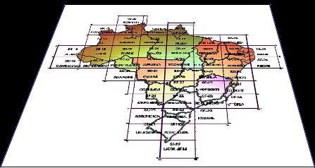
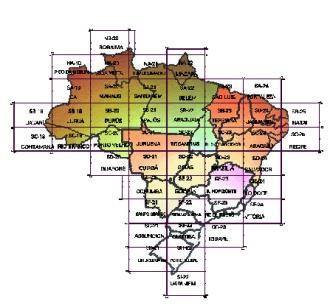
 Mapping Brazil in 1:250,000 scale João Bosco de Azevedo Belo Horizonte, outubro de 2005 Brazil in figures The Brazilian territory attracts attention because of its area, the fifth largest area of the world.
PAN AMERICAN INSTITUTE FOR GEOGRAPHY AND HISTORY
 Organization of American States PAN AMERICAN INSTITUTE FOR GEOGRAPHY AND HISTORY 47th MEETING OF THE DIRECTING COUNCIL REPORT OF THE GENERAL SECRETARY RODRIGO BARRIGA VARGAS November 2015 http://www.ipgh.org
WGCapD Support to AmeriGEOSS Week Disaster Training Report
 WGCapD Support to AmeriGEOSS Week Disaster Training Report 1 6-9 June 2016 CEOS WGCapD Support to AmeriGEOSS Week Disaster training DRAFT REPORT Hosted by: The government's Institute of Hydrology, Meteorology,
Capacity Building Activities at CRECTEALC. Ing. Jerjes Molina Blancas Professor and Developer.
 Capacity Building Activities at CRECTEALC Ing. Jerjes Molina Blancas Professor and Developer. Centro Regional de Enseñanza de Ciencia y Tecnología del Espacio para América Latina y el Caribe (CRECTEALC)
PAN AMERICAN INSTITUTE FOR GEOGRAPHY AND HISTORY
 Organization of American States PAN AMERICAN INSTITUTE FOR GEOGRAPHY AND HISTORY REPORT ON ACTIVITIES March 2015 to February 2016 http://www.ipgh.org Contents Basic Information... 4 Institutional Strategies...
Publ. Astron. Obs. Belgrade No. 91 (2012), REALIZATION OF ETRF2000 AS A NEW TERRESTRIAL REFERENCE FRAME IN REPUBLIC OF SERBIA
, REALIZATION OF ETRF2000 AS A NEW TERRESTRIAL REFERENCE FRAME IN REPUBLIC OF SERBIA") Publ. Astron. Obs. Belgrade No. 91 (2012), 199-206 Contributed paper REALIZATION OF ETRF2000 AS A NEW TERRESTRIAL REFERENCE FRAME IN REPUBLIC OF SERBIA D. BLAGOJEVIĆ and V. VASILIĆ Faculty of Civil Engineering,
Publ. Astron. Obs. Belgrade No. 91 (2012), 199-206 Contributed paper REALIZATION OF ETRF2000 AS A NEW TERRESTRIAL REFERENCE FRAME IN REPUBLIC OF SERBIA D. BLAGOJEVIĆ and V. VASILIĆ Faculty of Civil Engineering,
A Unique Reference Frame: Basis of the Global Geodetic Observing System (GGOS) for Geodynamics and Global Change
 for Geodynamics and Global Change") SRTM (InSAR) A Unique Reference Frame: Basis of the Global Geodetic Observing System (GGOS) for Geodynamics and Global Change Hermann Drewes President IAG Commission 1 Reference Frames Deutsches Geodätisches
SRTM (InSAR) A Unique Reference Frame: Basis of the Global Geodetic Observing System (GGOS) for Geodynamics and Global Change Hermann Drewes President IAG Commission 1 Reference Frames Deutsches Geodätisches
Proceedings of the First International Conference on Civil Engineering, Assiut University, Volume 2, pp , October 7-8.
 Proceedings of the First International Conference on Civil Engineering, Assiut University, Volume 2, pp. 246-253, October 7-8. PRODUCTIVE GPS TOPOGRAPHIC MAPPING FOR NATIONAL DEVELOPMENT PROJECTS IN EGYPT
Faatasi Malologa (PGSC Chair) Director Department of Lands & Survey, Tuvalu
 Director Department of Lands & Survey, Tuvalu") Seventh Session of the United Nations Committee of Experts on Global Geospatial Information Management (UN-GGIM) - 31 July -4 August 2017 Faatasi Malologa (PGSC Chair) Director Department of Lands & Survey,
Seventh Session of the United Nations Committee of Experts on Global Geospatial Information Management (UN-GGIM) - 31 July -4 August 2017 Faatasi Malologa (PGSC Chair) Director Department of Lands & Survey,
Case Study of Australia
 Case Study of Australia John Dawson, Geoscience Australia 1 Australia s Geodetic eco-system Geocentric Coordinates Observing Infrastructure Height Datum Geoid Models Tools Services Standards 2 Australia
Bengt Kjellson Chair of the Executive Committee UN-GGIM: Europe. 2 nd Joint UN-GGIM: Europe ESS Meeting 11 th March 2016, Luxembourg
 Bengt Kjellson Chair of the Executive Committee UN-GGIM: Europe 2 nd Joint UN-GGIM: Europe ESS Meeting 11 th March 2016, Luxembourg A global geospatial mandate At its 47th plenary in July 2011, ECOSOC,