REDUCING NON-UNIQUENESS IN SATELLITE GRAVITY INVERSION USING SEISMIC TOMOGRAPHY AND 3D OBJECT ORIENTED IMAGE ANALYSIS TECHNIQUES
|
|
|
- Arleen Wiggins
- 5 years ago
- Views:
Transcription

1 REDUCING NON-UNIQUENESS IN SATELLITE GRAVITY INVERSION USING SEISMIC TOMOGRAPHY AND 3D OBJECT ORIENTED IMAGE ANALYSIS TECHNIQUES ISLAM FADEL MARK VAN DER MEIJDE NORMAN KERLE
2 Research Topic: Reducing the non-uniqueness of satellite gravity inversion using constraints based on 3D seismic tomography data applying 3D Object Oriented Image Analysis (OOA).
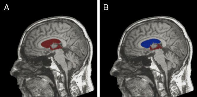
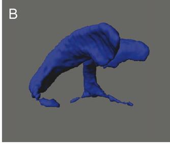
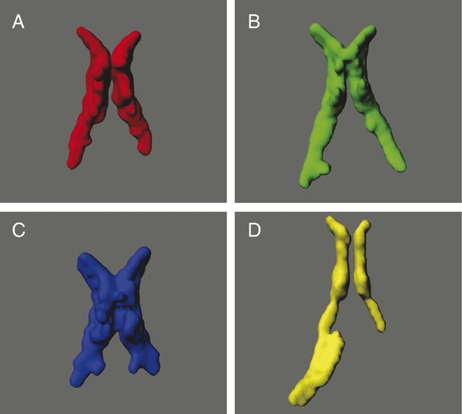
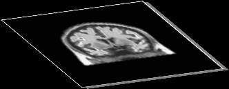
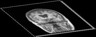


3 3D OOA (Bio-medical) Recent Image analysis technique. Ruleset = Set of classification criteria Extract 3D objects from 3D image stacks. Schӧnmeyer et al. (2006)


4 3D OOA (Geosciences) Extract 3D objects from LiDAR point cloud. Example by ecognition community:


 Subsurface Interpretation of layers and objects then forward")

5 How did the non-uniqueness of satellite gravity been recently reduced? The non-uniqueness has been reduced using seismic data. 3D Seismic Tomography Cammarano et al., 2011 Conversion functions Velocity Density Mishra et al. (2012) Ebbing et al. (2001) Subsurface Interpretation of layers and objects then forward modeling using estimated density values. Additional uncertainties due to the dependency on other physical parameters: Temperature Pressure Composition Trial and error. Usually 2D over profiles. NEW 3D structures from 3D seismic tomography data constrain the inversion of satellite gravity.


6 The Methodology The problem of the non-uniqueness has been divided into 2 sub-problems: The non-uniqueness The shape of the subsurface objects The values of the density contrasts of these objects?? Reduced using 3D OOA of 3D seismic tomography model. Reduced using Object-based inversion and Forward Modeling.
7 The Methodology 3D seismic tomography model (4) Object-based inversion (1) 3D OOA (3) Reconstruct the objects in IGMAS+ (5) Forward modeling (2) Classify the subsurface objects (6) Evaluate


. (Adams et al.")
8 Study Area From 3D tomography model and literature the study area mainly composed of : Tanzania Craton. Eastern and Western rift branches. Low velocity anomaly (start ~ at 250 km depth). (Adams et al., 2012) (Adams et al., 2012)

9 1-3D OOA results Results 2- Objects-Reconstruction 3- Object-based inversion


10 3D OOA Results Use of 3D histogram and visual interpretation. Homogeneity and discontinuity characteristics to extract 3D objects. 3D histogram upper mantle part km


11 Object-Based inversion (Upper Mantle) Object-Based Inversion Measured signal EIGEN6C2 Craton Rift Rift 70 % correlation Boundary Calculated signal from the upper mantle part. Low velocity Boundary km Deep High velocity Construction Process km km 1000


12 Objects-Based Inversion (Crustal Part) Object-Based Inversion MOHO Measured signal EIGEN6C2 95 % correlation Crust Calculated signal from the full model. Moho Upper Mantle m k Add layers represent the crustal part from the 3D tomography model. 0.0 km m k The Moho (Tugume et al. (in press))

13 Objects-Based Inversion Calculated signal Measured signal EIGEN6C2 The difference between the measured and the calculated signal from the full model.
14 Upper Mantle Crust Density Contrast Values Object Density Contrast (t/m3) Unit 1 (U1) Unit 2 (U2) Unit 3 (U3) Unit 4 (U4) Unit 5 (U5) MOHO MOHO Craton (C) Shallow High Velocity (SHV) Boundary Shallow High Velocity (BSHV) Rift (R) Boundary Shallow Low Velocity (BSLV) Low Velocity Zone (LV) Inner Low Velocity (ILV) Boundary Deep Low Velocity (BDLV) Deep High Velocity (DHV) Reference 0 Correlation Standard deviation 11
15 Conclusion and Recommendations A new methodology was developed and tested to reduce the non-uniqueness of the gravity modeling. 3D OOA can extract the 3D objects from 3D geophysical data. The methodology was able to reduce the non-uniqueness of the shape of the subsurface objects. However, the density contrast estimation needs to be constrained. The object based inversion approach is very promising and fast. However, IGMAS+ needs to be developed to allow the user to put boundary conditions for density contrast estimations.
, http://dx.doi.org/10.1016/j.")
16 THANK YOU For more details: Fadel, I., Kerle, N., van der Meijde, M., D object-oriented image analysis of geophysical data. Geophysical Journal International, /gji/ggu139. Fadel, I., et al., 3D object-oriented image analysis in 3D geophysical modelling: Analysing the central part of the East African Rift System. Int. J. Appl. Earth Observ. Geoinf. (2013), References Adams, A., Nyblade, A., Weeraratne, D., Upper mantle shear wave velocity structure beneath the East African plateau: evidence for a deep, plateauwide low velocity anomaly. Geophysical Journal International 189 (1), Götze, H., Lahmeyer, B., Application of three-dimensional interactive modeling in gravity and magnetics. Geophysics 53 (8), Schmidt, S., Götze, H., Fichler, Ch.,A.M., IGMAS+: a new 3D gravity, FTG and magnetic modelling software. Extended abstract. Geoinformatik, Schmidt, S., Plonka, C., Götze, H., Lahmeyer, B., Hybrid modelling of gravity, gravity gradients and magnetic fields. Geophysical Prospecting 59 (6, SI), Schӧenmeyer, R., Prvulovic, D., Rotarska-Jagiela, A., Haenschel, C., Linden, D. E. J., Automated segmentation of lateral ventricles from human and primate magnetic resonance images using cognition network technology. Magnetic Resonance Imaging 24 (10), Tugume, F., Nyblade, A., Julia, J., van der Meijde, M., Precambrian crustal structure in Africa and Arabia: evidence lacking for secular variation. Tectonophysics (in press).
scale Three-dimensional Modelling
 Lithospheric-scale scale Three-dimensional Modelling (Application to the EARS and Plateau) Girma Woldetinsae (Geological Survey of Ethiopia) and H.-J. Götze R. Hackney S. Schmidt (Institut für Geowissenschaften
Crustal thinning between the Ethiopian and East African plateaus from modeling Rayleigh wave dispersion
 GEOPHYSICAL RESEARCH LETTERS, VOL. 33,, doi:10.1029/2006gl025687, 2006 Crustal thinning between the Ethiopian and East African plateaus from modeling Rayleigh wave dispersion Margaret H. Benoit, 1 Andrew
Geophysical Journal International
 Geophysical Journal International Geophys. J. Int. (2012) 189, 123 142 doi: 10.1111/j.1365-246X.2012.05373.x Upper mantle shear wave velocity structure beneath the East African plateau: evidence for a
28th Seismic Research Review: Ground-Based Nuclear Explosion Monitoring Technologies
 DETERMINATION OF CRUST AND UPPER MANTLE STRUCTURE BENEATH AFRICA USING A GLOBAL OPTIMIZATION BASED WAVEFORM MODELING TECHNIQUE Jay Pulliam, Mrinal K. Sen, and Abhijit Gangopadhyay University of Texas at
2008 Monitoring Research Review: Ground-Based Nuclear Explosion Monitoring Technologies
 STRUCTURE OF THE KOREAN PENINSULA FROM WAVEFORM TRAVEL-TIME ANALYSIS Roland Gritto 1, Jacob E. Siegel 1, and Winston W. Chan 2 Array Information Technology 1 and Harris Corporation 2 Sponsored by Air Force
The thermal and density structure of passive margins
 The thermal and density structure of passive margins Magdalena Scheck-Wenderoth, Yuriy Maystrenko, Julia Autin, Hans Jürgen Götze, Sabine Schmidt, Christian Reichert basins in their plate-tectonic setting
Imaging Moho topography beneath the Alps by multdisciplinary seismic tomography
 Imaging Moho topography beneath the Alps by multdisciplinary seismic tomography Edi Kissling ETH Zürich SPP short course February 1+2, 218, Berlin, Germany Alpine Moho map from CSS Moho uncertainty derived
Dynamic Subsidence and Uplift of the Colorado Plateau. Supplementary Material
 GSA DATA REPOSITORY 2010177 Liu and Gurnis Dynamic Subsidence and Uplift of the Colorado Plateau Supplementary Material Lijun Liu and Michael Gurnis Seismological Laboratory California Institute of Technology
Airborne gravity gradiometer surveying of petroleum systems under Lake Tanganyika, Tanzania
 Airborne gravity gradiometer surveying of petroleum systems under Lake Tanganyika, Tanzania D. Roberts Beach Energy P. Roy Chowdhury CGG S. J. Lowe CGG A. N. Christensen CGG Outline Introduction Geology
27th Seismic Research Review: Ground-Based Nuclear Explosion Monitoring Technologies
 SIMULTANEOUS INVERSION OF RECEIVER FUNCTIONS AND SURFACE-WAVE DISPERSION MEASUREMENTS FOR LITHOSPHERIC STRUCTURE BENEATH ASIA AND NORTH AFRICA Charles J. Ammon 1, Minoo Kosarian 1, Robert B. Herrmann 2,
Northern Tanzanian Earthquakes: Fault orientations, and depth distribution
 Northern Tanzanian Earthquakes: Fault orientations, and depth distribution Stewart Rouse (NC A&T Physics) Penn State University SROP Mentors: Dr. Andy Nyblade & Dr. Rick Brazier July 27, 2005 1.0 Introduction
The Vision of a Polar Observing System - Seismology
 The Vision of a Polar Observing System - Seismology Andy Nyblade, Dept. of Geosciences, Penn State University Autonomous Polar Observing Systems Workshop, Sept 30, 2010 Outline Why do we need a polar obs.
Palaeozoic oceanic crust preserved beneath the eastern Mediterranean
 Palaeozoic oceanic crust preserved beneath the eastern Mediterranean Roi Granot Magnetic Anomaly Data Total field Three components 75 m 75 m Total field 250 m Overhauser Three-axial fluxgate Overhauser
The Afar Rift Consortium
 The Afar Rift Consortium University of Bristol University of Oxford University of Cambridge British Geological Survey University of Rochester University of Auckland, NZ Opportunistic programme following
Annað veldi ehf. Geothermal Provinces of Kenya
 Annað veldi ehf Geothermal Provinces of Kenya David Köndgen and Skuli Johannsson September 29, 2009 OUTLINE Overview Geology of Kenya Excursus: The Wilson Cycle How do rifts form? The world of Platetectonics
The Earth s Structure from Travel Times
 from Travel Times Spherically symmetric structure: PREM - Crustal Structure - Upper Mantle structure Phase transitions Anisotropy - Lower Mantle Structure D D - Structure of of the Outer and Inner Core
GEO-DEEP9300 Lithosphere and Asthenosphere: Composition and Evolution
 GEO-DEEP9300 Lithosphere and Asthenosphere: Composition and Evolution Summary Presentation The Structural Evolution of the Deep Continental Lithosphere Focused on the Junction of Arabian, Eurasian and
SPECTRAL ANALYSIS OF GROUND MAGNETIC DATA IN MAGADI AREA, SOUTHERN KENYA RIFT
 SPECTRAL ANALYSIS OF GROUND MAGNETIC DATA IN MAGADI AREA, SOUTHERN KENYA RIFT 1 JG Githiri, 2 JP Patel, 3 JO Barongo and 4 PK Karanja 1 Jomo-Kenyatta University of Agriculture, Science and Technology,
SM2.1/GD2.7/NH5.8/TS8.4, Large Earthquake and Tsunami Activity (co-organized), 13:30 17:00, Room B3
, 13:30 17:00, Room B3") SM Seismology Orals and PICOs MO1, 08:30 10:00 MO2, 10:30 12:00 MOL, 12:15 13:15 MO3, 13:30 15:00 MO4, 15:30 17:00 TU1, 08:30 10:00 Monday, 08 April SM1.2/AS4.13, Research and Development in Nuclear Explosion
SM Seismology Orals and PICOs MO1, 08:30 10:00 MO2, 10:30 12:00 MOL, 12:15 13:15 MO3, 13:30 15:00 MO4, 15:30 17:00 TU1, 08:30 10:00 Monday, 08 April SM1.2/AS4.13, Research and Development in Nuclear Explosion
Aubreya Nicole Adams, Ph.D. Postdoctoral Research Associate
 Aubreya Nicole Adams, Ph.D. Postdoctoral Research Associate Washington University aadams@seismo.wustl.edu Campus Box 1169 office: (314) 935-7372 1 Brooking Drive mobile: (314) 399-7015 St. Louis, MO 63130
Scenario Earthquake Shaking Maps in Japan
 1 Scenario Earthquake Shaking Maps in Japan Nobuyuki Morikawa National Research Institute for Earth Science and Disaster Prevention (NIED), JAPAN Scenario Earthquake Shaking Maps (SESMs) The shaking maps
Global Tectonics. Kearey, Philip. Table of Contents ISBN-13: Historical perspective. 2. The interior of the Earth.
 Global Tectonics Kearey, Philip ISBN-13: 9781405107778 Table of Contents Preface. Acknowledgments. 1. Historical perspective. 1.1 Continental drift. 1.2 Sea floor spreading and the birth of plate tectonics.
Tomographic imaging of P wave velocity structure beneath the region around Beijing
 403 Doi: 10.1007/s11589-009-0403-9 Tomographic imaging of P wave velocity structure beneath the region around Beijing Zhifeng Ding Xiaofeng Zhou Yan Wu Guiyin Li and Hong Zhang Institute of Geophysics,
Euler Deconvolution JAGST Vol. 15(1) 2013
 2013") Euler Deconvolution JAGST Vol. 15(1) 2013 2D-EULER DECONVOLUTION AND FORWARD MODELING OF GRAVITY DATA OF HOMA-HILLS GEOTHERMAL PROSPECT, KENYA A. Odek 1, A. B. Otieno 1, W. J. Ambusso 1 and J. G. Githiri
Euler Deconvolution JAGST Vol. 15(1) 2013 2D-EULER DECONVOLUTION AND FORWARD MODELING OF GRAVITY DATA OF HOMA-HILLS GEOTHERMAL PROSPECT, KENYA A. Odek 1, A. B. Otieno 1, W. J. Ambusso 1 and J. G. Githiri
Outcomes of the Workshop on the Geologic and Geothermal Development of the Western Branch of the Greater East African Rift System
 Outcomes of the Workshop on the Geologic and Geothermal Development of the Western Branch of the Greater East African Rift System East Africa Donor Coordination Meeting 14 June 2016 AUC Headquarter Addis
9. Density Structure. The Australian Continent: A Geophysical Synthesis Density Structure
 84 The Australian Continent: A Geophysical Synthesis Density Structure 9. Density Structure Although the primary focus for the development of the AuSREM model was the creation of 3-D seismic wavespeed
5. Gravity. 5.1 Geoid Variations. The Australian Continent: A Geophysical Synthesis Gravity
 34 The Australian Continent: A Geophysical Synthesis Gravity 5. Gravity Gravity data map subtle changes in the Earth s gravitational field caused by variations in the density of the underlying materials.
26th Seismic Research Review - Trends in Nuclear Explosion Monitoring
 GROUND TRUTH EVENTS FROM REGIONAL SEISMIC NETWORKS IN NORTHEASTERN AFRICA Richard A. Brazier 1, Yongcheol Park 1, Andrew A. Nyblade 1, and Michael E. Pasyanos 2 Penn State University 1 and Lawrence Livermore
Geophysik mittels Satellitenbeobachtungen - Von der Struktur zur dynamischen Betrachtung der Erde
 Geophysik mittels Satellitenbeobachtungen - Von der Struktur zur dynamischen Betrachtung der Erde Jörg Ebbing Institut für Geowissenschaften Christian-Albrechts-Universität zu Kiel 102. Sitzung des FKPE
SUPPLEMENTARY INFORMATION
 The major uncertainties in our model predictions arise from the input parameters, which include mantle density models (i.e. seismic tomography and choices about scaling velocities to temperature), crustal
Data Repository Item
 Data Repository Item 2009003 An abrupt transition from magma-starved to magma-rich rifting in the eastern Black Sea Donna J. Shillington, Caroline L. Scott, Timothy A. Minshull, Rosemary A. Edwards, Peter
OZ SEEBASE TM. Datasets. Digital Elevation Model
 Digital Elevation Model 10 Digital Elevation Models (DEM s) often show the youngest structures, and any active geological structures. They are widely used for neotectonic analysis. The composition of eroding
Tomography of the 2011 Iwaki earthquake (M 7.0) and Fukushima
 and Fukushima") 1 2 3 Auxiliary materials for Tomography of the 2011 Iwaki earthquake (M 7.0) and Fukushima nuclear power plant area 4 5 6 7 8 9 Ping Tong 1,2, Dapeng Zhao 1 and Dinghui Yang 2 [1] {Department of Geophysics,
1 2 3 Auxiliary materials for Tomography of the 2011 Iwaki earthquake (M 7.0) and Fukushima nuclear power plant area 4 5 6 7 8 9 Ping Tong 1,2, Dapeng Zhao 1 and Dinghui Yang 2 [1] {Department of Geophysics,
Laboratory #7: Plate Tectonics
 Materials Needed: 1. Pencil 2. Colored Pencils 3. Metric/Standard Ruler 4. Calculator 5. Tracing Paper Laboratory #7: Plate Tectonics Plate Tectonics The Earth is composed of layers. At the center is a
Nathan A. Simmons Lawrence Livermore National Laboratory, California Alessandro M. Forte Université du Québec à Montréal Lapo Boschi
 Nathan A. Simmons Lawrence Livermore National Laboratory, California Alessandro M. Forte Université du Québec à Montréal Lapo Boschi ETH Zurich Stephen P. Grand University of Texas at Austin LLNL-PRES-598995
Continental Margin Geology of Korea : Review and constraints on the opening of the East Sea (Japan Sea)
") Continental Margin Geology of Korea : Review and constraints on the opening of the East Sea (Japan Sea) Han-Joon Kim Marine Satellite & Observation Tech. Korea Ocean Research and Development Institute
Continental Margin Geology of Korea : Review and constraints on the opening of the East Sea (Japan Sea) Han-Joon Kim Marine Satellite & Observation Tech. Korea Ocean Research and Development Institute
Middle Mantle Seismic Structure of the African Superplume
 Pure Appl. Geophys. Ó 2012 Springer Basel AG DOI 10.1007/s00024-012-0589-y Pure and Applied Geophysics Middle Mantle Seismic Structure of the African Superplume MARTIN B. C. BRANDT 1,2 Abstract I present
Receiver function studies of crustal structure, composition, and evolution beneath the Afar Depression, Ethiopia
 Receiver function studies of crustal structure, composition, and evolution beneath the Afar Depression, Ethiopia PhD Dissertation Sattam A. Almadani Missouri University of Science & Technology (MST) Rolla,
A new burst of seafloor mapping and discovery driven by advances in satellite altimetry
 A new burst of seafloor mapping and discovery driven by advances in satellite altimetry! R. Dietmar Müller*, Kara J. Matthews* and David T. Sandwell^! *EarthByte Group, School of Geosciences, The University
Plaattektoniek en Mickey Mouse: de bewegingen van de Aarde en de geologie van Marokko. G. Bertotti - TUDelft
 Plaattektoniek en Mickey Mouse: de bewegingen van de Aarde en de geologie van Marokko G. Bertotti - TUDelft Moving continents Continent with matching boundaries Same fauna in different continents Similar
29th Monitoring Research Review: Ground-Based Nuclear Explosion Monitoring Technologies ENHANCEMENTS OF GEOPHYSICAL MODELS FOR MONITORING
 ENHANCEMENTS OF GEOPHYSICAL MODELS FOR MONITORING Michael E. Pasyanos, William R. Walter, Megan P. Flanagan Rengin Gok, Stephen C. Myers, Kathleen M. Dyer Lawrence Livermore National Laboratory Sponsored
D) outer core B) 1300 C A) rigid mantle A) 2000 C B) density, temperature, and pressure increase D) stiffer mantle C) outer core
 outer core B) 1300 C A) rigid mantle A) 2000 C B) density, temperature, and pressure increase D) stiffer mantle C) outer core") 1. In which area of Earth's interior is the pressure most likely to be 2.5 million atmospheres? A) asthenosphere B) stiffer mantle C) inner core D) outer core Base your answers to questions 2 and 3 on
1. In which area of Earth's interior is the pressure most likely to be 2.5 million atmospheres? A) asthenosphere B) stiffer mantle C) inner core D) outer core Base your answers to questions 2 and 3 on
Wilson cycle. 1. Intracontinental rift 2. From rifting to drifting
 Wilson cycle 1. Intracontinental rift 2. From rifting to drifting Stages of the Wilson Cycle Intracontinental Rifts 1. Contemporary examples (EAR, RGR, Baikal, Rhine graben) 2. Mechanical aspects. Characteristics
Mantle transition zone structure beneath Kenya and Tanzania: more evidence for a deep-seated thermal upwelling in the mantle
 Geophys. J. Int. (2009) doi: 10.1111/j.1365-246X.2009.04092.x Mantle transition zone structure beneath Kenya and Tanzania: more evidence for a deep-seated thermal upwelling in the mantle Audrey D. Huerta,
Edge Driven Convection and Iceland
 Edge Driven Convection and Iceland Scott D. King Department of Earth and Atmospheric Sciences Purdue University, West Lafayette, Indiana One of the alternative hypotheses for hotspot volcanism is Edge-Driven
29th Monitoring Research Review: Ground-Based Nuclear Explosion Monitoring Technologies
 JOINT INVERSION FOR 3-DIMENSIONAL S-VELOCITY MANTLE STRUCTURE ALONG THE TETHYAN MARGIN Suzan van der Lee 1, Sung-Joon Chang 1, Megan P. Flanagan 2, Heather Bedle 1, Federica Marone 3, Eric M. Matzel 2,
New Progress of SinoProbe:
 New Progress of SinoProbe: Deep Exploration in China, 2008-2012 Shuwen DONG, Tingdong LI, et al. Chinese Academy of Geological Sciences Beijing 100037 China Background of Deep Exploration in World USA
C3.4.1 Vertical (radial) variations in mantle structure
 variations in mantle structure") C3.4 Mantle structure Mantle behaves as a solid on short time scales (seismic waves travel through it and this requires elastic behaviour). Over geological time scales the mantle behaves as a very viscous
C3.4 Mantle structure Mantle behaves as a solid on short time scales (seismic waves travel through it and this requires elastic behaviour). Over geological time scales the mantle behaves as a very viscous
On the Limitation of Receiver Functions Method: Beyond Conventional Assumptions & Advanced Inversion Techniques
 On the Limitation of Receiver Functions Method: Beyond Conventional Assumptions & Advanced Inversion Techniques Hrvoje Tkalčić RSES, ANU Acknowledgment: RSES Seismology & Mathematical Geophysics Group
Earthquakes. Earthquakes are caused by a sudden release of energy
 Earthquakes Earthquakes are caused by a sudden release of energy The amount of energy released determines the magnitude of the earthquake Seismic waves carry the energy away from its origin Fig. 18.1 Origin
Structural Styles and Geotectonic Elements in Northwestern Mississippi: Interpreted from Gravity, Magnetic, and Proprietary 2D Seismic Data
 Structural Styles and Geotectonic Elements in Northwestern Mississippi: Interpreted from Gravity, Magnetic, and Proprietary 2D Seismic Data Nick Loundagin 1 and Gary L. Kinsland 2 1 6573 W. Euclid Pl.,
Supplementary Material for. Mantle induced subsidence and compression in SE Asia
 Supplementary Material for Mantle induced subsidence and compression in SE Asia Ting Yang 1 *, Michael Gurnis 1, Sabin Zahirovic 2 1 Seismological Laboratory, California Institute of Technology, Pasadena,
Icelandic Lithosphere & Upper Mantle Structure. Natalia Solomatova
 Icelandic Lithosphere & Upper Mantle Structure Natalia Solomatova Location of Iceland maps.google.com Lithosphere Thickness Anomalously thick lithosphere beneath Greenland and Baltic shield may be due
Earth s Interior and Geophysical Properties. Chapter 13
 Earth s Interior and Geophysical Properties Chapter 13 Introduction Can we just go there? Deep interior of the Earth must be studied indirectly Direct access only to crustal rocks and upper mantle fragments
Important information from Chapter 1
 Important information from Chapter 1 Distinguish between: Natural hazard // Disaster // Catastrophe What role does human population play in these categories? Know how to read a Hazard Map, such as Figure
Global geophysics and wave propagation
 Global geophysics and wave propagation Reading: Fowler p76 83 Remote sensing Geophysical methods Seismology Gravity and bathymetry Magnetics Heat flow Seismology: Directly samples the physical properties
2010 Monitoring Research Review: Ground-Based Nuclear Explosion Monitoring Technologies
 ADVANCED MULTIVARIATE INVERSION TECHNIQUES FOR HIGH RESOLUTION 3D GEOPHYSICAL MODELING Monica Maceira 1, Haijiang Zhang 2, Ryan T. Modrak 1, Charlotte A. Rowe 1, and Michael L. Begnaud 1 Los Alamos National
Outcomes of the Workshop on the Geologic and Geothermal Development of the Western Branch of the Greater East African Rift System
 Outcomes of the Workshop on the Geologic and Geothermal Development of the Western Branch of the Greater East African Rift System Energy Ministerial Meeting 13 June 2016 AUC Headquarter Addis Ababa, Ethiopia
Summary. Study Area. Data Acquisition
 Evidence for hyper-extended continental crust in the East Orphan Basin from seismic reflection data and potential field forward modelling and inversion J. Kim Welford 1, Deric Cameron 2, James Carter 2
Predictive Mineral Discovery the Yilgarn gold story.. by Y4-A3-M9-F6 Project Members. predictive mineral discovery Cooperative Research Centre
 Predictive Mineral Discovery the Yilgarn gold story.. by Y4-A3-M9-F6 Project Members Continent Y4-A3-M9-F6 Craton Province Camp-district Deposit SESSION: YILGARN 11:20 Bruce Goleby Y4) Big system big picture:
2011 Monitoring Research Review: Ground-Based Nuclear Explosion Monitoring Technologies
 ADVANCED MULTIVARIATE INVERSION TECHNIQUES FOR HIGH RESOLUTION 3D GEOPHYSICAL MODELING Monica Maceira 1, Haijiang Zhang 2, Carene Larmat 1, Charlotte A. Rowe 1, and Michael L. Begnaud 1 Los Alamos National
GENERAL GEOLOGY Fall Chapter 18: The Sea Floor. Partial Examination IV Study Guide Dr. Glen S. Mattioli
 GENERAL GEOLOGY 1113-005 Fall 2008 Partial Examination IV Study Guide Dr. Glen S. Mattioli Note that these are NOT questions, but rather are a list of topics that we have covered either in class or are
Mine Scale Constrained Geophysical Inversion; A Case Study at the Darlot-Centenary Gold Mine
 Page 1 Mine Scale Constrained Geophysical Inversion; A Case Study at the Darlot-Centenary Gold Mine Sarah Monoury, SRK Consulting, Ben Jupp, SRK Consulting and Andrew Foley, Gold Fields This article was
CURRICULUM VITAE WEISEN SHEN EDUCATION
 CURRICULUM VITAE WEISEN SHEN Center for Imaging the Earth s Interior, Department of Physics, CU Boulder Boulder, CO, 80309 Research ID: J-3969-2012 http://www.researcherid.com/rid/j-3969-2012 Citizenship:
ESA training. Gravity, magnetics and gradients for mapping and modelling. Jörg Ebbing. Department of Geosciences Kiel University
 ESA training Gravity, magnetics and gradients for mapping and modelling Jörg Ebbing Department of Geosciences Kiel University Contributions from: Eldar Baykiev (Trondheim), Des Fitzgerald (Melbourne),
Fig Available seismic reflection, refraction, and magnetic profiles from 107 the Offshore Indus Basin close to the representative profile GCDH,
 List of Figures Page No. Fig. 1.1 Generalized physiography of the Indian Ocean along with 2 selected (200 m, 1000 m, 2000 m, and 3000 m) bathymetric contours. Fig. 1.2 Lithospheric plates in the Indian
L.O: THE CRUST USE REFERENCE TABLE PAGE 10
 USE REFERENCE TABLE PAGE 10 1. The oceanic crust is thought to be composed mainly of A) granite B) sandstone C) basalt D) rhyolite 2. To get sample material from the mantle, drilling will be done through
Can the North Sea lower crustal body be explained by inherited subduction wedge petrology?
 Can the North Sea lower crustal body be explained by inherited subduction wedge petrology? Christine Fichler Tore Odinsen Håkon Rueslåtten Jens Emil Vindstad Susann Wienecke Odleiv Olesen 1 - Classification:
Dynamic Crust Practice
 1. Base your answer to the following question on the cross section below and on your knowledge of Earth science. The cross section represents the distance and age of ocean-floor bedrock found on both sides
Cratonic Lithosphere Group: Reconciling geophysical and geochemical observations to understand craton lithosphere architecture
 Cratonic Lithosphere Group: Reconciling geophysical and geochemical observations to understand craton lithosphere architecture Group Members: Patrick Boehnke, Pierre Bouilhol, Cathleen Doherty, Erica Emry,
Specific gravity field and deep crustal structure of the Himalayas east structural knot
 49 4 2006 7 CHINESE JOURNAL OF GEOPHYSICS Vol. 49, No. 4 Jul., 2006,,.., 2006, 49 (4) :1045 1052 Teng J W, Wang Q S, Wang GJ, et al. Specific gravity field and deep crustal structure of the Himalayas east
A) B) C) D) 4. Which diagram below best represents the pattern of magnetic orientation in the seafloor on the west (left) side of the ocean ridge?
 B) C) D) 4. Which diagram below best represents the pattern of magnetic orientation in the seafloor on the west (left) side of the ocean ridge?") 1. Crustal formation, which may cause the widening of an ocean, is most likely occurring at the boundary between the A) African Plate and the Eurasian Plate B) Pacific Plate and the Philippine Plate C)
1. Crustal formation, which may cause the widening of an ocean, is most likely occurring at the boundary between the A) African Plate and the Eurasian Plate B) Pacific Plate and the Philippine Plate C)
Tracing rays through the Earth
 Tracing rays through the Earth Ray parameter p: source receiv er i 1 V 1 sin i 1 = sin i 2 = = sin i n = const. = p V 1 V 2 V n p is constant for a given ray i 2 i 3 i 4 V 2 V 3 V 4 i critical If V increases
The 2nd South Asain Geoscience Conference and Exhibition,GEOIndia2011, 12-14th Jan,2011,Gearter Noida,New Delhi,India
 Summary Jaisalmer basin of western Rajasthan: a gravity perspective K. Arora, K. Suman, M.M. Dixit and D. Sarkar The sedimentary basins of western Rajasthan constitute a part of the shelf zone of the Indus
SUPPLEMENTARY INFORMATION
 SUPPLEMENTARY INFORMATION doi: 10.1038/ngeo739 Supplementary Information to variability and distributed deformation in the Marmara Sea fault system Tobias Hergert 1 and Oliver Heidbach 1,* 1 Geophysical
6. In the diagram below, letters A and B represent locations near the edge of a continent.
 1. Base your answer to the following question on the cross section below and on your knowledge of Earth science. The cross section represents the distance and age of ocean-floor bedrock found on both sides
Lesson 1 Introduction to geophysical methods Emanuele Forte
 Lesson 1 Introduction to geophysical methods Emanuele Forte 3 rd September 2016 Naxos, Greece 1 Outline - What is Geophysics - Base concepts: (Geo)Physical parameters Sensitivity Resolution - Active and
APPLICATION OF RECEIVER FUNCTION TECHNIQUE TO WESTERN TURKEY
 APPLICATION OF RECEIVER FUNCTION TECHNIQUE TO WESTERN TURKEY Timur TEZEL Supervisor: Takuo SHIBUTANI MEE07169 ABSTRACT In this study I tried to determine the shear wave velocity structure in the crust
Geophysical Surveys of The Geothermal System of The Lakes District Rift, Ethiopia
 Geophysical Surveys of The Geothermal System of The Lakes District Rift, Ethiopia By: Befekadu Oluma By: Geophysics Department Geological Survey of Ethiopia The formation of the rift was preceded by a
C5 Magnetic exploration methods data analysis techniques
 C5 Magnetic exploration methods data analysis techniques C5.1 Data processing and corrections After magnetic field data have been collected a number of corrections are applied to simplify the interpretation.
SUPPLEMENTARY INFORMATION
 doi:10.1038/nature10566 1 Supplementary Figure 1. Map showing the location of airborne geophysical tracks and seismic stations for the Gamburtsev Subglacial Mountains and adjacent regions of East Antarctica
Grand Unifying Theory of everything... for the Geosciences, at least!
 Plate Tectonics: Grand Unifying Theory of everything... for the Geosciences, at least! The Earth s lithosphere, composed of Oceanic and continental crust, is broken up into pieces that move and interact
G 3. AN ELECTRONIC JOURNAL OF THE EARTH SCIENCES Published by AGU and the Geochemical Society
 Geosystems G 3 AN ELECTRONIC JOURNAL OF THE EARTH SCIENCES Published by AGU and the Geochemical Society Article Volume 7, Number 9 28 September 2006 Q09012, doi:10.1029/2005gc001229 ISSN: 1525-2027 Small-scale
EASC100: EXAM1 (07) Lithosphere and Hydrosphere
 Lithosphere and Hydrosphere") EASC100: EXAM1 (07) Lithosphere and Hydrosphere Name: 1. Why do Mercury and the Moon lack an atmosphere? A) They formed after all the gas had been used up. B) They are so cold that all their gases have
EASC100: EXAM1 (07) Lithosphere and Hydrosphere Name: 1. Why do Mercury and the Moon lack an atmosphere? A) They formed after all the gas had been used up. B) They are so cold that all their gases have
Recall Hypsometric Curve?
 Structure of the Earth (Why?) Recall Hypsometric Curve? Continental lithosphere is very different from oceanic lithosphere. To understand this, we need to know more about the structure & composition of
GETAHUN Demissie Gemeda P. O. Box 7355, Addis Abeba, Ethiopia Tel. (251) ,
 ,") GETAHUN Demissie Gemeda P. O. Box 7355, Addis Abeba, Ethiopia Tel. (251) 91 173 6725, 92 720 9778 E-mail: getahun.demissie578@gmeil.com, getahun.demissie578@yahoo.com 1. The energy situation in Africa
GETAHUN Demissie Gemeda P. O. Box 7355, Addis Abeba, Ethiopia Tel. (251) 91 173 6725, 92 720 9778 E-mail: getahun.demissie578@gmeil.com, getahun.demissie578@yahoo.com 1. The energy situation in Africa
Earth s Continents and Seafloors. GEOL100 Physical Geology Ray Rector - Instructor
 Earth s Continents and Seafloors GEOL100 Physical Geology Ray Rector - Instructor OCEAN BASINS and CONTINENTAL PLATFORMS Key Concepts I. Earth s rocky surface covered by of two types of crust Dense, thin,
Strong, Wen (Shih Chung Wen, 溫士忠 ) TEL: ext FAX:
 TEL: ext FAX:") Strong, Wen (Shih Chung Wen, 溫士忠 ) TEL: +886-5-2720411 ext. 61212 FAX: +886-6-2720807 E-mail: strong@eq.ccu.edu.tw strong6212@gmail.com [Education] Ph.D., Institute of Seismology, National Chung Cheng
Strong, Wen (Shih Chung Wen, 溫士忠 ) TEL: +886-5-2720411 ext. 61212 FAX: +886-6-2720807 E-mail: strong@eq.ccu.edu.tw strong6212@gmail.com [Education] Ph.D., Institute of Seismology, National Chung Cheng
. Slide 1. Geological Survey of Ethiopia, P.O.Box 2302, Addis Ababa, Ethiopia
 The electrical resistivity structure of the Southern Main Ethiopian Rift (around the Lake Abaya geothermal prospect) revealed by magneto-telluric telluric imaging Mohammednur Desissa and Yohanes Lema Geological
THE GEMMA CRUSTAL MODEL: FIRST VALIDATION AND DATA DISTRIBUTION
 THE GEMMA CRUSTAL MODEL: FIRST VALIDATION AND DATA DISTRIBUTION D. Sampietro (1), M. Reguzzoni (2), M. Negretti (3) (1) GReD s.r.l., via Valleggio 11, 22100 Como, Italy, Email: daniele.sampietro@g-red.eu
Chapter 02 The Sea Floor
 Chapter 02 The Sea Floor Multiple Choice Questions 1. One of the following is not one of the world's major ocean basins: A. Atlantic Ocean B. Arctic Ocean C. Indian Ocean D. Antarctic Ocean E. Pacific
Exploring Eastern Africa. East Africa Oil and Gas Summit, 2014 March 2014
 Exploring Eastern Africa East Africa Oil and Gas Summit, 2014 March 2014 1 Exploring Eastern Africa Who is Rift Energy? Why East Africa? History of an exploration asset: Block L19 Kenya Growing the portfolio
1. In the diagram below, letters A and B represent locations near the edge of a continent.
 1. In the diagram below, letters A and B represent locations near the edge of a continent. A geologist who compares nonsedimentary rock samples from locations A and B would probably find that the samples
SOEE3250/5675/5115 Inverse Theory Lecture 2; notes by G. Houseman
 SOEE3250/5675/5115 Inverse Theory Lecture 2; notes by G. Houseman Topics covered in this lecture: Matrix diagonalisation Quadratic forms Examples from gravity and seismology Model parameterisation Model
Global variation of body wave attenuation in the upper mantle from teleseismic P wave and S wave spectra
 GEOPHYSICAL RESEARCH LETTERS, VOL. 38,, doi:10.1029/2011gl046812, 2011 Global variation of body wave attenuation in the upper mantle from teleseismic P wave and S wave spectra Y. K. Hwang, 1 J. Ritsema,
Preliminary results for a near surface 3D seismic survey of a geothermal system in Colorado
 Preliminary results for a near surface 3D seismic survey of a geothermal system in Colorado Andrew Lamb 1, Kasper van Wijk 1, Lee Liberty 1, Mike Batzle 2, André Revil 2, Kyle Richards 2 and Chuck Diggins
Object-oriented image analysis methods in disaster risk management Dr. Norman Kerle
 Object-oriented image analysis methods in disaster risk management Dr. Norman Kerle Lecture outline (1) Me @ ITC (3) Recent research (2) OOA for DRM Natural Hazard Center University of Colorado (4) Outlook
V s structure of the crust containing the Bushveld Complex
 V s structure of the crust containing the Bushveld Complex E. M. Kgaswane 1,4, A.A. Nyblade 2, R.J. Durrheim 3,4, J. Julià 5, P.H.G.M. Dirks 4,6 and S.J. Webb 4 1. Council for Geoscience, South Africa,
The Structure of the Earth and Plate Tectonics
 The Structure of the Earth and Plate Tectonics Agree or Disagree? 1. The Earth if made up of 4 different layers. 2. The crust (where we live) can be made of either less dense continental crust or the more
Recall Hypsometric Curve?
 Structure of the Earth (Why?) 1 Recall Hypsometric Curve? Continental lithosphere is very different from oceanic lithosphere. To understand this, we need to know more about the structure & composition