Over an extent of 1.36 Hectares in Sy. No. 60 / 33 Vennaram (V), Dornakal (M), Mahabubabad District, Telangana State
|
|
|
- Shanon Cook
- 5 years ago
- Views:
Transcription
1 SECOND SCHEME OF QUARRYING FOR BLACK GRANITE Extent : 1.36 Hectares 2019 SECOND SCHEME OF QUARRYING FOR BLACK GRANITE (Under Rule 7 B of TSMMC Rules, 1966) INCLUDING PROGRESSIVE QUARRY CLOSURE PLAN (Under Rule 7 B (viii) of TSMMC Rules, 1966) (FOR THE PLAN PERIOD TO ) OTHER THAN FULLY MECHANIZED OPEN CAST METHOD OF QUARRYING Over an extent of 1.36 Hectares in Sy. No. 60 / 33 Vennaram (V), Dornakal (M), Mahabubabad District, Telangana State LESSEE M/s DIVYA GRANITES Proprietor : Sri Yugender H. No Mamillagudem Khammam Telangana State Prepared By K. GOVINDA RAO (Regn. No. RQP / DMG / HYD / 52 / 2017) H.No / 45 Kayan Nagar Gaddiannaram Dilsukhnagar Hyderabad Telangana State Mobile No s , E Mail : gmsgeomasters@rediffmail.com, Web Site : Prepared By : K. GOVINDA RAO RQP / DMG / HYD / 52 / 2017
2 SECOND SCHEME OF QUARRYING FOR BLACK GRANITE Extent : 1.36 Hectares 2019 Form W (A) (Rule 7 B) SELF CERTIFICATION BY THE LESSEE I Sri Yugender, Proprietor of M/s DIVYA GRANITES being lessee heir of Black Granite over an extent of 1.36 Hectares in Sy. No. 60 / 33 of Vennaram Village, Dornakal Mandal, Mahabubabad District, (erstwhile Warangal District), Telangana State. I do solemnly certify that the information furnished in the Second Scheme of Quarrying is correct and based on the facts to the best of my knowledge and nothing has been concealed / suppressed / circumvented / misrepresented during preparation of document which may directly or indirectly affect the implementation of the document for execution of the work in the field. I also do hereby certify that all the rules and regulations viz., the Telangana State Minor Mineral Concession Rules, 1966 alongwith Mines Act, 1952 rules made thereunder, Granite Conservation and Development Rules, 1999, Marble Conservation and Development Rules, 2002, Mineral Conservation and Development Rules, 1988 and Metalliferous Mines Regulations, 1961 have been taken into consideration and nothing in contravention to above referred rules have been furnished in the Second Scheme of Quarrying. I am also fully aware that I am solely responsible for implementation of proposals furnished in the document for which the self certification is being signed by me in the document. I stand fully responsible and liable to face the consequences, legal or otherwise as laid down in the statutes or any penalty or fine as may be imposed or ordered by the competent authority for any kind of breach or failure in implementation of the proposals contained therein. Date : LESSEE Place : M/s DIVYA GRANITES Prepared By : K. GOVINDA RAO RQP / DMG / HYD / 52 / 2017
3 SECOND SCHEME OF QUARRYING FOR BLACK GRANITE Extent : 1.36 Hectares 2019 Form W (B) (Rule 7 B) RECOGNIZED PERSON CERTIFICATE The provisions of the Telangana State Minor Mineral Concession Rules, 1966 alongwith Mines Act, 1952 rules made thereunder, Granite Conservation and Development Rules, 1999, Marble Conservation and Development Rules, 2002, Mineral Conservation and Development Rules, 1988 and Metalliferous Mines Regulations, 1961 have been observed in the preparation of the Second Scheme of Quarrying for Black Granite quarry over an area of 1.36 Hectares in Sy. No. 60 / 33 of M/s DIVYA GRANITES, Proprietor : Sri Yugender in Vennaram Village, Dornakal Mandal Mahabubabad District, of Telangana State and whenever specific permissions are required, the lessee will approach the concerned Government authorities as appropriate. The information furnished in the Second Scheme of Quarrying is true and correct to the best my knowledge. I abide by any order passed by Mines & Geology Department, if any contravention of Act and Rules is found in this matter. Date : RQP Place : Hyderabad Sri K. GOVINDA RAO RQP / DMG / HYD / 52 / 2017 Prepared By : K. GOVINDA RAO RQP / DMG / HYD / 52 / 2017
4 SECOND SCHEME OF QUARRYING FOR BLACK GRANITE Extent : 1.36 Hectares 2019 INDEX S.NO. CONTENTS PAGE NO. 1.0 GENERAL LOCATION & ACCESSIBILITY TECHNICAL DETAILS I) INTRODUCTION 06 II) INFRASTRUCTURE & COMMUNICATION 07 III) GEOLOGY & EXPLORATION 08 IV) ESTIMATION OF GEOLOGICAL RESERVES 11 V) QUARRYING 15 VI) MARKET ANALYSIS 20 VII) WASTE MANAGEMENT PLAN 20 VIII) ENVIRONMENTAL MANAGEMENT PLAN 23 IX) ENVIRONMENTAL IMPACT ASSESSMENT 24 X) ENVIRONMENT MANAGEMENT 26 XI) ANY OTHER INFORMATION 28 PROGRESSIVE QUARRY CLOSURE PLAN 1.0 INTRODUCTION QUARRY DESCRIPTION QUARRY CLOSURE PLAN CERTIFICATE PLANS & SECTIONS 35 Prepared By : K. GOVINDA RAO RQP / DMG / HYD / 52 / 2017
5 SECOND SCHEME OF QUARRYING FOR BLACK GRANITE Extent : 1.36 Hectares 2019 LIST OF PLATES PLATE TITLE SCALE I LOCATION CUM KEY PLAN 1 : 50,000 II LEASE AREA PLAN 1 : 8,000 III SURFACE CUM GEOLOGICAL PLAN 1 : 1,000 IV GEOLOGICAL CROSS SECTIONS 1 : 1,000 V WORKING PLAN 1 : 1,000 VI WORKING CROSS SECTIONS 1 : 1,000 VII CONCEPTUAL PLAN 1 : 1,000 VIII CONCEPTUAL CROSS SECTIONS 1 : 1,000 IX RECLAMATION PLAN 1 : 1,000 X ENVIRONMENT PLAN 1 : 5,000 LIST O F ANNEXURES I Copy of Asst. Director, Mines & Geology, Mahabubabad, (erstwhile Warangal), Proceedings No / Q / 2007 dated II Copy of Zonal Joint Director of Mines & Geology, Hyderabad, vide Letter No / MP- WGL / 11 dated III Quarry Photographs IV RQP Certificate Prepared By : K. GOVINDA RAO RQP / DMG / HYD / 52 / 2017
6 SECOND SCHEME OF QUARRYING FOR BLACK GRANITE (Under Rule 7 B of TSMMC Rules, 1966) INCLUDING PROGRESSIVE QUARRY CLOSURE PLAN (Under Rule 7 B (viii) of TSMMC Rules, 1966) (FOR THE SCHEME PERIOD FROM TO ) OTHER THAN FULLY MECHANIZED OPEN CAST METHOD Over an extent of 1.36 Hectares in Sy. No. 60 / 33 Vennaram (V), Dornakal (M), Mahabubabad District, Telangana State LESSEE M/s DIVYA GRANITES Proprietor : Sri Yugender H. No Mamillagudem Khammam Telangana State By K. GOVINDA RAO (RQP / DMG / HYD / 52 / 2017) 1.0 GENERAL i) Name of lessee M/s DIVYA GRANITES Proprietor : Sri Yugender ii) Address H. No , Mamillagudem, Khammam, Telangana State. iii) Status of lessee Private Firm iv) Mineral (s) which is / are included in the prospecting license (for Fresh grant) Not applicable Prepared By : K. GOVINDA RAO RQP / DMG / HYD / 52 / 2017 Page 1
7 v) Mineral (s) which is / are included in the letter of intent / lease deed Black Granite vi) Mineral (s) which is the lessee intends to quarry Black Granite vii) Name of a person employed under clause (c) of Sub Rule (1) of Rule 42 of MCDR, 1988 preparing Second Scheme of Quarrying K. GOVINDA RAO Address H.No / 45, Kayan Nagar, Gaddiannaram, Dilsukhnagar, Hyderabad Telangana State. Phone No , ID Designation gmsgeomasters@rediffmail.com Web Site : Consultant Geologist & RQP Date of Appointment Date of Inspection and Survey Prepared By : K. GOVINDA RAO RQP / DMG / HYD / 52 / 2017 Page 2
8 2.0 LOCATION AND ACCESSIBILITY a) Lease Details Existing Quarry i) Name of Quarry M/s DIVYA GRANITES The quarry lease area falls in the Survey of India, Toposheet No. 65 C / 3 (Scale 1 : 50,000) (Plate - I) and is bounded ii) Latitude / Longitude of any Boundary Point B.P No MAP DATUM : WGS 84 LATITUDE LONGITUDE '44.99"N 80 8'5.18"E iii) Date of Execution of lease iv) Period / Expiry Date 20 Years / v) Name of lessee M/s DIVYA GRANITES Proprietor : Sri Yugender vi) Postal Address H. No , Mamillagudem, Khammam, Telangana State. Prepared By : K. GOVINDA RAO RQP / DMG / HYD / 52 / 2017 Page 3
9 Demarcated lease sketch certified by the ADMG, Mahabubabad, with Geo Co- Ordinates. MAP DATUM : WGS 84 b) Details of applied / lease area with precise area demarcation lease sketch duly certified by the State Government alongwith complete demarcation report giving co-ordinates of all boundary pillars B.P No LATITUDE LONGITUDE '44.99"N 80 8'5.18"E '46.17"N 80 8'7.28"E '42.99"N 80 8'9.93"E '41.12"N 80 8'7.67"E '41.41"N 80 8'6.76"E '40.66"N 80 8'6.01"E '41.96"N 80 8'4.82"E '44.01"N 80 8'6.34"E Forest Non Forest Forest (Specify) Division, Range, Beat and Compartment Area (Ha.) i. Waste Land ii. Grazing Land iii. Agriculture Land iv. Others (Specify) Area (Hectares) Nil Nil Govt. Land 1.36 i) Total lease area 1.36 Hectares ii) District & State Mahabubabad, Telangana iii) Taluka Dornakal iv) Village Vennaram v) Where the area falls under Coastal Regulation Zone (CRZ)? If yeas, details thereof No Prepared By : K. GOVINDA RAO RQP / DMG / HYD / 52 / 2017 Page 4
10 vi) Existence of public road / railway line, if any nearby and approximate distance Road is passing at the distance of 100 M due North 270 M due West of the quarry lease area. South Central Railway Line is passing at the distance of 3.60 Km due East The quarry lease area falls in the Survey of India, Toposheet No. 65 C / 3 (Scale 1 : 50,000) (Plate - I) and is bounded. vii) Topo-Sheet No. with latitude & longitude of all corner boundary point / pillar B.P No MAP DATUM : WGS 84 LATITUDE LONGITUDE '44.99"N 80 8'5.18"E '46.17"N 80 8'7.28"E '42.99"N 80 8'9.93"E '41.12"N 80 8'7.67"E '41.41"N 80 8'6.76"E '40.66"N 80 8'6.01"E '41.96"N 80 8'4.82"E '44.01"N 80 8'6.34"E viii) Attach a general location map showing area and access routes. It is preferred that the area be marked on a Survey of India topographical map or a cadastral map or forest map as the case may be. However, if none of these are available, the area may be shown on an administrative map The quarry lease area is located at a distance of 2.00 Km due SE of Vennaram village. The Mandal Head Quarters Dornakal is located at the distance of Km. The quarry lease area can be approached from Dornakal. The location of the area is indicated in Key - Cum - Location Map (Plate - I). Prepared By : K. GOVINDA RAO RQP / DMG / HYD / 52 / 2017 Page 5
11 3.0 TECHNICAL DETAILS i) Introduction M/s DIVYA GRANITES, Proprietor : Sri Yugender, was granted quarry lease for Black Granite over an extent of 1.36 Hectares in Sy. No. 60 / 33 of Vennaram Village, Dornakal Mandal, Mahabubabad District, (erstwhile Warangal District), Telangana State, by the Director of Mines & Geology, Hyderabad, vide Proceedings No / R6-1 / 2007 dated The quarry lease deed was executed on , by the Asst. Director, Mines & Geology, Mahabubabad, (erstwhile Warangal), Proceedings No / Q / 2007 dated , for a period of 20 years with effect from to (Annexure I). The cycle of 5 year plan period for 20 years lease period S.No. Plan Period of 5 Years Remarks to st Five Year Block Period to nd Five Year Block Period to rd Five Year Block Period to th Five Year Block Period The Quarry Plan in respect of Black Granite pertaining to M/s DIVYA GRANITES, Proprietor : Sri Yugender, over an extent of 1.36 Hectares in Sy. No. 60 / 33 of Vennaram Village, Dornakal Mandal, Mahabubabad District, (erstwhile Warangal District), Telangana State, was approved by the Zonal Joint Director of Mines & Geology, Hyderabad, vide Letter No / MP-WGL / 11 dated (Annexure II). M/s DIVYA GRANITES, Proprietor : Sri Yugender, approached Sri K. GOVINDA RAO, (RQP / DMG / HYD / 52 / 2017) for preparation of Second Scheme of Quarrying in the above mentioned area. Accordingly this Second Scheme of Quarrying is prepared under Rule 7 B of TSMMC Rules, 1966 and Progressive Quarry Closure Plan is prepared under Rule 7 B (viii) of TSMMC Rules, 1966 for the next five years period i.e to and submitted to the Deputy Director of Mines & Geology, Warangal, for scrutiny. Prepared By : K. GOVINDA RAO RQP / DMG / HYD / 52 / 2017 Page 6
12 ii) Infrastructure and Communication Availability of Water The ground water is available 20 M BGL. The agricultural fields in the surrounds of the quarry lease area are irrigated by ground water. Availability of Electricity Electricity is available in all the villages and in the nearby agricultural lands for borewells. Communication Network Tele Communications facility is available at the Vennaram village. Road Network State Transport Bus Services ply from Dornakal Khammam Mahabubabad frequently. Private Transport is also available on this road network. Nearest Rail Head Dornakal Railway Station is Km from the Site. Port Facility Kakinada Port is about 325 Km from the Site. School Primary School Education is available Vennaram Village. Higher Education are available at Dornakal & Mahabubabad. Medical Facility Registered Medical Practioner is available at Vennaram Village. Dornakal & Mahabubabad are well placed for Doctors, Nursing Homes & Hospitals. BOUNDARIES North Agricultural Lands South East West Agricultural Lands Agricultural Lands Agricultural Lands Agriculture is the important occupation of the local people. However the vast potential exists for the employment of unskilled and semi skilled labour in the existing granite quarries and allied industries. The area experience semi arid dry climatic conditions with an average rainfall of 772 MM. The local day temperature varies from 25 o C in Nov. to 45 o 50 o C in April and May months. The general wind direction recorded is SW to NE direction Prepared By : K. GOVINDA RAO RQP / DMG / HYD / 52 / 2017 Page 7
13 iii) Geology and Exploration a) Physiography The quarry lease area is located on a low level W E trending barren mound steeply sloping on both sides raising 5 M above GL. The area is unfit for agriculture as it is strewed with boulders. The drainage developed from this upland area flows due East & SE and join Muneru river at a distance of 0.50 Km due East. The area is surrounded by numerous water bodies. The areas around the dyke are agricultural lands b) Topography The quarry lease area consists of barren mound with topo relief in SW direction. The exposures of rock out crops are abundant with the intrusives in W E. The lowest contour is 125 M and highest contour is 130 M in topo plan (Plate III). Topographical Survey The levels were taken using total station of LEICA with 5 Cm accuracy covering the total area and contours were drawn. The BM is taken on Boundary Pillar 1 in the South of the quarry lease area with its value of M. Position Format hddd mm ss.s Map Datum WGS 84 Units North Reference Variance Angle Metric True North 001 o W Degrees Prepared By : K. GOVINDA RAO RQP / DMG / HYD / 52 / 2017 Page 8
14 c) Regional Geology The quarry lease area constitutes a part of Granite and Granitic Gneissic terrain of Archean age. Pink and Grey Coloured Granites, Pink Alkali Feldspar Granites are the important litho units in the area. Grano Diorites with basic enclaves of Supra Crystals like Horneblende Schists, Biotite Schists also occupy the area. These rock types are exhibiting various landforms like Domes, Inselbergs, Castle Koppies, Whalebacks and Linear Ridges. The geological succession of the area as worked out by GSI (1991) is as follows : RECENT ALLUVIUM / SOIL COVER Younger Quartz Veins, Pegmatites Dolerites, Gabbro, Pyroxenite Dykes Fine Grained Pink Alkali Feldspar Granite, Medium to Coarse Grained Pink Alkali Feldspar Granite Granite With Mega Crysts of K-Feldspar, very coarse grained Pink Alkali Feldspar Granite Precambrian Granitiod - Migmatite Complex Medium to Coarse Grained Pink Granite Migmatite II Fine grained Grey Alkali Feldspar Granite Medium to Coarse Grained Grey Alkali Feldspar Granite Very Coarse - Grained Grey Alkali Feldspar Granite Migmatite I Grano - Diorite Pink Alkali Feldspar is the most dominant rock type in the area with variations in grain size, scattered outcrops of Migmatites containing Neosomes of medium to Coarse - Grained Grey Alkali Feldspar Granites occurs at many places. A number of Quartz, Grey and Pink Pegmatites and Epidote Veins Criss are crossing the host rock. Basic dykes of Dolerite, Gabbro & Pyroxenitic Composition traverse the granites in NW-SE, NNW-SSE, E-W & NE-SW directions. Thin veneer of alluvium is found limited to streams. d) Geology of the Area Part of the quarry lease area is covered with dolerite dyke. The dolerite dyke is rising up to 5 M above ground level with lowest contour is 125 M and highest contour is 130 M trending W E, the strike length of the dyke measured 135 M in the area with an average width of 100 M. The dolerite dyke is an intrusive into the country rock granite and granitic gneiss. The outcrops of country rock are exposed on the both the sides of dolerite dyke. The dolerite is black coloured, medium to fine grained equigranular in texture. White crystals of plagioclase embedded in black coloured. Petrographically the dolerite essentially composed of plagioclase and augite with accessory minerals of biotite and ferrous minerals. Prepared By : K. GOVINDA RAO RQP / DMG / HYD / 52 / 2017 Page 9
15 Two sets of joints are recorded in the dolerite dyke 1. N S Vertical 2. E W Vertical These joints are closely spaced at the contact of the country rock and on the surface giving rise to bouldery nature to the dyke. On the other hand they are widely spaced in the depth as noticed in the quarry sections. e) Details of Prospecting / Quarrying already carried-out REVIEW OF QUARRY PLAN Quarrying of Black Granite has been in progress since 2008 and the working pits existing in the area are expression and result of it. 1 pit was excavated. 1 pit was opened covering an area of 7,480 M 2 with an average depth of 6.00 M. Year Wise Development Plan (As per the Approved Quarry Plan 2012) Approved Quarry Plan 2012 Target Achieved Exploitation Afforestation Reclamation & Rehabilitation The lessee was proposed quarrying operations from South of the pit of the quarry lease area. The quarrying is conventional opencast semi mechanized method by developing benches of 6 M height. The lessee was proposed afforestation along the eastern margin within the 7.5 M buffer zone. Since the quarry is active with quarrying activity no reclamation measures are possible. The quarrying was initiated as proposed in the Approved Quarry Plan The lessee has initiated the plantation in the buffer zone of 7.5 M. The plants did not survive as no proper tree guard were erected and also due to dust. No action was initiated as the quarrying is active in the lease hold area. Pits encroached in 7.5 M buffer zone area will be backfilled with waste. Control of Dust The roads, loading point and other dust generating areas will be sprinkled with water especially during dry season. Dusk masks will be provided to the workers in the dressing section and dust collectors in the drilling section. Sprinkling of water on the haul roads and covering the drill rods with gunny bags for suppression of dust is implemented. Prepared By : K. GOVINDA RAO RQP / DMG / HYD / 52 / 2017 Page 10
16 RESERVES (As per the Approved Quarry Plan 2012) Mineable Reserves Total Geological Reserves Category Geological Reserves (M 3 ) Recoverable Market Grade 10% Proved Reserves 55, , Extraction of Market Grade 10% Recovery = 5, M 3 Life of the Mine = 5, M 3 / M 3 = 9.91 OR SAY 10 YEARS iv) Estimation of Geological Reserves The deposit exposed on surface, hence cross sectional method adopted for Estimation of Geological Reserves. 3 Sections A-A1 to C-C1 were drawn at equal distance perpendicular to the strike direction of the dyke to estimate the reserves (Plate III). The cross sections were drawn perpendicular to the strike direction, the cross sectional area of the individual sections are calculated to arrive at sectional area, the area thus arrived is multiplied by the sectional influence of 40 M (average) to arrive the volume of rock mass. Since the recovery of the marketable blocks and tiles in the nearby quarries is low, a conservative recovery of 10% rough blocks is considered. Categorization of Reserves The exposed outcrops and the reserves upto 25 M below the surface are considered under Proved Category of Reserves (upto RL 100 M) and 10 M below the Proved Reserves (upto RL 90 M) are considered under Probable Resources (Plate III). Hence, G1 (Proved) scale category as (111) code & G2 (Probable) scale category as (122) is calculated. The intrusive rock is exhibiting the major joint pattern in SW NE vertical to near vertical and at places these joints are closely spaced. The behavior in the sheet also not uniform, obtaining sizeable blocks is meager. Hence, a conservative recovery of 10% of the total excavation is arrived for establishing the Economically Saleable blocks. Even after obtaining the 10% blocks the recovery of sizeable large blocks would be around 25% and 75% would be marginal blocks for obtaining smaller sizes. Prepared By : K. GOVINDA RAO RQP / DMG / HYD / 52 / 2017 Page 11
17 a) Total Geological Reserves Sections Category & UNFC Code Sectional Area Sectional Influence Volume Recovery 10% (M 2 ) (M) (M 3 ) (M 3 ) A - A1 B - B1 C - C1 Proved (111) Probable (122) Proved (111) Probable (122) Proved (111) Probable (122) 2, , , , , , , ,36, , , , , , , , , , TOTAL 4,45, , b) Reserves in UNFC Code S. No. Category of Reserves UNFC Code Reserves in M 3 Reserves in Million M 3 1 Proved 111 3,16, Probable 122 1,28, Possible 333 Nil Nil Prepared By : K. GOVINDA RAO RQP / DMG / HYD / 52 / 2017 Page 12
18 c) Reserves blocked under 7.5 M Buffer Zone Sections A - A1 B - B1 C - C1 Category & UNFC Code Proved (221) Probable (222) Proved (221) Probable (222) Proved (221) Probable (222) Sectional Area Sectional Influence Volume (M 2 ) (M) (M 3 ) , , , , , , TOTAL BLOCKED 73, d) Reserves blocked under Safety Slopes Sections A - A1 B - B1 C - C1 Category & UNFC Code Proved (221) Probable (222) Proved (221) Probable (222) Proved (221) Probable (222) Sectional Area Sectional Influence Volume (M 2 ) (M) (M 3 ) , , , , , , TOTAL BLOCKED 59, Prepared By : K. GOVINDA RAO RQP / DMG / HYD / 52 / 2017 Page 13
19 Total Mineable Reserves a) Extraction of Market Grade Reserves Considering the recovery of the dimensional stones from the quarry is less than 10% and as the boulders exposed from the bottom of the existing pits exhibit better quality when compared to the excavated boulders, conservative estimation is made with 10% recovery. RESERVES AVAILABLE FOR QUARRYING M 3 M 3 A. Total Geological Reserves Proved 3,16, Probable 1,28, ,45, B. Reserves Blocked under 7.5 M Buffer Zone Proved 53, Probable 20, , C. Reserves Blocked under Safety Slopes Proved 26, Probable 32, , D. Total Reserves Blocked (B + C) Proved 80, Probable 53, ,33, E. Reserves available for Quarry (A (B + C)) Proved 2,36, Probable 75, ,11, Recovery (Proved & 10% Recovery = 31, M 3 Life of the Quarry = 31, M 3 / 1, M 3 = OR SAY YEARS Prepared By : K. GOVINDA RAO RQP / DMG / HYD / 52 / 2017 Page 14
20 Economic Marketable Reserves The Black Granite of Mahabubabad area is having good export market; rough blocks free of defects and having 1.2 M upsize are mostly preferred for export. These are considered as Market Grade (Large Blocks) and in the present quarry the recovery of such blocks in Proved & Probable Category found to be 25%. Whereas the 2 x 2 and 2 x 1, generally marketed locally for the local cutting and polishing units, known as marginally economic grade and in the present quarry recovery of such blocks found to be 75%. Based on the recovery percentage economic marketable reserves computed are as follows : TOTAL RESERVES (Proved + Probable) = 31, M 3 (a) Economic Grade (Large Blocks) 25% = 7, M 3 (b) Marginal Grade 75% = 23, M 3 v) Quarrying Method of Quarrying (Open Cast Other Than Fully Mechanized / Semi Mechanized) The Black Granite in the quarry lease area is exposed on the surface with boulders. Hence, it is proposed to quarry the boulders / sheet by open cast, semi-mechanized methods by developing the benches of 6 M height and 3 M width. Wire Saw cutting will be deployed based on the favourable conditions. The development of benches in the sheet rock will be 60 o safety slopes. The separation of blocks from the sheet rock will be carried out by drilling, wedge cutting. Rock Splitting / Wedging : Thus 20 x 20 to 40 x 20 to 40 mass will be separated from mother rock by drilling the slotter holes on both sides of the mass and a top hole intersecting these two holes and wiresaw rope is passed through and cutting is done horizontally and vertically and by this there will be mass opening on all the sides from the main mass. The secondary splitting, dressing of blocks will be done manually. Secondary Splitting : After separation from the main rock, it is properly checked by washing with water to identify defects and cracks. Based on this observation, the size is decided and the blocks are marked and separated by drilling and wedging. The separated pieces will be examined for defects and lines, then the block or blocks are marked in clear area and holes are drilled along the line of marking, with the help of feathers and wedges and the waste portions are separated forming a rectangular blocks. Any bulges will be removed by drilling and wedging making it perfect blocks. A perfect block is that all the sides shall make with each other Prepared By : K. GOVINDA RAO RQP / DMG / HYD / 52 / 2017 Page 15
21 Dressing i) Dressing of dimensional rough blocks for export : Dressing is next phase of quarrying operation, wherein the secondary rough blocks are squared into regular perfect rectangular sizes, thereby avoiding uneven bulge or cavities and other defects. Jackhammers with compressor, feather end wedges and sledgehammers are equipments generally used for dressing the block. ii) Dressing of rough blocks for domestic processing plant : Dressing by means of squaring and splitting will be done for rough blocks of the size varying between 120 x 90 x 80 Cm and 300 x 200 x 190 Cm. iii) Description of granite processing plant : The lessee does not possess processing plant. Beneficiation (If required) Not applicable Drilling & Blasting A) Drill hole pattern for smooth blasting, holes of 3 M depth will be drilled in a single row with spacing of less than 0.3 M and burden of 1.6 M or more shall be maintained uniformly. This arrangement will yield rock size of 3 M x 2 M cross section. A bench height of 3.5 M will be tackled. B) Drilling Parameters : 1) Drill Hole Diameter 32 MM up to 3 M long. 2) Depth and Inclination of Drill Hole : Generally drilled vertically in an alignment, however in primary cutting in the absence of sheet joints to develop bottom level, horizontal holes also are drilled. 3) Spacing and Burden : The spacing shall be about 0.1 M to 0.3 M from hole to hole and burden goes up to 1.6 M for the splitting of the rock. 4) Stemming & Charging of Bore Hole : Gun Powder is used. The blast hole will be charged with 150 Grams of explosives by stemming with smooth strand. 5) Explosive Type : Wherever required gunpowder is used for splitting the rock. 6) Retrieving Dimensional Blocks : The Blasting operations will be restricted to splinter the host rock for approaching the intrusive body. The intrusive body will be tackled with latest technology by deploying Wiresaw and Tam Rock for obtaining the good recovery factor of sizeable blocks. Prepared By : K. GOVINDA RAO RQP / DMG / HYD / 52 / 2017 Page 16
22 Production Proposed for the next five years ( to ) The lessee desires to produce 7, M 3 of market grade rough blocks during the scheme period with an average annual production of 1, M 3. Benches of 6 M height and 3 M width will be developed during the scheme period. For achieving this production 77, M 3 of Rock Mass will be excavated and 70, M 3 of Waste will be generated. Quarrying Programme for the next five years ( to ) The quarrying operations will be initiated from SW of the quarry lease area between the grids N & E covering the Sections A-A1 to C-C1. The quarrying advance NE (Plate V). YEAR BLACK GRANITE 1 st ( ) In the first year quarrying will be initiated from SW of the quarry lease area between the grids N & E and between the Contour 129 M RL M to RL M with benches of 6 M height and 3 M width will be formed. The quarrying advances NE. An area of 2, M 2 will be excavated producing 15, M 3 of Rock Mass, 10% (1, M 3 ) of Market Grade Rough Blocks and 90% (13, M 3 ) of Waste Rock will be generated. 2 nd ( ) In the second year the quarrying will continue due SE of 1 st year workings between the grids N & E and between the Contour 130 M RL 123 M to RL M with benches of 6 M height and 3 M width will be formed. The quarrying advances NE. An area of 2,545.00M 2 will be excavated producing 15, M 3 of Rock Mass, 10% (1, M 3 ) of Market Grade Rough Blocks and 90% (13, M 3 ) of Waste Rock will be generated. 3 rd ( ) In the third year the quarrying will continue below 1 st year workings between the grids N & E and between the RL M to RL M with benches of 6 M height and 3 M width will be formed. The quarrying advances NE. An area of 2, M 2 will be excavated producing 13, M 3 of Rock Mass, 10% (1, M 3 ) of Market Grade Rough Blocks and 90% (11, M 3 ) of Waste Rock will be generated. Prepared By : K. GOVINDA RAO RQP / DMG / HYD / 52 / 2017 Page 17
23 4 th ( ) In the fourth year the quarrying will continue below 2 nd year workings between the grids N & E and between the RL M to RL M with benches of 6 M height and 3 M width will be formed. The quarrying advances NE. An area of 2, M 2 will be excavated producing 13, M 3 of Rock Mass, 10% (1, M 3 ) of Market Grade Rough Blocks and 90% (12, M 3 ) of Waste Rock will be generated. 5 th ( ) In the fifth year the quarrying will continue below 3 rd & 4 th year workings between the grids N & E and between the RL M to RL M with benches of 6 M height and 3 M width will be formed. The quarrying advances NE. An area of 3, M 2 will be excavated producing 21, M 3 of Rock Mass, 10% (2, M 3 ) of Market Grade Rough Blocks and 90% (18, M 3 ) of Waste Rock will be generated. The year wise production proposed is shown in the following table. YEAR WISE PRODUCTION FOR NEXT 5 YEARS ( TO ) Year Area (M 2 ) Bench Height Volume 10% 90% (M) (M 3 ) (M 3 ) (M 3 ) 1 st ( ) 2 nd ( ) 3 rd ( ) 4 th ( ) 5 th ( ) 2, , , , , , , , , , , , , , , , , , , , TOTAL 77, , , AVERAGE 15, , , Prepared By : K. GOVINDA RAO RQP / DMG / HYD / 52 / 2017 Page 18
24 Quantum of Excavation : A total of 77, M 3 of Rock Mass will be excavated during next five years to retrieve 7, M 3 of Market Grade Rough Blocks, there by generating 70, M 3 of Rock Waste. Production Schedule The production of Black Granite will be continuous throughout year except during monsoon. That is 10 working months, 20 working days per month are considered. The production of 1, M 3 per year can be easily achieved in a single shift with sufficient men and machinery. Men & Machinery MACHINERY MAN POWER Excavator 1 No. Mines Manager 1 No. Compressor 1 No. Supervisors 1 No. Jack Hammers 3 No s. Excavators Operators 1 +1 No. Tipper 1 No Compressor Operators 2 No s. Dewatering Pumps 2 No s Semi-Skilled & Un-Skilled 20 No s. Wire Saw Machines 2 No s Tipper Operators 2 No s Wire Saw Unit 18 No s Details of Stockyard, Non-Saleable Stock, Waste Dump, Site Services, Explosive Magazine etc. Stock Yard The blocks generated will be stocked in the temporary stock yard over an area of 200 M 2 in the SW of the quarry lease area (within 7.5 M buffer zone) (Plate V). Waste Dump The waste generated will be dumped in the NE of the quarry lease area (on existing pit area) covering an area of 2,520 M 2 with an average height of 20 M with 45 o slope angle will be formed (Plate V). Site Services Site services such as Office Cum First Aid, Separate Shelter and Toilets will be provided in the West of the quarry lease area (7.5 M buffer zone) covering an area of 170 M 2 (Plate V). Explosive Magazine Nil Prepared By : K. GOVINDA RAO RQP / DMG / HYD / 52 / 2017 Page 19
25 vi) Market Analysis The rough blocks being quarried in the quarries will be consumed in the local market. The average sale price of block 120 x 90 x 80 Cm will be Rs. 5,000 to 12,000 Per M 3. The lessee possess sufficient man and machinery for excavation and marketing. vii) Waste Management Plan The protective measures and precautions to be taken under the waste dump management shall be as follows : 1. The ultimate dump slope will be maintained at The individual terrace heights will be maintained at 3 m. 3. Each terrace will have inward slope with catch drains at the inward side of the terrace. 4. Suitable grass / plant species will planted in the dump slope, which will hold the materials in its fibrous and spread over roots to protect wash off in the rainy seasons. Quarrying planning has been carried out for the required production and development requirements. The other parameters like the bench height, operating width, pit slope etc., will be maintained as per the present norms which are described in foresaid paras. The overall ultimate pit slope is kept as 30. However, for a working pit, it is kept 30 from horizontal. Benches of different heights will be developed as discussed earlier for maintaining the targeted ROM. The proposed year wise excavation details are given in the table. The faces are advanced as per quarry law and to cope with production requirements. Estimated wastage quantities that will be generated over the entire the lease period During quarrying in next 5 years a total of 70, M 3 of waste will be generated per annum. Prepared By : K. GOVINDA RAO RQP / DMG / HYD / 52 / 2017 Page 20
26 Year 1 st ( ) 2 nd ( ) 3 rd ( ) 4 th ( ) 5 th ( ) Waste Generation Rock 90% (M 3 ) 13, , , , , TOTAL 70, AVERAGE 14, Estimated Waste Quantity that will be generated in the Entire Life of the Quarry At the rate of 14, M 3 per year the volume of waste generated in entire Life of the quarry period i.e. 20 years is estimated to be 2,80, M 3. Measures to be adopted for Solid Waste i) Reduction of waste at source : a) Where the defect less and defective bands are distinct in the quarry resorting to strip quarrying may be helpful in reduction of waste. b) Controlled and cushion blasting may be helpful in generation of less blasting waste. c) Employing experienced and skilled workers in the production and dressing of rough blocks may help in generation of less waste rock. ii) Utilisation of waste if not prevented : i) Separation of side burden in to different categories such as soil, weathered rock and dumping separately so that : Soil can be utilised for reclamation of degraded soil area Weathered rock if it is sufficiently soft and devoid of rock fragments can be utilized the filling of roads, side ditches, formation of approach roads to quarries, construction works etc. Prepared By : K. GOVINDA RAO RQP / DMG / HYD / 52 / 2017 Page 21
27 ii) Waste rock generated during production, blasting and dressing having large and medium sized can be used as break water stones, deep cut stream river sections, for preventing the soil erosion. iii) Recovery of waste material from the rejected block : Small size rough blocks can be obtained from large size rejected blocks and can be sold in the local market for the tiles etc. iv) Disposal of waste as last resort : The waste generated will be dumped in the NE of the quarry lease area (on existing pit area) covering an area of 2,520 M 2 with an average height of 20 M with 45 o slope angle will be formed (Plate V). v) Use for back fillings the quarried out mines and other landfill operations such as source of road building material etc. : The total waste generated during the quarry life will be used for filling up the pit after completion of the life of the quarry as part of reclamation. Liquid Waste (Measures to control quarry drainage, runoff from waste dumps) a) Quarry Drainage : The drainage system of quarry in this area consists of surface run off generated from rain fall and seepage The water that will be generated in the quarry pits will be pumped out for the benefit for agricultural fields existing around. b) Run off from waste dumps and measures proposed to arrest run off : Rainfall over the quarry lease area effected differently by waste dumps, quarry pits roads etc. The rain cuts the dumps to small rallies and there by a lot of runoff is generated, in contrast to barren mound, similar pit being a pond runoff generated will cumulate in the pit. The following measures proposed to arrest surface runoff. a) Garland drains around pit and waste dump b) Retention wall at the foot of the dump c) Check dam construction against drainage channels to arrest silt. d) Growing vegetation on the slopes of the dumps c) Excavation drainage ditches all around the quarry to direct surface drainage: Garland drains proposed around pit to divert the runoff in to natural drainage channels. Prepared By : K. GOVINDA RAO RQP / DMG / HYD / 52 / 2017 Page 22
28 d) Utilization of runoff for general surface use or discharge in to surface drainage networks only after meeting with prescribed discharge standards and further the agricultural purposes on the surface : Surface runoff during rainfall event cannot be utilized for the general use, hence through the garland drains proposed runoff will be diverted in to drainage network. Granite quarries or dump have no pollutants or toxic substances, hence, no contamination is expected, except siltation. e) Treating waste water to obtain the desired quality for industrial use as may be required : No industries exist in the vicinity of the quarry lease area. Hence, no treatment is required for the runoff. viii) Environmental Management Plan Baseline Information a) Existing Land Use Pattern The quarry lease area is barren mound with sparse vegetation small bushes form the vegetal cover. The dolerite is forming as a linear exposure above the ground level with 5 M above the ground. The areas adjoining the quarry lease area are agricultural lands. b) Water Regime The drainage developed from this upland area flows due East & SE and join Muneru river at a distance of 0.50 Km due East. The area is surrounded by numerous water bodies. The areas around the dyke are agricultural lands c) Flora & Fauna The quarry lease area does not cover any forest area. Occasionally, few shrubs are grown within the quarry lease area, the quarry lease area exhibits rocky nature. Some of the fauna present are mostly domestic animals like Cows, Buffalos, Sheep, Goat, Dogs & Cats. No endangered species are reported from this area. The existing area is not a habitat for migrating fauna nor it forms a breeding ground. d) Quality of Air, Ambient Noise Level and Water Air quality is good but at quarries it is filled with dust, due to haulage on the road, blasting etc. but it will be within the permissible limits. The noise generated mostly due to blasting, drilling, vehicular traffic but it is also within the permissible limits. Granite quarrying will not affect water quality Prepared By : K. GOVINDA RAO RQP / DMG / HYD / 52 / 2017 Page 23
29 e) Climate Condition The quarry lease area experience semi arid climatic condition. The area experience 772 mm average annual rainfall during June September month. The day temperatures vary 25 C in winter and about 45 C in summer season. The general wind direction is SW to NE & SE NW. The period between March and November will be very humid and muggy daytime. The months of December February are considered to have pleasant climate. f) Human Settlements The nearest village Vennawaram is situated 2.00 Km due NW of the quarry lease area, having an approximately population of 3,757 No s. HUMAN SETTLEMENT (PLATE NO I) (SCALE : 1 : 50,000) S. No. Village Direction Aerial Distance (Km) Approx Population (No s) 01. Vennawaram NW , Gurralakunta NW Uuyyalawada NW , Ammapalem NE , Garudapalle NE Polshettigudem SE , Mangalgudem SW ,350 g) Public Buildings, Places & Monuments No public buildings, important places and monuments are seen in and around 500 M of the quarry lease area. The lessee will adopt the safety measures while conducting the quarry operations as per the Regulations of Metalliferrous Mines Regulation 1961 h) Whether the area partly or fully fall under notified Water (Prevention & Control of Pollution) Act, 1974 Not applicable ix) Environmental Impact Assessment a) Land Degradation Granite quarrying will alter the physiographic scene as a large pit of 9,930 M 2 with 12 M depth will be formed at the end of scheme period. Prepared By : K. GOVINDA RAO RQP / DMG / HYD / 52 / 2017 Page 24
30 b) Air Quality Air quality is good but at quarries it is filled with dust, due to haulage on the road, blasting etc. but it will be within the permissible limits by sprinkling water on roads and covering the drill rods with cloth. Air quality will not be disturbed, as the quarrying is very limited. BASE LEVEL AIR QUALITY ALLOWABLE LEVEL SPM = 140 g/m g/m 3 RSPM = 60 g/m g/m 3 SO 2 = 40 g/m 3 80 g/m 3 NO 2 = 40 g/m 3 80 g/m 3 CO = 1.0 g/m g/m 3 Air quality is good but at quarries it is filled with dust, due to haulage on the road, blasting etc., but it will be within the permissible limits by adopting the following: The dust rising due to drilling will be controlled by covering the drill rods with cloth, dust extractors will also be employed. Dust suppression on haul road with sprinkling of water with chemical additives. c) Noise Levels The blasting and the haulage and the drilling of boreholes generate noise. However, the probable noise level will be within the permissible limits and will not cause harm. The lessee will provide suitable protective gear to the workers for minimizing the noise pollution and the machinery will be well maintained. The noise levels for various activities are 1. Compressor - 84 to 98 db(a) 2. Tipper Empty - 88 to 91 db(a) Tipper Loaded - 95 to 103 db(a) 3. Poclain - 90 to 96 db(a) 4. Blasting - 89 to 95 db(a) Prepared By : K. GOVINDA RAO RQP / DMG / HYD / 52 / 2017 Page 25
31 PERMISSIBLE NOISE EXPOSURE FOR DIFFERENT PERIOD OF TIME IS GIVEN BELOW Duration Per Day (Hrs) Sound Level Dba ½ 105 ¼ 110 1/8 115 The blasting, haulage, machinery and the drilling of drill holes generate noise. However, the probable noise level will be within the permissible limits with in 100 d B (A) and will not cause harm. The machinery will be maintained properly to reduce the noise The protective noise reducing gear like earmuffs, the lessee company will provide earplugs. d) Vibration Levels It is proposed to use low explosives and less quantity to minimize the effects so that the vibration generated will be feeble within 8 Hz e) Socio Economics Agriculture and sheep breeding are important profession of the people living in the village besides involving themselves in quarrying activity. x) Environment Management a) Temporary Utilization of Top Soil The Black Granite deposit in this area is in the form of exposed boulders, the soil excavated will be utilised for planting suitable trees all along the buffer zone. b) Year wise proposal for reclamation of land effected by quarrying activities in next five years Since the quarry is active with quarrying activity, no reclamation measures are possible in next 5 years. Prepared By : K. GOVINDA RAO RQP / DMG / HYD / 52 / 2017 Page 26
32 c) In case of abandoned quarries / pits, proposal for uses reservoir, size, water holding capacity and its utilization Physiographic and geological conditions are unfavorable for utilising abandoned pits for water conservation d) Program of afforestation year wise for the next 5 years indication the No. of plants with name of species to be afforested with extent of area The lessee proposes for afforestation in the South of the quarry lease area (within 7.5 M buffer zone) over an extent of 750 M 2 in phased manner during the scheme period with Neem plants (Plate V). YEAR AREA (M 2 ) NO. OF PLANTS 1 st ( ) 2 nd ( ) 3 rd ( ) 4 th ( ) 5 th ( ) TOTAL e) Stabilisation and vegetation of dumps alongwith waste dump management year-wise Since the waste generated is only rock debris and boulders vegetal growth is not possible on the waste dumps. However, measures will be taken by topping the dump area with soil for generation of vegetation. The waste generated will be useful for road material, embankment of canals and tank buds f) Measures to control erosion / sedimentation of water courses Not applicable g) Treatment and disposal of water from quarries Not applicable Prepared By : K. GOVINDA RAO RQP / DMG / HYD / 52 / 2017 Page 27
33 h) Measures for minimizing adverse effects on water regime No adverse effects on water regime are anticipated i) Protective measures for ground vibrations It is proposed to use low explosives and less quantity to minimise the effects so that the vibration generated will be feeble j) Measures for protecting historical monuments and for rehabilitation of human settlements likely to be disturbed due to quarrying activity No public buildings, important places and monuments are seen in and around 500 M of the quarry lease area. The lessee will adopt the safety measures while conducting the quarry operations as per the Regulations of Metalliferrous Mines Regulation k) Socio - Economic benefits arising from the quarrying Employment generation. Infrastructure development viz. roads, power & water supply, medical facilities in villages etc. xi) Any Other Information All the statutory provisions applicable to granite mining leases, such as Mines & Mineral Concessional Rules, Granite Conservation and Development Rules 1999, Mineral and Mining Rules, Indian Explosive Act, Payment and Wage Act, Work Men Welfare Act, Employees Provident Fund Act shall be adhered. Prepared By : K. GOVINDA RAO RQP / DMG / HYD / 52 / 2017 Page 28
34 CONCEPTUAL QUARRY PLAN Land Use Pattern of the quarry lease area will be as follows : Area M 2 Hectares Active Quarry Area Broken 7, To be broken 1, TOTAL 8, Waste Dumps Existing Nil Nil Proposed (over the existing pit area) (2,520) (0.252) 7.5 M Wide Safety Zone 2, Roads (included in pits) Infrastructure (within 7.5 M BZ) Stock Yard (within 7.5 M BZ) (620) (0.062) (170) (0.017) (200) (0.020) QUARRY LEASE AREA UTILIZED 10, TOTAL QUARRY LEASE AREA 13, Reclamation (Plate IX) The matured pits will be backfilled by re-handing of waste as a reclamation measure. Prepared By : K. GOVINDA RAO RQP / DMG / HYD / 52 / 2017 Page 29
35 PROGRESSIVE QUARRY CLOSURE PLAN (Under Rule 7 B (viii) of TSMMC Rules, 1966) 1.0 INTRODUCTION The main paras are common points, which are already discussed in main document of Second Scheme of Quarrying a) Name of the lessee M/s DIVYA GRANITES, Proprietor : Sri Yugender H. No Mamillagudem Khammam Telangana State b) Type of area (Forest or Non Forest area etc.,) Govt. Land. The quarry lease area is non forest area. c) Address of RQP K. GOVINDA RAO RQP / DMG / HYD / 52 / 2017 H.No / 45, Kayan Nagar, Gaddiannaram, Dilsukhnagar, Hyderabad Telangana State.. Mobile No , gmsgeomasters@rediffmail.com Web Site : d) The present land use pattern The quarry lease area is barren mound. The dolerite is forming as a linear exposure above the ground level with 5 M above the ground. The areas adjoining the quarry lease area are agricultural lands Prepared By : K. GOVINDA RAO RQP / DMG / HYD / 52 / 2017 Page 30
36 e) Method of Quarrying The Black Granite in the quarry lease area is exposed on the surface with boulders. Hence, it is proposed to quarry the boulders / sheet by open cast, semi-mechanized methods, by developing the benches of 6 M height & 3 M width. Wire Saw cutting will be deployed based on the favourable conditions. The development of benches in the sheet rock will be 60 o safety slopes. f) Reasons for Closure No quarry closure is anticipated in next 5 years period g) Statutory Obligations The lessee do not have any statutory obligations 2.0 QUARRY DESCRIPTION a) Geology Discussed under Chapter 3.0 (iii) of Second Scheme of Quarrying b) Reserves Discussed under Chapter 3.0 (iv) of Second Scheme of Quarrying 3.0 QUARRY CLOSURE PLAN Mined Outland The mined out pit will be utilized for water recharge structure. The entire area leaving 7.5 M buffer zone will be excavated to a depth of RL 90 M i.e. ultimate pit depth. Water Quality Management The quarry lease area is a part of barren mound with rock out crops. The surrounding area is also free from any water tanks or big nalas in 500 M radius. The ground water is found to be reached at 20 M depth at the bore well nearby areas on lower level. The effect of quarrying is not anticipated on ground water regime. Air Quality Management The air in this area is pollution free as there is no pollutant factories area there. The quarrying in this area will create air pollution due to emition of dust during quarying and transportation. Prepared By : K. GOVINDA RAO RQP / DMG / HYD / 52 / 2017 Page 31
37 Top Soil Management The soil if any generated from the quarrying will be used for developing the plantation in 7.5 M buffer zone. Tailing Dam Management Not applicable Infrastructure The infrastructure like road, transport will be altered in time to time at quarry lease area. The permanent road, electric lines, telephone lines are far away. Disposal of Quarrying Machinery In this quarry lease area, machineries deployed are on hire basis. However, the quarrying operations are continuous in this quarry. Hence, the question of disposal of machinery will not arise. Safety & Security In this area the quarrying is proposed at elevated area therefore, the safety of pits will not hurt. The cattle and human, however, the area will be protected by barbed wire fencing avoid undo incidences in quarry area Disaster Management and Risk Assessment In this quarry lease area, the quarrying does not involve disaster of land etc. In the event of natural calamities like floods and cyclones, the lessee will approach; the Revenue Officials will be informed. The area does not come under earthquake zone. There are no chances for flooding of water into working because the area is located away from the rivers at elevated place compare to the surroundings. The area is formed by massive formation with gentle slopes, there are no chances for land sliding in the quarry. If there are any chances for disasters, the lessee will take necessary action to prevent the same as per statutory requirement. The lessee has established a First Aid Room with Emergency Medicines in the event of any minor disaster to the workers. The lessee has sufficient vehicles for taking the injured / ill health persons to the nearest hospitals at Dornakal. Care and Maintenance during temporary discontinuance For the protection of mine and mined out pits the watchman will be engaged when the quarry is temporarily discontinued. Prepared By : K. GOVINDA RAO RQP / DMG / HYD / 52 / 2017 Page 32
38 Economic Repercussions of Closure of Quarry and Man Power Retrenchments The Black Granite quarrying is depending on market demand. Therefore, lessee engages labourers on daily wages basis. In this area only labourers will be engaged. They will do other works also when the quarry is closed. Time Schedule for Abandonment The time schedule of the Black Granite quarrying in this area does not arise and will continue for very longer period. Abandonment Cost No abandonment proposals are anticipated during the next five years quarrying period The Financial Assurance During or after the extraction of the minerals, a lease holder or permit holder shall take necessary steps for reclamation of the quarried out area as per scrutinized progressive quarry closure or final quarry closure plan or feasibility report. The compliance of quarry closure shall be by a lease holder for (31) minerals, existing minor minerals, granite and marble or by a lease holder or permit holder in respect of Gravel, Ordinary Earth, Rehmatti, Morrum, Shingle, Chalcedony Pebbles and Gypsum. As per G.O. Ms. No. 48, Industries & Commerce (Mines-I) Department, dated , the Financial Assurance of Rs. 25,000/- per Hectare in the form of Bank Guarantee (this amount works out for Hectares area for Rs. 24,225/-) minimum of Rs. 2,00,000/- of Financial Assurance will have to be submitted to the Assistant Director of Mines & Geology, Mahabubabad. FINANCIAL ASSURANCE PROFORMA The details of area put to use under various activities are calculated to arrive the Financial Assurance, various land uses are indicated in the following tabular form Prepared By : K. GOVINDA RAO RQP / DMG / HYD / 52 / 2017 Page 33
39 TABLE INDICATING THE BREAKUP OF AREAS IN THE QUARRY LEASE FOR CALCULATION OF FINANCIAL ASSURANCE S.No. Head Area put on use at the start of scheme (in Ha.) Additional requirement during the scheme period (in Ha.) Total (in Ha.) Area considered as fully reclaimed and rehabilitated (in Ha.) Net area considered for calculation (in Ha.) Area under Quarrying Storage for Top Soil Nil N.A. N.A. - N.A. 3 Overburden / Dump (over the existing pit area) Nil (0.252) (0.252) - (0.252) 4 Mineral Storage Nil Infrastructure (Workshop, Administrative Building etc.,) Nil Roads (included in pits) (0.062) Nil (0.062) - (0.062) 7 Railways Nil N.A. N.A. - N.A. 8 9 Green Belt (within 7.5 M BZ) Fencing around pit in length (M) GRAND TOTAL Nil Nil (294 M) (294 M) - (294 M) A B C = (A + B) D E = (C-D) Prepared By : K. GOVINDA RAO RQP / DMG / HYD / 52 / 2017 Page 34
40 4.0 CERTIFICATE Certified that the above mentioned will be taken care in the Progressive Quarry Closure Plan for Quarry Lease for Black Granite over an extent of 1.36 Hectares in Sy. No. 60 / 33 of Vennaram Village, Dornakal Mandal, Mahabubabad District, (erstwhile Warangal District), Telangana State. All statutory organizations, courts etc. have been taken into consideration and wherever any specific permission is required the lessee will approach the concerned authorities. All the measures proposed in this closure plan will be implemented in a time bound manner as proposed. 5.0 PLANS & SECTIONS Plans and Sections are submitted along with Second Scheme of Quarrying LESSEE RQP M/s DIVYA GRANITES (K. GOVINDA RAO) RQP / DMG / HYD / 52 / 2017 Prepared By : K. GOVINDA RAO RQP / DMG / HYD / 52 / 2017 Page 35

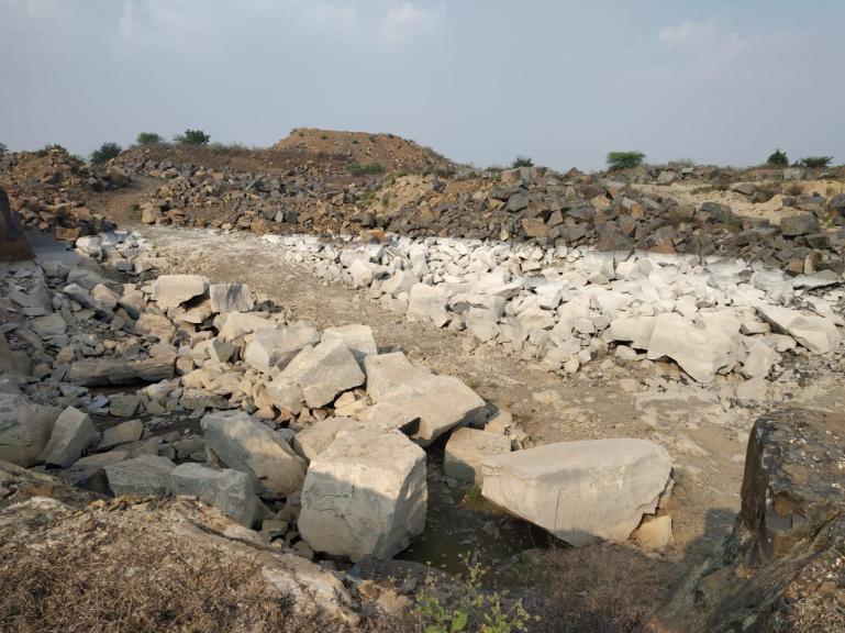
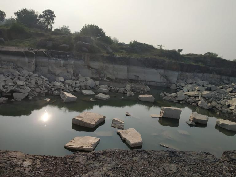

41 ANNEXURE III PHOTOGRAPHS SHOWING VIEW OF THE PIT DEVELOPMENT
ANNEXURE I Site Location map of M/s. Stone Plus quarry lease A-1
 ANNEXURE I Site Location map of M/s. quarry lease A-1 Quarry Lease boundary map of M/s. A-2 a. Introduction M/s. proposes to conduct semi mechanized open cast method quarrying for Colour granite extraction
Lessee. Sri.B.Srinivasa Rao S/o Seetha Ramaiah D.No:6-122/1 Guntupalli Village Ibrahimpatnam Mandal Krishna Dist.
 MINING PLAN INCLUDING PROGRESSIVE MINE CLOSURE PLAN FOR ROAD METAL (Under Rule 7 A of APMMC Rules 1966 & Rule 23 (B) of MCDR 1988) (FOR THE PLAN PERIOD 2017 18 TO 2021 22) Over an extent of 2.024 Hectares
PRE FEASIBILITY REPORT. Quartz and Feldspar Sy No 119 & 126/3, Kambampadu Village A. Konduru Mandal, Krishna District, Andhra Pradesh
 PRE FEASIBILITY REPORT Of Quartz and Feldspar Sy No 119 & 126/3, Kambampadu Village A. Konduru Mandal, Krishna District, Andhra Pradesh Area of Mining Lease 2.720 Ha For 1, 09,055.08 MT/Annum OF Quartz
M/s BENITA INDUSTRIES LIMITED
 M/s BENITA INDUSTRIES LIMITED (Colour Granite Quarry 19.150 Ha.) Sy. No: 82-1 of Kambadur (V), Kambadur (M), Ananthapur District, Andhra Pradesh State. ENVIRONMENTAL MANAGEMENT PLAN 0 P a g e INDEX S.
MCDR INSPECTION General. Date of Inspection Name of the Mine Bhatbhera Limestone Mine 2 Total Lease Area (Ha)
") ::1:: MCDR INSPECTION General SN Particulars Details Date of Inspection 23.8.2015 1 Name of the Mine Bhatbhera Limestone Mine 2 Total Lease Area (Ha) 4.808 Hect (Govt. Revenue Land), Non-forest land with
::1:: MCDR INSPECTION General SN Particulars Details Date of Inspection 23.8.2015 1 Name of the Mine Bhatbhera Limestone Mine 2 Total Lease Area (Ha) 4.808 Hect (Govt. Revenue Land), Non-forest land with
INDEX. Environmental Management Plan
 Environmental Management Plan M/s. N.V. Exports [Quarry Lease Area - 0.615 Ha.( 1.52 Acres)] Sy. No. : 11/1 Village : R.L. Puram Mandal : Chimakurthy District : Prakasam State : Andhra Pradesh ENVIRONMENTAL
MCDR INSPECTION REPORT
 MCDR INSPECTION REPORT General S. N. Particulars Details 1 Name of the Mine Matia Limestone Mine 2 Total Lease Area (Ha) with breakup of Non-forest and forest 12.137 Ha. land 3 Mine code 38CHG14086 4 IBM
Kurnool vide Proceedings No. 712/Q1/2012 dated Ulindakonda Village, Kallur Mandal, Kurnool District,
 1.0 EXECUTIVE SUMMARY 1.1 Introduction The proposed mining area of 1.157Ha. in survey No. 291 of Ulindakonda Village, Kallur Mandal, Kurnool District has been leased to M/s.Sri Lakshmi Sreenivasa Stone
MCDR INSPECTION REPORT
 MCDR INSPECTION REPORT General S. N. Particulars Details 1 Name of the Mine Matia Limestone Mine 2 Total Lease Area (Ha) with breakup of Non-forest and forest 8.144 ha.,non forest land land 3 Mine code
MCDR INSPECTION REPORT. S. N. Particulars Details 1 Name of the Mine, Inspecting officer with Designation, Date of Inspection
 MCDR INSPECTION REPORT General S. N. Particulars Details 1 Name of the Mine, Inspecting officer with Designation, Date of Inspection Bharuadih Limestone Mine,Rajesh Kumar Das,Sr.ACOM,18.08.2017 2 Total
SRI E.DEVARAJULU, S/O.E.Ramachandra Naidu, D.No: 26-39, Palamaner Road,Kajur, Chittoor (District), Andhara Pradesh State. Contact No:
, Andhara Pradesh State. Contact No:") MINING SCHEME FOR BLACK GRANITE OVER AN EXTENT OF 1.800Hects. IN Sy.No. 1406 OF VAVILTHOTA(V), PUTHALAPATTU (M), CHITTOOR (Dist) A.P (Under Rule 18(2) of GCDR 1999) BLOCK PERIOD 2015-16 TO 2021-22 BALANCE
MINING SCHEME FOR BLACK GRANITE OVER AN EXTENT OF 1.800Hects. IN Sy.No. 1406 OF VAVILTHOTA(V), PUTHALAPATTU (M), CHITTOOR (Dist) A.P (Under Rule 18(2) of GCDR 1999) BLOCK PERIOD 2015-16 TO 2021-22 BALANCE
APPLICANT: M/s. Rock Sand & Minerals Pvt Ltd PRE-FEASIBILITY REPORT
 PRE- FEASIBILITY REPORT 1.1 Introduction EXECUTIVE SUMMARY The proposed mining lease of 19.80ha in survey no. 345 was granted to M/s. Rock Sand Minerals Pvt Ltd, for a period of 15 years by Asst. Director
MINING PLAN FORMAT (A & B CATEGORY MINES) As per MCDR,1988
 As per MCDR,1988") MINING PLAN FORMAT (A & B CATEGORY MINES) As per MCDR,988 INTRODUCTORY NOTES. 'A' category mines : all mines excluding 'B' Category mines. B' category mines : all 'B' Category mines excluding very small
MINING PLAN FORMAT (A & B CATEGORY MINES) As per MCDR,988 INTRODUCTORY NOTES. 'A' category mines : all mines excluding 'B' Category mines. B' category mines : all 'B' Category mines excluding very small
TABLE 1.1: Salient features of the project Black Granite Mine of M/s. Shashi Granites
 1. EXECUTIVE SUMMARY 1.1 Introduction M/s. Shashi Granites, is having quarry lease area for Black Granite mine over an extent of 1.0 Hectares at Survey No. 249/4, Chinthapally(V), Kuravi(M), Mahabubabad
INDIAN BUREAU OF MINES MINERALS DEVELOPMEMT AND REGULATION DIVISION MCDR INSPECTION REPORT. Chennai regional office
 1. Mine file No : (i) Name of the Inspecting : Officer and ID No. INDIAN BUREAU OF MINES MINERALS DEVELOPMEMT AND REGULATION DIVISION TN/TCR/LST-1, MDS (ii) Designation : (iii) Accompaning mine : Official
MCDR INSPECTION REPORT
 MCDR INSPECTION REPORT 1.0 GENERAL SN Particulars Details 1 Name of the inspecting officer J.S. Hada, AMG 2 Date of Inspection 9.9.2017 3 Accompanying mine official Lessee and Mining Engineer Shri K.L.
TABLE OF CONTENTS. 1.0 Introduction. 2.0 Geology, Exploration and Reserves. 3.0 Mining. 4.0 Blasting. 5.0 Mine Drainage. 6.
 TABLE OF CONTENTS 1.0 Introduction 2.0 Geology, Exploration and Reserves 3.0 Mining 4.0 Blasting 5.0 Mine Drainage 6.0 Site Services 1.0 INTRODUCTION Pankaj Chandrakar a resident oftemri, P.O. Deopuri
INDIAN BUREAU OF MINES MINERALS DEVELOPMEMT AND REGULATION DIVISION MCDR inspection REPORT Jabalpur regional office
 INDIAN BUREAU OF MINES MINERALS DEVELOPMEMT AND REGULATION DIVISION MCDR inspection REPORT Jabalpur regional office Mine file No : MP/KTN/LST-96 (i) Name of the Inspecting : Officer and ID No. (ii) Designation
(FOR THE ENSUING BALANCE 2 YEARS PERIOD i.e to ) (UPTO END OF LEASE PERIOD ) For
 (UPTO END OF LEASE PERIOD ) For") MINING PLAN (QUARRYING OPERATIONS) FOR ROAD METAL & BUILDING STONE Over an extent of 2.000 Hectares in Sy. No. 134 Routhusuramala (V), Thottambedu (M), Chittoor District Andhra Pradesh State (FOR THE PLAN
MINING PLAN (QUARRYING OPERATIONS) FOR ROAD METAL & BUILDING STONE Over an extent of 2.000 Hectares in Sy. No. 134 Routhusuramala (V), Thottambedu (M), Chittoor District Andhra Pradesh State (FOR THE PLAN
SRI E.DEVARAJULU, S/O.E.Ramachandra Naidu, D.No: 26-39, Palamaner Road,Kajur, Chittoor (District), Andhara Pradesh State. Contact No:
, Andhara Pradesh State. Contact No:") MINING SCHEME FOR BLACK GRANITE OVER AN EXTENT OF 1.500Hects. IN Sy.No. 1406 OF VAVILTHOTA(V), PUTHALAPATTU (M), CHITTOOR (Dist) A.P (Under Rule 18(2) of GCDR 1999) 1st SCHEME PERIOD 2017-18 TO 2021-22
MINING SCHEME FOR BLACK GRANITE OVER AN EXTENT OF 1.500Hects. IN Sy.No. 1406 OF VAVILTHOTA(V), PUTHALAPATTU (M), CHITTOOR (Dist) A.P (Under Rule 18(2) of GCDR 1999) 1st SCHEME PERIOD 2017-18 TO 2021-22
Over an extent of 9.28 Acres in Sy. No. 72 / P of Jangameswarapuram (V), Martur (M), Prakasam District, Andhra Pradesh State
, Martur (M), Prakasam District, Andhra Pradesh State") MINING PLAN INCLUDING PROGRESSIVE MINE CLOSURE PLAN FOR ROAD METAL (Under Rule 7 A of APMMC Rules 1966 & Rule 23 (B) of MCDR 1988) (FOR THE PLAN PERIOD 2014 15 TO 2018 19) (FOR THE ENSUING BALANCE 2 YEARS
MINING PLAN INCLUDING PROGRESSIVE MINE CLOSURE PLAN FOR ROAD METAL (Under Rule 7 A of APMMC Rules 1966 & Rule 23 (B) of MCDR 1988) (FOR THE PLAN PERIOD 2014 15 TO 2018 19) (FOR THE ENSUING BALANCE 2 YEARS
QUARRY PLAN FOR LIMESTONE SLABS
 QUARRY PLAN FOR LIMESTONE SLABS (Under Rule 7 B of TSMMC Rules, 1966) INCLUDING PROGRESSIVE QUARRY CLOSURE PLAN (Under Rule 7 B (viii) of TSMMC Rules, 1966) (FOR THE PLAN PERIOD 2016 17 TO 2020 21) (FOR
FORM -1 MINING PLAN & PRE-FEASIBILITY REPORT
 FORM -1 MINING PLAN & PRE-FEASIBILITY REPORT TO OBTAIN ENVIRONMENTAL CLEARANCE FOR QUARRYING OF ROUGH STONE (Extent 1.91.5Ha)-B2 Project IN S.F.No 1257/1 Village Nagamangalam Taluk Denkanikottai District
Report for Area Drainage Studies for 1320 MW (2x660 MW) THERMAL POWER PROJECT AT MIRZAPUR, U.P.
 THERMAL POWER PROJECT AT MIRZAPUR, U.P.") Report for Area Drainage Studies for 1320 MW (2x660 MW) THERMAL POWER PROJECT AT MIRZAPUR, U.P. 1. Introduction M/s Welspun Energy Uttar Pradesh Ltd. (WEUPL) is putting up 1320 MW (2 x 660 MW) coal fired
Report for Area Drainage Studies for 1320 MW (2x660 MW) THERMAL POWER PROJECT AT MIRZAPUR, U.P. 1. Introduction M/s Welspun Energy Uttar Pradesh Ltd. (WEUPL) is putting up 1320 MW (2 x 660 MW) coal fired
KRISHNA MERCHANTS PVT. LTD.
 (Color Granite Quarry lease area 15.00 Ha. Sy. No.1) ADDUKONDA VILLAGE TEKKALI MANDAL SRIKAKULAM DISTRICT ANDHRA PRADESH ENVIRONMENTAL MANAGEMENT PLAN PREPARED BY 6-3-652 Flat # 7-3 Dhruvatara Apartments
Over an extent of Hectares in Sy. No. 01 of Kachavaram (V), Ibrahimpatnam (M), Krishna District, Andhra Pradesh State
, Ibrahimpatnam (M), Krishna District, Andhra Pradesh State") MINING PLAN INCLUDING PROGRESSIVE MINE CLOSURE PLAN FOR ROAD METAL & GRAVEL (Under Rule 7 A of APMMC Rules 1966 & Rule 23 (B) of MCDR 1988) INTRODUCTION Over an extent of 0.810 Hectares in Sy. No. 01 of
MINING PLAN INCLUDING PROGRESSIVE MINE CLOSURE PLAN FOR ROAD METAL & GRAVEL (Under Rule 7 A of APMMC Rules 1966 & Rule 23 (B) of MCDR 1988) INTRODUCTION Over an extent of 0.810 Hectares in Sy. No. 01 of
Smt. M. Hari Chandana
 Smt. M. Hari Chandana Quarry lease area 11.201 Ha. (27.68 Acres) in Sy. No. 22, Kudavanandapur Village, Raikode Mandal, Sangareddy District, Telangana CLUSTER ENVIRONMENTAL MANAGEMENT PLAN PREPARED BY
FOR Sand Stone Quarry Village : Chhirraleva Tehsil : Basna District : Mahasamund
 Project Report FOR Sand Stone Quarry at Village : Chhirraleva Tehsil : Basna District : Mahasamund Contents 1. About the Firm... 1 2. Location of the Project... 1 3. Environmental Setting of Project...
Submitted to: Central Coalfields Limited Ranchi, Jharkhand. Ashoka & Piparwar OCPs, CCL
 Land Restoration / Reclamation Monitoring of more than 5 million cu. m. (Coal + OB) Capacity Open Cast Coal Mines of Central Coalfields Limited Based on Satellite Data for the Year 2013 Ashoka & Piparwar
FORM -1 MINING PLAN & PRE-FEASIBILITY REPORT FOR QUARRYING OF BLACK GRANITE
 FORM -1 MINING PLAN & PRE-FEASIBILITY REPORT TO OBTAIN ENVIRONMENTAL CLEARANCE FOR QUARRYING OF BLACK GRANITE (Extent 2.3.0Ha)-B2 Project IN S.F.Nos 248/2 (P), 248/1A (P), 248/1B(P) and 248/1C (P) Village
JAI MAA SHARDA STONE CRUSHING
 JAI MAA SHARDA STONE CRUSHING Prop. Hukum Singh (M. No. 9425585252) Near-Pahunadukan Kedarpur Ambikapur, (C.G.) To, The Member Secretary, SLEIAA(State Level Environment Impact Assessment Authority), Ministry
FOR QUARRYING OF KAGANAM ROUGH STONE AND GRAVEL QUARRY
 PROPOSAL TO OBTAIN ENVIRONMENTAL CLEARANCE FROM District Level Environment Impact Assessment Authority (DEIAA), Tiruvannamalai District, Tamilnadu FOR QUARRYING OF KAGANAM ROUGH STONE AND GRAVEL QUARRY
THE MINISTRY OF ENERGY AND ENERGY INDUSTRIES MINERALS DIVISION MINE DESIGN TEMPLATE OPERATOR NAME: OPERATOR ADDRESS: PHONE NUMBER: FACSIMILE:
 THE MINISTRY OF ENERGY AND ENERGY INDUSTRIES MINERALS DIVISION MINE DESIGN TEMPLATE 1.0 GENERAL INFORMATION OPERATOR NAME: OPERATOR ADDRESS: PHONE NUMBER: FACSIMILE: NAME OF CONTACT: CELLULAR PHONE: EMAIL
EMP. In respect of. Cluster of Two Mines (Cluster area Ha)
") M/s. NSC Consortium, Road Metal Mine 12.146 Ha. EMP In respect of Cluster of Two Mines (Cluster area 22.146 Ha) AT Sy. No. 734/P, Yadavalli Village, Dornala Mandal, Prakasam district, Andhra Pradesh Cluster
M/s. NSC Consortium, Road Metal Mine 12.146 Ha. EMP In respect of Cluster of Two Mines (Cluster area 22.146 Ha) AT Sy. No. 734/P, Yadavalli Village, Dornala Mandal, Prakasam district, Andhra Pradesh Cluster
Geological report on Limestone Exploration of Goyla Block, Abadasa Taluka, Kachchh District, Gujarat. Executive Summary
 Geological report on Limestone Exploration of Goyla Block, Abadasa Taluka, Kachchh District, Gujarat Executive Summary Prepared for Commissioner of Geology & Mining Government of Gujarat Prepared by Geovale
ENVIRONMENTAL MANAGEMENT PLAN
 ENVIRONMENTAL MANAGEMENT PLAN Of M/s. B.K.R. GRANITES 4.790 HA. BLACK GRANITE MINING COMP NO. 205 &215 RAGIMANUPENTA & PARADARAMI R.F., YADAMARRI (M) CHITTOOR (DT), ANDHRA PRADESH. Submitted by SV ENVIRO
PRE-FEASIBILITY REPORT VASAI LIMESTONE MINE (APPLICANT: SHRI KHERAJBHA KARUBHA KER)
") PRE-FEASIBILITY REPORT OF VASAI LIMESTONE MINE (APPLICANT: SHRI KHERAJBHA KARUBHA KER) 1. EXECUTIVE SUMMARY: The existing Mining lease for mineral Limestone over 4.9000 Hectares for a period of thirty
PRE-FEASIBILITY REPORT OF VASAI LIMESTONE MINE (APPLICANT: SHRI KHERAJBHA KARUBHA KER) 1. EXECUTIVE SUMMARY: The existing Mining lease for mineral Limestone over 4.9000 Hectares for a period of thirty
MCDR INSPECTION REPORT hect. (All Non-forest) IBM/4816/2011
 IBM/4816/2011") MCDR INSPECTION REPORT 1.0 GENERAL SN Particulars Details 1 Name of the Mine, Name of Inspecting officer with designation and date of inspection 2 Total Lease Area (Ha) with breakup of Non-forest and forest
MCDR INSPECTION REPORT 1.0 GENERAL SN Particulars Details 1 Name of the Mine, Name of Inspecting officer with designation and date of inspection 2 Total Lease Area (Ha) with breakup of Non-forest and forest
SIXTH SCHEDULE REPUBLIC OF SOUTH SUDAN MINISTRY OF PETROLEUM, MINING THE MINING (MINERAL TITLE) REGULATIONS 2015
 REGULATIONS 2015") SIXTH SCHEDULE REPUBLIC OF SOUTH SUDAN MINISTRY OF PETROLEUM, MINING THE MINING ACT, 2012 THE MINING (MINERAL TITLE) REGULATIONS 2015 Guidelines should be prepared by the Directorate of Mineral Development
SIXTH SCHEDULE REPUBLIC OF SOUTH SUDAN MINISTRY OF PETROLEUM, MINING THE MINING ACT, 2012 THE MINING (MINERAL TITLE) REGULATIONS 2015 Guidelines should be prepared by the Directorate of Mineral Development
ANNEXURE-I (AS PER FORMAT ISSUED BY BIHAR-SEIAA)
") ANNEXURE-I (AS PER FORMAT ISSUED BY BIHAR-SEIAA) ANNEXURE-II (AS PER FORMAT ISSUED BY BIHAR-SEIAA) ANNEXURE-III LETTER OF INTENT Scanned by CamScanner Scanned by CamScanner Scanned by CamScanner
ANNEXURE-I (AS PER FORMAT ISSUED BY BIHAR-SEIAA) ANNEXURE-II (AS PER FORMAT ISSUED BY BIHAR-SEIAA) ANNEXURE-III LETTER OF INTENT Scanned by CamScanner Scanned by CamScanner Scanned by CamScanner
(3) The consent letter/declaration/undertaking may have uniform signature of the lessee.
 The consent letter/declaration/undertaking may have uniform signature of the lessee.") Annexure SCRUTINY COMMENTS ON THE DRAFT REVIEW OF MINING PLAN AND PMCP OF RAJABERA IRON ORE MINE (41.697 HA.) OF SHRI PADAM KUMAR JAIN LOCATED IN SINGHBHUM (WEST) DISTRICT, JHARKHAND SUBMITTED UNDER RULE
Annexure SCRUTINY COMMENTS ON THE DRAFT REVIEW OF MINING PLAN AND PMCP OF RAJABERA IRON ORE MINE (41.697 HA.) OF SHRI PADAM KUMAR JAIN LOCATED IN SINGHBHUM (WEST) DISTRICT, JHARKHAND SUBMITTED UNDER RULE
QUARRYING PLAN FOR. PARATAPUR SAND MINING BLOCK - 2 EXTENT Acres (4.93 Hectare)
") QUARRYING PLAN FOR PARATAPUR SAND MINING BLOCK - 2 EXTENT 12.20 Acres (4.93 Hectare) IN KRISHNA RIVER BED ADJACENT TO SY.NO 8/1, 8/2, 7/1 & 7/2 OF PARATAPUR - VILLAGE DEVADURGA - TALUK RAICHUR- DISTRICT
QUARRYING PLAN FOR PARATAPUR SAND MINING BLOCK - 2 EXTENT 12.20 Acres (4.93 Hectare) IN KRISHNA RIVER BED ADJACENT TO SY.NO 8/1, 8/2, 7/1 & 7/2 OF PARATAPUR - VILLAGE DEVADURGA - TALUK RAICHUR- DISTRICT
FIELD MONITORING OF STABILITY OF DUMP A CASE STUDY
 FIELD MONITORING OF STABILITY OF DUMP A CASE STUDY Dr. Singam Jayanthu*, and Dr. Simantini Behera** Professor, Associate Professor Department of Mining Engineering National Institute of Technology Rourkela-769008
Geological Report on Limestone Exploration Of Bhatvadiya B Block Of EXECUTIVE SUMMARY
 Geological Report on Limestone Exploration Of Bhatvadiya B Block Of Kalyanpur Taluka, Devbhumi Dwarka District, Gujarat EXECUTIVE SUMMARY Prepared for: Gujarat Mineral Research & Development Society Government
Regulations concerning protection of Bjørnøya Nature Reserve in Svalbard
 Regulations concerning protection of Bjørnøya Nature Reserve in Svalbard Laid down by the Royal Decree of 16 August 2002 pursuant to sections 12 and 17 of the Act of 15 June 2001 No. 79 relating to the
Guidelines for preparation of Mining Plans for Coal/Lignite Blocks
 Guidelines for preparation of Mining Plans for Coal/Lignite Blocks Annexure The following guidelines are issued for preparation of mining plans for coal/lignite block development by the block holders.
/4 Dy. Direct o i es & Geology, ~ erabad Region::Hyderabad.
 GOVERNMENT OF TELANGANA DEPARTMENT OF MINES & GEOLOGY::HYDERABAD Lr.No.2249/OP /RR/2017 From: G. Shravan Kumar Reddy, M.Sc., Tech., Dy. Director of Mines & Geology, Hyderabad. To: Dt:29-12-2017 1 M/s Rock
Geological Report on Limestone Exploration of Mudhvay Sub-block B, Lakhpat Taluka, Kachchh District, Gujarat. Executive Summary
 Geological Report on Limestone Exploration of Mudhvay Sub-block B, Lakhpat Taluka, Kachchh District, Gujarat Executive Summary Prepared for Commissioner of Geology & Mining Government of Gujarat Prepared
Submitted to Central Coalfields Limited BHURKUNDA OCP, CCL
 Land Restoration / Reclamation Monitoring of Open Cast Coal Mines of Central Coalfields Limited producing less than 5 m cu m. (Coal+ OB) based on Satellite Data for the Year 2013 BHURKUNDA OCP, CCL Submitted
Template for Sediment and Erosion Control Plan General Instructions. Section Instructions
 Template for Sediment and Erosion Control Plan General Instructions Introduction: Soil erosion and sediment deposition from farmlands can contribute to degraded surface water quality. Sediment delivery
MINING PLAN FOR QUARTZ & FELDSPAR
 MINING PLAN FOR QUARTZ & FELDSPAR Prepared By : P. V. SATYANARAYANA RQP / DMG / AP / 34 / Page 1 INCLUDING PROGRESSIVE MINE CLOSURE PLAN (Under Amended Rule 7 A (1) of APMMC Rules, 1966 & Rule 7 A (3)
2013 GEOLOGICAL ASSESSMENT REPORT SHERIDAN HILL PROPERTY
 2013 GEOLOGICAL ASSESSMENT REPORT ON THE SHERIDAN HILL PROPERTY NEW WESTMINSTER MINING DIVISION BRITISH COLUMBIA NTS 092G07 49 16 31 NORTH LATITUDE, 122 39 48 WEST LONGITUDE PREPARED FOR Sheridan Hill
Materials. Use materials meeting the following.
 208.01 Section 208. SOIL EROSION AND SEDIMENTATION CONTROL 208.01 Description. Install and maintain erosion and sedimentation controls to minimize soil erosion and to control sedimentation from affecting
WATER RESOURCES (CONTROLLED WATER AREAS) (NDIRANDE MUDI DAM CONTROLLED WATER AREA) ORDER
 (NDIRANDE MUDI DAM CONTROLLED WATER AREA) ORDER") WATER RESOURCES (CONTROLLED WATER AREAS) (NDIRANDE MUDI DAM CONTROLLED WATER AREA) ORDER under s. 22 G.N. 10/2008 1. Citation This Order may be cited as the Water Resources (Controlled Water Areas) (Ndirande-Mudi
WATER RESOURCES (CONTROLLED WATER AREAS) (NDIRANDE MUDI DAM CONTROLLED WATER AREA) ORDER under s. 22 G.N. 10/2008 1. Citation This Order may be cited as the Water Resources (Controlled Water Areas) (Ndirande-Mudi
CONTENTS. and 62 of MCDR Flow Diagram for Notice of opening of mine under Rule 20, 2.1 Rule - 18 Beneficiation studies to be carried out 11
 Part NO. CONTENTS CHAPTER I Flow Diagram for Rule 20, 21, 28, 30, 35, 45, 49, 50, 51 and 62 of MCDR 2017 1.1 Flow Diagram for Notice of opening of mine under Rule 20, PAGE NO. 1 MCDR 2017 1.2 Flow diagram
1.1 INTRODUCTION. EMP Report For 3.30 Ha. of Feldspar &, Quartz Mine located in Budharam village, Gopalpet Mandal, Wanaparthy District, T.S.
 1. INTRODUCTION 1.1 INTRODUCTION M/s.SRI SAI MINES & MINERALS was granted Mining lease for Quartz & Feldspar in Survey Number 3.30 over an extent of 3.30 Hect. In sy No. 326 & 330 Budharam village, Gopalpet
Geological Report on Limestone Exploration of Mudhvay Sub-block A, Lakhpat Taluka, Kachchh District, Gujarat. Executive Summary
 Geological Report on Limestone Exploration of Mudhvay Sub-block A, Lakhpat Taluka, Kachchh District, Gujarat Executive Summary Prepared for Commissioner of Geology & Mining Government of Gujarat Prepared
[Penumaka, 7(1): January-March 2017] ISSN Impact Factor
![[Penumaka, 7(1): January-March 2017] ISSN Impact Factor](/thumbs/95/124653515.jpg "[Penumaka, 7(1): January-March 2017] ISSN Impact Factor") INTERNATIONAL JOURNAL OF ENGINEERING SCIENCES &MANAGEMENT HYDROGEOMORPHOLOGY OF CHEVELLA BASIN, RANGA REDDY DISTRICT, TELANGANA STATE Penumaka Ramesh* 1 & Podila Sankara Pitchaiah 2 * 1&2 Department of
INTERNATIONAL JOURNAL OF ENGINEERING SCIENCES &MANAGEMENT HYDROGEOMORPHOLOGY OF CHEVELLA BASIN, RANGA REDDY DISTRICT, TELANGANA STATE Penumaka Ramesh* 1 & Podila Sankara Pitchaiah 2 * 1&2 Department of
6 MACRAES MINING PROJECT MINERAL ZONE
 6 MACRAES MINING PROJECT MINERAL ZONE 6.1 ZONE STATEMENT The Macraes Mining Zone applies to the area of land controlled by Macraes Mining Limited and included in Mining Permit 41-064 at the date of public
M/s.Harshad Granites,
 FORM -1 M (I) Basic Information S.NO. Item Details (i) Name of the Mining Lease Site M/s.Harshad Granites, Irapuram Village, Kunnathundu Taluk, Ernakulam District (ii) Location/site Topo sheet : 58/B12
APPLICANT: MD. SARFARAZ ANSARI & VIVEKA NAND RAY PRE FEASIBILITY REPORT PRE- FEASIBILITY REPORT
 PRE- FEASIBILITY REPORT 0 CONTENTS EXECUTIVE SUMMARY... 3 1.0 INTRODUCTION... 3 1.1 SALIENT FEATURES OF THE PROJECT... 4 1.2 PRESENT LAND USE PLAN... 5 1.3 PROPOSED PLANNING... 5 1.4 UTILIZATION... 5 2.
lit)'*'" m ( Reft- Representation received from M/s. Kasturi Granites and Exports, Proprietor Smt. C. Kasturibai Dated:
'*' m ( Reft- Representation received from M/s. Kasturi Granites and Exports, Proprietor Smt. C. Kasturibai Dated:") Lr.No.233 /QlzOrL GOVERNMENT OF ANDHRA PRADESH DEPARTMENT OF MINES & GEOLOGY D Dated: 7.03.2018 From Sri G. Shivaji, M.Sc., Tech.,, Asst. Director of Mines and Geology (FACJ, Srikakulam. To The SEIAA Govt.
Lr.No.233 /QlzOrL GOVERNMENT OF ANDHRA PRADESH DEPARTMENT OF MINES & GEOLOGY D Dated: 7.03.2018 From Sri G. Shivaji, M.Sc., Tech.,, Asst. Director of Mines and Geology (FACJ, Srikakulam. To The SEIAA Govt.
ENVIRONMENTAL MANAGEMENT PLAN
 ENVIRONMENTAL MANAGEMENT PLAN Submission By M/s PIONEER TOR STEEL MILLS PVT LIMITED FOR LATERITE [ROM]-11,19,144.60 TPA@67% PRODUCTION-7,49,826.88 TPA Extent-9.813 Hect. Sy. No. 396 / P, Bheemanpally[V],
Study on Bromide in Groundwater in Parts of Nalgonda District, Andhra Pradesh
 e-journal Earth Science India, Vol. 3 (I), January, 2010, pp.73-80 http://www.earthscienceindia.info/; ISSN: 0974 8350 Study on Bromide in Groundwater in Parts of Nalgonda District, Andhra Pradesh K. Brindha
GOAL 7 AREAS SUBJECT TO NATURAL DISASTERS AND HAZARDS. To protect life and property from natural disasters and hazards.
 GOAL 7 AREAS SUBJECT TO NATURAL DISASTERS AND HAZARDS A. GOALS: To protect life and property from natural disasters and hazards. B. POLICIES: 1. Floodplains shall be maintained as natural drainage-ways.
WHAT IS MINERAL EXPLORATION?
 INDABA PRESENTATION CAPE TOWN FEBRUARY 2017 AIM:SAV WHAT IS MINERAL EXPLORATION? AIM:SAV What is mineral exploration? 2 Exploration is the term used to describe a wide range of activities aimed at searching
GOVERNMENT OF MADHYA PRADESH WATER RESOURCES DEPARTMENT HANOTA MAJOR PROJECT PRE FEASIBILITY REPORT. ESTIMATED COST : Rs
 GOVERNMENT OF MADHYA PRADESH WATER RESOURCES DEPARTMENT HANOTA MAJOR PROJECT PRE FEASIBILITY REPORT ESTIMATED COST : Rs. 1392.42 Crores DESIGNED IRRIGATION : 40000 Ha. COST PER HACT. : Rs. 3.48 Lakhs ''EVERY
SCRUTINY COMMENTS ON DRAFT REVIEW OF MINING PLAN IN RESPECT OF GHATKURI IRON ORE MINE (149. A. TEXT:
 Annexure SCRUTINY COMMENTS ON DRAFT REVIEW OF MINING PLAN IN RESPECT OF GHATKURI IRON ORE MINE (149.7343 HA) OF M/S NIRMAL KUMAR PRADEEP KUMAR IN GHATKURI AND KARAMPADA RESERVE FOREST DISTICT WEST SINGBHUM
Resource and Reserve estimation for a marble quarry using quality indicators
 http://dx.doi.org/10.17159/2411-9717/2018/v118n1a5 Resource and Reserve estimation for a marble quarry using quality indicators by I. Kapageridis* and C. Albanopoulos The use of standard estimation and
INDIAN BUREAU OF MINES MINERALS DEVELOPMEMT AND REGULATION DIVISION MCDR INSPECTION REPORT. Bangalore regional office
 1. Mine file No : (i) Name of the Inspecting : Officer and ID No. INDIAN BUREAU OF MINES MINERALS DEVELOPMEMT AND REGULATION DIVISION KNT/CTD/LST/19/BNG (ii) Designation : (iii) Accompaning mine : Official
HISTORY OF CONSTRUCTION FOR EXISTING CCR SURFACE IMPOUNDMENT PLANT GASTON ASH POND 40 CFR (c)(1)(i) (xii)
(1)(i) (xii)") HISTORY OF CONSTRUCTION FOR EXISTING CCR SURFACE IMPOUNDMENT PLANT GASTON ASH POND 40 CFR 257.73(c)(1)(i) (xii) (i) Site Name and Ownership Information: Site Name: E.C. Gaston Steam Plant Site Location:
HISTORY OF CONSTRUCTION FOR EXISTING CCR SURFACE IMPOUNDMENT PLANT GASTON ASH POND 40 CFR 257.73(c)(1)(i) (xii) (i) Site Name and Ownership Information: Site Name: E.C. Gaston Steam Plant Site Location:
Woodford County Erosion Prevention Plan and Permit. Application #
 Woodford County Erosion Prevention Plan and Permit Application # Date Instructions: Applicant will complete Parts A and B, and attach a proposed site diagram. This diagram must be completed in accordance
Template for Sediment and Erosion Control Plan General Instructions
 Template for Sediment and Erosion Control Plan General Instructions Introduction: Soil erosion and sediment deposition from farmlands can contribute to degraded surface water quality. Sediment delivery
Coalfields Limited. Based on Satellite Data for the Year Central Coalfields Limited Ranchi, Jharkhand. Submitted to:
 Land Restoration / Reclamation Monitoring of less than 5 m cu. m. (Coal + OB) Capacity Open Cast Coal Mines of Central Coalfields Limited Based on Satellite Data for the Year 2011. N URIMARI (BIRSA) OCP,CCL
1. INTRODUCTION. EMP Report For Colour Granite Mine of Ha, located in Nellipudi Village, Gangavaram Mandal, East Godavari District, A.P.
 1. INTRODUCTION 1.1 INTRODUCTION M/S MARS GRANITES was granted a quarry lease over an extent of 1.520 Ha in Sy No: 486/1 & 488/1, Nellipudi Village, Gangavaram Mandal, East Godavari District in the State
ENVIRONMENTAL MANAGEMENT (CLUSTER)
") /+ ENVIRONMENTAL MANAGEMENT (CLUSTER) PLAN Of M/s. APARNA ENTERPRISES LIMITED MINING OF QUARTZ & FELDSPAR OVER AN EXTENT: 2.720 HA Mine Address: Sy. No.119 & 126/3 Khambhampadu (V), A.konduru (M) Krishna
/+ ENVIRONMENTAL MANAGEMENT (CLUSTER) PLAN Of M/s. APARNA ENTERPRISES LIMITED MINING OF QUARTZ & FELDSPAR OVER AN EXTENT: 2.720 HA Mine Address: Sy. No.119 & 126/3 Khambhampadu (V), A.konduru (M) Krishna
Continuing Education Associated with Maintaining CPESC and CESSWI Certification
 Continuing Education Associated with Maintaining CPESC and CESSWI Certification Module 2: Stormwater Management Principles for Earth Disturbing Activities Sponsors: ODOTs Local Technical Assistance Program
Guidelines for Site-Specific Seismic Hazard Reports for Essential and Hazardous Facilities and Major and Special-Occupancy Structures in Oregon
 Guidelines for Site-Specific Seismic Hazard Reports for Essential and Hazardous Facilities and Major and Special-Occupancy Structures in Oregon By the Oregon Board of Geologist Examiners and the Oregon
Geological Studies in the Larsemann Hills, Ingrid Chirstensen Coast, East Antarctica
 363 Twenty Fourth Indian Antarctic Expedition 2003-2005 Ministry of Earth Sciences, Technical Publication No. 22, pp 363-367 Geological Studies in the Larsemann Hills, Ingrid Chirstensen Coast, East Antarctica
The following Environmental Management Programme (EMP) was also approved in terms of the issuing of the above-mentioned mining right:
 was also approved in terms of the issuing of the above-mentioned mining right:") 1. INTRODUCTION Belfast Silica Mine is located on the Remaining Extent of Portion 1 of the farm Klipfontein 385 JS, which is situated approximately 8 km north west of Belfast and Siyathuthuka (Figure 2.1).
1. INTRODUCTION Belfast Silica Mine is located on the Remaining Extent of Portion 1 of the farm Klipfontein 385 JS, which is situated approximately 8 km north west of Belfast and Siyathuthuka (Figure 2.1).
Simplified exploration work report
 Simplified exploration work report Work Report of exploration and examination of outcrops of rock and boulders Report on stripping and excavating work of $ 5 000 or less.(section 81 of regulation) Report
CHAPTER GEOLOGICALLY HAZARDOUS AREAS Applicability Regulations.
 CHAPTER 19.07 GEOLOGICALLY HAZARDOUS AREAS 19.07.010 Applicability. Geologically hazardous areas may pose a threat to the health and safety of citizens when incompatible development is sited in areas of
HERON ENTERS OPTION TO PURCHASE A1 GOLD MINE, EASTERN VICTORIA
 ASX Release 13 AUGUST 2009 HERON ENTERS OPTION TO PURCHASE A1 GOLD MINE, EASTERN VICTORIA Heron Resources Limited (ASX:HRR, Heron) is pleased to announce it has purchased an Option (Option) to acquire
GROUNDWATER CONFIGURATION IN THE UPPER CATCHMENT OF MEGHADRIGEDDA RESERVOIR, VISAKHAPATNAM DISTRICT, ANDHRA PRADESH
 GROUNDWATER CONFIGURATION IN THE UPPER CATCHMENT OF MEGHADRIGEDDA RESERVOIR, VISAKHAPATNAM DISTRICT, ANDHRA PRADESH Prof.P.Jagadeesara Rao Department of Geo-Engineering and Centre for Remote Sensing, College
Request for Empanelment
 Request for Empanelment (Empanelment is method/procedure/way to seek technical & financial or financial quotation from eligible firm/organization/academic institute to short list eligible contender for
C. SHASHI KUMAR. Mine lease area Ha. in Sy. No. 120/1, Mailaram Village, Balmoor Mandal, Nagarkurnool District, Telangana
 C. SHASHI KUMAR Mine lease area 24.28 Ha. in Sy. No. 120/1, Mailaram Village, Balmoor Mandal, Nagarkurnool District, Telangana ENVIRONMENTAL MANAGEMENT PLAN PREPARED BY ISO 9001: 2008 Certified Accredited
AGENDA ITEM 6 APPENDIX /0151/DET GROUND WATER & SURFACE WATER MANAGEMENT PLAN
 CAIRNGORMS NATIONAL PARK AUTHORITY Planning Committee Agenda Item 6 Appendix 18 12/10/2018 AGENDA ITEM 6 APPENDIX 18 2018/0151/DET GROUND WATER & SURFACE WATER MANAGEMENT PLAN Dalwhinnie Quarry Ground
*** The following Notification shall be published in an extra-ordinary issue of the Andhra Pradesh Gazette dt
 GOVERNMENT OF ANDHRA PRADESH ABSTRACT Mines and Minerals Punitive Measures to control Illegal Mining and Transportation of Minor Minerals Amendments to A.P. Minor Mineral Concession Rules, 1966 - Orders
PRE FEASIBILITY REPORT OF QUARTZ & FELDSPAR MINING PROJECT (ML No- 80/03) FOR TERMS OF REFERENCE
 FOR TERMS OF REFERENCE") PRE FEASIBILITY REPORT OF QUARTZ & FELDSPAR MINING PROJECT (ML No- 80/03) FOR TERMS OF REFERENCE Village Ashapura Tehsil Nasirabad District Ajmer State Rajasthan Capacity 35945 TPA ROM (Max) Lease Area
PRE FEASIBILITY REPORT OF QUARTZ & FELDSPAR MINING PROJECT (ML No- 80/03) FOR TERMS OF REFERENCE Village Ashapura Tehsil Nasirabad District Ajmer State Rajasthan Capacity 35945 TPA ROM (Max) Lease Area
IN SY. NO. 1385, CHINNATHIPPASAMUDRAMVILLAGE, MADANAPALLI MANDAL, CHITTOOR DISTRICT, ANDHRA PRADESH STATE
 MINING PLAN FOR ROAD METAL & BUILDING STONE OVER AN EXTENT OF 1.894Hect. LOCATED IN SY. NO. 1385, CHINNATHIPPASAMUDRAMVILLAGE, MADANAPALLI MANDAL, CHITTOOR DISTRICT, ANDHRA PRADESH STATE Introduction Sri.K.Venkataramana,
Section 5 TERMS OF REFERENCE (ToR) For Topographical Surveying, Geological Study, and Final Mining Feasibilitiy Study
 For Topographical Surveying, Geological Study, and Final Mining Feasibilitiy Study") Section 5 TERMS OF REFERENCE (ToR) For Topographical Surveying, Geological Study, and Final Mining Feasibilitiy Study I. BACKGROUND State Mining Corporation Limited (SMC), a subsidaiary of Druk Holdings
Section 5 TERMS OF REFERENCE (ToR) For Topographical Surveying, Geological Study, and Final Mining Feasibilitiy Study I. BACKGROUND State Mining Corporation Limited (SMC), a subsidaiary of Druk Holdings
Environmental Science Institute The University of Texas - Austin
 Environmental Science Institute The University of Texas - Austin Geologic Wonders of Central Texas Dr. Leon Long This file contains suggestions for how to incorporate the material from this CDROM into
FOR PROJECTS INITIATED AFTER NOVEMBER 1, 2008 ITEM 716 EMBANKMENT EARTH OUTLET SEDIMENT TRAP
 AFTER NOVEMBER 1, 2008 ITEM 716 EMBANKMENT EARTH OUTLET SEDIMENT TRAP 716.1 Description. This work shall consist of furnishing, installing, maintaining, and removing temporary erosion protection and sediment
Gotechnical Investigations and Sampling
 Gotechnical Investigations and Sampling Amit Prashant Indian Institute of Technology Gandhinagar Short Course on Geotechnical Investigations for Structural Engineering 12 14 October, 2017 1 Purpose of
CHAPTER 9 SUMMARY AND CONCLUSIONS
 CHAPTER 9 SUMMARY AND CONCLUSIONS The following are the important conclusions and salient features of the present study. 1. The evaluation of groundwater potential is a prerequisite for any kind of planning
data becomes available to us. We already have crude maps of the Mars and the Moon. A map gives a picture of one or several of the elements of the
 FUNDAMENTALS OF MAPS THE SPHERICAL earth is best represented bya three-dimensional model of the earth, called a globe. All parts of the earth can be shown on it in their true shape, area and location along
Early Exploration Plan Activity Information
 Early Exploration Plan Activity Information Activities That Require an Early Exploration Plan: Line cutting that is a width of 1.5 metres or less; Geophysical surveys on the ground requiring the use of
Soil Mechanics/Geotechnical Engineering I Prof. Dilip Kumar Baidya Department of Civil Engineering Indian Institute of Technology, Kharagpur
 Soil Mechanics/Geotechnical Engineering I Prof. Dilip Kumar Baidya Department of Civil Engineering Indian Institute of Technology, Kharagpur Lecture - 01 Rock Cycle Good morning. I welcome you to this
ENVIRONMENTAL MANAGEMENT PLAN
 ENVIRONMENTAL MANAGEMENT PLAN Of GRAVEL & BUILDING STONE QUARRY For Sri Prathipati. Ram Prasad 1.235 HA GRAVEL & BUILDING STONE QUARRY SY. NO. 860, Vedurupavuluru (V), Gannavaram(M), Krishna(DT), ANDHRA
Roadmap to Stability
 Landslide Policy Committee for Aizawl City February 2014 Technical Support by: Aizawl is in earthquake hazard zone V and highly prone to natural, man-made and earthquake induced landslides. In order to