VHR seismic imaging of displacement along an active off-shore fault system of the Adriatic foreland
|
|
|
- Shona Bell
- 5 years ago
- Views:
Transcription
1 VHR seismic imaging of displacement along an active off-shore fault system of the Adriatic foreland Daniela Di Bucci 1, Domenico Ridente 2, 3, Umberto Fracassi 4, Fabio Trincardi 2, Gianluca Valensise 4 1 Dipartimento della Protezione Civile. Via Vitorchiano, Roma, Italy. 2 Istituto di Scienze Marine, Sezione di Geologia Marina, CNR. Via Gobetti, Bologna, Italy. 3 Now at Istituto di Geologia Ambientale e Geoingegneria, CNR. P.le A. Moro, Roma, Italy. 4 Istituto Nazionale di Geofisica e Vulcanologia. Via di Vigna Murata, Roma, Italy Convegno Nazionale
2 Genova 9 E 44 N I T A L Y Livorno Firenze Tuscany Bologna Ravenna Rimini Pesaro Ancona Pliocene-Quaternary terrigenous deposits Magmatic units Liguride units and related wedge-top basin deposits Tuscan pelagic basin, and related foredeep deposits Umbria-Marche pelagic basin, slopes and related foredeep deposits Laga Fm., Gessoso-Solfifera and related deposits Pescara Tremiti Islands Gargano promontory Roma Mattinata fault Mattinata fault study area Gondola Gondola linefault Zone Metamorphic units Molise-Sannio-Lagonegro pelagic basin, slopes and related foredeep deposits Apennine carbonate platform, by-pass margins and related foredeep deposits Apulia carbonate platform and related foredeep deposits Main thrusts fronts Napoli Bari APULIAN FORELAND Matera Potenza Main faults Main buried thrust fronts km (modified from: Butler et al., 2004) Calabrian arc 2 Study area and regional geological setting

3 I T A L Y (M > 4.0; Gruppo di lavoro CPTI, 2004; Vannucci and Gasperini, 2004). The size of the square symbols is proportional to an equivalent magnitude derived from intensity data. 3 Historical and instrumental earthquakes of the Central and Southern Apennines

4 4 Structural setting of the Gondola Fault Zone and nearby areas based on high-penetration/low-resolution seismic data

5 Bathymetry (grey lines): depth < 100 m, isobaths every 5 m; depth between 100 and 200 m, isobaths every 10 m; depth > 200 m, isobaths every 20 m. 5 We used this Chirp-Sonar and Sparker seismic database to define the stratigraphy of Late Quaternary deposits and the pattern of active deformation High-resolution seismic database
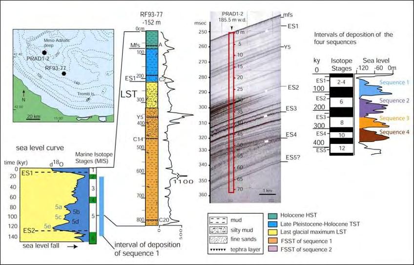


6 6 Depositional sequences and time lapses


7 All along the E-W segment of the Gondola Fault Zone, late Quaternary deposits appear folded and faulted (locally up to seafloor). notice the vertical exaggeration mfs = 5.5 ka maximum flooding surface 7 Key stratigraphic and structural features of the study area
8 Two major anticlines affected by a fault system can be identified. The faults may appear sealed by the ES1 surface (orange fault trace) or displace the Holocene deposits and the sea floor (red fault trace). They show a vertical component of motion, with the northern limb downthrown. In the easternmost part of the study area, instead, the southern limb is downthrown. 8 Structural map of the Gondola Fault Zone

9 Evidence of a secondary fold on the downthrown (northern) limb of the northern fault. We interpreted this kind of features as the expression of an unresolved strikeslip component of motion. Also notice the variable offset of reflectors along the fault plane. 9 An example of Chirp Sonar seismic profile
10 The entire deformation pattern of the Gondola Fault Zone suggests a significant strike-slip component of motion. Also at local scale, nearfault hanging-wall deformation suggests that the observed faults may well slip with an unresolved lateral component of motion. The overall geometry, formed by fault segments with minor vertical separation, connected by non-faulted sections where the anticline is better developed, supports dextral slip. Unfortunately, our data did not allow us to estimate the horizontal displacement. 10
 VHR seismic lines acquired during a 2006 cruise.")

11 We further integrated our studies with the analysis of new and closely-spaced (ca m) VHR seismic lines acquired during a 2006 cruise. The density of the data set allowed us to focus on the distribution in space and time of the vertical displacement measured on the fault planes dissecting shallow deposits up to the seafloor along the E-W branch of the Gondola Fault Zone. 11
12 1 ms TWT = ca m W E displacement (ms TWT) ES ka ES ka ES ka 5.5 ka Seafloor fault length (km) 12 Vertical displacement along the northern fault set
 13 Vertical displacement along the southern fault")
13 1 ms TWT = ca m W E 8 7 displacement (ms TWT) ES ka ES ka ES ka 5.5 ka Seafloor fault length (km) 13 Vertical displacement along the southern fault set
14 W 35 E displacement (ms TWT) ES ka ES ka ES ka 5.5 ka Seafloor different vertical scales fault length (km) ms TWT = ca m displacement (ms TWT) ES ka ES ka ES ka 5.5 ka Seafloor fault length (km) 14 Comparison

15 D = cumulative values of displacement ΔD = differential values of displacement 15 Vertical slip rates
16 The bell-shaped distribution of the displacements suggests a long-term behavior of the GFZ as a single structure. However, the irregular displacement distribution on the different branches and the related slip rates, i.e. the evidence of distinct deformation histories, implies that this single structure is composed of fault segments that can slip independently. A long-term homogeneous behavior of the GFZ, operating as a single structure, is also supported by the evidence of comparable and low values within a limited range ( mm/a) for all branches. 16 Conclusions - 1
17 Apart from the differentiated deformation rates, our data are strikingly similar to those acquired with comparable methods along well-known, major seismogenic fault systems, e.g. along the North Anatolian Fault (Polonia et al., 2004) or in the Panama Canal (Pratt et al., 2003). Moreover, the vertical slip rates here presented are comparable with those calculated from surface geological data along the Mattinata Fault ( mm/a; Tondi et al., 2005), a known seismogenic source sharing the same tectonic environment of the GFZ. Surface evidence thus suggests that the GFZ as well may be seismogenic. Defining the structural relationships between its shallower and deeper portions, up to typical hypocentral depth, is therefore fundamental for a correct assessment of its seismogenic potential. 17 Conclusions - 2

18 Thank you! 18 prints.org
Hints of active deformation in the southern Adriatic foreland: Holocene tectonics along the Apulia offshore (Italy)
") Hints of active deformation in the southern Adriatic foreland: Holocene tectonics along the Apulia offshore (Italy) Domenico Ridente^, Umberto Fracassi*, Daniela Di Bucci, Fabio Trincardi^ ^ & Gianluca
Hints of active deformation in the southern Adriatic foreland: Holocene tectonics along the Apulia offshore (Italy) Domenico Ridente^, Umberto Fracassi*, Daniela Di Bucci, Fabio Trincardi^ ^ & Gianluca
Project S1: Analysis of the seismic potential in Italy for the evaluation of the seismic hazard
 Agreement INGV-DPC 2007-2009 Project S1: Analysis of the seismic potential in Italy for the evaluation of the seismic hazard Responsibles: Salvatore Barba, Istituto Nazionale di Geofisica e Vulcanologia,
Monitoring long-term ground movements and Deep Seated Gravitational
 Monitoring long-term ground movements and Deep Seated Gravitational Slope Deformations by InSAR time series: cases studies in Italy Salvatore Stramondo (1), M. Saroli (1, 2), M. Moro (1, 2), S. Atzori
Dipartimento di Scienze Biologiche, Geologiche e Ambientali, Sezione di Scienze della Terra, Università di Catania, Italy 2
 Structural pattern and active deformation in the northern sector of the Aeolian-Tindari-Letojanni fault system in the geodynamic framework of the southern Calabrian Arc: an integrated analysis of field,
Depositional Environments and Hydrocarbon Potential of Northern Ionian Sea
 Depositional Environments and Hydrocarbon Potential of Northern Ionian Sea Vasiliki Kosmidou George Makrodimitras Nick Papatheodorou Contents Area of Interest Studied Dataset Workflow SWIT and Paleolatitude
Data Repository Item
 Parente, 1 30 N Ir P V 20 N A G Emerged land Terrigenous shelf and shallow basin Platform limestone Slope and basin above CCD Deep basin Active spreading ridge Oceanic subduction Thrust, fault 10 N Figure
Domenico Ridente a, Umberto Fracassi b, Daniela Di Bucci c, Fabio Trincardi a, Gianluca Valensise b
 Middle Pleistocene to Holocene activity of the Gondola Fault Zone (Southern Adriatic Foreland): deformation of a regional shear zone and seismotectonic implications Domenico Ridente a, Umberto Fracassi
8.0 SUMMARY AND CONCLUSIONS
 8.0 SUMMARY AND CONCLUSIONS In November 2008, Pacific Gas and Electric (PG&E) informed the U.S. Nuclear Regulatory Commission (NRC) that preliminary results from the Diablo Canyon Power Plant (DCPP) Long
FOLDS AND THRUST SYSTEMS IN MASS TRANSPORT DEPOSITS
 FOLDS AND THRUST SYSTEMS IN MASS TRANSPORT DEPOSITS G.I Aslop, S. Marco, T. Levi, R. Weinberger Presentation by Aaron Leonard INTRODUCTION Examine fold and thrust geometries associated with downslope movement
Ionian Sea and Margins: Recent Prospections and Interpretations
 Ionian Sea and Margins: Recent Prospections and Interpretations Liliana Minelli co-authors: Faccenna C., Casero P. Dipartimento Scienze Geologiche Università Roma Tre 9th Offshore Mediterranean Conference
The development of a geo-database of caprock quality and deep saline aquifers distribution suitable to geological storage of CO 2 in Italy
 The development of a geo-database of caprock quality and deep saline aquifers distribution suitable to geological storage of CO 2 in Italy Buttinelli M., Procesi M., Cantucci B., Quattrocchi F. INGV -
Neogene-Quaternary intraforeland transpression along a Mesozoic platform-basin margin: The Gargano fault system, Adria, Italy
 Neogene-Quaternary intraforeland transpression along a Mesozoic platform-basin margin: The Gargano fault system, Adria, Italy Andrea Billi* Dipartimento di Scienze Geologiche, Università Roma Tre, Largo
High resolution seismic imaging of the M w 5.7, 2002 Molise, southern Italy, earthquake area: Evidence of deep fault reactivation
 Click Here for Full Article High resolution seismic imaging of the M w 5.7, 2002 Molise, southern Italy, earthquake area: Evidence of deep fault reactivation Diana Latorre, 1 Alessandro Amato, 1 and Claudio
Monitoring techniques developed at CO2 natural laboratories to improve risks assessment and safety strategy
 Monitoring techniques developed at CO2 natural laboratories to improve risks assessment and safety strategy Sabina Bigi Dipartimento di Scienze della Terra Sapienza Università di Roma 3 rd International
INGV. Giuseppe Pezzo. Istituto Nazionale di Geofisica e Vulcanologia, CNT, Roma. Sessione 1.1: Terremoti e le loro faglie
 Giuseppe Pezzo Istituto Nazionale di Geofisica e Vulcanologia, CNT, Roma giuseppe.pezzo@ingv.it The study of surface deformation is one of the most important topics to improve the knowledge of the deep
Sequence Stratigraphy. Historical Perspective
 Sequence Stratigraphy Historical Perspective Sequence Stratigraphy Sequence Stratigraphy is the subdivision of sedimentary basin fills into genetic packages bounded by unconformities and their correlative
Migration and shortening rates in the northern Apennines, Italy: implications for seismic hazard
 Migration and shortening rates in the northern Apennines, Italy: implications for seismic hazard Roberto Basili and Salvatore Barba Istituto Nazionale di Geofisica e Vulcanologia Sezione di Sismologia
ACTIVE STRUCTURES OF THE EMILIA-ROMAGNA
 M. Boccaletti (1,2), M. Bonini (1), G. Corti (2), P. Gasperini (3), L. Martelli (4), L. Piccardi (1), C. Tanini (2) and G. Vannucci (5) (1) CNR - Istituto di Geoscienze e Georisorse, Sezione di Firenze
Global Tectonics. Kearey, Philip. Table of Contents ISBN-13: Historical perspective. 2. The interior of the Earth.
 Global Tectonics Kearey, Philip ISBN-13: 9781405107778 Table of Contents Preface. Acknowledgments. 1. Historical perspective. 1.1 Continental drift. 1.2 Sea floor spreading and the birth of plate tectonics.
Lecture Outline Friday March 2 thru Wednesday March 7, 2018
 Lecture Outline Friday March 2 thru Wednesday March 7, 2018 Questions? Lecture Exam Friday March 9, 2018 Same time, Same room Bring Pencils and WSU ID 50 question Multiple Choice, Computer Graded Interlude
John Shaw CRUSTAL DEFORMATION MODEL: OBLIQUE CONVERGENCE IN THE INNER CALIFORNIA BORDERLANDS ACCOMMODATED BY ACTIVE STRIKE-SLIP AND REVERSE FAULTS
 CRUSTAL DEFORMATION MODEL: OBLIQUE CONVERGENCE IN THE INNER CALIFORNIA BORDERLANDS ACCOMMODATED BY ACTIVE STRIKE-SLIP AND REVERSE FAULTS August 2013 SONGS SSC SSHAC Workshop # 2 (August 12-14, 2013) Crustal
Modes of fault reactivation from analogue modeling experiments: implications for the seismotectonics of the southern Adriatic foreland (Italy)
") * Manuscript QI special issue revised Modes of fault reactivation from analogue modeling experiments: implications for the seismotectonics of the southern Adriatic foreland (Italy) Extended abstract Daniela
* Manuscript QI special issue revised Modes of fault reactivation from analogue modeling experiments: implications for the seismotectonics of the southern Adriatic foreland (Italy) Extended abstract Daniela
Supplementary Information to: Shallow slip amplification and enhanced tsunami. hazard unravelled by dynamic simulations of mega-thrust earthquakes
 1 2 Supplementary Information to: Shallow slip amplification and enhanced tsunami hazard unravelled by dynamic simulations of mega-thrust earthquakes 3 4 6 7 8 9 1 11 12 S. Murphy* 1, A. Scala 2,3, A.
UNIT 10 MOUNTAIN BUILDING AND EVOLUTION OF CONTINENTS
 UNIT 10 MOUNTAIN BUILDING AND EVOLUTION OF CONTINENTS ROCK DEFORMATION Tectonic forces exert different types of stress on rocks in different geologic environments. STRESS The first, called confining stress
Dipartimento di Ingegneria Civile, Edile-Architettura e Ambientale, Università degli Studi dell Aquila, Italy 2
 Comparison between shallow geology, resonance frequency and buildings damage due to the April 6, 2009 Mw 6.1 and the February 2, 1703 Mw 6.7 earthquakes at L Aquila historical downtown M. Tallini 1, F.
SUPPLEMENTARY INFORMATION
 SUPPLEMENTARY INFORMATION doi: 10.1038/ngeo739 Supplementary Information to variability and distributed deformation in the Marmara Sea fault system Tobias Hergert 1 and Oliver Heidbach 1,* 1 Geophysical
Plate Tectonics. entirely rock both and rock
 Plate Tectonics I. Tectonics A. Tectonic Forces are forces generated from within Earth causing rock to become. B. 1. The study of the origin and arrangement of Earth surface including mountain belts, continents,
GEOLOGIC MAPS PART II
 EARTH AND ENVIRONMENT THROUGH TIME LABORATORY - EES 1005 LABORATORY FIVE GEOLOGIC MAPS PART II Introduction Geologic maps of orogenic belts are much more complex than maps of the stable interior. Just
KEY CHAPTER 12 TAKE-HOME QUIZ INTERNAL STRUCTURES AND PROCESSES Score Part B = / 55 PART B
 GEOLOGY 12 KEY CHAPTER 12 TAKE-HOME QUIZ INTERNAL STRUCTURES AND PROCESSES Score Part B = / 55 PART B CHAPTER 12 Isostacy and Structural Geology 1. Using the terms below, label the following diagrams and
Earth Science, (Tarbuck/Lutgens) Chapter 10: Mountain Building
 Chapter 10: Mountain Building") Earth Science, (Tarbuck/Lutgens) Chapter 10: Mountain Building 1) A(n) fault has little or no vertical movements of the two blocks. A) stick slip B) oblique slip C) strike slip D) dip slip 2) In a(n) fault,
Earth Science, (Tarbuck/Lutgens) Chapter 10: Mountain Building 1) A(n) fault has little or no vertical movements of the two blocks. A) stick slip B) oblique slip C) strike slip D) dip slip 2) In a(n) fault,
Theme 7. Metamorphic rocks. Distinguishing rock types
 Theme 7. Metamorphic rocks. Distinguishing rock types 7.1. Metamorphic rocks formation 7.2. Classification of metamorphic rocks 7.3. Distinguishing rock types 7.1. Metamorphic rocks formation 7.1. Metamorphic
Quantitative analysis of extensional joints in the southern Adriatic foreland (Italy), and the active tectonics of the Apulia region
, and the active tectonics of the Apulia region") *Manuscript Click here to view linked References Journal of Geodynamics - revised 1 2 3 Quantitative analysis of extensional joints in the southern Adriatic foreland (Italy), and the active tectonics of
*Manuscript Click here to view linked References Journal of Geodynamics - revised 1 2 3 Quantitative analysis of extensional joints in the southern Adriatic foreland (Italy), and the active tectonics of
Italian Map of Design Earthquakes from Multimodal Disaggregation Distributions: Preliminary Results.
 Italian Map of Design Earthquakes from Multimodal Disaggregation Distributions: Preliminary Results. Eugenio Chioccarelli Dipartimento di Ingegneria Strutturale, Università degli Studi di Napoli, Federico
Lab 7: STRUCTURAL GEOLOGY FOLDS AND FAULTS
 Lab 7: STRUCTURAL GEOLOGY FOLDS AND FAULTS This set of labs will focus on the structures that result from deformation in earth s crust, namely folds and faults. By the end of these labs you should be able
Lecture # 6. Geological Structures
 1 Lecture # 6 Geological Structures ( Folds, Faults and Joints) Instructor: Dr. Attaullah Shah Department of Civil Engineering Swedish College of Engineering and Technology-Wah Cantt. 2 The wavy undulations
Structural Style in the Peel Region, NWT and Yukon
 Structural Style in the Peel Region, NWT and Yukon Adriana Taborda* Husky Energy and University of Calgary, Calgary, AB Adriana.Taborda@huskyenergy.ca and Deborah Spratt University of Calgary, Calgary,
Structural Geology and Geology Maps Lab
 Structural Geology and Geology Maps Lab Mesa College Geology 101 Lab Ray Rector: Instructor Structural Geology Lab Pre-Lab Resources Pre-Lab Internet Links 1) Fundamentals of Structural Geology 2) Visualizing
Deformation of Rocks. Orientation of Deformed Rocks
 Deformation of Rocks Folds and faults are geologic structures caused by deformation. Structural geology is the study of the deformation of rocks and its effects. Fig. 7.1 Orientation of Deformed Rocks
Search and Discovery Article #40536 (2010) Posted June 21, 2010
 Posted June 21, 2010") Modern Examples of Mass Transport Complexes, Debrite and Turbidite Associations: Geometry, Stratigraphic Relationships and Implications for Hydrocarbon Trap Development* Fabiano Gamberi 1, Marzia Rovere
Modern Examples of Mass Transport Complexes, Debrite and Turbidite Associations: Geometry, Stratigraphic Relationships and Implications for Hydrocarbon Trap Development* Fabiano Gamberi 1, Marzia Rovere
Unit 4 Lesson 7 Mountain Building
 Indiana Standards 7.2.4 Explain how convection currents in the mantle cause lithospheric plates to move causing fast changes like earthquakes and volcanic eruptions, and slow changes like creation of mountains
New insights on some structural geometries in Southern Apennines by multiscale analysis of potential fields
 New insights on some structural geometries in Southern Apennines by multiscale analysis of potential fields F. Cella ( 1 ), L. Ferranti ( 2 ), G. Florio ( 2 ) and L. Maschio ( 2 ) ( 1 ) Dipartimento di
GEOPHYSICAL RESEARCH LETTERS, VOL. 37, L19302, doi: /2010gl044721, 2010
 GEOPHYSICAL RESEARCH LETTERS, VOL. 37,, doi:10.1029/2010gl044721, 2010 Ultrashallow seismic imaging of the causative fault of the 1980, M6.9, southern Italy earthquake by pre stack depth migration of dense
Active Tectonics. Earthquakes, Uplift, and Landscape. Edward A. Keller University of California, Santa Barbara
 Prentice Hall Earth Science Series SUB Gottingen 214 80416X, im ^, 2002 A 7883 lllllllilwii Active Tectonics Earthquakes, Uplift, and Landscape Second Edition V Edward A. Keller University of California,
Jocelyn Karen Campbell
 THE UNCERTAINTIES IN ASSESSING THE IMPACT OF REGIONAL SEISMICITY AT THE WIL SITE Statement of Evidence by Jocelyn Karen Campbell A CANTERBURY FAULTS coded by type CHARACTERISTICS OF THRUST FAULTS IN CANTERBURY
6.0 TDMT, M W. IREA-CNR, Napoli, Italy 2. DISPUTER, Università G. D Annunzio, Chieti, Italy 3. Dipartimento della Protezione Civile, Roma, Italy
 An intriguing perspective on the source geometry and slip distribution of the 2016 Amatrice Mw 6.2 earthquake (central Italy) from geological and satellite data P. Tizzani 1, M. Bonano 1, P. Boncio 2,
Seismicity of the gulf of Cadiz: Insights from the joint analysis of OBS and land seismic data
 UNIVERSIDADE DE LISBOA FACULDADE DE CIÊNCIAS DEPARTAMENTO DE ENGENHARIA GEOGRÁFICA, GEOFÍSICA E ENERGIA Seismicity of the gulf of Cadiz: Insights from the joint analysis of OBS and land seismic data Daniela
Lecture 6 Folds, Faults and Deformation Dr. Shwan Omar
 Fold: A fold is a bend or wrinkle of rock layers or foliation; folds form as a sequence of ductile deformation. Folding is the processes by which crustal forces deform an area of crust so that layers of
Chapter 15 Structures
 Chapter 15 Structures Plummer/McGeary/Carlson (c) The McGraw-Hill Companies, Inc. TECTONIC FORCES AT WORK Stress & Strain Stress Strain Compressive stress Shortening strain Tensional stress stretching
Ground displacement in a fault zone in the presence of asperities
 BOLLETTINO DI GEOFISICA TEORICA ED APPLICATA VOL. 40, N. 2, pp. 95-110; JUNE 2000 Ground displacement in a fault zone in the presence of asperities S. SANTINI (1),A.PIOMBO (2) and M. DRAGONI (2) (1) Istituto
Non-ideal Subduction
 Subduction zone cross sections Earthquake locations : black = teleseismic est. gray = local-array est. red line = top of slab seismicity blue line = center of slab seismicity Non-ideal Subduction Oblique
Foundations of Earth Science, 6e Lutgens, Tarbuck, & Tasa
 Foundations of Earth Science, 6e Lutgens, Tarbuck, & Tasa Oceans: The Last Frontier Foundations, 6e - Chapter 9 Stan Hatfield Southwestern Illinois College The vast world ocean Earth is often referred
Depositional History and Petroleum Potential of Ombilin Basin, West Sumatra - Indonesia, Based on Surface Geological Data*
 Depositional History and Petroleum Potential of Ombilin Basin, West Sumatra - Indonesia, Based on Surface Geological Data* Yahdi Zaim 1, Litto Habrianta 2, Chalid I. Abdullah 1, Aswan 1, Yan Rizal 1, Nurcahyo
Minor shallow gravitational component on the Mt. Vettore surface ruptures related to M W 6, 2016 Amatrice earthquake
 Minor shallow gravitational component on the Mt. Vettore surface ruptures related to M W 6, 2016 Amatrice earthquake MATTEO ALBANO 1, MICHELE SAROLI 2,1, MARCO MORO 1, EMANUELA FALCUCCI 1, STEFANO GORI
DANCORE-Day. Master s Thesis
 DANCORE-Day Master s Thesis Interpretation of Shallow Seismic and Sediment Cores from the Area stretching from the Southern Part of Kattegat to the Great Belt in the Period Late-Weichselian to Early Holocene.
Before Plate Tectonics: Theory of Continental Drift
 Before Plate Tectonics: Theory of Continental Drift Predecessor to modern plate tectonics Shape and fit of the continents was the initial evidence Snider-Pelligrini (1858) Taylor (1908) Wegner (1915) Fig.
Stress and Strain. Stress is a force per unit area. Strain is a change in size or shape in response to stress
 Geologic Structures Geologic structures are dynamically-produced patterns or arrangements of rock or sediment that result from, and give information about, forces within the Earth Produced as rocks change
Design earthquakes map: an additional tool for engineering seismic risk analysis. Application to southern Apennines (Italy).
.") Design earthquakes map: an additional tool for engineering seismic risk analysis. Application to southern Apennines (Italy). Vincenzo Convertito Istituto Nazionale di Geofisica e Vulcanologia, Osservatorio
Design earthquakes map: an additional tool for engineering seismic risk analysis. Application to southern Apennines (Italy). Vincenzo Convertito Istituto Nazionale di Geofisica e Vulcanologia, Osservatorio
NATURAL ENVIRONMENT. Geophysics
 NATURAL ENVIRONMENT Geophysics Geodynamics Alpine, Carpathian and Dinaric mountain belts surround the Pannonian (Carpathian) Basin, of Neogene through Quaternary in age. The Cenozoic evolution of the Alpine-Pannonian
Section 3 Deforming Earth s Crust
 Section 3 Deforming Earth s Crust Key Concept Tectonic plate motions deform Earth s crust. Deformation causes rock layers to bend and break and causes mountains to form. What You Will Learn Stress is placed
Unit 4 Lesson 3 Mountain Building. Copyright Houghton Mifflin Harcourt Publishing Company
 Stressed Out How can tectonic plate motion cause deformation? The movement of tectonic plates causes stress on rock structures. Stress is the amount of force per unit area that is placed on an object.
Hosgri-San Simeon Fault Zone Geologic Slip Rate
 Hosgri-San Simeon Fault Zone Geologic Slip Rate Insert picture(s) here Kathryn Hanson AMEC E&I Diablo Canyon SSHAC Project SSC Workshop 2 November 7, 2012 What insights have your geologic investigations
PLATE DEFORMATION - 2
 H4.SMR/1775-24 "8th Workshop on Three-Dimensional Modelling of Seismic Waves Generation, Propagation and their Inversion" 25 September - 7 October 2006 PLATE DEFORMATION - 2 Roberto Sabadini Dipartimento
Crustal Deformation. (Building Earth s Surface, Part 1) Science 330 Summer Mapping geologic structures
 Science 330 Summer Mapping geologic structures") Crustal Deformation (Building Earth s Surface, Part 1) Science 330 Summer 2005 Mapping geologic structures When conducting a study of a region, a geologist identifies and describes the dominant rock structures
Crustal Deformation (Building Earth s Surface, Part 1) Science 330 Summer 2005 Mapping geologic structures When conducting a study of a region, a geologist identifies and describes the dominant rock structures
The Ocean Floor Earth Science, 13e Chapter 13
 The Ocean Floor Earth Science, 13e Chapter 13 Stanley C. Hatfield Southwestern Illinois College The vast world ocean Earth is often referred to as the blue planet Seventy-one percent of Earth s surface
Study the architecture and processes responsible for deformation of Earth s crust. Folding and Faulting
 Crustal Deformation AKA Structural geology (adapted from Brunkel, 2012) Study the architecture and processes responsible for deformation of Earth s crust. Folding and Faulting How Rocks Deform: 4 Controls
Lecture Outlines PowerPoint. Chapter 13 Earth Science 11e Tarbuck/Lutgens
 Lecture Outlines PowerPoint Chapter 13 Earth Science 11e Tarbuck/Lutgens 2006 Pearson Prentice Hall This work is protected by United States copyright laws and is provided solely for the use of instructors
24. Ocean Basins p
 24. Ocean Basins p. 350-372 Background The majority of the planet is covered by ocean- about %. So the majority of the Earth s crust is. This crust is hidden from view beneath the water so it is not as
Chapter 16. Mountain Building. Mountain Building. Mountains and Plate Tectonics. what s the connection?
 Chapter 16 Mountains and Plate Tectonics what s the connection? Mountain Building Most crustal deformation occurs along plate margins. S.2 Active Margin Passive Margin Mountain Building Factors Affecting
DEEP-SEATED SPREADING MODEL TESTED ON ETNA MOUNT WITH FEM
 Presented at the COMSOL Conference 2008 Hannover DEEP-SEATED SPREADING MODEL TESTED ON ETNA MOUNT WITH FEM Pulvirenti F.* 1,2, Aloisi M. 1, Mattia M. 1 and Monaco C. 2 1 Istituto Nazionale di Geofisica
OCN 201 Seafloor Spreading and Plate Tectonics. Question
 OCN 201 Seafloor Spreading and Plate Tectonics Question What was wrong from Wegener s theory of continental drift? A. The continents were once all connected in a single supercontinent B. The continents
LOW ENTHALPY GEOTHERMAL RESERVOIR EXPLORATION IN THE APENNINES BURIED THRUST FRONT SOUTH OF PARMA
 LOW ENTHALPY GEOTHERMAL RESERVOIR EXPLORATION IN THE APENNINES BURIED THRUST FRONT SOUTH OF PARMA Geol. Molinari Fabio Carlo (1) Geol. Martelli Luca(1) Prof. Geol. Valloni Renzo (2) 1)Geological, Seismic
1. What define planetary surfaces geologically? 2. What controls the evolution of planetary surfaces?
 Planetary Surfaces: 1. What define planetary surfaces geologically? 2. What controls the evolution of planetary surfaces? 3. How do surface-shaping processes scale across planetary bodies of different
Mantle wedge dynamics vs crustal seismicity in the Apennines (Italy)
") Mantle wedge dynamics vs crustal seismicity in the Apennines (Italy) 1 Guido Ventura 1, Francesca R. Cinti 1, Francesca Di Luccio 1, N. Alessandro Pino 2 1 Istituto Nazionale di Geofisica e Vulcanologia,
Mantle wedge dynamics vs crustal seismicity in the Apennines (Italy) 1 Guido Ventura 1, Francesca R. Cinti 1, Francesca Di Luccio 1, N. Alessandro Pino 2 1 Istituto Nazionale di Geofisica e Vulcanologia,
Topics Laramide Orogeny: Late Cretaceous to Early Eocene Reading: GSA DNAG volume 3, Ch. 6
 Topics Laramide Orogeny: Late Cretaceous to Early Eocene Reading: GSA DNAG volume 3, Ch. 6 Late Cretaceous to early Eocene New patterns developed 5 main regions Tectonic interpretations Post-Laramide events
Blocks 31, 32, 33, 34, 35 & 36/03 Southeast Offshore Vietnam
 Blocks 31, 32, 33, 34, 35 & 36/03 Southeast Offshore Vietnam Block 31 32 33 34 35 36/03 Area (km 2) 5,036 4,440 4,630 4,700 4,630 2,950 Sea level (m) 20 20-30 30-40 50 50 50 Seismic 2D (km) 1,294 685 431
JOURNAL OF GEOPHYSICAL RESEARCH, VOL. 115, B12404, doi: /2009jb006480, 2010
 JOURNAL OF GEOPHYSICAL RESEARCH, VOL. 115,, doi:10.1029/2009jb006480, 2010 Tectonic evidence for the ongoing Africa Eurasia convergence in central Mediterranean foreland areas: A journey among long lived
Comment on: Cenozoic evolution of the eastern Danish North Sea by M. Huuse, H. Lykke-Andersen and O. Michelsen, [Marine Geology 177, 243^269]
![Comment on: Cenozoic evolution of the eastern Danish North Sea by M. Huuse, H. Lykke-Andersen and O. Michelsen, [Marine Geology 177, 243^269]](/thumbs/93/112023617.jpg "Comment on: Cenozoic evolution of the eastern Danish North Sea by M. Huuse, H. Lykke-Andersen and O. Michelsen, [Marine Geology 177, 243^269]") Marine Geology 186 (2002) 571^575 Discussion Comment on: Cenozoic evolution of the eastern Danish North Sea by M. Huuse, H. Lykke-Andersen and O. Michelsen, [Marine Geology 177, 243^269] P. Japsen, T.
Marine Geology 186 (2002) 571^575 Discussion Comment on: Cenozoic evolution of the eastern Danish North Sea by M. Huuse, H. Lykke-Andersen and O. Michelsen, [Marine Geology 177, 243^269] P. Japsen, T.
Answers: Internal Processes and Structures (Isostasy)
") Answers: Internal Processes and Structures (Isostasy) 1. Analyse the adjustment of the crust to changes in loads associated with volcanism, mountain building, erosion, and glaciation by using the concept
Answers: Internal Processes and Structures (Isostasy) 1. Analyse the adjustment of the crust to changes in loads associated with volcanism, mountain building, erosion, and glaciation by using the concept
Determination of fold and fault geometries from faultrelated fold study : A case of Hukou fault in NW Taiwan
 1 Determination of fold and fault geometries from faultrelated fold study : A case of Hukou fault in NW Taiwan Presenter : Dwi Febriana Rochmah Adviser : Wen-Jeng Huang Date : 2016/10/20 Motivation Fold
Overview of the Seismic Source Characterization for the Palo Verde Nuclear Generating Station
 Overview of the Seismic Source Characterization for the Palo Verde Nuclear Generating Station Scott Lindvall SSC TI Team Lead Palo Verde SSC SSHAC Level 3 Project Tuesday, March 19, 2013 1 Questions from
Zoning surface rupture hazard along normal faults: insight from the 2009 M w 6.3 L Aquila, central Italy, earthquake and other global earthquakes
 Zoning surface rupture hazard along normal faults: insight from the 2009 M w 6.3 L Aquila, central Italy, earthquake and other global earthquakes Boncio, P., Galli, P., Naso, G., Pizzi, A. Bulletin of
Learning goals - January 16, Describe the geometry of a fault (1) orientation of the plane (strike and dip) (2) slip vector
 orientation of the plane (strike and dip) (2) slip vector") Learning goals - January 16, 2012 You will understand how to: Describe the geometry of a fault (1) orientation of the plane (strike and dip) (2) slip vector Understand concept of slip rate and how it is
Learning goals - January 16, 2012 You will understand how to: Describe the geometry of a fault (1) orientation of the plane (strike and dip) (2) slip vector Understand concept of slip rate and how it is
Crustal Deformation Earth - Chapter Pearson Education, Inc.
 Crustal Deformation Earth - Chapter 10 Structural Geology Structural geologists study the architecture and processes responsible for deformation of Earth s crust. A working knowledge of rock structures
SEISMOTECTONIC ANALYSIS OF A COMPLEX FAULT SYSTEM IN ITALY: THE
 SEISMOTECTONIC ANALYSIS OF A COMPLEX FAULT SYSTEM IN ITALY: THE GARFAGNANA-NORTH (NORTHERN TUSCANY) LINE. Eva Claudio 1, Eva Elena 2, Scafidi Davide 1, Solarino Stefano 2, Turino Chiara 1 1 Dipartimento
Chirp Sonar Investigation of the Eel River Subaqueous Delta and Surrounding Shallow-Water Regions, Offshore California
 Chirp Sonar Investigation of the Eel River Subaqueous Delta and Surrounding Shallow-Water Regions, Offshore California Neal Driscoll Geology & Geophysics Department Woods Hole Oceanographic Institution
On May 4, 2001, central Arkansas experienced an M=4.4 earthquake followed by a
 1. Introduction On May 4, 2001, central Arkansas experienced an M=4.4 earthquake followed by a surprisingly large number of small earthquakes. We recorded about 2500 above the ambient noise level on a
Different stacking patterns along an active fold and thrust belt Acerenza Bay, Southern Apennines (Italy)
") GSA Data Repository 2019054 Different stacking patterns along an active fold and thrust belt Acerenza Bay, Southern Apennines (Italy) Domenico Chiarella 1, Sergio G. Longhitano 2, Marcello Tropeano 3 1
GSA Data Repository 2019054 Different stacking patterns along an active fold and thrust belt Acerenza Bay, Southern Apennines (Italy) Domenico Chiarella 1, Sergio G. Longhitano 2, Marcello Tropeano 3 1
Geology 300, Physical Geology Spring 2019 Quiz Ch 19, Plate Tectonics Name
 Geology 300, Physical Geology Spring 2019 Quiz Ch 19, Plate Tectonics Name MULTIPLE CHOICE. Choose the one alternative that best completes the statement or answers the question. 1) The portion of a fracture
Introduction Faults blind attitude strike dip
 Chapter 5 Faults by G.H. Girty, Department of Geological Sciences, San Diego State University Page 1 Introduction Faults are surfaces across which Earth material has lost cohesion and across which there
The problem (1/2) GPS velocity fields in plate boundary zones are very smooth. What does this smoothness hide?
 GPS velocity fields in plate boundary zones are very smooth. What does this smoothness hide?") Block models The problem (1/2) GPS velocity fields in plate boundary zones are very smooth Figure from Tom Herring, MIT What does this smoothness hide? Continuous deformation? Rigid block motions, with
Block models The problem (1/2) GPS velocity fields in plate boundary zones are very smooth Figure from Tom Herring, MIT What does this smoothness hide? Continuous deformation? Rigid block motions, with
Lecture 9 faults, folds and mountain building
 Lecture 9 faults, folds and mountain building Rock deformation Deformation = all changes in size, shape, orientation, or position of a rock mass Structural geology is the study of rock deformation Deformation
11.1 Rock Deformation
 Tarbuck Lutgens Mountain Building 11.1 Rock Deformation Factors Affecting Deformation Factors that influence the strength of a rock and how it will deform include temperature, confining pressure, rock
Ocean Basins, Bathymetry and Sea Levels
 Ocean Basins, Bathymetry and Sea Levels Chapter 4 Please read chapter 5: sediments for next class and start chapter 6 on seawater for Thursday Basic concepts in Chapter 4 Bathymetry the measurement of
APPENDIX C GEOLOGICAL CHANCE OF SUCCESS RYDER SCOTT COMPANY PETROLEUM CONSULTANTS
 APPENDIX C GEOLOGICAL CHANCE OF SUCCESS Page 2 The Geological Chance of Success is intended to evaluate the probability that a functioning petroleum system is in place for each prospective reservoir. The
Blocks Module Content Guide
 Blocks Module Content Guide This guide covers the basics of the content within the Interactive 3D Geologic Blocks Module. The content guide is intended to assist you, the teacher, in creating effective
Kinematic inversion of pre-existing faults by wastewater injection-related induced seismicity: the Val d Agri oil field case study (Italy)
") Kinematic inversion of pre-existing faults by wastewater injection-related induced seismicity: the Val d Agri oil field case study (Italy) Buttinelli M., Improta L., Bagh S., Chiarabba C. 1/10 The Val
Kinematic inversion of pre-existing faults by wastewater injection-related induced seismicity: the Val d Agri oil field case study (Italy) Buttinelli M., Improta L., Bagh S., Chiarabba C. 1/10 The Val
Geologic Structures. Changes in the shape and/or orientation of rocks in response to applied stress
 Geologic Structures Changes in the shape and/or orientation of rocks in response to applied stress Figure 15.19 Can be as big as a breadbox Or much bigger than a breadbox Three basic types Fractures >>>
Marine Science and Oceanography
 Marine Science and Oceanography Marine geology- study of the ocean floor Physical oceanography- study of waves, currents, and tides Marine biology study of nature and distribution of marine organisms Chemical
Italian design earthquakes: how and why
 Italian design earthquakes: how and why Iunio Iervolino, Eugenio Chioccarelli Dipartimento DIST Università degli Studi di Napoli Federico II. Via Claudio 21, 8125 Napoli. Vincenzo Convertito Istituto Nazionale
THE SEISMICITY OF THE CAMPANIAN PLAIN: PRELIMINARY RESULTS
 THE SEISMICITY OF THE CAMPANIAN PLAIN: PRELIMINARY RESULTS Girolamo Milano Osservatorio Vesuviano, Via Diocleziano 328, 80124 Napoli milano@osve.unina.it INTRODUCTION In areas affected by active volcanism,