Census Geography, Geographic Standards, and Geographic Information
|
|
|
- Oscar Dorsey
- 5 years ago
- Views:
Transcription
1 Census Geography, Geographic Standards, and Geographic Information Michael Ratcliffe Geography Division US Census Bureau New Mexico State Data Center Data Users Conference November 19, 2015
2 Today s Presentation A brief look at the history of the Census Bureau s development of geography standards and current GIS developments Focus on changes to: Geographic area concepts and criteria Examples: urban areas, census designated places, census tracts Measuring geospatial data accuracy and quality


3 The use of geographic information has a long history at the Census Bureau The 1874 Statistical Atlas was a landmark publication, mapping a variety of demographic and economic topics, using innovative mapping techniques. Creation detailed and accurate geographic information made this possible. 3
4 Uses of GIS at the Census Bureau Management of field data collection operations. Geographic area delineation. Review of address, spatial data, and boundary updates from tribal, state, and local governments and other organizations. Review of statistical data prior to dissemination. Analysis of statistical data for use in research and reports. Map production, including development of online mapping applications. 4
5 Changes to Census Geography Over the past century, the number and types of census geographic areas, and the criteria used to define areas, have changed in response to: Changes in technology (i.e., GIS, databases) providing for more efficient exchange, collection, management, and dissemination of data. Changes in user needs and expectations. Improvements in spatial resolution of data. Changes in theoretical approaches to interpreting and understanding geographic concepts. 5
6 Census Bureau s urban/rural classification : incorporated places meeting specified minimum population thresholds Close relationship between urban population and city and town boundaries : urbanized areas of 50,000 or more population based partly on population density 1950: applied only to cities of 50,000 or more Manual delineation, (planimeters and paper maps) Interactive GIS-based delineation in : density-based urbanized areas and urban clusters Automated, GIS-based delineation Use of National Land Cover Dataset impervious surface layer 6


7 Urbanized Areas, Adoption of concept to account for increased suburban growth around large cities. Adherence to place boundaries. Delineated manually/interactively. Delineation built from previous decade s boundary

8 Changes to the Urban Area Concept and Criteria for Census 2000 Urban clusters adopted, extending the urbanized area concept to smaller places. Place boundaries not considered when delineating areas. Automated delineation to improve efficiency and consistency. 8

9 Urban Areas: 2000 and 2010 Starting with Census 2000, place boundaries are no longer taken into account when delineating urban areas. As a result, incorporated places and CDPs may be split between urban and rural components.


10 2010 Census: Use of National Land Cover Dataset impervious surface layer to identify non-residential land uses Non-residential urban land use bridging the gap between residential areas. Non-residential urban land use located on the edge of an urban area, adjacent to low density rural territory. 10
11 11
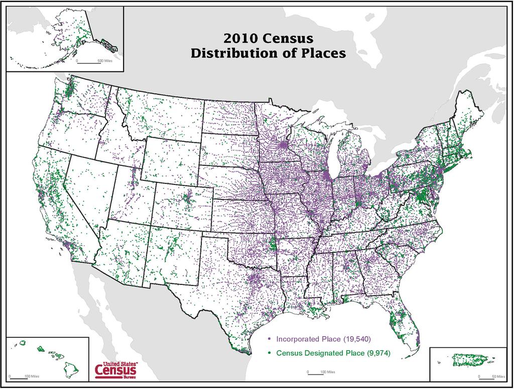
12 Unincorporated/Census Designated Places 1940: Supplementary report for unincorporated places. Minimum population: 500. New Mexico: 35 unincorporated places. 1950: unincorporated places only defined outside urbanized areas. Minimum population: 1,000. New Mexico: 16 unincorporated places through 1990: Minimum population: 2,500 inside urbanized areas. 1,000: outside urbanized areas to present: no minimum population threshold. New Mexico, 2000: 133 CDPs New Mexico, 2010: 341 CDPs 12


13 1940 Census Supplementary Report: Population in Unincorporated Communities 13

14 CDPs/Colonias, Doña Ana County

15 La Mesa CDP, Doña Ana County
16 16

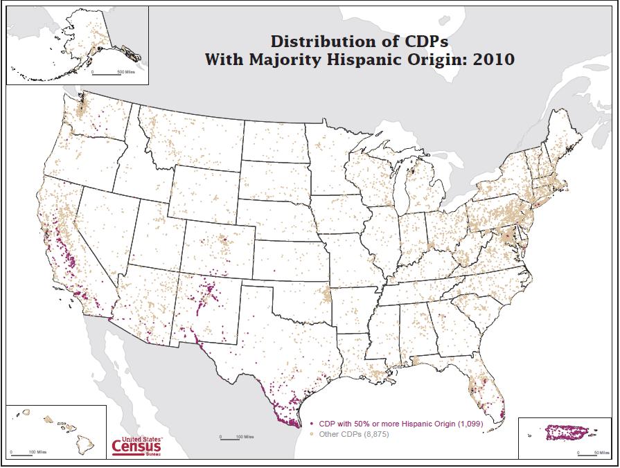
17 Census 2000: Minimum population requirements for Census Designated Places were eliminated to support identification of colonias and other small, unincorporated communities to improve access to data about demographic characteristics. 17
18 Census Tracts, Albuquerque Area, 1960 The 1960 Census was the first census for which census tracts were defined in New Mexico. Census tracts were limited to Bernalillo County.


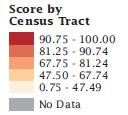
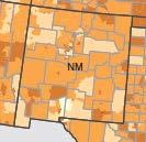
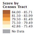
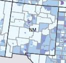
19 Census Tracts, 1970 Census For the 1970 Census, tracts were defined in Bernalillo, Santa Fe, Los Alamos, Doña Ana, and Otero Counties. For 1980, 15 additional counties were tracted. Census tracts and block numbering areas covered the entire state in 1990 Source: Social Explorer

20 Tribal Tracts and Tribal Block Groups Tribal tracts and tribal block groups added as new types of statistical geographic areas for the 2000 Census within Federally-recognized American Indian Reservations and allowed to cross county and state boundaries. Tribal tracts and block groups formed the framework for standard, county-based tracts and block groups. For the 2010 Census, tribal tracts/block groups were defined as completely separate areas from standard tracts/block groups; that is, no relationship between tribal tracts/block groups and county-based tracts/block groups. 20
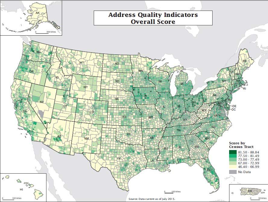
21 MAF/TIGER Accuracy Improvement MAF/TIGER Accuracy Improvement Project (MTAIP): Emphasis on positional accuracy. 7.2 meters or better accuracy for street centerlines. Post-2010: continue improving address and spatial data accuracy and completeness. Develop measures of quality, consistency, and completeness.

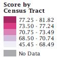
22 TIGER features Relative Accuracy 22

23 TIGER Features Positional Accuracy 23
24 Quality Indicators Address Name/Attribute Mailability Deliverability Locatability Geocode Accuracy Feature Spatial accuracy of features Number of driveways within geographic unit Address range parity, accuracy, and consistency 24
25 25


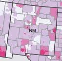
26 Address Sub-QI Scores by Tract 26
27 27
28 28

29 TIGER/Line Geodatabases with Selected Demographic and Economic Data

30 Interactive Mapping Tools
31 Concluding thoughts The history of Census Bureau geography has been one of increasing numbers and types of geographic areas, at increasing levels of spatial resolution, in response to data users needs. For the future, do we continue to add new and different types of geographic areas to Census Bureau databases? Or, do we develop processes and applications that allow data users to use geographic areas from one source to aggregate data from a different source? 31
32 Questions? Comments? Contact information: Michael Ratcliffe, Geography Division U.S. Census Bureau 32 32
The History Behind Census Geography
 The History Behind Census Geography Michael Ratcliffe Geography Division US Census Bureau Kentucky State Data Center Affiliate Meeting August 5, 2016 Today s Presentation A brief look at the history behind
The History Behind Census Geography
 The History Behind Census Geography Michael Ratcliffe Geography Division US Census Bureau Tennessee State Data Center August 8, 2017 Today s Presentation A brief look at the history behind some of the
Geographic Products and Data. Improvements in Spatial Accuracy and Accessing Data
 Geographic Products and Data Improvements in Spatial Accuracy and Accessing Data How it Began TIGER was internally developed to support the 1990 Decennial Census operations Used data sources such as USGS
Rural Alabama. Jennifer Zanoni. Geography Division U.S. Census Bureau. Alabama State Data Center 2018 Data Conference Tuscaloosa, Alabama
 Rural Alabama Jennifer Zanoni Geography Division U.S. Census Bureau Alabama State Data Center 2018 Data Conference Tuscaloosa, Alabama May 17, 2018 Agenda Census Geography Urban/Rural Definitions County-based
DRAFT RURAL-URBAN POPULATION CHANGE IN PUERTO RICO, 1990 TO 2000
 DRAFT RURAL-URBAN POPULATION CHANGE IN PUERTO RICO, 1990 TO 2000 Mei-Ling Freeman Geographic Standards and Criteria Branch Geography Division US Census Bureau For presentation at the Western Regional Science
Inclusion of Non-Street Addresses in Cancer Cluster Analysis
 Inclusion of Non-Street Addresses in Cancer Cluster Analysis Sue-Min Lai, Zhimin Shen, Darin Banks Kansas Cancer Registry University of Kansas Medical Center KCR (Kansas Cancer Registry) KCR: population-based
The 2020 Census Geographic Partnership Opportunities
 The 2020 Census Geographic Partnership Opportunities Web Adams Geographer, U.S. Census Bureau New York Regional Office 1 Geographic Partnership Opportunities The 2020 Census Local Update of Census Addresses
2010 Census Data Release and Current Geographic Programs. Michaellyn Garcia Geographer Seattle Regional Census Center
 2010 Census Data Release and Current Geographic Programs Michaellyn Garcia Geographer Seattle Regional Census Center 2010 Center of Population Located approximately 2.7 miles northeast of Plato, Missouri
US Census Bureau Geographic Entities and Concepts. Geography Division
 US Census Bureau Geographic Entities and Concepts Geography Division Geographic Concepts Addresses vs. Geographic features and entities Legal/Administrative vs. Statistical Nesting relationships (or the
The Evolution of NWI Mapping and How It Has Changed Since Inception
 The Evolution of NWI Mapping and How It Has Changed Since Inception Some Basic NWI Facts: Established in 1974 Goal to create database on characteristics and extent of U.S. wetlands Maps & Statistics In
PLANNING FOR THE FUTURE: THE GEOGRAPHIC SUPPORT SYSTEM INITIATIVE FOR THE U.S. CENSUS BUREAU
 PLANNING FOR THE FUTURE: THE GEOGRAPHIC SUPPORT SYSTEM INITIATIVE FOR THE U.S. CENSUS BUREAU Tim Trainor Geography Division, U.S. Census Bureau, Washington, DC. 20233 timothy.f.trainor@census.gov KEY WORDS:
Developing Spatial Data to Support Statistical Analysis of Education
 Developing Spatial Data to Support Statistical Analysis of Education Doug Geverdt National Center for Education Statistics Education Demographic and Geographic Estimates (EDGE) Program 2016 ESRI User Conference
ITEM 11 Information June 20, Visualize 2045: Update to the Equity Emphasis Areas. None
 ITEM 11 Information June 20, 2018 Visualize 2045: Update to the Equity Emphasis Areas Staff Recommendation: Issues: Background: Briefing on the TPB-approved methodology to update the Equity Emphasis Areas
ZIP Code Tabulation Areas For Census 2000
 ZIP Code Tabulation Areas For Census 2000 NCHS, CDC Andrew Flora June 13, 2000 TIGER Operations Branch Geography Division U S C E N S U S B U R E A U Helping You Make Informed Decisions ZIP Code Tabulations
Rural Pennsylvania: Where Is It Anyway? A Compendium of the Definitions of Rural and Rationale for Their Use
 Rural Pennsylvania: Where Is It Anyway? A Compendium of the Definitions of Rural and Rationale for Their Use Pennsylvania Office of Rural Health 310 Nursing Sciences Building University Park, PA 16802
Urban settlements delimitation using a gridded spatial support
 Urban settlements delimitation using a gridded spatial support Rita Nicolau 1, Elisa Vilares 1, Cristina Cavaco 1, Ana Santos 2, Mário Lucas 2 1 - General Directorate for Territory Development DGT, Portugal
Utilizing Data from American FactFinder with TIGER/Line Shapefiles in ArcGIS
 Utilizing Data from American FactFinder with TIGER/Line Shapefiles in ArcGIS Web Adams, GISP Data Dissemination Specialist U.S. Census Bureau New York Regional Office 1 What We Do Decennial Census Every
Updating the Urban Boundary and Functional Classification of New Jersey Roadways using 2010 Census data
 Updating the Urban Boundary and Functional Classification of New Jersey Roadways using 2010 Census data By: Glenn Locke, GISP, PMP 1 GIS-T May, 2013 Presentation Overview Purpose of Project Methodology
Boundary and Annexation Survey (BAS)
") Boundary and Annexation Survey (BAS) New Mexico SDC Meeting Chris Wingate Geography Division U.S. Census Bureau 1 Agenda Boundary and Annexation Survey (BAS) BAS Overview American Community Survey (ACS)
Boundary and Annexation Survey (BAS) New Mexico SDC Meeting Chris Wingate Geography Division U.S. Census Bureau 1 Agenda Boundary and Annexation Survey (BAS) BAS Overview American Community Survey (ACS)
Frontier and Remote (FAR) Area Codes: A Preliminary View of Upcoming Changes John Cromartie Economic Research Service, USDA
 Area Codes: A Preliminary View of Upcoming Changes John Cromartie Economic Research Service, USDA") National Center for Frontier Communities webinar, January 27, 2015 Frontier and Remote (FAR) Area Codes: A Preliminary View of Upcoming Changes John Cromartie Economic Research Service, USDA The views
National Center for Frontier Communities webinar, January 27, 2015 Frontier and Remote (FAR) Area Codes: A Preliminary View of Upcoming Changes John Cromartie Economic Research Service, USDA The views
GEOGRAPHIC INFORMATION SYSTEMS Session 8
 GEOGRAPHIC INFORMATION SYSTEMS Session 8 Introduction Geography underpins all activities associated with a census Census geography is essential to plan and manage fieldwork as well as to report results
Targeted LiDAR use in Support of In-Office Address Canvassing (IOAC) March 13, 2017 MAPPS, Silver Spring MD
 March 13, 2017 MAPPS, Silver Spring MD") Targeted LiDAR use in Support of In-Office Address Canvassing (IOAC) March 13, 2017 MAPPS, Silver Spring MD Imagery, LiDAR, and Blocks In 2011, the GEO commissioned independent subject matter experts (Jensen,
Targeted LiDAR use in Support of In-Office Address Canvassing (IOAC) March 13, 2017 MAPPS, Silver Spring MD Imagery, LiDAR, and Blocks In 2011, the GEO commissioned independent subject matter experts (Jensen,
Operational Definitions of Urban, Rural and Urban Agglomeration for Monitoring Human Settlements
 Operational Definitions of Urban, Rural and Urban Agglomeration for Monitoring Human Settlements By Markandey Rai United Nations Human Settlements Programme PO Box-30030 Nairobi, Kenya Abstract The United
Regional Growth Strategy Regional Staff Committee
 Regional Growth Strategy Regional Staff Committee June 21, 2018 1 Overview Summary of June Growth Management Policy Board Regional Growth Strategy Objectives Regional Geographies Regional Growth Strategy
KING FAHD UNIVERSITY OF PETROLEUM & MINERALS
 KING FAHD UNIVERSITY OF PETROLEUM & MINERALS Department of City & Regional Planning Introduction To GIS (CRP 514) Identifying & Planning Public School Facility In California Using GIS Presented to Dr.
Integration of geographical and statistical information: The Brazilian case 1
 UNITED NATIONS SECRETARIAT SA/STAT/AC.279/P16 Department of Economic and Social Affairs October 2013 Statistics Division English only United Nations Expert Group on the Integration of Statistical and Geospatial
Tracey Farrigan Research Geographer USDA-Economic Research Service
 Rural Poverty Symposium Federal Reserve Bank of Atlanta December 2-3, 2013 Tracey Farrigan Research Geographer USDA-Economic Research Service Justification Increasing demand for sub-county analysis Policy
Utilizing GIS Technology for Rockland County. Rockland County Planning Department Douglas Schuetz & Scott Lounsbury
 Utilizing GIS Technology for Rockland County Rockland County Planning Department Douglas Schuetz & Scott Lounsbury Presentation Agenda Introduction What is GIS What can GIS do GIS Efforts for BOE Resources
Final report for the Expert Group on the Integration of Statistical and Geospatial Information, May 2015
 Final report for the Expert Group on the Integration of Statistical and Geospatial Information, May 2015 Global geographic classification and geocoding practices Executive summary This final report was
Integrating Official Statistics and Geospatial Information NBS Experience
 Integrating Official Statistics and Geospatial Information NBS Experience Presented by Eng. Reda AL Sabbagh Director of IT Dept. Prepared by Eng. Adham Makky GIS Specialist Topics to be covered: Background
Chapter 6. Fundamentals of GIS-Based Data Analysis for Decision Support. Table 6.1. Spatial Data Transformations by Geospatial Data Types
 Chapter 6 Fundamentals of GIS-Based Data Analysis for Decision Support FROM: Points Lines Polygons Fields Table 6.1. Spatial Data Transformations by Geospatial Data Types TO: Points Lines Polygons Fields
Digitization in a Census
 Topics Connectivity of Geographic Data Sketch Maps Data Organization and Geodatabases Managing a Digitization Project Quality and Control Topology Metadata 1 Topics (continued) Interactive Selection Snapping
Geography and Usability of the American Community Survey. Seth Spielman Assistant Professor of Geography University of Colorado
 Geography and Usability of the American Community Survey Seth Spielman Assistant Professor of Geography University of Colorado Goals 1. To convince you that the margins of error from the American Community
Merging statistics and geospatial information
 Merging statistics and geospatial information Demography / Commuting / Spatial planning / Registers Mirosław Migacz Chief GIS Specialist Janusz Dygaszewicz Director Central Statistical Office of Poland
2011 Built-up Areas - Methodology and Guidance
 2011 Built-up Areas - Methodology and Guidance June 2013 Version: 2013 v1 Office for National Statistics 2013 Contents 1. Introduction... 3 2. Methodology... 3 2.1 Identifying built-up areas for the 2011
Colm O Muircheartaigh
 THERE AND BACK AGAIN: DEMOGRAPHIC SURVEY SAMPLING IN THE 21 ST CENTURY Colm O Muircheartaigh, University of Chicago Page 1 OVERVIEW History of Demographic Survey Sampling 20 th Century Sample Design New
Census Transportation Planning Products (CTPP)
") Census Transportation Planning Products (CTPP) Penelope Weinberger CTPP Program Manager - AASHTO September 15, 2010 1 What is the CTPP Program Today? The CTPP is an umbrella program of data products, custom
Census Transportation Planning Products (CTPP) Penelope Weinberger CTPP Program Manager - AASHTO September 15, 2010 1 What is the CTPP Program Today? The CTPP is an umbrella program of data products, custom
BROADBAND DEMAND AGGREGATION: PLANNING BROADBAND IN RURAL NORTHERN CALIFORNIA
 BROADBAND DEMAND AGGREGATION: PLANNING BROADBAND IN RURAL NORTHERN CALIFORNIA Steven J. Steinberg, Ph.D a,b, *, Rebecca Degagne a, M.S., Michael Gough a a Institute for Spatial Analysis, Humboldt State
1 ST High Level Forum on United Nations Global Geoespatial Information Management GEOGRAPHIC REFERENCING OF ECONOMIC UNITS. México
 1 ST High Level Forum on United Nations Global Geoespatial Information Management Thematic Seminar 27 October, Korea 2011. GEOGRAPHIC REFERENCING OF ECONOMIC UNITS México CONTENTS Introduction Census Cartography
Globally Estimating the Population Characteristics of Small Geographic Areas. Tom Fitzwater
 Globally Estimating the Population Characteristics of Small Geographic Areas Tom Fitzwater U.S. Census Bureau Population Division What we know 2 Where do people live? Difficult to measure and quantify.
New Mexico Public Education Department. 7th Grade Social Studies End-of-Course (EoC) Exam
 Exam") New Mexico Public Education Department Assessment Blueprint 7th Grade Social Studies End-of-Course (EoC) Exam Version 001 Spring 2015 Purpose Statement 7th Grade Social Studies The 7 th Grade Social Studies
New Mexico Public Education Department Assessment Blueprint 7th Grade Social Studies End-of-Course (EoC) Exam Version 001 Spring 2015 Purpose Statement 7th Grade Social Studies The 7 th Grade Social Studies
GEOCODING SELF-REPORTED ADDRESSES: LESSONS LEARNED. Karyn Backus CT Department of Public Health
 GEOCODING SELF-REPORTED ADDRESSES: LESSONS LEARNED Karyn Backus CT Department of Public Health GEOCODING ADDRESSES The process of assigning a location to an address Collect the address information Use
Spatial Organization of Data and Data Extraction from Maptitude
 Spatial Organization of Data and Data Extraction from Maptitude N. P. Taliceo Geospatial Information Sciences The University of Texas at Dallas UT Dallas GIS Workshop Richardson, TX March 30 31, 2018 1/
Egyptian E-Census 2017
 Egyptian E-Census 2017 Central Agency for Public Mobilization And Statistics An Integration between Spatial and Statistical information Prepared by: Nahla Seddik Mohamed General Director Mennat-Allah Anwar
Areal Interpolation Methods using Land Cover and Street Data. Jeff Bourdier GIS Master s s Project Summer 2006
 Areal Interpolation Methods using Land Cover and Street Data Jeff Bourdier GIS Master s s Project Summer 2006 Objective The areal interpolation problem Some variable (here, population) is known in a given
Census and USGS: Bringing Improved TIGER to The National Map. Jennie Karalewich-Census Andrea Johnson- Census Dick Vraga- USGS
 Census and USGS: Bringing Improved TIGER to The National Map Jennie Karalewich-Census Andrea Johnson- Census Dick Vraga- USGS USGS and the Census Bureau Since 1880 there has been a close working relationship
The 2010 Census Successful Because of GIS
 The 2010 Census Successful Because of GIS Timothy F. Trainor Chief, Geography Division, U.S. Census Bureau Vice President, International Cartographic Association Establishing the Framework of the Operation
Rules of the territorial division
 Rules of the territorial division Janusz Dygaszewicz Central Statistical Office of Poland Jerusalem, 4-7 December 2016 Rules of territory division (the Polish case) The area of each unit of territorial
Advanced Placement Human Geography
 Advanced Placement Human Geography Introduction to AP Human Geography The Advanced Placement course in Human Geography is designed to introduce students to the systematic study of the processes that have
High Speed / Commuter Rail Suitability Analysis For Central And Southern Arizona
 High Speed / Commuter Rail Suitability Analysis For Central And Southern Arizona Item Type Reports (Electronic) Authors Deveney, Matthew R. Publisher The University of Arizona. Rights Copyright is held
Second High Level Forum on GGIM Seminar on Regional Cooperation in Geospatial Information Management Doha, Qatar, 7 February 2013
 Second High Level Forum on GGIM Seminar on Regional Cooperation in Geospatial Information Management Doha, Qatar, 7 February 2013 Overview on Geospatial Activities in Egypt BY : Eng.Nahla Seddik Mohamed
Lecture 9: Geocoding & Network Analysis
 Massachusetts Institute of Technology - Department of Urban Studies and Planning 11.520: A Workshop on Geographic Information Systems 11.188: Urban Planning and Social Science Laboratory Lecture 9: Geocoding
Satellite Imagery: A Crucial Resource in Stormwater Billing
 Satellite Imagery: A Crucial Resource in Stormwater Billing May 10, 2007 Carl Stearns Engineering Technician Department of Public Works Stormwater Services Division Sean McKnight GIS Coordinator Department
Geodatabase for Sustainable Urban Development. Presented By Rhonda Maronn Maurice Johns Daniel Ashney Jack Anliker
 Geodatabase for Sustainable Urban Development Presented By Rhonda Maronn Maurice Johns Daniel Ashney Jack Anliker Objective Build a Geodatabase that will enable urban planners to create and assess the
H. R heading to fund the award and oversight by the Administrator of grants made under this heading. FEDERAL HIGHWAY ADMINISTRATION
 H. R. 1 92 heading to fund the award and oversight by the Administrator of grants made under this heading. FEDERAL HIGHWAY ADMINISTRATION HIGHWAY INFRASTRUCTURE INVESTMENT For an additional amount for
LBRS Ohio s Location-Based Response System
 LBRS Ohio s Location-Based Response System Comprised of state-level statewide datasets for Ohio, including road centerlines with point-based address locations, parcels, and orthophotography Spatially accurate
Brazil Experience in SDG data production, dissemination and capacity building
 Brazil Experience in SDG data production, dissemination and capacity building Claudio Stenner Coordinator of Geography 4th Meeting of the Working Group on Geospatial Information IAEG-SDG United Nations
A DATABASE TO FACILITATE REMOVAL OF SQUAW GEOGRAPHIC PLACE NAMES IN OREGON
 A DATABASE TO FACILITATE REMOVAL OF SQUAW GEOGRAPHIC PLACE NAMES IN OREGON Caroline Rouwalk Geography 575 12-9-2008 OUTLINE Background on Squaw Geographic place names in Oregon Database design objective
Oklahoma GIS for GeoCIP
 GeoCIP Program Partners Oklahoma GIS for GeoCIP A Center for Spatial Analysis Report to Oklahoma GI Council 6 November 2009 The CSA team Kathy Hines Tran Trung Semiha Caliskan Peter Camili Scott March
STATE GEOGRAPHIC INFORMATION DATABASE
 STATE GEOGRAPHIC INFORMATION DATABASE Data Information and Knowledge Management STATE GEOGRAPHIC INFORMATION DATABASE EXECUTIVE SUMMARY Utah has developed one of the most comprehensive statewide GIS resources
The Scope and Growth of Spatial Analysis in the Social Sciences
 context. 2 We applied these search terms to six online bibliographic indexes of social science Completed as part of the CSISS literature search initiative on November 18, 2003 The Scope and Growth of Spatial
GIS ADMINISTRATOR / WEB DEVELOPER EVANSVILLE-VANDERBURGH COUNTY AREA PLAN COMMISSION
 GIS ADMINISTRATOR / WEB DEVELOPER EVANSVILLE-VANDERBURGH COUNTY AREA PLAN COMMISSION SALARY RANGE INITIATION $43,277 SIX MONTHS $45,367 POSITION GRADE PAT VI The Evansville-Vanderburgh County Area Plan
Big-Geo-Data EHR Infrastructure Development for On-Demand Analytics
 Big-Geo-Data EHR Infrastructure Development for On-Demand Analytics Sohayla Pruitt, MA Senior Geospatial Scientist Duke Medicine DUHS DHTS EIM HIRS Page 1 Institute of Medicine, World Health Organization,
Louisiana Transportation Engineering Conference. Monday, February 12, 2007
 Louisiana Transportation Engineering Conference Monday, February 12, 2007 Agenda Project Background Goal of EIS Why Use GIS? What is GIS? How used on this Project Other site selection tools I-69 Corridor
Georelational Vector Data Model
 Georelational Vector Data Model Contents Georelational Data Model Representation of Simple Features Topology Non-topological Vector Data Data Models for Composite Features Geo-relational Looking at a paper
Policy Paper Alabama Primary Care Service Areas
 Aim and Purpose Policy Paper Alabama Primary Care Service Areas Produced by the Office for Family Health Education & Research, UAB School of Medicine To create primary care rational service areas (PCSA)
Sensitivity of estimates of travel distance and travel time to street network data quality
 Sensitivity of estimates of travel distance and travel time to street network data quality Paul Zandbergen Department of Geography University of New Mexico Outline Street network quality Approaches to
Deriving Spatially Refined Consistent Small Area Estimates over Time Using Cadastral Data
 Deriving Spatially Refined Consistent Small Area Estimates over Time Using Cadastral Data H. Zoraghein 1,*, S. Leyk 1, M. Ruther 2, B. P. Buttenfield 1 1 Department of Geography, University of Colorado,
European Regional and Urban Statistics
 European Regional and Urban Statistics Dr. Berthold Feldmann berthold.feldmann@ec.europa.eu Eurostat Structure of the talk Regional statistics in the EU The tasks of Eurostat Regional statistics Urban
GIS Level 2. MIT GIS Services
 GIS Level 2 MIT GIS Services http://libraries.mit.edu/gis Email: gishelp@mit.edu TOOLS IN THIS WORKSHOP - Definition Queries - Create a new field in the attribute table - Field Calculator - Add XY Data
BROOKINGS May
 Appendix 1. Technical Methodology This study combines detailed data on transit systems, demographics, and employment to determine the accessibility of jobs via transit within and across the country s 100
Use of administrative registers for strengthening the geostatistical framework of the Census of Agriculture in Mexico
 Use of administrative registers for strengthening the geostatistical framework of the Census of Agriculture in Mexico Susana Pérez INEGI, Dirección de Censos y Encuestas Agropecuarias. Avenida José María
Integrating GIS into Food Access Analysis
 GIS Day at Kansas University Integrating GIS into Food Access Analysis Daoqin Tong School of Geography and Development Outline Introduction Research questions Method Results Discussion Introduction Food
1.1 What is Site Fingerprinting?
 Site Fingerprinting Utilizing GIS/GPS Technology 1.1 What is Site Fingerprinting? Site fingerprinting is a planning tool used to design communities where protection of natural resources is the primary
Dasymetric Mapping Using High Resolution Address Point Datasets
 : 5 27 Research Article Dasymetric Mapping Using High Resolution Address Point Datasets Paul A Zandbergen Department of Geography University of New Mexico Abstract Mismatching sets of boundaries present
Integration for Informed Decision Making
 Geospatial and Statistics Policy Intervention: Integration for Informed Decision Making Greg Scott Global Geospatial Information Management United Nations Statistics Division Department of Economic and
PALS: Neighborhood Identification, City of Frederick, Maryland. David Boston Razia Choudhry Chris Davis Under the supervision of Chao Liu
 PALS: Neighborhood Identification, City of Frederick, Maryland David Boston Razia Choudhry Chris Davis Under the supervision of Chao Liu University of Maryland School of Architecture, Planning & Preservation
Transit Development Planning: Flagler County Needs Assessment & Implementation Program INTERGOVERNMENTAL MEETING OF FLAGLER COUNTY APRIL 13, 2010
 Transit Development Planning: nty Needs Assessment & Implementation Program INTERGOVERNMENTAL MEETING OF FLAGLER COUNTY APRIL 13, 2010 Rob Gregg & Justin Begley, Center for Urban Transportation Research
Schedule and Process:
 Census Bureau possible criteria for Urbanized Areas (July 9, 2009) On June 12, 2009 FHWA staff held a webinar where Census Bureau staff discussed the Census Bureau plans on developing new Urbanized Area
The Global Statistical Geospatial Framework and the Global Fundamental Geospatial Themes
 The Global Statistical Geospatial Framework and the Global Fundamental Geospatial Themes Sub-regional workshop on integration of administrative data, big data and geospatial information for the compilation
Indicator: Proportion of the rural population who live within 2 km of an all-season road
 Goal: 9 Build resilient infrastructure, promote inclusive and sustainable industrialization and foster innovation Target: 9.1 Develop quality, reliable, sustainable and resilient infrastructure, including
Medical GIS: New Uses of Mapping Technology in Public Health. Peter Hayward, PhD Department of Geography SUNY College at Oneonta
 Medical GIS: New Uses of Mapping Technology in Public Health Peter Hayward, PhD Department of Geography SUNY College at Oneonta Invited research seminar presentation at Bassett Healthcare. Cooperstown,
2/25/2019. Taking the northern and southern hemispheres together, on average the world s population lives 24 degrees from the equator.
 Where is the world s population? Roughly 88 percent of the world s population lives in the Northern Hemisphere, with about half north of 27 degrees north Taking the northern and southern hemispheres together,
Compact guides GISCO. Geographic information system of the Commission
 Compact guides GISCO Geographic information system of the Commission What is GISCO? GISCO, the Geographic Information System of the COmmission, is a permanent service of Eurostat that fulfils the requirements
Improving rural statistics. Defining rural territories and key indicators of rural development
 Improving rural statistics Defining rural territories and key indicators of rural development Improving rural statistics Improving Rural Statistics In 2016, the Global Strategy to improve Agricultural
Census Urban Area Comparisons, 2000 to 2010
 THE HONORABLE ROGERS Mayor ANDERSON, Karl Dean, CHAIRMAN Chairman Census Urban Area Comparisons, 2000 to 2010 TCC May 2, 2012 MPOs/RPOs in Tennessee Regional Geographies in Middle TN Nashville MPO Clarksville
STEREO ANALYST FOR ERDAS IMAGINE Stereo Feature Collection for the GIS Professional
 STEREO ANALYST FOR ERDAS IMAGINE Stereo Feature Collection for the GIS Professional STEREO ANALYST FOR ERDAS IMAGINE Has Your GIS Gone Flat? Hexagon Geospatial takes three-dimensional geographic imaging
Negative Exponential Model Parameters and Centralization in Large Urban Areas in the U.S.,
 Negative Exponential Model Parameters and Centralization in Large Urban Areas in the U.S., 1950-2010 Abstract John R. Ottensmann Indiana University-Purdue University Indianapolis john.ottensmann@gmail.com
INTEGRATION OF GIS AND MULTICRITORIAL HIERARCHICAL ANALYSIS FOR AID IN URBAN PLANNING: CASE STUDY OF KHEMISSET PROVINCE, MOROCCO
 Geography Papers 2017, 63 DOI: http://dx.doi.org/10.6018/geografia/2017/280211 ISSN: 1989-4627 INTEGRATION OF GIS AND MULTICRITORIAL HIERARCHICAL ANALYSIS FOR AID IN URBAN PLANNING: CASE STUDY OF KHEMISSET
An Introduction to China and US Map Library. Shuming Bao Spatial Data Center & China Data Center University of Michigan
 An Introduction to China and US Map Library Shuming Bao Spatial Data Center & China Data Center University of Michigan Current Spatial Data Services http://chinadataonline.org China Geo-Explorer http://chinageoexplorer.org
A Comprehensive Method for Identifying Optimal Areas for Supermarket Development. TRF Policy Solutions April 28, 2011
 A Comprehensive Method for Identifying Optimal Areas for Supermarket Development TRF Policy Solutions April 28, 2011 Profile of TRF The Reinvestment Fund builds wealth and opportunity for lowwealth communities
A.P. Human Geography
 A.P. Human Geography 2012-2013 Instructor: Chris Vitt Brief Description of Course AP Human Geography is designed to provide students with a learning experience equivalent to that obtained in most college
CES Seminar 2016: Geospatial information services based on official statistics Key issues from the session II papers
 Norbert Rainer 64 th plenary session of the Conference of European Statisticians 28 April 2016, Paris CES Seminar 2016: Geospatial information services based on official statistics Key issues from the
Data Creation and Editing
 11.520:A Workshop on Geographical Information Systems 1.188: Urban Planning and Social Science Laboratory Data Creation and Editing Based in part on notes by Prof. Joseph Ferreira and Michael Flaxman Lulu
Department of Economic and Social Affairs May 2007
 UNITED NATIONS SECRETARIAT ESA/STAT/AC.115/13 Department of Economic and Social Affairs May 2007 Statistics Division English only United Nations Expert Group Meeting on Contemporary Practices in Census
Gistat: moving towards a location information management system
 Gistat: moving towards a location information management system (merging geographical, statistical and historical information) Pina Grazia Ticca Marco Ballin Istat - Italy Aguascalientes, Mexico 2-4 December
Combining Geospatial and Statistical Data for Analysis & Dissemination
 Combining Geospatial and Statistical Data for Analysis & Dissemination (with Special Reference to Qatar Census 2010) Presentation by Mansoor Al Malki, Director of IT Department Qatar Statistics Authority
IMPERIAL COUNTY PLANNING AND DEVELOPMENT
 IMPERIAL COUNTY PLANNING AND DEVELOPMENT GEODATABASE USER MANUAL FOR COUNTY BUSINESS DEVELOPMENT GIS June 2010 Prepared for: Prepared by: County of Imperial Planning and Development 801 Main Street El
John Laznik 273 Delaplane Ave Newark, DE (302)
") Office Address: John Laznik 273 Delaplane Ave Newark, DE 19711 (302) 831-0479 Center for Applied Demography and Survey Research College of Human Services, Education and Public Policy University of Delaware
Office Address: John Laznik 273 Delaplane Ave Newark, DE 19711 (302) 831-0479 Center for Applied Demography and Survey Research College of Human Services, Education and Public Policy University of Delaware
COSMIC: COmplexity in Spatial dynamic
 COSMIC: COmplexity in Spatial dynamic MICs 9 10 November, Brussels Michael Batty University College London m.batty@ucl.ac.uk http://www.casa.ucl.ac.uk/ Outline The Focus of the Pilot The Partners: VU,